Uranium Exploration Status in Bangladesh: … Exploration Status in Bangladesh: Conceptual Study ......
26
Uranium Exploration Status in Bangladesh: Conceptual Study Ratan Kumar Majumder Nuclear Minerals Unit Bangladesh Atomic Energy Commission E-mail: [email protected], IAEA: Technical Meeting on Uranium from Unconventional Resources Vienna, Austria, 4 – 7 November 2014
Transcript of Uranium Exploration Status in Bangladesh: … Exploration Status in Bangladesh: Conceptual Study ......
Uranium Exploration Status in Bangladesh:
Conceptual Study
Ratan Kumar Majumder
Nuclear Minerals Unit
Bangladesh Atomic Energy Commission
E-mail: [email protected],
IAEA: Technical Meeting on Uranium from Unconventional Resources
Vienna, Austria, 4 – 7 November 2014
Bangladesh Atomic Energy Commission (BAEC) is very
much interested to get uranium from indigenous sources.
BAEC has been operating nuclear mineral exploration
program by its limited resource.
Bangladesh is geologically made mostly of sedimentary
rocks and it is only possible to mineralize sedimentary
types of uranium deposits under favourable reducing
environment.
Overview
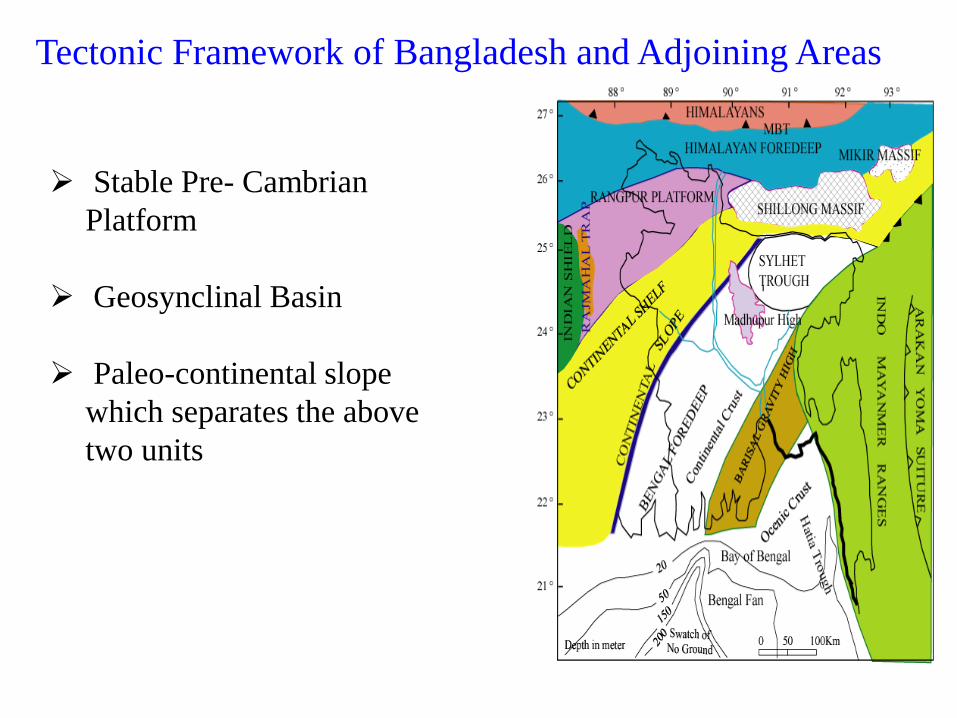
Tectonic Framework of Bangladesh and Adjoining Areas
Stable Pre- Cambrian
Platform
Geosynclinal Basin
Paleo-continental slope
which separates the above
two units
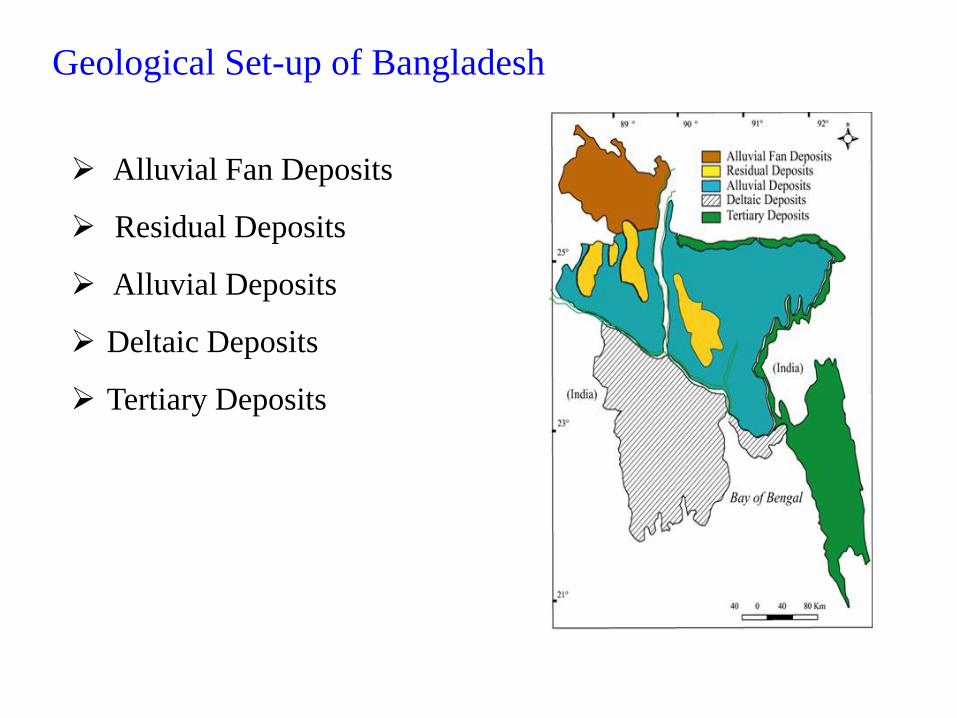
Geological Set-up of Bangladesh
• Alluvial Fan Deposits
• Residual Deposits
• Alluvial Deposits
• Deltaic Deposits
• Tertiary Deposits
Alluvial Fan Deposits
Residual Deposits
Alluvial Deposits
Deltaic Deposits
Tertiary Deposits
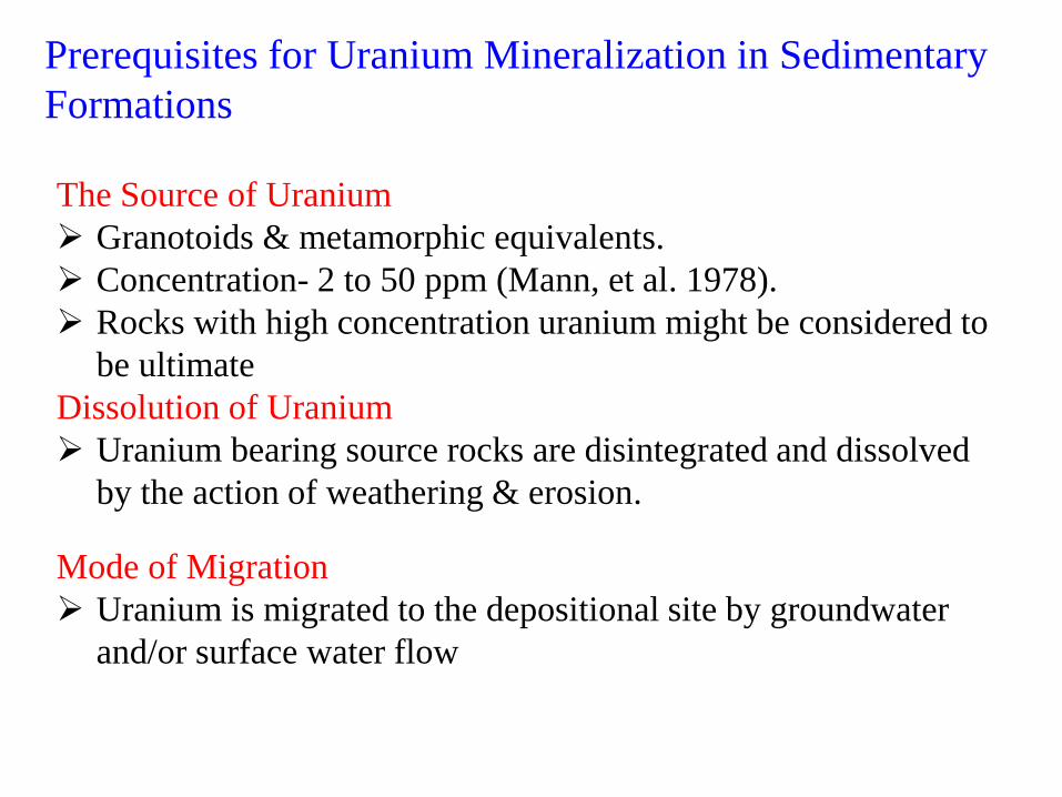
Prerequisites for Uranium Mineralization in Sedimentary
Formations
The Source of Uranium
Granotoids & metamorphic equivalents.
Concentration- 2 to 50 ppm (Mann, et al. 1978).
Rocks with high concentration uranium might be considered to
be ultimate source.
Dissolution of Uranium
Uranium bearing source rocks are disintegrated and dissolved
by the action of weathering & erosion.
Mode of Migration
Uranium is migrated to the depositional site by groundwater
and/or surface water flow
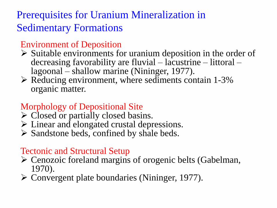
Prerequisites for Uranium Mineralization in
Sedimentary Formations
Environment of Deposition Suitable environments for uranium deposition in the order of
decreasing favorability are fluvial – lacustrine – littoral – lagoonal – shallow marine (Nininger, 1977).
Reducing environment, where sediments contain 1-3% organic matter.
Morphology of Depositional Site Closed or partially closed basins. Linear and elongated crustal depressions. Sandstone beds, confined by shale beds. Tectonic and Structural Setup Cenozoic foreland margins of orogenic belts (Gabelman,
1970). Convergent plate boundaries (Nininger, 1977).
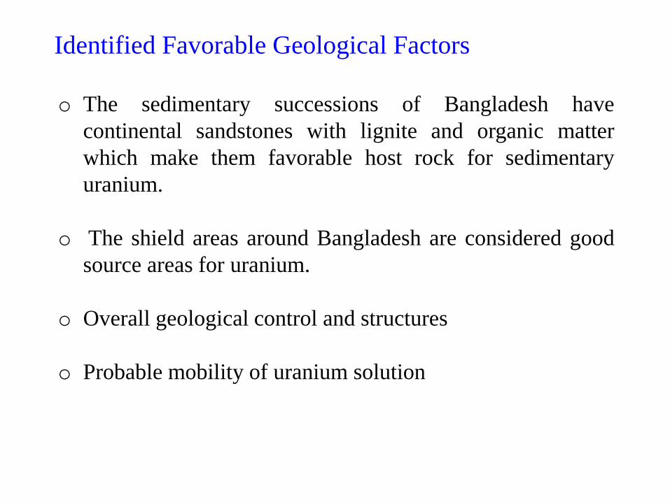
Identified Favorable Geological Factors
o The sedimentary successions of Bangladesh have
continental sandstones with lignite and organic matter
which make them favorable host rock for sedimentary
uranium.
o The shield areas around Bangladesh are considered good
source areas for uranium.
o Overall geological control and structures
o Probable mobility of uranium solution
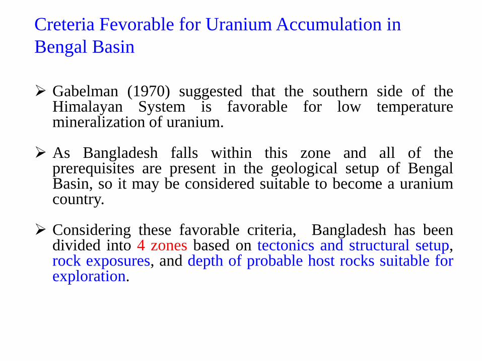
Creteria Fevorable for Uranium Accumulation in
Bengal Basin
Gabelman (1970) suggested that the southern side of the Himalayan System is favorable for low temperature mineralization of uranium.
As Bangladesh falls within this zone and all of the prerequisites are present in the geological setup of Bengal Basin, so it may be considered suitable to become a uranium country.
Considering these favorable criteria, Bangladesh has been
divided into 4 zones based on tectonics and structural setup, rock exposures, and depth of probable host rocks suitable for exploration.
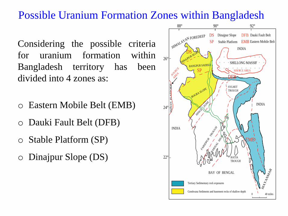
Considering the possible criteria
for uranium formation within
Bangladesh territory has been
divided into 4 zones as:
o Eastern Mobile Belt (EMB)
o Dauki Fault Belt (DFB)
o Stable Platform (SP)
o Dinajpur Slope (DS)
Possible Uranium Formation Zones within Bangladesh
HIMALAYAN FOREDEEP
INDIA
SHILLONG MASSIF
SOURCE AREA
INDIA
MA
YA
NM
AR
BAY OF BENGAL
INDIA
DINAJPUR SLOPE
RANGPUR SADDLE
BOGRA SLOPE
HIN
GE
ZONE
FARID
PUR TROUGH
SYLHET�
TROUGH
BARISAL H
IGH
HATIA�
TROUGH
IND
IAN
P
LA
TF
OR
M
SOURCE �
AREA
Tertiary Sedimentary rock exposures
Gondwana Sediments and basement rocks of shallow depth
88° 90° 92°
26°
24°
22°
0 40 miles
DS
SP
DFB
EMB
DS Dinajpur Slope
SP Stable Platform
DFB Dauki Fault Belt
EMB Eastern Mobile Belt
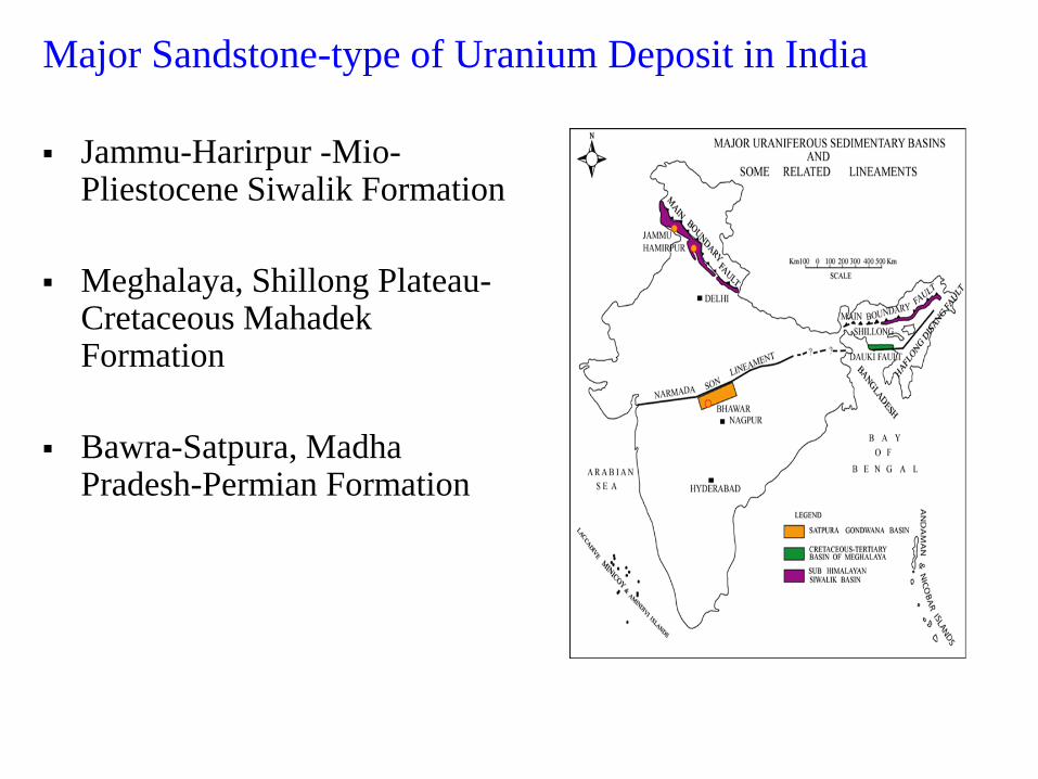
Major Sandstone-type of Uranium Deposit in India
Jammu-Harirpur -Mio-Pliestocene Siwalik Formation
Meghalaya, Shillong Plateau-Cretaceous Mahadek Formation
Bawra-Satpura, Madha Pradesh-Permian Formation
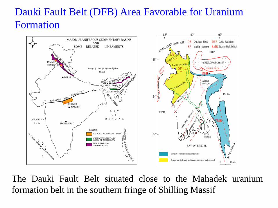
Dauki Fault Belt (DFB) Area Favorable for Uranium
Formation
The Dauki Fault Belt situated close to the Mahadek uranium
formation belt in the southern fringe of Shilling Massif
HIMALAYAN FOREDEEP
INDIA
SHILLONG MASSIF
SOURCE AREA
INDIA
MA
YA
NM
AR
BAY OF BENGAL
INDIA
DINAJPUR SLOPE
RANGPUR SADDLE
BOGRA SLOPE
HIN
GE
ZONE
FARID
PUR TROUGH
SYLHET�
TROUGH
BARISAL H
IGH
HATIA�
TROUGH
IND
IAN
P
LA
TF
OR
M
SOURCE �
AREA
Tertiary Sedimentary rock exposures
Gondwana Sediments and basement rocks of shallow depth
88° 90° 92°
26°
24°
22°
0 40 miles
DS
SP
DFB
EMB
DS Dinajpur Slope
SP Stable Platform
DFB Dauki Fault Belt
EMB Eastern Mobile Belt
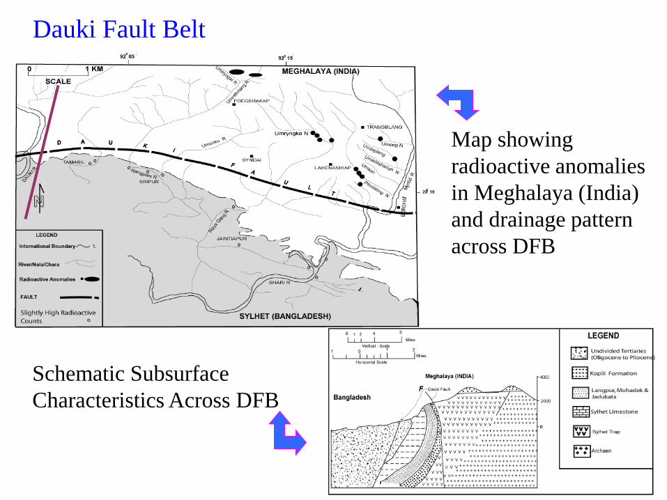
Dauki Fault Belt
Map showing
radioactive anomalies
in Meghalaya (India)
and drainage pattern
across DFB
Schematic Subsurface
Characteristics Across DFB
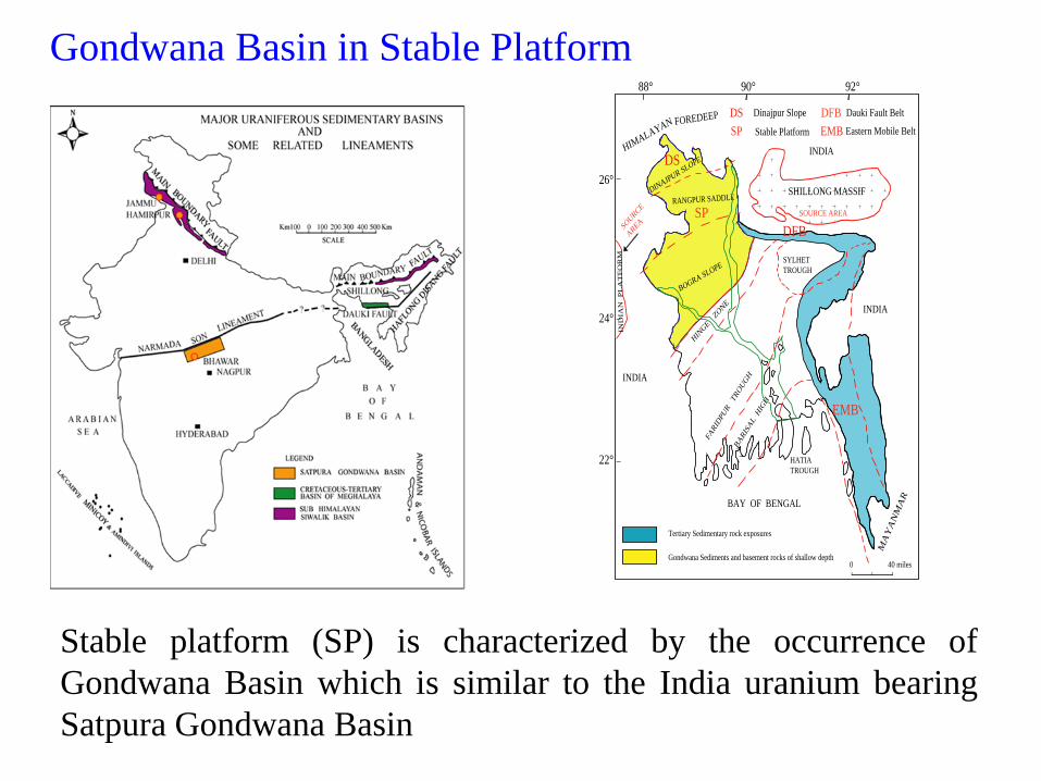
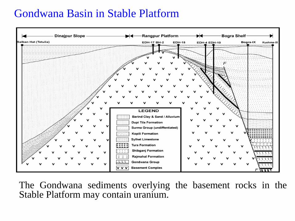
Gondwana Basin in Stable Platform
Stable platform (SP) is characterized by the occurrence of
Gondwana Basin which is similar to the India uranium bearing
Satpura Gondwana Basin
HIMALAYAN FOREDEEP
INDIA
SHILLONG MASSIF
SOURCE AREA
INDIA
MA
YA
NM
AR
BAY OF BENGAL
INDIA
DINAJPUR SLOPE
RANGPUR SADDLE
BOGRA SLOPE
HIN
GE
ZONE
FARID
PUR TROUGH
SYLHET�
TROUGH
BARISAL H
IGH
HATIA�
TROUGH
IND
IAN
P
LA
TF
OR
M
SOURCE �
AREA
Tertiary Sedimentary rock exposures
Gondwana Sediments and basement rocks of shallow depth
88° 90° 92°
26°
24°
22°
0 40 miles
DS
SP
DFB
EMB
DS Dinajpur Slope
SP Stable Platform
DFB Dauki Fault Belt
EMB Eastern Mobile Belt
Gondwana Basin in Stable Platform
The Gondwana sediments overlying the basement rocks in the Stable Platform may contain uranium.
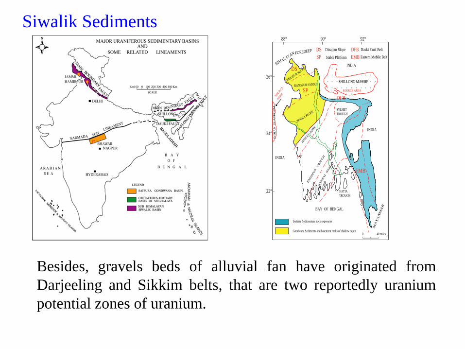
Siwalik Sediments
Dinajpur Slope is characterized by Siwalik sediments
which is capable of hosting Uranium as found in
Jammu and Hamirpur, Mio-Pleistocene Siwalik
Formation in India
Besides, gravels beds of alluvial fan have originated from
Darjeeling and Sikkim belts, that are two reportedly uranium
potential zones of uranium.
HIMALAYAN FOREDEEP
INDIA
SHILLONG MASSIF
SOURCE AREA
INDIA
MA
YA
NM
AR
BAY OF BENGAL
INDIA
DINAJPUR SLOPE
RANGPUR SADDLE
BOGRA SLOPE
HIN
GE
ZONE
FARID
PUR TROUGH
SYLHET�
TROUGH
BARISAL H
IGH
HATIA�
TROUGH
IND
IAN
P
LA
TF
OR
M
SOURCE �
AREA
Tertiary Sedimentary rock exposures
Gondwana Sediments and basement rocks of shallow depth
88° 90° 92°
26°
24°
22°
0 40 miles
DS
SP
DFB
EMB
DS Dinajpur Slope
SP Stable Platform
DFB Dauki Fault Belt
EMB Eastern Mobile Belt
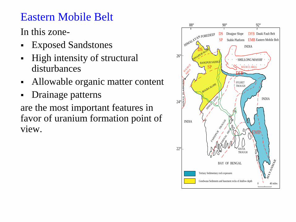
Eastern Mobile Belt
In this zone-
Exposed Sandstones
High intensity of structural disturbances
Allowable organic matter content
Drainage patterns
are the most important features in favor of uranium formation point of view.
HIMALAYAN FOREDEEP
INDIA
SHILLONG MASSIF
SOURCE AREA
INDIA
MA
YA
NM
AR
BAY OF BENGAL
INDIA
DINAJPUR SLOPE
RANGPUR SADDLE
BOGRA SLOPE
HIN
GE
ZONE
FARID
PUR TROUGH
SYLHET�
TROUGH
BARISAL H
IGH
HATIA�
TROUGH
IND
IAN
P
LA
TF
OR
M
SOURCE �
AREA
Tertiary Sedimentary rock exposures
Gondwana Sediments and basement rocks of shallow depth
88° 90° 92°
26°
24°
22°
0 40 miles
DS
SP
DFB
EMB
DS Dinajpur Slope
SP Stable Platform
DFB Dauki Fault Belt
EMB Eastern Mobile Belt
Uranium Exploration Activities in
Different Potentials Zones of Bangladesh
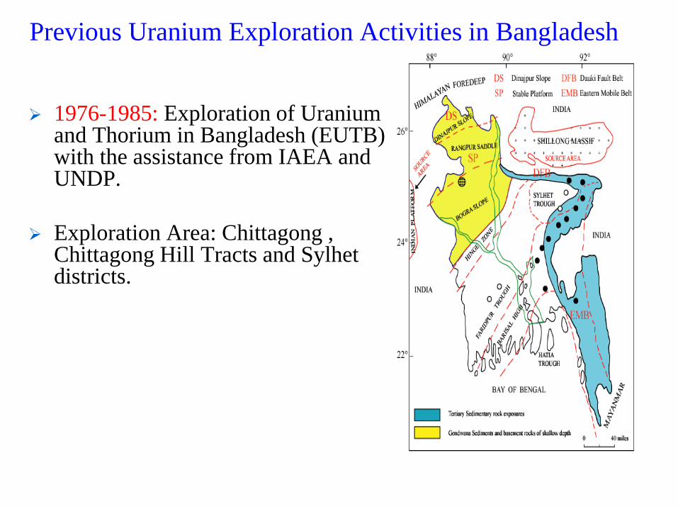
Previous Uranium Exploration Activities in Bangladesh
1976-1985: Exploration of Uranium and Thorium in Bangladesh (EUTB) with the assistance from IAEA and UNDP.
Exploration Area: Chittagong , Chittagong Hill Tracts and Sylhet districts.
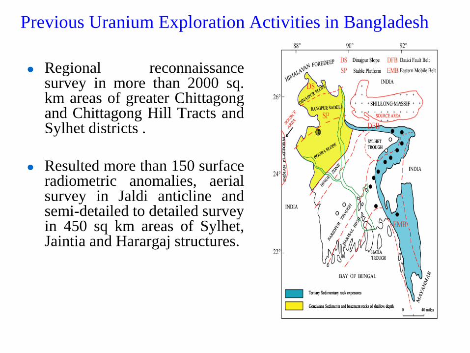
Regional reconnaissance survey in more than 2000 sq. km areas of greater Chittagong and Chittagong Hill Tracts and Sylhet districts .
Resulted more than 150 surface radiometric anomalies, aerial survey in Jaldi anticline and semi-detailed to detailed survey in 450 sq km areas of Sylhet, Jaintia and Harargaj structures.
Previous Uranium Exploration Activities in Bangladesh
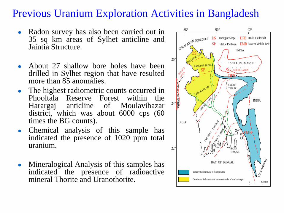
Radon survey has also been carried out in 35 sq km areas of Sylhet anticline and Jaintia Structure.
About 27 shallow bore holes have been drilled in Sylhet region that have resulted more than 85 anomalies.
The highest radiometric counts occurred in Phooltala Reserve Forest within the Harargaj anticline of Moulavibazar district, which was about 6000 cps (60 times the BG counts).
Chemical analysis of this sample has indicated the presence of 1020 ppm total uranium.
Mineralogical Analysis of this samples has indicated the presence of radioactive mineral Thorite and Uranothorite.
Previous Uranium Exploration Activities in Bangladesh
HIMALAYAN FOREDEEP
INDIA
SHILLONG MASSIF
SOURCE AREA
INDIA
MA
YA
NM
AR
BAY OF BENGAL
INDIA
DINAJPUR SLOPE
RANGPUR SADDLE
BOGRA SLOPE
HIN
GE
ZONE
FARID
PUR TROUGH
SYLHET�
TROUGH
BARISAL H
IGH
HATIA�
TROUGH
IND
IAN
P
LA
TF
OR
M
SOURCE �
AREA
Tertiary Sedimentary rock exposures
Gondwana Sediments and basement rocks of shallow depth
88° 90° 92°
26°
24°
22°
0 40 miles
DS
SP
DFB
EMB
DS Dinajpur Slope
SP Stable Platform
DFB Dauki Fault Belt
EMB Eastern Mobile Belt
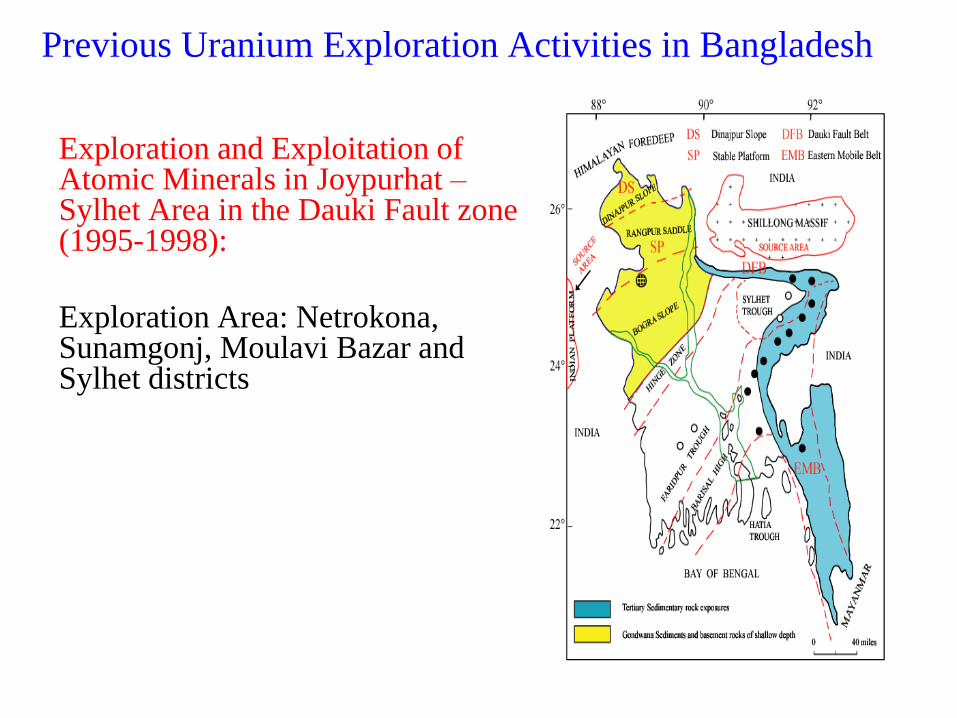
Exploration and Exploitation of Atomic Minerals in Joypurhat – Sylhet Area in the Dauki Fault zone (1995-1998):
Exploration Area: Netrokona, Sunamgonj, Moulavi Bazar and Sylhet districts
Previous Uranium Exploration Activities in Bangladesh
Previous Uranium Exploration Activities in Bangladesh
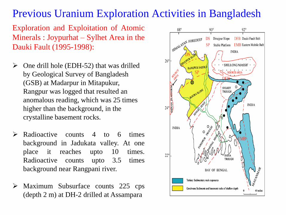
Exploration and Exploitation of Atomic
Minerals : Joypurhat – Sylhet Area in the
Dauki Fault (1995-1998):
One drill hole (EDH-52) that was drilled
by Geological Survey of Bangladesh
(GSB) at Madarpur in Mitapukur,
Rangpur was logged that resulted an
anomalous reading, which was 25 times
higher than the background, in the
crystalline basement rocks.
Radioactive counts 4 to 6 times
background in Jadukata valley. At one
place it reaches upto 10 times.
Radioactive counts upto 3.5 times
background near Rangpani river.
Maximum Subsurface counts 225 cps
(depth 2 m) at DH-2 drilled at Assampara
0
200
400
600
800
1000
1200
Con
cent
rati
on in
ppm
Fool Tala (Tipam
Fm)
M alnichara (Dupi
Tila Fm)
Telihati (Dupi Tila
Fm)
Lalakhal (Tipam
Fm)
Bhitirkhel (Dupi
Tila Fm)
AREAS
to tal
leached
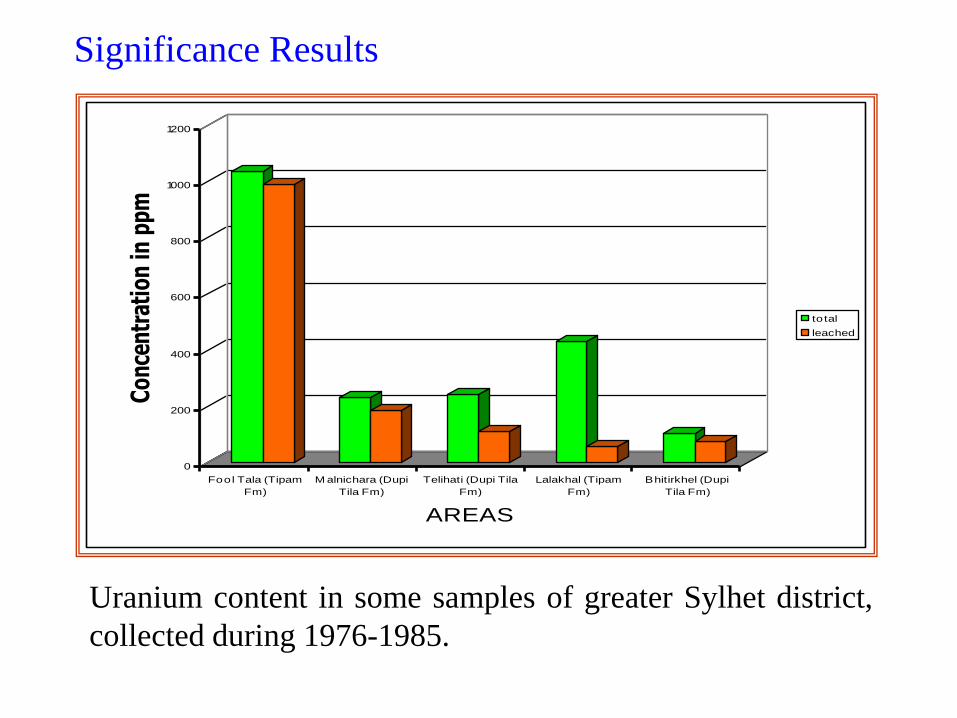
Significance Results
Uranium content in some samples of greater Sylhet district,
collected during 1976-1985.
0
20
40
60
80
100
120
140
160
Con
cent
ratio
n in
ppm
& p
pb (f
or w
s)
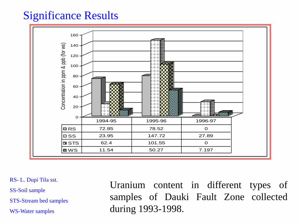
RS 72.85 78.52 0
SS 23.95 147.72 27.89
STS 62.4 101.55 0
WS 11.54 50.27 7.197
1994-95 1995-96 1996-97
Uranium content in different types of
samples of Dauki Fault Zone collected
during 1993-1998.
Significance Results
RS- L. Dupi Tila sst.
SS-Soil sample
STS-Stream bed samples
WS-Water samples
Summery
Uranium occurrences discovered so
far in the north-eastern region of
Bangladesh show presence of
uranium in total (60-1036 ppm) and
leachable form ( 13-988 ppm).
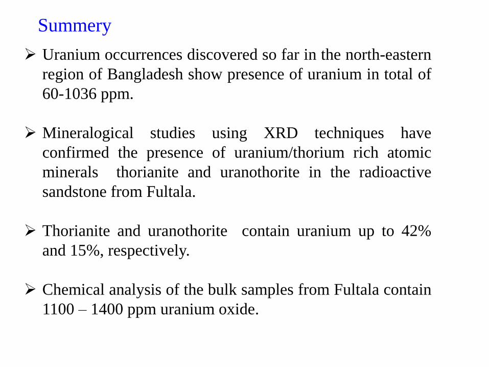
Uranium occurrences discovered so far in the north-eastern
region of Bangladesh show presence of uranium in total of
60-1036 ppm.
Mineralogical studies using XRD techniques have
confirmed the presence of uranium/thorium rich atomic
minerals thorianite and uranothorite in the radioactive
sandstone from Fultala.
Thorianite and uranothorite contain uranium up to 42%
and 15%, respectively.
Chemical analysis of the bulk samples from Fultala contain
1100 – 1400 ppm uranium oxide.

Thank you all