Upstream Suburban Philadelphia Sub-Watershed Cluster Modeling Overview
26
Upstream Suburban Philadelphia Sub - watershed Cluster Modeling Overview October 21, 2014 Robert J. Ryan, PhD., P.E. CEE Department Temple University Jeffrey Featherstone, PhD. Center for Sustainable Communities Temple University Richard K. Fromuth, P.E. Center for Sustainable Communities Temple University
-
Upload
kim-beidler -
Category
Environment
-
view
57 -
download
0
Transcript of Upstream Suburban Philadelphia Sub-Watershed Cluster Modeling Overview

Upstream Suburban Philadelphia Sub-watershed Cluster
Modeling Overview October 21, 2014
Robert J. Ryan, PhD., P.E.CEE DepartmentTemple University
Jeffrey Featherstone, PhD.Center for Sustainable CommunitiesTemple University
Richard K. Fromuth, P.E.Center for Sustainable CommunitiesTemple University

Presentation Format
Modeling Basics
Role of the modeling work
Specific Models for this study*HEC (Corps)*SWMM (EPA)
Questions

Modeling Basics
Models are used to represent a process oroperation with equations and data.
They allow for experiments and comparisonsto predict outcomes.
They can inform decision making and reducecosts.
Models are used in stormwater management andwater quality analysis.
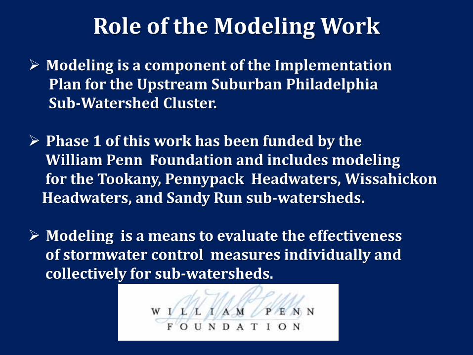
Role of the Modeling Work
Modeling is a component of the ImplementationPlan for the Upstream Suburban Philadelphia Sub-Watershed Cluster.
Phase 1 of this work has been funded by the William Penn Foundation and includes modelingfor the Tookany, Pennypack Headwaters, Wissahickon Headwaters, and Sandy Run sub-watersheds.
Modeling is a means to evaluate the effectivenessof stormwater control measures individually and collectively for sub-watersheds.

Types of Models for Watersheds
Hydrologic ModelsRate, Volume, and timing of runoff
Hydraulic ModelsWater elevation for a given flow rate
Water Quality ModelsLoadings and concentrations of substances
Models can be for discrete events or can be continuous

Modeling and Scale
Models are developed at different scales dependingon the application.
In the Philadelphia Region, existing watershed models for stormwater planning have beendeveloped for areas larger than 10 square miles.
These models generally do not have detailed representation for stormwater control measures.
This work will consider modeling at both the sub-watershed (Temple) and project site scales.(Villanova)

Wissahickon Headwaters HEC-HMS 2012
Pennypack Headwaters HEC-HMS 2010HEC-RAS 2007
Sandy Run HEC-HMS 2012HEC-RAS 2008
Poquessing Creek- Phase 2SWMM 2012
East Branch Indian Creek- Phase 2HEC-HMS 2005
TookanySWMM 2007
Existing Models for Cluster Watersheds
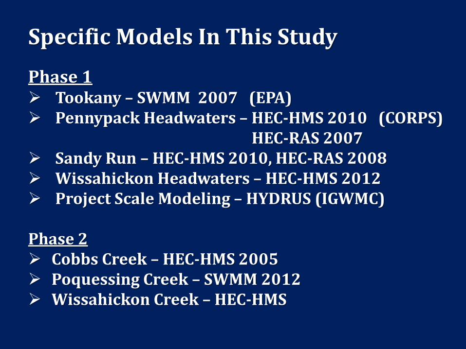
Specific Models In This Study
Phase 1 Tookany – SWMM 2007 (EPA) Pennypack Headwaters – HEC-HMS 2010 (CORPS)
HEC-RAS 2007 Sandy Run – HEC-HMS 2010, HEC-RAS 2008 Wissahickon Headwaters – HEC-HMS 2012 Project Scale Modeling – HYDRUS (IGWMC)
Phase 2 Cobbs Creek – HEC-HMS 2005 Poquessing Creek – SWMM 2012 Wissahickon Creek – HEC-HMS

Modeling activities in study contract with William Penn Foundation
Enhance LIDAR Terrain Data for the Tookany and
Wissahickon Headwaters
Begin development of a HEC-RAS model for the
Wissahickon Headwaters
Collect detention basin data and refine model
representation for each sub-watershed scale model with
more detailed data for detention basins with 1 or more
acre-ft of storage.
Perform an obstruction survey for the Tookany watershed
and improve hydraulic modeling.
Refine sub-watershed model capabilities using monitoring
results and results of Villanova’s project scale modeling.

10
• Pennypack TIN
(Triangulated
Irregular
Network)
• 2 ft resolution
2 ft resolution
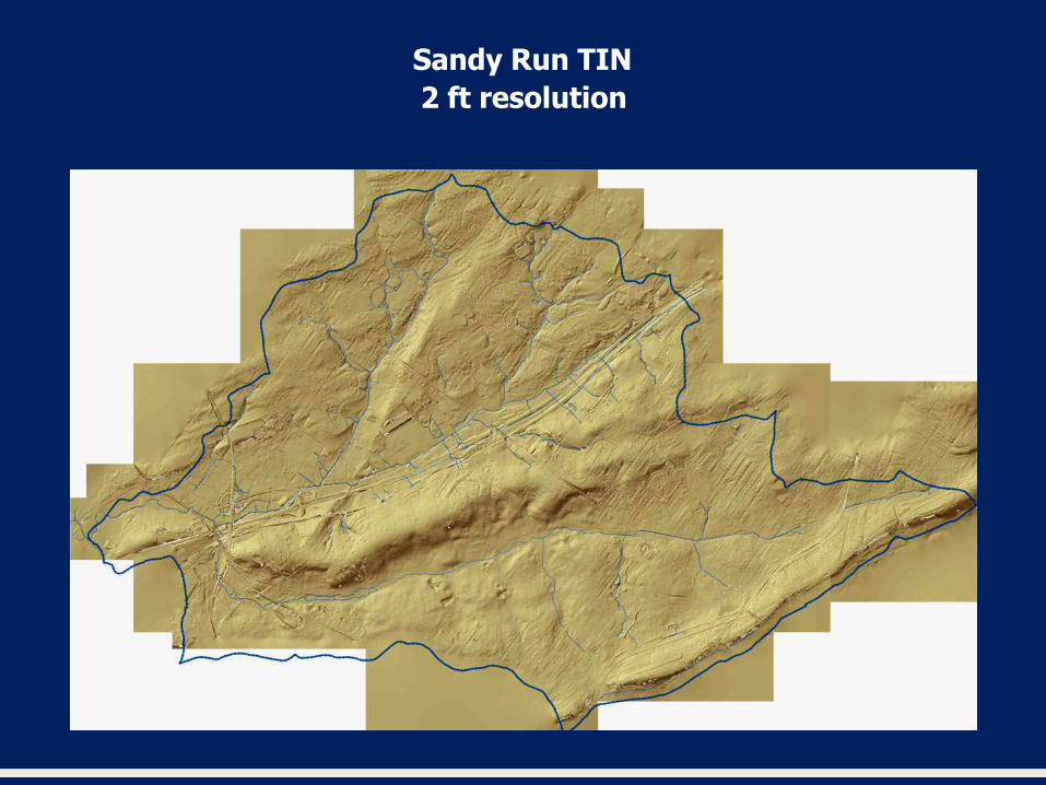
Sandy Run TIN

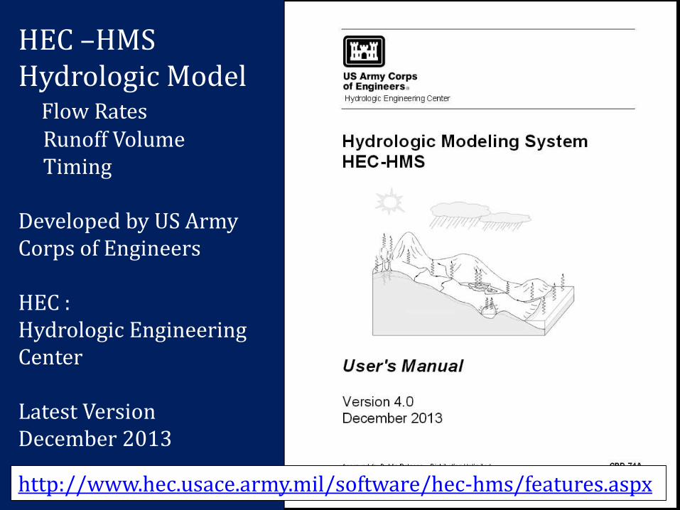
HEC –HMSHydrologic Model
Flow RatesRunoff VolumeTiming
Developed by US Army Corps of Engineers
HEC :Hydrologic EngineeringCenter
Latest Version December 2013
http://www.hec.usace.army.mil/software/hec-hms/features.aspx

HEC - RASHydaulic Model
Water Elevations
Developed by US Army Corps of Engineers
HEC :Hydrologic EngineeringCenter
Latest Version January 2010
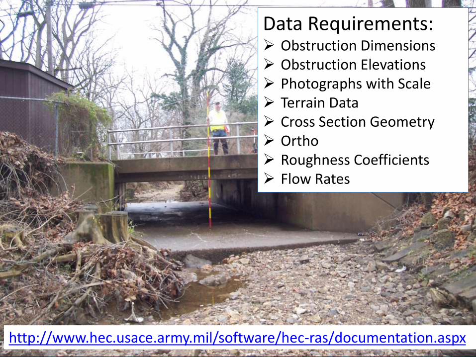
Data Requirements: Obstruction Dimensions Obstruction Elevations Photographs with Scale Terrain Data Cross Section Geometry Ortho Roughness Coefficients Flow Rates
http://www.hec.usace.army.mil/software/hec-ras/documentation.aspx
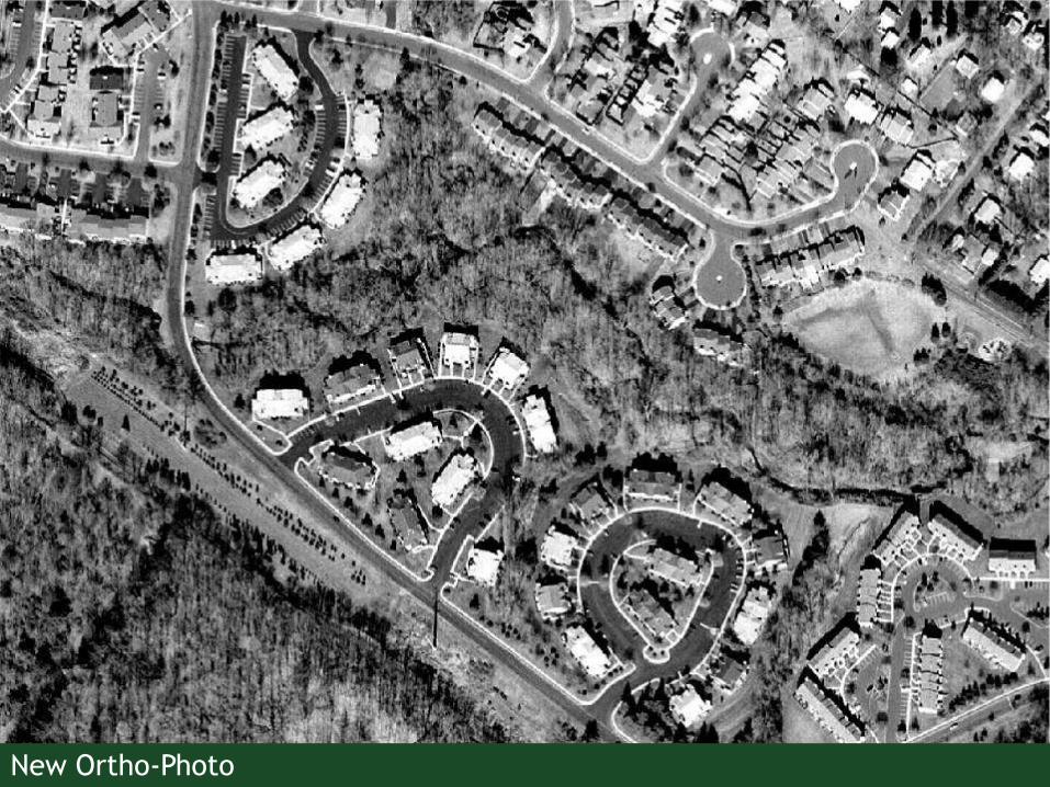
16New Ortho-Photo

172 Feet Contour Data
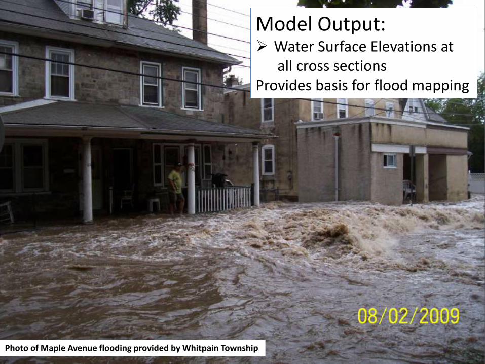
Photo of Maple Avenue flooding provided by Whitpain Township
Model Output: Water Surface Elevations at
all cross sections Provides basis for flood mapping

Recent HEC-RAS Models in Cluster Watersheds
Sandy Run 2008
Pennypack 2007
Ambler Tributaries2014

SWMM
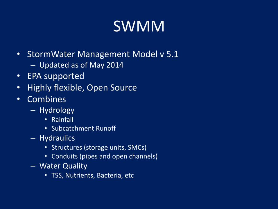
• StormWater Management Model v 5.1– Updated as of May 2014
• EPA supported• Highly flexible, Open Source• Combines
– Hydrology • Rainfall • Subcatchment Runoff
– Hydraulics• Structures (storage units, SMCs)• Conduits (pipes and open channels)
– Water Quality• TSS, Nutrients, Bacteria, etc
SWMM
• Hydraulics: LID Controls (aka Stormwater Control Measures)
– Rain gardens
– Green roofs
– Infiltration trenches
– Porous Pavement
– Rain barrels
– Vegetated Swales

SWMM
• Hydraulics: LID Controls (aka Stormwater Control Measures)
– Rain gardens
– Green roofs
– Infiltration trenches
– Porous Pavement
– Rain barrels
– Vegetated Swales
Surface characteristicsPavement characteristicsSoil characteristicsStorage characteristicsDrainage Mat characteristicsUnderdrain characteristics

SWMM
• Water Quality
– TSS
– Nutrients
– Bacteria
– Metals
– Others
SWMM
• CONCLUSION
– SWMM can model
• Rainfall
• Subcatchment Runoff
• Channel and Pipe Flow
• LID Control/SCM performance
• Water Quality

CONTACTS
Center for Sustainable Communities
Temple University Ambler
580 Meetinghouse Rd, Ambler, PA 19002
http://www.csc.temple.edu
E-mail: [email protected]