United States Department of the Interior National Park...
23
NPS Form 10-900 OMB No. 1024-0018 (Expires 5/31/2012) 1 United States Department of the Interior National Park Service National Register of Historic Places Registration Form This form is for use in nominating or requesting determinations for individual properties and districts. See instructions in National Register Bulletin, How to Complete the National Register of Historic Places Registration Form. If any item does not apply to the property being documented, enter "N/A" for "not applicable." For functions, architectural classification, materials, and areas of significance, enter only categories and subcategories from the instructions. Place additional certification comments, entries, and narrative items on continuation sheets if needed (NPS Form 10-900a). 1. Name of Property historic name California Granite Company other names/site number Capitol Granite Co., Union Granite Co., Big Gun Mining Co. 2. Location street & number 5255 Pacific Street not for publication city or town Rocklin vicinity state California code CA county Placer code 061 zip code 95677 3. State/Federal Agency Certification As the designated authority under the National Historic Preservation Act, as amended, I hereby certify that this nomination _ request for determination of eligibility meets the documentation standards for registering properties in the National Register of Historic Places and meets the procedural and professional requirements set forth in 36 CFR Part 60. In my opinion, the property _ meets _ does not meet the National Register Criteria. I recommend that this property be considered significant at the following level(s) of significance: national statewide local Signature of certifying official/Title Date State or Federal agency/bureau or Tribal Government In my opinion, the property meets does not meet the National Register criteria. Signature of commenting official Date Title State or Federal agency/bureau or Tribal Government 4. National Park Service Certification I hereby certify that this property is: entered in the National Register determined eligible for the National Register determined not eligible for the National Register removed from the National Register other (explain:) _________________ Signature of the Keeper Date of Action
Transcript of United States Department of the Interior National Park...
NPS Form 10-900 OMB No. 1024-0018 (Expires 5/31/2012)
1
United States Department of the Interior National Park Service
National Register of Historic Places Registration Form This form is for use in nominating or requesting determinations for individual properties and districts. See instructions in National Register Bulletin, How to Complete the National Register of Historic Places Registration Form. If any item does not apply to the property being documented, enter "N/A" for "not applicable." For functions, architectural classification, materials, and areas of significance, enter only categories and subcategories from the instructions. Place additional certification comments, entries, and narrative items on continuation sheets if needed (NPS Form 10-900a).
1. Name of Property
historic name California Granite Company
other names/site number Capitol Granite Co., Union Granite Co., Big Gun Mining Co.
2. Location
street & number 5255 Pacific Street not for publication
city or town Rocklin vicinity
state California code CA county Placer code 061 zip code 95677
3. State/Federal Agency Certification
As the designated authority under the National Historic Preservation Act, as amended, I hereby certify that this nomination _ request for determination of eligibility meets the documentation standards for registering properties in the National Register of Historic Places and meets the procedural and professional requirements set forth in 36 CFR Part 60. In my opinion, the property _ meets _ does not meet the National Register Criteria. I recommend that this property be considered significant at the following level(s) of significance:
national statewide local
Signature of certifying official/Title Date
State or Federal agency/bureau or Tribal Government
In my opinion, the property meets does not meet the National Register criteria.
Signature of commenting official Date
Title State or Federal agency/bureau or Tribal Government 4. National Park Service Certification
I hereby certify that this property is: entered in the National Register determined eligible for the National Register determined not eligible for the National Register removed from the National Register other (explain:) _________________
Signature of the Keeper Date of Action
wburg
Draft
United States Department of the Interior National Park Service / National Register of Historic Places Registration Form NPS Form 10-900 OMB No. 1024-0018 (Expires 5/31/2012) California Granite Company Placer, CA Name of Property County and State
2
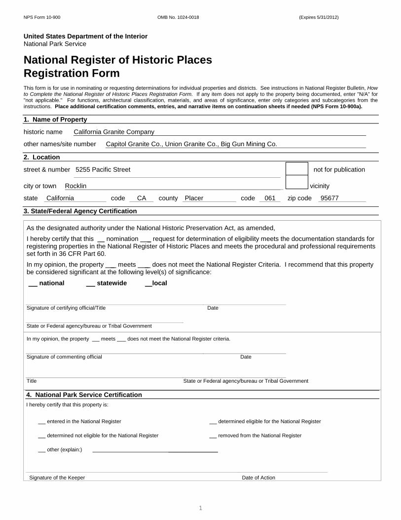
5. Classification Ownership of Property (Check as many boxes as apply.)
Category of Property (Check only one box.)
Number of Resources within Property (Do not include previously listed resources in the count.)
Contributing Noncontributing
private building(s) 3 buildings x public - Local district 1 sites public - State x site 4 1 structures public - Federal structure objects object 8 1 Total
Name of related multiple property listing (Enter "N/A" if property is not part of a multiple property listing)
Number of contributing resources previously listed in the National Register
N/A none 6. Function or Use
Historic Functions (Enter categories from instructions.)
Current Functions (Enter categories from instructions.)
Industry/Processing/ Extraction/extractive facility Vacant
Granite Quarry
7. Description
Architectural Classification (Enter categories from instructions.)
Materials (Enter categories from instructions.)
None foundation: Granite
walls: Wood, Oregon Fir
roof: Corrugated metal
other:

United States Department of the Interior National Park Service / National Register of Historic Places Registration Form NPS Form 10-900 OMB No. 1024-0018 (Expires 5/31/2012) California Granite Company Placer, CA Name of Property County and State
3
Narrative Description (Describe the historic and current physical appearance of the property. Explain contributing and noncontributing resources if necessary. Begin with a summary paragraph that briefly describes the general characteristics of the property, such as its location, setting, size, and significant features.) Summary Paragraph The California Granite Company is a 7.2 acre site located at 5255 Pacific Street in Rocklin California and has been an operational granite quarry since its inception in 1867 through 2005. The significant features of this historic site are one open granite quarry pit, two wooden sheds, one wooden office building, one derrick, one bridge crane, one reciprocating gang saw, one wire saw and a set of railroad tracks. Various pieces of granite remain strewn about the property along with various pieces of machinery from operations throughout the quarry’s 150 year history. This site is an industrial setting with small gray pines, oak trees and grasses surrounding the perimeter of the property. Although some portions of the sheds have deteriorated and some structures are missing components, this site retains strong physical integrity to the historic period and appears almost identical to photographs taken in 1900 (see attached). ________________________________________________________________________________________________________________________ Narrative Description Granite Quarry (Contributing) The granite quarry (circa 1865) is 85 feet in depth and measures 500 feet long by 250 feet wide. It is an open pit from which granite slabs were mined and used for the construction of buildings and projects throughout the state of California. The granite quarry was first utilized in 1865. This resource appears identical to photographs taken 100 years ago and retains a very strong level of historic integrity, remaining approximately in the same condition it was left when the last granite was extracted from the site. It is a contributing resource. Derrick (Contributing) The derrick (ca 1880) is 65 feet in height and it stands immediately adjacent to the west side of the quarry along with its pulleys and cables still attached. The two arms of this derrick, which was used to hoist tons of granite slabs from the quarry, are made from wood with metal cables fastened to it at several locations along each pole with metal hardware. There are also seven wire cables, each 300 feet in length, attached to the top of the derrick and anchored to the ground at strategic points around the bottom of the derrick’s center pole. These 300 foot long cables are used to keep the derrick upright. This contributing resource maintains a strong level of historic integrity to the historic period. Cutting Shed (Contributing) This is a one story rectangular shed used for cutting the large slabs of granite into smaller blocks. It is situated fifty feet southwest of the derrick and adjacent to the west side of the quarry. The cutting shed (ca 1900) is made from Oregon fir and measures 18 feet by 70 feet standing 26 feet in height at its peak with a corrugated metal roof attached. Monument Shed (Contributing) The Monument shed (ca 1907) is also a one story rectangular shed made of Oregon fir standing 36 feet at its highest peak. It originally measured 49 feet by 175 feet however, the existing structure now measures only 49 feet by 70 feet as a portion of this shed was lost due to deterioration. The corrugated metal roof is attached at some locations and missing in other areas. It is situated adjacent to the south side of the cutting shed on the west side of the quarry. This shed was used for chiseling and finishing the granite blocks into the final product which was then shipped to the customer. (See continuation sheet)
United States Department of the Interior National Park Service / National Register of Historic Places Registration Form NPS Form 10-900 OMB No. 1024-0018 (Expires 5/31/2012) California Granite Company Placer, CA Name of Property County and State
4
8. Statement of Significance
Applicable National Register Criteria (Mark "x" in one or more boxes for the criteria qualifying the property for National Register listing.)
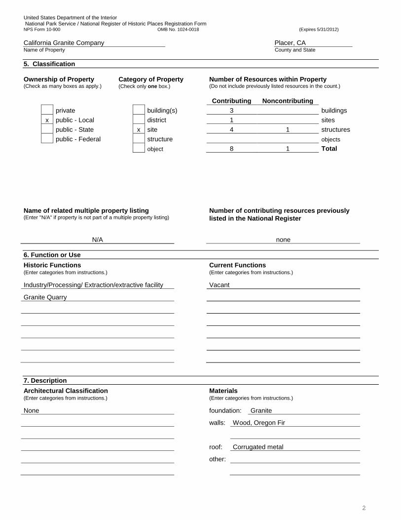
x A Property is associated with events that have made a
significant contribution to the broad patterns of our history.
B Property is associated with the lives of persons significant in our past.
C Property embodies the distinctive characteristics of a type, period, or method of construction or represents the work of a master, or possesses high artistic values, or represents a significant and distinguishable entity whose components lack individual distinction.
D Property has yielded, or is likely to yield, information important in prehistory or history.
Criteria Considerations (Mark "x" in all the boxes that apply.) N/A Property is:
A
Owned by a religious institution or used for religious purposes.
B removed from its original location.
C a birthplace or grave.
D a cemetery.
E a reconstructed building, object, or structure.
F a commemorative property.
G less than 50 years old or achieving significance
within the past 50 years.
Areas of Significance (Enter categories from instructions.)
Industry
Transportation
Period of Significance
1865 - 1940
Significant Dates
1865
Significant Person (Complete only if Criterion B is marked above.)
N/A
Cultural Affiliation
N/A
Architect/Builder
Period of Significance (justification) The period of significance extends from1867, when the quarry was first established, to 1940, when the industry changed and demand significantly dropped. In 1940, the second to last quarry in Rocklin, Quinn Quarry, closed, leaving California Granite Company as the last operating granite quarry in Rocklin. Criteria Considerations (explanation, if necessary) N/A

United States Department of the Interior National Park Service / National Register of Historic Places Registration Form NPS Form 10-900 OMB No. 1024-0018 (Expires 5/31/2012) California Granite Company Placer, CA Name of Property County and State
5
Statement of Significance Summary Paragraph (Provide a summary paragraph that includes level of significance and applicable criteria.) The California Granite Company meets the National Register of Historic Places Criterion A at a local level of significance due to its association with the development of the city of Rocklin and the local granite mining industry, and its association with the history of the Central Pacific Railroad. Rocklin granite mining operations dominated the region’s economic and social development from early American settlement during the Gold Rush period to the industry’s slow decline and demise in 2005. The railroad and the granite industry relied heavily on each other with the granite quarries supplying rip rap on which the railroad tracks were laid, and the railroad line provided the shipping method for the granite industry. California Granite was the largest quarry in Rocklin, with the most employees, and was the last functioning granite quarry in the city, in continuous operation from 1865 until 2005. The period of significance is from 1865-1940. ________________________________________________________________________________________________________________________ Narrative Statement of Significance (Provide at least one paragraph for each area of significance.) (See Continuation Sheet) ________________________________________________________________________________________________________________________ Developmental history/additional historic context information (if appropriate) (See Continuation Sheet)

United States Department of the Interior National Park Service / National Register of Historic Places Registration Form NPS Form 10-900 OMB No. 1024-0018 (Expires 5/31/2012) California Granite Company Placer, CA Name of Property County and State
6
9. Major Bibliographical References
Bibliography (Cite the books, articles, and other sources used in preparing this form.) Books Barry-Schweyer, Carmel, Rocklin. San Francisco, CA: Arcadia Publishing, 2005. California State Mining Bureau, The Structural and Industrial Materials of California, Bulletin No. 38,
California State Mining Bureau, 1906 Davis, Leonard M., Rocklin, Past, Present, Future, Rocklin, CA: Rocklin Friends of the Library 1981 Published Articles “City to Demolish Big Gun Quarry Shed”, Placer Herald, November 2011 “Town Built on Granite”, Rocklin Historical Society Newsletter, n.d. Unpublished Sources Rukhala, Roy, “History of Rocklin California” prepared for the Rocklin Historical Society, prepared by Roy Ruhkala, former owner and operator of California Granite Company, 1974 Hebuck, Uno, “My Memories of Rocklin,” unpublished manuscript at Rocklin History Museum. Websites Rocklin Historical Society http://www.rocklinhistory.org “Construction: A Tale of Two Stones”, California State Capitol Museum Virtual Tour http://capitolmuseum.ca.gov/virtualtour.aspx?Content1=1482&content2=1472&content3=362 Previous documentation on file (NPS): Primary location of additional data:
preliminary determination of individual listing (36 CFR 67 has been State Historic Preservation Office requested) Other State agency previously listed in the National Register Federal agency previously determined eligible by the National Register Local government designated a National Historic Landmark University recorded by Historic American Buildings Survey #____________ x Other
recorded by Historic American Engineering Record # __________ Name of repository: Rocklin Historical Society recorded by Historic American Landscape Survey # ___________ Historic Resources Survey Number (if assigned): N/A
United States Department of the Interior National Park Service / National Register of Historic Places Registration Form NPS Form 10-900 OMB No. 1024-0018 (Expires 5/31/2012) California Granite Company Placer, CA Name of Property County and State
7
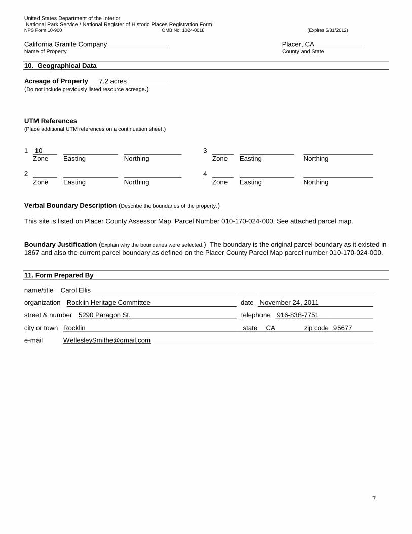
10. Geographical Data Acreage of Property 7.2 acres (Do not include previously listed resource acreage.) UTM References (Place additional UTM references on a continuation sheet.) 1 10 3 Zone
Easting
Northing Zone
Easting
Northing
2 4 Zone
Easting
Northing
Zone
Easting
Northing
Verbal Boundary Description (Describe the boundaries of the property.) This site is listed on Placer County Assessor Map, Parcel Number 010-170-024-000. See attached parcel map. Boundary Justification (Explain why the boundaries were selected.) The boundary is the original parcel boundary as it existed in 1867 and also the current parcel boundary as defined on the Placer County Parcel Map parcel number 010-170-024-000. 11. Form Prepared By
name/title Carol Ellis
organization Rocklin Heritage Committee date November 24, 2011
street & number 5290 Paragon St. telephone 916-838-7751
city or town Rocklin state CA zip code 95677
e-mail [email protected]
United States Department of the Interior National Park Service / National Register of Historic Places Registration Form NPS Form 10-900 OMB No. 1024-0018 (Expires 5/31/2012) California Granite Company Placer, CA Name of Property County and State
8
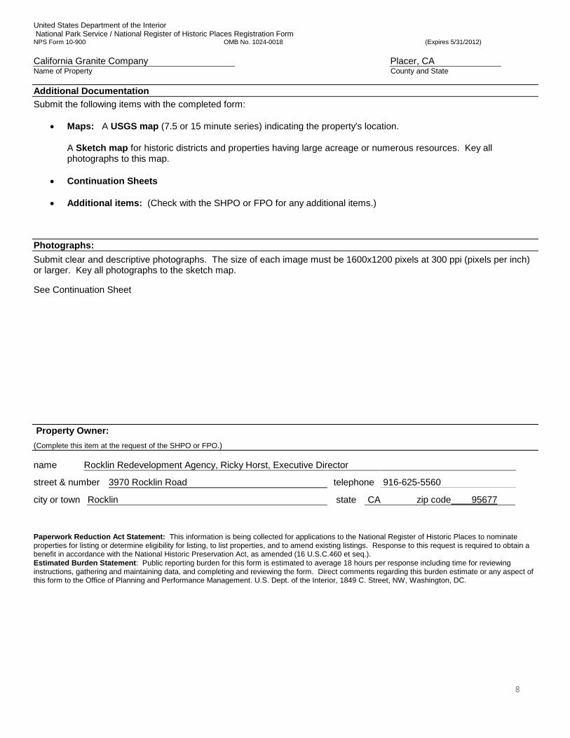
Additional Documentation
Submit the following items with the completed form:
• Maps: A USGS map (7.5 or 15 minute series) indicating the property's location.
A Sketch map for historic districts and properties having large acreage or numerous resources. Key all photographs to this map.
• Continuation Sheets
• Additional items: (Check with the SHPO or FPO for any additional items.)
Photographs:
Submit clear and descriptive photographs. The size of each image must be 1600x1200 pixels at 300 ppi (pixels per inch) or larger. Key all photographs to the sketch map. See Continuation Sheet Property Owner:
(Complete this item at the request of the SHPO or FPO.)
name Rocklin Redevelopment Agency, Ricky Horst, Executive Director
street & number 3970 Rocklin Road telephone 916-625-5560
city or town Rocklin state CA zip code 95677 Paperwork Reduction Act Statement: This information is being collected for applications to the National Register of Historic Places to nominate properties for listing or determine eligibility for listing, to list properties, and to amend existing listings. Response to this request is required to obtain a benefit in accordance with the National Historic Preservation Act, as amended (16 U.S.C.460 et seq.). Estimated Burden Statement: Public reporting burden for this form is estimated to average 18 hours per response including time for reviewing instructions, gathering and maintaining data, and completing and reviewing the form. Direct comments regarding this burden estimate or any aspect of this form to the Office of Planning and Performance Management. U.S. Dept. of the Interior, 1849 C. Street, NW, Washington, DC.
NPS Form 10-900-a (Rev. 8/2002) OMB No. 1024-0018 (Expires 5-31-2012)
United States Department of the Interior Put Here National Park Service National Register of Historic Places Continuation Sheet Section number 7 Page 1
Name of Property County and State Name of multiple listing (if applicable)
DESCRIPTION Gang Saw (Contributing) Located inside the cutting shed is the original reciprocating gang saw which was used to cut large slabs of granite into smaller pieces. This saw, including its six 16 ft. blades and eccentric drive equipment measures 50 feet in length and is made of steel. It works on the rectilinear long run motion for cutting granite blocks. The stone blocks rest in the blade rack and the friction of the segments in both directions by means of reciprocating motion facilitates the cutting of the block. To ensure perfect rectilinear movement of the blade rack, double connecting rods are attached at both ends of blade rack. Currently, the main support frame for the saw is the only remaining part. Although it appears rusted and some of the parts are missing, this structure is still largely intact and is a contributing resource. Bridge Crane (Contributing) The bridge crane (ca 1907) is made of metal with a wooden truss system to support its massive frame. This bridge crane is currently mounted 19 feet overhead inside the monument shed exactly as it was 100 years ago. This massive structure measures 175 feet in length (the original length of the monument shed) and was used for lifting and moving blocks of granite to work stations throughout the shed. Tables called “bankers” were set up throughout the monument shed and as the stone blocks would come in, the bridge crane would pick up a large block of granite and set it on your banker where it would be chiseled or hammered into what ever piece was being fabricated. Although this resource shows some rust, it maintains a strong level of historic integrity and is a contributing resource. Railroad Tracks (Contributing) Railroad tracks (ca 1865) leading from the derrick into the cutting shed are visible as are railroad tracks exiting the shed. Some railroad cars carried granite slabs from the derrick into the cutting shed while other railroad cars were used for transportation of the finished granite product to its destination via the Central Pacific rail line. Tracks and ties have been replaced over time but were replaced in kind and were utilized throughout the period of significance, and thus are a contributing resource. Office Building (Contributing) Situated 30 feet south of the monument shed is a one story, wooden building with a granite base (ca 1890) measuring 16 feet by 25 feet, standing 14 feet high. This building served as an office for the quarry during its historic period and it maintains strong historical integrity. This is considered a contributing resource. Wire Saw (Non-Contributing) A wire saw remains inside the cutting shed and was added to the property in 1950 by Ruben Ruhkala, owner of the quarry from 1933 through 1977. In 1950 wire saw technology displaced that of the 1907 reciprocating gang saw for cutting large stone into relatively thin workable slabs. Ruben Ruhkala of Union Granite Co is credited with assembly of the 24 ft wide saw which stands 25 ft high at the side of the Monument Shed. Stone as large as 8 ft high, 12 ft wide and of various lengths was moved under the cutting wire on a cable-drawn railroad carriage. Cutting was by an abrasive slurry consisting of water & carborundum dust carried by an endless steel wire circulated on a system of huge pulleys. As cutting progressed the wire was lowered through the stone utilizing a second set of pulleys and cables. A remote auxiliary frame and idler pulley, located 50 to 100 ft from the main frame, was used to
NPS Form 10-900-a (Rev. 8/2002) OMB No. 1024-0018 (Expires 5-31-2012)
United States Department of the Interior Put Here National Park Service National Register of Historic Places Continuation Sheet Section number 7 Page 2
Name of Property County and State Name of multiple listing (if applicable)
increase the length of the circulating wire which, in turn, increased the time between shutdowns required to replace worn wire. The wire saw is a non-contributing resource due to its installation after the end of the period of significance. Integrity Despite several years of decline, the property retains strong integrity of location, design, setting, workmanship, feeling and association. Although integrity of materials has been somewhat diminished by the deterioration of the sheds’ exteriors and the saws, much of the material integrity remains in place. The California Granite Company along with its sheds, derrick and saws has not been moved and retains its original footprint and, as such, exhibits integrity of location. While operations at the California Granite Company have ceased with the mine permanently closing in 2005, the industrial setting of the property remains largely intact and the setting retains historical integrity to the period. This site retains the feeling and association to the historic period and conveys its significance through these aspects of integrity. Although the California Granite Company is no longer in operation, with none of the famed Rocklin mines remaining, this site stands in its original location and setting and can convey its historical role as a granite quarry that provided California with granite during its formative years of statehood. Comparing current conditions with those from the active mining period, this site retains strong physical association to the historic period and physically conveys the lasting local legacy of the granite mining period.

NPS Form 10-900-a (Rev. 8/2002) OMB No. 1024-0018 (Expires 5-31-2012)
United States Department of the Interior Put Here National Park Service National Register of Historic Places Continuation Sheet Section number 8 Page 1
Name of Property County and State Name of multiple listing (if applicable)
Criterion A: California Granite Company and the Rocklin Granite Industry The California Granite Company is eligible for the National Register of Historic Places under Criterion A at the local level of significance for its association with the history of granite mining in Rocklin and the development of the City of Rocklin, California. California Granite Company was the largest granite quarry in the city of Rocklin, a city named after its quarrying industry and known as the “Granite City.” The property’s period of significance is from 1865 when the quarry was established until 1940 when it became the sole surviving quarry in the city of Rocklin. California Granite Company was established in 1865 as Capitol Granite Company by S.D. Smith, on behalf of the Central Pacific Railroad. The business was purchased by John M. Taylor in 1884, and sold to John Mantyla in approximately 1890. According to the The Structural and Industrial Materials of California, Bulletin No. 38, published by the California State Mining Bureau in 1906, there were fifteen quarries in operation in Rocklin with several remaining idle. Most employed between 3 – 10 men with the largest quarry, California Granite Company, employing between 33 – 50 men. The report goes on to say that California Granite Company’s pit was the biggest at about 100 feet deep, 100 feet wide and 250 feet long. The rock from California Granite Company has a remarkably straight grain and regular cleavage. Curbing slabs, from 10 to 20 feet long, are split with surfaces almost as regular and even as those cut with saws. Numerous slabs up to 16 by 20 feet surface, and from 10 to 12 inches thick, have been removed from the quarry. These large slabs, like the smaller ones, are nearly all split from the ledge by use of plugs and feathers. The California Granite Company was also well equipped with machinery for handling and dressing the stone. California Granite Company also had large derricks and steam hoists, an overhead steam traveler in the cutting sheds, and several polishing and surfacing machines. Other quarries in the area did not have such equipment making California Granite Company the biggest and best in the area. During the peak years of the granite industry, California Granite Company employed as many as 100 workers. The operator of the California Granite Company during the heyday of Rocklin’s granite industry was Adolph Pernu, a native of Finland and a Rocklin resident from circa 1902 until he died in 1931. Pernu purchased the property from John Mantyla and organized the California Granit Company. Between 1907 and 1920, granite from this quarry was used to construct the San Francisco Hibernia Bank, the Coaling and Naval Station at Pearl Harbor, the Sacramento County Courthouse, the University of California Campanile Bell Tower at Berkeley, the Sacramento County Jail, Santa Barbara Post Office, and the Bank of Italy Building in San Francisco. Pernu mortgaged the property in 1929 and died in a fall in 1931 while supervising construction of stone bridges in Sequoia National Park. After Adolph Pernu’s death, the property was sold to the Rukhala family, who operated the quarry until 1977. From 1977 until 1980 the property was owned by the Scapezzi family, and operated as the Big Gun Mining Company from 1980 until the quarry’s closure in 2005, owned by Don Epperson. California Granite Company was in operation from 1865 through 2005. Most of Rocklin’s other quarries went out of business by 1880, yet California Granite Company remained in business for another 125 years. Even as late at 1973 California Granite Company was participating in the building of California’s iconic buildings. In 1973 the crusher at California Granite Company crushed the quartz that was used for the floors in San Francisco’s TransAmerica Pyramid, giving the floors their sparkle.

NPS Form 10-900-a (Rev. 8/2002) OMB No. 1024-0018 (Expires 5-31-2012)
United States Department of the Interior Put Here National Park Service National Register of Historic Places Continuation Sheet Section number 8 Page 2
Name of Property County and State Name of multiple listing (if applicable)
Developmental history/additional historic context information The first reported use of granite from the vicinity of Rocklin was in 1855, utilized for the construction of Fort Mason in San Francisco. Due to the difficulties involved with transportation of granite from Rocklin to the nearest railroad at Folsom (the Sacramento Valley Railroad), Rocklin granite was not shipped very often until the arrival of the Central Pacific Railroad. The Central Pacific Railroad arrived at Rocklin in May of 1864, and pushed on, arriving at Newcastle that same year. Rocklin granite was used in construction of the railroad. According to the Sacramento Union of March 28, 1864 the Central Pacific’s first paid freight was three carloads of granite bound for a building project in San Francisco. A local newspaper reported that the town was “destined to become one of the best towns in Placer County.” With an industry, the town attracted many new immigrants, especially those with experience in the hard work and art of shaping stone to meet the needs of a new California. The U.S. census of 1870 credits Rocklin with 542 people but, with the increase in the number of granite quarries (more than 60 at one time or another) the population doubled to 1,050 residents by 1890. Rocklin’s 1870 census shows that Rocklin’s quarrymen of the 1860s and 1870s were predominantly Irish, possibly from families escaping the Irish potato famines of the 1840s. By 1900 Finns owned more than half of Rocklin’s quarries and were prominent in Rocklin’s politics, retail enterprises and social life. As the granite industry flourished, so did Rocklin’s other businesses such saloons, hotels and blacksmithing. At the height of granite quarrying there were 22 saloons in Rocklin. By 1880, at least six Rocklin quarries had shipped granite blocks for dozens of imposing granite structures, including the San Francisco Mint (1874) and San Francisco’s Palace Hotel (1875). The industry shrunk to one quarry in the early 1880s as public projects dried up but a better economy and machine-powered quarrying technology brought the quarries to their peak of activity by 1895 when at least 12 quarries operated. The 1880s saw the arrival in Rocklin of a large population of Finns. By 1900 Finns owned more than half of the Rocklin’s quarries and were dominant in Rocklin politics and social life. By 1910 Rocklin quarries had supplied granite for several major projects in Nevada and Northern California, including the courthouses in Auburn, Reno and Sacramento. Today, some San Francisco streets are still lined with Rocklin granite curbing used to repair roads damaged in the 1906 earthquake. But by 1915 cement-based concrete had begun to nudge granite from builders’ plans and a stonecutters’ strike that year closed all but two or three Rocklin operations permanently. In 1920, San Francisco’s Bank of Italy building consumed Rocklin’s last significant shipment of building stone.
Some quarries operated for just a few months, others for several decades. 61 quarry pits were eventually opened and abandoned. One was used as Rocklin’s garbage dump for several years and later filled to underpin a new building. At least one lies under the westbound lanes of highway 80. Another is water-filled and beautifies a mobile home park landscape. Many are filled with runoff rainwater and debris and lie hidden by weeds in empty fields.
The California Granite Company is associated with the construction of California’s early infrastructure supplying granite for many of the State’s most important and iconic buildings. Rocklin City Hall and Placer County Courthouse were built from granite mined in the local quarries. Granite was so plentiful

NPS Form 10-900-a (Rev. 8/2002) OMB No. 1024-0018 (Expires 5-31-2012)
United States Department of the Interior Put Here National Park Service National Register of Historic Places Continuation Sheet Section number 8 Page 3
Name of Property County and State Name of multiple listing (if applicable)
and the industry so influential that it was used for everything from the local city hall to the bridges on Joel Parker Whitney’s famed Spring Valley Ranch. Mr. Whitney hired Chinese immigrants to build 24 arched granite bridges across his vast, 30,000 acre ranch located in present day Rocklin, Lincoln and Penryn. Twelve of these bridges spanned the distance from his home which was located in the Mansion Oaks neighborhood of current day Rocklin to down town Rocklin. Hence the name “Twelve Bridges Drive” located off Hwy. 65 in Lincoln, CA Rocklin was born of the granite industry and so aptly named, “Rock” “lin” precisely because of the granite mining industry which dominated the area during the late 1800s. Granite quarrying was the most important industry in Placer County during that time proving steady, well-paying jobs for Irish immigrants and later Finnish immigrants. Rocklin granite mining was the lifeblood of the local economy bolstering local businesses such as the 22 saloons which were established at the height of its stone cutting years. During the 1800s, California was in its infancy and needed to construct infrastructure and government building so the State could conduct official business. During this construction period, Rocklin granite was used to build the ground level of the State Capitol in Sacramento which was completed in 1874. Rocklin granite not only supplied a sturdy base on which to build the upper levels of the State Capitol, it conveyed a sense of permanency and stability that the State of California was seeking at that time. Prior to settling in Sacramento, California’s governmental offices moved six times. Without a good supply of high quality, even colored granite, California would not have been able to construct our most important public buildings. The construction of San Francisco City Hall, which was built with Rocklin granite, was an important milestone in California’s history as it provided the citizens with an important governmental building from which the City could conduct business and serve its ever growing population. Numerous public and private buildings in San Francisco were built with Rocklin Granite which provided places for California’s citizens to conduct business and socialize. Some of the more notable places were the Palace Hotel, Bank of Italy and the Wells Fargo Bank. Without these centers of commerce and entertainment, California would not have been able to grow and prosper at the rate with which it did. As the State of California grew and its citizens required more services, other county governments utilized Rocklin’s granite in the construction of their buildings, as well. Noteworthy, as well, were Solano County Court House (1911), Sacramento City Hall (1911) and Sacramento City and County jails. The building of California’s railroad infrastructure also required massive amounts of granite, with California Granite Company supplying a large part of it. Thousands of tons of granite were used in the Sacramento River levee system as Sacramento attempted to deal with flooding in the early days. Tons of small granite blocks known as “rip rap” were used in the building of the Central Pacific Railroad as fill on which the tracks were laid. Granite also supplied the building blocks for the tunnels as the railroad building progressed upward from Sacramento toward the Sierras. The railroad was dependent upon the Rocklin granite industry and Rocklin was dependent upon the railroad to ship its granite throughout California. Finally, much of San Francisco’s streets and curbing, still visible today, were made from Rocklin’s granite. California Granite Company is also associated with the construction of federal buildings and military
NPS Form 10-900-a (Rev. 8/2002) OMB No. 1024-0018 (Expires 5-31-2012)
United States Department of the Interior Put Here National Park Service National Register of Historic Places Continuation Sheet Section number 8 Page 4
Name of Property County and State Name of multiple listing (if applicable)
installations on the west coast. As the U.S. Army Corps of Engineers began work on Fort Point in 1853, one of the first loads of granite shipped from Rocklin in 1855 went to this military installation in San Francisco. The Fort has been called "the pride of the Pacific," "the Gibraltar of the West Coast," and "one of the most perfect models of masonry in America. This resource is registered with the National Register of Historic Places. The old U.S. Mint which opened in 1874 and located at 88 Fifth Street in San Francisco is affectionately known as “The Granite Lady” because of the superb quality of Rocklin granite utilized in the building of the basement of this historic structure. The building sat on a concrete and granite foundation, designed to thwart tunneling into its vaults, which at the time of the 1906 fire held $300 million, fully a third of the United States' gold reserves. This resource is designated as a National Historic Landmark. After the Civil War, the reach of the U.S. Navy extended to the Pacific, and with it came the construction of dry docks at Mare Island (ca 1895) and Pearl Harbor (ca 1910). Once again, Rocklin’s granite was used in the construction of these historic, U.S. military installations. The granite in the Rocklin Pluton is 128 million years old but it was exposed at the earth’s surface in just the last two or three million years. It is for that reason that the granite appears fresh, is not deeply weathered and it has retained many of its original qualities with respect to hardness, glitter, brilliance and color. Beginning in 1848 the Gold Rush brought sudden, profound change when miners went through this area on their way to Auburn to find gold. They mined all the creeks in the area and when the gold ran out, the Irish landed in Rocklin. Some of them remained in Rocklin and began working on the railroad or opened up quarries. The rock was on top of the ground and exposed facilitating the opening of the first granite operations in 1855.

NPS Form 10-900-a (Rev. 8/2002) OMB No. 1024-0018 (Expires 5-31-2012)
United States Department of the Interior Put Here National Park Service National Register of Historic Places Continuation Sheet Section number Index of Figures Page 1
California Granite Company Name of Property County and State Name of multiple listing (if applicable)
Figure 1: Historical photograph (ca 1900) showing north elevation of cutting shed and monument shed with derrick and granite quarry in foreground. Figure 2: Historical photograph (ca 1900) depicting two granite workers standing on top of bridge crane with two workers standing below as granite slab is hoisted inside monument shed. Figure 3: Historical photograph (ca 1900) depicting granite workers chiseling granite slabs beside granite quarry with derrick and rail car in background. Figure 4: Sketch Map Figure 5: Detailed Footprint of Site showing portion of Monument Shed that was lost due to deterioration. Figure 6: Placer County Assessor Parcel Map referencing California Granite Company parcel in center, 7.2 acres. Figure 7: Historical Map referencing California Granite Company (shown as 1. John Taylor)
NPS Form 10-900-a (Rev. 8/2002) OMB No. 1024-0018 (Expires 5-31-2012)
United States Department of the Interior Put Here National Park Service National Register of Historic Places Continuation Sheet Section number 8 Page 1
Name of Property County and State Name of multiple listing (if applicable)
NPS Form 10-900-a (Rev. 8/2002) OMB No. 1024-0018 (Expires 5-31-2012)
United States Department of the Interior Put Here National Park Service National Register of Historic Places Continuation Sheet Section number 8 Page 1
Name of Property County and State Name of multiple listing (if applicable)
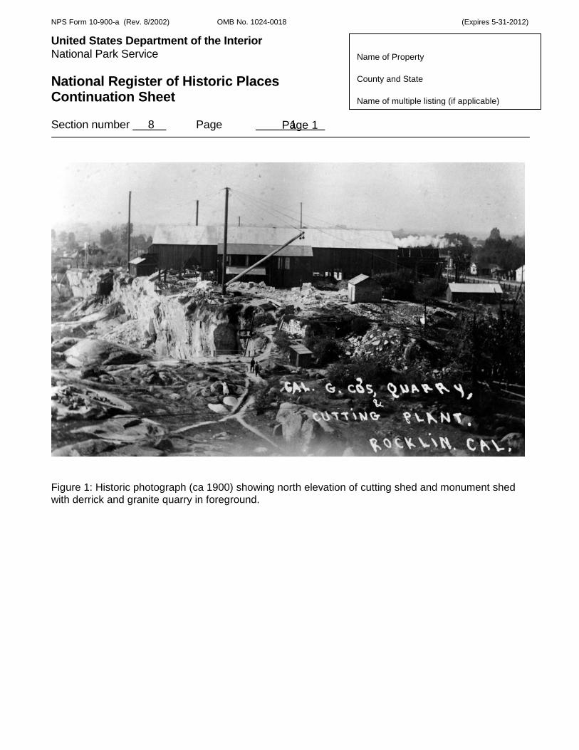
Figure 1: Historic photograph (ca 1900) showing north elevation of cutting shed and monument shed with derrick and granite quarry in foreground.
Page 1

NPS Form 10-900-a (Rev. 8/2002) OMB No. 1024-0018 (Expires 5-31-2012)
United States Department of the Interior Put Here National Park Service National Register of Historic Places Continuation Sheet Section number 8 Page 2
Name of Property County and State Name of multiple listing (if applicable)
Figure 2: Historic photograph (ca 1900) depicting two granite workers standing on top of bridge crane with two workers standing below as granite slab is hoisted inside monument shed.
Page 2

NPS Form 10-900-a (Rev. 8/2002) OMB No. 1024-0018 (Expires 5-31-2012)
United States Department of the Interior Put Here National Park Service National Register of Historic Places Continuation Sheet Section number 8 Page 3
Name of Property County and State Name of multiple listing (if applicable)
Figure 3: Historic photograph (ca 1900) depicting granite workers chiseling granite slabs beside granite quarry with derrick and rail car in background.
Page 3

NPS Form 10-900-a (Rev. 8/2002) OMB No. 1024-0018 (Expires 5-31-2012)
United States Department of the Interior Put Here National Park Service National Register of Historic Places Continuation Sheet Section number 8 Page 4
Name of Property County and State Name of multiple listing (if applicable)
Figure 4: Sketch Map (Google Maps)
Page 4

NPS Form 10-900-a (Rev. 8/2002) OMB No. 1024-0018 (Expires 5-31-2012)
United States Department of the Interior Put Here National Park Service National Register of Historic Places Continuation Sheet Section number 8 Page 5
Name of Property County and State Name of multiple listing (if applicable)
Figure 5: Detailed Footprint of Site showing portion of Monument Shed that was lost due to deterioration.
Page 5
Page 5
NPS Form 10-900-a (Rev. 8/2002) OMB No. 1024-0018 (Expires 5-31-2012)
United States Department of the Interior Put Here National Park Service National Register of Historic Places Continuation Sheet Section number 8 Page 6
Name of Property County and State Name of multiple listing (if applicable)
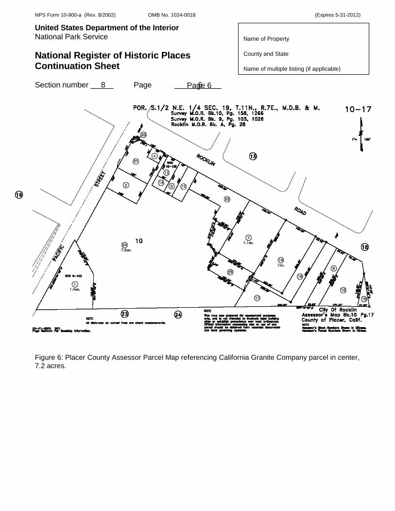
Figure 6: Placer County Assessor Parcel Map referencing California Granite Company parcel in center, 7.2 acres.
Page 6

NPS Form 10-900-a (Rev. 8/2002) OMB No. 1024-0018 (Expires 5-31-2012)
United States Department of the Interior Put Here National Park Service National Register of Historic Places Continuation Sheet Section number 8 Page 7
Name of Property County and State Name of multiple listing (if applicable)
Figure 7: Historical Map referencing California Granite Company (shown as 1. John Taylor)
Page 7