United States Apache-Sitgreaves National Forests Plan
24
United States Department of Agriculture Forest Service Southwestern Region July 2014 Apache-Sitgreaves National Forests Plan Monitoring and Evaluation Report Fiscal Years 2012 and 2013
Transcript of United States Apache-Sitgreaves National Forests Plan

United States Department of Agriculture
Forest Service
Southwestern Region
July 2014
Apache-Sitgreaves National Forests Plan Monitoring and Evaluation Report Fiscal Years 2012 and 2013

2
The U.S. Department of Agriculture (USDA) prohibits discrimination in all its programs and activities on the basis of race, color, national origin, age, disability, and where applicable, sex, marital status, familial status, parental status, religion, sexual orientation, genetic information, political beliefs, reprisal, or because all or part of an individual’s income is derived from any public assistance program. (Not all prohibited bases apply to all programs.) Persons with disabilities who require alternative means for communication of program information (Braille, large print, audiotape, etc.) should contact USDA’s TARGET Center at (202) 720-2600 (voice and TTY). To file a complaint of discrimination, write to USDA, Director, Office of Civil Rights, 1400 Independence Avenue, SW, Washington, DC 20250-9410, or call (800) 795-3272 (voice) or (202) 720-6382 (TTY). USDA is an equal opportunity provider and employer.
Printed on recycled paper – July 2014
3
Apache-Sitgreaves National Forests Plan ........................................................................1
Monitoring and Evaluation Report Fiscal Years 2012 and 2013 ..................................1 Introduction ............................................................................................................................................ 3 Integrated Resource Restoration ............................................................................................................. 3 Watershed and Air Quality Management ............................................................................................... 4 Fire and Fuels Management.................................................................................................................... 5 Cultural Resources .................................................................................................................................. 7 Rangeland Management ......................................................................................................................... 9 Terrestrial Wildlife ............................................................................................................................... 10 Threatened, Endangered, Proposed, and Sensitive Species (TEPS) ..................................................... 12 Mexican Gray Wolf Reintroduction Program....................................................................................... 13 Aquatic Species .................................................................................................................................... 14 Transportation ....................................................................................................................................... 15 Recreation ............................................................................................................................................. 18 Lands and Minerals .............................................................................................................................. 20 Forest Products ..................................................................................................................................... 22 White Mountain Stewardship and 4-FRI .............................................................................................. 22 Biomass Markets .................................................................................................................................. 23 Insects and Disease ............................................................................................................................... 23 Plan Revision ........................................................................................................................................ 23
Introduction This document is the Apache-Sitgreaves National Forests (ASNFs) monitoring and evaluation report for fiscal years 2012 and 2013. The report provides monitoring information and addresses monitoring questions as identified in chapter five (monitoring plan) of the 1987 Apache-Sitgreaves National Forests Plan. The ASNFs are in the process of revising the 1987 plan.
Integrated Resource Restoration During fiscal year 2012, the Forest Service aligned the budget structure to focus landscape-scale restoration across multiple resource areas to support and accelerate the pace of a wide spectrum of restoration and resiliency enhancing activities. This new emphasis merged programs previously separated out as forest products, vegetation and watershed management, fish and wildlife habitat management, non-WUI (wildland urban interface) hazardous fuels, post-fire restoration and rehabilitation, and legacy roads and trails (including road decommissioning).
This change was prompted by the Secretary of Agriculture’s vision for integrated watershed protection and restoration that recognizes the role of healthy forests in enhancing water resources and maintaining resiliency within a changing climate. This integrated approach should provide a more efficient method to reducing risk from uncharacteristic wildfire, restoring habitat in entire watersheds, and providing wood to local and regional industries.
The Forests began using this integrated approach in planning during fiscal years 2012 and 2013, identifying 7 priority landscapes with 6 priority watersheds to implement Integrated Resource Restoration over the next 5 years. The priority landscapes are Timber-Mesa-Vernon, Rim Lakes, Larson, Escudilla East, East Eagle-Sheep Wash, Black River, and Wildcat. The priority watersheds are Long Tom Canyon-Chevelon Canyon, Upper Wildcat Creek, Canovis Creek-Coyote Creek, Pratt Lake, Long Lake, and Dry Lakes-Nutrioso Creek. Due to the effects of the 2011 Wallow Fire, the Forests did not develop a watershed restoration action plan in 2012 or 2013.

4
Watershed and Air Quality Management The ASNFs continue to design, implement and monitor best management practices (BMPs) for all ground disturbing activities. In 2012, a new national BMP program was initiated. New monitoring protocols for most resource activities, such as logging, grazing, and road construction, are being field tested across all national forests. Full implementation is scheduled for 2015. Forest monitoring to date shows BMPs are highly effective in mitigating sediment and erosion. Watershed improvement accomplishments across the ASNFs have been directly linked to landscape-scale restoration and the White Mountain Stewardship Project. In fiscal year 2012, the Forests accomplished 5,629 acres of soil and water resource improvement. In 2013, 10,420 acres were accomplished. Most of the improvements resulted from thinning overstocked forests and stabilizing forest roads and trails.
Priority 6th level hydrologic unit code watersheds (averaging about 20,000 acres) were identified
and align with major landscape restoration treatment areas. The first six watersheds are Long Tom Canyon-Chevelon Canyon and Upper Wildcat Creek for the Larson Restoration Area; and Canovis Creek-Coyote Creek, Pratt Lake, Long Lake and Dry Lakes-Nutrioso Creek associated with Escudilla East Restoration Area. The watershed restoration actions plans are in progress, identifying potential projects including treatments of vehicle routes and stream crossings, riparian species re-establishment and protection, treatments of unstable slopes, and forest and woodland thinning to reduce risk of uncharacteristic wildfires and to restore grasslands.
Baseline watershed conditions on the ASNFs were evaluated in early 2011 using the national Watershed Condition Framework protocol. As indicated in figure 1 above and table 1 below, conditions declined as a result of the 538,000 acre Wallow Fire. The recovery rate of watershed conditions has varied based on soil type, severity of burn, and treatment type. Most long-term restoration funding has been directed towards replacement of burned infrastructure, such as pasture fences. Grazing has resumed only in lightly burned areas in order to allow high severity burn areas to recover at a maximum rate.
Figure 1. Maps of watershed condition classes for 2010 and 2012, before and after the Wallow Fire

5
Figure 2. Forest thinning equipment operating in dry soil conditions reduce impacts to soil and water resources
Table 1. Watershed condition by watershed basin (3rd level hydrologic unit code watershed) for pre-and post- Wallow Fire
Watershed Name
Number of Watersheds Functioning
Properly
Number of Watersheds
Functioning At-Risk
Number of Watersheds
Impaired Number of Total Water-sheds Pre-
Wallow Post-
Wallow Pre-
Wallow Post-
Wallow Pre-
Wallow Post-
Wallow Little Colorado River 23 17 69 68 0 5 92 Upper Gila River 20 14 35 39 0 2 45 Upper Salt River 11 3 11 13 1 7 23 Total All Watersheds 54 36 115 120 1 14 170
Streamflow monitoring continued in selected streams to perfect instream flow water rights, primarily in the Upper San Francisco and Black River Watersheds. These non-consumptive rights are junior to all existing water right claims, but are critical for the protection of aquatic habitat and water-based recreation.
Air quality monitoring for the Mount Baldy Wilderness continued in fiscal years 2012 and 2013 and is entering its eleventh year. Based on the 2011 IMPROVE (Interagency Monitoring of Protected Visual Environments) report1, there has been a slight reduction of regional haze over the period of 2005-2009 for the Mount Baldy Class I airshed. Because smoke contributes to regional haze, forest managers must request approval from Arizona Department of Environmental Quality daily for ignition of wildland fire projects to minimize cumulative effects across the state.
Fire and Fuels Management Fiscal years 2012 and 2013 were both below average for the number of fires and acreage burned. There were over 100 fires each year burning over 300 acres (see tables 2 and 3). Only two fires exceeded 100 acres during 2012 and 2013, respectively 1 per year. . The 17-year average is 225 wildfire occurrences per year at an average size of 2 acres and 72,598 acres consumed annually.
Table 2. Number and cause of wildfires during 2012 and 2013
Cause 2012 2013
Lightning 75 77
Equipment Fires 4 1
Smoking 0 1
Campfires 18 17
1 Hand Jenny, Scott Copeland, Derik Day, Ann Dillner, Gege Indresand, William Malm, Chuck McDatde, Charles Moore, Marc
Pitchford, Brett Schichtel, John Watson. 2011. Spatial and Seasonal Patterns and Temporal Variability of Haze and its Constituents in the United States: Report V. http://vista.cira.colostate.edu/IMPROVE/Publications/Reports/2011/2011.htm
6
Cause 2012 2013
Debris Burning 0 0
Arson 1 0
Children Caused 1 2
Miscellaneous 13 8
Total 112 106
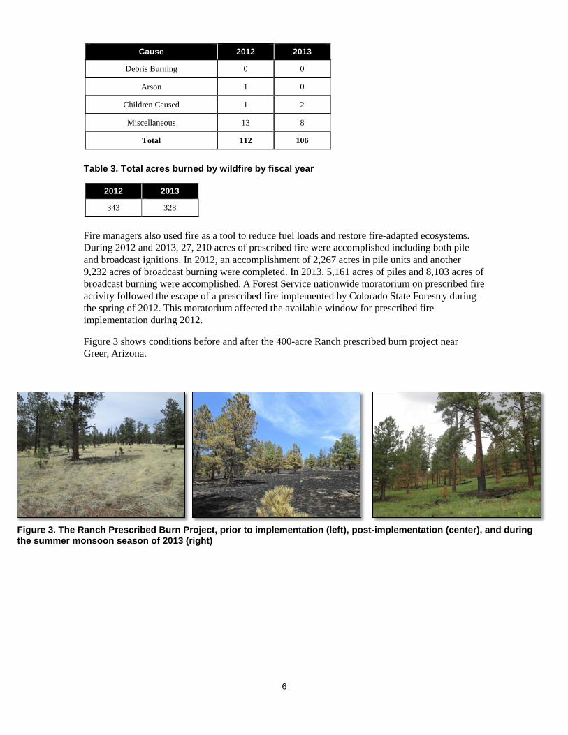
Table 3. Total acres burned by wildfire by fiscal year
2012 2013
343 328
Fire managers also used fire as a tool to reduce fuel loads and restore fire-adapted ecosystems. During 2012 and 2013, 27, 210 acres of prescribed fire were accomplished including both pile and broadcast ignitions. In 2012, an accomplishment of 2,267 acres in pile units and another 9,232 acres of broadcast burning were completed. In 2013, 5,161 acres of piles and 8,103 acres of broadcast burning were accomplished. A Forest Service nationwide moratorium on prescribed fire activity followed the escape of a prescribed fire implemented by Colorado State Forestry during the spring of 2012. This moratorium affected the available window for prescribed fire implementation during 2012.
Figure 3 shows conditions before and after the 400-acre Ranch prescribed burn project near Greer, Arizona.
Figure 3. The Ranch Prescribed Burn Project, prior to implementation (left), post-implementation (center), and during the summer monsoon season of 2013 (right)
7
Cultural Resources Fiscal years 2012 and 2013 marked busy times for the ASNFs’ archaeologists. Most of the compliance-related work under Section 1062 of the National Historic Preservation Act and the Region 3 Programmatic Agreement was related to activities addressing salvage timber sales and rangeland activities. Sixty-seven Section 106 clearances were completed in 2012. Sixty-four Section 106 clearances were completed in 2013. Most of the inventory work was completed by contract archaeologists for landscape-scale restoration projects.
Table 4. Acres surveyed and numbers of sites recorded or re-recorded in fiscal years 2012 and 2013
Fiscal Year
Project Acreage
Acres Surveyed
Acres Resurveyed
Acres Previously-Surveyed
Number Of Sites
Recorded, Updated, or Monitored1
2012 47,514 41,958 234 3,909 265 2013 51,583 45,945 9 2,117 237
1As of this June 2014, the ASNFs have 7,197 cultural resources listed in its INFRA database
As a probable consequence of the ASNFs’ heritage program department being understaffed in fiscal years 2012 and 2013, only three sites were reported as monitored for Section 106 projects in 2012. These sites were monitored during the Show Low Fuels Reduction Project.
The ASNFs also worked on Section 1103 targets, including mitigating damages from looters and one Forest Service undertaking. During 2012, the ASNFs did not meet the Section 110 target having only a score of 42 (out of a minimum of 45). This resulted from the Forests not having the capacity to conduct surveys or priority heritage asset (PHA) site monitoring.
In 2013, the ASNFs met the Section 110 target with a score of 47, with the addition of inventory and 16 PHAs monitored or enhanced.
Table 5. Listing of Section 110 projects in fiscal years 2012 and 2013
Project Type Fiscal Year(s)
Number of Sites
Involved Notes
Site Monitoring Direct Protection 2012, 2013 5 Two sites protected from OHV impacts in
2012, three sites protected in 2013. Site Steward Monitoring 2013 7 Seven sites on the Springerville and Lakeside
Ranger Districts were monitored by Arizona Site Stewards in 2013
Priority Heritage Asset (PHA) Monitoring
2013 16 Sixteen PHAs on the Alpine, Black Mesa, Springerville and Lakeside Ranger Districts were monitored in FY 2013.
2 Section 106 requires agencies to take into account the effects of their actions on historic properties 3 Section 110 requires agencies to identify, evaluate, and protect historic properties
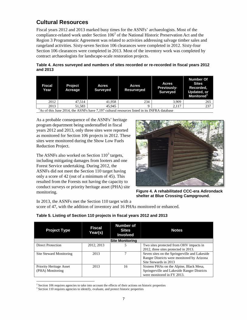
Figure 4. A rehabilitated CCC-era Adirondack shelter at Blue Crossing Campground.
8
Project Type Fiscal Year(s)
Number of Sites
Involved Notes
Presentations/Windows-In-The-Past Projects Professional Presentations 2012-13 10 presentations Papers/posters were presented at the Arizona
Centennial Conference, Little Colorado Chapter of the Arizona Archaeological Society (2, 2012); Greenlee County, the Pecos Conference, and Mogollon Conference (8, 2013)
Public Outreach/Guided Talks
2013 - Round Valley Middle School 7th grade field trip, Wapiti Weekend public outreach, and Rudd Creek Field Trip
Site Evaluations National Register Evaluations
2012-13 37 Twenty sites from the Alpine and Clifton Ranger Districts were evaluated for inclusion on the National Register of Historic Places in 2012 and 17 from Alpine, Clifton, and Black Mesa Ranger Districts in 2013.
Planning Forest Plan Revision 2012 - The Cultural Resource chapters were
completed for the new Forest Plan Revision scheduled to be completed in FY 2014. These chapters were completed in consultation with Tribes.
Other Heritage Resource Program Planning
2012 - A predictive model for locating cultural resource sites was developed as part 3 of the ASNF Cultural Resource Overview and Management Plan.
Training/Recertification Para-Archaeologist Training/Recertification
2012-13 - In order to meet the guidelines set forth in FSM 2360, R-3 Supplement 2300-99-3, para-archaeologist refresher training was conducted throughout the field seasons of 2012 and 13. Six para-archaeologists were recertified in 2012 and nine were recertified in 2013.
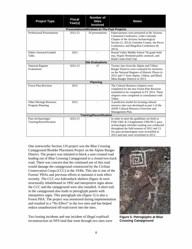
One noteworthy Section 110 project was the Blue Crossing Campground Boulder Placement Project on the Alpine Ranger District. The project was initiated to block a user-created road leading out of Blue Crossing Campground to a closed two-track road. There was concern that the continued use of this road would damage the campground constructed by the Civilian Conservation Corps (CCC) in the 1930s. This site is one of the Forests’ PHAs and previous efforts to maintain it took effect recently. The CCC-era Adirondack shelters (figure 4) were structurally rehabilitated in 1992 and interpretive signs about the CCC and the campground were also installed. A short trail in the campground also leads to petroglyph panels with interpretive signs. This petroglyph site (figure 5) is also a Forest PHA. The project was monitored during implementation and resulted in a “No Effect” to the two sites and has helped reduce unauthorized off-road travel into the sites.
Two looting incidents and one incident of illegal road/trail reconstruction on NFS land that went through two sites were
Figure 5. Petroglyphs at Blue Crossing Campground
9
reported in 2012 and 2013. As of 2014, both of the looting incidents are still under investigation. Table 6 provides information about these three incidents.
Table 6. Archaeological Resources Protection Act (ARPA) investigations in fiscal years 2012 and 2013
Incident Type
Fiscal Year
Number of Sites Involved
Description
Looting 2012 1 In August 2012, a private citizen reported that a Mogollon habitation site on the Lakeside Ranger District was recently looted. Five fresh holes had been dug. Thirty older holes and depressions were found at the site. Estimated damage from the recent looting (cost to government and cost of restoration and repair) is estimated to be $18,124.68. The incident is still under investigation.
Looting 2013 1 Forest Service Law Enforcement was notified by a private citizen that looting was occurring on a site on the Black Mesa Ranger District. The site was previously unrecorded and there was evidence that it was looted prior to the recent incident. One fresh looters’ hole and 4 other recently dug holes were observed in addition to six older ones. All of the holes except for the newest one had been filled-in. Estimated damage to the site from the recent incident is $17,863.68. The incident is still under investigation.
Illegal Road/Trail Reconstruction
2012 4 Four sites were investigated on the Lakeside Ranger District as a result of a private citizen notifying the Forest Service about illegal trail construction activities on NFS land. Two of the four sites were adversely impacted by illegal road reconstruction. Estimated damage to the sites was $16,482.00.
In 2012, one foreclosure resulting from a Forest Service undertaking that did not have a Section 106 clearance under the National Historic Preservation Act was reported. In July of that year, personnel at the Clifton Ranger District partially dismantled a CCC-era Adirondack at the National Register-eligible Strayhorse Campground. The roof, support beams, and several courses of log siding were removed. Clifton Ranger District personnel agreed to reconstruct the partially dismantled CCC shelter and rehabilitate another Adirondack shelter located within the campground. It was agreed that materials and workmanship would follow the Secretary of Interior’s standards for rehabilitating historic structures and that it would be monitored by a Forest Service cultural resource specialist. Partial dismantling of the historic structure was determined to be an adverse effect.
Rangeland Management The ASNFs administered nearly two million National Forest System acres in 92 active livestock grazing allotments between 2012 and 2013. The ASNFs’ rangeland management emphasis has been on maintaining satisfactory wildlife habitat, watershed, riparian, and forage vegetation. Between 2012 and 2013, the ASNFs authorized an average of approximately 103,000 head months of livestock annually (see table 7).
Figure 6. Looters' hole dug at the Mogollon habitation site in 2012
10
Table 7. Authorized head months of occupancy between 2012 and 2013
Fiscal Year Authorized
Head Months Cattle
Authorized Head Months
Sheep
Authorized Head Months
Horses
2012 88,454 13,719 1,726
2013 81,625 19,982 1,731
Many allotments were not grazed at all by livestock, and some allotments were authorized less livestock than full permitted numbers (43 allotments in 2012, and 50 in 2013). This total or partial non-use happened because of resource protection needs, wildfire, or personal convenience of the ranchers. Forty-five of the allotments were affected by the 2011 Wallow Fire.
Range specialists conducted condition and trend studies on portions of 24 allotments between 2012 and 2013.
The Forests continue to work on reducing excess canopy in piñon and juniper woodlands. Over 20,000 acres were treated between 2012 and 2013 using mechanical treatments, prescribed burning, and managed wildfires (table 8). In addition, the Forests treated approximately 1,000 acres of noxious and undesired exotic weeds (table 9).
Table 8. Canopy reduction treatments by fiscal year
Fiscal Year Acres Treated
2012 10,665
2013 10,037
Table 9. Noxious and exotic weed treatments by fiscal year
Fiscal Year Acres Treated
2012 363
2013 642
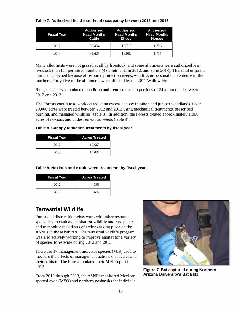
Terrestrial Wildlife Forest and district biologists work with other resource specialists to evaluate habitat for wildlife and rare plants and to monitor the effects of actions taking place on the ASNFs in those habitats. The terrestrial wildlife program was also actively working to improve habitat for a variety of species forestwide during 2012 and 2013.
There are 17 management indicator species (MIS) used to measure the effects of management actions on species and their habitats. The Forests updated their MIS Report in 2012.
From 2012 through 2013, the ASNFs monitored Mexican spotted owls (MSO) and northern goshawks for individual
Figure 7. Bat captured during Northern Arizona University’s Bat Blitz

11
projects and through the White Mountain Stewardship Landbird Monitoring Program. Mule deer, turkey, antelope, and elk are managed as game species and are monitored annually by Arizona Game and Fish Department (AGFD).
Population and habitat trends on the ASNFs were generally stable for all MIS during 2012 and 2013, with the exception of goshawk which is considered to have a stable to declining habitat trend and a declining population trend; Mexican spotted owl, which is considered to have declining habitat and population trends; Rocky Mountain elk, which is considered to have an increasing habitat trend with a stable to declining population trend; and red squirrel, which is considered to have a declining habitat trend and a stable to declining population trend across the Forests.
The wildlife program was very active during 2012 and 2013 with a variety of projects, surveys, monitoring, and agreements occurring. These included agreements with AGFD, Northern Arizona University (NAU), and Rocky Mountain Bird Observatory (RMBO) for ASNFs’ Bald Eagle NestWatch Program, AGFD Pronghorn Antelope Movement Study, NAU Small Mammal and Bat Survey, and RMBO Northern Goshawk Monitoring.
Surveys completed included forestwide bald eagle winter counts, forestwide MSO inventory and surveys, forestwide northern goshawk inventory and monitoring, southwestern willow flycatcher survey, and wildlife structure and development inventory post-Wallow Fire.
Projects included placement of bear-proof dumpsters and containers at recreation and administrative sites, Arizona and Bebbs willow protection and monitoring, other wildlife exclosure maintenance, Burro Creek grassland restoration, precommercial thinning, commercial thinning, prescribed burn projects, guzzler maintenance, and Wallow Fire bark beetle treatments in MSO PACs.
Table 10. Wildlife program project accomplishments for fiscal years 2012 and 2013
Project Type 2012 2013 Partnership 11,067 acres 10,015 acres
Non-Partnership 14,808 acres 56,031 acres The ASNFs continue to have a large partnership program, working with multiple partners between 2012 and 2013 to complete habitat improvement projects for a variety of species. Partners included AGFD, Rocky Mountain Elk Foundation, Arizona Elk Society, Carl-Eric Granfelt, NAU, RMBO, Experience International, General Wildlife Services, Habitat Partnership Program, and the National Wild Turkey Federation. Tables 10 through 12 summarize wildlife program accomplishments, species and ecosystems benefitting from these accomplishments, and costs for completing these projects between 2012 and 2013.
Partners contributed over $603,000 in funding to projects between 2012 and 2013. This resulted in over 42,000 acres of habitat restoration and improvement, as well as construction, reconstruction, or maintenance of 41 structural improvements.
Table 11. Summary of project funding for the wildlife Figure 8. Black Bear on the ASNFs

12
program for fiscal years 2012 and 2013
Type of Funding 2012 2013 Partnership $237,269 $365,842
Non-Partnership (all other funding sources)
$5,737,086 $5,184,935
Total $5,976,367 $5,552,790
Table 12. Summary of projects by species/ecosystem benefitting from the wildlife program during fiscal years 2012 and 2013
Benefitting Species / Ecosystem Acres Improved Number of Structures
Arizona and Bebbs Willow 11 17
Mexican Spotted Owl 1,814 0
Big Game 24,657 10
Grasslands 15,748 0
Black Bear 0 14
Total 42,230 41
Threatened, Endangered, Proposed, and Sensitive Species (TEPS) In 2012 and 2013, the ASNFs had one federally listed threatened, one federally listed endangered, and one experimental/non-essential (terrestrial) species: the Mexican spotted owl, the southwestern willow flycatcher, and the Mexican gray wolf, respectively.
In 2013, the New Mexico meadow jumping mouse (figure 9) and the western yellow-billed cuckoo were proposed for listing as endangered and threatened, respectively. Aquatic species are addressed in another section of this report. Mexican gray wolves are discussed under the Mexican Wolf Reintroduction Program section of this report.
Designated critical habitat for two species, the southwestern willow flycatcher and Mexican spotted owl, occurred on the Forests in 2012 and 2013. In 2013, designated critical habitat for southwestern willow flycatchers was revised and critical habitat for New Mexico meadow jumping mouse was proposed.
Figure 9. New Mexico meadow jumping mouse
Figure 10. Habitat for New Mexico meadow jumping mouse along the East Fork of the Little Colorado River

13
The Regional Forester’s Sensitive Species List was revised in 2013. There are currently 22 Forest Service sensitive terrestrial species, and 22 Forest Service sensitive rare plant species occurring on the ASNFs.
In 2013, two additional bald eagle nests were located on the ASNFs for a total of 5 nests. One occurs adjacent to River Reservoir on the Springerville RD, and the other occurs along the shore of Show Low Lake on the Lakeside RD.
Between 2012 and 2013, ASNFs biologists conducted analyses of projects that resulted in 35 Biological assessments and evaluations for terrestrial and aquatic species. The Forests participated in formal consultation with the U.S. Fish and Wildlife Service on five projects and informal consultation on seven projects, the Forests requested concurrence with determinations that projects were “not likely to adversely affect” federally listed species.
Monitoring
Monitoring terrestrial TEPS species during 2012 and 2013 (table 13) was accomplished with the assistance and cooperation of the Arizona Game and Fish Department’s Bald Eagle Nest Watch program, NAU, and RMBO. This resulted in monitoring for three terrestrial TEPS species from 2012 and 2013.
Table 13. Summary of TEPS monitoring completed between 2012 through 2013
Benefitting Species / Ecosystem Acres Monitored
Number of PACS/PFAs/Nest Sites
Monitored
Mexican Spotted Owl 243,400 158
Northern Goshawk 79,370 58
Bald Eagle 2,024 8
Mexican Gray Wolf Reintroduction Program The ASNFs actively worked with five other state and federal agencies to continue efforts in the reintroduction of the endangered Mexican gray wolf into the Blue Range Wolf Recovery Area (BRWRA) in New Mexico and Arizona.
From 2012 through 2013, Mexican gray wolf numbers continued to increase with a minimum of 75 wolves counted in Arizona and New Mexico in 2012 and 83 counted in 2013. The field team located 22 wolves on the Apache portion of the ASNFs in 2012, and 20 wolves in 2013. These wolves made up of six packs in 2012 and seven packs in 2013 (a pack is composed of at least one adult pair) that are maintaining territories on the ASNFs.
No releases of Mexican gray wolves were done during 2012 and one initial release occurred in 2013 on the ASNFs. No translocations occurred in 2012 and three wolves were translocated during 2013. A translocation is defined as when an
Figure 9. Captured wolf being brought in for processing during the annual wolf count
14
individual free-ranging wolf is captured and moved to a location within either the Primary or Secondary Recovery Zone but away from the site of capture. This includes captured wolves that have been temporarily housed in captivity.
Reports from ranchers and others resulted in confirmation of six depredations on livestock killed or injured by wolves on the ASNFs and private holdings from 2012. In 2013, sixteen depredations on livestock were confirmed as wolf-caused. Additional livestock may have been killed by wolves but were not found or were found too late to confirm the cause of death. In response to these problems, the Interagency Field Team conducts hazing on wolves known to kill livestock and uses other proactive measures to reduce depredations.
Four wolves are known to have died in the wild during 2012 and seven died in 2013. All of these mortalities except two were from illegal shooting. The other two mortalities were from other causes which may include, but are not limited to capture-related mortalities and legal public shooting.
Please report any encounters with wolves to the Interagency Field Team at 1-888-459-9656.
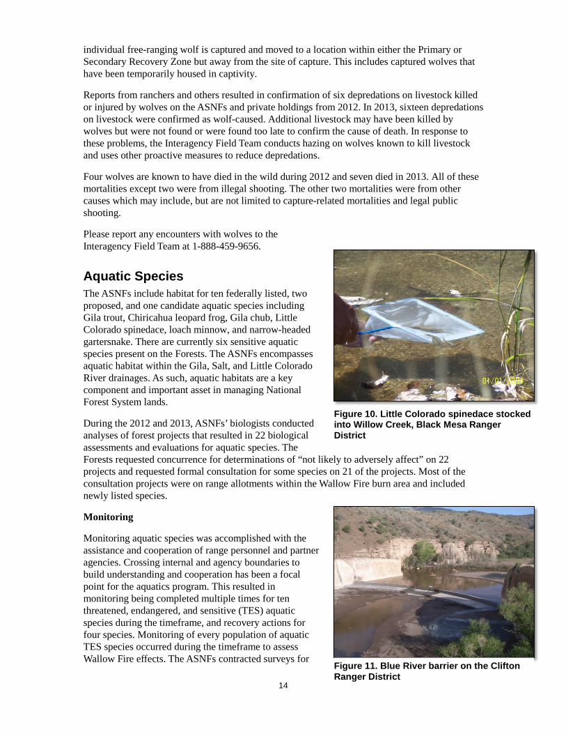
Aquatic Species The ASNFs include habitat for ten federally listed, two proposed, and one candidate aquatic species including Gila trout, Chiricahua leopard frog, Gila chub, Little Colorado spinedace, loach minnow, and narrow-headed gartersnake. There are currently six sensitive aquatic species present on the Forests. The ASNFs encompasses aquatic habitat within the Gila, Salt, and Little Colorado River drainages. As such, aquatic habitats are a key component and important asset in managing National Forest System lands.
During the 2012 and 2013, ASNFs’ biologists conducted analyses of forest projects that resulted in 22 biological assessments and evaluations for aquatic species. The Forests requested concurrence for determinations of “not likely to adversely affect” on 22 projects and requested formal consultation for some species on 21 of the projects. Most of the consultation projects were on range allotments within the Wallow Fire burn area and included newly listed species.
Monitoring
Monitoring aquatic species was accomplished with the assistance and cooperation of range personnel and partner agencies. Crossing internal and agency boundaries to build understanding and cooperation has been a focal point for the aquatics program. This resulted in monitoring being completed multiple times for ten threatened, endangered, and sensitive (TES) aquatic species during the timeframe, and recovery actions for four species. Monitoring of every population of aquatic TES species occurred during the timeframe to assess Wallow Fire effects. The ASNFs contracted surveys for
Figure 10. Little Colorado spinedace stocked into Willow Creek, Black Mesa Ranger District
Figure 11. Blue River barrier on the Clifton Ranger District

15
loach minnow in the Blue River, Chiricahua leopard frog in the upper and lower West Fork Black River watersheds, and macroinvertebrates within the Wallow Fire area. Recovery actions included the following: stocking of Chiricahua leopard frog; stocking of spikedace, roundtail chub and loach minnow in Blue River; stocking of Little Colorado spinedace in Willow Creek (figure 12); and replication of Harden Cienega Gila chub in Mule Creek, NM. Removal of nonnative brook trout was completed in West Fork Black River.
Overall monitoring showed that while aquatic species were affected by ash flows and siltation post-Wallow Fire, only two populations of Apache trout were lost. Populations of other species persist and are rebounding.
The ASNFs began a long-term stream temperature monitoring program in 2012. As of December 2013, over 30 data loggers have been placed within the Wallow Fire area to monitor stream temperatures year round. This program will aid in identifying where climate change and increased stream temperatures may be an issue for native fish, as well as where management actions may be needed. The data can be used for climate change modelling and predict increases in stream temperature. The work is part of the Rocky Mountain Research Station stream temperature monitoring program.
Projects
There were a total of 11 projects completed during the timeframe for TES and other aquatic species. Projects resulted in 75 stream miles of habitat restoration, 100 acres of lakes restoration, and 32.5 stream miles and 600 acres of habitat inventoried. Projects included species restoration, habitat restoration and protection, salt cedar removal, barrier construction, barrier maintenance, and inventories. Species benefiting from these projects include Chiricahua and lowland leopard frogs, Little Colorado spinedace, loach minnow, spikedace, roundtail chub, Apache trout, and Arizona and Bebbs willows.
The largest project completed was the Blue River barrier which will protect over 50 miles of native fish streams from non-native fishes (see figure 13). After completion of the barrier, loach minnow were augmented and two new native fishes were stocked: spikedace and roundtail chub. The Bureau of Reclamation spent over $10 million dollars on the barrier in 2012.
Partner contributions besides the barrier were over $50,000 in funding and labor for these projects including U.S. Fish and Wildlife Service, Arizona Game and Fish Department, and Bureau of Reclamation. Many of these projects documented Wallow Fire effects to aquatic species. Partners and volunteers are vital to accomplishments on the ASNFs.
Transportation One of the goals of the current Apache-Sitgreaves National Forests Plan is to “provide and manage a serviceable road transportation system that meets the need for public access, land management resource protection, and user safety.” Road maintenance and reconstruction is a major activity to support forest restoration activities through White Mountain
Figure 13. Reconstruction of NFSR 61 using the ASNFs mobile rock crusher
Figure 12. West Fork Black River near the confluence with the East Fork Black River

16
Stewardship and Four Forest Restoration Initiative (4-FRI).
The ASNF’s transportation system is comprised of more than 700 miles of roads designed and maintained for passenger vehicles and over 2,000 miles of roads designed and maintained for high clearance vehicles. Approximately 3,000 miles of roads are in storage to be opened for specific projects (e.g., for commercial product removal) and then placed back in storage at the completion of the project; these roads are closed to all motorized travel while in storage.
During 2012 and 2013 the ASNFs accomplished routine road maintenance on an average of 660 miles annually and improved/reconstructed on an average of 21 miles annually.
Table 14. Road maintenance and improvement in fiscal years 2012 and 2013
Miles of Routine Road Maintenance Miles of Road Improvement
Fiscal Year Level 2 Roads
(High Clearance)
Level 3-5 Roads (Passenger
Cars)
Level 2 Roads (High
Clearance)
Level 3-5 Roads
(Passenger Cars)
2012 212 508 8 13
2013 103 498 4.5 16
Over the two years, the Forests decommissioned 10 miles of unauthorized user-created routes and 11 miles of system roads identified as not being needed currently or in the future.
In 2012, $80,000 of restoration funds (NFRR) was used to reconstruct 2 miles of NFSR 116 along Thompson Creek, to minimize sediment from the road going into the creek.
In 2013, $50,000 of restoration funds was used to stabilize one-half mile of NFSR 25 along Black River. Road fill was sliding off into Black River from poor drainage design.
The ASNFs continued to replace warning and regulatory signing destroyed in the 2011 Wallow Fire. The Forests also continued to stabilize road drainage structures and install additional road drainage structures to minimize road damage due to increased precipitation run off.
In the fall of 2013, the Alpine Ranger District experienced a 100+ year flood event resulting in the loss of a bridge and many road wash outs. The ASNFs’ construction and maintenance crew, district dozer operators, and district personnel worked closely with Apache and Greenlee Counties to construct a hardened crossing below the bridge location and to repair the road wash outs. This provided people access to and from their residences and an escape route for stranded forest
Figure 14. Luce Ranch road flooding 2013
Figure 15. Forest Road 25 Erosion Reconstruction Project
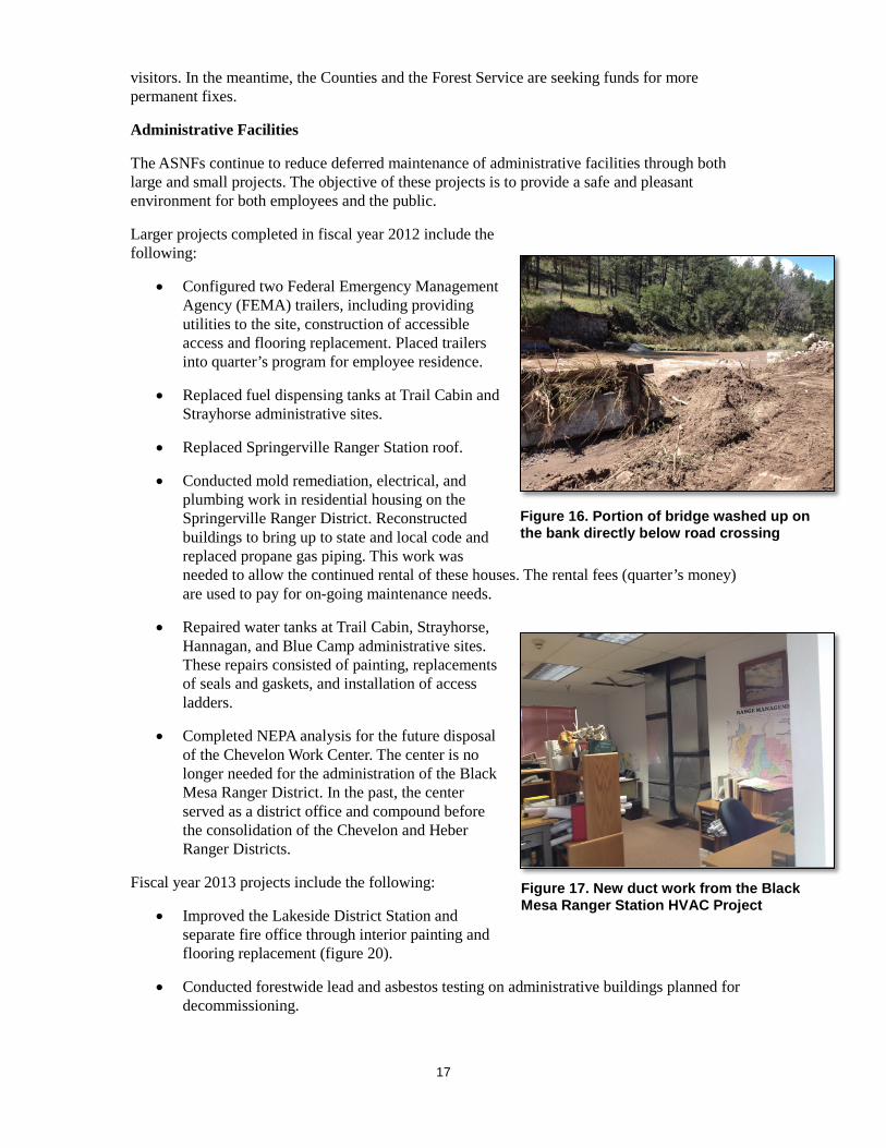
17
visitors. In the meantime, the Counties and the Forest Service are seeking funds for more permanent fixes.
Administrative Facilities
The ASNFs continue to reduce deferred maintenance of administrative facilities through both large and small projects. The objective of these projects is to provide a safe and pleasant environment for both employees and the public.
Larger projects completed in fiscal year 2012 include the following:
• Configured two Federal Emergency Management Agency (FEMA) trailers, including providing utilities to the site, construction of accessible access and flooring replacement. Placed trailers into quarter’s program for employee residence.
• Replaced fuel dispensing tanks at Trail Cabin and Strayhorse administrative sites.
• Replaced Springerville Ranger Station roof.
• Conducted mold remediation, electrical, and plumbing work in residential housing on the Springerville Ranger District. Reconstructed buildings to bring up to state and local code and replaced propane gas piping. This work was needed to allow the continued rental of these houses. The rental fees (quarter’s money) are used to pay for on-going maintenance needs.
• Repaired water tanks at Trail Cabin, Strayhorse, Hannagan, and Blue Camp administrative sites. These repairs consisted of painting, replacements of seals and gaskets, and installation of access ladders.
• Completed NEPA analysis for the future disposal of the Chevelon Work Center. The center is no longer needed for the administration of the Black Mesa Ranger District. In the past, the center served as a district office and compound before the consolidation of the Chevelon and Heber Ranger Districts.
Fiscal year 2013 projects include the following:
• Improved the Lakeside District Station and separate fire office through interior painting and flooring replacement (figure 20).
• Conducted forestwide lead and asbestos testing on administrative buildings planned for decommissioning.
Figure 16. Portion of bridge washed up on the bank directly below road crossing
Figure 17. New duct work from the Black Mesa Ranger Station HVAC Project

18
• Replaced power pole and installed new 400 amp service and miscellaneous exterior light fixture wiring to meet code requirements at the Alpine Ranger District administrative site 3 and Springerville Ranger District yard.
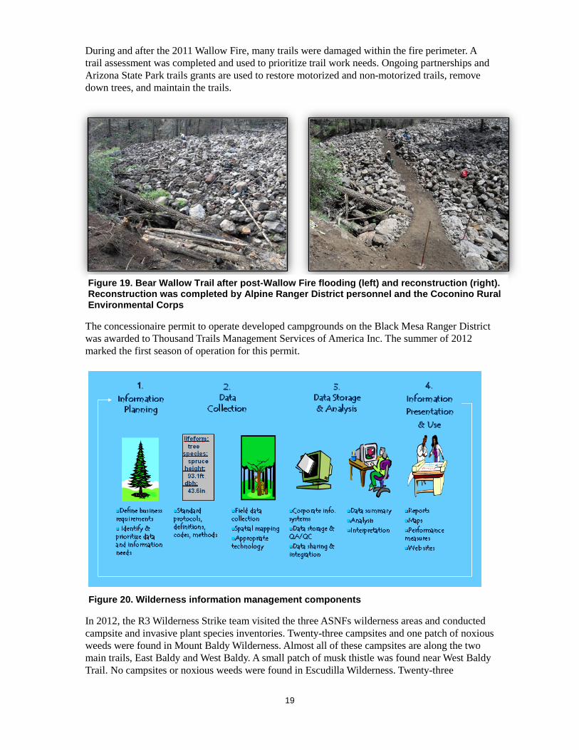
Also in 2013, the Black Mesa Ranger Station HVAC (heating, ventilation, and air conditioning) Project was initiated (figure 19). The project’s purpose was to replace all existing HVAC systems in the 10,000 square-foot Black Mesa Ranger Station. The existing systems were failing and could no longer be serviced due to age. Due to issues found during construction, only the four largest units could be replaced. The project included removal of existing above ceiling furnaces and commercial evaporative coolers, installation of four combined heat and refrigeration units, and modifications to the existing heat and air conditioning distribution duct system. Each of the four new units incorporated economizer units. Economizers bring in outside air to raise or lower the interior temperature without having to heat or cool the air. The project began in October 2013 and was completed in February 2014 with no interruptions of heating over the winter. The contractor provided temporary heat during the time the new units were installed. Engineering and design of the new system was performed by the Forest Service’s Region 2 Center for Design and Interpretation, Rocky Mountain Region. Engineering and design cost was approximately $12,000; construction cost approximately $19,000.
Recreation The ASNFs offer a variety of recreation opportunities with over 120 developed recreation sites, including campgrounds, picnic areas, trailheads, and two visitor centers; over 1,300 miles of hiking, equestrian, and off-highway vehicle trails; 3 wilderness areas; 1 primitive area; and numerous areas for dispersed recreation activities, such as hunting, fishing, hiking, and camping. More than 30 lakes and reservoirs and over 1,000 miles of rivers and perennial streams provide opportunities for fishing and boating.
Fiscal Year 2012
Figure 18. Before and after pictures of 2013 Lakeside Ranger Station Painting and Reflooring Project
19
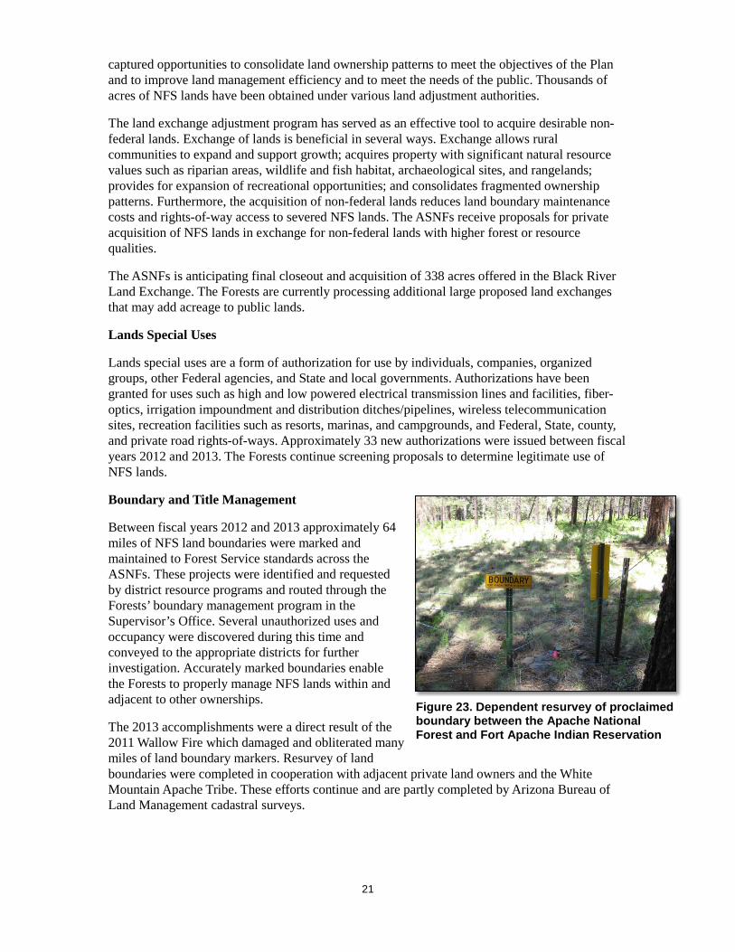
During and after the 2011 Wallow Fire, many trails were damaged within the fire perimeter. A trail assessment was completed and used to prioritize trail work needs. Ongoing partnerships and Arizona State Park trails grants are used to restore motorized and non-motorized trails, remove down trees, and maintain the trails.
The concessionaire permit to operate developed campgrounds on the Black Mesa Ranger District was awarded to Thousand Trails Management Services of America Inc. The summer of 2012 marked the first season of operation for this permit.
In 2012, the R3 Wilderness Strike team visited the three ASNFs wilderness areas and conducted campsite and invasive plant species inventories. Twenty-three campsites and one patch of noxious weeds were found in Mount Baldy Wilderness. Almost all of these campsites are along the two main trails, East Baldy and West Baldy. A small patch of musk thistle was found near West Baldy Trail. No campsites or noxious weeds were found in Escudilla Wilderness. Twenty-three
Figure 19. Bear Wallow Trail after post-Wallow Fire flooding (left) and reconstruction (right). Reconstruction was completed by Alpine Ranger District personnel and the Coconino Rural Environmental Corps
Figure 20. Wilderness information management components

20
campsites and no noxious weeds were found in Bear Wallow Wilderness. Almost all of these campsites are along Bear Wallow Creek.
Fiscal Year 2013
The ASNFs continue to apply for and receive grants and work with partners to maintain trails across the Forests. New partnerships were developed and existing ones nurtured for recreation site maintenance, visitor information, interpretive activities, and motorized and nonmotorized trail maintenance.
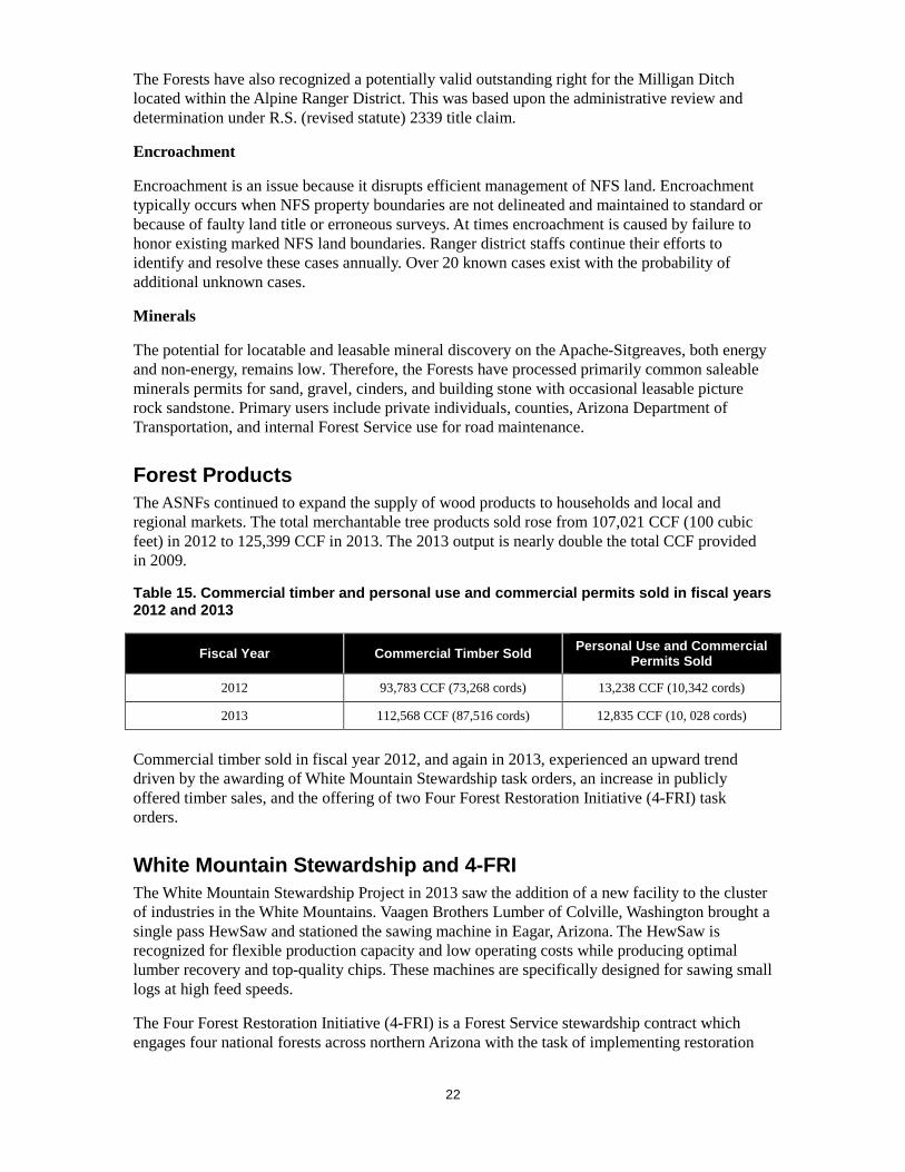
The Forests participated in wilderness information needs assessments (INA) for the three wilderness areas to determine data collection, storage, and analysis needs. INAs are conducted to ensure information is available, of sufficient quality and in the right format, and to support key decisions related to wilderness stewardship while making the most efficient use of limited resources.
Lands and Minerals The mission of the ASNFs’ lands and realty management program is to secure and protect America’s public rights, title, value, and interest in its national forests and grasslands and authorize a variety of uses on those lands to meet the needs of present and future generations. Security and protection of the public’s interests in National Forest System (NFS) lands is essential to the land stewardship and public trust responsibilities of the Forest Service.
Land Exchanges
A land exchange is a discretionary and voluntary real estate transaction that is considered only if it is in the public interest and is consistent with the Apache-Sitgreaves National Forests Plan. The ASNFs have
Figure 21. Portal sign replacement near Big Lake Recreation Area
Figure 22. Acquisition of the Thompson Ranch parcel resulting from the Black River Land Exchange
21
captured opportunities to consolidate land ownership patterns to meet the objectives of the Plan and to improve land management efficiency and to meet the needs of the public. Thousands of acres of NFS lands have been obtained under various land adjustment authorities.
The land exchange adjustment program has served as an effective tool to acquire desirable non-federal lands. Exchange of lands is beneficial in several ways. Exchange allows rural communities to expand and support growth; acquires property with significant natural resource values such as riparian areas, wildlife and fish habitat, archaeological sites, and rangelands; provides for expansion of recreational opportunities; and consolidates fragmented ownership patterns. Furthermore, the acquisition of non-federal lands reduces land boundary maintenance costs and rights-of-way access to severed NFS lands. The ASNFs receive proposals for private acquisition of NFS lands in exchange for non-federal lands with higher forest or resource qualities.
The ASNFs is anticipating final closeout and acquisition of 338 acres offered in the Black River Land Exchange. The Forests are currently processing additional large proposed land exchanges that may add acreage to public lands.
Lands Special Uses
Lands special uses are a form of authorization for use by individuals, companies, organized groups, other Federal agencies, and State and local governments. Authorizations have been granted for uses such as high and low powered electrical transmission lines and facilities, fiber-optics, irrigation impoundment and distribution ditches/pipelines, wireless telecommunication sites, recreation facilities such as resorts, marinas, and campgrounds, and Federal, State, county, and private road rights-of-ways. Approximately 33 new authorizations were issued between fiscal years 2012 and 2013. The Forests continue screening proposals to determine legitimate use of NFS lands.
Boundary and Title Management
Between fiscal years 2012 and 2013 approximately 64 miles of NFS land boundaries were marked and maintained to Forest Service standards across the ASNFs. These projects were identified and requested by district resource programs and routed through the Forests’ boundary management program in the Supervisor’s Office. Several unauthorized uses and occupancy were discovered during this time and conveyed to the appropriate districts for further investigation. Accurately marked boundaries enable the Forests to properly manage NFS lands within and adjacent to other ownerships.
The 2013 accomplishments were a direct result of the 2011 Wallow Fire which damaged and obliterated many miles of land boundary markers. Resurvey of land boundaries were completed in cooperation with adjacent private land owners and the White Mountain Apache Tribe. These efforts continue and are partly completed by Arizona Bureau of Land Management cadastral surveys.
Figure 23. Dependent resurvey of proclaimed boundary between the Apache National Forest and Fort Apache Indian Reservation
22
The Forests have also recognized a potentially valid outstanding right for the Milligan Ditch located within the Alpine Ranger District. This was based upon the administrative review and determination under R.S. (revised statute) 2339 title claim.
Encroachment
Encroachment is an issue because it disrupts efficient management of NFS land. Encroachment typically occurs when NFS property boundaries are not delineated and maintained to standard or because of faulty land title or erroneous surveys. At times encroachment is caused by failure to honor existing marked NFS land boundaries. Ranger district staffs continue their efforts to identify and resolve these cases annually. Over 20 known cases exist with the probability of additional unknown cases.
Minerals
The potential for locatable and leasable mineral discovery on the Apache-Sitgreaves, both energy and non-energy, remains low. Therefore, the Forests have processed primarily common saleable minerals permits for sand, gravel, cinders, and building stone with occasional leasable picture rock sandstone. Primary users include private individuals, counties, Arizona Department of Transportation, and internal Forest Service use for road maintenance.
Forest Products The ASNFs continued to expand the supply of wood products to households and local and regional markets. The total merchantable tree products sold rose from 107,021 CCF (100 cubic feet) in 2012 to 125,399 CCF in 2013. The 2013 output is nearly double the total CCF provided in 2009.
Table 15. Commercial timber and personal use and commercial permits sold in fiscal years 2012 and 2013
Fiscal Year Commercial Timber Sold Personal Use and Commercial Permits Sold
2012 93,783 CCF (73,268 cords) 13,238 CCF (10,342 cords)
2013 112,568 CCF (87,516 cords) 12,835 CCF (10, 028 cords)
Commercial timber sold in fiscal year 2012, and again in 2013, experienced an upward trend driven by the awarding of White Mountain Stewardship task orders, an increase in publicly offered timber sales, and the offering of two Four Forest Restoration Initiative (4-FRI) task orders.
White Mountain Stewardship and 4-FRI The White Mountain Stewardship Project in 2013 saw the addition of a new facility to the cluster of industries in the White Mountains. Vaagen Brothers Lumber of Colville, Washington brought a single pass HewSaw and stationed the sawing machine in Eagar, Arizona. The HewSaw is recognized for flexible production capacity and low operating costs while producing optimal lumber recovery and top-quality chips. These machines are specifically designed for sawing small logs at high feed speeds.
The Four Forest Restoration Initiative (4-FRI) is a Forest Service stewardship contract which engages four national forests across northern Arizona with the task of implementing restoration
23
treatments at the landscape level. In 2013, the ASNFs awarded and treated the first 4-FRI task order: Ranch at 932 acres.
Biomass Markets Biomass is generated following mechanical treats; the Forests saw an increase in percent of fiber removed per acre during fiscal years 2012 and 2013. Approximately 78 percent of biomass was removed and utilized in local facilities to make wood stove pellets and electricity. The remaining biomass was left on site to provide woody material for soil enhancement and improve watershed condition.
Insects and Disease The effects of the 2011 Wallow Fire across the Apache National Forest continued to become apparent in subsequent years. Bark beetle outbreaks occurred in live trees of all conifer species because trees were weakened by the fire and prolonged drought conditions.
The ASNFs employed the use of beetle pheromones to steer adult beetles away from laying eggs in key forested areas critical to the local recreation economy and threatened and endangered species critical habitat. These natural compounds are hormones the beetles emit to communicate with each other by smell. After they have fully occupied a tree, one type of pheromone (repellent) tells other beetles flying through the area to avoid the tree or area because it is already full, essentially a “no vacancy” sign. The beetle pheromones are stapled to trees in an area before the beetles start to fly in search of new trees to attack. This strategy can effectively protect all susceptible host trees within a given distance.
Pheromones pose no harm to humans or the environment when installed correctly but must be reapplied every year. Local entomologists, foresters, biologists, and recreation staff have collaborated with an Arizona-based young adult conservation corps to provide the field labor. Due to the high cost and tight timeframe to beat the beetle flight, only a limited number of key acres can be treated. In the 2012 and 2013 seasons, 432 acres were successfully treated within developed campgrounds on the Springerville and Alpine Ranger Districts, including the popular Big Lake Recreation Complex. Another 1,814 acres of Mexican spotted owl (MSO) habitat that survived the Wallow Fire were also treated.
Another type of beetle-produced pheromone which acts as an attractant to lure beetles into traps is being used to monitor beetle population trends during the outbreak. In 2013, 3,075 Douglas-fir beetles were collected at just one trap in a two week period. This work is expected to be needed for at least another one to three years until the outbreak subsides. These projects contribute toward the national Western Bark Beetle Initiative.
Plan Revision The ASNFs continue to move forward revising the 1987 Apache-Sitgreaves National Forests Plan; initial public discussions about plan revision began in 2006. The plan provides direction to forest specialists on managing the natural resources across the Forests. When the Wallow Fire hit in late May 2011, the Forest Supervisor decided to pause work on plan revision. Following the fire, stakeholders were updated on the status of revision as the revision team conducted a changed condition assessment and updated both documents. The changed condition assessment identified the need to add a new section to the plan entitled “Landscape Scale Disturbances.” This section is meant to guide forest managers when landscape scale disturbance events like the Wallow Fire occur.

24
The proposed plan and draft environmental impact statement were published in February 2013 for a 90-day public comment period. The final plan and final environmental impact statement are expected to be published in December 2014. For additional information on the revision process, please visit the Forests’ website at http://www.fs.usda.gov/asnf or call the Apache-Sitgreaves National Forests Supervisor’s Office at 928-333-4301.