UNITED NATIONS SECRETARIAT ESA/STAT/AC.115/27...
21
UNITED NATIONS SECRETARIAT ESA/STAT/AC.115/27 Department of Economic and Social Affairs May 2007 Statistics Division English only United Nations Expert Group Meeting on Contemporary Practices in Census Mapping and Use of Geographical Information Systems 29 May-1 June 2007 United Nations, New York ESRI Experience in the Use of GIS for Census Mapping Applications * Prepared by Carmelle J. Terborgh ESRI - Global Affairs * This document is being reproduced without formal editing.
Transcript of UNITED NATIONS SECRETARIAT ESA/STAT/AC.115/27...
UNITED NATIONS SECRETARIAT ESA/STAT/AC.115/27 Department of Economic and Social Affairs May 2007 Statistics Division English only
United Nations Expert Group Meeting on Contemporary Practices in Census Mapping and Use of Geographical Information Systems 29 May-1 June 2007 United Nations, New York
ESRI Experience in the Use of GIS for Census Mapping Applications *
Prepared by
Carmelle J. Terborgh ESRI - Global Affairs
* This document is being reproduced without formal editing.
United Nations Expert Group Meeting on Contemporary Practices
in Census Mapping and Use of Geographical Information Systems 29 May - June 1, 2007
New York, New York, USA
1
ESRI Experience in the Use of GIS for Census Mapping Applications
Author: Carmelle J. Terborgh, Ph.D. ESRI - Global Affairs [email protected] ABSTRACT: Geographic Information Systems (GIS) can provide significant benefits in all phases of the enumeration process. The upcoming 2010 Round of the Decennial Census is an opportunity for National Statistical Organizations (NSOs) to utilize the latest in GIS technology for digital census mapping. This paper presents an overview of how GIS can effectively be utilized in pre-enumeration, enumeration, and post-enumeration efforts. Additionally, it provides brief examples of how ESRI’s GIS technology is being utilized by several NSOs from all regions of the world and their plans for its future use. KEYWORDS: GIS, Census Mapping, Digital Mapping, Mobile Mapping, Situs Geocoding
INTRODUCTION For some nations, a decennial census has been conducted on a regular basis for centuries. Meanwhile, for others the National Statistical Organization/Agency (NSO/NSA) may be undertaking the first census in many decades during the 2010 Round of the Census. The efforts of the United Nations Department of Economic and Social Affairs (DESA) – Statistical Division and the United Nations Population Fund (UNFPA) should be commended – as they are working tirelessly to provide NSOs with the best technologies, best practices, and sufficient resources in time for the next census. It is important to all citizens that they are counted during this census– so that their existence and the condition of their homes, family, livelihood, etc. is officially noted and given consideration by the government, business, and others institutions that affect their everyday lives. NSOs can realize many benefits in both effectiveness and efficiency though the use of Geographic Information Systems (GISs) for digital mapping, data analysis, and geodatabase development. These include:
• productivity gain and time savings, • cost savings/cost avoidance, • greater credibility and authority of map products, • better service,
United Nations Expert Group Meeting on Contemporary Practices
in Census Mapping and Use of Geographical Information Systems 29 May - June 1, 2007
New York, New York, USA
2
• increased accuracy, • improved consistency, • income generation • improved analysis, • improved policy-making, • improved data sharing, and • improved outreach. (United Nations, DESA - Statistical Division, 2000)
This paper shares the experiences of ESRI and several agencies that use ESRI’s GIS technology in all phases of the census. It also includes some highlights about the plans of several NSOs as they adopt or adapt their digital mapping efforts to provide enhanced data collection, analysis, and dissemination for the 2010 Round.
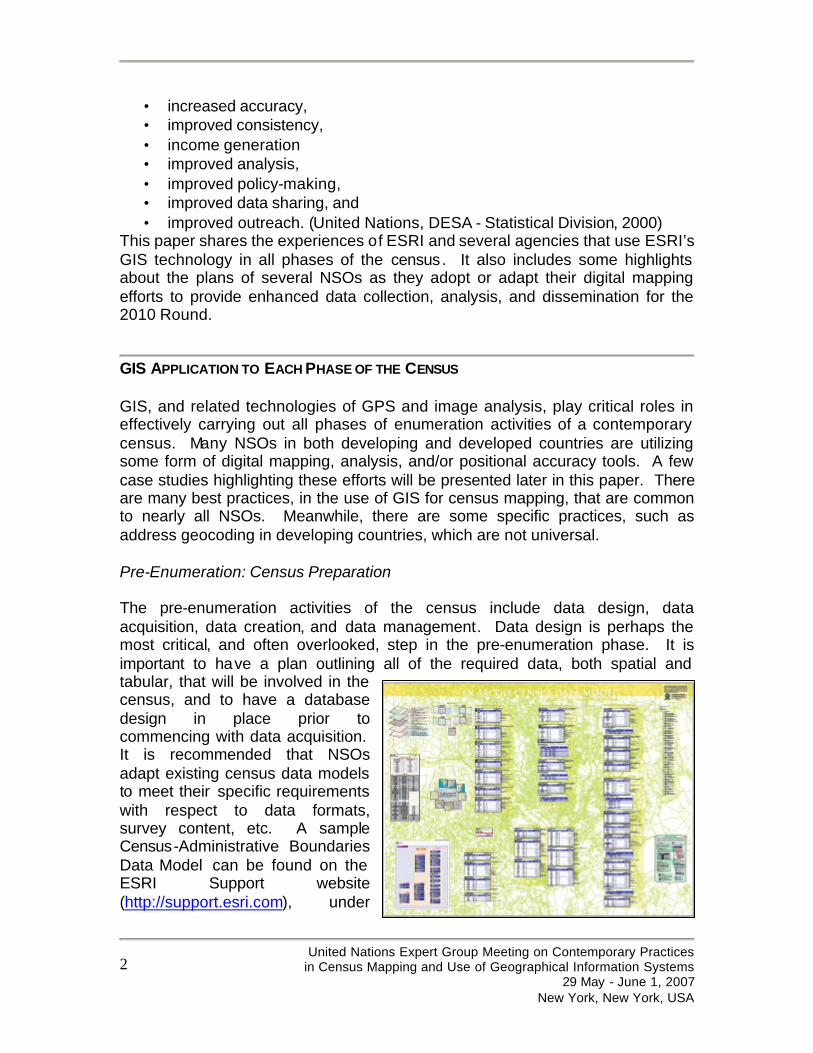
GIS APPLICATION TO EACH PHASE OF THE CENSUS GIS, and related technologies of GPS and image analysis, play critical roles in effectively carrying out all phases of enumeration activities of a contemporary census. Many NSOs in both developing and developed countries are utilizing some form of digital mapping, analysis, and/or positional accuracy tools. A few case studies highlighting these efforts will be presented later in this paper. There are many best practices, in the use of GIS for census mapping, that are common to nearly all NSOs. Meanwhile, there are some specific practices, such as address geocoding in developing countries, which are not universal. Pre-Enumeration: Census Preparation The pre-enumeration activities of the census include data design, data acquisition, data creation, and data management. Data design is perhaps the most critical, and often overlooked, step in the pre-enumeration phase. It is important to have a plan outlining all of the required data, both spatial and tabular, that will be involved in the census, and to have a database design in place prior to commencing with data acquisition. It is recommended that NSOs adapt existing census data models to meet their specific requirements with respect to data formats, survey content, etc. A sample Census-Administrative Boundaries Data Model can be found on the ESRI Support website (http://support.esri.com), under
United Nations Expert Group Meeting on Contemporary Practices
in Census Mapping and Use of Geographical Information Systems 29 May - June 1, 2007
New York, New York, USA
3
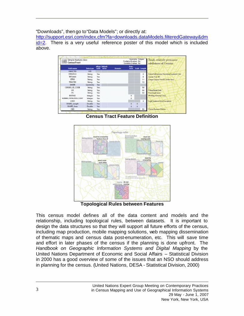
“Downloads”, then go to“Data Models”; or directly at: http://support.esri.com/index.cfm?fa=downloads.dataModels.filteredGateway&dmid=2. There is a very useful reference poster of this model which is included above.
Census Tract Feature Definition
Topological Rules between Features
This census model defines all of the data content and models and the relationship, including topological rules, between datasets. It is important to design the data structures so that they will support all future efforts of the census, including map production, mobile mapping solutions, web mapping dissemination of thematic maps and census data post-enumeration, etc. This will save time and effort in later phases of the census if the planning is done upfront. The Handbook on Geographic Information Systems and Digital Mapping by the United Nations Department of Economic and Social Affairs – Statistical Division in 2000 has a good overview of some of the issues that an NSO should address in planning for the census. (United Nations, DESA - Statistical Division, 2000)
United Nations Expert Group Meeting on Contemporary Practices
in Census Mapping and Use of Geographical Information Systems 29 May - June 1, 2007
New York, New York, USA
4
Data acquisition and/or data creation may be accomplished via several methods – depending on the needs and resources of the NSO. For example, an NSO might need to do one or more of the following processes in order to develop a comprehensive geodatabase for the census with the relevant geographic data layers:
• scanning, georeferencing, and vectorization of existing paper maps to develop the digital datasets required by the census;
• conversion of existing digital maps and datasets into the desired data structure for a given census;
• updating of digital datasets since the last census activity to ensure that new settlements and roads are included and obsolete settlements are omitted from the enumeration activities; and/or
• collection of aerial or satellite imagery followed by digital feature extraction and ground-truthing with GPS to ensure proper georeferencing of the images.
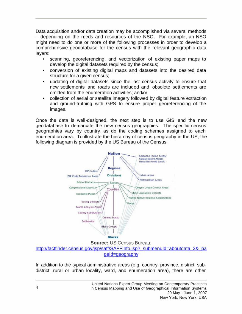
Once the data is well-designed, the next step is to use GIS and the new geodatabase to demarcate the new census geographies. The specific census geographies vary by country, as do the coding schemes assigned to each enumeration area. To illustrate the hierarchy of census geography in the US, the following diagram is provided by the US Bureau of the Census:
Source: US Census Bureau:
http://factfinder.census.gov/jsp/saff/SAFFInfo.jsp?_submenuId=aboutdata_3&_pageId=geography
In addition to the typical administrative areas (e.g. country, province, district, sub-district, rural or urban locality, ward, and enumeration area), there are other
United Nations Expert Group Meeting on Contemporary Practices
in Census Mapping and Use of Geographical Information Systems 29 May - June 1, 2007
New York, New York, USA
5
areas that may need to be generated by the NSO such as economic census units or electoral districts. One benefit of using a GIS is that each feature (e.g. enumeration area) can have both its geometry and attribute information stored in one geodatabase via a database management system. This geodatabase can be continually updated between censuses and can be managed with the added benefits of database functionality, such as security, roll-back/historical views, and easier search and retrieval of census information. Lastly, a GIS allows the NSO to manage all of these complex geographies and their topological relationships in one system with both a graphical and tabular view of the information. As undertaking a national census is a large task in even the smallest countries, specialized GIS tools provide easier data and workflow management. Quality control and accuracy assessments can also be carried out with a GIS, per the procedures adopted by the NSO, with specialized tools such as the PLTS GIS Data ReViewer (an extension to ArcGIS Desktop), which is a quality control management application. Project and workflow management can benefit from the use of the Job Tracking for ArcGIS (JTX) application. These tools and other add-ons/extensions mentioned later in this paper, such as Districting for ArcGIS and Local Update of Census Addresses (LUCA) for ArcGIS, provide the NSO with solutions tailored to their specific needs. The process of automated or semi-automated geocoding is another way to take advantage GIS functionality. While there are many geocode locators developed and in use in developed countries which focus on address geocoding, it is important to note that these methods will not work effectively in many developing countries and some non-urban contexts. Adaptations of these geocoding principles must be made for many developing countries. During the United Nations Economic Commission for Africa (UNECA) – Committee on Development Information (CODI IV) meeting in 2005, a workshop on “Situs Addressing in Africa” was held. During this workshop, we were able to identify five (5) types of geocoding systems that would be needed to effectively locate settlements in an African context :
• Urban Street Addressing - planned communities • Urban Situs Addressing - less planned communities (no street
names/numbers) • Urban Informal Settlements Addressing - in slum areas • Rural Area Addressing - few settlements • Traditional Area Addressing - tribal areas
For more information, please refer to the final report: http://geoinfo.uneca.org/Docs/Situs%20addressing%20report%20expert%20group-Full.pdf An interesting book on this topic by The World Bank in 2005 is Street Addressing and Management of Cities by Catherine Farvacque-Vitkovic, et. al. and can be downloaded from the link noted in the Sources section of this paper.
United Nations Expert Group Meeting on Contemporary Practices
in Census Mapping and Use of Geographical Information Systems 29 May - June 1, 2007
New York, New York, USA
6
GIS is also very useful in the production of enumerator maps – in either digital or hardcopy format, in preparation of the census. Digital versions can be deployed with data on a CD with a free map viewer, such as ArcReader, or directly to mobile computer devices (MCDs) with ArcMobile or ArcPad solutions. The advanced cartographic functionality provided by desktop GIS software, such as ArcInfo, ArcEditor, or ArcView, allow NSOs to produce high quality maps, map templates and map indices.
Enumeration: Conducting the Census Useful tools developed since the last decennial census in 2000 are mobile computing solutions and devices. These can be utilized during the enumeration process. The United States case study later in this paper outlines more information regarding the plans of the US Census Bureau to enable their 500,000 enumerators to have hand-held MCDs, which are both GIS and GPS-enabled. The ability to have area specific maps, images, data, and customized data collection forms in the hands of each enumerator will save endless hours of data transfer from paper forms to digital format. Additionally, the GPS location on the GIS interface will allow enumerators to have assistance with positional accuracy, directions, and navigation between addresses. The automation of map production in hardcopy format and/or for access by enumerators via web mapping applications will provide efficiencies while the census is being conducted. In addition, the managers overseeing the census can have up-to-date reports on the progress and accuracy of the census collection efforts, if this information is tracked digitally and mapped for visualization by decision-makers.
Post-Enumeration: Making the most out of the Census The dissemination of census data during the post-enumeration phase allows an NSO the opportunity to share data with their citizens, to encourage economic development by enterprises, to share data with researchers who investigate all aspects of demography, and to provide services to other government agencies. Each of these census end users may need data and information presented in a different format, such as webservices, web mapping applications, or raw data files or geodatabases. The data sharing/dissemination policies of the National Statistical Organization will need to be established ahead of the post-enumeration phase, such that the goals of the NSO and the needs of the census data user are well-suited. ESRI has a great deal of experience in the US and elsewhere with the dissemination of census information. Please find below some case studies,
United Nations Expert Group Meeting on Contemporary Practices
in Census Mapping and Use of Geographical Information Systems 29 May - June 1, 2007
New York, New York, USA
7
although not complete in geographic scope or details for any one statistical agency, that are representative of the many contemporary practices in place around the globe with respect to the use of GIS for dissemination and other phases in census mapping.
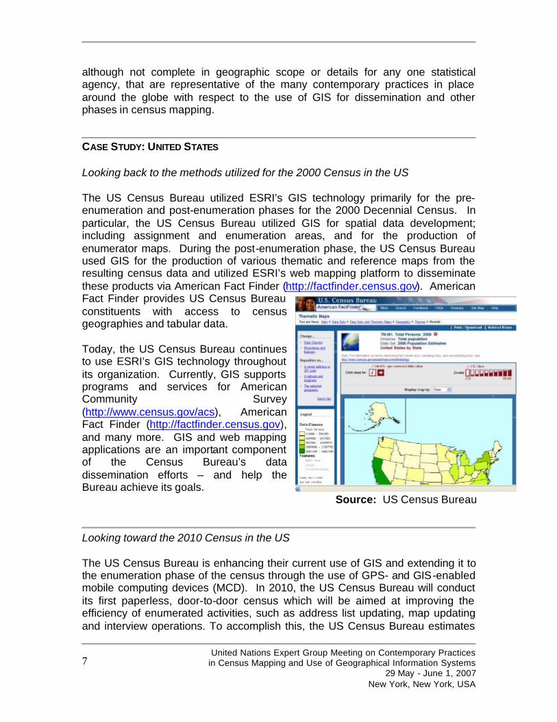
CASE STUDY: UNITED STATES Looking back to the methods utilized for the 2000 Census in the US The US Census Bureau utilized ESRI’s GIS technology primarily for the pre-enumeration and post-enumeration phases for the 2000 Decennial Census. In particular, the US Census Bureau utilized GIS for spatial data development; including assignment and enumeration areas, and for the production of enumerator maps. During the post-enumeration phase, the US Census Bureau used GIS for the production of various thematic and reference maps from the resulting census data and utilized ESRI’s web mapping platform to disseminate these products via American Fact Finder (http://factfinder.census.gov). American Fact Finder provides US Census Bureau constituents with access to census geographies and tabular data. Today, the US Census Bureau continues to use ESRI’s GIS technology throughout its organization. Currently, GIS supports programs and services for American Community Survey (http://www.census.gov/acs), American Fact Finder (http://factfinder.census.gov), and many more. GIS and web mapping applications are an important component of the Census Bureau’s data dissemination efforts – and help the Bureau achieve its goals.
Source: US Census Bureau
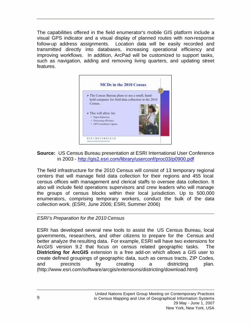
Looking toward the 2010 Census in the US The US Census Bureau is enhancing their current use of GIS and extending it to the enumeration phase of the census through the use of GPS- and GIS-enabled mobile computing devices (MCD). In 2010, the US Census Bureau will conduct its first paperless, door-to-door census which will be aimed at improving the efficiency of enumerated activities, such as address list updating, map updating and interview operations. To accomplish this, the US Census Bureau estimates
United Nations Expert Group Meeting on Contemporary Practices
in Census Mapping and Use of Geographical Information Systems 29 May - June 1, 2007
New York, New York, USA
8
that it may need to deploy 500,000 mobile computing devices equipped with GPS receivers, which will be distributed to enumerators all across the country. The Field Data Collection Automation (FDCA) program will support census field enumerators who will follow up and collect survey data from households that did not return their census forms. (ESRI, June 2006; ESRI, Summer 2006) In addition, the use of MCDs will enable these enumerators to obtain directions on how to find these addressees, and help reduce post-processing of data costs and time upon the census survey completion.
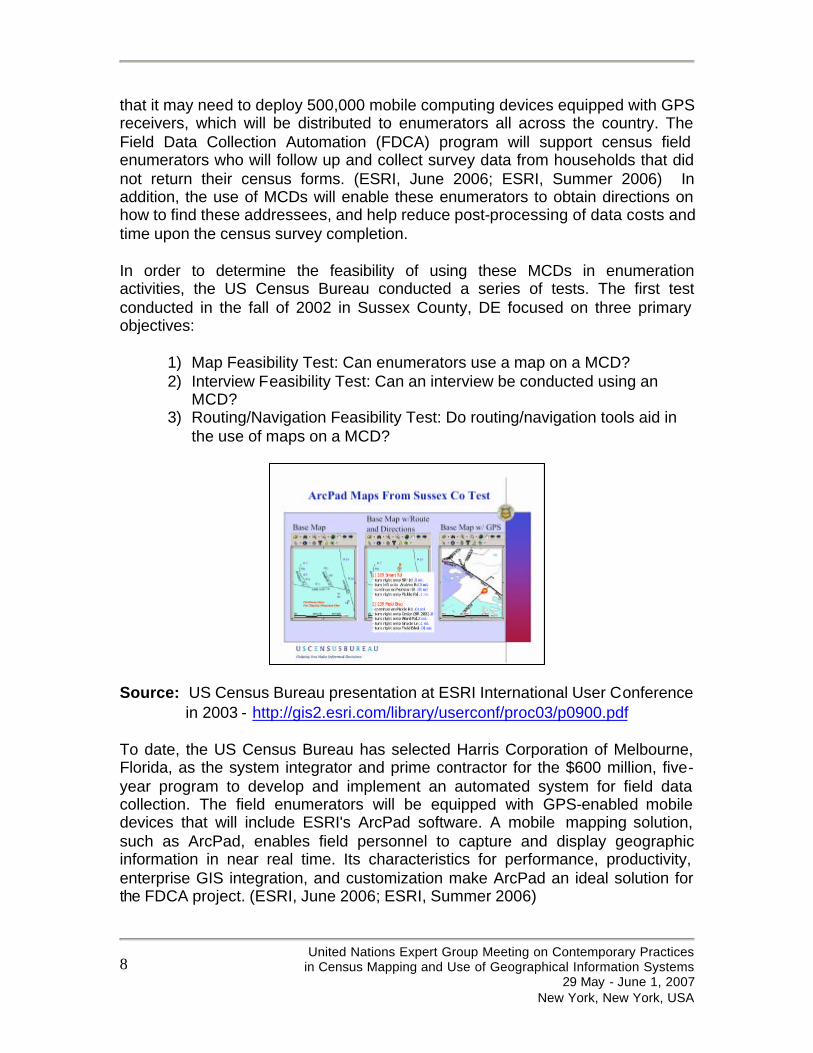
In order to determine the feasibility of using these MCDs in enumeration activities, the US Census Bureau conducted a series of tests. The first test conducted in the fall of 2002 in Sussex County, DE focused on three primary objectives:
1) Map Feasibility Test: Can enumerators use a map on a MCD? 2) Interview Feasibility Test: Can an interview be conducted using an
MCD? 3) Routing/Navigation Feasibility Test: Do routing/navigation tools aid in
the use of maps on a MCD?
Source: US Census Bureau presentation at ESRI International User Conference in 2003 - http://gis2.esri.com/library/userconf/proc03/p0900.pdf
To date, the US Census Bureau has selected Harris Corporation of Melbourne, Florida, as the system integrator and prime contractor for the $600 million, five-year program to develop and implement an automated system for field data collection. The field enumerators will be equipped with GPS-enabled mobile devices that will include ESRI's ArcPad software. A mobile mapping solution, such as ArcPad, enables field personnel to capture and display geographic information in near real time. Its characteristics for performance, productivity, enterprise GIS integration, and customization make ArcPad an ideal solution for the FDCA project. (ESRI, June 2006; ESRI, Summer 2006)
United Nations Expert Group Meeting on Contemporary Practices
in Census Mapping and Use of Geographical Information Systems 29 May - June 1, 2007
New York, New York, USA
9
The capabilities offered in the field enumerator's mobile GIS platform include a visual GPS indicator and a visual display of planned routes with non-response follow-up address assignments. Location data will be easily recorded and transmitted directly into databases, increasing operational efficiency and improving workflows. In addition, ArcPad will be customized to support tasks, such as navigation, adding and removing living quarters, and updating street features.
Source: US Census Bureau presentation at ESRI International User Conference in 2003 - http://gis2.esri.com/library/userconf/proc03/p0900.pdf
The field infrastructure for the 2010 Census will consist of 13 temporary regional centers that will manage field data collection for their regions and 455 local census offices with management and clerical staffs to oversee data collection. It also will include field operations supervisors and crew leaders who will manage the groups of census blocks within their local jurisdiction. Up to 500,000 enumerators, comprising temporary workers, conduct the bulk of the data collection work. (ESRI, June 2006; ESRI, Summer 2006)
ESRI’s Preparation for the 2010 Census
ESRI has developed several new tools to assist the US Census Bureau, local governments, researchers, and other citizens to prepare for the Census and better analyze the resulting data. For example, ESRI will have two extensions for ArcGIS version 9.2 that focus on census related geographic tasks. The Districting for ArcGIS extension is a free add-on which allows a GIS user to create defined groupings of geographic data, such as census tracts, ZIP Codes, and precincts by creating a districting plan. (http://www.esri.com/software/arcgis/extensions/districting/download.html)
United Nations Expert Group Meeting on Contemporary Practices
in Census Mapping and Use of Geographical Information Systems 29 May - June 1, 2007
New York, New York, USA
10
ESRI is also working jointly with a business partner, Citygate GIS, LLC, to develop the Local Update of Census Addresses (LUCA) for ArcGIS add-on. This free add-on will allow local governments to improve the accuracy of the Master Address File (MAF) for the 2010 Census. Accurate Census data is important in apportioning seats in the U.S. House of Representatives, allocating federal monies to state and local governments, and helping communities plan for future needs. The LUCA for ArcGIS is expected to be available for download from the ESRI Web site late summer 2007. These are just two of the many efforts by ESRI to ensure that our GIS user community, including numerous local governments and researchers, can fully participate in, benefit from, and make improvements to the processes of the 2010 Round of the Census in the US.
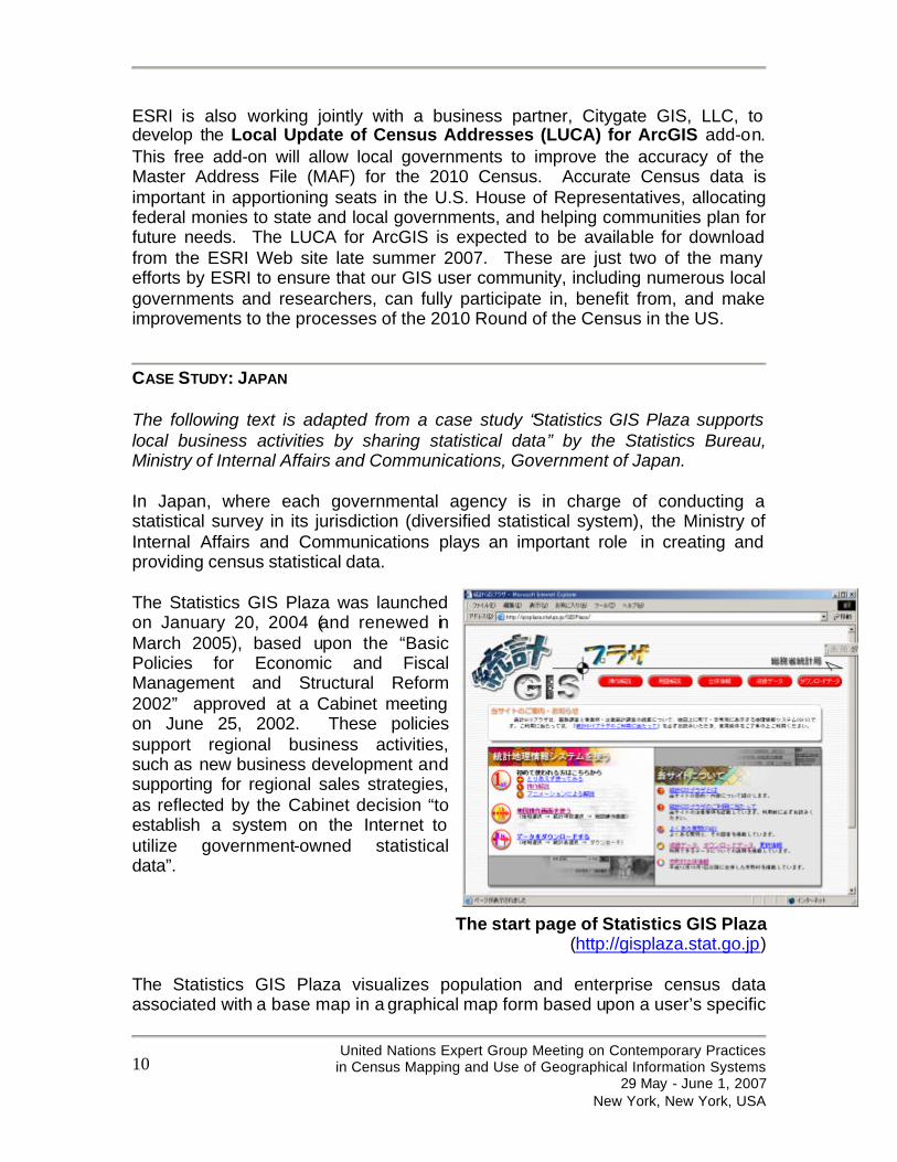
CASE STUDY: JAPAN The following text is adapted from a case study “Statistics GIS Plaza supports local business activities by sharing statistical data” by the Statistics Bureau, Ministry of Internal Affairs and Communications, Government of Japan. In Japan, where each governmental agency is in charge of conducting a statistical survey in its jurisdiction (diversified statistical system), the Ministry of Internal Affairs and Communications plays an important role in creating and providing census statistical data. The Statistics GIS Plaza was launched on January 20, 2004 (and renewed in March 2005), based upon the “Basic Policies for Economic and Fiscal Management and Structural Reform 2002” approved at a Cabinet meeting on June 25, 2002. These policies support regional business activities, such as new business development and supporting for regional sales strategies, as reflected by the Cabinet decision “to establish a system on the Internet to utilize government-owned statistical data”.
The start page of Statistics GIS Plaza (http://gisplaza.stat.go.jp)
The Statistics GIS Plaza visualizes population and enterprise census data associated with a base map in a graphical map form based upon a user’s specific

United Nations Expert Group Meeting on Contemporary Practices
in Census Mapping and Use of Geographical Information Systems 29 May - June 1, 2007
New York, New York, USA
11
needs. This web mapping system unveils characteristics of the area hidden behind the numbers on spreadsheets or in databases. The Statistics GIS Plaza enables users to grasp the patterns and trends for the area visually by creating user-specified maps. Both population and enterprise censuses are conducted nation-wide in Japan. The Population Census is the most basic statistical survey that researches population, household, and industrial compositions by employees in each region. This survey contributes data to various issues related to population and household matters, such as the ageing society with declining birthrate and deficit working population problem. The Establishment and Enterprise Census is the most basic survey of establishments and enterprises to unveil not only the basic structure of industries and staff size nation-wide and regions, but also provide the information about a given population for various pilot surveys. The results will be utilized for various research efforts such as planning, drafting , and documenting of the distribution of local sales taxes and for regional development and urban planning. The main objective of the Statistics GIS Plaza is to widely share the statistical information retrieved from these surveys with the public, and to support various activities such as business, education, and local governance.
“The first priority of designing Statistics GIS Plaza was easy-to-use operability for users who are not familiar with GIS. Since Statistical GIS Plaza has opened, the average number of access to the start page is 20,000 per month. It may not seem many accesses, however, I feel confident that the constant number of accesses to the Website shows that it is getting good reputation as a geographic information Website. Moreover, we have been receiving many questions from advertising industry, think-tanks, constructing consultants and GIS users. I hope to attract more people to this Website from now on.” Mr. Kawabe, local information sub-section chief, said.
The Statistics GIS Plaza website is very user-friendly. Users only require a OC and Internet browser, such as MS Internet Explorer or Firefox, with no plug-in in order to use the Statistic GIS Plaza. Statistics GIS Plaza Website provides many useful tools such as area selection, data field selection, data table selection, map navigation, graphing, labeling, layer transparent, and downloading data. These user-friendly tools are accessed from icons and pull-down menus, and this user interface and tools enable users to create maps for their purposes very easily. Map data for the website were originally provided from both governmental and private organizations:
• The Cadastral Data - maintained by the Statistic Bureau, Ministry of Internal Affairs and Communications;

United Nations Expert Group Meeting on Contemporary Practices
in Census Mapping and Use of Geographical Information Systems 29 May - June 1, 2007
New York, New York, USA
12
• The Place Name and Public Facility Data (Suchi chizu) - maintain by Geographic Survey Institute (www.gsi.go.jp/); and
• 1/25,000 PascoMap data - provided by Pasco, Inc. (www.pasco.co.jp)
In addition, various statistical data are retrieved from Census 2000 and Establishment and Enterprise Census 2001. The GIS software employe with the application is ArcSDE, as a database server, and ArcIMS, as a geoprocessing server and web mapping server. Moreover, a free GIS data download service is available for GIS users. The Cadastral Data is provided in shapefile and G-XML format, and the statistical data is available in CSV file format. This free data download service enables GIS users to utilize statistical data for further analysis and visualization in various GIS software. On July 17, 2003, the Chief Information Officers (CIOs) from each governmental agency discussed an E-Government Plan, and decided to form a cross-disciplinary team in order to follow the reform plan of administrative systems and agencies using information technologies. This approach aims to reconstruct the system and optimize the entire system of Japanese government with enterprise architecture. In this approach, the Statistic Bureau of the Ministry of Internal Affairs and Communications was assigned to be in charge of statistical survey duties. Mr. Kawabe said,
“We, the Statistic Bureau, Ministry of Internal Affairs and Communications are going to make an optimization plan for administrative system and duties related to statistical surveys in 2005. From the year of 2006 to 2007, the enterprise system for all governmental agencies will be established to optimize all administrative workflow of the entire government. In this plan, we are planning to provide data of population and enterprise census 2005 and 2006 in a new system called “Statistics GIS System (a tentative name)” in 2008 as a succeeding system of Statistics GIS Plaza. One of main objectives in this system is to provide the one-stop environment to utilize all statistical data owned by each agency. I hope that general public feels statistical information is useful.”
Examples of the Statistics GIS Plaza System functionality:

United Nations Expert Group Meeting on Contemporary Practices
in Census Mapping and Use of Geographical Information Systems 29 May - June 1, 2007
New York, New York, USA
13
Area Selection
Cadastral Map Graph Settings
Map and Graph
United Nations Expert Group Meeting on Contemporary Practices
in Census Mapping and Use of Geographical Information Systems 29 May - June 1, 2007
New York, New York, USA
14
For further information on the use of GIS by the Statistics Bureau, please contact:
Statistics Bureau, Ministry of Internal Affairs and Communications (Person in charge of Statistics GIS Plaza: Mr. Yasutaka Kobe) Address: 19-1 Wakamatsu-cho, Shinjuku-ku, Tokyo 162-8668 Tel: +81-3-5273-2020 Fax: +81-3-5273-1180 e-mail: [email protected] website: http://www.stat.go.jp/english/index.htm
For additional information about the Statistical Bureau, Ministry of Internal Affairs and Communications, in English, please refer to:
Information on the 2005 Population Census of Japan http://www.stat.go.jp/english/data/kokusei/index.htm, and the Outline of the 2000 Population Census http://www.stat.go.jp/english/data/kokusei/2000/outline.htm
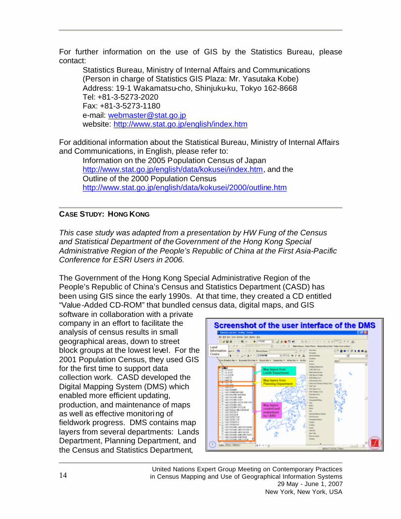
CASE STUDY: HONG KONG This case study was adapted from a presentation by HW Fung of the Census and Statistical Department of the Government of the Hong Kong Special Administrative Region of the People’s Republic of China at the First Asia-Pacific Conference for ESRI Users in 2006. The Government of the Hong Kong Special Administrative Region of the People’s Republic of China’s Census and Statistics Department (CASD) has been using GIS since the early 1990s. At that time, they created a CD entitled “Value-Added CD-ROM” that bundled census data, digital maps, and GIS software in collaboration with a private company in an effort to facilitate the analysis of census results in small geographical areas, down to street block groups at the lowest level. For the 2001 Population Census, they used GIS for the first time to support data collection work. CASD developed the Digital Mapping System (DMS) which enabled more efficient updating, production, and maintenance of maps as well as effective monitoring of fieldwork progress. DMS contains map layers from several departments: Lands Department, Planning Department, and the Census and Statistics Department,
United Nations Expert Group Meeting on Contemporary Practices
in Census Mapping and Use of Geographical Information Systems 29 May - June 1, 2007
New York, New York, USA
15
and has several custom GIS functions. The pre-enumeration activities included data collection and other preparation efforts such as:
• Updating the sampling frame which involved linking the spatial data and textual records of buildings/structures to facilitate the updating process and delineating boundary segments,
• Allocation of assignments, • Itinerary planning, • Production of tailor-made and up-to-date maps of good quality to support
fieldwork operation, and • Data compilation
After the census, CADS was involved with a number of data dissemination efforts, such as:
• Creation of value-added CD-ROM product, • Development of thematic maps, and • Development of Scaleable Vector Graphic map presentations for
download from their website. For more information on their efforts can be found here: http://www.censtatd.gov.hk .
CASE STUDIES: DEVELOPING COUNTRIES ESRI has a network of international distributors in over 100 countries on every continent. During recent correspondence with this locally-owned GIS companies, it became apparent that to provide an overview of ESRI’s experiences with census mapping would be incomplete without mention of a few of the many agencies within the developing world that have already embraced our GIS technology in support of their census mapping efforts for either the 2000 Round or in preparation for the 2010 Round. With funding from the UN Population Fund (UNFPA), many developing countries will have the opportunity to conduct their census with digital mapping. This is of great benefit to these countries and will allow them to benefit from the effectiveness and efficiencies discussed in the introductory section of this paper. For example, UNFPA has recently acquired ESRI technology for the NSOs in Zambia, Bhutan, Afghanistan, and other nations. ESRI and its network of international distributors look forward to collaborating with the relevant UN agencies and the NSOs in the coming years as they conduct the 2010 Decennial Census. In Latin America -
United Nations Expert Group Meeting on Contemporary Practices
in Census Mapping and Use of Geographical Information Systems 29 May - June 1, 2007
New York, New York, USA
16
Bolivia The Bolivian Instituto Nacional de Estadística (INE) is one of the most important users of GIS in the country since the early 1990s. However, it was not until the years 2000 and 2001 when GIS became of critical importance to INE due to their use of the technology in all phases of the Census of Population and Houses in 2001. For the 2001 Census in Bolivia, GIS was primarily used for:
• Enumeration Mapping: Updating of cartographic products (maps); • Planning the Census: such as territory mapping by population density,
territory segmentations, staff organization, etc.; • Publishing and Dissemination of Statistical Information: provision of
census data to the local level municipal governments and research institutions; and
• Allocation of Financial Resources: per the Bolivian Law of Political and Economic Autonomy, the government resources are assigned to the municipalities according to population. Hence, GIS technology was used for assigning finances to the municipalities according to the census results from 2001.
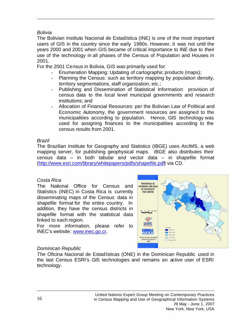
Brazil The Brazilian Institute for Geography and Statistics (IBGE) uses ArcIMS, a web mapping server, for publishing geophysical maps. IBGE also distributes their census data – in both tabular and vector data – in shapefile format (http://www.esri.com/library/whitepapers/pdfs/shapefile.pdf) via CD. Costa Rica The National Office for Census and Statistics (INEC) in Costa Rica is currently disseminating maps of the Census data in shapefile format for the entire country. In addition, they have the census districts in shapefile format with the statistical data linked to each region. For more information, please refer to INEC’s website: www.inec.go.cr. Dominican Republic The Oficina Nacional de Estadísticas (ONE) in the Dominican Republic used in the last Census ESRI’s GIS technologies and remains an active user of ESRI technology.
United Nations Expert Group Meeting on Contemporary Practices
in Census Mapping and Use of Geographical Information Systems 29 May - June 1, 2007
New York, New York, USA
17
In Africa – Ethiopia During a recent visit to the Ethiopian Central Statistical Agency (CSA) in April 2007, the author had the opportunity to learn first-hand from the GIS staff in the Information Technology division the challenges that this agency is facing. Even with challenges such as limited GIS staff and ever-changing administrative boundaries, CSA disseminates from its website an Atlas on Selected Welfare Indicators of Ethiopian Households and an Atlas of the Ethiopian Economy which are created with ArcGIS. To view these atlases, please refer to: http://www.csa.gov.et/Text_files/ATLAS%20ON%20SELECTED%20WELFARE%20INDICATORS%20OF%20ETHIOPIAN%20HOUSEHOLDS.pdf and http://www.csa.gov.et/text_files/Atlas%20of%20the%20Ethiopian%20Rural%20Economy.pdf. With future funding from UNFPA, they will be able to enhance their GIS skills and technological capacity at CSA. The dedication of the CSA staff was evident and we hope to further enable them to reach their full potential and achieve their goals. Lesotho, Namibia, and South Africa The NSOs of these countries are all currently using ArcGIS and are supported by the local international distributor, GIMS (Pty.) Ltd. Statistics South Africa (Stats SA) disseminates the 2001 Census Data on CD for use by GIS users who have their own software. In addition, they have a very comprehensive Stats SA Geography website) that addresses many of the issues presented in this paper, such as the need to establish a coding scheme for dwelling units such that their location can be found. Stats SA has developed a geo-referenced dwelling frame which is a complete, up-to-date database of all dwellings and other structures in the country. (http://mapserver.statssa.gov.za/geographywebsite/)
CONCLUSION: The opportunity to determine the best practices in census mapping for NSOs prior to the 2010 Round of the Decennial Census is tremendous and the UN Statistical Division is taking the leadership role in this effort. GIS, and related technologies, have already been utilized in many developed and developing countries for census mapping activities in all phases of the enumeration process. With the high demand for spatial data from the ever-growing GIS user, this is a great time for NSOs to prepare themselves to conduct the census with digital technology and to deliver value-added products, maps, and services with the resulting census data. Developing countries have the opportunity to engage in the knowledge economy through practicing contemporary census mapping methods.
United Nations Expert Group Meeting on Contemporary Practices
in Census Mapping and Use of Geographical Information Systems 29 May - June 1, 2007
New York, New York, USA
18
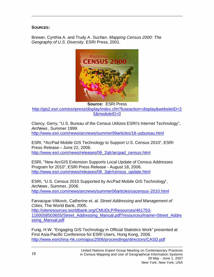
SOURCES: Brewer, Cynthia A. and Trudy A. Suchan. Mapping Census 2000: The Geography of U.S. Diversity, ESRI Press, 2001.
Source: ESRI Press
http://gis2.esri.com/esripress/display/index.cfm?fuseaction=display&websiteID=25&moduleID=0
Clancy, Gerry, “U.S. Bureau of the Census Utilizes ESRI's Internet Technology”, ArcNews , Summer 1999. http://www.esri.com/news/arcnews/summer99articles/18-usbureau.html ESRI, “ArcPad Mobile GIS Technology to Support U.S. Census 2010”, ESRI Press Release – June 22, 2006. http://www.esri.com/news/releases/06_2qtr/arcpad_census.html ESRI, "New ArcGIS Extension Supports Local Update of Census Addresses Program for 2010”, ESRI Press Release - August 18, 2006. http://www.esri.com/news/releases/06_3qtr/census_update.html ESRI, “U.S. Census 2010 Supported by ArcPad Mobile GIS Technology”, ArcNews , Summer, 2006. http://www.esri.com/news/arcnews/summer06articles/uscensus-2010.html Farvacque-Vitkovic, Catherine et. al. Street Addressing and Management of Cities, The World Bank, 2005. http://siteresources.worldbank.org/CMUDLP/Resources/461753-1160058503655/Street_Addressing_Manual.pdf?resourceurlname=Street_Addressing_Manual.pdf Fung, H.W. “Engaging GIS Technology in Official Statistics Work” presented at First Asia-Pacific Conference for ESRI Users, Hong Kong, 2006. http://www.esrichina-hk.com/apuc2006/proceedings/directors/CASD.pdf
United Nations Expert Group Meeting on Contemporary Practices
in Census Mapping and Use of Geographical Information Systems 29 May - June 1, 2007
New York, New York, USA
19
Harvard School of Design, Mapping Census Data Tutorial http://www.gsd.harvard.edu/gis/manual/census/tutorial/index.htm Johnson, Andrea. “The Road Ahead: Using ArcPad Maps in Census Bureau Field Activities” in ESRI User Conference Proceedings, 2003. http://gis2.esri.com/library/userconf/proc03/p0900.pdf Peters, Alan and Heather MacDonald. Unlocking the Census with GIS, ESRI Press, 2004.
Source: ESRI Press
http://gis2.esri.com/esripress/display/index.cfm?fuseaction=display&websiteID=84&moduleID=0
Price, Mike, “Mapping Census 2000 with ArcGIS” in ArcNews , April-June, 2002. http://www.esri.com/news/arcuser/0402/files/census1.pdf United Nations, Department of Economic and Social Affairs - Statistical Division, Integration of GPS, Digital Imagery and GIS with Census Mapping, United Nations Expert Group Meeting to Review Critical Issues Relevant to the Planning of the 2010 Round of Population and Housing Censuses, New York, New York, USA, 15-17 September 2004 http://unstats.un.org/unsd/demographic/meetings/egm/CensusEGM04/docs/AC98_14.pdf United Nations, Department of Economic and Social Affairs - Statistical Division, Handbook on geographic information systems and digital mapping, 2000. United Nations Economic Commission for Africa – Committee on Development Information (CODI IV), “Final Workshop Report on Situs Addressing in Africa”, 2005.

United Nations Expert Group Meeting on Contemporary Practices
in Census Mapping and Use of Geographical Information Systems 29 May - June 1, 2007
New York, New York, USA
20
http://geoinfo.uneca.org/Docs/Situs%20addressing%20report%20expert%20group-Full.pdf
The author wishes to express special thanks to the following organizations for sharing information about the use of ESRI’s GIS technology in their countries: GIMS (Pty) Ltd. in South Africa; Statistics Bureau, Ministry of Internal Affairs and Communications, PASCO, Inc., and ESRI Japan in Japan; GeoTecnologías SA in Costa Rica; GEOSYSTEMS SRL in Bolivia; Imagem Geosistemas E Comercio Ltda. in Brazil; IMAges & GRAPHics S.A. (IMAGRAPH) in Dominican Republic; and ESRI China – Hong Kong in Hong Kong.