“Understanding how 3D Technology and UAV's are changing...
40
Tate Jones President LandAir Surveying 12.09.2014 “Understanding how 3D Technology and UAV's are changing the workflow of Highway Design,”
-
Upload
nguyendiep -
Category
Documents
-
view
214 -
download
0
Transcript of “Understanding how 3D Technology and UAV's are changing...

Tate JonesPresident
LandAir Surveying
12.09.2014
“Understanding how 3D Technology and UAV's are changing the workflow of Highway Design,”

What is a Point Cloud?

Presentation Objectives
Understand Benefits of 3D Preconstruction Data Analysis
Understand the 3D Data Capture Process
Modeling Process
Clash Detection Process
Benefits & Cost
See some really COOL drones!
We do not sell any specific brand of softwareor hardware this presentation.
Technology Changing the World of Land Surveying.
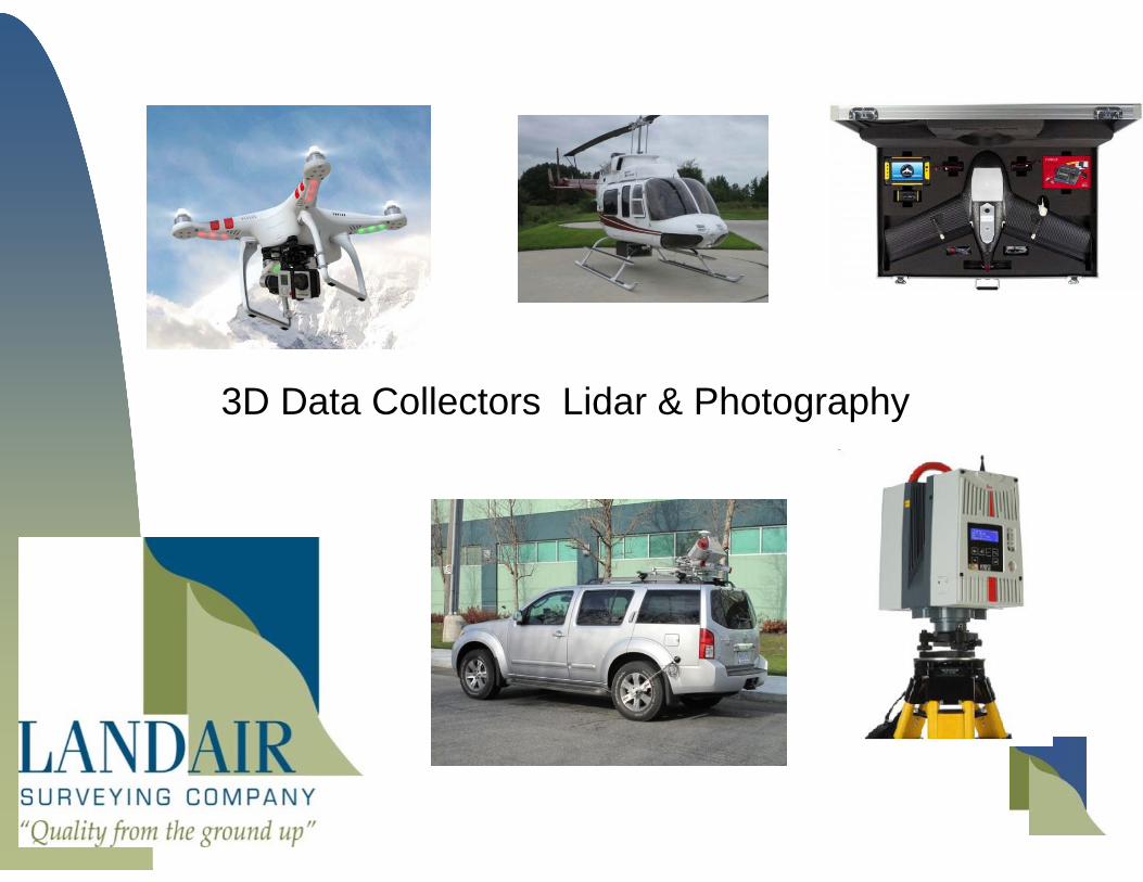
3D Data Collectors Lidar & Photography
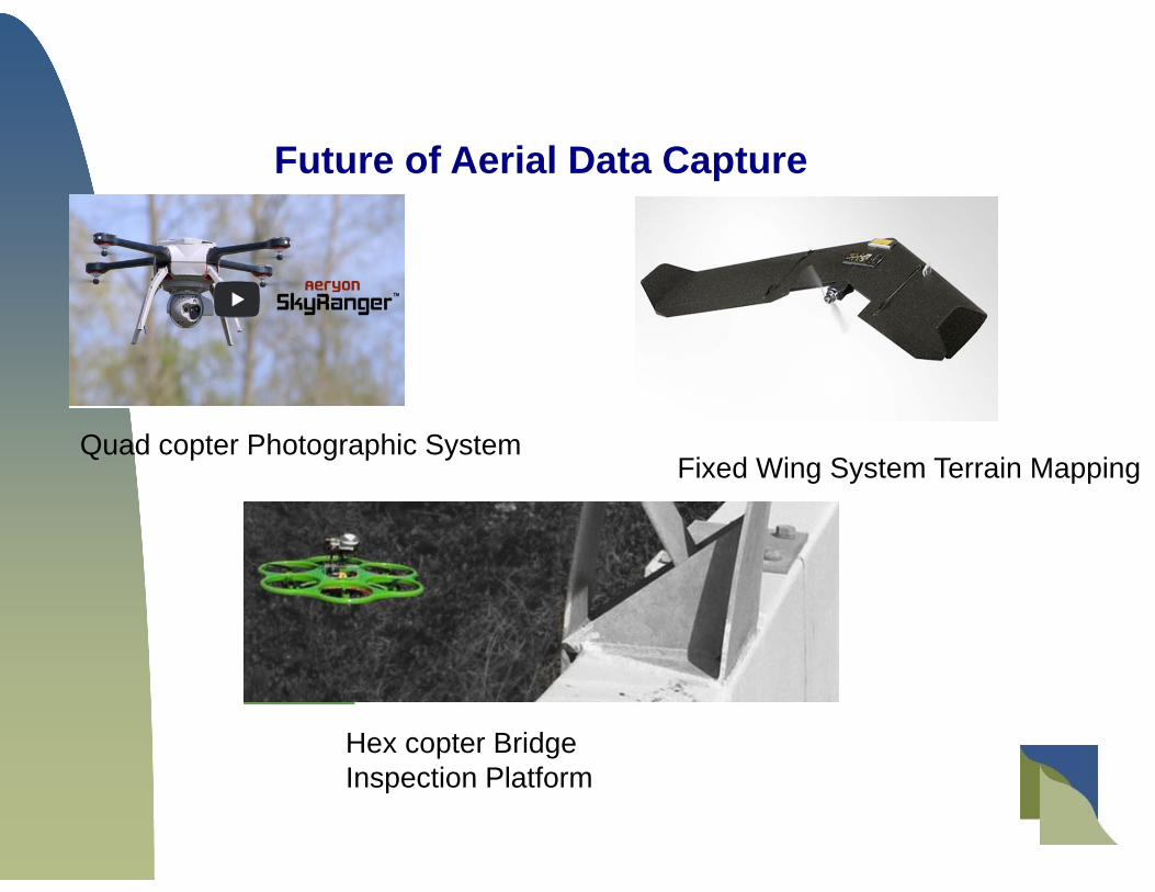
Quad copter Photographic System
Hex copter Bridge Inspection Platform
Fixed Wing System Terrain Mapping
Future of Aerial Data Capture
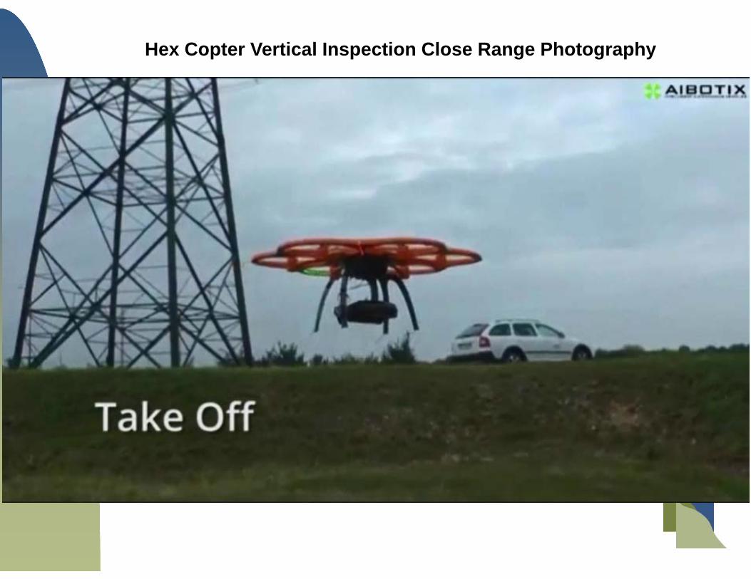
Hex Copter Vertical Inspection Close Range Photography

Fix Wing Mapping System
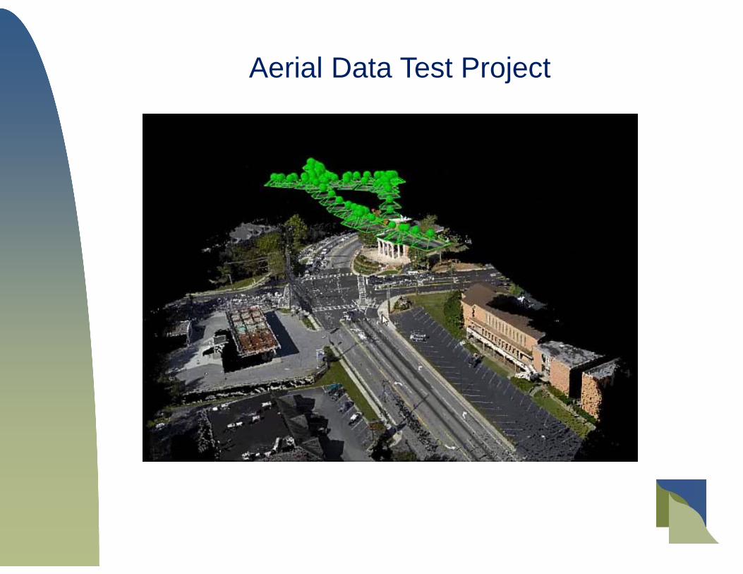
Aerial Data Test Project

Joe Harrington’s Hex Copter
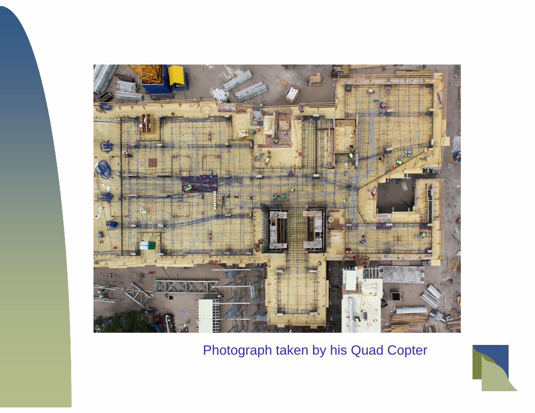
Photograph taken by his Quad Copter
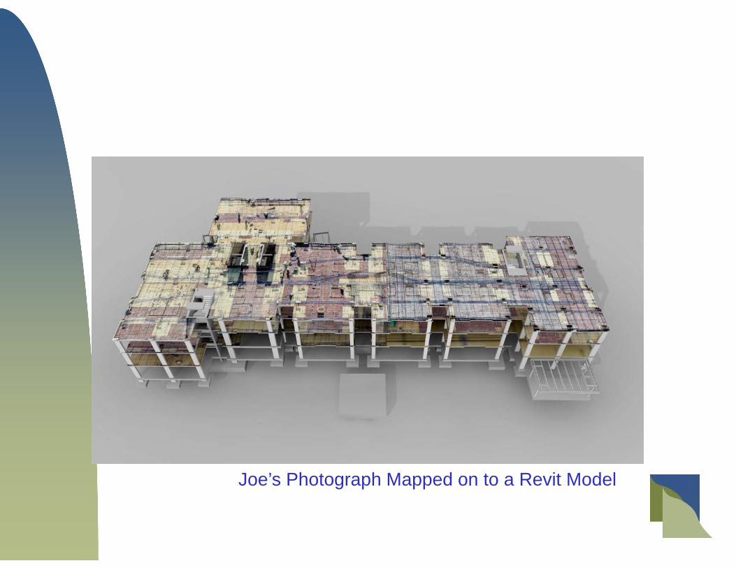
Joe’s Photograph Mapped on to a Revit Model

Software Considerations
Very few CAD packages were effectively running point clouds inside their softwareprior to 2011.
Autodesk and Bentley are the most common packages, but there are many others thatare task-specific including 3D Reshaper (micro-mesh), Inventor (for machines applications), orClearEdge 3D (for auto-modeling).
Revit AutoCAD MicroStation Navisworks 3D Reshaper AutoDesk Recap ClearEdge 3d
Sketch up Bentley Descartes TopoDOT TrueView Faro Software Products (for scan data) Z&F Software Products (for scan data) Leica Software Products (for scan data)

Mobile Units

Various Systems Available
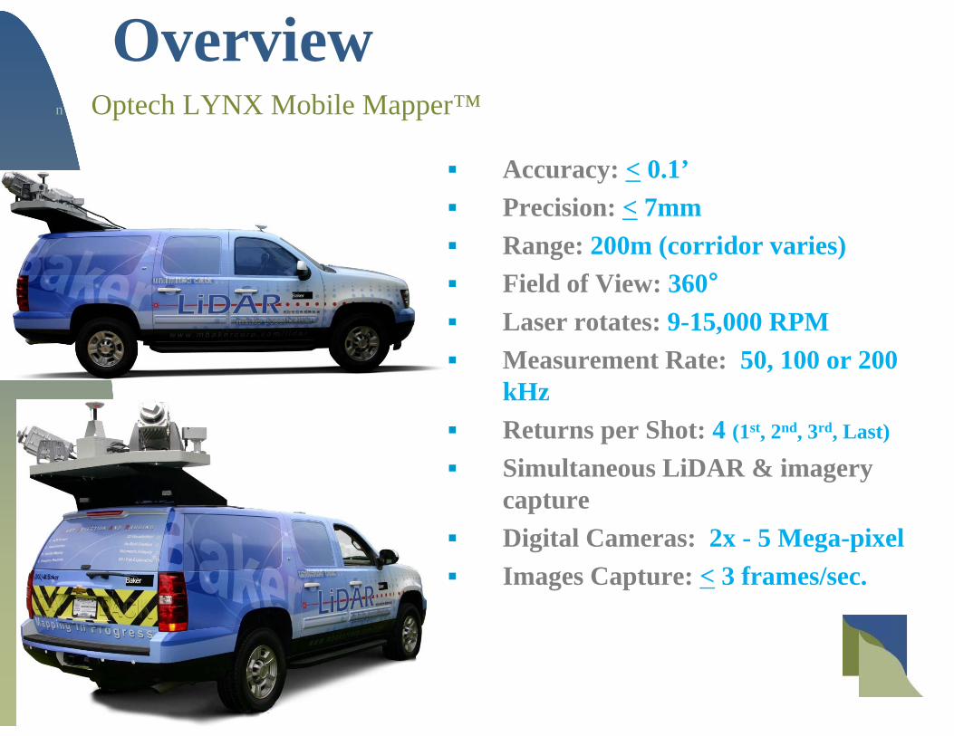
Overviewn Optech LYNX Mobile Mapper™
Specifications Accuracy: < 0.1’ Precision: < 7mm Range: 200m (corridor varies) Field of View: 360° Laser rotates: 9-15,000 RPM Measurement Rate: 50, 100 or 200
kHz Returns per Shot: 4 (1st, 2nd, 3rd, Last)
Simultaneous LiDAR & imagery capture
Digital Cameras: 2x - 5 Mega-pixel Images Capture: < 3 frames/sec.
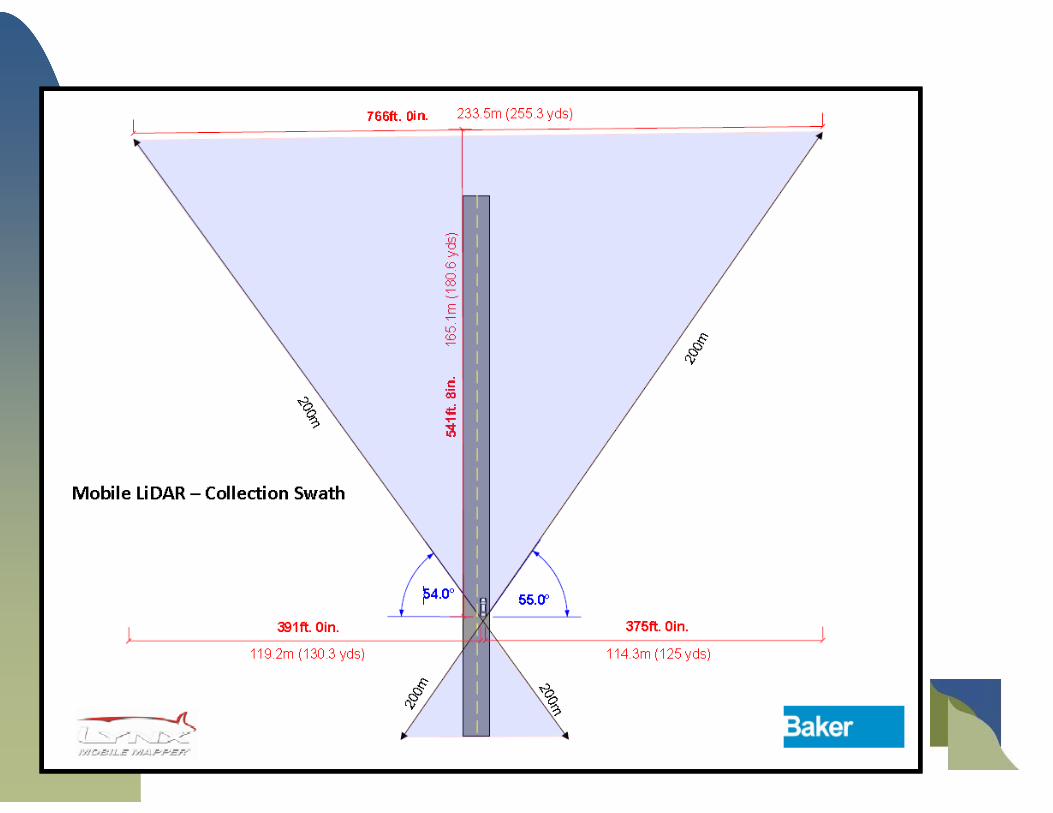
Collection Corridor

Multiple Survey Platforms Motor Vehicle
Highways Levees Developed Environments
Off-Road Karst Topography Beaches Trails
On the Water Coastal Environments / Streams Bridges

What is 3D Laser Scanning?• “LiDAR”
• High speed lasers
• 50,000 – 1,000,000 points per second
• Collecting geometric data point
• Precisely registered in space
• “Point Cloud”

FaroFocus Scanner
Light weight close range scanner Riegl VZ 400
Versatile Scanner
Z&F 5010
ScannersWhat are they and
What do they look like?

6200 Close Range scanner300,000 PPSEffective Range 30 meters
C10 Laser Scanner 50,000 PPSEffective range 100 meters
Phase Based ScannerHigh Speed LaserUsed Inside
Time of FlightLong Range LaserUsed outside & Inside
Current State of the Science Laser Scanners
$

Bridge Scan Terrestrial Lidar

Is laser scanning and point cloud technology right for your project?
Are you documenting a complex environment?
Are you documenting something you cannot physically touch like a tower, structural beams or tall building?
Is this a pipe room, conveyor system or manufacturing process that isextremely complex and mistakes could be costly?
Is the interior architectural detail very ornate and intricate?
Do you want the ability to test the new design against existing conditions scientifically, empirically and visually?
Do you want to be able to go back and measure areas that you didn’t think you would need initially, but that are now critical to the project?
Generally, the more valuable and complex the project, the greater the need for precision data – and the greater likelihood of multiple trips to the jobsite, the more value laser scanning will provide. Laser scans quickly pay for themselves!
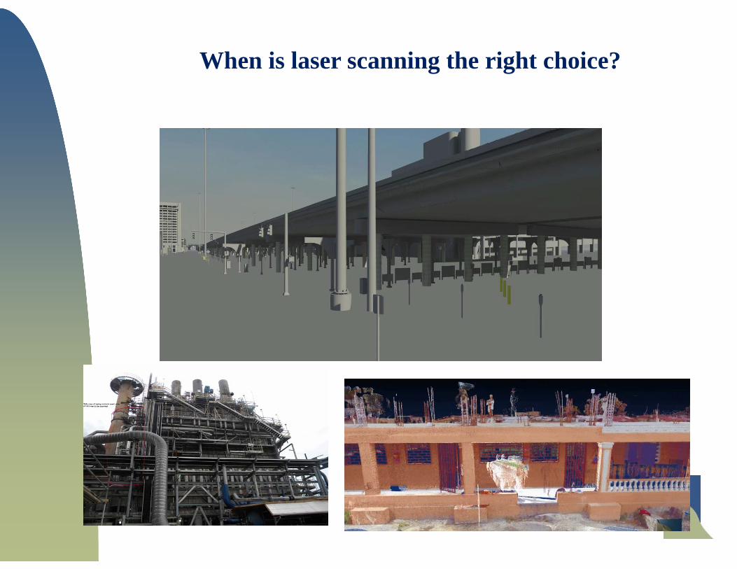
When is laser scanning the right choice?
Complex Piping Above Ceiling Elements
Complicated Architecture in Haiti
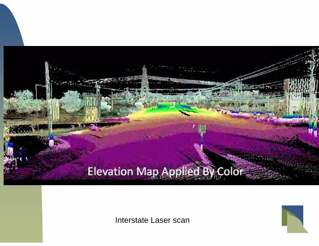
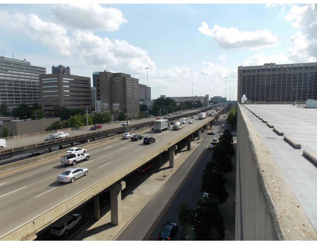
Interstate Laser scan

Simple 1 day Bridge Scan
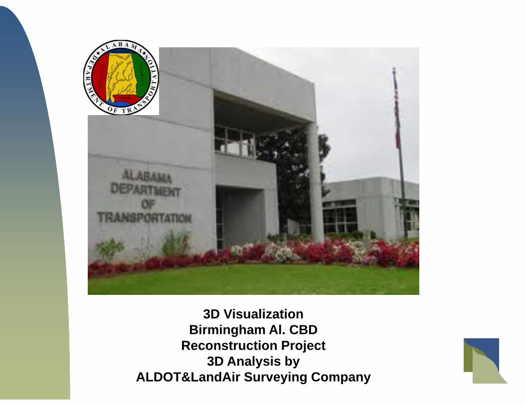
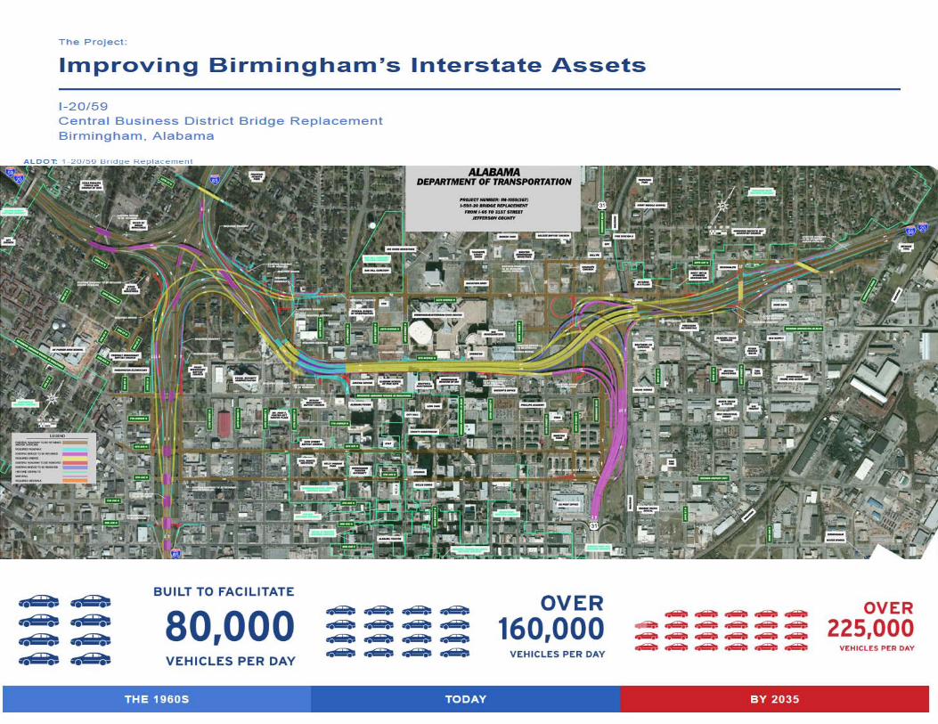
3D VisualizationBirmingham Al. CBD
Reconstruction Project3D Analysis by
ALDOT&LandAir Surveying Company

The Project Flow 3D Data Collection using… Helicopter, Laser Scanner, Fixed Wing, County GIS.
Process and check the data + .07 all data combined.
Produce Standard Micro Station In Roads Plans.
Model the existing data into useable 3D cad files.
Model the future design plans in 3D cad format.
Compare the existing and proposed and check for Interference Clash
Give information to the designers and contractors
Start with 3D Data Capture!
CBD Project
Entities in the model;Existing roadway and bridges, adjoining mainline, light poles, power lines, roadway elements, columns, bents, footings.
We used Revit to model substructure and Descartes to modelThe bridge deck surfaces. This workflow was chosen due to the expertise of the existing cad techs.
Modeled areas included 1400 bridges columns, 8 miles of bridges, 1 tunnel, 100’s of light poles, miles of underground utilities, adjoining buildings and improvements within the design
envelope.

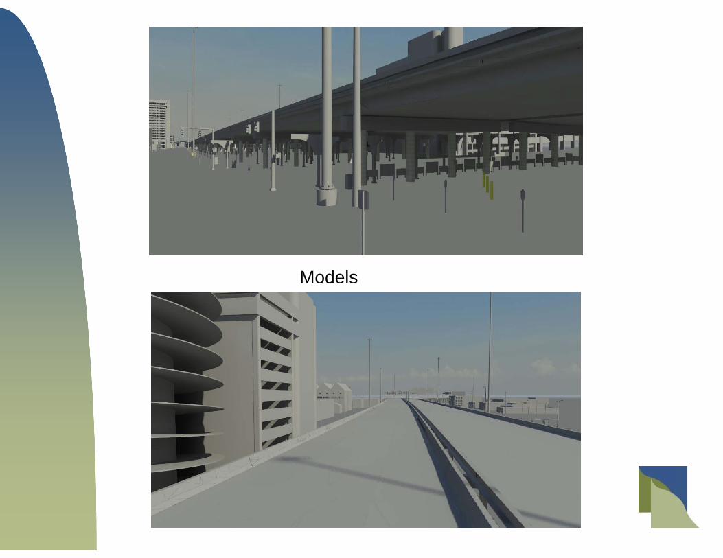
Models

Current Model of CBD Project
The 3D Design Advantages
You can drop a 3D pointcloud into in to Micro Station and design thru the data.
You can check the data and the design against the existing conditions.
You get all the data not just a 25’ grid that is the standard.
You don’t have to return to the field to view the actual conditions.
3D Design files can be built into models and videos to assists in public presentations.
The Cost to you
Training Computer Software Learning Curve

What is the ROI of 3D Preconstruction Analysis?
Wisconsin Study
Write up by FHWA
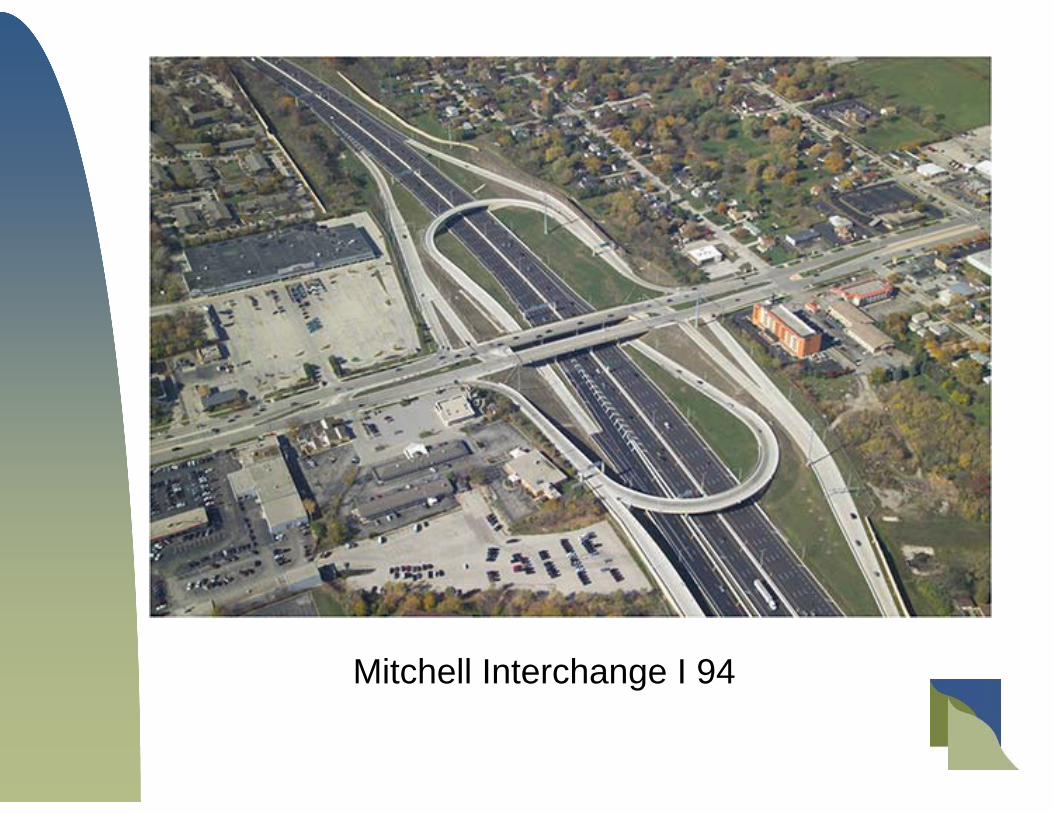
Mitchell Interchange I 94

Mitchell Interchange I 94

Total Cost Savings from Pre Construction 3D Analysis$9.5 Million Dollars!
DIN Category Estimated Percent of Reduction
Total Cost ($ millions) Average Cost Per I ssue
General Structures 30.5% 6.8 $45,674
Roadway Drainage 25.5% 5.7 85,631
Wet Utilities/D r ainage 11.1% 2.4 27,120
Bridges 8.0% 1.8 15,557
Noise Wall 8.0% 1.8 125,909
Retaining Wall 7.7% 1.7 21,818
Earthwork 4.5% 1.0 59,220
Electrical/IT S/FT MS 2.6% 0.6 15,557
Traffic 2.1% 0.5 18,174
Sign Structures 0.1% 0.02 738
Design issue notices (DINs) are changes to the design that become necessary due to conflicts or issues identified during construction.

Crain Radius Clash Detection
Questions or Comments?
Tate Jones (770) 730 [email protected]
James Clay770 730 9950jclay@ lasurveying. com
See more at:www.LandAirSurveying.com LandAir Surveying’s YouTube
Channel