Transportation Subcommittee Update - Gis-T Symposium GIST_2016.pdf · Transportation Subcommittee...
24
Transportation Subcommittee Update 5 April 2016 Coordination Group Meeting Derald Dudley Geographer/Computer Scientist USDOT, BTS 202.309.0940 [email protected] Ronald Vaughn Transportation Specialist USDOT, FHWA 202.366.9248 [email protected]
-
Upload
hoangquynh -
Category
Documents
-
view
217 -
download
3
Transcript of Transportation Subcommittee Update - Gis-T Symposium GIST_2016.pdf · Transportation Subcommittee...

Transportation Subcommittee Update
5 April 2016Coordination Group Meeting
Derald DudleyGeographer/Computer Scientist
USDOT, BTS202.309.0940
Ronald VaughnTransportation Specialist
USDOT, FHWA202.366.9248
2
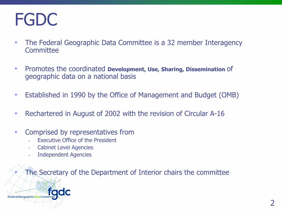
FGDC• The Federal Geographic Data Committee is a 32 member Interagency
Committee
• Promotes the coordinated Development, Use, Sharing, Dissemination of geographic data on a national basis
• Established in 1990 by the Office of Management and Budget (OMB)
• Rechartered in August of 2002 with the revision of Circular A-16
• Comprised by representatives from• Executive Office of the President
• Cabinet Level Agencies
• Independent Agencies
• The Secretary of the Department of Interior chairs the committee
3
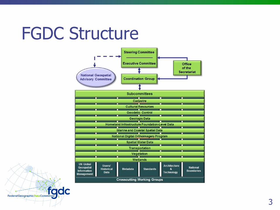
FGDC Structure

4
FGDC Steering Committee• Governing Body of the FGDC
• Comprised of SAOGIs (Senior Agency Officials for Geospatial Information)
• Policy Level Interagency Group
• Provides Executive Leadership for the coordination of Federal Geospatial Activities
• Oversees OMBs Circular A-16 activities and the
• Implements of the NSDI
5
FGDC Executive Committee• A subset of the Steering Committee
• Lead by the FGDC Chair and Vice Chair
• Members guide Chair and Vice Chair on major Federal geospatial priorities and activities
• Members include OMB representatives and seven Federal agencies with the largest investments in Geospatial Activities

6
FGDC Coordination Group• Provides advice on the day to day business
• Facilitates Interagency Coordination
• Implements NSDI at the Operational Level
• Provides functional leadership for
• FGDC subcommittees
• Working Groups
• Geospatial Line Of Business Working Groups
• Chaired by the Executive Director of the FGDC Office of the Secretariat (FGDC OS) and an elected member of the Federal Coordination Group members
7
FGDC Subcommittees & WGs• OMB Circular A-16 enumerates 34 data themes of National Significance
• Each theme is the responsibility of a Federal Agency
• Thematic Subcommittees are established for 9 of the data themes
• Each agency is responsible for managing the subcommittees
• FGDC Working Groups
• Crosscut Subcommittees
• Focus on issues common to the NSDI Themes
8
NGAC• National Geospatial Advisory Council
• Established by the Federal Advisory Committee Act
• Sponsored by the U.S. Department of the Interior
• Advises the FGDC on Federal geospatial policy and management issues
• Provides a forum for partners in the geospatial community
• Membership includes representatives from 28 Government and nongovernmental organizations
• Solicits input from State, Tribal, regional, and local governments, academic institutions, and the private sector
9
FGDC Office of the Secretariat• FGDC OS Provides Support to all Components of the FGDC
• Managing Partner for the GLOB, E-government initiative
• Designated Federal Official for the FGDC NGAC FACA committee
• Initiates, participates, and or leads FGDC committees, subcommittees and working groups
• Drafts policies and procedures for consideration and approval by the Coordination Group, the Steering Committee, and the Executive Committee
• Provides project management support for FGDC initiatives
10
FGDC Office of the Secretariat• Administers the FGDC standards program
• Administers the NSDI Cooperative Agreements Program (CAP)
• Administers the FGDC International Spatial Data Infrastructure program
• Manages the NSDI training and outreach program
• Manages all administrative requirements associated with scheduling and conducting meetings
• Undertakes staff analysis, technical development, and other activities on behalf of the Coordination Group
11
FGDC Partnerships• FGDC solicits the involvement of public interest groups
• Collaborating partnerships are open to public, private, and nonprofit organizations
• Organizations invited to send a written request to the FGDC Chair.
• Partners include
• State, Tribal, and local governments;
• academic institutions;
• private sector geographic, statistical, demographic, and other business information providers and users.
12
NSDI?• National Spatial Data Infrastructure
• Established by Executive Order 12906
• The Technologies, Policies and People necessary to promote the sharing of geospatial data through out all levels of government, the private and non-profit sectors, and the academic community

13
NSDI Goals• Reduce duplication of effort among agencies
• Improve quality
• Reduce costs related to geographic information
• Make geographic data more accessible to the public
• Increase the benefits of using available data
• Establish key partnerships with states, counties, cities, tribal nations, academia and the private sector to increase data availability.

14
NSDI Evolution• Provides a base or structure of practices and relationships among data
producers and users
• Identify new ways of accessing, sharing and using geographic data
• Enable more comprehensive analysis of data to help decision-makers choose the best course(s) of action.
• There is still much to be done to achieve the vision of current and accurate geographic data being readily available across the country.

15
Transportation Subcommittee• Enhancing the Transportation Theme of the NSDI
• Better Data, Easy Access, Greater Understanding
• Facilitating Partnerships and Coordinating Efforts
• Problem Identification, Evaluation, Resolution
• Data Development
• Standards Development
• Identifying and Promoting Best Practices

16
Member and Partner OrganizationsParticipating Organizations
• Army Corps of Engineers
• Center for Disease Control (CDC)
• Department of Agriculture
• Forest Service
• Department of Commerce
• Census Bureau
• Department of Defense (DOD)
• National Geospatial-Intelligence Agency
• Department of Health & Human Services (HHS)
• Indian Health Service
• National Institutes of Health (NIH)
• Department of Transportation
• Federal Highway Administration
• Federal Motor Carrier Safety Administration
• Federal Railroad Administration
• Federal Transit Administration
• Pipeline and Hazardous Materials Safety Administration
• District Dept. of Transportation (DDOT)
• Environmental Protection Agency (EPA)
• General Services Administration (GSA)
• National States Geographic Information Council (NSGIC)
• Transportation Research Board (TRB)

17
Transportation Theme of the NSDI• Census
• Dataset Manger - Michael Fournier
• Roads
• Traffic Analysis Zones
• U.S. Army Corps of Engineers• Dataset Managers - Shaku Jain and Robert Mann
• Inland Electronic Navigation Charts
• Locks
• Ports
• Waterways
• U.S. Department of Transportation• Airports - Abigail Smith
• National Bridge Inventory – Samantha Lubkin
• Intermodal Freight – Dom Menegus
• Intermodal Passenger Travel – Theresa Firestine
• Rail – Raquel Hunt
• Runways – Abigail Smith
• Transit - Derald Dudley
18
Recent MeetingsAttending 24 February 2016:
• US DOT, FWS, Census, USGS, GSA, ORNL, WMATA, USACE, NGA
Topics:• Welcome back / Management Strategy
• Charter Review and Update
• Transportation Definition Review
• ARNOLD
• Membership
• What should the Subcommittee’s Objectives be• Review of the 2012 GAO report and agency responses• Identify Federal Stakeholder's needs regarding data, standards, workflows, challenges, best
practices• Transportation Data Models• Integration of federal and non federal data sources• Prioritization of TSC objectives• Strategic plans
19
Meeting Outcomes• Charter Review• Build Membership• Inventories
• Standards• Data• Activities
• Planning• Establish Teams
• Charter Review• Membership Strategy• Standards Inventory• Data Inventory• Activities Inventory• Strategic Planning
20
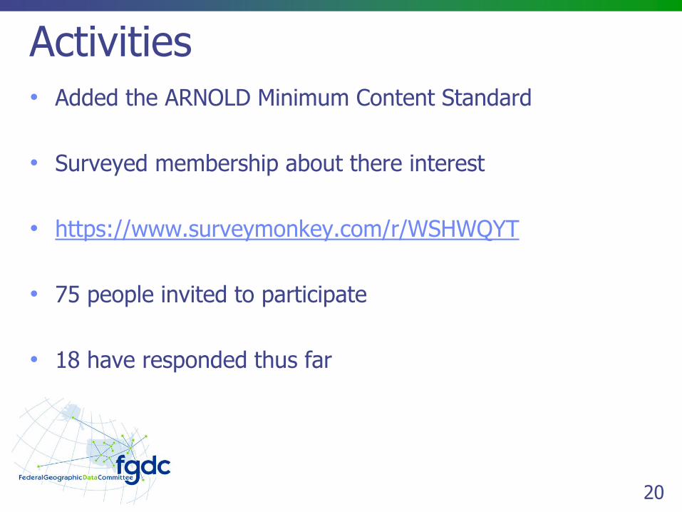
Activities• Added the ARNOLD Minimum Content Standard
• Surveyed membership about there interest
• https://www.surveymonkey.com/r/WSHWQYT
• 75 people invited to participate
• 18 have responded thus far
21
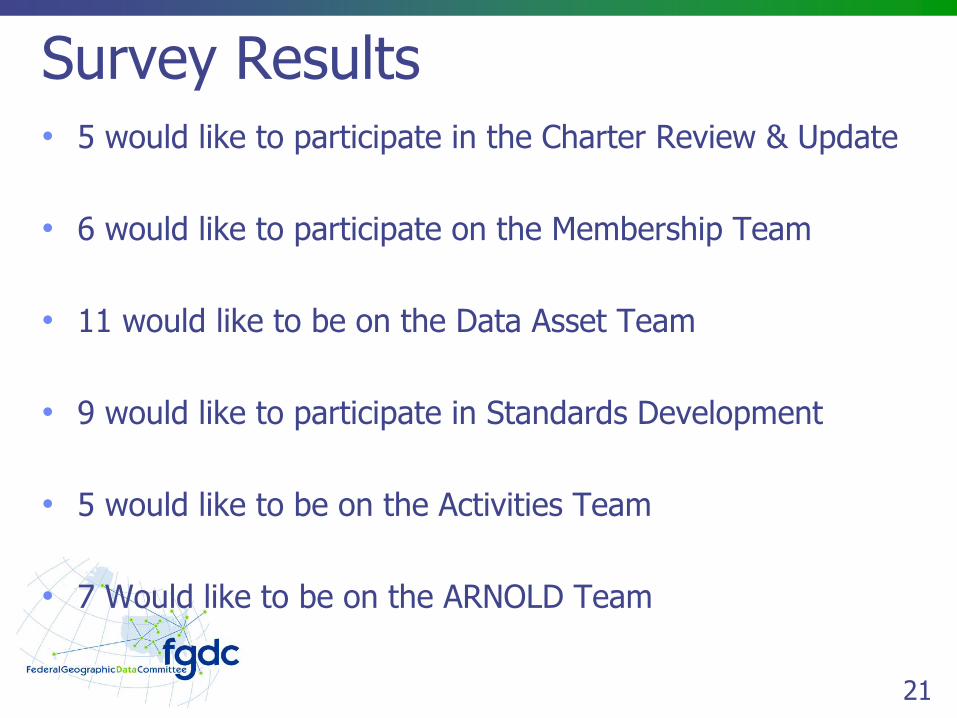
Survey Results• 5 would like to participate in the Charter Review & Update
• 6 would like to participate on the Membership Team
• 11 would like to be on the Data Asset Team
• 9 would like to participate in Standards Development
• 5 would like to be on the Activities Team
• 7 Would like to be on the ARNOLD Team
22
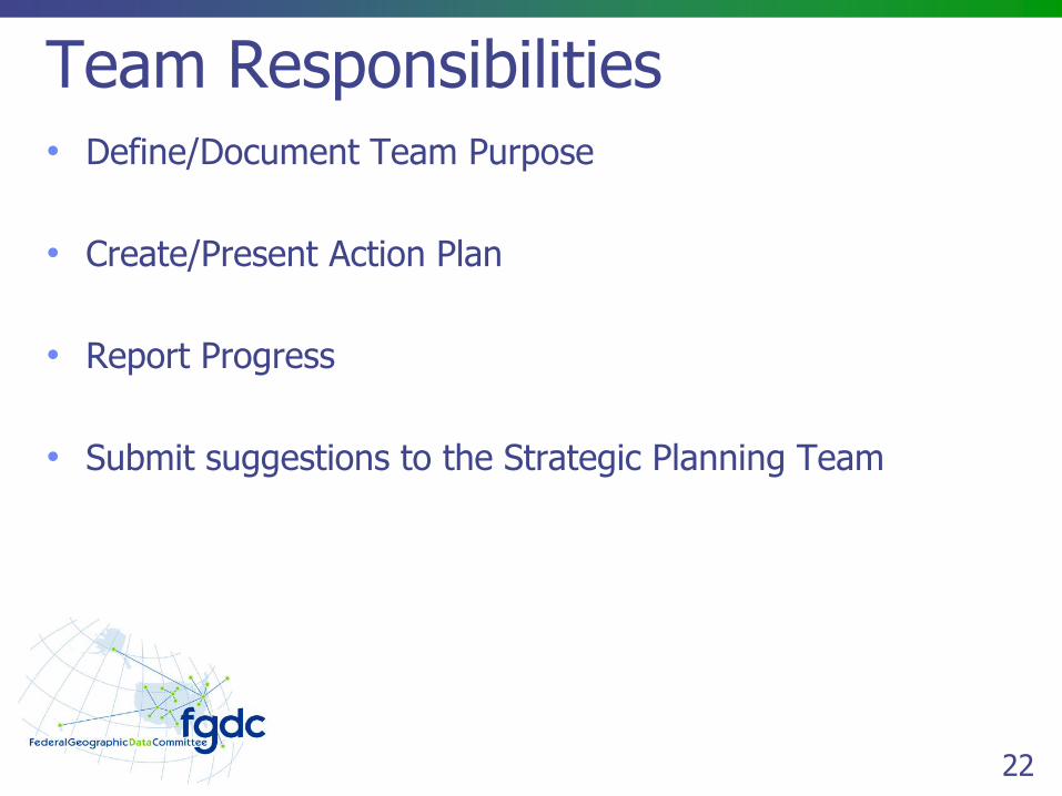
Team Responsibilities• Define/Document Team Purpose
• Create/Present Action Plan
• Report Progress
• Submit suggestions to the Strategic Planning Team
23
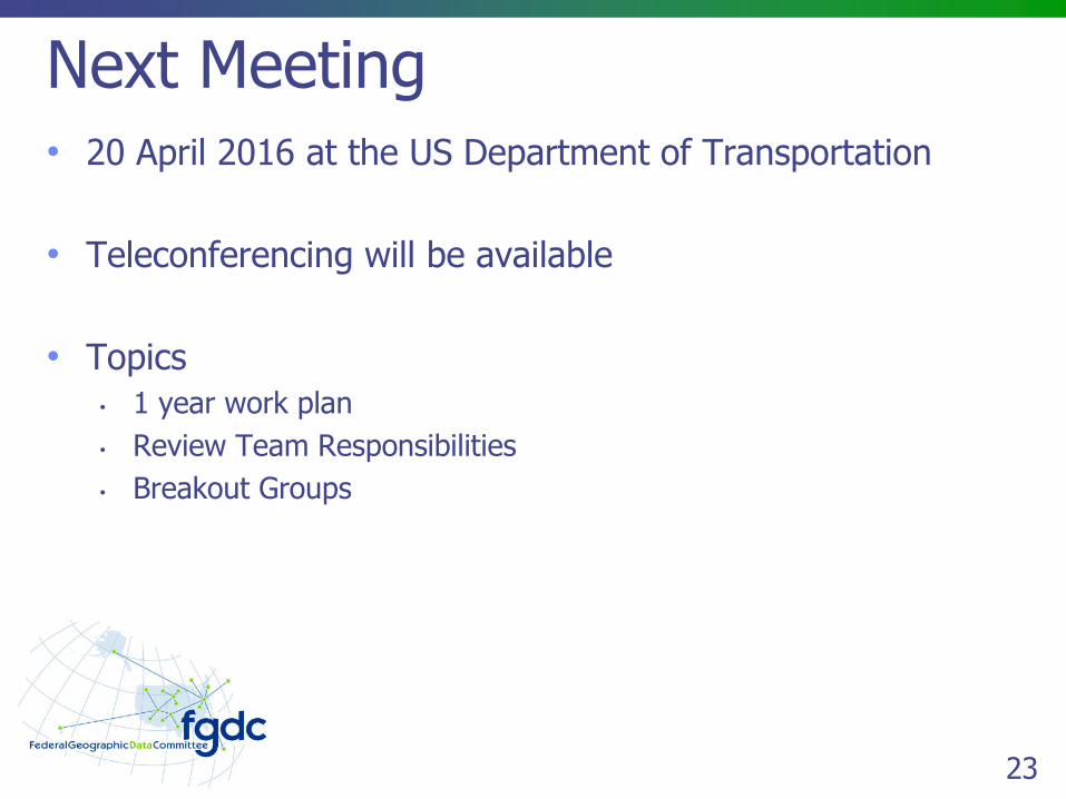
Next Meeting• 20 April 2016 at the US Department of Transportation
• Teleconferencing will be available
• Topics
• 1 year work plan
• Review Team Responsibilities
• Breakout Groups
24
Questions?
Derald DudleyGeographer/Computer Scientist
USDOT, BTS202.309.0940
Ronald VaughnTransportation Specialist
USDOT, FHWA202.366.9248