Town Trail - Wigan · Town Trail. 1 The Leigh Town ... strong, individual character as a lively...
17
Before starting the walks it is not essential to read all of the first section “What to look for in Leigh”. Instead, the headings and main points (in bold type) can be noted. This section and “Aspects of Leigh’s History” can be read later. comprising Two Guided Walks in Leigh Town Centre Contents Introduction What to look for in Leigh Aspects of Leigh’s history A map of Leigh in 1847 appears after p.11 with maps of Leigh in 1825 and 1762 overleaf. Some notable Leigh People Walk One Market Place and Railway Road Walk Two King Street and Bradshawgate A directional map of both walks appears at the end of the book fol- lowed by a Bibliography. 1 1 9 21 23 43 LEIGH Town Trail
Transcript of Town Trail - Wigan · Town Trail. 1 The Leigh Town ... strong, individual character as a lively...

Before starting the walks it is not essential to read all ofthe first section “What to look for in Leigh”. Instead, theheadings and main points (in bold type) can be noted.This section and “Aspects of Leigh’s History” can beread later.
comprising
Two Guided Walks inLeigh Town Centre
Contents
Introduction
What to look for in Leigh
Aspects of Leigh’s historyA map of Leigh in 1847
appears after p.11 withmaps of Leigh in 1825 and 1762 overleaf.
Some notable Leigh People
Walk OneMarket Place andRailway Road
Walk TwoKing Street andBradshawgate
A directional map of both walksappears at the end of the book fol-lowed by a Bibliography.
1
1
9
21
23
43
LEIGHTown Trail
1
The Leigh Town Centre Trail explores Leigh’s townscape, archi-tecture and history which combine to produce much of itsstrong, individual character as a lively market and industrialtown. Despite considerable changes in its economic basis andenvironment a great deal of that character was establishedabout a century ago and survives reasonably intact. In con-trast the 19th Century, especially in its second half, involvedthe transformation of the village-like Pennington, Bedford andWestleigh townships, with a total population of about 5,000 in1801 into the thriving industrial and market centre of Leighwith 40,000 people in 1901. The townships had in fact beenevolving over several centuries from the medieval period.
It is hoped that these guided walks round historic areas of Leighwill reveal and encourage appreciation of its distinctive architec-tural character and lengthy history. This trail includes two walkscovering the town centre. Another trail will explore Bedford andPennington south of Twist Lane and north of Lord Street.
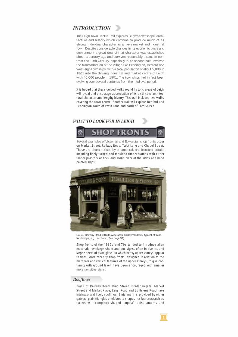
Several examples of Victorian and Edwardian shop fronts occuron Market Street, Railway Road, Twist Lane and Chapel Street.These are characterised by ornamental, architectural detailsincluding finely turned and moulded timber frames with eithertimber pilasters or brick and stone piers at the sides and handpainted signs.
Shop fronts of the 1960s and 70s tended to introduce alienmaterials, overlarge sheet and box signs, often in plastic, andlarge sheets of plate glass on which heavy upper storeys appearto float. More recently shop fronts, designed in relation to thematerials and vertical features of the upper storeys, to give con-tinuity with ground level, have been encouraged with smallermore sensitive signs.
Parts of Railway Road, King Street, Bradshawgate, MarketStreet and Market Place, Leigh Road and St Helens Road haveintricate and lively rooflines. Enrichment is provided by eithergables - plain triangles or elaborate shapes - or features such asturrets with complexly shaped ‘cupola’ roofs, lanterns and
No. 40 Railway Road with its wide sash display windows, typical of freshfood shops, e.g. butchers. (See page 39).
Rooflines
INTRODUCTION
WHAT TO LOOK FOR IN LEIGH
2 3
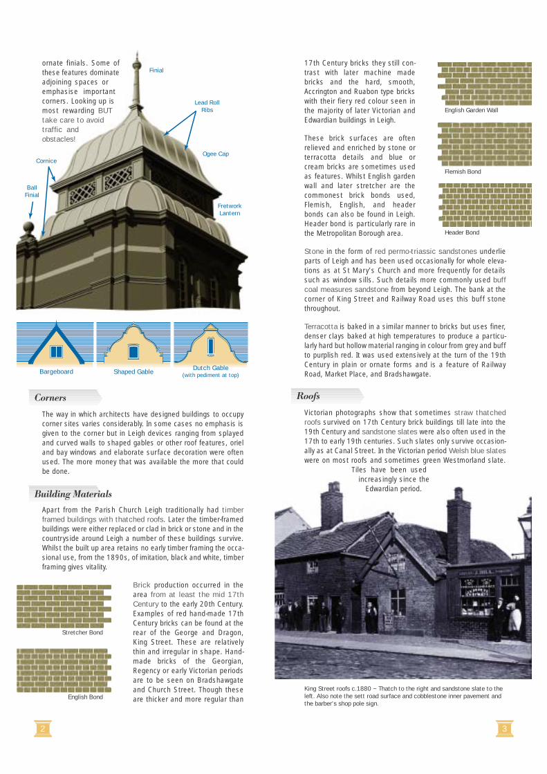
17th Century bricks they still con-trast with later machine madebricks and the hard, smooth,Accrington and Ruabon type brickswith their fiery red colour seen inthe majority of later Victorian andEdwardian buildings in Leigh.
These brick surfaces are oftenrelieved and enriched by stone orterracotta details and blue orcream bricks are sometimes usedas features. Whilst English gardenwall and later stretcher are thecommonest brick bonds used,Flemish, English, and headerbonds can also be found in Leigh.Header bond is particularly rare inthe Metropolitan Borough area.
Stone in the form of red permo-triassic sandstones underlieparts of Leigh and has been used occasionally for whole eleva-tions as at St Mary’s Church and more frequently for detailssuch as window sills. Such details more commonly used buffcoal measures sandstone from beyond Leigh. The bank at thecorner of King Street and Railway Road uses this buff stonethroughout.
Terracotta is baked in a similar manner to bricks but uses finer,denser clays baked at high temperatures to produce a particu-larly hard but hollow material ranging in colour from grey and buffto purplish red. It was used extensively at the turn of the 19thCentury in plain or ornate forms and is a feature of RailwayRoad, Market Place, and Bradshawgate.
Victorian photographs show that sometimes straw thatchedroofs survived on 17th Century brick buildings till late into the19th Century and sandstone slates were also often used in the17th to early 19th centuries. Such slates only survive occasion-ally as at Canal Street. In the Victorian period Welsh blue slateswere on most roofs and sometimes green Westmorland slate.
Tiles have been usedincreasingly since the
Edwardian period.
ornate finials. Some ofthese features dominateadjoining spaces oremphasise importantcorners. Looking up ismost rewarding BUTtake care to avoidtraffic andobstacles!
The way in which architects have designed buildings to occupycorner sites varies considerably. In some cases no emphasis isgiven to the corner but in Leigh devices ranging from splayedand curved walls to shaped gables or other roof features, orieland bay windows and elaborate surface decoration were oftenused. The more money that was available the more that couldbe done.
Apart from the Parish Church Leigh traditionally had timberframed buildings with thatched roofs. Later the timber-framedbuildings were either replaced or clad in brick or stone and in thecountryside around Leigh a number of these buildings survive.Whilst the built up area retains no early timber framing the occa-sional use, from the 1890s, of imitation, black and white, timberframing gives vitality.
Brick production occurred in thearea from at least the mid 17thCentury to the early 20th Century.Examples of red hand-made 17thCentury bricks can be found at therear of the George and Dragon,King Street. These are relativelythin and irregular in shape. Hand-made bricks of the Georgian,Regency or early Victorian periodsare to be seen on Bradshawgateand Church Street. Though theseare thicker and more regular than
Bargeboard Shaped Gable Dutch Gable(with pediment at top)
King Street roofs c.1880 ~ Thatch to the right and sandstone slate to theleft. Also note the sett road surface and cobblestone inner pavement andthe barber’s shop pole sign.
Finial
Ogee CapCornice
Lead RollRibs
BallFinial
FretworkLantern
Stretcher Bond
English Bond
English Garden Wall
Flemish Bond
Header Bond
Building Materials
Corners Roofs
4 5
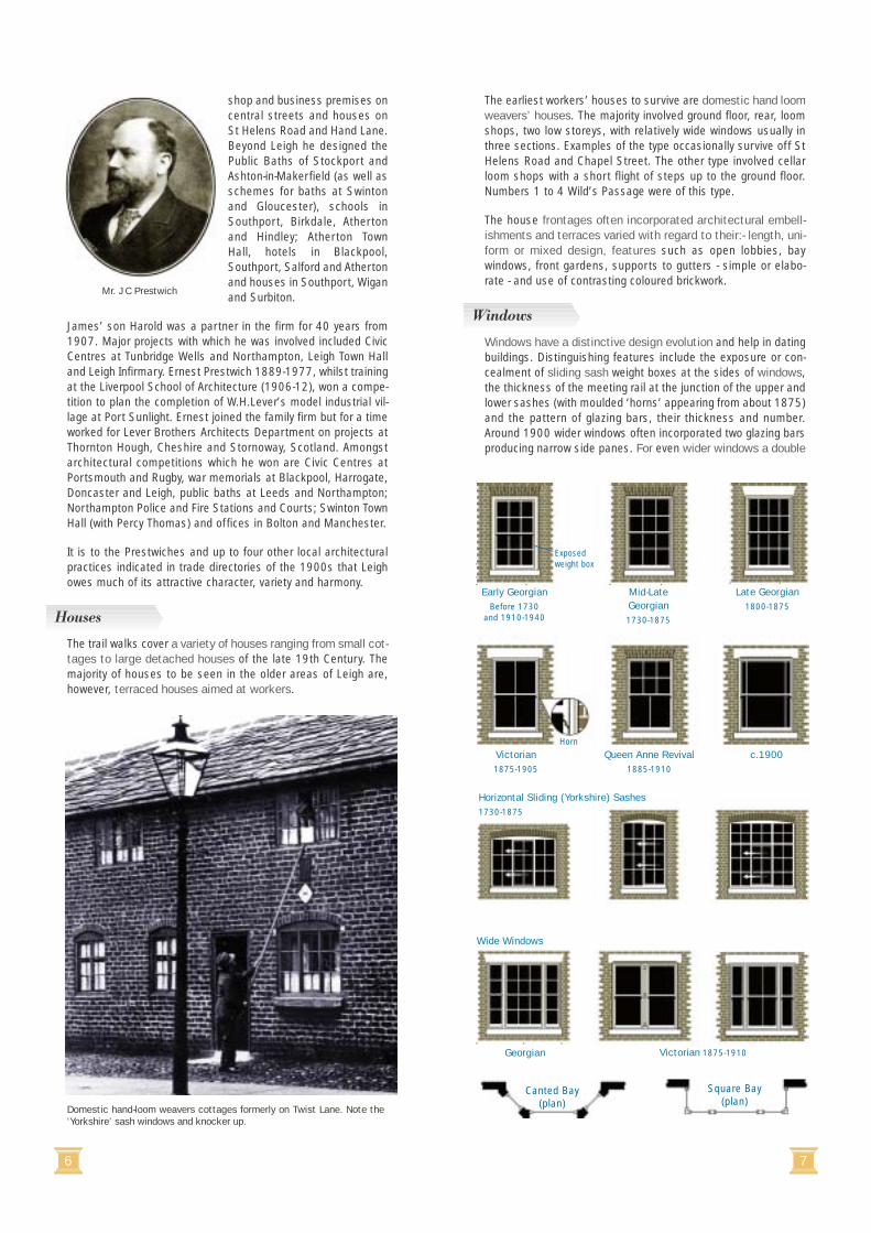
Look up and not only rich rooflines but also a wealth of orna-mental details will be seen, especially on Victorian andEdwardian buildings. Cornices, pilasters, capitals, finials, pat-terning, sculptured panels, pediments, keystones, windowframes, door features and, nearer the ground, decorative terra-cotta ventilators, provide plenty of visual interest, often in threedimensions, to delight the eye. They also play important rolessuch as breaking up the scale of large buildings or emphasisingentrances.
Amongst nationally significant architects whose works are repre-sented in Leigh are Sir Joseph Hansom who designed theHansom Cab, Birmingham Town Hall and St Joseph’s Church,Leigh; Paley and Austin were leading church architects andSt Peter’s at Westleigh and St Mary’s, Leigh are two of theirfinest. Bradshaw and Gass of Bolton who designed numerousmills and methodist missions and the Royal Exchange,Manchester, in Leigh, designed four mills as did J H Stott andSons of Oldham. Within this group of architects with widespreadpractices was the Leigh firm of J C Prestwich and Sons.
James Caldwell Prestwich was born at Atherton in 1852. AfterLeigh and Nantwich Grammar Schools, he trained in London andcommenced practice in Leigh in 1875, continuing until 1930.He was a Fellow of the Manchester Society of Architects. Hisworks in Leigh include the Central Buildings (Quality House)Bradshawgate, for the Leigh Friendly Co-operative Society; LeighTechnical School and Library, Leigh Town Hall, Leigh Infirmary,Leigh Public Baths, Leigh Union workhouse hospital, numerous
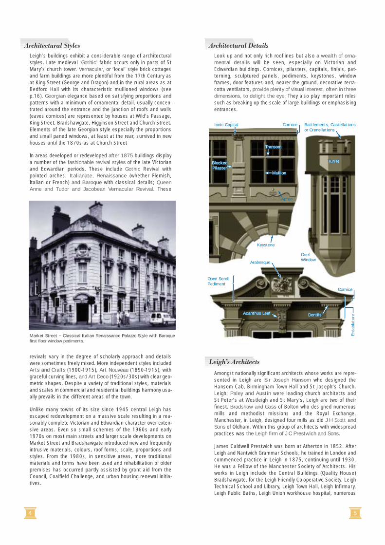
Leigh’s buildings exhibit a considerable range of architecturalstyles. Late medieval ‘Gothic’ fabric occurs only in parts of StMary’s church tower. Vernacular, or ‘local’ style brick cottagesand farm buildings are more plentiful from the 17th Century asat King Street (George and Dragon) and in the rural areas as atBedford Hall with its characteristic mullioned windows (seep.16). Georgian elegance based on satisfying proportions andpatterns with a minimum of ornamental detail, usually concen-trated around the entrance and the junction of roofs and walls(eaves cornices) are represented by houses at Wild’s Passage,King Street, Bradshawgate, Higginson Street and Church Street.Elements of the late Georgian style especially the proportionsand small paned windows, at least at the rear, survived in newhouses until the 1870s as at Church Street
In areas developed or redeveloped after 1875 buildings displaya number of the fashionable revival styles of the late Victorianand Edwardian periods. These include Gothic Revival withpointed arches, Italianate, Renaissance (whether Flemish,Italian or French) and Baroque with classical details; QueenAnne and Tudor and Jacobean Vernacular Revival. These
revivals vary in the degree of scholarly approach and detailswere sometimes freely mixed. More independent styles includedArts and Crafts (1900-1915), Art Nouveau (1890-1915), withgraceful curving lines, and Art Deco (1920s/30s) with clear geo-metric shapes. Despite a variety of traditional styles, materialsand scales in commercial and residential buildings harmony usu-ally prevails in the different areas of the town.
Unlike many towns of its size since 1945 central Leigh hasescaped redevelopment on a massive scale resulting in a rea-sonably complete Victorian and Edwardian character over exten-sive areas. Even so small schemes of the 1960s and early1970s on most main streets and larger scale developments onMarket Street and Bradshawgate introduced new and frequentlyintrusive materials, colours, roof forms, scale, proportions andstyles. From the 1980s, in sensitive areas, more traditionalmaterials and forms have been used and rehabilitation of olderpremises has occurred partly assisted by grant aid from theCouncil, Coalfield Challenge, and urban housing renewal initia-tives.
Cornice
Apron
Turret
Battlements, Castellationsor Crenellations
Transom
Mullion
OrielWindow
Keystone
Arabesque
Acanthus Leaf
Enta
blat
ure
Open ScrollPediment
Dentils
}
Cornice
}
BlockedPilaster
Ionic Capital
Turret
Transom
Mullion
Acanthus Leaf Dentils
BlockedPilaster
Market Street ~ Classical Italian Renaissance Palazzo Style with Baroquefirst floor window pediments.
Leigh’s Architects
Architectural DetailsArchitectural Styles
6 7
The earliest workers’ houses to survive are domestic hand loomweavers’ houses. The majority involved ground floor, rear, loomshops, two low storeys, with relatively wide windows usually inthree sections. Examples of the type occasionally survive off StHelens Road and Chapel Street. The other type involved cellarloom shops with a short flight of steps up to the ground floor.Numbers 1 to 4 Wild’s Passage were of this type.
The house frontages often incorporated architectural embell-ishments and terraces varied with regard to their:- length, uni-form or mixed design, features such as open lobbies, baywindows, front gardens, supports to gutters - simple or elabo-rate - and use of contrasting coloured brickwork.
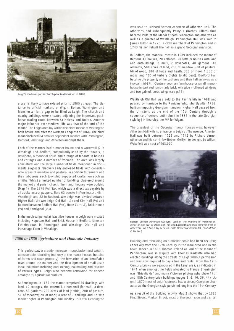
Windows have a distinctive design evolution and help in datingbuildings. Distinguishing features include the exposure or con-cealment of sliding sash weight boxes at the sides of windows,the thickness of the meeting rail at the junction of the upper andlower sashes (with moulded ‘horns’ appearing from about 1875)and the pattern of glazing bars, their thickness and number.Around 1900 wider windows often incorporated two glazing barsproducing narrow side panes. For even wider windows a double
shop and business premises oncentral streets and houses onSt Helens Road and Hand Lane.Beyond Leigh he designed thePublic Baths of Stockport andAshton-in-Makerfield (as well asschemes for baths at Swintonand Gloucester), schools inSouthport, Birkdale, Athertonand Hindley; Atherton TownHall, hotels in Blackpool,Southport, Salford and Athertonand houses in Southport, Wiganand Surbiton.
James’ son Harold was a partner in the firm for 40 years from1907. Major projects with which he was involved included CivicCentres at Tunbridge Wells and Northampton, Leigh Town Halland Leigh Infirmary. Ernest Prestwich 1889-1977, whilst trainingat the Liverpool School of Architecture (1906-12), won a compe-tition to plan the completion of W.H.Lever’s model industrial vil-lage at Port Sunlight. Ernest joined the family firm but for a timeworked for Lever Brothers Architects Department on projects atThornton Hough, Cheshire and Stornoway, Scotland. Amongstarchitectural competitions which he won are Civic Centres atPortsmouth and Rugby, war memorials at Blackpool, Harrogate,Doncaster and Leigh, public baths at Leeds and Northampton;Northampton Police and Fire Stations and Courts; Swinton TownHall (with Percy Thomas) and offices in Bolton and Manchester.
It is to the Prestwiches and up to four other local architecturalpractices indicated in trade directories of the 1900s that Leighowes much of its attractive character, variety and harmony.
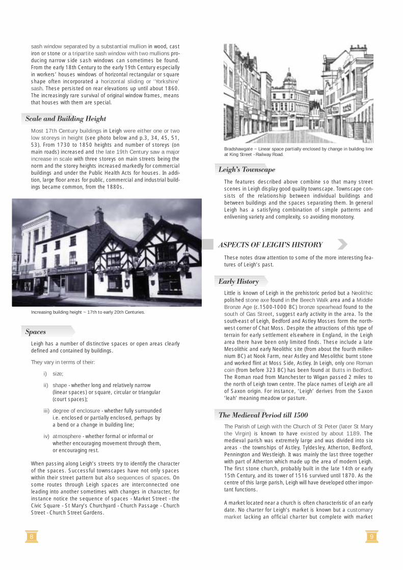
The trail walks cover a variety of houses ranging from small cot-tages to large detached houses of the late 19th Century. Themajority of houses to be seen in the older areas of Leigh are,however, terraced houses aimed at workers.
Domestic hand-loom weavers cottages formerly on Twist Lane. Note the‘Yorkshire’ sash windows and knocker up.
Horizontal Sliding (Yorkshire) Sashes1730-1875
Wide Windows
Georgian Victorian 1875-1910
Exposedweight box
Early GeorgianBefore 1730
and 1910-1940
Late Georgian1800-1875
Horn
Victorian1875-1905
Canted Bay(plan)
Square Bay(plan)
Mid-LateGeorgian1730-1875
c.1900Queen Anne Revival1885-1910
�
Mr. J C Prestwich
Houses
Windows
8 9
The features described above combine so that many streetscenes in Leigh display good quality townscape. Townscape con-sists of the relationship between individual buildings andbetween buildings and the spaces separating them. In generalLeigh has a satisfying combination of simple patterns andenlivening variety and complexity, so avoiding monotony.
These notes draw attention to some of the more interesting fea-tures of Leigh’s past.
Little is known of Leigh in the prehistoric period but a Neolithicpolished stone axe found in the Beech Walk area and a MiddleBronze Age (c.1500-1000 BC) bronze spearhead found to thesouth of Gas Street, suggest early activity in the area. To thesouth-east of Leigh, Bedford and Astley Mosses form the north-west corner of Chat Moss. Despite the attractions of this type ofterrain for early settlement elsewhere in England, in the Leigharea there have been only limited finds. These include a lateMesolithic and early Neolithic site (from about the fourth millen-nium BC) at Nook Farm, near Astley and Mesolithic burnt stoneand worked flint at Moss Side, Astley. In Leigh, only one Romancoin (from before 323 BC) has been found at Butts in Bedford.The Roman road from Manchester to Wigan passed 2 miles tothe north of Leigh town centre. The place names of Leigh are allof Saxon origin. For instance, ‘Leigh’ derives from the Saxon‘leah’ meaning meadow or pasture.
The Parish of Leigh with the Church of St Peter (later St Marythe Virgin) is known to have existed by about 1189. Themedieval parish was extremely large and was divided into sixareas - the townships of Astley, Tyldesley, Atherton, Bedford,Pennington and Westleigh. It was mainly the last three togetherwith part of Atherton which made up the area of modern Leigh.The first stone church, probably built in the late 14th or early15th Century, and its tower of 1516 survived until 1870. As thecentre of this large parish, Leigh will have developed other impor-tant functions.
A market located near a church is often characteristic of an earlydate. No charter for Leigh’s market is known but a customarymarket lacking an official charter but complete with market
sash window separated by a substantial mullion in wood, castiron or stone or a tripartite sash window with two mullions pro-ducing narrow side sash windows can sometimes be found.From the early 18th Century to the early 19th Century especiallyin workers’ houses windows of horizontal rectangular or squareshape often incorporated a horizontal sliding or ‘Yorkshire’sash. These persisted on rear elevations up until about 1860.The increasingly rare survival of original window frames, meansthat houses with them are special.
Most 17th Century buildings in Leigh were either one or twolow storeys in height (see photo below and p.3, 34, 45, 51,53). From 1730 to 1850 heights and number of storeys (onmain roads) increased and the late 19th Century saw a majorincrease in scale with three storeys on main streets being thenorm and the storey heights increased markedly for commercialbuildings and under the Public Health Acts for houses. In addi-tion, large floor areas for public, commercial and industrial build-ings became common, from the 1880s.
Leigh has a number of distinctive spaces or open areas clearlydefined and contained by buildings.
They vary in terms of their:
i) size;
ii) shape - whether long and relatively narrow (linear spaces) or square, circular or triangular (court spaces);
iii) degree of enclosure - whether fully surrounded i.e. enclosed or partially enclosed, perhaps by a bend or a change in building line;
iv) atmosphere - whether formal or informal or whether encouraging movement through them, or encouraging rest.
When passing along Leigh’s streets try to identify the characterof the spaces. Successful townscapes have not only spaceswithin their street pattern but also sequences of spaces. Onsome routes through Leigh spaces are interconnected oneleading into another sometimes with changes in character, forinstance notice the sequence of spaces - Market Street - theCivic Square - St Mary’s Churchyard - Church Passage - ChurchStreet - Church Street Gardens.
Increasing building height ~ 17th to early 20th Centuries.
Bradshawgate ~ Linear space partially enclosed by change in building lineat King Street - Railway Road.
Scale and Building Height
Spaces
Leigh’s Townscape
Early History
The Medieval Period till 1500
ASPECTS OF LEIGH’S HISTORY
10 11
was sold to Richard Vernon Atherton of Atherton Hall. TheAthertons and subsequently Powys’s (Barons Lilford) thusbecame lords of the Manor at both Pennington and Atherton aswell as a quarter of Westleigh. Pennington Hall was sold toJames Hilton in 1726, a cloth merchant of Pennington and in1748 his son rebuilt the hall as a grand Georgian mansion.
In Bedford, the manorial estate in 1589 included the manor ofBedford, 40 houses, 20 cottages, 20 tofts or houses with landand outbuildings, 2 mills, 2 dovecotes, 40 gardens, 40orchards, 500 acres of land, 200 of meadow, 500 of pasture,60 of wood, 200 of furze and heath, 300 of moor, 1,000 ofmoss and 100 of turbary (rights to dig peat). Bedford Hallbecame the property of the Lathoms and their hall survives as atypical mid-17th Century yeoman farmhouse or small manor-house in dark red hand-made brick with wide mullioned windowsand two gabled, cross wings (see p.16).
Westleigh Old Hall was sold to the Parr family in 1688 andpassed by marriage to the Ranicars who, shortly after 1756,built an imposing Georgian mansion. Higher Hall passed fromthe Urmstons at the end of the 17th Century through asequence of owners until rebuilt in 1832 in the late Georgianstyle by J H Kearsley, the MP for Wigan.
The grandest of the Georgian manor houses was, however,Atherton Hall with its entrance in Leigh at The Avenue. AthertonHall was built between 1723 and 1742 by Richard VernonAtherton and his son-in-law Robert Gwillym to designs by WilliamWakefield at a cost of £63,000.
Building and rebuilding on a smaller scale had been occurringespecially from the 17th Century in the rural area and in thetown. Indeed in 1606 Thomas Ireland as lord of the manor ofPennington, was in dispute with Thomas Radcliffe who haderected buildings along the streets of Leigh without permissionand was now required to pay a fine and rents. From the 17thCentury, bricks were produced in the Leigh area, as indicated in1641 when amongst the fields allocated to Francis Sherringtonwas “Brickfields” and many Victorian photographs show 17thand 18th Century brick buildings (pages 3, 6, 16, 36, 44). Upuntil 1870 most of Leigh’s streets had a strong Georgian char-acter as the Georgian style persisted long into the 19th Century.
As a result of this building activity, Map 2 shows that by 1825King Street, Market Street, most of the south side and a small
cross, is likely to have existed prior to 1500 at least. The dis-tance to official markets at Wigan, Bolton, Warrington andManchester left a gap to be filled at Leigh. The church andnearby buildings were situated adjoining the important pack-horse trading route between St Helens and Bolton. Anothermajor influence over medieval life was that of the lord of themanor. The Leigh area lay within the chief manor of Warringtonboth before and after the Norman Conquest of 1066. The chiefmanor included 34 smaller dependent manors with Pennington,Bedford, Westleigh and Atherton amongst them.
Each of the manors had a manor house and a watermill (2 inWestleigh and Bedford) compulsorily used by the tenants, adovecote, a manorial court and a range of tenants in housesand cottages and a number of freemen. The area was largelyagricultural and the large number of fields mentioned in docu-ments suggests relatively early enclosed fields with consider-able areas of meadow and pasture. In addition to farmers andtheir labourers each township supported craftsmen such assmiths. Whilst a limited number of buildings clustered aroundthe market and parish church, the manor houses were outlying(Map 1). The 1379 Poll Tax, which was a direct tax payable byall adults except paupers, lists 63 people in Pennington, 48 inWestleigh and 33 in Bedford. Westleigh was divided betweenHigher Hall (1⁄2) Westleigh Old Hall (1⁄4) and Kirk Hall (1⁄4) andBedford between Bedford Hall (7⁄16), Hope Carr (1⁄4), Brick House(1⁄4) and Sandypool (1⁄16).
In the medieval period at least five houses in Leigh were moatedincluding Hopecarr Hall and Brick House in Bedford, UrmstonI’th’Meadows in Pennington and Westleigh Old Hall andParsonage Farm in Westleigh.
This period saw a steady increase in population and wealth,considerable rebuilding (not only of the manor houses but alsoof farms and town property), the formation of an identifiabletown around the market and the development of small scalelocal industries including coal mining, nailmaking and textilesof various types. Leigh also became renowned for cheeseamongst its agricultural products.
At Pennington, in 1652 the manor comprised 40 dwellings withland, 40 cottages, the watermill, a horsemill (for malt), a dove-cote, 80 gardens, 200 acres of land (arable), 200 of pasture,50 of meadow, 20 of moor, a rent of 9 shillings and 6d withmarket rights in Pennington and Hindley. In 1726 Pennington
Leigh’s medieval parish church prior to demolition in 1870.
Robert Vernon Atherton Gwillym, Lord of the Manors of Pennington,Atherton and part of Westliegh, his wife Elizabeth and their family in front ofAtherton Hall 1745-6 by A Devis. (Yale Center for British Art, Paul MellonCollection).
1500 to 1830 Agriculture and Domestic Industry
12 13
encouraged by the high price of corn, marled and ploughed theirfarms, which had been grazed time immemorial; the consequencewas the plough soon wore them out, and left them poorer thanever”.
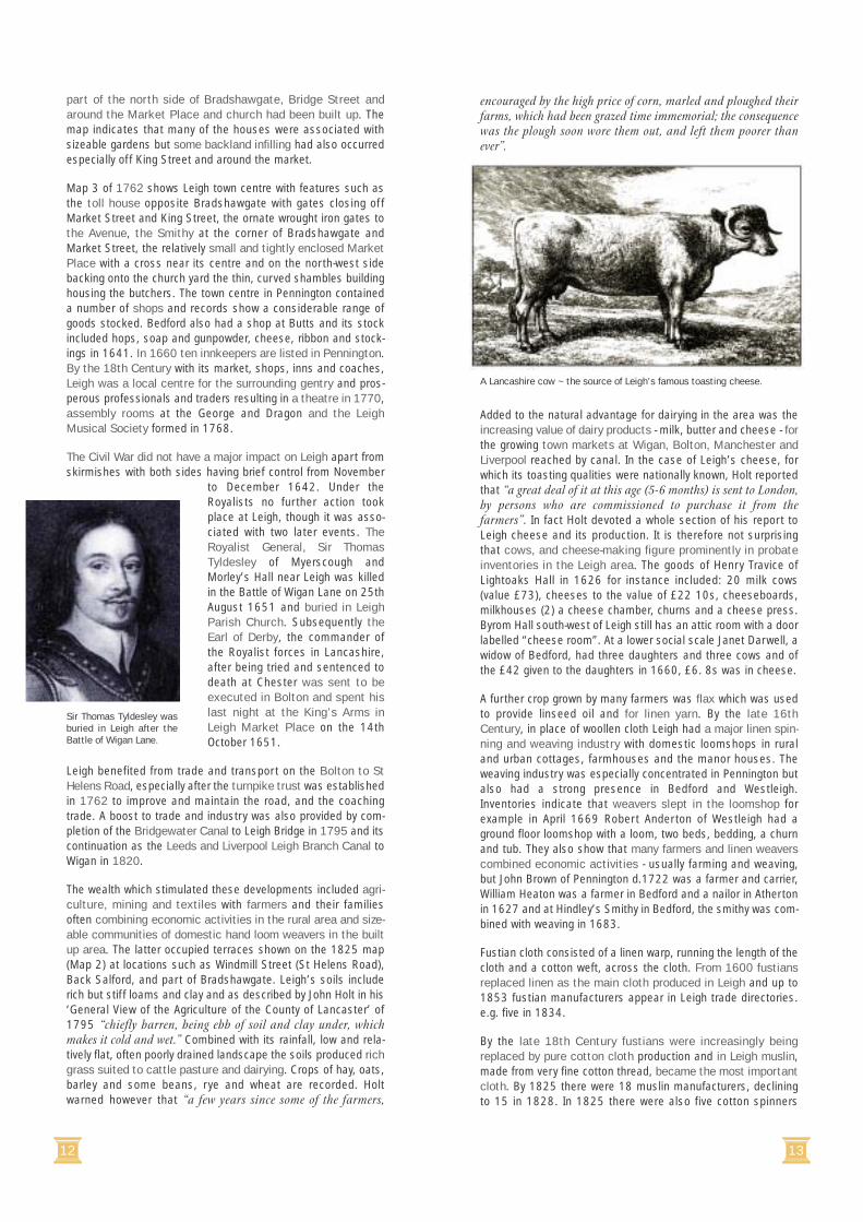
Added to the natural advantage for dairying in the area was theincreasing value of dairy products - milk, butter and cheese - forthe growing town markets at Wigan, Bolton, Manchester andLiverpool reached by canal. In the case of Leigh’s cheese, forwhich its toasting qualities were nationally known, Holt reportedthat “a great deal of it at this age (5-6 months) is sent to London,by persons who are commissioned to purchase it from thefarmers”. In fact Holt devoted a whole section of his report toLeigh cheese and its production. It is therefore not surprisingthat cows, and cheese-making figure prominently in probateinventories in the Leigh area. The goods of Henry Travice ofLightoaks Hall in 1626 for instance included: 20 milk cows(value £73), cheeses to the value of £22 10s, cheeseboards,milkhouses (2) a cheese chamber, churns and a cheese press.Byrom Hall south-west of Leigh still has an attic room with a doorlabelled “cheese room”. At a lower social scale Janet Darwell, awidow of Bedford, had three daughters and three cows and ofthe £42 given to the daughters in 1660, £6. 8s was in cheese.
A further crop grown by many farmers was flax which was usedto provide linseed oil and for linen yarn. By the late 16thCentury, in place of woollen cloth Leigh had a major linen spin-ning and weaving industry with domestic loomshops in ruraland urban cottages, farmhouses and the manor houses. Theweaving industry was especially concentrated in Pennington butalso had a strong presence in Bedford and Westleigh.Inventories indicate that weavers slept in the loomshop forexample in April 1669 Robert Anderton of Westleigh had aground floor loomshop with a loom, two beds, bedding, a churnand tub. They also show that many farmers and linen weaverscombined economic activities - usually farming and weaving,but John Brown of Pennington d.1722 was a farmer and carrier,William Heaton was a farmer in Bedford and a nailor in Athertonin 1627 and at Hindley’s Smithy in Bedford, the smithy was com-bined with weaving in 1683.
Fustian cloth consisted of a linen warp, running the length of thecloth and a cotton weft, across the cloth. From 1600 fustiansreplaced linen as the main cloth produced in Leigh and up to1853 fustian manufacturers appear in Leigh trade directories.e.g. five in 1834.
By the late 18th Century fustians were increasingly beingreplaced by pure cotton cloth production and in Leigh muslin,made from very fine cotton thread, became the most importantcloth. By 1825 there were 18 muslin manufacturers, decliningto 15 in 1828. In 1825 there were also five cotton spinners
part of the north side of Bradshawgate, Bridge Street andaround the Market Place and church had been built up. Themap indicates that many of the houses were associated withsizeable gardens but some backland infilling had also occurredespecially off King Street and around the market.
Map 3 of 1762 shows Leigh town centre with features such asthe toll house opposite Bradshawgate with gates closing offMarket Street and King Street, the ornate wrought iron gates tothe Avenue, the Smithy at the corner of Bradshawgate andMarket Street, the relatively small and tightly enclosed MarketPlace with a cross near its centre and on the north-west sidebacking onto the church yard the thin, curved shambles buildinghousing the butchers. The town centre in Pennington containeda number of shops and records show a considerable range ofgoods stocked. Bedford also had a shop at Butts and its stockincluded hops, soap and gunpowder, cheese, ribbon and stock-ings in 1641. In 1660 ten innkeepers are listed in Pennington.By the 18th Century with its market, shops, inns and coaches,Leigh was a local centre for the surrounding gentry and pros-perous professionals and traders resulting in a theatre in 1770,assembly rooms at the George and Dragon and the LeighMusical Society formed in 1768.
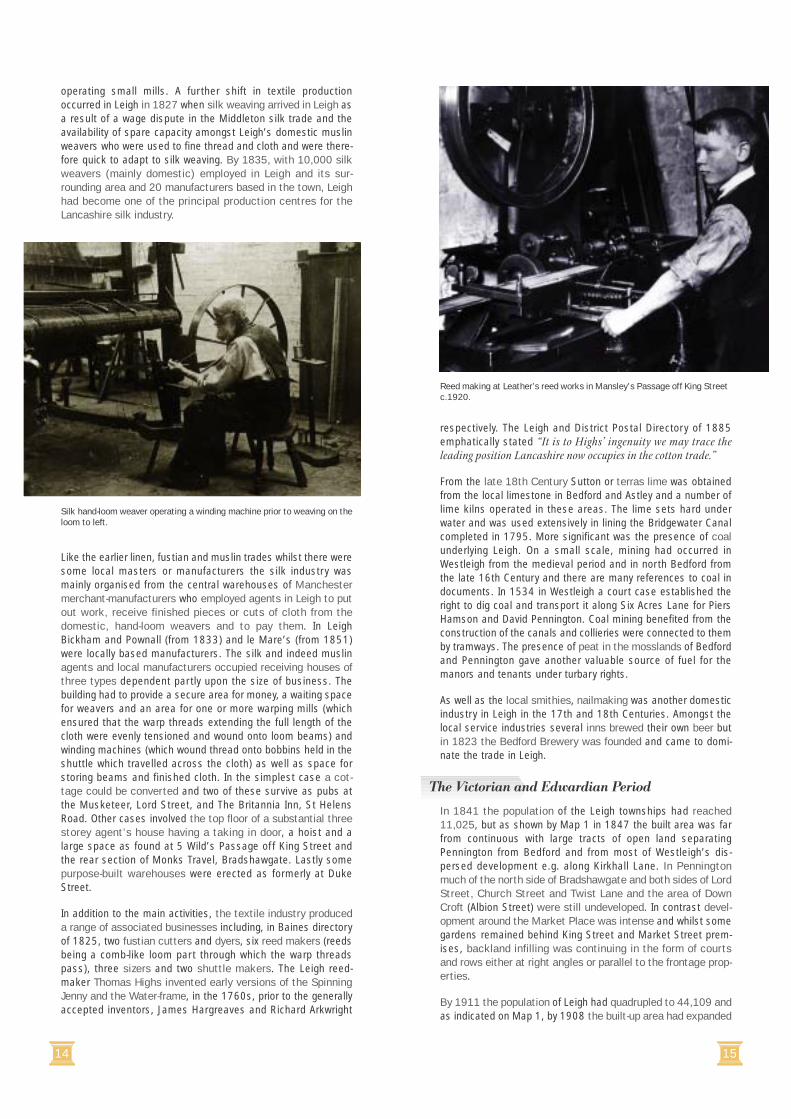
The Civil War did not have a major impact on Leigh apart fromskirmishes with both sides having brief control from November
to December 1642. Under theRoyalists no further action tookplace at Leigh, though it was asso-ciated with two later events. TheRoyalist General, Sir ThomasTyldesley of Myerscough andMorley’s Hall near Leigh was killedin the Battle of Wigan Lane on 25thAugust 1651 and buried in LeighParish Church. Subsequently theEarl of Derby, the commander ofthe Royalist forces in Lancashire,after being tried and sentenced todeath at Chester was sent to beexecuted in Bolton and spent hislast night at the King’s Arms inLeigh Market Place on the 14thOctober 1651.
Leigh benefited from trade and transport on the Bolton to StHelens Road, especially after the turnpike trust was establishedin 1762 to improve and maintain the road, and the coachingtrade. A boost to trade and industry was also provided by com-pletion of the Bridgewater Canal to Leigh Bridge in 1795 and itscontinuation as the Leeds and Liverpool Leigh Branch Canal toWigan in 1820.
The wealth which stimulated these developments included agri-culture, mining and textiles with farmers and their familiesoften combining economic activities in the rural area and size-able communities of domestic hand loom weavers in the builtup area. The latter occupied terraces shown on the 1825 map(Map 2) at locations such as Windmill Street (St Helens Road),Back Salford, and part of Bradshawgate. Leigh’s soils includerich but stiff loams and clay and as described by John Holt in his‘General View of the Agriculture of the County of Lancaster’ of1795 “chiefly barren, being ebb of soil and clay under, whichmakes it cold and wet.” Combined with its rainfall, low and rela-tively flat, often poorly drained landscape the soils produced richgrass suited to cattle pasture and dairying. Crops of hay, oats,barley and some beans, rye and wheat are recorded. Holtwarned however that “a few years since some of the farmers,
Sir Thomas Tyldesley wasburied in Leigh after theBattle of Wigan Lane.
A Lancashire cow ~ the source of Leigh’s famous toasting cheese.
14 15
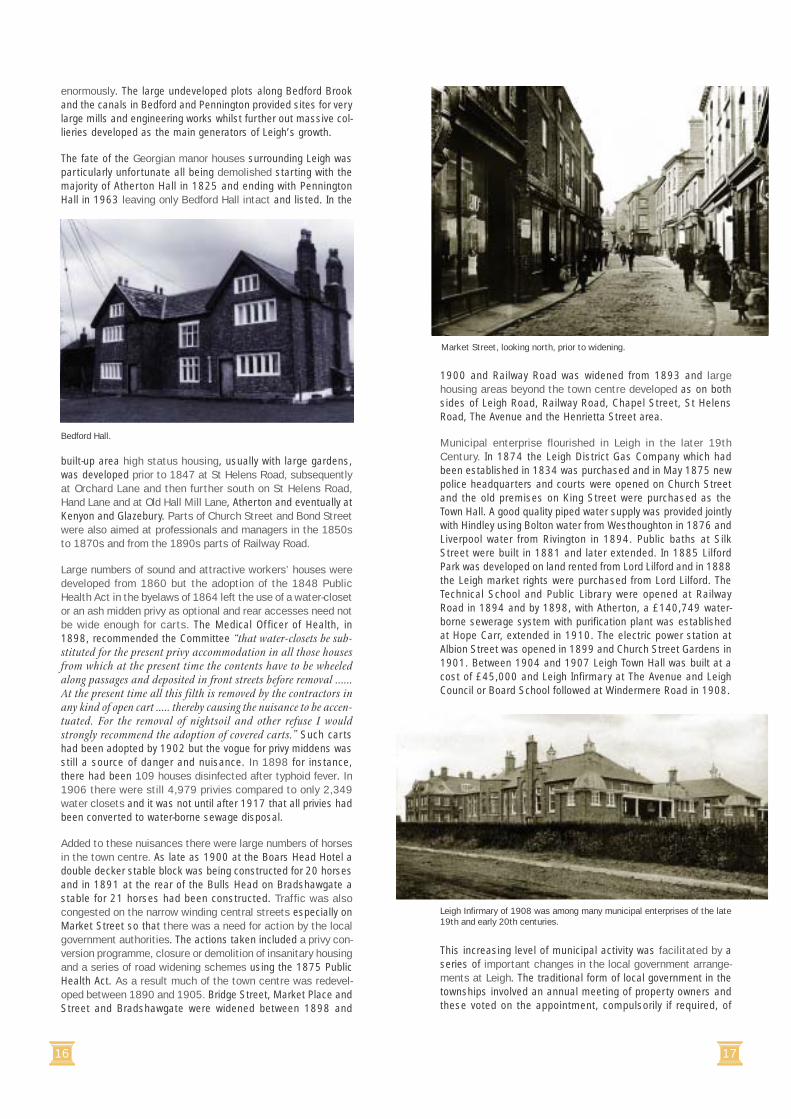
operating small mills. A further shift in textile productionoccurred in Leigh in 1827 when silk weaving arrived in Leigh asa result of a wage dispute in the Middleton silk trade and theavailability of spare capacity amongst Leigh’s domestic muslinweavers who were used to fine thread and cloth and were there-fore quick to adapt to silk weaving. By 1835, with 10,000 silkweavers (mainly domestic) employed in Leigh and its sur-rounding area and 20 manufacturers based in the town, Leighhad become one of the principal production centres for theLancashire silk industry.
Like the earlier linen, fustian and muslin trades whilst there weresome local masters or manufacturers the silk industry wasmainly organised from the central warehouses of Manchestermerchant-manufacturers who employed agents in Leigh to putout work, receive finished pieces or cuts of cloth from thedomestic, hand-loom weavers and to pay them. In LeighBickham and Pownall (from 1833) and le Mare’s (from 1851)were locally based manufacturers. The silk and indeed muslinagents and local manufacturers occupied receiving houses ofthree types dependent partly upon the size of business. Thebuilding had to provide a secure area for money, a waiting spacefor weavers and an area for one or more warping mills (whichensured that the warp threads extending the full length of thecloth were evenly tensioned and wound onto loom beams) andwinding machines (which wound thread onto bobbins held in theshuttle which travelled across the cloth) as well as space forstoring beams and finished cloth. In the simplest case a cot-tage could be converted and two of these survive as pubs atthe Musketeer, Lord Street, and The Britannia Inn, St HelensRoad. Other cases involved the top floor of a substantial threestorey agent’s house having a taking in door, a hoist and alarge space as found at 5 Wild’s Passage off King Street andthe rear section of Monks Travel, Bradshawgate. Lastly somepurpose-built warehouses were erected as formerly at DukeStreet.
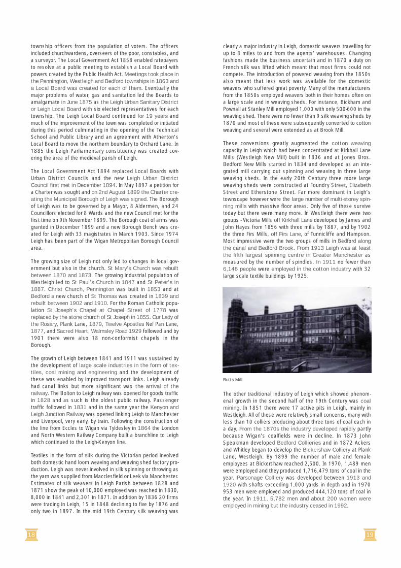
In addition to the main activities, the textile industry produceda range of associated businesses including, in Baines directoryof 1825, two fustian cutters and dyers, six reed makers (reedsbeing a comb-like loom part through which the warp threadspass), three sizers and two shuttle makers. The Leigh reed-maker Thomas Highs invented early versions of the SpinningJenny and the Water-frame, in the 1760s, prior to the generallyaccepted inventors, James Hargreaves and Richard Arkwright
respectively. The Leigh and District Postal Directory of 1885emphatically stated “It is to Highs’ ingenuity we may trace theleading position Lancashire now occupies in the cotton trade.”
From the late 18th Century Sutton or terras lime was obtainedfrom the local limestone in Bedford and Astley and a number oflime kilns operated in these areas. The lime sets hard underwater and was used extensively in lining the Bridgewater Canalcompleted in 1795. More significant was the presence of coalunderlying Leigh. On a small scale, mining had occurred inWestleigh from the medieval period and in north Bedford fromthe late 16th Century and there are many references to coal indocuments. In 1534 in Westleigh a court case established theright to dig coal and transport it along Six Acres Lane for PiersHamson and David Pennington. Coal mining benefited from theconstruction of the canals and collieries were connected to themby tramways. The presence of peat in the mosslands of Bedfordand Pennington gave another valuable source of fuel for themanors and tenants under turbary rights.
As well as the local smithies, nailmaking was another domesticindustry in Leigh in the 17th and 18th Centuries. Amongst thelocal service industries several inns brewed their own beer butin 1823 the Bedford Brewery was founded and came to domi-nate the trade in Leigh.
In 1841 the population of the Leigh townships had reached11,025, but as shown by Map 1 in 1847 the built area was farfrom continuous with large tracts of open land separatingPennington from Bedford and from most of Westleigh’s dis-persed development e.g. along Kirkhall Lane. In Penningtonmuch of the north side of Bradshawgate and both sides of LordStreet, Church Street and Twist Lane and the area of DownCroft (Albion Street) were still undeveloped. In contrast devel-opment around the Market Place was intense and whilst somegardens remained behind King Street and Market Street prem-ises, backland infilling was continuing in the form of courtsand rows either at right angles or parallel to the frontage prop-erties.
By 1911 the population of Leigh had quadrupled to 44,109 andas indicated on Map 1, by 1908 the built-up area had expanded
Silk hand-loom weaver operating a winding machine prior to weaving on theloom to left.
Reed making at Leather’s reed works in Mansley’s Passage off King Streetc.1920.
The Victorian and Edwardian Period
16 17
enormously. The large undeveloped plots along Bedford Brookand the canals in Bedford and Pennington provided sites for verylarge mills and engineering works whilst further out massive col-lieries developed as the main generators of Leigh’s growth.
The fate of the Georgian manor houses surrounding Leigh wasparticularly unfortunate all being demolished starting with themajority of Atherton Hall in 1825 and ending with PenningtonHall in 1963 leaving only Bedford Hall intact and listed. In the
built-up area high status housing, usually with large gardens,was developed prior to 1847 at St Helens Road, subsequentlyat Orchard Lane and then further south on St Helens Road,Hand Lane and at Old Hall Mill Lane, Atherton and eventually atKenyon and Glazebury. Parts of Church Street and Bond Streetwere also aimed at professionals and managers in the 1850sto 1870s and from the 1890s parts of Railway Road.
Large numbers of sound and attractive workers’ houses weredeveloped from 1860 but the adoption of the 1848 PublicHealth Act in the byelaws of 1864 left the use of a water-closetor an ash midden privy as optional and rear accesses need notbe wide enough for carts. The Medical Officer of Health, in1898, recommended the Committee “that water-closets be sub-stituted for the present privy accommodation in all those housesfrom which at the present time the contents have to be wheeledalong passages and deposited in front streets before removal ......At the present time all this filth is removed by the contractors inany kind of open cart ..... thereby causing the nuisance to be accen-tuated. For the removal of nightsoil and other refuse I wouldstrongly recommend the adoption of covered carts.” Such cartshad been adopted by 1902 but the vogue for privy middens wasstill a source of danger and nuisance. In 1898 for instance,there had been 109 houses disinfected after typhoid fever. In1906 there were still 4,979 privies compared to only 2,349water closets and it was not until after 1917 that all privies hadbeen converted to water-borne sewage disposal.
Added to these nuisances there were large numbers of horsesin the town centre. As late as 1900 at the Boars Head Hotel adouble decker stable block was being constructed for 20 horsesand in 1891 at the rear of the Bulls Head on Bradshawgate astable for 21 horses had been constructed. Traffic was alsocongested on the narrow winding central streets especially onMarket Street so that there was a need for action by the localgovernment authorities. The actions taken included a privy con-version programme, closure or demolition of insanitary housingand a series of road widening schemes using the 1875 PublicHealth Act. As a result much of the town centre was redevel-oped between 1890 and 1905. Bridge Street, Market Place andStreet and Bradshawgate were widened between 1898 and
1900 and Railway Road was widened from 1893 and largehousing areas beyond the town centre developed as on bothsides of Leigh Road, Railway Road, Chapel Street, St HelensRoad, The Avenue and the Henrietta Street area.
Municipal enterprise flourished in Leigh in the later 19thCentury. In 1874 the Leigh District Gas Company which hadbeen established in 1834 was purchased and in May 1875 newpolice headquarters and courts were opened on Church Streetand the old premises on King Street were purchased as theTown Hall. A good quality piped water supply was provided jointlywith Hindley using Bolton water from Westhoughton in 1876 andLiverpool water from Rivington in 1894. Public baths at SilkStreet were built in 1881 and later extended. In 1885 LilfordPark was developed on land rented from Lord Lilford and in 1888the Leigh market rights were purchased from Lord Lilford. TheTechnical School and Public Library were opened at RailwayRoad in 1894 and by 1898, with Atherton, a £140,749 water-borne sewerage system with purification plant was establishedat Hope Carr, extended in 1910. The electric power station atAlbion Street was opened in 1899 and Church Street Gardens in1901. Between 1904 and 1907 Leigh Town Hall was built at acost of £45,000 and Leigh Infirmary at The Avenue and LeighCouncil or Board School followed at Windermere Road in 1908.
This increasing level of municipal activity was facilitated by aseries of important changes in the local government arrange-ments at Leigh. The traditional form of local government in thetownships involved an annual meeting of property owners andthese voted on the appointment, compulsorily if required, of
Bedford Hall.
Market Street, looking north, prior to widening.
Leigh Infirmary of 1908 was among many municipal enterprises of the late19th and early 20th centuries.
18 19
township officers from the population of voters. The officersincluded churchwardens, overseers of the poor, constables, anda surveyor. The Local Government Act 1858 enabled ratepayersto resolve at a public meeting to establish a Local Board withpowers created by the Public Health Act. Meetings took place inthe Pennington, Westleigh and Bedford townships in 1863 anda Local Board was created for each of them. Eventually themajor problems of water, gas and sanitation led the Boards toamalgamate in June 1875 as the Leigh Urban Sanitary Districtor Leigh Local Board with six elected representatives for eachtownship. The Leigh Local Board continued for 19 years andmuch of the improvement of the town was completed or initiatedduring this period culminating in the opening of the TechnicalSchool and Public Library and an agreement with Atherton’sLocal Board to move the northern boundary to Orchard Lane. In1885 the Leigh Parliamentary constituency was created cov-ering the area of the medieval parish of Leigh.
The Local Government Act 1894 replaced Local Boards withUrban District Councils and the new Leigh Urban DistrictCouncil first met in December 1894. In May 1897 a petition fora Charter was sought and on 2nd August 1899 the Charter cre-ating the Municipal Borough of Leigh was signed. The Boroughof Leigh was to be governed by a Mayor, 8 Aldermen, and 24Councillors elected for 8 Wards and the new Council met for thefirst time on 9th November 1899. The Borough coat of arms wasgranted in December 1899 and a new Borough Bench was cre-ated for Leigh with 33 magistrates in March 1903. Since 1974Leigh has been part of the Wigan Metropolitan Borough Councilarea.
The growing size of Leigh not only led to changes in local gov-ernment but also in the church. St Mary’s Church was rebuiltbetween 1870 and 1873. The growing industrial population ofWestleigh led to St Paul’s Church in 1847 and St Peter’s in1887. Christ Church, Pennington was built in 1853 and atBedford a new church of St Thomas was created in 1839 andrebuilt between 1902 and 1910. For the Roman Catholic popu-lation St Joseph’s Chapel at Chapel Street of 1778 wasreplaced by the stone church of St Joseph in 1855. Our Lady ofthe Rosary, Plank Lane, 1879, Twelve Apostles Nel Pan Lane,1877, and Sacred Heart, Walmsley Road 1929 followed and by1901 there were also 18 non-conformist chapels in theBorough.
The growth of Leigh between 1841 and 1911 was sustained bythe development of large scale industries in the form of tex-tiles, coal mining and engineering and the development ofthese was enabled by improved transport links. Leigh alreadyhad canal links but more significant was the arrival of therailway. The Bolton to Leigh railway was opened for goods trafficin 1828 and as such is the oldest public railway. Passengertraffic followed in 1831 and in the same year the Kenyon andLeigh Junction Railway was opened linking Leigh to Manchesterand Liverpool, very early, by train. Following the construction ofthe line from Eccles to Wigan via Tyldesley in 1864 the Londonand North Western Railway Company built a branchline to Leighwhich continued to the Leigh-Kenyon line.
Textiles in the form of silk during the Victorian period involvedboth domestic hand loom weaving and weaving shed factory pro-duction. Leigh was never involved in silk spinning or throwing asthe yarn was supplied from Macclesfield or Leek via Manchester.Estimates of silk weavers in Leigh Parish between 1828 and1871 show the peak of 10,000 employed was reached in 1830,8,000 in 1841 and 2,301 in 1871. In addition by 1836 20 firmswere trading in Leigh, 15 in 1848 declining to five by 1876 andonly two in 1897. In the mid 19th Century silk weaving was
clearly a major industry in Leigh, domestic weavers travelling forup to 8 miles to and from the agents’ warehouses. Changingfashions made the business uncertain and in 1870 a duty onFrench silk was lifted which meant that most firms could notcompete. The introduction of powered weaving from the 1850salso meant that less work was available for the domesticweavers who suffered great poverty. Many of the manufacturersfrom the 1850s employed weavers both in their homes often ona large scale and in weaving sheds. For instance, Bickham andPownall at Stanley Mill employed 1,000 with only 500-600 in theweaving shed. There were no fewer than 9 silk weaving sheds by1870 and most of these were subsequently converted to cottonweaving and several were extended as at Brook Mill.
These conversions greatly augmented the cotton weavingcapacity in Leigh which had been concentrated at Kirkhall LaneMills (Westleigh New Mill) built in 1836 and at Jones Bros.Bedford New Mills started in 1834 and developed as an inte-grated mill carrying out spinning and weaving in three largeweaving sheds. In the early 20th Century three more largeweaving sheds were constructed at Foundry Street, ElizabethStreet and Etherstone Street. Far more dominant in Leigh’stownscape however were the large number of multi-storey spin-ning mills with massive floor areas. Only five of these survivetoday but there were many more. In Westleigh there were twogroups - Victoria Mills off Kirkhall Lane developed by James andJohn Hayes from 1856 with three mills by 1887, and by 1902the three Firs Mills, off Firs Lane, of Tunnicliffe and Hampson.Most impressive were the two groups of mills in Bedford alongthe canal and Bedford Brook. From 1913 Leigh was at leastthe fifth largest spinning centre in Greater Manchester asmeasured by the number of spindles. In 1911 no fewer than6,146 people were employed in the cotton industry with 32large scale textile buildings by 1925.
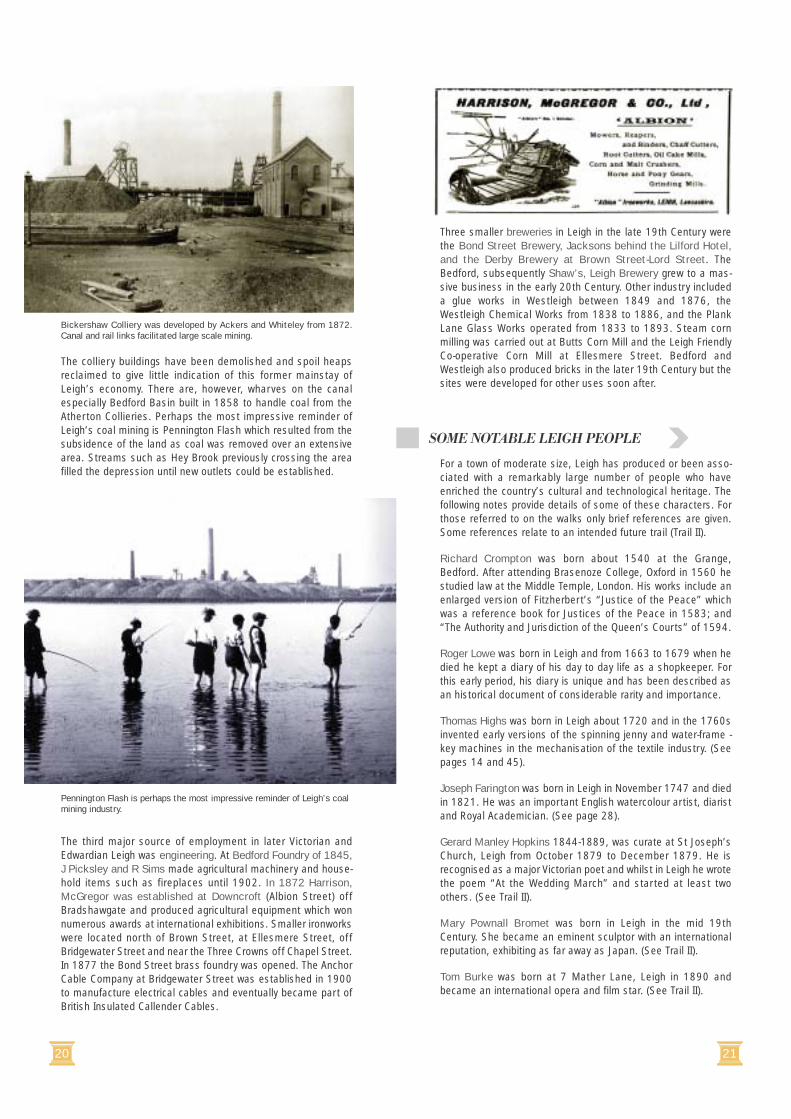
The other traditional industry of Leigh which showed phenom-enal growth in the second half of the 19th Century was coalmining. In 1851 there were 17 active pits in Leigh, mainly inWestleigh. All of these were relatively small concerns, many withless than 10 colliers producing about three tons of coal each ina day. From the 1870s the industry developed rapidly partlybecause Wigan’s coalfields were in decline. In 1873 JohnSpeakman developed Bedford Collieries and in 1872 Ackersand Whitley began to develop the Bickershaw Colliery at PlankLane, Westleigh. By 1899 the number of male and femaleemployees at Bickershaw reached 2,500. In 1970, 1,489 menwere employed and they produced 1,716,479 tons of coal in theyear. Parsonage Colliery was developed between 1913 and1920 with shafts exceeding 1,000 yards in depth and in 1970953 men were employed and produced 444,120 tons of coal inthe year. In 1911, 5,782 men and about 200 women wereemployed in mining but the industry ceased in 1992.
Butts Mill.
20 21
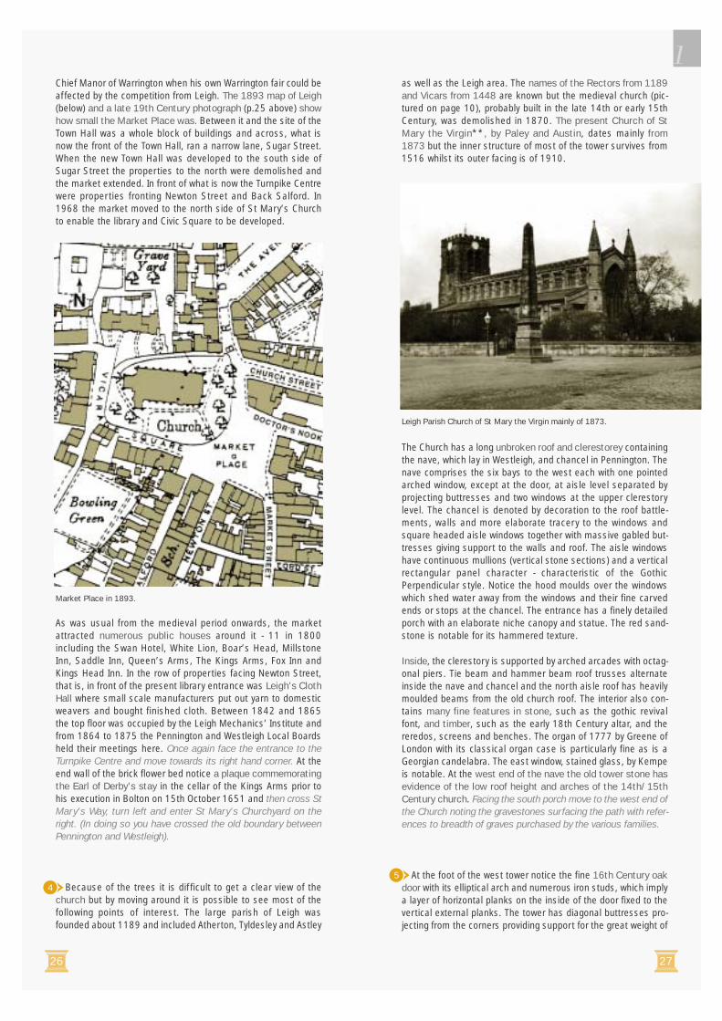
The colliery buildings have been demolished and spoil heapsreclaimed to give little indication of this former mainstay ofLeigh’s economy. There are, however, wharves on the canalespecially Bedford Basin built in 1858 to handle coal from theAtherton Collieries. Perhaps the most impressive reminder ofLeigh’s coal mining is Pennington Flash which resulted from thesubsidence of the land as coal was removed over an extensivearea. Streams such as Hey Brook previously crossing the areafilled the depression until new outlets could be established.
The third major source of employment in later Victorian andEdwardian Leigh was engineering. At Bedford Foundry of 1845,J Picksley and R Sims made agricultural machinery and house-hold items such as fireplaces until 1902. In 1872 Harrison,McGregor was established at Downcroft (Albion Street) offBradshawgate and produced agricultural equipment which wonnumerous awards at international exhibitions. Smaller ironworkswere located north of Brown Street, at Ellesmere Street, offBridgewater Street and near the Three Crowns off Chapel Street.In 1877 the Bond Street brass foundry was opened. The AnchorCable Company at Bridgewater Street was established in 1900to manufacture electrical cables and eventually became part ofBritish Insulated Callender Cables.
Three smaller breweries in Leigh in the late 19th Century werethe Bond Street Brewery, Jacksons behind the Lilford Hotel,and the Derby Brewery at Brown Street-Lord Street. TheBedford, subsequently Shaw’s, Leigh Brewery grew to a mas-sive business in the early 20th Century. Other industry includeda glue works in Westleigh between 1849 and 1876, theWestleigh Chemical Works from 1838 to 1886, and the PlankLane Glass Works operated from 1833 to 1893. Steam cornmilling was carried out at Butts Corn Mill and the Leigh FriendlyCo-operative Corn Mill at Ellesmere Street. Bedford andWestleigh also produced bricks in the later 19th Century but thesites were developed for other uses soon after.
For a town of moderate size, Leigh has produced or been asso-ciated with a remarkably large number of people who haveenriched the country’s cultural and technological heritage. Thefollowing notes provide details of some of these characters. Forthose referred to on the walks only brief references are given.Some references relate to an intended future trail (Trail II).
Richard Crompton was born about 1540 at the Grange,Bedford. After attending Brasenoze College, Oxford in 1560 hestudied law at the Middle Temple, London. His works include anenlarged version of Fitzherbert’s “Justice of the Peace” whichwas a reference book for Justices of the Peace in 1583; and“The Authority and Jurisdiction of the Queen’s Courts” of 1594.
Roger Lowe was born in Leigh and from 1663 to 1679 when hedied he kept a diary of his day to day life as a shopkeeper. Forthis early period, his diary is unique and has been described asan historical document of considerable rarity and importance.
Thomas Highs was born in Leigh about 1720 and in the 1760sinvented early versions of the spinning jenny and water-frame -key machines in the mechanisation of the textile industry. (Seepages 14 and 45).
Joseph Farington was born in Leigh in November 1747 and diedin 1821. He was an important English watercolour artist, diaristand Royal Academician. (See page 28).
Gerard Manley Hopkins 1844-1889, was curate at St Joseph’sChurch, Leigh from October 1879 to December 1879. He isrecognised as a major Victorian poet and whilst in Leigh he wrotethe poem “At the Wedding March” and started at least twoothers. (See Trail II).
Mary Pownall Bromet was born in Leigh in the mid 19thCentury. She became an eminent sculptor with an internationalreputation, exhibiting as far away as Japan. (See Trail II).
Tom Burke was born at 7 Mather Lane, Leigh in 1890 andbecame an international opera and film star. (See Trail II).
Pennington Flash is perhaps the most impressive reminder of Leigh’s coalmining industry.
Bickershaw Colliery was developed by Ackers and Whiteley from 1872.Canal and rail links facilitated large scale mining.
SOME NOTABLE LEIGH PEOPLE
1
22 23
The walk starts outside Leigh Town Hall, ** the symbol ofLeigh’s civic pride following its incorporation as a MunicipalBorough in August 1899, and close to St Mary’s Church andMarket Place, the heart of the townships of Pennington,Westleigh and Bedford and the medieval Parish of Leigh. Standfar enough back to view the front of the Town Hall (1904-1907J C Prestwich). It cost approximately £45,000 to build and uses
Darley Dale stone with a pale green Westmorland slate roof. Itis a fine example of the Edwardian Baroque style with classicalarchitectural features used in a monumental manner. The largesymmetrical section centred on the entrance porch, has ahipped roof surmounted by a large turrett with pediments anddome. The section is framed by two characteristic “giant-order”pilasters or projecting vertical features extending from groundlevel to the roof cornice. Between the pilasters are seven sec-tions or bays each with a window, separated by giant columnswith Ionic capitals. The columns are “blocked” with alternatingoctagonal and round sections. Of the seven first floor windowsthe two to the left light a committee room and the remainderlight the Council Chamber. The ground floor is far more solidand plainer apart from the elaborate entrance porch with paired,blocked columns having Ionic order capitals at the top. Above
Leigh Town Hall by J C Prestwich.
James Hilton was born at 26 Wilkinson Street, Leigh in 1900.Two of his outstanding novels were “Goodbye, Mr Chips” and“Lost Horizon” which led to successful films. (See page 37).
Lord Alan Bullock (born 1914) moved to 716, Leigh Road,Leigh, in 1915 when his father was Minister at the Twist LaneUnitarian Chapel. He was the Founding Master (1960-80) of StCatherine’s College, Oxford, and subsequently Vice Chancellorof Oxford University. His books include “Hitler: A Study inTyranny”(1952), “The Humanist Tradition in the West” (1985)and “Hitler and Stalin: Parallel Lives” (1991). He has beenChairman of the Trustees of the Tate Gallery, London.
Sir Peter Maxwell Davies, although born in Salford, was edu-cated at Leigh Grammar School between 1945-53. As one ofthe foremost composers of the post-war period, he has over 200published works including four operas, two full length ballets and56 orchestral works.
Pete Morgan was born in Leigh in 1939 and is recognised asone of the best English social poets with collections publishedregularly since 1968. Some of his poems have been set tomusic and recorded and he has written and presented televisionseries.
Philip Larkin (1922-1985) the leading post war poet and nov-elist, descended on his mother’s side from the Day family wholived at 13 The Avenue, Leigh (See Trail II).
Georgie Fame was born in Leigh in 1943 and as Clive Powelllived at 5 Cotton Street, Westleigh. Georgie Fame gained suc-cess as a singer, pianist and composer and achieved No.1 inthe “pop” hit parade several times in the 1960s, e.g. “TheBallad of Bonnie and Clyde” and at least once displaced theBeatles from top of the hit parade. He later worked with AlanPryce and in the 1990s with Van Morrison.
Ronnie Taylor 1921-1979 was born at 159 Hope Street, Leigh,and became a leading radio and television producer andscriptwriter and Head of Light Entertainment for ABC (ITV)Weekend Television. (See Trail II).
Professor R W Brunskill OBE was born in Lowton and subse-quently lived in Leigh and through his teaching and numerousbooks has greatly raised the level of recognition and apprecia-tion of vernacular i.e. traditional local architecture. He is aformer Commissioner of English Heritage and was ViceChairman of the Royal Commission on the Ancient and HistoricalMonuments of Wales. His books have become standard refer-ences including: The Illustrated Handbook of VernacularArchitecture (1971) and Brick Building in Britain (1990).
WALK ONEMarket Place andRailway Road
Numbers refer to observationpoints on Map 4 after Page 67.
Start at Leigh Civic Square,facing Leigh Town Hall.
The Walk lasts 2 1/2 hours- it can be varied to suitindividual needs.
Route directions are in italics.
Dates and names in brackets arethose of the building and architect.
** Buildings Listed as of SpecialArchitectural or Historic Interest.
1

24 25
To the west is a modern building,the Turnpike Centre (1971J C Prestwich and Sons) which con-tains Leigh Library, an art galleryand a meeting room. Originally atheatre was also planned. TheTurnpike Centre is a strikingbuilding which, despite its rein-forced-concrete frame and pre-fabricated concrete panelledwalls, presents a relatively highlevel of three dimensionalinterest and texture. The deeplytextured relief sculpture abovethe entrance was by a leadingsculptor of the period, WilliamMitchell. With your back to theTurnpike Centre entrance a littleto the left is a stone obelisk.Move towards this.
The obelisk ** was erected in 1762 by Robert Vernon AthertonGwillym of Atherton Hall and Lord of the Manors of Atherton andPennington. Obelisks originated in Egypt but placing them onpedestals was a Roman and Renaissance practice, perhapsadopted by Atherton after a ‘grand’ tour or from engravings.Robert Atherton erected a similar obelisk in Atherton MarketPlace. The obelisk base may comprise stones from the base ofthe medieval Market Cross. The upper portion has marks left bystreet lighting brackets attached around 1900. The obelisk hasbeen moved and rebuilt twice (in 1859 and 1986). The obeliskand earlier cross had been an important location in communitylife as public announcements were usually made there. Forinstance the Riot Act was read here at the time of the ‘LeytheFight’, in 1839, when troops charged 1000 protesters who wereattempting to shut mills as part of a campaign to extend votingrights (in 1863 only 450 of the 5015 population of Penningtoncould vote). In 1881 when a miners’ strike occurred which lastedfor 28 weeks, despite the reading of the Riot Act at the obelisk,15,000 people marched along Church Street and a detachmentof the 12th Hussars were sent to the neighbourhood to preventdisorder breaking out.
Originally the obelisk was located in the road space now occu-pied by St Mary’s Way at its junction with Market Place. This wasthe centre of the small Market Place complete with butchers’shambles along the churchyard wall facing the Market. It wasalso the location of Leigh’s two annual cattle and trading fairsone of which, in 1581 caused a dispute with the Lord of the
these is a semi-circular pediment with a deeply sculptured coatof arms of the Borough. The quarterings of the shield contain aspearhead (from the Urmstons of Westleigh), a mullet - the starshape (from the Bradshaw’s of Pennington), a shuttle (from theShuttleworth’s of Sandypool, Bedford) and a sparrowhawk (fromthe Atherton’s crest of Atherton). The crest above with a bear’spaw clutching a spear combines symbols of the Powys family(Lord Lilford) and the Urmstons of Westleigh. The motto “Aequopede propera” or “hasten with equal foot” means “to makeprogress steadily”.
The additional full height sec-tion of the front to the far leftcontains a glazed door to asecond committee room withan open segmental pedimentabove and a balcony. Noticethe scrolled brackets withacanthus leaves and therichly carved figure sup-porting the balcony. At the lefthand corner is a prominent,octagonal corner turrettspringing from a carved baseand rising tower-like to adome. Notice the fine castand wrought iron classical
railings and gates. Inside is a sequence of high quality interiorsincluding the classical entrance hall with scagliola (imitationmarble) columns, an impressive “imperial” staircase, and theCouncil Chamber, committee rooms and Mayor’s Parlour withtheir fine plasterwork, woodwork and glass. The fixtures and fur-niture were designed by Prestwich. When open it is well worthlooking inside and see if the keepers can show any of the grand,first floor rooms. The original Spinning Jenny tiled picture is pre-served in the entrance hall. Go to the left hand corner of theTown Hall and turn right into Market Street. Taking care, as faras possible, look up at the stone facade to Market Street.
The main features of the Market Street facade of the TownHall are the large gables with massive cornices at both ends,four giant order pilasters and a small projecting oriel window atthe centre. The end sections include elaborate oriel windowswith blocked attached columns and to the right a circular bull’seye window, with an elaborate carved surround in the gable.Supporting the oriel windows notice the carved corbel brackets.The ground floor is occupied by a row of nine shops separatedby massive, rusticated (grooved) piers. From the corner the firstfour have inappropriate modern shop fronts but the next fourshop fronts are original and display fine detailing, especially inthe deep recesses, including classical and Art Nouveau carving.Notice also the finely turned corner posts or mullions. Many ofthe fascia signs to the shops are over-deep but two units haveappropriate shallow signs. Return to the Civic Square and standnear the middle of the space.
This is a court type space being almost square in shape andsuccessfully enclosed by the Town Hall, the Turnpike Centre andSt Mary’s Church and its trees. Unfortunately the east side isunenclosed though the bank at the corner of Lord Street and theadjoining shop unit hint at the character of the historic streetand enclosure. In 1986 the removal of concrete flags andreplacement with clay brick paving (paviors) together withseating and tree planting greatly enhanced the square.
Leigh Municipal Boroughcoat of arms.
Turnpike Centreentrance sculpture.
Leigh’s medieval Market Place in 1883 ~ Doctor’s Nook is at upper left and StMary’s Way at bottom right. Showing former enclosure at east side.
2
3
1
1
26 27
as well as the Leigh area. The names of the Rectors from 1189and Vicars from 1448 are known but the medieval church (pic-tured on page 10), probably built in the late 14th or early 15thCentury, was demolished in 1870. The present Church of StMary the Virgin**, by Paley and Austin, dates mainly from1873 but the inner structure of most of the tower survives from1516 whilst its outer facing is of 1910.
The Church has a long unbroken roof and clerestorey containingthe nave, which lay in Westleigh, and chancel in Pennington. Thenave comprises the six bays to the west each with one pointedarched window, except at the door, at aisle level separated byprojecting buttresses and two windows at the upper clerestorylevel. The chancel is denoted by decoration to the roof battle-ments, walls and more elaborate tracery to the windows andsquare headed aisle windows together with massive gabled but-tresses giving support to the walls and roof. The aisle windowshave continuous mullions (vertical stone sections) and a verticalrectangular panel character - characteristic of the GothicPerpendicular style. Notice the hood moulds over the windowswhich shed water away from the windows and their fine carvedends or stops at the chancel. The entrance has a finely detailedporch with an elaborate niche canopy and statue. The red sand-stone is notable for its hammered texture.
Inside, the clerestory is supported by arched arcades with octag-onal piers. Tie beam and hammer beam roof trusses alternateinside the nave and chancel and the north aisle roof has heavilymoulded beams from the old church roof. The interior also con-tains many fine features in stone, such as the gothic revivalfont, and timber, such as the early 18th Century altar, and thereredos, screens and benches. The organ of 1777 by Greene ofLondon with its classical organ case is particularly fine as is aGeorgian candelabra. The east window, stained glass, by Kempeis notable. At the west end of the nave the old tower stone hasevidence of the low roof height and arches of the 14th/15thCentury church. Facing the south porch move to the west end ofthe Church noting the gravestones surfacing the path with refer-ences to breadth of graves purchased by the various families.
At the foot of the west tower notice the fine 16th Century oakdoor with its elliptical arch and numerous iron studs, which implya layer of horizontal planks on the inside of the door fixed to thevertical external planks. The tower has diagonal buttresses pro-jecting from the corners providing support for the great weight of
Chief Manor of Warrington when his own Warrington fair could beaffected by the competition from Leigh. The 1893 map of Leigh(below) and a late 19th Century photograph (p.25 above) showhow small the Market Place was. Between it and the site of theTown Hall was a whole block of buildings and across, what isnow the front of the Town Hall, ran a narrow lane, Sugar Street.When the new Town Hall was developed to the south side ofSugar Street the properties to the north were demolished andthe market extended. In front of what is now the Turnpike Centrewere properties fronting Newton Street and Back Salford. In1968 the market moved to the north side of St Mary’s Churchto enable the library and Civic Square to be developed.
As was usual from the medieval period onwards, the marketattracted numerous public houses around it - 11 in 1800including the Swan Hotel, White Lion, Boar’s Head, MillstoneInn, Saddle Inn, Queen’s Arms, The Kings Arms, Fox Inn andKings Head Inn. In the row of properties facing Newton Street,that is, in front of the present library entrance was Leigh’s ClothHall where small scale manufacturers put out yarn to domesticweavers and bought finished cloth. Between 1842 and 1865the top floor was occupied by the Leigh Mechanics’ Institute andfrom 1864 to 1875 the Pennington and Westleigh Local Boardsheld their meetings here. Once again face the entrance to theTurnpike Centre and move towards its right hand corner. At theend wall of the brick flower bed notice a plaque commemoratingthe Earl of Derby’s stay in the cellar of the Kings Arms prior tohis execution in Bolton on 15th October 1651 and then cross StMary’s Way, turn left and enter St Mary’s Churchyard on theright. (In doing so you have crossed the old boundary betweenPennington and Westleigh).
Because of the trees it is difficult to get a clear view of thechurch but by moving around it is possible to see most of thefollowing points of interest. The large parish of Leigh wasfounded about 1189 and included Atherton, Tyldesley and Astley
Leigh Parish Church of St Mary the Virgin mainly of 1873.
Market Place in 1893.
45

1
28 29
figure in the Academy his support and advice were sought bymany younger artists, including Constable. He also wrote a biog-raphy of Sir Joshua Reynolds. His diaries, kept from 1793 untilhis death in 1821, record, in intimate detail, much of the lifeand politics of the Royal Academy and London society in whichhe moved at the highest levels. The 16 volumes of the diarieshave a rich character and are an invaluable research source forthe period.
To the right of the vicarage across a former narrow lane stoodVicarage Farm. Today in the distance the rich roofline of theformer Leigh Girls Grammar School can be seen. Pass out of thechurchyard and turn right and almost immediately right againinto Church Passage and walk along the north side of the churchto near the far end.
At the left side of Church Passage, at its end, stood LeighGrammar School which had been founded about 1578 fromwhen its head teachers are known. Various endowments in theearly 17th Century established it as a free school. A new schoolwas built on the site in 1719 and eventually collapsed in 1919,after the school had relocated in 1889. Its site together with aburial ground, established in 1828 and used until 1856, andother land were used for a new market hall and outdoor marketin 1968. In 1880 the Leigh Journal had pressed for a coveredmarket to be built at the time of the opening of Leigh bazaar onRailway Road but it was almost 90 years before the hall wasconstructed. In order to build the market hall, 7000 bodies hadto be exhumed from the Parish Graveyard. The market closed in1989 when it was transferred to a new hall at Albion Street withbetter access from the main shopping areas. On the right handside of Church Way notice the stone building projecting from StMary’s Church - the vestry of 1910 by Austin and Paley. Nearthe end on the low wall to the right notice the commemorativeplaque recording the Grammar School and then turn right intothe churchyard.
The east end of the church reveals the form of the church withcentral chancel and lean-to aisles traditionally occupied by theAtherton Chapel on the south and Tyldesley Chapel on the north.This end is dominated by two octagonal turrets with pinnacles atthe sides of the chancel end and a massive perpendicular gothicwindow. Notice the cusped rectangular panels produced by thetracery. Now return to the pavement at the end of Church Way.
stone. The parapet at roof level is again battlemented. St Mary’sis a particularly good example of Paley and Austin’s work.
The short road running past the west end formed part ofVicarage Square. Looking across it to the left is Leigh Vicarage(1959 D Buckler) which is a relatively small, neo-Georgian,double fronted house in light red brick. Notice the vertical slidingsash windows with Georgian glazing bars and the wide timbersections at the side (exposed weight boxes) slightly recessed -typical of early Georgian windows. The Vicarage has been in thisvicinity from 1448 when the post of vicar replaced that of rectorand a vicarage of 16 marks yearly with a tenement was ordainedand separated from the former rectory at Kirk Hall. In 1771 thevicar, John Barlow, built a new vicarage part of which can beseen next to the church tower in the photograph of the oldchurch on page 10. The house and the farmland forming theglebe land belonging to the vicar are described in a document of1789:-
“The Vicarage House is 16 yds. in front and 12 yds. broad, waslately rebuilt by the Revd. John Barlow the late vicar with brick andcovered with slate is 3 storeys high and contains 6 rooms on a floorthe ground floors are laid with flags and the upper rooms with daleboards 2 front parlours the stair case and 2 upper rooms are ceiledwith plaster and the walls hung with paper all the other rooms areceiled and the walls plastered with lime mortar the outhousingconsists of 1 building 17 yds. long and 7 yds. broad is built withbrick and covered with thatch.
The Glebe consists of 2 small estates of inclosed land the Quantityof land on the whole is 15 acres and a half..... the first estate con-tains 8 acres..... is inclosed with quickset hedge and is chieflymeadow and pasture land is bounded on the east and north sidesby the road leading from Leigh to Wigan.... the other estate (dis-tant about half a mile) contains 7 acres and a half..... has adwelling house upon it built likewise by the said Revd.John Barlowwith brick and covered with thatch is enclosed with quickset hedgesis chiefly meadow and pasture land..... There are no orchards,woods or underwoods upon the glebe or any right of commoningbelong to it at the Vicarage House there is a small convenient backyard and garden containing about 20 perches fenced in withquick-set hedges there are no valuable timber trees upon the glebethey being cut down and made use of in rebuilding the VicarageHouse in the year of our Lord 1772.”
The Glebe included the land north of the vicarage to Kirk HallLane and until 1890 it remained largely undeveloped. A map of1907 still showed extensive “Church Fields”. Between 1734and 1767 William Farington was Vicar of Leigh and his sonJoseph Farington was born in Leigh in 1747. Joseph Faringtonis recognised as a nationally significant artist and diarist andwas a leading member of the Royal Academy. At 16 he was sentto London to train under the major landscape painter RichardWilson and in 1768 he became one of the original students atthe Royal Academy Schools. He went on to become a successfultopographical artist making tours, producing drawings and water-colours and some of these were reproduced as engravings oraquatints and published in collections such as “Views of theCities and Towns in England and Wales” of 1790, “A History ofthe River Thames” of 1794/6, “Britannia Depicta” of 1806 and“Britannia Magna” 1818. Farington specialised in tone and lineand using pencil, ink and, often, grey washes produced land-scapes of great serenity and strength. His paintings todayappear in all the great national collections such as the Victoriaand Albert Museum and the Queen’s Collection. JosephFarington was elected to membership of the Royal Academy in1785 and although he did not hold any major posts he was amember of its Council and influential committees. As a leading
View of Lancaster by Joseph Farington from “Views of the Lakes inCumberland and Westmorland” 1789.
6
1
30 31
Across the yard notice the L shaped building** which is adouble decker stable block for 20 horses with stable boyaccommodation and tackle rooms. Notice the long ramp withsett surface providing horse access to the upper stables. Suchbuildings were quite common in densely developed urban areasand indeed Leigh had another off Brown Street South (demol-ished) but only a few survive nationally today.
Cross Doctor’s Nook and walk along Market Place and MarketStreet and stop at the junction with Lord Street on the leftnoticing the railings and brick wall to the car park giving someenclosure to the street on the way.
The bank on the corner built in the early 20th Century is agood example of neo-Georgian architecture - notice the upperwindow frames and brickwork and the fan-light over the entrancedoor and the classical cornices projecting above the ground andsecond floor windows - all typical of the style. The white stone isPortland Limestone which has easily seen shell fragments.Notice the horizontal grooves between courses of stone (rusti-cation) and the punched, rock-faced stone plinth at the basesuggesting strength and stability on which the bank is built. Lookacross Market Street and note the full view of both sides of theTown Hall and how well the corner turret “turns” and holds thecorner whilst linking two differently designed facades. Prior tothe Town Hall, Sugar Street continued the line of Lord Street toNewton Street. Turn left and proceed along Lord Street to thepelican crossing and use it to reach the corner with Union Street.
Look diagonally across Lord Street to the relatively low, redbrick Musketeer Public House. The 1840 Pennington Rate Bookshows four silk receiving warehouses of the cottage type (seePage 14), where domestic silk weavers brought their cloth andreceived payment and warp beams and yarn from agents,located between Union Street and Hope Street (next street alongLord Street) and one of these was later occupied by TheVolunteer and subsequently the Musketeer Inn. The Lord Street- Union Street area was earlier Folly Field. Now return along LordStreet to Market Street and turn left, pass the Town Hall andstop opposite a group of three shop units (Cook’s / Eye).
Look across the main road towards Church Street and to its rightnotice the Boar’s Head Hotel** (1900) with its extensive use ofhighly decorative terracotta. It is one of the most flamboyantbuildings in Leigh especially in relation to the first floor Ioniccolumns, terminated at parapet level by ball finials, and thethree oriel windows to Market Place. At the Church Street cornerthe tower with bull’s eye window within an elaborate cartouchesurmounted by a cupola on columns and scrolls demands atten-tion. Decorative gables are a feature of all three elevations asare the rounded ground floor windows with a frieze above. Thebuilding on the opposite corner, despite being relatively plain,forms an effective corner feature. Now turn left and cross LeighRoad at the pelican crossing and then turn right and proceed toChurch Street. (Another trail will explore Leigh Road, The Avenueand Windermere Road).
From this point look closer at the terracotta and other detailsof the Boar’s Head across Church Street, especially the chimneystack, gable with a boar’s head peering through an ornatearabesque sculpture and the first floor mullion and transom win-dows with aprons beneath terminated by swags. Now crossChurch Street to Market Place and look at the front elevation ofthe Boar’s Head. Notice the curved oriel window with reededbase above the main entrance, the strapwork decoration infillingthe corners above the entrance arch and decorative ventilatorgrilles. BB stands for the Bedford Brewing and Malting Company.This was the brewery’s “flagship” public house and breweryoffices and the board room occupied part of the upper floor. Atthe end of the building cross Doctor’s Nook and look back tonote the gable and to the left the date plaque (cartouche) com-plete with boar’s head relief sculpture. Much of the interior isintact and worth a visit. Overall the style is eclectic or mixed withbaroque three dimensional complexity, Flemish Renaissancecorner tower and strapwork and French Renaissance classicaldetails.
Prior to major road widening in 1900 the previous Boar’s Headbuilding erected in the early 19th Century projected out into theroad much more and formed the northern side of Market Place.(See map on page 26). Additional uses housed in the buildingincluded the Pennington Manorial Court Leet and rent office andMagistrates Clerks’ offices. Theatrical performances occurredin a barn at the rear. Re-cross Doctor’s Nook to the gate at therear of the Boar’s Head.
The Boar’s Head Hotel of 1900.
The old Boar’s Head about 1890 facing Market Place. Note the narrow roadand irregular building lines beyond Market Place.
7
9
10
8