TOWN OF MILTON -...
15
CITY OF SOUTH BURLINGTON DEVELOPMENT REVIEW BOARD CU_14_07_333VanSicklenRd_Tonaquint_Aug19_mtg DEPARTMENT OF PLANNING & ZONING Report preparation date: August 14, 2014 Application received: 5/22/14 AGENDA ITEM #5 Tonaquint, Inc. - 333 Van Sicklen Road Conditional Use Application #CU-14-07 Meeting date: August 19, 2014 Applicants/Owners Tonaquint, Inc. Attn: Carolyn Bever 333 Van Sicklen Road South Burlington, VT 05403 Property Information Tax Parcel IDs Southeast Quadrant District Natural Resource Protection District Floodplain Overlay District PROJECT DESCRIPTION Conditional use application #CU-14-07 of Tonaquint, Inc. for a project consisting of: 1) constructing a 1,039 sq. ft. detached accessory residential unit, and 2) allowing a new single family dwelling and the accessory residential unit to encroach into a wetland buffer, 333 Van Sicklen Road.
Transcript of TOWN OF MILTON -...

CITY OF SOUTH BURLINGTON DEVELOPMENT REVIEW BOARD CU_14_07_333VanSicklenRd_Tonaquint_Aug19_mtg
DEPARTMENT OF PLANNING & ZONING Report preparation date: August 14, 2014 Application received: 5/22/14
AGENDA ITEM #5
Tonaquint, Inc. - 333 Van Sicklen Road
Conditional Use Application #CU-14-07
Meeting date: August 19, 2014
Applicants/Owners Tonaquint, Inc. Attn: Carolyn Bever 333 Van Sicklen Road South Burlington, VT 05403
Property Information Tax Parcel IDs Southeast Quadrant District Natural Resource Protection District Floodplain Overlay District
PROJECT DESCRIPTION Conditional use application #CU-14-07 of Tonaquint, Inc. for a project consisting of: 1) constructing a 1,039 sq. ft. detached accessory residential unit, and 2) allowing a new single family dwelling and the accessory residential unit to encroach into a wetland buffer, 333 Van Sicklen Road.

CITY OF SOUTH BURLINGTON 2 DEPARTMENT OF
DEVELOPMENT REVIEW BOARD PLANNING & ZONING CU_14_07_333VanSicklenRd_Tonaquint
COMMENTS Administrative Officer Ray Belair and Planner Temporary Assignment Dan Albrecht have reviewed the plans submitted on May 22, 2014 and August 12, and offer the following comments. This project is subject to review under the LDRs covering the Southeast Quadrant, Natural Resource Protection Area, Floodplain Overlay District, and Section 14.10 conditional uses. Normally, this project could be reviewed solely by the Administrative Officer however, the proposed project intrudes into a Class II Wetland Buffer and also includes construction of new accessory residential unit, both of which require DRB review. Zoning District & Dimensional Requirements:
SEQ-NRP Zoning District Required Existing Proposed
Min. Lot Size 24,000 sq. ft. for two dwelling units
385,070.4 sq. ft. 385,070.4 sq. ft.
Max. Building Coverage 15% 0.6% 3.8%
Max. Overall Coverage 30% 3.7% 12.7%
Min. Front Setback 20 ft. >> 20 ft. >> 20 ft.
Min. Side Setback 10 ft. >> 10 ft. >> 10 ft.
Min. Rear Setback 30 ft. >> 30 ft. >> 30 ft.
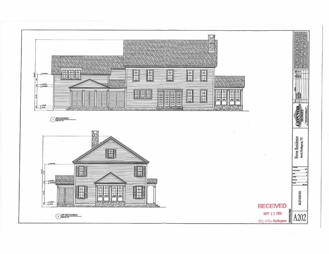
Max. Building Height 25/28 ft. unknown 28 ft. main house, 15’ cottage
Zoning compliance
SOUTHEAST QUADRANT – SEQ: Applicable Regulations
9.12 SEQ-NRP; Supplemental Regulations B. A lot that was in existence on or before June 22, 1992 and which lies substantially or entirely within a SEQ-NRP sub-district may be improved with one or more single family detached dwelling units, subject to conditional use review and the following supplemental standards:
(1) Where the lot is less than fifteen (15) acres in size, the Development Review Board may permit no more than one (1) single family dwelling unit only if:
(a) The portion of the lot in any other (non-NRP) SEQ sub-district is insufficient to accommodate the construction and use of a single family dwelling unit in compliance with these Regulations, and;
(b) The location of structures, yards, and access drives have no portion within a designated primary natural community or its related buffer.
This criterion is met. There is no portion of the lot outside the NRP SEQ subdistrict. No structures, yards or access drives are within a designated primary natural community or its related buffer.

CITY OF SOUTH BURLINGTON 3 DEPARTMENT OF
DEVELOPMENT REVIEW BOARD PLANNING & ZONING CU_14_07_333VanSicklenRd_Tonaquint
9.13 SEQ Review and Approval Process A. Single family residences and two-family residences on a single existing lot are specifically excluded from the review provisions of Section 9.13 of this article. All other development is subject to the provisions presented below. This criterion is met. 3.10 Accessory Structures and Uses A. General Requirements. Customary accessory structures and uses are allowed in all districts, as specifically regulated in that district, under the provisions that follow below.
(1) On lots of less than one (1) acre in size, no more than two (2) accessory structures, including a detached private garage, shall be permitted per principal structure. On lots used primarily for agricultural uses and lots that are one (1) acre or greater in size, more than two (2) accessory structures shall be permitted provided all applicable limitations on coverage and setbacks in these Regulations are met.
(2) Accessory structures, if detached from a principal structure, shall not be placed in the front yard, and they shall not, if placed in a side yard, be located closer to the street than the required front setback of the principal structure.
(3) Accessory structures shall be located a minimum of five (5) feet from all side and rear lot lines.
(4) On corner lots, accessory structures shall not be located on the side street side between the side street and the required front setback line of structures fronting on the side street.
(5) When an accessory structure is attached to a principal structure, it shall comply in all respects with the requirements of these regulations applicable to the principal structure(s).
(6) Accessory structures shall comply with front yard requirements for the principal structure to which they are accessory.
(7) Any structure connected to another structure by an open breezeway shall be deemed to be a separate structure.
(8) The total square footage of all accessory structures shall not exceed fifty percent (50%) of the first or ground floor of the principal structures, with the exception of in-ground pools, tennis courts, and other similar structures at grade level, which shall not be counted towards the maximum square footage of accessory structures.
(9) The footprint of the accessory structure(s) shall be included in the computation of lot coverage, except for ramps and other structures for use by the disabled, which in the sole discretion of the Administrative Officer are consistent with the purpose of providing such access and do not constitute a de facto expansion of decks, porches, etc.
(10) No accessory structure shall be constructed with a cellar or below-grade story.
(11) No part of any such accessory structure shall be designed or used for sleeping purposes, and no cooking facilities shall be placed or permitted in any part of such accessory structure unless such structure is a duly approved location of an accessory residential unit.

CITY OF SOUTH BURLINGTON 4 DEPARTMENT OF
DEVELOPMENT REVIEW BOARD PLANNING & ZONING CU_14_07_333VanSicklenRd_Tonaquint
Criteria (1) – (11) but excluding (8) are met.
1. With regards to (8), as currently proposed, the total square footage of all accessory structures is 1,385 s.f. for the cottage unit plus approximately 192 s.f. for the existing shed indicated on the plans. This totals 1,577 s.f. which is 56% of the 2,795 s.f. footprint of the principal structure.
Staff has contacted the applicant’s engineer who has indicated they will consult with the owners about the possibility of removing the shed from the property. If this were done, the percentage would drop to 49.55% which would make the project compliant with this standard.
B. Poolhouse. Any accessory structure designed as a poolhouse shall be located no farther than fifteen (15) feet from the swimming pool to which it shall be accessory. Not applicable. C. Attached Garage. A private garage may be constructed as part of a main structure, provided that when so constructed the garage walls shall be regarded as the walls of the main building in applying the applicable front, side, and rear yard requirements of this chapter. Not applicable. D. Accessory Retail Uses. Where non-residential uses are permitted in a residential district, uses such as hospitals, clubs, and multi-family buildings over fifty (50) dwelling units, such uses may conduct customary and appropriate retail activities such as gift shops, cafeterias, fitness rooms, and snack shops. Such uses shall be conducted within the principal structure. There shall be no external evidence of retail activity discernible from the outside of the structure. Access to the retail activity shall only be from within the principal structure. Not applicable. E. Accessory Residential Units. One (1) accessory residential unit constructed within or attached to a primary single-family dwelling or within an existing, permitted accessory structure shall be a permitted single family use, in accordance with the following criteria:
(1) Floor space of the accessory residential unit shall not exceed thirty percent (30%) of the total habitable area of the single-family dwelling unit.
This criterion is met. The unit’s floor space is 1,039 ft. The total habitable area of the single-family home is 3,744 ft.
(2) The principal dwelling shall be owner-occupied.
This criterion is met. The owner has indicated they will reside in the principal dwelling. This is a unique situation in that the property owner is a corporation. It must be established that at least one (1) of the owners of the corporation will reside in the principal unit. A related issue is that this corporation is not currently registered with the Secretary of State’s Office.
2. The applicant has provided a copy of a deed transferring the ownership of this property to 333 V.S. Road, L. P. The only information missing at this time is a copy of the partnership agreement to show that the principal residence will be occupied by someone who is a partner in the L.P. The Board should discuss whether it wants to continue the hearing until that information is part of the record.
CITY OF SOUTH BURLINGTON 5 DEPARTMENT OF
DEVELOPMENT REVIEW BOARD PLANNING & ZONING CU_14_07_333VanSicklenRd_Tonaquint
(3) The accessory dwelling unit shall be an efficiency or one-bedroom unit.
This criterion is met.
(4) Adequate wastewater capacity is available to service the accessory unit, as demonstrated by issuance of a Wastewater Allocation or on-site wastewater permit pursuant to the South Burlington Ordinance Regulating the use of Public and Private Sanitary Sewerage and Stormwater Systems.
This criterion is met. The applicant’s are connecting the accessory unit to the City’s wastewater system.
(5) Two (2) additional off-street parking spaces shall be provided on the same lot, either in a garage or in a driveway, and not in any areas required to meet coverage limitations, or any front yard area other than a driveway, required by these Regulations.
This criterion is met. One (1) space will be in the garage and the other space will be nearby to the cottage.
(6) If occupancy of the unit is to be restricted in the deed of the single-family home to a disabled person, no additional off-street parking is required.
Not applicable.
(7) A zoning permit shall be required for each accessory residential unit.
The applicant’s proposal, if granted, will meet this criterion.
Conditional Use Review by the Development Review Board pursuant to Article 14, Section 14.10 shall be required if the establishment of the accessory residential unit involves the construction of a new accessory structure, an increase in the height or floor area of the existing single-family dwelling or existing accessory structure, or an increase in the dimensions of the off-street parking areas (i.e. garages and driveway areas) presently existing on the site. 10.01 FLOOD PLAIN OVERLAY DISTRICT While according to the application, this property lies within the Floodplain Overlay District (FP), none of the following standards should apply. The reason is that the owner filed for, and was granted, a “LOMA “(Letter of Map Amendment) in July 2008 from FEMA. The LOMA established a 100 year floodplain elevation of 322.5 ft. in the area proposed for construction. The basement floor elevation of the main house was established at 324.0 ft. and the first floor elevation of the cottage was established at 332.0 ft. Therefore, the structures themselves will be located in “Zone C”. This is a non-restricted zone that lies above and outside of the 100-year flood hazard zone (the standard regulated flood zone) and the 500-year flood hazard zone (which is not always regulated elsewhere, but which is regulated to a certain degree in the LDRs).
12.02 Wetland Protection Standards and Review Procedures
A. Purpose. It is the purpose of this Section to provide appropriate protection of the City’s wetland resources in order to protect wetland functions and values related to surface and ground water protection, wildlife habitat, and flood control. B. Comprehensive Plan. These regulations hereby implement the relevant provisions of the City

CITY OF SOUTH BURLINGTON 6 DEPARTMENT OF
DEVELOPMENT REVIEW BOARD PLANNING & ZONING CU_14_07_333VanSicklenRd_Tonaquint
of south Burlington adopted comprehensive plan and are in accord with the policies set forth therein.
C. Wetlands Map and Applicability of Standards.
(1) All wetland areas within the City of South Burlington, whether identified on the map entitled “Wetlands Map” as set forth in Section 3.02 of these regulations or as identified through field delineation, and a buffer area fifty (50) feet horizontal distance surrounding the boundary of any such wetland, shall be subject to the provisions of this section.
(2) In the absence of site-specific delineations, the City’s Wetlands Map shall control as to the location of wetlands and wetland buffer areas subject to the provisions of this section.
D. Submittal and Review of Field Delineation and Wetlands Report
(1) For all properties for which any application for development requiring DRB review is made, and on which any wetland areas are indicated on the Wetlands Map, applicants are strongly encouraged to submit site specific field delineations indicating the location, classification, functions and values of all wetland areas (Class I, II and III) and an associated fifty (50) foot buffer area. In the absence of such site-specific delineations and information, the City’s Wetlands Map shall control.
(2) Applicants are encouraged to submit a field delineation and wetlands report as early in the development review process as possible.
(3) The DRB shall have the authority to invoke technical review by a qualified wetlands consultant of any field delineation and wetlands report. The City’s wetlands consultant shall submit an evaluation of the field delineation and wetlands report addressing the proposed development’s consistency with the standards in (D) above, and outlining the following:
(a) Measures that can be taken to improve the overall effect of the project on wetland resources without altering the layout of the proposed project.
(b) Measures that can be taken to improve the overall effect of the project on wetland resources that involve altering the layout of the proposed project.
E. Standards for Wetlands Protection
(1) Consistent with the purposes of this Section, encroachment into wetlands and buffer areas is generally discouraged.
(2) Encroachment into Class II wetlands is permitted by the City only in conjunction with issuance of a Conditional Use Determination (CUD) by the Vermont Department of Environmental Conservation and positive findings by the DRB pursuant to the criteria in (3) below.
(3) Encroachment into Class II wetland buffers, Class III wetlands and Class III wetland buffers, may be permitted by the DRB upon finding that the proposed project’s overall development, erosion control, stormwater treatment system, provisions for stream buffering, and landscaping plan achieve the following standards for wetland protection:
(a) The encroachment(s) will not adversely affect the ability of the property to carry or store flood waters adequately;
(b) The encroachment(s) will not adversely affect the ability of the proposed stormwater treatment system to reduce sedimentation according to state standards;

CITY OF SOUTH BURLINGTON 7 DEPARTMENT OF
DEVELOPMENT REVIEW BOARD PLANNING & ZONING CU_14_07_333VanSicklenRd_Tonaquint
(c) The impact of the encroachment(s) on the specific wetland functions and values identified in the field delineation and wetland report is minimized and/or offset by appropriate landscaping, stormwater treatment, stream buffering, and/or other mitigation
measures.
The eastern edge of the proposed new single-family home and the proposed new detached accessory structure (which contains the accessory residential unit) intrude into the 50 ft. buffer for Class II wetlands and therefore paragraph (3) is operative. Several areas of the existing driveway and parking areas are also in this buffer area. The plans also indicate the presence of an existed shed in the wetland buffer. This shed may be removed by the applicant. --------Criterion (a) appears to be met. The 2008 LOMA referenced above established a 100 year floodplain elevation of 322.5 ft. The basement floor elevation of the main house is 324.0 ft. and the first floor elevation of the cottage is 332.0 ft. therefore the structures should not affect the ability of the property to carry or store flood waters adequately. --------Criterion (b) is not applicable. --------It is unclear at this point if Criterion (c) is met. The applicant’s plans submitted to date do not appear to show any new mitigation measures. The applicant’s documents submitted on August 12, 2014 show that the proposed project would increase the impacts to the buffer area by 46.6 square feet, from 5582.6 SF to 5,629.2 SF. It is staff’s position that the project will meet the above criteria for wetland buffer encroachment.
3. The applicant should note that the City will only approve this project contingent upon and consistent with the issuance of a Conditional Use Determination (CUD) by the Vermont Department of Environmental Conservation.
SECTION 14. SITE PLAN & CONDITIONAL USE REVIEW This review only applies to the proposed Accessory Residential Unit. CONDITIONAL USE CRITERIA Pursuant to Section 14.10(E) of the Land Development Regulations, the proposed conditional use shall meet the following standards: 1. The proposed use, in its location and operation, shall be consistent with the planned character of the area as defined by the City of South Burlington Comprehensive Plan. The project is consistent with the planned character of the SEQ-NRP District. 2. The proposed use shall conform to the stated purpose of the district in which the proposed use is located. The project is consistent with the purpose of the SEQ-NRP District. 3. The Development Review Board must find that the proposed uses will not adversely affect the following: (a) The capacity of existing or planned municipal or educational facilities. There is no reason to believe that this will adversely affect the capacity of municipal services, as long as

CITY OF SOUTH BURLINGTON 8 DEPARTMENT OF
DEVELOPMENT REVIEW BOARD PLANNING & ZONING CU_14_07_333VanSicklenRd_Tonaquint
it is determined that City water and wastewater services can be provided. (b) The planned character of the neighborhood or district in which the property is located, nor
ability to develop adjacent property for appropriate uses. See 1. and 2. above. (c) Traffic on roads and highways in the vicinity. There is no reason to believe that this will adversely affect traffic in the vicinity. (d) Bylaws in effect. Except where the DRB has discretionary authority noted above, and unless prior decisions have found otherwise, the property should be in compliance with the bylaws in effect, or is existing nonconforming. See 1. and 2. above. (e) Utilization of renewable energy resources. No known effects. OTHER Based on the site plan, it appears that further intrusion into the wetland buffer is proposed for both the new house and the new cottage, as compared with the existing home. Please note that some existing sidewalks within the wetland buffer will be removed. Erosion control details are provided, but the areas where these would be employed are not shown clearly on any plans. DPW will have to confirm whether any required isolation distances from the existing/to be abandoned well and septic system and the new water and wastewater service lines are met. It is difficult to tell from the plans how much new or temporary construction or disruption (pump station, pit staging for directional drilling, other site work and construction for the new structures) will take place within the 50’ wetland buffer. While a silt fence is shown along the northerly boundary of the new homes, it is unusual to think that as shown, one can excavate for and pour a foundation, and then do exterior construction work, in such a limited and constrained area. RECOMMENDATION The Board and the applicant should address the concerns and issues identified herein. Respectfully submitted, ________________________________ Raymond J. Belair, Administrative Officer

PROPOSED
EXISTING
HOUSE + SIDEWALK ONLYBUFFER IMPACT
EXISTING vs. PROPOSEDINCREASE OF 46.6 S.F.
PROPOSEDEXISTING
TOTAL BUFFER IMPACT(EXCLUDING GRADING)EXISTING vs. PROPOSEDINCREASE OF 46.6 S.F.
PROPOSED
TOTAL BUFFER IMPACT(INCLUDING GRADING)EXISTING vs. PROPOSEDINCREASE OF 46.6 S.F. +5582.6 S.F. = 5,629.2 S.F.
PROPOSEDEXISTING
Sheet Title
Project Title
Use of These Drawings1. UNLESS OTHERWISE NOTED, THESE DRAWINGSARE INTENDED FOR PRELIMINARY PLANNING,COORDINATION WITH OTHER DISCIPLINES ORUTILITIES, AND/OR APPROVAL FROM THEREGULATORY AUTHORITIES.� THEY ARE NOTINTENDED AS CONSTRUCTION DRAWINGS UNLESSNOTED AS SUCH.
2. ONLY DRAWINGS SPECIFICALLY MARKED “FORCONSTRUCTION” ARE INTENDED TO BE USED INCONJUNCTION WITH CONTRACT DOCUMENTS,SPECIFICATIONS, OWNER/CONTRACTORAGREEMENTS AND TO BE FULLY COORDINATEDWITH OTHER DISCIPLINES, INCLUDING BUT NOTLIMITED TO, THE ARCHITECT, IF APPLICABLE.� THESEDRAWINGS SHALL NOT BE USED FORCONSTRUCTION LAYOUT. CONTACT TCE FOR ANYCONSTRUCTION SURVEYING SERVICES OR TOOBTAIN ELECTRONIC DATA SUITABLE FORCONSTRUCTION LAYOUT.
3. THESE DRAWINGS ARE SPECIFIC TO THE PROJECTAND ARE NOT TRANSFERABLE. AS INSTRUMENTS OFSERVICE, THESE DRAWINGS, AND COPIES THEREOF,FURNISHED BY TCE ARE ITS EXCLUSIVE PROPERTY.�CHANGES TO THE DRAWINGS MAY ONLY BE MADEBY TCE. IF ERRORS OR OMISSIONS AREDISCOVERED, THEY SHALL BE BROUGHT TO THEATTENTION OF TCE IMMEDIATELY.
4. BY USE OF THESE DRAWINGS FORCONSTRUCTION OF THE PROJECT, THE OWNERREPRESENTS THAT THEY HAVE REVIEWED,APPROVED, AND ACCEPTED THE DRAWINGS ANDHAVE MET WITH ALL APPLICABLEPARTIES/DISCIPLINES TO INSURE THESE PLANS AREPROPERLY COORDINATED WITH OTHER ASPECTSOF THE PROJECT.� THE OWNER AND ARCHITECT,ARE RESPONSIBLE FOR ANY BUILDINGS SHOWN,INCLUDING AN AREA MEASURED FIVE (5) FEETAROUND ANY BUILDING.�
5. IT IS THE USER'S RESPONSIBILITY TO ENSURE THISCOPY CONTAINS THE MOST CURRENT REVISIONS.
Scale:
Project Number:
Date:
Drawn By:
Project Engineer:
Approved By:
No. Description Date By
Revisions
478 BLAIR PARK ROAD | WILLISTON, VERMONT 05495802 879 6331 | WWW.TCEVT.COM
TRUDELL CONSULTING ENGINEERS
Buffer Impacts
EX-01
07/17/2014
2014039RMPJAD
��
Bever Residence333 Van Sicklen Road
South Burlington, Vermont
----

SHED
Scale:
Project Number:
Date: Drawn By:
Project Engineer:
Approved By: 478 BLAIR PARK ROAD | WILLISTON, VERMONT 05495
802 879 6331 | WWW.TCEVT.COM
TRUDELL CONSULTING ENGINEERS
Sheet Title:
Project Name:
07/17/2014
1" = 20'
2014039
RMP
JAD
Bever Residence
Building Footprint Comparsion
PROPOSED COTTAGE
EXISTING HOUSE
EX-02
PROPOSED HOUSE
FOOTPRINT AREAS
PROPOSED HOUSE 2373 S.F.PROPOSED COTTAGE 1384 S.F.
TOTAL 3757 S.F.
EXISTING HOUSE 2198 S.F.


W
W
W
W
VA
N S
ICKL
EN R
D
PAVED DRIVE
MUDDY BROOK
D24
" HD
PE
i=317.72
15" HDPE
15" PVC POND OUTFLOW
EXISTINGPOND
24" C
MP
24" C
MP
42" C
MP
BRID
GE
i=323.53
6" PVC
TCE CONTROLPOINTS #501ELEV.=322.17
TCE CONTROLPOINTS #3ELEV.=323.41
TCE CONTROLPOINTS #2ELEV.=320.99
TCE CONTROLPOINTS #1ELEV.=333.51
SMALL STREAM
EXISTING HOUSEFFE=332.78BFE=324.29
SHED
MTCTP
T1-S1
T1-S2
T2-S1
T2-S2
T3-S2
T3-S1
12" CMP
i=321.11
i=322.25
STONEWALLUP
UP
UP
UP
UP
50' W
ETLA
ND
BUFF
ER
50' W
ETLA
ND
BUFF
ER
ROCK LEDGE
EXISTINGWETLAND
EXISTINGWETLAND
BRICK-LIN
ED
STREAM
WAL
KWAY
EXISTINGTREE (TYP.)
SMH
SMHPS
PS
TOP/BANK
50' WETLANDBUFFER
CBRIM=321.08
i=318.31
BRIDGE
WETLAND BUFFERZONE
BOUNDARY LINE PERSOUTH BURLINGTON
TAX MAP
TCE CONTROLPOINT #503ELEV.=329.05
OHP
OHP
OHP
OHP
OHP
OHP
OHP
OHP
SMALL ELECTRICALTRANSFORMER
AP
AP
GG
G
340
340
340
338
338
338
338
338
338
336
336
336
336
336
336
334
334
33433
4
334
334
334
334
332
332
332
332
332
330
330
330
330
330
330
328
328
328
328
328
326
326
326
326
326
326 324
324
324
324
324
324
324
324
324
324
322
322
322
322
322
322
322
322
322
322
320
320
320
320 320
320
320
S
S
S
FM
FM
S
S
S
D
20' SEWER
EASEMENT
4" SDR 21 PV
C FO
RCEM
AIN
MTC
TCE CONTROLPOINT #504
ELEV.=330.34
GAS GATEVALVES
DCB
CB
CB
326
328
330
COBBLESTONE DR.
C.O.
SMH
SMH8" PERF. PE
8" PVC
8" PVC
FM
FM
FM
FM
HYD.
12" P.E.
4"
8" D.I.
6" PERF. PED
D
15" H
DPE
i=330.56
LOT 29
LOT 28
LOT 51
LOT 50
LOT 1
LOT 27
EXISTING HOUSEAND SIDEWALK TO
BE DEMOLISHED
APPROXIMATE LOCATION OFEXISTING FUNCTIONINGLEACHFIELD TO BE ABANDONED
2008
025
256
Bever Residence333 Van Sicklen Road
South Burlington, Vermont
Existing Conditions
C1-02
04/24/14
!" = 30'
2014039
NPC
JAD
��
Sheet Title
Project Title
Use of These Drawings1. Unless otherwise noted, these Drawings are intended forpreliminary planning, coordination with other disciplines orutilities, and/or approval from the regulatory authorities.�They are not intended as construction drawings unless notedas such.
2. Only drawings specifically marked “For Construction” areintended to be used in conjunction with contractdocuments, specifications, owner/contractor agreementsand to be fully coordinated with other disciplines, includingbut not limited to, the Architect, if applicable.� TheseDrawings shall not be used for construction layout. ContactTCE for any construction surveying services or to obtainelectronic data suitable for construction layout.
3. These Drawings are specific to the Project and are nottransferable. As instruments of service, these drawings, andcopies thereof, furnished by TCE are its exclusive property.�Changes to the drawings may only be made by TCE. Iferrors or omissions are discovered, they shall be brought tothe attention of TCE immediately.
4. By use of these drawings for construction of the Project,the Owner represents that they have reviewed, approved,and accepted the drawings and have met with allapplicable parties/disciplines to insure these plans areproperly coordinated with other aspects of the Project.� TheOwner and Architect, are responsible for any buildingsshown, including an area measured a minimum five (5) feetaround any building.�
5. It is the User's responsibility to ensure this copy contains themost current revisions.
Fiel
d B
ook:
Proj
ect R
efer
ence
:
Scale:
Project Number:
Date:
Drawn By:
Project Engineer:
Approved By:
No. Description Date By
Revisions
No. 8917CIVIL
JENN
I FER ANN DESAUT ELS
S TA T E OF V E RMON
T
PRO
F E S S I ONA L ENG
I NE E
R
L I C E N S E D
PROJECT INFORMATION:
1. OWNER OF RECORD: TONAQUIT INC.333 VAN SICKLEN ROADSOUTH BURLINGTON, VERMONT 05403
2. TAX PARCEL ID: 1750-00333
3. PHYSICAL ADDRESS 333 VAN SICKLIN RD OF PROPERTY: SOUTH BURLINGTON, VERMONT 05403
4. PARCEL SIZE: 10± ACRES
5. ZONING DISTRICT: SOUTHEAST QUADRANT (SEQ)NATURAL RESOURCE PROTECTION AREA (NRP)FLOODPLAIN OVERLAY DISTRICT
6. TCE DID NOT COMPLETE A BOUNDARY SURVEY FOR THIS PROPERTY. THE LOTLINES AND AREAS SHOWN ARE FOR ILLUSTRATIVE PURPOSES ONLY AND AREAPPROXIMATE.
7. WETLAND DELINEATION BY TRUDELL CONSULTING ENGINEERS IN APRIL 2014.THIS DETERMINATION WAS CONFIRMED BY STATE WETLANDS OFFICE IN MAY2014.
LEGEND
CATCH BASIN (CB)
UTILITY POLE
SIGN
TELEPHONE PEDESTAL (TP)
PROPERTY LINE
WETLAND LIMIT
FENCE
TREE LINE
STONEWALL
OVERHEAD POWER
UNDERGROUND POWER
OHP
UP
FM
D
W
S
SEWER FORCEMAIN
STORM DRAINAGE
TOPOGRAPHIC CONTOURS
PAVED DRIVE OR ROAD
GRAVEL DRIVE OR ROAD
IRON PIPE
WATER SUPPLY WELL
TCE CONTROL POINTSTEEL REBAR
SEWER MAINSAND SERVICES
WATER MAINSAND SERVICES
124
W
SURVEY NOTES:
1. THE PURPOSE OF THE EXISTING CONDITIONS PLAN IS TO DEPICTPERTINENT EXISTING CONDITIONS AS OF THE DATE OF SURVEY,04-21-2014.
2. BEARINGS SHOWN ARE BASED UPON VERMONT GRID NORTH.
3. VERTICAL DATUM IS BASED ON NAVD88 (GEIOD 12).
4. COORDINATE SYSTEM IS BASED ON VERMONT STATE PLANE (U.S.SURVEY FEET).
5. HORIZONTAL AND VERTICAL CONTROL ESTABLISHED WITH RTK GPSOBSERVATIONS FROM THE RICHMOND CORS STATION. A TRIMBLE R6RTK GPS UNIT WAS EMPLOYED FOR THESE OBSERVATIONS.
6. THE LOCATION OF EXISTING UNDERGROUND UTILITIES ANDIMPROVEMENTS SHOWN ARE BASED ON RESEARCH, UTILITY PLANSPROVIDED BY OTHERS, AND/OR SURFACE EVIDENCE ENCOUNTEREDAND WERE OBTAINED IN A MANNER CONSISTENT WITH THE ORDINARYSTANDARD OF PROFESSIONAL CARE AND HAVE NOT BEENINDEPENDENTLY VERIFIED BY THE OWNER OR THE DESIGN ENGINEER.ADDITIONAL UTILITIES NOT SHOWN MAY EXIST. ENGINEER SHALL BENOTIFIED IF ANY DISCREPANCIES ARE ENCOUNTERED. ACTUALLOCATION OF UNDERGROUND UTILITIES MAY VARY. DIGSAFE MUST BECONTACTED PRIOR TO ANY EXCAVATION. CALL 1-888-DIG SAFE(344-7233).
7. PERIMETER BOUNDARIES SHOWN HEREON STRICTLY FROM TAX MAPINFORMATION ONLY, THIS PLAN DOES NOT DEPICT A FORMALBOUNDARY SURVEY.
PROJECT LOCATION
0Feet
Graphic Scale
30 30 60 90 120
SEWER MANHOLE (SMH)
PUMP STATION (PS) PS
WETLAND SAMPLE POINT
ALARM PANEL (AP)
GGAS LINE
MTC OR TRANSFORMER (MTC) MTC
VALVE
OUTLET OREND SECTION
SEWER CLEANOUT (CO)
WATER CURB STOP
SILT FENCE
S:\_TCE DRAWINGS\2014\039 Fife Residence- South Burlington\2014039 - EC.dwg, 5/22/2014 2:44:33 PM, DWG To PDF.pc3


From: Victoria Fraser [mailto:[email protected]] On Behalf Of Vicki Fraser Sent: Wednesday, July 16, 2014 12:05 PM To: ray Subject: Flooding on Van Sicklen Ray - There were several things I didn’t get to mention last night, because I was interrupted. I would appreciate it if you would forward this to the Chairman of the DRB. I have lived on Van Sicklen Road for 27 years. The photographs of the flooding in March of 2011 represent a moderate flood. On a scale of 1 - 10, I would say this flood is a 4. A flood to which I would give an 8 rating would be covering my driveway, covering the road extending past my driveway to the next house, and be half way up the hubcaps of my car when driving out the flooded drive. This has happened 4 times in the years I have lived on Van Sicklen. The flood in March 2011 has not gone over my driveway. Photograph 4 shows the water still has a foot or two to go before touching the road. Significant flooding occur every 2-3 years. Some floods are moderate, some are severe. Photograph 1 shows the water coming to the base of a pine tree on the east side of the house. If that pine tree had been shown in the drawings, we would know the elevation of the moderate flood in 2011. I believe this flood is past FEMA’s 100 year mark of 322.5 feet. This is important because it indicates that the extension of the sunroom to the east, with the needed fill, which will continue to extend east, projects into an area that floods regularly, even though it is not in the 100 year flood plain. I would like to suggest that the eastward edge of the envelope extend no further than the current foundation. Thank you, Vicki Fraser