Todd Shallat
67
Transcript of Todd Shallat

Investigate Boise Student Research SeriesBoise State UniversityCollege of Social Sciences and Public Affairs
2010
Todd ShallatDavid EberleLarry Burke, editors
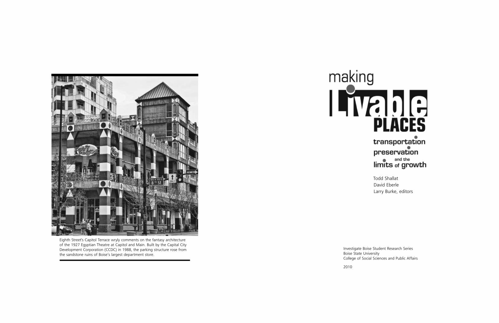
Eighth Street's Capitol Terrace wryly comments on the fantasy architectureof the 1927 Egyptian Theatre at Capitol and Main. Built by the Capital CityDevelopment Corporation (CCDC) in 1988, the parking structure rose fromthe sandstone ruins of Boise’s largest department store.
©Laura Gilmore

4 livable places 5
The Investigate Boise Student ResearchSeries ... the Boise State University College of SocialSciences and Public Affairs proudly sponsors a
nine-credit field school for the study of the
Treasure Valley. Each summer, about 40 students
interact with professors, practitioners and pub-
lic officials in a storefront classroom down-
town. Students tour, investigate and com-
pose documented research papers con-
cerning political and social problems
that vex municipal government. Top
papers are peer-reviewed and edited for
publication. Topics include housing and homelessness, neighborhood preser-
vation, the political economy of energy and natural resources, and the chal-
lenge of urban renewal downtown. For information and sponsorship oppor-
tunities, contact Dean Melissa Lavitt at [email protected]; (208) 426-
3776.
Todd Shallat, Ph.D.Investigate Boise series editorCenter for Idaho History and [email protected]
David Eberle, Ph.D.consulting editor
Larry Burkemanaging editor
Mary Harbststudent editor
Adele Thomsenart director
Melissa Lavitt, Ph.D.Dean, College of Social Sciences and Public Affairs
© 2010
Boise State UniversityCollege of Social Sciences and Public Affairs1910 University Drive - MS 1925Boise, Idaho 83725
ISBN 978-0-557-32324-1
To order copies contact theCollege of Social Sciences and Public Affairs [email protected]
(208) 426-3776

6 livable places contents 7
ContentsIntroduction ...................................................................... 8
1. Boise Builds a Streetcar ................................................... 12
2. Saving the Warehouse .................................................... 22
3. Creating Collister ............................................................ 34
4. Ustick on the Brink of Place ............................................ 42
5. Scoop Leeburn’s Lost City ............................................... 52
6. Urban Crossroads............................................................ 70
7. Revitalizing the Bench ..................................................... 82
8. Bus Rapid Transit............................................................. 92
9. Scaling the Cliffs ........................................................... 100
10. More Like Avimor?........................................................ 110
11. Growing Smart ............................................................. 118
Sources ......................................................................... 126
Alley history presented through art was a theme of the 2009 "InvestigateBoise" field school on urban affairs. Pictured: Kerry Moosman's 2001 tributeto the Idanha Hotel.
©Diesel Demon “Nick”

introduction 98 livable places
Introductionaking Livable Places explores the history and politics of the issues
and places that shape Boise's metropolitan growth. In the sum-
mer of 2009, in the donated space of a vacant downtown store-
front, the investigation began as a Boise State University field
school on urban affairs. About 40 students attended. City planners and
elected officials worked with professors from five academic departments.
There were architecture walks and visits to blighted places. There were bus
and Segway tours. Students wrote research papers, and 11 were selected for
publication by the Boise State University College of Social Sciences and Public
Affairs.
The approach has sometimes been called place-based education.
Holistic and experiential, it makes the city a living textbook. In June, our sum-
mer began with the downtown core of Boise. In July, we broadened the les-
son to the Boise Valley and the city’s role as regional hub. Students selected
from a list of research topics concerning transportation, preservation, conser-
vation, housing, homelessness, crime, regional planning and urban renewal.
Professors Todd Shallat and David Eberle invited top students to continue for
additional credits. Eight students were recruited from the summer program
Mand three were master’s students who had previously written on Boise top-
ics. Under the guidance of editor Larry Burke, the student authors stepped
through the process of publication—of revising, fact-checking, documenting,
editing, graphics selection and book production. The result is an anthology
of essays on urban issues that vex municipal policymakers. It showcases the
pragmatic application of social science research to the study of public affairs.
Students were asked to place local problems in historical context—to
understand the origins of disputes, to appreciate how recurrent historical
themes shape decision-making today. Chris Mansayon’s study of the Boise
streetcar, our lead essay, illustrates the importance of historical context.
"Investigate Boise" thrived in the donated space of a storefront classroom.Pictured: Boise’s Capital City Public Market at Idaho and Eighth.
©Bob Minton

introduction 11
investigator Kelly Foster provides a revealing interview with Kathleen Lacey, a
city planner. Buses, Foster explains, are gaining popularity. But an effective
alternative to auto commuting may require funding in the form of a local
option tax. Bus rapid transit may also require stronger cooperation among
the dozens of jurisdictions that compete for highway funds.
Central to the campaign for better transportation is the problem of
urban sprawl. Planners agree that smaller houses closer to downtown Boise
can alleviate traffic congestion. Houses far from the workplace add com-
muters to the highways, pave farmland, cripple wildlife and foul the valley’s
dirty air. Sprawl pits conservationists against developers and property own-
ers. Tedd Thompson marks the lines of dispute in an essay concerning the
The Cliffs, once a planned community approved on a foothills plateau called
Hammer Flat until the City of Boise purchased the land. Kurtis Hawkins looks
at the Avimor development between Boise and Horseshoe Bend. Both
authors emphasize urban impact areas and the limits of a city’s power to
contain developments outside their boundaries.
David Webb concludes with strategies that a city such as Boise might
use to preserve livable places. The list of “smart growth” tactics includes zon-
ing reform, landmark preservation, the reinvestment in vacant buildings,
workforce housing, buses, light rail and land-use policies that reduce the
dependence on cars. Smart growth begins, says Webb, with public educa-
tion about the ramifications of development policies. Webb’s plea for educa-
tion about the dynamics of cities resonates with the College of Social
Sciences and Public Affairs. Our mission, simply stated, is to train informed
citizens, and to clarify the confusion that clouds voting and policymaking.
We proudly submit these essays as proof that place-based urban research
can help Boise grow in a responsible way.
Todd Shallat, Ph.D., directs the Center for Idaho History and Politics atBoise State University. His Boise writings include Ethnic Landmarks:Ten Historic Places that Define the City of Trees (2007).
David Eberle, Ph.D., serves on Boise City Council and the board ofdirectors for the Capital City Development Corporation (CCDC). Hespecializes in tax-financing, transportation and urban renewal.
10 livable places
Mansayon returns to a city of risk-taking entrepreneurs in an era when
power grids and rail lines were powerful tools of economic development.
Ann Felton’s essay on a threatened Eighth Street warehouse also explores
the importance of railroads. Felton gets to the nub at what is at stake in the
preservationist’s fight to keep historic streetscapes whole.
Even in places without iconic historical landmarks, preservation can
contribute to economic development. William Blackadar’s essay on Collister
follows a neighborhood that emerged from an orchard on an electric street-
car line. Collister’s revival depends in part on promoting neighborhood identi-
ty. Ted Vanegas tells a similar story in a study of the suburbanization that
transformed the Ustick townsite. Both essays begin with the streetcar. Both
offer hope that walkable streets and traffic-calming improvements can help
neighborhoods prosper and grow.
Student historian Jacey Brain studies planning and livable places
through the tight lens of a single downtown corner. Ever since the Boise
gold rush, Eighth and Idaho has always been a commercial hub. City Hall
once anchored the corner, which later became ground zero for the razing of
historic buildings during the era of urban renewal. Today a mix of historic
uses—of retail, cafes, offices and nearby workforce housing—contributes to
the urban feeling that helps downtown commerce survive. Some of the ele-
ments that have allowed downtown to prosper are evident through the cam-
era lens of Leo J. “Scoop” Leeburn. A photographer of fires, crime scenes
and stories for the Idaho Statesman, Leeburn documented the demolition of
historic brownstones during urban renewal. Student historian Mary Harbst
provides a sampling of Leeburn’s photography with an emphasis on the city
that Boiseans lost.
Sarah Cunningham’s essay on the Central Bench studies the connection
between history and revitalization, between the need for historic centers and
the future of a place overwhelmed by the automobile. Shaded sidewalks,
better lighting, bike paths and landscaping can make the area more inviting.
A emerging “international district” of immigrant markets and shops may help
the neighborhood prosper by nurturing a new sense of its place.
While Boiseans debate the revitalization of auto-dependent strip malls,
planners lay the foundation for a network of high-speed buses. Student

12 livable places streetcar 13
hile federal funding for a proposed downtown streetcar loop did-n’t materialize, the need for enhanced mass transit will remainhigh on the agenda as city leaders work toward solutions tomore effectively move people into and around Boise’s downtowncore. Whether the proposed 15-block east-west loop through
downtown or another route is eventually selected, the return of the streetcarappears to be only a matter of time—and money. As novel as the conceptseems today, the current discussion over streetcars takes a page from a 110-year distant past, from a time when streetcar routes played a key role inshaping Boise’s first neighborhoods, connected the city’s core to the sur-rounding countryside and linked all of the communities in the valley. Perhapsa look at how streetcars benefited Boise in the past can provide some per-spective on the future.
It is hard to imagine that the character of present-day Boise wasshaped by something that existed a century ago—and is now extinct. Today,
WBoiseans board streetcars in front of the Borah Post Office, about 1915. TheBorah building faced the main trolley depot at Bannock and Seventh.
ISHS

streetcar 15
the trolley system outside the city limits. In 1904, the BRTC’s first rival, theBoise and Interurban Company (B&I), was created and charged with the con-struction of a new electric rail line to connect Boise and Caldwell. Plans wereimmediately drawn up and tracks were laid following the same lines that
State Street and Highway 44 now occupy, passing through Eagle, Star andMiddleton before heading south to Caldwell, ending where the iconicSaratoga Hotel stood until 1990.
At the same time the B&I began construction on its stretch of line, athird company, called the Boise Valley (Electric) Railroad (BVRR), received per-mission to begin working on a project of its own. Starting from within Boiseat Broadway, going to Morris Hill and extending out from Fairview Hill, theBVRR laid tracks westward along Fairview Road until jutting north at Cole,
14 livable places
few residents remember an era when they could board a rail line in Boiseand travel to Caldwell, Eagle or Nampa, or when farmers from Ustick andCollister used the Interurban streetcar line to ship goods to Boise. EvenBoise’s famous North End was originally created and shaped to be a street-car suburb. For those who lived during the peak of the streetcar age, trolleysmust have seemed as new and magical as the mysterious electricity thatpowered both them and the city. Will the streetcar in Boise work its magiconce again in the second decade of the 21st century? That is a question yetto be answered. But there is no question that Boise’s streetcar system was amagic potion when it spurred the region’s development more than a centuryago.
In 1869, the first transcontinental railroad connected the nation, effec-tively shrinking the United States. Long gone were the days of six-monthwagon trips from Missouri to Oregon. Most of the nation could now be tra-versed in as little as a week. Just a few years after such a monumentalachievement, steam cars were being seriously considered as a mode ofinterurban transportation to link nearby towns together and provide a fastermode of transit than walking, horse-driven carriages or horse cars, whichwere trolley cars and trams pulled by animals on steel tracks. But the noiseand smoke of steam power was impractical, so most American inventorsturned their efforts toward other forms of motion and the steam-poweredtrolley eventually went on to enjoy far greater support in Europe andAustralia. Cable cars seemed to be a more practical substitute, but that tech-nology also was short-lived. Only San Francisco and a few other cities heldonto their old cable car systems. By the time the 1900s rolled around, manymajor cities were turning to new electric trolleys. Boise was one of the earlyadopters, establishing the first lines in 1891, only three years after FrankSprague had completed his first electric system in Richmond, Va., and justfour years after Boise first received electricity. Chartered in 1890, the BoiseRapid Transit Company (BRTC) laid down 2.25 miles of track between 14thand Idaho streets and continuing down Warm Springs to the newly con-structed Natatorium. The two companies in charge of the electric lines andthe construction of the Natatorium even coordinated their efforts to drawpeople onto the streetcars and provide them an easy way to get to theNatatorium pool. Like many of the early lines, the Warm Springs line was agreat success, boosting migration to the area and promoting developmenteast along Warm Springs Avenue and as far south as the Boise Bench. At therequest of several prominent Boiseans, by 1900 plans were drawn up to takethe first steps toward the creation of an interurban rail system by expanding
Streetcars connected the City of Boise to the independent village of SouthBoise via the Broadway Bridge, about 1910.
ISHS

streetcar 17
completion. New stops were also added in the farmlands to accommodatethe people who lived away from population centers. The new enclosed trol-ley cars carried people and their goods at speeds reaching more than 50miles per hour. Not only was the new “Boise Valley Loop” a popular Sundayexcursion, but just like Warm Springs, property values along or near the lineskyrocketed and new developments sprung up seemingly overnight, allowingthe ITC to boast more than 70 stops along the line at its peak of operation.Country depots were also informal communal hubs and farmers often set upproduce shops near the trolley stops to sell and transport their goods allacross the valley. These small towns, which constituted the majority of stopsbetween larger hubs of Boise, Meridian, Nampa and Caldwell, earned thenickname of “Toonervilles” for the name of the clanging or “toon” soundthat came from a trolley as it was about to arrive at a stop. In addition to asmall station that resembled a modern sheltered bus stop, Toonervilles usual-ly consisted of only a small grocer’s store and a crossroad. The nicknamewas also given to country residents by upper class city dwellers and urban-ites, but as the larger towns expanded and distinctions between town andcountry disappeared, so did the nickname.
Trolleys ran quickly between stops and during the early years of opera-tion a trip anywhere on the rail line cost just 5 cents. After a few years, atrip to most places still cost a nickel but longer rides, such as the weekendexcursions families took along the Loop, might cost up to a $1.50. On aclear day, an entire trip around the valley took roughly two hours, with eachtrolley making between 50-70 stops for passengers and freight. The Boiseand Interurban line highlighted stops at the Natatorium and Pierce Park,which were visited far more frequently than other attractions in the valley.After lines had been connected to Caldwell in 1907, promotional travel rateswere given to patrons who were going to the Canyon County Fair. Throughthe years, the trolley cars created a way for people to connect with oneanother and were a unifying force within the Treasure Valley.
Popularity would not swing the way of the streetcar forever. By thetime the Idaho Traction Company emerged in 1912, the automobile was win-ning over newspaper headlines throughout America for its low price tag andpotentially lower maintenance costs. Before 1910, the privileged could beseen driving up and down Warm Springs Avenue and the popularity of thenew mode of transportation steadily grew over the next 10 years. The costsof WWI temporarily stalled the fall of the American streetcar. Passenger traf-fic actually rose during that time, but that only put off the inevitable. New“trackless trolleys” began to emerge and slowly replaced the increasinglyexpensive and aging streetcars. The entire nation slowly succumbed to this
16 livable places
following Ustick Road and eventually stopping at Meridian and Nampa. By1912, the BVRR owned 31 miles of track, had 21 cars in operation and wasthe Boise Rapid Transit Company’s main rival. The independence of the threecompeting companies was to be short-lived and by 1912 they were merged
into one large corporation named the Idaho Traction Company. The consoli-dation of the three companies was immediately beneficial to the travelingpublic and shortly after the merger a new segment of tracks was laidbetween Nampa and Caldwell, connecting the two former rival lines of theBVRR and the B&I into one large loop that spanned more than 60 miles after
The Boise Valley Railroad had reached the fairgrounds at Orchard nearFairview by 1905. A funeral car extended the line to the city's cemetery atMorris Hill.
ISHS

streetcar 19
the east end of a line that ran as far west as Eagle and Star. This building inparticular was constructed so people could visit the area’s largest attraction,the Natatorium. The only indication of the building’s former use is a largemural painted on the western wall depicting a red trolley car with several
passengers on board. Inside, the walls are adorned with pictures, newspaperclippings, photos and other various crafts contained within display cases.Another remnant once nestled in the Boise Bench neighborhood at Rose Hilland Roosevelt. The “Trolley Bar” began life as a train car in 1882, serving asboth a passenger car and a caboose for the Oregon and Washington Railway& Navigation Co. before being rebuilt in 1911 to serve as a trolley car indowntown Boise. In 1930, it was retired and moved to Rose Hill to becomean ice cream parlor before finally being converted into a local tavern in1934, where it became one of the longest running businesses in Boise. Allthat came to an end in 2006 when the Trolley was partially burned in anarson fire, subsequently forcing the owner to board up its doors and shutdown. Restoration estimates have ranged anywhere between $10—40,000depending on the scope of reconstruction.
18 livable places
new trend, with only a few cities hanging on to their old urban and interur-ban lines. In Idaho, the Idaho Traction Company was divided into the BoiseStreetcar Co. and the Boise Valley Traction Co. in 1915, and the two firmsreturned to their old ways of competing with each other. The upper handeventually went to the Boise Streetcar Co. in the 1920s when it beganswitching all the trolleys out for new, gas-powered buses. The switch, com-bined with the growing popularity of the automobile, prompted many citiesto begin large paving projects, further drawing away profits from the BoiseValley Traction Company, which had to cut back on car maintenance in orderto cope.
Finally, on May 17, 1928, with work already underway on a new, state-of-the-art highway between Nampa and Boise, the Interurban system shutdown all passenger and freight service indefinitely. The last streetcars uncere-moniously ran the last routes of the Loop and at 6 p.m. they were all shuf-fled into barns and passengers were handed bus schedules. The closure ofthe Boise Valley Traction Company met with strong opinions on both sides.Farmers and businessmen who relied on the routes protested the loss of thesystem, while many citizens who no longer used it praised the notion thatthey would never have to hear the screeching of the railcars again.Newspaper headlines boldly proclaimed that during its last few years of serv-ice, the Boise Traction Company had gone $2 million into debt and that inSeptember of 1925, a foreclosure suit had already been filed on the dwin-dling company. Bondholders split up and bought portions of the lines, whichwere all eventually removed or paved over to accommodate growing auto-motive and bus traffic. For Boise, and much of the rest of the United States,the magical age of electricity and the street rail was over in a flash.
With the exception of an occasional lament over the lost trolley car ora reminder of the “good old days” by an Idaho newspaper whenever oldlines are dug up to repave an existing road, little attention is given to the oldsystem in the age of the auto and “super highways.” Occasional IdahoStatesman articles give readers cause to reminisce about Boise’s long losttrolley car system, which was hastily buried underneath new road develop-ments. Titles like “Remember? Buried rails recall a bygone era” or“Newfangled streetcars found popularity quickly in Boise” graced the paperas people began to realize that no matter how large the freeways and roadswere, or how many lanes wide they were, that they would never solve theproblems of congestion alone.
Perhaps the most noticeable reminder of Boise’s streetcar legacy is arestaurant aptly named “The Trolley House” located on Warm SpringsAvenue. Originally built in 1922, the building served as a dispatch station at
The Boise and Interurban Company extended its line from Main Street toCaldwell along Valley Road (now State Street). In 1912 the B&I merged withits rivals to create the Idaho Traction Company.
ISHS

streetcar 21
U.S. and Canada currently have a streetcar or light rail system, or both, andmore than 80 cities either have plans or have begun construction on newstreetcar systems, including Washington D.C.
Some local leaders and business owners are saying that now it isBoise’s turn. In 2004 various proponents from the local and state levels cametogether and created what they called the “Boise Mobility Study” in order todetermine the growth needs of downtown Boise. The study concluded thatthe development of a new form of transit to serve the downtown sector wasmuch more desirable than widening streets to accommodate more traffic.Two years later, the Treasure Valley High Capacity Transit Study examinedhow to successfully integrate a new transportation system that would notonly include downtown Boise, but also eventually connect the major TreasureValley communities back together; streetcars were the answer. They also con-cluded that a downtown system would not only enhance the transportationsystem, but also help revitalize underdeveloped areas served by the streetcarroute. As a result, the downtown streetcar proposal came to the fore. Theproject didn’t clear its first financial hurdle and is back on the drawing board.But the streetcar emerged as a major player in the mass transit discussion.Will there someday be a new valley “loop” that extends to Star, Emmett andKuna? Will the old headline, “Valley Once Had Trolley Line,” someday bereplaced with, “Valley Once Again Has Trolley Line"? Time can only tell.
• • •
Chris Mansayon is a senior who will graduate in spring 2010 with amajor in history and a minor in Chinese culture. A 2005 Kuna HighSchool graduate, he plans to pursue a master’s in applied historicalresearch or library science.
What are the most important aspects of a “livable” city?
“The most important aspect is planning, planning, planning. Not justselfish planning for ‘us’ and ‘right now,’ but planning for 10, 15, or20 years down the road. It would greatly serve our community totake the time and MONEY (I know this state hates spending money)to do it properly the first time around rather than rush to employpatch solutions.”
20 livable places
The last 20 years have seen the successful reintegration of the trolleycar into urban transit systems as cities have realized that highways alone arenot sufficient to move masses of people from growing suburbs to the urban
core. San Diego began building a new system in the 1980s. Denver also revi-talized its streetcar system as a light rail system in 1994. Many major citiesquickly followed suit and either recreated, or in the case of Boston and SanFrancisco, renovated and expanded their still-existing systems into popularand invaluable assets to the communities they serve. One of Boise’s closestsister cities in the west, Portland, entered its second age of light rail in 1986under the direction of the Tri-County Metropolitan Transportation District ofOregon. Between 2001—05 alone the interurban rail system produced morethan $2.3 billion worth of urban development. More than 30 cities in the
Portland's streetcar has inspired a controversial campaign to rebuild Boise'ssystem as an economic development tool. Pictured: Portland's Pearl District.
©Patrick Dirden

22 livable places warehouse 23
n Aug.1, 1864, Boise teamed with activity as 100 immigrant wag-ons streamed down its crowded Main Street, mixing with those oflocal farmers bringing hay and produce to market. Adding to theconfusion were long lines of ox teams loaded with lumber andother goods from Salt Lake and the Columbia River. Scenes such as
these are far removed from today’s growing metropolitan area of Boise. Thelast visual images of that time in history disappeared in 2006-07 with thereconstruction of the O.W. Smith Building, the oldest building in the down-town warehouse district. Its reconstruction took away the bay windows anddoors that serviced the freight wagons of pioneer Boise. This destruction ofthe city’s past might not seem so surprising except that it occurred in a des-ignated historic district supposedly designed to protect historically significantbuildings. With this development came questions about the city’s commit-ment to preserving a sense of its historic past.
OOtto W. Smith’s warehouse at Myrtle and Eighth, completed in 1902.Pulleys and hoists unloaded goods from wagons on the building’ssouth side.
ISHS

warehouse 2524 livable places
As with most towns, Boise’s battle to preserve its heritage has evolvedover the last 60 years. After World War II the city grew as the nation pros-pered and the GI Bill created new suburbs throughout the surroundingbench areas. Businesses in the core of the city started to suffer as smallneighborhood malls appeared in the outlying developments. In 1965, cityleaders followed the nationwide trend of renewal and redevelopment inhopes of transforming Idaho’s capital city into a modern and viable businesscenter. They created the Boise Redevelopment Agency and a plan evolvedcalling for the replacement of the “deteriorating downtown core” with anew open-air mall. Soon blocks of older buildings were bought and demol-ished using federal funds from the U. S. Department of Housing and UrbanDevelopment. What the city didn’t realize was that many of those old anddeteriorating buildings contained a cultural and historic connection to the cit-izens of the town. As people started to see their heritage piled high in rub-ble, some started to question the demolition. When the bulldozers started toapproach the iconic 1927 Egyptian Theater, people stood up to fight againstthe eradication of their past. But only after blocks of historic structures hadbeen razed did they stop the destruction that had engulfed many pioneerbuildings as well as what was left of a once thriving Chinatown.
Across the nation, communities started to question the practices ofthose early urban renewal efforts and in the late 1970s President JimmyCarter authorized a series of tax breaks for those engaged in historic preser-vation. This change in policy hit Boise at a time when a lack of financialbacking had ground the downtown mall project to a halt. Suddenly, enter-prising businessmen started to look at those “deteriorating buildings” in anew light and together with innovative architects began to refurbish the his-toric fabric of the downtown area. The city recognized there was value inpromoting the cultural history of Boise. In 1976, the city established theHistoric Preservation Commission with a mandate to “promote, preserve andprotect historic buildings, structures, sites, monuments, streets, squares andneighborhoods” so they could serve as a visual reminder of the city’s past.Through the creation of historic districts, the commission could designateareas that held special historic significance to the city and then exercise anoversight position over reconstruction of visual elements in those areas. Allmajor remodeling or construction projects in those districts had to pass thereview of this commission and its decisions could be overturned only by theCity Council. During this time, what had once been a struggle betweendevelopers and historic preservationists turned into a win-win situation withthe refurbishing of old structures into productive commercial spaces. In
Foster’s triangular “flat-iron” warehouse was rounded to accommodate therailroad’s downtown right-of-way. The curved north face of the 1910 build-ing has since been encapsulated by a parking garage.

warehouse 27
streets. Prior to that time orchards owned by Thomas Davis spread along thenorthern side of the river. Upon receiving word of the railway’s intentions tolocate downtown, he platted blocks 1, 2 and 3 of the Davis Addition, trans-forming a section of orchard into a workable spot for a warehouse district.The railroad company’s right of way passed through those blocks and in1902 the first of many new warehouse buildings graced the area. The origi-nal set of warehouses stretched between Broad and Myrtle on the west sideof 8th Street, with the right-of-way forming an alley behind the buildings.Soon the district expanded in all directions, including another set of build-ings between the alley and 9th Street. In 1905-06, a spur line was laid downthe center of the alley, bringing the railway cars to the back doors of thebuildings.
Boise’s prosperity in the early 1900s led to the development of grandbuildings—even the warehouses bore stately arches, detailed cornices andstout posts. The warehouse district’s wholesalers prospered as they sentgoods to Idaho’s mining, lumber, agriculture and irrigation industries. Thearea housed hardware, fruit, grocery and paint wholesalers and servicedindustries such as a milling company, an icehouse, a storage company and acreamery. Pulley systems protruded from the sides and backs of many build-ings, allowing for the transfer of large crates of merchandise from the redbrick warehouses to waiting wagons. Two of Boise’s leading architecturalfirms of the time, Tourtellotte and Hummel and Wayland and Fennell,designed most of the buildings. The front of the warehouses facing thestreets usually housed offices and storefronts. Between 1902-1915, a four-block warehouse area featured an array of substantial and beautiful build-ings.
The grand age of the railroad came to a halt in the 1940s as roadwayscarved a path across the nation. Automobiles not only changed the waygoods were transported, but also the way Boise grew. Wholesalers moved toareas with newer buildings and easier access to highways and the downtownwarehouse district started to decline. By the late 1960s, the construction ofthe freeway system south of town caused a final exodus from the area,seemingly sealing the fate of the 8th Street warehouse district. The buildingswere obsolete for modern day warehousing and the area struggled to find anew identity. In 1975, a development team bought five of the warehousebuildings and hired historic planner John Bertram as project coordinator.Because the buildings were “no longer usable for modern day warehousing,”the developers requested that the city change the zoning to commercial useto accommodate a plan for developing an 8th Street Marketplace in thearea. In 1977, developers Winston Moore and Larry Leasure started the first
26 livable places
1975, one of the first projects of this type started in the old warehouse dis-trict along downtown Boise’s 8th Street.
The history of the warehouses reaches back to those far-gone dayswhen the survival of the town depended on the timely arrival of supplies.The city, founded as a trading supply point for miners, needed to expand itsability to store massive amounts of goods awaiting transfer to outlying min-ing areas. The growth of the city became dependent upon the freightingindustry and the warehouses were needed to hold the goods. By the 1870s,the mines in the area started to produce less, but Boise did not follow thefate of many former supply towns by fading away. Instead, it grew as its citi-zens recognized the potential of the region. The railroads also saw the area’sviability and started construction of the Oregon Short Line railway. In 1893,the railroad built a spur line into Boise’s downtown area, and soon aftercame the construction of a fine stone depot and park near 10th and Front
Peasley Transfer Company ran freight from the warehouse district during theheyday of railroad era.
ISHS

warehouse 29
windows and doors to facilitate the loading of wagons. A system of pulleysand hoists were used to load bags of seed or other products onto wagonsparked on the Myrtle side of the building. Most of these features were torndown and replaced with a new wall when the building was renovated. The
original architectural features provided a visual reminder of Boise’s history,illustrating the working history of mule packers and pack trains and the vital-ly important service they provided to the people of the area as well as theearly economy of the city. While the storefront had received structuralupdates, the previous owners had done little to improve the warehouse por-tion of the building. It had substandard electrical wiring, no modern heatand many other things that were needed to make the space easily adaptablefor modern business use. Over time many of the front and side windows hadbeen altered and the recessed entryway had been filled in and made flushwith the front of the building. The brick had been painted and a side rail ofcheap concrete had been added to the Myrtle Street side when theConnector was built.
28 livable places
phase of the adaptive re-use plan with renovation of the Northrup Hardwareand Coffin Building at the corner of Broad and 8th streets. That same yearsaw the implementation of the North Bank Project, providing a new and his-toric streetscape on 8th between the bridge and Front Street. In 1978, theSouth Eighth Street Historic District gained recognition by being placed onthe National Register of Historic Places. Then in 1979, renovations came tothe buildings on the east side of 8th Street, where shops and office spaceswere developed in the Falk, Carlson Lusk Hardware and Boise Elevator build-ings. Conversion of the Falk/Davidson garage into a theatre accompanied the1979 renovations. The only other business on that side of the street, theIdaho Candy Company, had been in existence since 1909, making thatTourtellotte and Hummel building the home of the longest-standing businessof the area.
As Boise started to recognize the importance of its historic architec-ture, preservationists started to recommend areas for local historic districts.In 1982, the city’s Historic Preservation Commission made the warehouse dis-trict its third official historic district. Ownership of the area changed in 1994as S-16 Corporation bought the marketplace. The corporation, owned bybusinessman J.R. Simplot and his grandchildren, expanded the area over thenext 10 years, working with the city to develop a cultural district stretchingfrom the 8th Street Bridge to Grove Street. Additional warehouses were ren-ovated in the area to house practice and business space for the ballet, opera,philharmonic and a contemporary theatre. They combined with the area’sexisting museums and library to create a unique setting in the downtownarea. Educators also saw the advantage of being in the district as a privateschool moved in, again renovating a warehouse building for its use.
In 2003, Brix and Co., a development firm out of Bethesda, MD,bought the 8th Street Marketplace, renaming it Boise Downtown, or BoDo.The new owners released a plan for renovating the market area, calling fornew development between Front and Broad streets. One of the structuresbought by the BoDo developers was the district’s oldest remaining ware-house, the O.W. Smith Building. On the northwest corner of Myrtle and 8thstreets, the 1902 two-story structure was built as a warehouse and store-front for Smith and Company, which dealt in essential goods of the day suchas seeds, hay, cereals, salt, flour, grain and produce. Otto W. Smith built thisstore on a site close to the depot’s newly developing warehouse district. Thefire of 1903 left the Smith Building untouched and it remained the place ofbusiness for Smith and Co. until 1908. The front of the building featured ahandsome storefront with windows, a canopy and a recessed entryway. Theside of the building that faced Myrtle Street housed a series of bays with
Davis meat truck, 1919. Meat packers had brought cold storage refrigera-tion to the warehouse district by 1910.
ISHS
warehouse 31
the deteriorating brick in an aesthetically pleasing manner. Thus, renovationwould not be economically feasible for the owner. One commissioner, whilesupporting the project, also brought up the concern that “peeling away” somuch of the building may not only be stripping away at the warehouse’s his-
tory but may jeopardize the structure’s National Registry status. Bertramlater voiced this same concern about the district as a whole. He noted thatmany small changes had been made to the buildings since their placementon the National Register of Historic Places. Those changes, added to the lossof the oldest building in the district, could place the designation at risk, hesuggested.
30 livable places
Instead of renovating the building as their 2003 plan indicated, theBoDo team sold the building in 2005 to local developer Gary Christensen,who submitted a plan that same year to the Planning and ZoningDepartment to completely demolish the building, citing costly procedures torenovate the structure. Christensen proposed tearing the structure down andreconstructing a commercial and residential building that would “keep thecharacter” of the area. Because of the building’s location in a historic district,the plans needed the approval of the Historic Preservation Commission,which ruled against a complete demolition of the building. In October of2005, the eight-person commission heard a second proposal by Christensen,which focused on keeping only the front wall of the storefront on 8th Street.The plan called for the demolition of all but 10 percent of the original struc-ture and construction of a new building behind the old façade. Developerswould then add a third story to the new building that would be set backfrom the original storefront. The new design also incorporated the next-doorPeasley Building into the plan. Historic planner Bertram and historic architectDan Everhart both wanted more from the developer. Everhart argued thatthe real historic value of the building lay in its Myrtle Street wall, whosearchitecture displayed one of the last visual images of the days the freightwagons. He also reminded the group that demolishing 90 percent of a build-ing is not now, nor ever will be, considered a historic preservation technique.The developers objected to keeping the Myrtle Street wall because of amasonry shear test showing deterioration of the brick on that side of thebuilding. They argued that the cost of renovating the wall would be prohibi-tive.
The Historic Commission focused on two criteria in determining thefate of the building: whether the changes adversely affected the nature ofthe Historic District and whether historic renovation proved economically fea-sible for the owner. In the commission’s opinion, the commercial storefrontof the building represented the primary façade of historic significance and bykeeping that, the plan did not adversely affect the nature of the district.They noted the preservation of many architectural features on the frontfaçade as essential to keeping the historical accuracy of the building. InEverhart’s opinion, the Myrtle Street façade represented the only readableface defining the building as a warehouse and that losing it did indeed sub-tract from the “historic fabric” of the district. The commission’s second issueof interest centered on the economic feasibility of renovating the originalstructure. They concluded that the cost to bring the building up to the seis-mic standards required by building codes created a financial hardship for theowner and that in the opinion of the staff it would be impossible to restore
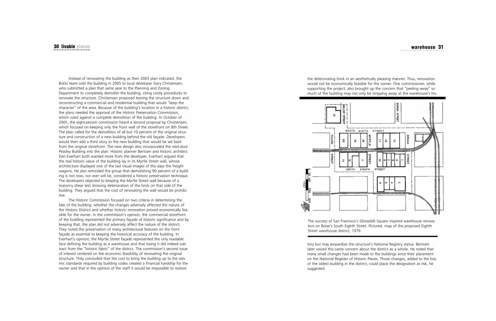
The success of San Francisco’s Ghiradelli Square inspired warehouse renova-tion on Boise’s South Eighth Street. Pictured: map of the proposed EighthStreet warehouse district, 1979.

warehouse 33
adverse affect of possibly having the building remain empty seemed of moreimportance than keeping the historic fabric in place. In the end the commis-sion ruled in favor of the developer’s second plan, with the condition thatthe original storefront be retained as presented by Bertram in three historicphotos of the building. The 2005 decision on the O.W. Smith Buildingmarked a change in focus on the part of the Historic PreservationCommission. In this case, promoting the city’s economic welfare becamemore central to the discussion than promoting its cultural and educationalwelfare. While commissioners talked about architectural aspects of the build-ing and “retaining the character” of the area, little was voiced about preserv-ing the actual history of the district. Historic fabric goes beyond design ele-ments such as beams, cornices and pilasters. It includes a discussion of theworking history of the area and the contributions the people who worked inthe warehouses made to the city. That history speaks, maybe ironically,about the city’s economic past and its earliest means of economic stability.Rather than consider the warehouse’s role in Boise’s working history, thecommission focused on how to reoccupy the building.
While the city should be concerned with preserving only historicallyappropriate buildings, it seems an unnecessary battle in historic districtswhere their significance has already been established. It is also undisputablethat the economic viability of Boise’s downtown core is of vital importance,but one has to question any precedent set by the Historic PreservationCommission to trade that for historical integrity when working within historicdistricts. While much of the O.W. Smith Building may have met the criteriafor demolition due to the high cost of renovation and saving the façade atleast brings coherency to the streetscape, the designation of the front as theprimary façade of historical significance was simply not justified by the histo-ry of the district. A project that focuses on preserving only the front 10 per-cent of the building, while destroying the wall that truly speaks to the his-toric nature of the district, cannot truly be called historic preservation of thebuilding. After all what is historic preservation without the history?
• • •
Ann Felton graduated from Boise State with a BBA in accountancy in1981 and a master's degree in history in 2007. She is an adjunct pro-fessor in the history department.
32 livable places
At the October 2005 meeting it became apparent that Historic Registerstatus was not driving the decision. It was, as one member commented, eco-nomics. The usability of the building became the bottom line, and the
National landmark status was not enough to save the O.W. Smith ware-house. Only the facade (center of photo) remains from the original building,which was torn down in 2006.
©Shallat

34 livable places collister 35
estled against the northwest Boise foothills, the greater Collisterarea was once a distant trolley stop in an agriculturally centeredcommunity three miles away from the hustle of Boise City. Today,it’s a place with deep community roots, stemming from early gen-erosity and maturing into the neighborhood that residents have
molded into a community. Bordered by State Street on its southwesternedge, Pierce Park Lane to the west, Cartwright and Hill roads to the north,and Taft and 36th streets to the south and east, the Collister area existscomfortably between the downtown economic center and the residentialexpansions toward Eagle. But due to its location, the Collister area, like manyBoise neighborhoods, faces the challenges of urban sprawl.
The Collister neighborhood derives its name posthumously after Dr.George Collister, called a “pioneer” in his Oct. 19, 1935, obituary in TheIdaho Daily Statesman. Upon graduating in 1880 from Heron Medical
NBoiseans frolic in the boating lake at Pierce Park near the Collister Station,about 1908.
ISHS

collister 37
wrote historian Arthur Hart in the Jan. 9, 2007 Idaho Statesman. Terry’sState Street Saloon currently occupies the site of the old Collister Station-Boise Interurban stop. With the completion of the Collister MercantileCompany in 1910 at the same intersection, the Collister area had the begin-
nings of a small, quiet, agricultural community. Mixed use in nature, thewood-framed building operated as a grocery and general store through the1940s.
Some historians believe that State Street’s width can be attributed tothe streetcar. Rather than building new tracks or roads over already-existingrail bed, it was not uncommon for planners and engineers to synergisticallyincorporate rails alongside or within roads. Now all but a memory, Boise’sbustling trolley system has had ripple effects through time. Without theadvent of the trolley at the beginning of the 20th century, the TreasureValley would arguably look much different than it does today. With invest-ments in and along the trolley line, many distinct neighborhoods in the coun-try became notable destinations, including the Natatorium, the city ofCaldwell, and Pierce and Curtis parks in Boise. The planners of the new Boise
36 livable places
College in Cleveland, Dr. Collister was convinced by his sister Julia, whoalready lived in Idaho, to leave his native Ohio and move west. Being thewife of Idaho Supreme Court Judge Joseph Huston, apparently his sister wasa persuasive woman. Dr. Collister and his wife Mary Elizabeth moved toBoise, where he opened a downtown office on Main Street in June of 1881.Advertising as a specialist in pediatrics, Dr. Collister was one of the first tobring public health services to the Treasure Valley. He served twice on thecity council, where he was instrumental in creating numerous health andsanitation ordinances. He served as city and county physician and was physi-cian at the Idaho State Penitentiary and at the Soldier’s Home, according tohis obituary.
An avid writer and horticulturalist, Dr. Collister became the owner ofone of the valley’s first peach orchards. Shaded by nearly 11,000 peach,prune and various other fruit trees, Dr. Collister built a 20-bedroom mansionoverlooking the developing orchard on some 245 acres owned by him andhis sister a few miles west of the city limits on Valley Road, now State Street.Though many of the orchard’s original trees have since died or been cutdown, numerous others still bear fruit to this day. Collister’s mansion, builtby the noted architectural firm Tourtellotte and Hummel near the junction ofpresent-day Sycamore and Taft streets, was converted into the Elks RehabMedical Care Center after Dr. Collister’s death. The house has since beentorn down and Boise City Fire Station No.9 now occupies the original homesite. Of the 245 acres that Dr. Collister owned, about 150 acres were donat-ed for a new school site, leaving ample open space for children to play. Firstopened to students in the fall of 1911, Collister Elementary on Catalpa Driveis currently Boise’s smallest elementary school, serving 185 students from theCollister neighborhood. The remaining acreage was subsequently sold to R.H.and Elton Davidson, who subdivided the newly acquired land in 1944, form-ing the heart of what is now called the Sycamore neighborhood, nestledbetween Taft and Sycamore streets and Catalpa Drive to the north. TheSycamore neighborhood is unique because of its 101 acres of similarlydesigned and oriented lots; the acreage was divided into 98 7/8-acre parcelsthat allowed one horse, one cow and 150 chickens on each, believing thatlots could be self-supporting with room for a large garden. To this day, spe-cial covenants make it the only neighborhood in Boise that still formallyallows agricultural stock on each lot.
Officially existing outside of the Boise city limits until the mid-1970s,the Collister neighborhood was tethered to the bustling city by rail at thedawn of the 20th century. The Boise Interurban Railway Company construct-ed a main stop and shelter at the intersection with Valley Road and Collister,
Collister Depot on Valley Road, about 1910. Today the site of the boardwalkdepot is occupied by Terry’s State Street Saloon.

collister 39
and Interurban line realized from the beginning that the electric trolley carscould generate extra revenue if they created special destinations for pleasureseekers. School kids on field trips, church groups and families on Sunday out-ings began riding the cars for picnics, holidays or birthday parties … or justto see the sights alongthe way. One could ridethe rails from downtownBoise to Collister Stationfor a mere 5 cents.
Walter E. Pierce, asuccessful entrepreneurfrom Kansas, promotedone of the first “destina-tions” along the trolleyline. Being the sole realestate broker in the newNorth End and Resseguiedevelopments closer tothe city, Pierce turned hisattention further northalong the rail line that hehad invested in, whichsparked the developmentof what is now known asPierce Park. With the newInterurban running downState Street (Valley Road)and throughout the valley,remote land in the coun-try became accessible. Ina matter of a few years,Pierce Park provided a grand recreation spot for the modern electric worldwhen it opened in 1908. A mere three miles from Collister Station, the parkfeatured an electric-lighted entrance archway, picnic areas, a baseball dia-mond and a dance pavilion, among other things.
But today’s Collister is far different than the idyllic community thatthrived 100 years ago. Cities are an evolving collection of communities builtby people to serve their vision of well-being. Dr. Collister originally envisioneda rural lifestyle near Boise where he could enjoy his orchards and be close tothe cultural and economic hub of the valley. The development of the
38 livable places
Walter Pierce’s interurban railroad linked Collister to Caldwell via Middleton.Pictured: Car No. 99 at the Middleton substation, about 1920.
Real estate tycoon Walter E. Pierce pioneeredthe Boise-to-Caldwell interurban railroad. In1908, he opened Pierce Park.
ISHS

collister 41
Threatened by infill, sprawl, crime, noise and suffocating traffic, toname a few, residents, as well as the rest of the city, are taking steps tochange the neighborhood for the better. Through a combination of coordi-nated efforts by its residents and Boise City initiatives, Collister is now anexample of a neighborhood in renaissance. Today, the area is seeing revital-ization that started with a few committed residents. The Collister Associationhas developed a neighborhood plan that has become a part of Boise City’sComprehensive Plan. The association has advocated before the Ada CountyHighway District to improve the major State Street arterial and eventuallyconstruct a roundabout at 36th Street. The roundabout will be the finalinfrastructure improvement in what is becoming a small commercial nodethat includes the local junior high school and the redevelopment of the oldnursery renamed as the 36th Street Garden Center that now includes retail,restaurant and work-live space. As a result, it is projected that over the next20 years, households in this area could grow by 7 percent and jobs in thearea could increase by 25 percent. This urbanization is supported andencouraged by the city through neighborhood grants to improve local infra-structure such as sidewalks and direct investment with the 2008 opening ofBoise’s first neighborhood library in the refurbished Collister ShoppingCenter. In the first six months more than 70,000 individual visits were madeto the new branch library, and the library loans about 16,000 items everymonth. The future is bright for the area, with plans to create a high-speedbus rapid transit system on State Street, thus giving residents an alternativeto the auto and relieving commuter pressure on the local roads. The con-struction of a roundabout will increase the pedestrian access between thejunior high and nearby businesses and homes. New townhouse develop-ments, new commercial ventures and a renaissance of neighborhood servicesblend with Collister’s unique character, where residential rural lots nestleamong new and old subdivisions, where roosters can be heard in the morn-ing and cattle graze on a summer evening.
• • •
William Blackadar will graduate from Boise State in May with a BA inenvironmental studies. He resides in Salmon, where he guides white-water trips and works on his family’s ranch. He may attend lawschool in the future and will continue running wild rivers throughoutthe world.
40 livable places
Interurban streetcar line made the area more accessible, prompting the cre-ation of one of the valley’s early suburbs. Today we see a similar pattern—people want a bit of country near an urban area. Then as transportation cor-ridors are built to serve these first groups, more people follow, filling theopen space that they sought to enjoy. First it was Collister, then Eagle. NowStar and points west are seeing this evolution. Thus, Collister has gonethrough a decline as people saw the area as neither rural nor suburban norurban. Some observers say it is a community that has lost its sense of place,lost its sense of identity. Rurally and socially intertwined with the bustlingeconomic centers of downtown, the ‘New North End’ and the now moretony subdivisions toward Eagle, the Collister neighborhood may be straddlingthe line between possible blight and continued development.
A neighborhood in renaissance: The 36th Street Garden Center, above, is arecent addition to the commercial life of Collister. In 2008 the City of Boisealso opened its first neighborhood branch library in the Collister ShoppingCenter.
©Larry Burke

42 livable places ustick 43
he Ustick townsite once had acres of orchards, an effective publictransportation system and a largely self-contained community envi-ronment. Over time, the automobile replaced the Interurban rail sys-tem and suburban development in Boise methodically devoured the
orchards that once characterized the area. Consequently, the neighborhoodlost the sense of place it once held, and so lost its community and historicidentity. Long-time resident Gladys Clymens recalled when Ustick was stillconsidered a place. “Even as a child living in the townsite during the 1940sand 1950s, I thought of Ustick as my home town. It had not yet become asuburb of Boise.” Alarmed by the continued erosion of their community andlack of input on development decisions, neighborhood leaders organized intoone of Boise’s most effective neighborhood associations. They have sincemade strides in determining their own future and have taken on issues suchas infill development, historic preservation and, more recently, the controver-sial Ustick road-widening project. However, Ustick continues to teeter on thebrink of place. Local policy decisions will ultimately determine if this historic
T
Dentist Harlan P. Ustick platted his streetcar township in 1907. Pictured: the1908 First Bank of Ustick, a survivor from the trolley era.
©Larry Burke

ustick 45
in the valley had ample incentive to see it prosper. In the long run the enter-prise did not prove to be solvent, as expenses were extremely high and prof-itable years were few and far between. By the 1930s, the automobile hadreplaced rail as the dominant form of personal transportation, effectively
sounding the death knell for many rail systems throughout the westernUnited States. The Interurban managed to hang on until 1928, when its hey-day as an initiator and connector of communities ended.
One of the Interurban’s biggest supporters was dentist Harlan P.Ustick. Though he was one of Boise’s pioneers and founders, little informa-tion on him is available. What does exist ties him to various business ven-tures in the valley. Dr. Ustick moved from Ohio in 1903 to the agriculturalsettlement between Boise and Meridian, where he purchased a ranch-stylehouse and ran the third-largest apple orchard in the valley. It was under hisinfluence that the Interurban was routed along Market Street in 1907, laterrenamed Ustick Road, and along the land that he had newly acquired and
44 livable places
Boise community will regain its former identity or continue to fall into frag-mentation.
Prior to World War II, agricultural communities like Ustick were com-mon across the country. Farmers and ranchers brought produce to these cen-ters to be shipped and sold. Their families attended the churches and schoolsand shopped at the markets. Beyond this, these townsites served as placeswhere rural people met each other, communed and discussed the issues ofthe day. In modern urbanist terminology, they existed as “place,” familiarand vibrant to those who lived, worked and socialized within their bound-aries. Many of these areas lost their sense of place as transportation anddevelopment policies resulted in the conversion of villages into suburban stripmalls and parking lots. Where public transportation once centralized commu-nities, automobile-centered planning has fragmented them. In How CitiesWork, Alex Marshall metaphorically describes this phenomenon in comparingpre-World War II communities to modern ones: “Newer places have no fabricat all. It’s the difference between a well-knit sweater and a pile of yarn.” Theold Ustick townsite fits Marshall’s metaphor well. Though it is an older neigh-borhood, the loss of the Interurban railway, low interest in the area’s historyand the lack of growth management turned what was once a well-knitsweater into an indiscernible pile of yarn.
One of the most important threads knitting Ustick together was itsInterurban rail system. While apple orchards formed the economic base forthe farming communities in the west valley, public and product transporta-tion built the foundation for townsites. The streetcar system spurred develop-ment of the areas around Boise and helped make suburban growth popular.By the turn of the century rail had been laid throughout the valley, connect-ing remote farming communities such Eagle, Star and Middleton. In 1907,the Boise Valley Railroad Company completed the streetcar lines runningwest from Boise to Fairview Hill and Ustick. Ustick Road later had rail tracksrunning along its full length connecting Caldwell to Boise. The Interurban, asthe popular rail system came to be known, was completed by 1912 andallowed farmers to ship their produce easily from outlying areas into thecommercial hub of Boise. Just as important, it allowed rural residents to com-mute in an affordable and timely manner, socially and economically connect-ing these small, remote communities to each other. Early schedules showthat a person could hop the trolley in Ustick and be to Boise within 20 min-utes. Today’s automobile commuters would be hard pressed to match thattime on the congested roadways.
The rail company ownership roster listed some of Boise’s founding fam-ilies, including Lemp, Ustick, Sonna, Pierce and Noble, who as stakeholders
A Victorian lady advertises cola on Ustick Road. The store opened in 1912.
©Larry Burke

ustick 47
Despite its history and the fact that many pre-World War II residents still callUstick home, the neighborhood continues to spiral into a blighted state.Residential and commercial development projects not fitting with the existingform have altered the character of Ustick so much that its historic identity ishardly recognizable. During the 1990s a number of concerned Ustick resi-dents banded together in an effort to promote a historic district designationfor the old townsite, hoping to preserve what little remained. The movementfor this type of designation among Ustick residents intensified and blos-somed, especially as development and infill projects loomed over their neigh-borhoods.
As part of the West Valley Neighborhood Association, the communitycame together to put a voice to Ustick’s legacy and future. The city of Boisewas receptive to the idea of historic districts to combat the rapid growth andurban sprawl that were consuming farmland and open space at an alarmingrate. With as much, if not more, history than other historic districts, Ustickresidents were confident that they had something significant to offer. TriciaCanaday, the Boise historic preservation planner at the time, commentedthat with historic district status Ustick residents would “gain the reassurancethat their historic fabric will be maintained and preserved.” This becameincreasingly important to Ustick residents who had witnessed a pattern ofstrip malls, big box stores and cookie-cutter houses becoming more promi-nent throughout the region. The neighborhood had begun to understandthat in order to restore and preserve place, while staving off undesired devel-opment, they would need to organize and put together a vision.
In anticipation of historic district designation, community leaders andactivists in 1997 collaborated to form a united vision for the area andpressed the city for action. Ultimately they looked to Hyde Park and HarrisonBoulevard in Boise’s North End as examples of what they would like to seefor Ustick. Hyde Park, once a neighborhood commercial center, had becomea destination point for visitors who enjoyed the history, architecture andquaintness of the area. But consensus among residents and the city deterio-rated into philosophical and economic disagreements. The concept of historicpreservation collided with Idaho’s deeply-rooted tradition of property rights.Idaho is a state built on the western tradition of individual and propertyrights, and more often than not this mentality encourages policy that trumpsthe common good. Though most Idahoans might agree on the importanceof historical heritage and preservation, they likely would not agree that thisshould interfere with the rights of people to do as they wish with their prop-erty. With these obstacles to overcome, the vision for a historic district in the
46 livable places
platted. The initial 110 plots that he purchased came to form the originalUstick townsite. A 1907 Idaho Statesman article exclaimed that, “Ustickwould soon be a live bustling village … although little effort has been madeto sell the lots, 28 have already been sold.” Today there are few remnants of
the village that bears Dr. Ustick’s name. The store, the bank and the schoolare the only public buildings that have survived time and progress, and eachhas undergone a number of incarnations over the years. Period residentialhomes still dot the neighborhood, including Dr. Ustick’s original home, buteven these are becoming rare as developers scurry to acquire valuable land.
Cattle guards at a West Boise trolley crossing. Streetcars linked Boise toUstick in 1907.
ISHS

ustick 49
In 1999, just months after the IURDC project was completed, theneighborhood association solicited the Boise State University Department ofPublic Policy and Administration to conduct a neighborhood survey, theresults of which contributed to the final draft of the neighborhood plan. Thegoal of the survey was to get an idea of how the Ustick residents viewedtheir neighborhood and what kind of future development patterns theywould like to see. Results indicated that the neighborhood’s vision con-formed to each of the models created by the IURDC design team: citizensvalued a pedestrian-friendly community, an environment conducive to humaninteraction and a neighborhood atmosphere that acknowledged its historicidentity. Clearly, the residents desired a neighborhood model that resembled,or at least paid tribute to, the way Ustick was before the Interurban gaveway to the automobile and the farms to urban sprawl. They also wanted atraditional marketplace that recreated the social and communal impressionsthat the Ustick village once had. The overriding theme was the townsite resi-dents’ yearning for place in its most genuine context of familiarity and com-munity.
The final version of the neighborhood plan, completed in 2001,focused on five central components: land use, community design, transporta-tion, parks, recreation and cultural resources, and economic development.Each component encouraged neighborhood interaction, which is critical inreclaiming place and identity in the community. Progress on the five planningcomponents has been slow, however. A grant for funds to write a preserva-tion ordinance that would give residents some control over future develop-ment was not approved. The Ustick neighborhood plan was adopted by theCity of Boise, which made it a part of the city’s comprehensive plan. Butuntil language from the plan is implemented as ordinances or codes, Ustickwill continue as it has, with few safeguards placed on the history and integri-ty of the area.
One of the most pressing issues in Ustick revolves around transporta-tion corridors and their future expansion. In 2006, a plan by the Ada CountyHighway District (ACHD) to widen Ustick Road to five lanes was met withlocal criticism and led to a jurisdictional dispute, with the ACHD claiming con-trol over city roads and the City of Boise claiming control over land useissues, including the protection of neighborhood integrity. After a longdebate and an eventual lawsuit, the ACHD won in court and Ustick waswidened to five lanes, without the neighborhood’s suggestions for separatedsidewalks and landscaped medians to promote pedestrian activity and calmtraffic flows. Though the old townsite neighborhood was not immediatelyimpacted by the project, neighbors have been told that future widening will
48 livable places
old Ustick townsite dissolved as quickly as it had evolved, and the area’sidentity continued to teeter on the brink of extinction.
Though the opportunity for a historic district appeared lost, the hopefor a rebirth of the Ustick townsite still lingered in the minds of many neigh-borhood residents. Some community leaders looked for ideas that might set-tle the central differences that continued to divide the neighborhood. By thelate 1990s, concepts such as Smart Growth and New Urbanism becamecommon vernacular in planning and urban studies circles. These ideasstressed a return to an era when architecture resonated with a sense ofplace, communities were pedestrian-friendly, and public transit was bothaccessible and affordable. Their philosophies were the antithesis to thesprawling suburbs that sucked life out of the towns and cities and madehumanity more dependent on the introverted and soulless automobile.
In Suburban Nation Andres Duany states that Americans have been“building a national landscape that is largely devoid of places worth caringabout.” Our American heritage has embedded us with the idea that it is ourGod-given right to have our plot of land, tall fences and complete privacyfrom the outside world. Unfortunately, this has alienated us from the com-munity, and indeed Americans are in the process of desensitizing themselvesto the need for community. Reversing this negative trend has become thegoal of planners, architects and environmentalists, as well as that segmentof the public concerned with problems associated with rampant, unregulateddevelopment.
In the spirit of this New Urbanism ideal, a team of students andresearchers from the University of Idaho’s Urban Research and Design Center(IURDC) in Boise approached the West Valley Neighborhood Association(WVNA). The design team was initially presented with a number of localneighborhoods to choose from, including historic areas of Vista, Pierce Parkand Ustick. They chose the Ustick townsite neighborhood because it present-ed an opportunity to work with an area that had a history of community aswell as an organized and motivated neighborhood association. The teamproceeded with a grant from the Treasure Valley Futures Project, a non-profitorganization that studies the links between transportation and land use. TheWVNA was specifically interested in this project because it provided anopportunity to reinvent the neighborhood without the challenges associatedwith a historic district. The IURDC plan emphasized the importance ofdesigning around the historic identity of the old Ustick townsite, keeping inmind both the integrity of the older structures and the traditional agriculturalidentity.

ustick 51
eventually extend into their area. This spurred them to take a proactiveapproach, and to gain better leverage they are working with other neighbor-hood associations along Ustick. Resigned to the idea that widening willoccur, the WVNA provided a proposal of its own to ACHD for any projectsimpacting the old townsite. The plan includes the classic boulevard-styleexpansion with landscaped medians and turn lanes, detached sidewalks, bikelanes and large-growth trees framing each side of the road.
Most Boiseans, unaware of the rich history of the Ustick townsite, tendto have little concern for its future. Development decisions that threaten theneighborhood’s integrity might go uncontested or even meet with approvalfrom outsiders who only want their morning commute to go more smoothly.One way to combat this mentality is through historic and cultural education.Neighborhood leaders would like to see some sort of historic recognition forthe area in the form of a centennial celebration or historic entry signs. But alack of funding has resulted in the status quo. Decision makers must under-stand their roles in determining how our communities will evolve. When weallow markets to dictate growth with little or ineffective regulation, the resultis disconnected communities and inefficient transportation systems. We alsotend to lose pieces of our past because in the commercial world, history isnot seen as economically valuable. It is past time for local governments tocome up with a creative solution that reevaluates the paradigm of land-useand infrastructure planning. A more holistic approach that takes into accountsocial concerns as well as the environment and property rights is the onlyway to a sustainable future.
• • •
Ted Vanegas graduated from Boise State in 2006 with a master’sdegree in urban/environmental history. He has worked as a city plan-ner for the City of Eagle and teaches at the College of WesternIdaho.
50 livable places
Boise's 1997 master plan proposed walkable streets, corner stores and busstops for Ustick from Mitchell Street to Maple Grove.
City of Boise

52 livable places scoop leeburn 53
eo J. “Scoop” Leeburn was born in Pawtucket, Rhode Island, in 1921.In 1943, at the age of 22, Leo and his family moved to Boise. Leoimmediately fell in love with Boise’s downtown and embraced thearea as his personal territory, where he was often seen walking with
his camera day or night. When he first arrived in Boise, he enjoyed riding onpatrol with officers from the Boise and Ada County police forces. As a result,he was typically the first person to photograph the scenes of accidents andfires, earning him the friendly nickname of “Scoop.” He worked for the AdaCounty Sheriff’s Department for several years. Scoop’s freelance photogra-phy included city nightlife, weddings, parades, sporting events, local build-ings and city views. His pictures were frequently printed in the local newspa-pers. Even though Scoop was a shy man, he quickly became very popular.Many Boiseans enjoyed chatting with him as he strolled the streets, andwere thrilled when he wanted to take their picture. In 1999, Scoop’s photosthat captured the changes in Boise from the 1940s to the 1980s were
L
Leo J. “Scoop” Leeburn at age 34, having fun while capturing photos at awedding on May 1, 1954.

scoop leeburn 5554 livable places
displayed at the Idaho Historical Museum. Scoop continued his freelancework until he passed away in 2002 at the age of 81. The photos in thischapter depict not only the “lost city” of Boise’s downtown, but also displaythe insight Scoop possessed in capturing images of the area.
“Scoop’s” pictures demonstrate the rich history of Boise’s downtown,and depict the vibrant city of the past, the “lost city.” Some of the buildingshave been preserved, but many that were reusable were regrettably razed.Boise is trying to learn from its past mistakes and the irreversible damages oftearing down historic buildings by placing a focus on urban, mixed-use, sus-tainable development.
• • •
Mary Harbst is a graduate of Highland High School in Pocatello. Afreshman studying nursing, she will graduate in 2013 and then plansto work as a nurse in the Boise area.
What are the most important aspects of a “livable” city?
“A city is livable if its focus is on urban, mixed-use, sustainable devel-opment that will protect open spaces and create a desirable place forpeople and wildlife alike. There must be amenities that include jobs,transportation, stores, restaurants and a variety of entertainment.”
The Riverside Ba
llroo
m on So
uth Ninth Stree
t was a hot spo
t for youn
g ad
ults. Th
e bu
ilding no
w hou
ses the Mardi G
ras
Ballroo
m.

56 livable places scoop leeburn 57
Barten
der serves customers at M
ain Street’s Pastim
e Sp
ortsmen
’s Club, 196
7.
Idah
o Street in
195
6, w
hen the lane
s were tw
o-way and
the
re w
as parking
on the streets be
twee
nEigh
th and
Ninth.
ISHS
ISHS

58 livable places scoop leeburn 59
In 197
6, at Fifth an
d State, the
St. Alpho
nsus building was dem
olishe
d. A state governm
ent bu
ilding no
w occup
ies
the site.
Book
s an
d stationa
ry have be
en sold on
the
900
block of Main Street since territorial tim
es. Pictured
: Th
e Main Street
Book
Sho
p in the
Jam
es Pinne
y Bu
ilding, 195
5.
ISHS
ISHS

60 livable places scoop leeburn 61
Boise merchan
ts ada
pted
to the au
tomob
ile as subu
rban
ization sapp
ed the
dow
ntow
n core. Pictured: a dow
ntow
ndrive-in pha
rmacy, abo
ut 196
0.
On Janu
ary 1, 198
9, on the corner of Eigh
th and
Main, fire
destroyed
the
Eastm
an Building. Th
e corner has
remaine
d vacant ever since.
ISHS
ISHS

62 livable places scoop leeburn 63
On April 25
, 19
56, ba
seba
ll players pa
rade
d pa
st the
800
block of Main Street in
an era whe
n ho
tels and
dep
artm
ent
stores still d
ominated
com
mercial dow
ntow
n.
Tearing do
wn Bo
ise City Hall, 19
53. A flat-roo
f Skag
gs drug store replaced
the
brick an
d sand
ston
e land
mark.
ISHS
ISHS

64 livable places scoop leeburn 65
The Ro
yal R
estauran
t at 111
2 Main Street w
as once Bo
ise’s prem
ier prom
-date de
stination. Luxury con
dominiums
now occup
y the site.
The So
uthe
ast corner of Eigh
th at Ba
nnock, 194
9. Bob
by-soxers played
juke box m
usic at the corner sod
a foun
tain.
ISHS
ISHS

66 livable places scoop leeburn 67
Retail on
ce thrived
in the 19
02 G
em-Nob
le Building. Tod
ay the
building ho
uses restauran
ts and
luxury
cond
ominiums.
There was a tim
e whe
n it was a lo
ng com
mute be
twee
n Bo
ise an
d Garde
n City.
ISHS
ISHS

68 livable places scoop leeburn 69
The pa
rking lot to the
right of Ninth Stree
t is now
the
locatio
n for the Wells Fargo
Ban
k an
d the Grove Plaza, a com-
mun
ity gathe
ring place an
d locatio
n for special e
vents.
The 19
29 Hotel Boise broug
ht Art Deco to Boise. Re
mod
eled
into an office bu
ilding with
a roo
f-top
restauran
t in
1979
, the ho
tel lost its signa
ture neo
n sign
and
Deco pillar crow
n.
ISHS
ISHS

70 livable places crossroads 71
he downtown intersection of 8th and Idaho streets—just a stone’sthrow from City Hall, the Boise Convention Center, several of thestate’s largest banks and dozens of retail stores and restaurants—isthe urbane hub of Boise. Its street scene reflects Boise at its citified
best—an eclectic mingle of counterculture teen-agers, button-down bankers/lawyers and North End vegans, all going their separate ways, yet broughttogether on this busy patch of downtown real estate. But as contemporaryas the 8th and Idaho scene is, three of its four corners are occupied by his-toric buildings whose rich heritage and classic aesthetics date back to thedirt-street days before the automobile.
The Mode Building and Fidelity Building, both former departmentstores, sit on two of the corners. The Simplot Building, once the home ofBoise City National Bank, occupies the third. Until 1953, the fourth cornerfeatured a Romanesque-style City Hall where the Capitol Terrace parkinggarage and retail complex now sit. In addition to a variety of shops and
TPresident Theodore Roosevelt parades north on Eighth Street past Boise’sRomanesque Revival City Hall, 1903.
ISHS

crossroads 73
new direction that called for mixed-use development and the reintroductionof regulated private development. The R/UDAT stated that the developmentof downtown Boise “must pull together people and factions fragmented bytwo decades of the redevelopment struggle,” and that “it must succeed in
blueprinting a redeveloped city core with business, entertainment and recre-ational opportunities that will provide the sense of identity Boiseans havemissed.” In the plan, the R/UDAT suggested that the “Eighth Street Mall,” or8th Street between Front Street and Bannock, should be the focus of newdevelopment in downtown Boise’s core.
The R/UDAT plan for the outdoor mall on 8th Street suggested thatretail space should line the street at ground level and the landscaping shouldbe informal, connecting the Boise River and the Greenbelt to the CapitolBuilding. Outdoor entertainment and cultural and recreational activitiesshould be interspersed along the way. In 1986, the Boise City Council adopt-ed a new plan for downtown that envisioned Eighth Street as a pedestrian-
72 livable places
restaurants, these buildings include professional and office space. Adjacentblocks feature residential space, and a proposed apartment complex abovethe Capitol Terrace could eventually come to fruition. Through mixed use—acombination of retail, office and residential space—the corner of 8th andIdaho serves as a perfect example of “smart growth” in Boise. The preserva-tion and mixed-use development of classic buildings is at the heart of theblock’s success, and can serve as a template for others across the city.
The intersection hasn’t always been the lively, people-centered place itis today. In fact, it witnessed one of the most regretful eras in Boise’s cityplanning, a time when a large segment of the historic downtown fell to thewrecking ball in the name of “urban renewal.” But, unlike many to thesouth, the intersection survived intact and eventually benefitted from thesubsequent emphasis on the redevelopment of existing downtown buildings.The urban renewal saga began in the mid-1960s when Boise’s central down-town suffered from disinvestment and suburbs began to sprawl at the edgesof Boise. A civic task group developed a central business district plan in 1964that called for a process of urban renewal, including the clearance and rede-velopment of downtown’s blighted areas. The City Council adopted the planand created the Boise Redevelopment Agency (B.R.A.) in 1965 after passageof Idaho’s Urban Renewal Law. Between 1965 and 1969, the B.R.A. (nowcalled the Capital City Development Corporation) surveyed the area and thenacquired and cleared buildings deemed to be beyond rehabilitation or in theway of the large, multi-block regional shopping center planned for the cen-tral business district. Using federal urban renewal funding, the B.R.A.acquired 12 blocks and cleared six between 1965 and 1974. Four city blockscleared for the shopping center became parking lots. As the B.R.A. began todemolish historic downtown buildings, ordinary citizens and prominent Boiseresidents alike condemned the activity. Senator Frank Church urged theagency to “…save what remains of downtown Boise before the bulldozersrun completely amuck.” While the B.R.A. succeeded in completing some proj-ects during this time—most notably the new Boise City Hall and the tall U.S.Bank building—the downtown shopping center never advanced beyond theplanning stages. The B.R.A worked with five major shopping center develop-ers over the years, none of which worked out due to the unresponsivenessand unwillingness of major retailers to commit to the project. When the lastof the five developers resigned in May 1985, the B.R.A. asked theRegional/Urban Design Assistance Team (R/UDAT) at the American Instituteof Architects to study Boise’s downtown area and develop a new conceptplan. Following the advice of the R/UDAT, the B.R.A. abandoned the pro-posed shopping mall and took the plans for the central business district in a
Photographer R. Harold Sigler captured the commercial vitality of EighthStreet, looking north from Main Street, about 1930.
ISHS

crossroads 75
street parking is limited. The improvements allow for optimal mixed use.Several restaurants take advantage of the upgraded sidewalks that line bothsides of 8th Street. According to CCDC Executive Director Phil Kushlan, allnew plans for development in downtown Boise call for the sidewalks to bedesigned to encourage people to walk and spend more time. Kushlan saysthat the goal is to “extend activity downtown beyond 8 to 5, rather thanrolling up the sidewalks at 5 o’clock.” Special events, such as the Capital CityPublic Market, with its blend of local art, food and agricultural products,draw thousands of people to 8th Street each weekend from early spring tolate fall.
The three historic buildings that anchor the 8th and Idaho intersectioncame through Boise’s “urban renewal” era of the 1960s and 1970sunscathed as visible reminders of Boise’s past, yet they are vitally immersedin the present. The stories of their early years are testaments to the city’s richheritage of entrepreneurship and civic pride. Developers used sandstonefrom Table Rock Quarry to construct the Boise City National Bank, foundedby Henry Wadsworth and Alfred Eoff, in 1891-92 on the southwest corner ofthe intersection. The team of John Tourtellotte and Charles FrederickHummel, along with James King, designed the building. Tourtellotte andHummel designed almost 200 Boise buildings. In 1905, Boise approved theaddition of a new story and an annex to the building, costing $80,000. Thebank ceased operation during the Great Depression on Aug. 1, 1932. Afterthe bank closed, over the years the building has been home to many ten-ants, including offices for Idaho Power, J.R. Simplot Co., lawyers, account-ants, architects, real estate companies and the CCDC. In 1978, the buildingwas named to the National Park Service’s Register of Historic Places.Developer Rick Peterson completed a $4 million renovation in 1993, attract-ing a variety of tenants that includes restaurants, retail outlets and offices.An outdoor dining area in front of the former bank contributes to the inter-section’s lively atmosphere.
The Mode Building stands at the northwest corner of 8th and Idaho.Completed in 1895, the building housed the Mode, Ltd., a department storefor almost 100 years until it closed in 1991. Before the Mode’s construction,a small store called the Palace Meat Market stood at the corner. In its earlydays, the Mode block brought high-end and specialty shopping to downtownBoise. Harry Falk, a member of the family that established Falk’s DepartmentStore, hired Boise-based developer John Broadbent to build the Mode’s three-story building, which featured picture windows on each floor. Several otherlocally-owned department stores made their homes in downtown Boise
74 livable places
friendly zone with an emphasis on open public space. It called for streettrees and iron tree grates, appropriate lighting and street furniture, and fur-nishings for the whole width of the street. Since 1987, the streetscapesaround 8th and Idaho have undergone major renovations. The wider side-
walks along 8th Street between Idaho and Bannock now feature extensivepatio space for the restaurants on the block. The streetscape also includestrees, benches, planters, bicycle racks and even public art. Although thestreet did not become an auto-free zone, it is open only to slow traffic and
Service alleys contribute to the walkability of the urban renewal district.Pictured: alleyway ghost sign behind the Fidelity Building, 2009.
©Frank Lundberg and Garren Evans

crossroads 77
In 1972, the National Park Service added the Union Block and FidelityBuilding as one piece of architecture to the National Register of HistoricPlaces. In 1986, consultants advised the B.R.A. that a restoration of theFidelity-Union Block would be economically practical. Planners expressed
immediate interest in the project, even though reports anticipated therestoration would cost $3.6 million and it would take an estimated four yearsto fill all vacancies with tenants. Investors Gary Christensen and JamesTomlinson purchased the Fidelity Building, refurbishing it during their firstyear (1993) and operating it for only five years. They sold it to DavidAlmquist, president and CEO of California-based marketing firm TheDesignory, Inc. Today the building is home to several restaurants that creditoutdoor patio dining combined with the revitalized downtown for their suc-cess. Re-use of the historic Fidelity Building brought a new energy and
76 livable places
during the heyday of the Mode, including Falk’s, the Bazaar and C.C.Anderson’s, all of which the Mode outlasted. Despite the continued successof the store, Falk and his partners sold the business to J.J. Chapman in 1938.Chapman’s wife, Ethel, began managing the store after he died only fouryears later. Fire engulfed the Mode’s interior on June 18, 1958. The disasterattracted thousands of people, who watched as fire and water destroyedeverything inside the store. Chapman held a reopening ceremony for therebuilt store nine months later. In 1969, she sold the Mode to James Ruark,the manager of Falk’s. As soon as the store opened, downtown shoppersquickly grew fond of second-floor Mode Tea Room, beginning a long tradi-tion of dining in the Mode Building that continues today. In 1988, Ruarkcompletely upgraded all four floors and expanded retail space. He turneddown an offer to move to the Boise Towne Square mall, and instead pur-chased the building from the B.R.A., which had obtained the property in1978 during the urban renewal project. Despite his satisfaction with theremodeling, Ruark put the Mode, Ltd. up for sale in January 1991. But thatOctober he announced that the landmark Boise store would close by the endof the year, stating that the business was not profitable enough to remainopen. The Mode Building was empty for a few years following the store’sclosure. In 1994, after another major interior renovation (and demolition),tenants returned, and today the building includes a mix of restaurants andretail businesses. Many residents credited the area’s recent business boom tothe reopening of the Mode Building.
Across from the Mode, the sandstone Fidelity Building, formerly calledthe Montandon Building after builder August F. Montandon, has functionedas a mixed-use property for more than a century. Architect J.W. Smith, whodesigned the Montandon in the Romanesque Revival style, built several build-ings in Baltimore before the Boise project. In late 1908, the $30,000 buildingbecame the new home of the Anderson-Blomquist department store. Prior tothat, Sanborn maps indicate that the corner was home to several small busi-nesses, including a barber, a fish market and a hardware store turned candystore. The Anderson-Blomquist store held its grand opening in the new build-ing on Jan. 15, 1909, but in 1927 the store closed and one year later thebuilding became home to the Fidelity Loan and Investment Company.Although the company was in business only until 1932, it put a “Fidelity”sign on the second floor and since then the structure has been known as theFidelity Building. For the next 55 years the building saw many tenants comeand go, including drug stores, government agencies, retail outlets and non-profit organizations.
The 1908 Fidelity Building abuts the Union Block on the northeast corner ofEighth and Idaho, about 1978.
Library of Congress

crossroads 79
1988, the CCDC took over the block and constructed the Capitol Terrace, acolorful mixed-use building that functions today as a parking garageenclosed by multi-level commercial space. The Capitol Terrace is one of sever-al parking garages built between 1978-1990 in response to a R/UDAT survey
that suggested that the surface parking lots downtown should be replacedwith parking garages located near and integrated with new developments.Thus, the Capitol Terrace brings consolidated parking, an important elementof mixed use, to the corner of 8th and Idaho.
While they have added character and interest to the intersection, thestructures at 8th and Idaho lack one important element of mixed-use devel-opment—residential space. Although nearby locations such as the Idaho
78 livable places
audience to 8th and Idaho, and contributed to the block’s present daymixed-use atmosphere.
The Capitol Terrace, the only contemporary building on the corner of8th and Idaho, was the site of the former Boise City Hall, a Romanesque
Revival building designed by German architect James C. Paulsen and com-pleted in 1893. The Boise City Council held its first meeting there on May24, 1893, and it soon became the center of town celebrations and specialevents. The city put the City Hall up for sale in June 1948 after Mayor PotterP. Howard announced that city offices had outgrown the building. WilliamZeckendorf and the Webb and Knapp Corporation purchased the propertyafter the building became vacant. After sitting empty for three years, itbecame a canteen for Boise military servicemen in 1951, and wrecking crewsbegan dismantling the building in 1953. The space served as a temporaryparking lot, and later a drug store occupied the corner for several years. In
North-bound traffic dominated Eighth Street, about 1980. Barren, treelesssidewalks discouraged walking.
The 1990s remaking of Eighth Street included wide sidewalks, landscaping,benches, street art and patio seating.

crossroads 81
built in developments such as the Aspen Lofts, CitySide Lofts and the RoyalPlaza, says Sheldon. In December 2005, developer Ken Howell of ParklaneManagement Co. proposed the construction of an 81-unit apartment com-plex to be built above the Capitol Terrace parking garage and retail building.The plans called for 57 studio or one-bedroom apartments to be targetedtoward downtown workers and those with low incomes. One- or two-bed-room units to be rented at the normal market rate comprised the remainderof the complex. The downturn of the national economy and the decreasedvalue of the property repeatedly delayed the development.
Continued preservation efforts and imaginative re-use of the buildingsat 8th and Idaho have fostered a sense of community and history and creat-ed a comfortable atmosphere on the block. Karen Sander, executive directorfor the Downtown Boise Association, says that historic preservation is animportant part of the city development and planning process “so that thefabric of the city is maintained … our history gives us a sense of place.” TheCCDC’s Sheldon adds that through the preservation of these buildings, mem-ories and personal connections to downtown Boise are being saved. Sheldonsays that while not all of Boise’s historic downtown buildings are unique, thecombination of buildings certainly is, and the variety should be preserved.Through historic preservation and mixed use, the corner of 8th and Idahohas become one of Boise’s most prominent and popular spots. The block’sstreetscapes encourage pedestrian activity and promote outdoor enjoyment.Local historian J.M. Neill may have put it best when he said that people cansit at a table on 8th Street and feel like they are in San Francisco. “Not thatwe really want to imitate San Francisco, but having an occasional touch ofSan Francisco ain’t too bad.”
• • •
Jacey Brain graduated in December 2009 with a degree in history. A2005 Capital High graduate, he will pursue a master’s degree inU.S. history.
What are the most important aspects of a livable city?
“A great city is one that holds a sense of place. Cities are livable iftheir historical and natural aesthetics are acknowledged when lookingto the future.”
80 livable places
Building and the Washington Mutual (now Chase) Building offer housingoptions in the heart of downtown Boise, the proposed Capitol TerraceApartments above the garage structure could complete the 8th and Idahomixed-use resume. Pam Sheldon, general contracts manager at CCDC, says
that traditional thinking paints city downtown areas as primarily centers foroffice and retail space. Instead, she explains, “Retail is a follower. Housingcan do a lot to help other aspects of downtown development.” CCDC-hiredconsultants found that downtown rated high in available jobs, retail,nightlife, recreation, schools and most importantly, demand for housing. Sothe CCDC began working with developers to consider locations for new resi-dential space. Since 2006, 251 units of new downtown housing have been
Crafts and produce lure crowds to the open-air Capital City Public Market.Pictured: buying flowers at Eighth and Bannock, 2009.
©Dan McLean

82 livable places the bench 83
oise’s Central Bench neighborhood surrounding the Orchard Streetcorridor has been an area in decline, but under the right circum-stances it has enormous potential to once again become a success-ful social space. What are the issues that face this long-established
Boise neighborhood, one of the early suburbs that developed during thecity’s streetcar era? How can it be improved to restore its sense of communi-ty and rebuild its identity? There are no easy answers, but through arenewed sense of citizen involvement, the Central Bench can again stake itsclaim as one of Boise’s thriving neighborhoods.
Historical relevance makes a profound contribution to the success of asocial space—one that maintains a sense of its history while also serving thecurrent needs and desires of the community. While there is little left to physi-cally document the rich history of the Central Bench, the area can trace itsroots back to the Oregon Trail and Boise’s early settlement. The Bench wason the route of pioneering settlers who traveled the Oregon Trail as it
B
©Ward Hooper
Artist Ward Hooper recalls the architecture of the 1920s in his tribute tothe Boise Bench.

the bench 85
form, structure and comfort of the surrounding urban community. While theOrchard artery provides a thoroughfare for commuting traffic, it has createda sense of social isolation among commuters, neighborhood residents and
businesses.Rather than con-tinue as a divid-ing element inthe community,Orchard hastremendouspotential tobecome a “greatstreet,” onewhich urbandesigner AllanJacobs describesas a social spacethat creates asense of comfortand encouragesparticipation in acommunity. “Theinterplay ofhuman activitywith the physicalplace has anenormousamount to dowith the great-ness of a street,”he says.Successful streetsand public spacesprovide peoplewith opportunities
to gather, to be greeted and welcomed, and to be part of something largerthan oneself, Jacobs explains.
In keeping with the “great street” concept, redevelopment will need tofocus on making the area more pedestrian and bicycle friendly. Infrastructureimprovements, such as continuous sidewalks, more functional crosswalks and
84 livable places
followed the rim along Federal Way and westward on Overland to the lowervalley near Emmett. Early in the 20th century, fueled by the new streetcarlines and canal system, the sagebrush-covered plateau quickly evolved intoone of Boise’s first suburbs. The construction of the canal system in the1890s transformed the landscape from desert to fertile farms and orchardsover much of the area between Boise and Meridian. The Boise River fed themain canals, which in turn supplied water to many smaller canals. Peoplefirst began to settle the Central Bench area when the New York Canal wasbuilt in 1890. The local farmers favored the land southwest of the BoiseRiver, believing the soil to be richer and more productive than that found inthe lowlands. The arrival of the streetcar created an important and conven-ient connection to downtown industry and schools. After the streetcarceased operating in 1928, the Bench lost a vital connection to the down-town. The automobile took over as the main mode of transportation andmajor traffic arterials began to cut through the neighborhood.
Until the early 1960s, the Bench area functioned as a community inde-pendent of the City of Boise. The sprawling neighborhoods were a strain toBoise officials, who made efforts to gradually incorporate them into the city.Robert Day, Boise’s acting mayor in 1960, cited several reasons why hebelieved annexation would be beneficial to Boise, saying, “A growingdemand for central government, and a growing demand for utilities hasbrought people to rely on the urban government … the population is win-ning from two ends: they are able to use the city’s resources without taxesand profit from the county’s resources, which to a large extent are also paidby the people of Boise.” The Bench was annexed into Boise shortly afterthese discussions in the early 1960s. Initially, Bench residents were vehe-mently opposed to annexation, arguing it would result in increased taxes.Later, residents recognized that enlarging the city limits would be beneficialto them because it would stabilize residential and commercial property val-ues and encourage economic growth for an expanding population. In 1964,not long after annexation, the area became a focus in Boise’sComprehensive Plan. Under the plan, the Bench was to be “primarily residen-tial” with “commercial uses along arterial streets” and “a system of neighbor-hood parks.” The plan was updated in 1973 to allow higher-density residen-tial areas and more commercial development.
As the area grew, traffic arterials overwhelmed and divided neighbor-hoods. Roadway and parking considerations took precedence over the quali-ty of the social space and commercial development focused on the majorstreets, further increasing traffic and making the area less inviting to pedes-trians. The success or failure of a street as a social space directly impacts the
Residents have cited the 2009 demolition of FranklinSchool as a blow to neighborhood cohesiveness.
© arenarop

the bench 87
maintenance of numerous strip malls along Orchard, a number of which areowned by absentee landlords. The 1960s-era mall at Emerald and Orchardprovides an example. Beyond a vast desert of cracked asphalt and weeds,with a leaning light post and drooping electrical lines, the mall’s exterior isseen by neighbors as an eyesore. The condition of the parking lot is the maincause of disappointment for business owners and neighboring homeownersalike. Recently, a few business owners attempted to reverse the appearanceof neglect by paving a major portion of the parking lot. This, however, ismore a band-aid than a successful remedy because the partial paving onlyadds to the mall’s lack of cohesion. Despite their misgivings about the exteri-or appearance, residents are fond of the businesses within the mall, whichoffer great diversity to the community. Some tenants, including the Bosnianand Orient markets and the bowling alley, have made extensive interior reno-vations at their own expense to improve the ambiance of their businesses. Ifthe owners could unite to collectively improve the entire exterior mall spaceas they have done with their individual interiors, the mall would increase itsmagnetism and become a successful social space.
The recent demolition of the historic Franklin Elementary School—closed permanently in June of 2008—has further degraded the community’scohesiveness. With the loss of the only Central Bench elementary school, stu-dents are bussed to schools outside their neighborhoods, compounding theloss of one of the oldest historical buildings on the Bench with a loss ofneighborhood identity and involvement as children are spread to disparatelocations outside their own neighborhood. Many residents mourn the demo-lition and loss of local history. While fearing the potential development ofyet another strip mall or condensed housing units, the neighborhoodremains hopeful that the property will be utilized for a park or some otherpurpose that contributes to the community. The school board has clearedthe land and put it up for sale to pay for improvements made to otherschools. If the board is sincere in preserving the health of the neighborhoodwhere Franklin Elementary once existed, it will strive to find a conscientiousbuyer who will respect the interests of the residents. The Central BenchNeighborhood Association is working to rezone the property—now zoned asmixed-use—to exert more control over future uses. Whether it is a park or aventure with living units, social space and small businesses, the new develop-ment could be a positive addition to the Central Bench. If built for the neigh-borhood rather than as a destination for commuters, an appropriate use ofthe old school site could invigorate the neighborhood and bring new invest-ment.
86 livable places
bike lanes and improved street lighting, should be priorities. Elaine Clegg,Boise City Councilwoman and special projects manager for Idaho SmartGrowth, suggests one remedy might be to put the street on a “diet,” anurban planning tactic used to slow traffic on busy thoroughfares by reducing
the number of lanes, thereby opening up space for safe and user-friendlysidewalks and bike lanes while making the social space of the communityalong the street much more inviting and interactive. Boise City CouncilmanDavid Eberle says years of disinvestment—a consequence of urban sprawlpromoted by the false promise of lower costs of building outward ratherthan reinvesting in existing infrastructure and buildings—has contributed todecline on the Central Bench. This disinvestment manifests itself in the deteri-oration of some residential and commercial areas, and is evident in the poor
Ethnic markets suggest the growing immigrant and refugee population ofthe Central Bench. Pictured: the 600 block of North Orchard Street.

the bench 89
tance in finding jobs, in navigating the city and in understanding the culturalexpectations of their new home.
Change, whether it means putting streets on a “diet,” enhancing astrip mall, ensuring positive development at the Franklin School site or insti-
tuting an International District, will not come without citizen participation.The demolition of Franklin Elementary along with the distressed quality ofthe commercial thoroughfare, the lack of a satisfactory infrastructure forcyclists and pedestrians and rising crime rates inspired local residents last fall
88 livable places
There is general agreement that the area is in decline and needs rein-vestment. Councilman Eberle says the intersection of Orchard and Emerald isone of his favorite candidates for rehabilitation. Councilwoman Clegg hasexpressed a desire to see the Central Bench area redeveloped as well, sayingthat the City Council has had many projects on the list for the Bench butthey have continued to fall down on the list of priorities. Councilman AlanShealy acknowledges the city’s focus in the downtown area and expressedthe need to expand influence into other areas such as the Central Bench.Eberle says the new library at the Hillcrest Shopping Center has added animportant service to the area, along with after-school programs at the ele-mentary schools. But he feels commercial disinvestment along the Orchardcorridor has to be resolved by the community. Clegg adds a similar senti-ment, saying that she looks forward to seeing the community take action onits own behalf. Clegg and Eberle agree on the importance of a neighbor-hood association to voice concerns, access improvement funds and createcohesion. Both council members suggest the implementation of an UrbanRenewal District to take advantage of tax-increment financing to fund rein-vestment in the area. Small businesses along Orchard could unite to form anassociation and work together to create a cohesive commercial corridor.Eberle delights in the idea that Orchard could become an eclectic arts andculture hub of Boise similar to Portland’s Hawthorne Street, with an identitycreated by the residents of the Bench community. Sustainable communitieshave been and can be redeveloped through these programs, and city officialsagree that the endeavor will be more effective if the community participatesin the redevelopment planning process.
One of the Central Bench’s most important, yet understated, attributesis its cultural diversity. The neighborhood has a sizeable refugee and immi-grant population, making it one of the more diverse areas in the city.Several businesses along the Orchard corridor reflect that diversity. For exam-ple, Oriental and Bosnian markets, along with Thai and Chinese restaurants,are all tenants at the mall on Orchard and Emerald. With its rich ethnic diver-sity, the neighborhood has the potential to become Boise’s first InternationalDistrict, anchored by a Cultural Arts and Community Center that can cele-brate the diversity that exists in the businesses already thriving in the areaand give a social face to the diversity of the residents. Representatives fromthe refugee and immigrant population, as well as in the surrounding neigh-borhoods, say the center is something that Boise needs. Abu Mohammed, anew American from Somalia who lives on the Bench, says a cultural centercould be a place where new Americans can feel welcome and receive assis-
Immigrants from four continents—and from Somalia, Bosnia, Vietnam,Thailand, Mexico and many other places—are quietly remaking the CentralBench into an international district. Pictured: Campos Market on Orchard.

the bench 91
organized in partnership with a neighborhood retirement center, aimed atbringing the community together. The association is also discussing prelimi-nary steps to install Oregon Trail historic markers on Overland.
The current efforts to redevelop the disinvested areas of the CentralBench area seem to be driven by a quiet undercurrent of the City Beautifulmovement of the early 20th century. History proves that if redevelopment ofthe area is motivated by civic pride, beauty and community, then the processof urban rebuilding will transform streets that are currently in decline intosuccessful social spaces and “great streets.” One important step is toacknowledge the disinvested social spaces in Central Bench area. “Civilcourage in an ecological age means not only demanding social justice, butalso aesthetic justice and the will to make judgments of taste, to stand forbeauty in the public arena and speak out about it,” wrote authors JamesHillman and Michael Ventura. The decline of the commercial area is directlyimpacting the form, structure and comfort of the surrounding urban commu-nity. This can be overcome by grounding redevelopment endeavors in history,by building a sustainable community and by celebrating the diversity in thecommunity. With the right public policies and neighborhood action, theCentral Bench can again become a vibrant area with a sense of healthy com-munity.
• • •
Sarah Cunningham graduated from Capital High School in 1991. Shewill earn a BA in general studies and a minor in leadership at the endof the fall 2010 semester. After graduation she plans to start twosmall businesses in the Bench area and later open an interdisciplinarydesign company.
What are most important aspects of a “livable” city?
“A livable city works to improve the overall quality and health of theenvironment to improve the quality of life for its citizens—streets,homes, waterways, air, soil and public buildings. It creates welcomingcivic spaces for people to be social and interact with one another,experiencing being part of something larger than oneself”
90 livable places
to reactivate the Central Bench Neighborhood Association to prevent the further disenfranchisement of their community. The CBNA is currently work-ing to develop a comprehensive neighborhood plan to get the Central Benchcommunity’s input and expectations adopted in Boise City’s ComprehensivePlan—Blueprint Boise. In recent meetings the CBNA emphasized neighbor-hood safety, community events and neighborliness as goals. The associationhas applied to the city for a neighborhood investment grant to assist in thedevelopment of a comprehensive neighborhood plan. The CBNA will sponsorseveral events this year, including its first Spring Celebration in Cassia Park tocelebrate community, a neighborhood cleanup in June and a summer event
A branch library in a vacant storefront contributes to the revitalization of theHillcrest Plaza Shopping Center.

92 livable places buses 93
magine a fleet of sleek buses moving swiftly in their own lanes on con-gested streets, passing lines of stop-and-go traffic as they deliver theirregional passengers to a city’s busy downtown core. That scene isunfamiliar to Boiseans, but not to commuters in similar-sized cities like
Albany, NY; Eugene, OR and Santa Clara, CA, or in dozens of larger citiesthat have adopted what is known as “bus rapid transit” (BRT) systems to effi-ciently move thousands of commuters over crowded streets. What is now avision in Boise will someday turn to reality. Planners are laying the foundationfor what will be the city’s first BRT route, which will run on State Street fromdowntown Boise to the intersection of State Street/State Highway 44 andState Highway 16 west of Eagle.
“Research study after research study has proven that expanding lanesfor traffic doesn’t solve congestion problems,” says Kathleen Lacey, trans-portation planner for the City of Boise. “Dedicating seven lanes to auto traf-fic isn’t going to solve the problem on State Street at all. We have a much
I
A bus company purchased and displaced the Boise electric streetcar in 1928.Pictured: buses on the 700 block of Main Street, about 1950.
ISHS

buses 95
needs special infrastructure so that bus systems can approach the quality ofrail service, but at a lower cost. A BRT system is comparable to light rail inthat both have stations at regular intervals, use dedicated lanes and travel atspeeds faster than regular traffic. Like light rail, BRT also uses park and ridestations.
One of the first infrastructure requirements is a main station wherebuses load and unload passengers, who can then walk to work or catch localbuses or other modes of transportation. Boise is taking the first steps towardthe construction of a multi-modal center in the heart of downtown. The cur-rent plan, which is subject to public hearings and City Council approval, calls
94 livable places
better opportunity to solve it if we have bus lanes dedicated to transit only.”With a myriad hurdles to jump—environmental impact statements, right-of-way acquisition, road expansion and infrastructure construction, to name afew—the rapid transit system may be several years away. However, shouldfederal funds be received, the day the first specially-designed buses roll downState Street could occur within a fairly short time, says Lacey. Valley RegionalTransit (VRT), the regional transit authority, in partnership with the AdaCounty Highway District (ACHD), is now leading the Traffic and TransitOperational Plan (TTOP). Consultants are currently studying traffic patterns,employment and residential growth projections and possible BRT routes. Thefinished TTOP report, due the fall of 2010, will determine how to integrateBRT into State Street’s regular traffic flow and to outline the incrementalsteps needed to implement the system. With that report in hand, planningagencies will draft a master plan that will include land use scenarios alongthe corridor. Federal requirements must be met and right-of-way propertypurchased before the construction of bus lines and stations.
How long will all this take? Achieving BRT is a long-term effort, saysLacey. “We know people in the valley desire improved transit systems. Wehave so many steps to go through that it’s not something we can manage insix years. It is going to take step-by-step, incremental improvements.” Buteach improvement moves the region closer to achieving the transit vision.More than a million patrons rode the VRT system in 2009 and more frequentservice is planned on State Street. Buses currently run every 30 minutes onthe corridor. Within the year, VRT anticipates the buses will run every 20 min-utes. And, of course, it is all a matter of money. The system will cost mil-lions, and even with an infusion of federal funds, local governments will haveto come up with a sizeable sum on their own. Implementation will be “verydifficult” without local option taxing authority, says Lacey. A quarter centincrease in the local sales tax, for example, would be sufficient to fund a“high-quality” transit system for the entire valley, she says. The IdahoLegislature has been reluctant in the past to give local entities permission tolevy local option taxes. So far, only cities in resort areas can utilize thosetaxes.
BRT is a new concept to Boise, but not new to transit systems. Citiesthroughout the world, from London, England to Cleveland, Ohio have select-ed BRT as a less expensive, but equally effective alternative to light rail orcommuter rail transit. BRT is a mass transit system specifically designed forfast intercity/intercounty travel. It uses buses to provide transportation that isof a higher speed than ordinary bus routes or cars. To be effective, BRT
The Federal Transit Authority promotes dedicated lanes with high-speedbuses. Pictured: a MAX bus in Las Vegas, part of a BRT demonstrationproject.
U.S. Dept. Transportation

buses 97
for a multi-level structure on the corner of 11th between Idaho and Bannockstreets. The center will include 12 dedicated bus bays to serve both city andcommuter bus systems and possibly a parking garage. Valley Regional Transithas $9 million set aside to buy property and construct the station.
Dedicated bus lanes are another vital BRT infrastructure requirement.The Boise area does not have any bus rights-of-way at the moment. ThoughValleyRide, the Boise bus system operated to VRT, utilizes two dedicated buslanes on four downtown blocks, these lanes are used solely for picking upand dropping off passengers. After loading riders, the buses must mergeback into the normal flow of traffic. Like city buses, the Boise/CanyonCounty VRT shuttles use normal traffic lanes. To dedicate lanes for BRTmeans widening existing roads to accommodate those lanes or putting theroads on a “diet” by shrinking them by a lane on each side and dedicatingthose lanes to BRT. A Transit Priority System is also needed so stoplightsalong the BRT route are timed to give buses an early start through intersec-tions. And transit stations and parking for passengers need to be built alongthe route. One important element for successful transit is what planners call“the last mile,” generally assumed the longest distance that a passenger willwalk between the station and work or home. People need to access the sys-tem safely and conveniently, explains Lacey, so planners will focus on pedes-trian-friendly access and street crossings as well as lighting and other safetyfeatures.
While the system may be expensive at the outset, the financial picturehas two sides. With BRT comes significant economic and social benefits—decreased air pollution, lower fuel consumption, reduced traffic and moreefficient movement of people in and out of the city core. There is also aneconomic development side to BRT that has the potential to bring commer-cial and residential vitality to neighborhoods along the route. Along the StateStreet corridor, for example, planners are working to identify several areasfor “transit-oriented development.” These are 4-5 block “nodes” aroundfuture BRT stations where planners hope to attract high-density private devel-opment of offices, retail outlets, residential units and other services. Theintent is to create a sense of place with open spaces, pedestrian- and bicycle-friendly access and mixed-use development, all conveniently clustered near aBRT station. “There is a demonstrated correlation between investment intransit stations and an increase in the economic value of the land adjacent tothe station,” explains Lacey. The TTOP study due this fall will recommendone site for early development as well as provide market data for up to 14other potential locations along State Street and beyond. The State Street BRTproject cuts across several jurisdictions and involves cooperation from a long
96 livable places
This m
ap from Valley Re
gion
al Transit show
s ho
w high-spee
d bu
ses wou
ld enh
ance service and
increa
serid
ership.

buses 99
Street corridor is Boise’s first project dedicated to a long-awaited BRT transitsystem, there could be other places where the system will be implemented inthe future. A valley-wide transit study is underway to determine ways toimprove high-capacity transit. BRT could be a solution on east-west routessuch as Fairview, Franklin or the rail corridor. Lacey says BRT typically requiresa density of 12-14 residences per acre, ranging from single-family homes tohigh-density structures like apartments. Boise offers enough residential densi-ty to support BRT, but the Treasure Valley as a whole currently lacks the con-centrated residential development required for a wider BRT network. So fornow, the Treasure Valley will continue to use the Valley Regional Transit inter-county express system. That system has been in high demand ever since itstarted in 2000, and the buses are filled to capacity.
The City of Boise, COMPASS, VRT and many other entities understandthe impact that a thriving public transit system can have on the economicand social life of the region. Several planning efforts have recently been com-pleted or are currently underway to anticipate the valley’s future transitneeds and formulate a vision for the next generation of transportation proj-ects—the Treasure Valley High Capacity Transit Study, Communities inMotion, Treasure Valley in Transit and the Downtown Boise Mobility Study.What all of these have in common is the understanding that the regionneeds a more efficient mass-transit system to move the increasing numbersof people who live in the valley. And in some ways, the future may resemblethe past. BRT and the transit-oriented development concept is a throwbackto the streetcar days of 100 years ago when stations stimulated develop-ments such as Collister and Ustick. The past may not be prologue, but thestreetcar era at least may be instructive as Boise tries to reduce traffic and aspeople reduce their dependence on the automobile. “It would be nostalgicand idealistic to say we are returning to a past era, but we have historicalprecedence that is applicable to the needs of today,” says Lacey.
• • •
Kelly Foster, a 2007 Borah High graduate, is a junior art history major.After earning a BA degree, she plans to continue her studies with afocus on design.
98 livable places
list of parties—the cities of Boise, Garden City and Eagle, Ada County, theAda County Highway District, the Idaho Department of Transportation,Valley Regional Transit and the Community Planning Association ofSouthwest Idaho (COMPASS). “Cooperation is absolutely essential for all
those along the State Street corridor. This project cannot be done by just onejurisdiction because people are traveling so far between their employmentand residence,” says Lacey. “We have to understand each other’s positions,funding circumstances and long-range planning efforts.” While the State
Intergovernmental cooperation is key to long-range planning for bus rapidtransit. Pictured: a bus rider on Boise’s Main Street.
©Rocky Mountain Joe

100 livable places the cliffs 101
rom the calm of the place today, one would never know that only afew years ago the expanse of grass known as Hammer Flat was atthe center of a spirited debate over Foothills development. The prop-erty located on a plateau north of Highway 21 between Diversionand Lucky Peak dams now enjoys quieter times, its tranquility only
broken by the coming and going of wildlife. One day, however, the flora andfauna of Hammer Flat will be sharing their habitat when the placid plateaumorphs into a planned community called The Cliffs. Approval for the devel-opment, named after the black basalt cliffs below the bluff, was granted bythe Ada County Commission in December of 2006 amid concerns from Boise
F
Author Tedd Thompson climbs the Black Cliffs below Hammer Flat, from thecover of a 1997 rock climber’s guide.
Editor's note: The Boise City Council purchased Hammer Flat from SkylineDevelopment as Making Livable Places went to press. While the controversy over TheCliffs is over, issues such as city-county jurisdiction and "sprawl" developmentremain.Tedd Thompson's case study of Hammer Flat can be instructive as similar proj-ects come before city and county officials in the future.

the cliffs 103
some of which will be dedicated to parks and sports fields. But most,approximately 270 acres adjacent to the Boise River Wildlife ManagementArea, will be set aside as natural open space that will feature restored habi-tat for deer, elk and other animals. Skyline’s first step was to seek approvalfrom Ada County, including a zoning change from rural preservation, whichallowed one house per 40 acres, to a higher density required by a plannedcommunity. As The Cliffs plan began to work its way through the county’sapproval process, it drew strong reactions from a variety of sources and for avariety of reasons. To those opposed, The Cliffs was a poorly conceived, par-tially planned development that would consume prime Foothills wildlife habi-tat, conflict with the city’s Foothills Management Plan, increase Boise trafficand burden city taxpayers. To supporters, The Cliffs was a well-planned com-munity that would provide homes and other amenities for people who lovenature and want to live in a wildlife-friendly area. And to decision-makers,The Cliffs represented the classic political balancing act, with private propertyrights on one hand and the city’s strong open spaces ethic on the other.
Among the concerns expressed, one seemed to receive the mostemphasis: the potential impact on wildlife, including a loss of habitat for thedeer and elk herds that winter graze on the plateau. In a cover letter to his“Hammer Flat Development” report, Al Van Vooren, the Idaho Departmentof Fish and Game’s Southwest Regional Supervisor at the time, offered anopinion that spoke to many citizens’ concerns about The Cliffs’ shortcom-ings: “Simply not building on part of the land does not mitigate or compen-sate for building on the rest of the property.” Skyline, says Johnson, hasaddressed the environmental concerns through a mitigation plan that hesays will improve the habitat on the plateau to make it even friendlier towildlife. The natural open space portion will be closed forever to develop-ment. Original species of foliage will be planted and the land will be closedto all foot, bike and motorized traffic in the winter months. Johnson saidthat a portion of all real estate transactions will go into a fund dedicated torestoring the natural habitat. “We will replant bitterbrush, sagebrush andgrasses that are native to the area. These are the foods the wildlife originallyate—not cheat grass and cattle feed.” Recycled wastewater may be used towater the native plants. Reintroducing some of the original plant species alsowill reduce fire risk, he added. The mitigation plan, which will guide Skyline’suse of the undeveloped portion of the project, was approved when the AdaCounty Commission gave the green light to the development. “We recognizethat there are antelope and deer in this location,” says Ada CountyCommissioner Fred Tilman. “But there are ways we can mitigate the impacts
102 livable places
residents, state wildlife officials and city hall. The proposal also sparked ajurisdictional tussle that focused on the city of Boise’s influence, or lackthereof, over growth occurring outside its formal boundary.
The Hammer Flat saga began in 2005 after Boise-based SkylineDevelopment Company purchased 707 acres next to the Boise River Wildlife
Management Area, a 32,000-acre expanse in the Boise Foothills and LuckyPeak area set aside as prime habitat for deer and other wildlife. The intent,according to Skyline President Tucker Johnson, is to build a planned commu-nity, a land-use designation that implies a dense, urban-style developmentthat will eventually become its own community of 3-4,000 people, completewith stores and other commercial enterprises, a school, fire station, parksand other services. At build out, The Cliffs will be a community of 3-4,000people and include 1,350 homes, townhouses, cottages, businesses andparks on 350 acres. The other half of the property will remain open space,
In 2005, Skyline Development Company purchased 707 acres for a plannedcommunity called The Cliffs. In March 2010, the Boise City Council voted topurchase the acreage for wildlife habitat.

the cliffs 105
effort.” Given the city’s concerns over the potential impacts of The Cliffs, theCity Council came up with a means to exert more influence on the decision—expand Boise’s area of impact to include the development. “By including it inthe area of impact at least that would bring us into the discussion,” explains
Zuzel. The City Council approved the concept on Feb. 22, 2006, but beforethe city and country could negotiate new impact boundaries, Skyline filed anapplication to build The Cliffs, which meant the project would fall under theexisting area of impact. Skyline later filed a petition for judicial review inFourth District Court to challenge the city’s efforts to expand the area ofimpact, claiming there were legal, factual and procedural flaws in the city’sproceedings. With Skyline’s application moving forward, the area of impactexpansion became a moot point—the decision to approve or reject The Cliffsremained wholly in the county’s hands.
104 livable places
of having another use on the property. At the end of the day, we were con-vinced that the mitigation plan was adequate to resolve the concerns.”
Prior to Skyline’s application to the county, Boise’s Mayor Dave Bieterwent clearly on record as opposing the development. As Bieter expressed ina letter to the Ada County Commissioners on Jan. 13, 2005, “High densityresidential development of Foothills properties immediately adjacent to theWildlife Management Area will, on a year round basis, bring people, pets,motor vehicles, noise, light and general activity that will be harmful to thearea’s sensitive habitat resources.” Bieter stated other issues that will directlyaffect Boise: “The Hammer Flat property appears inappropriate for a highdensity development. This is especially true if it does little more than accom-modate residential home sites that create a disproportionate burden on Cityinfrastructure and public lands in the Boise Foothills.” Bieter’s concerns led toa policy question: How much influence does the city have on developmentoutside its boundary? The answer: Not as much as it would like.
Each city in Ada County has an “area of impact,” which is a negotiatedboundary around the city where planners feel future development and even-tual annexation might occur. A city’s area of impact is still under the jurisdic-tion of the county, but when a development is proposed, the county oftenconsults with the city over such issues as building codes and zoning laws.The Boise City Council reviews applications for development in the area ofimpact just like it does for those in the city limits and then forwards its con-cerns to the county, says Michael Zuzel, assistant to Mayor Bieter. “The coun-ty is free to take our advice or not,” he says. Zuzel adds that there is consid-erable communication between the city and county at the staff level whendevelopment is proposed within the area of impact. Commissioner Tilmansays the county respects the concerns of the city. “We always ask for com-ment and try to look at the information that is made available,” he says.
But for land outside the area of impact, such as The Cliffs, decision-making is solely in the hands of the county. Even though the city registeredits concerns about The Cliffs, the county had jurisdiction over land contigu-ous to Boise’s area of impact. “The city’s main concern was wildlife habitat,”says Zuzel. “The development was close enough to the city limits that eventhough it wasn’t in the current area of impact, eventually it could become apart of the city. So the mayor and council felt an obligation to weight in onthat.” Mayor Bieter, quoted in an Aug. 14, 2005, Idaho Statesman report,said, “It’s no secret that pressure to urbanize the area east of Boise hasgrown tremendously. The geography of the area virtually assures that theCity of Boise will sooner or later be the one to provide services there andwe’ve already done planning in that area as part of the Foothills open space
Notices for public hearings were frequent sights in the Foothills when thedevelopment of Hammer Flat was under consideration by the Ada CountyCommission.
©Larry Burke

the cliffs 107
wastewater plant once construction begins. Skyline is on track to meet thoseconditions, but one vexing issue remains—access to the property.
The company’s original plans included a roundabout main entrance offHighway 21 approximately 1,000 feet north of the Warm Springs and Idaho
21 intersection. But the development company doesn’t own any land thatfronts Highway 21. The piece of property that Skyline originally thought itcould use is owned by the Idaho Transportation Department, which plans tokeep the land for a future traffic interchange, according to Pam Golden,Development and Access Management Engineer for ITD. “Without question,that is one of the key issues,” says Johnson. “If we don’t change their mind,the project has a challenge.” Johnson adds that there is limited access on thewestern end of the property that could serve as an alternative road for thefirst phase of the development. But it doesn’t have the capacity to serve theentire community.
106 livable places
As Skyline’s proposal worked its way through the county’s approvalprocess, the opposition and developer presented their respective cases tolocal officials and in the media. Save the Plateau, a group organized by engi-neer and Hammer Flat resident Anthony Jones, presented more than 3,000postcards, e-mails, Web comments and petition signatures calling for protec-tion of the area. And 110 of the 130 who testified at hearings were in oppo-sition. Skyline responded with newspaper advertising, guest opinions andtestimony rebutting claims and explaining the benefits of the new communi-ty. The county’s Planning and Zoning Commission approved the project by a4-3 vote. After another round of testimony two months later, all three coun-ty commissioners then approved The Cliffs on Dec. 20, 2006. As with all newdevelopment, the county commissioners weighed the opinions of the cityand the affected neighbors, evaluated how an additional community couldaffect air pollution, traffic, fire and police, and then determined if thebuilder’s plan met state law and county ordinances. “It is important to real-ize what our job is in these types of hearings,” says Tilman. “We are a quasi-judicial body … we are there to listen to the facts, not emotions, and applythe law and our ordinances. We describe what the facts are and apply thatto what the law is.”
But opposition continued. Save the Plateau leaders turned to the courtsa year later, filing a petition in Fourth District Court to determine if the coun-ty’s action complied with federal, state and county laws. Another year wentby before the Judge D. Duff McKee ruled in favor of Ada County, saying alle-gations against the commissioners were “without merit.” “If we had takenour personal views and not evaluated the development based on the facts,then I believe Skyline would have cause for an action that we were denyingthem the use of their property… the land-use laws focus on private propertyrights,” says Tilman. “We have to consider, what does the law say? What doordinances say? Did we give all parties due process in implementing the law?Was our decision based on the facts? Did they comply with the laws andordinances? Those are the real questions,” he adds.
The Cliffs was approved with a development agreement that specified75 conditions of approval that must be met before building permits can beissued. “We both agree that the applicant will fulfill certain conditions. If thedeveloper fails to meet them, they can’t develop … approval is withdrawn. Itis a step-by-step process—if you miss a step, the process is done,” saysTilman. Many of the conditions won’t come into play until constructionbegins, Johnson says. Then, standards for drainage, roads, soils and lotdimensions must be satisfied. Skyline also has worked out agreementsregarding library services and schools, and will build a new fire station and
Access to Hammer Flat (bluff at center-left of photo) was not resolved priorto the property's sale to the City of Boise.
©Thunder Hammer

the cliffs 109
taxpayers,” Zuzel says. Zoning laws, explains Tilman, create a “gray area” inthe planning process because a city may zone property one way and thecounty another, which can cause problems when the properties are contigu-ous. Says Tilman: “This especially comes into play regarding density. That’swhy we have some differences with cities over planned communities. Thoseare an urban density, like a small city. Cities are saying, ‘Wait a minute … youshouldn’t be planning that in a rural area and that it should be connected tothe city. We want to determine how it should be planned even though it isin the county.’”
A house that sits above a scenic river with views of snow-cappedmountains, with elk, deer and antelope nearby, with access to hiking, bikingand climbing just outside the front door and downtown only minutes away,may seem like a dream—the type of dream that draws people to Idaho. Asdevelopments like The Cliffs turn this dream into reality, many wonder atwhat price. Although Skyline has been conscious of wildlife concerns and fol-lowed all the rules of the county and state, many still oppose the develop-ment of Hammer Flat. Opponents to The Cliffs, whose protests did not carrythe day with the Ada County Commission, might feel that development willcontinue and that’s that. While change might not take place in the exactway or at the exact time a person wants, the public’s opinion does matter.The rules that are in place for the next development to come along will bestandards set by builders, planners, commissions and lawmakers who havelearned something from the past. Citizens must educate themselves andthen speak up if they want change to follow a certain direction. Change isinevitable, but how we change isn’t.
• • •
Tedd Thompson, a 1981 Borah High graduate, is a junior majoring inart history. After graduation he plans a trip to Europe to “see whatthey are doing right and what we might do better.”
What are the most important aspects of a “livable” city?
“I grew up climbing on the Black Cliffs and Table Rock. The thingthat has kept me around Boise, and hopefully will always keep mearound Boise, is the easy access to open spaces. Being able to climb,mountain bike and fish without traveling is essential to livability forme. If we as a community recognize the importance of our openspace, Boise will continue to be a great place to call home.”
108 livable places
One obstacle not on the radar screen in 2005 is another major reasonthe development hasn’t started—the slow economy. That has put The Cliffsin a holding pattern, waiting for the market to turn and lenders to loosenthe purse strings. “The magnitude of the market collapse has certainlyfrozen things,” says Johnson. “There is no demand; fortunately, we did nothave a lot of infrastructure in. But our application application did have sixzeros behind it.” Skyline has been in business for more than 40 years andhas seen real estate ups and downs like this before. “My father, TedJohnson, started this business in 1967. We have been developing in theBoise area ever since. We noticed that about every five to seven years thereis a slowdown in the market. We are always subject to the forces of the mar-ket … we knew this correction was overdue; we just didn’t expect that itwould drop in its value so enormously.” Johnson says his company boughtHammer Flat in the middle of the building boom, but might have done so nomatter what the current economy was. “When the land went up for sale weheard that some buyers from out of town were interested. We saw HammerFlat as a perfect opportunity to build something that would be good forBoise,” says Johnson. “I have 10 brothers and sisters; nine of us live in thevalley. It is important to us that we have a great place for our children andgrandchildren to live. We hope that The Cliffs will be a model for good devel-opment in the future.” It may be some time before Johnson’s hope can beborne out. First, the market has to turn around. “It is tough to predict thefuture when the pattern has been interrupted,” he says. But even if it takesanother year or year and a half before they start, he expects it will be 2020before the development is “built out.”
The saga of The Cliffs’ approval may be over, but what about the nextdevelopment? Will Boise’s voice be heard? Zuzel says Ada County and itscities are working on the area of impact issue through the cooperative plan-ning effort called Blueprint for Good Growth. Blueprint “calls for a moredependable process for setting boundaries,” Zuzel says. He adds that plan-ners are looking more into the future—a 20-year window instead of the usual10—which means in many cases area of impact boundaries will be drawn fur-ther away from cities than they are now. “One idea of Blueprint is to channelurban development into urban areas. In theory, we wouldn’t have many situ-ations where there is an urban style development outside anybody’s area ofimpact,” says Zuzel. The city’s primary concern is to limit “sprawl” develop-ment, he adds. “this mayor and council are resolute in their conviction that ifyou channel development into urban areas—areas that are already developedor that can be developed more—that is a better deal environmentally and abetter deal financially. The capacity is already there. You don’t have to spendmore dollars to support that development. That’s a better deal for the

110 livable places avimor 111
he Avimor planned development has been a major source of contro-versy since its land purchase in July of 2003. Questions about sus-tainability, wildlife impact, foothills conservation, traffic influx andother issues are significant to the valley because Avimor proposes to
eventually build 12,000 new homes. The property encompasses 23,000 acresin the area off Highway 55 between Boise and Horseshoe Bend. The firstplatted village now under development is approximately 480 acres. Other vil-lages are on the drawing board. Avimor is one of the first planned communi-ties to exist in the foothills region northwest of Boise, and as such, can be acase study for future developments that will surely follow.
A planned community like Avimor is a designed grouping of varied andcompatible land uses, such as housing, recreation, commercial centers andindustrial parks, all within one contained development. To put it more simply,a planned community is zoned for mixed-use. Unlike typical subdivisions that
TA lakeside community park fronts the 480-acre Avimor development offHighway 55.
©Kurtis Hawkins

avimor 113
ment and others like it. As it turned out, Judge D. Duff McKee dismissedBoise’s appeal, saying the city had no standing in court. Ada County’s deci-sion to allow Avimor stood. What can Boise do to prevent future develop-ments from impacting the city in this way? Michael Zuzel, Mayor Bieter’sassistant, explained that as far as these “leapfrog” developments are con-
cerned, there is really nothing the city can do. If a development is under thecounty’s jurisdiction, the city has no say over it. It is more difficult for aplanned development to get permits than it is for small developments likesubdivisions. There are many stipulations that result when a developmentclassifies itself as a planned community. They must be at least 640 acres andbe self-contained, meaning they provide for infrastructure like roads, water,electrical power and wastewater treatment. Ada County approved Avimorafter developers met the required codes and ordinances and satisfied theconditions put on the project before it could begin.
112 livable places
are zoned only for residential and recreational parks, Avimor eventually willhost a variety of uses ranging from housing to commercial retailers.
Spanning three different counties and existing several miles from anycity, Avimor and the issues surrounding its development are complex andcontroversial. For starters, every city has a boundary, and directly outside ofthat is what is known as the city’s area of impact. Because of close proximi-ty, many factors can affect a city from within its area of impact, such as traf-fic influx, landfill usage, infrastructure development, emergency service capa-bility and many others. Avimor sits immediately outside of Boise’s legal areaof impact but, as Mayor David Bieter believes, it still will have a great effecton Boise’s services and infrastructure. Because the development is on landgoverned by Ada County, the decision to approve Avimor was made by thecounty commissioners. Throughout the process several concerns wereexpressed about the potential impact on Boise and the area surroundingAvimor. New Urbanists and environmentalists resist developments thatencourage commuters to drive long distances to and from work. Some citi-zens and wildlife experts also weren’t sure what the impact would be onlarge game. This is a concern because Avimor is being built on a critical win-tering range for a variety of animals like deer and elk. Developments likeAvimor can push wildlife into less habitable locations because of noise, petsand fenced-off areas. Even though Avimor has an extensive wildlife mitiga-tion plan, it is impossible to know exactly what effect it will have on theexisting wildlife.
In 2006, when Avimor received approval from Ada County, Boise fileda petition for judicial review in Fourth District Court questioning the sub-stance and procedures of the county’s decision. An article in the IdahoStatesman explains Boise’s reason for filing the appeal, stating, “The commis-sioners appeared to have made up their minds in advance, violating theirroles as independent reviewers and decision-makers.” Mayor Bieter stated hisconcerns in a different Statesman interview: “While Avimor is technically out-side the City of Boise’s area of impact, it will have a direct effect on our serv-ices and infrastructure,” meaning the majority of people living in Avimor willcommute to and work in Boise. He believes that increased traffic on already-congested State Street will decrease air quality and impact downtown park-ing—and that these commuters will not be paying Boise City property tax,even though they will surely be using some of Boise’s services. After Boisefiled its appeal against Ada County, the City of Star filed as an amicus curiae,or “friend of the court.” Star’s case stated that in attempting to interferewith the land-use decisions of another jurisdiction, Boise threatens theauthority of Star and other cities that have a stake in the Avimor develop-
Mule deer in the Boise foothills. Avimor has promoted “zero net loss” ofwildlife habitat. Critics say the development contributes to sprawl.
©James Neeley

avimor 115
designed to improve substandard land and prevent the displacement ofwildlife. The land is surveyed and rated on a one through ten scale. A ratingof “one” represents land that is unfit for wildlife habitat; the rating of “ten”represents land that is completely rife with plant and animal life. Overall, thereport rates the land at an average of “four.” Most of the land is cheat grassthat does not sustain much animal life and provides ready fuel for wildfires,says Baun in the plan. Every time a house is sold, the seller pays .5 percentof the gross sales price to the Avimor Stewardship Organization. Those fundswill be used to restore vegetation on lower-rated, substandard land so therating can go from, for example, a “four” to an “eight.” By improving thequality of open space, Avimor makes up for the land that houses consumeand creates a zero-net-loss of land. The mitigation plan also defines areasthat are crucial for wintering animals and explains how these areas will notbe fenced, which will prevent wildlife from migrating to other less sustainingareas. Avimor is also trying to reduce its carbon footprint through the build-ing standards it uses. The Idaho Statesman published a story about theadvantages of building “Energy Star” rated homes, stating, “During 2008,SunCor Idaho Inc. built 19 Energy Star-certified homes in Avimor. These 19homes are equivalent to eliminating the emissions from nine vehicles andplanting 15 acres of trees.”
The development is for sale as SunCor's parent company, PinnacleWest, restructures its business. In March 2010, five of Avimor's six staffmembers were laid off and sales were halted pending the sale of SunCor’sassets, according to the Idaho Statesman. There are currently 23 houses atAvimor—20 occupied and three that have been sold but that Avimor is leas-ing back from the buyers. Most of the occupants moved in last summer. Thelast closing occurred in December 2009, and no houses are under construc-tion at the current time. Avimor has not been spared from the harsh realestate market forces that are affecting other developers. “The economicimpact has been profoundly difficult,” says John Rogers, sales manager forAvimor. “Housing may have cratered deeper than other sectors, but nobody’sgetting a free ride on this roller-coaster. Ultimately, the impact has been two-fold—first, to brutally separate the wheat from the chaff, both on an individ-ual developer level and on a development model level, and second, to galva-nize the public into re-evaluating their reasons to buy.”
Planned communities like Avimor, he says, are better prepared toweather the economic storm. Most are well-funded endeavors with longtimeline horizons that can survive market cycles. Avimor, for example, is a30-year project. “Quality of life issues are of paramount concern for theplanned-community developer. If he wants the product to be attractive and
114 livable places
Eventually, Avimor’s three phases of development will cross throughAda, Gem and Boise counties. The amount of traffic added to State Highway55 is being studied by the Idaho Transportation Department. ITD and Avimorare working to develop a way to enhance the current highway access and
better suit it for the inevitable increase in traffic. The environmental impactof Avimor is a concern that the developers have addressed with a compre-hensive wildlife mitigation plan. Developed by Charles Baun of Boise-basedEnvironmental Conservation Services, Inc., the plan explains how Avimor willattempt to limit its impact on the environment. Avimor will withhold 70 per-cent of its property as open space and will institute a “zero-net-loss” policy
Avimor is for sale by SunCor, the original developer. Twenty-three homeshave been sold in the project's first two years.
©Kurtis Hawkins

avimor 117
it is evident that the planned community mode of development will play arole in the region’s future. Understanding the ways that people view devel-opments like these and being knowledgeable about the process to approveand govern them is important in keeping the Boise area sustainable for manyyears to come.
• • •
Kurtis Hawkins is a 1999 graduate of Payette High School. He willreceive his BA in mass communication in spring 2010. He plans tobegin work next winter on a master’s degree in the philosophy ofcommunication, with the goal of teaching at the college level.
What are the most important aspects of a “livable” city?
“A positive, shared understanding of what a city is and should be willmake any city livable.”
116 livable places
profitable 25-30 years hence, he cannot undermine the quality of life of hisprevious residents by his own efforts or lack of foresight. The master-plannedcommunity is the model of the future and the reasons are obvious,” saysRogers. Avimor may have been one of the valley’s the first, but it won’t bethe last planned community. Prior to the nation’s economic slowdown, adozen or more planned communities were in Ada County’s applicationprocess. That number has dropped by half due to the economy. Even at that,
Large planned communities such as Avimor may be the future of foothillsdevelopment in Ada County. Pictured: Avimor, slowed by the recession inthe fall of 2009.
©Kurtis Hawkins

118 livable places growing 119
rom the vital urban core of downtown Boise to future modes oftransportation, a common theme emerges from this collection ofessays. There is a need for “smart” strategies to sustain our urbanexperience, whether it applies to the redevelopment of urban decayalong the Orchard and Emerald Street corridors or the proliferation
of exurbs being carved out of green fields. As noted in the preceding chap-ters, urban growth can drastically change our community’s landscapes foreither better or worse, and greatly affect our temporal ideas of growth andplanning. Smart growth is not only essential to the health and well-being ofa community, but also is an important factor in the quality of life a cityoffers. It is what distinguishes a good city from a great one. Smart growth isessentially a methodology; it centers on the relationship between housing,business, transportation and preservation. The successful relationship ofthese four characteristics comes together to produce a mixed-use develop-ment. For that to exist, the emerging complexities of urban sprawl and
FIdaho’s Capitol fronts the Boise Foothills. A vibrant downtown and Foothillsconservation are keys to sustainable growth.
©EcoSnake

growing 121
builders and investors who could financially benefit from reinvestment strategies. Because greyfields are generally commercially oriented, codes thatwould allow existing structures to be converted into high-density residentialdwellings are complicated. There is no magic wand that can instantly allowfor such adaptation of greyfields. However, the Boise’s Comprehensive Plan isa good start.
Not only does preservation apply to the developed parts of the com-munity, but it also relates to the open spaces we have come to enjoy. Today,planned communities such as Avimor and The Cliffs (formerly Hammer Flat)are poised for development. On paper, both developments look sustainable.Both have mixed-use, baseline modes of operation and appeal to consumersas planned communities. Homes, businesses and recreational opportunitiesformulate a cornerstone methodology for both. From a growth patternstandpoint, both planned communities contribute to sprawl outside the city’sarea of impact. Though smart planning is incorporated into Avimor and TheCliffs, the main issue against both has been open space preservation. Withthe Black Cliffs and Highway 21 as its foundation, The Cliffs is planned for aplateau east of Boise, a piece of open space valued for wildlife habitat withinclose proximity to the city. The idea that this beautiful piece of prime realestate will someday be platted with homes and businesses stirs an ardentpush by some for its preservation. Avimor, on the other hand, is locatednorthwest of Boise and miles from the city limits. Primarily planted in alfalfa,the cozy valley once offered passers-by a view of deer and at times, antelopeand elk.
Both developments lie outside Boise's jurisdiction—they are beyondBoise’s area of impact, but still affect the city through the need for trans-portation and other services. Essentially, the county determines decisionsabout property use outside of the city. Avimor and The Cliffs have theapproval of Ada County; both met the legal requirements. Avimor is in theprocess of building homes, but The Cliffs has not reached that point. Legally,the growth that Boise has seen over the last several years has the right toexist. Current codes do not prevent building and sprawl from continuing.However, the recent use of easements and financial incentives for farm andranch owners to keep their properties in agricultural use may be one strategyto stem the loss of open space, meshing rural development deals with urbanneeds. (The developers sold the land where The Cliffs was planned to theCity of Boise as this publication went to press.)
120 livable places
impractical development have to be tamed. The method of community plan-ning for smart, sustainable living places the emphasis on a mixture of uses ina relatively small space.
Future development should reflect a complimentary use of space andresources, much like the corner of 8th and Idaho in downtown Boise, wheremixed-use development incorporates many of the fundamental “smart”necessities. Shops, restaurants, offices and nearby residential accommoda-tions comprise a mixed-use environment that makes it a vibrant and sustain-able place. A well-organized neighborhood of this caliber builds on the prem-ise of narrow streets and the revitalization of existing infrastructure, alongwith large, pedestrian-friendly spaces for residents to socialize. Eighth andIdaho is also a testament to preservation. Many of the buildings on the cor-ner have been used for decades due to preservation efforts by their ownersand by the city. The functioning layout of 8th Street gives Boise a templatefor smart growth. In contrast, increasing urban sprawl and poorly plannedliving environments pose challenges—longer commutes, a stressed infrastruc-ture and the loss not only of open space, but also of historical context.
PreservationPreservation is certainly not solely the practice of saving historic archi-
tecture or open space. In areas like the Central Bench, development in otherparts of the city has left the area a disinvested community of empty store-fronts and neglected infrastructure. Traffic crams the streets and abandonedbuildings wait for tenants. Preservation can also mean reinvesting in a com-munity like the Central Bench. The City of Boise has initiated the BlueprintBoise process designed to update the current Comprehensive Plan. BlueprintBoise acknowledges the impact that growth has on our current communityand proposes several specific plans and/or strategies for managing futureexpansion. Among the plans considered are some specifically targeted at theneed for reinvestment in our disinvested areas to, as Blueprint states, “pro-mote the revitalization of underutilized existing centers over time.” Theseareas are the greyfields of Boise, the abandoned (but still functional) andneglected building spaces left to sit unoccupied and scarcely managed bytheir owners.
Another goal in Blueprint Boise would “encourage existing single-usecenters to incorporate a greater mix of compatible uses, such as offices andhousing, through infill, adaptive reuse, or redevelopment.” Policy changes arerequired to accomplish this goal, along with the cooperation of developers,

growing 123
and revitalize areas along the routes. This recommendation also endorses“Location Efficient Mortgages” that would encourage lenders to offer mort-gages to commuters who chose to live closer to work. This financial toolcould mitigate the need to live further from the city because of more afford-able housing options. The committee also recommended “employer alterna-tive transportation programs” that target Boise building owners, developersand other city employers by providing incentives for “density bonuses,” “zon-ing changes” and “expanding downtown parking districts.”
Limits of GrowthSprawl, as defined in The American Heritage Dictionary, is “to spread
out in a staggering or disordered fashion.” Certainly, the key term is “disor-dered.” Today, an array of homes, businesses, roads and mass developmentreach across Boise and the surrounding areas. “Disordered” sprawl has bledinto the valley’s open spaces. During the early days of Boise’s history, growthsimply occurred. Towns essentially grew in convenient locations, a patternevident in many of the West’s early settlements. However, with the adventof the automobile and without the proper planning of space, resources andhousing alternatives, sprawl has developed. For Boise, this has gobbled upmuch of our open space and swelled the present city. Growth has chokedout the individuality of places like Collister, Ustick and the areas aroundOrchard and Emerald and replaced that with a municipal backdrop of unin-terrupted homes and businesses. Boise has seen great changes in the physi-cal layout and structure of its neighborhoods. Collister and Ustick were onceagricultural landscapes—open spaces of fields and orchards considered bytheir residents as townships apart from Boise. They were almost entirelyfarming communities, shipping fruit and other agricultural commodities tothe metropolis via rail line. Named after their prominent patrons, these twosmall towns offer Boise a unique and individualized stamp on its history.Early Ustick and Collister point to a picture of what once was—a bustling hubof mixed-use development and a heritage of smart planning based on a phi-losophy that contrasts to sprawl.
The introduction of the trolley system (mass transit) and later the auto-mobile led to the beginning of sprawl, eventually causing one-time outskirtvillages like Ustick and Collister to lose their identities. As commute timesinto larger municipalities like Boise were shortened, more residents migratedout of the city. Once the automobile replaced much of the nation’s publictransit options, growth of unexpected proportions flooded into the country’s
122 livable places
TransportationBoise is losing its battle with traffic congestion. With growth that has
occurred outside the city, roads in and around Boise are clogged with com-muters, a pattern experienced by other urban areas. It appears from the mul-titude of orange cones and the “Pardon Us For The Inconvenience” construc-tion signs of the Ada County Highway District that efforts are being made toalleviate this problem. But can the issue be successfully addressed simply byimproving existing roads? More asphalt doesn't necessarily resolve trafficcongestion. The valley is beginning to understand the costs of such a devel-opment strategy. Plans to accommodate traffic flow are best solved by smartgrowth, which utilizes the full potential of a mass transit system. Currently,Boise’s transit system is inadequate for the size of the community. ValleyRegional Transit has limited options to update the system and provide for anattractive alternative to personal transportation. Funding is a critical issue forVRT and mass transit in general. Additional funds are required to improvethe system. One solution may be a local option tax or the issuance of munici-pal bonds to fund transportation projects. A local option tax is a plausiblesolution. An extra fraction of one cent in local sales tax could be used toupgrade Boise’s transit system. For this option to work, the Idaho StateLegislature would first have to grant municipalities like Boise the authoritythat resort towns like McCall and Sun Valley already have. Once allowed bythe Legislature, citizens of the city or town would vote on the new tax,which would require a supermajority (two-thirds) vote. The local optionwould empower the citizens of Boise to choose whether or not this solutionis right for them.
Additional strategies for combating transportation issues are outlinedin the “Greenhouse Gas Reduction Strategies for Boise” report. Appointed byMayor Dave Beiter, six prominent community members make up the ClimateProtection Program Advisory Committee, whose goal is to “assist in thedevelopment of greenhouse gas reduction strategies...” The committee’s July2008 report provides some viable strategies. In addition to the adoption of alocal option tax, it is recommended that “transit-oriented development,”which places residential infrastructure in proximity to areas of work and traf-fic corridors, be adopted. The plan considers providing incentives for residen-tial dwellings to create higher-density living areas that “support transit alongtraffic corridors.” These dwelling units would be near the mass transit infra-structure, which would increase the ridership of city’s public transit system

growing 125
this issue. By establishing more mid-range housing options, life in downtowncould outweigh the conveniences of suburban living.
Much depends on a citizenry that is informed about the impacts ofgrowth on transportation, pollution and habitat preservation. Educationabout the benefits of smart growth is key to implementing effective solu-tions for Boise. Without smart strategies to guide to our city’s future, issuessuch as transportation and preservation will challenge Boise’s livability as wemove forward. This collection of essays provides readers with a context tounderstand not only the rich heritage of our city, but also the challengesconfronting neighbors and city officials in their quest to make this the “mostlivable city in America.” The essays are filled with optimism about the citizenswho care about their neighborhoods and get involved to shape our futurecommunity. Today’s activists and developers follow the traditions and visionarticulated by their predecessors who built neighborhoods like Collister andmade Boise the cultural and economic center of the valley The students’essays reveal how investigating one’s environment can lead to significantinsight and foster a commitment to help Boise realize its vision.
• • •
David Webb is a 2001 home-school graduate. He will graduate fromBoise State in May 2010 with a BA in political science. He plans topursue a law degree after graduation. He was a candidate for a seaton the Boise City Council in 2009.
What are the most important aspects of a “livable” city?
“Aspects of a livable city include efficient transportation modes, openspace preservation and sustainable policies for future growth. To besuccessful, a city’s political culture and value proposition(s) shouldalign together to promote these three aspects of a livable city.”
124 livable places
open spaces. Boise was not immune to this expansion, leading to what wenow see—homes, businesses and development of all kinds filling the BoiseValley. The remains of our farming townships are pushed further west andprivately held open space near the city is being sold for developments.
Sprawl has its reasons. Once understood by municipal governments and citi-zens, Boise can work in concert with its residents to enable smart growthplanning, which can potentially quell or mitigate future sprawl. Its resolutionstarts with simple, yet effective strategies. Boise has an inventory of high-and low-income housing options, but insufficient middle-income housingopportunities. The downtown area currently employs approximately 40,000workers, according to a Capital City Development Corporation estimate. Only2,000 downtown residential dwellings exist. The CCDC has published a“Workforce Housing Policy” with recommendations and strategies to address
A subdivision consumes farmland near Meridian in West Ada County.
©Susan Carlson

sources 127
Chamber of Commerce. MS0394. Idaho State Historical Library and Archives, Boise. Financial docu-ments relating to location of Depot in Boise. MS 2/0026. Idaho State Historical Library andArchives, Boise.
Food Products Co. of Idaho. MS0278. Idaho State Historical Library and Archives, Boise.
Kratville, William. Golden Rails. Omaha: Barnham Press, 1965.
Records of General Merchant Stores in Boise. MS0573. Idaho State Historical Library and Archives,Boise.
Rim on railroads in Boise. MS2/0803. Idaho State Historical Library and Archives, Boise.
Planmakers Inc., The History of Boise’s 8th Street Marketplace. Boise: Planmakers.
Potter, Janet Greenstein. Great American Railroad Stations. New York: John Wiles and Sons, Inc.,1996.
Interviews
Bertram, John. April 6, 2006.
Everhart, John. April 7, 2006.
McLeod, Theresa. April 19, 2006.
Ch. 3: Creating Collister
“36th and Hill Road due for overhaul.” Idaho Statesman, March 22, 2005.
Ada County Platt Map. Map G4273 .S1 A3 1917 .In8. Idaho State Historical Library and Archives.Boise.
Bernard, Joshua. “Boise, The City of Trees.” May 3, 2006. Office of the Historian, City of Boise.www.boisehistory.com
Casner, Nick, and Valerie Kiesig. Trolley: Boise Valley’s Electric Railroad 1891-1928. Boise: Black CanyonCommunications, 2002.
“Collister Elementary celebrates new sculpture in Catalpa Park.” Idaho Statesman. Jan. 28, 2005.
“Collister Neighborhood Association.” Collister Neighborhood Comprehensive Plan. 9 Jan. 2004.www.collistercna.org.
“Collister residents hone plan.” Idaho Statesman. February 28, 2006.
“Collister neighbors worry about traffic.” Idaho Statesman. January 28, 2005.
“Collister residents have nearly finished neighborhood plan.” Idaho Statesman. June 21, 2006.
“Death Claims Dr. Collister, Boise Pioneer”. Idaho Statesman. October 19, 1935.
“Interurban electric trains catered to pleasure, business.” Idaho Statesman. January 9, 2007.
Interview
Keener, Edward. Collister Neighborhood Association Regional Representative. April 10, 2007.
Ch. 4: Ustick on the Brink of Place
Beatly, Timothy, and Kristy Manning. The Ecology of Place: Planning for Environment, Economy andCommunity . Washington, D.C.: Island Press, 1997.
Casner, Nick, and Valerie Kiesig. Trolley: Boise Valley’s Electric Railroad 1891-1928.
Boise: Black Canyon Communications, 2002.
Duany Andres. Suburban Nation. New York: North Point Press, 2001.
Duany Andres, Elizabeth Plater-Zyberk, and Jeff Speck, Suburban Nation: The Rise of Sprawl and theDecline of the American Dream. New York: North Point Press, 2000.
Engwicht, David. Reclaiming our Cities and Towns: Better Living With Less Traffic New York: NewSociety Publishers, 1993.
126 livable places
SourcesCh. 1: Boise Builds a Streetcar
“Bondsmen Buy Traction Line.” Idaho Statesman. 1928. Vertical file. Boise Public Library.
“Caldwell.” Idaho Press-Tribune. March 12, 2008.
“Cars Killed Valley Trollies.” Boise West. February 15, 1978.
“Economic and Social Benefits of Vintage/Heritage Trolley and Streetcar Lines.” APTA Streetcar andHeritage Trolley Site. www.heritagetrolley.com/Overview.
Fischler, Stanley I. Moving Millions. New York: Harper and Row Publishers, Inc., 1979.
Grote, Tom. “Remember? Buried rails recall a bygone era.” Idaho Statesman. October 13, 1980.
Hart, Arthur. “New-fangled streetcars found popularity quickly in Boise.” Idaho Statesman. August 23,1892.
Hoffman, Nathaniel. “Training Wheels.” Boise Weekly. August 13, 2008; “Boise streetcar route pro-posed.” Idaho Press-Tribune. September 8, 2008.
Holle, Gena. The San Diego Trolley. Glendale: Interurban Press, 1990.
Jones, William. Mile-High Trolleys. Denver: National Railway Historical Society, Inc., 1975.
Johnson, Jordan and Amanda Roberg. “Trolley House”. Boise Architecture Project. www.boisearchitec-ture.org/section.php?id=288.
Krueger, Dr. Phillip M. “It's time for Boiseans to jump aboard the light rail train.” Idaho Statesman. July8, 2008.
Newman, Peter, and Jeffrey Kenworthy. Sustainability and Cities: Overcoming AutomobileDependence. Washington D.C.: Island Press, 1999.
Pearson, Margaret. “Pioneer Boiseans Rode to Town On Old-Tie ‘Toonerville’.” Idaho Statesman. July13, 1952.
Sewell, Cynthia. “Boise leaders raise streetcar concerns.” Idaho Statesman. June 14, 2009.
Sewell, Cynthia. “Downtown Boise streetcar plan on track.” Idaho Statesman. May 27,
2009.
Sewell, Cynthia. “Will Boise hear the clang of a trolley again?” Idaho Statesman. June 9, 2008.
Thompson, Richard. Images of Rail: Portland’s Streetcars. Chicago: Arcadia Publishing, 2006.
“Traction Line Will Be Sold.” Idaho Statesman. 1928. Vertical file. Boise Public Library.
“Tram.” Wikipedia, the free encyclopedia. 2009. www.en.wikipedia.org/wiki/Tram.
“Why a Streetcar?” Boise Streetcar. WordPress, 2009.
Woodward, Tim. “Ask Tim: Boise Bench’s historic trolley will rise from ashes.” Idaho Statesman. March22, 2009.
Woodward, Tim. “Woodward: Can we afford to scrap the trolley?” Idaho Statesman. March 1, 2009.
Ch. 2: Saving the Warehouse
Articles on Boise Businesses. MS0310. Idaho State Historical Library and Archives, Boise.
Boise and Idaho Express Fast Freight Co. Waybill 1865. MS2/0017. Idaho State Historical Library andArchives, Boise.
Boise Business firms. MS2/0683. Idaho State Historical Library and Archives, Boise. Booth Furniture andLemp’s merchants. MS2/0501. Idaho State Historical Library and Archives, Boise.
sources 129
Shallat, Todd. Ethnic Landmarks: Ten Historic Places that Define the City of Trees. Boise: Boise CityOffice of the Historian, 2007.
“Urban Renewal District History.” CCDC Boise. Capital City Development Corp.www.ccdcboise.com/AboutCCDC/History.aspx.
Vertical files. Boise Public Library
Vertical files. Idaho State Historical Library and Archives
Wells, Merle W. Boise, An Illustrated History. Woodland Hills, CA: Windsor Publications, 1982.
Zimmer Gunsul Frasca Partnership, et. al, Boise Downtown Urban Design Plan,. 1, 2 vols. Boise: March1986.
Interviews
Howell, Ken. Owner, Parklane Management Company, LLC. October 2009.
Kushlan, Phil. Executive Director, Capital City Development Corporation (CCDC). September 8, 2009.
Neill, J.M. Historian. October 16, 2009.
Sander, Karen. Executive Director, Downtown Boise Association. June 25, 2009.
Sheldon, Pam. Contracts Manager, Capital City Development Corporation (CCDC). October 23, 2009
Ch. 7: Revitalizing the Bench
Beaver, Carolyn. “Oregon Trail Crossed the Bench.” Idaho Statesman. Sept. 6, 1978.
Chambers, Albert M. “Charter Stands in Way: Extension of City Limits to Include Bench Areas Seen asGradual Process.” Idaho Statesman. Sept. 1,1960.
Duany, Andres, and Elizabeth Plater-Zyberk, and Jeff Speck. “The American Transportation Mess.”Suburban Nation: The Rise of Sprawl and the Decline of the American Dream. New York:North Point Press, 2000.
Duany, Andres, and Elizabeth Plater-Zyberk, and Jeff Speck. “What is To Be Done.” Suburban Nation:The Rise of Sprawl and the Decline of the American Dream. New York: North Point Press,2000.
Duany, Andres, and Elizabeth Plater-Zyberk, and Jeff Speck. “The Physical Creation of Society.”Suburban Nation: The Rise of Sprawl and the Decline of the American Dream. New York:North Point Press, 2000.
Congress for the New Urbanism. “Greyfields into Goldfields: From Failing Shopping Centers to GreatNeighborhoods.” Feb. 2001.
Hester, Johnny. “Reinventing Boise: Changing Influences on Boise’s Growth Pattern as Exhibitedthrough Maps, 1863-1930.” Boise State University.www.boisestate.edu/history/cityhistorian/atlas_city/atlas_reinvent/atlas_reinvent.html#/.
Jacobs, Allan. “An Introduction to Great Streets.” Great Streets. 1993.
Martin, Marion. “Old-Timers to Picnic; Memories of Boise's Bench.” Idaho Statesman. Aug. 10, 1962.
Volkert, Lora. “CCDC Considers Expansion Outside of Downtown Area in Boise.” Idaho BusinessReview. Oct. 15, 2007.
Webb, Jay. “Minutes of April 4, 2007.” Boise City Hearing Examiner. 2007. Boise City Planning &Development Services. www.cityofboise.org/
“Bench Group Okehs Proposal for City Annexation; Collister Residents Give Strong Refusal to Program.”Idaho Statesman. Jan. 30, 1959.
Interviews
Bounyavong, Mock. Chiang Mai House, Owner. June 21, 2009.
Chan, C.C. Wok-Inn, Owner. June 23, 2009.
128 livable places
“Five-Mile and Ustick Survey.” Boise State University, Department of Public Policy, Fall 1999.
Hayden, Delores. The Power of Place: Urban Landscapes as Public History. MIT Press, 1995.
Idaho Traction Company, “Interurban Time Tables.” Nov. 16, 1913.
Jackson, Kenneth T. The Crabgrass Frontier . New York: Oxford University Press, 2000.
Johncox, Martin S. “Push to Preserve Ustick’s Past Puts Districts on Trial.” Idaho Statesman. Vertical file.Boise Public Library.
Kunstler, James Howard. Geography of Nowhere: The Rise and Decline of America’s Man-MadeLandscape. New York: Free Press, 1994.
“Like A Weed: Articles of Incorporation Filed Yesterday for a Bank.” Idaho Statesman. July 31, 1907.
Marshall, Alex. How Cities Work: Suburban Sprawl and the Roads Not Taken. Austin, TX: University ofTexas Press, 2000.
“Our View: ACHD, Council Shame Themselves Over Ustick Road.” Idaho Statesman. Oct. 8, 2005
Sewell, Cynthia. “City Wants Fewer Lanes to Preserve Neighborhood.” Idaho Statesman. Aug. 2, 2005.
Sewell,Cynthia. “Ustick Road Compromise Falls Apart,” Idaho Statesman. Sept. 7, 2005.
Szold, Terry S., and Armando Carbonell. eds., Smart Growth: Form and Consequences. Cambridge,MA: Lincoln Institute of Land Policy, 2002.
“The West Valley Community Center Plan: Goals, Objectives and Policies.”
Weatherby, James B., and Randy Stapilus. Governing Idaho: Politics, People and Power. Caldwell, ID:Caxton Press, 2005.
Woodward, Tim. “Village of Ustick May Yet Find Its Place in History.” Idaho Statesman. Aug. 19, 1997.
Interviews:
Alloway, Don. West Valley Neighborhood Association board member. October 17, 2005.
Clymens, Gladys. Ustick townsite resident and former WVNA board Member. Sept. 28, 2005.
McKibbin, Sherry. Head Professor, Idaho Urban Research Design Center. October 2000.
Ch. 5: Scoop Leeburn’s Lost City
Hernandez, Jennifer. “Royal Plaza, 1112 Main St.” The Boise Weekly.www.boiseweekly.com/boise/royal-plaza-1112-main-st/Content?oid=935201.
“Historic American Buildings Survey.” Heritage Conservation and Recreation Service, Department of theInterior. www.lcweb2.loc.gov/pnp/habshaer/id/id0000/id0016/data/id0016.pdf.
Woodward, Tim. “Woodward: All that's left of a Boise treasure.” Idaho Statesman. www.idahostates-man.com/Woodward/story/890327.html.
Ch. 6: Urban Crossroads
American Institute of Architects: Idaho Chapter. Boise R/UDAT. October 11-14, 1985. Boise.
Arrington, Leonard J. History of Idaho. 1, 2 vols. Moscow, ID: University of Idaho Press, 1994.
“Boise”. Outdoor Idaho. Designing Idaho: Some Shining Examples.http://idahoptv.org/outdoors/shows/designingidaho/boise.html.
Digital Sanborn Maps 1867-1970. Proquest. http://sanborn.umi.com.libproxy.boisestate.edu/.
Hart, Arthur. The Boiseans: At Home. Boise: Historic Boise, Incorporated, 1985.
Idaho Business Review. 1984-Current. Vertical file. Boise Public Library.
Idaho Statesman. 1864-Current. Vertical file. Boise Public Library.
MacGregor, Carol Lynn. Boise, Idaho 1882-1910: Prosperity in Isolation. Missoula, MT: MountainPublishing Company, 2006.

sources 131
Perkins, Dusty. Instructor, College of Western Idaho. July14, 2009.
Sewall, Cynthia. Idaho Statesman. August 3, 2006.
Tilman, Fred. Ada County Commissioner. October 11, 2009; January 14, 2010.
Zuzel, Michael. Assistant to the Mayor. October 8, 2009; January 6, 2010.
Ch. 10: More like Avimor?
Baun, Charles. “Avimor Wildlife Mitigation Plan.” Avimor. Dec. 2006. SunCor ID, Inc.,www.avimor.com/residents/files/wildlife-mitigation-plan.pdf.
Carson, Pat. “Your Business Community-Your Treasure Valley Business Community: Accomplishmentsand Promotions….” Idaho Statesman. May 2009. www.infoweb.newsbank.com.
Dey, Ken. “Regulators Deny Deal—Commission Strikes Down $4.3 Million Proposal Between Developerand Idaho Power.” Idaho Statesman. May 25, 2007. www.infoweb.newsbank.com.
Sewell, Cythia. “Boise’s Objection to Homes Dismissed.” Idaho Statesman. Nov. 10, 2006.www.infoweb.newsbank.com.
Sewell, Cynthia. “Star Enters Legal Battle Between Boise and Ada County over Avimor.” IdahoStatesman. Sept. 2, 2006. www.infoweb.newsbank.com.
Taunton, Robert. “Avimor and SunCor Development.” President of SunCor Idaho Inc. Lecture. July 7,2009.
130 livable places
Johnson, Joan. Boise City Planning & Development–Neighborhood Planner. June 23, 2009.
Kurtagic, Dusanka. Bosnia-Express, Owner. 20 June 2009.
McKibbin, Sherry. Head Professor, Idaho Urban Research Design Center. June 18, 2009.
Norman. Neighboring homeowner. June 22, 2009.
Perlman, Rainey. Area resident. June 24, 2009.
Sorensen, Andrea. Wireless Toys, Owner. June 23, 2009.
Ta, Hoa. Oriental Market, Owner. June 21, 2009.
Ch. 8: Bus Rapid Transit
APTA Streetcar and Heritage Trolley Site. Sept. 9, 2009. SeashoreTrolley Museum. Kennebunkport,Maine. www.heritagetrolley.com.
Eberle, David. Lecture. July 7, 2009.
Luft, Amy. (CIM) Communities in Motion pamphlet and handouts. COMPASS. July 9, 2009.
Martinez, Kendra. “Shuttle service may expand: Meridian, Nampa riders make test project a success.”Idaho Statesman. June 17, 2001.
Porticha, Shelley, and Gloria Ohland. Urban Idyll: A Case Study of the Portland Streetcar; StreetSmartStreetcars and Cities in the Twenty-First Century. Oakland, CA: Reconnecting America.
Schrag, Zachary. “Urban Mass Transit In The United States.” EH.Net Encyclopedia, edited by RobertWhaples. May 7, 2002. www.eh.net/encyclopedia/article/schrag.mass.transit.us.
Shallat, Todd. Lecture. July 7, 2009.
“Working with CCDC & Boise City.” Capital City Development Corp. 2009.www.ccdcboise.com/InformationForDevelopers/WorkingWithCCDCAndBoise City.aspx.
Wood, David, and Gloria Ohland. Four Case Studies. Oakland, CA: Reconnecting America.
Interviews
Charles Trainor, Director of Planning for COMPASS. Sept. 17, 2009.
Ingram, Karalee. Petty Officer. July 9, 2009.
Kathleen Lacey. Boise City Planning and Development Department. Sept. 13, 2009; January 21, 2010.
Ch. 9: Scaling The Clif fs
“Decade of Ada County growth slowing; planners look for next wave.” 2News.TV.www.2news.tv/news/16748116.html.
“Wildlife Mitigation Plan.” Savetheplateau.org. July 28, 2009. www.Savetheplateau.org/index2.html.
Scholten, Jerry. “Hammer Flat Community Planned Development draft.” Save the Plateau. 2005.www.savetheplateau.org/Scholten%20Draft%20.pdf.
“Urban growth boundary.” Metro Regional Government. 2009.www.oregonmetro.gov/index.cfm/go/by.web/id=277.
Van Vooren, A. “Hammer Flat Development .” Save the Plateau. 2005.www.savetheplateau.org/Fish_Game_Cmnts.pdf.
Interviews
Epeldi, Sandy. Author Boise Climbs. July 15, 2009.
Fedigan, Brian. President, Boise Climber Alliance. July 12, 2009.
Franden, John. ACHD Commissioner. September 16, 2009.
Golden, Pam. IDT Development & Access Management Engineer. September 17, 2009.
Johnson, Tucker. President, Skyline Development. September 29, 2009; January 25, 2010
Biking in the Boise Foothills. Recreationalists think bikingand hiking make Boise a livable place.
©Jim Tuttle
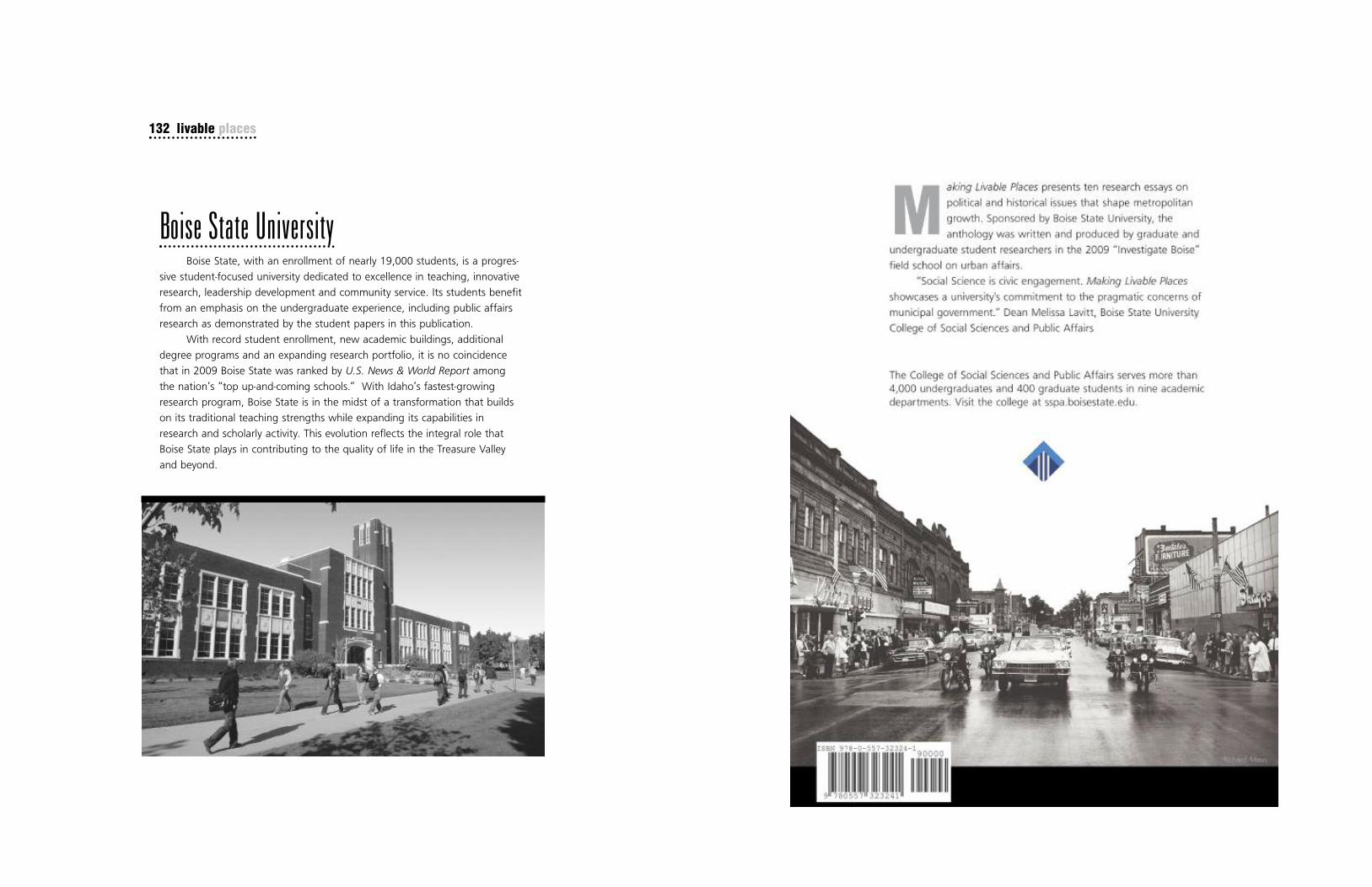
132 livable places
Boise State UniversityBoise State, with an enrollment of nearly 19,000 students, is a progres-
sive student-focused university dedicated to excellence in teaching, innovative
research, leadership development and community service. Its students benefit
from an emphasis on the undergraduate experience, including public affairs
research as demonstrated by the student papers in this publication.
With record student enrollment, new academic buildings, additional
degree programs and an expanding research portfolio, it is no coincidence
that in 2009 Boise State was ranked by U.S. News & World Report among
the nation’s “top up-and-coming schools.” With Idaho’s fastest-growing
research program, Boise State is in the midst of a transformation that builds
on its traditional teaching strengths while expanding its capabilities in
research and scholarly activity. This evolution reflects the integral role that
Boise State plays in contributing to the quality of life in the Treasure Valley
and beyond.