to · Page 2 James Lloyd (d ... Revolutionary War as a cap"2in of the local militia. ... Lloyd's...
46
T-124 Lloyd's Landing Eas+-..on vicinity Private c. 1720, 1939-1940 Lloyd's Landing is a highly significant architectural survival from the early eighteenth century representing the first phase of permanent buildings that have last-..ed until modern times. Estimated to have been erected around 1720-1730, this story-and-a-half hall/parlor dwelling of English bond walls and s+-...eeply pitched roof is one of approximately eight s+--.ructures in Ta] bot County that date comfortably to t.he first half of the eighteenth century (See also Bos+-..on Cliff, T-122; Hampden, T-68; Crooked Intention, T-48; Wickersham, T-56; White Marshes, T-105; Orem' s Delight, T-193; and BJessJand, T-360). Of this group Lloyd's Landing is one of the oldest and best preserved; retaining much of its early eighteenth century character. Significant to the exterior is i-::S well preserved condition and especially the series of exposed joist ends on each elevation, now sheltered by shed roofed porches. The main room or "hall" boas+-..s a finely paneled chimney breast wi-l:-.h a bold bolection molding which frames the firebox. Raised panel wainscoting also enhances the room. Rising against the center pa:r+,.i.tion is a portion of the enclosed s+-,_air. Although par+...iaJly rearranged the second floor retains por+...ions of eighteenth century finishes as well. Notable outbuildings on the property include an early nineteenth century smokehouse and a mid nine+...eenth century hay barn that s+-...ands in a field south of the house. Although professionaJly untes+-...ed at this time, the archeologicaJ resources on this site have great potentiaJ in terms of prehistoric and colonial si"::es. Construction of this early story-and-a-half English bond brick dwelling is beJieved to have been accomplished during the ownership of
Transcript of to · Page 2 James Lloyd (d ... Revolutionary War as a cap"2in of the local militia. ... Lloyd's...

T-124 Lloyd's Landing Eas+-..on vicinity Private
c. 1720, 1939-1940
Lloyd's Landing is a highly significant architectural survival from the early
eighteenth century representing the first phase of permanent buildings that
have last-..ed until modern times. Estimated to have been erected around
1720-1730, this story-and-a-half hall/parlor dwelling of English bond walls
and s+-...eeply pitched roof is one of approximately eight s+--.ructures in Ta] bot
County that date comfortably to t.he first half of the eighteenth century
(See also Bos+-..on Cliff, T-122; Hampden, T-68; Crooked Intention, T-48;
Wickersham, T-56; White Marshes, T-105; Orem' s Delight, T-193; and
BJessJand, T-360). Of this group Lloyd's Landing is one of the oldest and
best preserved; retaining much of its early eighteenth century character.
Significant to the exterior is i-::S well preserved condition and especially
the series of exposed joist ends on each elevation, now sheltered by shed
roofed porches. The main room or "hall" boas+-..s a finely paneled chimney
breast wi-l:-.h a bold bolection molding which frames the firebox. Raised
panel wainscoting also enhances the room. Rising against the center
pa:r+,.i.tion is a portion of the enclosed s+-,_air. Although par+...iaJly rearranged
the second floor retains por+...ions of eighteenth century finishes as well.
Notable outbuildings on the property include an early nineteenth century
smokehouse and a mid nine+...eenth century hay barn that s+-...ands in a field
south of the house. Although professionaJly untes+-...ed at this time, the
archeologicaJ resources on this site have great potentiaJ in terms of
prehistoric and colonial si"::es.
Construction of this early story-and-a-half English bond brick
dwelling is beJieved to have been accomplished during the ownership of

Page 2
James Lloyd (d. 1738), who acquired the Choptank River lands known as
"Parson's Landing" through the 1720 will of his father-in-law, Robert
Grundy. Although James Lloyd ( 1680-1738) and his wife Ann Grundy
( 1690-1732) are documented as the residents of Hope Plantation on
Woodland Creek, the couple continued to own and probably improved the
Choptank River lands, perhaps for their son, James Lloyd, Jis+"...ed as a
mariner in the Talbot County land records. Due to the early eighteenth
century architectural features of the house it is reasonably believed the
house had been ere&...ed by the time of James Lloyd's father death in 1738.
Five years later his brother, Robert, of Queen Anne's County, ":ransferred
his interes+-...s in the Choptank River property to his brd-J1er James. James
Lloyd, the mariner, married EJizabe+-...h Frisby in 1749, and during the
following year their first son, James, was born at Lloyd's Landing. James
Lloyd III presumably remained on the family lands, serving in the
Revolutionary War as a cap"2in of the local militia. He had married Sarah
Martin, a neighbor, in 1772 and held title to his large land holdings until
his death in 1815. At the time of the Revolution, James Lloyd's property
was described in the 1783 tax assessment as:
Rumbley Marsh, 300 acres, Soil Midling on the River 1 Brick Dwelling house, 1 Frame Barn, 1 fram Corn house, 1 frame s+-..ore house in middling repair, 1 fram 'd kitchen, 1 Granary, 1 Quar+...er, 1 Warehouse in bad repair, 1 fr am' d Dwelling house unfinished
In addition to the lands known as "Rumbley Marsh" James Lloyd held also
trac+-...s called "Buckland," "Partnership," and "Grundys Inclosure" along with
other marsh trac+-...s totaling close to 1500 acres.
Fifteen years later the federal "'::ax assessors visited the Choptank
River plantation and described the Lloyd house as

Page 3
1 Dwelling Ho (sic) 1 story Brick 36 by 20, 5 windows 60 by 32 Ines Each 6 Dorman~ windows 40 by 20, value 50 Dollars, 1 Old Ki-Xhen framed 16 by 22 vaJ ue 10 Dol, 1 Meat house Log' d, 10 by 8, 5 Dols, 1 Milk Ho fram'd, 12 by 10, 5 Dols, 1 Fowle Ho Log'd with 1 Acre thereto Situate on Choptank River
Af"-._er James Lloyd's death in 1815 the property was devised by his
will "::o Robert Lloyd who continued to reside on the plantation un':i..l 1839.
At that time the Talbot County court was caned in to settle the personal
insolvency of Robert Lloyd. In 1841 the property, consis+-..ing of three
trad-._s known at that time as MineraJ Springs farm, Warehouse farm, and
Mansion house farm, were sold to William HughJett for $10,000. The river
farm has remained in Hughlett and related Hardcas'-"Je and Henderon family
hands through to the present time. In 1942 the current owner, Margaret
M. Henderson and her husband Charles E. Henderson, Jr., bought out the
other family interes'-"....s in the land and engaged in an ambi"2ous res'-"...oration
of the early Lloyd house.

EISTOP.IC CONTEXT H~FOPJv'..J..TION
Resource Na.Ine: LLOYD'S LANDING
M::T Inventory !~umber: T-124
V~.RYLAND CO~.:?REHENSIVE HISTORIC PRESERVATION PLAN DATA:
1) Historic Period Theme(s): ARCHITECTURE AGRICULTURE
2) Geographic Orientation: EASTERN SHORE
3) Chronological/Developmental Period(s):
RURAL AGRARIAN INTENSIFICATION AGRICULTURAL-INDUSTRIAL 1680-11815 TRANSITION 1815-1870
4) Resource Type(s): SINGLE-FAMILY DWELLING, c. 1720
PERIOD OUTBUILDINGS
1. Smokehouse, c. 1830 2. Barn, c. 1850

Survey No. T-124
Maryland Historical Trust State Historic Sites Inventory Form
Magi No.
DOE _yes no
1. Name (indicate preferred name}
historic LLOYD'S LANDING, PARSON'S LANDING, MANSION HOUSE FARM
and/or common LLOYD'S LAND I NG
2. Location
street & number End of Lloyd's Landing Road
city, town Easton
state Maryland
3. Classification Category __ district ~ building(s) __ structure __ site _object
Ownership __ public ~private
_both Public Acquisition __ in process __ being considered ~not applicable
_x_ vicinity of
county
Status ~occupied __ unoccupied __ work in progress Accessible -*----yes: restricted _ yes: unrestricted __ no
congressional district
Talbot
Present Use __ agriculture _commercial __ educational __ entertainment __ government __ industrial __ military
__ not for publication
First
__ museum __ park _x_ private residence __ religious __ scientific __ transportation __ other:
4. Owner of Property (give names and mailing addresses of ~ owners)
name Mrs. Charles Henderson, Jr.
street & number P. 0. Box 40 telephone no. :
city, town Easton state and zip code MD 2 160 l
5. Location of Legal Description
courthouse, registry of deeds, etc. Talbot County Clerk of Court liber lS'.3
street & number Talbot County Courthouse folio I lf 1
city, town Easton state MD 2 160 I
6. Representation in Existing Historical surveys
title Maryland Historic Sites Inventory
date l 9 7 2 __ federal ~ state __ county __ local
pository for survey records Maryland Historical Trust
city, town Annapolis state MD 2 14 0 l

7. Description
Condition ~excellent _good _fair
Check one _ deteriorated _ unaltered _ ruins ~ altered _unexposed
SurveyNo. T-124
Check one x . . . _ original site
_moved date of move
Prepare both a summary paragraph and a general description of the resource and its various elements as it exists today.
The historic property known as Lloyd's Landing is located at the end of Lloyd's Landing Road which intersects Landing Neck Road approximately two miles southeast of US Route 50 a mile south of Easton, Talbot County, Maryland. The story-and-a-ha]£ brick house, situated on a large farm, faces south with the gable roof oriented on an east/west axis. The property has an er..ensive shoreline along the Choptank River.
Reasonably dated to the first quar+..er of the eighteenth century--c. 1720--this s+--....ory-and-a-haJf haU/parlor brick dwelling of English bond walls and a steeply pitched wood shingle roof, is supported by a raised foundation that is defined by a simple s+--..epped water+....able. Sheltering the front and rear walls are chamfered post, shed roofed porches. Attached to the west gable end is a 1939 story-and-a-half brick addition that doubled the space of the original house. The oldest outbuilding is an early nine+--...eenth century frame smoke house. A mid nine+--...eenth century frame hay barn s+--....ands in the middle of the adjacent fields south of the house.
The south (main) facade of the earlv brick house is a three-bav elevation with an off-center entrance and fl~nking twelve-over-twelve sa;h windows. Heavy mor-dse-and-tenon timber surrounds frame the windows as well as the over-sized five-panel front door. Bold cyma curve backband surrounds enhance the door and window frames. One of the rarest exeterior features of the house is the series of exposed joist ends that has been protected by the shed roof of the porch. The bottom ends of the wooden pins that fix the rafter feet to each joist are clearly visible. Piercing the steeply pitched roof is a pair of gable roofed dormers filled with six-over-six sash windows.
The east gable end of the hall/parlor house is patially covered by a screened in gable roofed porch. An er..erior brick chimney rises against the gable end and is finished with a corbelled cap. A faint remnant of the stuccoed banding below the corbelled cap is clearly evident on the east end s+--....ack. Directly north of the chimney s+--....ack is a twelve-overtwelve sash window. The gable end to the house is flush and trimmed with a simply molded bargeboard.
The west end of the old house is covered comple+""..ely by the 1939 story-and-a-half addition that repeateQ the originaJ dwelling in approximate size and shape. Rising in the center of the house at the junction of the original house with the twentieth century addition is a second corbelled cap brick chimney. The roof of the addition follows the same pitch as the original house, and the chamfered post porch was extended on the same line as well. In addition six-over-six sash dormers were positioned on both
slopes of the roof in imitation of the originaJ dwelling. At'-"....ached to the west end of the 1939 addition is a single ~....cry gable roof wing.
(continued)

T . ~ '·' ' .... · l
Page 2
LLOYD'S LANDING DESCRIPTION (CONTINUED)
The interior of the early house follows a hall/parlor plan with a large percentage of the original woodwork intact. The main room or "hall" boa~....s a raised panel overmanteJ over a bold boJection molding which frames the fireplace. Raised panel wainscoting and a heavy cornice molding trims the perimeter of the room. Fixed against the middle par+..ition is a por+..ion of the original enclosed stair which had access from the hall as wen as the old "parlor," now used as a dining room. A raised two-panel door hung on HL hinges survives in the hall. Although the lower por+..ion of the ~...air was preserved during the 1939 re~...oration the upper run of ~...eps was removed to allow for e:x+-...ra room in the dining room. A centrally positioned raised two-panel door framed by a cyma curve backband molding pierces the hall par+..ition allowing for movement between rooms. In the dining room the raised panel chimney breast has survived, and a board mantel shelf has been added. To the right of the fireplace is a raised panel closet door which ret:ains a por+..ion of an early chair rail molding. Otherwise, the chair rail is missing from this room. When the 1939 addition was attached a doorway was cut through the back wall of the closet for access to the new kitchen. In addition a cornice molding was added to this room.
The second floor has been altered with the addition of a partition that subdivided the west bedroom. In the process of renovation the original stair access, which came through the west bedroom, was sealed off and access was introduced from the west end addition. To allow for privacy in both rooms a small hall partition was introduced which reduced the size of the west bedroom. Surviving in the west bedroom is a raised panel end walJ with an adjacent two-panel closet door hung on HL hinges. The east bedroom has a small fireplace and new clos~....s.
standing behind the house is a smaU gable roofed smokehouse cJad with asbe~...os shingles and covered with a ~...eeply pitched corrugated tin roof. The gable front main elevation is pierced by an off-center board door hung on Jong strap hinges. The sides of the smokehouse are plain walls with simple boxed cornices at the base of the roof. Inside the exposed mortise-and-tenon frame is smoke blackened.
Located in the field south of the house is a mid-to-late nin~...eenth century hay barn supported on a brick pier foundation and sheathed with board and ba~...en siding. The medium pitched roof is covered with sheet tin. Extending from the north and south sides are shed roofed e:x+-...ensions. The mortise-and-tenon frame ~...ructure is divided into two levels with board doors allowing access through the front wall to each level. Inside the barn, a stair is fixed in the northwest corner.
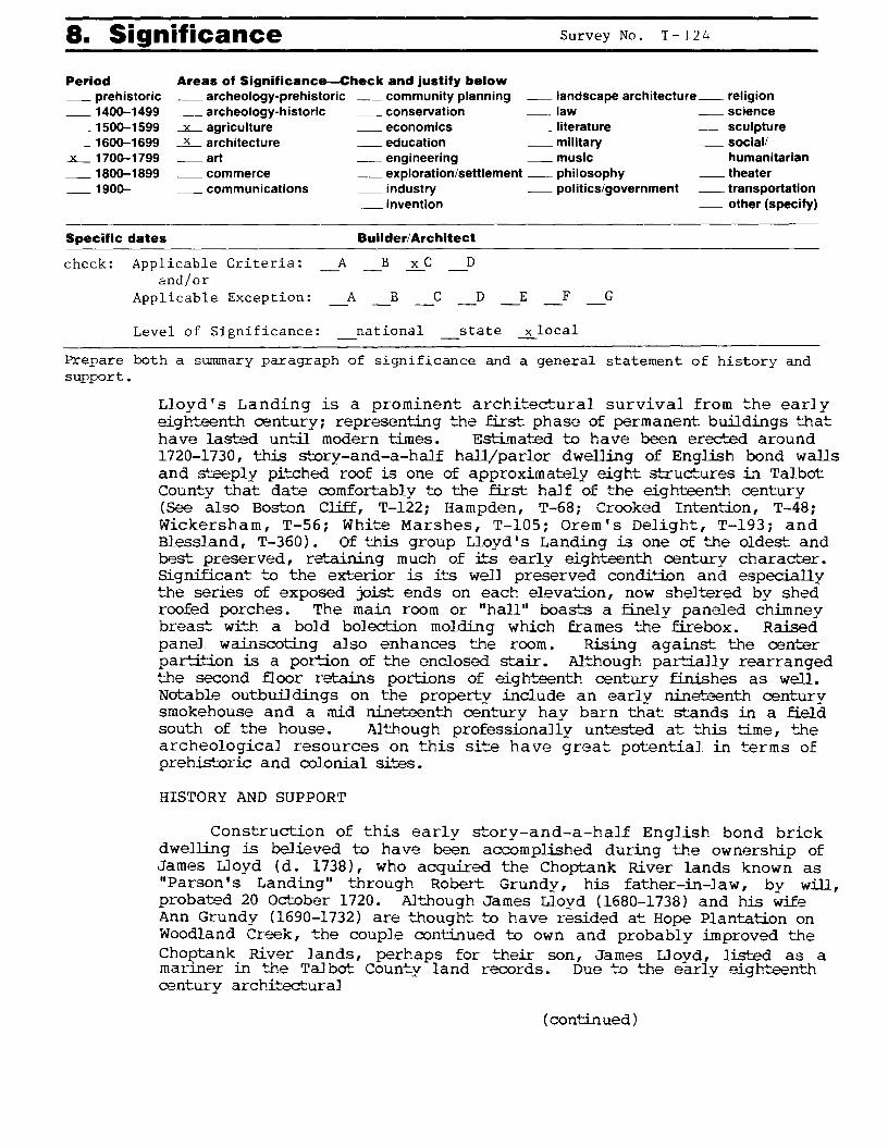
8. Significance Survey No. T - I 2 4
Period Areas of Significance-Check and justify below _ prehistoric _ 1400-1499
__ archeology-prehistoric _community planning _landscape architecture_ religion __ archeology-historic _ conservation _ law _ science
- 1500-1599 - 1600-1699
_x_ 1700-1799 _ 1800-1899 _ 1900-
Specific dates
__x_ agriculture _ economics _ literature _ sculpture -~ architecture _ education _ military _ social/ _ art _ engineering _ music humanitarian _ commerce _exploration/settlement _ philosophy _ theater __ communications _ industry _ politics/government _ transportation
_ invention _ other (specify)
Builder/ Architect
check: Applicable Criteria: and/or
A B x C D
Applicable Exception: A B C D E F G
Level of Significance: national state ~local
Prepare both a summary paragraph of significance and a general statement of history and support.
Lloyd's Landing is a prominent architectural survival from the early eighteenth century; representing the first phase of permanent buildings that have las+--.ed until modern times. Est.Lrnated to have been erected around 1720-1730, this story-and-a-half hall/parlor dwelling of English bond walls and steeply pitched roof is one of approximately eight structures in Talbot County that date comfortably to the first half of the eighteenth century (see also Bos+-._on Cliff, T-122; Hampden, T-68; Crooked Intention, T-48; Wickersham, T-56; White Marshes, T-105; Orem' s Delight, T-193; and Blessland, T-360) . Of this group Lloyd's Landing is one of the oldest and best preserved, retaining much of its early eighteenth century character. Significant to the exterior is its well preserved condition and especially the series of exposed joist ends on each elevation, now sheltered by shed roofed porches. The main room or "hall" boas+-...s a finely paneled chimney breast with a bold bol~--ion molding which frames the firebox. Raised panel wainscoting also enhances the room. Rising against the center partition is a portion of the enclosed s+-...air. Although partially rearranged the second floor retains portions of eighteenth century finishes as well. Notable outbuildings on the property include an early nineteenth century smokehouse and a mid nin~...eenth century hay barn that stands in a field south of the house. Although professionaJly untes+--.ed at this time, the archeological resources on this si::.e have great potential in terms of prehistoric and colonial sites.
HISTORY AND SUPPORT
Construction of this early story-and-a-half English bond brick dwelling is believed to have been accomplished during the ownership of James Lloyd (d. 1738), who acquired the Choptank River lands known as "Parson's Landing" through Robert Grundy, his father-in-law, by will, probated 20 October 1720. Although James Lloyd ( 1680-1738) and his wile Ann Grundy (1690-1732) are thought to have resided at Hope Plantation on Woodland Creek, the couple continued to own and probably improved the Choi;>tank River lands, perhaps for their son, James Lloyd, listed as a manner in the Talbot County land records. Due t:o the early eighteenth century architectural
(continued)

Page 2
HISTORY AND SUPPORT (CONTINUED)
features of the house it is reasonably believed the house had been erected by the time of James Lloyd's father death in 1738. Five years later his brother, Robert, of Queen Anne's County, transferred his interes+-...s in the Choptank River property to his brcr...her James. (16/26) James Lloyd, the mariner, married Elizabeth Frisby in 1749, and during the following year their first son, James, was born at Lloyd's Landing. James Lloyd III presumably remained on the famDy lands, serving in the Revolutionary War as a captain of the local militia. He had married Sarah Mar+..in, a neighbor, in 1772 and held title to his large land holdings until his death in 1815. At the time of the Revolution, James Lloyd's property was described in the 1783 tax assessment as:
Rumbley Marsh, 300 acres, Soil Midling on the River 1 Brick Dwelling house, 1 Frame Barn, 1 fram Corn house, 1 frame s'""....ore house in middling repair, 1 fr am' d kitchen, 1 Granary, 1 Quar+...er, 1 Warehouse in bad repair, 1 fr am' d Dwelling house unfinished
In addition to the lands known as "Rumbley Marsh" James Lloyd held also trac+-...s called "Buckland," "Partnership," and "Grundys Inclosure" along with other marsh trac4"'...s totaling close to 1500 acres.
Fifteen years later the federal -tax assessors visited the Choptank River plantation and described the Lloyd house as
1 Dwelling Ho (sic) 1 story Brick 36 by 20, 5 windows 60 by 32 Ines Each 6 Dormants windows 40 by 20, value 50 Dollars, 1 Old Ki"'xhen framed 16 by 22 value 10 Dol, 1 Meat house Log'd, 10 by 8, 5 Dols, 1 Milk Ho fr am' d, 12 by 10, 5 Dols, 1 Fowle Ho Log' d wi':h 1 Acre thereto Situate on Choptank River
Af'-...er James Lloyd's death in 1815 the property was devised by his will to Robert Lloyd who continued to reside on the plantation until 1839. At that time the Talbot County court was called in to settle the personal insolvency of Robert Lloyd. In 1841 the property, cons.is+-...ing of three tracts known at that time as Mineral Springs farm, Warehouse farm, and Mansion house farm, were sold to William Hughlett for $10,000. The river farm has remained in Hughlett and related Hardcas'""..le and Henderon family hands through to the present time. In 1942 the current owner, Margaret M. Henderson and her husband Charles E. Henderson, Jr., bought out the other family interes'""...s in the land and engaged in an ambitious res'""....oration of the early Lloyd house.

9. Major Bibliographical References Survey No. T- 124
1 o. Geographical Data Acreage of nominated property _________ _
Quadrangle name _______ _ Quadrangle scale ______ _
UTM References do NOT complete UTM references
ALU I I I I I I I I I I B LJ I I I I I I I I I I Zone Easting Northing Zone Easting Northing
cL.i.J ~I_._. __ ..._._!~! _.___.__.._.&....,l....&....,j o LU I I I I E LLJ I I .._I _.__._.__ __ F LL_j I I aLi.J I I ~I....___.._._ ...... __. H LiJ I Verbal boundary description and justification
List all states and counties for properties overlapping state or county boundaries
state code county code
state code county code
11. Form Prepared By
name/title P au 1 T o u a r t Ar ch i t e c t u r a 1 H i s t o r i an
organization Private Consultant date s I 1I9 1
street & number P. 0. Box 5 telephone 301-651-1094
city or town Westover state Maryland
The Maryland Historic Sites Inventory was officially created by an Act of the Maryland Legislature to be found in the Annotated Code of Maryland, Article 41, Section 181 KA, 1974 supplement.
The survey and inventory are being prepared for information and record purposes only and do not constitute any infringement of individual property rights.
return to: Maryland Historical Trust Shaw House 21 State Circle Annapolis, Maryland 21401 (301) 269-2438
2 18 7 1
PS-2746

,--~· ~ ,~ -·c !'/I '~ n - t. \ 0 \ ~lf s l~
T-124 MARYLAND HISTORICAL TRUST
INVENTORY FORM FOR STATE HISTORIC SITES SURVEY
HISTORIC
ANO/OR COMMON
Lloyd's Landing IJLOCATION
STREET & NUMBER
Lloyd's Landing Rd., 2.1 miles east of Jackson Rd. CITY. IOWN CONGRESSIONAL DISTRICT
Trappe _VICINITY OF
STATE
Maryland DcLASSIFICATION
CATEGORY OWNERSHIP
-DISTRICT _PUBLIC
~BUILDINGISI &f'RIVATE
_STRUCTURE -BOTH
-SITE PUBLIC ACQUISITION _OBJECT _IN PROCESS
-BEING CONSIDERED
DOWNER OF PROPERTY NAME
Mrs. Charles Henderson, Jr. STREET & NUMBER
Box 40 CIT -r· 1, ;.·
STATUS
~OCCUPIED
_UNOCCUPIED
_WORK IN PROGRESS
ACCESSIBLE _YES: RESTRICTED
_YES UNRESTRICTED
~NO
Easton _ v1c1N1TY oF
llLOCATION OF LEGAL DESCRIPTION COURTHOUSE.
REGISTRY oF oEEDs.ETc Talbot County Courthouse STREET & NUMBER
Washington Street CITY. TOWN
Easton II REPRESENTATION IN EXISTING SURVEYS
TITLE
DATE
First COUNTY
Talbot
PRESENT USE
_AGRICULTURE _MUSEUM
_COMMERCIAL __ PA;lK
_EDUCATIONAL ~PRIVATE RESIDENCE
_ENTERTAINMENT _RELIGIOUS
_GOVERNMENT _SCIENTIFIC.
_INDUSTRIAL _ TRANSPOiHl>'•C!N
_MILITARY _OTHER
Telephone #:(301) 476-3248
STATE ' Zlp code Maryland 21601
Liber #: 32 Folio #: 134
STATE
Maryland 21601
_FEDERAL _$TATE _COUNTY _LOCAL
DEPOSITORY FOR
SURVEY RECORDS
CITY.TOWN STATE

B DESCRIPTION
:i.EXCELLENT
-GOOD
_FAIR
CONDITION
_DETERIORATED
_RUINS
_ UNEXPOSED
CHECK ONE
_UNALTERED
kALTERED
CHECK ONE
~ORIGINAL SITE
_MOVEO DATE: __ _
DESCRIBE THE PRESENT AND ORIGINAL (IF KNOWN) PHYSICAL APPEARANCE
Lloyd's Landing is located on the east side of the County on, the Choptank River across from Frazier Point. The house was doubled in size about 1950 and a garage was built onto the addition. beside those extensions on the west side, a screened porch was added on the east overlooking the river.
The old part of the house is two bays long plus a central entrance on the south side only. A porch extends across both south and north sides. The one and one-half story structure is laid in English bond below and above the stepped water table. The sash of the first story have 12/12 lights and are in original frames. Likewise the central door frame is original and the door itself has five panels. On each side of the 'A' roof are two dormer windows with 6/6 sash. Large chimneys rise partly within the gable walls, although the west chimney is now in the center of the building. One unique feature about the building is the exposed joists beneath the roof. There was never a boxed cornice as there were in most other buildings in Talbot. The north side of the house has two large windows with a small casement near the exposed joists to light the stair.
The entrance opens into the 'Hall' of the 'hall and parlor' plan. The 'Hall•or living room has a fireplace on the east wall with two large horizontal panels above the bolection molded fireplace opening. There is raised panel dado and window seats throughout. In the northwest corner of the room are three steps leading to a two panel door and the stair beyond, enclosed within the 'parlor' or dining room. There is also a two piece cornice around the room. Windqw trim is original and has only a ovolo molding on the edge of the jamb.
Another door and short set of stairs opens from the dining room. Some original trim exists in the dining room but not as much as the living room.
On the second story, the stair ascended to a small vestibule from which opened the two original bed rooms. Each room had a small fireplace but little trim of the period.
Beneath the dining room was a basement, but there was only crawl space beneath the living room, a common feature of houses built in the first half of the 18th century.
CONTINUE ON SEPARATE SHEET IF NECESSARY

II SIGNIFICANCE
PERIOD AREAS OF SIGNIFICANCE -- CHECK AND JUSTIFY BELOW
_PREHISTORIC --ARCHEOLOGY-PREHISTORIC _COMMUNITY PLANNING _LANDSCAPE ARCHITECTURE
_1400-1499 --ARCHEOLOGY-HISTORIC _CONSERVATION _LAW
_1500-1599 hGRICULTURE _ECONOMICS _LITERATURE
- 1600-1699 --ARCHITECTURE _EDUCATION _MILITARY
~1700-1799 __ART _ENGINEERING _MUSIC
_ 1800- 1899 _COMMERCE _EXPLORATION/SETTLEMENT _PHILOSOPHY
_ 1900- _COMMUNICATIONS _INDUSTRY _POLITICS/GOVERNMENT
_INVENTION
SPECIFIC DATES BUILDER/ ARCHITECT
STATEMENT OF SIGNIFICANCE
_RELIGION
_SCIENCE
_SCULPTURE
_SOCIAUHUMANITARIAN
_THEATER
_TRANSPORTATION
_OTHER (SPECIFY)
Architecturally Lloyd's Landing is a superior example of the type house most often constructed by prosperous fa:mn families of the first half of the 18th century. It is unique in that all facades are laid in English bond and that the joist ends are exposed, similar to Cloverfield, Queen Anne's County. The floor plan is also unusual, probably being similar to Clifton near Easton and several later houses in Dorchester County. Its interior is also noteworthy for the fine paneling which still exists in the living room and the unusual manner in which it is treated.
In the 1798 Tax, the building was owned and occupied by James Lloyd and the property was called part of Jamaica. Beside that explained above, there was then a framed kitchen 16 by 22, a log meat house 12 x 12, framed milk house 10 x 12, and a fowl house.
CONTINUE ON SEPARATE SHEET IF NECESSARY

IJMAJOR BIBLIOGRAPHICAL REFERENCES Forman, H.C., Earl)' Manor~ Plantation Houses •••• , 1934, p.187,
(Old Manor Farm • Wilson, E.B., Mab!land's Colonial Mansions, A.S. Barnes & Co.,
New York, p. , 65. CONTINUE ON SE~AR.ATE SHEET I~ NECESSARY
ll!JGEOGRAPHICAL DATA ACREAGE OF NOMINATED PROPERTY--------
VERBAL BOUNDARY DESCRIPTION
LIST ALL STATES AND COUNTIES FOR PROPERTIES OVERLAPPING STATE OR COUNTY BOUNDARIES
STATE COUNTY
STATE COUNTY
mFORM PREPARED BY NAME I TITLE
Michael Bourne, Architectural Consultant ORGANIZATION DATE
Maryland Historical Trust Aug., 1975 STREET 8i NUMBER TELEPHONE
Shaw House, 21 State Circle CITY OR TOWN STATE
Annapolis Maryland 21401
The Maryland Historic Sites Inventory was officially created by an Act of the Maryland Legislature, to be found in the Annotated Code of Maryland, Article 41, Section 181 KA, 1974 Supplement.
The Survey and Inventory are being prepared for information and record purposes only and do not constitute any infringement of individual property rights.
RETURN TO: Maryland Historical Trust The Shaw House, 21 State Circle Annapolis, Maryland 21401 (301) 267-1438
PS· 1 IOS

LLOYD'S LANDING T-124
YEAR: 1942 VOL/PAGE: 253/147 FROM: Yellot F. Hardcastle et al* PRICE: TO Margaret M. Henderson NOTES: *Others are Helen W. Hardcastle, Mary L. H. Wright, Margaret M. Henderson. There are three farms on this deed. This is number one called "Mansion House" or "Lloyd's Landing" Farm. 505 acres. Conveyed to the grantors by Mary L. H. Wright and T. Hughlett Henry, the executors of Hughlett Hardcastle, dcd. by deed 1939, 245/403. The interests of the other survivors were transferred in 1940. The other farms were "Marshland"and "Rigby Marsh" - all descended from Edward B. Hardcastle. "Marshland went to Edward B. by his mother Sarah D. Hardcastle. (Will 1877, 12/202)
YEAR: 1939 VOL/PAGE: 245/403 FROM: Mary L. H. Wright and T. Hughlett Henry, Extrs. PRICE: TO Y. Hardcastle, M. L. H. Wright, M. M. Henderson & E. M. Hardcastle NOTES: Distribution made according to the will of Hughlett Hardcastle 1938, 24/432. 505 acres of "Mansion House" or "Lloyd's Landing" Farm.
Conveyed to William Hughlett by James Lloyd Martin, trustee 1841, 56/129 (Parcel 3). Devised to Sarah D. Hughlett by her father William Hughlett by will 1845. 9/371. Devised to Hughlett Hardcastle by his mother Sarah D. Hardcastle, formerly Sarah D. Hughlett by will 1877, 12/202.
YEAR: 1841 VOL/PAGE: 56/129 FROM: James LLoyd Martin PRICE: $10008.37 TO William Hughlett NOTES: By authority of the Equity Court, 9 June 1840 to dispose of the real estate of James Lloyd, dcd. for payment of his debts. There were three tracts: (1) "Mineral Spring Farm" per plat made by John H. Harris 361+ A
(2) "Warehouse Farm" 176+ acres.
(3) "Mansion House Farm"

LLOYD'S LANDING PAGE TWO
YEAR: 1743 VOL/PAGE: 16/26 FROM: Robert Lloyd (of Queen Anne's County) PRICE: TO James Lloyd (Mariner) NOTES: For natural love and affection his moiety in the lands devised to him by Robert Grundy in his will written 20 Oct 1720. Consists of 1050 acres contained in several tracts "and all other lands withinn 3 miles of Parson's Landing" for life. The property apparenly stayed with the Lloyd family until the death of the last Lloyd in 1840.
YEAR: 1704 VOL/PAGE: 9/278 FROM: Thomas Marsh and Elizabeth PRICE: TO Robert Grundy NOTES: "The remainder of 500 acres called "Marshland" formerl laid out for Sarah Marsh, widow". The land tranf erred is what remains of the 500 acres after 70 acres was sold to James Anderson and 165 acres to Naomi Berry. By "estimation" the remainder was 265 acres.
YEAR: 1663 VOL/PAGE: ptent FROM: PRICE: TO Sarah Marsh NOTES: Laid out for Sarah Marsh a parcel of land called MARSHLAND lying on the N side of the Choptank river uponm a point in a creek called St. Michaels Creek and running for breadth W x S 150 perches to a marked pohickory at the head of the creek by a marsh. Bounded on the W by a line N x W from the said pohickory or length 500 perches on the N by a line drawn E x N from the end of the N x W line 150 perches on the E by a line drawn S x E from the end of the E x N line 500 perches to the first marked oak upon the point on the S by the creek. Containing 500 acres.
It takes some juggling to fit this tract to Parson's - Lloyd's Landing on the map!!
Parson's Landing (derivation unknown) was an important tobacco shipping point, the site of a ferry, a warehouse.and a tavern from the late 17th century. There are several references to ships laying at the Landing awaiting cargoes. There is also a deed making a contract to construct a tobacco inspection warehouse. Too bad an archeological survey could not have been made before the area was covered by a par-:

r.H .. \~l'''N''~l'.N/ . ,,.,.,l/•1"r·~
fl:.s·1nrow
· . ... -· •' .- • if>'tA'J/ Ha ,y/ru.r-t /,
'hk1R --
~~{/!:. r:. ,s·,..,., -..
"'Ho,,,.,.
• ·Lllnrlrr.r
,..X-,,,.Hruidnwur
~;~·- x e c"k '""".,,,...,,....,,.,.~
' i . ~ ' ' ~ ' ·~
7',.,.)+llrl'-HrLlL
'
. Sl r1,,,-,.11'ntfs
1.oru,,-A,. ' ~
/f)7 7
1'2 f
"
lA7C€ C)~ ~--y~F(;/il
t' ~ ,..,? ./
A-rc-4-c-5'
l (._ 0 /_ ~(/' _,v7
Dist.X!? 3 TALBOT CO.
_I .. _

' . r:;;;.~H r. Vnrtin ) ,.__
\
\ I • • \
\ \ .
"i¥UF /
ii/ii ~r.r k• J.JLlh . Dll. ' -----·- ····--··
,,.,.J..ll rl'Ha7l
·•
Dist.X9. 3 TALBOT CO.
/.-.1,c., (,..,,..:.f'f:',.,..f• e I ~...-~..._,o,,
\~77 ATLAS
T - \ z. t..1 t:
••• 11'.rt. ,,r •y.· .. ~w-~u • Jlt!1. • .....
• "./':rt.,,r ~ •.pJDri:lru
... " "' ... ~ .
·f_11pf~o.u --.

p (( £;~ roN "sc-.s .,,S"' rofo C'2111tb
1- i~Y • 'I ~ r~~ - - ............
z'
• j • "ll t - "
1-C)}r=====-1,
.i[ • II •• II
b II II
7- - l' ·-
~$-:fi-----tJ~ ~: -- "" ~f)" Point ---.-~, . -
J. it/ ,;13114~lf:iff~_o-t-~-· --J---~ ·~83
t:Cl ';:Q
\
~. g,l~t3J.t0/1.~'i'W';V '
~ '-, -
: -- ~ . . ... . .
...... ·, . .. . ~ ··~ ·. . ,. .. -. ... .... . -
\
/:~~!... . l' "l <$-. l'~~ .. .... _ . :L
/ --··-.
. I \
i
\
\ \

.;2'30"
II~
I
T ... t 1. 4 Lt.. 0'11>', p f{.f"~ 'f'""O ,.JI
(q4t\-
)
I
: ~ . J --======:J
. ~ 0-d_::!J ( . .. 1 -< ~
11 r
~%....=:=====-""= l·r~ 11 ·.1. If
II
I! ~ ·-
---Frazier Point , __ __
r
.. ..
-m ';:c
. ··' ~"
\
\
3
\
\ \

..
r-1 if Le. ~t 11'§
fA'-~or M/IP ..

..
r- ii" L ..... 011 '~ lkYVo'"" r. I'/ 1 &f "~ ,e::: u~ .re
Ote1(, N~ ,- /W ~-s. d?. < 5 ,..,, " ..... 1""" CJ ."i Ct..,,.,.4 1-tf"f /?. f*NOe'1 .!'<I~


r
·. . . .... ·· '"' ~ -~ l )' ·~· • ' w ~ ~ . ~ . . .


T-124 LLOYD ' S LANDING Easton vicinity, Talbot County, MD East elevation 5/91, Paul Touart, photographer Negative/MD Historical Trust


T-124 LLOYD'S LANDING Easton vicinity , Talbot County, MD Southeast elevation 5/91, Paul Touart, photographer Negative/MD Historical Trust


T-124 LLOYD ' S LANDING Easton vicinity, Talbot County, MD Northeast elevation 5/91 , Pa u l Touart , photographer Negative/MD Historical Trust


T-124 LLOYD ' S LANDING Easton vicinity, Talbol Counly, MD East elevation 5/91, Paul Touart, photographer Negative/MD Historical Trust


T-124 LLOYD'S LANDING Easton vicinity, Talbot County, MD Southeast elevation S/91, Paul Touart, photographer Negative/MD Historical Trust


T-124 LLOYD ' S LANDING Easton vicinity, Talbot CounLy, MD Exposed joist ends 5/91, Paul Touart, phographer Negative/MD Historical Trust


T-124 LLOYD'S LANDING Easton vicinity, Talbo~ County, MD "Hall" chimney breasL paneling 5/9 l > Paul Touart> photographer Negative/MD Historical Trust


T-124 LLOYD'S LANDING Easton vicinity, Talbot County, MD Front door 5/91, Paul Touart, photographer Negative/MD Historical Trust


T-124 LLOYD'S LANDING Easton vicinity, Talbot County, MD Barn Northwest elevation 5/91, Paul Touart, photographer Negative/MD Historical Trust


T-124 LLOYD ' S LANDING Easton vicinity, Talbot County, MD Smokehouse Southeast elevation 5/91, Paul Touart, photographer Negative/MD Historical Trust


lwvor t.1Wo11Jl.., -llnwrco. T-it?--4 3/1) Jfl<!-