TISEC OPEN SOURCE, WEB-BASED, SPATIAL DECISION SUPPORT TOOL FOR TIDAL POWER SITING IN WASHINGTON...
17
TISEC OPEN SOURCE, WEB-BASED, SPATIAL DECISION SUPPORT TOOL FOR TIDAL POWER SITING IN WASHINGTON STATE
-
Upload
dominic-romero -
Category
Documents
-
view
220 -
download
0
Transcript of TISEC OPEN SOURCE, WEB-BASED, SPATIAL DECISION SUPPORT TOOL FOR TIDAL POWER SITING IN WASHINGTON...
TISECOPEN SOURCE, WEB-BASED, SPATIAL DECISION SUPPORT TOOL FOR TIDAL
POWER SITING IN WASHINGTON STATE

Tidal In-Stream Energy Conversion
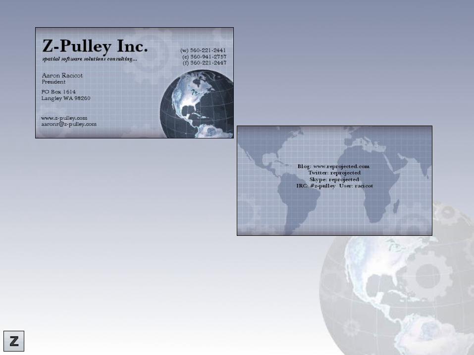
Z-Pulley Inc2
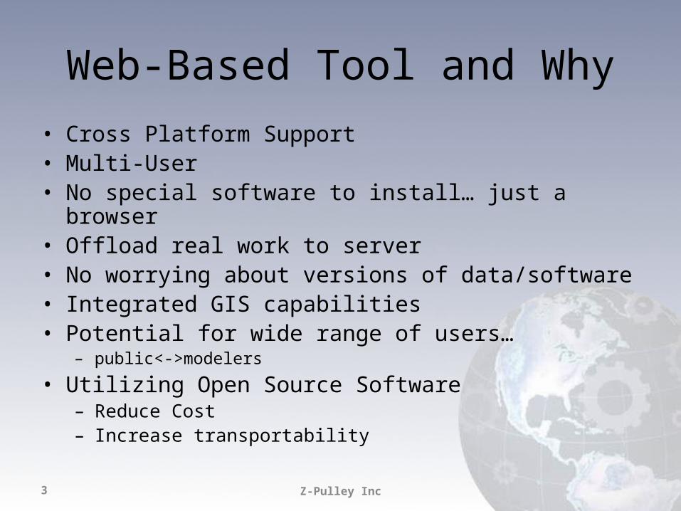
Web-Based Tool and Why• Cross Platform Support• Multi-User• No special software to install… just a browser• Offload real work to server• No worrying about versions of data/software• Integrated GIS capabilities• Potential for wide range of users…
– public<->modelers
• Utilizing Open Source Software – Reduce Cost– Increase transportability
Z-Pulley Inc3
Z-Pulley Inc4
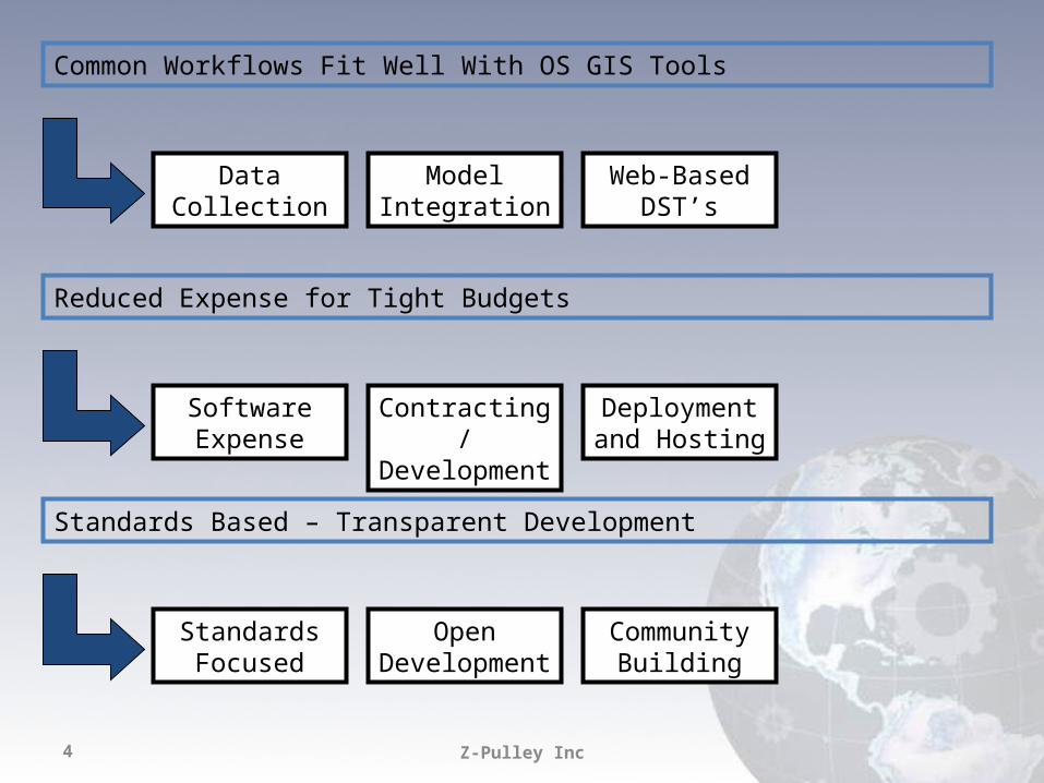
Common Workflows Fit Well With OS GIS Tools
Data Collection Model Integration
Web-Based DST’s
Reduced Expense for Tight Budgets
Software Expense
Contracting/ Development
Deployment and Hosting
Standards Based – Transparent Development
Standards Focused
Open Development
Community Building
Flexibility
Z-Pulley Inc5
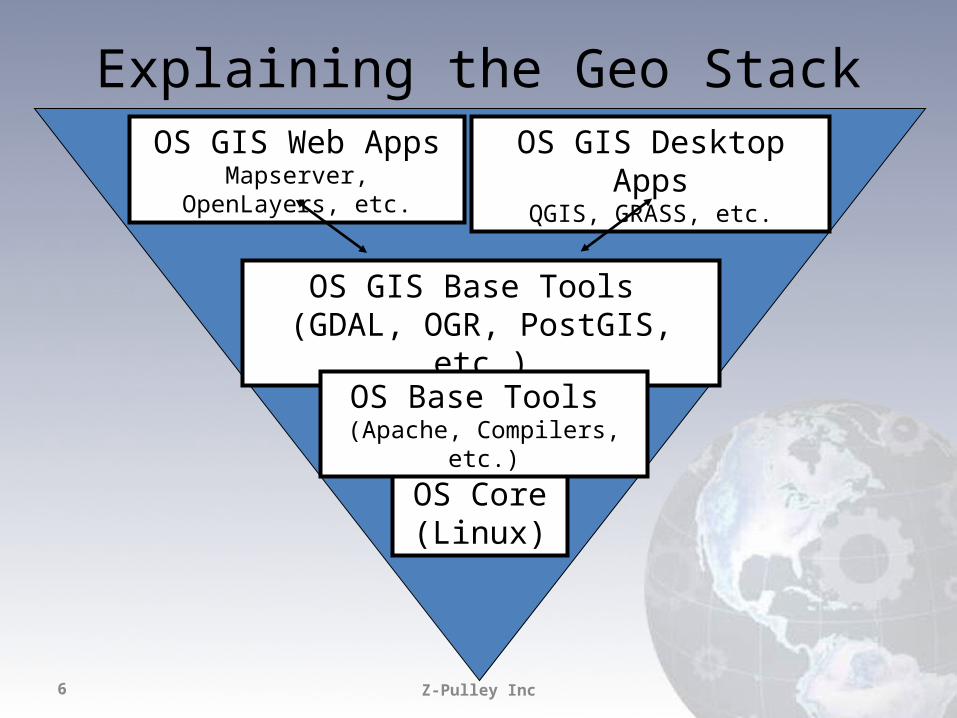
Explaining the Geo Stack
Z-Pulley Inc6
OS Core(Linux)
OS GIS Base Tools (GDAL, OGR, PostGIS, etc.)
OS GIS Web AppsMapserver, OpenLayers, etc.
OS Base Tools (Apache, Compilers, etc.)
OS GIS Desktop AppsQGIS, GRASS, etc.
Z-Pulley Inc7
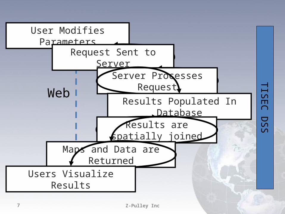
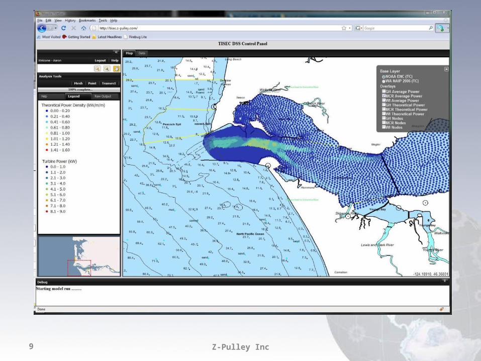
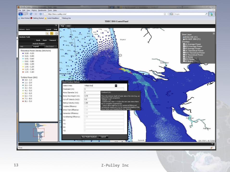
TISEC DSS
User Modifies Parameters
Request Sent to Server
Server Processes Request
Results Populated In Database
Results are spatially joined
Maps and Data are Returned
Users Visualize Results
Web
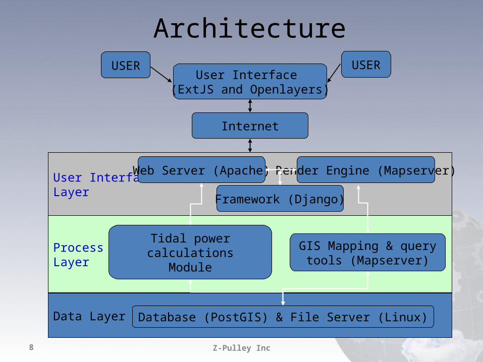
Architecture
Z-Pulley Inc8
Data Layer
ProcessLayer
User InterfaceLayer
USER USERUser Interface
(ExtJS and Openlayers)
Internet
Web Server (Apache)
Tidal power calculationsModule
GIS Mapping & query tools (Mapserver)
Database (PostGIS) & File Server (Linux)
Render Engine (Mapserver)
Framework (Django)
Z-Pulley Inc9
ExtJS
Z-Pulley Inc10
Django
Z-Pulley Inc11
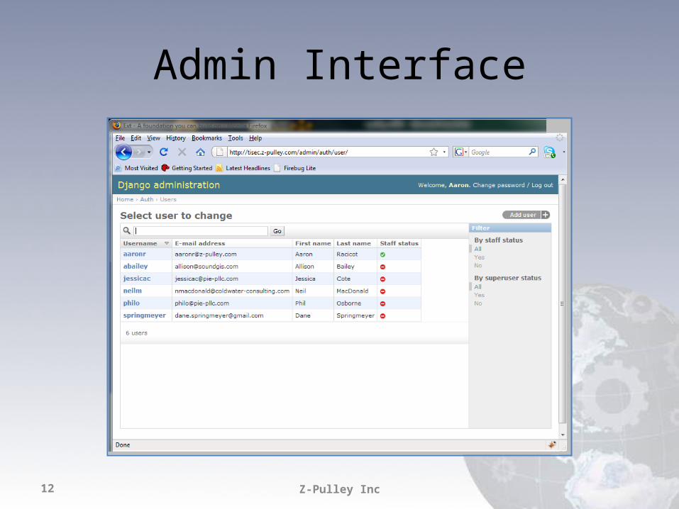
Admin Interface
Z-Pulley Inc12
Z-Pulley Inc13

Z-Pulley Inc14
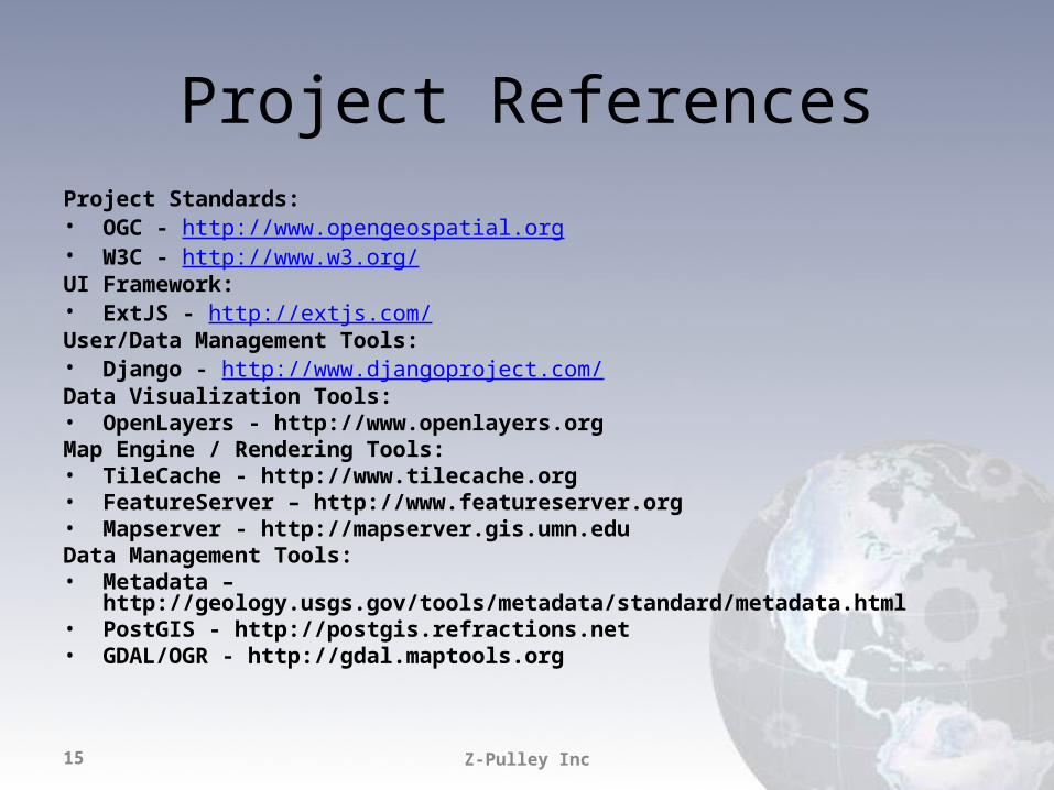
Project ReferencesProject Standards: • OGC - http://www.opengeospatial.org • W3C - http://www.w3.org/ UI Framework: • ExtJS - http://extjs.com/ User/Data Management Tools: • Django - http://www.djangoproject.com/ Data Visualization Tools: • OpenLayers - http://www.openlayers.org Map Engine / Rendering Tools: • TileCache - http://www.tilecache.org • FeatureServer – http://www.featureserver.org • Mapserver - http://mapserver.gis.umn.edu Data Management Tools: • Metadata – http://geology.usgs.gov/tools/metadata/standard/metadata.html • PostGIS - http://postgis.refractions.net • GDAL/OGR - http://gdal.maptools.org
Z-Pulley Inc15
Technical Partners
Z-Pulley Inc16