THE SUMBA ENIGMA: IS SUMBA A DIAPIRIC FORE-ARC NAPPE IN...
15
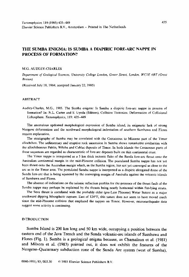
Tecionophysm, 119 (1985) 435-449 Elsevier Science Publishers B.V., Amsterdam - Printed in The Netherlands 435 THE SUMBA ENIGMA: IS SUMBA A DIAPIRIC FORE-ARC NAPPE IN PROCESS OF FORMATION? M.G. AUDLEY-CHARLES Department of Geological Sciences, University CoRege London, Gower Street, London, WClE 6BT {Great Brrtarn) (Received July 18, 1984; accepted January 22, 1985) ABSTRACT Audley-Charles, M.G., 1985. The Sumba enigma: Is Sumba a diapiric fore-arc nappe in process of formation? In: N.L. Carter and S. Uyeda (Editors), Collision Tectonics: Deformation of Collisional Lithosphere. Tectonophysia, 119: 435-449 The anomalous updomed rno~holo~c~ expression of Sumba island, its enigmatic lack of strong Neogene deformation and the northward morphological indentation of southern Sumbawa and Flares require explanation. The stratigraphy of Sumba may be correlated with the Cretaceous to Miocene part of the Timor allochthon. The sedimentary and eruptive rock succession in Sumba shows remarkable similarities with the allochthonous Palelo, Wiluba and Cablac deposits of Timor. In both islands the Cretaceous parts of these sequences are regarded as characteristic of fore-arc deposits built on thin continental crust. The Timor nappe is interpreted as a 5 km thick tectonic flake of the Banda fore-arc thrust onto the Australian continental margin in the mid-Pliocene collision. The postulated Sumba nappe has not yet been thrust onto the Australian margin which, in the Sumba region, has not yet converged as close to the arc as in the Timor area. The postulated Sumba nappe is interpreted as a diapiric elongated dome of the Sunda fore-arc that is being squeezed by the converging margin of Australia against the volcanic islands of Sumbawa and Flares. The absence of indications on the seismic reflection profiles for the presence of the thrust fault of the Sumba nappe may perhaps be explained by the thrusts being nearly horizontal within flat-lying strata. The Savu thrust is correlated with the probably older (pre-Late Pliocene) Wetar Suture as a major southward dipping lithospheric rupture. East of 124”E, this suture does not seem to have moved much since the mid-Pliocene collision that emplaced the nappes on Timor. However, microearthquake data suggest some activity is continuing. INTRODUCTION Sumba Island is 200 km long and 50 km wide, occupying a position between the eastern end of the Java Trench and the Sunda volcanic-arc islands of Sumbawa and Flares (Fig. 1). Sumba is a geological enigma because, as Chamaiaun et al. (1981) and Milsom et al. (1983) pointed out, it does not exhibit the features of the Neogene-Quaternary subduction zone of the Sunda Arc system (west of Sumba), HO-1951/85/$03.30 0 1985 Elsevier Science Publishers B.V.
Transcript of THE SUMBA ENIGMA: IS SUMBA A DIAPIRIC FORE-ARC NAPPE IN...
Tecionophysm, 119 (1985) 435-449
Elsevier Science Publishers B.V., Amsterdam - Printed in The Netherlands
435
THE SUMBA ENIGMA: IS SUMBA A DIAPIRIC FORE-ARC NAPPE IN
PROCESS OF FORMATION?
M.G. AUDLEY-CHARLES
Department of Geological Sciences, University CoRege London, Gower Street, London, WClE 6BT {Great
Brrtarn)
(Received July 18, 1984; accepted January 22, 1985)
ABSTRACT
Audley-Charles, M.G., 1985. The Sumba enigma: Is Sumba a diapiric fore-arc nappe in process of
formation? In: N.L. Carter and S. Uyeda (Editors), Collision Tectonics: Deformation of Collisional
Lithosphere. Tectonophysia, 119: 435-449
The anomalous updomed rno~holo~c~ expression of Sumba island, its enigmatic lack of strong
Neogene deformation and the northward morphological indentation of southern Sumbawa and Flares
require explanation.
The stratigraphy of Sumba may be correlated with the Cretaceous to Miocene part of the Timor
allochthon. The sedimentary and eruptive rock succession in Sumba shows remarkable similarities with
the allochthonous Palelo, Wiluba and Cablac deposits of Timor. In both islands the Cretaceous parts of
these sequences are regarded as characteristic of fore-arc deposits built on thin continental crust.
The Timor nappe is interpreted as a 5 km thick tectonic flake of the Banda fore-arc thrust onto the
Australian continental margin in the mid-Pliocene collision. The postulated Sumba nappe has not yet
been thrust onto the Australian margin which, in the Sumba region, has not yet converged as close to the
arc as in the Timor area. The postulated Sumba nappe is interpreted as a diapiric elongated dome of the
Sunda fore-arc that is being squeezed by the converging margin of Australia against the volcanic islands
of Sumbawa and Flares.
The absence of indications on the seismic reflection profiles for the presence of the thrust fault of the
Sumba nappe may perhaps be explained by the thrusts being nearly horizontal within flat-lying strata.
The Savu thrust is correlated with the probably older (pre-Late Pliocene) Wetar Suture as a major
southward dipping lithospheric rupture. East of 124”E, this suture does not seem to have moved much
since the mid-Pliocene collision that emplaced the nappes on Timor. However, microearthquake data
suggest some activity is continuing.
INTRODUCTION
Sumba Island is 200 km long and 50 km wide, occupying a position between the eastern end of the Java Trench and the Sunda volcanic-arc islands of Sumbawa and Flares (Fig. 1). Sumba is a geological enigma because, as Chamaiaun et al. (1981) and Milsom et al. (1983) pointed out, it does not exhibit the features of the Neogene-Quaternary subduction zone of the Sunda Arc system (west of Sumba),
HO-1951/85/$03.30 0 1985 Elsevier Science Publishers B.V.
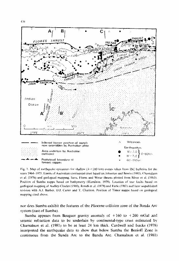
- - Inferred former pasitton of trench A Volc?lI~o@S now overridden by Australian plate
:I: ‘.‘.‘,~.~.‘_ Earthquakes ::.:.:::.
,~_‘.‘.‘. . Area underlain by Austrafmn ,‘,‘~“’ continent
a LA:: 7.0 ~~~~~~~,“~‘~‘~~~~ O-fOkit~
* MS 7.0 -‘A. -A
I Postulated boundary of x forearc nappes
Fjo -1llOkiir
Fig. 1. Map of earthquake epicenrcrs for shallow (h i iix) km) events taken from ISC bulletins for the
years 1964-1975. Limits of Australian continental crust based on Johnston and Howin (1%1), C‘hamalaun
et al. (1976} and geological mapping. Saw, FIoses and Wetar thrusts plotted from Silver et ai. (1983).
Position of Sumba nappe based on ~dth~rnetr~ (Hamilton. 1979). Location of tear faults based on
gwlogigiral mapping of Audfey-Char& (1968). Rosidi et af. ($979) and Earle (1981 f and iater unpu~l~shed
revision with A.J. Barber, 13.5. Carter and T. Charlton. Position of Timor nappe based on geological
mapping cited above.
nor does Sumba exhibit the features of the Pliocene collision zone of the Banda Arc
system (east of Sumba).
Sumba appears from Bouguer gravity anomaly of -t 160 to -t 200 mGal and
seismic refraction data to be underlain by continental-type crust estimated by
Chamalaun et al. (1981) to be at least 24 km thick. Cardwell and Isacks (1978)
interpreted the earthquake data to show that below Sumba the Benioff Zone is
continuous from the Sunda Arc to the Banda Arc. Chamalaun et at. (1981)

437
lndian ::-‘sCOTT ‘::yi:‘, j,
Ocean ,;+?TEA”:ij ._ (...
:_.. .:: ~..,~,..‘.~. :::‘. .,~...~.....
Fig. 2. Geological interpretation of Sumba and Timor nappes based on data in Fig. 1 and on the model of
Price and Audley-Charles (1983).
reinterpreted the earthquake data. They argued that west of 121”E (Figs. 1 and 2) the Benioff Zone appears to be typical of an oceanic subduction zone but that east of 121”E shallow earthquakes are almost absent and the Benioff Zone is less steep. Chamalaun et al. (1981) concluded that there is a sharp seismic discontinuity at about 121”E and that, in terms of earthquake pattern, Sumba is much more closely related to the Sunda Arc and is very different seismically from the Banda Arc. McCaffrey et al. (1984) reporting results of their microearthquake survey also drew attention to the significantly lower earthquake activity east of 124S’E. Whitford et al. (1977) pointed out that there are important differences in composition of the volcanic part of the Sunda and Banda Arcs and that these changes occur in the region opposite Timor between 123”E-127”30’E.
Palaeomagnetic data for Sumba were interpreted by Otofuji et al. (1980) to indicate Sumba had been derived from the Australian continental margin. Chamalaun

et al. (1981)+ reviewing the palaeomagnetic data for Sumba. concluded that the data
were insufficient to permit a confident interpretation of the palaeogeographiunf
origin of pre-Tertiary Sumba.
Since the review of Sumha’s geology by ~~~~anlaJaun et al. { 1981). two papers have
presented important new data: the sedimentological discoveries reported by Van der
Borch et al. (1983) have direct bearing on the Sumba’s pre-Tertiary origin, while the
marine geophysical work of Silver et aJ. (1983) has considerabte relevance for the
mode of late Tertiary evolution. These papers have led to the proposal put forward
here to correlate the pre-Eocene stratigraphy of Sumba with that of the PaIeJo
Group of Timor (Earie. 1983). This correlation has considerable structural, tectonic
and paJaeogeographi,cal implication because the Paleto Group of Timor is nJloch-
thonous (Barber et al., 1977: Rosidi et al.. 1979: EarJe, 1983).
STRATIGRAPHYOFSWMBA
The recent study by Von der Borch et al. (1983) has substantially improved our
knowledge of the pre-Tertiary rocks of Sumba. The dating of the oldest exposed
rocks as Cretaeeous (JocaJJy mid-Cr~ta~euus~ according to Chama~aun et al., f9Xf)
and discovery that they contain volcanogenic mudstones, sandstones, gravels and
diamictites intruded by andesite and dacite dykes is not only important in itself but
also because it invites comparison of the Sumba stratigraphical succession (Fig. 3)
with the Palelo Group in Timor (Earle, 1983).
Von der Borch et al. (I 983) concluded from their study that the pre-Tertiary rocks
of Sumba were deposited on thin continental crust and that Sumba represents part
of an uplifted fore-arc basin. Earle (1983) concluded from his study of the Mutis
n~etarno~hj~ complex and its overlying Palelo Group and associated Pateogene
succession that these altochthonous Timor deposits represent part of a fore-arc basin
floored by thin continental crust overthrust onto the Australian continental margin
by its Pliocene collision with the Java Trench.
Comparison of the pre-Tertiary to Early Miocene successions of Sumba (Van
Bemmefen, 1949; Von der Borch et al., 1983) with the Pafelo Group (Haiie et al.,
1979; Earle, 19831, Eocene Wiluba facies (Audiey-Charles and Carter, 1972) and
Cablac Limestone (Rosidi et al., 1979) of the allochthonous nappes of west Timor
(Fig. 3) reveals some strong simiiarities and some notable differences in these
successions in Sumba and Timor that are now separated by 400 km along strike.
The base of the sedimentary section in Sumba is not exposed. In West Timor the
base of the PaleJo Group is faulted against the Mutis Complex but an angular
unconformity is suspected (Haile et al., 1979). The Metan Formation of Timor is
regarded by HaiIe et al. (1979) and by Earle (1983) as probably Late Jurassic 0x1 the
basis of it occurring below the Early Cretaceous cherts. Rosidi et al. (1973) suggest a
different series of stratigraphical elements for the Palelo Group. I have fallowed
Ha& et al. and EarJe because their work was far more detaifed and because it
corresponds more closely to my own unpublished observations.

- 400hl . WEST
TIMOR
NON! FORMAlWN
,roan
Fig. 3. Stratigraphical successions (not to scale) in Sumba based on Van Bemmeien (1949). Chamalaun et al. (1981) and Von der Borch et al. (1983). West Timor stratigraphical section based on Tappenbeck (1940), Audley-Charles and Carter (1972), Rosidi et al. (19791, Earle (1983) and unpublished field work in 1983 by the author.
The lower part of the Noni Formation of Timor seems to be similar to the Lasipu Formation of Sumba (Fig. 3). Differences appear at the top of the Noni Formation where about 5 m of pelagic limestones and cherts occur. These have not been seen in Sumba. However, the red and green chert pebbles and cabbies in the Lasipu conglomerates are reminiscent of the Noni cherts of Timor.
There are far more dykes cutting the Lasipu Formation than in the Noni of Timor and no plutonic equivalent of the granodiorite intrusions cutting the Lasipu is known in Timor. However, the pre-Paleogene nature of these intrusions is common.
The presence of ignimbritic rocks of Early Paleogene age is common to both Sumba and Timor followed in both successions by neritic limestones with large Foraminifera of Middle and Upper Eocene age. Both successions display neritic limestones of Early Miocene age, but volcanism seems to have been much more important in Sumba during the Miocene than in the all~hthon of Timor.
The angular unconformity at the base of the Paieogene is a notable feature of both the Sumba and Timor allochthon successions. Similarly the unconformity at the base of the Miocene shallow water limestones is present in both.

440
Overall the sequence of the two successions (now 400 km apart along strike)
seems remarkably similar from late Mesozoic until the end of the Early Miocene.
The change in the Middle Miocene may correlate with the very early stage of the
collision process between the continental margin of Australia that began to under-
thrust the Banda fore-arc in MiddleeLate Miocene times in the Timor region. The
rocks of the Timor allochthon seem to be more deformed as might be expected from
their occurrence as part of a nappe that has travelled 50 km southward over the
para-autochthon.
STRUCTURE OF SUMBA AND MUTIS-PALELO GROUP OF TIMOR
According to Von der Borch et al, (1983) the structure of Sumba is very simple
and Van Bemmelen (1949) reports only erosional unconformities within the Ceno-
A SUMBA
S N
B TIMOR
NW Ml.MOLlO SE
QUE OUP
Fig. 4. A. Section across Sumba to show relative posltion of principal stratigraphical elements based on
Chamalaun et al. (1981) and Von der Borch et al. (1983). The basement below the Cretaceous is not
exposed in Sumba. Much minor faulting omitted. B. Section across Mt. Mollo in west Timor to show
relationship of Palelo Group to Mutis metamorphic basement and the position of the Wiluba facies and
Cablac Limestone based on Tappenbeck (1940). Rosidi et al. (1979). Earle (1983) and unpublished
geological map (1 : 50,000) of west Timor by Audley-Charles. Much minor normal faulting omitted.

441
zoic above the basal Tertiary angular unconformity. Figure 4 summarises the geological structure of Sumba which compares closely with the structural relation- ships of the Palelo-Wiluba-Cablac succession of the Timor allochthon (Tappen- beck, 1940; Carter et al., 1976; Barber et al., 1977; Rosidi et al., 1979; Earle, 1983).
Some of these relationships are revealed in the most detailed published map (scale 1: 25,000) of the Mollo Massif of Timor (Tappenbeck, 1940). The Rosidi et al. (1979) map of western Timor (scale 1 : 250,000) reveals a geometry compatible with that shown in,Fig. 4. However, the cross-section L-M drawn by Rosidi et al. (1979) through this Mollo Massif interprets the Mutis Complex as bounded by steeply northward dipping reverse faults. This reflects the interpretation Rosidi et al. have adopted for all their cross sections of western Timor, but the geometry implied by the outcrop-topography relationships throughout their map is incompatible in many places (including Mollo) with those steeply dipping reverse faults (c.f. also Tappen- beck’s more detailed map and section along the same line). In many parts of western Timor the Rosidi et al. (1979) mapping indicates their allochthon to be flat lying thrust sheets overlain by a terrain linking unconformable contact at the base of the Bobonaro Scaly Clay (Bobonaro Complex). That is also the structure mapped throughout eastern Timor (Audley-Charles, 1968).
EARTHQUAKES
Silver et al. (1983) published a map showing the earthquakes of shallow focus epicenters (O-100 km) in the Sumba-Timor region. These same data have been
@I JAVA
TRENCH FLORES El
- 1’1
A
ASTHENOSPHEf?E
,-200
-300
km 0 100 Xx) ?%400 km
Fig. 5. Interpretative N-S cross section located west Sumba (see Fig. 1). Earthquakes plotted from the seismicity window A of Chamalaun et al. (1981).
442
plotted (Fig. 1) with the thrusts mapped off-shore by Silver et al. (1983) together
with the principal submarine morphological features of the region. The fore-arc
nappes in Timor are based on geological mapping (Audley-Charles, 196X; Carter et
al.. 1976: Barber et al.. 1977: Kosidi et af.. 1979) interpreted in terms of the model
proposed by Price and Audlev-Charles (198.3). This model follows the views of
10
3c
5C
7c
I
------ 8” 9”
------ ----- ---_r__
IO rr” I?” s
FLORES SUMBA c S
l
*oo :‘= . l e :
0
200 400 I I
600 k
Fig. 6. interpretative N-S cross section through east Sumba based on the tectonic model of Price and
Audley-Charles (1983). Earthquakes plotted from ISC bulletins for years 1964-1980.

443
Carter et al. (1976), Earle (1983), Brown and Earle (1983) in regarding the alloch- thonous elements of Timor as derived from the basement of the Banda volcanic
fore-arc. This interpretation now appears to be strengthened by the correlation (Figs. 2, 3,4) of Sumba and the Timor allochthon.
McCaffrey et al. (1984,1985) in their microearthquake survey of the region found the epicenters distribution pattern similar to that reported by Silver et al. (1983). One feature of particular interest noted by McCaffrey et al. (1985, fig. 9) is their hypocenter plot onto a plane striking N25”W through Niki Niki in southwest Timor. This reveals a distinctly northward dipping Benioff zone below the north coast of Timor passing below the volcanic arc. However, below Timor their hypocenters have a flat or slightly southward dip as far as the south coast of Timor. There is no indication of the Benioff zone, which appears to be about 70 km below the north coast of Timor, extending upward to the surface in the Timor Trough as postulated by Hamilton (1979), Von der Borch (1979), SiIver et al. (1983) and other authors. The results of this microearthquake survey (McCaffrey et al., 1985) appear to support the crustal and lithospheric structure proposed in Figs. 5,6 and 7.
INI Q.I.U. Q.1.U. TECTONIC FLAKE e - &gREARC q
Former position
SOUTH BANM SEA ALOR WETAR STRAIT TIMOR /
of Java Trench I
-0
C’
-100
ASJHfNOSPHERE -200
WETAR THRUST ,-300
QIU REG/oNOF ~ATERNARY fSO-
0
km 0 100 200 I ,i 300 A;
Fig. 7. Interpretative N-S cross section through west Timor. Earthquakes plotted from seismicity window
B of Chamalaun et al. (1981). The section is based on the tectonic model of Price and Audley-Charles
(1983). The postulated presence of mantle and asthenosphere in the Wetar Suture seems to be required by
the very high positive gravity anomaly below the Wetar Strait (Milsom and Audley-Charles, 1985). The
discovery of ecologite on the north coast of Timor near Atapupu (close to this line of section) by S.
Tjokrosapoetro in the intertidal zone (pers. commun., 1983) is noted. Afthough this particular profile
shows no hypocenters beneath Timor, McCaffrey et al. (1985) have found microearthquake activity below
Timor.
444
McCaffrey et al. (1984) also noted the tendency for many hypocentrrs below
Timor to be less than 150 km deep indicating the strain is affecting the crust of this
region.
STRIKE-SLIP FAULTS
One feature to emerge from this study (Figs. 1 and 2) is the correlation between
shallow focus epicenters and tear faults across the strike in the Timor region. These
faults have been mapped onshore (Audley-Charles. 1968; Rosidi et al.. 1979: Earle,
19X1) and studies now being undertaken (‘I‘. Charlton. pers. commun.) of the
Australian facies para-autochthon exposed in western Timor are revealing the
importance of these post-overthrusting (post mid-Pliocene) strike-slip faults. The
~ollcentration of earthquake activity in the western part of this Wetar Strait appears
to correspond with a rapid shift in the position of the northern limit of the
Australian offshore continental crust reflected in the shape of the very steep offshore
margin of westernmost Timor. This is also the region where the allochthonous
nappes of Timor cut out westward against the Savu Sea.
We can suspect that these changes (Fi g. 2) may he related to tear faults cutting _ across the strike of western Timor in the region between Semau and Panlar islands.
Furthermore, on the basis of their microearthquake study McCaffrey et al. (1985)
suggested a major tear fault is present below 124”E and they drew attention to the
contrast in seismic characteristics on either side of 124OE.
The Savu Thrust has been mapped as an active feature (Silver et al.. i983). It is
regarded here as marking ,the northern limit of the Australian continentat margin
rocks. The interpretation (Figs. 1 and 2) that it continues eastward to the western
margin of Timor lacks the support of any direct published observation, but Michel
Latreille (pers. commun., 1984) has unpublished high quality seismic reflection
survey data that led him to interpret its presence as shown in Figs. 1 and 2. The high
rate of sedimentation at the vvestern margin of Timor may perhaps obscure its
recognition from lower quality seismic reflection data. The Savu Thrust is considered
to terminate against the strike slip fault below 124OE proposed by McC’affrey et al.
(in press) on the basis of their micro~arthquake survey. Their report of much less
active seismicity east of 124Ot; correlates with the low level of Quaternary movement
on the Wetar Suture regarded by Price and Audley-Charles f 1983) as a nli~i-Plio~eIle
structure.
EPICENTERS AND BATHYMETRY BETWEEN SUMBA AND THE VOLCANIC‘ ARC’
The 1000 m bathymetric contour off southern Sumbawa and Flares shows a
northward indentation by 30 km into the southern border of these volcanic islands.
This indentation can be clearly seen on Hamilton’s (1979) tectonic map of In-
donesia. The epicenters of the quakes at depths of 60.-100 km make a similarly
445
northward convex pattern north of Sumba (Fig. 1). The close relationship between
these details of submarine morphology and earthquakes of the Sumba region require
consideration in the light of the stratigraphical and structural similarities now
revealed between Sumba and the Timor allochthon.
DISCUSSION
The palaeogeography of Sumba
Chamalaun et al. (1981) in their recent review of the palaeogeography of Sumba
identified three possible origins: (a) the margin of N.W. Australia from which
Sumba was rifted in Jurassic times in association with the formation of the Wharton
Basin (Audley-Charles, 1975; Otofuji et al., 1980); (b) the margin of Sundaland in
the region between east Java, southeast Kalimantan and southwest Sulawesi from
which it was rifted presumably during the Cenozoic (Hamilton, 1979); (c) an
intra-Tethys position where it formed a micro-continent of uncertain affinity.
The available palaeomagnetic evidence is, according to Chamalaun et al. (1981)
not sufficiently strong to discriminate between these various models but they
consider it slightly favoured derivation from the northwest Australian margin.
The new stratigraphical and sedimentological data of Von der Borch et al. (1983)
particularly the indication that an active volcanic arc was close to and north of
Sumba during the Cretaceous, together with the palaeocurrents indicating Creta-
ceous volcanoclastic sediments moving southwest into Sumba argues strongly against
the northwest Australian margin origin and supports Hamilton’s proposal that in
Cretaceous times Sumba formed a part of the margin of southeast Sundaland. Such
a view corresponds with the proposed origin of the thrust sheets of the Timor
allochthon (Carter et al., 1976; Brown and Earle, 1983; Earle, 1983). The stra-
tigraphical and sedimentological correlation of Sumba with the Timor allochthon
(Fig. 3) reinforces the interpretation of their common derivation from southeast
Sundaland.
Deep structure and tectonic evolution of Sumba
One interpretative step taken by this paper (Figs. 2, 7, 8) has been to postulate
that the 2 km high morphological elongated dome of Sumba (400 km-150 km in
area), representing an uplifted part of the forearc basin (Von der Borch et al., 1983)
is a diapiric nappe in process of formation within the fore-arc. The postulated
Sumba nappe is correlated with the nappe of the Timor region of the Outer Banda
Arc on the basis of stratigraphy. Price and McClay (1981) favoured the role of
diapirism in generating nappes. The presence of the exposed pre-Paleogene pervasive
dykes in Sumba (Von der Borch et al., 1983) indicates a significant heat input and
implies a large-scale displacement of water which might be related to the end-creta-
ceous uplift of Sumba. The later repetition of such events related to continuing
subduction below this fore-arc region which. together with the squeezing effect of the
converging Australian continent. might be responsible for the post-Miocene uplift of
Sumba as a large diapir.
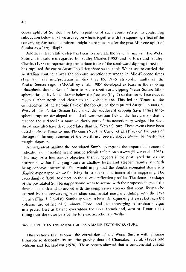
Another interpretative step has been to correlate the Savu Thrust with the Wetar
Suture. This suture is regarded by Audley-Charles (1983) and by Price and Audley-
Charles (1983) as representing the surface trace of the southward dipping thrust that
has ruptured the entire Australian lithosphere so that this Wetar suture carried the
Australian continent over the fore-arc accretionary wedge in Mid-Pliocene times
(Fig. 8). This inte~retation implies that the N-S strike-slip faults of the
Pantar-Semau region (McCaffrey et al., 1985) deveioped as tears in the evolving
fithospheric thrust. East of these tears the southward dipping Wetar Suture litho-
spheric thrust developed deeper below the fore-arc (Fig. 7) so that its surface trace is
much further north and closer to the volcanic arc. This led in Timor to the
emplacement of the tectonic flake of the fore-arc on the ruptured Australian margin.
West of this PantarSemau fault zone the southward dipping Savu thrust litho-
spheric rupture developed in a shallower position below the fore-arc so that it
reached the surface in a more southerly part of the accretionary wedge. The Savu
thrust may also have developed later than the Wetar Suture. These events have been
dated onshore Timor as mid-Pli[~cene (N20) by Carter et al. (1976) on the basis of
the age of the emplacement of the overthrust fore-arc nappe above the Australian
margin deposits.
An argument against the postulated Sumba Nappe is the apparent absence of
indications of thrusting in the marine seismic reflection surveys (Silver et al.. 1983).
This may be a less serious objection than it appears if the postulated thrusts are
horizontal within flat lying strata at shallow levels and steepen rapidly at depth
being concave downward. This would imply that the Sumba elongated dome is a
diapiric-type nappe whose flat-lying thrust near the perimeter of the nappe might be
exceedingly difficult to detect on the seismic reflection profiles. The dome-like shape
of the postulated Sumha nappe would seem to accord with the proposed shape of the
thrusts at depth and to accord with the compressive stresses that seem likely to be
exerted by the converging Australian continental margin colliding with the Java
Trench (Figs. 1, 2 and 6). Sumha appears to be under squeezing stresses between the
volcanic arc edifice of SumbawaaFlores and the converging Australian margin
interpreted here as having overridden the Java Trench and, west of Timor. to be
riding over the outer part of the fore-arc accretionary wedge.
SAVU THRUST AND WETAR SUTURE AS A MAJOR TECTONIC RUPTURE
Observations that support the correlation of the Wetar Suture with a major
lithospheric discontinuity are the gravity data of Chamalaun et al. (1976) and
Milsom and Richardson (1976). These papers showed that a fundamental change
from continental to much denser rock occurs at the north coast of Timor. Chamalaun et al. (1976) modelled their data to show continental crust terminating abruptly at
the north coast implying the presence of a fundamentaf lithospheric contact. The geomagnetic depth sounding of Chamalaun and White (1975) led them to suggest a subduction zone is present close to the north coast of Timor, although as Milsom et al. (1983) pointed out there is little support for this from other evidence. However, these observations suggest an important discontinuity is present immediately off- shore northern Timor. McCaffrey et al. (1985) have argued that their microearth- quake survey data indicate that the downgoing Australian plate has ruptured in the position and with the same sense of movement (south side up) as was postulated for the Wetar Suture by Price and Audley-Charles (1983), the only difference being that McCaffrey et al. interpret the rupture to dip more steeply.
The indications that this major structural discontinuity of the Wetar Suture dips south are the microearthquake data of McCaffrey et al. (1985), its correlation with the southward dipping Savu thrust of Silver et al. (1983) and the absence of a fore-arc accretionary wedge on-shore Timor where Australian continental margin deposits underlie the whole island cropping out from south to north coast (Audley- Charles, 1968; Rosidi et al., 1979). It is because these Permian to Early Pliocene Australian continental margin sediments accumulated at a passive margin so far
from any volcanic arc that they show so little resemblance to a fore-arc accretionary prism, although locally they are imbricated. The presence of Australian continental margin deposits on the north coast of Timor only 20 km from the volcanic-arc island of Atauro can be explained by the Wetar Suture being a southward dipping thrust that has carried the Austrahan margin northward over the Banda fore-arc accretion- ary wedge (Fig. 7).
THE SUMBA NAPPE
The Sumba nappe, unhke the Timor Nappe, has not been thrust over the Australian continental margin. On the contrary, the Sumba nappe appears to be slightly overridden in the southeast by the Australian margin (Figs. 1, 5 and 6). The enigmatic lack of strong Neogene deformation, the anomalous updomed mdrpho- logical expression and the northward morphological indentation of southern Sumbawa and Fiores require explanation. One approach is to regard Sumba as being in the process of being detached from its basement to form a diapiric nappe as the Australian margin converging with the volcanic islands of Flores and Sumbawa compresses the intervening Sunda fore-arc.
SIGNIFICANCE OF THE FLORES THRUST AND WETAR THRUST
These back-arc thrusts appear to be relatively young features (Silver et al,, 1983). They may be interpreted qualitatively as the result of strain in the Asian plate

44x
consequent upon continuing convergence of the Australian-Indian Ocean plate (Fig.
7).
ACKNOWLEDGEMENTS
I am grateful to Michel Latreille, John Milsom, Stan Murrell. Neville Price, Eli
Silver and Soebardjio Tjokrosapoetro for discussion, to the referees for suggesting
improvements, and to Janet Baker and Colin Stuart for help with the art work.
REFERENCES
Audley-Charles. M.G., 196X. The geology of Portuguese Timor. Geol. Sot. London. Mem., 4: I ~76.
Audley-Charles. M.G., 1975. The Sumba fracture: a maJor discontinuity between eastern and western
Indonesia. Tectonophysics 26, 213321X.
Audley-Charles. M.G.. 1983. Comments on “Analogous tectonic evolution of the Ordovician foredeeps.
southern and central Appalachians”. Geology. 1 1: 490-493.
Audley-Charles. M.G. and Carter. D.J., 1972. Palaeogeographical significance of some aspects 01
Palaeogene and early Neogene stratigraphy and tectonics of the Timor Sea region. Palaeogeogr.
Palaeoclimatol. Palaeoecol., 11: 247.-264.
Barber, A.J.. Audley-Charles, M.G. and Carter. D.J.. 1977. Thrust tectomcs in Timor. J. Geol. Sot. Aust..
24: 51-62.
Brown. M. and Earle, M.M., 1983. C‘ordierite-bearing schists and gneisaes from Trmor. eastern Indonesia:
I’ T condittons of metamorphism and tectonic implications. J. Metamorph. Gcol.. I : 1 X3 203.
Cardwell. R.K. and Isacks. B.L.. 197X. Geometry of the subducted lithosphere beneath the Banda Sea in
eastern Indonesia from seismicity and fault plane solutions. J. Geophya. Res.. X3: 2X25 2X3X.
Carter. D.J.. Audley-Charles. M.G. and Barber, A.J.. 1976. Stratigraphical analysis of island arc--con-
tinental margin collision in eastern Indonesia. J. Geol. Sot. London., 132: 179-19X.
C‘hamalaun. F.H. and White. A.. 1975. Electromagnetic induction at Dili, Portuguese Timor. J. Geophys..
41: 53775413.
C‘hamalaun. F.H., Lockwood. K. and White, A., 1976. The Bouguer gravity field and crustal structure of
eastern Timor. Tectonophysics. 30: 241.-259.
Chamalaun. F.H.. Grady, A.E.. Van der Borch, C.C. and Hartono. H.M.S.. 19X1. I‘he tectontc srgnifi-
cance of Sumha. Bull. Geol. Res. Develop. Centre, Bandung, 5: l-20.
Earle. M.M.. 1981. A study of Boi and Molo. two metamorphic massifs in Timor. eastern Indonesia.
Unpubl. Ph.D. thesis, Univ. of London.
Earle. M.M.. 19X3. Contrnental margin origin for Cretaceouz radiolarian cherts rn western Tumor. Nature.
305: l29- 130.
Grady. A.E. and Berry, R.F.. 1977. Some PalaeozoicMesozoic stratigraphic-structural relattonships tn
east Timor and their significance in the tectonics of Timor. J. Geol. Sot. Aust., 24: 203 -214.
Haile. N.S.. Barber. A.J. and Carter, D.J.. 1979. Mesozoic cherts on crystalline schists in Sulawesi and
Timor. J. Geol. Sot. London, 136: 65570.
Hamilton. W.. 1979. Tectonics of the Indonesian region. U.S. Geol. Surv., Prof. Pap.. 107X.
Hubhert, M.K. and Rubey. W.W.. 1959. Role of fluid pressure in mechanics of overthrust fauitmg. Pt. I.
Mechanrcs of fluid filled porous solids and its application to overthrust faulting. Bull. Geol. SOC. Am..
70: 1155166.
Johnston, C.R. and Bowin. C.0.. 19X1. Crustal reactions resulting from the mid-Pliocene to Recent
continent-island arc collision in the Timor region. Bur. Miner. Resour., J. Aust. Geol. Geophys.. 6:
223.--243.
449
McCaffrey, R. and 16 others, 1984. Preliminary results of the 1982 Microearthquake Survey in Nusa
Tenggara Timor, Indonesia. Bull. Geol. Res. Dev. Centre, Bandung, 10: 1-9.
McCaffrey, R., Molnar, P. and Roecker, S., 1985. Micr~arthquake seismicity and fault plane solutions
related to arc-continental collision in the eastern Sunda Arc, Indonesia. J. Geophys. Res., 451 l-4528.
Milsom, J. and Audley-Charles, M.G.. 1985. Post-collision isostatic readjustment in the southern Banda
Arc. In: J.G. Ramsay, M.P. Coward and A.C; Ries (Editors), Collision Tectonics. Geol Sot. London,
Spec. Publ., 11: 341-360.
Milsom, J. and Richardson, A., 1976. Implications of the occurrence of large gravity gradients in northern
Timor. Geol. Mijnbouw. 55: 175-178.
Milsom, J., Audley-Charles, M.G., Barber, A.J. and Carter, D.J., 1983. Geological-geophysical paradoxes
of the eastern Indonesian collision zone. In: T.W.C. Hilde and S. Uyeda (Editors). Geodynamics of
the Western Pacific-Indonesian Region. Geodyn. Ser., Am. Geophys. Union, 11: 401-411.
Otofuji. Y., Sasajima, S., Nishimuta, S., Hadiwisastra, S., Yokoyama. ‘I. and Hehuwat, F., 1980.
Palaeomagnetic evidence for the paleoposition of Sumba Island, Indonesia. In: S. Nishimura (Editor),
Physics and Geology of the Indonesian Island Arcs. Kyoto University Press, Kyoto, pp. 59-66.
Price, N.J. and Audley-Charles, M.G., 1983. Plate rupture by hydraulic fracture resulting in overthrusting.
Nature. 306: 572-575.
Price. N.J. and McClay, K.R., 1981. Introduction. In: K. McCIay and N.J. Price (Editors), Thrust and
Nappe Tectonics. Geol. Sot. London, Spec. PubI., 9: 1-5.
Rosidi, H.M.D., Suwitodirdjo, K. and Tjokrosapoetro. S.. 1979. Geologic map of the Kupang-Atambua
quadrangles, Timor. Geological Research and Development Centre, Bandung.
Silver, E.A., Reed, D., McCaffrey, R. and Joyodirwiryo, Y., 1983. Back arc thrusting in the eastern Sunda
arc, Indonesia: a consequence of arc-continent collision. J. Geophys. Res., 88: 7429-7448.
Tappenbeck, D., 1940. Geologie des Mollogebirges und einiger benachbarter Gebiete (Nierlandisch
Timor). Geol. Exp. Lesser Sunda Islands, 1: 1-105--Univ. Amsterdam.
Van Bemmelen, R.W., 1949. The Geology of Indonesia. Government Printing Office, The Hague, 732 pp.
Van der Borch, C.C., Grady, A.E., Hardjoprawiro, S., Prasetyo, H. and Hadiwisastra, S., 1983. Mesozoic
and Iate Tertiary submarine fan sequences and their tectonic significance. Sumba, Indonesia. Sedi-
ment. Geol., 37: 113-132.
Whitford, D.J., Compston, W., Nicholls, I.A. and Abbott, M.J., 1977. Geochemistry of late Cenozoic
Iavas from eastern Indonesia: role of subducted sediments in petrogenesis. Geology, 5: 571-575.