The Shropshire Landscape Typology · Contents Part I – Setting the Scene 1 Introduction 2 The...
78
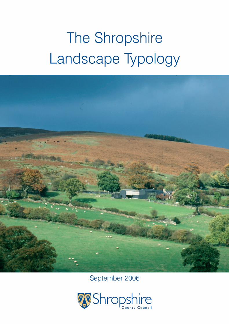
The Shropshire Landscape Typology September 2006
Transcript of The Shropshire Landscape Typology · Contents Part I – Setting the Scene 1 Introduction 2 The...
The ShropshireLandscape Typology
September 2006
Contents
Part I – Setting the Scene 1
Introduction 2
The Shropshire Character Framework 5
Assessing Landscape Character 6
Part II – The Typology 11
Defining landscape types 12
High Open Moorland 14
High Enclosed Plateau 16
High Volcanic Hills and Slopes 18
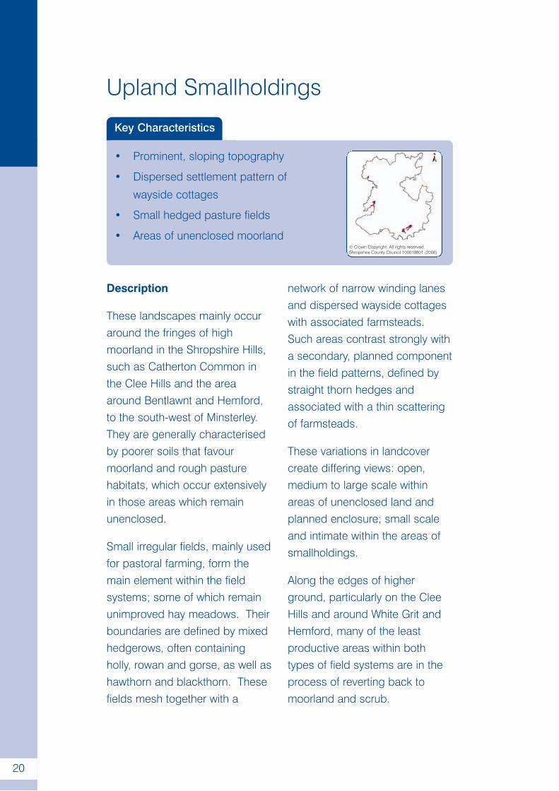
Upland Smallholdings 20
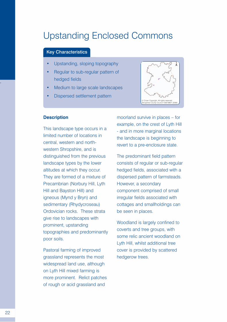
Upstanding Enclosed Commons 22
Pasture Hills 24
Principal Wooded Hills 26
Wooded River Gorge 28
Wooded Hills and Farmlands 30
Wooded Hills and Estatelands 32
Sandstone Hills 34
Sandstone Estatelands 36
Incised Sandstone Valleys 38
Wooded Forest 40
Forest Smallholdings 42
Timbered Plateau Farmlands 44
Principal Timbered Farmlands 46
Timbered Pastures 48
Wooded Estatelands 50
Estate Farmlands 52
Settled Pastoral Farmlands 54
Principal Settled Farmlands 56
i
Contents
Part II – The Typology continued
Enclosed Lowland Heaths 58
Lowland Moors 60
Riverside Meadows 62
Lowland Moss 64
Coalfields 66
Glossary 68
Further Information 73
ii
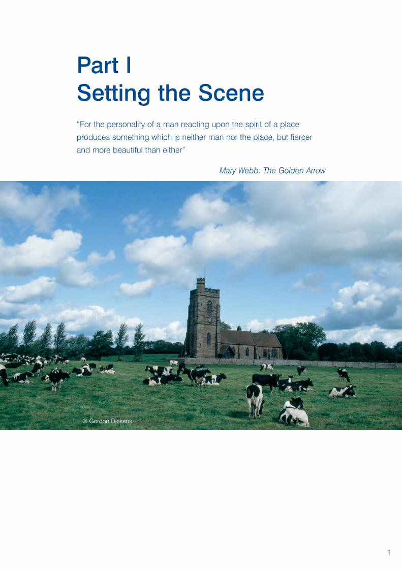
Part ISetting the Scene“For the personality of a man reacting upon the spirit of a place
produces something which is neither man nor the place, but fiercer
and more beautiful than either”
Mary Webb. The Golden Arrow
1
© Gordon Dickens
Introduction
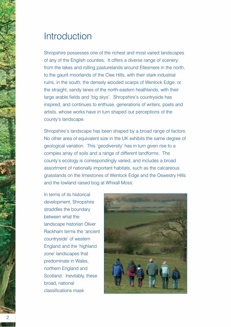
Shropshire possesses one of the richest and most varied landscapes
of any of the English counties. It offers a diverse range of scenery:
from the lakes and rolling pasturelands around Ellesmere in the north,
to the gaunt moorlands of the Clee Hills, with their stark industrial
ruins, in the south; the densely wooded scarps of Wenlock Edge; or
the straight, sandy lanes of the north-eastern heathlands, with their
large arable fields and ‘big skys’. Shropshire’s countryside has
inspired, and continues to enthuse, generations of writers, poets and
artists, whose works have in turn shaped our perceptions of the
county’s landscape.
Shropshire’s landscape has been shaped by a broad range of factors.
No other area of equivalent size in the UK exhibits the same degree of
geological variation. This ‘geodiversity’ has in turn given rise to a
complex array of soils and a range of different landforms. The
county’s ecology is correspondingly varied, and includes a broad
assortment of nationally important habitats, such as the calcareous
grasslands on the limestones of Wenlock Edge and the Oswestry Hills
and the lowland raised bog at Whixall Moss.
In terms of its historical
development, Shropshire
straddles the boundary
between what the
landscape historian Oliver
Rackham terms the ‘ancient
countryside’ of western
England and the ‘highland
zone’ landscapes that
predominate in Wales,
northern England and
Scotland. Inevitably, these
broad, national
classifications mask
2
detailed local
distinctiveness.
Many of the more
fertile soils have
been cultivated
since later
prehistory, and
have a present day
character that has
been deeply
influenced by the
gradual, informal
enclosure of the medieval open fields between the 14th and 17th
centuries. Where conditions are less favourable, either because of
altitude and/or the infertile nature of the soils, cultivation has been more
sporadic, and the present day landscape has often developed from
once extensive commons. Some of the latter locations, which today
represent some of most tranquil corners of the county, bear the scars
of frenetic 18th and 19th century industrial operations: a legacy of rich
mineral deposits within the underlying rocks. The aim of this document,
therefore, is to define and describe the different types of landscapes
that occur within Shropshire, and to explain how and why these
distinctions have arisen.
Because of these factors, Shropshire’s landscape forms an integral part
of the county’s unique environment. It is vital to the county’s economy,
not only because of the farming industries it sustains but also because
of the tourists and investors it attracts. In addition, the landscape forms
part of the surroundings in which we all live and work, and therefore
makes an important contribution to our quality of life and sense of place.
The importance of the landscape of the Shropshire Hills has long been
appreciated and is formally recognised through its designation as an
Area of Outstanding Natural Beauty (AONB). This ensures that around
25% of the county continues to receive added protection from
unsustainable development.
3
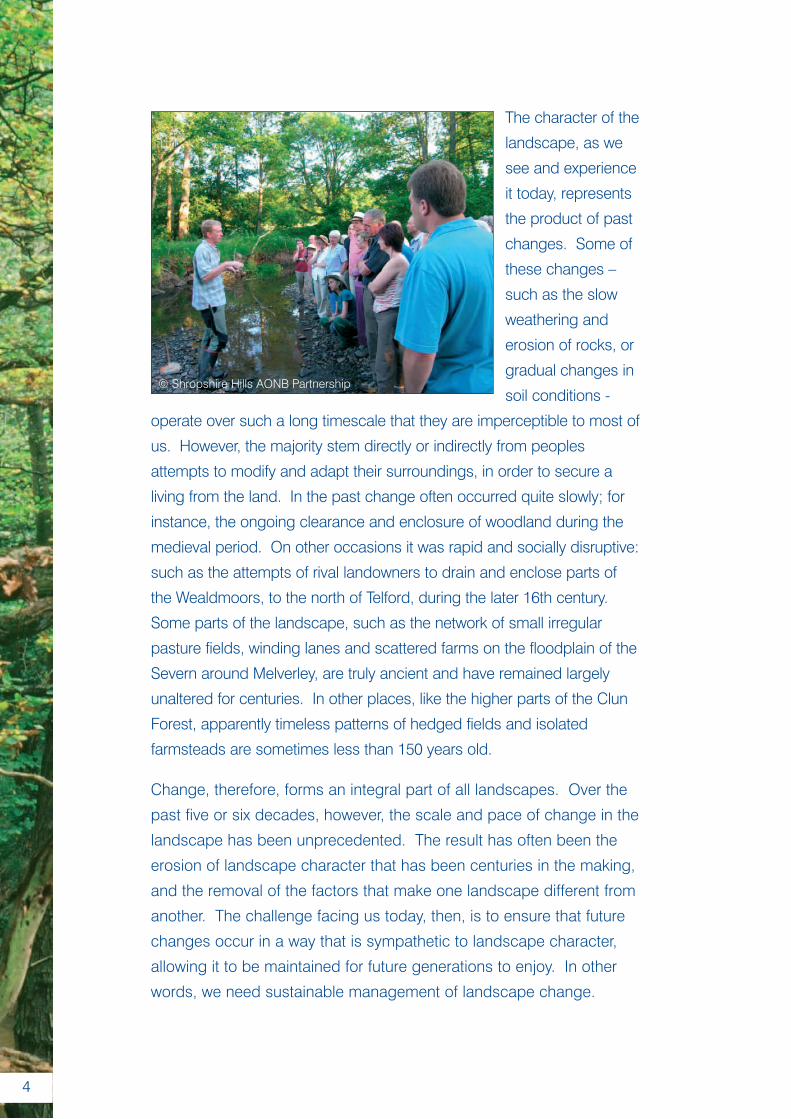
The character of the
landscape, as we
see and experience
it today, represents
the product of past
changes. Some of
these changes –
such as the slow
weathering and
erosion of rocks, or
gradual changes in
soil conditions -
operate over such a long timescale that they are imperceptible to most of
us. However, the majority stem directly or indirectly from peoples
attempts to modify and adapt their surroundings, in order to secure a
living from the land. In the past change often occurred quite slowly; for
instance, the ongoing clearance and enclosure of woodland during the
medieval period. On other occasions it was rapid and socially disruptive:
such as the attempts of rival landowners to drain and enclose parts of
the Wealdmoors, to the north of Telford, during the later 16th century.
Some parts of the landscape, such as the network of small irregular
pasture fields, winding lanes and scattered farms on the floodplain of the
Severn around Melverley, are truly ancient and have remained largely
unaltered for centuries. In other places, like the higher parts of the Clun
Forest, apparently timeless patterns of hedged fields and isolated
farmsteads are sometimes less than 150 years old.
Change, therefore, forms an integral part of all landscapes. Over the
past five or six decades, however, the scale and pace of change in the
landscape has been unprecedented. The result has often been the
erosion of landscape character that has been centuries in the making,
and the removal of the factors that make one landscape different from
another. The challenge facing us today, then, is to ensure that future
changes occur in a way that is sympathetic to landscape character,
allowing it to be maintained for future generations to enjoy. In other
words, we need sustainable management of landscape change.
4
© Shropshire Hills AONB Partnership
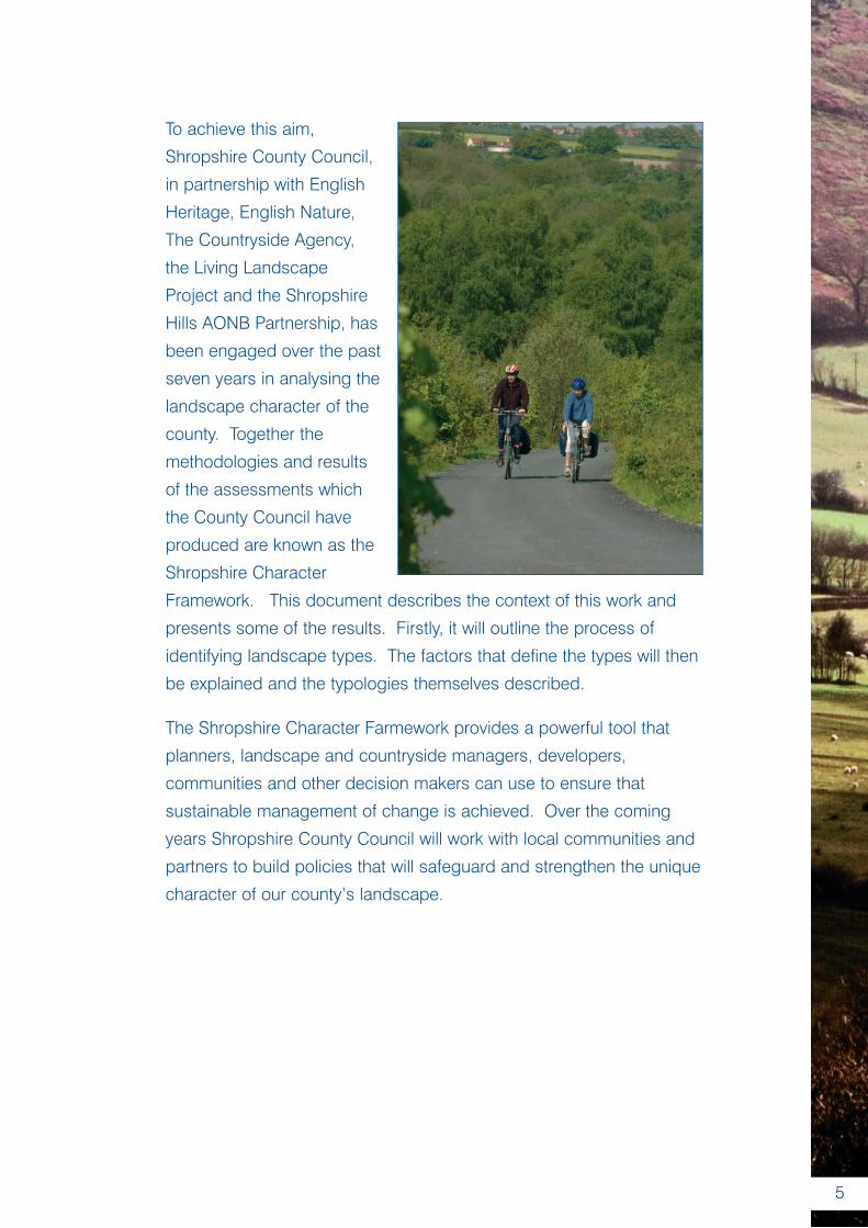
To achieve this aim,
Shropshire County Council,
in partnership with English
Heritage, English Nature,
The Countryside Agency,
the Living Landscape
Project and the Shropshire
Hills AONB Partnership, has
been engaged over the past
seven years in analysing the
landscape character of the
county. Together the
methodologies and results
of the assessments which
the County Council have
produced are known as the
Shropshire Character
Framework. This document describes the context of this work and
presents some of the results. Firstly, it will outline the process of
identifying landscape types. The factors that define the types will then
be explained and the typologies themselves described.
The Shropshire Character Farmework provides a powerful tool that
planners, landscape and countryside managers, developers,
communities and other decision makers can use to ensure that
sustainable management of change is achieved. Over the coming
years Shropshire County Council will work with local communities and
partners to build policies that will safeguard and strengthen the unique
character of our county’s landscape.
5
The Shropshire CharacterFramework in Context
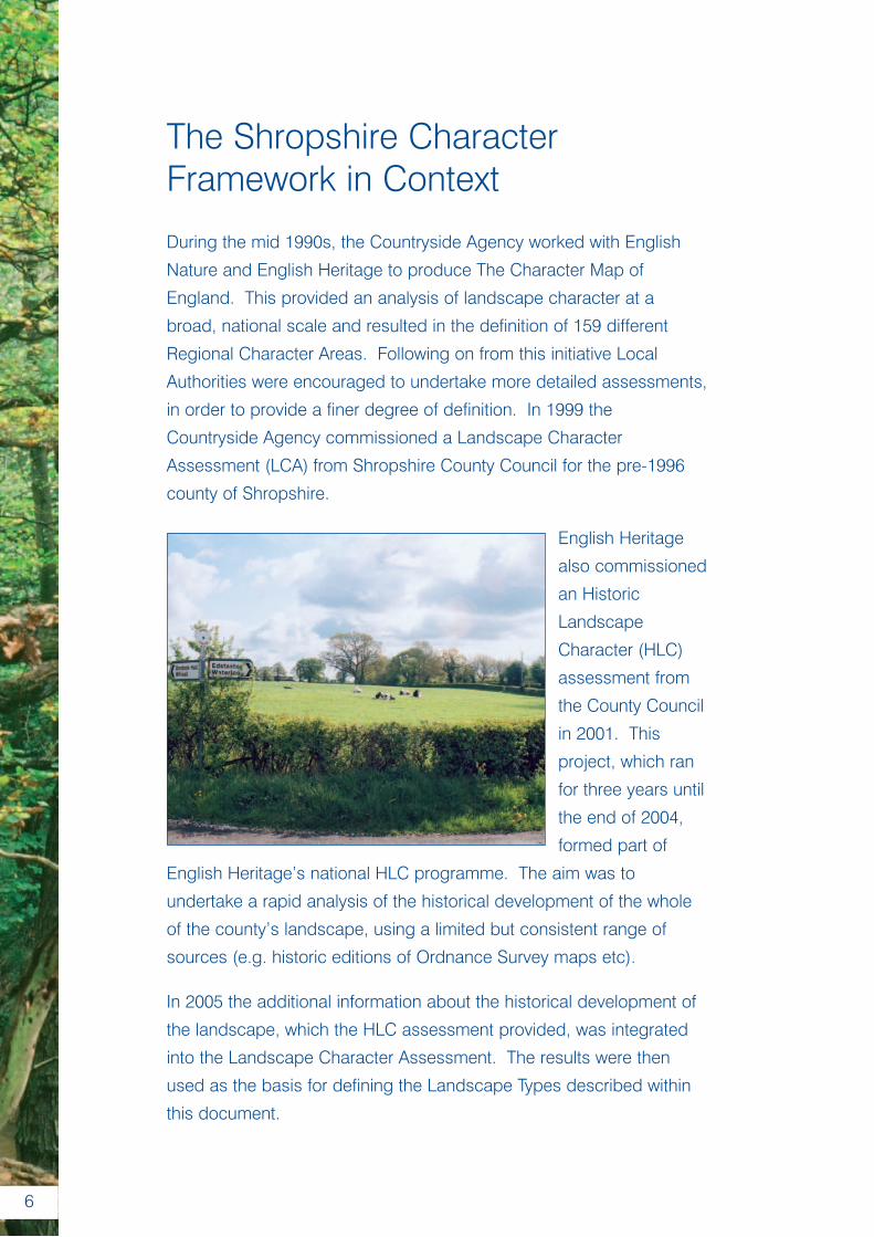
During the mid 1990s, the Countryside Agency worked with English
Nature and English Heritage to produce The Character Map of
England. This provided an analysis of landscape character at a
broad, national scale and resulted in the definition of 159 different
Regional Character Areas. Following on from this initiative Local
Authorities were encouraged to undertake more detailed assessments,
in order to provide a finer degree of definition. In 1999 the
Countryside Agency commissioned a Landscape Character
Assessment (LCA) from Shropshire County Council for the pre-1996
county of Shropshire.
English Heritage
also commissioned
an Historic
Landscape
Character (HLC)
assessment from
the County Council
in 2001. This
project, which ran
for three years until
the end of 2004,
formed part of
English Heritage’s national HLC programme. The aim was to
undertake a rapid analysis of the historical development of the whole
of the county’s landscape, using a limited but consistent range of
sources (e.g. historic editions of Ordnance Survey maps etc).
In 2005 the additional information about the historical development of
the landscape, which the HLC assessment provided, was integrated
into the Landscape Character Assessment. The results were then
used as the basis for defining the Landscape Types described within
this document.
6
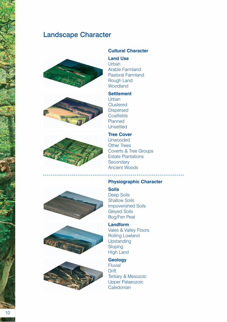
Assessing Landscape Character
Landscape character is determined by six elements – Geology,
Landform, Soils, Settlement, Tree Cover and Land Use - each of which
can be represented in different ways via a series of different
‘attributes’. In Shropshire a broad range of attributes are present for
each of the six elements.
The first set of elements – geology, landform and soils – represent the
physiographic component of landscape character:-
• Geology is a primary determinant of landscape character,
since it significantly influences the other two physiographic
elements. No other area of comparable size in Britain can rival
the degree of geological variation found in Shropshire, and
rocks from eleven of the thirteen geological periods are present
in the county. During the 19th century, some of the
stratigraphic sequences in the county were studied by a
number of the pioneering figures of British geology, including
Sir Roderick Murchison and Charles Lapworth.
• Landform is largely determined by the underlying geology. The
older, harder rocks are more resistant to erosion and usually form
areas of more prominent and dramatic topography. In contrast,
younger, softer rocks tend to underlie areas of lower ground.
Shropshire exhibits a wide variety of different landforms; from the
low lying wetlands, low sandstone hills and rolling pastures of the
Shropshire plain in the north; to the dramatic hills and valley
systems of the Shropshire Hills in the south.
7
• Soils are formed through the weathering and breakdown of the
underlying rocks and drift deposits. The key attributes that
determine what kind of vegetation a soil will support and how it is
utilised by farmers are its chemistry – its fertility and acidity – its
depth and its drainage. The physical and chemical properties of
the underlying parent material strongly influence those of the
resulting soil. Land use can also initiate changes in the properties
of a soil. For example, cultivation of some areas with light sandy
soils in later prehistory depleted them of nutrients and helped to
increased their acidity, resulting in the formation of heathlands.
All of these elements are subject to only very gradual changes and, in
terms of human perception, can be regarded as permanent (although
human activity can, and has, had a significant effect on soils). Whilst
not necessarily determining peoples actions, they have played a
significant role in constraining it, particularly with regard to the
agricultural practices they have employed over time.
Settlement, tree cover and landuse make up the cultural elements of
the landscape:-
• Settlement comprises two variables – dispersion (scattered
farmsteads/ isolated dwellings) and nucleation (towns, villages
and hamlets). A strongly nucleated settlement pattern exists
where most dwellings are clustered together in villages or
hamlets, whilst in highly dispersed settlement pattern dwellings
are scattered throughout the landscape. Invariably settlement
patterns reflect the broader history of the landscape. In
Shropshire, the origins of many settlement patterns lie in the
medieval period. Others result from the colonisation of formerly
unsettled areas of common land between the 16th and 19th
centuries. Some locations, such as The Long Mynd and the
upper slopes of the Stiperstones remain largely unsettled.
8
• Tree cover is a significant determinant of landscape character,
framing or filtering views and shaping our perceptions of scale
and degree of enclosure. Conversely, an absence of tree cover
usually creates the impression of an open, exposed landscape.
The extent and composition of the tree cover within Shropshire
has been significantly influenced by several thousand years of
human activity.
• Land Use in Shropshire reflects the physical factors which
affect the agricultural productivity of the land, particularly soil
type and relief. However, cultural choice has also played an
important role. In particular, the gradual growth of specialised
forms of farming between the 15th and 19th centuries, which
themselves represented responses to the emergence of an
increasingly complex, market-based economy. The changes
that have occurred in agriculture since World War II –
mechanisation, intensification and agricultural subsidies – have
to a certain extent reversed this trend, blurring some of the long
established distinctions between land use in different areas.
Whilst the cultural elements of the landscape are shaped to some
degree by the physiographical character of the landscape, they are
also strongly influenced by socio-economic factors. Because the
cultural character of the landscape is the product of human agency,
change occurs more rapidly than is the case for the physiographic
elements. The descriptions of the cultural patterning of the landscape
presented in this volume have been informed by the results of the
Historic Landscape Character Assessment.
9
10
Landscape Character
Cultural Character
Land UseUrbanArable FarmlandPastoral FarmlandRough LandWoodland
SettlementUrbanClusteredDispersedCoalfieldsPlannedUnsettled
Tree CoverUnwoodedOther TreesCoverts & Tree GroupsEstate PlantationsSecondaryAncient Woods
Physiographic Character
SoilsDeep SoilsShallow SoilsImpoverished SoilsGleyed SoilsBog/Fen Peat
LandformVales & Valley FloorsRolling LowlandUpstandingSlopingHigh Land
GeologyFluvialDriftTertiary & MesozoicUpper PalaeozoicCaledonian
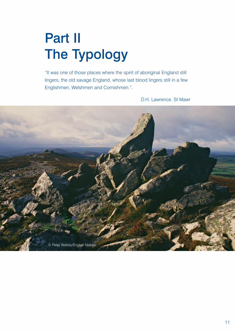
Part IIThe Typology“It was one of those places where the spirit of aboriginal England still
lingers, the old savage England, whose last blood lingers still in a few
Englishmen, Welshmen and Cornishmen.”.
D.H. Lawrence. St Mawr
11
© Peter Wakely/English Nature
Defining Landscape Types
The methodology for assessing landscape character outlined in Part I
makes it possible to identify the factors that make the landscape in
one area different from that in another. These distinctions result from
the different combinations in which the various attributes occur.
Wherever a particular set of attributes occurs repeatedly they give rise
to a ‘landscape type’.
Landscape types are therefore generic: a given landscape type occurs
wherever a particular set of attributes exists, but all of the areas
assigned to that type will have a similar character. For example, in
Shropshire the Stiperstones, much of The Long Mynd, and the tops of
the Clee Hills have all been assigned to High Open Moorland landscape
type. Whilst each of these areas have certain unique features (such as
the exposed ‘stacks’ of quartzite rock on the Stiperstones), they have a
number of factors in common with one another, which lends them the
same character. Thus, they are all exposed areas of upland that provide
panoramic views over the surrounding countryside, they contain large
tracts of unenclosed moorland which remain unsettled, and all are open,
large scale landscapes.
In Shropshire 27 different landscape types can be recognised. Some
of these, such as the Forest Smallholdings or Lowland Moss types,
have a very limited distribution and are present in only one or two
locations. Others, like the Estate Farmlands or the Principal Settled
Farmlands, occur widely in the county.
Each of the following landscape type descriptions sets out the key
characteristic and describes the broad character of the type, defines
its distribution within the county, and provides a visual example of what
they look like ‘on the ground’.
12
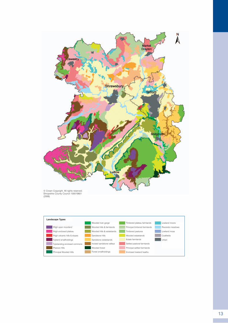
13
High open moorland
High enclosed plateau
High volcanic hills & slopes
Upland smallholdings
Upstanding enclosed commons
Pasture Hills
Principal Wooded Hills
Landscape TypesTimbered plateau farmlands
Principal timbered farmlands
Timbered pastures
Wooded estatelands
Estate farmlands
Settled pastoral farmlands
Principal settled farmlands
Enclosed lowland heaths
Wooded river gorge
Wooded hills & farmlands
Wooded hills & estatelands
Sandstone hills
Sandstone estatelands
Incised sandstone valleys
Wooded forest
Forest smallholdings
Lowland moors
Riverside meadows
Lowland moss
Coalfields
Urban
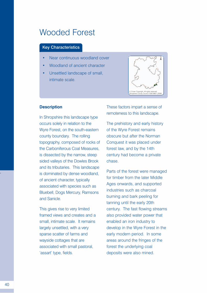
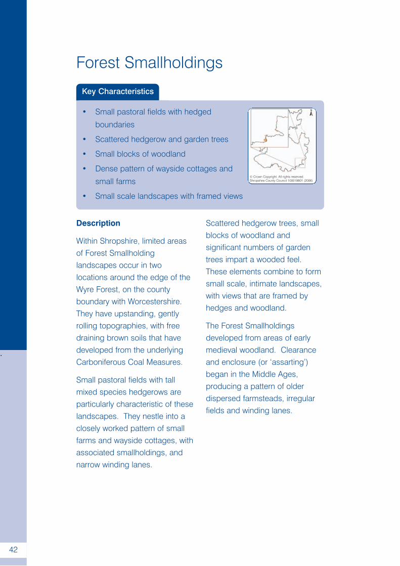
© Crown Copyright. All rights reserved.Shropshire County Council 100019801(2006)
. High Open Moorland
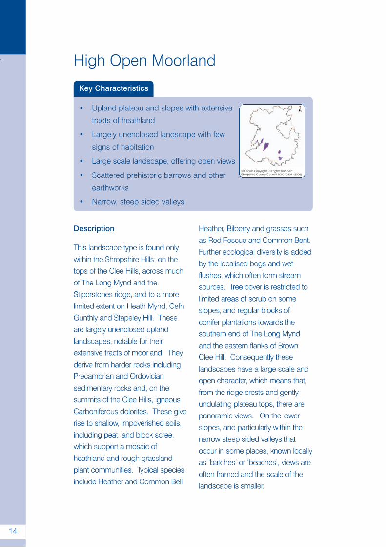
Key Characteristics
• Upland plateau and slopes with extensive
tracts of heathland
• Largely unenclosed landscape with few
signs of habitation
• Large scale landscape, offering open views
• Scattered prehistoric barrows and other
earthworks
• Narrow, steep sided valleys
14
© Crown Copyright. All rights reserved.Shropshire County Council 100019801 (2006)
Description
This landscape type is found onlywithin the Shropshire Hills; on thetops of the Clee Hills, across muchof The Long Mynd and theStiperstones ridge, and to a morelimited extent on Heath Mynd, CefnGunthly and Stapeley Hill. Theseare largely unenclosed uplandlandscapes, notable for theirextensive tracts of moorland. Theyderive from harder rocks includingPrecambrian and Ordoviciansedimentary rocks and, on thesummits of the Clee Hills, igneousCarboniferous dolorites. These giverise to shallow, impoverished soils,including peat, and block scree,which support a mosaic ofheathland and rough grasslandplant communities. Typical speciesinclude Heather and Common Bell
Heather, Bilberry and grasses suchas Red Fescue and Common Bent.Further ecological diversity is addedby the localised bogs and wetflushes, which often form streamsources. Tree cover is restricted tolimited areas of scrub on someslopes, and regular blocks ofconifer plantations towards thesouthern end of The Long Myndand the eastern flanks of BrownClee Hill. Consequently theselandscapes have a large scale andopen character, which means that,from the ridge crests and gentlyundulating plateau tops, there arepanoramic views. On the lowerslopes, and particularly within thenarrow steep sided valleys thatoccur in some places, known locallyas ‘batches’ or ‘beaches’, views areoften framed and the scale of thelandscape is smaller.
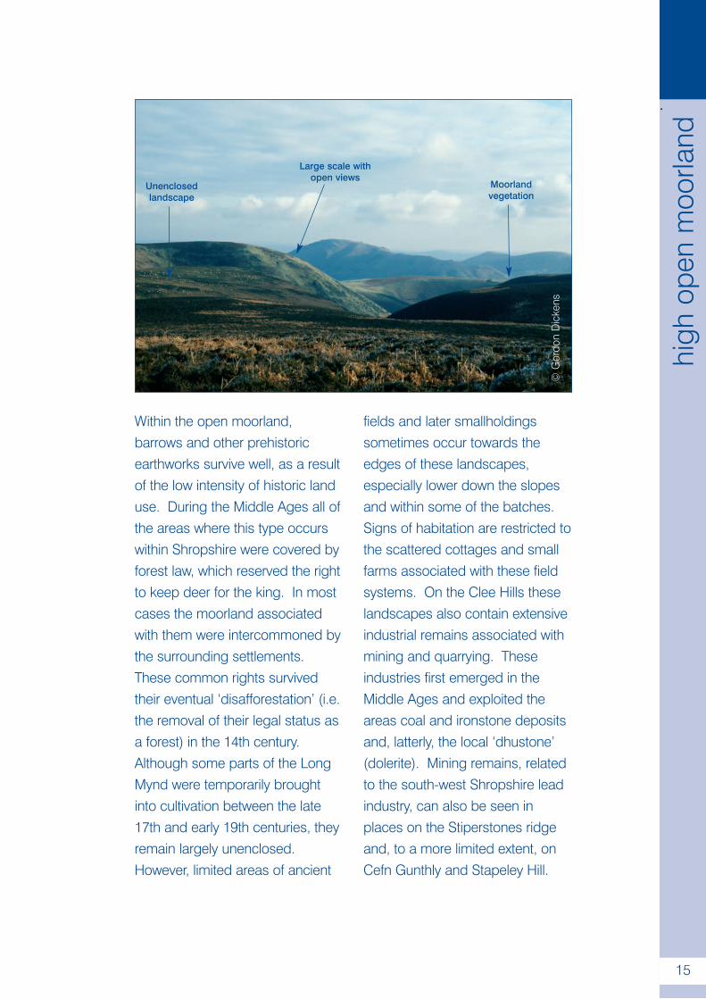
Within the open moorland,barrows and other prehistoricearthworks survive well, as a resultof the low intensity of historic landuse. During the Middle Ages all ofthe areas where this type occurswithin Shropshire were covered byforest law, which reserved the rightto keep deer for the king. In mostcases the moorland associatedwith them were intercommoned bythe surrounding settlements.These common rights survivedtheir eventual ‘disafforestation’ (i.e.the removal of their legal status asa forest) in the 14th century.Although some parts of the LongMynd were temporarily broughtinto cultivation between the late17th and early 19th centuries, theyremain largely unenclosed.However, limited areas of ancient
fields and later smallholdingssometimes occur towards theedges of these landscapes,especially lower down the slopesand within some of the batches.Signs of habitation are restricted tothe scattered cottages and smallfarms associated with these fieldsystems. On the Clee Hills theselandscapes also contain extensiveindustrial remains associated withmining and quarrying. Theseindustries first emerged in theMiddle Ages and exploited theareas coal and ironstone depositsand, latterly, the local ‘dhustone’(dolerite). Mining remains, relatedto the south-west Shropshire leadindustry, can also be seen inplaces on the Stiperstones ridgeand, to a more limited extent, onCefn Gunthly and Stapeley Hill.
©G
ordo
nD
icke
ns
.
15
high
open
moo
rland
Unenclosedlandscape
Large scale withopen views
Moorlandvegetation
High Enclosed Plateau
Key Characteristics
• High, upland plateau
• Regular, planned field pattern
• Relict thorn hedges
• Medium to large scale landscape with
open views
• Dispersed settlement pattern© Crown Copyright. All rights reserved.Shropshire County Council 100019801 (2006)
.
16
Description
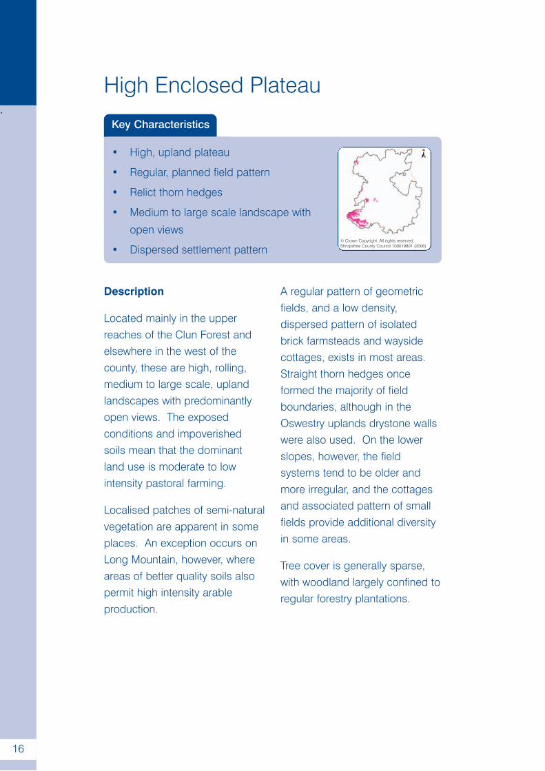
Located mainly in the upperreaches of the Clun Forest andelsewhere in the west of thecounty, these are high, rolling,medium to large scale, uplandlandscapes with predominantlyopen views. The exposedconditions and impoverishedsoils mean that the dominantland use is moderate to lowintensity pastoral farming.
Localised patches of semi-naturalvegetation are apparent in someplaces. An exception occurs onLong Mountain, however, whereareas of better quality soils alsopermit high intensity arableproduction.
A regular pattern of geometricfields, and a low density,dispersed pattern of isolatedbrick farmsteads and waysidecottages, exists in most areas.Straight thorn hedges onceformed the majority of fieldboundaries, although in theOswestry uplands drystone wallswere also used. On the lowerslopes, however, the fieldsystems tend to be older andmore irregular, and the cottagesand associated pattern of smallfields provide additional diversityin some areas.
Tree cover is generally sparse,with woodland largely confined toregular forestry plantations.
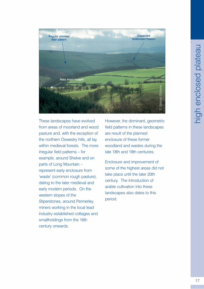
These landscapes have evolvedfrom areas of moorland and woodpasture and, with the exception ofthe northern Oswestry hills, all laywithin medieval forests. The moreirregular field patterns – forexample, around Shelve and onparts of Long Mountain –represent early enclosure from‘waste’ (common rough pasture),dating to the later medieval andearly modern periods. On thewestern slopes of theStiperstones, around Pennerley,miners working in the local leadindustry established cottages andsmallholdings from the 16thcentury onwards.
However, the dominant, geometricfield patterns in these landscapesare result of the plannedenclosure of these formerwoodland and wastes during thelate 18th and 19th centuries.
Enclosure and improvement ofsome of the highest areas did nottake place until the later 20thcentury. The introduction ofarable cultivation into theselandscapes also dates to thisperiod.
©G
ordo
nD
icke
ns
Regular plannedfield pattern
DispersedSettlement Pattern
Relic thorn hedges
.
17
high
encl
osed
plat
eau
High Volcanic Hills and Slopes
Key Characteristics
• Precambrian volcanic geology
• Prominent hills with notable steep slopes
• Unsettled, unenclosed landscape with
few signs of habitation
• Rough grazing© Crown Copyright. All rights reserved.Shropshire County Council 100019801 (2006)
.
18
Description
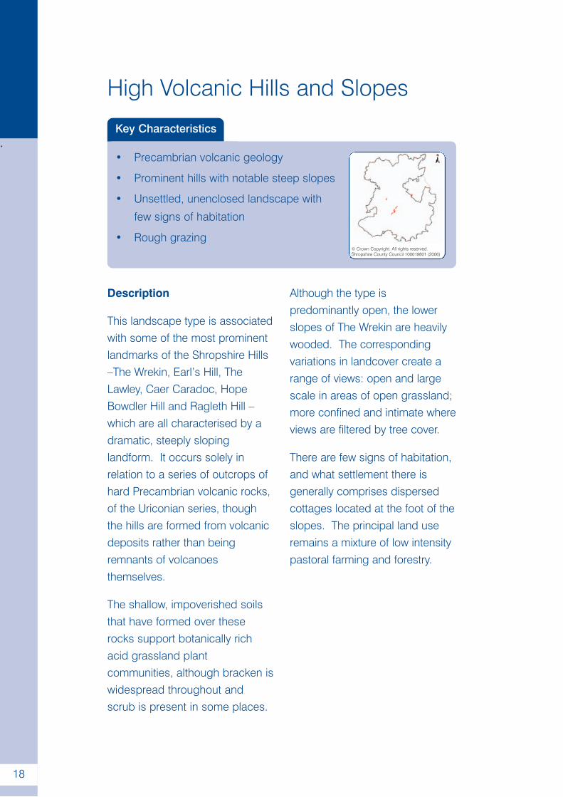
This landscape type is associatedwith some of the most prominentlandmarks of the Shropshire Hills–The Wrekin, Earl’s Hill, TheLawley, Caer Caradoc, HopeBowdler Hill and Ragleth Hill –which are all characterised by adramatic, steeply slopinglandform. It occurs solely inrelation to a series of outcrops ofhard Precambrian volcanic rocks,of the Uriconian series, thoughthe hills are formed from volcanicdeposits rather than beingremnants of volcanoesthemselves.
The shallow, impoverished soilsthat have formed over theserocks support botanically richacid grassland plantcommunities, although bracken iswidespread throughout andscrub is present in some places.
Although the type ispredominantly open, the lowerslopes of The Wrekin are heavilywooded. The correspondingvariations in landcover create arange of views: open and largescale in areas of open grassland;more confined and intimate whereviews are filtered by tree cover.
There are few signs of habitation,and what settlement there isgenerally comprises dispersedcottages located at the foot of theslopes. The principal land useremains a mixture of low intensitypastoral farming and forestry.
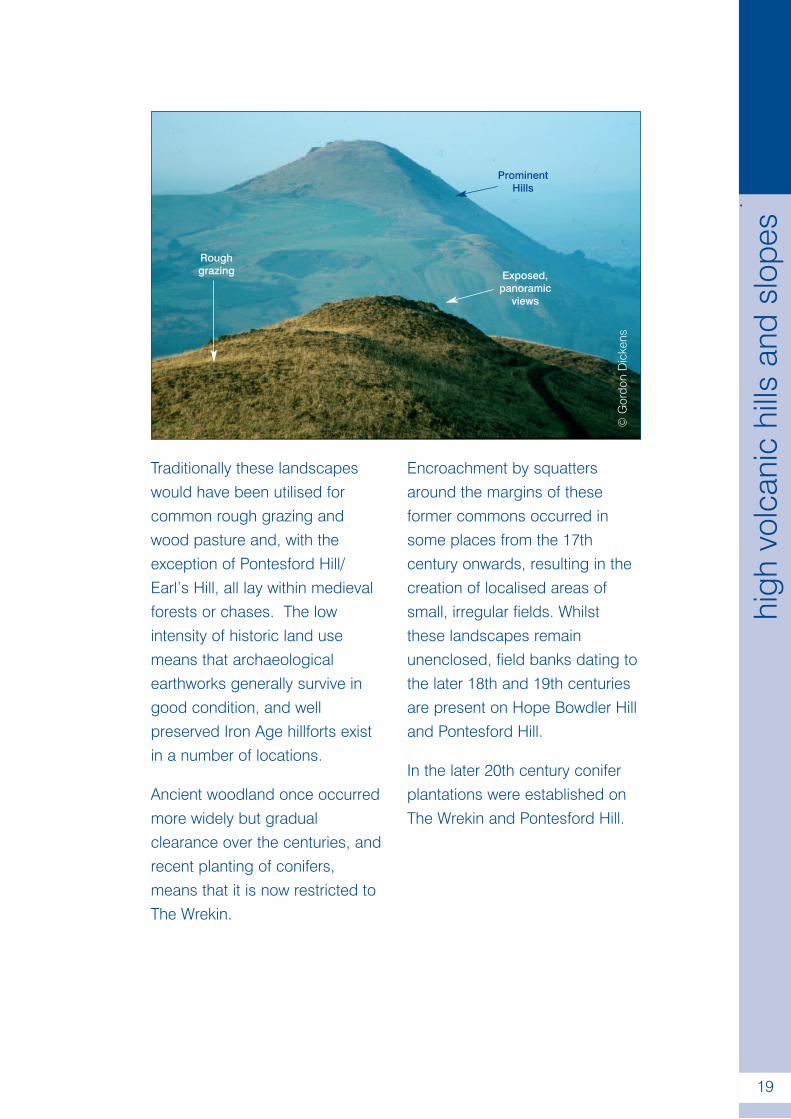
Traditionally these landscapeswould have been utilised forcommon rough grazing andwood pasture and, with theexception of Pontesford Hill/Earl’s Hill, all lay within medievalforests or chases. The lowintensity of historic land usemeans that archaeologicalearthworks generally survive ingood condition, and wellpreserved Iron Age hillforts existin a number of locations.
Ancient woodland once occurredmore widely but gradualclearance over the centuries, andrecent planting of conifers,means that it is now restricted toThe Wrekin.
Encroachment by squattersaround the margins of theseformer commons occurred insome places from the 17thcentury onwards, resulting in thecreation of localised areas ofsmall, irregular fields. Whilstthese landscapes remainunenclosed, field banks dating tothe later 18th and 19th centuriesare present on Hope Bowdler Hilland Pontesford Hill.
In the later 20th century coniferplantations were established onThe Wrekin and Pontesford Hill.
©G
ordo
nD
icke
ns
.
19
high
volc
anic
hills
and
slop
es
Roughgrazing
ProminentHills
Exposed,panoramic
views
Upland Smallholdings
Key Characteristics
• Prominent, sloping topography
• Dispersed settlement pattern of
wayside cottages
• Small hedged pasture fields
• Areas of unenclosed moorland© Crown Copyright. All rights reserved.Shropshire County Council 100019801 (2006)
.
20
Description
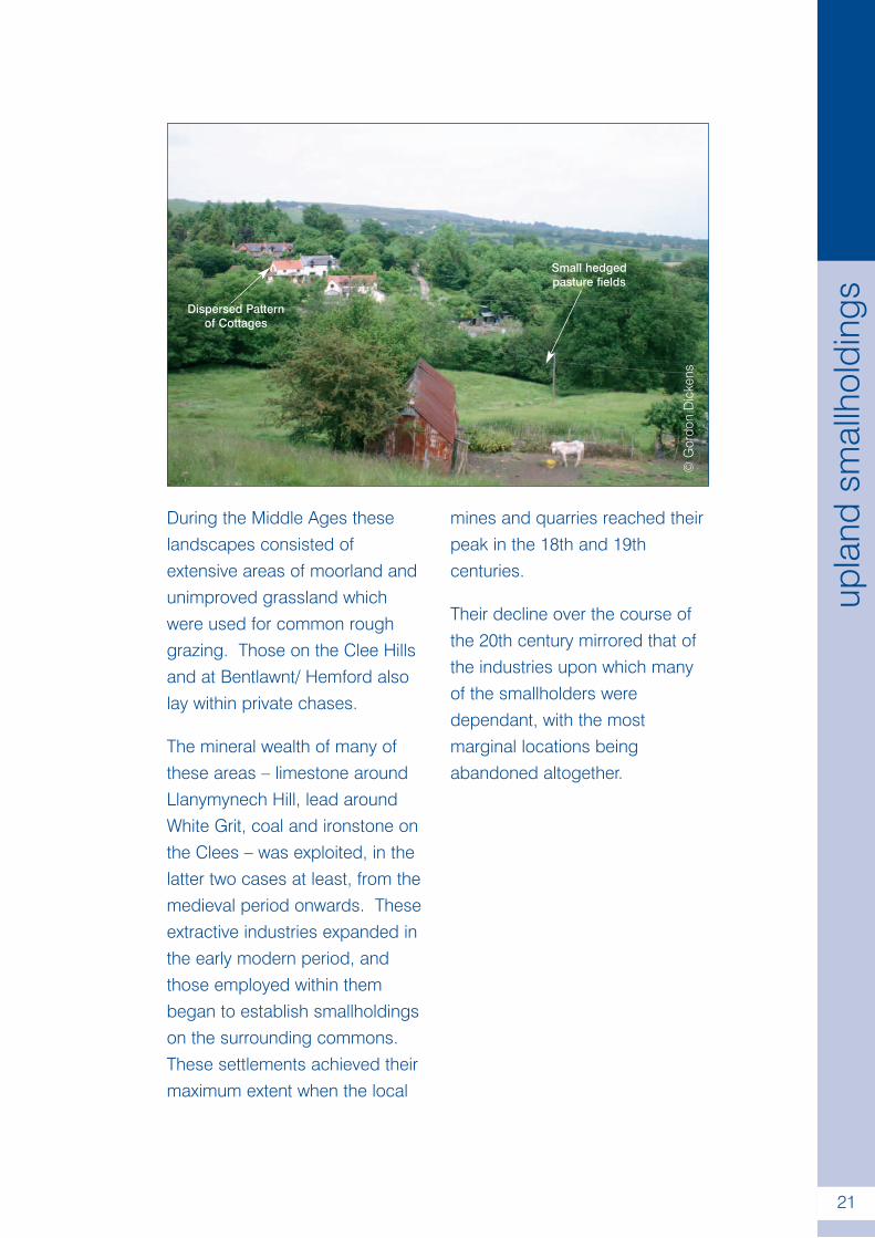
These landscapes mainly occuraround the fringes of highmoorland in the Shropshire Hills,such as Catherton Common inthe Clee Hills and the areaaround Bentlawnt and Hemford,to the south-west of Minsterley.They are generally characterisedby poorer soils that favourmoorland and rough pasturehabitats, which occur extensivelyin those areas which remainunenclosed.
Small irregular fields, mainly usedfor pastoral farming, form themain element within the fieldsystems; some of which remainunimproved hay meadows. Theirboundaries are defined by mixedhedgerows, often containingholly, rowan and gorse, as well ashawthorn and blackthorn. Thesefields mesh together with a
network of narrow winding lanesand dispersed wayside cottageswith associated farmsteads.Such areas contrast strongly witha secondary, planned componentin the field patterns, defined bystraight thorn hedges andassociated with a thin scatteringof farmsteads.
These variations in landcovercreate differing views: open,medium to large scale withinareas of unenclosed land andplanned enclosure; small scaleand intimate within the areas ofsmallholdings.
Along the edges of higherground, particularly on the CleeHills and around White Grit andHemford, many of the leastproductive areas within bothtypes of field systems are in theprocess of reverting back tomoorland and scrub.
During the Middle Ages theselandscapes consisted ofextensive areas of moorland andunimproved grassland whichwere used for common roughgrazing. Those on the Clee Hillsand at Bentlawnt/ Hemford alsolay within private chases.
The mineral wealth of many ofthese areas – limestone aroundLlanymynech Hill, lead aroundWhite Grit, coal and ironstone onthe Clees – was exploited, in thelatter two cases at least, from themedieval period onwards. Theseextractive industries expanded inthe early modern period, andthose employed within thembegan to establish smallholdingson the surrounding commons.These settlements achieved theirmaximum extent when the local
mines and quarries reached theirpeak in the 18th and 19thcenturies.
Their decline over the course ofthe 20th century mirrored that ofthe industries upon which manyof the smallholders weredependant, with the mostmarginal locations beingabandoned altogether.
©G
ordo
nD
icke
ns
Dispersed Patternof Cottages
Small hedgedpasture fields
.
21
upla
ndsm
allh
oldi
ngs
Upstanding Enclosed Commons
Key Characteristics
• Upstanding, sloping topography
• Regular to sub-regular pattern of
hedged fields
• Medium to large scale landscapes
• Dispersed settlement pattern© Crown Copyright. All rights reserved.Shropshire County Council 100019801 (2006)
.
22
Description
This landscape type occurs in alimited number of locations incentral, western and north-western Shropshire, and isdistinguished from the previouslandscape types by the loweraltitudes at which they occur.They are formed of a mixture ofPrecambrian (Norbury Hill, LythHill and Bayston Hill) andigneous (Mynd y Bryn) andsedimentary (Rhydycroseau)Ordovician rocks. These stratagive rise to landscapes withprominent, upstandingtopographies and predominantlypoor soils.
Pastoral farming of improvedgrassland represents the mostwidespread land use, althoughon Lyth Hill mixed farming ismore prominent. Relict patchesof rough or acid grassland and
moorland survive in places – forexample, on the crest of Lyth Hill- and in more marginal locationsthe landscape is beginning torevert to a pre-enclosure state.
The predominant field patternconsists of regular or sub-regularhedged fields, associated with adispersed pattern of farmsteads.However, a secondarycomponent comprised of smallirregular fields associated withcottages and smallholdings canbe seen in places.
Woodland is largely confined tocoverts and tree groups, withsome relic ancient woodland onLyth Hill, whilst additional treecover is provided by scatteredhedgerow trees.
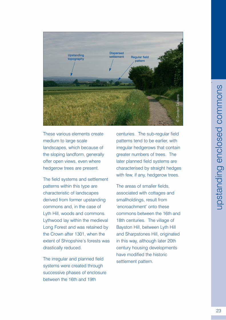
These various elements createmedium to large scalelandscapes, which because ofthe sloping landform, generallyoffer open views, even wherehedgerow trees are present.
The field systems and settlementpatterns within this type arecharacteristic of landscapesderived from former upstandingcommons and, in the case ofLyth Hill, woods and commons.Lythwood lay within the medievalLong Forest and was retained bythe Crown after 1301, when theextent of Shropshire’s forests wasdrastically reduced.
The irregular and planned fieldsystems were created throughsuccessive phases of enclosurebetween the 16th and 19th
centuries. The sub-regular fieldpatterns tend to be earlier, withirregular hedgerows that containgreater numbers of trees. Thelater planned field systems arecharacterised by straight hedgeswith few, if any, hedgerow trees.
The areas of smaller fields,associated with cottages andsmallholdings, result from‘encroachment’ onto thesecommons between the 16th and18th centuries. The village ofBayston Hill, between Lyth Hilland Sharpstones Hill, originatedin this way, although later 20thcentury housing developmentshave modified the historicsettlement pattern.
©G
ordo
nD
icke
ns
Upstandingtopography
Dispersedsettlement Regular field
pattern
.
23
upst
andi
ngen
clos
edco
mm
ons
.
24
Pasture Hills
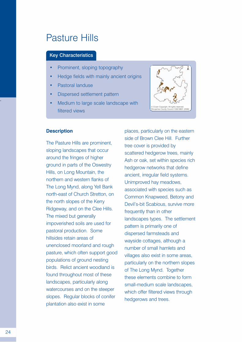
Key Characteristics
• Prominent, sloping topography
• Hedge fields with mainly ancient origins
• Pastoral landuse
• Dispersed settlement pattern
• Medium to large scale landscape with
filtered views© Crown Copyright. All rights reserved.Shropshire County Council 100019801 (2006)
Description
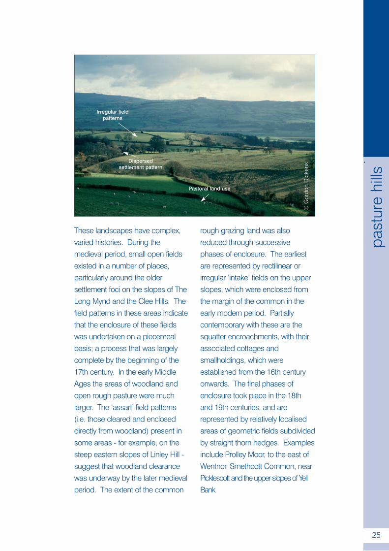
The Pasture Hills are prominent,sloping landscapes that occuraround the fringes of higherground in parts of the OswestryHills, on Long Mountain, thenorthern and western flanks ofThe Long Mynd, along Yell Banknorth-east of Church Stretton, onthe north slopes of the KerryRidgeway, and on the Clee Hills.The mixed but generallyimpoverished soils are used forpastoral production. Somehillsides retain areas ofunenclosed moorland and roughpasture, which often support goodpopulations of ground nestingbirds. Relict ancient woodland isfound throughout most of theselandscapes, particularly alongwatercourses and on the steeperslopes. Regular blocks of coniferplantation also exist in some
places, particularly on the easternside of Brown Clee Hill. Furthertree cover is provided byscattered hedgerow trees, mainlyAsh or oak, set within species richhedgerow networks that defineancient, irregular field systems.Unimproved hay meadows,associated with species such asCommon Knapweed, Betony andDevil’s-bit Scabious, survive morefrequently than in otherlandscapes types. The settlementpattern is primarily one ofdispersed farmsteads andwayside cottages, although anumber of small hamlets andvillages also exist in some areas,particularly on the northern slopesof The Long Mynd. Togetherthese elements combine to formsmall-medium scale landscapes,which offer filtered views throughhedgerows and trees.
.
25
past
ure
hills
These landscapes have complex,varied histories. During themedieval period, small open fieldsexisted in a number of places,particularly around the oldersettlement foci on the slopes of TheLong Mynd and the Clee Hills. Thefield patterns in these areas indicatethat the enclosure of these fieldswas undertaken on a piecemealbasis; a process that was largelycomplete by the beginning of the17th century. In the early MiddleAges the areas of woodland andopen rough pasture were muchlarger. The ‘assart’ field patterns(i.e. those cleared and encloseddirectly from woodland) present insome areas - for example, on thesteep eastern slopes of Linley Hill -suggest that woodland clearancewas underway by the later medievalperiod. The extent of the common
rough grazing land was alsoreduced through successivephases of enclosure. The earliestare represented by rectilinear orirregular ‘intake’ fields on the upperslopes, which were enclosed fromthe margin of the common in theearly modern period. Partiallycontemporary with these are thesquatter encroachments, with theirassociated cottages andsmallholdings, which wereestablished from the 16th centuryonwards. The final phases ofenclosure took place in the 18thand 19th centuries, and arerepresented by relatively localisedareas of geometric fields subdividedby straight thorn hedges. Examplesinclude Prolley Moor, to the east ofWentnor, Smethcott Common, nearPicklescott and the upper slopes of YellBank.
©G
ordo
nD
icke
ns
Pastoral land use
Dispersedsettlement pattern
Irregular fieldpatterns
.
26
Principal Wooded Hills
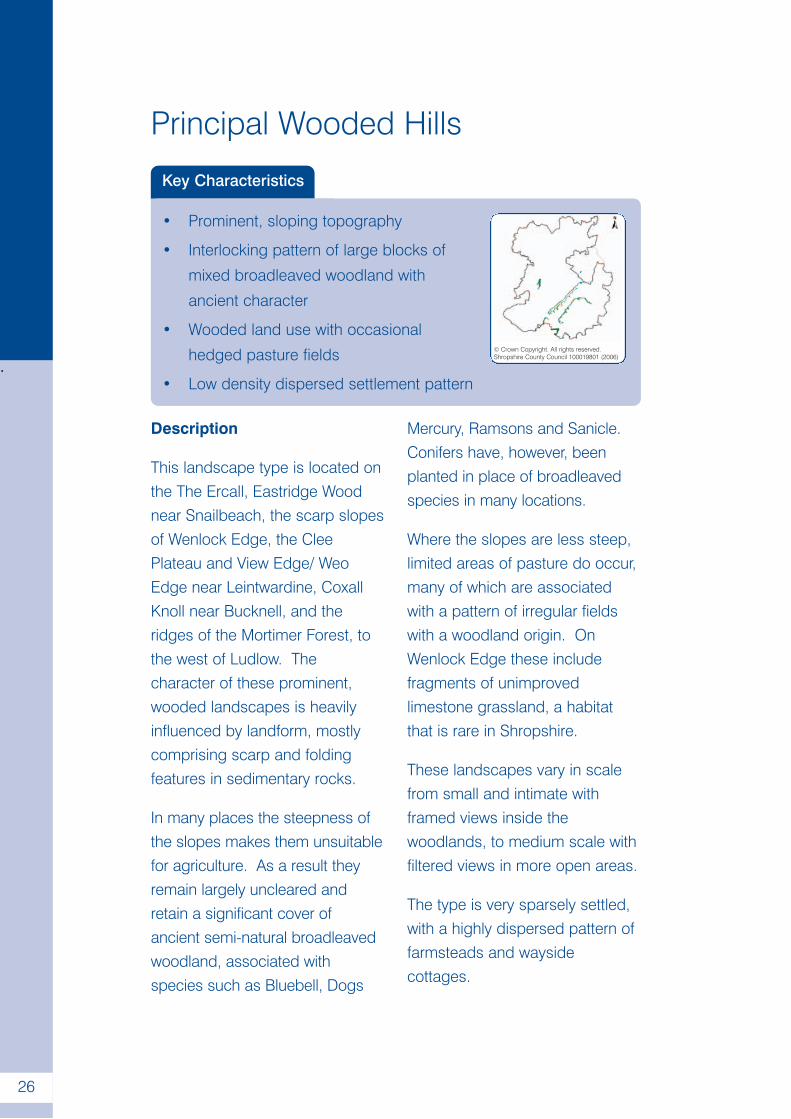
Key Characteristics
• Prominent, sloping topography
• Interlocking pattern of large blocks of
mixed broadleaved woodland with
ancient character
• Wooded land use with occasional
hedged pasture fields
• Low density dispersed settlement pattern
© Crown Copyright. All rights reserved.Shropshire County Council 100019801 (2006)
Description
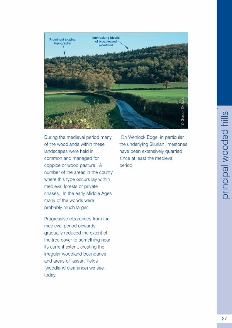
This landscape type is located onthe The Ercall, Eastridge Woodnear Snailbeach, the scarp slopesof Wenlock Edge, the CleePlateau and View Edge/ WeoEdge near Leintwardine, CoxallKnoll near Bucknell, and theridges of the Mortimer Forest, tothe west of Ludlow. Thecharacter of these prominent,wooded landscapes is heavilyinfluenced by landform, mostlycomprising scarp and foldingfeatures in sedimentary rocks.
In many places the steepness ofthe slopes makes them unsuitablefor agriculture. As a result theyremain largely uncleared andretain a significant cover ofancient semi-natural broadleavedwoodland, associated withspecies such as Bluebell, Dogs
Mercury, Ramsons and Sanicle.Conifers have, however, beenplanted in place of broadleavedspecies in many locations.
Where the slopes are less steep,limited areas of pasture do occur,many of which are associatedwith a pattern of irregular fieldswith a woodland origin. OnWenlock Edge these includefragments of unimprovedlimestone grassland, a habitatthat is rare in Shropshire.
These landscapes vary in scalefrom small and intimate withframed views inside thewoodlands, to medium scale withfiltered views in more open areas.
The type is very sparsely settled,with a highly dispersed pattern offarmsteads and waysidecottages.
.
27
prin
cipa
lwoo
ded
hills
During the medieval period manyof the woodlands within theselandscapes were held incommon and managed forcoppice or wood pasture. Anumber of the areas in the countywhere this type occurs lay withinmedieval forests or privatechases. In the early Middle Agesmany of the woods wereprobably much larger.
Progressive clearances from themedieval period onwardsgradually reduced the extent ofthe tree cover to something nearits current extent, creating theirregular woodland boundariesand areas of ‘assart’ fields(woodland clearance) we seetoday.
On Wenlock Edge, in particular,the underlying Silurian limestoneshave been extensively quarriedsince at least the medievalperiod.
©G
ordo
nD
icke
ns
Prominent slopingtopography
Interlocking blocksof broadleaved
woodland
Wooded River Gorge
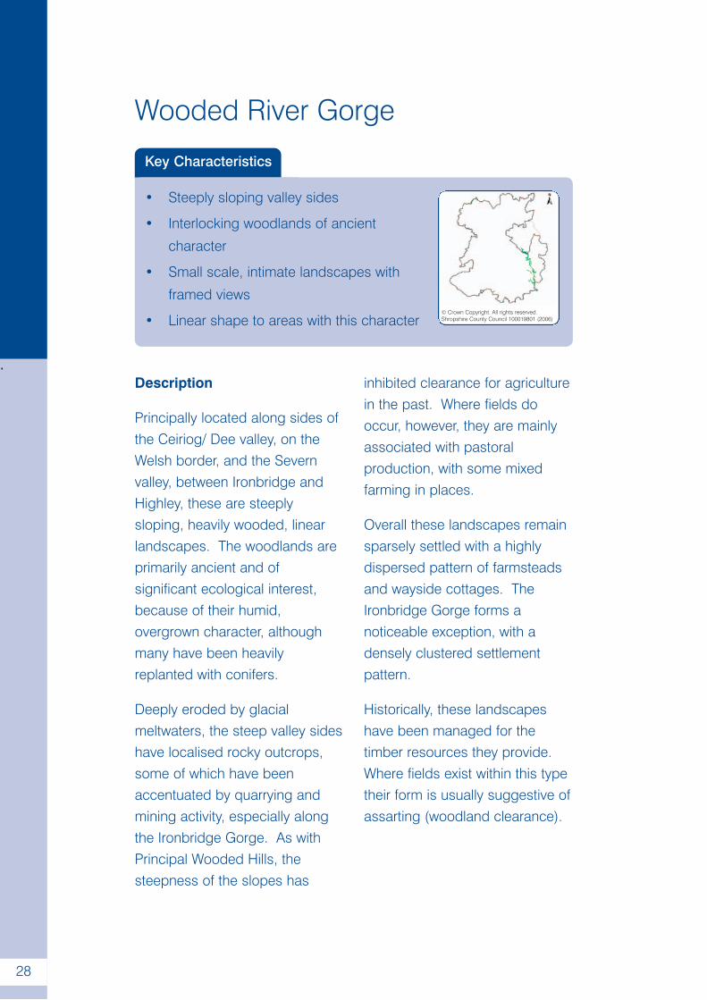
Key Characteristics
• Steeply sloping valley sides
• Interlocking woodlands of ancient
character
• Small scale, intimate landscapes with
framed views
• Linear shape to areas with this character© Crown Copyright. All rights reserved.Shropshire County Council 100019801 (2006)
.
28
Description
Principally located along sides ofthe Ceiriog/ Dee valley, on theWelsh border, and the Severnvalley, between Ironbridge andHighley, these are steeplysloping, heavily wooded, linearlandscapes. The woodlands areprimarily ancient and ofsignificant ecological interest,because of their humid,overgrown character, althoughmany have been heavilyreplanted with conifers.
Deeply eroded by glacialmeltwaters, the steep valley sideshave localised rocky outcrops,some of which have beenaccentuated by quarrying andmining activity, especially alongthe Ironbridge Gorge. As withPrincipal Wooded Hills, thesteepness of the slopes has
inhibited clearance for agriculturein the past. Where fields dooccur, however, they are mainlyassociated with pastoralproduction, with some mixedfarming in places.
Overall these landscapes remainsparsely settled with a highlydispersed pattern of farmsteadsand wayside cottages. TheIronbridge Gorge forms anoticeable exception, with adensely clustered settlementpattern.
Historically, these landscapeshave been managed for thetimber resources they provide.Where fields exist within this typetheir form is usually suggestive ofassarting (woodland clearance).
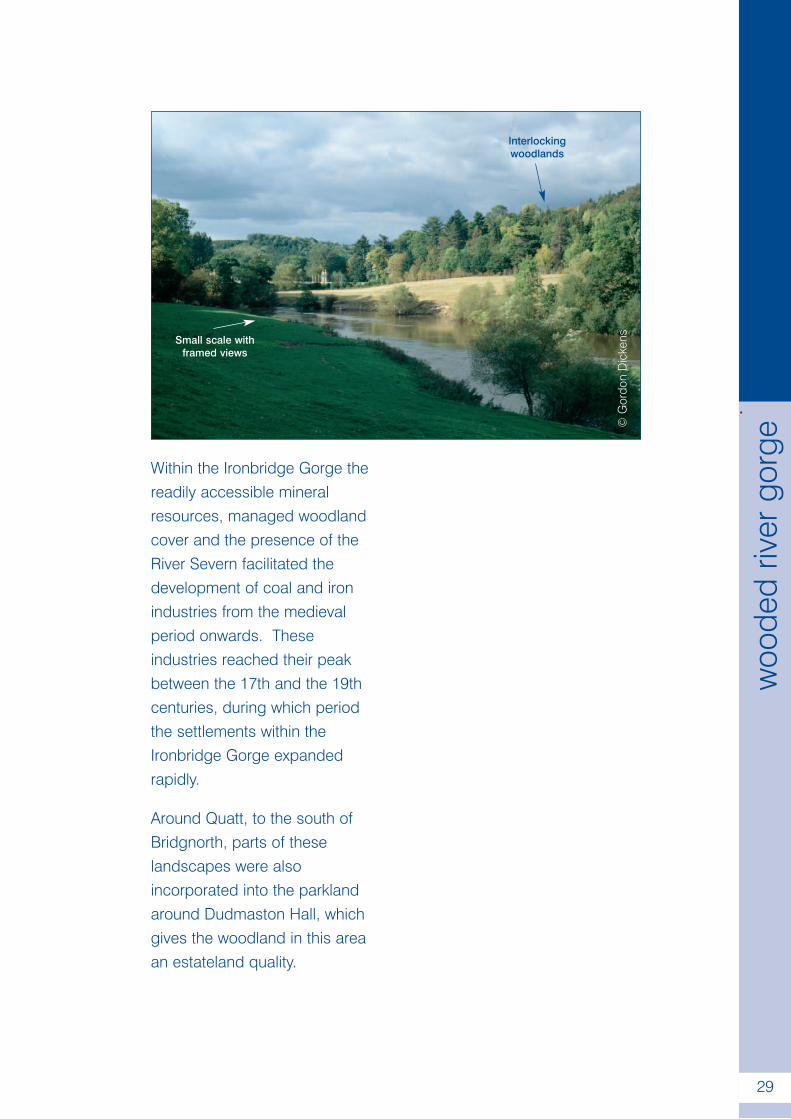
Within the Ironbridge Gorge thereadily accessible mineralresources, managed woodlandcover and the presence of theRiver Severn facilitated thedevelopment of coal and ironindustries from the medievalperiod onwards. Theseindustries reached their peakbetween the 17th and the 19thcenturies, during which periodthe settlements within theIronbridge Gorge expandedrapidly.
Around Quatt, to the south ofBridgnorth, parts of theselandscapes were alsoincorporated into the parklandaround Dudmaston Hall, whichgives the woodland in this areaan estateland quality.
©G
ordo
nD
icke
ns
.
29
woo
ded
river
gorg
e
Interlockingwoodlands
Small scale withframed views
.
30
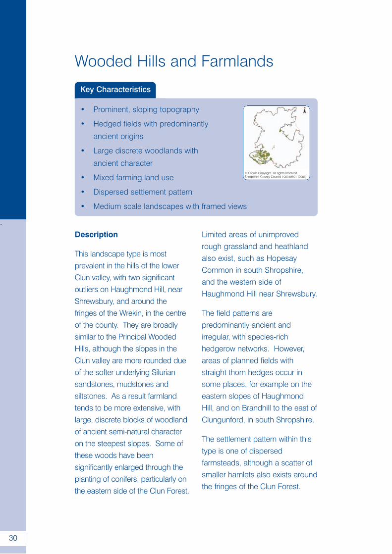
Wooded Hills and Farmlands
Key Characteristics
• Prominent, sloping topography
• Hedged fields with predominantly
ancient origins
• Large discrete woodlands with
ancient character
• Mixed farming land use
• Dispersed settlement pattern
• Medium scale landscapes with framed views
© Crown Copyright. All rights reserved.Shropshire County Council 100019801 (2006)
Description
This landscape type is mostprevalent in the hills of the lowerClun valley, with two significantoutliers on Haughmond Hill, nearShrewsbury, and around thefringes of the Wrekin, in the centreof the county. They are broadlysimilar to the Principal WoodedHills, although the slopes in theClun valley are more rounded dueof the softer underlying Siluriansandstones, mudstones andsiltstones. As a result farmlandtends to be more extensive, withlarge, discrete blocks of woodlandof ancient semi-natural characteron the steepest slopes. Some ofthese woods have beensignificantly enlarged through theplanting of conifers, particularly onthe eastern side of the Clun Forest.
Limited areas of unimprovedrough grassland and heathlandalso exist, such as HopesayCommon in south Shropshire,and the western side ofHaughmond Hill near Shrewsbury.
The field patterns arepredominantly ancient andirregular, with species-richhedgerow networks. However,areas of planned fields withstraight thorn hedges occur insome places, for example on theeastern slopes of HaughmondHill, and on Brandhill to the east ofClungunford, in south Shropshire.
The settlement pattern within thistype is one of dispersedfarmsteads, although a scatter ofsmaller hamlets also exists aroundthe fringes of the Clun Forest.
.
31
woo
ded
hills
and
farm
land
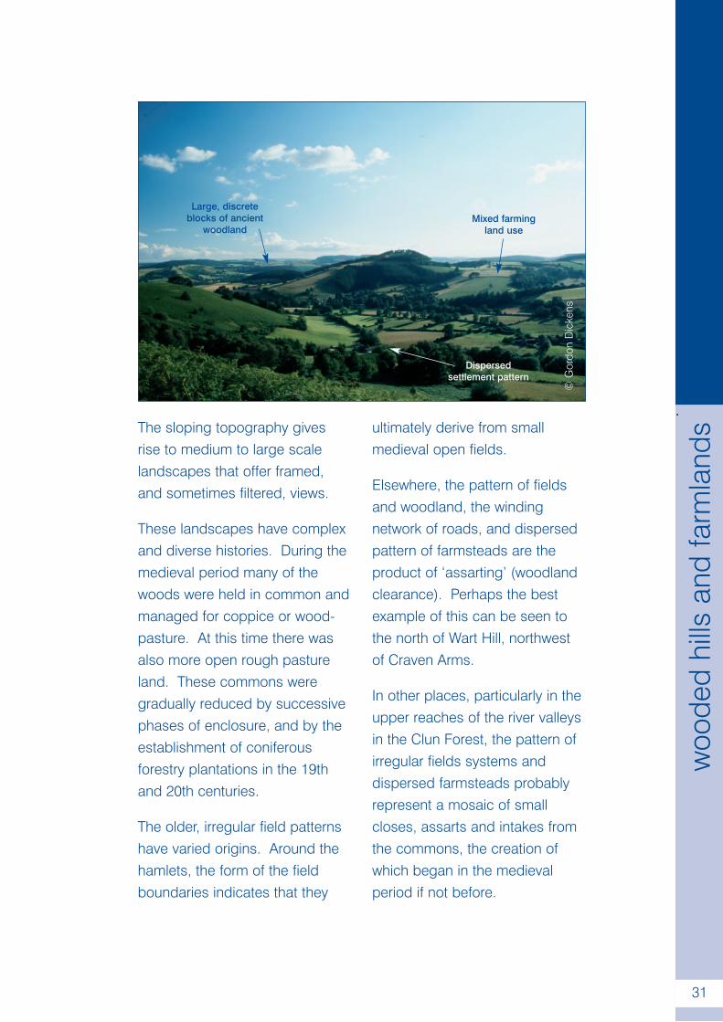
sThe sloping topography givesrise to medium to large scalelandscapes that offer framed,and sometimes filtered, views.
These landscapes have complexand diverse histories. During themedieval period many of thewoods were held in common andmanaged for coppice or wood-pasture. At this time there wasalso more open rough pastureland. These commons weregradually reduced by successivephases of enclosure, and by theestablishment of coniferousforestry plantations in the 19thand 20th centuries.
The older, irregular field patternshave varied origins. Around thehamlets, the form of the fieldboundaries indicates that they
ultimately derive from smallmedieval open fields.
Elsewhere, the pattern of fieldsand woodland, the windingnetwork of roads, and dispersedpattern of farmsteads are theproduct of ‘assarting’ (woodlandclearance). Perhaps the bestexample of this can be seen tothe north of Wart Hill, northwestof Craven Arms.
In other places, particularly in theupper reaches of the river valleysin the Clun Forest, the pattern ofirregular fields systems anddispersed farmsteads probablyrepresent a mosaic of smallcloses, assarts and intakes fromthe commons, the creation ofwhich began in the medievalperiod if not before.
©G
ordo
nD
icke
ns
Mixed farmingland use
Large, discreteblocks of ancient
woodland
Dispersedsettlement pattern
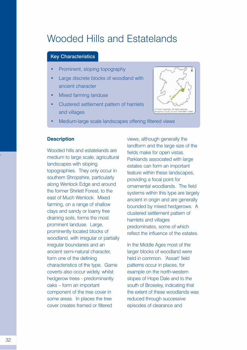
Wooded Hills and Estatelands
Key Characteristics
• Prominent, sloping topography
• Large discrete blocks of woodland with
ancient character
• Mixed farming landuse
• Clustered settlement pattern of hamlets
and villages
• Medium-large scale landscapes offering filtered views
© Crown Copyright. All rights reserved.Shropshire County Council 100019801 (2006)
.
32
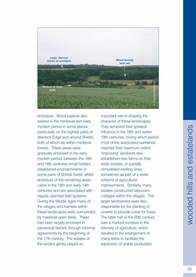
Description
Wooded hills and estatelands aremedium to large scale, agriculturallandscapes with slopingtopographies. They only occur insouthern Shropshire, particularlyalong Wenlock Edge and aroundthe former Shirlett Forest, to theeast of Much Wenlock. Mixedfarming, on a range of shallowclays and sandy or loamy freedraining soils, forms the mostprominent landuse. Large,prominently located blocks ofwoodland, with irregular or partiallyirregular boundaries and anancient semi-natural character,form one of the definingcharacteristics of the type. Gamecoverts also occur widely, whilsthedgerow trees - predominantlyoaks – form an importantcomponent of the tree cover insome areas. In places the treecover creates framed or filtered
views, although generally thelandform and the large size of thefields make for open vistas.Parklands associated with largeestates can form an importantfeature within these landscapes,providing a focal point forornamental woodlands. The fieldsystems within this type are largelyancient in origin and are generallybounded by mixed hedgerows. Aclustered settlement pattern ofhamlets and villagespredominates, some of whichreflect the influence of the estates.
In the Middle Ages most of thelarger blocks of woodland wereheld in common. ‘Assart’ fieldpatterns occur in places, forexample on the north-westernslopes of Hope Dale and to thesouth of Broseley, indicating thatthe extent of these woodlands wasreduced through successiveepisodes of clearance and
enclosure. Wood pasture alsoexisted in the medieval and earlymodern period in some places,particularly on the highest parts ofWenlock Edge and around Shirlett,both of which lay within medievalforests. These areas weregradually enclosed in the earlymodern period: between the 16thand 18th centuries small holdersestablished encroachments insome parts of Shirlett forest, whilstenclosure of the remaining areascame in the 18th and early 19thcenturies and are associated withregular, planned field systems.During the Middle Ages many ofthe villages and hamlets withinthese landscapes were surroundedby medieval open fields. Thesehad been largely enclosed inpiecemeal fashion through informalagreements by the beginning ofthe 17th century. The estates ofthe landed gentry played an
important role in shaping thecharacter of these landscapes.They achieved their greatestinfluence in the 18th and earlier19th centuries, during which periodmost of the associated parklandsreached their maximum extent.‘Improving’ landlords alsoestablished new farms on theirwider estates, or partiallyremodelled existing ones,sometimes as part of a widerscheme of agriculturalimprovements. Similarly, manyestates constructed labourerscottages within the villages. Thelarger landowners were alsoresponsible for the planting ofcoverts to provide cover for foxes.The latter half of the 20th centurysaw a marked increase in theintensity of agriculture, whichresulted in the enlargement ofmany fields to facilitate theexpansion of arable production.
©G
ordo
nD
icke
ns
Large, discreetblocks of woodland Mixed farming
land use
Medium to largescale
.
33
woo
ded
hills
and
esta
tela
nds
Sandstone Hills
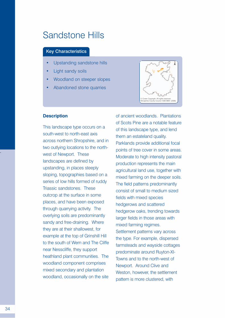
Key Characteristics
• Upstanding sandstone hills
• Light sandy soils
• Woodland on steeper slopes
• Abandoned stone quarries
© Crown Copyright. All rights reserved.Shropshire County Council 100019801 (2006)
.
34
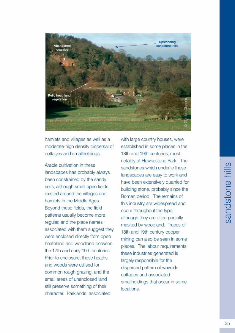
Description
This landscape type occurs on asouth-west to north-east axisacross northern Shropshire, and intwo outlying locations to the north-west of Newport. Theselandscapes are defined byupstanding, in places steeplysloping, topographies based on aseries of low hills formed of ruddyTriassic sandstones. Theseoutcrop at the surface in someplaces, and have been exposedthrough quarrying activity. Theoverlying soils are predominantlysandy and free-draining. Wherethey are at their shallowest, forexample at the top of Grinshill Hillto the south of Wem and The Cliffenear Nesscliffe, they supportheathland plant communities. Thewoodland component comprisesmixed secondary and plantationwoodland, occasionally on the site
of ancient woodlands. Plantationsof Scots Pine are a notable featureof this landscape type, and lendthem an estateland quality.Parklands provide additional focalpoints of tree cover in some areas.Moderate to high intensity pastoralproduction represents the mainagricultural land use, together withmixed farming on the deeper soils.The field patterns predominantlyconsist of small to medium sizedfields with mixed specieshedgerows and scatteredhedgerow oaks, trending towardslarger fields in those areas withmixed farming regimes.Settlement patterns vary acrossthe type. For example, dispersedfarmsteads and wayside cottagespredominate around Ruyton-XI-Towns and to the north-west ofNewport. Around Clive andWeston, however, the settlementpattern is more clustered, with
hamlets and villages as well as amoderate-high density dispersal ofcottages and smallholdings.
Arable cultivation in theselandscapes has probably alwaysbeen constrained by the sandysoils, although small open fieldsexisted around the villages andhamlets in the Middle Ages.Beyond these fields, the fieldpatterns usually become moreregular, and the place namesassociated with them suggest theywere enclosed directly from openheathland and woodland betweenthe 17th and early 19th centuries.Prior to enclosure, these heathsand woods were utilised forcommon rough grazing, and thesmall areas of unenclosed landstill preserve something of theircharacter. Parklands, associated
with large country houses, wereestablished in some places in the18th and 19th centuries, mostnotably at Hawkestone Park. Thesandstones which underlie theselandscapes are easy to work andhave been extensively quarried forbuilding stone, probably since theRoman period. The remains ofthis industry are widespread andoccur throughout the type,although they are often partiallymasked by woodland. Traces of18th and 19th century coppermining can also be seen in someplaces. The labour requirementsthese industries generated islargely responsible for thedispersed pattern of waysidecottages and associatedsmallholdings that occur in somelocations.
©G
ordo
nD
icke
ns
.
35
sand
ston
ehi
lls
Abandonedquarries
Relic heathlandvegetation
Upstandingsandstone hills
.
36
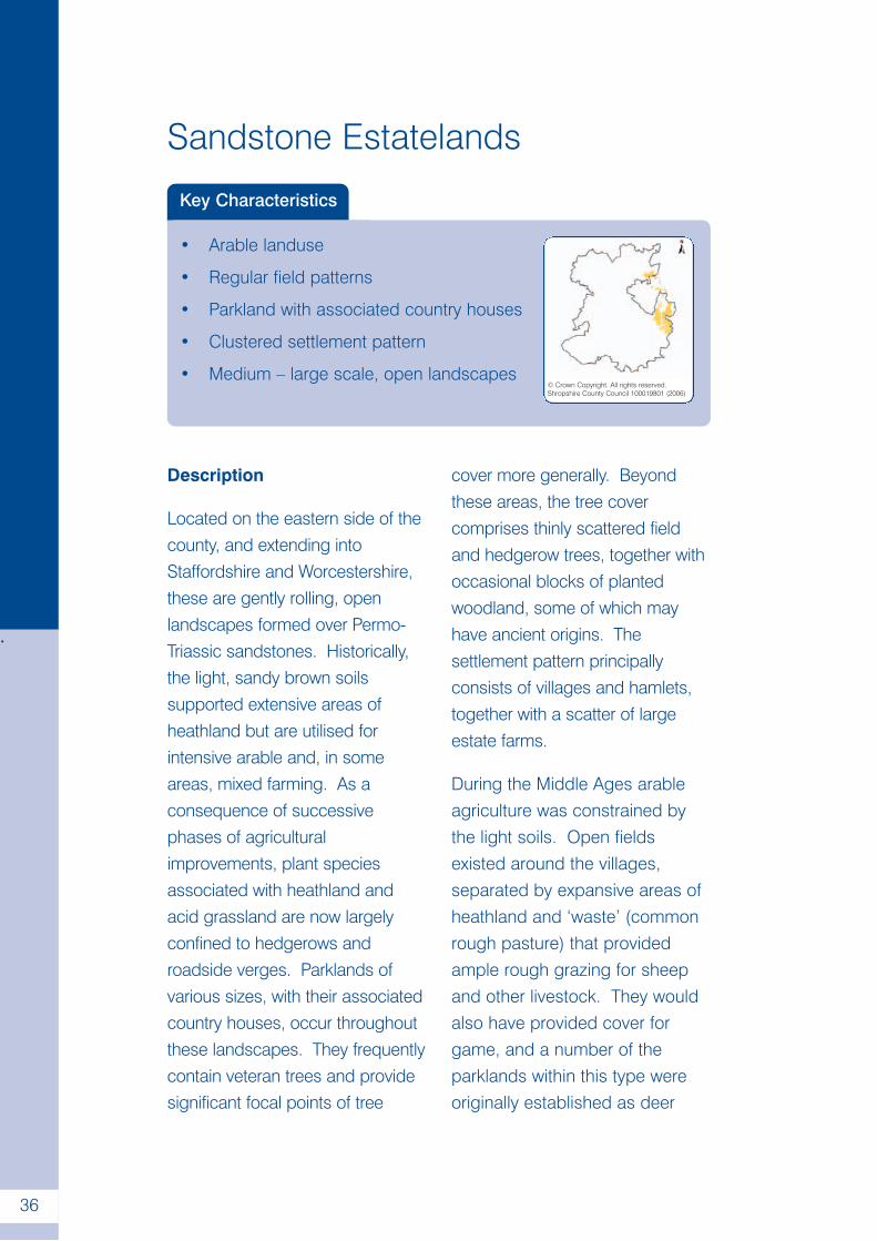
Sandstone Estatelands
Key Characteristics
• Arable landuse
• Regular field patterns
• Parkland with associated country houses
• Clustered settlement pattern
• Medium – large scale, open landscapes© Crown Copyright. All rights reserved.Shropshire County Council 100019801 (2006)
Description
Located on the eastern side of thecounty, and extending intoStaffordshire and Worcestershire,these are gently rolling, openlandscapes formed over Permo-Triassic sandstones. Historically,the light, sandy brown soilssupported extensive areas ofheathland but are utilised forintensive arable and, in someareas, mixed farming. As aconsequence of successivephases of agriculturalimprovements, plant speciesassociated with heathland andacid grassland are now largelyconfined to hedgerows androadside verges. Parklands ofvarious sizes, with their associatedcountry houses, occur throughoutthese landscapes. They frequentlycontain veteran trees and providesignificant focal points of tree
cover more generally. Beyondthese areas, the tree covercomprises thinly scattered fieldand hedgerow trees, together withoccasional blocks of plantedwoodland, some of which mayhave ancient origins. Thesettlement pattern principallyconsists of villages and hamlets,together with a scatter of largeestate farms.
During the Middle Ages arableagriculture was constrained bythe light soils. Open fieldsexisted around the villages,separated by expansive areas ofheathland and ‘waste’ (commonrough pasture) that providedample rough grazing for sheepand other livestock. They wouldalso have provided cover forgame, and a number of theparklands within this type wereoriginally established as deer
.
37
sand
ston
ees
tate
land
s
©S
hrop
shire
Cou
nty
Cou
ncil
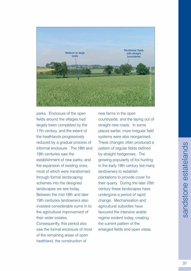
Medium to largescale
Rectilinear fieldswith straightboundaries
parks. Enclosure of the openfields around the villages hadlargely been completed by the17th century, and the extent ofthe heathlands progressivelyreduced by a gradual process ofinformal enclosure. The 18th and19th centuries saw theestablishment of new parks, andthe expansion of existing ones,most of which were transformedthrough formal landscapingschemes into the designedlandscapes we see today.Between the mid 18th and later19th centuries landowners alsoinvested considerable sums in tothe agricultural improvement oftheir wider estates.Consequently, this period alsosaw the formal enclosure of mostof the remaining areas of openheathland, the construction of
new farms in the opencountryside, and the laying out ofstraight new roads. In someplaces earlier, more irregular fieldsystems were also reorganised.These changes often produced apattern of regular fields definedby straight hedgerows. Thegrowing popularity of fox huntingin the early 19th century led manylandowners to establishplantations to provide cover fortheir quarry. During the later 20thcentury these landscapes haveundergone a period of rapidchange. Mechanisation andagricultural subsidies havefavoured the intensive arableregime evident today, creatingthe current pattern of theenlarged fields and open vistas.
.
38
Incised Sandstone Valleys
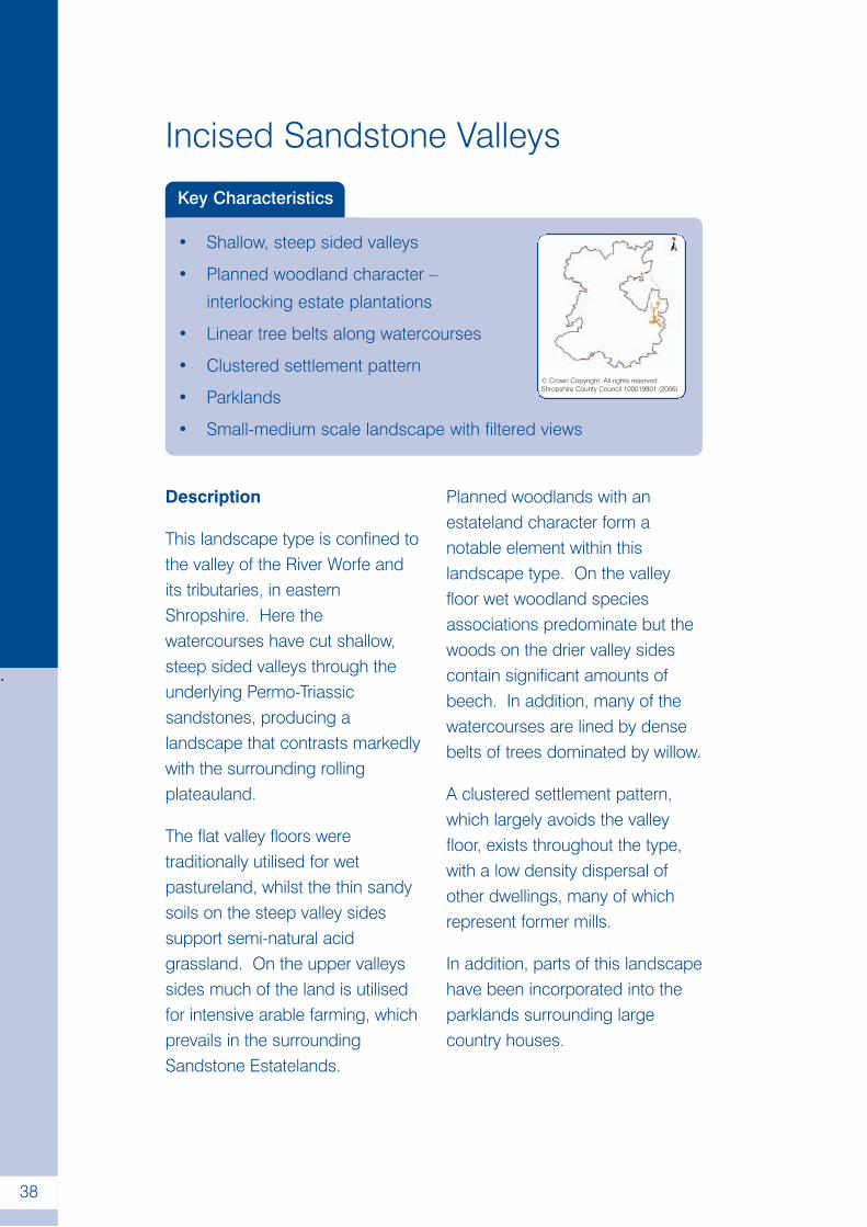
Key Characteristics
• Shallow, steep sided valleys
• Planned woodland character –
interlocking estate plantations
• Linear tree belts along watercourses
• Clustered settlement pattern
• Parklands
• Small-medium scale landscape with filtered views
© Crown Copyright. All rights reserved.Shropshire County Council 100019801 (2006)
Description
This landscape type is confined tothe valley of the River Worfe andits tributaries, in easternShropshire. Here thewatercourses have cut shallow,steep sided valleys through theunderlying Permo-Triassicsandstones, producing alandscape that contrasts markedlywith the surrounding rollingplateauland.
The flat valley floors weretraditionally utilised for wetpastureland, whilst the thin sandysoils on the steep valley sidessupport semi-natural acidgrassland. On the upper valleyssides much of the land is utilisedfor intensive arable farming, whichprevails in the surroundingSandstone Estatelands.
Planned woodlands with anestateland character form anotable element within thislandscape type. On the valleyfloor wet woodland speciesassociations predominate but thewoods on the drier valley sidescontain significant amounts ofbeech. In addition, many of thewatercourses are lined by densebelts of trees dominated by willow.
A clustered settlement pattern,which largely avoids the valleyfloor, exists throughout the type,with a low density dispersal ofother dwellings, many of whichrepresent former mills.
In addition, parts of this landscapehave been incorporated into theparklands surrounding largecountry houses.
.
39
inci
sed
sand
ston
eva
lleys
Taken together, these factorsresult in a small to medium scalelandscape with views that arefiltered by woodland.
Historically, the wet pastures andmeadowland on the valley floorswould have been a highly valuedresource, particularly given the light,sandy nature of the soils on thesurrounding plateau. In this respectmany of the older settlementcentres within this part of Shropshireappear to be located on the edgeof this landscape type, permittingready access to the valleys and theresources they provided.
It is clear, from the nineteenthcentury map depictions of millleats and water meadowsystems, that by the earlymodern period water hadbecome a carefully managedresource within this landscape.
In the 18th century, thiscombination of sheltered valleysand carefully controlledwatercourses attracted the eye ofa number of the landscapegardeners working for local landowners. As a result, a number oflocations have been transformedthrough formal landscapingschemes. In the 19th centuriesthis landscape was furthertransformed through the plantingof woodland on the valley sides.
In their upper reaches the valleyfloors are still dominated by smallwet pasture fields with elmhedges, although in the lowerWorfe valley significant areas arenow under cultivation. On theupper valley sides fieldamalgamations in the later 20thcentury have also created moreopen and irregular field systems.
©G
ordo
nD
icke
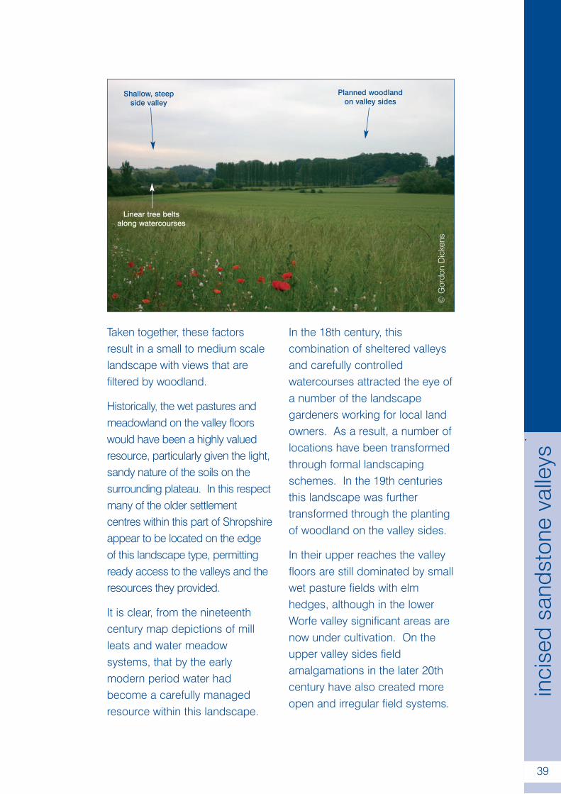
ns
Shallow, steepside valley
Planned woodlandon valley sides
Linear tree beltsalong watercourses
.
40
Wooded Forest
Key Characteristics
• Near continuous woodland cover
• Woodland of ancient character
• Unsettled landscape of small,
intimate scale.
© Crown Copyright. All rights reserved.Shropshire County Council 100019801 (2006)
Description
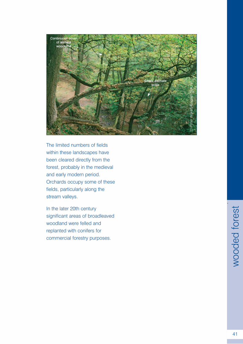
In Shropshire this landscape typeoccurs solely in relation to theWyre Forest, on the south-easterncounty boundary. The rollingtopography, composed of rocks ofthe Carboniferous Coal Measures,is dissected by the narrow, steepsided valleys of the Dowles Brookand its tributaries. This landscapeis dominated by dense woodland,of ancient character, typicallyassociated with species such asBluebell, Dogs Mercury, Ramsonsand Sanicle.
This gives rise to very limitedframed views and creates and asmall, intimate scale. It remainslargely unsettled, with a verysparse scatter of farms andwayside cottages that areassociated with small pastoral,‘assart’ type, fields.
These factors impart a sense ofremoteness to this landscape.
The prehistory and early historyof the Wyre Forest remainsobscure but after the NormanConquest it was placed underforest law, and by the 14thcentury had become a privatechase.
Parts of the forest were managedfor timber from the later MiddleAges onwards, and supportedindustries such as charcoalburning and bark peeling fortanning until the early 20thcentury. The fast flowing streamsalso provided water power thatenabled an iron industry todevelop in the Wyre Forest in theearly modern period. In someareas around the fringes of theforest the underlying coaldeposits were also mined.
.
41
woo
ded
fore
st
The limited numbers of fieldswithin these landscapes havebeen cleared directly from theforest, probably in the medievaland early modern period.Orchards occupy some of thesefields, particularly along thestream valleys.
In the later 20th centurysignificant areas of broadleavedwoodland were felled andreplanted with conifers forcommercial forestry purposes.
©Pe
terW
akel
y/E
nglis
hN
atur
e
Continuous coverof ancientwoodland
Small, intimatescale
.
42
Forest Smallholdings
Key Characteristics
• Small pastoral fields with hedged
boundaries
• Scattered hedgerow and garden trees
• Small blocks of woodland
• Dense pattern of wayside cottages and
small farms
• Small scale landscapes with framed views
© Crown Copyright. All rights reserved.Shropshire County Council 100019801 (2006)
Description
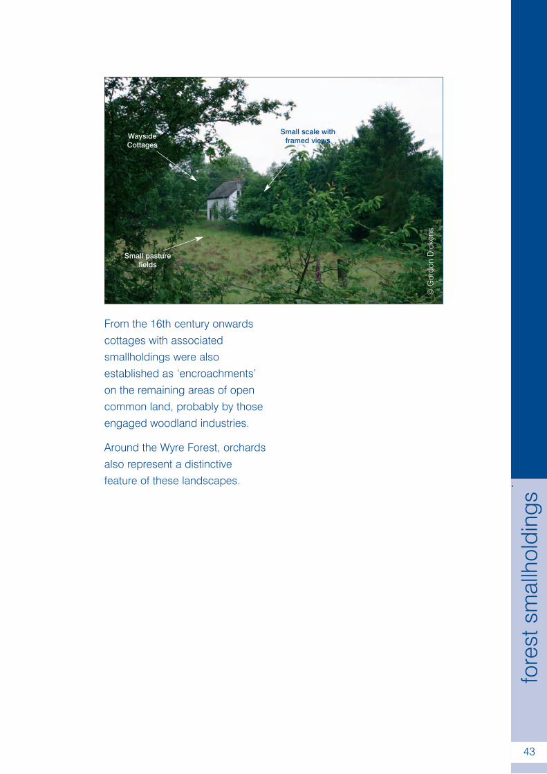
Within Shropshire, limited areasof Forest Smallholdinglandscapes occur in twolocations around the edge of theWyre Forest, on the countyboundary with Worcestershire.They have upstanding, gentlyrolling topographies, with freedraining brown soils that havedeveloped from the underlyingCarboniferous Coal Measures.
Small pastoral fields with tallmixed species hedgerows areparticularly characteristic of theselandscapes. They nestle into aclosely worked pattern of smallfarms and wayside cottages, withassociated smallholdings, andnarrow winding lanes.
Scattered hedgerow trees, smallblocks of woodland andsignificant numbers of gardentrees impart a wooded feel.These elements combine to formsmall scale, intimate landscapes,with views that are framed byhedges and woodland.
The Forest Smallholdingsdeveloped from areas of earlymedieval woodland. Clearanceand enclosure (or ‘assarting’)began in the Middle Ages,producing a pattern of olderdispersed farmsteads, irregularfields and winding lanes.
.
43
fore
stsm
allh
oldi
ngs
From the 16th century onwardscottages with associatedsmallholdings were alsoestablished as ‘encroachments’on the remaining areas of opencommon land, probably by thoseengaged woodland industries.
Around the Wyre Forest, orchardsalso represent a distinctivefeature of these landscapes.
©G
ordo
nD
icke
ns
WaysideCottages
Small scale withframed views
Small pasturefields

.
44
Timbered Plateau Farmlands
Key Characteristics
• Upstanding plateau with rolling relief,
dissected by valleys
• Linear ancient woodlands in valleys
and dingles
• Mixed farming landuse
• Ancient pattern of irregular hedged fields
• Medium scale landscape
© Crown Copyright. All rights reserved.Shropshire County Council 100019801 (2006)
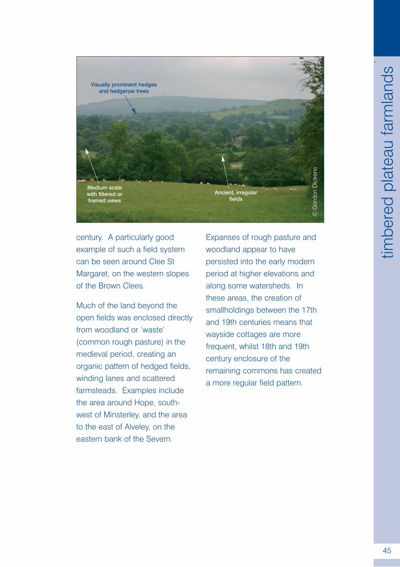
Description
This landscape type occurswidely in the Shropshire Hills andis mainly associated withsedimentary Ordovician rocksand Devonian Old RedSandstones, with one outlier onthe Carboniferous limestone ofthe Oswestry Hills.
The upstanding, rollingtopography increases the visualprominence of the hedgerowsand woods, and creates a rangeof different vistas; from openviews on plateau tops to framedviews within the valleys. Thewoodlands essentially have anancient semi-natural character,although much has beenreplanted. They vary in size, withwooded stream valleys beingparticularly characteristic of this
landscape type. Additional treecover is provided by scatteredhedgerow trees.
Farming tends to be mixed, withpasture – sometimes ofunimproved character - dominantwhere the terrain is more difficult.
The settlement pattern consistsprimarily of dispersed farms,wayside cottages and hamlets,although small villages arepresent in some areas creating amore clustered pattern.
The Timbered Plateau Farmlandshave a varied history ofdevelopment. Small open fieldsexisted around many of thehamlets and villages in theMiddle Ages, which in mostcases had been enclosedthrough piecemeal agreementsby the beginning of the 17th
.
45
timbe
red
plat
eau
farm
land
s
century. A particularly goodexample of such a field systemcan be seen around Clee StMargaret, on the western slopesof the Brown Clees.
Much of the land beyond theopen fields was enclosed directlyfrom woodland or ‘waste’(common rough pasture) in themedieval period, creating anorganic pattern of hedged fields,winding lanes and scatteredfarmsteads. Examples includethe area around Hope, south-west of Minsterley, and the areato the east of Alveley, on theeastern bank of the Severn.
Expanses of rough pasture andwoodland appear to havepersisted into the early modernperiod at higher elevations andalong some watersheds. Inthese areas, the creation ofsmallholdings between the 17thand 19th centuries means thatwayside cottages are morefrequent, whilst 18th and 19thcentury enclosure of theremaining commons has createda more regular field pattern.
©G
ordo
nD
icke
ns
Visually prominent hedgesand hedgerow trees
Ancient, irregularfields
Medium scalewith filtered orframed views
.
46
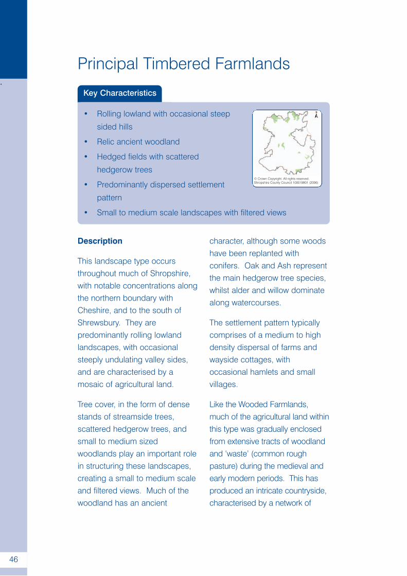
Principal Timbered Farmlands
Key Characteristics
• Rolling lowland with occasional steep
sided hills
• Relic ancient woodland
• Hedged fields with scattered
hedgerow trees
• Predominantly dispersed settlement
pattern
• Small to medium scale landscapes with filtered views
© Crown Copyright. All rights reserved.Shropshire County Council 100019801 (2006)
Description
This landscape type occursthroughout much of Shropshire,with notable concentrations alongthe northern boundary withCheshire, and to the south ofShrewsbury. They arepredominantly rolling lowlandlandscapes, with occasionalsteeply undulating valley sides,and are characterised by amosaic of agricultural land.
Tree cover, in the form of densestands of streamside trees,scattered hedgerow trees, andsmall to medium sizedwoodlands play an important rolein structuring these landscapes,creating a small to medium scaleand filtered views. Much of thewoodland has an ancient
character, although some woodshave been replanted withconifers. Oak and Ash representthe main hedgerow tree species,whilst alder and willow dominatealong watercourses.
The settlement pattern typicallycomprises of a medium to highdensity dispersal of farms andwayside cottages, withoccasional hamlets and smallvillages.
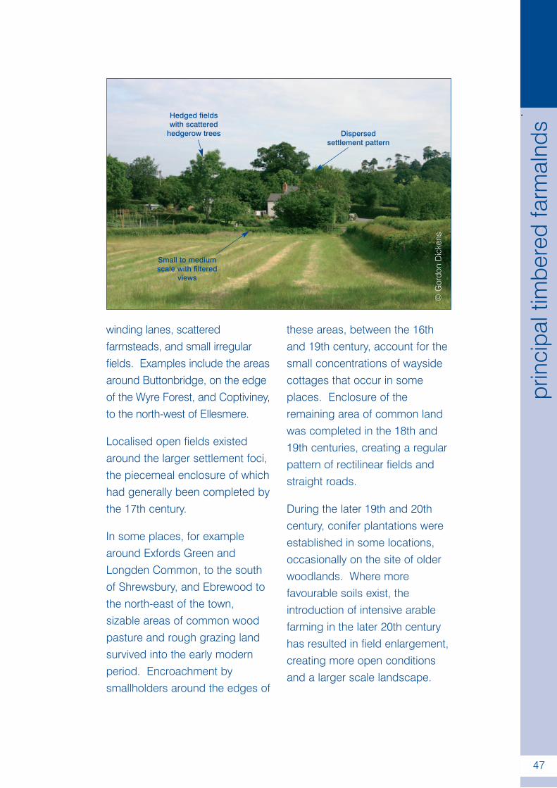
Like the Wooded Farmlands,much of the agricultural land withinthis type was gradually enclosedfrom extensive tracts of woodlandand ‘waste’ (common roughpasture) during the medieval andearly modern periods. This hasproduced an intricate countryside,characterised by a network of
.
47
prin
cipa
ltim
bere
dfa
rmal
nds
winding lanes, scatteredfarmsteads, and small irregularfields. Examples include the areasaround Buttonbridge, on the edgeof the Wyre Forest, and Coptiviney,to the north-west of Ellesmere.
Localised open fields existedaround the larger settlement foci,the piecemeal enclosure of whichhad generally been completed bythe 17th century.
In some places, for examplearound Exfords Green andLongden Common, to the southof Shrewsbury, and Ebrewood tothe north-east of the town,sizable areas of common woodpasture and rough grazing landsurvived into the early modernperiod. Encroachment bysmallholders around the edges of
these areas, between the 16thand 19th century, account for thesmall concentrations of waysidecottages that occur in someplaces. Enclosure of theremaining area of common landwas completed in the 18th and19th centuries, creating a regularpattern of rectilinear fields andstraight roads.
During the later 19th and 20thcentury, conifer plantations wereestablished in some locations,occasionally on the site of olderwoodlands. Where morefavourable soils exist, theintroduction of intensive arablefarming in the later 20th centuryhas resulted in field enlargement,creating more open conditionsand a larger scale landscape.
©G
ordo
nD
icke
ns
Hedged fieldswith scattered
hedgerow trees Dispersedsettlement pattern
Small to mediumscale with filtered
views
.
48
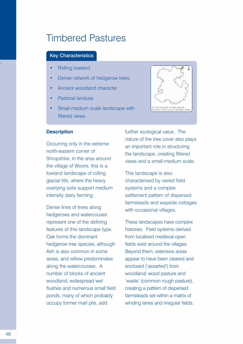
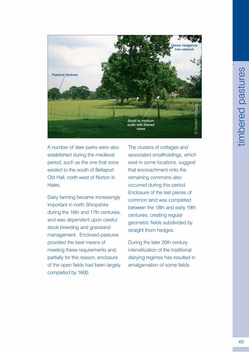
Timbered Pastures
Key Characteristics
• Rolling lowland
• Dense network of hedgerow trees
• Ancient woodland character
• Pastoral landuse
• Small-medium scale landscape with
filtered views
© Crown Copyright. All rights reserved.Shropshire County Council 100019801 (2006)
Description
Occurring only in the extremenorth-eastern corner ofShropshire, in the area aroundthe village of Woore, this is alowland landscape of rollingglacial tills, where the heavyoverlying soils support mediumintensity dairy farming.
Dense lines of trees alonghedgerows and watercousesrepresent one of the definingfeatures of this landscape type.Oak forms the dominanthedgerow tree species, althoughAsh is also common in someareas, and willow predominatesalong the watercourses. Anumber of blocks of ancientwoodland, widespread wetflushes and numerous small fieldponds, many of which probablyoccupy former marl pits, add
further ecological value. Thenature of the tree cover also playsan important role in structuringthe landscape, creating filteredviews and a small-medium scale.
This landscape is alsocharacterised by varied fieldsystems and a complexsettlement pattern of dispersedfarmsteads and wayside cottageswith occasional villages.
These landscapes have complexhistories. Field systems derivedfrom localised medieval openfields exist around the villages.Beyond them, extensive areasappear to have been cleared andenclosed (‘assarted’) fromwoodland/ wood pasture and‘waste’ (common rough pasture),creating a pattern of dispersedfarmsteads set within a matrix ofwinding lanes and irregular fields.
.
49
timbe
red
past
ures
A number of deer parks were alsoestablished during the medievalperiod, such as the one that onceexisted to the south of BellaportOld Hall, north-west of Norton inHales.
Dairy farming became increasinglyimportant in north Shropshireduring the 16th and 17th centuries,and was dependent upon carefulstock breeding and grasslandmanagement. Enclosed pasturesprovided the best means ofmeeting these requirements and,partially for this reason, enclosureof the open fields had been largelycompleted by 1600.
The clusters of cottages andassociated smallholdings, whichexist in some locations, suggestthat encroachment onto theremaining commons alsooccurred during this period.Enclosure of the last pieces ofcommon land was completedbetween the 18th and early 19thcenturies, creating regulargeometric fields subdivided bystraight thorn hedges.
During the later 20th centuryintensification of the traditionaldairying regimes has resulted inamalgamation of some fields.
©G
ordo
nD
icke
ns
Pastoral landuse
Dense hedgerowtree network
Small to mediumscale with filtered
views
.
50
Wooded Estatelands
Key Characteristics
• Rolling landform
• Large blocks of ancient woodland
• Large country houses with associated
parklands
• Mixed agricultural land use© Crown Copyright. All rights reserved.Shropshire County Council 100019801 (2006)
Description
The lowland equivalent of ‘WoodedHills and Estatelands’, WoodedEstatelands are rolling landscapeswith occasional wooded wetdingles. In Shropshire they mainlyoccur to the west and south-west ofTelford; on the Coal Measures tothe north of the Wyre Forest; on thecounty boundary with Herefordshireto the west of Ludlow; aroundAlberbury in western Shropshire; tothe north-east of Ellesmere; and onthe Shropshire/ Staffordshire countyboundary around Bishop’s Wood.The varied but often impoverishedsoils are associated with highintensity mixed farming. Large,often prominently located woods ofancient semi-natural character formone of the defining characteristicsof this landscape type. Thesewoodlands represent the dominantstructural component, creatingframed views and medium to largescale landscapes. Dense stands
of trees along water courses andscattered hedgerow trees, with oakas the predominant species,provide additional tree cover.Parklands associated with countryhouses constitute anotherimportant element and representfocal points for tree cover in someplaces. The settlement patterncomprises occasional villagestogether with dispersed farmsteadsand wayside cottages.
Many of the parklands within thetype originated as medieval andearly modern deer parks. Anumber were significantly extendedbetween the 17th and 19thcenturies, and reworked throughformal landscaping schemes. Themixed field patterns within this typehave a varied history ofdevelopment. During the MiddleAges relatively limited areas ofopen field land surrounded thevillages and hamlets. Aselsewhere in Shropshire, the
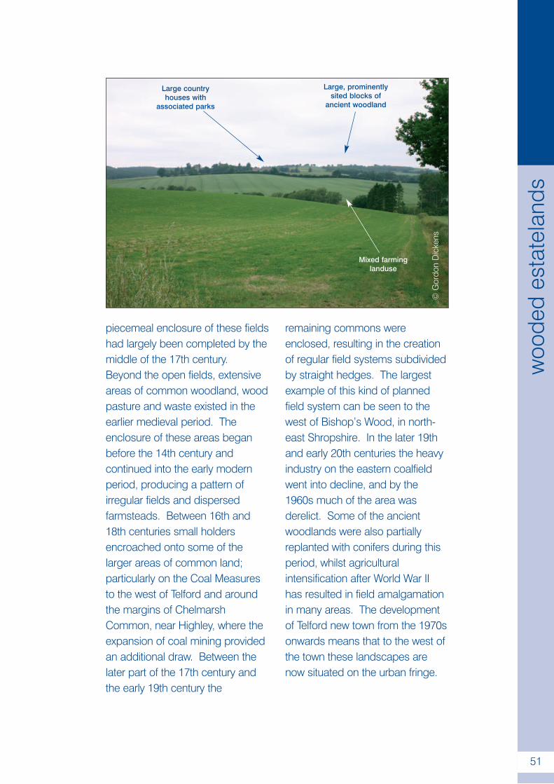
.
51
woo
ded
esta
tela
nds
piecemeal enclosure of these fieldshad largely been completed by themiddle of the 17th century.Beyond the open fields, extensiveareas of common woodland, woodpasture and waste existed in theearlier medieval period. Theenclosure of these areas beganbefore the 14th century andcontinued into the early modernperiod, producing a pattern ofirregular fields and dispersedfarmsteads. Between 16th and18th centuries small holdersencroached onto some of thelarger areas of common land;particularly on the Coal Measuresto the west of Telford and aroundthe margins of ChelmarshCommon, near Highley, where theexpansion of coal mining providedan additional draw. Between thelater part of the 17th century andthe early 19th century the
remaining commons wereenclosed, resulting in the creationof regular field systems subdividedby straight hedges. The largestexample of this kind of plannedfield system can be seen to thewest of Bishop’s Wood, in north-east Shropshire. In the later 19thand early 20th centuries the heavyindustry on the eastern coalfieldwent into decline, and by the1960s much of the area wasderelict. Some of the ancientwoodlands were also partiallyreplanted with conifers during thisperiod, whilst agriculturalintensification after World War IIhas resulted in field amalgamationin many areas. The developmentof Telford new town from the 1970sonwards means that to the west ofthe town these landscapes arenow situated on the urban fringe.
©G
ordo
nD
icke
ns
Large countryhouses with
associated parks
Large, prominentlysited blocks of
ancient woodland
Mixed farminglanduse

.
52
Estate Farmlands
Key Characteristics
• Mixed farming landuse
• Clustered settlement pattern
• Large country houses with associated
parklands
• Planned woodland character
• Medium to large scale landscapes with
framed views
© Crown Copyright. All rights reserved.Shropshire County Council 100019801 (2006)
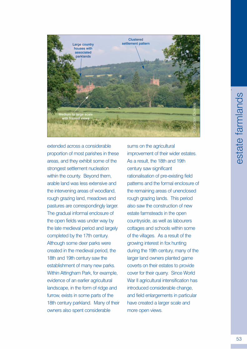
Description
Estate farmlands are gently rollinglowland and valley floorlandscapes that occur acrosslarge areas of Shropshire. Thelower ground is usually underlainby softer, more easily erodedrocks such as shales, sometimesin sharp contrast to nearby ridgesof harder rocks. Glacial driftdeposits form the basis of mostsoils and these landscapesinclude some the best agriculturalland in the county, which havetraditionally been associated withmixed farming. As with theSandstone Estatelands, landscapecharacter is largely determined byan ordered pattern of fields andwoods, although the prevailingpattern of medium to large sub-regular fields means that they lacktheir strong, planned aspect. Themajority of the woodlands have a
planned appearance, althoughsome plantations occupy the sitesof older woods and small standsof ancient woodland occur insome places. They tend to createframed views within medium tolarge scale landscapes.Parklands, with their veteran andspecimen trees, are a particularfeature of the type. The settlementpattern is predominantly one ofvillages and hamlets and largeestate farmsteads.
The Estate Farmlands have variedhistories of development. To thesouth-east and east of Shrewsbury,along the Tern valley, and within ApeDale and Corve Dale, the density ofIron Age archaeological sitessuggests that a carefully managedagricultural landscape had existedfor some considerable time prior tothe Roman Conquest. By the latermedieval period arable open fields
.
53
esta
tefa
rmla
nds
extended across a considerableproportion of most parishes in theseareas, and they exhibit some of thestrongest settlement nucleationwithin the county. Beyond them,arable land was less extensive andthe intervening areas of woodland,rough grazing land, meadows andpastures are correspondingly larger.The gradual informal enclosure ofthe open fields was under way bythe late medieval period and largelycompleted by the 17th century.Although some deer parks werecreated in the medieval period, the18th and 19th century saw theestablishment of many new parks.Within Attingham Park, for example,evidence of an earlier agriculturallandscape, in the form of ridge andfurrow, exists in some parts of the18th century parkland. Many of theirowners also spent considerable
sums on the agriculturalimprovement of their wider estates.As a result, the 18th and 19thcentury saw significantrationalisation of pre-existing fieldpatterns and the formal enclosure ofthe remaining areas of unenclosedrough grazing lands. This periodalso saw the construction of newestate farmsteads in the opencountryside, as well as labourerscottages and schools within someof the villages. As a result of thegrowing interest in fox huntingduring the 19th century, many of thelarger land owners planted gamecoverts on their estates to providecover for their quarry. Since WorldWar II agricultural intensification hasintroduced considerable change,and field enlargements in particularhave created a larger scale andmore open views.
©G
ordo
nD
icke
ns
Large countryhouses withassociatedparklands
Clusteredsettlement pattern
Medium to large scalewith framed views
.
54
Settled Pastoral Farmlands
Key Characteristics
• Heavy, poorly drained soils
• Pastoral land use
• Scattered hedgerow trees
• Irregular field pattern
• Small to medium scale landscapes© Crown Copyright. All rights reserved.Shropshire County Council 100019801 (2006)
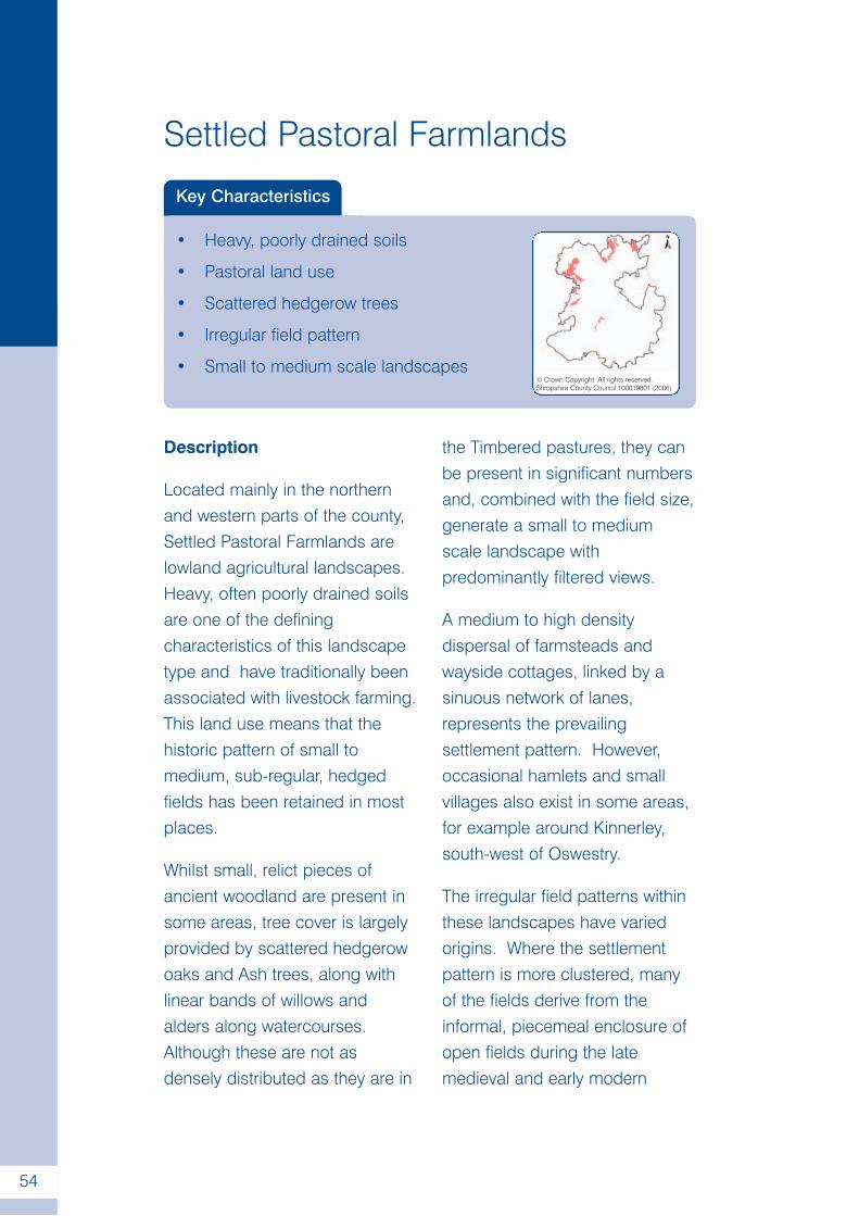
Description
Located mainly in the northernand western parts of the county,Settled Pastoral Farmlands arelowland agricultural landscapes.Heavy, often poorly drained soilsare one of the definingcharacteristics of this landscapetype and have traditionally beenassociated with livestock farming.This land use means that thehistoric pattern of small tomedium, sub-regular, hedgedfields has been retained in mostplaces.
Whilst small, relict pieces ofancient woodland are present insome areas, tree cover is largelyprovided by scattered hedgerowoaks and Ash trees, along withlinear bands of willows andalders along watercourses.Although these are not asdensely distributed as they are in
the Timbered pastures, they canbe present in significant numbersand, combined with the field size,generate a small to mediumscale landscape withpredominantly filtered views.
A medium to high densitydispersal of farmsteads andwayside cottages, linked by asinuous network of lanes,represents the prevailingsettlement pattern. However,occasional hamlets and smallvillages also exist in some areas,for example around Kinnerley,south-west of Oswestry.
The irregular field patterns withinthese landscapes have variedorigins. Where the settlementpattern is more clustered, manyof the fields derive from theinformal, piecemeal enclosure ofopen fields during the latemedieval and early modern
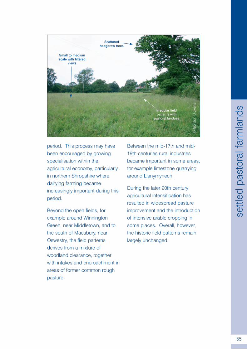
.
55
settl
edpa
stor
alfa
rmla
nds
period. This process may havebeen encouraged by growingspecialisation within theagricultural economy, particularlyin northern Shropshire wheredairying farming becameincreasingly important during thisperiod.
Beyond the open fields, forexample around WinningtonGreen, near Middletown, and tothe south of Maesbury, nearOswestry, the field patternsderives from a mixture ofwoodland clearance, togetherwith intakes and encroachment inareas of former common roughpasture.
Between the mid-17th and mid-19th centuries rural industriesbecame important in some areas,for example limestone quarryingaround Llanymynech.
During the later 20th centuryagricultural intensification hasresulted in widespread pastureimprovement and the introductionof intensive arable cropping insome places. Overall, however,the historic field patterns remainlargely unchanged.
©G
ordo
nD
icke
ns
Small to mediumscale with filtered
views
Scatteredhedgerow trees
Irregular fieldpatterns with
pastoral landuse
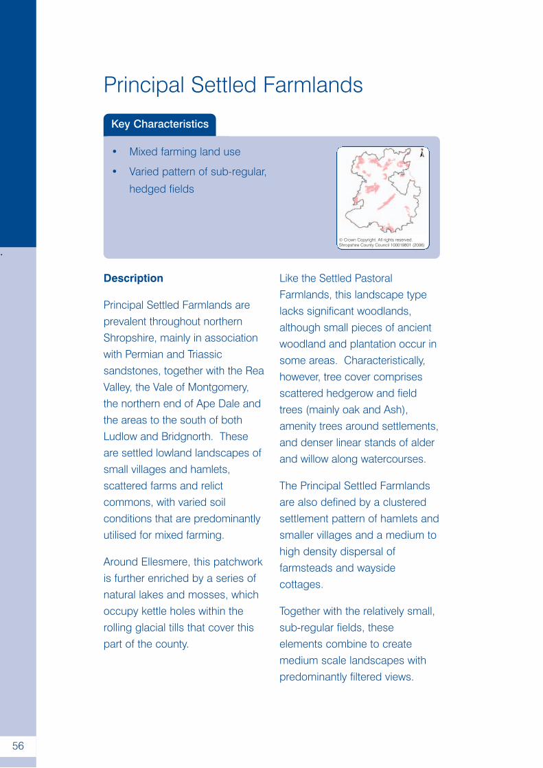
.
56
Principal Settled Farmlands
Key Characteristics
• Mixed farming land use
• Varied pattern of sub-regular,
hedged fields
© Crown Copyright. All rights reserved.Shropshire County Council 100019801 (2006)
Description
Principal Settled Farmlands areprevalent throughout northernShropshire, mainly in associationwith Permian and Triassicsandstones, together with the ReaValley, the Vale of Montgomery,the northern end of Ape Dale andthe areas to the south of bothLudlow and Bridgnorth. Theseare settled lowland landscapes ofsmall villages and hamlets,scattered farms and relictcommons, with varied soilconditions that are predominantlyutilised for mixed farming.
Around Ellesmere, this patchworkis further enriched by a series ofnatural lakes and mosses, whichoccupy kettle holes within therolling glacial tills that cover thispart of the county.
Like the Settled PastoralFarmlands, this landscape typelacks significant woodlands,although small pieces of ancientwoodland and plantation occur insome areas. Characteristically,however, tree cover comprisesscattered hedgerow and fieldtrees (mainly oak and Ash),amenity trees around settlements,and denser linear stands of alderand willow along watercourses.
The Principal Settled Farmlandsare also defined by a clusteredsettlement pattern of hamlets andsmaller villages and a medium tohigh density dispersal offarmsteads and waysidecottages.
Together with the relatively small,sub-regular fields, theseelements combine to createmedium scale landscapes withpredominantly filtered views.
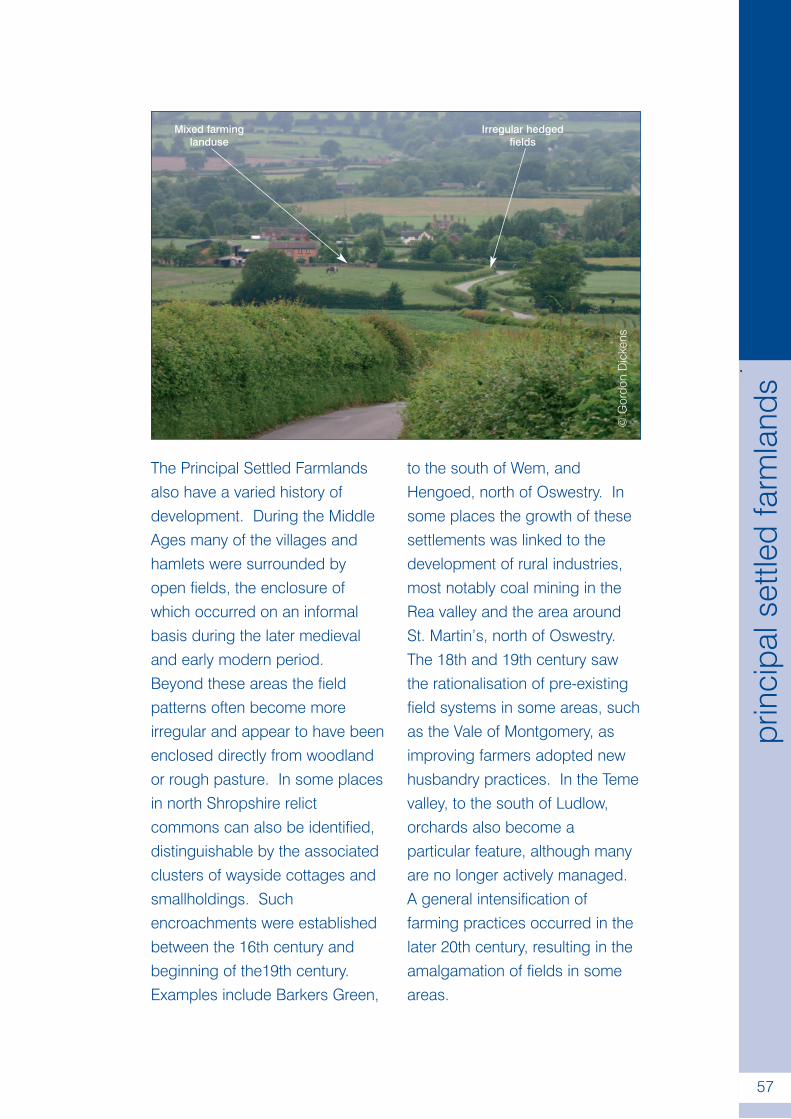
.
57
prin
cipa
lset
tled
farm
land
s
The Principal Settled Farmlandsalso have a varied history ofdevelopment. During the MiddleAges many of the villages andhamlets were surrounded byopen fields, the enclosure ofwhich occurred on an informalbasis during the later medievaland early modern period.Beyond these areas the fieldpatterns often become moreirregular and appear to have beenenclosed directly from woodlandor rough pasture. In some placesin north Shropshire relictcommons can also be identified,distinguishable by the associatedclusters of wayside cottages andsmallholdings. Suchencroachments were establishedbetween the 16th century andbeginning of the19th century.Examples include Barkers Green,
to the south of Wem, andHengoed, north of Oswestry. Insome places the growth of thesesettlements was linked to thedevelopment of rural industries,most notably coal mining in theRea valley and the area aroundSt. Martin’s, north of Oswestry.The 18th and 19th century sawthe rationalisation of pre-existingfield systems in some areas, suchas the Vale of Montgomery, asimproving farmers adopted newhusbandry practices. In the Temevalley, to the south of Ludlow,orchards also become aparticular feature, although manyare no longer actively managed.A general intensification offarming practices occurred in thelater 20th century, resulting in theamalgamation of fields in someareas.
©G
ordo
nD
icke
ns
Mixed farminglanduse
Irregular hedgedfields
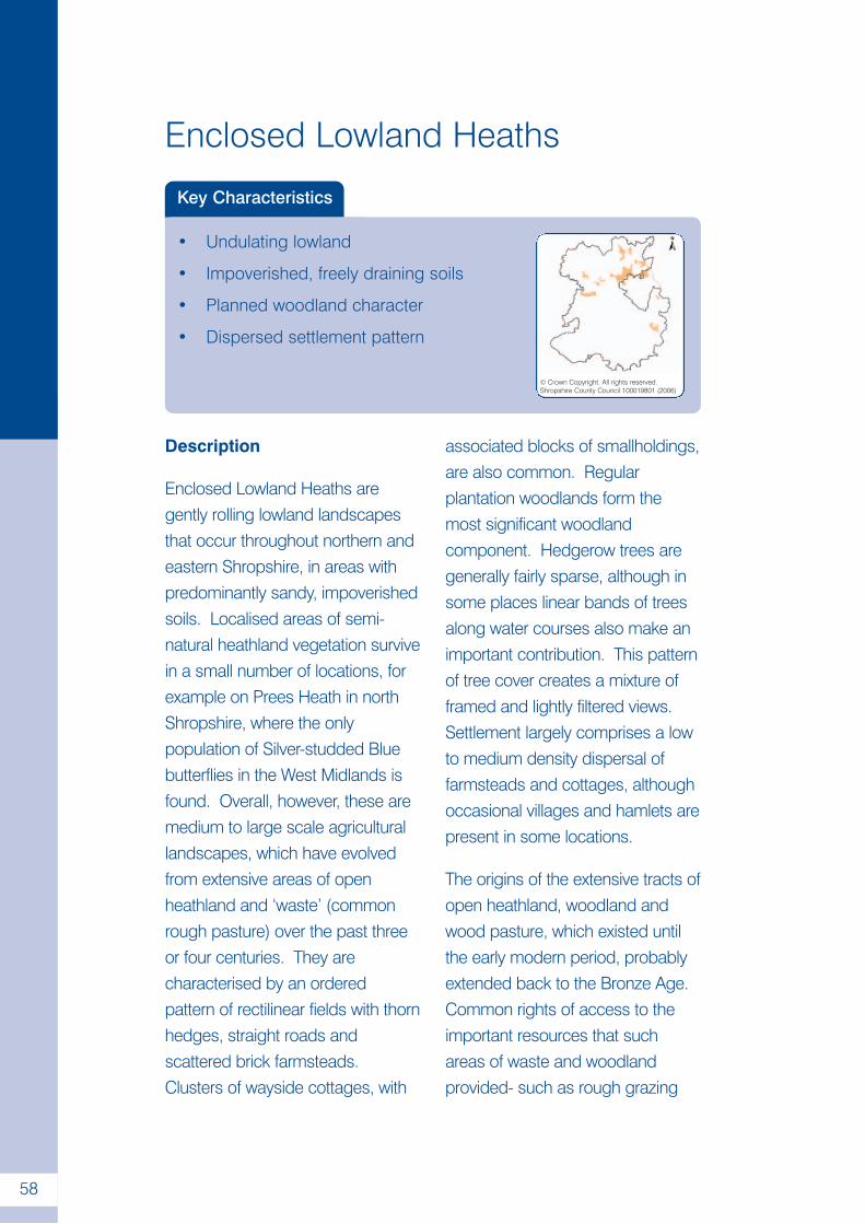
.
58
Enclosed Lowland Heaths
Key Characteristics
• Undulating lowland
• Impoverished, freely draining soils
• Planned woodland character
• Dispersed settlement pattern
© Crown Copyright. All rights reserved.Shropshire County Council 100019801 (2006)
Description
Enclosed Lowland Heaths aregently rolling lowland landscapesthat occur throughout northern andeastern Shropshire, in areas withpredominantly sandy, impoverishedsoils. Localised areas of semi-natural heathland vegetation survivein a small number of locations, forexample on Prees Heath in northShropshire, where the onlypopulation of Silver-studded Bluebutterflies in the West Midlands isfound. Overall, however, these aremedium to large scale agriculturallandscapes, which have evolvedfrom extensive areas of openheathland and ‘waste’ (commonrough pasture) over the past threeor four centuries. They arecharacterised by an orderedpattern of rectilinear fields with thornhedges, straight roads andscattered brick farmsteads.Clusters of wayside cottages, with
associated blocks of smallholdings,are also common. Regularplantation woodlands form themost significant woodlandcomponent. Hedgerow trees aregenerally fairly sparse, although insome places linear bands of treesalong water courses also make animportant contribution. This patternof tree cover creates a mixture offramed and lightly filtered views.Settlement largely comprises a lowto medium density dispersal offarmsteads and cottages, althoughoccasional villages and hamlets arepresent in some locations.
The origins of the extensive tracts ofopen heathland, woodland andwood pasture, which existed untilthe early modern period, probablyextended back to the Bronze Age.Common rights of access to theimportant resources that suchareas of waste and woodlandprovided- such as rough grazing
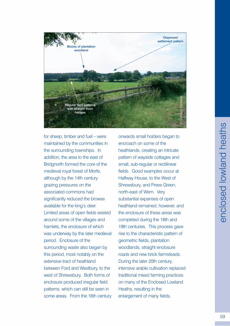
.
59
encl
osed
low
land
heat
hs
for sheep, timber and fuel – weremaintained by the communities inthe surrounding townships. Inaddition, the area to the east ofBridgnorth formed the core of themedieval royal forest of Morfe,although by the 14th centurygrazing pressures on theassociated commons hadsignificantly reduced the browseavailable for the king’s deer.Limited areas of open fields existedaround some of the villages andhamlets, the enclosure of whichwas underway by the later medievalperiod. Enclosure of thesurrounding waste also began bythis period, most notably on theextensive tract of heathlandbetween Ford and Westbury, to thewest of Shrewsbury. Both forms ofenclosure produced irregular fieldpatterns, which can still be seen insome areas. From the 16th century
onwards small holders began toencroach on some of theheathlands, creating an intricatepattern of wayside cottages andsmall, sub-regular or rectilinearfields. Good examples occur atHalfway House, to the West ofShrewsbury, and Prees Green,north-east of Wem. Verysubstantial expanses of openheathland remained, however, andthe enclosure of these areas wascompleted during the 18th and19th centuries. This process gaverise to the characteristic pattern ofgeometric fields, plantationwoodlands, straight enclosureroads and new brick farmsteads.During the later 20th century,intensive arable cultivation replacedtraditional mixed farming practiceson many of the Enclosed LowlandHeaths, resulting in theenlargement of many fields.
©G
ordo
nD
icke
ns
Blocks of plantationwoodland
Dispersedsettlement pattern
Regular field patternswith straight thorn
hedges
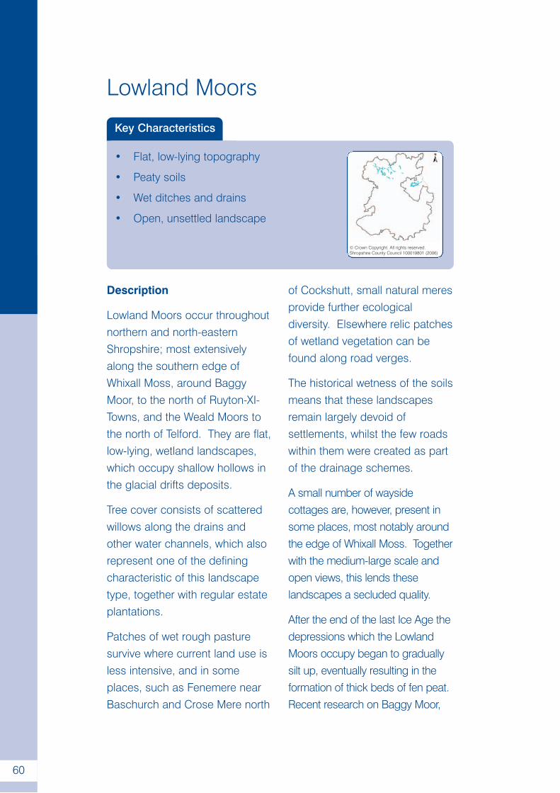
.
60
Lowland Moors
Key Characteristics
• Flat, low-lying topography
• Peaty soils
• Wet ditches and drains
• Open, unsettled landscape
© Crown Copyright. All rights reserved.Shropshire County Council 100019801 (2006)
Description
Lowland Moors occur throughoutnorthern and north-easternShropshire; most extensivelyalong the southern edge ofWhixall Moss, around BaggyMoor, to the north of Ruyton-XI-Towns, and the Weald Moors tothe north of Telford. They are flat,low-lying, wetland landscapes,which occupy shallow hollows inthe glacial drifts deposits.
Tree cover consists of scatteredwillows along the drains andother water channels, which alsorepresent one of the definingcharacteristic of this landscapetype, together with regular estateplantations.
Patches of wet rough pasturesurvive where current land use isless intensive, and in someplaces, such as Fenemere nearBaschurch and Crose Mere north
of Cockshutt, small natural meresprovide further ecologicaldiversity. Elsewhere relic patchesof wetland vegetation can befound along road verges.
The historical wetness of the soilsmeans that these landscapesremain largely devoid ofsettlements, whilst the few roadswithin them were created as partof the drainage schemes.
A small number of waysidecottages are, however, present insome places, most notably aroundthe edge of Whixall Moss. Togetherwith the medium-large scale andopen views, this lends theselandscapes a secluded quality.
After the end of the last Ice Age thedepressions which the LowlandMoors occupy began to graduallysilt up, eventually resulting in theformation of thick beds of fen peat.Recent research on Baggy Moor,
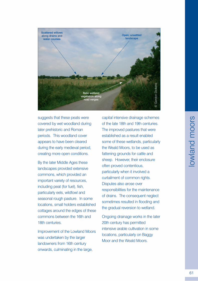
.
61
low
land
moo
rs
©G
ordo
nD
icke
ns
Scattered willowsalong drains and
water coursesOpen, unsettled
landscape
Relic wetlandvegetation along
road verges
suggests that these peats werecovered by wet woodland duringlater prehistoric and Romanperiods. This woodland coverappears to have been clearedduring the early medieval period,creating more open conditions.
By the later Middle Ages theselandscapes provided extensivecommons, which provided animportant variety of resources,including peat (for fuel), fish,particularly eels, wildfowl andseasonal rough pasture. In somelocations, small holders establishedcottages around the edges of thesecommons between the 16th and18th centuries.
Improvement of the Lowland Moorswas undertaken by the largerlandowners from 16th centuryonwards, culminating in the large,
capital intensive drainage schemesof the late 18th and 19th centuries.The improved pastures that wereestablished as a result enabledsome of these wetlands, particularlythe Weald Moors, to be used asfattening grounds for cattle andsheep. However, their enclosureoften proved contentious,particularly when it involved acurtailment of common rights.Disputes also arose overresponsibilities for the maintenanceof drains. The consequent neglectsometimes resulted in flooding andthe gradual reversion to wetland.
Ongoing drainage works in the later20th century has permittedintensive arable cultivation in somelocations, particularly on BaggyMoor and the Weald Moors.
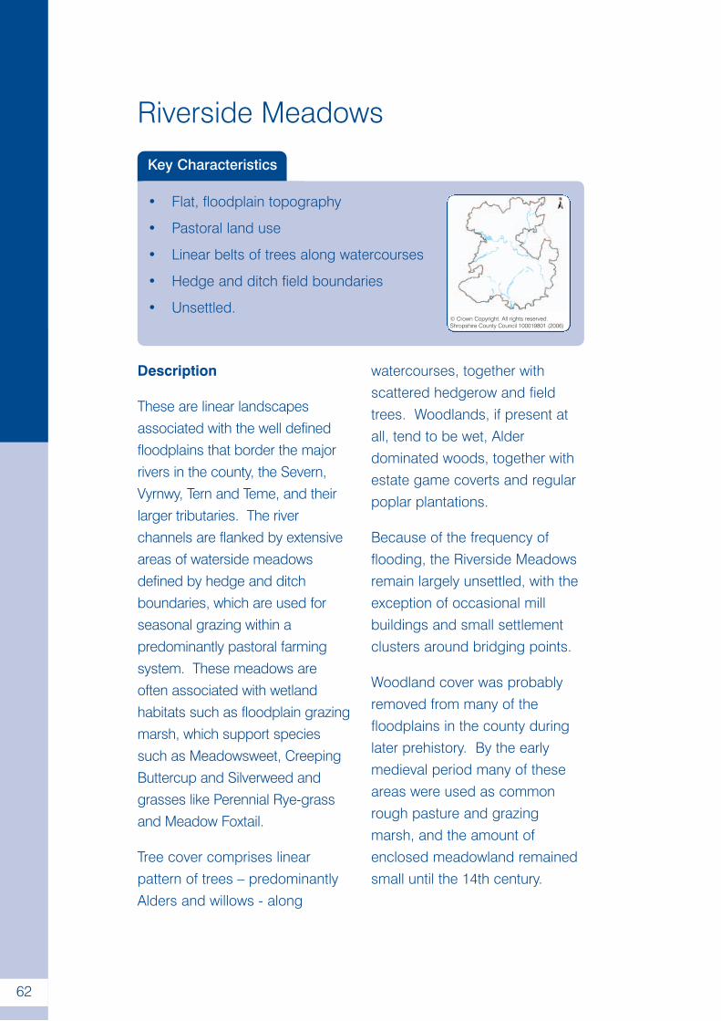
.
62
Riverside Meadows
Key Characteristics
• Flat, floodplain topography
• Pastoral land use
• Linear belts of trees along watercourses
• Hedge and ditch field boundaries
• Unsettled.© Crown Copyright. All rights reserved.Shropshire County Council 100019801 (2006)
Description
These are linear landscapesassociated with the well definedfloodplains that border the majorrivers in the county, the Severn,Vyrnwy, Tern and Teme, and theirlarger tributaries. The riverchannels are flanked by extensiveareas of waterside meadowsdefined by hedge and ditchboundaries, which are used forseasonal grazing within apredominantly pastoral farmingsystem. These meadows areoften associated with wetlandhabitats such as floodplain grazingmarsh, which support speciessuch as Meadowsweet, CreepingButtercup and Silverweed andgrasses like Perennial Rye-grassand Meadow Foxtail.
Tree cover comprises linearpattern of trees – predominantlyAlders and willows - along
watercourses, together withscattered hedgerow and fieldtrees. Woodlands, if present atall, tend to be wet, Alderdominated woods, together withestate game coverts and regularpoplar plantations.
Because of the frequency offlooding, the Riverside Meadowsremain largely unsettled, with theexception of occasional millbuildings and small settlementclusters around bridging points.
Woodland cover was probablyremoved from many of thefloodplains in the county duringlater prehistory. By the earlymedieval period many of theseareas were used as commonrough pasture and grazingmarsh, and the amount ofenclosed meadowland remainedsmall until the 14th century.
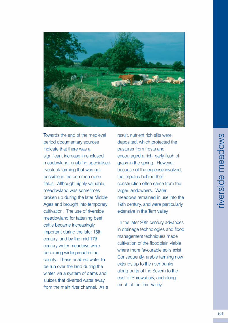
.
63
river
side
mea
dow
sTowards the end of the medievalperiod documentary sourcesindicate that there was asignificant increase in enclosedmeadowland, enabling specialisedlivestock farming that was notpossible in the common openfields. Although highly valuable,meadowland was sometimesbroken up during the later MiddleAges and brought into temporarycultivation. The use of riversidemeadowland for fattening beefcattle became increasinglyimportant during the later 16thcentury, and by the mid 17thcentury water meadows werebecoming widespread in thecounty. These enabled water tobe run over the land during thewinter, via a system of dams andsluices that diverted water awayfrom the main river channel. As a
result, nutrient rich slits weredeposited, which protected thepastures from frosts andencouraged a rich, early flush ofgrass in the spring. However,because of the expense involved,the impetus behind theirconstruction often came from thelarger landowners. Watermeadows remained in use into the19th century, and were particularlyextensive in the Tern valley.
In the later 20th century advancesin drainage technologies and floodmanagement techniques madecultivation of the floodplain viablewhere more favourable soils exist.Consequently, arable farming nowextends up to the river banksalong parts of the Severn to theeast of Shrewsbury, and alongmuch of the Tern Valley.
©G
ordo
nD
icke
ns
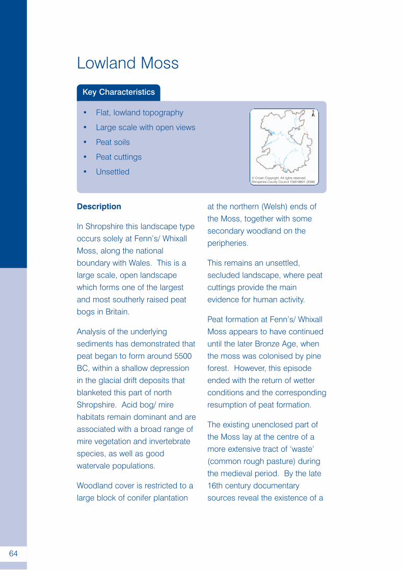
.
64
Lowland Moss
Key Characteristics
• Flat, lowland topography
• Large scale with open views
• Peat soils
• Peat cuttings
• Unsettled© Crown Copyright. All rights reserved.Shropshire County Council 100019801 (2006)
Description
In Shropshire this landscape typeoccurs solely at Fenn’s/ WhixallMoss, along the nationalboundary with Wales. This is alarge scale, open landscapewhich forms one of the largestand most southerly raised peatbogs in Britain.
Analysis of the underlyingsediments has demonstrated thatpeat began to form around 5500BC, within a shallow depressionin the glacial drift deposits thatblanketed this part of northShropshire. Acid bog/ mirehabitats remain dominant and areassociated with a broad range ofmire vegetation and invertebratespecies, as well as goodwatervale populations.
Woodland cover is restricted to alarge block of conifer plantation
at the northern (Welsh) ends ofthe Moss, together with somesecondary woodland on theperipheries.
This remains an unsettled,secluded landscape, where peatcuttings provide the mainevidence for human activity.
Peat formation at Fenn’s/ WhixallMoss appears to have continueduntil the later Bronze Age, whenthe moss was colonised by pineforest. However, this episodeended with the return of wetterconditions and the correspondingresumption of peat formation.
The existing unenclosed part ofthe Moss lay at the centre of amore extensive tract of ‘waste’(common rough pasture) duringthe medieval period. By the late16th century documentarysources reveal the existence of a
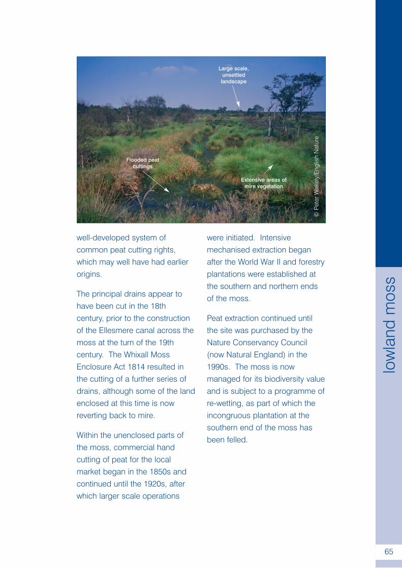
.
65
low
land
mos
s
well-developed system ofcommon peat cutting rights,which may well have had earlierorigins.
The principal drains appear tohave been cut in the 18thcentury, prior to the constructionof the Ellesmere canal across themoss at the turn of the 19thcentury. The Whixall MossEnclosure Act 1814 resulted inthe cutting of a further series ofdrains, although some of the landenclosed at this time is nowreverting back to mire.
Within the unenclosed parts ofthe moss, commercial handcutting of peat for the localmarket began in the 1850s andcontinued until the 1920s, afterwhich larger scale operations
were initiated. Intensivemechanised extraction beganafter the World War II and forestryplantations were established atthe southern and northern endsof the moss.
Peat extraction continued untilthe site was purchased by theNature Conservancy Council(now Natural England) in the1990s. The moss is nowmanaged for its biodiversity valueand is subject to a programme ofre-wetting, as part of which theincongruous plantation at thesouthern end of the moss hasbeen felled.
©Pe
terW
akel
y/E
nglis
hN
atur
e
Large scale,unsettledlandscape
Extensive areas ofmire vegetation
Flooded peatcuttings
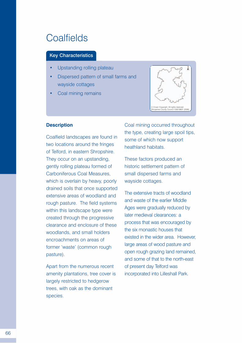
.
66
Coalfields
Key Characteristics
• Upstanding rolling plateau
• Dispersed pattern of small farms and
wayside cottages
• Coal mining remains
© Crown Copyright. All rights reserved.Shropshire County Council 100019801 (2006)
Description
Coalfield landscapes are found intwo locations around the fringesof Telford, in eastern Shropshire.They occur on an upstanding,gently rolling plateau formed ofCarboniferous Coal Measures,which is overlain by heavy, poorlydrained soils that once supportedextensive areas of woodland andrough pasture. The field systemswithin this landscape type werecreated through the progressiveclearance and enclosure of thesewoodlands, and small holdersencroachments on areas offormer ‘waste’ (common roughpasture).
Apart from the numerous recentamenity plantations, tree cover islargely restricted to hedgerowtrees, with oak as the dominantspecies.
Coal mining occurred throughoutthe type, creating large spoil tips,some of which now supportheathland habitats.
These factors produced anhistoric settlement pattern ofsmall dispersed farms andwayside cottages.
The extensive tracts of woodlandand waste of the earlier MiddleAges were gradually reduced bylater medieval clearances: aprocess that was encouraged bythe six monastic houses thatexisted in the wider area. However,large areas of wood pasture andopen rough grazing land remained,and some of that to the north-eastof present day Telford wasincorporated into Lilleshall Park.
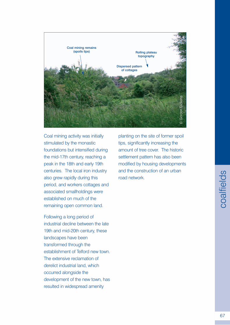
.
67
coal
field
s
Coal mining activity was initiallystimulated by the monasticfoundations but intensified duringthe mid-17th century, reaching apeak in the 18th and early 19thcenturies. The local iron industryalso grew rapidly during thisperiod, and workers cottages andassociated smallholdings wereestablished on much of theremaining open common land.
Following a long period ofindustrial decline between the late19th and mid-20th century, theselandscapes have beentransformed through theestablishment of Telford new town.The extensive reclamation ofderelict industrial land, whichoccurred alongside thedevelopment of the new town, hasresulted in widespread amenity
planting on the site of former spoiltips, significantly increasing theamount of tree cover. The historicsettlement pattern has also beenmodified by housing developmentsand the construction of an urbanroad network.
©G
ordo
nD
icke
ns
Coal mining remains(spoils tips) Rolling plateau
topography
Dispersed patternof cottages
Glossary
Ancient semi-natural woodland – Woodlands that have been in
continuous existence since at least 1600, and which are identified as
such on the Ancient Woodland Inventory (Provisional) for England.
They normally comprise of mixed broadleaved species (although
some have been replanted) and often have irregular boundaries.
Area of Outstanding Natural Beauty (AONB) - A statutory
designation, under the terms of National Parks and Access to the
Countryside Act 1949, intended to conserve and enhance the natural
beauty of the landscape in a given area. The Shropshire Hills AONB
was designated in 1958 and covers an area 804km2 in southern
Shropshire. A statutory Management Plan is prepared and overseen
by the Shropshire Hills AONB Partnership; a formal structure between
five Local Authorities, with core funding from the Countryside Agency.
Assarts – Fields cleared and enclosed directly from woodland,
heathland or moorland, usually between the 12th and 17th centuries.
Where they survive, they can sometimes be distinguished by their
irregular form and association with a pattern of dispersed farmsteads,
a network of winding lanes, and blocks of ancient woodland with
irregular boundaries.
Attributes – the individual variables within each of the six elements
that define landscape character (e.g. mezozoic rocks, rolling lowland
topography, dispersed settlement pattern etc.).
Characterisation – the process of creating a broad and generalised
appreciation of the character and significance of the environment or
landscape (see also Historic Landscape Characterisation, Landscape
Character Assessment).
Closes - small hedged or walled fields with medieval origins. Some lay
beyond the margins of the common open fields and were created through
assarting (see ‘assarts’ above). Others were situated between the
ploughlands and the settlements, providing convenient enclosed pastures.
.
68
Coverts – small planted woodlands established to provide cover for
game (particularly foxes).
Deer parks – A area of private woodland and/or wood pasture within
which deer were kept, which were originally strongly enclosed with
earthworks, timber pails or hedges. The creation of such parks
reached a peak in the 13th and early 14th centuries.
Discrete woods – clearly defined blocks of woodland that are spatially
separate from one another.
Ecology – the study (and science) of living organisms in terms of their
relations to one another and their wider environment.
Elements – six individual components which make up landscape
character (e.g. Geology, Landform, Settlement etc.).
Encroachments – cottages and associated smallholdings established
on common land by cottagers and ‘squatters’ between the 16th and
18th centuries. In some instances cottages were erected close to
extractive industries by part-time colliers, quarrymen or lead miners.
Field pattern – an inherited configuration of fields, hedgerows, roads
and trackways, the form of which is determined by, and indicative of, a
particular set of historical processes.
Geodiversity – The natural range of rocks, fossils, landforms and soils
that exist within a given area, together with the earth processes, both
past and present, that have given rise to them.
Habitat – Locality where a particular plant or animal normally lives.
Also used in a wider sense to refer to a major assemblage of plants
and animals that occur together e.g. grassland, woodland etc.
Heathland/acid grassland – plant communities that have typically
developed on free draining, nutrient poor soils, although localised
areas with poor drainage may also be present.
.
69
glos
sary
Historic Landscape Characterisation (HLC) – a national programme
co-ordinated by English Heritage, which is primarily concerned with
mapping the historic dimension of today’s rural and urban landscape.
Intake – field enclosed directly from common land between the 16th
and 17th centuries.
Intercommoning – commons to which two or more communities held
customary rights of access.
Interlocking woodlands – a pattern of conjoined blocks of woodland.
Key characteristics – a prominent and recurrent set of elements that
define a given landscape type.
Landscape Character - a distinct, recognisable and consistent
pattern of elements in the landscape that makes one landscape
different from another, rather than better or worse.
Landscape Character Assessment (LCA) – an analysis, based upon
a predetermined objective methodology, of the various elements that
together comprise landscape character.
Landscape Type – these are defined by a particular and consistent
combination of attributes. They occur wherever such a combination
exists and make one landscape distinct from another.
Moorland – plant communities developed over peaty soils and/or in
areas with impeded drainage. Often used in relation to heathland
plant communities in an upland setting, although it also applies to
present and former wetlands at lower elevations.
Open fields – a communal agricultural system, with early medieval
origins, in which a given settlement had two or more large arable fields
that were subdivide into separate, unhedged strips. These were
shared out between each farmer and mixed together with those of
their neighbours, so that each holding was scattered across the
territory of the settlement. In Shropshire most parishes had several
open fields, the enclosure of which proceeded on an informal,
piecemeal basis from the later Middle Ages onwards, such that most
had disappeared by the 17th century.
.
70
glos
sary
Parks/parkland – designed landscapes usually associated with a
large country house, which typically contain some or all of the
following: ornamental planting, artificial lakes and ponds, kitchen
gardens, lodges and other ornamental buildings such as follies,
temples and pagodas. Many also contain significant numbers of
veteran trees.
Planned enclosure – a regular geometric pattern of fields with straight
boundaries typically associated with a network of straight roads and
dispersed farmsteads. These field systems were generally laid out in
the period between the later 17th and 19th centuries. Although some
can be attributed to the Parliamentary Enclosure movement, others
were created through private agreements between improving
landowners. In Shropshire, they largely occur in relation to areas of
former common land, although in some instances similar enclosure
patterns were produced by the ‘improvement’ earlier field systems in
the 18th and 19th century.
Planned woodland – woods with regular boundaries, which in most
instances have been planted.
Prehistory – The period of human history preceding the advent of
written records. In southern Britain it is broadly subdivided into the
Palaeolithic (3.5 million years BP - 10,000 BC), Mesolithic (10,000 -
4000 BC), Neolithic (4000 - 2300 BC), Bronze Age (2300 - 700 BC)
and Iron Age (700 BC - AD43).
Rectilinear fields – field systems with a regular form and
predominantly straight boundaries (see also planned enclosure).
Rough grazing – areas associated with poor soils, which are also
characterised by low intensity grazing of unimproved or semi-improved
grassland, moorland or heathland.
Smallholdings – see encroachments above.
.
71
glos
sary
Sub-regular fields – field systems with predominantly curving or
irregular boundaries. In many cases they will pre-date the 17th
century, although encroachments established between the 16th to
18th century also tend to have an irregular form.
Tree cover – the overall pattern of woodlands and hedgerow trees
within a given landscape type.
Veteran tree – a tree that is of interest biologically, culturally or
aesthetically because of its age, size or condition.
Waste – unoccupied and uncultivated land, often applied to areas of
medieval common rough pasture.
Wood pasture – a land use combining trees and grazing animals
(stock or deer). Often the trees are old, at low density and managed
through pollarding. The underlying herbage, together with open
glades occupied by scrub and rough vegetation, provides the pasture
component.
.
72
glos
sary
Further information
The Shropshire Character Framework
For further information about the Shropshire Character Framework, or
to obtain a copy of the information relating to a specific area, please
visit our website, following links to ‘landscape’:-
www.shropshire.gov.uk/sustainability.nsf
Alternatively, you can contact the Sustainability Group:-
Telephone:- (01743) 252562
Email:- [email protected]
Landscape Character Assessment.
For an introduction to Landscape Character Assessment see:-
The Countryside Agency and Scottish Natural Heritage. 2002.
Landscape Character Assessment: Guidance for England and
Scotland. Wetherby. The Countryside Agency and Scottish Natural
Heritage.
Further information about Landscape Character Assessment, together
with an electronic copy of the above publication and subsequent Topic
Papers, can be obtained from:-
www.landscapecharacter.org.uk
.
73
furth
erin
form
atio
n
Historic Landscape Characterisation
For an introduction to Historic Landscape Characterisation, together
with examples of how it is being used to manage the historic
environment, see:-
Clark, J., Darlington, J and Fairclough, G. 2004. Using Historic
Landscape Characterisation: English Heritages review of HLC
Applications 2002-03. Lancaster. English Heritage & Lancashire
County Council.
Further information about Historic Landscape Characterisation,
together with electronic copy of the above publication, can be
obtained from English Heritage’s website:-
www.english-heritage.org.uk
Follow links to ‘Research & Conservation’, ‘Conservation’,
‘Archaeology & Buildings’ and ‘Promoting Characterisation’.
The Shropshire Character Framework was produced in partnership
with:-
.
74
furth
erin
form
atio
n
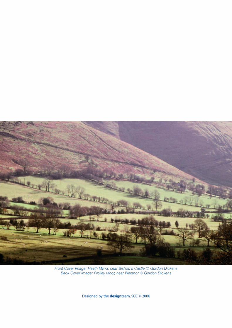
Designed by the designteam, SCC © 2006
Front Cover Image: Heath Mynd, near Bishop’s Castle © Gordon DickensBack Cover Image: Prolley Moor, near Wentnor © Gordon Dickens