Why are there so many languages in the world? Richard McGinn Linguistics Department.

The Seattle Department of Transportationp p
Mike McGinn, MayorPeter Hahn, Director of Transportation
2010

Peter Hahn, DirectorSeattle Department of Transportation
a MESSAGE from the DIRECTOR
While our fi nancial diffi culties continued through this past year, we made the most of our limited funding and will continue to do so in the coming year. That said, I would like to focus on some of our many impressive achievements of this past year.
The department secured $87,254,000 in grant funding for transportation projects that will improve roadways, repair bridges and enhance safety for motorists, transit users, freight, pedestrians and bicyclists. For 2010, SDOT submitted 37 grant applications and received awards for 21, achieving an astounding 57 percent success rate. This success can be attributed to leveraging Bridging the Gap dollars for matching grant funds; a strong track record of delivering prior grant-funded projects on-time and on-budget; and submitting projects that achieve granting agencies’ goals of safety, mobility, sustainability and facility preservation.
SDOT made signifi cant strides on major projects that will benefi t the travelling public for decades to come. In 2010, we ended more than 40 years of debate and broke ground on the Mercer Corridor Project - East phase, the traffi c tangle disparagingly called the Mercer Mess. We completed the fi rst phase of widening the Spokane Street Viaduct by building and completing, ahead of schedule, the Fourth Avenue S ramp which allows traffi c, including transit, to exit into the SODO district rather than merging into the already congested I-5 corridor. We provided oversight on the completion of the WSDOT-SDOT SR 519 grade separation from I-5/I-90 to First Avenue S, which provides a direct connection moving people and freight over the railroad tracks to the Seattle waterfront and ferry docks. We also completed a three-year effort to repave the major downtown arterials to accommodate the impacts of constructing the Alaskan Way Viaduct replacement.
A major priority underlying all our work this past year has been to support the Walk Bike Ride initiative. This report summarizes our many detailed efforts that embrace and reinforce the goal to invest in, design, and build SDOT’s infrastructure so as to make walking, biking and using transit the easiest choice for moving about in Seattle. Not only are we building a transportation network that prioritizes safety, but one that promotes environmental sustainability and meets the needs of all users.
Finally, as we move into 2011, we face the continued challenge of maintaining and upgrading our $13 billion transportation infrastructure with declining revenues. Over the coming year, SDOT will support the work of the Citizens Transportation Advisory Committee (CTAC) III, which will advise the Mayor and City Council on transportation funding alternatives and priorities. SDOT has an ambitious agenda ahead including completing construction of the fi rst phase of the Mercer East project and fi nishing the new Spokane Street Viaduct First Avenue S off-ramp. In addition, we will break ground on the First Hill Streetcar. We will conduct a Variable Parking Pricing Feasibility Study, which will be a major effort to assess the ability of performance-based parking strategies and new technology to improve the use of on-street parking resources. Our recently-established Seattle Freight Advisory Board will also advise the Mayor, City Council and multiple city departments on further enhancements to Seattle’s freight system.
Please take time to review this report. It is a high level view of the signifi cant amount of work accomplished in 2010 by SDOT employees who are dedicated to building a sustainable transportation system.
Peter HahnDirector

Making Seattle
We are addressing a backlog of overdue maintenance while building much needed infrastructure to keep people and goods moving. As we do so, we’re also enhancing that work through programs that utilize new technologies, encourage community interaction and celebrate creativity.

making seattle MORE LIVABLE in 2010
WALK BIKE RIDE: Giving People Better Transit Choices and Safer Routes for Walking and Biking
The Mayor’s Walk Bike Ride initiative, launched in 2010, encourages a balanced approach to how we use our streets, invest our transportation dollars, collaborate with agency partners and encourage people to make the most of their trips by walking, biking and riding transit. By doing so, Seattle can build a transportation system that supports safe and healthy communities; creates a dependable, connected and equitable transportation system; creates great places; and encourages more frequent and reliable transit.
Many of SDOT’s 2010 projects advanced Walk Bike Ride, including the S Columbian Way Complete Street and the Rainier/Jackson Corridor project. In 2010 SDOT introduced the Walk Bike Rider e-newsletter to deliver relevant information, tools and inspiration to walk, bike and ride. Along with other education and incentive programs, SDOT engaged thousands of people in these programs, who reported cutting nearly 600,000 miles of car trips.
Bridging the Past to the Future
Not since the 1980s has the Bridge and Roadway Structures section been as productive as it was in 2010. Seattle has an aging bridge inventory consisting of 148 bridges with an average age of 58 years. SDOT was able to leverage the BTG initiative’s dollars to gain federal bridge funding. By investing that money in our bridge and roadways structures, those expenditures will benefi t the public for generations to come. The NE 45th Street Viaduct Bridge was completely replaced and 90 percent of the work to replace the 15th Avenue NE Bridge was fi nished. The Jose Rizal and E Duwamish Waterway Bridges were rehabilitated while the Albro Place Bridge over
Airport Way was seismically retrofi tted. Seven stairways were totally rebuilt and 17 were rehabilitated.
BRIDGING the GAP: Making Improvements throughout Seattle
Seattle voters passed a nine-year, $365 million transportation levy for maintenance and improvements known as Bridging the Gap (BTG) in 2006.
In 2010, SDOT paved 31 lane-miles of roads, restriped 1,148 lane-miles of arterials, and replaced street name signs at 1,701 intersections. In addition, the department remarked 631 crosswalks, repaired 24 blocks of existing sidewalks,
and built 15 blocks of new sidewalks.
The levy funds programs that address the more than 20 years of maintenance backlog for paving; sidewalk development and repairs; bridge repair, rehabilitation and seismic upgrades; tree pruning and planting; and other much-needed maintenance work. Funding also develops and implements both the Bicycle and Pedestrian Master plans, creates a Safe Routes to School Program, improves transit connections throughout the city and helps neighborhoods get larger projects built as part of the Neighborhood Street Fund large project program.
making seattle MORE LIVABLE in 2010
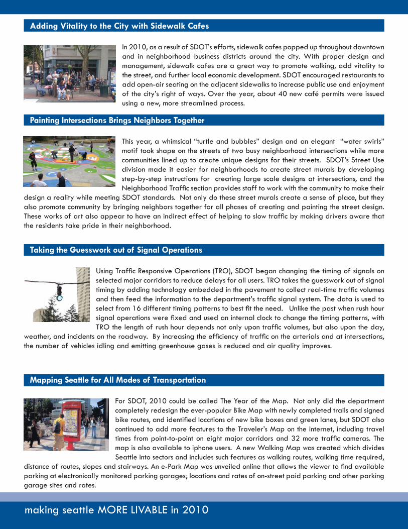
Adding Vitality to the City with Sidewalk Cafes
In 2010, as a result of SDOT’s efforts, sidewalk cafes popped up throughout downtown and in neighborhood business districts around the city. With proper design and management, sidewalk cafes are a great way to promote walking, add vitality to the street, and further local economic development. SDOT encouraged restaurants to add open-air seating on the adjacent sidewalks to increase public use and enjoyment of the city’s right of ways. Over the year, about 40 new café permits were issued using a new, more streamlined process.
Painting Intersections Brings Neighbors Together
This year, a whimsical “turtle and bubbles” design and an elegant “water swirls” motif took shape on the streets of two busy neighborhood intersections while more communities lined up to create unique designs for their streets. SDOT’s Street Use division made it easier for neighborhoods to create street murals by developing step-by-step instructions for creating large scale designs at intersections, and the Neighborhood Traffi c section provides staff to work with the community to make their
design a reality while meeting SDOT standards. Not only do these street murals create a sense of place, but they also promote community by bringing neighbors together for all phases of creating and painting the street design. These works of art also appear to have an indirect effect of helping to slow traffi c by making drivers aware that the residents take pride in their neighborhood.
Mapping Seattle for All Modes of Transportation
For SDOT, 2010 could be called The Year of the Map. Not only did the department completely redesign the ever-popular Bike Map with newly completed trails and signed bike routes, and identifi ed locations of new bike boxes and green lanes, but SDOT also continued to add more features to the Traveler’s Map on the internet, including travel times from point-to-point on eight major corridors and 32 more traffi c cameras. The map is also available to iphone users. A new Walking Map was created which divides Seattle into sectors and includes such features as walking routes, walking time required,
distance of routes, slopes and stairways. An e-Park Map was unveiled online that allows the viewer to fi nd available parking at electronically monitored parking garages; locations and rates of on-street paid parking and other parking garage sites and rates.
Taking the Guesswork out of Signal Operations
Using Traffi c Responsive Operations (TRO), SDOT began changing the timing of signals on selected major corridors to reduce delays for all users. TRO takes the guesswork out of signal timing by adding technology embedded in the pavement to collect real-time traffi c volumes and then feed the information to the department’s traffi c signal system. The data is used to select from 16 different timing patterns to best fi t the need. Unlike the past when rush hour signal operations were fi xed and used an internal clock to change the timing patterns, with TRO the length of rush hour depends not only upon traffi c volumes, but also upon the day,
weather, and incidents on the roadway. By increasing the effi ciency of traffi c on the arterials and at intersections, the number of vehicles idling and emitting greenhouse gases is reduced and air quality improves.

Seeing theg
SDOT is constructing several major projects and partnering with the Washington State Department of Transportation on others that serve vital transportation corridors. These projects will facilitate mobility and enhance safety for all modes of transportation. Not only will they improve access, they will also provide new connections and help to shape future growth.

seeing the BIG PICTURE
SEATTLE STREETCARIn December 2007, Seattle’s fi rst modern streetcar line began operations, connecting downtown Seattle to the emerging South Lake Union area. There were over half a million riders in 2010, a 15 percent increase over 2009, and 25 percent greater than ridership in 2008, the fi rst full year of operation. The gains were driven largely by increased weekday trips. Average weekday ridership was over 1,800, peaking at over 2,200 in August 2010.
2010 also saw signifi cant progress on the next stop for the Seattle Streetcar, the First Hill Streetcar line. Funded by Sound Transit, the new streetcar line will link First Hill employment centers to the light rail system via connections on Capitol Hill and in the International District. This is an important link in the regional transit system, providing an alternative to the originally proposed deep tunnel light rail
station on First Hill. The First Hill Streetcar will also connect diverse and vibrant neighborhoods on Capitol Hill, First Hill, and in the Chinatown/International District, while serving medical centers (Harborview, Swedish, and Virginia Mason), Seattle Central Community College and Seattle University.
In May 2010, the Seattle City Council approved the project route, running along Broadway, Yesler Way, 14th Avenue and Jackson Street. The environmental review was completed in October. Construction is scheduled to begin the fall of 2011, with operations to begin in late 2013.
seeing the BIG PICTURE
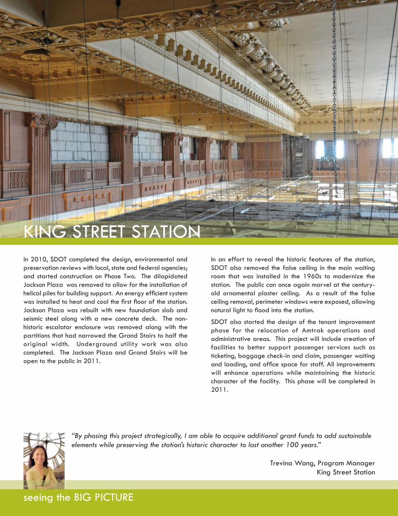
KING STREET STATIONIn 2010, SDOT completed the design, environmental and preservation reviews with local, state and federal agencies; and started construction on Phase Two. The dilapidated Jackson Plaza was removed to allow for the installation of helical piles for building support. An energy effi cient system was installed to heat and cool the fi rst fl oor of the station. Jackson Plaza was rebuilt with new foundation slab and seismic steel along with a new concrete deck. The non-historic escalator enclosure was removed along with the partitions that had narrowed the Grand Stairs to half the original width. Underground utility work was also completed. The Jackson Plaza and Grand Stairs will be open to the public in 2011.
“By phasing this project strategically, I am able to acquire additional grant funds to add sustainable elements while preserving the station’s historic character to last another 100 years.”
Trevina Wang, Program ManagerKing Street Station
In an effort to reveal the historic features of the station, SDOT also removed the false ceiling in the main waiting room that was installed in the 1960s to modernize the station. The public can once again marvel at the century- old ornamental plaster ceiling. As a result of the false ceiling removal, perimeter windows were exposed, allowing natural light to fl ood into the station.
SDOT also started the design of the tenant improvement phase for the relocation of Amtrak operations and administrative areas. This project will include creation of facilities to better support passenger services such as ticketing, baggage check-in and claim, passenger waiting and loading, and offi ce space for staff. All improvements will enhance operations while maintaining the historic character of the facility. This phase will be completed in 2011.

seeing the BIG PICTURE
SPOKANE STREET VIADUCT WIDENING
“While not without its construction challenges, it has been a lot of fun watching a new Spokane Street Viaduct emerge from the ground up.”
Stuart Goldsmith, Senior Project ManagerSpokane Street Viaduct Widening
With an average of 70,000 vehicles traveling on the South Spokane Street Viaduct daily, the structure is a critical connection linking I-5 to Port of Seattle terminals on Harbor Island, and West Seattle residents and businesses to I-5 and the SODO district. The Spokane Street Viaduct Widening project will provide improved safety and traffi c fl ow for all modes of travel while enhancing freight mobility; reduce delays on the lower Spokane roadway at the railroadtracks; provide new access to the surface streets from the upper roadway; facilitate transit access between West Seattle and downtown; and improve bicycle and pedestrian access.
The Spokane Street Widening Project has several major elements. The north side of the structure will be widened by 41 feet between Sixth Avenue S and E Marginal Way S to allow for a new westbound acceleration/deceleration lane, widening of lanes and shoulders, an additional eastbound lane and a permanent median. The westbound on- and off-ramps from Fourth Avenue S to First Avenue S will be relocated and built to current design standards. Seismic strengthening of the viaduct will be completed. The lower roadway will be rebuilt in concrete
with the addition of curbs and a 10-foot wide sidewalk along the north side of lower roadway. A planted median will be built on Fourth Avenue S north of S Spokane Street. Also, an eastbound off-ramp at Fourth Avenue S will be added along with a third lane eastbound between SR 99 and Fourth Avenue S.
In 2010, the widening of the Spokane Street Viaduct got underway and by the end of the year considerable progress had been made with a majority of the drill shafts installed and the main utility relocations completed. In addition, the superstructure is well underway between Fifth Avenue and the BNSF Railway mainline at Second Avenue. By the end of 2011, the new structure will be nearly completed and the new westbound ramps at First Avenue will be built and likely operational. Rehabilitation work on the old section of the structure and repaving of the lower roadway will extend into 2012.
The Fourth Avenue Off-Ramp reached substantial completion in 2010 and opened for use several months ahead of schedule.

seeing the BIG PICTURE
MERCER CORRIDORImproving the Mercer Corridor
For decades, the Mercer Corridor between I-5 and SR 99 has been one of the city’s most signifi cant traffi c bottlenecks and a frustration for the 80,000 travelers who use it daily. The Mercer Corridor Program includes two distinct phases, the East and West phases, which, although related, are independently planned, designed and funded.
Mercer East Phase
In short, the plan includes widening Mercer to create a two-way boulevard from I-5 to Dexter Avenue, reconstructing Valley Street as a two-way, local access street, providing new, wider sidewalks and other pedestrian amenities, improving connections to transit, and adding bicycle lanes. The project will also replace major utility infrastructure and reconnect the street grid in South Lake Union. Construction work includes new pavement, sidewalk, signals, lighting, signage, Intelligent Transportation Systems, drainage facilities, undergrounding of electrical facilities, replacing sewer and water mains, and providing new and improved landscaping and urban design throughout the project area.
In January 2010, SDOT awarded an early construction contract that allowed for building demolition and site preparation work to begin. In February 2010, SDOT was awarded a $30 million federal Transportation Investment
Generating Economic Recovery (TIGER) grant, completing the funding requirements of the project and allowing SDOT to advertise the project for construction. Just as the building demolition work was wrapping up in June, SDOT received council approval to award the Mercer contract. A Notice To Proceed was issued in August 2010. A groundbreaking ceremony was held on September 8th. Attendees included US Secretary of Transportation Ray LaHood, Senator Patty Murray, Representative Jim McDermott, Governor Christine Gregoire, Mayor Michael McGinn, and WSDOT Secretary Paula Hammond. Construction of the project is ongoing.
Mercer West Phase
The Mercer West Phase will continue the two-way Mercer Street between Dexter and Elliott avenues. Mercer will be widened to six lanes where it passes under Aurora Avenue between Dexter and Fifth Avenue. Between Fifth Avenue N and Queen Anne Avenue N, signals and channelization will be modifi ed to convert Mercer and Roy streets to two-way operation, and bike lanes will be added to Roy Street, all within the existing right-of-way. Accomplishments in 2010 include the development of preliminary design for the Mercer West corridor, as well as beginning the traffi c and environmental analysis for the segment west of Fifth Avenue N. The segment between Dexter and Fifth avenues - the Mercer Underpass - is covered under the Environmental Impact Statement Process for the Alaskan Way Viaduct Replacement Project, which published a Supplemental Draft Environmental Impact Statement in October 2010.
seeing the BIG PICTURE
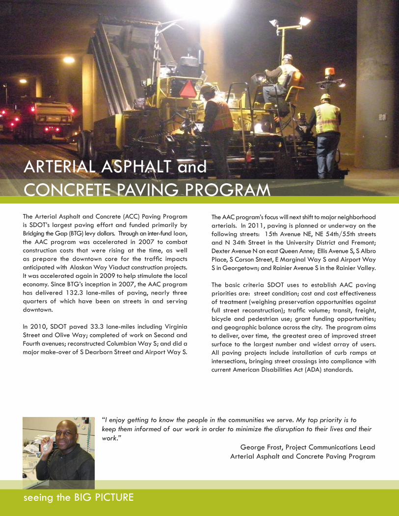
ARTERIAL ASPHALT andCONCRETE PAVING PROGRAMThe Arterial Asphalt and Concrete (ACC) Paving Program is SDOT’s largest paving effort and funded primarily by Bridging the Gap (BTG) levy dollars. Through an inter-fund loan, the AAC program was accelerated in 2007 to combat construction costs that were rising at the time, as well as prepare the downtown core for the traffi c impacts anticipated with Alaskan Way Viaduct construction projects. It was accelerated again in 2009 to help stimulate the local economy. Since BTG’s inception in 2007, the AAC program has delivered 132.3 lane-miles of paving, nearly three quarters of which have been on streets in and serving downtown.
In 2010, SDOT paved 33.3 lane-miles including Virginia Street and Olive Way; completed of work on Second and Fourth avenues; reconstructed Columbian Way S; and did a major make-over of S Dearborn Street and Airport Way S.
The AAC program’s focus will next shift to major neighborhood arterials. In 2011, paving is planned or underway on the following streets: 15th Avenue NE, NE 54th/55th streets and N 34th Street in the University District and Fremont; Dexter Avenue N on east Queen Anne; Ellis Avenue S, S Albro Place, S Corson Street, E Marginal Way S and Airport Way S in Georgetown; and Rainier Avenue S in the Rainier Valley.
The basic criteria SDOT uses to establish AAC paving priorities are: street condition; cost and cost effectiveness of treatment (weighing preservation opportunities against full street reconstruction); traffi c volume; transit, freight, bicycle and pedestrian use; grant funding opportunities; and geographic balance across the city. The program aims to deliver, over time, the greatest area of improved street surface to the largest number and widest array of users. All paving projects include installation of curb ramps at intersections, bringing street crossings into compliance with current American Disabilities Act (ADA) standards.
“I enjoy getting to know the people in the communities we serve. My top priority is to keep them informed of our work in order to minimize the disruption to their lives and their work.”
George Frost, Project Communications LeadArterial Asphalt and Concrete Paving Program

seeing the BIG PICTURE
SEAWALL REPLACEMENTand CENTRAL WATERFRONTCentral Waterfront
In 2010, the Central Waterfront Project passed an important milestone with the selection of a consultant team to design the project. The selection process culminated in public interviews and presentations from the four fi nalist design teams at Benaroya Hall, attended by approximately 1,400 people. The presentations allowed the public to hear the shortlisted designers discuss their skills, experience and approach to the project. Ultimately, James Corner Field Operations was selected as lead designer and CH2MHill and Shiels Oblitz Johnsen were selected as the lead engineering and project management fi rms. The fi rms were integrated into one team and the city signed a contract for an initial phase of work in the fourth quarter of 2010.
In addition, the Central Waterfront Partnerships Committee (CWPC), a citizen advisory group formed by the mayor and council in 2009, made recommendations to the city on a range of topics related to the future of the Central Waterfront: design scope and process, public engagement and oversight, and governance and partnerships. In the fourth quarter of 2010, they issued a report summarizing their work over the past year and key recommendations as work on the waterfront moves forward.
In 2011, the waterfront project will advance a Waterfront Framework Plan and Concept Design, and engage the public through a series of events on the waterfront.
Seawall Replacement
The Elliott Bay Seawall Project made signifi cant progress in 2010. In January Mayor McGinn advanced design and construction of the central portion of the seawall, from Washington Street to Pine Street, due to the critical public safety need of this portion. SDOT hired a consultant team led by TetraTech, Inc., which began working in earnest in April.
In coordination with the U S Army Corps of Engineers, SDOT launched the environmental scoping for the seawall project in June. Additional coordination with the Corps has resulted in the identifi cation and pre-screening of habitat measures the Corps will consider for future cost sharing.
In July SDOT convened the 18-member Seawall Stakeholder Subgroup to gather a variety of perspectives and recommendations on the design of the new seawall and potential construction impacts of the project. Comprised of waterfront business owners and tenants, professionals from the design and environmental fi elds, representatives from the Port of Seattle and Washington State Ferries, and downtown community members and residents, the subgroup met monthly throughout the remainder of 2010. The Seawall Stakeholder Subgroup will be part of the full Central Waterfront Stakeholder Group in 2011 to continue providing feedback to staff on both the Elliott Bay Seawall Project and Waterfront Seattle.
The seawall project’s planning and conceptual design process included signifi cant involvement from the stakeholders, Waterfront Seattle, and the public throughout 2010. The team identifi ed six different zones along the waterfront, as well as opportunities and issues in each of the zones. Those opportunities were translated into designs for each area of the seawall, which were eventually strung together into concept plans. The concept plans served as a basis for discussion and identifi ed strengths and weaknesses of the elements considered. The team provided opportunities for the public to learn about the project and offer feedback by conducting briefi ngs with various neighborhood and business groups, and hosting a walking tour along the waterfront in September.
Since November, the project team has been working to establish a range of seawall replacement alternatives in coordination with Waterfront Seattle, the Army Corps and the public. The project’s alternatives for the EIS process will be announced in April 2011, followed by environmental review and fi nal design. Construction of the seawall is planned to occur between 2013 and early 2015. The goal is to complete the fi rst phase of seawall construction prior to the demolition of the Alaskan Way Viaduct’s central waterfront section.

seeing the BIG PICTURE
SR 519 PHASE II &SR 520/EVERGREEN FLOATING BRIDGESR 519 Phase II
The $79 million SR 519 Phase II project improves mobility and safety by creating a more direct westbound connection between I-90/I-5 and the waterfront, and by separating pedestrian, bicycle, auto and freight traffi c from railroad activities. The project includes a new westbound off-ramp from I-90/I-5 to Edgar Martinez Drive, building a two-lane vehicle, bicycle and pedestrian bridge on S Royal Brougham Way over the railroad tracks connecting Fourth Avenue S and Occidental Avenue S, and the redesign of the intersection of First Avenue S and S Atlantic Street. In April of 2010, Governor Gregoire, Mayor McGinn, and representatives from the Port of Seattle and other partner agencies offi cially opened the S Royal Brougham Way Bridge and the new Atlantic ramp.
The SR 520/Evergreen Point Floating Bridge
SDOT assisted the mayor with a study of light rail alternatives for SR 520 and worked with the city council to identify elements that were included in the state’s preferred alternative, announced in April 2010. In late spring 2010, the state legislature passed ESSB 6392, establishing several work groups in which SDOT participated for the mayor and council. These work groups included design refi nements and transit connections, transit planning and fi nance, and Arboretum mitigation. These efforts have further refi ned the preferred alternative and will be included in the fi nal environmental impact statement that will be released in spring 20ll. Finally, SDOT has been an active participant in the development of the Montlake Triangle Project, which will provide better connections between the new regional bicycle and pedestrian path across SR 520, the U-Link light rail station at Husky Stadium, the University of Washington Campus, and the Burke-Gilman Trail.

making itmaking itakin itgphoto courtesy of Rich Bowen
In a time when belt-tightening is the norm, wehave been fortunate to have the Bridging theGap transportation levy, as well as other grant and partnership funding. It has allowed us to implement transportation improvements in a time of declining revenues.
CAPITAL IMPROVEMENT PROJECTS - costs detailed by phase as of December 31, 2010Data for planned total costs are linked to the 2010-14 Adopted CIP; data for the life-to-date costs are as of the end of December 2010. Management of the TCIP re-quires adjustments among project spending plans to maintain overall progress. The project breakouts on the following pages show expenditures from prior years through December 2010. The budget amounts refl ect available funding for the life of the project, as published in the 2010-14 Adopted Capital Improvement Program (CIP).The few annual programs identifi ed separately refl ect only planned 2010 budgets and costs through December 31, 2010.
PLANNINGPlan Actual
6,815 3,307
508 717
PROJECT
Alaskan Way Viaduct &Seawall Replacement
SR 520 Project
DESIGNPlan Actual
123,365 30,945
1,858 485
CONSTRUCTIONPlan Actual
244,920 4,314
0 0
TOTAL PROJECT COSTPlan Actual
375,100 38,566
2,366 1,202Comments: SDOT assisted the Mayor with a study of light rail alternatives for SR 520 and worked with the City Council to identify elements that were included in the state’s preferred alternative, announced in April 2010. In late spring 2010, the state legislature passed ESSB 6392, establishing several work groups in which SDOT participated for the Mayor and Council. These work groups included design refi nements and transit connections, transit planning and fi nance, and Arboretum mitigation.
Comments: In 2010, the Central Waterfront and Seawall projects selected design consultants. The 10% Design milestones are expected in 2Q 2011 for the Seawall and 3Q 2012 for the Central Waterfront. The construction costs are associated with the E-Park Program. Phase I was completed and launched in September with six partner garages. Phase II expansion with a focus on Pioneer Square and Waterfront will begin in 2011.
PLANNING STAGE
PLANNINGPlan Actual
0 0
183 188
0 0
0 0
297 297
33 33
385 385
PROJECT
Mountain to SoundGreenway Trail
Linden Avenue NorthComplete Streets
Mercer Corridor ProjectWest Phase
South Park Bridge
NE Northgate Way Intersection and Pedestrian Improvements
Thomas St. Pedestrian Overpass
Burke Gilman Trail Extension
DESIGNPlan Actual
713 499
4,884 783
17,352 2,493
570 638
1,586 1,297
2,218 2,681
6,953 7,524
CONSTRUCTIONPlan Actual
2,712 0
8,479 125
82,488 0
116 16
0 0
7,750 0
17,238 6,581
TOTAL PROJECT COSTPlan Actual
3,425 499
13,546 1,096
99,840 2,493
686 654
1,883 1,594
10,001 2,714
24,576 14,490
Comments: Design has been completed and the project will be advertised for construction by WSDOT in early 2011.
Comments: In 2010, the project selected a design consultant. The 30 percent design milestone is expected in 2Q 2011.
Comments: SDOT continued coordination with King County for the replacement of the bridge, which included addressing impacts from its closure in June 2010.
DESIGN STAGE
Comments: Design continued and will reach 60 percent design in January 2011. Utility relocation will start June 2011 and street redevelopment construction is expected to start in January 2012.
Comments: With the successful award of $4.5M in TIB grant funds, this project has moved from being on hold to the completion of the design and right-of-way processes.
Comments: Design has been completed and the project will be advertised for construction in early 2011.
Comments: Design continued on the 17th to Locks segment of the trail and an additional environmental review was conducted. Updated SEPA determination is expected to bepublished in early 2011.
making it COUNT
making it COUNT
PROJECT
Bridge Painting Program
Bridge Rehabilitation andReplacement
Bridge Seismic Retrofi t Phase II
DESIGNPlan Actual
607 171
13,128 12,576
4,595 4,966
CONSTRUCTIONPlan Actual
5,800 1,926
92,514 14,805
22,668 2,592
TOTAL PROJECT COSTPlan Actual
6,407 2,097
106,181 27,841
30,191 10,378
Comments: Painting of the Washington St Pier reached physical completion in October 2010. Painting of the approach portions of the Ballard bridge began in June 2010, and is expected to be completed in early 2011. Design progressed to 90 percent for the bascule portion of the Ballard bridge, and is expected to be advertised for construction in 2011.
PLANNINGPlan Actual
0 0
538 459
2,929 2,820Comments: The Albro (over Airport Way) Bridge project began construction in January 2010 and was substantially complete in October 2010. Design continued on the Fauntleroy Expressway, Ballard and King Street Bridges.
DESIGN to CONSTRUCTION STAGE
Comments: The E Duwamish Waterway bridge was physically complete in March 2010. The Jose Rizal bridge was physically complete in November 2010. The NE 45th St viaduct began construction in April 2010 and was substantially complete in November 2010. The 15th Ave NE bridge (at NE 105th St) began construction in May 2010 and is expected to be completed in early 2011. Design continued on the Airport over Argo bridge and E Marginal Way at Horton St, and both are expected to be advertised for construction in 2011.

making it COUNT
PLANNINGPlan Actual
0 0
166 166
0 0
0 0
0 0
PROJECT
Arterial Asphalt and Concrete Program
Lake Union Ship Canal Trail - Phase II
Pay Stations
Spokane Street Viaduct
Westlake Hub (City Center Access)
DESIGNPlan Actual
4,687 4,723
2,906 3,147
0 405
24,319 24,550
230 229
CONSTRUCTIONPlan Actual
19,276 17,347
2,792 1,547
17,914 17,169
159,498 78,628
700 615
TOTAL PROJECT COSTPlan Actual
23,963 22,070
5,864 4,860
17,914 17,574
183,817 103,178
930 844
Comments: Paving work was completed on over 33 lane miles this year, with a large portion of the work being performed in downtown Seattle and the SODO district.
Comments: In 2010, the remaining parking meters were replaced in the city and pay stations were installed in the Capitol Hill and First Hill neighborhoods. A total of 173 pay stations were installed. There are neither plans nor funding for new pay station installations in 2011.
Phase II of this project consists of two trail contracts and work related to the relocation of a private water main. Contract 1 reached physical completion in November 2010. Design is being completed on Contract 2 and the water main relocation work, and both will be advertised for construction in 2011, in coordination with the relocation of the BNSF mainline and industry spur tracks.
Comments: Construction on the 4th Avenue ramp reached substantial completion in December 2010, while construction work continued on the widening portion of the project.
CONSTRUCTION STAGE
Comments:Notice to proceed with construction work was issued in September 2010 and the project will be substantially complete early 2011.
PLANNINGPlan Actual
23 23
1,047 1,047
PROJECT
Greenwood Avenue N Street Improvements
Intelligent TransportationSystems (ITS)
DESIGNPlan Actual
1,958 1,958
5,720 6,935
CONSTRUCTIONPlan Actual
5,694 5,074
23,798 17,238
TOTAL PROJECT COSTPlan Actual
7,675 7,055
30,564 25,220
Comments: Project was physically completed in June 2010.
Comments: All construction contracts are completed. Final improvements in the Traffi c Management Center to support fi eld deployment were substantially complete and will be closed out in the fi rst two quarters of 2011.
CLOSED OUT PROJECTS
PLANNINGPlan Actual
374 367
1,699 1,699
TITLE
Aurora Transit, Pedestrian, and Safety Improvements
Magnolia Bridge Replacement Project
DESIGNPlan Actual
2,850 2,839
7,897 7,766
CONSTRUCTIONPlan Actual
0 0
0 0
TOTAL PROJECT COSTPlan Actual
3,224 3,206
9,596 9,465
Comments: Project is on hold until suffi cient funding can be acquired.
Comments: Project is on hold until suffi cient funding can be acquired.
PROJECTS ON HOLD
PROJECT
King Street Station Multimodal Terminal
Mercer Corridor Project
Transit Corridor Projects
DESIGNPlan Actual
3,480 3,804
80,084 79,530
6,456 5,816
CONSTRUCTIONPlan Actual
44,573 13,479
115,913 5,949
25,793 3,841
TOTAL PROJECT COSTPlan Actual
50,553 18,436
198,400 86,874
32,249 9,898
Comments: Design of Phase 2 (Building Seismic Upgrade, Systems Improvement, Interior and Exterior Rehabilitation) was completed in 1Q 2010. Due to budget constraints, the project was divided into phases and construction of Phase 2A (Jackson Plaza Rebuild and the Reopening of the Grand Stairs) started in 2Q 2010.
PLANNINGPlan Actual
2,500 1,153
2,404 1,395
0 241
DESIGN to CONSTRUCTION STAGE (CONTINUED)
Comments: The project was awarded a $30M TIGER grant (federal ARRA funds), allowing project construction to move forward. A separate Building Demolition and Site Preparation contract was issued in early 2010, with work completed in July 2010. The project contract was awarded in June, followed by issuance of a Notice To Proceed with construction work in August 2010.
Comments: The Belltown Bus Bulb project reached substantial completion in August 2010. The Rainier Corridor project reached substantial completion in December 2010. Design continued on the Rainier ITS project and 45th/Market Street and West Seattle Corridors.
ANNUAL FINANCIALS
Revenues:
In 2010, the revenues and expenditure budgets decreased by approximately $30.6 million over 2009. This change refl ected a weakened economy, with less General Fund and Reimbursable support. The change also refl ected a reduction in grant revenues. The 2009 budget contained an unprecedented amount of grants in support of the Mercer Corridor and Spokane Street Viaduct projects.
Expenditures:
In 2010, SDOT experienced a significant decrease in its expenditure budget from 2009 due to completion of right of way acquisition for the Mercer Corridor Project and four Intelligent Transportation System (ITS) projects, as well as a reduction in our basic services funded by General Fund and Gas Tax that were a result of continued weakness in the economy.
SDOT 2010 revenues
General Fund $38.6 (12%)
Gas Tax $13.4 (4%)
Debt $97.2 (31%)
Cumulative Reserve Fund $7.7 (3%)
Bridging the Gap $61 (20%)
Reimbursables $37.6 (12%)
Grants & Other $45.9 (15%)
Fund Balance $8.8 (3%)
$341.2 million
SDOT 2010 budget
Major Projects $75.2 (24%)
ROW Management $11.3 (4%)
City Central & Claims Costs $20.8 (7%)
Bridges & Structures $7.2 (2%)
Urban Forestry $4.4 (2%)
Dept Management $3.5 (1%)
Major Maint/Replacement $84.8 (27%)
Engineering Services $2.3 (1%)
Mobility Operations $35.1 (11%)
Mobility-Capital $37.3 (12%)
Street Maintenance $28.2 (9%)
$310.2 million
SDOT 2010 Year to date budgetExpenditures versus Planned (in millions)
O & M - 83%
TCIP - 89%
TOTAL - 87%
2010 YTD Budget Planned
2010 YTD Actual
$310.20$270.04
$197.36$176.17
$112.84$93.87
making it COUNT

DOLLARS SPENT versus PLANNED SPENDINGMost capital improvement projects are multi-year in nature. The graph below is a snapshot of the expenditure plan SDOT proposed for 2010. The graph indicates that the projects in the capital program achieved 70.8 percent of the expenditure goal. These numbers refl ect the costs that were booked as of February 11, 2011.
$300
$250
$200
$150
$100
$50
$0
tota
l spe
ndin
g (in
mill
ions
)
jan feb mar apr may jun jul aug sept oct nov dec
2010 planned ($248.7)
2010 actual ($176.2)
70.8%
PROJECT TOTAL FOR 2010
BIKES AND PEDESTRIANSBike lane and “sharrow” miles striped 20Bike route signs installed 31Pedestrian/Bike trails built 1Trail maintenance requests completed 46Trail miles inspected 26Pedestrian and bicycle spots improved 99Bike parking spaces installed 356 (in 115 racks)Bike maps issued 24,207New sidewalks built (blocks) 15Sidewalk blocks rehabilitated 24New single crosswalks installed 30 Crosswalks remarked 631Curb bulbs installed 14 Curb ramps constructed 375Curb ramps retrofi tted 34Stairways retrofi tted 19Walking routes to schools improved for safety 5Signage of school zones improved 10
Orange text signifi es this work was funded in part or entirely with Bridging the Gap Transportation Initiative revenues.
ACCOMPLISHMENTS BY THE NUMBERS
making it COUNT
BRIDGES Bridge repairs completed 290Bridges painted 1Guardrail replaced (in feet) 2,023

PARKING Pay stations installed 107Pay station inquiries resolved 8,609
PAVEMENT Lane-miles paved 31Potholes fi lled 10,124
TRAFFIC Construction/Special Event Traffi c Control Plans Developed/Approved 3,354Lane - miles of pavement restriped 1,148Regulatory traffi c signs replaced 7,544Street name signs replaced (intersections) 1,701Safety concerns investigated 56School zones with safety signs 10
TRAFFIC SIGNALS Traffi c Signals Optimized 139New traffi c signals installed 3Traffi c signals maintained 1,053Pedestrian countdown signals installed 40Signal beacons maintained 105
PROJECT TOTAL FOR 2010
OTHER Transit hours secured 14,800SDOT public website visits 3,456,483Street Use permits issued 18,273Speed watch trailers deployed 61
Grants/appropriations/authorizations received $ 87,254,000Grants/appropriations/authorizations submitted for future funding $125,000,000
Percentage of contracts issued to women and minority business enterprises for Goods and Services** 18.4%Percentage of Completed Construction Projects by WMBE contracts 8.7%**
Orange text signifi es this work was funded in part or entirely with Bridging the Gap Transportation Initiative revenues.*SDOT either plants or facilitates ** Dollars expended with WMBE vendors are reported based on actual payments in the current year.
making it COUNT
ACCOMPLISHMENTS BY THE NUMBERS
URBAN FORESTRYStreet trees planted* 851 Street trees pruned 3,781Tree pits restored 131Landscape maintained (square feet) 1,529

Working from a
SDOT is methodically mapping out a transportation system that will sustain the city’s vitality and economy for decades to come. Thorough plans are guiding this effort as we improve our transportation system to accommodate growth in both population and jobs. We are building neighborhoods by creating great places for people to interact as well as connecting public spaces and urban villages where people can walk or bike to nearby destinations. In addition, we are also furthering economic growth by expediting the movement of freight. Combined, these plans will help reshape our transportation system to meet the needs of Seattle now and in the future.

The Seattle Bicycle Master Plan defi nes specifi c actions, to be completed within 10 years, to make Seattle the best community for bicycling in the United States. The plan recommends a 450-mile network of bicycle facilities that, when implemented, puts more than 95 percent of Seattle’s residents within one-quarter mile of a bicycle facility. The network will serve all types of bicyclists—from novice to experienced riders.
The Bicycle Master Plan has been in place for four years and we are seeing the results. SDOT has designed and installed 113 miles of new bike lanes and sharrows and installed 64 miles of signed routes. The department has also completed nine trail segments.
In 2010, SDOT installed Seattle’s fi rst bike boxes and buffered bike lanes. The bike box is an intersection safety design to prevent bicycle and car collisions. It is a painted green space with a white bicycle symbol inside. The box creates space between motor vehicles and the crosswalk that allows bicyclists to position themselves ahead of vehicles.
The main goal of the bike box is to improve safety by increasing visibility of cyclists; helping cyclists make safer intersection crossings - especially when drivers are turning right and bicyclists are going straight; and encouraging cyclists to make more predictable approaches to and through an intersection.
A buffered bike lane provides a striped cross-hatched area between bicyclists and motor vehicles. SDOT added the fi rst one along N 130th Street between Linden Avenue N and Greenwood Avenue N and on Seventh Avenue from Denny Way to Virginia Street.
When you ride a bike, you also need a place to park it. With funding from the Bridging the Gap transportation levy, SDOT installed on-street fi sh and car motif bike racks in neighborhoods around Seattle. These unusual bicycle racks only take one motor vehicle parking space while accommodating on-street bike parking for up to 14 people.
Innovations coming out of the Bicycle Master Plan are making biking one of the easiest ways to get around Seattle.
“As a resident of this city and a daily bicycle commuter myself, I know some of the challenges people face when they think about riding a bicycle in Seattle. While the rain and terrain are constants, my goal is to make some of those challenges fewer, giving more people the choice to ride.”
Brian Dougherty, Transportation Planner AssociateTraffi c Management Division
working from A PLANBICYCLE MASTER PLAN

In 2009, the Mayor and City Council adopted the Seattle Pedestrian Master Plan, which addresses four key goals.Safety, to reduce the number and severity of vehicle collisions involving pedestrians. Equity, to make Seattle more walkable for all. Vibrancy, to develop a pedestrian environment that sustains healthy communities and supports a vibrant economy. Health, to raise awareness of the important role of walking in promoting health and preventing disease.
With these goals in mind, the plan focuses our efforts where they are needed most. Improvements that have the highest priority are determined by a data-driven assessment that looks at three factors: pedestrian demand, equity and corridor function. Locations with high pedestrian demand are where people walk and where destinations tend to attract pedestrians such as colleges, transit stops, parks and local business districts. The equity criteria examines data in order to serve residents who most need to walk due to restricted income, limited access to a car or limited mobility due to disability or other health related issues. Corridor function prioritizes locations that have the most direct access to transit routes, or have high volumes of traffi c and need more pedestrian improvements to help walkers get to transit and major destinations.
As part of the planning process, we evaluated every street and every intersection in the city and prioritized project areas based on the criteria mentioned. We continue to build high priority projects each year, as funding allows.
In 2010, funded largely by the 2007 voter-approved Bridging the Gap levy, we completed a range of projects, including new sidewalks and curb ramps, school zone improvements and projects to make crossing safer and easier. SDOT also completed a third successful year of the Summer Streets program, conducted a well-publicized second Downtown Holiday Pedestrian Safety Campaign, and continued work on the Aurora Traffi c Safety Project. The Aurora Safety Project is a partnership with the Washington Traffi c Safety Commission, law enforcement, and local residents and businesses to implement a series of street improvements, educational outreach efforts, and traffi c enforcement emphasis patrols intended to enhance safety for all users.
We also published the fi rst Seattle Walking Map, which is designed to help Seattle residents and visitors choose a walking route that best suits their interests and fi tness level. The map is color coded to indicate steeper streets, and includes estimated walking times. To download the map, or request a hard copy, visit this website: http://www.seattle.gov/Transportation/walk_map.htm.
Each of these investments is a critical component in making Seattle a more walkable city.
“While it’s legal to cross at any street intersection, doing so when you cannot get and maintain eye contact with drivers can be treacherous. In some cases, our goal is not necessarily to slow down existing traffi c, just make it safer by giving pedestrians more visibility.”
Christina Bollo, Architect and Chair of thePedestrian Advisory Committee
working from A PLANPEDESTRIAN MASTER PLAN

working from A PLANTRANSIT MASTER PLAN
Transit buses and rail cars provide hundreds of thousands of rides every day in Seattle, connecting people to residences, jobs, educational institutions and recreational opportunities. Because many streets and highways are at or near capacity, increased transit ridership is critical to Seattle’s ability to create livable neighborhoods, support economic growth, slow global warming and ensure mobility for all.
While King County Metro and Sound Transit operate most transit in Seattle and the region, SDOT infl uences where service is provided by designing and operating streets in a manner that maintains and increases the speed, reliability, and effi ciency of buses on city streets. Additionally, SDOT plans for and recommends service increases or decreases commensurate with transit agencies resources and funds specifi c local service increases.
Transit Bus Capital ProgramSDOT designs and builds transit-focused roadway and signal modifi cations including bus lanes, bus stop bulb-outs, traffi c signal improvements, street rechannelizations, electric trolley bus infrastructure, and related Intelligent Transportation System elements. Projects also include bus stop upgrades to both improve the passenger experience and streamline bus boarding, deboarding, and operations. Funding comes from Bridging the Gap, grants, and partnerships.
SDOT’s bus capital program encompasses both large-scale corridor projects and small-scale spot improvements all aimed at improving transit speed and reliability. In 2010, spot improvements were built in Wallingford, Phinney Ridge,
and the Center City area. Extensive corridor improvements were built on the Third Avenue Belltown and Rainier/Jackson corridors. Design progressed on corridor improvement projects in the Market/45th Street corridor connecting Ballard and the University District, as well as the West Seattle corridor connecting to Downtown. Additionally, responsibility for design and construction of the Ballard to Uptown and Downtown corridor was transferred to Metro.
Bus Service ProgramThrough a partnership with King County Metro, SDOT provides $1.5 million to leverage about $4.5 million worth of bus service each year. Strategic service investments are made to further the city’s goal of 15-minute service frequencies, 18 hours per day, seven days per week on a core network of routes. Additionally in 2010, SDOT participated in funding the Downtown Ride-Free Area as it has historically done.
Transit Master Plan DevelopmentIn 2010, SDOT began an update to the 2005 Seattle Transit Plan to include service and capital investment priorities for Seattle and more explicitly defi ne the links between transit, sustainable growth and land use.
The most appropriate type of transit service - bus, streetcar, bus rapid transit, light rail - will be designated for high demand corridors to increase ridership and meet the needs of those communities most reliant on high quality transit performance, such as seniors, people with disabilities and low-income populations. Electric transit expansion opportunities will also be identifi ed to help Seattle meet its climate action goals.

working from A PLANPARKING PLANNING
e-Park
In September 2010, Mayor McGinn pulled the switch to turn “on” e-Park, providing parking guidance and real-time space availability information for over 4,500 parking spaces located in six garages in the retail district of downtown. E-Park aims to provide easy access to off-street, short-term parking to help keep downtown moving at a time when major construction will take place on the Alaskan Way Viaduct and seawall. Through the “Everything Easier Downtown” campaign, the system is promoted to motorists through bus ads, and coasters and java jackets are provided to businesses close to e-Park garages. In 2011, the program will expand to additional garages in other downtown destination areas, including the Central Waterfront and Pioneer Square.
Seattle Parking Map
In September 2010, SDOT also launched an innovative online parking map that shows street parking, garages, and parking lots all around the city. Highlights of the Seattle Parking Map include: locations of on-street parking signs, and garages and lots citywide; paid on-street parking rates; off-street rates for garages and lots; real-time space availability from e-Park in Downtown; and the ability to personalize the map to focus on a specifi c business district.
The Seattle Parking Map is an easy way for businesses and organizations to provide information to their customers about parking availability.
Community Parking Program
The Community Parking Program engages neighborhoods throughout Seattle to improve on-street parking management in business districts and nearby residential areas. It strives to make improvements that balance competing parking needs and support walking, biking, and riding transit.
Once a neighborhood is identifi ed, SDOT staff spends about a year working with community members to identify on-street parking challenges and opportunities. Walking tours, community meetings, door-to-door outreach, and a Facebook page are a few ways we connect with people. We study parking, develop recommendations, collaborate on solutions, and implement changes. Communities vary, so parking plans vary to meet their needs. Resulting plans may incorporate new time-limit signs, load zones, pay stations, or bicycle and scooter/motorcycle parking.
In 2010, we implemented plans in First Hill, Capitol Hill, and the West Seattle Junction, and began new parking assessments in Madison Valley and the University District. Two new neighborhoods will be launched in 2011.
Laying the Groundwork for 2011
Parking Management Efforts
Planning and preparation for several 2011 parking management programs occurred through 2010. These include passage by the City Council of legislation to create a booting program in 2011 to address parking citation scoffl aws, and new direction from the City Council and the Mayor’s Offi ce to set 2011 parking rates using a data driven process to provide an average of one to two open spaces on each block.

“SDOT’s Freight Program aligns with the Mayor’s Job Plan which states in part, ‘We will work to increase effi cient movement of freight and goods to keep industrial businesses competitive, while identifying opportunities to increase the local manufacture of green transportation technologies.’ ”
Ron Borowski, Freight ProgramFreight Mobility Program
Seattle depends on the effi cient and cost effective movement of goods and services to supply Seattle’s neighborhoods, businesses, and construction services, and to support a successful manufacturing and industrial community. Freight movement is critical to Seattle’s economy and quality of life. In particular, it is vital to Seattle’s manufacturing and maritime sectors which support more than 90,000 jobs, generate $6 billion per year in taxable retail sales, and contribute over $37 million per year in B&O taxes.
The roads, ports, and other infrastructure that serve industrial needs represent a signifi cant public investment. SDOT recognizes the importance of maintaining and investing in freight mobility to assure long term economic strength. Freight mobility issues are particularly important to Seattle’s two designated manufacturing and industrial centers – the Greater Duwamish Manufacturing Industrial Center and the Ballard/Interbay/Northend Manufacturing Industrial Center, which together comprise more than 10 percent of Seattle’s land area. With the support of the manufacturing and industrial community, the Port of Seattle, the State Freight Mobility Strategic Investment Board and the Washington State Department of Transportation, Seattle is working to increase effi cient movement of freight.
2010 AccomplishmentsIn 2010, SDOT made improvements that support freight movement including: opening of the 4th Avenue South ramp as part of the South Spokane Street Viaduct Project; implementing Intelligent Transportation Systems technology to provide real time traffi c information that aids freight operators in reducing travel time and avoiding incidents; installing signal improvements to reduce truck delays at certain intersections and to improve safety; nstalling channelization changes, curb adjustments and parking controls to improve turning radii; and improving truck signage.
SDOT continues to ensure freight movement is considered in traffi c management, and in the design and implementation of major city and partnership projects including: Mercer East; the Alaskan Way Viaduct Replacement Project (Holgate to King Street Replacement; Central Waterfront and the proposed Bored Tunnel North and South Portals); the Spokane Street Viaduct Widening Project and Fourth Avenue off-ramp; construction detour routes in the SODO area; and multiple bridge upgrades. Partnership projects included support of the Port of Seattle’s construction of a grade separation on E Marginal Way south of Spokane Street, and efforts to replace King County’s South Park Bridge.
working from A PLANFREIGHT MOBILITY STRATEGIC ACTION PLAN
working from A PLANURBAN FORESTRY MANAGEMENT PLAN
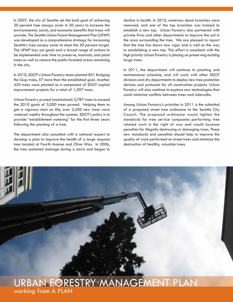
In 2007, the city of Seattle set the bold goal of achieving 30 percent tree canopy cover in 30 years to increase the environmental, social, and economic benefi ts that trees will provide. The Seattle Urban Forest Management Plan (UFMP) was developed as a comprehensive strategy for increasing Seattle’s tree canopy cover to meet the 30 percent target. The UFMP lays out goals and a broad range of actions to be implemented over time to preserve, maintain, and plant trees as well as restore the public forested areas remaining in the city.
In 2010, SDOT’s Urban Forestry team planted 851 Bridging the Gap trees, 57 more than the established goal. Another 450 trees were planted as a component of SDOT capital improvement projects for a total of 1,307 trees.
Urban Forestry pruned (maintained) 3,787 trees to exceed the 2010 goals of 3,000 trees pruned. Helping them to get a vigorous start on life, over 2,200 new trees were watered weekly throughout the summer. SDOT’s policy is to provide “establishment watering” for the fi rst three years following the planting of a tree.
The department also consulted with a national expert to develop a plan to improve the health of a large sequoia tree located at Fourth Avenue and Olive Way. In 2006, the tree sustained damage during a storm and began to
decline in health. In 2010, numerous dead branches were removed, and one of the top branches was trained to establish a new top. Urban Forestry also partnered with private fi rms and other departments to improve the soil in the area surrounding the tree. We are pleased to report that the tree has shown new vigor and is well on the way to establishing a new top. This effort is consistent with the high priority Urban Forestry is placing on preserving existing large trees.
In 2011, the department will continue its planting and maintenance schedule, and will work with other SDOT divisions and city departments to deploy new tree protection devices and protocols for all construction projects. Urban Forestry will also continue to explore new technologies that could minimize confl icts between trees and sidewalks.
Among Urban Forestry’s priorities in 2011 is the submittal of a proposed street tree ordinance to the Seattle City Council. The proposed ordinance would tighten the standards for tree service companies performing tree related work in the right of way and would increase penalties for illegally destroying or damaging trees. These new standards and penalties should help to improve the quality of work performed on street trees and minimize the destruction of healthy, valuable trees.

Taking youg y
The city of Seattle established the important goals of reducing its impact on the environment to meet the Kyoto Protocol and eradicating race and social injustice. SDOT is strongly embracing both efforts through two active internal programs – the Race and Social Justice Initiative and the Environmental Management Program known as GreenDOT. While these two programs must fi rst be fi rmly established internally, this work can greatly improve SDOT’s transportation services and the way in which they are provided throughout the city.

taking you BEHIND THE SCENES
SDOT is GreenDOT
GreenDOT is the name of SDOT’s environmental management system, which is designed to reduce the impact of SDOT’s operations on the environment.
Following up on the calculation of the department’s carbon emmissions in 2009, in 2010 SDOT focused on reducing greenhouse gas generation from its paving activities. SDOT engineers developed new specifi cations for “green” concrete and asphalt, which were successfully applied in selected roadway and sidewalk projects. The groundwork was also
laid for an informal carbon offset program to address situations in which “green” paving materials cannot be used.
Additionally, GreenDOT honed in on other daily business practices to support environmental sustainability. After a highly successful employee awareness campaign in 2009 to “drive less, drive lite, drive wise,” the amount of fuel used by SDOT’s fl eet continued to drop last year. In 2010, SDOT’s fl eet used 22,113 fewer gallons of fuel than in 2009, which saved an additional $65,000 and reduced CO2 emissions by approximately 230 tons.
SDOT launched a program to re-use offi ce supplies and limit offi ce supply purchases to environmentally-preferable products, and improved internal recycling programs. As part of SDOT’s on-going National Pollutant Discharge Elimination System program, over 100 fi eld staffers were trained on the use of best management practices for stormwater pollution control. A comprehensive review of both contract specifi cations and street use permit processes was begun, to reduce the likelihood of soil and groundwater contamination in the street right-of-way.
In 2011, the GreenDOT work plan calls for continued efforts to complete these initiatives and to improve monitoring and measurement of progress in these areas.
Race and Social Justice Initiative
The Race and Social Justice Initiative (RSJI) is a citywide effort to end institutionalized racism and race-based disparities in our communities. To accomplish these goals, the SDOT RSJI Change Team developed and implemented a work plan.
Highlights in 2010, include presenting the work plan to the City Council Transportation Committee; preparing and conducting training of department managers and directors on identifying
qualifying Women and Minority Business Enterprises (WMBEs) for goods and services; and providing advice to the Department of Finance and Administration on Consultant Contract Procedures for WMBEs. The team developed a training plan “Conversations in the Field” to be implemented in 2011. The plan encourages self-help in upward mobility for SDOT’s minority employees, includes a how-to manual on fi nding and applying for city jobs and out-of-class cross-training opportunities, as well as a class on improving interviewing skills.
The team also worked on improving SDOT’s community outreach. SDOT’s Information Systems Governance Board is considering a proposal to create a web-based application so staff can easily visualize the effect of projects or programs on ethnic populations. More employees were trained on how to use the SDOT Language Line in order to strengthen service delivery to residents with limited English profi ciency. The team developed draft performance measures to help SDOT meet goals for inclusive outreach, a test pilot of which is being implemented on the Mercer West Project. Lastly, the team partnered with ethnic organizations in Southeast Seattle to help implement and encourage participation in Rainier Valley Summer Streets.
Insti tuti onal racism defi ned:
Organizati onal programs, policies or procedures that work to the benefi t of white people and to the detriment of people of color, usually unintenti onally or inadvertently e.g., job requirements that put undue emphasis on college degrees over work experience may eliminate qualifi ed candidates of color, who face insti tuti onal barriers to higher educati on.

The Seattle Department of Transportation700 5th Avenue, Suite 3800
PO Box 34996Seattle, WA 98124-4996
(206) 684-ROADwww.seattle.gov/transportation
making a DIFFERENCEIn order to minimize printing costs and reduce paper use, a limited number of copies were printed on recycled paper.
The individual pages are available to view athttp://www.seattle.gov/transportation/sdotreports.htm