The Right Tree for the Right Place: Poster on the
1
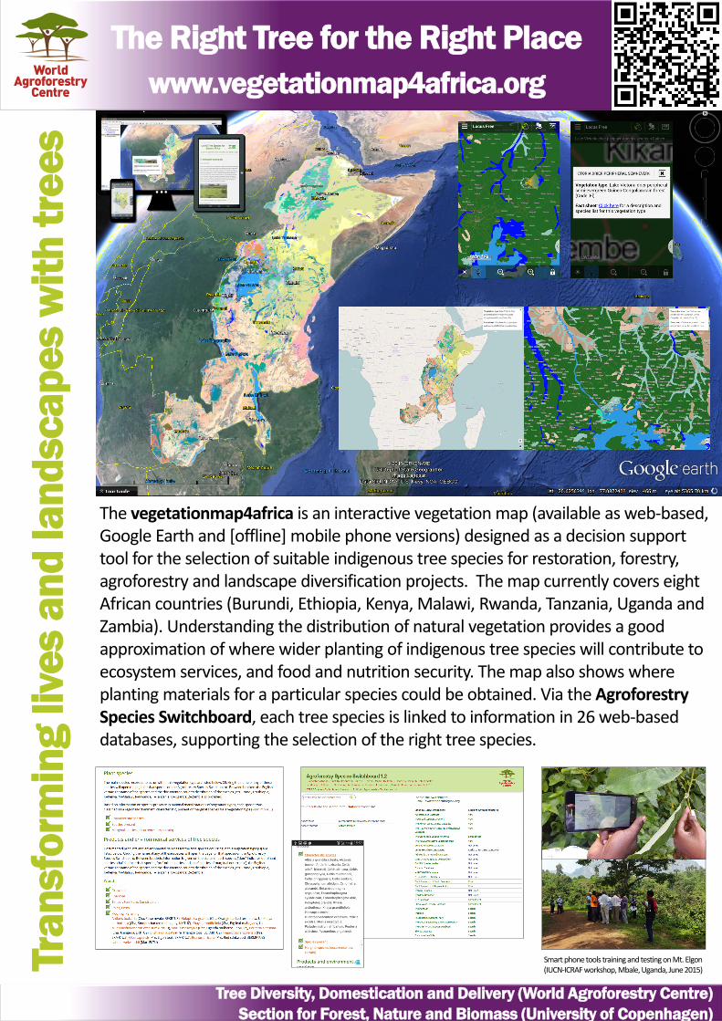
The Right Tree for the Right Place www.vegetationmap4africa.org Transforming lives and landscapes with trees Tree Diversity, Domestication and Delivery (World Agroforestry Centre) Section for Forest, Nature and Biomass (University of Copenhagen) The vegetationmap4africa is an interactive vegetation map (available as web‐ based, Google Earth and [offline] mobile phone versions) designed as a decision support tool for the selection of suitable indigenous tree species for restoration, forestry, agroforestry and landscape diversification projects. The map currently covers eight African countries (Burundi, Ethiopia, Kenya, Malawi, Rwanda, Tanzania, Uganda and Zambia). Understanding the distribution of natural vegetation provides a good approximation of where wider planting of indigenous tree species will contribute to ecosystem services, and food and nutrition security. The map also shows where planting materials for a particular species could be obtained. Via the Agroforestry Species Switchboard, each tree species is linked to information in 26 web‐ based databases, supporting the selection of the right tree species. Smart phone tools training and testing on Mt. Elgon (IUCN‐ ICRAF workshop, Mbale, Uganda, June 2015)
-
Upload
world-agroforestry-centre-icraf -
Category
Science
-
view
438 -
download
1
Transcript of The Right Tree for the Right Place: Poster on the
The Right Tree for the Right Placewww.vegetationmap4africa.org
Tran
sfor
min
g liv
es a
nd la
ndsc
apes
with
tree
s
Tree Diversity, Domestication and Delivery (World Agroforestry Centre)Section for Forest, Nature and Biomass (University of Copenhagen)
The vegetationmap4africa is an interactive vegetation map (available as web‐based, Google Earth and [offline] mobile phone versions) designed as a decision support tool for the selection of suitable indigenous tree species for restoration, forestry, agroforestry and landscape diversification projects. The map currently covers eight African countries (Burundi, Ethiopia, Kenya, Malawi, Rwanda, Tanzania, Uganda and Zambia). Understanding the distribution of natural vegetation provides a good approximation of where wider planting of indigenous tree species will contribute to ecosystem services, and food and nutrition security. The map also shows where planting materials for a particular species could be obtained. Via the Agroforestry Species Switchboard, each tree species is linked to information in 26 web‐based databases, supporting the selection of the right tree species.
Smart phone tools training and testing on Mt. Elgon (IUCN‐ICRAF workshop, Mbale, Uganda, June 2015)