THE JANUARY 6, 2021 VILLAGE BOARD MEETING WILL BE HELD ...
45
THE JANUARY 6, 2021 VILLAGE BOARD MEETING WILL BE HELD VIRTUALLY. YOU CAN WATCH THE MEETING LIVE VIA THE VILLAGE WEBSITE BY CLICKING "WATCH LIVE" UNDER THE TROLLWAY TV GRAPHIC ON THE RIGHT SIDE OF THE HOME PAGE AT WWW.MOUNTHOREBWI.INFO. THE MEETING IS ALSO BROADCAST LIVE ON MHTC CHANNEL 181 AND CHARTER CHANNEL 981. YOU CAN ALSO JOIN THE MEETING USING THE FOLLOWING: Please join my meeting from your computer, tablet or smartphone: https://global.gotomeeting.com/join/665432253 You can also dial in using your phone: United States: +1 (312) 757-3121 Access Code: 665-432-253 VILLAGE BOARD WEDNESDAY, JANUARY 6, 2021 The Village Board of the Village of Mount Horeb will meet virtually on the above date at 7:00pm. Agenda as follows: 1) Call to order Roll call 2) Consent Agenda: a) December 2, 2020 Village Board minutes b) Operator's License: Nicole Ranum c) Extraterritorial jurisdiction Certified Survey Map for James Leuzinger/Z&L Properties LLC, Section 13 Town of Blue Mounds d) Rezones/CSM for Town of Blue Mounds as recommended by ETZ Committee: Jeremy/Crystal Charles, Elizabeth Hackett 3) Consider Kwik Trip requests: a) Ordinance 2020-20, "AN ORDINANCE PROVIDING FOR THE DIRECT ANNEXATION OF A PORTION OF THE TOWN OF SPRINGDALE TO THE VILLAGE OF MOUNT HOREB, DANE COUNTY, WISCONSIN" b) Annexation Agreement c) Ordinance 2020-19, "AN ORDINANCE CHANGING THE ZONING CLASSIFICATION OF LOT 1 CSM 14813 TO PB PLANNED BUSINESS WITH PD-1 PLANNED DEVELOPMENT" with Specific Implementation Plan
Transcript of THE JANUARY 6, 2021 VILLAGE BOARD MEETING WILL BE HELD ...

THE JANUARY 6, 2021 VILLAGE BOARD MEETING WILL BE HELD VIRTUALLY. YOU CAN WATCH THE MEETING LIVE VIA THE VILLAGE WEBSITE BY CLICKING "WATCH LIVE" UNDER THE TROLLWAY TV GRAPHIC ON THE RIGHT SIDE OF THE HOME PAGE AT WWW.MOUNTHOREBWI.INFO. THE MEETING IS ALSO BROADCAST LIVE ON MHTC CHANNEL 181 AND CHARTER CHANNEL 981. YOU CAN ALSO JOIN THE
MEETING USING THE FOLLOWING: Please join my meeting from your computer, tablet or smartphone: https://global.gotomeeting.com/join/665432253 You can also dial in using your phone: United States: +1 (312) 757-3121 Access Code: 665-432-253
VILLAGE BOARD WEDNESDAY, JANUARY 6, 2021
The Village Board of the Village of Mount Horeb will meet virtually on the above date at 7:00pm. Agenda as follows: 1) Call to order
Roll call
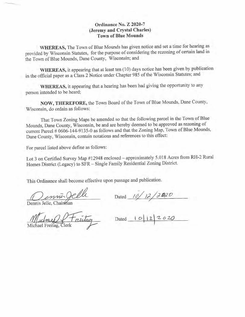
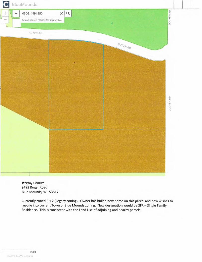
2) Consent Agenda: a) December 2, 2020 Village Board minutes b) Operator's License: Nicole Ranum c) Extraterritorial jurisdiction Certified Survey Map for James Leuzinger/Z&L
Properties LLC, Section 13 Town of Blue Mounds d) Rezones/CSM for Town of Blue Mounds as recommended by ETZ Committee:
Jeremy/Crystal Charles, Elizabeth Hackett
3) Consider Kwik Trip requests: a) Ordinance 2020-20, "AN ORDINANCE PROVIDING FOR THE DIRECT
ANNEXATION OF A PORTION OF THE TOWN OF SPRINGDALE TO THE VILLAGE OF MOUNT HOREB, DANE COUNTY, WISCONSIN"
b) Annexation Agreement c) Ordinance 2020-19, "AN ORDINANCE CHANGING THE ZONING
CLASSIFICATION OF LOT 1 CSM 14813 TO PB PLANNED BUSINESS WITH PD-1 PLANNED DEVELOPMENT" with Specific Implementation Plan
4) Discussion/consideration of 2021 Streetery Program
5) Consider Mission, Vision Statement, and Core Values
6) Discussion/Consideration Repeal of ETZ Ordinance and appointment of Taskforce 7) Village President's report
8) Village Administrator's report
9) Village Clerk/Deputy Treasurer's report
10) Adjourn UPON REASONABLE NOTICE, EFFORTS WILL BE MADE TO ACCOMMODATE THE NEEDS OF DISABLED INDIVIDUALS THROUGH
APPROPRIATE AIDS AND SERVICES. FOR INFORMATION OR TO REQUEST THIS SERVICE, CONTACT ALYSSA GROSS, CLERK, AT 138 E MAIN STREET, MOUNT HOREB, WI (608) 437-9404.

12/02/20 Village Board Meeting Page 1
VILLAGE OF MOUNT HOREB VILLAGE BOARD MEETING MINUTES
DECEMBER 2, 2020
The Village Board met in regular session via virtual meeting due to the COVID-19 pandemic. Call to Order/Roll Call: Village President Randy Littel called the meeting to order at 7:00pm. Present were Trustees Fendrick, Czyzewski, Boehnen, Hill, and Scott. Trustee Jackson was absent. Also present were Administrator Nic Owen, Assistant Administrator Kathy Hagen, and Clerk/Deputy Treasurer Alyssa Gross. Consent Agenda: Fendrick moved, Hill seconded to approve the following consent agenda items: November 4 and November 18, 2020 Village Board minutes; Operator’s License: Brittany Massey, Mollie Guthrie, Nicholas Kraus, and Shawn Moore; Appointment of Sarah J Best to Plan Commission/Historic Preservation Commission to replace Dave Hoffman with term expiring May 1, 2023; Pay Request No. 3 2020 Street Project to S&L Underground Inc for $360,142.13; Deputy Treasurer/Governance Coordinator job description; Electric Superintendent job description; Electric Foreman job description; Water Utility Manager job description. Motion carried by unanimous voice vote. Consider Ordinance 2020-17 “AN ORDINANCE CHANGING THE ZONING CLASSIFICATION OF LOT 26 STONE HAVEN ESTATES II SUBDIVISION, PARCEL 0607-072-6886-6 FROM R-3 MULTI-FAMILY RESIDENTIAL TO PD-1 PLANNED DEVELOPMENT” with Specific Implementation Plan for proposed multi-family building project: Owen explained this item. Village Planner Mike Slavney answered questions from the board. Boehnen moved, Scott seconded to approve the ordinance. Motion carried by unanimous voice vote. Consider Resolution 2020-30, “ADOPTION OF THE VILLAGE OF MOUNT HOREB 2020-2025 COMPREHENSIVE OUTDOOR RECREATION PLAN”: Vandewalle & Associates Project Manager Ben Rohr presented the Comprehensive Outdoor Recreation Plan. Village Planner Mike Slavney was also present to address questions. Scott moved, Fendrick seconded to approve the plan. Motion carried by unanimous voice vote. Discussion regarding Public Safety Committee recommendations for ordinance changes to Chapter 7 Traffic Code and Chapter 9 Public Peace and Good Order: Chief Vierck and Trustee Fendrick explained the proposed changes to the code. The board gave feedback on those changes. The full amended code will come to the board for approval once the recodification is complete. No action was taken. Update/Discussion on Evaluation Process for Streetery Program: Owen gave an updated on the evaluation process and addressed comments from the board.
12/02/20 Village Board Meeting Page 2
Village President’s report: Littel thanked everyone for their efforts throughout the year and wished everyone Happy Holidays. Village Administrator’s report: Owen did not have anything to report. Village Clerk/Deputy Treasurer’s report: Gross reported on the General Election recount and informed that candidacy papers are currently available. Adjournment: There being no further business before the Board, Scott moved, Hill seconded to adjourn the meeting at 8:17pm. Motion carried by voice vote. Minutes by Alyssa Gross, Clerk/Deputy Treasurer
a
a
a
!!! !!! !!! !!! !!! !!! !!!!!!
!!!
!!!
!!!
!!!
!!!!!!
!!!
!!!
!!!
!!!
!!!
!!!
!!!
!!!
!!!
!!!
!!!
!!!
!!!
!!
!
!!!
!!!
!!!
!!!
!!!
!!!
!!!
!!!
!!!
!!!
!!!
!!!
!!!
!!!
!!!
!!!
!!!
!!!
!!!
!!!
!!!
!!!
!!
!
!!!
!!!
!!!
!!!
!!!
!!!
!!!
!!!
!!!
!!!
!!!
!!!
!!!
!!!
!!!
!!!
!!!
!!!
!!!
!!!
!!!
!!!
!!!
!!!
!!!
!!!
!!!
!!!!!!
!!!!!!!!!!!!!!!!!!
!!!!!
!
!!!
!!!
!!!
!!!
!!!
!!!
!!!
!!!
!!!
!!!
!!!
!!!
!!!
!!!
!!!
!!!
!!!
!!!
!!!
!!!
!!!
!!!
!!!
!!!
!!!
!!!
!!!
!!!
!!!
!!!
!!!
!!!
!!!
!!!
!!!
!!!
!!!
!!!
!!!
!!!
!!!
!!!
!!!
!!!
!!!
!!!
!!!
!!!
!!!
!!!
!!!
!!!
!!!
!!!
!!!
!!!
!!!
!!!
!!!!!! !!!
Town
of Sp
ringd
aleTo
wn of
Blue
Mou
nds
Town of SpringdaleTown of Blue MoundsTown of Cross PlainsTown of Vermont
Germ
an Va
lley B
ranch
Bohn Cree
k
Elvers Creek
Moen Creek
Bohn Creek
Little
No
rway Creek
Elvers Creek
SugarRiv e
r
Sugar River
Schlapbach Creek
Schlap
bach Cree
k
Frye rs Feeder
Fryer
s Fee
der
Deer Creek
Deer Creek
WestBranchSugar R iver
StewartLake
³±ID
£¤151£¤18
¬«78
³±P
³±PD
³±ID
³±J
³±JG
³±JG
³±P
³±S
¬«78
¬«92
³±JG
³±E
¬«78
£¤151£¤18
Fourth
St
Town
Hall
Rd
Town Hall Rd
North
Rd
Witte
Rd
Barton Rd
Blue M
ounds
St
Bergu
m Rd
Garfield St
Eighth
St
Erbe R
d
Main St
Secon
d St
Sprin
gdale
Cente
r Rd
First
St
Andre
w Ln
Lunde Ln
Lincoln St
Lake S
t
Fargo Rd
Fertile Ridge Rd
Per imeterRd
Offerdahl Rd
Front StHic
kory D
r
Brian St
Blue Mounds Rd
Sletto Rd
Docke
n Rd
Durtschi Dr
Forest St
South Rd Prairie Ridge Rd
Nesheim Tr
Nordic Tr
Park V
iew D
r
Wilson St
³±J
Brook
w ood
Dr
Malone Rd
Sand Rock Rd
Lewis
Rd
Town
Hall
Rd
Blue Mounds Rd
Messerschmidt Dr
Bus. 18/151 E
PotentialSchool
Site
±Adopted: November 2, 2005Revised: July 22, 2009Data Source: Dane County LIO, Dane County RPC
Mount HorebComprehensive Plan
±Data Source: Dane County LIO, V&A, Capitol Area RPC
0 2,000 4,000 6,0001,000Feet
Future Land UseETJ View 4a
!!!
!!! !
!!
!!!!!! Extraterritorial Jurisdiction Boundary
Land Use Categories
Planned Neighborhood
Neighborhood Business
Each "Planned Neighborhood" mayinclude a mix of: 1. Single-Family (Sewered) - predominate land use 2. Two-Family Residential 3. Multi-Family Residential 4. Government and Institutional 5. Neighborhood Business 6. Public Park and Open Space
Agriculture and VacantSingle-Family Residential (Unsewered)Single-Family Residential (Sewered)Two-Family ResidentialMulti-Family ResidentialElderly Housing Residential
Planned Business
Planned OfficeRecreation Business
Planned Mixed Use
General Industrial
Public Park and Open Space
Environmental Corridor
Extraction
Right of Way
Town Boundaries
Potential Future RoadsSurface Water
Main Street Business
Shaping places, shaping change
VANDEWALLE &ASSOCIATES INC.
Current Urban Service Area Boundary
Village of Mount Horeb Boundary
Planned Industrial
126
4 35
Conservancy
Government and Institutional
126
435
Business Park may include: 1. Planned Industrial 2. Planned Business 3. Recreation Business 4. Government and Institutional 5. Public Park and Open Space 6. Planned Office
Planned Business Park
Central Business
Potential Future Urban Service Area Boundary
Adopted: January 16, 2020
khagen
Line
khagen
Text Box
Z&L Properties revised CSM
khagen
Line
khagen
Text Box
Charles Rezone/CSM
khagen
Line
khagen
Line
khagen
Text Box
Elizabeth Hackett Rezone Parcels (2)


1
ORDINANCE 2020-20
VILLAGE OF MOUNT HOREB
AN ORDINANCE PROVIDING FOR THE DIRECT ANNEXATION OF A PORTION OF THE TOWN OF SPRINGDALE TO THE
VILLAGE OF MOUNT HOREB, DANE COUNTY, WISCONSIN
RECITALS
A. On or about October 20, 2020, a petition to annex (the “Annexation
Petition”) the property described in and shown on Exhibit A (the “Property”) to the Village of Mount Horeb was filed with the Village Clerk by the owner of the Property, The Elmer C. Baker and Norma J. Baker Joint Revocable Trust (the “Owner”).
B. On or about October 20, 2020, the Owner owned all of the real property
within the Property. No electors reside within the Property. The current population of the Property is zero.
C. A copy of the Annexation Petition, together with a scale map and a legal
description of the Property, was filed with the Wisconsin Department of Administration and the Town Clerk of the Town of Springdale.
D. The Village has considered the recommendations, if any, that the
Department of Administration has made regarding the annexation.
NOW THEREFORE, the Village Board of the Village of Mount Horeb,
Dane County, do ordain as follows:
ORDINANCE
1. Property Annexed. In accordance with Wis. Stat. § 66.0217, the Village
Board approves the annexation of the Property. 2. Effect of Annexation. From and after the effective date, the Property shall
be a part of the Village of Mount Horeb for any and all purposes provided by law, and all persons coming or residing within such Property shall be subject to all ordinances, rules, and regulations governing the Village of Mount Horeb.
3. Ward Designation. From and after the effective date, the Property annexed
by this Ordinance shall be incorporated into Ward No. 3 of the Village.

2
4. Clerk Duties. From and after the effective date, the Village Clerk is hereby directed to provide notice and copies of this Ordinance pursuant to the applicable Wisconsin Statutes.
5. Zoning. From and after the effective date, the Property shall be initially
and temporarily zoned in the A-1 Agricultural District pursuant to section 17.34 of the Village Code.
6. Payment to Town of Springdale. Pursuant to Wis. Stat. § 66.0217(14)(a)1.,
the Village agrees to pay annually to the Town of Springdale, for five (5) years, an amount equal to the amount of property taxes that the Town of Springdale levied on the Property as shown by the 2021 tax roll.
7. Effective Date. This Ordinance shall take effect upon passage and
publication as provided by law. 8. Recitals incorporated. The representations and recitations set forth in
Recitals are material to this Ordinance and are hereby incorporated into and made a part of this Ordinance as though they were fully set forth in this paragraph.
The above ordinance was duly adopted by a two thirds (2/3) majority vote of
the elected members of the Village Board of the Village of Mount Horeb at a
regular meeting held on January 6, 2021. APPROVED: By: _____________________________ Randy J. Littel, Village President ATTEST: By: _____________________________ Alyssa Gross, Village Clerk Attachment: Exhibit A – Legal Description and Map of Property to be annexed
3
STATE OF WISCONSIN COUNTY OF DANE Personally came before me this ___ day of _________________, 2021, the above named Randy J. Littel and Alyssa Gross, to me known to be the persons who executed the foregoing instrument and acknowledged the same with authority from the Village of Mount Horeb. (Print name) Notary Public, State of Wisconsin My commission:
This instrument drafted by:
Bryan Kleinmaier Stafford Rosenbaum LLP P.O. Box 1784 Madison, WI 53701-1784

4
EXHIBIT A
Legal Description and Map of Property
LANDS TO BE ANNEXED TO THE VILLAGE OF MOUNT HOREB

Annexation Legal Description
Lot 1 of Certified Survey Map No. 14813, recorded in the Office of the Register of Deeds for Dane
County, Wisconsin on May 24, 2018, in Volume 103 of Certified Survey Maps, Pages 274-276, as
Document No. 5411524, and as amended by affidavit of correction recorded on December 23, 2019 as
Document No. 5550913, and a portion of Ridgeview Road Right-of-Way, being a part of the Northeast
Quarter of the Southeast Quarter and the Southeast Quarter of the Southeast Quarter of Section 7, and
also part of the Southwest Quarter of the Southwest Quarter and the Northwest Quarter of the
Southwest Quarter of Section 8, all in Township 6 North, Range 7 East, Town of Springdale, Dane
County, Wisconsin, more particularly described as follows:
Commencing at the East Quarter Corner of aforesaid Section 7; thence South 00 degrees 23 minutes 31
seconds West, 1208.56 feet to the northeasterly Right-of-Way line of Ridgeview Road also being the
Southwest corner of Lot 1 of Certified Survey Map no. 8658 recorded on August 5th, 1997 in Volume 47
of Certified Survey Maps of Dane County on Pages 286 and 287, as Document No. 2876530, and the
Point of Beginning;
thence along said northeasterly Right-of-Way line, South 66 degrees 10 minutes 05 seconds East, 499.46
feet to a point of tangent curve on said Right-of-Way; thence continuing along said Right-of-Way 378.72
feet on the arc of a curve to the left, having a radius of 5639.65 feet and a long chord that bears South
68 degrees 11 minutes 22 seconds East, 397.89 feet to a point of compound tangent curve on said Right-
of-way; thence continuing along said Right-of-Way 32.96 feet on the arc of a curve to the left, having a
radius of 5639.58 feet and a long chord that bears South 70 degrees 22 minutes 43 seconds East, 32.96
feet, to a non-tangent line; ; thence South 19 degrees 24 minutes 30 seconds West, 170.00 feet to the
Southwesterly line of said Ridgeview Road and the Northerly Right-of-Way of United States Highway 18
& 151 (USH 18 & 151) also being the easterly most corner of aforesaid Lot 1 of Certified Survey Map No.
14813 (CSM 14813); thence along the northerly Right-of-Way of USH 18 & 151, North 81 degrees 31
minutes 08 seconds West, 212.65 feet to a point of tangent curve on said Right-of-Way; thence
continuing along said northerly Right-of-Way 378.72 feet on the arc of a curve to the left, having a radius
of 3889.72 feet and a long chord bears North 84 degrees 18 minutes 29 seconds West, 378.57 feet to a
tangent line on said Right-of-Way; thence continuing along said northerly Right-of-Way, North 87
degrees 05 minutes 51 seconds West, 454.43 feet to the Municipal Limits of the Village of Mount Horeb;
thence continuing along said northerly Right-of-Way and the Municipal Limits of the Village of Mount
Horeb, North 64 degrees 09 minutes 28 seconds West, 165.78 feet to a point on the easterly Right-of-
Way of Business 18-151; thence continuing along said Municipal Limits and said easterly Right-of-Way of
Business 18-151, North 29 degrees 05 minutes 31 seconds West, 520.36 feet; thence continuing along
said Municipal Limits, North 52 degrees 02 minutes 25 seconds East, 192.91 feet to a point on the
aforesaid northeasterly Right-of-Way of Ridgeview Road; thence along said northeasterly Right-of-Way,
South 66 degrees 10 minutes 05 seconds East, 535.84 feet back to the Point of Beginning.
Said parcel contains 515,864 square feet or 11.84 acres.
8.

VILLAGE OF MOUNT HOREB
TOWN OF SPRINGDALE
LOT 1
CSM NO. 14813
LOT 1
CSM NO. 8658
LOT 1
CSM NO. 13538
LANDS
LANDS
LOT 1
CSM NO. 15417
SECT
ION
7SE
CTIO
N 8
SW-SW
NW-SW
SE-SE
NE-SE
TOWN OF SPRINGDALE
L-2
L-3
L-1
L-5
L-4
S 66° 10' 05" E 1035.30'
C-2
C-3
C-1
LANDSP.O.B. 535.84'
499.46'
EAST
LINE
OF T
HESO
UTHE
AST Q
UART
EROF
SECT
ION
7S 0
° 23'
31" W
2647
.27'
MON
. TO
MON
.
1208
.86'
1438
.41'
N 87° 05' 51" W 454.43'
PROJECT NO:
SHEET NO:
SURVEYED BY:
DRAWN BY:
APPROVED BY: 1 of 1
PREPARED FOR:PREPARED BY:
EXHIBIT "A"
ANNEXATION EXHIBIT
---
JWS
ZMR/JWS 190663
LOT ONE(1), CERTIFIED SURVEY MAP NO. 14813, RECORDED IN THE OFFICE OF THE REGISTER OF DEEDS FOR DANECOUNTY, WISCONSIN ON MAY 24, 2018, IN VOLUME 103 OF CERTIFIED SURVEY MAPS, PAGES 274-276, AS DOCUMENT NO.
5411524, AND AS AMENDED BY AFFIDAVIT OF CORRECTION RECORDED ON DECEMBER 23, 2019 AS DOCUMENT NO. 5550913,AND A PORTION OF RIDGEVIEW ROAD RIGHT-OF-WAY, BEING A PART OF THE NORTHEAST QUARTER OF THE SOUTHEAST
QUARTER AND THE SOUTHEAST QUARTER OF THE SOUTHEAST QUARTER OF SECTION 7, AND ALSO PART OF THESOUTHWEST QUARTER OF THE SOUTHWEST QUARTER AND THE NORTHWEST QUARTER OF THE SOUTHWEST QUARTER OF
SECTION 8, ALL IN TOWNSHIP 6 NORTH, RANGE 7 EAST, TOWN OF SPRINGDALE, DANE COUNTY, WISCONSIN.
0' 125' 250'
KWIK TRIP, INC.1626 OAK STREETPO BOX 2107LACROSSE, WI 54602
312 EAST MAIN STREETMOUNT HOREB, WI 53572www.wyserengineering.com
LINE TABLE
LINE #
L-1L-2
DISTANCEBEARING
CENTERLINERIGHT-OF-WAY LINE
SECTION/QUARTER LINEPLATTED LINE
LEGEND
EXHIBIT NOTES:
1. NORTH REFERENCE FOR THIS EXHIBIT IS BASEDON WISCONSIN COORDINATE REFERENCE SYSTEM,NAD 83 (2011) - DANE COUNTY (WISCRS-DANE),GRID NORTH. THE EAST LINE OF THE SOUTHEASTQUARTER OF SECTION 7 WAS MEASURED TO BEARS 0 23' 31" W.
SECTION CORNER
E-1/4 CORNERSECTION 7-6-7
VILLAGE OF MOUNT HOREB
TOWN OF SPRINGDALER
ID
G
E
V
IE
W
R
O
A
D
170' RIGHT-OF-WAY - PREVIOUSLY U.S.H. 18 & 151
RIGHT-OF-WAY
SE CORNERSECTION 7-6-7
B
U
S
IN
E
S
S
18
-15
1 E
A
S
T
RIGHT-OF-WAY VARIES - ALSO KNOWN AS COUNTY
TRUNK HIGHWAY "ID" AND SPRINGDALE STREETU
.S. H
IGH
W
AY
18
& 1
51
RIGHT-OF-WAY VARIES
MUNICIPAL LIMITSVILLAGE OF MOUNTHOREB / TOWN OFSPRINGDALE
ANNEXATION LIMITS
VILLAGE OF MOUNT HOREB
515,864 SQUARE FEETOR 11.84 ACRES
PARCEL
L-3L-4L-5
CURVE TABLE
CURVE #
C-1C-2C-3
CURVE LENGTH
397.97'32.96'378.72'
RADIUS
5639.65'5639.58'3889.72'
DELTA
4° 02' 35"0° 20' 06"5° 34' 43"
CHORD BEARING
S 68° 11' 22" ES 70° 22' 43" EN 84° 18' 29" W
CHORD LENGTH
397.89'32.96'378.57'
TANGENT IN
S 66° 10' 05" ES 70° 12' 40" EN 81° 31' 08" W
TANGENT OUT
S 70° 12' 40" ES 70° 32' 46" EN 87° 05' 51" W
212.65'N 81° 31' 08" W165.78'N 64° 09' 28" W520.36'N 29° 05' 31" W192.91'N 52° 02' 25" E
170.00'S 19° 24' 30" W
AutoCAD SHX Text
____
AutoCAD SHX Text
_________
AutoCAD SHX Text
____
AutoCAD SHX Text
________
AutoCAD SHX Text
____
AutoCAD SHX Text
_________
AutoCAD SHX Text
_____
AutoCAD SHX Text
_____
AutoCAD SHX Text
____
AutoCAD SHX Text
_________
AutoCAD SHX Text
_____
AutoCAD SHX Text
NORTH
AutoCAD SHX Text
°

ANNEXATION AGREEMENT
KWIK TRIP DEVELOPMENT
This Annexation Agreement (the “Agreement”) is made and entered into this ____ day of __________, 2021, by and between the Village of Mount Horeb, a Wisconsin municipal corporation (the “Village”), and Kwik Trip, Inc., a Wisconsin corporation (the “Developer”).
RECITALS A. On or about October 20, 2020, a petition to annex (the “Annexation Petition”) the
property described in and shown on Exhibit A (the “Property”) to the Village of Mount Horeb was filed with the Village Clerk by The Elmer C. Baker and Norma J. Baker Joint Revocable Trust (the “Owner”).
B. On or about October 20, 2020, the Owner owned all of the real property within the
Property. No electors reside within the Property, and the current population of the Property is zero.
C. The Annexation Petition was voluntarily filed by the Owner, and the Village has
not initiated or required the annexation. D. The Developer and the Owner have an agreement for the subsequent purchase of
the Property by the Developer from the Owner. The Developer wishes to develop the Property consistent with this Agreement.
E. The annexation and development of the Property are consistent with the Village of
Mount Horeb Comprehensive Plan (the “Comprehensive Plan”), and are necessary to provide urban services to the proposed development of the Property.
F. The annexation and development of the Property are beneficial to the Village if
accomplished in accordance with the terms of this Agreement in that such annexation and development will increase the Village’s tax base; permit the sound planning and development of the Property; and otherwise promote the general welfare of the Village.
G. The parties desire that the Property be annexed into the Village in a manner that
minimizes the cost of development to Village taxpayers and that complies with the Comprehensive Plan, the Village’s Official Map, and all Village ordinances, rules, regulations and policies.

2
H. To induce the Village to annex the Property and take other actions contemplated by this Agreement, the Developer agrees to dedicate land and pay certain costs for on-site and off-site improvements.
I. The Developer recognizes the many advantages and benefits of annexation,
particularly in regard to the Village’s ability to provide the full range of urban services to the Property.
J. The Developer recognizes that it and any successor owner(s) of the Property will
receive the benefits of Village services, including but not limited to, snow removal, garbage removal, street cleaning, emergency services protection, and other necessary or expected services received by Village property owners.
K. The annexation and development of the Property will require that certain public
improvements be planned and made which will serve the Property. L. The Mount Horeb Plan Commission conducted a public meeting on December 16,
2020, to consider the proposed annexation of the Property, and after careful review recommended to the Village Board that the Property be annexed and that the Property be zoned A-1 Agricultural District pursuant to section 17.34 of the Village Code.
M. The annexation and development of the Property for the zoning uses described
below are in compliance with the Comprehensive Plan, and will promote the sound planning and development of the Village.
N. The parties acknowledge that they enter into this Agreement for their mutual
benefit and in order to specify certain rights, obligations, conditions and liabilities which will arise in the event the annexation proceeds.
NOW, THEREFORE, for and in consideration of the mutual covenants and
agreements hereinafter set forth, the parties, on behalf of themselves, their heirs, successors and assigns, agree as follows in connection with the annexation of the and development of the Property: 1. Recitals.
The representations and recitations set forth in the foregoing paragraphs are material to this Agreement and are hereby incorporated into and made a part of this Agreement as though they were fully set forth in this paragraph, subject to all of the terms and conditions in the balance of this Agreement.

3
2. Annexation.
a. The Annexation Petition was voluntarily filed with the Village Clerk by the Owner and requests annexation of the Property to the Village.
b. This Agreement is made pursuant to and in accordance with the provisions
of Wis. Stat. §§ 61.34, 61.35, and 66.0217. c. On January 6, 2021, the Village Board approved an ordinance annexing the
Property (the “Annexation Ordinance”), effective upon the Developer’s acquisition of the Property from the Owner and conditioned upon the Developer and the Village executing this Agreement. Although this Agreement may be executed prior to the Developer’s acquisition of the Property from the Owner, this Agreement becomes effective upon the Developer’s acquisition of the Property from the Owner.
d. If the validity of the Annexation Ordinance is challenged, the Village shall
be under no obligation to defend the Annexation Ordinance. Moreover, if the Annexation Ordinance is deemed invalid or otherwise voided by a court of competent jurisdiction, the Village shall not be liable to the Developer for any damages, in any form, as a result of the action.
e. If the Annexation Ordinance becomes effective, the Developer shall
reimburse the Village for any amounts the Village is required by law to pay the Town of Springdale as a result of the annexation of the Property. Any such reimbursements shall be paid within 30 days after the Village requests payment, as and when due to the Town.
3. Zoning.
a. Temporary Zoning. Upon annexation, the Annexed Property shall be zoned A-1 Agricultural District pursuant to section 17.34 of the Village Code.
b. Final Zoning of the Property. Following annexation, the parties anticipate
that the Property will be rezoned to planned unit development district or other district consistent with the Comprehensive Plan.
4. Development of the Property.
a. Development Agreement. The Developer agrees and acknowledges that development of the Property shall not occur until a development agreement on terms and subject to conditions satisfactory to the Village and the
4
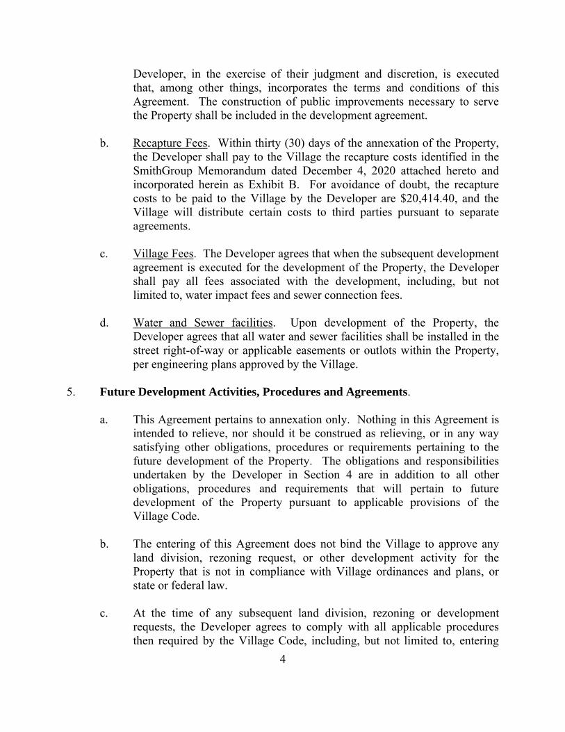
Developer, in the exercise of their judgment and discretion, is executed that, among other things, incorporates the terms and conditions of this Agreement. The construction of public improvements necessary to serve the Property shall be included in the development agreement.
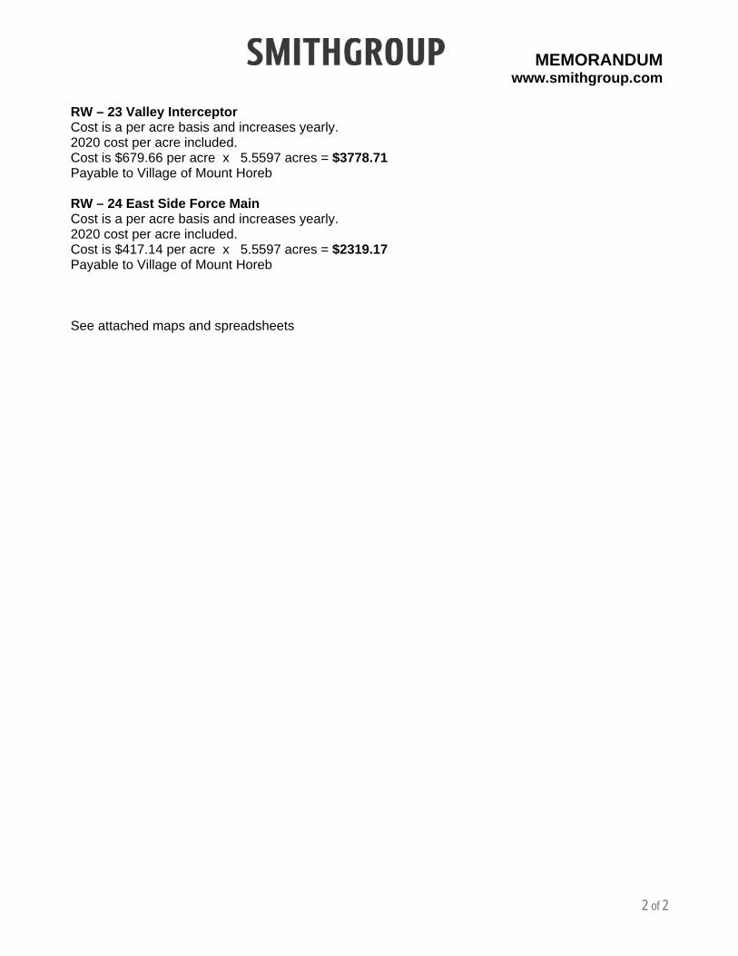
b. Recapture Fees. Within thirty (30) days of the annexation of the Property,
the Developer shall pay to the Village the recapture costs identified in the SmithGroup Memorandum dated December 4, 2020 attached hereto and incorporated herein as Exhibit B. For avoidance of doubt, the recapture costs to be paid to the Village by the Developer are $20,414.40, and the Village will distribute certain costs to third parties pursuant to separate agreements.
c. Village Fees. The Developer agrees that when the subsequent development
agreement is executed for the development of the Property, the Developer shall pay all fees associated with the development, including, but not limited to, water impact fees and sewer connection fees.
d. Water and Sewer facilities. Upon development of the Property, the
Developer agrees that all water and sewer facilities shall be installed in the street right-of-way or applicable easements or outlots within the Property, per engineering plans approved by the Village.
5. Future Development Activities, Procedures and Agreements.
a. This Agreement pertains to annexation only. Nothing in this Agreement is intended to relieve, nor should it be construed as relieving, or in any way satisfying other obligations, procedures or requirements pertaining to the future development of the Property. The obligations and responsibilities undertaken by the Developer in Section 4 are in addition to all other obligations, procedures and requirements that will pertain to future development of the Property pursuant to applicable provisions of the Village Code.
b. The entering of this Agreement does not bind the Village to approve any
land division, rezoning request, or other development activity for the Property that is not in compliance with Village ordinances and plans, or state or federal law.
c. At the time of any subsequent land division, rezoning or development
requests, the Developer agrees to comply with all applicable procedures then required by the Village Code, including, but not limited to, entering
5
into a separate agreement for land division improvements acceptable to the Village pursuant to the Village Code. Among other things, the agreement for land division improvements shall set forth the required dedications and improvements, shall identify the specifications and construction standards for the dedications and improvements, shall establish cost responsibilities, and shall impose financial security requirements for such improvements, all in accordance with the then current provisions of the Village Code.
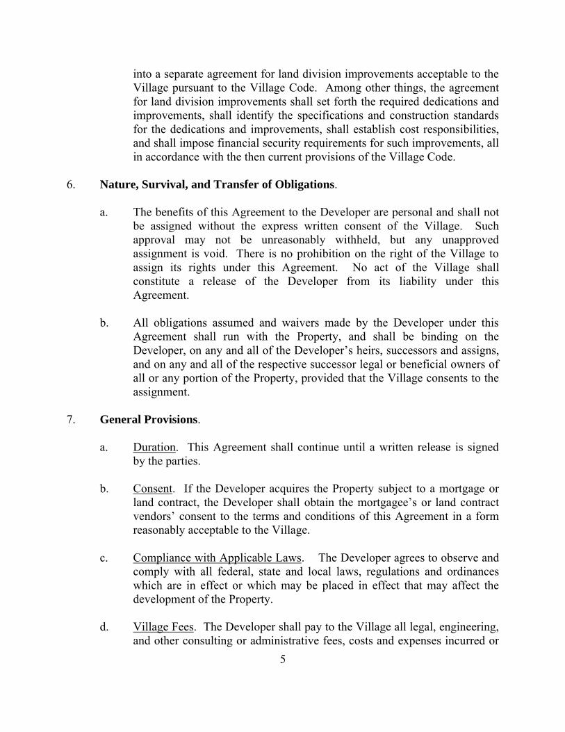
6. Nature, Survival, and Transfer of Obligations.
a. The benefits of this Agreement to the Developer are personal and shall not be assigned without the express written consent of the Village. Such approval may not be unreasonably withheld, but any unapproved assignment is void. There is no prohibition on the right of the Village to assign its rights under this Agreement. No act of the Village shall constitute a release of the Developer from its liability under this Agreement.
b. All obligations assumed and waivers made by the Developer under this
Agreement shall run with the Property, and shall be binding on the Developer, on any and all of the Developer’s heirs, successors and assigns, and on any and all of the respective successor legal or beneficial owners of all or any portion of the Property, provided that the Village consents to the assignment.
7. General Provisions.
a. Duration. This Agreement shall continue until a written release is signed by the parties.
b. Consent. If the Developer acquires the Property subject to a mortgage or
land contract, the Developer shall obtain the mortgagee’s or land contract vendors’ consent to the terms and conditions of this Agreement in a form reasonably acceptable to the Village.
c. Compliance with Applicable Laws. The Developer agrees to observe and
comply with all federal, state and local laws, regulations and ordinances which are in effect or which may be placed in effect that may affect the development of the Property.
d. Village Fees. The Developer shall pay to the Village all legal, engineering,
and other consulting or administrative fees, costs and expenses incurred or

6
accrued in connection with the review and processing of plans for the annexation and development of the Property and in connection with the negotiation, preparation, consideration and review of this Agreement.
e. Recording. The Village may record a copy of this Agreement or a notice of
this Agreement with the Dane County Register of Deeds Office. The recording costs shall be paid by the Developer.
f. Governing Law. This Agreement shall be governed by, and enforced in
accordance with, the laws of the State of Wisconsin. Any claim arising under this Agreement shall be brought in Dane County Circuit Court, Dane County, Wisconsin.
g. No Third Party Beneficiaries. No claim as a third party beneficiary under
this Agreement by any person shall be made or valid against the parties.
h. Amendments and Modifications. No amendment or modification to this Agreement shall be effective until it is reduced to writing and approved and executed by all parties to this Agreement.
i. Interpretation. This Agreement shall be construed without regard to the
identity of the party who drafted the various provisions of this Agreement. Moreover, each and every provision of this Agreement shall be construed as though all parties to this Agreement participated equally in the drafting of this Agreement. As a result of the foregoing, any rule of construction that a document is to be construed against the drafting party shall not be applicable to this Agreement.
j. Entire Agreement. This Agreement constitutes the entire agreement
between the parties and supersedes any and all prior agreements and negotiations between the parties, whether written or oral, relating to the subject matter of this Agreement.
k. Severability. If any part of this Agreement or its application to any person
or property be held invalid by a court of competent jurisdiction, the remaining provisions of this Agreement shall not be impaired thereby, and the remaining provisions shall be interpreted, applied and enforced so as to achieve, as near as may be, the purpose and intent of the Agreement to the greatest extent permitted by applicable law.
l. Non-Waiver. The Village shall be under no obligation to exercise any of
the rights granted to it in this Agreement. The failure of the Village to

7
exercise at any time any right granted to the Village shall not be deemed or construed to be a waiver of that right, nor shall the failure void or affect the Village’s right to enforce that right or any other right.
m. Authority. The parties agree that the undersigned signatories to this
Agreement have full power and authority to act on behalf of the parties, and that all necessary and enabling resolutions have been enacted.
n. Counterparts. This Agreement may be executed in one or more
counterparts and upon execution and delivery by each of the parties hereto shall constitute one and the same enforceable agreement.
[Signature pages to follow]
8
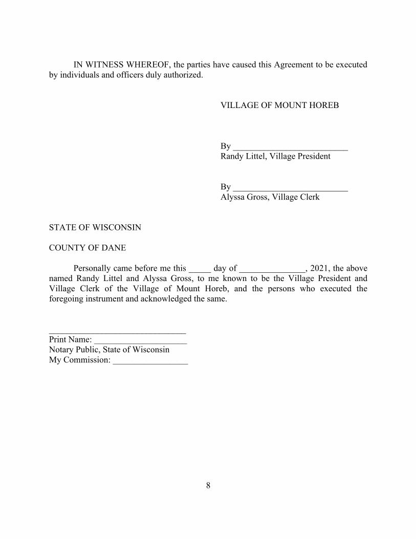
IN WITNESS WHEREOF, the parties have caused this Agreement to be executed
by individuals and officers duly authorized. VILLAGE OF MOUNT HOREB By __________________________ Randy Littel, Village President By __________________________ Alyssa Gross, Village Clerk STATE OF WISCONSIN COUNTY OF DANE Personally came before me this _____ day of _______________, 2021, the above named Randy Littel and Alyssa Gross, to me known to be the Village President and Village Clerk of the Village of Mount Horeb, and the persons who executed the foregoing instrument and acknowledged the same. _______________________________ Print Name: _____________________ Notary Public, State of Wisconsin My Commission: _________________
9
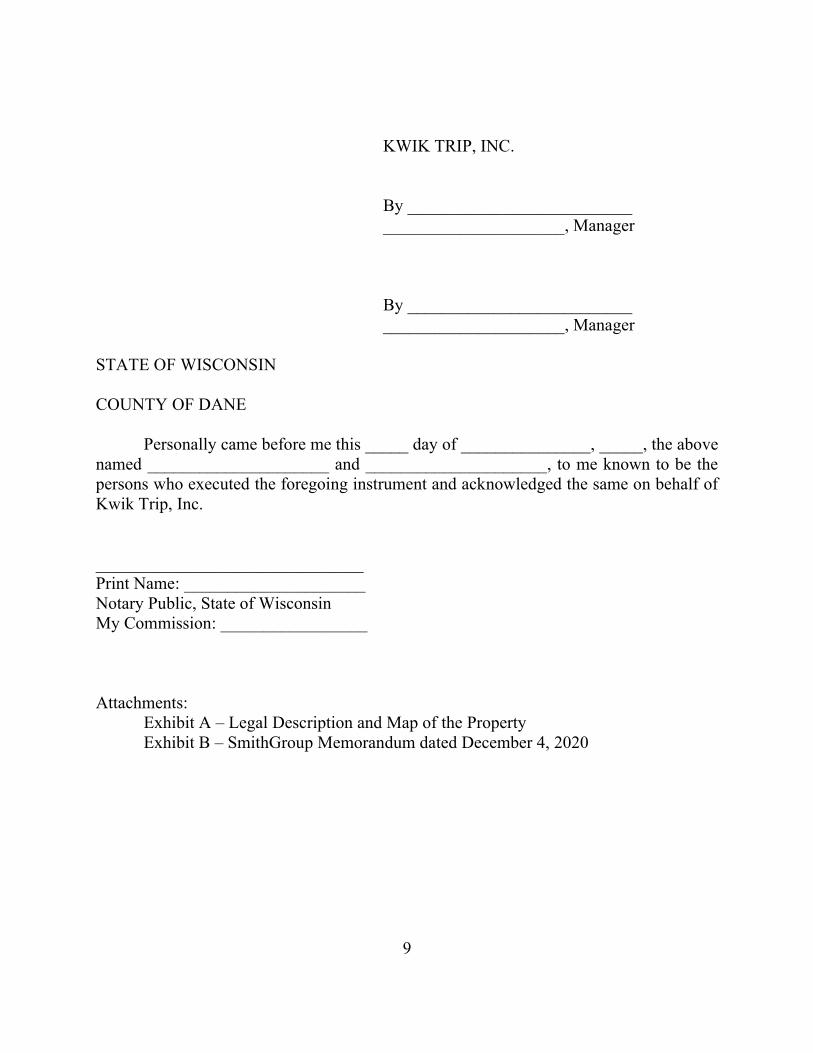
KWIK TRIP, INC. By __________________________ _____________________, Manager By __________________________ _____________________, Manager STATE OF WISCONSIN COUNTY OF DANE Personally came before me this _____ day of _______________, _____, the above named _____________________ and _____________________, to me known to be the persons who executed the foregoing instrument and acknowledged the same on behalf of Kwik Trip, Inc. _______________________________ Print Name: _____________________ Notary Public, State of Wisconsin My Commission: _________________
Attachments:
Exhibit A – Legal Description and Map of the Property Exhibit B – SmithGroup Memorandum dated December 4, 2020
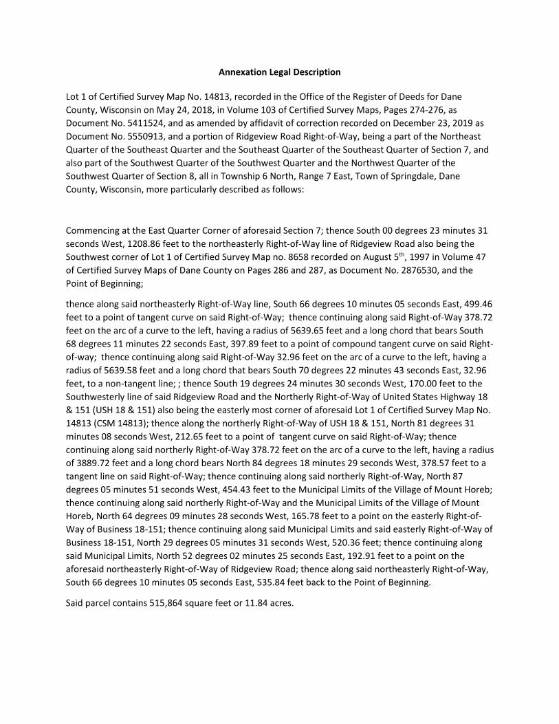
Annexation Legal Description
Lot 1 of Certified Survey Map No. 14813, recorded in the Office of the Register of Deeds for Dane
County, Wisconsin on May 24, 2018, in Volume 103 of Certified Survey Maps, Pages 274-276, as
Document No. 5411524, and as amended by affidavit of correction recorded on December 23, 2019 as
Document No. 5550913, and a portion of Ridgeview Road Right-of-Way, being a part of the Northeast
Quarter of the Southeast Quarter and the Southeast Quarter of the Southeast Quarter of Section 7, and
also part of the Southwest Quarter of the Southwest Quarter and the Northwest Quarter of the
Southwest Quarter of Section 8, all in Township 6 North, Range 7 East, Town of Springdale, Dane
County, Wisconsin, more particularly described as follows:
Commencing at the East Quarter Corner of aforesaid Section 7; thence South 00 degrees 23 minutes 31
seconds West, 1208.56 feet to the northeasterly Right-of-Way line of Ridgeview Road also being the
Southwest corner of Lot 1 of Certified Survey Map no. 8658 recorded on August 5th, 1997 in Volume 47
of Certified Survey Maps of Dane County on Pages 286 and 287, as Document No. 2876530, and the
Point of Beginning;
thence along said northeasterly Right-of-Way line, South 66 degrees 10 minutes 05 seconds East, 499.46
feet to a point of tangent curve on said Right-of-Way; thence continuing along said Right-of-Way 378.72
feet on the arc of a curve to the left, having a radius of 5639.65 feet and a long chord that bears South
68 degrees 11 minutes 22 seconds East, 397.89 feet to a point of compound tangent curve on said Right-
of-way; thence continuing along said Right-of-Way 32.96 feet on the arc of a curve to the left, having a
radius of 5639.58 feet and a long chord that bears South 70 degrees 22 minutes 43 seconds East, 32.96
feet, to a non-tangent line; ; thence South 19 degrees 24 minutes 30 seconds West, 170.00 feet to the
Southwesterly line of said Ridgeview Road and the Northerly Right-of-Way of United States Highway 18
& 151 (USH 18 & 151) also being the easterly most corner of aforesaid Lot 1 of Certified Survey Map No.
14813 (CSM 14813); thence along the northerly Right-of-Way of USH 18 & 151, North 81 degrees 31
minutes 08 seconds West, 212.65 feet to a point of tangent curve on said Right-of-Way; thence
continuing along said northerly Right-of-Way 378.72 feet on the arc of a curve to the left, having a radius
of 3889.72 feet and a long chord bears North 84 degrees 18 minutes 29 seconds West, 378.57 feet to a
tangent line on said Right-of-Way; thence continuing along said northerly Right-of-Way, North 87
degrees 05 minutes 51 seconds West, 454.43 feet to the Municipal Limits of the Village of Mount Horeb;
thence continuing along said northerly Right-of-Way and the Municipal Limits of the Village of Mount
Horeb, North 64 degrees 09 minutes 28 seconds West, 165.78 feet to a point on the easterly Right-of-
Way of Business 18-151; thence continuing along said Municipal Limits and said easterly Right-of-Way of
Business 18-151, North 29 degrees 05 minutes 31 seconds West, 520.36 feet; thence continuing along
said Municipal Limits, North 52 degrees 02 minutes 25 seconds East, 192.91 feet to a point on the
aforesaid northeasterly Right-of-Way of Ridgeview Road; thence along said northeasterly Right-of-Way,
South 66 degrees 10 minutes 05 seconds East, 535.84 feet back to the Point of Beginning.
Said parcel contains 515,864 square feet or 11.84 acres.
8.

VILLAGE OF MOUNT HOREB
TOWN OF SPRINGDALE
LOT 1
CSM NO. 14813
LOT 1
CSM NO. 8658
LOT 1
CSM NO. 13538
LANDS
LANDS
LOT 1
CSM NO. 15417
SECT
ION
7SE
CTIO
N 8
SW-SW
NW-SW
SE-SE
NE-SE
TOWN OF SPRINGDALE
L-2
L-3
L-1
L-5
L-4
S 66° 10' 05" E 1035.30'
C-2
C-3
C-1
LANDSP.O.B. 535.84'
499.46'
EAST
LINE
OF T
HESO
UTHE
AST Q
UART
EROF
SECT
ION
7S 0
° 23'
31" W
2647
.27'
MON
. TO
MON
.
1208
.86'
1438
.41'
N 87° 05' 51" W 454.43'
PROJECT NO:
SHEET NO:
SURVEYED BY:
DRAWN BY:
APPROVED BY: 1 of 1
PREPARED FOR:PREPARED BY:
EXHIBIT "A"
ANNEXATION EXHIBIT
---
JWS
ZMR/JWS 190663
LOT ONE(1), CERTIFIED SURVEY MAP NO. 14813, RECORDED IN THE OFFICE OF THE REGISTER OF DEEDS FOR DANECOUNTY, WISCONSIN ON MAY 24, 2018, IN VOLUME 103 OF CERTIFIED SURVEY MAPS, PAGES 274-276, AS DOCUMENT NO.
5411524, AND AS AMENDED BY AFFIDAVIT OF CORRECTION RECORDED ON DECEMBER 23, 2019 AS DOCUMENT NO. 5550913,AND A PORTION OF RIDGEVIEW ROAD RIGHT-OF-WAY, BEING A PART OF THE NORTHEAST QUARTER OF THE SOUTHEAST
QUARTER AND THE SOUTHEAST QUARTER OF THE SOUTHEAST QUARTER OF SECTION 7, AND ALSO PART OF THESOUTHWEST QUARTER OF THE SOUTHWEST QUARTER AND THE NORTHWEST QUARTER OF THE SOUTHWEST QUARTER OF
SECTION 8, ALL IN TOWNSHIP 6 NORTH, RANGE 7 EAST, TOWN OF SPRINGDALE, DANE COUNTY, WISCONSIN.
0' 125' 250'
KWIK TRIP, INC.1626 OAK STREETPO BOX 2107LACROSSE, WI 54602
312 EAST MAIN STREETMOUNT HOREB, WI 53572www.wyserengineering.com
LINE TABLE
LINE #
L-1L-2
DISTANCEBEARING
CENTERLINERIGHT-OF-WAY LINE
SECTION/QUARTER LINEPLATTED LINE
LEGEND
EXHIBIT NOTES:
1. NORTH REFERENCE FOR THIS EXHIBIT IS BASEDON WISCONSIN COORDINATE REFERENCE SYSTEM,NAD 83 (2011) - DANE COUNTY (WISCRS-DANE),GRID NORTH. THE EAST LINE OF THE SOUTHEASTQUARTER OF SECTION 7 WAS MEASURED TO BEARS 0 23' 31" W.
SECTION CORNER
E-1/4 CORNERSECTION 7-6-7
VILLAGE OF MOUNT HOREB
TOWN OF SPRINGDALER
ID
G
E
V
IE
W
R
O
A
D
170' RIGHT-OF-WAY - PREVIOUSLY U.S.H. 18 & 151
RIGHT-OF-WAY
SE CORNERSECTION 7-6-7
B
U
S
IN
E
S
S
18
-15
1 E
A
S
T
RIGHT-OF-WAY VARIES - ALSO KNOWN AS COUNTY
TRUNK HIGHWAY "ID" AND SPRINGDALE STREETU
.S. H
IGH
W
AY
18
& 1
51
RIGHT-OF-WAY VARIES
MUNICIPAL LIMITSVILLAGE OF MOUNTHOREB / TOWN OFSPRINGDALE
ANNEXATION LIMITS
VILLAGE OF MOUNT HOREB
515,864 SQUARE FEETOR 11.84 ACRES
PARCEL
L-3L-4L-5
CURVE TABLE
CURVE #
C-1C-2C-3
CURVE LENGTH
397.97'32.96'378.72'
RADIUS
5639.65'5639.58'3889.72'
DELTA
4° 02' 35"0° 20' 06"5° 34' 43"
CHORD BEARING
S 68° 11' 22" ES 70° 22' 43" EN 84° 18' 29" W
CHORD LENGTH
397.89'32.96'378.57'
TANGENT IN
S 66° 10' 05" ES 70° 12' 40" EN 81° 31' 08" W
TANGENT OUT
S 70° 12' 40" ES 70° 32' 46" EN 87° 05' 51" W
212.65'N 81° 31' 08" W165.78'N 64° 09' 28" W520.36'N 29° 05' 31" W192.91'N 52° 02' 25" E
170.00'S 19° 24' 30" W
AutoCAD SHX Text
____
AutoCAD SHX Text
_________
AutoCAD SHX Text
____
AutoCAD SHX Text
________
AutoCAD SHX Text
____
AutoCAD SHX Text
_________
AutoCAD SHX Text
_____
AutoCAD SHX Text
_____
AutoCAD SHX Text
____
AutoCAD SHX Text
_________
AutoCAD SHX Text
_____
AutoCAD SHX Text
NORTH
AutoCAD SHX Text
°

MEMORANDUM www.smithgroup.com
1 of 2
PROJECT Mount Horeb – Kwik Trip DATE 12/4/2020
PROJECT NO. 50581.001
PROJECT LOCATION
Village of Mount Horeb
SUBJECT Kwik Trip Annexation – recapture costs
PREPARED BY Robert Wright, PE
DISTRIBUTION
NAME COMPANY EMAIL PHONE
Kathy Hagen Village of Mount Horeb
Nic Owen Village of Mount Horeb
Kwik Trip Annexation – recapture calculations
CSM # 14813Baker / Kwik Trip CSMLot 1 Size = 242,180 square feet | 5.5597 acres
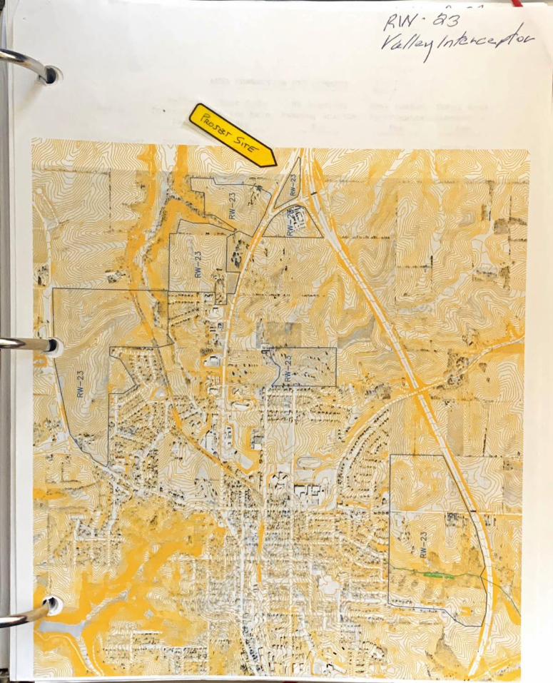
Recapture Areas for this site:RW – 18 Water Main Under CTH ID RW – 21 Wayside Pumping Station and Force Main RW – 23 Valley Interceptor RW – 24 East Side Force Main
Recapture calculations:RW – 18 Water Main Under CTH ID This is for the water main extension installed under CTH ID.Cost is a Lump Sum of $6350.00Payable to Symdon
RW – 21 Wayside Pumping Station and Force Main This is for the new pumping station at Wayside, new force main, and upgrades to impellers at Brookwood Pumping Station.Cost is a per acre basis.Cost is $1,432.9039 per acre x 5.5597 acres = $7966.52Payable to CTH ID, LLC
khagen
Text Box
EXHIBIT "B"
MEMORANDUM www.smithgroup.com
2 of 2
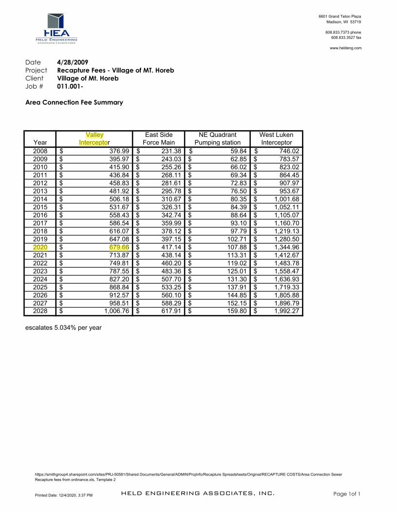
RW – 23 Valley InterceptorCost is a per acre basis and increases yearly.2020 cost per acre included.Cost is $679.66 per acre x 5.5597 acres = $3778.71Payable to Village of Mount Horeb
RW – 24 East Side Force MainCost is a per acre basis and increases yearly.2020 cost per acre included.Cost is $417.14 per acre x 5.5597 acres = $2319.17Payable to Village of Mount Horeb
See attached maps and spreadsheets


rwright
Callout
1/2 ($6,350 to Symdon)
rwright
Highlight
rwright
Highlight

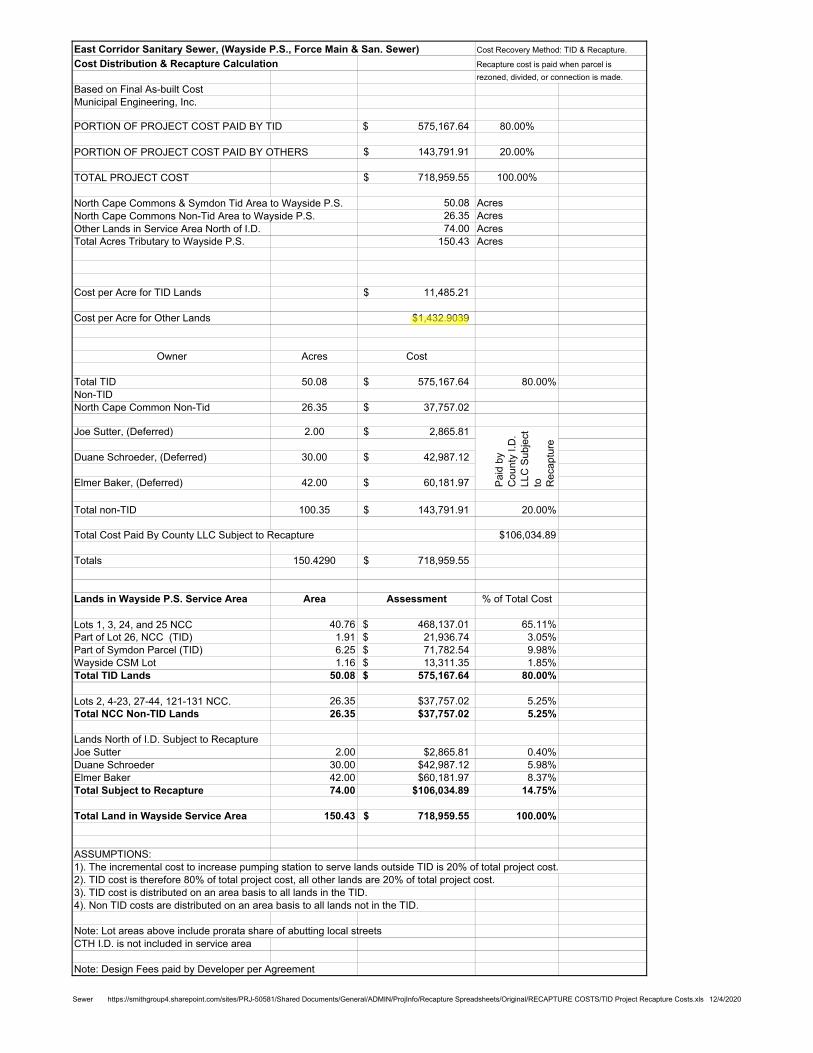
East Corridor Sanitary Sewer, (Wayside P.S., Force Main & San. Sewer) Cost Recovery Method: TID & Recapture.
Cost Distribution & Recapture Calculation Recapture cost is paid when parcel is
rezoned, divided, or connection is made.
Based on Final As-built Cost
Municipal Engineering, Inc.
PORTION OF PROJECT COST PAID BY TID 575,167.64$ 80.00%
PORTION OF PROJECT COST PAID BY OTHERS 143,791.91$ 20.00%
TOTAL PROJECT COST 718,959.55$ 100.00%
North Cape Commons & Symdon Tid Area to Wayside P.S. 50.08 Acres
North Cape Commons Non-Tid Area to Wayside P.S. 26.35 Acres
Other Lands in Service Area North of I.D. 74.00 Acres
Total Acres Tributary to Wayside P.S. 150.43 Acres
Cost per Acre for TID Lands 11,485.21$
Cost per Acre for Other Lands $1,432.9039
Owner Acres Cost
Total TID 50.08 575,167.64$ 80.00%
Non-TID
North Cape Common Non-Tid 26.35 37,757.02$
Joe Sutter, (Deferred) 2.00 2,865.81$
Duane Schroeder, (Deferred) 30.00 42,987.12$
Elmer Baker, (Deferred) 42.00 60,181.97$
Total non-TID 100.35 143,791.91$ 20.00%
Total Cost Paid By County LLC Subject to Recapture $106,034.89
Totals 150.4290 718,959.55$
Lands in Wayside P.S. Service Area Area Assessment % of Total Cost
Lots 1, 3, 24, and 25 NCC 40.76 468,137.01$ 65.11%
Part of Lot 26, NCC (TID) 1.91 21,936.74$ 3.05%
Part of Symdon Parcel (TID) 6.25 71,782.54$ 9.98%
Wayside CSM Lot 1.16 13,311.35$ 1.85%
Total TID Lands 50.08 575,167.64$ 80.00%
Lots 2, 4-23, 27-44, 121-131 NCC. 26.35 $37,757.02 5.25%
Total NCC Non-TID Lands 26.35 $37,757.02 5.25%
Lands North of I.D. Subject to Recapture
Joe Sutter 2.00 $2,865.81 0.40%
Duane Schroeder 30.00 $42,987.12 5.98%
Elmer Baker 42.00 $60,181.97 8.37%
Total Subject to Recapture 74.00 $106,034.89 14.75%
Total Land in Wayside Service Area 150.43 718,959.55$ 100.00%
ASSUMPTIONS:
1). The incremental cost to increase pumping station to serve lands outside TID is 20% of total project cost.
2). TID cost is therefore 80% of total project cost, all other lands are 20% of total project cost.
3). TID cost is distributed on an area basis to all lands in the TID.
4). Non TID costs are distributed on an area basis to all lands not in the TID.
Note: Lot areas above include prorata share of abutting local streets
CTH I.D. is not included in service area
Note: Design Fees paid by Developer per Agreement
Pa
id b
y
Co
un
ty I
.D.
LL
C S
ub
ject
to
Re
ca
ptu
re
Sewer https://smithgroup4.sharepoint.com/sites/PRJ-50581/Shared Documents/General/ADMIN/ProjInfo/Recapture Spreadsheets/Original/RECAPTURE COSTS/TID Project Recapture Costs.xls 12/4/2020
rwright
Highlight
$1,432.903
rwright
Highlight
39
rwright
Callout
5.5597 acres of the 42 Baker areas for Kwik Trip Annex.
6601 Grand Teton Plaza
Madison, WI 53719
608.833.7373 phone
608.833.3527 fax
www.heldeng.com
Date 4/28/2009
Project Recapture Fees - Village of MT. Horeb
Client Village of Mt. Horeb
Job # 011.001-
Area Connection Fee Summary
Valley East Side NE Quadrant West LukenYear Interceptor Force Main Pumping station Interceptor
2008 376.99$ 231.38$ 59.84$ 746.02$
2009 395.97$ 243.03$ 62.85$ 783.57$
2010 415.90$ 255.26$ 66.02$ 823.02$
2011 436.84$ 268.11$ 69.34$ 864.45$
2012 458.83$ 281.61$ 72.83$ 907.97$
2013 481.92$ 295.78$ 76.50$ 953.67$
2014 506.18$ 310.67$ 80.35$ 1,001.68$
2015 531.67$ 326.31$ 84.39$ 1,052.11$
2016 558.43$ 342.74$ 88.64$ 1,105.07$
2017 586.54$ 359.99$ 93.10$ 1,160.70$
2018 616.07$ 378.12$ 97.79$ 1,219.13$
2019 647.08$ 397.15$ 102.71$ 1,280.50$
2020 679.66$ 417.14$ 107.88$ 1,344.96$
2021 713.87$ 438.14$ 113.31$ 1,412.67$
2022 749.81$ 460.20$ 119.02$ 1,483.78$
2023 787.55$ 483.36$ 125.01$ 1,558.47$
2024 827.20$ 507.70$ 131.30$ 1,636.93$
2025 868.84$ 533.25$ 137.91$ 1,719.33$
2026 912.57$ 560.10$ 144.85$ 1,805.88$
2027 958.51$ 588.29$ 152.15$ 1,896.79$ 2028 1,006.76$ 617.91$ 159.80$ 1,992.27$
escalates 5.034% per year
https://smithgroup4.sharepoint.com/sites/PRJ-50581/Shared Documents/General/ADMIN/ProjInfo/Recapture Spreadsheets/Original/RECAPTURE COSTS/Area Connection Sewer
Recapture fees from ordinance.xls, Template 2
Printed Date: 12/4/2020, 3:37 PM HELD ENGINEERING ASSOCIATES, INC. Page 1of 1
rwright
Highlight
Valley
rwright
Highlight
Intercepto
rwright
Highlight
679.66
rwright
Highlight
2020
rwright
Callout
RW-23


6601 Grand Teton Plaza
Madison, WI 53719
608.833.7373 phone
608.833.3527 fax
www.heldeng.com
Date 4/28/2009
Project Recapture Fees - Village of MT. Horeb
Client Village of Mt. Horeb
Job # 011.001-
Area Connection Fee Summary
Valley East Side NE Quadrant West LukenYear Interceptor Force Main Pumping station Interceptor
2008 376.99$ 231.38$ 59.84$ 746.02$
2009 395.97$ 243.03$ 62.85$ 783.57$
2010 415.90$ 255.26$ 66.02$ 823.02$
2011 436.84$ 268.11$ 69.34$ 864.45$
2012 458.83$ 281.61$ 72.83$ 907.97$
2013 481.92$ 295.78$ 76.50$ 953.67$
2014 506.18$ 310.67$ 80.35$ 1,001.68$
2015 531.67$ 326.31$ 84.39$ 1,052.11$
2016 558.43$ 342.74$ 88.64$ 1,105.07$
2017 586.54$ 359.99$ 93.10$ 1,160.70$
2018 616.07$ 378.12$ 97.79$ 1,219.13$
2019 647.08$ 397.15$ 102.71$ 1,280.50$
2020 679.66$ 417.14$ 107.88$ 1,344.96$
2021 713.87$ 438.14$ 113.31$ 1,412.67$
2022 749.81$ 460.20$ 119.02$ 1,483.78$
2023 787.55$ 483.36$ 125.01$ 1,558.47$
2024 827.20$ 507.70$ 131.30$ 1,636.93$
2025 868.84$ 533.25$ 137.91$ 1,719.33$
2026 912.57$ 560.10$ 144.85$ 1,805.88$
2027 958.51$ 588.29$ 152.15$ 1,896.79$ 2028 1,006.76$ 617.91$ 159.80$ 1,992.27$
escalates 5.034% per year
https://smithgroup4.sharepoint.com/sites/PRJ-50581/Shared Documents/General/ADMIN/ProjInfo/Recapture Spreadsheets/Original/RECAPTURE COSTS/Area Connection Sewer
Recapture fees from ordinance.xls, Template 2
Printed Date: 12/4/2020, 3:37 PM HELD ENGINEERING ASSOCIATES, INC. Page 1of 1
rwright
Callout
RW-24
rwright
Highlight
2020
rwright
Highlight
417.14
rwright
Highlight
East Sid
rwright
Highlight
Force Main
VILLAGE OF MOUNT HOREB ORDINANCE 2020-19
AN ORDINANCE CHANGING THE ZONING CLASSIFICATION
OF LOT 1 CSM 14813 PARCEL 0607-074-9520-0 TO PB PLANNED BUSINESS WITH A PD-1 PLANNED DEVELOPMENT
WHEREAS, Elmer C and Norma J Baker Joint Revocable Trust is the owner of Lot 1 CSM 14813, further described as parcel 0607-074-9520-0 in the Town of Springdale; and
WHEREAS, Kwik Trip, Inc applied to request the zoning classification of the above referenced property be changed from A-1 Agriculture to PB Planned Business with a PD-1 Planned Development following annexation to the Village of Mount Horeb for a convenience store with fueling station and carwash; and
WHEREAS, the Village Plan Commission/Historic Preservation Commission held a public hearing regarding the zoning request on December 16, 2020 which was preceded by publication of a class 2 notice under ch. 985, Stats.; and
WHEREAS, the Village Plan Commission/Historic Preservation Commission determined that changing the zoning classification of the above referenced property to PB Planned Business with a PD-1 Planned Development and Specific Implementation Plan would promote the public health, safety, and general welfare of the Village and would allow appropriate use of the property, and therefore recommends that the zoning classification of the property be changed as requested; and
WHEREAS, the proposed use is consistent with the Comprehensive Plan; and
WHEREAS, the Village Board concurs with the recommendation of the Plan
Commission/Historic Preservation Commission. NOW THEREFORE, the Village Board of the Village of Mount Horeb, Dane County,
Wisconsin, do ordain as follows: Section 1. The zoning classification of the above referenced property is hereby
designated as PB Planned Business with a PD-1 Planned Development conditioned on annexation of the property to the Village, and the Zoning Map of the Village shall be amended accordingly.
Section 2. This Ordinance shall take effect after passage and posting pursuant to
law.

The foregoing ordinance was duly adopted by the Village Board of the Village
Mount Horeb at its regular meeting held on January 6, 2020. APPROVED: Randy J Littel, Village President ATTEST: Alyssa Gross, Village Clerk APPROVED: PUBLISHED/POSTED:

Village of Mount Horeb / Mount Horeb Utilities Mission, Vision, ValuesOutcome of Fall 2019 Village Wide Strategic Planning Meeting (led by LaCoona Consulting)
Mission Heritage. Community. Opportunity.
Vision Statement With fun at the heart of all we do, we provide outstanding service, guide sustainable growth, and enhance the quality of life for all.
Core Values Quality Customer ServiceFinancial StabilityFriendly CommunityPrideStrong LeadershipFun