The geology of Sarawak deepwater and surrounding areas · regional seismic in Sarawak deepwater...
14
AAPG InternatwfIIli Conference d &bibiJwn '94 Augwt 21-24, 1994, Kuala Lumpur, MalaYJUz The geology of Sarawak deepwater and surrounding areas MOlm IDRUS ISMAIL, ABDUL RAHMAN EUSOFF, ABDUL MANAF MOHAMAD, SAHALAN ABD Azrz AND BARNEY MAHENDRAN Exploration Management Department PETRONAS 28th Floor Menara 1, Petronas Twin Towers P.O. Box 12444 50778 Kuala Lumpur Abstract: A geological and geophysical investigation of several key transects ofthe 1989 vintage seismic grid in the Sarawak deepwater was conducted in order to understand the sedimentation history and structural geology of the area. In the study area, two tectonostratigraphic provinces can be recognised, namely the North Luconia and West Luconia Provinces. The deep sedimentary basin of North Luconia is filled with 7-8 km of Tertiary sediments and are characterised by NNE-SSW trending extensional fault bounded features, buried hills and local occurrences of forced folds. On the eastern boundary, a major, NNE-SSW trending basin boundary fault separates it from the Northwest Sabah Platform. The latter by contrast is an attenuated crustal terrain characterised by NE-SW trending rift systems and generally thinner sedimentary cover of about only 2-4 km thick. To the southeast, the West Luconia Province which is a thick sedimentary basin with up to about 13 km of sediments, contains a very thick pile of post mid Miocene sedimentary section and is characterised by E-W trending growth faults and °a series of slumps and toe thrusts formed by gravity gliding. These overlie an older normal-faulted section at a mid Miocene unconformity. Generally, the crustal extension in the South China Sea and peripheral areas have generated various patterns of rift orientation and extensional axes. In North Luconia the NNE-SSW trending extensional elements parallel some of the basin axes in the N am Con Son Basin, offshore Vietnam. Finally, based on sequence stratigraphic framework, up to five sub-megasequences are recognised in the Sarawak deepwater. The age determination from well controls and correlation with the episodic crustal rifting and seafloor spreading in the South China Sea Basin has provided some insight on the tectonic evolution. INTRODUCTION The geology in Sarawak deepwater is closely associated and linked to the tectonic development of the South China Sea Basin. Several prominent workers from research institutions and from oil exploration companies have provided critical insight on the evolution of the Late Mesozoic to Tertiary aged South China Sea Basin. The activities of these exploration companies are directed to studying a number of the surrounding basins in order to understand the geology and the commercial potential of these areas. Our focus is the Sarawak deepwater and a small part of the surrounding area and our hope is that it would be a contribution to the overall understanding to the region. E-W oriented magnetic lineations in the South China Sea Basin with E-W trends were discovered (Ben Avraham and Uyeda, 1973) and correlated with the worldwide magnetic reversal trends that point to the age that the ocean floor in the eastern part of the South China Sea Basin came into existence was in 17-32 Ma. (Taylor and Hayes, Geol. Soc. MalaYJia, Bulletin 37, July 1995; pp. 165-178 1980). In the northern and southeastern margins, most normal faults that are associated with the crustal extension in the South China Sea Basin (Ru and Pigott, 1986) and some fractures in the oceanic crust (Briais et al., 1989) however appear to be NE- SW trending. This led to the suggestion of overall change in the direction of ocean floor spreading (Ben Avraham, 1978; Ru and Pigott, 1986). However, Briais et al. (1989) noted that the data sample spacing of the magnetic anomaly in the South China Sea Basin was too large and in order to account for the conflicting trends, concluded that the average trend of the magnetic anomaly is E-W and the trend of each anomaly segment is NE-SW. Nevertheless, with new support of a dense set of magnetic data, Briais et al. (1993) showed that the pattern of seafloor spreading is asymmetric. The main spreading appears to have developed first in the eastern part of the basin and to have propagated towards the southwest in two major steps at time anomaly 6b-7 (- 22 Ma) and at time anomaly 6 (- 19 Ma). The details and exact mechanism to explain
Transcript of The geology of Sarawak deepwater and surrounding areas · regional seismic in Sarawak deepwater...

AAPG InternatwfIIli Conference d &bibiJwn '94 Augwt 21-24, 1994, Kuala Lumpur, MalaYJUz
The geology of Sarawak deepwater and surrounding areas
MOlm IDRUS ISMAIL, ABDUL RAHMAN EUSOFF, ABDUL MANAF MOHAMAD,
SAHALAN ABD Azrz AND BARNEY MAHENDRAN
Exploration Management Department PETRONAS
28th Floor Menara 1, Petronas Twin Towers P.O. Box 12444
50778 Kuala Lumpur
Abstract: A geological and geophysical investigation of several key transects ofthe 1989 vintage seismic grid in the Sarawak deepwater was conducted in order to understand the sedimentation history and structural geology of the area. In the study area, two tectonostratigraphic provinces can be recognised, namely the North Luconia and West Luconia Provinces. The deep sedimentary basin of North Luconia is filled with 7-8 km of Tertiary sediments and are characterised by NNE-SSW trending extensional fault bounded features, buried hills and local occurrences of forced folds. On the eastern boundary, a major, NNE-SSW trending basin boundary fault separates it from the Northwest Sabah Platform. The latter by contrast is an attenuated crustal terrain characterised by NE-SW trending rift systems and generally thinner sedimentary cover of about only 2-4 km thick. To the southeast, the West Luconia Province which is a thick sedimentary basin with up to about 13 km of sediments, contains a very thick pile of post mid Miocene sedimentary section and is characterised by E-W trending growth faults and °a series of slumps and toe thrusts formed by gravity gliding. These overlie an older normal-faulted section at a mid Miocene unconformity. Generally, the crustal extension in the South China Sea and peripheral areas have generated various patterns of rift orientation and extensional axes. In North Luconia the NNE-SSW trending extensional elements parallel some of the basin axes in the N am Con Son Basin, offshore Vietnam. Finally, based on sequence stratigraphic framework, up to five sub-megasequences are recognised in the Sarawak deepwater. The age determination from well controls and correlation with the episodic crustal rifting and seafloor spreading in the South China Sea Basin has provided some insight on the tectonic evolution.
INTRODUCTION
The geology in Sarawak deepwater is closely associated and linked to the tectonic development of the South China Sea Basin. Several prominent workers from research institutions and from oil exploration companies have provided critical insight on the evolution of the Late Mesozoic to Tertiary aged South China Sea Basin. The activities of these exploration companies are directed to studying a number of the surrounding basins in order to understand the geology and the commercial potential of these areas. Our focus is the Sarawak deepwater and a small part of the surrounding area and our hope is that it would be a contribution to the overall understanding to the region.
E-W oriented magnetic lineations in the South China Sea Basin with E-W trends were discovered (Ben Avraham and Uyeda, 1973) and correlated with the worldwide magnetic reversal trends that point to the age that the ocean floor in the eastern part of the South China Sea Basin came into existence was in 17-32 Ma. (Taylor and Hayes,
Geol. Soc. MalaYJia, Bulletin 37, July 1995; pp. 165-178
1980). In the northern and southeastern margins, most normal faults that are associated with the crustal extension in the South China Sea Basin (Ru and Pigott, 1986) and some fractures in the oceanic crust (Briais et al., 1989) however appear to be NESW trending. This led to the suggestion of overall change in the direction of ocean floor spreading (Ben Avraham, 1978; Ru and Pigott, 1986). However, Briais et al. (1989) noted that the data sample spacing of the magnetic anomaly in the South China Sea Basin was too large and in order to account for the conflicting trends, concluded that the average trend of the magnetic anomaly is E-W and the trend of each anomaly segment is NE-SW. Nevertheless, with new support of a dense set of magnetic data, Briais et al. (1993) showed that the pattern of seafloor spreading is asymmetric. The main spreading appears to have developed first in the eastern part of the basin and to have propagated towards the southwest in two major steps at time anomaly 6b-7 (- 22 Ma) and at time anomaly 6 (-19 Ma).
The details and exact mechanism to explain
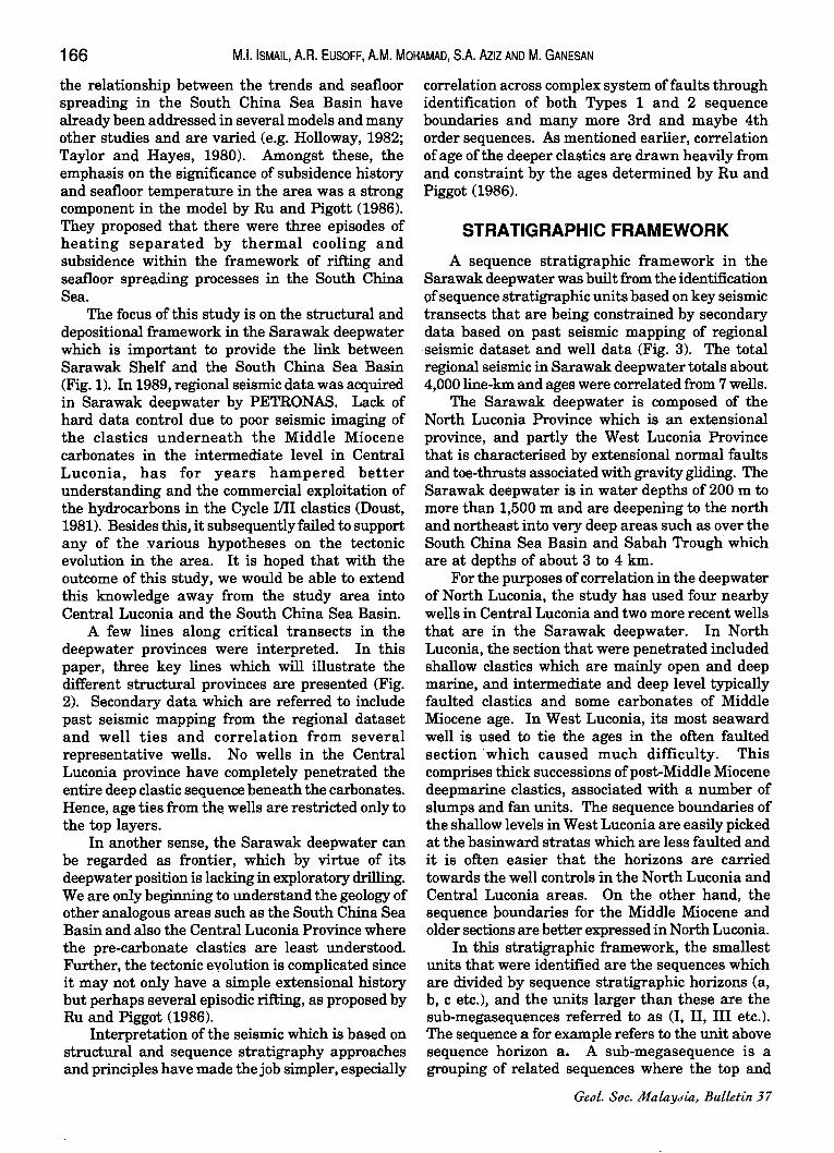
166 M.1. ISMAIL, A.R. EUSOFF, A.M. MOHAMAD, SA AzIZ AND M. GANESAN
the relationship between the trends and seafloor spreading in the South China Sea Basin have already been addressed in several models and many other studies and are varied (e.g. Holloway, 1982; Taylor and Hayes, 1980). Amongst these, the emphasis on the significance of subsidence history and seafloor temperature in the area was a strong component in the model by Ru and Pigott (1986). They proposed that there were three episodes of heating separated by thermal cooling and subsidence within the framework of rifting and seafloor spreading processes in the South China Sea.
The focus of this study is on the structural and depositional framework in the Sarawak deepwater which is ~portant to provide the link between Sarawak Shelf and the South China Sea Basin (Fig. 1). In 1989, regional seismic data was acquired in Sarawak deepwater by PETRONAS. Lack of hard data control due to poor seismic imaging of the clastics underneath the Middle Miocene carbonates in the intermediate level in Central Luconia, has for years hampered better understanding and the commercial exploitation of the hydrocarbons in the Cycle IIII clastics (Doust, 1981). Besides this, it subsequently failed to support any of the various hypotheses on the tectonic evolution in the area. It is hoped that with the outcome of this study, we would be able to extend this knowledge away from the study area into Central Luconia and the South China Sea Basin.
A few lines along critical transects in the deepwater provinces were interpreted. In this paper, three key lines which will illustrate the different structural provinces are presented (Fig. 2). Secondary data which are referred to include past seismic mapping from the regional dataset and well ties and correlation from several representative wells. No wells in the Central Luconia province have completely penetrated the entire deep clastic sequence beneath the carbonates. Hence, age ties from th~ wells are restricted only to the top layers.
In another sense, the Sarawak deepwater can be regarded as frontier, which by virtue of its deepwater position is lacking in exploratory drilling. We are only beginning to understand the geology of other analogous areas such as the South China Sea Basin and also the Central Luconia Province where the pre-carbonate clastics are least understood. Further, the tectonic evolution is complicated since it may not only have a simple extensional history but perhaps several episodic rifting, as proposed by Ru and Piggot (1986).
Interpretation of the seismic which is based on structural and sequence stratigraphy approaches and principles have made the job simpler, especially
correlation across complex system of faults through identification of both Types 1 and 2 sequence boundaries and many more 3rd and maybe 4th order sequences. As mentioned earlier, correlation of age of the deeper clastics are drawn heavily from and constraint by the ages determined by Ru and Piggot (1986).
STRATIGRAPHIC FRAMEWORK
A sequence stratigraphic framework in the Sarawak deepwater was built from the identification of sequence stratigraphic units based on key seismic transects that are being constrained by secondary data based on past seismic mapping of regional 'seismic dataset and well data (Fig. 3). The total regional seismic in Sarawak deepwater totals about 4,000 line-km and ages were correlated from 7 wells.
The Sarawak deepwater is composed of the North Luconia Province which is an extensional province, and partly the West Luconia Province that is characterised by extensional normal faults and toe-thrusts associated with gravity gliding. The Sarawak deepwater is in water depths of 200 m to more than 1,500 m and are deepening to the north and northeast into very deep areas such as over the South China Sea Basin and Sabah Trough which are at depths of about 3 to 4 km.
For the purposes of correlation in the deepwater of North Luconia, the study has used four nearby wells in Central Luconia and two more recent wells that are in the Sarawak deepwater. In North Luconia, the section that were penetrated included shallow clastics which are mainly open and deep marine, and intermediate and deep level typically faulted clastics and some carbonates of Middle Miocene age. In West Luconia, its most seaward well is used to tie the ages in the often faulted section 'which caused much difficulty. This comprises thick successions of post-Middle Miocene deepmarine clastics, associated with a number of slumps and fan units. The sequence boundaries of the shallow levels in West Luconia are easily picked at the basinward stratas which are less faulted and it is often easier that the horizons are carried towards the well controls in the North Luconia and Central Luconia areas. On the other hand, the sequence boundaries for the Middle Miocene and older sections are better expressed in North Luconia.
In this stratigraphic framework, the smallest units that were identified are the sequences which are divided by sequence stratigraphic horizons (a, b, c etc.), and the units larger than these are the sub-megasequences referred to as (I, II, III etc.). The sequence a for example refers to the unit above sequence horizon a. A sub-megasequence is a grouping of related sequences where the top and
Geol. Soc. Maiaytlia, Bu.lletin 37

~ <2-....... ~ v·,
IS'N
II'N
S'N
7'N
S'N
S'N
I'N
1/K1'E 11"E "~'F IIj'E IH'E , ( ;; , i)' j > Ii .. I
....-.:..- / ,.---/ J /./ .... _ .J
,I
u.~ - f/ I~·t; \ V /;<:( 1 ... • I ,- r1~'" -, . .I. ,.. "l
.,y ."". •
lr.!:!= "'
200 II ...
SEDIMENTARY BASINS IN SOUTH EAST ASIA Legend:
SEDIMENTARY THICKNESS
c:=J 1000 - < 4000 m ~ STUDY AREA
> 4000 m
Figure 1. Sedimentary basins in South East Asia.
'S'
11 '
g-
7'
"
I
I I
-i I m Q m 0 r 0 Q -< 0 .., (J) » ::0 » ::E » '" 0 m m -0 ::E » --I m ::0 » Z 0 en c: ::0 ::0 0 c: z 0 Z Q
» ::0 m » en
....... en '-l

u
§ fn ::E
168
rJl :J o W u ~ UJ 0:
'----''--_u
...J
< Il.
0: UJ Il. Il. :J
M.I. ISMAIL, A.R. EUSOFF, A.M. MOHAMAD, SA AzIZ AND M. GANESAN
p ~
v 68
Oevek:>pment of major regional unconformty (NL & NSP)
NL - NORTH LUCONIA NSP - NORTH\MOST SABAH PLATFORM WI.. - \MOST LUCONIA
Figure 2. Deepwater Sarawak and Sabah stratigraphic chart.
Bnlak ""'up
unc .
Subduction Jf oceanic ::rust atong _upar Una :Ounter : Iockwise 1 ·olation of : Borneo I

I \ \ I N 10 ', 0 I ;!
TATAU
, .PROVINCE
SWSARAWAK
PROVINCE
I
'-i
"
NWSABAH
PLATFORM
<~ ~~
,.../-/
// / 0~
1 OV
/
/1 .;?'~ ///#e;,~
I
\
,'-/\-- " \ \ "- \ ',\
" \'-
PROVINCE
BAUNGIAN
/
"
/ /
/
/
/ \
/ /
/
/,/",\
/
I
I
~0-,," ~'<) & / I
&~ // //
, ,,/
\ ///
\,/ " '// ... / ".0-/. - " (()"
,../ II ,<»> / ,/ _0~
I ~
Figure 3. Sarawak deepwater and surroundings seismic and well location map,
i ----I
TA~KAN
.I
~ASIN I I
i /
1:::::::---------
Legend:
SEISMIC
• WELL
-l :r: m Gl m o 5 Gl -< o ., en > :rJ
~ A o m m -u
~ m :rJ
> Z o en c: :rJ :rJ o c: z o Z Gl > :rJ m > en
...... (J) <D
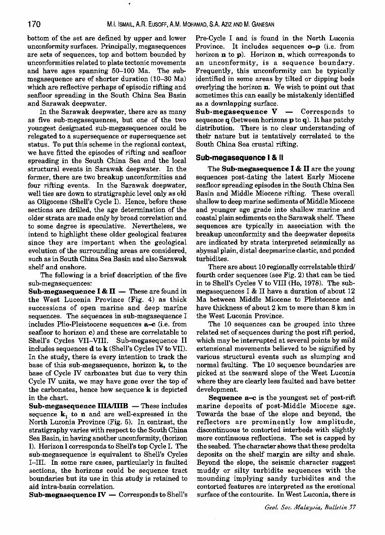
170 M.I. ISMAIL, A.R. EUSOFF, A.M. MOHAMAD, SA AzIZ AND M. GANESAN
bottom of the set are defined by upper and lower unconformity surfaces. Principally, megasequences are sets of sequences, top and bottom bounded by unconformities related to plate tectonic movements . and have ages spanning 50-100 Ma. The submegasequence are of shorter duration (10-30 Ma) which are reflective perhaps of episodic rifting and seafloor spreading in the South China Sea Basin and Sarawak deepwater.
In the Sarawak deepwater, there are as many as five sub-megasequences, but one of the two youngest designated sub-megasequences could be relegated to a supersequence or supersequence set status. To put this scheme in the regional context, we have fitted the episodes of rifting and seafloor spreading in the South China Sea and the local structural events in Sarawak deepwater. In the former, there are two breakup unconformities and four rifting events. In the Sarawak deepwater, well ties are down to stratigraphic level only as old as Oligocene (Shell's Cycle I). Hence, before these sections are drilled, the age determination of the older strata are made only by broad correlation and to some degree is speculative. Nevertheless, we intend to highlight these older geological features since they are important when the geological evolution of the surrounding areas are considered, such as in South China Sea Basin and also Sarawak shelf and onshore.
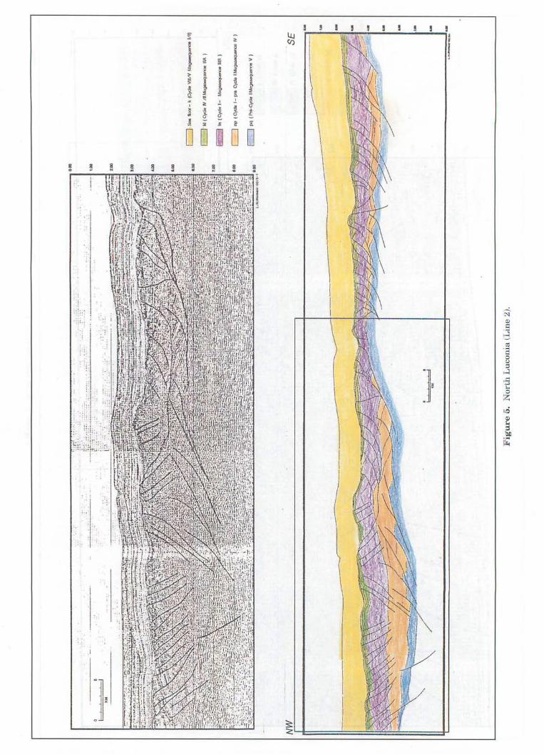
The following is a brief description of the five sub-megasequences: Sub-megasequence I & n - These are found in the West Luconia Province (Fig. 4) as thick successions of open marine and deep marine sequences. The sequences in sub-megasequence I includes Plio-Pleistocene sequences a-c (i.e. from seafloor to horizon c) and these are correlatable to Shell's Cycles VII-VIII. Sub-megasequence II includes sequences d to k (Shell's Cycles IV to VII). In the study, there is every intention to track the base of this sub-megasequence, horizon k, to the base of Cycle IV carbonates but due to very thin Cycle IV units, we may have gone over the top of the carbonates, hence how sequence k is depicted in the chart. Sub-megasequence IIIAIIIIB - These includes sequence kl to n and are well-expressed in the North Luconia Province (Fig. 5). In contrast, the stratigraphy varies with respect to the South China Sea Basin, in having another unconformity, (horizon 1). Horizon 1 corresponds to Shell's top Cycle I. The sub-megasequence is equivalent to Shell's Cycles I-III. In some rare cases, particularly in faulted· sections, the horizons could be sequence tract boundaries but its use in this study is retained to aid intra-basin correlation. Sub-megasequence IV - Corresponds to Shell's
Pre-Cycle I and is found in the North Luconia Province. It includes sequences o-p (i.e. from horizon n to p). Horizon n, which corresponds to an unconformity, is a sequence boundary. Frequently, this unconformity can be typically identified in some areas by tilted or dipping beds overlying the horizon n. We wish to point out that sometimes this can easily be mistakenly identified as a downlapping surface. Sub-megasequence V - Corresponds to sequence q (between horizons p to q). It has patchy distribution. There is no clear understanding of their nature but is tentatively correlated to the South China Sea crustal rifting.
Sub-megasequence I & II The Sub-megasequence I & n are the young
sequences post-dating the latest Early Miocene seafloor spreading episodes in the South China Sea Basin and Middle Miocene rifting. These overall shallow to deep marine sediments of Middle Miocene and younger age grade into shallow marine and coastal plain sediments on the Sarawak shelf. These sequences are typically in association with the breakup unconformity and the deepwater deposits are indicated by strata interpreted seismically as allyssal plain, distal deepmarine clastic, and ponded tUrbidites.
There are about 10 regionally correlatable third! fourth order sequences (see Fig. 2) that can be tied in to Shell's Cycles V to VIII (Ho, 1978). The submegasequences I & II have a duration of about 12 Ma between Middle Miocene to Pleistocene and have thickness of about 2 km to more than 8 km in the West Luconia Province.
The 10 sequences can be grouped into three related set of sequences during the post rift period, which may be interrupted at several points by mild extensional movements believed to be signified by various structural events such as slumping and normal faulting. The 10 sequence boundaries are picked at the seaward slope of the West Luconia where they are clearly less faulted and have better development.
Sequence a-c is the youngest set of post-rift marine deposits of post-Middle Miocene age. Towards the base of the slope and beyond, the reflectors are prominently low amplitude, discontinuous to contorted interbeds with slightly more continuous reflections. The set is capped by the seabed. The character shows that these prodelta deposits on the shelf margin are silty and shale. Beyond the slope, the seismic character suggest muddy or silty turbidite sequences with the mounding implying sandy turbidites and the contorted features are interpreted as the erosional surface of the contourite. In West Luconia, there is
Geol. Soc. MalaYJia, Bulletin 37

=:-5 .. ~ ., ~ ~ I
! ! §
~ § ~ ~ ~ 8 8 ~ ~ ~ • wi oj
:I ~ .
,
I I .-..
r-I Q)
.S 8 '" ·s 0 C,)
]-;::l
H .;.> rn Q)
~ ~ III J.c g. .... ~
~ . CI') '--________ ~
! ! ! ! ! ! ! ~
I ' • i ; iJ.J <:J)
f
; J J d , " .!. .!. i ~ ! ! ! ~ " ... ~ K
o 0 ~ 0 0 ~ !
\ \
\
. :1
~ Q)
c:: 8 (Ii
: : . -< q :l :.J :j
; ., ]. \
, .~
..c: -" i-o 0 Z Il5
I
<l) ':.)
& ... ~
I I I
:
:,:'1 , '. (
' . l:' . . .
J

THE GEOLOGY OF SARAWAK DEEPWATER AND SURROUNDING AREAS 173
high frequency of the contourite beds and erosive surfaces in these deepmarine sections and may be interrelated with sediment uplift due to episodes of folding and toe thrusting that culminated at horizon a.
Sequence d-g shows growth faulting character over the whole area and is recognised by its wedge-shaped packages that is formed thickest near major faults. The reflectors of each coarsening up sequence grade from weak amplitude, fairly continuous deepmarine units that goes into strong and continuous reflectors suggesting shallow marine on top. Sequence f-g shows a large scale slump with classic listric head scarp fractures, basal detachment planes and toe areas.
Sequence h-k represent the post rift fill deposits equivalent to Shell's Cycle V that commonly fill the lower half of many of the mildly subsiding lows between the pre-existing rift high. Along the bases of these sequences, the mounded features are the deepwater depositional clastics and prominent submarine that were derived from the uplifted graben shoulders. Ponded turbidites commonly occur in the post-rift sequences of North Luconia and are found within small symmetrical basins or structural lows bounded by minor faults. Each of these units has continuous and high amplitude reflection with gentle internal convergent or onlap at channel margin. The reflectors grade laterally into a thin, low amplitude successions over the flank high. Several localised disconformities can be identified within the overall section.
Sub-megasequence IIIA/IIIB The two depositional sequences, sub
megasequence lIlA and IIIB, are developed between a breakup unconformity in the Upper Oligocene and end of rifting in the Middle Miocene (Fig. 3). The identification of structural episodes in the North Luconia Province such as rift faulting, listric normal faulting and gravity gliding/slumping between these unconformities allow further sub-classification of these intervals into sub-megasequence IIIAIIIIB. This is one of the evidence based on the detailed structure for episodic rifting in the Sarawak deepwater area.
A brief description of sub-megasequence lIlA and IIIB are given below.
The development of sub-megasequence lIlA in North Luconia is believed to be correlatable to the tectonic episodes In South China Sea Basin. To the north, the end of seafloor spreading in the South China Sea Basin that was dated by the age of magnetic anomaly to be latest Early Miocene and a subsequent rifting event that followed (Ru and Pigott, 1986) probably marks the equivalent period in the South China Sea Basin. The submegasequence IlIA which is associated with rifting
July 1995
phase was probably accompanied by thermal uplift. The end of this sub-megasequence is signified by horizon k, a major unconformity in the Sarawak deepwater. Initiated in latest Early Miocene, it is represented by shallow to open marine sequences and changes laterally into coastal plain deposits. It was deposited within duration of about 12 Ma. Correlation with the wells at the shelf margin indicate that end of the sub-megasequence is equivalent to the Intra Cycle III. Due to thinness of Cycle IV, it probably extended into Cycle IV age in the deepwater area.
Generally, Sequence k2 - 1 is variable in thickness (about 600 msec) thinning towards the east and thicker towards shelf and the west. These reflectors are regularly spaced parallel layers, with moderate continuity. The sub-megasequence is bottomed by a sequence boundary (horizon 1) There are about three sequences identified as ~, ks and I. Correlation of the unconformity pose difficulties due to variable thickness of the sequence ~.
Sequence ~ is thinnest and represent the final stage of deposition of this group characterising the cessation offaulting. ~ graded from a reflection free sequence in the basin area to regular stack parallel reflectors on the shelf indicating low energy deep marine shale in the basinal area and shallow marine influence on stable shelfal area.
Sequence ks -1 have the wedge shape synrift character marked with truncations between the two sequences. The reflectors are strong and continuous within 1 and weaken up in k3. Sequence 1 is a much thicker sequence then ~, throughout this area. Detach structures are observered over tilted horsts and broader structural ramps.
The top of sub-megasequence IIIB is a strong angular unconformity (horizon 1) due to the tilting, crestal faulting and erosion of the seque~ce as a result of the effect of thermal uplift, and change of rift movements. This set of sequence clearly represent another rifting event that is widespread within the Sarawak deepwater. Generally, this period represents a seafloor spreading phase in the South China Sea Basin but an unconformity at the end of Oligocene is also identified (Ru and Pigott, 1986) as another tectonic event. The sea-floor spreading that started in Oligocene was followed by thermal uplift and rifting imprinted on sequence 1 with several extensional structural styles that involved the basement and sedimentary cover.
Sub-megasequence IIIB is based by an unconformity (horizon n) and has 3 set of sequences viz. m 1 m2 and n. It is believed that the submegasequence is characterised by mass flow deposits succeeded by coastal plain and shallow marine sequence on top. The sequence covers a duration of 8 Ma starting from Lower Upper
174 M.1. ISMAIL, A.A. EUSOFF, A.M. MOHAMAD, SA Allz AND M. GANESAN
Oligocene and ending in Mid Lower Miocene which is equivalent to Shell's top Cycle 1. It is thicker with an average thickness of about 2 km.
Sequence m 1 has strong amplitude, parallel to subparallel and fairly continuous reflectors that have a striking angular unconformity at horizon 1, The unconformity records the intense period of rifting. The sequence probably represent a welldeveloped highstand system tract shown by it's strong continuous reflectors of interpreted coastal fluviomarine environment in a coarsening upward sequence.
Sequence Dl:J and n reflectors are weak and discontinuous, interbedded with slightly more continuous reflectors. There are frequent bursts of strong amplitude towards the western parts in North Luconia indicative of lower coastal plain sequences. Reflector strength dramatically diminished in sequence n. Mounded features are common occurrences in sequence n, implying some mass flow or slump.
Sub-megasequencelV Sub-megasequence IV overlies a major regional
unconformity (horizon p) and capped by another unconformity (horizon n), which is also the base of sub-megasequence IIIB. In these unpenetrated sequences, the ages of the unconformity are related to the regional events in the South China Sea (Ru and Pigott, 1986). Generally, the earliest part of the sub-megasequence is contemporaneous with seafloor spreading in the S.W. Basin of the South China Sea Basin. By incorporating the model of episodic rifting of the South China Sea Basin, the younger growth episode and listric faulting in North Luconia could be associated with the rifting event in the extensional tectonics of the Eastern subbasin.
The sequences occur within the megasequence has a duration of 28.5 Ma. The sequences are identified as p and o. Total sediment thickness range from about 2 sec in this graben to about 0.2-0.4 sec on the horst block. The sub-megasequence shows a coarsening upward pattern of the graben fill and is based with the reflection-free aildseismic mounds in the lower half of the major grabens. Without concrete data, it is not possible to conclude on the presence and the extent of marine or nonmarine influences in the lower fills of the halfgrabens. On the broad regional highs, these are identified as thinly developed sequences between horizon p and horizon n, which is a faint marker. The sequences underneath this marker is variable in thickness due to minor faulting and almost reflection free.
Sequence 0 is the younger synrift deposits characterised by strong parallel reflectors indicating sedimentation of coastal plain deposits. Sequence
o is easily picked in the thicker expanded section of the major grabens. Generally, they appear faulted and truncated.
Sequence p is the initial graben sequence and begins below the base of mounded features. The base of the grabens are probably filled by debris flows characterised by the mounded features, and in the lower-half portion of the graben, it is followed by overlying thicker sequences that are lacking in much seismic character. The sediments are capped by stack of continuous parallel reflectors in a high stands system.
Sub-megasequence V The oldest sub-megasequence V constitute the
earliest phase of rifting and subsidence in Sarawak deepwater. They are sporadic in nature and may comprise several units and based by horizon q. These are treated as one sequence.
The synrift sequence q shows an overall wedgeshape geometry, thinning over high. The internal character is hummocky and discontinuous. Below, the prerift sequence has basement-like appearance.
There is absolutely no age control. By correlation with the South China Sea, the tectonic event began as Late Cretaceous rifting and ended in Late Paleocene, a duration of 11.5 Ma.
STRUCTURAL GEOLOGY Crustal extension in the Sarawak deepwater is
complex and involved several episodes of rifting and drifting that are Late Cretaceous to Mid Miocene in age on the basis of correlation with the South China Sea Basin. The crustal extension in the ·South China Sea and peripheral areas have generated various patterns of rift orientation and extensional axes. In the South China Sea Basin, like in the NW Sabah Platform, crustal extensions are normal to the E-W and NE-SW extensional axes. Nearby, NNE-SSW trending extensional elements comprise the most dominant trend in the North Luconia Province which parallels some of the basin axes in the N am Con Son Basin, offshore Vietnam. Whereas, the East Natuna Basin and the Tatau Province offshore Sarawak are different and have NW-SE trends. The movements have generated patterns of intersecting rift trends and transforms, for example, say the overprinting of rifts where deeper underlying rifts are evident in North Luconia Province. Structurally, folds that developed in the complex and episodic rifting are present in some areas in the North Luconia Province in addition to the other extensional assemblages.
The West Luconia Province which underwent passive rifting and thermal sag events from Mid Miocene to Recent are characterised by very thick
Geol. Soc. MalaYJia, Bulletin 37

. 0
THE GEOLOGY OF SARAWAK DEEPWATER AND SURROUNDING AREA~ 175
post-mid Miocene clastic succession that underwent faulting, folding and thrusting due to gravity gliding (Lowell, 1985).
A. Cretaceous-Palaeocene Extensional System
In North Luconia Province, the submegasequence V has fragmented occurrences, which makes it difficult to decipher its geology. Their occurrences are mainly as sedimentary wedges. These extensional units appear to be bounded by high angle, widely space faults (Figs. 5 and 6).
B. Palaeocene-Mid Miocene Extensional System
The structural morphology of post Upper Palaeocene to Mid Miocene section of North Luconia and nearby areas are illustrated on Seismic lines 2 and 3. The main characteristic structural features are the varied crustal extension rift fault styles that were generated by the break up of crustal layers during episodic extension and thermal uplift, and the change in rifting direction.
In North Luconia, major, NNE-SSW trending asymmetrical grabens were created where each of
0.00
. : 1 '" I ' ' "
KM 1.00
2.00
3.00
~.OO
6.00
8.00
7.00
8.00
~~--~--~~~~~'-~~~~~~~~~~~~~~~~~----""~~~~~~~~~~~~~~~~~~~~g.00 l I'ItJRAH'l.CAtI -0016-1
NW SE
t o)
L--~-1t:::::::::::::::::::::::::::::::::::::::::::::::::::::::::::::::::::::::::::::j-~~==~~'" ""' _ _ .u
Figure 6. N.w. Sabah platform (Line 3).
JuLy 1995
c=J !,,-t.JQf -k(~ vaJ'II~lJi J
~1If(C\d. N J1-L~M }
IEJl n(c,oo ,-_",,)
E:=J ro (~ I _ rn ~ I~ W)
E!§ pq(""'(.)~IL~V)

176 M.I. ISMAIL, A.A. EUSOFF, A.M. MOHAMAD, S.A. AzIZ AND M. GANESAN
these grabens are normally separated by ~de regional highs. The grabens, which have expanded clastic section infills, are controlled by main boundary faults commonly having substantial fault throws. Episodic movement along the faults are indicated by the recognition of several unconformity surfaces in the graben fills and the various fault patterns, which had enabled the distinction of the detailed stratigraphic unit, such as between submegasequences IlIA and IIIB. The cumulative downfaulting and rotation of fault blocks meant further steepening and increased dips of tilted blocks which introduced a variety of effects including listric faults and a type of forced-folds. Generally, the former occurs at shallow levels and are associated with shale prone layers .. The morphology of the graben fills is complicated by the presence of antithetic faults and the marginal subsidiary faults on each side of the graben which are normally joined and frequently flattens at depth at a gliding plane. The most major boundary faults generate 'stair-step', ramp and flat geometry and listric fan faults on the upward bend of the gliding fault plane.
In North Luconia Province, gentle and open forced-folds which are highly faulted formed mainly by bending and rollover of the Late OligoceneMiddle Miocene sub-megasequence IIIAlIIIB strata in the grabens between the major or synthetic faults and the antithetic faults. These were formed during the episodic rifting and horst block" rotation mainly at end of sub-megasequence IlIA. The mechanism for the episodic rifting and fault block rotation in the North Luconia province could either be multiple thermal uplift, or isostatic rebound due to stress release in the fault blocks ~thin the complex; multiple rift system present around the peripheries of the South China Sea Basin. .
C. Mid Miocene-Recent Extensional System
i) Late Miocene Gravity Gliding In West Luconia Province, the structural styles
in the Late Miocene to Pleistocene include growth faults and some slump folds and toe thrusts at the deeper levels.
These are represented by a series of arcuate growth faults on the shelfal areas ~th NW-SE regional trends that goes into the basin as a series oflong regional trends of slump folds with prominent bounding thrusts, well-developed in the sedimentary sequences between horizons f and k. The bounding thrusts are southwest-hading, soles at a perhaps shale prone layers near the prominent Mid-Miocene Unconformity (horizon k), and develops moderately steep ramps. Culmination offolding is indicated at the horizon f, but under one exceptional. condition, the reactivation of the folding caused much younger
folding that formed at end of horizon a. Extensional tilt blocks are developed in the landward areas and the growth of the synsedimentary faults was mainly between horizons g to h, and minor movements occurred between horizons i to k.
The post middle Miocene in N. Luconia are hardly affected by tectonics, ~th only mild faulting that are noticed between horizons g and i.
ii) Late Miocene-Pleistocene Extension In West Luconia, reactivation of growth faulting
on the Sarawak shelf occurred between horizons c to f, causing the development of rollovers on the downthrown blocks. Further moderate to mild normal faulting are observed between horizons a to c. It is believed that faulting was a consequence of space creation due to gravity gliding and folding or thrusting at depths and the presence of mobile shale prone layers could facilitate the extensional tectonics.
In North Luconia, the tectonics are characterised by simple subsidence. Mild faulting is observed at horizon d and near the seafloor. Structurally, the faults at the seafloor are closely associated ~th the topography underlying the midMiocene Unconformity (horizon k) and are perhaps nucleated at horst block faults either by differential compaction, force drape or drag. However, these shallower faulting could also have been developed due to horst block rotation and movements in the deep crustal blocks related to tectonic adjustment in these region. After all, the end of Miocene and early Pliocene marks a period of major tectonic compression in the Sarawak and Sabah shelf and off the Gulf of Thailand. In the South China Sea Basin, young rifting has been identified (Ru and Pigott, 1986).
TECTONO STRATIGRAPHIC PROVINCES
The varied structure in the Sarawak deepwater and the surrounding areas has resulted predominantly from complex interactions of lithospheric extension and seafloor opening of the South China Sea and basin subsidence in the peripheral areas. Two structural provinces lie in the study area - the North Luconia Province and the West Luconia Province. Features in the Northwest Sabah Platform are used for comparison.
North Luconia Province North Luconia Province is an extensional
province that developed during most of the Lower Tertiary. It is situated immediately off the Sarawak shelf and is flanked by the Central Luconia province to the south, to the east by the Northwest Sabah Platform which is a rising basement complex to the
Geot. Soc. MataYJia, Bulletin 57
THE GEOLOGY OF SARAWAK DEEPWATER AND SURROUNDING AREAS 177
north of the Sabah Trough (Tan and Lamy, 1990). On its eastern boundary that limits the Northwest Sabah Platform, a major boundary fault that trends NNE-SSW separates a major graben from the platformal areas to the east. The location of this boundary is marked by a structural nose which extends basinwards out from the shelf and supports a Tertiary carbonate (G 10 carbonate buildup) which is currently still growing. In Northwest Sabah Platform, the extensional structures are NE-SW trending but by contrast, in the North Luconia Province the structures immediately west of the major boundary fault are NNE-SSW trending.
Structural features include tilted horst, graben and half grabens, and rift basin separated by broad horst blocks (Fig. 5). Major grabens have infills of between 7-8 km of sediments. Thermal uplift and cumulative subsidence resulted in a number of basement-detached structures such as tilted horst blocks and crestal-collapsed anticline. In the less shale prone and hence more competent sections, larger and widely spaced fault blocks, anticlines which are moderately faulted and buried hills are developed.
In the NW Sabah Platform, which is also an attenuated crust, a series of E-W trending tilted horst blocks and a number of small to medium sized graben or rift basins with infills of between 2 to 5 km are also developed. Its sedimentary sequence development are similar to the North Luconia Province (Fig. 6).
West Luconia Province The West Luconia Province is a thick clastic
depocentre located southwest of the North Luconia province, where the Middle Miocene and older clastic successions are buried by a thick pile of deltaic and open marine sediments (Fig. 4). Gravity gliding tectonics in the Late Miocene and Pliocene resulted in the development of slump folds and series of toe thrusts in the present day slope areas regional development of growth faults on the shelf. Age of the of the folding and thrusting are Late Miocene and Pliocene.
EVOLUTION OF SARAWAK DEEP WATER AREA
Initial rifting in the area of the South China Sea Basin, and in the Sarawak deepwater, was recorded as a horst and graben system within submegasequence V in Upper Cretaceous to Lower Paleocene. A similar event was identified on seismic in Palawan Island and southern Sunda shelf. Well dating indicate the sequence are Lower Cretaceous to Eocene (Hinz and Schulter, 1985; Hinz et al., 1989). The grabens were presumably filled with
JuLy 1995
synrift Upper Cretaceous and Lower Paleocene clastics.
Following this, drifting occurred at about the same period of global high sea-level. A regional unconformities in the upper Paleocene corresponding to the break-up unconformity in the SW sub-basin is recorded and is seen in Sarawak deepwater and surrounding areas. The closest well that encountered a similar event is Sampaguita-1, Reed Bank (Taylor and Hayes, 1980). This regional break-up unconformity occurred simultaneously with the spreading event in this area and becomes a reliable marker for stratigraphic correlation. In Late Middle Eocene, there was onset of new rifting associated with the extension in the Eastern Basin of the South China Sea. Structural movements including block rotation and faulting in submegasequence IV, as featured on seismic, probably reflects this event. These movements are perhaps fault rejuvenation as the rift matured and rotated by uplift. The development of the late Middle Eocene unconformity was attributed to the result of uplift in the region with onset of rifting (Taylor and Hayes, 1980).
At about 30 Ma (Upper Oligocene) drifting and seafloor spreading in the Eastern Sub-Basin occurred concurrently with the global fall in sea level, recording distinct angular unconformity which extensively underlies tilted fault block in Sabah and Sarawak. This eustatic fall was documented extensively as an unconformity throughout much of South East Asia region (Ru and Pigott, 1983). The Upper Oligocene break-up unconformity represents a regional stratigraphic marker within the stratigraphic section of the Sarawak deepwater, equivalent to the lower bounding surface of submegasequence IIIAlIIIB. A deformation and erosion in the Lower Miocene was perhaps caused by change of rifting movement and fall in sea level and the event is believed to be correlatable to Shell's Top Cycle I. A localised event, which is at the end of Oligocene (onset of rifting ?) was documented by Ru and Pigott (1986).
By Late Early Miocene, end of seafloor spreading in the South China Sea was followed by a rifting episode. This event has some clear indications of thermal heating. This is characterised by horst block uplift and resulted in generated secondary detached structures. The structuring ended at the Middle Miocene regional unconformity, Ru and Pigott (1983) demonstrated that this event is regional in nature since the onset of the rifting can be identified in China's margin and Palawan Island.
From Middle Miocene, Sarawak deepwater was under passive rifting and subsidence. Gravity gliding processes occurred in the· post Middle Miocene section in West Luconia and could be

178 M.I. ISMAIL, A.R. EUSOFF, A.M. MOHAMAD, S.A. AzIZ AND M. GANESAN
initiated at a deeper level by horst block rotation and movements in the deeper crust due to tectonic adjustment. There was active compression in the Sarawak and Sabah shelves during the end of Miocene. A minor rifting in Lower Pliocene was recorded in the China margin.
CONCLUSION
1. Based on the interpretation of key seismic transects, a sequence stratigraphic framework for Sarawak deepwater was established. The term sub-megasequence is used to denote a grouping of related sequences where the top and bottom of the set are defined by upper and lower unconformity surfaces and the time span of these are between 10-30 Ma, shorter than that of megasequences.
2. There are as many as five megasequences -sub-megasequences I to V. Their age dating are based on well data and partly by correlation with the South China Sea Basin. The identification of structural episodes in the North Luconia Province such as rift faulting, listric normal faulting and gravity gliding/slumping between the Upper Oligocene breakup unconformity and end of rifting in the middle Miocene allows further sub-classification of these intervals into sub-megasequences IlIA and IIIB. Generally, the sub-megasequence IV is probably contemporaneous with seafloor spreading in the SW sub-basin and partly the rifting in the extensional tectonics in the Eastern sub-basin.
3. The crustal extension in the South China Sea and peripheral area has generated various patterns of rift orientation and extensional axes. NNE-SSW trending extensional element is the dominant trend in North Luconia Province, which parallels some of the basin axes in Nam Con-Son Basin, Offshore Vietnam. A major boundary fault that trends NNE-SSW separates North Luconia from adjacent Northwest Sabah Platform where structural elements are NESW to E-W trending, like in the South China Sea Basin.
4 In North Luconia structural features include tilted blocks, grabens, and half grabens and rift basins. Cumulative downfaulting and rotation of fault blocks introduced a variety of effects including listric faults and a type of forcedfolds. In West Luconia, the structural styles in the Late Miocene to Pleistocene include growth faults and some slump folds and toe thrusts related to gravity gliding processes. It is possible the development of these structures were triggered by horst block rotation and movements in deep crustal blocks due to tectonic adjustment in these region.
REFERENCES BEN-AIwiAM, Z. AND UYEDA, S., 1973. The Evolution of the
China Basin and the Mesozoic Palaeogeography of Borneo. Earth and Planetary Sci. Letters, 18, 365-376.
BEN-A VRAHAM, Z., 1978. The Evolution of Marginal Basin and Adjacent Shelves in East and Southeast Asia. In: Uyeda, S. (Ed.), Active Plate Boundaries of the Western Pacific. Tectonaphysics, 45, 269-288.
DouST, H., 1981. Geology and Exploration History of Offshore Central Sarawak, AAPG Bulletin, 117-132.
HINz, K., FRITSCH, J.,I<EMrER, E.H.K., MOHAMMAD, A.M., MEYER, J., MOHAMED, D., VOSBERG, H., WEBER, J. AND BENAVIDEX, J., 1989. Thrust Tectonics along the North-Western Continental Margin of Sabah/Borneo. Geologisiche Rundschau, 78/3.
HINz, K. AND SCHLUI'ER, H.V., 1985. Geology of the Dangerous Ground, South China Sea and the continental margin off SW Palawan: Results of SONNE Cruises SO-23 SO-27. Energy, 10.
HOLWWAY, N.G., 1982. The NorthPalawan Block, Philippines. Its Relation to the Asian Mainland and Role in Evolution of South China Sea. AAPG Bulletin, PP,1355-1383.
Ho KIAM FUl, 1978. Stratigraphic Framework for Oil Exploration in Sarawak, Geol. Soc. Mal. Bull., 10, 1-13.
KE Ru AND PIGOTI, J.D., 1986. Episodic Rifting and Subsidence in the South China Sea. AAPG Bulletin, 70, 1136-1155.
LOWELL, J.D., 1985. Structural Styles in Petroleum Exploration, OGCI Publication, 470p.
TAN, D.M.K. AND LAMY, J.M., 1990. Tectonic Evolution of the NW Sabah Continental Margin since Late Eocene. Geol. Soc. Mal. Bull., 27.
TAYLOR, B., AND HAYES, D.E., 1980. The Tectonic Evolution of the South China Basin. The Tectonic and Geologic Evolution of Southeast Asia Seas and Islands: American Geaphysical Union Geaphysical Monograph, 22, 89-104.
---------.. ~.-~-.~.---------Manuscript received 24 October 1994
GeoL. Soc. MaLaYJia, BuLLetin 57