Essex Vehicle Equip Asset Strategy - Welcome to Essex County

23
3
The Essex Loop
When I ran the little green cutter Shoal Waters onto her trailer at the back end of 2011, it was the end to a
glorious first year of sailing with my new boat. I had already decided to trailer her home for the winter layup, and all being good I would launch her into the upper reaches of the River Stort the following Easter. The Stort forms part of an ancient trade route to and from all ports of the world, and the prospect of taking its course all the way to London via the River Lee and the newly-built Olympic stadi-um—to then pass through the historic Bow Locks and navigate the tidal Bow Creek, and up the East Coast via the mighty Thames—made an irresistible prospect.
Not only that, but this trip would be a double win as the boat would end up on her mooring at Goldhanger Creek in the River Blackwater by the end of the seven-day trip. Having been born an east-ender, I had spent much time on the banks of the lower Lee and the Thames in my early years, so this would be a journey of personal significance too.
To sail these rivers in the true sense of the word in a mast-rigged seagoing cabin cruiser takes some determination, as there are more than 100 low bridges to ‘shoot’ along the inland leg of the journey, as well as 29 locks to pass through. My aim therefore was to sail if and when possible using mainsail or ‘bridgesail,’ but I could also use
24 sea-country
all man-powered methods such as paddles, quant pole and ‘bow-hauling’, ie towing, using the towpath to literally pull the boat along by hand.
Similarly, the cargo barges that the River Stort was dug by hand for in 1769 would have been pulled along by horse at walking pace. It was not unusual for these commercial boats to use a small bridgesail in the form of a simple sprit rig set on a short mast to help them on their way from one end of the river to the other.
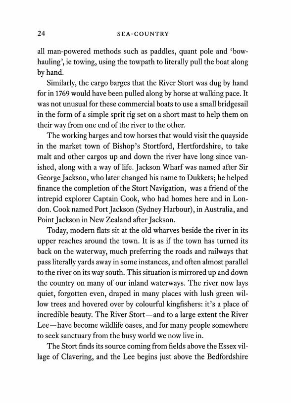
The working barges and tow horses that would visit the quayside in the market town of Bishop’s Stortford, Hertfordshire, to take malt and other cargos up and down the river have long since van-ished, along with a way of life. Jackson Wharf was named after Sir George Jackson, who later changed his name to Dukkets; he helped finance the completion of the Stort Navigation, was a friend of the intrepid explorer Captain Cook, who had homes here and in Lon-don. Cook named Port Jackson (Sydney Harbour), in Australia, and Point Jackson in New Zealand after Jackson.
Today, modern flats sit at the old wharves beside the river in its upper reaches around the town. It is as if the town has turned its back on the waterway, much preferring the roads and railways that pass literally yards away in some instances, and often almost parallel to the river on its way south. This situation is mirrored up and down the country on many of our inland waterways. The river now lays quiet, forgotten even, draped in many places with lush green wil-low trees and hovered over by colourful kingfishers: it’s a place of incredible beauty. The River Stort—and to a large extent the River Lee—have become wildlife oases, and for many people somewhere to seek sanctuary from the busy world we now live in.
The Stort finds its source coming from fields above the Essex vil-lage of Clavering, and the Lee begins just above the Bedfordshire

the essex loop 25
Jackson Wharf, Bishop’s Stortford, taken by Charles Stock in 1982Jackson Wharf today
26 sea-country
town of Luton. On the journey southwards the rivers pass many former watermills and malting buildings, natural marshland and flat meads. Long-time favourites of narrow boat and canoe enthusiasts, these rivers have tended to be somewhat overlooked by cruising sailors—which, for me, merely adds to their appeal.
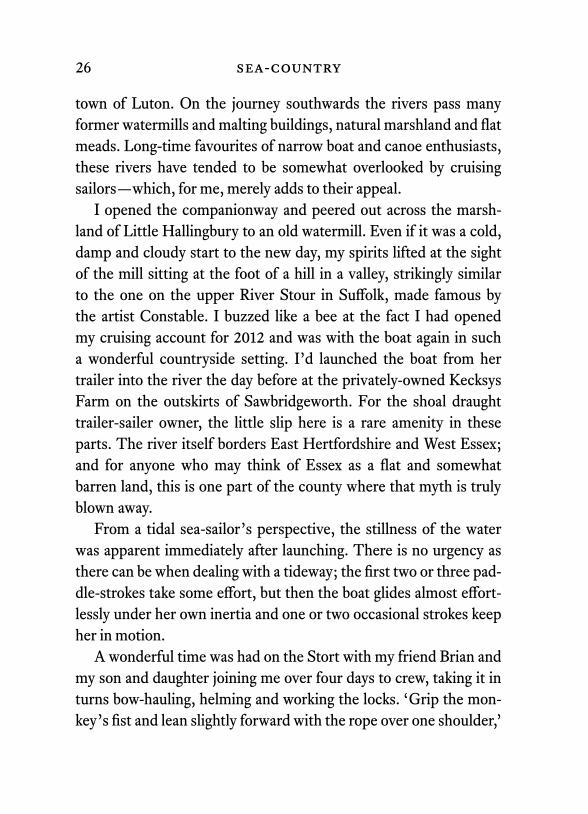
I opened the companionway and peered out across the marsh-land of Little Hallingbury to an old watermill. Even if it was a cold, damp and cloudy start to the new day, my spirits lifted at the sight of the mill sitting at the foot of a hill in a valley, strikingly similar to the one on the upper River Stour in Suffolk, made famous by the artist Constable. I buzzed like a bee at the fact I had opened my cruising account for 2012 and was with the boat again in such a wonderful countryside setting. I’d launched the boat from her trailer into the river the day before at the privately-owned Kecksys Farm on the outskirts of Sawbridgeworth. For the shoal draught trailer-sailer owner, the little slip here is a rare amenity in these parts. The river itself borders East Hertfordshire and West Essex; and for anyone who may think of Essex as a flat and somewhat barren land, this is one part of the county where that myth is truly blown away.
From a tidal sea-sailor’s perspective, the stillness of the water was apparent immediately after launching. There is no urgency as there can be when dealing with a tideway; the first two or three pad-dle-strokes take some effort, but then the boat glides almost effort-lessly under her own inertia and one or two occasional strokes keep her in motion.
A wonderful time was had on the Stort with my friend Brian and my son and daughter joining me over four days to crew, taking it in turns bow-hauling, helming and working the locks. ‘Grip the mon-key’s fist and lean slightly forward with the rope over one shoulder,’

the essex loop 27
I yelled to my son Harry. He looked bemused at first but was soon enjoying the novelty of bow-hauling a cruising yacht.
All too soon we’d covered the length of the river and we parted at the last lock, where I paddled on into the sunset to moor along-side the towpath and enjoy the night under a clear sky in this rural utopia.
The following day called for an early start: not only was I now single-handed, but I also had eleven locks to pass through on my journey south along the River Lee. The Lee, considerably wider than the Stort, is known as London’s other river and was busy with commercial traffic until the 1970s, serving the many timber wharves that once lined its banks.
I was wide awake by the time I’d passed through Fieldes Lock; the further downstream I reached, the more urbanized the water-way became. However, it struck me that barely another boat was using the waterway, although a hive of industry hummed just be-yond the fences and walls above the banks. Many towpaths on the Lee are now lined with liveaboard barges, a number of which are permanently cruising—moving every two weeks to a new moor-ing. I can recall that the banks here were deserted back in the 1980s, other than for the odd steel lighter sat beside empty, overhanging wharves.
A very active day lay ahead and the next lock was soon in sight, so the task of working the lock gates was put into practice again. I relish the physical element that this form of cruising has. Typi-cally there’s an hour or two of paddling or towing, culminating in heaving pairs of giant pivoting gates across the river, having to move from one side of the lock via a bridge to the other, and back again to then wind ferociously on the windlass to open ground paddles and release an incredible force of water. I set the bridgesail to drift along
28 sea-country
from Tottenham Hale to where I spent the night at Springfield and the Lee Valley Marina moorings. It was great to be able to use the showers after five nights afloat.
The next morning, I set off downriver at 0500. Graffiti decorated the old warehouses, and new towpaths had been built in many plac-es. Bridges gleamed with fresh paintwork and workboats seemed to be all about the river from Lea Bridge Road down to Hackney Marshes, which could well have been in the countryside looking from my position in the centre of the river.
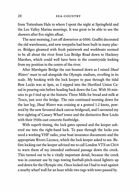
After Marshgate Bridge the sun beamed down as I raised Shoal Waters’ mast to sail alongside the Olympic stadium, revelling in its scale. My booking with the lock keeper to pass through the tidal Bow Locks was at 3pm, so I nipped into the Hertford Union Ca-nal in pouring rain before heading back down the Lee. With 50 min-utes to go I tied up at the historic Three Mills for bread and milk at Tesco, just over the bridge. The rain continued teeming down for the last leg; Shoal Waters was cruising at a genteel 1.2 knots, pow-ered by the now favoured duck canvas bridgesail, and I savoured my first sighting of Canary Wharf tower and the distinctive Bow Locks with their 1930s cast concrete footbridge.
With superb timing, the lock gates opened and the keeper ush-ered me into the right-hand lock. To pass through the locks you need a working VHF radio, your boat insurance documents and the appropriate Rivers Licence, which the lock keeper asked to see. Be-fore locking out the keeper advised me to call London VTS on Ch14 to warn them of my intended outbound passage down the creek. This turned out to be a vitally important detail, because the creek was in constant use by tugs towing football-pitch-sized lighters up and down for the Olympic site. Once locked out I had to wait against a nearby wharf wall for an hour while two tugs with tows passed by.

the essex loop 29
Near the Olympic Stadium on the Lee NavigationLondon’s only lighthouse, at Trinity Buoy Wharf

30 sea-country
The Thames BarrierThe Queen Elizabeth II Bridge across the Thames at Dartford
the essex loop 31
I was early on the flood tide, but the sun shone over flat calm wa-ter as I chugged down the creek. The inland waterways are a tonic and I enjoyed the two inland rivers immensely, but was glad to be back in the salt and thrashing with my sounding cane into the soft mud a few feet below.
Bow Creek is in effect the lower River Lee, here somewhat con-fusingly spelt ‘Lea.’ The creek is shouldered by heavy cast concrete quays and is bridged by huge iron structures bearing the full weight of East London’s industrial traffic.
Above the wharves, Dockland skyscrapers disappeared behind misty clouds. Gulls cruised above the River Thames and the O2 Arena was ahead as I pulled into the wall behind two former Trin-ity House light vessels at Trinity Buoy Wharf, the mouth of Bow Creek. I climbed over the wall and found the wharf manager, who kindly permitted me to stay alongside for the night. I visited Lon-don’s only lighthouse; this was used by Trinity as a testing light but now houses Longplayer, a fascinating music of chimes and bell sounds that was started in the Millennium year and which will play nonstop for 1,000 years.
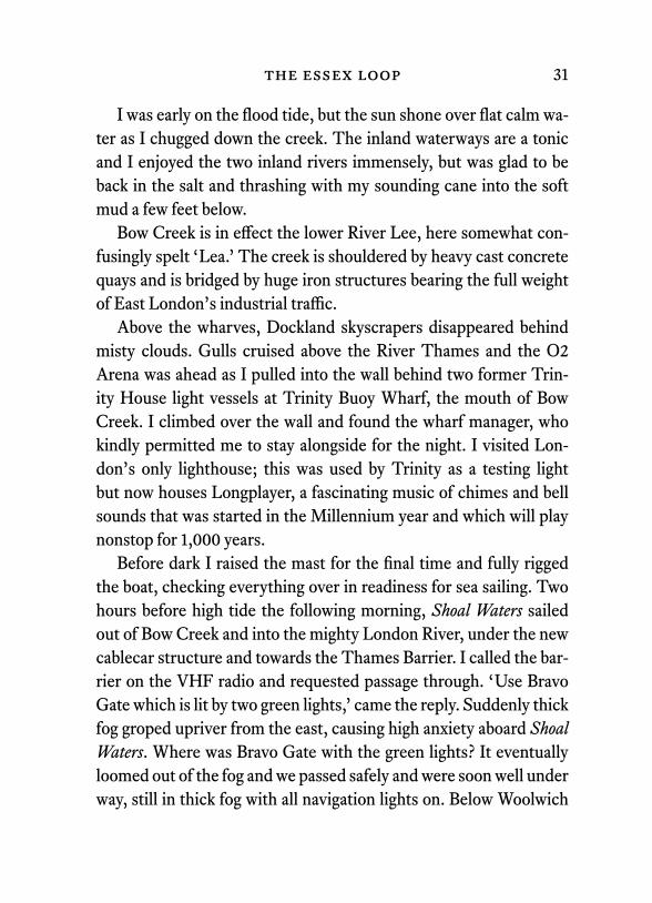
Before dark I raised the mast for the final time and fully rigged the boat, checking everything over in readiness for sea sailing. Two hours before high tide the following morning, Shoal Waters sailed out of Bow Creek and into the mighty London River, under the new cablecar structure and towards the Thames Barrier. I called the bar-rier on the VHF radio and requested passage through. ‘Use Bravo Gate which is lit by two green lights,’ came the reply. Suddenly thick fog groped upriver from the east, causing high anxiety aboard Shoal Waters. Where was Bravo Gate with the green lights? It eventually loomed out of the fog and we passed safely and were soon well under way, still in thick fog with all navigation lights on. Below Woolwich
32 sea-country
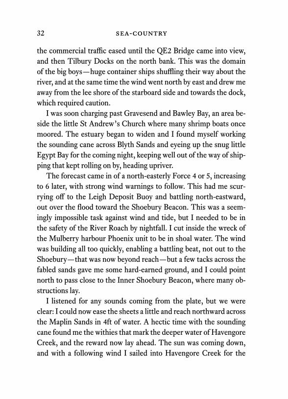
the commercial traffic eased until the QE2 Bridge came into view, and then Tilbury Docks on the north bank. This was the domain of the big boys—huge container ships shuffling their way about the river, and at the same time the wind went north by east and drew me away from the lee shore of the starboard side and towards the dock, which required caution.
I was soon charging past Gravesend and Bawley Bay, an area be-side the little St Andrew’s Church where many shrimp boats once moored. The estuary began to widen and I found myself working the sounding cane across Blyth Sands and eyeing up the snug little Egypt Bay for the coming night, keeping well out of the way of ship-ping that kept rolling on by, heading upriver.
The forecast came in of a north-easterly Force 4 or 5, increasing to 6 later, with strong wind warnings to follow. This had me scur-rying off to the Leigh Deposit Buoy and battling north-eastward, out over the flood toward the Shoebury Beacon. This was a seem-ingly impossible task against wind and tide, but I needed to be in the safety of the River Roach by nightfall. I cut inside the wreck of the Mulberry harbour Phoenix unit to be in shoal water. The wind was building all too quickly, enabling a battling beat, not out to the Shoebury—that was now beyond reach—but a few tacks across the fabled sands gave me some hard-earned ground, and I could point north to pass close to the Inner Shoebury Beacon, where many ob-structions lay.
I listened for any sounds coming from the plate, but we were clear: I could now ease the sheets a little and reach northward across the Maplin Sands in 4ft of water. A hectic time with the sounding cane found me the withies that mark the deeper water of Havengore Creek, and the reward now lay ahead. The sun was coming down, and with a following wind I sailed into Havengore Creek for the

the essex loop 33
1838 high tide. The bridge-keeper raised the bridge in good time and Shoal Waters glided past into the sanctuary of Narrow Cuts and up through Middleway and Yokesfleet Creeks, where seals followed us into Devil’s Reach. The sound of terns calling faded and I was soon out of the Roach and at Shore Ends in the River Crouch by 2130. “That’s enough sailing for today,” I said to myself, and dropped the hook. I hadn’t been long settled in the bunk when I was awoken by an RNLI RIB searchlight. They asked if I was alright, and enquired if I’d seen a man in the sea?
The following morning I left at high water for the near 10-mile beat up the coast. To avoid the worst of the choppy seas at the mouth of the Crouch I cunningly guided Shoal Waters from Holli-well Point across the shallow Ray Sand like a slithering sand-eel.
Sea conditions were pretty lively and I felt scared for a while, so I hove to and pulled down a reef. I passed the two new safe water marks in the swatchway a couple of hours later and suddenly things began to calm down again, encouraging me to shake out the reef and unfurl the jib. The remote chapel of St Peter-on-the-Wall, built in ad654 by St Cedd, came into view and soon I was heading up the Blackwater once more. I enjoyed some fantastic sailing to scrape onto my drying mud mooring in Goldhanger Creek, stepping ashore to end a wonderful ‘Essex Loop’ cruise.
34 sea-country
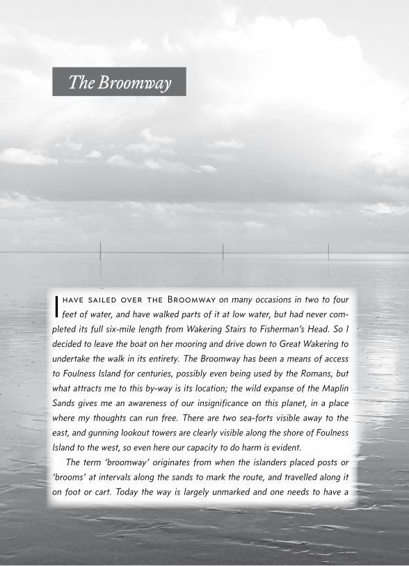
I have sailed over the Broomway on many occasions in two to four
feet of water, and have walked parts of it at low water, but had never com-
pleted its full six-mile length from Wakering Stairs to Fisherman’s Head. So I
decided to leave the boat on her mooring and drive down to Great Wakering to
undertake the walk in its entirety. The Broomway has been a means of access
to Foulness Island for centuries, possibly even being used by the Romans, but
what attracts me to this by-way is its location; the wild expanse of the Maplin
Sands gives me an awareness of our insignificance on this planet, in a place
where my thoughts can run free. There are two sea-forts visible away to the
east, and gunning lookout towers are clearly visible along the shore of Foulness
Island to the west, so even here our capacity to do harm is evident.
The term ‘broomway’ originates from when the islanders placed posts or
‘brooms’ at intervals along the sands to mark the route, and travelled along it
on foot or cart. Today the way is largely unmarked and one needs to have a
The Broomway

the essex loop 35
good navigational sense, and a sound knowledge of the tides, to traverse the
way in both directions in one dry ‘window’. The sands can be soft underfoot,
causing fatigue and consequent problems.
Once past the obstacle of the firing range, which may have red flags
raised closing access to the sands, one needs to allow for roughly six hours
of continual walking for the two-way journey. The tide can appear sud-
denly. If I can offer one word of advice it would be prepare yourself physically by
doing a walk across soft terrain for five or six hours in one session, a couple of
weeks beforehand, to see how your body reacts to it, then you will have the con-
fidence that you can endure the journey. The last thing you would want while out
on the sands is muscle cramp, in fact any unforeseen mishap disabling you, for
the tide waits for no-one and your calls for help are highly likely to go unheard.
When your preparation is done and you take the first step onto the sand at Wak-
ering Stairs, embrace the moment for it is truly magical.