The Dundee Parks and Open Space Plan
55
The Dundee Parks and Open Space Plan Adopted by the Dundee City Council July 15, 2008 Ordinance 469-2008
Transcript of The Dundee Parks and Open Space Plan

The Dundee Parks and Open Space Plan
Adopted by the Dundee City Council July 15, 2008 Ordinance 469-2008

The Dundee Parks and Open Space Plan
City Council Adoption July 15, 2008 Ordinance 469-2008
The Parks Committee
Jeannette Adlong, Chair Ivon Miller
Joyce Stalcup Karen Talbot Ernie Castro
Ann Light Kay Edwards
Jerome Rogers Jim McMaster, Chehalem Parks & Recreation District
Eve Dolan, City Administrator, City of Dundee Rob Daykin, City Administrator, City of Dundee
John N. Morgan AICP, The MorganCPS Group Principal Planner & Project Manager
Walter J. Wendolowski AICP, The MorganCPS Group Project Planner
Robert Foster FSLA, Foster & Associates Urban Designer and Graphic Artist

Dundee Parks and Open Space Plan
City Council Adoption July 15, 2008 – Ordinance 469-2008 | Page 1
Table of Contents Table of Contents ................................................................................................................................................................................... 1
Introduction ........................................................................................................................................................................................... 4
Goals and Objectives .............................................................................................................................................................................. 5
• Goals – ......................................................................................................................................................................................... 5
• Objectives .................................................................................................................................................................................... 5
Executive Summary of Recommendations ............................................................................................................................................... 7
• Park Development ........................................................................................................................................................................ 7
• Open Spaces and Natural Areas .................................................................................................................................................... 7
• Pedestrian/Bicycle Corridors ......................................................................................................................................................... 7
• Implementation ............................................................................................................................................................................ 7
Inventory ................................................................................................................................................................................................ 9
• Existing Parks ................................................................................................................................................................................ 9
• Undeveloped Park Lands ............................................................................................................................................................ 10
• Other Open Space Lands............................................................................................................................................................ 11
Policy Context and Analysis .................................................................................................................................................................. 14
• Comprehensive Plan ................................................................................................................................................................... 14
• City Zoning and Subdivision Ordinances ..................................................................................................................................... 14
• Transportation System Plan ......................................................................................................................................................... 14
• SDC ........................................................................................................................................................................................... 15
• Chehalem Parks and Recreation District ...................................................................................................................................... 15
Assessment ........................................................................................................................................................................................... 16

Dundee Parks and Open Space Plan
City Council Adoption July 15, 2008 – Ordinance 469-2008 | Page 2
• Park Acreage .............................................................................................................................................................................. 16
• Park Locations ............................................................................................................................................................................ 16
• Park Potential ............................................................................................................................................................................. 16
• Transportation System Plan Effects .............................................................................................................................................. 17
Regional Context .................................................................................................................................................................................. 18
• Chehalem Parks and Recreation District (CPRD) ......................................................................................................................... 18
• Oregon State Parks - Champoeg State Heritage Area ................................................................................................................... 18
• Yamhill County Parks - Crabtree Park .......................................................................................................................................... 18
• Willamette River ......................................................................................................................................................................... 18
Analysis and Conclusions ...................................................................................................................................................................... 20
• Summary .................................................................................................................................................................................... 20
• Parks Standards .......................................................................................................................................................................... 20
• Park Acreage .............................................................................................................................................................................. 20
• Recreation and Facilities Standards ............................................................................................................................................. 21
• Park Locations ............................................................................................................................................................................ 21
The Plan ............................................................................................................................................................................................... 22
• General Theme........................................................................................................................................................................... 22
• Park Development Standards ...................................................................................................................................................... 22
• The Parks Plan ............................................................................................................................................................................ 25
• Neighborhood Parks ................................................................................................................................................................... 25
• Community Parks ....................................................................................................................................................................... 25
• Regional Parks ............................................................................................................................................................................ 26

Dundee Parks and Open Space Plan
City Council Adoption July 15, 2008 – Ordinance 469-2008 | Page 3
• Open Space and Natural Areas ................................................................................................................................................... 28
• Pathways .................................................................................................................................................................................... 29
Figure 1 – Parks and Open Space Plan Map .......................................................................................................................................... 32
Implementation .................................................................................................................................................................................... 33
• Strategy ...................................................................................................................................................................................... 33
• Implementation through the Capital Improvements Program ....................................................................................................... 34
• Implementation through Plan and Code Amendments ................................................................................................................ 34
APPENDIX A – The Capital Improvements Program ............................................................................................................................... 35
• Capital Improvements Program ................................................................................................................................................... 35
APPENDIX B –Plan and Code Analysis and Suggested Amendments ...................................................................................................... 39
• Implementation Measures ........................................................................................................................................................... 44
• Comprehensive Plan ................................................................................................................................................................... 45
• Policies and Standards – Willamette River Greenway .................................................................................................................. 45
• Transportation System Plan ......................................................................................................................................................... 46
• Development Ordinance ............................................................................................................................................................ 46
• Site Development Review ........................................................................................................................................................... 46
• Subdivisions ............................................................................................................................................................................... 47

Dundee Parks and Open Space Plan
City Council Adoption July 15, 2008 – Ordinance 469-2008 | Page 4
Introduction Dundee is a remarkable community with many natural advantages. Dundee Junction was originally of significance as a Willamette River port and railroad depot. It has been of agricultural significance with a variety of crops and is currently the center of Oregon’s acclaimed wine industry. The city has many natural advantages, including the Willamette River and its extensive floodplain, the hillside with sweeping views, and the character of a rural city with many vibrant and green spaces for enjoyment and recreation.
The city’s vision, adopted in 2002, sets the framework for preserving these advantages and maintaining the desired character of the city in all of Dundee’s planning documents and efforts. This Plan will focus on creating extraordinary parks, open spaces, natural areas, and corridors needed to make Dundee’s vision a reality. The relevant elements of that Vision Statement are quoted below:
The Year is 2022. Dundee is a rural city noted for its freshness and harmony with nature.
Pedestrian friendly paths follow the Willamette River, while scenic picnic areas and nature parks add to the serene environment. Wildlife corridors, walking trails and bicycle paths further enhance the opportunities for enjoying nature. A citywide system of pedestrian walkways and greenways are unimpeded by motorist traffic. Preservation of views, parks and greenways is paramount in planning and building. Hillsides remain lush green sentinels to be visually enjoyed by all.
The business district has been expanded and redesigned to encourage leisurely pedestrian movement throughout the shopping area.
There is not another place in the country like Dundee that has succeeded in creating such an attractive and harmonious atmosphere.
This Parks and Open Space Plan was developed for several reasons:
• The Parks and Open Space Plan identifies a strategy for the development of new parks and new open space.
• This Plan is intended to provide a clear statement of Dundee city policy on new parks and open space to be used when advocating with CPRD and other agencies and organizations for new park development.
• As the formal statement of the City’s plan for park and open space development, this document will serve to support grants and other funding requests.
• The Plan lays the foundation for the development of Code amendments helping develop the parks and open space system.

Dundee Parks and Open Space Plan
City Council Adoption July 15, 2008 – Ordinance 469-2008 | Page 5
Goals and Objectives Goals –
To plan for, develop, and manage a network of parks, paths, and open space keeping pace with the growth of the City.
To create a comprehensive plan for development and management of a network of parks, paths, greenways and open space that support local citizens’ desires to re-create and enjoy local natural resources.
To complement Dundee’s unique rural character with a park and open space system that contributes to an extraordinarily livable community.
To provide recreational opportunities integrated into neighborhood centers and into Downtown.
Objectives Provide recreational opportunities integrated throughout
the community and into Downtown.
Develop and maintain a multi-purpose park system enriching the community’s livability while remaining cost-effective.
Create a citywide system of interconnecting pedestrian walkways and greenways with minimal impediment by motorized traffic.
Assure convenient, safe access for pedestrians, cyclists, and vehicles across Highway 99W and the proposed Bypass corridor.
Create and enhance opportunities for enjoying nature with walking trails and bicycle paths.
Establish goals and standards to be used in the development of all future parks.
Engage with other partner agencies to see that a detailed design and development program for Dundee’s riverfront and river recreational opportunities within a tranquil and natural environment is developed.
Foster a pedestrian, equestrian, and bicycle path along the Willamette River connecting Dundee’s riverfront with Newberg’s proposed Riverfront Park and Champoeg State Park, and connecting with the Yamhill County parks and CPRD’s park system.
Integrate the City’s riverfront with the Willamette River Greenway.
Provide a landing for non-motorized craft on the Willamette River.
Anticipate and provide developed parks, open spaces, and natural areas prior to or concurrent with the development of neighborhoods.
Fund the maintenance and development of new parks through grants where possible, and through locally generated funds raised in an appropriate balance between existing and new residents for community wide facilities. Additional facilities provided to accommodate growth should be funded through the development process.
Leverage public and private funds by partnering as much as possible with other agencies, organizations, and

Dundee Parks and Open Space Plan
City Council Adoption July 15, 2008 – Ordinance 469-2008 | Page 6
foundations.
• Protect and where possible restore natural areas.
Cooperate as needed in providing land for recreational uses administered in cooperation with the School District, the Chehalem Parks and Recreation District, Oregon State Parks, and other agencies.

Dundee Parks and Open Space Plan
City Council Adoption July 15, 2008 – Ordinance 469-2008 | Page 7
Executive Summary of Recommendations Park Development
The Plan identifies a need for two new neighborhood parks and a new community park, all in the area between Highway 99W and the Willamette River, known as the Riverside area. The details of locations and specifics of these parks will be developed in future planning processes.
New Special Purpose Parks include the Viewmont Watershed Park and Canyon Lake Park.
The Dundee riverfront will be fully defined in subsequent specific planning and design processes, but it could be integrated into a major regional park that takes full advantage of access to the Willamette River and Ash Island.
The City of Dundee supports Oregon Parks and Recreation Department (OPRD) effort to develop a proposed Ash Island State Park, which includes Ash Island and floodplain areas along Dundee’s riverfront.
Open Spaces and Natural Areas Important open spaces to be preserved and enhanced include the Dundee Pioneer Cemetery as a quiet open space focusing on the view to the southeast and access to the Viewmont watershed to the northwest. Also included is development of the Maple Creek Greenway as a wetlands restoration project and a new open space corridor.
Pedestrian/Bicycle Corridors The Plan envisions a major looping pedestrian path system that connects all parts of the City including all of the park system. It is
anchored at the top of the hill in the City’s northwest corner by the cemetery open space and terminates at the Dundee riverfront. The pathway system will include a newly developed dedicated open space corridor along the Viewmont Greenway.
This system incorporates bicycle facilities in the central and southeastern portions of the community.
The central part of the pedestrian and bicycle system will focus on Downtown Dundee, tying directly into the redeveloping main street area.
Implementation Implementation of this Plan will take place in several ways:
Parks System Development Charges may be developed in conjunction with the Chehalem Parks and Recreation District adequate to implement the Parks Capital Improvements Program.
Amendments to the Development Code will be made to establish standards and procedures for requiring the dedication and development of parks and open space land as part of private development projects.
The City will continue an active role with the Chehalem Parks and Recreation District to implement this Plan through the District’s annual budgeting process, capital improvement programming, assessment of Parks system development charges, grantsmanship, and through a strong partnership in achieving this Plan’s goals and objectives.

Du
City Council Adoption July 15, 2008 – Ordinance 469-2008
ndee Parks and Open Space Plan
| Page 8
The City and Chehalem Parks and Recreation District will create an Intergovernmental Agreement in order to enhance the opportunity for park creation and expand the application of resources to support implementation of this Parks Plan. Specific elements will include:
• Confirm CPRD’s commitment to assist with the funding, acquiring, and developing all improvements identified in this Plan.
• Create the funding programs to acquire, build, and operate the needed park spaces as listed in the Capital Improvements Program below.
• Revise the Parks System Development Charges to reflect new projects and priorities.
• Channel SDC revenue created in Dundee to Dundee projects. All SDC revenue paid by Dundee homebuilders, and the interest thereon, should be channeled to local projects identified in this Plan rather than go to regional projects.
• Require annual accounting of all SDC revenues and expenditures.
• When appropriate partner with CPRD to aggressively pursue parks funding through outside sources such as grants.
• Assure that parkland within Dundee owned by CPRD will not be sold or traded without the consultation and approval of the Dundee City Council.

Dundee Parks and Open Space Plan
City Council Adoption July 15, 2008 – Ordinance 469-2008 | Page 9
• Adjoins and blends with Dundee Elementary School
• Administered and Maintained by CPRD
• Owned partially by School District and partially by CPRD
• Facilities - Park
Basketball Court Tennis Courts (2) Large Play Structure Small Play Structure Baseball Fields (2) Covered picnic shelter Picnic tables Paved trails Lawn areas Paved parking near School off 5th Gravel parking off 3rd
Billick/Dundee School Park
• Facilities – School
Large play structure
• Community Park
• 9.9 acres
Inventory Existing Parks

Dundee Parks and Open Space Plan
City Council Adoption July 15, 2008 – Ordinance 469-2008 | Page 10
Sheltered play area ½ court basketball courts (2)
Falcon Crest
• Neighborhood Park
• 2.5 acres
• Play structure
• Paved trails
• Lawn areas
• Basketball court
• Owned by CPRD
• Maintained by CPRD
Undeveloped Park Lands Falcon Crest Overlook Park
• .8 acre
• Pathway, tables, and other improvements have been proposed by CPRD
• Bare ground with steep slope up to street
• Owned by CPRD
Dundee Landing
• 5 acres
• No improvements
• Level field with some mature fir trees
• Owned by CPRD

Dun
City Council Adoption July 15, 2008 – Ordinance 469-2008
dee Parks and Open Space Plan
| Page 11
• Only designated park land on east side of 99W
Viewmont Watershed Open Space
• 20 acres
• No improvements
• Heavily forested
• Steep slopes
• Trail connecting Viewmont Road to Red Hills Road
• Owned by City of Dundee
• Outside of UGB
Other Open Space Lands Dundee Pioneer Cemetery
• 5 acres ±
• Owned by Cemetery Association
• Outside city limits, within UGB
Viewmont Greenway
• Public right of way, owned by the City of Dundee
• Formally designated as a Greenway & Open Space
• Approximately 1,200 feet long and 50 feet wide
Dundee Riverfront
• 100+ acres below 100 year flood plain
• Private ownership
• Uses

Dundee Parks and Open Space Plan
City Council Adoption July 15, 2008 – Ordinance 469-2008 | Page 12
Orchard Tilled crops Lowland forest Significant riparian vegetation along bank
Ash Island
• Within Willamette River
• Adjacent to City
• 100+ farmed acres
• Private ownership
• Outside UGB
Canyon Lake
• Owned by City
• 7 acres ±
• Dammed drainage swale
• Significant wildlife habitat
• Being separated from sewerage treatment process as part of the Sewerage Plant Master Plan
Falcon Crest Retention Pond
• CPRD owned and maintained
• 1.3 acres
• Pedestrian access from Viewcrest Drive
• 60’ x 150’ level field at the bottom of a gradually sloped basin
• South side abuts 11th Street
| Page 13
Du Open Space Plan
City Council Adoption July 15, 2008 – Ordinance 469-2008
ndee Parks and
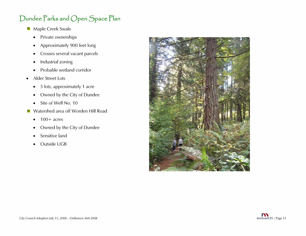
Watershed area off Worden Hill Road
• Owned by the City of Dundee
• Owned by the City of Dundee
• Crosses several vacant parcels
• Approximately 900 feet long
• 5 lots, approximately 1 acre
• Probable wetland corridor
• Site of Well No. 10
• Private ownerships
• Industrial zoning
Maple Creek Swale
• Sensitive land
• Outside UGB
• Alder Street Lots
• 100+ acres

Dundee Parks and Open Space Plan
City Council Adoption July 15, 2008 – Ordinance 469-2008 | Page 14
Policy Context and Analysis Comprehensive Plan
Open Space Chapter
• Calls for adequate open space and preservation of scenic and historic resources
• Identifies Watershed land as open space
• Identifies views of valley and mountains as significant
• Identifies views of river as significant
• Calls for Old Log Dump on the Willamette River as a park site
Recreation and Greenway Chapter
• Sets park land standard of 15.5 acres per 1,000 population
• Calls for establishing and setting aside land for parks
• Calls for combining public and private development
City Zoning and Subdivision Ordinances Willamette River Greenway
• Properties along river within 150 feet from the ordinary low water line
• Allows uses through conditional use process
• Requires minimization of impacts on river and bank
Flood Plain
• All low land near river
• Conditional Use required for most new uses
• Requires elevation of all uses for human habitat above 100 year flood plain level
• Restricts uses in floodway
Subdivision
• No park dedication required
• No capability to require dedication
• Needs appropriate legislation
PUD
• 20% common open space
• May be dedicated as public space
Transportation System Plan 99W Bypass
• To be built between current developed area and river
• Not on the planning horizon
• Limited access and crossings
• No specific plans for pedestrians/bikes
Dundee Riverfront Drive
• Parkway collector
• Between bypass and river
• Parallel to river

Dundee Parks and Open Space Plan
City Council Adoption July 15, 2008 – Ordinance 469-2008 | Page 15
Sidewalks
• Planned to be added to existing through streets without sidewalks
• Required with all new construction
Bicycle System
• Looping bike route planned
• Connection to rural areas and wineries to west planned
SDC Funds
• Collected by City, turned over to the CPRD
• Used by CPRD
Uses
• Acquisition of parks land and facilities
• Development of parks land and facilities
Charges
• SDC is $2,017 per residential unit
Chehalem Parks and Recreation District History
• Dundee incorporated in 1979
• Voters approved tax base
Dundee’s Role
• Dundee is about 9% of District’s tax base revenues (2007)
• CPRD Total Assessed Value $2,189,406,608
• Dundee Total Assessed Value $195,480,082
• Dundee is about 10% of District’s population (2000)
• CPRD 26,500
• Dundee 2,6001
Functions
• Own and Manage Parks and Facilities
• Purchase and Develop Parks
• Provide Recreation Program
• Recreation and sports programs
• Maintain Little League Fields
• Chehalem Glen Golf Course
• Aquatic Facility
• Other programs in Newberg
1 2007 population is estimated as 3,040 by the PSU Population Research Center

Dundee Parks and Open Space Plan
City Council Adoption July 15, 2008 – Ordinance 469-2008 | Page 16
Assessment Park Acreage
Less than one third the acreage established by the Comprehensive Plan Criteria is now developed into park land. (see page 20)
75 to 90 additional acres of park land are needed over the next two decades.
Park Locations The City has two distinct halves now with developed park
facilities only found in the western half.
The fastest growing area, and that with the greatest growth potential over the planning period, is the eastern half.
Park Potential Future Neighborhood Parks
• Integrated into neighborhoods
• Integrated with school sites if possible
• Combination of green open space and active recreation
Special Purpose Parks
• Take advantage of unique environment or opportunity
• Preserve significant resources
• May have passive, active, or both elements
Opportunities for Park Development
• Viewmont Watershed
Area between Cemetery & Red Hills Road
Passive open space with low-impact improvements
Expansion and enhancement of existing primitive trail from Viewmont Drive to Red Hills Road
• Watershed Area off Worden Hill Road
Must preserve watershed values
Passive open space with low-impact improvements
• Dundee Landing Park
Preserve natural features
CPRD has no plans for development
May be impacted by Bypass
• Canyon Lake
Significant lake/riparian area
Significant wildlife habitat
City ownership
Potential for fishing/wildlife viewing/walking paths

Dundee Parks and Open Space Plan
City Council Adoption July 15, 2008 – Ordinance 469-2008 | Page 17
• Ash Island
Privately owned
State initiated acquisition for regional park
Bridge to island would be required
• Dundee Riverfront
Unique opportunity for natural area protection and trail development
Urban development potential constrained by Greenway and floodplain restrictions
• Alder Street Lots
Located between residential neighborhoods and commercial development
Possible development as a passive park with limited improvements such as benches, tables, tot lot, water fountain, gazebo
• New Developments
PUD’s require 20% land dedication for common open space, outdoor recreational areas or indoor recreational facilities. May be dedicated to public.
All builders pay SDC’s which are used to acquire and develop parks
Subdivider cannot be compelled to donate land under City’s current ordinances
General Sites must be identified in advance
General sizes and configurations must be identified in advance
Preferable to acquire before development
Transportation System Plan Effects Roadways
• Bypass corridor cuts Dundee into 3 distinct areas
Residential development will occur in each Each needs neighborhood park or equivalent facilities The Dundee TSP anticipates 3 non-grade local street crossings of the Bypass
• New and improved collector streets provide for access into heart of each neighborhood
Pedestrian System
• Planned sidewalk system does not integrate with Viewmont Greenway
• Planned sidewalk system does not extend to Dundee Riverfront
Bicycle System
• Planned bicycle system does not integrate with parks
• Planned bicycle system does not extend to Dundee Riverfront

Dundee Parks and Open Space Plan
City Council Adoption July 15, 2008 – Ordinance 469-2008 | Page 18
Regional Context Chehalem Parks and Recreation District (CPRD)
• The Chehalem Park and Recreation District encompasses 68 square miles of Yamhill County, based in the communities of Newberg and Dundee. The District is responsible for administering programs which enrich leisure time, foster physical and mental well-being and provide positive free time opportunities for its roughly 25,000 residents.
• Operates all developed parks in Dundee
• Owns some park land, other land owned by School District and City of Dundee
• Logical provider of park facilities and programs due to expertise, skills, and resources
• Collects system development charges for new park acquisition and development
• Provides recreation programs in Newberg and Dundee
Aquatics and Recreation Center in Newberg
Youth field sports in Dundee in Billick School Park
Oregon State Parks - Champoeg State Heritage Area
• 640 acres
• Major park of statewide scale and scope
• Extensive recreational facilities, river access
• 9 Miles drive east of Dundee
Yamhill County Parks - Crabtree Park
• 12.4 acres
• Located approximately 4 miles north of Dundee off Worden Hill Road
• Operated and maintained by CPRD
Willamette River
• Rogers Landing Park, a County park located in Newberg, is approximately two river miles downstream. It has the nearest river access featuring a multi-lane boat ramp but few recreation facilities. Champoeg is approximately 8 river miles downstream and features river access and extensive recreational facilities. 20 miles downstream in the Wilsonville area several river access facilities are found along with developed park lands.
• The nearest river access upstream is at Hess Creek Landing a short distance from Dundee. The nearest developed recreation facilities are at Willamette Mission State Park and Wheatland Ferry just north of Keizer approximately 20 river miles upstream from Dundee. Salem’s Riverfront Park and Wallace Marine Park are approximately 30 river miles from Dundee in Salem.
• Ash Island, one of the largest islands in the Willamette River, is located immediately adjacent to Dundee.

Dundee Parks and Open Space Plan
City Council Adoption July 15, 2008 – Ordinance 469-2008 | Page 19
The major current is on the eastern side of the island leaving the western side next to the Dundee riverfront with much slower water flows.

Dundee Parks and Open Space Plan
City Council Adoption July 15, 2008 – Ordinance 469-2008 | Page 20
Analysis and Conclusions Summary
The analysis below is based on national and local standards. These standards look at parks three different ways.
First is a gross measurement of acreage. It is found that Dundee does not have an adequate amount of park acreage to meet today’s needs and future growth.
Second is an inventory of recreational facilities where it is found the City has generally adequate facilities for a city of this size other than not having a community center. However, as the City grows additional facilities will be needed.
The third standard deals with the location of parks reflecting the availability of appropriate park types in convenient locations to citizens. The analysis shows a deficiency east of the highway today, and a need to add parks as the land between the current neighborhoods and the river is developed.
Parks Standards The National Recreation and Parks Association
publishes national standards for parks classifications and characteristics. These standards are used by the Chehalem Parks and Recreation District and will serve as the basis of this plan’s
2 Standard from the Dundee Comprehensive Plan - 1977
analysis of Dundee’s needs.
NRPA further recommends that a park system, at a minimum, be composed of a “core” system of park lands with a total of 6.25 to 10.5 acres per 1,000 population. The 1977 Dundee Comprehensive Plan set a higher standard appropriate for Dundee of 15.5 acres per 1,000. This Parks Plan follows the Comprehensive Plan standard.
Park Acreage The table below shows the analysis of Dundee’s park land
using the 15.5 acres per 1,000 population standard. 75 to 90 additional acres of park land are needed over the next two decades.
• The 2000 population is from the federal decennial census. The population estimates for 2020 and 2025 originate from the 2003 Dundee Transportation System Plan.
2000 2020 2025
Developed 12.4
Undeveloped 26.0
Population 2,600 5,700 6,600
Standard –15.5/1,0002
40.3 88.35 102.3
Deficiency in Developed Parks
27.9 75.95 89.9

Dundee Parks and Open Space Plan
City Council Adoption July 15, 2008 – Ordinance 469-2008 | Page 21
Recreation and Facilities Standards CPRD is the recreation provider for Dundee, Newberg
and the surrounding area. CPRD provides active recreation facilities for the most part in conjunction with School District facilities. In Dundee sports field and other major recreation facilities are located at Billick School Park.
The City does not intend to take on the provision of recreation programs, but will seek to provide facilities to support recreation programs within the parks if needed and as jointly agreed with the CPRD and the School
District. It is noted that the major recreation facilities, such as baseball fields, are located in Newberg, which has a greater population to support the facilities. These facilities are within a short driving distance of Dundee.
The NRPA standards for facilities appropriately sized for Dundee’s neighborhood and community parks are listed below. By these standards, Dundee has adequate facilities other than for horseshoes and a community center.
Park Locations The City has two distinct halves now with developed park
facilities only found in the western half. Billick School Park and Falcon Crest Park adequately meet the current and future needs of the hillside residential neighborhoods
The fastest growing area, and that with the greatest growth potential over the planning period, is the eastern half, known as the Riverside neighborhood. No developed parks exist now to serve the existing residents of this neighborhood. Nor is there any land set aside for future park development other than the five acre CPRD piece, which will likely be impacted by the future bypass. Using the ¼ - ½ mile radius criterion, as well as a criterion of planning for park locations where they can be accessed by nearby residents without crossing busy streets, no less than three neighborhood parks should be developed in this area. However, the need for at least one of these could be met through the development of a community park central to the area.
Facility Standard/People
Current Supply
Softball/Youth Baseball 1/5,000 1
Soccer 1/10,000 1
Basketball 1/5,000 1
Tennis 1/2,000 2
Horseshoe 1/5,000 0
Community Center 1/15,000 0
Gymnasiums 1/10,000 1
Picnic Shelters 1/3,000 1
Playground 1/3,000 2
Picnic Tables 1/300 20
Dundee Parks and Open Space Plan
City Council Adoption July 15, 2008 – Ordinance 469-2008 | Page 22
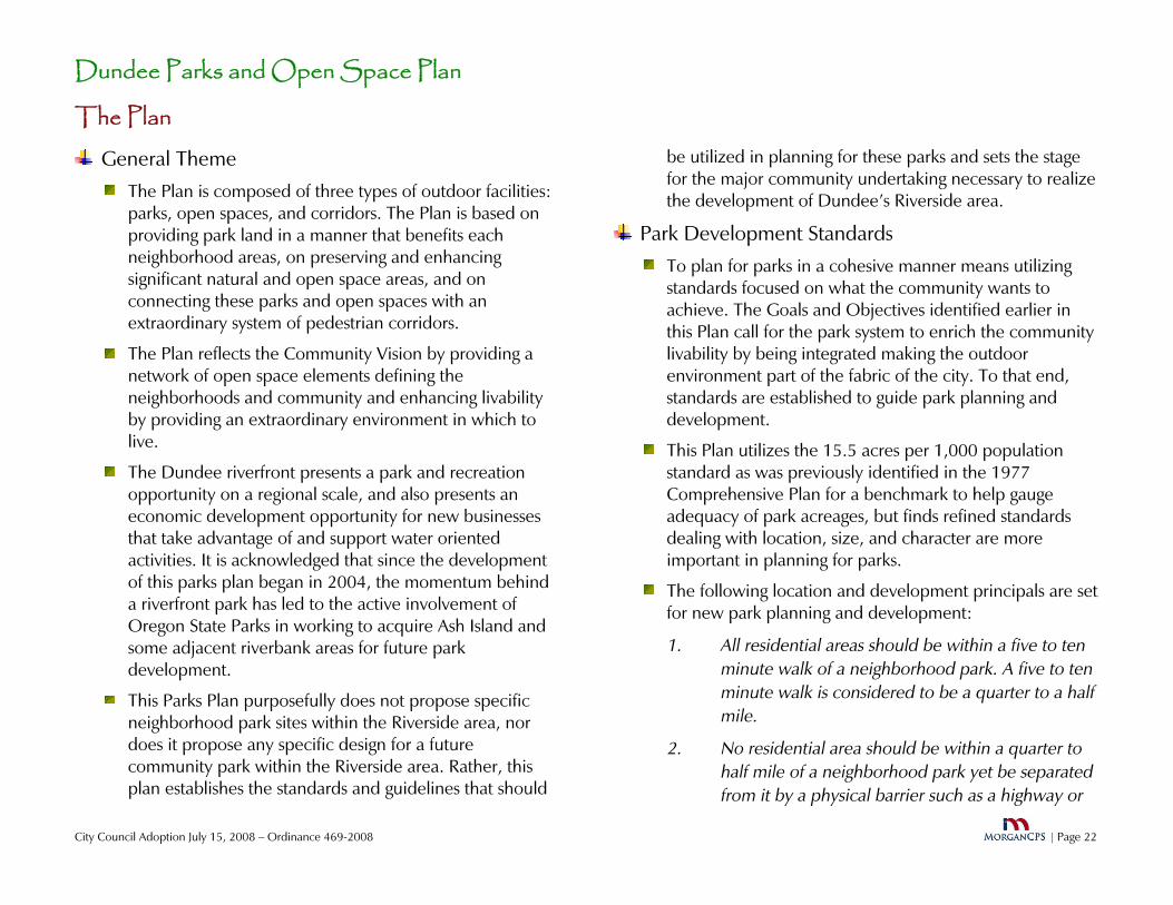
The Plan General Theme
The Plan is composed of three types of outdoor facilities: parks, open spaces, and corridors. The Plan is based on providing park land in a manner that benefits each neighborhood areas, on preserving and enhancing significant natural and open space areas, and on connecting these parks and open spaces with an extraordinary system of pedestrian corridors.
The Plan reflects the Community Vision by providing a network of open space elements defining the neighborhoods and community and enhancing livability by providing an extraordinary environment in which to live.
The Dundee riverfront presents a park and recreation opportunity on a regional scale, and also presents an economic development opportunity for new businesses that take advantage of and support water oriented activities. It is acknowledged that since the development of this parks plan began in 2004, the momentum behind a riverfront park has led to the active involvement of Oregon State Parks in working to acquire Ash Island and some adjacent riverbank areas for future park development.
This Parks Plan purposefully does not propose specific neighborhood park sites within the Riverside area, nor does it propose any specific design for a future community park within the Riverside area. Rather, this plan establishes the standards and guidelines that should
be utilized in planning for these parks and sets the stage for the major community undertaking necessary to realize the development of Dundee’s Riverside area.
Park Development Standards To plan for parks in a cohesive manner means utilizing
standards focused on what the community wants to achieve. The Goals and Objectives identified earlier in this Plan call for the park system to enrich the community livability by being integrated making the outdoor environment part of the fabric of the city. To that end, standards are established to guide park planning and development.
This Plan utilizes the 15.5 acres per 1,000 population standard as was previously identified in the 1977 Comprehensive Plan for a benchmark to help gauge adequacy of park acreages, but finds refined standards dealing with location, size, and character are more important in planning for parks.
The following location and development principals are set for new park planning and development:
1. All residential areas should be within a five to ten minute walk of a neighborhood park. A five to ten minute walk is considered to be a quarter to a half mile.
2. No residential area should be within a quarter to half mile of a neighborhood park yet be separated from it by a physical barrier such as a highway or

Dundee Parks and Open Space Plan
City Council Adoption July 15, 2008 – Ordinance 469-2008 | Page 23
arterial street. In such cases, the quarter to half mile standard shall be reduced to reflect the physical barrier.
3. If a community or regional park serves a residential area not served by a neighborhood park, a playground and associated improvements should be located within the ¼ to ½ mile standard, even if the balance of the park is not.
4. Within a neighborhood area, a park should be centrally located if possible.
5. Construction of any new school shall include development of new park land incorporating playground facilities, open space, and sports fields.
6. Recreation fields for organized sports will be located in cooperation with the Chehalem Parks and Recreation District and the School District. The focus for new field development will be first on school sites and second on community or regional parks.
Using these six principals, and incorporating the national and CPRD parks standards, the City’s park development standards are established. These are reflected in the table below:

Dundee Parks and Open Space Plan
City Council Adoption July 15, 2008 – Ordinance 469-2008 | Page 24
Dundee Park Development Standards
Park Classification
Size Area Served Facilities Other Standards Developed Facilities
Neighborhood 2 to 5 acres
¼ - ½ mile radius without barriers such as highways or arterial streets
Playground, outdoor multipurpose court with basketball backboards, picnic tables, open space accessible by walkways, water fountain, may or may not have restrooms
Off-street parking not required.
2.5 acres per 1,000 population
Tied into open space corridor system. Geographically located near the center of each neighborhood area.
Falcon Crest Park
Community 5 to 25 acres
1 to 3 mile radius Same as neighborhood park plus picnic shelter, restrooms, sports fields & courts, natural outdoor areas, trails
Tied into open space corridor system.
Located on Collector or Arterial Street.
Off street parking required.
Billick/Dundee School Park
Special N/A No standard Varies depending upon use of park Special purpose parks including mini-parks smaller than neighborhood parks, memorials, plazas, etc.
Falcon Crest Overlook Park
Open Space N/A N/A Undeveloped natural areas, walkways, open space corridors, and other lands open to the public but not developed as formal parks
None as each open space is unique
Falcon Crest retention area on 11th Street

Dundee Parks and Open Space Plan
City Council Adoption July 15, 2008 – Ordinance 469-2008 | Page 25
The Parks Plan The Parks Plan is presented in Figure 1. This plan is based
on the application of the criteria. The information presented in this plan is conceptual for the new facilities and the actual placement of the facilities is dependant on further planning processes. Each element is described below:
Neighborhood Parks The two parks on the west side of the highway, Billick
and Falcon Crest, are adequate in meeting the park needs for those neighborhoods. Billick is a community park by size and because of the athletic fields, but it also has neighborhood park elements such as the playground.
There are no parks serving the neighborhoods on the east side of the highway. A neighborhood park is needed to serve this area but there is no land within the neighborhood available on which to build a park. Therefore, this need must be met by a new park built as close to the neighborhood as possible within the developing lands to the east.
The developing area between the existing neighborhood and the river will be the future site of hundreds of new homes. This area clearly needs neighborhood parks to be developed as the homes are built.
The area is impacted by the alignment of the future Dundee-Newberg Bypass and the development of east/west major streets accessing the new neighborhoods. Using the ¼ to ½ mile radius and the barrier standards, three new neighborhood parks will be needed to serve
this area. Two of these are shown in very general locations on the Parks Plan map. The function of the third will be integrated into the planned community park which will be central to this neighborhood.
A Special Purpose park is proposed for the City’s Alder Street lots. It is smaller than a neighborhood park, but it can serve much of that same function by being permanent open space, having tables, benches, and a playground. It will serve as a buffer between the residential neighborhood to the west and the commercial uses to the east.
Community Parks A community park is desirable on the riverside of Dundee. Such a park could provide ball fields, restrooms, parking, picnic facilities, tennis court, and other community scale improvements. The location of such a park has not been determined and should be considered as planning and development occur in this area. A primary consideration is this community park will also serve as a neighborhood park. Two unique opportunities help to frame how this park can be developed. First; CPRD owns a five acre parcel located about a half mile east of Edwards Drive. The property can form the core of a neighborhood park, or can be traded or sold with the proceeds used to purchase and develop a park in the immediate neighborhood. Second; when the sewage treatment plant is expanded over the next few years, there will be ponds developed using recycled water. This water, while not considered

Dundee Parks and Open Space Plan
City Council Adoption July 15, 2008 – Ordinance 469-2008 | Page 26
potable, is clean. These ponds and associated shore areas, should be considered for incorporation into a community park. This park can use the ponds as an amenity and irrigation source while also providing a buffer between the sewage treatment plant and the residential neighborhood.
Regional Parks Dundee/Willamette Riverfront Regional
Park
Dundee has potential to cultivate the development of a unique riverfront park. The outdoor recreation opportunity and economic development may well serve the region, as well as local community. Interest generated in this park potential has brought many partners together, most especially Oregon State Parks, to work to acquire, plan, and develop this park.
The development of a riverfront park requires additional study and involvement with the property owners. The City of Dundee is benefiting from partnerships with Chehalem Park and Recreation District, Oregon Parks and Recreation Department, City of Newberg, Willamette River Keepers, the Willamette River Water Trail Plan,
the Mid-Willamette River Connections Group, and others organizations to create a unique Willamette riverfront.
Ash Island is centered in the Willamette River immediately adjacent to the Dundee riverfront. The major current is on the far side of the island leaving the portion adjacent to Dundee as the slack water. This unique situation gives the City the opportunity to pursue

Dundee Parks and Open Space Plan
City Council Adoption July 15, 2008 – Ordinance 469-2008 | Page 27
economic development activities associated with non-motorized watercraft including canoes and kayaks. Ash Island activities could include wildlife viewing, picnicking, cycling, and preservation and restoration of significant wildlife habitat on the island. It is hope of the city that Ash Island can be included in Dundee's riverfront area in the future in order to provide these amenities for the community.
The following features are those identified by the Parks Committee as desirable in a future Willamette Riverfront park:
Preservation and restoration of Ash Island as a natural area
Wildlife and river viewing areas and facilities
Marina and dock facilities
Some floodplain areas devoted to open space
Walking trails and bicycle trails integrated into the city’s pathway system
A central gathering area possibly including an amphitheater
A pedestrian and bike pathway paralleling the Willamette River through the length of the city
The Canyon Lake natural area
Active and passive recreation
An area of forest
Restrooms
Parking
Dundee Parks and Open Space Plan
City Council Adoption July 15, 2008 – Ordinance 469-2008 | Page 28
Open Space and Natural Areas Several areas are identified as future open spaces. These
lands are not proposed to be developed as parks, with formal landscaping and recreation facilities, but rather to stay in a relatively natural state with walkways the only likely improvements.
Viewmont Watershed - The City owns a 20-acre parcel of land located near the Dundee Pioneer Cemetery. It is generally located between Viewmont Drive and west toward Red Hills Road. The land is outside the urban growth boundary and the city limits. The terrain is mostly steep hills and is not suitable for typical park development due to its topography. The land is covered with a Willamette Valley forest of mixed conifers and deciduous trees. Logging previously occurred on the land. Restoration efforts are recommended and include replanting of fir trees and removal of noxious vegetation including Himalayan blackberry bushes, Scotch broom (Cytisus scoparius), poison oak (Toxicodendron diversiloba), and loosestrife (Lythrum salicaria). Protection of the space requires additional safeguards to keep motorized vehicles off the land. There is a primitive path that connects Viewmont Drive to Red Hills Road. Consideration should be given to redevelopment of the path and possible connection to future regional trails.
Canyon Lake Located on the riverside of the City, this man-made lake has become a wildlife habitat. It is located on the footprint of the wastewater system and is a part of the City’s original sewage treatment facility that serves as an overflow for the lagoons at times when the sewage ponds have reach capacity and a holding area is
needed. Once a new treatment plant is built, and the overflow pond no longer functions as a holding pond, Canyon Lake will become a city-owned natural park area. The grassy shores near the lake will be maintained in its natural state. A naturally landscaped pedestrian trail is to be constructed in this eastern portion of wastewater treatment plant property, with access for wildlife viewing. Motorized vehicles will not be allowed in this natural area. The path will connect the City’s trail corridor system neighborhoods to the west and the Dundee riverfront area to the east.
Canyon Lake’s shores are lined with vegetation and its waters are abundantly filled with birds, fish and aquatic animals. Known species to live in or near the waters are western painted turtle, otters, beaver, hawks, frogs, toads, salamanders, blue heron, osprey, deer, and fishes including blue gill, bass, and catfish. The northeast shore is especially inviting for wildlife habitat because of its riparian vegetation conducive to the type of environment needed for nesting and wildlife shelter.
Currently there are invasive and non-native species that will be removed, such as Himalayan blackberry. During restoration, native riparian species will be planted.
Maple Creek Greenway - Approximately six acres of privately owned, bare land surround the Maple Creek swale, extending from 11th Street to the city limits. Heavy blackberry growth and several other wetland and riparian species cover the surface. The Parks and Open Space Plan encourages future development on the land that

Dundee Parks and Open Space Plan
City Council Adoption July 15, 2008 – Ordinance 469-2008 | Page 29
permits keeping the swale in an uncovered, un-piped condition to continue the beneficial effects of Maple Creek to clean, slow and manage rainfall and surface water. If this objective is to be met, the existing industrial zoning may need to change. Also, this objective may be in conflict with the extension of Locust and Elm Streets to Parks Drive as identified in the TSP.
Pathways A key element of the Plan is the proposed system of open
space corridors, paths, sidewalks, and greenways. By using public streets, sidewalks, and City right-of-way, a pedestrian or cyclist can leave one’s home or the downtown business area and travel throughout the city, whether for a morning walk to the park, a kayak trip on the river, or downtown shopping, all will be within easy traveling distance. A full loop goes from the cemetery at the top of the hill to the Willamette River and back--a distance of almost three miles.
It is suggested that the City publish a walking map of the trail system. The sidewalks and pathways that are part of the open space system may be distinguished by the use of distinctive identification and directional signage and possibly distinctive pavement material. The system should be given a name; possibly something like: “The Red Hills Trail” or “The Vineyard Loop.”
The routes for the corridor system are shown on the map included in this plan. In most cases, the routes follow streets where the path will take the form of a sidewalk. In other cases, the opportunity exists to have a separated path that may have a differing character. In some cases,
on minor local streets, no separate pedestrian facility is needed. The precise location of paths in the currently undeveloped land near the river will be determined as development plans are considered.
Pathways form important connectors between sidewalk segments. These generally are to be located in areas where no right-of-way exists or within right-of-ways when a street is not needed or practical. Major new pathways will include the following:
Viewmont Greenway – This will be a serpentine path down the Viewmont right-of way between Laurel and Ione Streets.
Bypass to Dundee riverfront connector – These paths are to be located during future neighborhood planning process, and are to show the connection between the Bypass and the riverfront area.
Dundee Willamette River path – The primary path will parallel the river’s edge and extend up and down the banks of the river to other regional park facilities.
Canyon Lake Natural Area – A path along the eastern bank of the lake will provide access to the lake’s features and a connection to new neighborhoods along the west and south.
SW Red Hills Drive to Pioneer Cemetery location. There are options in creating a though pathway system that allows one to pass by the Pioneer Cemetery using Viewmont Drive as part of a loop route:
(i) Option #1: A path is proposed to connect Viewmont and Red Hills Drive via a currently vacant lot. A

Dundee Parks and Open Space Plan
City Council Adoption July 15, 2008 – Ordinance 469-2008 | Page 30
serpentine path or a stairway is proposed down one side of the lot. Issues with disabled access will have to be resolved. This could be accomplished by working with the property owners to subdivide a strip of land and then purchase the strip, or the entire lot could be purchased and divided and the buildable portion of the lot could be resold. This option is not necessary if Option # 2 is developed.
(ii) Option #2: Is to develop the T-shape 10’ wide strip owned by the City between Walnut, Viewmont, and Red Hills Dr. Adjacent homeowners have fenced over a portion of the strip and this would need to be resolved. The parks committee was advised that the adjacent homeowners cannot claim adverse possession of publicly owned (city) land. If this option is chosen, the plan recommends a comprehensive public process to ensure privacy and appropriate screening for all the homes that border the connecting path. This option is not necessary if Option #1 is developed.
SW 3rd. The City has a right-of-way from Third Street to Dogwood Drive for the stormwater piping. A pedestrian access route is to be constructed after the installation of the stormwater line. This connector will help link the neighborhoods on the hill to Dundee-Billick Park
SW 7th Street at Alder. The city will maintain a pedestrian access across the city owned street right-of-way.
SW 5th to 7th Street near post office. This is an important link that ties together two through streets that
parallel each other without any other connection within one quarter mile. The path links the senior apartments and neighborhoods to the school and the post office. This plan suggests that a pedestrian connection be required during development.
SW 5th to 7th Street at Graystone Drive. Pedestrian path connects from 5th Street to cul-de-sac, along sidewalks to 7th Street.
SW 5th to SE 6th Street – The sidewalk on the east side of Hwy 99W will complete a walking path system that ties together the commercial uses on this side of the highway.
SE Ash Street – SE Ash Street to SE 10th Street pedestrian path. Requires paving.
SW Arrowhead Place to SW Tomahawk Place. In place.
SW Viewcrest Drive to the retention basin. In place.
SW Oliver Court to SW Namitz Court. In place.
Pathways and Crossings along the Newberg-Dundee Bypass - It is the City of Dundee’s policy position that access to the Dundee riverfront area shall be a high priority in the design of the Newberg-Dundee Bypass. Crossing the Bypass is to include a minimum of three crossing points for pedestrians, bicyclists, and vehicles. Access for wildlife movement is required in the design. The crossings shall have the following characteristics:
• Wherever a local street crossing is designed to traverse the Bypass, it shall include no less than one pedestrian facility designed and built to be ADA requirements.

Dun
City Council Adoption July 15, 2008 – Ordinance 469-2008
dee Parks and Open Space Plan
| Page 31
• All facilities shall be made both attractive and safe and be light and open.
• A walking path shall be built along the Bypass right-of-way through the City. It shall have connections to the pedestrian facilities incorporated into local streets crossing the Bypass.
| Page 32
Dundee Parks and Open Space Plan
City Council Adoption July 15, 2008 – Ordinance 469-2008
See Insert for Plan Map
Figure 1 – Parks and Open Space Plan Map

Dundee Parks and Open Space Plan
City Council Adoption July 15, 2008 – Ordinance 469-2008 | Page 33
Implementation Strategy
Implementing this Parks Plan involves a multi-faceted strategy. However, the single most important element is the City, for the first time, having its own plan for parks and open space rather than leaving the provision of these important facilities up to other agencies. The City has identified the system that it desires to create, prioritized its elements, and put in place those tools that will allow it to advocate and partner with the agencies needed to accomplish the Plan.
Actions to be taken by the City Council include:
• Charge the Parks Advisory Committee with the on-going role of advocating for the recommendations of this Plan through continued planning and refinement, advocacy, and recommendations to the City Council.
• Advocate for parks development with the Chehalem Parks and Recreation District, Yamhill County, and Oregon State Parks using this Plan as a statement of public policy on park and open space needs and development
• Renegotiate the Intergovernmental Agreement with the Chehalem Parks and Recreation District in order to enhance the opportunity for park creation and expand the application of resources to support implementation of this Parks Plan. Specific elements will include:
1. Confirm CPRD’s commitment to assist with the funding, acquiring, and developing all improvements identified in this Plan.
2. Create the funding programs to acquire, build, and operate the needed park spaces as listed in the Capital Improvements Program below.
3. Revise the Parks System Development Charges to reflect new projects and priorities.
4. Channel SDC revenue created in Dundee to Dundee projects. All SDC revenue paid by Dundee homebuilders, and the interest thereon, should be channeled to local projects identified in this Plan rather than go to regional projects.
5. Require annual accounting of all SDC revenues and expenditures.
6. When appropriate partner with CPRD to aggressively pursue parks funding through outside sources such as grants.
7. Assure that parkland within Dundee owned by CPRD will not be sold or traded without the consultation and approval of the Dundee City Council.
• Work closely with the CPRD and other agencies in jointly seeking grants and other funds.

Dun
City Council Adoption July 15, 2008 – Ordinance 469-2008
dee Parks and Open Space Plan
| Page 34
• Amend the Development Code to require dedication of land for parks and open space purposes as a condition of development when it is necessary to acquire land to fulfill the recommendations of this Plan. The decision on the size, location, and improvements will be solely the City’s.
Implementation through the Capital Improvements Program
Appendix A is a proposed Capital Improvements Program. It presents a list of each project identified in this plan along with a short description, a cost estimate, and a list of potential funding sources. This CIP is to be used to guide budgeting and capital programming efforts as well as serving as the basis for Parks System Development Charges.
Implementation through Plan and Code Amendments
The City’s Comprehensive Plan, Development Ordinance and recently adopted Transportation System Plan all address park and open space issues. The status of those documents relative to this Parks Plan and suggested language for amendments is provided in Appendix B.

Dundee Parks and Open Space Plan
City Council Adoption July 15, 2008 – Ordinance 469-2008 | Page 35
APPENDIX A – The Capital Improvements Program
Capital Improvements Program This Plan is primarily a policy document. However, it
identifies several discrete parks and open space projects to be undertaken within the planning period. The most significant capital construction is anticipated in the Riverside Conceptual Planning area, with that planning process providing the details on needed neighborhood and regional parks.
This plan is to be implemented by both public and private actions. Primarily, the City in cooperation with the CPRD will take the lead on development of community-wide facilities and on facilities that are located within existing
neighborhoods. In newly developing areas, neighborhood parks will be created in cooperation with the developers of new housing projects within the context of the Development Code and System Development Charge Ordinance standards for locating, developing, and contributing to the costs of these facilities.
The following table lays out the Capital Improvements Program for undertaking the projects in this Plan. It does not include the Dundee Riverfront Park as that project is not refined enough at this stage to be able to scope out elements and costs.

Dundee Parks and Open Space Plan
City Council Adoption July 15, 2008 – Ordinance 469-2008 | Page 36
Capital Improvements Program3
Project
Description
Elements
Subtotal
Total
Potential Funding Source Priority
Neighborhood Parks
Development of three new neighborhood parks in Riverside Neighborhood. Assume 3 acres average size
Acquisition, development, and equipment costs averaging $41 per square foot. Subtotal is for each park. Total is for all three
$5,357,880 $16,073,640 SDC
CPRD
Development Contribution
Cemetery to Red Hills Drive Pedestrian Connection - Option One – Stairway
OR
Develop a connection from the Cemetery to Red Hills Drive to complete the pedestrian loop. Option one is to acquire a vacant lot, install stairs on a public easement with a culvert on Red Hills Drive, and then resell the lot.
Lot Acquisition $ 100,000 Volunteers
CPRD
SDC
Stairway @ $50/square foot of tread plus culvert
$ 38,500
Lot Resale $ (80,000) $ 56,500
3 This table includes general cost estimates based on 2005 value and identification of potential funding sources. It is not intended to preclude detailed cost estimates at the time of project planning or design, and is not to be considered more than an initial estimate of project costs based on general assumptions. The potential funding source list does not preclude the suggestion, exploration, or use of other sources of funding that might become available or appropriate.

Dundee Parks and Open Space Plan
City Council Adoption July 15, 2008 – Ordinance 469-2008 | Page 37
Cemetery to Red Hills Drive Pedestrian Connection - Option Two - Walkway on existing ROW
Develop walking paths along existing right-of-way.
Clearing and construction - estimated flat fee
$ 100,000 $ 100,000 Volunteers
CPRD
SDC
Viewmont Watershed
Develop a walking path descending hillside from Cemetery to Red Hills Road at bottom
Clearing and construction – estimated flat fee
$ 25,000 $ 25,000 Volunteers
Community Corrections
National Guard
CPRD
Grants
Viewmont Greenway
Develop a meandering path and landscaping along the length of the Viewmont Greenway including creating streambed and bank.
Landscaping and pathway along 2,200 lineal feet of 50' ROW @ $2/square foot.
$ 220,000 $ 220,000 Volunteers
Community Corrections
National Guard
CPRD
Grants
Pedestrian Trails and Sidewalks
Development of pedestrian system in accordance with Plan standards in developed areas where sidewalks do not currently exist and will not be constructed by other projects, as described in the TSP.
8,000' of 8' sidewalk @ $5/square foot
$ 320,000 $ 480,000 Developer Requirement

Dundee Parks and Open Space Plan
City Council Adoption July 15, 2008 – Ordinance 469-2008 | Page 38
Third Street and Ash Street Connections
Identify and mark City ROW
Identify approximately 300 feet of ROW
$ 1,000 $ 1,000 Street Fund
Maple Creek Greenway
Development of a linear wetland and trail along Maple Creek (assuming acquisition is condition of development)
800'x100' area @ $2/square foot
$ 160,000 $ 160,000 Private Funds as part of Development
Grant
Canyon Lake Removal of invasive vegetation. Creation of a walking path around lake.
Estimate flat $150,000 $ 150,000 $ 150,000 Volunteers
Yamhill Basin Council
Grant
Sewer Fund
CPRD

Dundee Parks and Open Space Plan
City Council Adoption July 15, 2008 – Ordinance 469-2008 | Page 39
APPENDIX B –Plan and Code Analysis and Suggested Amendments Comprehensive Plan
• The City’s Comprehensive Plan has a number of Sections devoted to parks, recreation and open space issues. Each applicable element is reviewed below:
• Open Spaces, Natural and Cultural Resources
• Goal: To conserve open space and preserve natural and cultural resources.
• Objectives:
Ensure adequate open space to meet the needs of Dundee’s citizens.
Preserve scenic, historic, and natural resource areas.
Promote a healthy, clean, and aesthetic environment.
• The “Existing Conditions” section identified three primary areas to provide open space. The first area included the agricultural holding lands located on the southeast side of the City. The second area included existing orchards within the community, although it was assumed these would be developed residentially. The third area included the steeply-sloped area to the west of the Dundee cemetery. The Plan recognized recreational opportunities were limited but also recognized this area is suitable for open space.
• This Plan Element also details the location of fish and wildlife habitat, scenic views, historic resources, as well as potential recreational trails along Chehalem Creek and the Willamette River. This Element also discusses the possibility of creating a scenic waterway designation.
• Policies and Standards
The city supports the use of the old log dump as a potential park site.
Standards for open space lands will be developed when the State publishes its findings on needs and demands. The standard shall be reviewed periodically to meet the changing nature and character of open space demands.
Fish and wildlife habitat, water resources and groundwater sources will be protected and preserved.
• Implementation
• The Plan supports the use of the log dump site for recreation and inclusion of this property within the Willamette River Greenway Boundary.
• Recreation and Willamette River Greenway
• Goal: To provide adequate park land and recreation facilities for area residents and visitors and preserve land within the Willamette River Greenway.

Dundee Parks and Open Space Plan
City Council Adoption July 15, 2008 – Ordinance 469-2008 | Page 40
• Objectives:
To establish and set aside areas for parks and other recreational facilities and uses in a manner compatible with surrounding areas.
To establish a park and open space system that fulfills the needs and desires of local citizens.
To achieve the maximum possible benefits from local recreational opportunities by combining both public and private development.
• The “Existing Conditions” section identified the possibility of a park development located adjacent to the elementary school. Additional areas of potential development included the steeply-sloped land behind the Dundee Cemetery and the old log dump near Ash Island. For the record, the “dump” was not so much an unloading area as a place where logs were formed into rafts and floated to sawmills down river. The term “dump” is more terminology than description.
• The “Issues and Problems” section clearly identified the lack of recreational opportunities within the community as well as the lack of funds necessary to develop such opportunities. The “Alternatives” section states the City will likely seek a combination of outside funding, local taxes (or similar measures) and property dedication - as part of residential subdivision developments - to provide park land. No mention was made as to financial methods to construct improvements or to maintain facilities.
• Policies and Standards
The City supports the 150-foot line from the ordinary low-water mark for the Greenway. The City will continue efforts to educate property owners on the purpose and intent of the Greenway, and will evaluate the boundary line when the Comprehensive Plan is reviewed.
As public funds permit, the acquisition of park sites in advance of actual need will be made to assure the availability of adequate, properly located sites.
Creeks and natural drainage channels will become increasingly important for storm drainage as development increases. Major alterations to these stream courses or building in their flood plains will be prohibited. At a future date, pedestrianways or bicycle paths might be developed along these creeks.
Developers of large subdivisions will be encouraged to use the Planned Unit Development concept and will be required to set aside lands for open space and parks within their developments or to make donations of money in lieu of land.
The plan supports the concept of acquiring scenic easements along the Willamette River to preserve it as part of the Greenway system.
The city will support District 3 in meeting its anticipated demand for future park land and recreational uses. (Note: the demand estimate is

Dundee Parks and Open Space Plan
City Council Adoption July 15, 2008 – Ordinance 469-2008 | Page 41
31 acres of recreational/open space per 1000 residents.)
• The “Implementation” section viewed the Planned Unit Development provisions as supplying open space and recreational facilities. The subdivision regulations are (or were) to provide for land dedication or payments to meet open space needs. Further, the City established a process to review development within the Willamette River Greenway.
Urban Growth Boundary and City Limits
The City’s Urban Growth Boundary and City Limits are not logically placed along the Willamette River. The UGB generally follows the top of bank while the City Limits in some areas extends outside the Boundary and goes to the riverbank.
Transportation System Plan
• The key transportation policy is “Newberg-Dundee Bypass” Policy #3 which states the following:
The City shall encourage the new bypass design to provide adequate access – including pedestrian, bicycle, vehicle and recreational to the Willamette River.
• Other policies encourage the creation and maintenance of pedestrian and bicycle facilities. While not directly related to parks and open space, such access is an important component for recreational access - especially with regard to younger
citizens - and allows a means to connect various park sites with the community at large.
Council Resolution on the Bypass
• Council Resolution Number 05-32 states that it is the City policy to strongly support a below-grade design for the Newberg-Dundee Bypass in order to facilitate ease of crossing for pedestrians, bicycles, and vehicles accessing the Willamette River.
Development Ordinance
The Development Ordinance implements the goals and policies of the Comprehensive Plan. The following section identifies specific sections in the Ordinance referencing parks, open spaces and recreation. In effect, these are the City’s current “tools” to meet Plan objectives.
• AGRICULTURAL ZONE
• Conditional Uses
The following uses are permitted as conditional uses, provided that such uses are approved in accordance with Section 3.103.
Private parks, playgrounds, hunting and fishing preserves, and campgrounds
Parks, playgrounds, or community centers owned and operated by a governmental agency or a non-profit organization
EFU ZONE
Conditional Uses

Dundee Parks and Open Space Plan
City Council Adoption July 15, 2008 – Ordinance 469-2008 | Page 42
The following uses are permitted as conditional uses, provided that such uses are approved in accordance with Section 3.103.
Private parks, playgrounds, hunting and fishing preserves, and campgrounds
Parks, playgrounds, or community centers owned and operated by a governmental agency or a non-profit organization
SINGLE-FAMILY RESIDENTIAL ZONE (R-1)
Permitted Uses
Unless otherwise subject to Conditional Use provisions or requirements of this Ordinance, the following uses are permitted in the R-1 zone:
Public park and recreation area
Conditional Uses
The following uses are permitted as conditional uses, provided that such uses are approved in accordance with Section 3.103.
Golf course except driving range, or miniature golf operated as a business
SINGLE-FAMILY RESIDENTIAL ZONE (R-2)
Permitted Uses
Unless otherwise subject to Conditional Use provisions or requirements of this Ordinance, the following uses are permitted in the R-2 zone:
Public park and recreation area
Conditional Uses
The following uses are permitted as conditional uses, provided that such uses are approved in accordance with Section 3.103.
Golf course except driving range, or miniature golf operated as a business
MEDIUM DENSITY RESIDENTIAL ZONE (R-3)
Permitted Uses
Unless otherwise subject to Conditional Use provisions or requirements of this Ordinance, the following uses are permitted in the R-3 zone:
Public park and recreation area
Conditional Uses
The following uses are permitted as conditional uses, provided that such uses are approved in accordance with Section 3.103.
Golf course except driving range, or miniature golf operated as a business
COMMUNITY COMMERCIAL ZONE (C)
Permitted Uses
The following uses are permitted in the C zone, subject to a Site Plan Review:
Public and semi-public buildings, structures and uses, such as parks, municipal offices, libraries, police and fire stations and hospitals
PUBLIC ZONE (P)

Dundee Parks and Open Space Plan
City Council Adoption July 15, 2008 – Ordinance 469-2008 | Page 43
Permitted Uses
The following uses are permitted in the P zone and subject to a Site Plan Review:
Publicly owned buildings and facilities such as city halls, community centers, libraries, schools, fire stations and police stations
Public outdoor recreation facilities such as parks, swimming pools, golf courses and playgrounds
Conditional Uses
The following uses may be permitted in then P zone when authorized under the procedures in Section 3.103:
Commercial recreational services with typical uses such as marinas, boating clubs, recreational vehicle or boat rentals, amusement parks, and race tracks
GM (GREENWAY MANAGEMENT OVERLAY) Zone
Review of Uses
Within the GM (GREENWAY MANAGEMENT OVERLAY) Zone, a conditional use permit shall be required for all use changes, intensification of uses or site alteration on land or water otherwise permitted in the underlying zone except for the following activities which are not subject to review in this overlay zone:
Activities to protect, conserve, enhance, and maintain public recreational, scenic, historical and
natural uses of public lands, identified in a public park master plan approved by the City Council by order. If the responsible agency did not hold a public hearing prior to plan adoption, the City shall hold a hearing under the procedures for a conditional use permit and make findings that the criteria in this Chapter are satisfied before approving a park plan
PLANNED UNIT DEVELOPMENT
2.302.05 PUD
Community Option: The City may request the dedication of proposed open space in lieu of payment of park system development charges. The land must be reasonably suited for use as a City park or for recreation purposes, taking into consideration such factors as size, shape, topography, geology, access, location, and applicable Comprehensive Plan policies, when such dedication is consistent with the ability of the City to maintain such parks.
Submittal Requirements
The following submittal requirements shall apply to all major partition applications and to Preliminary Plan applications for subdivisions and PUD’s.
The following supplemental information shall be required for all PUD Preliminary Plan applications:
Dundee Parks and Open Space Plan
City Council Adoption July 15, 2008 – Ordinance 469-2008 | Page 44
Calculations justifying the proposed density of development as required by Subsection 2.302.05(C).
Proposed uses of the property, including sites, if any, for attached dwelling units, recreational facilities, parks and playgrounds or other public or semi-public uses, with the purpose, condition and limitations of such reservations clearly indicated.
These regulatory measures are primarily limited to identifying in which zones allow or conditionally permit parks, open spaces and associated recreational facilities. The sole exception is the PUD provisions which allow the City to request park land dedication to meet specific public needs. This provision, however, does not apply to subdivisions.
Implementation Measures Ultimately, the intent of the Parks and Open Space Plan
is to identify and advocate for proposed improvements. This is not a simple task and will involve the cooperation of many organizations and individuals as well as coordination of efforts between a variety of agencies and interests.
The Plan envisions three general improvement categories:
• Community, District, or Regional Park – This type of park will not only serve the community as a whole but provides recreational opportunities for the region and state. Efforts center on developing the Dundee riverfront on the east side of Dundee.
• Corridors – The Parks Plan features connecting corridors to effectively unite the entire park system. While some specialized corridors were identified (e.g., Viewpoint Greenway) many of the connecting corridors will utilize existing right-of-way as part of the local pedestrian and bicycle transportation system.
• Neighborhood Parks – No less important are parks serving local neighborhoods. Due to their size, they represent a unique challenge in acquisition and improvement.
Existing planning documents offer some opportunity to implement the Park Plan objectives. However, it is important to recognize that while planning will be important to the Plan’s success, it is not the only “tool” available to the community nor the necessarily the best one to accomplish stated objectives.
Cooperation and coordination among individuals and agencies will likely play a greater role, especially with regard to financing the acquisition, improvement and maintenance of parks and open space. Such cooperation will be especially critical in creating a community-wide and regional park. Fortunately, the proposed bicycle and pedestrian connections envisioned by the TSP will assist with the proposed corridors. Probably the one single issue is the acquisition of the necessary park land to meet neighborhood needs. This represents an important challenge to the success of any adopted park plan.
With that, the following sections address possible revisions to existing planning documents to help implement the Parks Plan.

Dundee Parks and Open Space Plan
City Council Adoption July 15, 2008 – Ordinance 469-2008 | Page 45
Comprehensive Plan The existing Plan document provided the framework for
the Parks Plan. In many respects, the Parks Plan mirrors the objectives of the Comprehensive Plan, but in greater detail. For this reason, it would be appropriate to directly reference the Parks and Open Space Plan and recognize its primacy in park planning.
Open Spaces, Natural and Cultural Resources - Policies under this Plan element - though somewhat archaic – can remain. The first Policy regarding the “log dump” could be removed without affecting the element’s overall intent.
Recreation and Willamette River Greenway – This is the key Plan element with regard to park and open space planning. The basic premise and objectives of the park plan should be outlined in this element. It is suggested the policy provisions be revised as follows:
Policies and Standards - Parks
• The City shall provide and promote recreational opportunities for the citizens of Dundee through the adoption of a Master Parks and Open Space Plan. The adopted Plan shall serve as a guide for development of a park system including location, potential improvements and methods of financing. The City envisions including the following concepts in developing the Plan
The creation of a waterfront park along the Willamette River, designed to serve local, regional and potentially state recreational needs by providing amenities and opportunities unique to the river setting.
The creation of a series of parks designed to serve the local neighborhoods and within reasonable walking distance.
The creation of a system of pedestrian and bicycle paths, walkways and the local street system, connecting the individual parks into a unified system.
The use of the City’s downtown area as a focal point within a park system as a means to unite public and private interests in the park amenity.
• The City shall promote public/private coordination and cooperation to obtain park land, construct improvements and maintain facilities.
• The City shall establish provisions in the implementing land use ordinances to assist in the acquisition of land and funding to support the adopted Parks Plan.
Policies and Standards – Willamette River Greenway
• The City supports the 150-foot line from the ordinary low-water mark for the Greenway. The City will continue efforts to educate property owners on the purpose and intent of the Greenway, and will evaluate the boundary line when the Comprehensive Plan is reviewed.
• As public funds permit, the acquisition of park sites in advance of actual need will be made to assure the availability of adequate, properly located sites.
• Creeks and natural drainage channels will become increasingly important for storm drainage as development increases. Major alterations to these
Dundee Parks and Open Space Plan
City Council Adoption July 15, 2008 – Ordinance 469-2008 | Page 46
stream courses or building in their flood plains will be prohibited. At a future date, pedestrianways or bicycle paths might be developed along these creeks.
• Developers of large subdivisions will be encouraged to use the Planned Unit Development concept and will be required to set aside lands for open space and parks within their developments or to make donations of money in lieu of land.
• The plan supports the concept of acquiring scenic easements along the Willamette River to preserve it as part of the Greenway system.
• The city will support District 3 in meeting its anticipated demand for future park land and recreational uses. (Note: the demand estimate is 31 acres of recreational/open space per 1000 residents.)
Transportation System Plan The TSP was adopted in October 2003. The City
subsequently amended the TSP to address issues related to the proposed Newberg-Dundee Transportation Improvement Plan. The policies – in general – support a design concept that ensures continued access to the Willamette River. Regardless, the language reinforces the City’s – and certainly the Park Plan’s – desire to ensure vehicle, pedestrian and bicycle access to the Willamette River remains. Development of the community park is not possible without this access.
Development Ordinance The Development Ordinance is the primary land use tool
to implement the proposed Parks Plan. Certain
modifications would appear appropriate to assist the City.
Industrial Zone
There is some potential for certain Light Industrial zoned land to be included in the Park plan. For this reason, the park-related developed should be permitted within the zone. It is suggested Section 2.109.02.B., be amended as follows (new language in bold):
Public utility and public service installations, including repair and storage facilities, and, parks and parks improvement identified in an adopted master park plan.
Planned Unit Development
The City recently amended the PUD provisions to require the dedication of land that is identified in a master park plan. Further, this land can be credited to the open space requirement for a PUD. No further action is recommended.
Site Development Review With few exceptions, a site development review application and approval is required for the development of vacant land. This provision also applies to park development. It is recommended that park projects supported by an adopted plan be exempt from this requirement. This recognizes the park planning process addressed design and compatibility issues. The suggested amendment to Section 3.105.03 is as follows (new language in bold):

Dundee Parks and Open Space Plan
City Council Adoption July 15, 2008 – Ordinance 469-2008 | Page 47
Parks and park improvements included as part of an adopted master park plan.
Please note that parks that are not part of an adopted plan would still require a site development review application and approval.
Subdivisions Park and open space demand is directly related to population growth. For Dundee, this is primarily through subdivision development. While PUD projects are required to dedicate land for public park development under specific circumstances, this requirement does not apply to subdivisions.
It is suggested that such language be incorporated into the subdivision development requirements. Recognizing that not all such projects contain land located within the master park plan, it is appropriate to consider a cash payment in lieu of land dedication. Section 2.208.03 could be amended with the addition of the following new Section:
Park Requirements for Residential Subdivisions. Subdivisions shall provide for public parks by one of the following methods:
1. Dedication - The dedication of park land shall be deeded to the City and subject to the following:
a. Area Calculation. Land shall be dedicated at an area equal to one acre per 100 potential residents. For the purposes of this section, the potential residential population shall be computed at the rate of 3.25 persons for each
potential unit for single family homes and duplexes.
b. Location. The location of any dedicated park land shall be consistent with the adopted master parks plan.
c. Limitations. The land dedication shall not exceed the requirements established by an adopted master parks plan nor shall exceed more than 5% of the gross area of the subject project area.
2. Financial Contribution - If the project is not located within an area identified by an adopted master park plan for park or open space development, the developer shall contribute toward a City park fund a dollar amount equivalent to the market value of land that would have been required in item 1 above. Also, in the event the Planning Commission determines that due to the size or characteristics of a particular project it is not practical or desirable to require dedication, an equivalent financial contribution can be required. The financial contribution shall be subject to the following:
a. Appraisal Requirements: Market value shall be established by a professional land appraiser who is a member of the American Institute of Real Estate Appraisers or is certified by the State of Oregon as a certified appraiser. A date which is within 60 days of the final approval of the tentative plan shall be used for the purpose

Dundee Parks and Open Space Plan
City Council Adoption July 15, 2008 – Ordinance 469-2008 | Page 48
of fixing value.
b. Responsibility: The City shall be responsible for securing the services of a professional appraiser. The selected individual shall be acceptable to both the City and the developer.
c. Annexation: If the property is subject to an annexation the appraisal shall always be determined on a date subsequent to the parcel’s annexation to the City.
d. Payment Schedule: The sum of money established by this procedure shall be paid to the City prior to the approval and recording of the final plat.
This language has the possibility of obtaining park land – or necessary funds - but also has its limits. While the City can plan for parks, it cannot expect the unlimited dedication of land. Recognizing this, the provisions state the land dedication cannot exceed the amount anticipated by the park plan nor can it exceed 5% of the area of the project.
Under this scenario, the City may face a situation whereby more land must be dedicated to meet park plan expectations. For this reason, the City must be prepared to purchase this additional land. These funds will likely be generated by other development projects located outside of identified park areas.