The Corps of Discovery: The Lewis and Clark Expedition
32
1 The Huntington Library, Art Collections, and Botanical Gardens I. Standards Assessed History-Social Science Content Standards 5.8 (3) Demonstrate knowledge of the explorations of the trans-Mississippi West following the Louisiana Purchase (e.g., Meriwether Lewis and William Clark, Zebulon Pike, John Frémont). History-Social Science Analysis Skill Standards Chronological and Spatial Thinking (4) Students use map and globe skills to determine the absolute locations of places and interpret information available through a map’s or globe’s legend, scale, and symbolic representations. (5) Students judge the significance of the relative location of a place (e.g., proximity to a harbor, or trade routes) and analyze how relative advantages or disadvantages can change over time. Research, Evidence, and Point of View (2) Students pose relevant questions about events they encounter in historical doc- uments, eyewitness accounts, oral histories, letters, diaries, artifacts, photographs, maps, artworks, and architecture. Historical Interpretation (1) Students summarize the key events of the era they are studying and explain the historical contexts of those events. (3) Students identify and interpret the multiple causes and effects of historical events. THE CORPS OF DISCOVERY: THE LEWIS AND CLARK EXPEDITION The Huntington Library, Art Collections, and Botanical Gardens Grade 5 United States History and Geography
Transcript of The Corps of Discovery: The Lewis and Clark Expedition
1The Huntington Library, Art Collections, and Botanical Gardens
I. Standards Assessed
History-Social Science Content Standards
5.8(3) Demonstrate knowledge of the explorations of the trans-Mississippi West following
the Louisiana Purchase (e.g., Meriwether Lewis and William Clark, Zebulon Pike,John Frémont).
History-Social Science Analysis Skill StandardsChronological and Spatial Thinking
(4) Students use map and globe skills to determine the absolute locations of places andinterpret information available through a map’s or globe’s legend, scale, and symbolicrepresentations.
(5) Students judge the significance of the relative location of a place (e.g., proximity toa harbor, or trade routes) and analyze how relative advantages or disadvantages canchange over time.
Research, Evidence, and Point of View
(2) Students pose relevant questions about events they encounter in historical doc-uments, eyewitness accounts, oral histories, letters, diaries, artifacts, photographs,maps, artworks, and architecture.
Historical Interpretation
(1) Students summarize the key events of the era they are studying and explain thehistorical contexts of those events.
(3) Students identify and interpret the multiple causes and effects of historical events.
THE CORPS OF DISCOVERY:
THE LEWIS AND CLARK EXPEDITION
The Huntington Library, Art Collections, and Botanical Gardens
�Grade 5
United States History and Geography
2 The Huntington Library, Art Collections, and Botanical Gardens
Corps of Discovery Lesson Plan
English-Language Arts Content Standards
Reading Comprehension
2.3 Discern main ideas and concepts presented in texts, identifying and assessingevidence that supports those ideas.
2.4 Draw inferences, conclusions, or generalizations about text and support themwith textual evidence and prior knowledge.
English-Language Development Standards (Grades 3–5, Level 4)
Reading Comprehension
(1) Describe main ideas and supporting details of a text.
(2) Generate and respond to comprehension questions related to the text.
(6) Distinguish between explicit examples of fact, opinions, inference, and cause/effect in texts.
3The Huntington Library, Art Collections, and Botanical Gardens
Corps of Discovery Lesson Plan
II. Teacher Background Information
Thomas Jefferson had long dreamed of an expanding United States, establishinga “New Empire of Liberty.” When he became President in 1801,the nation was bounded by British Canada to the north, Spanish Florida to the
south and Louisiana to the west. In October 1800 Spain had ceded the LouisianaTerritory to the French by a secret treaty. France had originally turned over Louisiana in1762 to her ally Spain in order to keep the vast territory from falling to the British afterthe Seven Years’ War. Jefferson was unaware of the secret treaty that jeopardized anagreement between Spain and the United States. The Pinckney Treaty of 1795 hadgranted free use of the Mississippi River and the “right of deposit” in New Orleans. A fewmonths after his inauguration, President Jefferson learned of the transfer of the territoryto France.
In October, 1802, Spain, which had not yet officially turned over Louisiana to theFrench, suspended the right of deposit that had been granted by the Pinckney Treaty.The loss of the right of deposit was a serious blow to western farmers, the backbone ofJefferson’s support. Westerners began to call for militias to seize New Orleans, an act thatwould certainly lead to war with France. On April 18, 1802, Jefferson wrote to RobertLivingston, U.S. minister to France, that “the day that France takes possession of NewOrleans…we must marry ourselves to the British fleet and nation.” Determined to securefree use of the Mississippi River, the President was eager to settle the issue once and forall. He sent James Monroe as a special envoy to work with Robert Livingston, the U.S.minister to France, to negotiate for the sale of New Orleans. Few had any hope that thismission would be successful.
Napoleon Bonaparte had come to power in France in 1799 and became “Consul for Life”in 1802. Napoleon had dreams of reestablishing a French empire in America. Francenow had control of Louisiana and Napoleon sought to regain Haiti. A slave uprising haddriven the French from the island during the French Revolution. Unable to retake theisland and in need of funds, Napoleon surprised the U.S. ministers to France by offeringthe sale of the entire Louisiana Territory. Jefferson had originally instructed ambassadorsMonroe and Livingston to offer two million dollars for New Orleans and authorizedthem to go as high as ten million for the sale of the city and as much of Florida as possible.The territory of West Florida had changed hands between Spain and France convincingJefferson that it might be included in a sale agreement with the French. Napoleon’sforeign minister, Talleyrand, instead of agreeing to sell New Orleans, offered the entireLouisiana Territory. After some haggling with the American commissioners, a price of$15 million was agreed upon; exceeding President Jefferson’s original high offer for thepurchase of New Orleans and part of West Florida by $5 million.
Jefferson, a strict constructionist, believed that the Constitution did not give the Presidentthe power to purchase foreign lands. If he sought a constitutional amendment that requireda two-thirds vote of the House and Senate and approval by three-fourths of the states, hemay very well lose the chance to purchase the territory. He instructed his ministers to sign
4 The Huntington Library, Art Collections, and Botanical Gardens
Corps of Discovery Lesson Plan
the agreement and presented it to the Senate for quick approval. Federalists opposed thepurchase and could have prevented ratification of a constitutional amendment but werepowerless to defeat a purchase treaty.
Before initial negotiations had even begun for the sale of New Orleans, PresidentJefferson sent a secret message to Congress requesting funds for an expedition to explorewestern lands and to determine if the continent could be crossed by a river system—theage-old search for a Northwest Passage. Congress, however, did not authorize fundsuntil after the U.S. had purchased the Louisiana Territory. The President seemed intenton acquiring western territory. The question remains, what action would the Presidenthave taken if France had refused to agree to either the sale of New Orleans or theLouisiana Territory.
When Jefferson was inaugurated President of the United States in March 1801, heappointed Captain Meriwether Lewis as his personal secretary. Captain Lewis had noqualifications that warranted his appointment. He was, however, keenly interested inwestern expansion and had a reputation as a man of science with a curiosity about botany,zoology, and archaeology. Jefferson selected his personal secretary to lead the expeditionthat came to be called the Corps of Discovery. Lewis, in turn, called upon CaptainWilliam Clark, brother of the famed Indian fighter George Rogers Clark and amapmaker of some skill, to be his second in command.
When the Corps of Discovery set out in 1804 no one knew exactly what to expect. Somebelieved that they would find blue-eyed, Welsh-speaking Indians, others said they theexplorers would surely come across strange animals including woolly mammoths, llamas,and even unicorns. Likewise, no one knew the extent of the territory that had beenpurchased. Jefferson believed it extended to the “mountains west of the MississippiRiver” but no one seemed to know exactly how far west they were. The southernboundary was also unclear. Neither France nor Spain had officially established aboundary between Louisiana and New Spain. When Jefferson sent the Lewis and Clarkexpedition on their trek across the continent into previously unexplored territory he wasrealizing his dream of establishing a “New Empire of Liberty.”
5The Huntington Library, Art Collections, and Botanical Gardens
Corps of Discovery Lesson Plan
III. Materials Needed
Student Readings
• Desk map of the Louisiana Purchase• Classroom maps or historical atlas• Document 1 The Louisiana Purchase• Document 2 President Jefferson’s Secret Message to Congress• Document 3 President Jefferson’s Instructions to Meriwether Lewis• Document 4 Selections from the Journals of Lewis and Clark• Document 5 Commemorative Coins
Supplies• Compass• Graph paper• Ribbon or twine• Hole puncher
IV. Lesson Activities
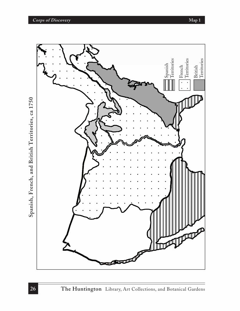
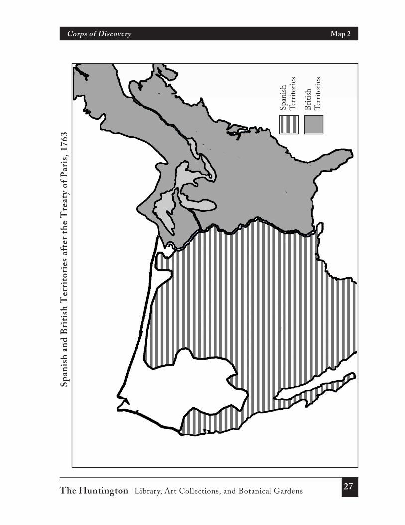
1. Begin the lesson with a study of several maps using textbook maps, classroom mapsof North America, or a historical atlas. (If you are unable to find textbook maps, seeMaps 1–4, pages 26–29.) Have students note the following:• French and Spanish possessions on the North American continent before the
Seven Years’ War (c. 1750)• English territorial possessions following the Seven Years’ War (Treaty of Paris,
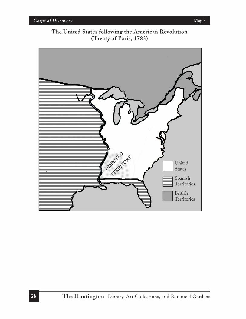
1763)• The United States following the American Revolution (Treaty of Paris, 1783)• Louisiana and Spanish West Florida in 1800
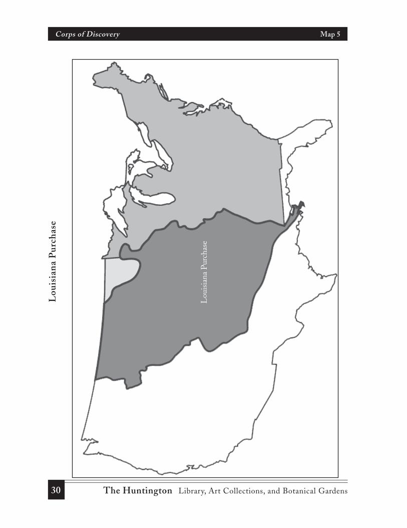
2. Duplicate the outline map of the Louisiana Purchase (Map 5, page 30), along withDocument 1, “The Louisians Purchase.” In groups, have students examine the mapand read Document 1. Referring to both, ask students to list reasons that the UnitedStates sought free use of the Mississippi River and the “right of deposit” in NewOrleans.
3. Distribute Document 2, “President Jefferson’s Secret Message to Congress.” Discussthe reasons the President may have wanted this message to be kept secret. WhenJefferson sent this message to Congress, Louisiana had not yet become a part of theUnited States. What evidence can be found in this secondary account of the secretmessage to Congress that suggests that the President planned to annex all or part ofthe Louisiana Territory?
6 The Huntington Library, Art Collections, and Botanical Gardens
Corps of Discovery Lesson Plan
4. Divide the class into small groups. Distribute Document 3, “President Jefferson’sInstructions to Meriwether Lewis.” As students read either the primary source orcontemporary English transcription have them list what the President hoped toaccomplish by this mission of exploration. Refer to the expedition as the “Corps ofDiscovery” and explain that “corps” is a group or unit. In a general class discussion,ask why Jefferson instructed Lewis to keep an accurate account of what he saw. Askquestions such as:• Why do you think the Lewis and Clark expedition was called the “Corps of
Discovery?”• Why was it so important to know about the river system?• Why was the President interested in knowing about Native Americans living in
the territory?• Why did Jefferson want Lewis to take notes on the plants and animals he would
come across in his journey?• Why did the President want the expedition to travel to the Pacific Ocean? Did
he believe that the Pacific Coast was part of the Louisiana Purchase?6. Assign textbook readings on the Lewis and Clark expedition. Refer to a map
showing the route of the Corps of Discovery. Maps are provided in some textbooksor may be found on the Internet. Have students trace the route on the outline mapof the Louisiana Purchase provided earlier in the lesson (Map 5). Ask students toimagine that they were members of the Corps of Discovery. In small groups of nomore than three, have students make a list of five observations that Lewis and Clarkmight have made in their journals. Have each group report on their lists and explainwhy they chose these five observations. How similar are the entries?
7. Document 4, “Selections from the Journals of Lewis and Clark,” provides a glimpse ofsome of the observations these two explorers entered in their journals. Either read theselected entries to the class or have different students read the entries aloud. Be surethat students realize that these represent no more than a fraction of the thousands ofentries in the detailed journals that Lewis and Clark kept. Inform the class that othermen in the Corps of Discovery also kept journals. From this short glimpse at journalentries, did Lewis and Clark seem to follow President Jefferson’s instructions?
8. Have each group construct a journal consisting of several sheets of paper, foldedhorizontally and fastened with string or ribbon through holes punched along thecrease. You may wish to provide parchment paper to give the impression of an oldmanuscript. Give each group a compass and have them walk around the schoolcampus mapping their route and recording what they see in their journal. Compassesare usually available in the science labs. To facilitate the “campus trek” it would bewise to assign specific areas of the school groups for the activity. Students shoulddraw representations of any plants, trees, shrubs, birds, or animals they come across.You may also suggest that students collect “specimens” of leaves or plants toincorporate in their journals. You should model this by bringing samples of leaves,
7The Huntington Library, Art Collections, and Botanical Gardens
Corps of Discovery Lesson Plan
flowers, rocks, etc., to class for students to sketch. Explain that a written descriptionshould be included with their sketches.Students should also note any topographical variations in the area they walk. Everyattempt should be made to draw maps to scale. A compass rose or legend should beincluded on each map. The maps they draw may either be included in their journalsor kept separate and submitted with their journals. You may wish to provide graphpaper for students to use in making their maps.
When completed post the maps and sample of the journals in the classroom. Havestudents discuss the problems they may have had in creating their maps and journals.Relate their experiences in this activity to the challenges Lewis and Clark may haveencountered in completing the task that President Jefferson had given them. Askquestions such as:
• How difficult is it to construct a topographical map?• How does your journal help to explain the map you have drawn?• Why is it important to have accurate maps?• What problems do you think Lewis and Clark may have faced in attempting to
record information about their discoveries?• Why did President Jefferson wish to have a good description of the area explored
and accurate maps of the territory?
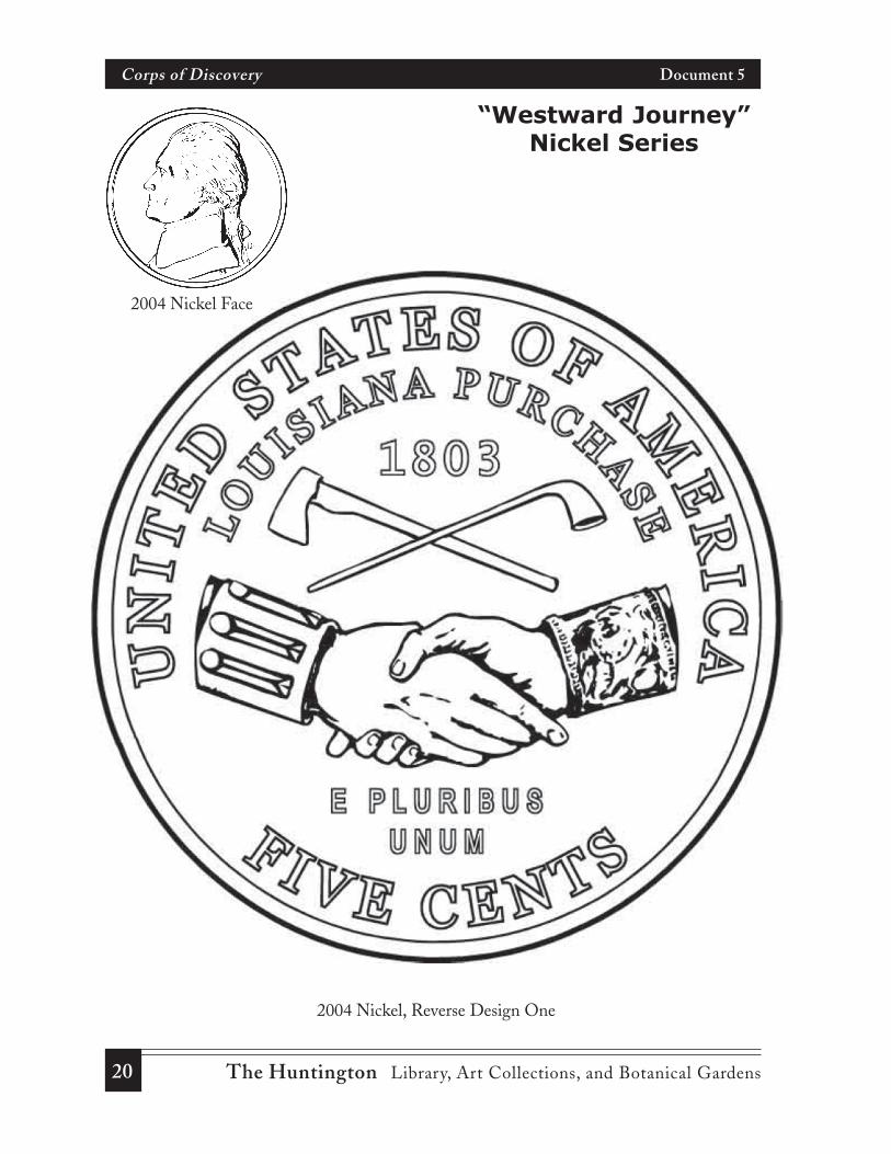
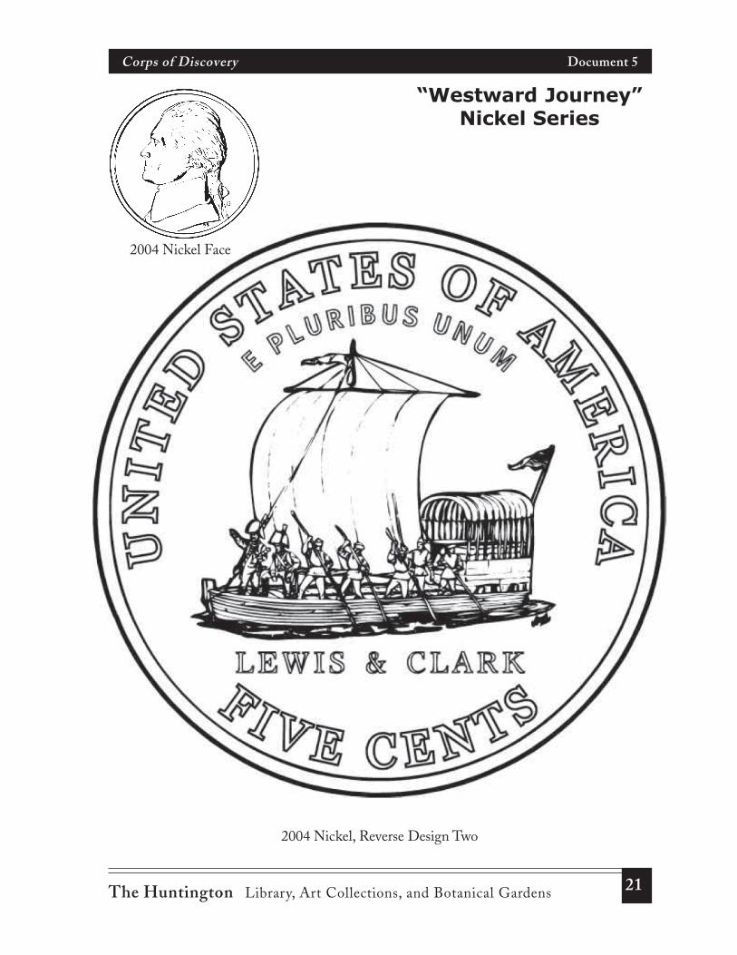
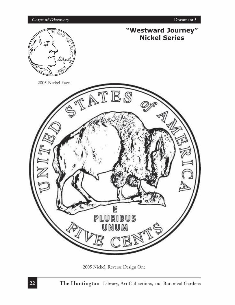
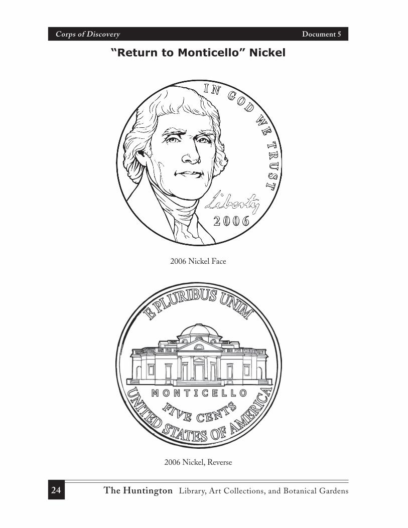
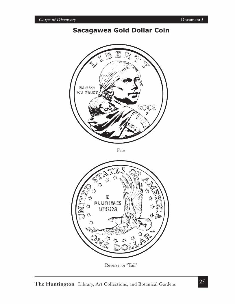
9. The United States Mint has produced commemorative nickels between 2002 and2004 to celebrate the Louisiana Purchase and the Lewis and Clark expedition. Anearlier “gold” dollar coin, minted in 2000, featured Sacagawea. Divide the class intofive groups (six groups if the dollar coin is used) and give each group the handoutshowing the coin images (Document 5).Ask each group to explain the significance of the pictures on the coins in relation tothe Corps of Discovery’s journey. Using these coins as models, have each groupdesign a new coin in any denomination to further commemorate “The WestwardJourney.” For example, a coin may include a portrait of one of the major participantsin the expedition on the front side and a scene representing the Pacific coast ofOregon, a specimen of one of the plants sketched in the Journal of Lewis and Clark,or a council with Native Americans.
In lieu of the coin design, you may wish to have the class examine postage stampscelebrating Lewis and Clark (see images on pages 17 and 19) and have studentsdesign a new postage stamp commemorating the Corps of Discovery.
V. Extended Geography Activities
1. Select a series of pictures that portray the physical geography along the Lewis andClark trek across the continent such as the Great Plains, Rocky Mountains, andPacific Coastal region. Photographs showing the physical features may be found inold issues of National Geographic or on the Internet by using different search words;
8 The Huntington Library, Art Collections, and Botanical Gardens
Corps of Discovery Lesson Plan
for example, “Missouri River,” “Prairie,” “Great Plains,” and “Continental Divide.”Have students working in groups examine selected photographs and write journalentries describing the physical features of the region from the perspective of amember of the Corps of Discovery. In their journals they should include climate andvegetation of different regions of the country that they may infer from thephotographs.
2. The Corps of Discovery traveled through 11 states and established camps during thethree years journey. Students may follow the Lewis and Clark trail on one of severalwebsites devoted to the Corps of Discovery. (The resources on page 32 list severalinteractive Internet sources.)
3. The following places are in some way associated with the Lewis and Clarkexpedition:• St. Louis, Missouri• Independence, Missouri• Fort Osage, Missouri• Sioux City, Iowa• Great Falls, Montana• Big Sandy, Montana• Fort Clatsop (near Astoria), Oregon“Location” is the first of the five themes of geography. Review the meaning of“absolute” and “relative” location. Students should understand that an “absolutelocation” is a very specific location given as its latitude and longitude for a globallocation or a street address for a local location; relative locations are described bylandmarks, direction or distance from one place to another. Using a map or atlas,have students give the absolute location of each of the above places in latitude andlongitude and describe its “relative location.”
Teacher’s Note
You will be able to find the exact latitude and longitude of each ofthese sites by using the Atlas Query’s Latitude and LongitudeFinder,
<http://stutzfamily.com/mrstutz/LatLong/findlatlong3.htm>
9The Huntington Library, Art Collections, and Botanical Gardens
Corps of Discovery Document 1
The Louisiana PurchaseSecondary Source
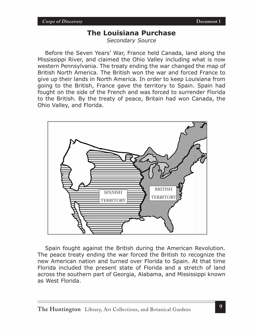
Before the Seven Years’ War, France held Canada, land along theMississippi River, and claimed the Ohio Valley including what is nowwestern Pennsylvania. The treaty ending the war changed the map ofBritish North America. The British won the war and forced France togive up their lands in North America. In order to keep Louisiana fromgoing to the British, France gave the territory to Spain. Spain hadfought on the side of the French and was forced to surrender Floridato the British. By the treaty of peace, Britain had won Canada, theOhio Valley, and Florida.
Spain fought against the British during the American Revolution.The peace treaty ending the war forced the British to recognize thenew American nation and turned over Florida to Spain. At that timeFlorida included the present state of Florida and a stretch of landacross the southern part of Georgia, Alabama, and Mississippi knownas West Florida.
SPANISH
TERRITORY
BRITISH
TERRITORY
10 The Huntington Library, Art Collections, and Botanical Gardens
Corps of Discovery Document 1
The United States had worked out an agreement with Spain for use ofthe Mississippi River and the right to store supplies, known as the “rightof deposit,” in New Orleans. It was difficult for farmers to send theirproducts across the Appalachian Mountains. They wanted to make surethat they could ship goods on barges down the Mississippi and storethem at New Orleans until they could be loaded on ocean-going ships.
After Napoleon Bonaparte became the French leader, he signed asecret treaty with Spain that would turn Louisiana back to France. Whenthis secret treaty became known President Thomas Jefferson sent JamesMonroe to France. He wanted to try to get the French to agree to freeuse of the Mississippi River and the right of deposit. When this failed,President Jefferson offered to buy New Orleans and West Florida fortwo million dollars. He instructed Monroe to go as high as ten million, ifnecessary. Spain still held West Florida and would not agree to sell it tothe U.S. The French refused to grant the right of deposit in New Orleansbut, to the surprise of the American ministers, offered all of Louisianato the United States for 15 million dollars.
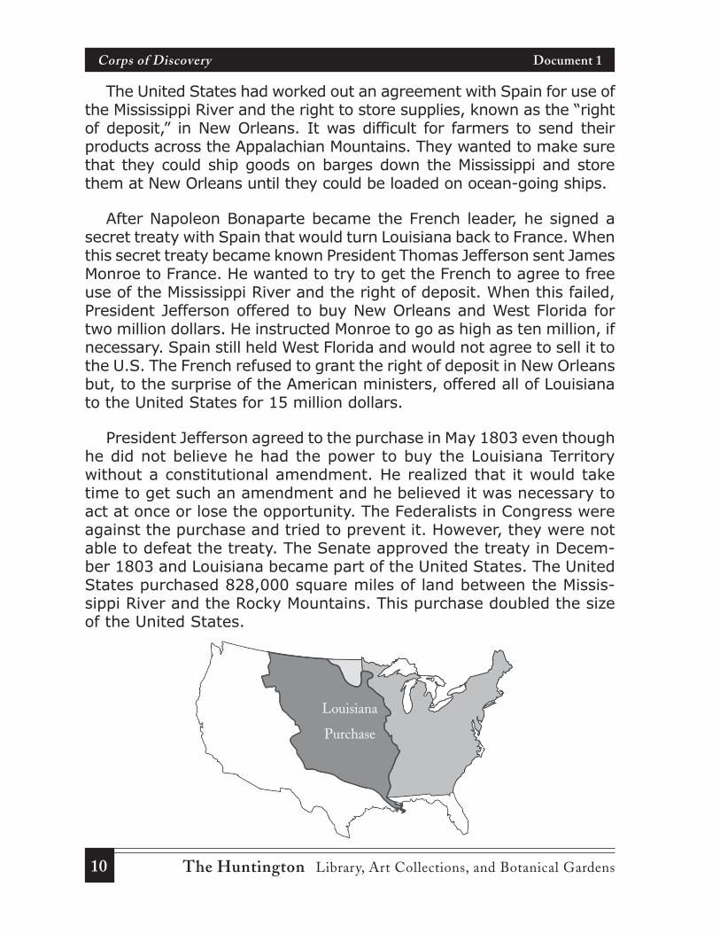
President Jefferson agreed to the purchase in May 1803 even thoughhe did not believe he had the power to buy the Louisiana Territorywithout a constitutional amendment. He realized that it would taketime to get such an amendment and he believed it was necessary toact at once or lose the opportunity. The Federalists in Congress wereagainst the purchase and tried to prevent it. However, they were notable to defeat the treaty. The Senate approved the treaty in Decem-ber 1803 and Louisiana became part of the United States. The UnitedStates purchased 828,000 square miles of land between the Missis-sippi River and the Rocky Mountains. This purchase doubled the sizeof the United States.
Louisiana
Purchase
11The Huntington Library, Art Collections, and Botanical Gardens
Corps of Discovery Document 2
President Jefferson’s Secret Message to CongressSecondary Source
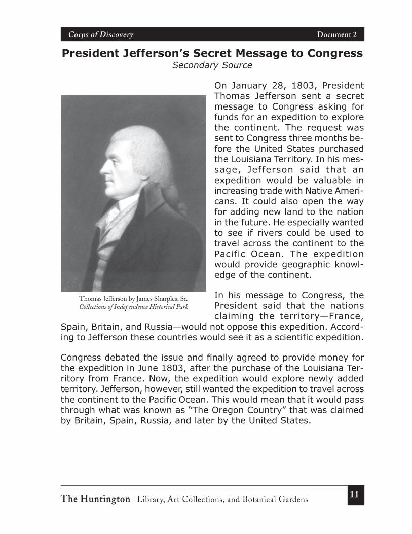
On January 28, 1803, PresidentThomas Jefferson sent a secretmessage to Congress asking forfunds for an expedition to explorethe continent. The request wassent to Congress three months be-fore the United States purchasedthe Louisiana Territory. In his mes-sage, Jefferson said that anexpedition would be valuable inincreasing trade with Native Ameri-cans. It could also open the wayfor adding new land to the nationin the future. He especially wantedto see if rivers could be used totravel across the continent to thePacific Ocean. The expeditionwould provide geographic knowl-edge of the continent.
In his message to Congress, thePresident said that the nationsclaiming the territory—France,
Spain, Britain, and Russia—would not oppose this expedition. Accord-ing to Jefferson these countries would see it as a scientific expedition.
Congress debated the issue and finally agreed to provide money forthe expedition in June 1803, after the purchase of the Louisiana Ter-ritory from France. Now, the expedition would explore newly addedterritory. Jefferson, however, still wanted the expedition to travel acrossthe continent to the Pacific Ocean. This would mean that it would passthrough what was known as “The Oregon Country” that was claimedby Britain, Spain, Russia, and later by the United States.
Thomas Jefferson by James Sharples, Sr.Collections of Independence Historical Park
12 The Huntington Library, Art Collections, and Botanical Gardens
Corps of Discovery Document 2
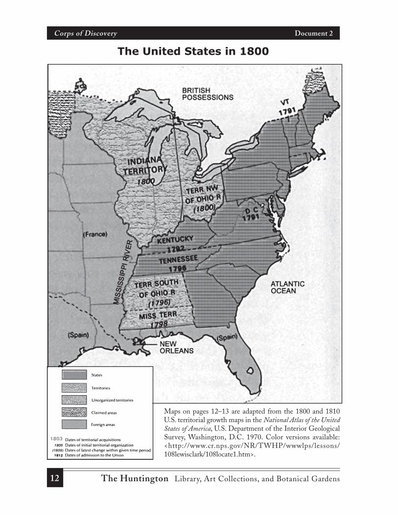
The United States in 1800
Maps on pages 12–13 are adapted from the 1800 and 1810U.S. territorial growth maps in the National Atlas of the UnitedStates of America, U.S. Department of the Interior GeologicalSurvey, Washington, D.C. 1970. Color versions available:<http://www.cr.nps.gov/NR/TWHP/wwwlps/lessons/108lewisclark/108locate1.htm>.
13The Huntington Library, Art Collections, and Botanical Gardens
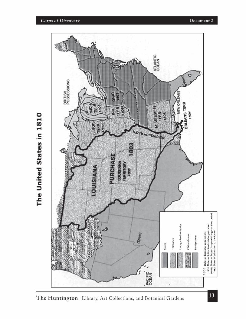
Corps of Discovery Document 2
Th
e U
nit
ed
Sta
tes
in 1
81
0
14 The Huntington Library, Art Collections, and Botanical Gardens
Corps of Discovery Document 3
President Jefferson’sInstructions to Meriwether Lewis
When Thomas Jefferson became President in 1801he asked Meriwether Lewis, a captain in the army, tobe his personal secretary. Captain Lewis was a ter-rible speller and the last man anyone would imagineas secretary to the President of the United States.Lewis, however, was the best qualified to head anexpedition of discovery. Did the President have some-thing else in mind for his newly appointed secretary?
. . . The object of your mission isto explore the Missouri River, andsuch principal stream of it, as, byits course and communication withthe water of the Pacific Ocean mayoffer the most direct and practi-cable water communication acrossthis continent, for the purposes ofcommerce.
Beginning at the mouth of the Mis-souri, you will take observationsof latitude and longitude at all re-markable points on the river, andespecially at the mouths of rivers,at rapids, at islands, and otherplaces. . . .
The interesting points of portagebetween the heads of the Missouriand the water offering the bestcommunication with the PacificOcean should be fixed by obser-vation and the course of that water
Contemporary English
. . . You are to explore the Mis-souri River to see if it or any branchof the river reaches the PacificOcean. You are to try to find themost direct water route to theocean for the purpose of trade.
Begin at the mouth of the MissouriRiver and take down the latitudeand longitude at all special pointson the river, and especially at themouths of other rivers, at rapids,at islands, and other places. . . .
Make notes on places where youwill have to leave the river andtravel overland carrying thekeelboat to another river. You areto find the best passage by rivers
Primary Source
15The Huntington Library, Art Collections, and Botanical Gardens
Corps of Discovery Document 3
to the ocean. . . . Your observa-tions are to be taken with greatpains and accuracy. . . .
The commerce which may be car-ried on with the people inhabitingthe line you will pursue renders aknowledge of these people impor-tant. You will therefore endeavorto make yourself acquainted . . .with the names of the nations andtheir numbers; the extent and lim-its of their possessions; theirrelations with other tribes or na-tions; their language, traditions .. . ; their food, clothing . . . ; thediseases prevalent among them,and the remedies they use . . . ;and articles of commerce they mayneed or furnish and to what ex-tent.
Other objects worthy of notice willbe: the soil and face of the coun-try, its growth and vegetableproductions, especially those notof the U.S.; the animals of thecountry . . . ; the mineral produc-tions of every kind . . . ; volcanicappearances; climate as charac-terized by the thermometer, by theproportion of rainy, cloudy, andclear days, by lightning, hail, snow,ice . . . , by the winds, . . . thedates at which particular plants putforth or lose their flowers, or leaf,times of appearance of particularbirds, reptiles, or insects. . . .
Contemporary English, cont.Primary Source, cont.
to the Pacific Ocean. Your obser-vations are to be taken with greatpains and accuracy.
It is important to know about Na-tive Americans living along yourroute so that we can carry outtrade with them. You will try toknow as much about them as youcan. Know the names of the na-tions and their numbers; the landsthey live on; how they get alongwith other tribes or nations; theirlanguage, traditions . . . ; theirfood, clothing . . . ; the diseasescommon among them, and howthey treat these diseases . . . ;and the things they trade and any-thing they may need.
You are also to make observationson the geography of the land. Youshould pay attention to the soil,what vegetables grow there, es-pecially those that do not grow inthe U.S. Make a list of the animalsyou come across. Record everykind of minerals; any signs of vol-canoes; climate, the range oftemperatures, the number of rainy,cloudy, and clear days; make noteof lightning, hail, snow, ice . . . ,and the winds, . . . the dates whenplants put forth or lose their flow-ers or leaves. Record the times ofthe year you see particular birds,reptiles, or insects. . . .
16 The Huntington Library, Art Collections, and Botanical Gardens
Corps of Discovery Document 3
♦ Why did President Jefferson give these special instructions toMeriwether Lewis?
♦ What did he hope the expedition would accomplish?
♦ How important was it to know about the river system in thewest? About the physical geography and the climate in the west?
♦ Why would it be important to know about the Native Americansin the region?
17The Huntington Library, Art Collections, and Botanical Gardens
Corps of Discovery Document 4
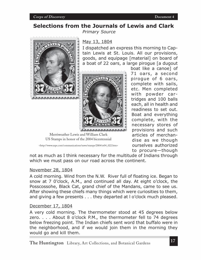
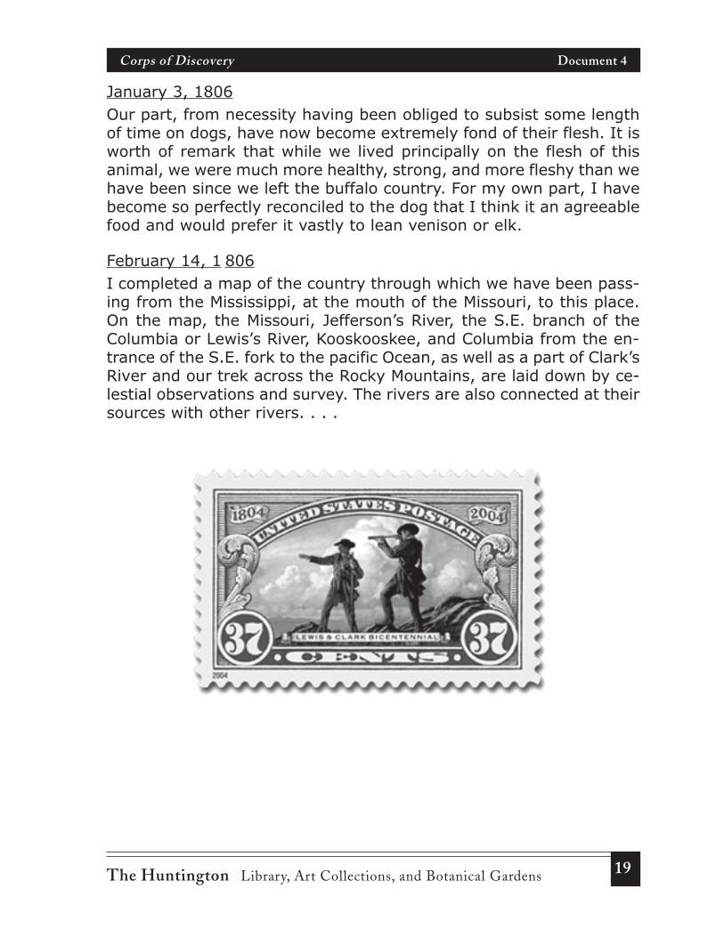
Merriweather Lewis and William ClarkUS Stamps in honor of the 2004 bicentennial
<http://www.usps.com/communications/news/stamps/2004/sr04_022.htm>
Selections from the Journals of Lewis and ClarkPrimary Source
May 13, 1804I dispatched an express this morning to Cap-tain Lewis at St. Louis. All our provisions,goods, and equipage [material] on board ofa boat of 22 oars, a large pirogue [a dugout
boat like a canoe] of71 oars, a secondpirogue of 6 oars,complete with sails,etc. Men completedwith powder car-tridges and 100 ballseach, all in health andreadiness to set out.Boat and everythingcomplete, with thenecessary stores ofprovisions and sucharticles of merchan-dise as we thoughourselves authorizedto procure—though
not as much as I think necessary for the multitude of Indians throughwhich we must pass on our road across the continent.
November 28, 1804A cold morning. Wind from the N.W. River full of floating ice. Began tosnow at 7 0’clock, A.M., and continued all day. At eight o’clock, thePosscossohe, Black Cat, grand chief of the Mandans, came to see us.After showing these chiefs many things which were curiosities to them,and giving a few presents . . . they departed at l o’clock much pleased.
December 17, 1804A very cold morning. The thermometer stood at 45 degrees belowzero. . . . About 8 o’clock P.M., the thermometer fell to 74 degreesbelow freezing point. The Indian chiefs sent word that buffalo were inthe neighborhood, and if we would join them in the morning theywould go and kill them.
18 The Huntington Library, Art Collections, and Botanical Gardens
Corps of Discovery Document 4
January 13, 1805A cold, clear day. Great numbers of Indians move down the river tohunt. Those people kill a number of buffalo near the villages and savea great proportion of the meat. . . . Their corn and beans, etc., theykeep for the summer, and as a reserve in case of an attack from theSioux, of which they are always in dread, and seldom go far to huntexcept in large parties. . . .
April 22, 1805. . . The broken hills of the Missouri, about this place, exhibit largeirregular and broken masses of rock and stone; some of which, though200 feet above the level of the water, seem at some former period tohave felt its influence, for they appear smooth as if worn by the agita-tion of the water. This collection consists of white and gray granite, abrittle black rock, flint, limestone, freestone, some small specimensof an excellent pebble and occasionally broken . . . stone which ap-pears to be petrified wood. . . . Coal or carbonated wood, pumicestone, lava, and other mineral appearances still continue. The coalappears to be of better quality. I exposed a specimen of it to the fire,and found that it burned tolerably well; it afforded but little flame orsmoke, but produced a hot and lasting fire. . . .
November 3, 1805A mountain which we suppose to be Mt. Hood is S. 85 degrees E.,about 47 miles distant from the mouth of Quicksand River. This moun-tain is covered with snow and in the range of mountains which wehave passed through and is of a conical form [pointed, similar to avolcano], but rugged. After taking dinner at the mouth of this river,we proceeded on.
November 20, 1805Found many of the Chinooks with Captain Lewis, of whom there were2 chiefs, Comcommoly and Chillarlawil, to whom we gave medals,and to one a flag. One of the Indians had on a robe made of two sea-otter skins. The fur of them was more beautiful than any fur I hadever seen. Both Captain Lewis and myself endeavored to purchasethe robe with different articles. At length, we procured it for a belt ofblue beads which the squaw wife of our interpreter Charbonneau[Sacagawea] wore around her waist.
19The Huntington Library, Art Collections, and Botanical Gardens
Corps of Discovery Document 4
January 3, 1806Our part, from necessity having been obliged to subsist some lengthof time on dogs, have now become extremely fond of their flesh. It isworth of remark that while we lived principally on the flesh of thisanimal, we were much more healthy, strong, and more fleshy than wehave been since we left the buffalo country. For my own part, I havebecome so perfectly reconciled to the dog that I think it an agreeablefood and would prefer it vastly to lean venison or elk.
February 14, 1 806I completed a map of the country through which we have been pass-ing from the Mississippi, at the mouth of the Missouri, to this place.On the map, the Missouri, Jefferson’s River, the S.E. branch of theColumbia or Lewis’s River, Kooskooskee, and Columbia from the en-trance of the S.E. fork to the pacific Ocean, as well as a part of Clark’sRiver and our trek across the Rocky Mountains, are laid down by ce-lestial observations and survey. The rivers are also connected at theirsources with other rivers. . . .
20 The Huntington Library, Art Collections, and Botanical Gardens
Corps of Discovery Document 5
2004 Nickel, Reverse Design One
“Westward Journey”Nickel Series
2004 Nickel Face
21The Huntington Library, Art Collections, and Botanical Gardens
Corps of Discovery Document 5
2004 Nickel, Reverse Design Two
2004 Nickel Face
“Westward Journey”Nickel Series
22 The Huntington Library, Art Collections, and Botanical Gardens
Corps of Discovery Document 5
2005 Nickel, Reverse Design One
2005 Nickel Face
“Westward Journey”Nickel Series

23The Huntington Library, Art Collections, and Botanical Gardens
Corps of Discovery Document 5
2005 Nickel, Reverse Design Two
2005 Nickel Face
“Westward Journey”Nickel Series
24 The Huntington Library, Art Collections, and Botanical Gardens
Corps of Discovery Document 5
2006 Nickel, Reverse
2006 Nickel Face
“Return to Monticello” Nickel
25The Huntington Library, Art Collections, and Botanical Gardens
Corps of Discovery Document 5
Sacagawea Gold Dollar Coin
Face
Reverse, or “Tail”
26 The Huntington Library, Art Collections, and Botanical Gardens
Corps of Discovery Map 1
Span
ish,
Fre
nch,
and
Bri
tish
Ter
rito
ries
, ca
1750
Span
ish
Terr
itori
es
Fren
chTe
rrito
ries
Bri
tish
Terr
itori
es
27The Huntington Library, Art Collections, and Botanical Gardens
Corps of Discovery Map 2
Span
ish
Terr
itori
es
Bri
tish
Terr
itori
es
Span
ish
and
Bri
tish
Ter
rito
ries
aft
er t
he T
reat
y of
Par
is, 1
763
28 The Huntington Library, Art Collections, and Botanical Gardens
Corps of Discovery Map 3
The United States following the American Revolution(Treaty of Paris, 1783)
DISPUTED
TERRITORY
UnitedStates
SpanishTerritories
BritishTerritories
29The Huntington Library, Art Collections, and Botanical Gardens
Corps of Discovery Map 4
Uni
ted
Stat
es
U. S
.Te
rrito
ries
Span
ish
Terr
itori
es
Are
a gi
ven
back
toFr
ance
in th
e se
cret
“Tre
aty
of S
anIl
edef
onso
,”18
00
The
Uni
ted
Stat
es, 1
800
30 The Huntington Library, Art Collections, and Botanical Gardens
Corps of Discovery Map 5
Lou
isia
na P
urch
ase
Lou
isia
na P
urch
ase
31The Huntington Library, Art Collections, and Botanical Gardens
Corps of Discovery Resources
Resources
Blumberg, Rhoda. The Incredible Journey of Lewis and Clark. Lothrop, Lee & Shepard, 1987.This retelling of the expedition by a noted children’s author explores the confrontationof two cultures along the route of the Corps of Discovery.
Erdrich, Lise. Sacagawea. Lerner, 2003.This is the story of a young Shoshone woman who joined the Lewis and Clark expedi-tion with her French-Canadian husband. Sacagawea served the Corps of Discovery asan interpreter and was responsible for saving the expedition from ruin on several occa-sions. The book includes a number of illustrations by Julie Buffalohead.
Fifwer, Barbara. Going Along with Lewis and Clark. Farcountry Press, 2000.The book follows the route of the expedition and describes dramatic events along theway. It includes the day-to-day activities of the Corps of Discovery including findingand cooking food.
Jaffe, Elizabeth, and Alecia Long. The Louisiana Purchase. Capstone Press, 2002.The book is part of the “Let Freedom Ring” series. It relates a dramatic story of theevolution of the Louisiana Purchase and the bargaining that finally led to the purchase.
Johmann, Carol A. The Lewis & Clark Expedition: Join the Corps of Discovery to Explore Un-charted Territory. Williamson Publishing, 2003.A Kaleidoscope Kids Book that includes information about the Lewis and Clark expe-dition and a number of related activities.
Karwoski, Gail Langer. Seaman: The Dog who Explored the West with Lewis & Clark. PeachtreePublishers, 1999.Although a fictional account, the story of this black Newfoundland is based on histori-cal accounts of the expedition and includes references to Seaman’s adventures reportedin Lewis’ journal.
“Lewis and Clark: The Corps of Discovery, Connect, Vol. 17, Issue 1 (September/October 2003).This issue of Connect, a magazine devoted to innovative instruction in science, math-ematics, and technology, contains articles on celestial navigation, foods and medicinefound along the Lewis and Clark trail, and suggestions for the development of student-made journals.
32 The Huntington Library, Art Collections, and Botanical Gardens
Corps of Discovery Resources
“Lewis and Clark New Perspectives,” Gateway Heritage, Vol. 24, No. 2 & 3 (Fall 2003-Winter2004).This quarterly magazine of the Missouri Historical Society contains an excellent over-view of the expedition, a detailed timeline, letters Meriwether Lewis wrote to his mother,the Mandan and Hidatsa perspectives on the Corp of Discovery, and much more. Rec-ommended as teacher reading.
Schanzer, Rosalyn. How We Crossed the West, The Adventures of Lewis and Clark. National Geo-graphic, 1997.The book includes short excerpts from the journals of Lewis, Clark, an other membersof the Corp of Discovery.
Internet
“Hip Pocket Change” The United States Mint’s Fun Facts for Kids.The website includes teacher materials and activities associated with the mint’s West-ward Journey Nickel Series.<http://www.usmint.gov/kids/index.cfm?fileContents=teachers/nickelLessons.cfm>
Jefferson National Expansion MemorialThis website includes a list of all members of the Corps of Discovery along with briefbiographies of several members of the party including York, Sacagawea, and Chabonneau.There is also some information on Seaman, Lewis’ black Newfoundland dog.<http://www.nps.gov/archive/jeff/LewisClark2/HomePage/HomePage.htm>
“Lewis and Clark: Mapping the West,” National Museum of American History, SmithsonianInstitutionAn overview of the Lewis and Clark expedition. <http://www.edgate.com/lewisandclark>.
“Lewis and Clark: The Journal of the Corps of Discovery,” PBSSelected entries from the Lewis and Clark Journals. <http://www.pbs.org/lewisandclark>
PBS, Inside the Corps
This is part of a larger PBS website devoted to the Corps of Discovery. Inside the Corpsgives biographical sketches about members of the Corps of Discovery from the mostfamous to the virtually unknown. It also provides a partial list of supplies brought on theexpedition and put the expedition into historical perspective. <http://www.pbs.org/lewisandclark/inside>
Lewis and Clark Trail, “Re-live the Adventure”An online virtual tour of the Corp of Discovery’s 8,000 mile trek from Camp Dubois(Wood River, Illinois) on May 14, 1804 to their return to Missouri in September 1806.<http://lewisandclarktrail.com>