The Control of Nature ATCHAFALAYA The New Yorker
33
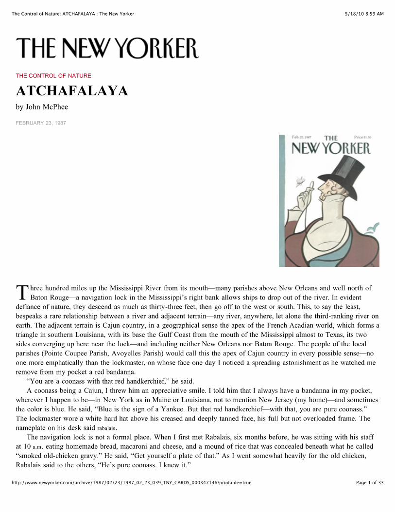
5/18/10 8:59 AM The Control of Nature: ATCHAFALAYA : The New Yorker Page 1 of 33 http://www.newyorker.com/archive/1987/02/23/1987_02_23_039_TNY_CARDS_000347146?printable=true T THE CONTROL OF NATURE ATCHAFALAYA by John McPhee FEBRUARY 23, 1987 hree hundred miles up the Mississippi River from its mouth—many parishes above New Orleans and well north of Baton Rouge—a navigation lock in the Mississippi’s right bank allows ships to drop out of the river. In evident defiance of nature, they descend as much as thirty-three feet, then go off to the west or south. This, to say the least, bespeaks a rare relationship between a river and adjacent terrain—any river, anywhere, let alone the third-ranking river on earth. The adjacent terrain is Cajun country, in a geographical sense the apex of the French Acadian world, which forms a triangle in southern Louisiana, with its base the Gulf Coast from the mouth of the Mississippi almost to Texas, its two sides converging up here near the lock—and including neither New Orleans nor Baton Rouge. The people of the local parishes (Pointe Coupee Parish, Avoyelles Parish) would call this the apex of Cajun country in every possible sense—no one more emphatically than the lockmaster, on whose face one day I noticed a spreading astonishment as he watched me remove from my pocket a red bandanna. “You are a coonass with that red handkerchief,” he said. A coonass being a Cajun, I threw him an appreciative smile. I told him that I always have a bandanna in my pocket, wherever I happen to be—in New York as in Maine or Louisiana, not to mention New Jersey (my home)—and sometimes the color is blue. He said, “Blue is the sign of a Yankee. But that red handkerchief—with that, you are pure coonass.” The lockmaster wore a white hard hat above his creased and deeply tanned face, his full but not overloaded frame. The nameplate on his desk said rabalais . The navigation lock is not a formal place. When I first met Rabalais, six months before, he was sitting with his staff at 10 a.m. eating homemade bread, macaroni and cheese, and a mound of rice that was concealed beneath what he called “smoked old-chicken gravy.” He said, “Get yourself a plate of that.” As I went somewhat heavily for the old chicken, Rabalais said to the others, “He’s pure coonass. I knew it.”
Transcript of The Control of Nature ATCHAFALAYA The New Yorker
5/18/10 8:59 AMThe Control of Nature: ATCHAFALAYA : The New Yorker
Page 1 of 33http://www.newyorker.com/archive/1987/02/23/1987_02_23_039_TNY_CARDS_000347146?printable=true
T
THE CONTROL OF NATURE
ATCHAFALAYAby John McPhee
FEBRUARY 23, 1987
hree hundred miles up the Mississippi River from its mouth—many parishes above New Orleans and well north ofBaton Rouge—a navigation lock in the Mississippi’s right bank allows ships to drop out of the river. In evident
defiance of nature, they descend as much as thirty-three feet, then go off to the west or south. This, to say the least,bespeaks a rare relationship between a river and adjacent terrain—any river, anywhere, let alone the third-ranking river onearth. The adjacent terrain is Cajun country, in a geographical sense the apex of the French Acadian world, which forms atriangle in southern Louisiana, with its base the Gulf Coast from the mouth of the Mississippi almost to Texas, its twosides converging up here near the lock—and including neither New Orleans nor Baton Rouge. The people of the localparishes (Pointe Coupee Parish, Avoyelles Parish) would call this the apex of Cajun country in every possible sense—noone more emphatically than the lockmaster, on whose face one day I noticed a spreading astonishment as he watched meremove from my pocket a red bandanna.
“You are a coonass with that red handkerchief,” he said.A coonass being a Cajun, I threw him an appreciative smile. I told him that I always have a bandanna in my pocket,
wherever I happen to be—in New York as in Maine or Louisiana, not to mention New Jersey (my home)—and sometimesthe color is blue. He said, “Blue is the sign of a Yankee. But that red handkerchief—with that, you are pure coonass.”The lockmaster wore a white hard hat above his creased and deeply tanned face, his full but not overloaded frame. Thenameplate on his desk said rabalais.
The navigation lock is not a formal place. When I first met Rabalais, six months before, he was sitting with his staffat 10 a.m. eating homemade bread, macaroni and cheese, and a mound of rice that was concealed beneath what he called“smoked old-chicken gravy.” He said, “Get yourself a plate of that.” As I went somewhat heavily for the old chicken,Rabalais said to the others, “He’s pure coonass. I knew it.”

5/18/10 8:59 AMThe Control of Nature: ATCHAFALAYA : The New Yorker
Page 2 of 33http://www.newyorker.com/archive/1987/02/23/1987_02_23_039_TNY_CARDS_000347146?printable=true
If I was pure coonass, I would like to know what that made Rabalais—Norris F. Rabalais, born and raised on a farmnear Simmesport, in Avoyelles Parish, Louisiana. When Rabalais was a child, there was no navigation lock to lower shipsfrom the Mississippi. The water just poured out—boats with it—and flowed on into a distributary waterscape known asAtchafalaya. In each decade since about 1860, the Atchafalaya River had drawn off more water from the Mississippi thanit had in the decade before. By the late nineteen-forties, when Rabalais was in his teens, the volume approached one-third. As the Atchafalaya widened and deepened, eroding headward, offering the Mississippi an increasingly attractivealternative, it was preparing for nothing less than an absolute capture: before long, it would take all of the Mississippi,and itself become the master stream. Rabalais said, “They used to teach us in high school that one day there was going tobe structures up here to control the flow of that water, but I never dreamed I was going to be on one. Somebody way backyonder—which is dead and gone now—visualized it. We had some pretty sharp teachers.”
The Mississippi River, with its sand and silt, has created most of Louisiana, and it could not have done so byremaining in one channel. If it had, southern Louisiana would be a long narrow peninsula reaching into the Gulf ofMexico. Southern Louisiana exists in its present form because the Mississippi River has jumped here and there within anarc about two hundred miles wide, like a pianist playing with one hand—frequently and radically changing course,surging over the left or the right bank to go off in utterly new directions. Always it is the river’s purpose to get to theGulf by the shortest and steepest gradient. As the mouth advances southward and the river lengthens, the gradientdeclines, the current slows, and sediment builds up the bed. Eventually, it builds up so much that the river spills to oneside. Major shifts of that nature have tended to occur roughly once a millennium. The Mississippi’s main channel of threethousand years ago is now the quiet water of Bayou Teche, which mimics the shape of the Mississippi. Along BayouTeche, on the high ground of ancient natural levees, are Jeanerette, Breaux Bridge, Broussard, Olivier—arcuate strings ofCajun towns. Eight hundred years before the birth of Christ, the channel was captured from the east. It shifted abruptlyand flowed in that direction for about a thousand years. In the second century a.d., it was captured again, and taken south,by the now unprepossessing Bayou Lafourche, which, by the year 1000, was losing its hegemony to the river’s presentcourse, through the region that would be known as Plaquemines. By the nineteen-fifties, the Mississippi River hadadvanced so far past New Orleans and out into the Gulf that it was about to shift again, and its offspring Atchafalaya wasready to receive it. By the route of the Atchafalaya, the distance across the delta plain was a hundred and forty-five miles—well under half the length of the route of the master stream.
For the Mississippi to make such a change was completely natural, but in the interval since the last shift Europeanshad settled beside the river, a nation had developed, and the nation could not afford nature. The consequences of theAtchafalaya’s conquest of the Mississippi would include but not be limited to the demise of Baton Rouge and the virtualdestruction of New Orleans. With its fresh water gone, its harbor a silt bar, its economy disconnected from inlandcommerce, New Orleans would turn into New Gomorrah. Moreover, there were so many big industries between the twocities that at night they made the river glow like a worm. As a result of settlement patterns, this reach of the Mississippihad long been known as “the German coast,” and now, with B. F. Goodrich, E. I. du Pont, Union Carbide, ReynoldsMetals, Shell, Mobil, Texaco, Exxon, Monsanto, Uniroyal, Georgia-Pacific, Hydrocarbon Industries, Vulcan Materials,Nalco Chemical, Freeport Chemical, Dow Chemical, Allied Chemical, Stauffer Chemical, Hooker Chemicals, RubiconChemicals, American Petrofina—with an infrastructural concentration equalled in few other places—it was often called“the American Ruhr.” The industries were there because of the river. They had come for its navigational convenience andits fresh water. They would not, and could not, linger beside a tidal creek. For nature to take its course was simplyunthinkable. The Sixth World War would do less damage to southern Louisiana. Nature, in this place, had become anenemy of the state.
Rabalais works for the U.S. Army Corps of Engineers. Some years ago, the Corps made a film that showed thenavigation lock and a complex of associated structures built in an effort to prevent the capture of the Mississippi. Thenarrator said, “This nation has a large and powerful adversary. Our opponent could cause the United States to lose nearlyall her seaborne commerce, to lose her standing as first among trading nations. . . .We are fighting Mother Nature. . . .It’sa battle we have to fight day by day, year by year; the health of our economy depends on victory.”
Rabalais was in on the action from the beginning, working as a construction inspector. Here by the site of thenavigation lock was where the battle had begun. An old meander bend of the Mississippi was the conduit through which

5/18/10 8:59 AMThe Control of Nature: ATCHAFALAYA : The New Yorker
Page 3 of 33http://www.newyorker.com/archive/1987/02/23/1987_02_23_039_TNY_CARDS_000347146?printable=true
A
navigation lock was where the battle had begun. An old meander bend of the Mississippi was the conduit through whichwater had been escaping into the Atchafalaya. Complicating the scene, the old meander bend had also served as themouth of the Red River. Coming in from the northwest, from Texas via Shreveport, the Red River had been a tributary ofthe Mississippi for a couple of thousand years—until the nineteen-forties, when the Atchafalaya captured it and drew itaway. The capture of the Red increased the Atchafalaya’s power as it cut down the country beside the Mississippi. On amap, these entangling watercourses had come to look like the letter “H.” The Mississippi was the right-hand side. TheAtchafalaya and the captured Red were the left-hand side. The crosspiece, scarcely seven miles long, was the formermeander bend, which the people of the parish had long since named Old River. Sometimes enough water would pour outof the Mississippi and through Old River to quintuple the falls at Niagara. It was at Old River that the United States wasgoing to lose its status among the world’s trading nations. It was at Old River that New Orleans would be lost, BatonRouge would be lost. At Old River, we would lose the American Ruhr. The Army’s name for its operation there was OldRiver Control.
Rabalais gestured across the lock toward what seemed to be a pair of placid lakes separated by a trapezoidal earthdam a hundred feet high. It weighed five million tons, and it had stopped Old River. It had cut Old River in two. Thesevered ends were sitting there filling up with weeds. Where the Atchafalaya had entrapped the Mississippi, bigmouthbass were now in charge. The navigation lock had been dug beside this monument. The big dam, like the lock, was fittedinto the mainline levee of the Mississippi. In Rabalais’s pickup, we drove on the top of the dam, and drifted as wedthrough Old River country. On this day, he said, the water on the Mississippi side was eighteen feet above sea level,while the water on the Atchafalaya side was five feet above sea level. Cattle were grazing on the slopes of the levees, andwhite horses with white colts, in deep-green grass. Behind the levees, the fields were flat and reached to rows of distanttrees. Very early in the morning, a low fog had covered the fields. The sun, just above the horizon, was large and ruddy inthe mist, rising slowly, like a hot-air baboon. This was a countryside of corn and soybeans, of grain-fed-catfish ponds, offeed stores and Kingdom Halls in crossroad towns. There were small neat cemeteries with ranks of white sarcophagiraised a foot or two aboveground, notwithstanding the protection of the levees. There were tarpapered cabins on concretepylons, and low brick houses under planted pines. Pickups under the pines. If this was a form of battlefield, it was notunlike a great many battlefields—landscapes so quiet they belie their story. Most battlefields, though, are places wheresomething happened once. Here it would happen indefinitely.
We went out to the Mississippi. Still indistinct in mist, it looked like a piece of the sea. Rabalais said, “That’s a widebooger, right there.” In the spring high water of vintage years—1927, 1937, 1973—more than two million cubic feet ofwater had gone by this place in every second. Sixty-five kilotons per second. By the mouth of the inflow channel leadingto the lock were rock jetties, articulated concrete mattress revetments, and other heavy defenses. Rabalais observed thatthis particular site was no more vulnerable than almost any other point in this reach of river that ran so close to theAtchafalaya plain. There were countless places where a breakout might occur: “It has a tendency to go through justanywheres you can call for.”
Why, then, had the Mississippi not jumped the bank and long since diverted to the Atchafalaya?“Because they’re watching it close,” said Rabalais. “It’s under close surveillance.”
fter the Corps dammed Old River, in 1963, the engineers could not just walk away, like roofers who had fixed aleak. In the early planning stages, they had considered doing that, but there were certain effects they could not
overlook. The Atchafalaya, after all, was a distributary of the Mississippi—the major one, and, as it happened, the onlyone worth mentioning that the Corps had not already plugged. In time of thundering flood, the Atchafalaya was used as asafety valve, to relieve a good deal of pressure and help keep New Orleans from ending up in Yucatán. The Atchafalayawas also the source of the water in the swamps and bayous of the Cajun world. It was the water supply of small citiesand countless towns. Its upper reaches were surrounded by farms. The Corps was not in a political or moral position tokill the Atchafalaya. It had to feed it water. By the principles of nature, the more the Atchafalaya was given, the more itwould want to take, because it was the steeper stream. The more it was given, the deeper it would make its bed. Thedifference in level between the Atchafalaya and the Mississippi would continue to increase, magnifying the conditions forcapture. The Corps would have to deal with that. The Corps would have to build something that could give theAtchafalaya a portion of the Mississippi and at the same time prevent it from taking all. In effect, the Corps would have

5/18/10 8:59 AMThe Control of Nature: ATCHAFALAYA : The New Yorker
Page 4 of 33http://www.newyorker.com/archive/1987/02/23/1987_02_23_039_TNY_CARDS_000347146?printable=true
Atchafalaya a portion of the Mississippi and at the same time prevent it from taking all. In effect, the Corps would haveto build a Fort Laramie: a place where the natives could buy flour and firearms but where the gates could be closed ifthey attacked.
Ten miles upriver from the navigation lock, where the collective sediments were thought to be more firm, they duginto a piece of dry ground and built what appeared for a time to be an incongruous, waterless bridge. Five hundred andsixty-six feet long, it stood parallel to the Mississippi and about a thousand yards back from the water. Between itsabutments were ten piers, framing eleven gates that could be lifted or dropped, opened or shut, like windows. To thisstructure, and through it, there soon came a new Old River—an excavated channel leading in from the Mississippi andout seven miles to the Red-Atchafalaya. The Corps was not intending to accommodate nature. Its engineers were intendingto control it in space and arrest it in time. In 1950, shortly before the project began, the Atchafalaya was taking thirty percent of the water that came down from the north to Old River. This water was known as the latitude flow, and itconsisted of a little in the Red, a lot in the Mississippi. The United States Congress, in its deliberations, decided that “thedistribution of flow and sediment in the Mississippi and Atchafalaya Rivers is now in desirable proportions and should beso maintained.” The Corps was thereby ordered to preserve 1950. In perpetuity, at Old River, thirty per cent of the latitudeflow was to pass to the Atchafalaya.
The device that resembled a ten-pier bridge was technically a sill, or weir, and it was put on line in 1963, in anorchestrated sequence of events that flourished the art of civil engineering. The old Old River was closed. The new OldRiver was opened. The water, as it crossed the sill from the Mississippi’s level to the Atchafalaya’s, tore to white shredsin the deafening turbulence of a great new falls, from lip to basin the construction of the Corps. More or lesssimultaneously, the navigation lock opened its chamber. Now everything had changed and nothing had changed. Boatscould still drop away from the river. The ratio of waters continued as before—this for the American Ruhr, that for theecosystems of the Cajun swamps. Withal, there was a change of command, as the Army replaced nature.
In time, people would come to suggest that there was about these enterprises an element of hauteur. A professor oflaw at Tulane University, for example, would assign it third place in the annals of arrogance. His name was Oliver Houck.“The greatest arrogance was the stealing of the sun,” he said. “The second-greatest arrogance is running rivers backward.The third-greatest arrogance is trying to hold the Mississippi in place. The ancient channels of the river go almost toTexas. Human beings have tried to restrict the river to one course—that’s where the arrogance began.” The Corps listensclosely to things like that and files them in its archives. Houck had a point. Bold it was indeed to dig a fresh conduit inthe very ground where one river had prepared to trap another, bolder yet to build a structure there meant to be in chargeof what might happen.
Some people went further than Houck, and said that they thought the structure would fail. In 1980, for example, astudy published by the Water Resources Research Institute, at Louisiana State University, described Old River as “thescene of a direct confrontation between the United States Government and the Mississippi River,” and—all constructionsof the Corps notwithstanding—awarded the victory to the Mississippi River. “Just when this will occur cannot bepredicted,” the report concluded. “It could happen next year, during the next decade, or sometime in the next thirty orforty years. But the final outcome is simply a matter of time and it is only prudent to prepare for it.”
The Corps thought differently, saying, “We can’t let that happen. We are charged by Congress not to let that happen.”Its promotional film referred to Old River Control as “a good soldier.” Old River Control was, moreover, “the keystone ofthe comprehensive flood-protection project for the lower Mississippi Valley,” and nothing was going to remove thekeystone. People arriving at New Orleans District Headquarters, U.S. Army Corps of Engineers, were confronted at thedoor by a muralled collage of maps and pictures and bold letters unequivocally declaring, “The Old River ControlStructures, located about two hundred miles above New Orleans on the Mississippi River, prevent the Mississippi fromchanging course by controlling flows diverted into the Atchafalaya Basin.”
No one’s opinions were based on more intimate knowledge than those of LeRoy Dugas, Rabalais’s upstreamcounterpart—the manager of the apparatus that controlled the flow at Old River. Like Rabalais, he was Acadian and ofthe country. Dugie—as he is universally called—had worked at Old River Control since 1963, when the water startedflowing. In years to follow, colonels and generals would seek his counsel. “Those professors at L.S.U. say that whateverwe do we’re going to lose the system,” he remarked one day at Old River, and, after a pause, added, “Maybe they’re
5/18/10 8:59 AMThe Control of Nature: ATCHAFALAYA : The New Yorker
Page 5 of 33http://www.newyorker.com/archive/1987/02/23/1987_02_23_039_TNY_CARDS_000347146?printable=true
A
we do we’re going to lose the system,” he remarked one day at Old River, and, after a pause, added, “Maybe they’reright.” His voice had the sound of water over rock. In pitch, it was lower than a helicon tuba. Better to hear him indoors,in his operations office, away from the structure’s competing thunders. “Maybe they’re right,” he repeated. “We feel thatwe can hold the river. We’re going to try. Whenever you try to control nature, you’ve got one strike against you.”
Dugie’s face, weathered and deeply tanned, was saved from looking weary by the alertness and the humor in his eyes.He wore a large, lettered belt buckle that said to help control the mississippi. “I was originally born in Morganza,” he told me.“Thirty miles down the road. I have lived in Pointe Coupee Parish all my life. Once, I even closed my domicile and wentto work in Texas for the Corps—but you always come back.” (Rabalais also—as he puts it—“left out of here one time,”but not for long.) All through Dugie’s youth, of course, the Mississippi had spilled out freely to feed the Atchafalaya. Hetook the vagaries of the waters for granted, not to mention the supremacy of their force in flood. He was a naval gunneron Liberty ships in the South Pacific during the Second World War, and within a year or two of his return was astonishedto hear that the Corps of Engineers was planning to restrain Old River. “They were going to try to control the flow,” hesaid. “I thought they had lost their marbles.”
Outside, on the roadway that crosses the five-hundred-an-sixty-six-foot structure, one could readily understand wherethe marbles might have gone. Even at this time of modest normal flow, we looked down into a rage of water. It wasrunning at about twelve miles an hour—significantly faster than the Yukon after breakup—and it was pounding into theso-called stilling basin on the downstream side, the least still place you would ever see. The No. 10 rapids of the GrandCanyon, which cannot be run without risk of life, resemble the Old River stilling basin, but the rapids of the canyon are afifth as wide. The Susitna River is sometimes more like it—melted glacier ice from the Alaska Range. Huge trucks full ofhardwood logs kept coming from the north to cross the structure, on their way to a chipping mill at Simmesport. Onecould scarcely hear them as they went by.
There was a high sill next to this one—a separate weir, two-thirds of a mile long and set two feet above the localflood stage, its purpose being to help regulate the flow of extremely high waters. The low sill, as the one we stood onwas frequently called, was the prime valve at Old River, and dealt with the water every day. The fate of the project haddepended on the low sill, and it was what people meant when, as they often did, they simply said “the structure.” Thestructure and the high sill—like the navigation lock downstream—were filled into the Mississippi’s mainline levee.Beyond the sound of the water, the broad low country around these structures was quiet and truly still. Here and again inthe fields, pump jacks bobbed for oil. In the river batcher—the silt-swept no man’s land between waterline and levee—lone egrets sat in trees, waiting for the next cow.
Dugie remarked that he would soon retire, that he felt old and worn down from fighting the river.I said to him, “All you need is a good flood.”And he said, “Oh, no. Don’t talk like that, man. You talk vulgar.”It was odd to look out toward the main-stem Mississippi, scarcely half a mile away, and see its contents spilling
sideways, like cornmeal pouring from a hole in a burlap bag. Dugie said that so much water coming out of theMississippi created a powerful and deceptive draw, something like a vacuum, that could suck in boats of any size. He hadseen some big ones up against the structure. In the mid-sixties, a man alone had come down from Wisconsin in a smalldouble-ended vessel with curling ends and tumblehome—a craft that would not have been unfamiliar to the Algonquians,who named the Mississippi. Dugie called this boat “a pirogue.” Whatever it was, the man had paddled it all the way fromWisconsin, intent on reaching New Orleans When he had nearly conquered the Mississippi, however, he was captured bythe Atchafalaya. Old River caught him, pulled him off the Mississippi, and shot him through the structure. “He was inshock, but he lived,” Dugie said. “We put him in the hospital in Natchez.”
After a moment, I said, “This is an exciting place.”And Dugie said, “You’ve heard of Murphy—‘What can happen will happen’? This is where Murphy lives.”
towboat coming up the Atchafalaya may be running from Corpus Christi to Vicksburg with a cargo of gasoline, orfrom Houston to St. Paul with ethylene glycol. Occasionally, Rabalais sees a sailboat, more rarely a canoe. One
time, a cottonwood-log dugout with a high Viking bow went past Old River. A ship carrying Leif Eriksson himself,however, would be less likely to arrest the undivided attention of the lockmaster than a certain red-trimmed cream-hulledvessel called Mississippi, bearing Major General Thomas Sands.
5/18/10 8:59 AMThe Control of Nature: ATCHAFALAYA : The New Yorker
Page 6 of 33http://www.newyorker.com/archive/1987/02/23/1987_02_23_039_TNY_CARDS_000347146?printable=true
vessel called Mississippi, bearing Major General Thomas Sands.Each year, in late summer or early fall, the Mississippi comes down its eponymous river and noses into the lock. This
is the Low-Water Inspection Trip, when the General makes a journey from St. Louis and into the Atchafalaya, stoppingalong the way at river towns, picking up visitors, listening to complaints. In external configuration, the Mississippi is aregular towboat—two hundred and seventeen feet long, fifty feet wide, its horsepower approaching four thousand. Theterm “towboat” is a misnomer, for the river towboats all push their assembled barges and are therefore designed withbroad flat bows. Their unpleasant profiles seem precarious, as if they were the rear halves of ships that have been cut intwo. The Mississippi triumphs over these disadvantages. Intended as a carrier of influenceable people, it makes up inluxury what it suffers in form. Only its red trim is martial. Its over-all bright cream suggests globules that have risen tothe top. Its broad flat front is a wall of picture windows, of riverine panoramas, faced with cream-colored couches amongcoffee tables and standing lamps. A river towboat will push as many as fifty barges at one time. What this boat pushes isthe program of the Corps.
The Mississippi, on its fall trip, is the site of on-board hearings at Cape Girardeau, Memphis, Vicksburg, and,ultimately, Morgan City. Customarily, it arrives at Old River early in the morning. Before the boat goes through the lock,people with names like Broussard, Brignac, Begnaud, Blanchard, Juneau, Gautreau, Caillouet, and Smith get on—peoplefrom the Atchafalaya Basin Levee Board, the East Jefferson Levee Board, the Pontchartrain Levee Board, the LouisianaOffice of Public Works, the United States Fish and Wildlife Service, the Teche-Vermilion Fresh Water District. OliverHouck, the Tulane professor, gets on, and nine people—seven civilians and two colonels—from the New Orleans Districtof the Corps of Engineers. “This is the ultimate in communications,” says the enthusiastic General Sands as he greets hiscolleagues and guests. The gates close behind the Mississippi. The mooring bits inside the lock wail like coyotes as thewater and the boat go down.
The pilothouse of the Mississippi is a wide handsome room directly above the lounge and similarly fronted with awall of windows. It has map-and-chart tables, consoles of electronic equipment, redundant radars. The pilots stand frontand center, as trim and trig as pilots of the air—John Dugger, from Collierville, Tennessee (the ship’s home port isMemphis), and Jorge Cano, a local “contact pilot,” who is here to help the regular pilots sense the shoals of theAtchafalaya. Among the mutating profiles of the river, their work is complicated. Mark Twain wrote of river pilots, “Twothings seemed pretty apparent to me. One was, that in order to be a pilot a man had got to learn more than any one manought to be allowed to know; and the other was, that he must learn it all over again in a different way every twenty-fourhours. . . .Your true pilot cares nothing about anything on earth but the river, and his pride in his occupation surpasses thepride of kings.” Cano, for his part, is somewhat less flattering on the subject of Twain. He says it baffles him that Twainhas “such a big reputation for someone who spent so little time on the river.” Today, the Atchafalaya waters are twelvefeet lower than the Mississippi’s. Cano says that the difference is often as much as twenty. Now the gates slowly open,revealing the outflow channel that leads into old Old River and soon to the Atchafalaya.
The Mississippi River Commission, which is part civilian and part military, with General Sands as president, isrequired by statute to make these trips—to inspect the flood-control and navigation systems from Illinois to the Gulf, andto hold the hearings. Accordingly, there are two major generals and one brigadier aboard, several colonels, various majors—in all, a military concentration that is actually untypical of the U.S. Army Corps of Engineers. The Corps consistsessentially of civilians, with a veneer of military people at and near the top. For example, Sands has with him his chiefexecutive assistant, his chief engineer, his chief planner, his chief of operations, and his chief of programming. All thesechiefs are civilians. Sands is commander of the Corps’ Lower Mississippi Valley Division, which the New OrleansDistrict, which includes Old River, is a part. The New Orleans District, U.S. Army Corps of Engineers, consists ofsomething like ten Army officers and fourteen hundred civilians.
Just why the Army should be involved at all with levee systems, navigation locks, rock jetties, concrete revetments,and the austere realities of deltaic geomorphology is a question that attracts no obvious answer. The Corps is herebecause it is here. Its presence is an expression not of contemporary military strategy but of pure evolutionary tradition, itsdepth of origin about a century and three-quarters. The Corps is here specifically to safeguard the nation against anyrepetition of the War of 1812. When that unusual year was in its thirty-sixth month, the British Army landed on the GulfCoast and marched against New Orleans. The war had been promoted, not to say provoked, by territorially aggressive

5/18/10 8:59 AMThe Control of Nature: ATCHAFALAYA : The New Yorker
Page 7 of 33http://www.newyorker.com/archive/1987/02/23/1987_02_23_039_TNY_CARDS_000347146?printable=true
Coast and marched against New Orleans. The war had been promoted, not to say provoked, by territorially aggressiveAmerican Midwesterners who were known around the country as hawks. It had so far produced some invigoratingAmerican moments (“We have met the enemy and they are ours”), including significant naval victories by ships like theHornet and the Wasp. By and large, though, the triumphs had been British. The British had repelled numerous assaults onCanada. They had established a base in Maine. In Washington, they had burned the Capitol and the White House, andwith their rutilant rockets and airburst ballistics they tried to destroy Baltimore. New Orleans was not unaware of theseevents, and very much dreaded invasion. When it came, militarily untrained American backwoods sharpshooters, standingbehind things like cotton bales, picked off two thousand soldiers of the King while losing seventy-one of their own.Nonetheless, the city’s fear of invasion long outlasted the war.
Despite the Treaty of Ghent, there was a widespread assumption that the British would attack again and, if so, wouldsurely attack where they had attacked before. One did not have to go to the War College to learn that lightning enjoys asecond chance. Fortifications were therefore required in the environs of New Orleans. That this was an assignment for theArmy Corps of Engineers was obvious in more than a military sense. There was—and for another decade would be—onlyone school of engineering in America. This was the United States Military Academy, at West Point, New York. Theacademy had been founded in 1802. The beginnings of the Army Corps of Engineers actually date to the AmericanRevolution. General Washington, finding among his aroused colonists few engineers worthy of the word, hired engineersfrom Louis XVI, and the first Corps was for the most part French.
The Army engineers chose half a dozen sites near New Orleans and, setting a pattern, signed up a civilian contractorto build the fortifications. Congress also instructed the Army to survey the Mississippi and its tributaries with an eye toassuring and improving inland navigation. Thus the Corps spread northward from its military fortifications into civilworks along the rivers. In the eighteen-forties and fifties, many of these projects were advanced under the supervision ofPierre Gustave Toutant Beauregard, West Point ’38, a native of St. Bernard Parish, and ranking military engineer in thedistrict. Late in 1860, Beauregard was named superintendent of the United States Military Academy. He served five days,resigned to become a Confederate general, and opened the Civil War by directing the bombardment of Fort Sumter.
So much for why there are military officers on the towboat Mississippi inspecting the flood controls of Louisiana’sdelta plain. Thomas Sands with his two stars, his warm smile, his intuitive sense of people, and his knowledge ofhydrology—is Pierre Gustave Toutant Beauregard’s apostolic successor. Sands is trim, athletic, and, in appearance,youthful. Only in his Vietnam ribbons does he show the effects of his assignments as a combat engineer. One of histhumbs is larger and less straight than the other, but that is nothing more than an orthopedic reference to the rigors ofplebe lacrosse—West Point ’58. He grew up near Nashville, and has an advanced degree in hydrology from Texas A. &M. and a law degree he earned at night while working in the Pentagon. As a colonel, he spent three years in charge of theNew Orleans District. As a brigadier general, he was commander of the Corps’ North Atlantic Division, covering militaryand civil works from Maine to Virginia. Now, from his division headquarters, in Vicksburg, he is in charge of theMississippi Valley from Missouri to the Gulf. On a wall of his private office is a board of green slate. One day when Iwas interviewing him there, he spent much of the time making and erasing chalk diagrams. “Man against nature. That’swhat life’s all about,” he said as he sketched the concatenating forces at Old River and the controls the Corps hadapplied. He used only the middle third of the slate. The rest had been preempted. The words ‘Be Innovative, Be Responsive, andOperate with a Touch of Class” were chalked across the bottom. “Old River is a true representation of a confrontation withnature,” he went on. “Folks recognized that Mother Nature, being what she is—having changed course many times—would do it again. Today, Mother Nature is working within a constrained environment in the lower Mississippi. Old Riveris the key element. Every facet of law below there relates to what goes on in this little out-of-the-way point that mostfolks have never heard about.” Chalked across the upper third of the state were the words “Do What’s Right, and Be Prepared toFight as Infantry When Required!!!”
Now, aboard the towboat Mississippi, the General is saying, “In terms of hydrology, what we’ve done here at OldRiver is stop time. We have, in effect, stopped time in terms of the distribution of flows. Man is directing the maturingprocess of the Atchafalaya and the lower Mississippi.” There is nothing formal about these remarks. The General says thatthis journey downriver is meant to be “a floating convention.” Listening to him is not a requirement. From the pilothouseto the fantail, people wander where they please, stopping here and again to converse in small groups.
5/18/10 8:59 AMThe Control of Nature: ATCHAFALAYA : The New Yorker
Page 8 of 33http://www.newyorker.com/archive/1987/02/23/1987_02_23_039_TNY_CARDS_000347146?printable=true
to the fantail, people wander where they please, stopping here and again to converse in small groups.Two floatplanes appear above the trees, descend, flare, and land side by side behind the Mississippi. The towboat
reduces power, and the airplanes taxi into its wake. They carry four passengers from Morgan City—latecomers to thefloating convention. They climb aboard, and the airplanes fly away. These four, making such effort to advance theirspecial interests, are four among two million nine hundred thousand people whose livelihoods, safety, health, and qualityof life are directly influenced by the Corps’ controls at Old River. In years gone by, when there were no controlstructures, naturally there were no complaints. The water went where it pleased. People took it as it came. The delta wasin a state of nature. But now that Old River is valved and metered there are two million nine hundred thousand potentialcomplainers, very few of whom are reluctant to present a grievance to the Corps. When farmers want less water, forexample, fishermen want more, and they all complain to the Corps. In General Sands’ words, “We’re always walkin’around with, by and large, the black hat on. There’s no place in the U.S. where there are so many competing interestsrelating to one water resource.”
Aboard the Mississippi, this is the primary theme. Oliver Houck, professor of ecoprudence, is heard to mutter, “Whatthe Corps does with the water decides everything.” And General Sands cheerfully remarks that every time he makes oneof these trips he gets “beaten on the head and shoulders.” He continues, “In most water-resources stories, you can identifytwo sides. Here there are many more. The crawfisherman and the shrimper come up within five minutes asking foropposite things. The crawfishermen say, ‘Put more water in, the water is low.’ Shrimpers don’t want more water. Theyare benefitted by low water. Navigation interests say, ‘The water is too low, don’t take more away or you’ll have todredge.’ Municipal interests say, ‘Keep the water high or you’ll increase saltwater intrusion.’ In the high-water season,everybody is interested in less water. As the water starts dropping, upstream farmers say, ‘Get the water off of usquicker.’ But folks downstream don’t want it quicker. As water levels go up, we divert some fresh water into marshes,because the marshes need it for the nutrients and the sedimentation, but oyster fishermen complain. They all complainexcept the ones who have seed-oyster beds, which are destroyed by excessive salinity. The variety of competinginfluences is phenomenal.”
In southern Louisiana, the bed of the Mississippi River is so far below sea level that a flow of at least a hundred andtwenty thousand cubic feet per second is needed to hold back salt water and keep it below New Orleans, which drinks theriver. Along the ragged edges of the Gulf, whole ecosystems depend on the relationship of fresh to salt water, which is inlarge part controlled by the Corps. Shrimp people want water to be brackish, waterfowl people want it fresh—a situationthat causes National Marine Fisheries to do battle with United States Fish and Wildlife while both simultaneously attackthe Corps. The industrial interests of the American Ruhr beseech the Corps to maintain their supply of fresh water.Agricultural pumping stations demand more fresh water for their rice but nervily ask the Corps to keep the sediment.Morgan City needs water to get oil boats and barges to rigs offshore, but if Morgan City gets too much water it’s the endof Morgan City. Port authorities present special needs, and the owners of grain elevators, and the owners of coalelevators, barge interests, flood-control districts, levee boards. As General Sands says, finishing the list, “A guy whowants to put a new dock in has to come to us.” People suspect the Corps of favoring other people. In addition to all thethings the Corps actually does and does not do, there are infinite actions it is imagined to do, infinite actions it isimagined not to do, and infinite actions it is imagined to be capable of doing, because the Corps has been conceded thealmighty role of God.
The towboat enters the Atchafalaya at an unprepossessing T in a jungle of phreatophytic Trees. Atchafalaya. The “a”sare broad, the word rhymes with “jambalaya,” and the accents are on the second and fourth syllables. Among navigablerivers, the Atchafalaya is widely described as one of the most treacherous in the world, but it just lies there quiet andsmooth. It lies there like a big alligator in a low slough, with time on its side, waiting—waiting to outwit the Corps ofEngineers—and hunkering down ever lower in its bed and presenting a sort of maw to the Mississippi, into which theriver could fall. In the pilothouse, standing behind Jorge Cano and John Dugger as they swing the ship to port and headsouth, I find myself remembering an exchange between Cano smd Rabalais a couple of days ago, when Cano wasspeculating about the Atchafalaya’s chances of capturing the Mississippi someday despite all efforts to prevent it fromdoing so. “Mother Nature is patient,” he said. “Mother Nature has more time than we do.”

5/18/10 8:59 AMThe Control of Nature: ATCHAFALAYA : The New Yorker
Page 9 of 33http://www.newyorker.com/archive/1987/02/23/1987_02_23_039_TNY_CARDS_000347146?printable=true
A
Rabalais said, “She has nothing but time.”Frederic Chatry happens to be in the pilothouse, too, as does Fred Bayley. Both are civilians: Chatry, chief engineer of
the New Orleans District; Bayley, chief engineer of the Lower Mississippi Valley Division. Chatry is short and slender, acourtly and formal man, his uniform a bow tie. He is saying that before the control structures were built water used toflow in either direction through Old River. It would flow into the Mississippi if the Red happened to be higher. This wasknown as a reversal, and the last reversal occurred in 1945. The enlarging Atchafalaya was by then so powerful in itsdraw that it took all of the Red and kept it. “The more water the Atchafalaya takes, the bigger it gets; the bigger it gets,the more water it takes. The only thing that interrupts it is Old River Control. If we had not interrupted it, the main riverwould now be the Atchafalaya, below this point. If you left it to its own devices, the end result had to be that it wouldbecome the master stream. If that were to happen, below Old River the Mississippi reach would be unstable. Salt wouldfill it in. The Corps could not cope with it. Old River to Baton Rouge would fill in. River traffic from the north wouldstop. Everything would go to pot in the delta. We couldn’t cope. It would be plugged.”
I ask to what extent they ever contemplate that the structures at Old River might fail.Bayley is quick to answer—Fred Bayley, a handsome sandy-haired man in a regimental tie and a cool tan suit, with
the contemplative manner of an academic and none of the defenses of a challenged engineer. “Anything can fail,” hesays. “In most of our projects, we try to train natural effects instead of taking them head on. I never approach anything wedo with the idea that it can’t fail. That is sticking your head in the sand.”
We are making twelve knots on a two-and-a-half-knot current under bright sun and cottony bits of cloud—flyingalong between the Atchafalaya levees, between the river-batcher trees. We are running down the reach aboveSimmesport, but only a distant bridge attests to that fact. From the river you cannot see the country. From the country youcannot see the river. I once looked down at this country from the air, in a light plane, and although it is called a floodway—this segment of it the West Atchafalaya Floodway—it is full of agriculture, in plowed geometries of brown, green, andtan. The Atchafalaya from above looks like the Connecticut winding past New Hampshire floodplain farms. If you lookup, you do not see Mt. Washington. You see artificial ponds, now and again, as far as the horizon—square ponds, dottedwith the cages of crawfish. You see dark-green pastureland, rail fences, cows with short fat shadows.
The unexpected happens—unthinkable, unfortunate, but not unimaginable. At first with a modest lurch, and then witha more pronounced lurch, and then with a profound structural shudder, the Mississippi is captured by the Atchafalaya.The mid-American flagship of the U.S. Army Corps of Engineers has run aground.
fter going on line, in 1963, the control structures at Old River had to wait ten years to prove what they could do.The nineteen-fifties and nineteen-sixties were secure in the Mississippi Valley. In human terms, a generation passed
with no disastrous floods. The Mississippi River and Tributaries Project—the Corps’ total repertory of defenses fromCairo, Illinois, southward—seemed to have met its design purpose: to confine and conduct the run of the river, to see itsafely into the Gulf. The Corps looked upon this accomplishment with understandable pride and, without intendeddiminution of respect for its enemy, issued a statement of victory: “We harnessed it, straightened it, regularized it,shackled it.”
Then, in the fall of 1972, the winter of 1973, river stages were higher than normal, reducing the system’s tolerance forwhat might come in spring. In the upper valley, snows were unusually heavy. In the South came a season of exceptionalrains. During the uneventful era that was about to end, the Mississippi’s main channel, in its relative lethargy, had givenup a lot of volume to accumulations of sediment. High water, therefore, would flow that much higher. As the springrunoff came down the tributaries, collected, and approached, computers gave warning that the mainline levees were notsufficient to contain it. Eight hundred miles of frantically filled sandbags were added to the levees. Bulldozers addedpotato ridges—barriers of uncompacted dirt. While this was going on, more rain was falling. In the southern part of thevalley, twenty inches fell in a day and a half.
At Old River Control on an ordinary day, when the stilling basin sounds like Victoria Falls but otherwise the countryis calm and dry—when sandy spaces and stands of trees fill up the view between the structure and the Mississippi—analmost academic effort is required to visualize a slab of water six stories high, spread to the ends of perspective. That ishow it was in 1973. During the sustained spring high water—week after week after week—the gathered drainage ofMiddle America came to Old River in units exceeding two million cubic feet a second. Twenty-five per cent of that left

5/18/10 8:59 AMThe Control of Nature: ATCHAFALAYA : The New Yorker
Page 10 of 33http://www.newyorker.com/archive/1987/02/23/1987_02_23_039_TNY_CARDS_000347146?printable=true
Middle America came to Old River in units exceeding two million cubic feet a second. Twenty-five per cent of that leftthe Mississippi channel and went to the Atchafalaya. In aerial view, trees and fields were no longer visible, and the gatedstronghold of the Corps seemed vulnerable in the extreme—a narrow causeway, a thin fragile line across a brown sea.
The Corps had built Old River Control to control just about as much as was passing through it. In mid-March, whenthe volume began to approach that amount, curiosity got the best of Raphael G. Kazmann, author of a book called“Modern Hydrology” and professor of civil engineering at Louisiana State University. Kazmann got into his car, crossedthe Mississippi on the high bridge at Baton Rouge, and made his way north to Old River. He parked, got out, and beganto walk the structure. An extremely low percentage of its five hundred and sixty-six feet eradicated his curiosity. “Thatwhole miserable structure was vibrating,” he recalled in 1986, adding that he had felt as if he were standing on a platformat a small rural train station when “a fully loaded freight goes through.” Kazmann opted not to wait for the caboose. “Ithought, This thing weighs two hundred thousand tons. When two hundred thousand tons vibrates like this, this is no placefor R. G. Kazmann. I got into my car, turned around, and got the hell out of there. I was just a professor—and, thankGod, not responsible.”
Kazmann says that the Tennessee River and the Missouri River were “the two main culprits” in the 1973 flood. Inone high water and another, the big contributors vary around the watershed. An ultimate deluge might possibly involvethem all. After Kazmann went home from Old River that time in 1973, he did his potamology indoors for a while,assembling daily figures. In some of the numbers he felt severe vibrations. In his words, “I watched the Ohio like a hawk,because if that had come up, I thought, Katie, bar the door!”
The water was plenty high as it was, and continuously raged through the structure. Nowhere in the Mississippi Valleywere velocities greater than in this one place, where the waters made their hydraulic jump, plunging over what Kazmanndescribes as “concrete falls” into the regime of the Atchafalaya. The structure and its stilling basin had been configured todissipate energy—but not nearly so much energy. The excess force was attacking the environment of the structure. Alarge eddy had formed. Unbeknownst to anyone, its swirling power was excavating sediments by the inflow apron of thestructure. Even larger holes had formed under the apron itself. Unfortunately, the main force of the Mississippi wascrashing against the south side of the inflow channel, producing unplanned turbulence. The control structure had been setup near the outside of a bend of the river, and closer to the Mississippi than many engineers thought wise.
On the outflow side—where the water fell to the level of the Atchafalaya—a hole had developed that was larger anddeeper than a football stadium, and with much the same shape. It was hidden, of course, far beneath the chop of wildwater. The Corps had long since been compelled to leave all eleven gates wide open, in order to reduce to the greatestextent possible the force that was shaking the structure, and so there was no alternative to aggravating the effects on thebed of the channel. In addition to the structure’s weight, what was holding it in place was a millipede of stilts—steel H-beams that reached down at various angles, as pilings, ninety feet through sands and silts, through clayey peats andorganic mucks. There never was a question of anchoring such a fortress in rock. The shallowest rock was seven thousandfeet straight down. In three places below the structure, sheet steel went into the substrate like fins; but the integrity of thestructure depended essentially on the H-beams, and vehicular traffic continued to cross it en route to San Luis Rey.
Then, as now, LeRoy Dugas was the person whose hand controlled Old River Control—a thought that makes himsmile. “We couldn’t afford to close any of the gates,” he remarked to me one day at Old River. “Too much water waspassing through the structure. Water picked up riprap off the bottom in front, and rammed it through to the tail bed.” Theriprap included derrick stones, and each stone weighed seven tons. On the level of the road deck, the vibrations increased.The operator of a moving crane let the crane move without him and waited for it at the end of the structure. Dugiecontinued, “You could get on the structure with your automobile and open the door and it would close the door.” Thecrisis recalled the magnitude of “the ’27 high water,” when Dugie was a baby. Up the valley somewhere, during the ’27high water, was a railroad bridge with a train sitting on it loaded with coal. The train had been put there because itsweight might help keep the bridge in place, but the bridge, vibrating in the floodwater, produced so much friction that thecoal in the gondolas caught fire. Soon the bridge, the train, and the glowing coal fell into the water.
One April evening in 1973—at the height of the flood—a fisherman walked onto the structure. There is, after all,order in the universe, and some things take precedence over impending disasters. On the inflow side, facing theMississippi, the structure was bracketed by a pair of guide walls that reached out like curving arms to bring in the water.
5/18/10 8:59 AMThe Control of Nature: ATCHAFALAYA : The New Yorker
Page 11 of 33http://www.newyorker.com/archive/1987/02/23/1987_02_23_039_TNY_CARDS_000347146?printable=true
T
Mississippi, the structure was bracketed by a pair of guide walls that reached out like curving arms to bring in the water.Close by the guide wall at the south end was the swirling eddy, which by now had become a whirlpool. There was othermotion as well—or so it seemed. The fisherman went to find Dugas, in his command post at the north end of thestructure, and told him the guide wall had moved. Dugie told the fisherman he was seeing things. The fisherman noddedaffirmatively.
When Dugie himself went to look at the guide wall, he looked at it for the last time. “It was slipping into the river,into the inflow channel.” Slowly it dipped, sank, broke. Its foundations were gone. There was nothing below it but water.Professor Kazmann likes to say that this was when the Corps became “scared green.” Whatever the engineers may havefelt, as soon as the water began to recede they set about learning the dimensions of the damage. The structure wasobviously undermined, but how much so, and where? What was solid, what was not? What was directly below the gatesand the roadway? With a diamond drill, in a central position, they bored the first of many holes in the structure. Whenthey had penetrated to basal levels, they lowered a television camera into the hole. They saw fish.
his was scarcely the first time that an attempt to control the Mississippi had failed. Old River, 1973, was merely themost emblematic place and moment where, in the course of three centuries, failure had occurred. From the
beginnings of settlement, failure was the par expectation with respect to the river—a fact generally masked by thepowerful fabric of ambition that impelled people to build towns and cities where almost any camper would be loath topitch a tent.
If you travel by canoe through the river swamps of Louisiana, you may very well grow uneasy as the sun is goingdown. You look around for a site—a place to sleep, a place to cook. There is no terra firma. Nothing is solider thanduckweed, resting on the water like green burlap. Quietly, you slide through the forest, breaking out now and again intoacreages of open lake. You study the dusk for some dark cap of uncovered ground. Seeing one at last, you occupy it,limited though it may be. Your tent site may be smaller than your tent, but in this amphibious milieu you have foundyourself terrain. You have established yourself in much the same manner that the French established New Orleans. Sowhat does it matter if your leg spends the night in the water.
The water is from the state of New York, the state of Idaho, the province of Alberta, and everywhere below thatframe. Far above Old River are places where the floodplain is more than a hundred miles wide. Spaniards in the sixteenthcentury came upon it at the wrong time, saw an ocean moving south, and may have been discouraged. Where the deltabegan, at Old River, the water spread out even more—through a palimpsest of bayous and distributary streams in forestedpaludal basins—but this did not dissuade the French. For military and commercial purposes, they wanted a city in suchcountry. They laid it out in 1718, only months before a great flood. Even as New Orleans was rising, its foundations filledwith water. The message in the landscape could not have been more clear: like the aboriginal people, you could fish andforage and move on, but you could not build there—you could not create a city, or even a cluster of modest steadings—without declaring war on nature. You did not have to be Dutch to understand this, or French to ignore it. The people ofsouthern Louisiana have often been compared unfavorably with farmers of the pre-Aswan Nile, who lived on high ground,farmed low ground, and permitted floods to come and go according to the rhythms of nature. There were differences inLouisiana, though. There was no high ground worth mentioning, and planters had to live on their plantations. The watersof the Nile were warm; the Mississippi brought cold northern floods that sometimes stood for months, defeatingagriculture for the year. If people were to farm successfully in the rich loams of the natural levees—or anywhere nearby—they could not allow the Mississippi to continue in its natural state. Herbert Kassner, the division’s public-relationsdirector, once remarked to me, “This river used to meander all over its floodplain. People would move their tepees, andthat was that. You can’t move Vicksburg.”
When rivers go over their banks, the spreading water immediately slows up, dropping the heavier sediments. The finerthe silt, the farther it is scattered, but so much falls close to the river that natural levees rise through time. The firsthouses of New Orleans were built on the natural levees, overlooking the river. In the face of disaster, there was no betterplace to go. If there was to be a New Orleans, the levees themselves would have to be raised, and the owners of thehouses were ordered to do the raising. This law (1724) was about as effective as the ordinances that compel homeownersand shopkeepers in the North to shovel snow off their sidewalks. Odd as it seems now, those early levees were only threefeet high, and they were rife with imperfections. To the extent that they were effective at all, they owed a great deal to
5/18/10 8:59 AMThe Control of Nature: ATCHAFALAYA : The New Yorker
Page 12 of 33http://www.newyorker.com/archive/1987/02/23/1987_02_23_039_TNY_CARDS_000347146?printable=true
feet high, and they were rife with imperfections. To the extent that they were effective at all, they owed a great deal tothe country across the river, where there were no artificial levees, and waters that went over the bank flowed to thehorizon. In 1727, the French colonial governor declared the New Orleans levee complete, adding that within a year itwould be extended a number of miles up and down the river, making the community floodproof. The governor’s namewas Perrier. If words could stop water, Perrier had found them—initiating a durable genre.
In 1735, New Orleans went under—and again in 1785. The intervals—like those between earthquakes in SanFrancisco—were generally long enough to allow the people to build up a false sense of security. In response to the majorfloods, they extended and raised the levees. A levee appeared across the river from New Orleans, and by 1812 the westbank was leveed to the vicinity of Old River, a couple of hundred miles upstream. At that time, the east bank was leveedas far as Baton Rouge. Neither of the levees was continuous. Both protected plantation land. Where the country remainedas the Choctaws had known it, floodwaters poured to the side, reducing the threat elsewhere. Land was not cheap—fortyacres cost three thousand dollars—but so great was the demand for riverfront plantations that by 1828 the levees insouthern Louisiana were continuous, the river artificially confined. Just in case the levees should fail, some plantationhouses—among their fields of sugarcane, their long bright rows of oranges—were built on Indian burial mounds. In 1828,Bayou Manchac was closed. In the whole of the Mississippi’s delta plain, Bayou Manchac happened to have been theonly distributary that went east. It was dammed at the source. Its discharge world no longer ease the pressures of themaster stream.
By this time, Henry Shreve had appeared on the scene—in various ways to change it forever. He was the consummateriverman: boatman, pilot, entrepreneur, empirical naval architect. He is noted as the creator of the flat hulled layer-cakestern-wheel Mississippi steamboat, its shallow draft result of moving the machinery up from below to occupy its owndeck. The Mississippi steamboat was not invented, however. It evolved. And Shreve’s contribution was less in itsconfiguration than its power. A steamboat built and piloted by Henry Shreve travelled north against the current as far asLouisville. He demonstrated that commerce could go both ways. Navigation was inconvenienced, though, by hazards inthe river—the worst of which were huge trees that had drifted south over the years and become stuck in various ways.One kind was rigid in the riverbed and stood up like a spear. It was called a planter. Another, known as a sawyer sawedup and down with the vagaries of the current, and was likely to rise suddenly in the path of a boat and destroy it. In theYukon River, such logs—eternally bowing—are known as preachers. In the Mississippi, whatever the arrested logs werecalled individually, they were all “snags,” and after the Army engineers had made Shreve, a civilian, their Superintendentof Western River Improvements he went around like a dentist yanking snags. The multihulled snag boats were devices ofhis invention. In the Red River, he undertook to disassemble a “raft”—uprooted trees by the tens of thousands that werestopping navigation for a hundred and sixty miles. Shreve cleared eighty miles in one year. Meanwhile, at 31 degreesnorth latitude (about halfway between Vicksburg and Baton Rouge) he made a bold move on the Mississippi. In thesinusoidal path of the river, any meander tended to grow until its loop was so large it would cut itself off. At 31 degreesnorth latitude was a westbending loop that was eighteen miles around and had so nearly doubled back upon itself thatShreve decided to help it out. He adapted one of his snag boats as a dredge, and after two weeks of digging across thenarrow neck he had a good swift current flowing. The Mississippi quickly took over. The width of Shreve’s new channeldoubled in two days. A few days more and it had become the main channel of the river.
The great loop at 31 degrees north happened to he where the Red-Atchafalaya conjoined the Mississippi, like a pair ofparentheses back to back. Steamboats had had difficulty there in the colliding waters. Shreve’s purpose in cutting off theloop was to give the boats a smoother shorter way to go, and, as an incidental, to speed up the Mississippi, lowering,however slightly, its crests in flood. One effect of the cutoff was to increase the flow of water out of the Mississippi andinto the Atchafalaya, advancing the date of ultimate capture. Where the flow departed from the Mississippi now, itfollowed an arm of the cutoff meander. This short body of water soon became known as Old River. In less than afortnight, it had been removed as a segment of the main-stem Mississippi and restyled as a form of surgical drain.
In city and country, riverfront owners became sensitive about the fact that the levees they were obliged to build wereprotecting not only their properties but also the properties behind them. Levee districts were established—administered bylevee boards—to spread the cost. The more the levees confined the river, the more destructive it became when they failed.A place where water broke through was known as a crevasse—a source of terror no less effective than a bursting dam—
5/18/10 8:59 AMThe Control of Nature: ATCHAFALAYA : The New Yorker
Page 13 of 33http://www.newyorker.com/archive/1987/02/23/1987_02_23_039_TNY_CARDS_000347146?printable=true
A place where water broke through was known as a crevasse—a source of terror no less effective than a bursting dam—and the big ones were memorialized, like other great disasters, in a series of proper names: the Macarty Crevasse (1816),the Sauve Crevasse (1849). Levee inspectors were given power to call out male slaves—aged fifteen to sixty—whoseowners lived within seven miles of trouble. With the approach of mid-century, the levees were averaging six feet—twicetheir original height—and calculations indicated that the flow line would rise. Most levee districts were not populousenough to cover the multiplying costs, so the United States Congress, in 1850, wrote the swamp and Overflow Land Act.It is possible that no friend of Peter had ever been so generous in handing over his money to Paul. The federalgovernment deeded millions of acres of swampland to states along the river, and the states sold the acreage to pay for thelevees. The Swamp Act gave eight and a half million acres of river swamps and marshes to Louisiana alone. Other states,in aggregate, got twenty million more. Since time immemorial, these river swamps had been the natural reservoirs wherefloodwaters were taken in and held, and gradually released as the flood went down. Where there was timber (includingvirgin cypress), the swampland was sold for seventy-five cents an acre, twelve and a half cents where there were no trees.The new owners were for the most part absentee. An absentee was a Yankee. The new owners drained much of theswampland, turned it into farmland, and demanded the protection of new and larger levees. At this point, Congress mighthave asked itself which was the act and which was the swamp.
River stages, in their wide variations, became generally higher through time, as the water was presented with feweroutlets. People began to wonder if the levees could ever be high enough and strong enough to make the river safe.Possibly a system of dams and reservoirs in the tributaries of the upper valley could hold water back and release it in thedrier months, and possibly a system of spillways and floodways could be fashioned in the lower valley to distribute waterwhen big floods arrived. Beginning in the eighteen-fifties, these notions were the subject of virulent debate amongcivilian and military engineers. Four major floods in ten years and thirty-two disastrous crevasses in a single spring werenot enough to suggest to the Corps that levees alone might never be equal to the job. The Corps, as things stood, was notyet in charge. District by district, state by state, the levee system was still a patchwork effort. There was no highcommand in the fight against the water. In one of the Corps’ official histories, the situation is expressed in this ratherpreoccupied sentence: “By 1860, it had become increasingly obvious that a successful war over such an immensebattleground could be waged only by a consolidated army under one authority.” While the Civil War came and went, theposture of the river did not change. Vicksburg fell but did not move. In the floods of 1862,1866, and 1867, levees failed.Catastrophes notwithstanding, Bayou Plaquemine—a major distributary of the Mississippi and a natural escape for largepercentages of spring high water—was closed in 1868, its junction with the Mississippi sealed by an earthen dam. Even atnormal stages, the Mississippi was beginning to stand up like a large vein on the back of a hand. The river of theeighteen-seventies ran higher than it ever had before.
In 1879, Congress at last created the Mississippi River Commission, which included civilians but granted hegemonyto the Corps. The president of the commission would always be an Army engineer, and all decisions were subject to vetoby the commandant of the Corps. Imperiously, Congress ordered the commission to “prevent destructive floods,” and leftit to the Corps to say how. The Corps remained committed to the argument that tributary dams and reservoirs anddownstream spillways would create more problems than they would solve. “Hold by levees” was the way to do the job.
The national importance of the commission is perhaps illuminated by the fact that one of its first civilian members wasBenjamin Harrison. Another was James B. Eads, probably the most brilliant engineer who has ever addressed his attentionto the Mississippi River. As a young man, he had walked around on its bottom under a device of his own invention thathe called a submarine. As a naval architect in the Civil War, he had designed the first American ironclads. Later, at St.Louis, he had built the first permanent bridge across the main stem of the river south of the Missouri. More recently, indefiance of the cumulative wisdom of nearly everyone in his profession, he had solved a primal question in anadromousnavigation: how to get into the river. The mouth was defended by a mud-lump blockade—impenetrable masses ofsediment dumped by the river as it reached the still waters of the Gulf. Dredging was hopeless. What would make achannel deep enough for ships? The government wouldn’t finance him, so Eads bet his own considerable fortune on anelegant idea: he built parallel jetties in the river’s mouth. They pinched the currents. The accelerated water dug out andmaintained a navigable channel.
5/18/10 8:59 AMThe Control of Nature: ATCHAFALAYA : The New Yorker
Page 14 of 33http://www.newyorker.com/archive/1987/02/23/1987_02_23_039_TNY_CARDS_000347146?printable=true
To the Corps’ belief that a river confined by levees would similarly look after itself the success of the jetties gaveconsiderable reinforcement. And Eads added words that spoke louder than his actions. “If the profession of an engineerwere not based upon exact science,” he said, “I might tremble for the result, in view of the immensely of the interestsdependent on my success. But every atom that moves onward in the river, from the moment it leaves its home among thecrystal springs or mountain snows, throughout the fifteen hundred leagues of its devious pathway, until it is finally lost inthe vast waters of the Gulf, is controlled by laws as fixed and certain as those which direct the majestic march of theheavenly spheres. Every phenomenon and apparent eccentricity of the river—its scouring and depositing action, its cavingbanks, the formation of the bars at its mouth, the effect of the waves and tides of the sea upon its currents and deposits—is controlled by law as immutable as the Creator, and the engineer need only to be insured that he does not ignore theexistence of any of these laws, to feel positively certain of the results he aims at.”
When the commission was created, Mark Twain was forty-three. A book he happened to be working on was “Life onthe Mississippi.” Through a character called Uncle Mumford, he remarked that “four years at West Point, and plenty ofbooks and schooling, will learn a man a good deal, I reckon, but it won’t learn him the river.” Twain also wrote, “Onewho knows the Mississippi will promptly aver—not aloud but to himself—that ten thousand River Commissions, with themines of the world at their back, cannot tame that lawless stream, cannot curb it or confine it, cannot say to it, ‘Go here,’or ‘Go there,’ and make it obey; cannot save a shore which it |has sentenced; cannot bar its path with an obstructionwhich it will not tear down, dance over, and laugh at. But a discreet man will not put these things into spoken words; forthe West Point engineers have not their superiors anywhere; they know all that can be known of their abstruse science;and so, since they conceive that they can fetter and handcuff that river and boss him, it is but wisdom for the unscientificman to keep still, lie low, and wait till they do it. Captain Eads, with his jetties, has done a work at the mouth of theMississippi which seemed clearly impossible; so we do not feel full confidence now to prophesy against likeimpossibilities. Otherwise one would pipe out and say the Commission might as well bully the comets in their coursesand undertake to make them behave, as try to bully the Mississippi into right and reasonable conduct.”
In 1882 came the most destructive flood of the nineteenth century. After breaking the levees in two hundred andeighty-four crevasses, the water spread out as much as seventy miles. In the fertile lands on the two sides of Old River,plantations were deeply submerged, and livestock survived in flatboats. A floating journalist who reported these scenes inthe March 29th New Orleans Times-Democrat said, “The current running down the Atchafalaya was very swift, theMississippi showing a predilection in that direction, which needs only to be seen to enforce the opinion of that river’sdesperate endeavors to find a short way to the Gulf.” The capture of the Mississippi, in other words, was already obviousenough to be noticed by a journalist. Seventy-eight years earlier—just after the Louisiana Purchase—the Army officerwho went to take possession of the new country observed the Atchafalaya “completely obstructed by logs and othermaterial” and said in his report, “Were it not for these obstructions, the probability is that the Mississippi would soon finda much nearer way to the Gulf than at present, particularly as it manifests a constant inclination to vary its course.” Thehead of the Atchafalaya was plugged with logs for thirty miles. The raft was so compact that El Camino Real, theSpanish trail coming in from Texas, crossed the Atchafalaya near its head, and cattle being driven toward the Mississippiwalked across the logs. The logjam was Old River Control Structure No. O. Gradually, it was disassembled, freeing theAtchafalaya to lower its plain. Snag boats worked on it, and an attempt was made to clear it with fire. The flood of 1863apparently broke it open, and at once the Atchafalaya began to widen and deepen, increasing its draw on the Mississippi.Shreve’s clearing of the Red River had also increased the flow of the Atchafalaya. The interventional skill of humanengineers, which would be called upon in the twentieth century to stop the great shift at Old River, did much in thenineteenth to hurry it up.
For forty-eight years, the Mississippi River Commission and the Corps of Engineers adhered strictly to the “hold bylevees” policy—levees, and levees only. It was important that no water be allowed to escape the river, because its fullpower would be most effective in scouring the bed, deepening the channel, increasing velocity, lowering stages, andpreventing destructive floods. This was the hydraulic and hydrological philosophy not only of the U.S. Army Corps ofEngineers but also of the great seventeenth-century savant Domenico Guglielmini, whose insights, ultimately, were toprove so ineffective in the valley of the Po. In 1885, one of General Sands’ predecessors said, “The commission isdistinctly committed to the idea of closing all outlets. . . .It has consistently opposed the fallacy known as the ‘Outlet
5/18/10 8:59 AMThe Control of Nature: ATCHAFALAYA : The New Yorker
Page 15 of 33http://www.newyorker.com/archive/1987/02/23/1987_02_23_039_TNY_CARDS_000347146?printable=true
T
distinctly committed to the idea of closing all outlets. . . .It has consistently opposed the fallacy known as the ‘OutletSystem.’”
Slaves with wheelbarrows started the levees. Immigrants with wheelbarrows replaced the slaves. Mule-drawn scrapersreplaced the wheelbarrows, but not until the twentieth century. Fifteen hundred miles of earthen walls—roughly six, thennine, then twelve feet high, and a hundred feet from side to side—were built by men with shovels. They wove huge matsof willow poles and laid them down in cutbanks as revetments. When floods came, they went out to defend their defenses,and, in the words of a Corps publication, the effort was comparable to “the rigors of the battlefield.” Nature was notalways the only enemy. Anywhere along the river, people were safer if the levee failed across the way. If you lived on theeast side, you might not be sad if water flooded west. You were also safer if the levee broke on your own sidedownstream. Armed patrols went up and down the levees. They watched for sand boils—signs of seepage that could opena crevasse from within. And they watched for Private commandos, landing in the dark with dynamite.
Bayou Lafourche, a major distributary, was dammed in 1904. In something like twenty years, the increasedconfinement of the river had elevated floodwaters in Memphis by an average of about eight feet. The Corps remainedloyal to the teachings of Guglielmini, and pronouncements were still forthcoming that the river was at last under controland destructive floods would not occur again. Declarations of that sort had been made in the quiet times before the greatfloods of 1884, 1890, 1891, 1897, 1898, and 1903, and they would be made again before 1912, 1913, 1922, and 1927.
The ’27 high water tore the valley apart. On both sides of the river, levees crevassed from Cairo to the Gulf, and inthe same thousand miles the flood destroyed every bridge. It killed hundreds of people, thousands of animals. Overbank,it covered twenty-six thousand square miles. It stayed on the land as much as three months. New Orleans was saved byblowing up a levee downstream. Yet the total volume of the 1927 high water was nowhere near a record. It was not ahundred-year flood. It was a form of explosion, achieved by the confining levees.
he levees of the nineteen-twenties were about six times as high as their earliest predecessors, but really no moreeffective. In a sense, they had been an empirical experiment—in aggregate, fifteen hundred miles of trial and error.
They could be—and they would be—raised even higher. But in 1927 the results of the experiment at last came clear. Thelevees were helping to aggravate the problem they were meant to solve. With walls alone, one could only build anabsurdly elevated aqueduct. Resistance times the resistance distance amplified the force of nature. Every phenomenon andapparent eccentricity of the river might be subject to laws as fixed and certain as those which direct the majestic march ofthe heavenly spheres, but, if so, the laws were inexactly understood. The Corps had attacked Antaeus without quiteknowing who he was.
Congress appropriated three hundred million dollars to find out. This was more money in one bill—the hopefully titledFlood Control Act (1928)—than had been spent on Mississippi levees in all of Colonial and American history. Thesewere the start-up funds for the Mississippi River and Tributaries Project, the coordinated defenses that would still beincomplete in the nineteen-eighties and would ultimately cost about seven billion dollars. The project would raise leveesand build new ones, pave cutbanks, sever loops to align the current, and hold back large volumes of water withsubstantial dams in tributary streams. Dredges known as dustpans would take up sediment by the millions of tons. Stonedikes would appear in strategic places, forcing the water to go around them, preventing the channel from spreading out.Most significantly, though, the project would acknowledge the superiority of the force with which it was meant to deal. Itwould give back to the river some measure of the freedom lost as the delta’s distributaries one by one were sealed. Itwould go into the levees in certain places and build gates that could be opened in times of extraordinary flood. The watercoming out of such spillways would enter new systems of levees guiding it down floodways to the Gulf. But how manyspillways? How many floodways? How many tributary dams? Calculating maximum storms, frequency of storms,maximum snowmelts, sustained saturation of the upper valley, coincident storms in scattered parts of the watershed, theCorps reached for the figure that would float Noah. The round number was three million—that is, three million cubic feetper second coming past Old River. This was twenty-five per cent above the 1927 high. The expanded control system, withits variety of devices, would have to be designed to process that. Various names were given to this blue-moon superflow,this concatenation of recorded moments written in the future unknown. It was called the Design Flood. Alternatively, itwas called the Project Flood.

5/18/10 8:59 AMThe Control of Nature: ATCHAFALAYA : The New Yorker
Page 16 of 33http://www.newyorker.com/archive/1987/02/23/1987_02_23_039_TNY_CARDS_000347146?printable=true
Bonnet Carre was the first spillway—completed in 1931, roughly thirty miles upriver from New Orleans. The waterwas meant to Spill into Lake Pontchartrain and go on into the Gulf, dispersing eight and a half per cent of the ProjectFlood. Bonnet Carre (locally pronounced “Bonny Carey”) would replace dynamite in the defense of New Orleans. Whenthe great crest of 1937 came down the river—setting an all-time record at Natchez—enough of the new improvementswere in place to see it through in relative safety, with the final and supreme test presented at Bonnet Carre, where thegates were opened for the first time. At the high point, more than two hundred thousand feet per second were divertedinto Lake Pontchartrain, and the flow that went on by New Orleans left the city low and dry.
For the Corps of Engineers, not to mention the people of the southern parishes, the triumph of 1937 brought freshcourage, renewed confidence—a sense once again that the river could be controlled. Major General Harley B. Ferguson,the division commander, became a regional military hero. It was he who had advocated the project’s many cutoffs, allmade in the decade since 1927, which shortened the river by more than a hundred miles, reducing the amount of frictionworking against the water. The more distance, the more friction. Friction slows the river and raises its level. The mainlinelevees were rebuilt, extended, reinforced—and their height was almost doubled, reaching thirty feet. There was now aGreat Wall of China running up each side of the river, with the difference that while the levees were each about as longas the Great Wall they were in many places higher and in cross-section ten times as large. Work continued on thefloodways. There was one in Missouri that let water out of the river and put it back into the river a few milesdownstream. But the principal conduit of release—without which Bonnet Carre would be about as useful as a bailing can—was the route of the Atchafalaya. Since the lower part of it was the largest river swamp in North America, it was, bynature, ready for the storage of water. The Corps built guide levees about seventeen miles apart to shape the dischargetoward Atchafalaya Bay, incidentally establishing a framework for the swamp. In the northern Atchafalaya, near OldRiver, they built a three-chambered system of floodways involving so many intersecting levees that the country soonresembled a cranberry farm developed on an epic scale. The West Atchafalaya Floodway had so many people in it, and somany soybeans, that its levees were to be breached only by explosives in extreme emergency—maybe once in a hundredyears. The Morganza Floodway, completed in the nineteen-fifties, contained farmlands but no permanent buildings. Acouple of towns and the odd refinery were surrounded by levees in the form of rings. But the plane geometry of thefloodways was primarily intended to take the water from the Mississippi and get it to the swamp.
The flood-control design of 1928 had left Old River open—the only distributary of the Mississippi to continue in itsnatural state. The Army was aware of the threat from the Atchafalaya. Colonel Charles Potter, president of the MississippiRiver Commission, told Congress in 1928 that the Mississippi was “just itching to go that way.” In the new master plan,however, nothing resulted from his testimony. The Corps, in making its flow diagrams, planned that the Atchafalayawould take nearly half the Mississippi during the Design Flood. It was not in the design that the Atchafalaya take it all.
The Atchafalaya, continuing to grow, had become, by volume of discharge, the second-largest river in the UnitedStates. Compared with the Mississippi, it had a three-to-one advantage in slope. Around 1950, geologists predicted that by1975 the shift would be unstoppable. The Mississippi River and Tributaries Project would be in large part invalidated, theentire levee system of southern Louisiana would have to be rebuilt, communities like Morgan City in the AtchafalayaBasin would be a good deal less preserved than Pompeii, and the new mouth of the Mississippi would be a hundred andtwenty miles from the old. Old River Control was authorized in 1954.
The levees were raised again. What had been adequate in 1937 was problematical in the nineteen-fifties. New gradeswere set. New dollars were spent to meet the grades. So often compared with the Great Wall of China, the levees hadmore in common with the Maginot Line. Taken together, they were a retroactive redoubt, more than adequate to wage abygone war but below the requirements of the war to come. The levee grades of the nineteen-fifties would proveinadequate in the nineteen-seventies. Every shopping center, every drainage improvement, every square foot of newpavement in nearly half the United States was accelerating runoff toward Louisiana. Streams were being channelized todrain swamps. Meanders were cut off to speed up flow. The valley’s natural storage capacities were everywhere reduced.As contributing factors grew, the river delivered more flood for less rain. The precipitation that produced the great floodof 1973 was only about twenty per cent above normal. Yet the crest at St. Louis was the highest ever recorded there. Theflood proved that control of the Mississippi was as much a hope for the future as control of the Mississippi had ever been.The 1973 high water did not come close to being a Project Flood. It merely came close to wiping out the project.

5/18/10 8:59 AMThe Control of Nature: ATCHAFALAYA : The New Yorker
Page 17 of 33http://www.newyorker.com/archive/1987/02/23/1987_02_23_039_TNY_CARDS_000347146?printable=true
The 1973 high water did not come close to being a Project Flood. It merely came close to wiping out the project.While the control structure at Old River was shaking, more than a third of the Mississippi was going down the
Atchafalaya. If the structure had toppled, the flow would have risen to seventy per cent. It was enough to scare not only aLouisiana State University professor but the division commander himself. At the time, this was Major General CharlesNoble. He walked the bridge, looked down into the exploding water, and later wrote these words: “The south trainingwall on the Mississippi River side of the structure failed very early in the flood, causing violent eddy patterns andextreme turbulence. The toppled training wall monoliths worsened the situation. The integrity of the structure at this pointwas greatly in doubt. It was frightening to stand above the gate bays and experience the punishing vibrations caused bythe violently turbulent, massive flood waters.”
If the General had known what was below him, he might have sounded retreat. The Old River Control Structure—thistwo-hundred-thousand-ton keystone of the comprehensive flood-protection project for the lower Mississippi Valley—wasteetering on steel pilings above extensive cavities full of water. The gates of the Morganza Floodway, thirty milesdownstream, had never been opened. The soybean farmers of Morganza were begging the Corps not to open them now.The Corps thought it over for a few days while the Old River Control Structure, absorbing shock of the sort that couldbring down a skyscraper, continued to shake. Relieving some of the pressure, the Corps opened Morganza.
The damage at Old River was increased but not initiated by the 1973 flood. The invasive scouring of the channel bedand the undermining of the control structure may actually have begun in 1963, as soon as the structure opened. In yearsthat followed, loose barges now and again slammed against the gates, stuck there for months, blocked the flow, enhancedthe hydraulic jump, and no doubt contributed to the scouring. Scour holes formed on both sides of the control structure,and expanded steadily. If they had met in 1973, they might have brought the structure down.
After the waters quieted and the concrete had been penetrated by exploratory diamond drills, Old River Control atonce became, and has since remained, the civil-works project of highest national priority for the U.S. Army Corps ofEngineers. Through the surface of Louisiana 15, the road that traverses the structure, more holes were drilled, withdiameters the size of dinner plates, and grout was inserted in the cavities below, like fillings in a row of molars. The groutwas cement and bentonite. The drilling and filling went on for months. There was no alternative to leaving gates open andgiving up control. Stress on the structure was lowest with the gates open. Turbulence in the channel was commensuratelyhigher. The greater turbulence allowed tho water on the Atchafalaya side to dig deeper and increase its advantage over theMississippi side. As the Corps has reported, “The percentage of Mississippi River flow being diverted through thestructure in the absence of control was steadily increasing.” That could not be helped.
After three and a half years, control was to some extent restored, but the extent was limited. In the words of theCorps, “The partial foundation undermining which occurred in 1973 inflicted permanent damage to the foundation of thelow sill control structure. Emergency foundation repair, in the form of rock riprap and cement grout, was performed tosafeguard the structure from a potential total failure. The foundation under approximately fifty per cent of the structurewas drastically and irrevocably changed.” The structure had been built to function with a maximum difference of thirty-seven feet between the Mississippi and Atchafalaya sides. That maximum now had to be lowered to twenty-two feet—adiminution that brought forth the humor in the phrase “Old River Control.” Robert Fairless, a New Orleans Districtengineer who has long been a part of the Old River story, once told me that “things were touch and go for some monthsin 1973” and the situation was precarious still. “At a head greater than twenty-two feet, there’s danger of losing thewhole thing,” he said. “If loose barges were to be pulled into the front of the structure where they would block the flow,the head would build up, and there’d be nothing we could do about it.”
A sign appeared on one of the three remaining wing walls: “Fishing and Shad Dipping off This Wing Wall Is Prohibited.”A survey boat, Navy-gray and very powerful and much resembling PT-109, began to make runs toward the sill
upstream through the roiling brown rapids. Year after year—at least five times a week—this has continued. The surveyboat drives itself to a standstill in the whaleback waves a few yards shy of the structure. Two men in life vests, who standon the swaying deck in spray that curls like smoke, let go a fifty-pound ball that drops on a cable from a big stainlessreel. The ball sinks to the bottom. The crewmen note the depth. They are not looking for mark twain. For example, in1974 they found three holes so deep that it took a hundred and eighty-five thousand tons of rock to fill them in.

5/18/10 8:59 AMThe Control of Nature: ATCHAFALAYA : The New Yorker
Page 18 of 33http://www.newyorker.com/archive/1987/02/23/1987_02_23_039_TNY_CARDS_000347146?printable=true
The 1973 flood shook the control structure a whole lot more than it shook the confidence of the Corps. When alegislative committee seemed worried, a Corps general reassured them, saying, “The Corps of Engineers can make theMississippi River go anywhere the Corps directs it to go.” On display in division headquarters in Vicksburg is a largeaerial photograph of a school bus moving along a dry road beside a levee while a Galilee on the other side laps at thelevee crown. This picture alone is a triumph for the Corps. Herbert Kassner, the public-relations director and a master ofhis craft, says of the picture, “Of course, I tell people the school bus may have been loaded with workers going to fix abreak in the levee, but it looks good.” And of course, after 1973, the flow lines were recomputed and the levees had to beraised. When the river would pool against the stratosphere was only a question of time.
The Washington Post, in an editorial in November of 1980, called attention to the Corps’ efforts to prevent the greatshift at Old River, and concluded with this paragraph:
Who will win as this slow-motion confrontation between humankind and nature goes on? No one really knows. But after watching Mt. St.Helens and listening to the guesses about its performance, if we had to bet, we would bet on the river.
The Corps had already seen that bet, and was about to bump it, too. Even before the muds were dry from the 1973flood, Corps engineers had begun building a model of Old River at their Waterways Experiment Station, in Vicksburg.The model was to cover an acre and a half. A model of that size was modest for the Corps. Not far away, it had a fifteen-acre model of the Mississippi drainage, where water flowing in from the dendritic tips could get itself together and attackLouisiana. The scale was one human stride to the mile. In the time it took to say “one Mississippi,” if fourteen gallonswent past Arkansas City that was a Project Flood. Something like eight and a half gallon was “a high-water event.” “It’sthe ultimate sandbox—these guys have made a profession of the sandbox,” Tulane’s Oliver Houck has said, withconcealed admiration. “They’ve put the whole river in a sandbox.” The Old River model not only helped with repairs, italso showed a need for supplementary fortification. Since the first control structure was irreparably damaged, a secondone, nearby, with its own inflow channel from the Mississippi, should establish full control at Old River and take pressureoff the original structure in times of high stress.
To refine the engineering of the auxiliary structure, several additional models, with movable beds, were built on adistorted scale. Making the vertical scale larger than the horizontal was believed to eliminate surface-tension problems insimulating the turbulence of a real river. The channel beds were covered with crushed coal—which has half the specificgravity of sand—or with walnut shells, which were thought to be better replicas of channel-protecting rock but had anunfortunate tendency to decay, releasing gas bubbles. In one model, the stilling basin below the new structure was filledwith driveway-size limestone gravel, each piece meant to represent a derrick stone six feet thick. After enough water hadchurned through these models to satisfy the designers, ground was broken at Old River, about a third of a mile from thecrippled sill, for the Old River Control Auxiliary Structure, the most advanced weapon ever developed to prevent thecapture of a river—a handsome gift to the American Ruhr, worth three hundred million dollars. In Vicksburg, RobertFletcher—a sturdily built, footballish sort of engineer, who had explained to me about the nutshells, the coal, and thegravel—said of the new structure, “I hope it works.”
The Old River Control Auxiliary Structure is a rank of seven towers, each buff with a white crown. They are verticalon the upstream side, and they slope toward the Atchafalaya. Therefore, they resemble flying buttresses facing theMississippi. The towers are separated by six arciform gates, convex to the Mississippi, and hinged in trunnion blockssecured with steel to carom the force of the river into the core of the structure. Lifted by cables, these tainter gates, asthey are called, are about as light and graceful as anything could be that has a composite weight of twenty-six hundredtons. Each of them is sixty-two feet wide. They are the strongest the Corps has ever designed and built. A work ofengineering such as a Maillart bridge or a bridge by Christian Menn can outdo some other works of art, because it is notonly a gift to the imagination but also structural in the matrix of the world. The auxiliary structure at Old River containstoo many working components to be classed with such a bridge, but in grandeur and in profile it would not shame apharaoh.
The origin Old River Control project, going on line in 1963, cost eighty-six million dollars. The works of repair andsupplement have extended the full cost of the battle to five hundred million. The disproportion in these figures does, ofcourse, reflect inflation, but to a much greater extent it reflects the price of lessons learned. It reflects the fact that no one

5/18/10 8:59 AMThe Control of Nature: ATCHAFALAYA : The New Yorker
Page 19 of 33http://www.newyorker.com/archive/1987/02/23/1987_02_23_039_TNY_CARDS_000347146?printable=trueT
course, reflect inflation, but to a much greater extent it reflects the price of lessons learned. It reflects the fact that no oneis stretching words who says that in 1973 the control structure failed. The new one is not only bigger and better and morecostly; also, no doubt, there are redundancies in its engineering in memory of ’73.
In 1983 came the third-greatest flood of the twentieth century—a narrow but decisive victory for the Corps. The OldRiver Control Auxiliary Structure was nothing much by then but a foundation that had recently been poured in dryground. The grout in the old structure kept Old River stuck together. Across the Mississippi, a few miles downstream, thewater rose to a threatening level at Louisiana’s maximum-security prison. The prison was protected not only by themainline levee but also by a ring levee of its own. Nonetheless, as things appeared for a while the water was going topour into the prison. The state would have to move the prisoners, taking them in buses out into the road system, riskingLord knows what. The state went on its knees before the Corps: Do something. The Corps evaluated the situation anddecided to bet the rehabilitation of the control structure against the rehabilitation of the prisoners. By letting more waterthrough the control structure, the Corps caused the water at the prison to go down.
Viewed from five or six thousand feet in the air, the structures at Old River inspire less confidence than they do upclose. They seem temporary, fragile, vastly outmatched by the natural world—a lesion in the side of the Mississippibutterflied with surgical tape. Under construction nearby is a large hydropower plant that will take advantage of the headbetween the two rivers and light the city of Vidalia. The channel cut to serve it raises to three the number of artificialoutlets opened locally in the side of the Mississippi River, making Old River a complex of canals and artificial islands,and giving it the appearance of a marina. The Corps is officially confident that all this will stay in place, and supports itsclaim with a good deal more than walnuts. The amount of limestone that has been imported from Kentucky is enough toconfuse a geologist. As Fred Chatry once said, “The Corps of Engineers is convinced that the Mississippi River can beconvinced to remain where it is.”
I once asked Fred Smith, a geologist who works for the Corps at New Orleans District Headquarters, if he thoughtOld River Control would eventually be overwhelmed. He said, “Capture doesn’t have to happen at the control structures.It could happen somewhere else. The river is close to it a little to the north. That whole area is suspect. The Mississippiwants to go west. Nineteen-seventy-three was a forty-year flood. The big one lies out there somewhere—when thestructures can’t release all the floodwaters and the levee is going to have to give way. That is when the river’s going tojump its banks and try to break through.”
Geologists in general have declared the capture inevitable, but, of course, they would. They know that in 1852 theYellow River shifted its course away from the Yellow Sea, establishing a new mouth four hundred miles from the old.They know the story of catastrophic shifts by the Mekong, the Indus, the Po, the Volga, the Tigris and the Euphrates. TheRosetta branch of the Nile was the main stem of the river three thousand years ago.
Raphael Kazmann, the hydrologic engineer, who is now emeritus at Louisiana State, sat me down in his study inBaton Rouge, instructed me to turn on a tape recorder, and, with reference to Old River Control, said, “I have no fightwith the Corps of Engineers. I may be a critic, but I’m not mad at anybody. It’s a good design. Don’t get me wrong.These guys are the best. If it doesn’t work for them, nobody can do it.”
A tape recorder was not a necessity for gathering the impression that nobody could do it. “More and more energy isbeing dissipated there,” Kazmann said. “Floods are more frequent. There will be a bigger and bigger differential head astime goes on. It almost went out in ’73. Sooner or later, it will be undermined or bypassed—give way. I have a lot ofrespect for Mother . . . for this alluvial river of ours. I don’t want to be around here when it happens.”
The Corps would say he won’t be.“Nobody knows where the hundred-year flood is,” Kazmann continued. “Perspective should be a minimum of a
hundred years. This is an extremely complicated river system altered by works of man. A fifty-year prediction is notreliable. The data have lost their pristine character. It’s a mixture of hydrologic events and human events. Floods acrossthe century are getting higher, low stages lower. The Corps of Engineers—they’re scared as hell. They don’t know what’sgoing to happen. This is planned chaos. The more planning they do, the more chaotic it is. Nobody knows exactly whereit’s going to end.”
he towboat Mississippi has hit the point of a sandbar. The depth finder shows thirty-eight feet—indicating that thereare five fathoms of water between the bottom of the hull and the bed of the river. The depth finder is on the port

5/18/10 8:59 AMThe Control of Nature: ATCHAFALAYA : The New Yorker
Page 20 of 33http://www.newyorker.com/archive/1987/02/23/1987_02_23_039_TNY_CARDS_000347146?printable=true
Tare five fathoms of water between the bottom of the hull and the bed of the river. The depth finder is on the portside of the ship, however, and the sandbar to starboard, only a few feet down. Thus the towboat has come to itsconvulsive stop, breaking the stride of two major generals and bringing state officials and levee boards out to the rail.General Sands, the division commander, has a look on his face which suggests that Hopkins has just scored on Army butArmy will win the game. There is some running around, some eye-bugging, some breaths drawn shallower even than thesandbar—but not here in the pilothouse. John Dugger, the pilot, and Jorge Cano, the local contact pilot, reveal on theirfaces not the least touch of dismay, or even surprise, whatever they may feel. They behave as if it were absolutely routineto be aiming downstream in midcurrent at zero knots. In a sense, that is true, for this is not some minor navigationalchallenge, like shooting rapids in an aircraft carrier. This is the Atchafalaya River.
A poker player might get out of an analogous situation by reaching toward a sleeve. A basketball player would reversepivot—shielding the ball, whirling the body in a complete circle to leave the defender flat as a sandbar. John Duggerseems to be both. He has cut the engines, and now—looking interested, and nothing else—he lets the current take thestern and swing it wide. The big boat spins, reverse pivots, comes off the bar, and leaves it behind.
Conversations resume—in the lounge, on the outer decks, in the pilothouse—and inevitably many of them touch onthe subject of controls at Old River. General Sands is saying, “Between 1950 and 1973, there was intensification of landuse in the lower Mississippi—a whole generation grew up thinking you could grow soybeans here and never get wet.Since ’73, Mother Nature has been trying to catch up. There have been seven high-water events since 1973. Now theauxiliary structure gives these folks all the assurance they need that Old River can continue to operate.”
I ask if anyone agrees that the Atchafalaya could capture the Mississippi near the control structures and not throughthem.
General Sands replies, “I don’t know that I’m personally smart enough to answer that, but I’d say no.”Lieutenant Colonel Ed Willis asks C. J. Nettles, chief of operations for the New Orleans District, if he thinks the
auxiliary structure will do the job.Nettles says, “The jury is out on that one,” and adds that he is not as confident about it as others are.At Old River a couple of days ago, near the new structure, Nettles and LeRoy Dugas were looking over a scene full
of cargo barges, labor barges, crawling bulldozers, hundreds of yards of articulated concrete mattress revetments recentlysunk into place, and millions of tons of new limestone riprap. Nettles asked Dugie how long he thought the new armorwould last.
Dugie said, “Two high waters.”General Sands advanced a question: “Had man not settled in southern Louisiana, what would it be like today? Under
nature’s scenario, what would it be like?” And, not waiting for an answer, he supplies one himself: “If only nature werehere, people—except for some hunters and fishermen—couldn’t exist here.”
Under nature’s scenario, with many distributaries spreading the floodwaters left and right across the big deltaic plain,visually the whole region would be covered—with fresh sediments as well as water. In an average year, some twohundred million tons of sediment are in transport in the river. This is where the foreland Rockies go, the westernAppalachians. Southern Louisiana is a very large lump of mountain butter, eight miles thick where it rests upon thecontinental shelf, half that under New Orleans, a mile and a third at Old River. It is the nature of unconsolidatedsediments to compact, condense, and crustally sink. So the whole deltaic plain, a superhimalaya upside down, is tovarying extents subsiding, as it has been for thousands of years. Until about 1900, the river and its distributaries wereable to compensate for the subsidence with the amounts of fresh sediment they spread in flood. Across the centuries,distribution was uneven, as channels shifted and land would sink in one place and fill in somewhere else, but over all theland building process was net positive. It was abetted by decaying vegetation, which went into the flooded silts and madesoil. Vegetation cannot decay unless it grows first, and it grew in large part on nutrients supplied by floodwaters.
“In the seventeenth century, the Mississippi was very porous along its banks, and water left it in many places,” FredChatry reminds us. “Only at low water was it completely confined. Now, in two thousand miles, the first place wherewater naturally escapes the Mississippi is at Bayou Baptiste Collette—sixty miles below New Orleans.”
What was a net gain before 1900 has by now been a net loss for nearly a hundred years, and the Louisiana we haveknown—from Old River and the Acadian world to Bayou Baptiste Collette—is sinking. Sediments are being kept within

5/18/10 8:59 AMThe Control of Nature: ATCHAFALAYA : The New Yorker
Page 21 of 33http://www.newyorker.com/archive/1987/02/23/1987_02_23_039_TNY_CARDS_000347146?printable=true
known—from Old River and the Acadian world to Bayou Baptiste Collette—is sinking. Sediments are being kept withinthe mainline levees and shot into the Gulf at the rate of three hundred and fifty-six thousand tons a day—shot over theshelf like peas through a peashooter, and lost to the abyssal plain. As waters rise ever higher between levees, the groundbehind the levees subsides, with the result that the Mississippi delta plain has become an exaggerated Venice, twohundred miles wide—its rivers, its bayous, its artificial canals a trelliswork of water among subsiding lands.
The medians of interstates are water. St. Bernard Parish, which includes suburbs of New Orleans and is larger thanthe state of Delaware, is two per cent terra firma, eighteen per cent wetland, and eighty per cent water. A ring levee maysurround a whole parish. A ring levee may surround fifty-five square miles of soybeans. Every square foot within a ringlevee forces water upward somewhere else.
An Alexander Calder might revel in these motions—interdependent, interconnected, related to the flow at Old River.Calder would have understood Old River Control: the place where the work is attached to the ceiling, and below whicheverything—New Orleans, Morgan City, the river swamp of the Atchafalaya—dangles and swings.
Something like half of New Orleans is now below sea level—as much as fifteen feet. New Orleans, surrounded bylevees, is emplaced between Lake Pontchartrain and the Mississippi like a broad shallow bowl. Nowhere is New Orleanshigher than the river’s natural bank. Underprivileged people live in the lower elevations, and always have. The rich—bythe river—occupy the highest ground. In New Orleans, income and elevation can be correlated on a literally sliding scale:the Garden District on the highest level, Stanley Kowalski in the swamp. The Garden District and its environs are locallyknown as uptown.
Torrential rains fall on New Orleans—enough to cause flash floods inside the municipal walls. The water has nowhereto go. Left on its own, it would form a lake, rising inexorably from one level of the economy to the next. So it has to bepumped out. Every drop of rain that falls on New Orleans evaporates or is pumped out. Its removal lowers the water tableand accelerates the city’s subsidence. Where marshes have been drained to create tracts for new housing, ground willshrink, too. People buy landfill to keep up with the Joneses. In the words of Bob Fairless, of the New Orleans Districtengineers, “It’s almost an annual spring ritual to get a load of dirt and fill in the low spots on your lawn.” A childjumping up and down on such a lawn can cause the earth to move under another child, on the far side of the lawn.
Many houses are built on slabs that firmly rest on pilings. As the turf around a house gradually subsides, the slabseems to rise. Where the driveway was once flush with the floor of the carport, a bump appears. The front walk sags likea hammock. The sidewalk sags. The bump up to the carport, growing, becomes high enough to knock the front wheels outof alignment. Sakrete appears, like putty beside a windowpane, to ease the bump. The property sinks another foot. Thehouse stays where it is, on its slab and pilings. A ramp is built to get the car into the carport. The ramp rises three feet.But the yard, before long, has subsided four. The carport becomes a porch, with hanging plants and steep wooden steps.A carport that is not firmly anchored may dangle from the side of a house like a third of a drop-leaf table. Under thehouse, daylight appears. You can see under the slab and out the other side. More landfill or more concrete is packedaround the edges to hide the ugly scene. A gas main, broken by the settling earth, leaks below the slab. The sealed cavityfills with gas. The house blows sky high.
“The people cannot have wells, and so they take rain-water,” Mark Twain observed in the eighteen-eighties. “Neithercan they conveniently have cellars or graves, the town being built upon ‘made’ ground; so they do without both, and fewof the living complain, and none of the others.” The others may not complain, but they sometimes leave. New Orleans isnot a place for interment. In all its major cemeteries, the clients lie aboveground. In the intramural flash floods, coffins goout of their crypts and take off down the street.
The water in New Orleans’ natural aquifer is modest in amount and even less appealing than the water in the river.The city consumes the effluent of nearly half of America, and, more immediately, of the American Ruhr. None of thesematters withstanding, in 1984 New Orleans took first place in the annual Drinking Water Taste Test Challenge of theAmerican Water Works Association.
The river goes through New Orleans like an elevated highway. Jackson Square, in the French Quarter, is on highground with respect to the rest of New Orleans, but even from the benches of Jackson Square one looks up across thelevee at the hulls of passing ships. Their keels are higher than the AstroTurf in the Superdome, and if somehow the shipscould turn and move at river level into the city and into the stadium they would hover above the playing field like blimps.

5/18/10 8:59 AMThe Control of Nature: ATCHAFALAYA : The New Yorker
Page 22 of 33http://www.newyorker.com/archive/1987/02/23/1987_02_23_039_TNY_CARDS_000347146?printable=true
could turn and move at river level into the city and into the stadium they would hover above the playing field like blimps.In the early nineteen-eighties, the U.S. Army Corps of Engineers built a new large district headquarters in New
Orleans. It is a tetragon, several stories high, with expanses of sheet glass, and it is right beside the river. Its foundationwas dug in the mainline levee. That, to a fare-thee-well, is putting your money where your mouth is.
Among the five hundred miles of levee deficiencies now calling for attention along the Mississippi River, the mostserious happen to be in New Orleans. Among other factors, the freeboard—the amount of levee that reaches above floodlevels—has to be higher in New Orleans to combat the waves of ships. Elsewhere, the deficiencies are averaging betweenone and two feet with respect to the computed high-water flow line, which goes on rising as runoffs continue to speed upand waters are increasingly confined. Not only is the water higher. The levees tend to sink as well. They press down onthe mucks beneath them and squirt materials out to the sides. Their crowns have to be built up. “You put five feet on andthree feet sink,” a Corps engineer remarked to me one day. This is especially true of the levees that frame the Atchafalayaswamp, so the Corps has given up trying to fight the subsidence there with earth movers alone, and has built concretefloodwalls along the tops of the levees, causing the largest river swamp in North America to appear to be the world’slargest prison. It keeps in not only water, of course, but silt. Gradually, the swamp elevations are building up. The peopleof Acadiana say that the swamp would be the safest place in which to seek refuge in a major flood, because the swamp ishigher than the land outside the levees.
As sediments slide down the continental slope and the river is prevented from building a proper lobe—as the deltaplain subsides and is not replenished—erosion eats into the coastal marshes, and quantities of Louisiana steadilydisappear. The net loss is over fifty square miles a year. In the middle of the nineteenth century, a fort was built about athousand feet from a saltwater bay east of New Orleans. The fort is now collapsing into the bay. In a hundred years,Louisiana as a whole has decreased by a million acres. Plaquemines Parish is coming to pieces like old rotted cloth. Ahundred years hence, there will in all likelihood be no Plaquemines Parish, no Terrebonne Parish. Such losses are beingaccelerated by access canals to the sites of oil and gas wells. After the canals are dredged, their width increases on itsown, and they erode the region from the inside. A typical three-hundred-foot oil-and-gas canal will be six hundred feetwide in five years. There are in Louisiana ten thousand miles of canals. In the nineteen-fifties, after Louisiana had beenmade nervous by the St. Lawrence Seaway, the Corps of Engineers built the Mississippi River-Gulf Outlet, a shippingcanal that saves forty miles by traversing marsh country straight from New Orleans to the Gulf. The canal is known asMr. Go, and shipping has largely ignored it. Mr. Go, having eroded laterally for twenty-five years, is as much as threetimes its original width. It has devastated twenty-four thousand acres of wetlands, replacing them with open water. A mileof marsh will reduce a coastal-storm-surge wave by about one inch. Where fifty miles of marsh are gone, fifty inches ofadditional water will inevitably surge. The Corps has been obliged to deal with this fact by completing the ring of leveesaround New Orleans, thus creating New Avignon, a walled medieval city accessed by an interstate that jumps over thewalls.
“The coast is sinking out of sight,” Oliver Houck has said. “We’ve reversed Mother Nature.” Hurricanes greatlyadvance the coastal erosion process, tearing up landscape made weak by the confinement of the river. The threat ofdestruction from the south is even greater than the threat from the north.
I went to see Sherwood Gagliano one day—an independent coastal geologist and regional planner who lives in BatonRouge. “We must recognize that natural processes cannot be restored,” he told me. “We can’t put it back the way it was.The best we can do is try to get it back in balance, try to treat early symptoms. It’s like treating cancer. You get in early,you may do something.” Gagliano has urged that water be diverted to compensate for the nutrient starvation and sedimentdeprivation caused by the levees. In other words, open holes in the riverbank and allow water and sediment to build smalldeltas into disappearing parishes. “If we don’t do these things, we’re going to end up with a skeletal framework withlevees around it—a set of peninsulas to the Gulf,” he said. “We will lose virtually all of our wetlands. The cost ofmaintaining protected areas will be very high. There will be no buffer between them and the coast.”
Professor Kazmann, of L.S.U., seemed less hopeful. He said, “Attempts to save the coast are pretty much spitting inthe ocean.”
The Corps is not about to give up the battle, or so much as imagine impending defeat. “Deltas wax and wane,”remarks Fred Chatry, in the pilothouse of the Mississippi. “You have to be continuously adjusting the system in

5/18/10 8:59 AMThe Control of Nature: ATCHAFALAYA : The New Yorker
Page 23 of 33http://www.newyorker.com/archive/1987/02/23/1987_02_23_039_TNY_CARDS_000347146?printable=true
T
remarks Fred Chatry, in the pilothouse of the Mississippi. “You have to be continuously adjusting the system inconsonance with changes that occur.” Southern Louisiana may be a house of cards, but, as General Sands suggested,virtually no one would be living in it were it not for the Corps. There is no going back, as Gagliano says—not withoutgoing away. And there will be no retreat without a struggle. The Army engineers did not pick this fight. When it started,they were still in France. The guide levees, ring levees, spillways, and floodways that dangle and swing from Old Riverare here because people, against odds, willed them to be here. Or, as the historian Albert Cowdrey expresses it in theintroduction to “Land’s End,” the Corps’ official narrative of its efforts in southern Louisiana, “Society required artifice tosurvive in a region where nature might reasonably have asked a few more eons to finish a work of creation that wasincomplete.”
he towboat Mississippi is more than halfway down the Atchafalaya now—beyond the leveed farmland of the upperbasin and into the storied swamp. The willows on the two sides of the river, however, continue to be so dense that
they block from sight what lies behind them, and all we can see is the unobstructed waterway running on and on, half amile wide, in filtered sunlight and the shadows of clouds. A breeze has put waves on the water. Coming over thestarboard quarter, it more than quells the humidity and the heat. Nevertheless, as one might expect, most of the peopleremain indoors, in the chilled atmosphere of the pilothouse, the coat-and-tie comfort of the lounge. A deck of cardsappears, and a game of bouré develops, in showboat motif, among various civilian millionaires—Ed Kyle, of the MorganCity Harbor & Terminal District, dealing off the top to the Pontchartrain Levee Board, the Lafourche Basin Levee Board,the Teche-Vermilion Fresh Water District. Oliver Houck—the law professor, former general counsel of the NationalWildlife Federation, whose lone presence signals the continuing existence of the environmental movement—naturallystays outdoors. He has established an eyrie on an upper deck, to windward. Tall and loosely structured, Houck could be amiddle-aged high jumper, still in shape to clear six feet. His face in repose is melancholy—made so, perhaps, by theworld as his mind would have it in comparison with the world as he sees it. What he is seeing at the moment—in thecenter of the greatest river swamp in North America, which he and his battalions worked fifteen years to “save”—is awalled-off monotony of sky and water.
General Sands joins him, and they talk easily and informally, as two people will who have faced each other acrossgreat quantities of time and paper. Sands remarks again that on inspection trips such as this one he has become wed tobeing “beaten on the head and shoulders” by almost everyone he encounters, not just the odd ecologue attired inalienation.
Houck addresses himself to the head, the shoulders, and the chest, saying that he has deep reservations about Sands’uniform: all those brass trinkets and serried stars, the castle keeps, the stratified ribbons. He says that Sands’ habilimentsconstitute a form of intimidation, especially in a region of the country that has not lost its respect for the militarypresence. Sands’ habiliments are not appropriate in a civilian milieu. “You are Army—an untypical American entity to beperforming a political role like this,” Houck says to him, beating on. He tells Sands that he reminds him of “a politicianon the stump, going around stroking his constituency.” He calls him “a political water czar.”
Sands implicitly reminds Houck that if it were not for the U.S. Army Corps of Engineers there wouldn’t be anystump, the constituency would be somewhere else, and Houck’s neighborhood would be nine feet under water. He says,“Under nature’s scenario, think what it would be like.”
The water czar, I feel a duty to insert, is not the very model of a major general. If he were to chew nails, he wouldbreak his teeth. I am not attempting to suggest that he lacks the presence of a general, or the mien, or the bearing. Yet heis, withal, somewhat less martial than most English teachers. Effusive and friendly in a folk-and-country way, courteous,accommodating, he is of the sort whose upward mobility would be swift in a service industry. Make no mistake, he is ageneral. “Shall we just go to the Four Seasons? A nice little place to have lunch,” he said one day in Vicksburg, and wedrove to a large building in the center of town, where his car was left directly in front of the main entrance, beside abright-yellow curb under various belligerent signs forbidding parking. It stayed there for an hour while he had his crabgumbo.
We approach, on the right, a gap in the Atchafalaya’s bank, where the willows open to reveal a plexus of bayous.Houck has been complaining that the old Cajun swamp life of the Atchafalaya Basin is gone now, and has been for manyyears, as a result of the volumes of water concentrated in the floodway and of rules forbidding people to live inside the
5/18/10 8:59 AMThe Control of Nature: ATCHAFALAYA : The New Yorker
Page 24 of 33http://www.newyorker.com/archive/1987/02/23/1987_02_23_039_TNY_CARDS_000347146?printable=true
years, as a result of the volumes of water concentrated in the floodway and of rules forbidding people to live inside thelevees. “This single piece of plumbing,” he says of the Atchafalaya, “is the last great river-overflow swamp in the worldand also the biggest floodway in the world—all to protect Baton Rouge and New Orleans.” We now come abreast of thegap on the right, and it ends the tedium of the reach upriver. It is a broad window into stands of cypress, their wide flutedbases attached to their redirections in still, dark water. “How I love them,” says Houck, who is a conservationist of thesunset school, with legal skills adjunct to the force of his emotion. Pointing into the beauty of the bayou, he informsGeneral Sands, “That’s what it’s all about.”
The General takes in the scene without comment. In silence, we look at the water-standing trees and into narrowpassages that disappear among them. They draw me into thoughts of my own. I first went in there in 1980—that is, intothe Atchafalaya swamp, away from its floodway levees, and miles from the river. There were four of us, in canoes. Theguide was Charles Fryling, a professor of landscape architecture at Louisiana State University, who, among theenvironmentalists of the eighteenth state, plays Romulus to Oliver Houck’s Remus. Fryling is a tall man with a broadforehead, whose hair falls straight to his eyes without the slight suggestion that comb or brush has ever been invited tointrude upon nature. In 1973, when he moved into his house, on the periphery of Baton Rouge, it sat on a smooth greenlawn, in a neighborhood of ranch contemporaries, each on a smooth green lawn. Fryling’s yard is now a rough greenforest, its sweet gums, grapevine, pepper vine, rattan vine, hackberry, passionflowers, and climbing ferns a showcase ofnatural succession. In Fryling’s words, “It beats the hell out of mowing the lawn.” The trees are thirty feet high.
Fryling speaks in a slow country roll that could win him a job in movies. He would be Li’l Abner, or Candide at FortDix—the soldier who appears slow in basic training and dies on an intelligence mission twenty-five miles behind enemylines. He is a graduate of the illustrious forestry school of the State University of New York (Syracuse), his advanceddegree is from Harvard, and—to continue the escalation—he knows how to get from here to there in the swamp. This isa remarkable feat in seven hundred thousand acres that change so much and so often that they are largely unmappable.Fryling understands the minor bayous. Sometimes they run one way, sometimes the other. The water contains sediment oris clear. “See. The water is clearer. It’s coming toward us. It’s coming down from Bayou Pigeon. We’ll get through.”
If you ask him what something is, he knows. It’s green hawthorn. It’s deciduous holly. It’s water privet. It’s waterelm. It’s a water moccasin—there on the branch of that water oak. The moccasin doesn’t move. A moccasin never backsoff. Dragonflies land on the gunwales. In the Atchafalaya, dragonflies are known as snake doctors. Leaving the openbayou, the canoes turn into the forest and slide among the trunks of cypress under feathery arrowhead crowns. “Youngcypress need a couple of years on dry land to get started, but we rend so much water through the Atchafalaya that youngtrees” can’t get going. So existing cypress are not—as trees are generally thought to be—a renewable resource. We haveto protect them in order to have them.”
To be in the Atchafalaya is to float among trees under silently flying blue herons, to see the pileated woodpecker, tohope to see an ivorybill, to hear the prothonotary warbler. The barred owl has a speaking voice as guttural as a dog’s. Itseems to be growling, “Who cooks for you? Who cooks for y’all?” The barred owl—staring from a branch straight downinto the canoes—appears to be a parrot in camouflage. In the language of the Longtown Choctaw, “Hacha Falaia” meant“Long River.” (The words are reversed in translation.) Since my first travels with Fryling, those rippling syllables havesymbolized for me the bilateral extensions of the phrase “control of nature.” Atchafalaya. The word will now come tomind more or less in echo of any struggle against natural forces—heroic or venal, rash or well advised—when humanbeings conscript themselves to fight against the earth, to take what is not given, to rout the destroying enemy, to surroundthe base of Mt. Olympus demanding and expecting the surrender of the gods. The Atchafalaya—this most apparentlynatural of natural worlds, this swamp of the anhinga, swamp of the nocturnal bear—lies between walls, like a zoo. It isutterly dependent on the U.S. Army Corps of Engineers, whose decisions at Old River can cut it dry or fill it with waterand silt. Fryling gave me a green-and-white sticker that said “atchafalaya.” I put it in a window of my car. It has been therefor many years, causing drivers on the New Jersey Turnpike to veer in close and crowd my lane while staring at a wordthat signifies collision.
In the Atchafalaya more recently, we came upon a sport fisherman in a skiff called Mon Ark. “There’s all kind of landout there now,” he said. He meant not only that the wet parts were low but also that the dry parts were growing. In theAtchafalaya, the land comes and goes, but it comes more than it goes. As the overflow swamp of the only remaining

5/18/10 8:59 AMThe Control of Nature: ATCHAFALAYA : The New Yorker
Page 25 of 33http://www.newyorker.com/archive/1987/02/23/1987_02_23_039_TNY_CARDS_000347146?printable=true
Atchafalaya, the land comes and goes, but it comes more than it goes. As the overflow swamp of the only remainingdistributary in the delta—the only place other than the mouth of the Mississippi where silt can go—the Atchafalaya issilting in. From a light plane at five hundred feet, this is particularly evident as the reflection of the sun races throughtrees and shoots forth light from the water. The reflection disappears when it crosses the accumulating land. If landaccretes from the shore of a lake or a bayou, the new ground belongs to the shore’s owner. If it accretes as an island, itbelongs to the state—a situation of which Gilbert would be sure to inform Sullivan. Some fifty thousand acres are caughtin this tug-of-war. Wet and dry, three-quarters of the Atchafalaya swampland is privately owned. Nearly all the ownersare interested less in the swamp than in what may lie beneath it. The conservationists, the Corps, landowners, andrecreational interests have worked out a compromise by which all parties putatively get what they want: floodway,fishway, oil field, Eden. From five hundred feet up, the world below is green swamp everywhere, far as the eye can see.The fact is, though, that the eye can’t see very far. The biggest river swamp in North America, between its demarcatinglevees, is seventeen miles wide and sixty miles long. It is about half of what it was when it began at the MississippiRiver and went all the way to Bayou Teche.
The old life of the basin is not entirely gone. It is true that people don’t collect moss anymore to use in stuffingfurniture, true that the great virgin cypresses are away. Their flared stumps remain, like cabins standing in the water.From the beginning of the nineteenth century, Cajuns made their lives and livings in the swamp. Their grocery storeswere afloat, and moved among them, camp to camp. It is true all that has vanished, and the Cajuns live outside thelevees, but they and others—operating for the most part alone or in pairs—go into the swamp and take twenty-fivemillion dollars’ worth of protein out of the water in any given year. The fish alone can average a thousand pounds anacre, and that, according to Fryling, is “more fish than in any other natural water system in the United States”—two and ahalf times as productive as the Everglades. The fish are not in the conversation, however, when compared with thecrawfish.
I know a crawfisherman named Mike Bourque, who lives in Catahoula. I remember as if it were today running hislines with him. “Watch your hands. Don’t put ’em on the side of the boat. ’Cause smash ’em,” he said as we went out ofBayou Gravenburg and headed into the trees. His boat was not a canoe, and the object on the stern was no paddle. It wasa fifty-horse Mariner, enough for lift-off if the boat had wings. Bourque’s brother-in-law was with us. In French,Bourque told him that he was affecting the balance and to shift his position in the boat. Then, addressing me in English,he said, “Watch yourself, I got to jump that log.” Ahead of us, half hidden in water hyacinths, was an impressive floatinglog, with a solid diameter of about two feet. The boat smashed against it, thrust up and over it, with a piercing aluminumscreech. The boat was about seventeen feet long. The brother-in-law, Dave Soileau, called it a bateau. Bourque called it askiff. “French and English—we mix it up,” he said. Ordinarily, he works alone, and talks a good deal to himself. “When Italk to myself, I talk in French. When I meet other fishermen, ninety per cent of the time we speak French.” If he doesn’tknow them, he knows where they live, because each town has its accent.
Like everyone else, he calls the hyacinths lilies—water lilies. This densely growing plant—a waterborne kudzu, anexotic from the Orient—has come to plague Southern waterways and spread over marshes like nuclear winter closingmany forms of life. That is not the case, however, in the Atchafalaya, where the lilies are good for the crawfish. Theyoung feed on stuff that clings to the roots. On heavy stems, the water hyacinths grow three to four feet high, so a lot ofpower is needed to get through them. “You’ll never see a fisherman with less than a fifty-horse motor.”
Bourque moved the skiff from tree to tree as if he were on snowshoes in a sugarbush emptying buckets of sap. Thecrawfish cages were chicken-wire pillows with openings at one end. Bourque pulled them out of the water on cords thatwere tied to the trees, and poured the crawfish into a device that looked something like a roasting pan and was hinged tothe side of the boat. He called it the trough. Open at the inner end, it forms a kind of ramp down which the crawfishcrawl until they drop into a bucket. Dead bait fish, dead crawfish, and other detritus remain in the trough, and thus theliving creatures winnow themselves from what is thrown away. Snakes are thrown away. Some of the used bait fish haveless remaining flesh than skeletons lifted by waiters who work in white gloves. The larger crawfish weigh a quarter of apound and are nine inches long, with claw spans greater than that. When the bucket is full, the crawfish in their motionsseem to simmer at the top. “C’est bon. C’est bon. Où est le sac?” said Bourque, and Soileau handed him a plastic-burlapsack. Containing forty pounds each, the sacks began to pile up. The crawfish lay quiet. When a sack was moved, or even
5/18/10 8:59 AMThe Control of Nature: ATCHAFALAYA : The New Yorker
Page 26 of 33http://www.newyorker.com/archive/1987/02/23/1987_02_23_039_TNY_CARDS_000347146?printable=true
sack. Containing forty pounds each, the sacks began to pile up. The crawfish lay quiet. When a sack was moved, or eventouched, though, the commotion inside sounded like heavy rain.
The boat climbed another log. The engine cavitated. We broke through brush like an elephant. Bourque had beenfollowing what he called the driftwood line, where a small change in depth had caused driftwood to linger. To him theswamp topography was as distinctive and varied as the neighborhoods of a city would be to someone else—thesesubworlds of the Atchafalaya, out past Bayou Gravenburg, on toward the Red Eye Swamp. “This line used to go in backthere, but I moved them out in front,” he said in a place that seemed much too redundant to have a back or a front.Colored ribbons, which he called flags, helped to distinguish the fishermen’s trees, but he could run his lines withoutthem, covering his four hundred cages. He did about sixty an hour. Soileau, using a grain scoop, shoveled dead alewivesand compressed pellets of Acadiana Choice Crawfish Bait into each emptied cage, and Bourque returned it to the water.Bourque told Soileau, who is a biologist with the United States Fish and Wildlife Service, to quit the government andcome work for him. Soileau said, “For ten dollars a day?”
Bourque said, “Good future. No benefits.”We were in a coulee, which is like a slough but deeper and with slushier muds at the bottom. A cage came up with
seventy crawfish, all dead. The cage had been too low in the muck, where the creatures died in an anoxic slurry. Theystirred it up themselves. The cage should just lightly touch the bottom, with the closed end slightly raised.
Bourque next pulled up an empty cage. “Somebody helped me out,” he remarked, and added that he had occasionallymet a thief in the act of raiding one of his cages.
Soileau said, “There’s only one thing to do. Go straight to him, board his vessel, and start slugging. There have beenno deaths.”
Theft was rising in direct proportion to unemployment. Oil companies owned that part of the swamp. Fishermen have,in fact, been arrested for trespass. Fryling’s wife, Doris Falkenheiner, defends them in court. Meanwhile, so manyfishermen work the watery forest that there is a plastic ribbon on almost every tree. The fishermen say they have to bringtheir own trees.
We hit another log. We ran between a cypress and its knees. “We’re getting up on the ridge,” Bourque said, referringto a subtle, invisible feature of the bottom of the swamp. Out of a cage came a white crawfish, a male. (The male haslonger arms.) Crawfish are red, white, or blue. The white ones like the sand of the ridge. Blue ones are rare. Bourquesees fewer than twenty a year. Now he was reaching down into the water for a cage that had been separated from itsstring by another fisherman’s motor.
“Touchez la?” asked Soileau.Bourque answered, “Yes.” Then he said, “Ah, bon,” as he retrieved the cage.“Are y’all hungry?” Bourque asked.“I live hungry,” said Soileau.Bourque turned off the motor and we stopped for lunch: ham sandwiches, Royal Crown, Mr. Porker fried cured pork
skins. It was seven-thirty in the morning.We got up around three-thirty and were driving down the levee by four o’clock—in Bourque’s pickup, with the skiff
behind. Soileau made the comment that the levees were like cancer, because they had to keep growing while they sankinto the swamp. After twenty-five miles, we went down a ramp to a boat landing, where forty-one pickups had arrivedbefore us. Roughly five thousand people take crawfish from the swamp, annually trapping twenty-three million pounds.
Now, at lunchtime, as the early-morning sun began to penetrate the trees, we were looking out on one lovely scene,with tupelo and cypress rising from the water, and pollen on the water like pale-green silk. “The best months are Epp Rilland May,” Bourque said. “The water might rise in October sometimes. I’ll come and try.” He was wearing mirroredsunglasses, a soft cap with a buttoned visor, white rubber boots, and yellow rubber overalls slashed at the crotch. Ofmiddle height, blond and fine-featured, he had sandy hair around his ears and a large curl in back, like a breaking wave.His low-sill mustache looked French. He went to St. Martinville High School, as did Soileau, who married the youngestof Bourque’s six sisters. In large script below the windows of a drugstore in St. Martinville, a sign says, “Sidney DupoisPharmacien—Au Service de la Santé de Votre Famille.” The Teche News, published down the street, has a regularcolumn headlined “pense donc!!” and contains marriage and death notices about people with names like Boudreau, Tesreau,
5/18/10 8:59 AMThe Control of Nature: ATCHAFALAYA : The New Yorker
Page 27 of 33http://www.newyorker.com/archive/1987/02/23/1987_02_23_039_TNY_CARDS_000347146?printable=true
column headlined “pense donc!!” and contains marriage and death notices about people with names like Boudreau, Tesreau,Landreaux, Passeau, Bordagaray, Lajoie, Angelle, and Guidry. Bourque was the youngest in his family and the onlysibling male. He explains that Cajuns keep going until they get a male, and this was where the Bourques stopped.
Soileau passed the pork skins. Bourque chewed them crunchily. “Crawfish are écrevisses in French,” he said. “We callthem crawfish.”
I mentioned that écrevisses are cherished by chefs in France.Soileau said, “I hear you get only three or four.”Bourque had a recipe of which the nouveaux cuisiniers may not have heard. “Sauté onions in butter, then put in fat
out of the head for ten or fifteen minutes, then put meat in for a few minutes more,” he said. “Salt. Cayenne pepper.Onion tops. What makes the étouffée is the fat. Some people put a little roux in there. You can stretch it like that.”Crawfish étouffée: the Cajun quenelle de brochet. The meat is ground, but not to the end of texture. On Easter Sundaymorning in Catahoula, the Bourques have a crawfish ball. At least, I thought that’s what they were saying until I sawwhat they did. They boiled a hundred pounds of crawfish. They ate a crimson mountain of condensed lobsters.
Now we were running in Bayou Eugene, which Soileau and Bourque lyrically pronounced in three syllables—“byyooz yen.” We came upon a beaver on a floating log. This was not the animal that founded a nation, the alert and agileslapper of the boreal lakes. This was a Louisiana beaver—huge, half asleep, prone like a walrus, a mound of cinnamonfur with nothing much to do but eat. There was no need to dam a thing here. The Corps of Engineers would see to that.The beaver topples trees just to eat the bark. There is no mandate to practice conservation when you are what is beingconserved. “A willow branch eaten by a beaver is just as smooth as if it had been sanded,” Soileau remarked. “There’snothing prettier than a willow branch eaten by a beaver.” Nutria live in the swamp as well. Bourque said that he sees onlyfour or five alligators a year. A friend of his lost a finger to a cottonmouth. “He was walking through thick lilies, veryhigh lilies, to make a road for his pirogue. The snake bit his finger through a glove.” Among the crowns of the cypress, aheron flapped by. Bourque called it a gros bec. Soileau called it a yellow-crowned night heron. Bourque said, “The grosbec is here for the same purpose we are: to get crawfish.” A mulberry-blue crawfish came into the boat from a cage thatwas deep in the Red Eye Swamp.
Farther down the trap line, Bourque said, “Crawfish is something hard to understand. When it’s muddier, they’rehungrier. The water’s not muddy enough out here.” There was a time when that sort of thing was a fact of nature. Now, ofcourse, he blamed the Corps. “I’d like more water,” he continued. “A lot of times, they’ve got much more in theMississippi than they can use. They say they give us thirty per cent. We don’t know if that’s true.”
I told him I had seen a tally sheet at Old River Control, and it said that 31.1 per cent had gone down the Atchafalayathe day before.
“I’d like to see that paper when the river starts dropping,” Bourque responded. “I don’t see that we get thirty per centexcept when there is plenty of water. If they close the locks, it start dropping fast.”
I mentioned the towboat Mississippi and its low-water Atchafalaya inspection trip, and asked if he had ever goneaboard to complain.
“I never heard of that until you mentioned it right now,” he said. “They know we want more water. They don’t haveto ask.”
I remembered Rabalais saying, “After they built the structure and started stabilizing this water and so on, the maincomplaint was the people from the Atchafalaya Basin—all your crawfish fishermen, and so on. They claimed they wasn’tgetting enough water, but over the years they’ve learned to live with it, and they catch as many crawfish, I would say,now as they did then.”
And Peck Oubre, the lock mechanic, asking Rabalais, “Before they put in Old River Lock and the control structure,what was the people talking about when the water used to rise and come through here? Were they complaining about it?”
“No,” said Rabalais. “They wouldn’t complain, because there wasn’t nothing you could do.”Bourque said that farmers who raise crawfish in artificial ponds—a fairly new and rapidly expanding industry—were
influencing the Corps to keep the water low in the Atchafalaya in order to squeeze out swamp fishermen like him, whoseforebears were swamp fishermen. It is possible that the charge he was making was based on pure suspicion, but now thatthe structures were emplaced at Old River—and the Corps had assumed charge of the latitude flow—suspicion was one
5/18/10 8:59 AMThe Control of Nature: ATCHAFALAYA : The New Yorker
Page 28 of 33http://www.newyorker.com/archive/1987/02/23/1987_02_23_039_TNY_CARDS_000347146?printable=true
I
the structures were emplaced at Old River—and the Corps had assumed charge of the latitude flow—suspicion was onemore force they had to try to control.
As we were heading back toward the landing, Bourque remarked, surprisingly, “It’s good we have the levees. Beforethe levees, the crawfish, they was spread all over.”
For bait, for gasoline, and so forth, the cost of the day’s run was seventy-five dollars. At the boat landing, Bourquesold the crawfish for three hundred and sixty. The buyer was Michael Williams, a youth from New Iberia with a mane ofEtruscan hair. He identified himself as a poet, and said, “For poems there’s not a market anymore. The days of theRomantic poets is gone. That’s like in the past.” So he also writes country-and-western lyrics. He recited one that began,“Oh, it’s hard to write a love song / If you’ve never been in love.” He had a pit bull named Demon with him. Demonwent into the water and snapped at wave. He tried to bite motorboat waves.
emerge from my remembrances standing at the rail, bewitched by the impenetrable vegetation. No part of those scenesthat lie behind it can be felt or sensed from the decks of the Mississippi as the towboat moves on between the curtains
of willow and straight down the middle of the bifurcated swamp. The others continue to talk, argue. The point is madethat if the Mississippi River were to shift into the Atchafalaya the entire basin would fill with sediment and become abottomland hardwood forest. “When nature shifts, man shifts,” Oliver Houck says. The petrochemical industries wouldmove to the basin, too, rebuilding themselves on Bayou Eugene, extruding plastics in the Red Eye Swamp. There arepeople in Morgan City who envision another Ruhr Valley up the Atchafalaya. Morgan City would be the new NewOrleans.
The new New Orleans—seventeen miles from the Gulf—is not far ahead of us now. The landscape is changing tocoastal marsh. Going below, I make a circumspect visit to the card game in the lounge. The Pontchartrain Levee Boarddraws three, Teche-Vermilion needs two. Ed Kyle, of Morgan City, whose pockets are familiar with United Statescurrency bearing portraits that most people in their lifetime never see and do not even know exist, throws one dollar intothe pot. In the center of the table, the greenbacks reach flood stage.
Now, through the picture windows at the front of the lounge, our destination is in view: Morgan City, the CajunCarcassonne—a very small town behind a very high wall. A railroad bridge and two highway bridges leap theAtchafalaya and seem to touch gingerly on the two sides, as if they were landing on lily pads. Flood stage in Morgan Cityis four feet above sea level. A dirt levee protected the town until 1937. It was succeeded by concrete walls six and theneight feet high. As floods grew—and the Atchafalaya became the only distributary of the Mississippi—sandbags andwooden baffles were piled up in haste on top of the eight-foot walls. Since it is the Corps’ intention that fifty per cent ofa Design Flood go down the Atchafalaya, and since Morgan City is on a small island of no relief situated directly in thepath of the planned deluge, the Corps has built the present wall twenty-two feet high. It is of such regal and formidabledemeanor that it attracts tourists. It is a wall that imagines water—a sheet of water at least twenty feet thick betweenMorgan City and the horizon. The sea wall, as it is known, rises to the skirts of palms that stand in rows behind it. Fromthe approaching towboat we can see a steeple, a flagpole, a water tower, but not the town’s low avenues or deeply shadedstreets. Damocles would not have been so lonely had he lived in Morgan City. In a proportion inverse to the seawall’sgreat size, the seawall betokens a vulnerability the like of which is hard to find so far from a volcano.
Water approaches Morgan City from every side. The Atchafalaya River and its surrounding floodway come downfrom the north and pass the western edge of town. The seawall is a part of the floodway’s eastern guide levee. Whenthere are heavy local rains, as there were at the time of the great flood of 1973, water that is kept out of the floodway bythe seventy-five miles of the eastern guide levee—water that used to go into the swamp and the river when the basin wasunder the control of nature—pools against the levee, caroms in the direction of the Gulf, and assaults Morgan City fromthe back side. The levee ends on Avoca Island, five or six miles south. The Atchafalaya floodwaters are sometimes sohigh that they go around the end of the levee and come back against Morgan City. Hurricanes also bring floods from thatdirection, surging from the Gulf like tidal waves.
Professor Kazmann, of L.S.U., said, “You can’t sell Morgan City short, or I would.” To end its days, Morgan Citydoes not require a Design Flood. The Design Flood, at Morgan City, is a million and a half cubic feet per second. LeRoyDugas, of Old River, once explained to me, “The Old River Control Structures can pass seven hundred and fifty thousandcubic feet per second and the Morganza Spillway six hundred. In that situation, if both of them are wide open, we’ve got

5/18/10 8:59 AMThe Control of Nature: ATCHAFALAYA : The New Yorker
Page 29 of 33http://www.newyorker.com/archive/1987/02/23/1987_02_23_039_TNY_CARDS_000347146?printable=true
cubic feet per second and the Morganza Spillway six hundred. In that situation, if both of them are wide open, we’ve gotMorgan City gasping for air.” The people of Morgan City are not easily frightened. They would tell Professor Kazmannto get back into his college and Dugie to shut a few gates. Mayor Cedric LaFleur says, “I feel safe. I feel secure. We’renot going to wash away.” If there is a slightly hollow sound as he speaks, it is because Morgan City is sort of like a largetumbler glued to the bottom of an aquarium. The Corps, of course, built Morgan City’s great rampart, and graced it withbas-reliefs of shrimp boats and oil rigs—consecutive emblems of Morgan City booms. Everyone is grateful for the wall.Morgan City—in its unusual setting—is dependent on the Corps of Engineers in the way that a space platform woulddepend on Mission Control. The fate of Morgan City is written at Old River. Anything that happens there is relevant tothe town.
As the towboat passes under the second bridge and turns toward a berth below the seawall, I ask General Sands whatsort of complaint he most frequently receives when he comes here. He says, “The Corps of Engineers isn’t doing enoughto protect Morgan City from disaster.”
The hearing is at nine the next morning, aboard the Mississippi in the thoroughly transformed lounge. Where Teche-Vermilion was taking pots, the scene is now set for the court-martial of Billy Mitchell. In front of various standing flags,the three generals and two civilian members of the Mississippi River Commission sit at a large formal table, with GeneralSands in the central position. A colonel is master of ceremonies, and three other colonels are in the front row. This seemsan unlikely place for Clifton Aucoin to present his petitions, but now he stands before them—a man in bluejeans and anopen shirt, whose remarks suggest that he has spent a good many days of his life up to his hips in water. “My name isClifton Aucoin,” he testifies. “Very few people pronounce it right, so don’t feel bad about it.” He tells the commissionthat he once kept a boat tied to the knob of his front door. “As far as us people in the back floodwater area, we feelneglected,” he continues. “As far as we can tell, nothing has been fixed. Atchafalaya water just comes around BayouChene, it comes right on us backwater people. . . . We feel that it’s just another major flood that’s waiting to hit us ifnothing is done about it.” As a hunter, he further complains of dying trees, of disappearing browse and cover—changesno longer ascribable to nature but now quite obviously conceded to be under the control of the Corps.
The commissioners hear Cedric LaFleur, a trimly built man with curly hair and dark, quick eyes. LaFleur says it is “adire relief” to have the seawall completed, and suggests that the Corps stop studying the Avoca Island levee and extend itseveral miles south—to prevent the floods of the Atchafalaya from going around the levee’s tip and coming back upon thetown. Terrebonne Parish, east of the proposed extension, has complained to the Corps that an extended levee woulddeprive Terrebonne marshes of sediment, thereby destroying the marshes. The survival of one parish is in conflict withthe survival of another, and each is appealing to the Corps.
They hear Mark Denham, of St. Mary Parish: “We appreciate y’all coming down. We really consider having theCorps as a presence in our area a tremendous asset to our area as far as protection of floodwaters and as far as economicdevelopment also.”
They hear Jesse Fontenot, Curtis Patterson, Gerald Dyson—chambers of commerce, levee boards, the government ofthe state. And, as they inevitably do in Morgan City, they hear Doc Brownell. He comes forward slowly, slightly stoop-shouldered, septuagenarian. This man once entered prizefights. There is a trace of smile on his face. He, too, thanks thecommission. “It’s always a pleasure to see you people come down here. It gives as a little encouragement.” And then, ineffect, he tells the Corps to get its act mobilized and extend the levee. For thirty-two and a half years, Doc Brownell wasthe mayor of Morgan City. LaFleur has been described as his clone. In 1973, when the water went around the end of thelevee and came back up Bayou Chene, Brownell, without authority, sank a fifteen-hundred-ton barge in the bayou. Thebarge acted as a dam and held off the water long enough for the people to build up their defenses and save the city. “Thenightmare of ’73 is still with us,” Brownell reminds the commission. “We live in a state of apprehension; we live on thewhims of the weather of over forty-two per cent of the United States. . . .We live with it twenty-four hours a day.” Hepraises the beauty of the new seawall but points out that to the people of Morgan City its extraordinary height is anunambiguous message from the Corps. “We can expect that much more water. It makes us very apprehensive. We havegot to extend our defenses.”
Brownell, who went into medicine because the lumber business was dying, became a sort of bayou Schweitzer,delivering babies far out in the swamps, doing surgery in an un-air-conditioned operating room for twelve and fourteen
5/18/10 8:59 AMThe Control of Nature: ATCHAFALAYA : The New Yorker
Page 30 of 33http://www.newyorker.com/archive/1987/02/23/1987_02_23_039_TNY_CARDS_000347146?printable=true
delivering babies far out in the swamps, doing surgery in an un-air-conditioned operating room for twelve and fourteenhours a day. Among his closest companions was an alligator called Old Bull, who lived with the Brownell family forthirty-five years. Old Bull died in 1982 and is now in a glass-sided mahogany-framed case—in effect, a see-in coffin—looking almost alive among simulated hyacinths, iris, and moss in Brownell’s parlor. Tip to tip, Old Bull is ten and a halffeet long. There is a brass footrail next to Old Bull and a padded bar above him, with beer tap, soda siphon, and agenerous stock of bottles. Brownell took Charlie Fryling and me there one spring day to admire Old Bull and to show us,with the help of pictures, the predicament of Morgan City. What struck me most of all as he talked was his evident andinherent conviction that a community can have a right to exist—to rise, expand, and prosper—in the middle of one of themost theatrically inundated floodplains in the world. To be sure, the natural floodplain is also an artificial floodway—concentrated and shaped—and, accordingly, its high waters are all the more severe. In Morgan City, it has becomeimpossible to separate the works of people from the periodic acts of God. “We have a lot of restaurants now and varioustypes of establishments in places vulnerable to the water,” Brownell said. “We got to develop on the floodplain. It’s theonly place we got to develop. We still have got to look for places for people to live. Now, you can see from this map thatwe’re right in the middle of this floodway. It’s like a funnel with a spout, and we’re at the end of that spout. We’re in theconcentration part of it. We have our homes, our families, our whole future in the floodway. We’ve got to live with theseproblems—and to me it ought to be some type of priority for the people who live under these conditions twelve monthsout of the year should be given some type of preference as to what our future is. It’s the nation’s problem, and we areonly the victims here of a lot of things that does happen here that are imposed upon us. We lost the big live oaks in thepark because of the long-standing floodwater. A flood doesn’t last for weeks here, as it does in some of those northernplaces. Our floods last for months. The more ring levees are built to the north, the more water Morgan City gets. Inwhatever way the people upriver protect themselves, they send more water to Morgan City. If people dig canals to getwater off their land, it goes to Morgan City. When you’re drowning, you don’t need more water.”
Tarzan of the Apes once leaped about among the live oaks in the park. The first Tarzan movie was filmed in MorganCity. The Atchafalaya swamp was Tarzan’s jungle. Black extras in costumes pretended they were Africans.
Not far from Old Bull, the head of another alligator was in use as a lamp—its mouth open, a light bulb in the back ofits throat. Stuffed owls and hawks were hanging on the walls, and Canada geese were flying through the air. There werethe heads of deer, of black bears from the Atchafalaya swamp. Brownell said his father had killed six bears shortly beforehe died. There was a stuffed tarpon head as large as the head of a horse. The tarpon was caught in the Atchafalaya Rivernear Morgan City before the river, increasing in volume and power, pushed back the salt water. Islands now stand wherethe river was a hundred feet deep. As the Atchafalaya has grown, more and more sediments have, of course, come with it,stopping where they reach still water. This is the one place in Louisiana, other than the mouth of the Mississippi, wherenew coastal land is forming. Large areas of what was once Atchafalaya Bay have become dry flats. The soil broke thesurface as the flood receded in 1973. Whole islands appeared at once. The bay was choked. Brownell says the river builta dam there. A geologist would call it a delta.
Charles Morgan, a shipper in New Orleans in the eighteen-fifties and sixties, was so irritated by New Orleans’ taxes,New Orleans’ dockage fees, and New Orleans’ waterfront clutter that he moved his operation to the Atchafalaya anddeveloped a competing city. It seems unlikely that he was aware that the Mississippi River meant to follow him. MorganCity thrived on shipping, on oysters. When the big cypresses were felled in the Atchafalaya swamp, Morgan City becamethe center of the cypress industry in the United States: numerous sawmills, hundreds of schooners in the port. Brownell’sgreat-grandfather owned a sawmill. In the nineteen-thirties, Captain Ted Anderson, a Florida-based fisherman, was blownoff course by a storm, and put in at Morgan City. In the hold of his boat were shrimp of a size unfamiliar in Morgan City—big ones, like croissants, from far offshore. They were considered repulsive, and at first no one wanted them, but thesejumbos of the deep Gulf soon gave Morgan City the foremost shrimp fleet in the world. As the Atchafalaya River pushedback the salt water, it pushed out of the marshes the nurseries of shrimp. Caught in the westbound littoral drift, the shrimpwent to Texas, where much of the business is now. The growth of cypresses was too slow to keep up with the lumberindustry, so the lumber industry collapsed. The next boom was in oil. The big offshore towers come out of the marshlandssurrounding Morgan City. They are built on their sides and dominate the horizon like skeletons of trapezoidal blimps. Ofthe twelve hundred and sixty-three permanent platforms now standing in the Gulf on the continental shelf, eighty-eight
5/18/10 8:59 AMThe Control of Nature: ATCHAFALAYA : The New Yorker
Page 31 of 33http://www.newyorker.com/archive/1987/02/23/1987_02_23_039_TNY_CARDS_000347146?printable=true
I
the twelve hundred and sixty-three permanent platforms now standing in the Gulf on the continental shelf, eighty-eightper cent are off Louisiana.
In other words, the people of Morgan City are accustomed to taking nature as it comes. Cindy Thibodaux, the townarchivist—a robust young poet with cerulean eyes and a fervent manner of speaking—said to me one day, “When you’refishing in the bayou, you’re out in nature with the oil industry all around you.” She has written a poem about the oilindustry and nature from an alligator’s perspective.
n the presence of the tribunes on the towboat, as the Pontchartrain Levee District recites its needs and the State ofLouisiana its concerns—as the discussion touches upon the varied supplication of the whole deltaic plain, and on the
growth of the extremities of the great levee system not only below Morgan City but down the Mississippi from Bohemiato Baptiste Collette—my mind cannot help drifting back to Old River, where every part of this story in a sense had itsbeginnings and could also have its end. Near the mouths of the intake channels of Old River Control, the Corps maintainsanother towboat, smaller than the Mississippi but no less powerful—a vessel on duty twenty-four hours a day and notequipped with white couches, wall-to-wall windows, or venetian blinds—the name of which is Kent.
Kent is a picket boat. It defends Old River Control. With its squared bow and severed aspect, it appears to be a pieceof wharf that loosened like a tooth and came out on the river. Kent’s job is to catch, hold, and assist any vessel in trouble.If barges break loose upstream and there is insufficient time to tie them up, Kent is supposed to divert them. Technically,it is a twin-screw steel motor rug, eighty-five feet long, with two nine-hundred-horse diesels that can start at the touch ofbuttons. (Compressed air makes that possible.) It cost two million dollars and differs from most river towboats only in itsuncommon electronics—the state and variety of its radar, the applications of its multiple computers. In addition to the on-board radar, two radar beams sweep the river from the bank at stations four miles apart, and anything that reflects fromthese beams appears on a screen in Kent. If a tow rig is moving at the speed of the current, an alarm goes off, for thecoincidental speed suggests that the rig is without power. Kent can tell this eight miles away.
Fifteen miles up the river, in April of 1964, twenty barges full of ore were tied to the bank and left there unattended.Eight of them broke free. There was no picket boat then. As a functioning valve, the control structure at Old River wasnine months old. As the ore-laden barges drifted near, they were drawn away from the Mississippi, sucked into thestructure by the power of the Atchafalaya. One of them plunged through the gates and sank on the lower side. Three sankin front of the gates and effectively closed the structure. A standard barge is a hundred and ninety-five feet long. Waterpiled up. Weeks went by. Much of the time, the difference in water level between the Mississippi and Atchafalaya sideswas thirty-five feet, a critical number that resulted in damage and “threatened the integrity of the structure”—the Corps’way of saying that it might have been wiped out.
Today, it is illegal to tie anything to either bank of the Mississippi within twenty upstream miles of the structures atOld River. Every approaching vessel has to radio Kent and, as Dugas puts it, “say what he is, who he is, and if he has ared-flag product.” And for ignorant river pilots and all uninitiated craft there’s a very large sign high up the bank of theriver—its first three words in red:
WARNING DANGEROUS DRAW 1 Mile—West Bank Old River Control Structure U.S. ARMY Corps of Engineers New Orleans District
Spring high water often knocks the sign away.It would be difficult to overestimate the power of the draw, deriving, as it does, from the Atchafalaya, by now, in
point of discharge, the seventh-strongest river in the world. The Coast Guard once tried to set five warning buoys in thewest side of the Mississippi, but could not keep them in place, because the suction was so fierce. This threat to navigationcould be called an American Maelstrom—a modern Charybdis, a Corryvreckan—were it not so very much greater indestructive force. In Dugie’s words, “Any rig on the right side of the river is in trouble.”
5/18/10 8:59 AMThe Control of Nature: ATCHAFALAYA : The New Yorker
Page 32 of 33http://www.newyorker.com/archive/1987/02/23/1987_02_23_039_TNY_CARDS_000347146?printable=true
destructive force. In Dugie’s words, “Any rig on the right side of the river is in trouble.”An empty barge and three barges loaded with quarry stones were sucked into the low sucked into the low sill in 1965.
Two loaded barges went through the structure and sank on the Atchafalaya side. The other sank against the gates withoutcausing apparent damage, but it must have contributed to the turbulences that even then were undermining the structure.After the great flood of 1973 and the considerable debilitation it disclosed, there was the constant danger that if severalloose barges were to block the flow and the difference in water levels were to build to catastrophic proportions nothingcould be done about it. One barge spent a flood against the gates in 1974, but the structure survived.
People in Simmesport often refer to Old River Control as “the second locks.” John Hughes, the supervisor of Kentand one of its operators, does his best to correct them. “That’s not a lock, that’s a control structure,” he says. And aSimmesport person says, “Well, we was born and raised here, and we call it the second locks.” To judge by the amountof traffic erroneously attracted to the control structure, they have a point. A boat comes down the river, takes a right, andheads for Old River Control, thinking that it is Old River Navigation Lock. Usually, the boat is smaller—a cabin cruiser,or something of the sort—but the mistake has been made by a fifteen-barge tow. Its skipper called in on the radio to thenavigation lock, announcing his arrival. The people at the lock replied that they didn’t see him. He said, “I’m right herelooking at you, I’m coming in.” The mistake was corrected just in time.
In 1982, thirty-nine barges broke loose thirteen miles upstream at four in the morning. The whole rig just came apart.Dugie recalls, “He was in a bend of the river. He couldn’t maneuver the river. He hit the bank.” The picket boat wentafter the barges. Five other skippers, joining their units together, detached four towboats that came to help. “They couldsee the picket boat had a lot of problems, trying to catch thirty-nine barges by himself,” Dugie says. At 6 a.m., right at theentrance to the intake channel of Old River Control, the last barge was caught. Not even one hit the gates. Two of thethirty-nine were red-flag barges, loaded with petroleum. Later that year, a fifteen-barge rig heading north in the darkswung too close to Old River Control, was drawn off course, and—its engines overmatched by the force of the water—crashed in the sand on the north side of the intake-channel mouth. In 1983, at midnight, a towboat with three jumbobarges lost power at Black Hawk Point, two miles above the structure. The picket boat caught it before it reached thechannel.
The operator on that occasion was Gerald Gillis, whose broad full face and long jet-black hair lend him the look of anElizabethan page after twenty-five years in Morgan City. He is one of eight men who work Kent—two on a shift. Oneday, he took me out on the beat with him, running up the river. He said the speed of the Mississippi current ranges fromabout three knots in low water to six in spring and eight in flood. A rig coming downstream on this September day wouldbe averaging about eight knots. To conserve fuel, the big thirty-five-barge tows like to crawl along just barely ahead ofthe speed of the river, and that confuses Kent, because the tows could be dead in the water. An example was descendingtoward us now, called Gale C, shoving thirty-five barges of grain and cord, and much alive in the river, as Gillis learnedfrom his transceiver. While the huge rig was passing by us—really an itinerant island, eight thousand horsepower and athird of a mile long, with its barges in seven ranks of five—he said the rough rule of thumb for fuelling such anenterprise is one gallon per horsepower per day.
Gillis turned on the depth finder. We had come up the Mississippi’s east side, and now he swung crosscurrent,heading for the cutbank of the west-convexing bend just above the structures of Old River. As we traversed theMississippi, the depth, which was being sketched by a stylus on graph paper, dropped steadily and kept on dropping thecloser we came to the bank. We were only a few swimming strokes from shore when the depth reached a hundred feet. Itwas notable that the riverbed was fifty feet below sea level more than three hundred miles from the mouth of the river,but what particularly astounded me was the very great depth so close to the west bank. It showed the excavating force ofa tremendous river. The foundations of skyscrapers are rarely that deep. And this was the bend where the water swungoff and into Old River Control—a bend armored with concrete where the Mississippi might break free and go to theAtchafalaya. Kent was so close to the bank that it had no room to turn. Gillis backed away.
Twenty years before, a barge that broke loose and was crumpled after sinking at the structure was hauled up theintake channel and left by the edge of the river. The barge had not moved since then, but the Mississippi’s bank—consumed by the scouring currents—had eroded to the west. The barge now lay five hundred feet out in the Mississippi.
5/18/10 8:59 AMThe Control of Nature: ATCHAFALAYA : The New Yorker
Page 33 of 33http://www.newyorker.com/archive/1987/02/23/1987_02_23_039_TNY_CARDS_000347146?printable=true
General Sands, reflecting on these matters, once said, “The Old River Control Structure was put in the wrong place. Itwas designed to a dollar figure.”
And Fred Bayley, his chief engineer, added, “That is correct. It was done during the Eisenhower Administration.”The Corps once attempted to barricade the intake channel with a string of barges anchored in the river. Drift—as the
big logs are called that unremittingly come down the river—amassed against the anchoring cables until enough hadgathered to heave high and start breaking the cables. As if drift were not enough of a problem, ice has been known toappear as well. It may come only once in twenty years, but ice it is, in Louisiana.
The water attacking Old River Control is of course continuous, working, in different ways, from both sides. In 1986,one of the low-sill structure’s eleven gates was seriously damaged by the ever-pounding river. Another gate lost itsguiding rail. When I asked Fred Smith, the district geologist, if he thought it inevitable that the Mississippi would succeedin swinging its channel west, he said, “Personally, I think it might. Yes. That’s not the Corps’ position, though. We’ll tryto keep it where it is, for economic reasons. If the right circumstances are all put together (huge rainfall, a largesnowmelt), there’s a very definite possibility that the river would divert—go down through the Atchafalaya Basin. So far,we have been able to alleviate those problems.”
Significant thanks to Kent.A skiff rides on Kent’s stern. A part of the skiff’s permanent equipment is a fifteen-foot bamboo pole. Kent is alert to
everything that moves in the river, including catfish. ♦
To get more of The New Yorker 's signature mix of politics, culture and the arts: Subscribe now


![Why Work [New Yorker]](https://static.fdocuments.in/doc/165x107/577cdacb1a28ab9e78a68a26/why-work-new-yorker.jpg)