Test Pit 10 Whitwick Park POS (1) - WordPress.com · Test Pit 10 – Whitwick Park POS (1) Summary...
4
Test Pit 10 – Whitwick Park POS (1) Summary This 1x1m test pit was excavated as part of Whitwick’s Big Dig (25-26 July, 2015) in the northern corner of Whitwick Park, 9.8 metres north of the footpath that encircles the park. The test pit was excavated by members of the Young Archaeologists’ Club and monitored by Stephen Bell (Figure 1). Excavations were supervised by Mathew Morris from University of Leicester Archaeological Services. A 1903 colliery map of Whitwick indicates this test pit was once located in a field, near the boundary between two fields (Figure 2). Methods Excavation methods were drawn from previous community archaeology projects such as The Great Easton community dig (Cooper and Score, 2006), the Hallaton Test-pitting report (Score, 2003) and our own experience from the previous year in Anstey (Bielmann, 2014). The 1x1 metre test pit was excavated in 10cm spits until a natural, sterile and undisturbed deposit was reached. No machinery was used during these excavations and volunteers were advised to carefully remove the turf with spades or shovels and reuse the grass to cover the test pit upon backfill and completion. The recording process included a sketch of the location of the test-pit in relation to other structures (e.g., walls, garden boundaries, roads, etc…), a plan drawing with soil descriptions for each excavated spit, a section drawing and photograph for each wall of the test pit (illustrating the stratigraphy) and a photograph of the completed test pit. Artefacts were washed and sorted by volunteers and professionals at the Hermitage Leisure Centre. Only a selection of artefacts deemed to be representative of the different materials recovered from the test pit were kept for recording purposes. Historical Background Whitwick is first recorded as Witewic in the Domesday Book in 1086 as one of the lands given to Hugh de Grandmesnil by William I (Morris, 1979). The name is a combination of two old English words. The first part derives from the word ‘Hwit’ meaning ‘white’ or ‘Hwita’ as a reference to a male personal name. The second part derives from the word ‘wic’ meaning a specialized farm (usually a diary farm). Therefore, the town name could be a reference to ‘the dairy farm of Hwita’ or the ‘white dairy farm’ (Bourne, 2003). A Norman motte and bailey castle was first mentioned in 1204. It was already out of use by the 14 th century and reportedly in a “ruinous” state by 1427 (Farnham, 1928). Other medieval features recorded in the village include a few farms and a market place (located in the area that is now south of Market Pl. between Silver Street and the old railway tracks). The church of St. John the Baptist has early medieval components but most of the building was heavily restored in 1848-1850 and only its south doorway dates back to the 13 th century. Post- medieval buildings survive around the community; one of the oldest is the Old Vicarage at 11 Silver Street, a stone house built in the 17 th century or possibly earlier. Unfortunately, little is known of the village’s history prior to the medieval period. The information we do have is based on a few archaeological finds from mostly disturbed contexts within the village and surrounding fields. These include finds from the Palaeolithic, Mesolithic, Neolithic, Iron-Age, Roman and Anglo-Saxon periods. One of the goals of this project was to learn more about all periods of Whitwick’s history through the material remains left behind by its former inhabitants.
-
Upload
nguyenkhanh -
Category
Documents
-
view
216 -
download
0
Transcript of Test Pit 10 Whitwick Park POS (1) - WordPress.com · Test Pit 10 – Whitwick Park POS (1) Summary...

Test Pit 10 – Whitwick Park POS (1)
Summary This 1x1m test pit was excavated as part of Whitwick’s Big Dig (25-26 July, 2015) in the northern
corner of Whitwick Park, 9.8 metres north of the footpath that encircles the park. The test pit was
excavated by members of the Young Archaeologists’ Club and monitored by Stephen Bell (Figure 1).
Excavations were supervised by Mathew Morris from University of Leicester Archaeological Services.
A 1903 colliery map of Whitwick indicates this test pit was once located in a field, near the boundary
between two fields (Figure 2).
Methods Excavation methods were drawn from previous community archaeology projects such as The
Great Easton community dig (Cooper and Score, 2006), the Hallaton Test-pitting report (Score, 2003)
and our own experience from the previous year in Anstey (Bielmann, 2014). The 1x1 metre test pit
was excavated in 10cm spits until a natural, sterile and undisturbed deposit was reached. No
machinery was used during these excavations and volunteers were advised to carefully remove the
turf with spades or shovels and reuse the grass to cover the test pit upon backfill and completion.
The recording process included a sketch of the location of the test-pit in relation to other structures
(e.g., walls, garden boundaries, roads, etc…), a plan drawing with soil descriptions for each
excavated spit, a section drawing and photograph for each wall of the test pit (illustrating the
stratigraphy) and a photograph of the completed test pit. Artefacts were washed and sorted by
volunteers and professionals at the Hermitage Leisure Centre. Only a selection of artefacts deemed
to be representative of the different materials recovered from the test pit were kept for recording
purposes.
Historical Background Whitwick is first recorded as Witewic in the Domesday Book in 1086 as one of the lands
given to Hugh de Grandmesnil by William I (Morris, 1979). The name is a combination of two old
English words. The first part derives from the word ‘Hwit’ meaning ‘white’ or ‘Hwita’ as a reference
to a male personal name. The second part derives from the word ‘wic’ meaning a specialized farm
(usually a diary farm). Therefore, the town name could be a reference to ‘the dairy farm of Hwita’ or
the ‘white dairy farm’ (Bourne, 2003). A Norman motte and bailey castle was first mentioned in
1204. It was already out of use by the 14th century and reportedly in a “ruinous” state by 1427
(Farnham, 1928). Other medieval features recorded in the village include a few farms and a market
place (located in the area that is now south of Market Pl. between Silver Street and the old railway
tracks). The church of St. John the Baptist has early medieval components but most of the building
was heavily restored in 1848-1850 and only its south doorway dates back to the 13th century. Post-
medieval buildings survive around the community; one of the oldest is the Old Vicarage at 11 Silver
Street, a stone house built in the 17th century or possibly earlier.
Unfortunately, little is known of the village’s history prior to the medieval period. The
information we do have is based on a few archaeological finds from mostly disturbed contexts within
the village and surrounding fields. These include finds from the Palaeolithic, Mesolithic, Neolithic,
Iron-Age, Roman and Anglo-Saxon periods. One of the goals of this project was to learn more about
all periods of Whitwick’s history through the material remains left behind by its former inhabitants.

Results Although excavations only reached a maximum of 30cm below the surface, a number of
finds relating to the medieval/post-medieval field system once located on the property were
recovered from a mixed deposit. These include a piece of Medieval Sandy ware produced from the
early to mid-13th century through to ca. 1400 or 1450. A piece of Splashed ware was also recovered,
it being a product of the 12th to mid-13th century. These medieval artefacts were mixed in with post-
medieval and modern ceramics and materials like a plastic button from the 20th century or Jackfield-
type ware. The latter was first produced in Jackfield, Shropshire in the early 18th Century and was
later produced by big manufacturers elsewhere (e.g., Thomas Whieldon and Josiah Wedgewood in
Staffordshire). Noted for its smooth and vitreous black glaze, this ware type was first popular as
drinking mugs in pubs and became particularly sought after in the late Victorian era when the
Queen, in her state of mourning, helped the colour black become fashionable.
Bibliography Bielmann, C., 2014. A community dig at Anstey, Leicestershire. Unpublished report on file with the
Charnwood Roots Project at the University of Leicester.
Bourne, J., 2003. Understanding Leicestershire and Rutland Place Names. Loughborough: Heart of
Albion Press.
Cooper, N.J. and Score, V., 2006. Investigating the Origins of Great Easton, Leicestershire:
Community Archaeology meets the ‘Big Dig’. The Leicestershire Archaeological and Historical Society
(80), pp. 209-214.
Farnham, G., 1928. Charnwood Forest: The Charnwood Manors. Transactions of the Leicestershire
Archaeological and Historical Society, Vol. 15, pp. 231-240.
Morris, J. (ed.) 1979. Domesday Book: Leicestershire. Chichester: London.
Score, V., 2013. ULAS Guide to Test Pitting. Unpublished report on file at the University of Leicester
Archaeological Services.
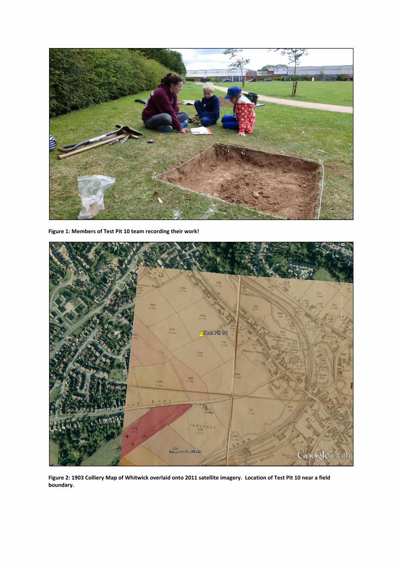
Figure 1: Members of Test Pit 10 team recording their work!
Figure 2: 1903 Colliery Map of Whitwick overlaid onto 2011 satellite imagery. Location of Test Pit 10 near a field boundary.
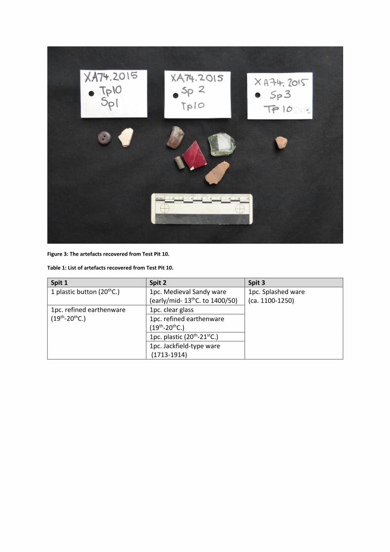
Figure 3: The artefacts recovered from Test Pit 10.
Table 1: List of artefacts recovered from Test Pit 10.
Spit 1 Spit 2 Spit 3
1 plastic button (20thC.) 1pc. Medieval Sandy ware (early/mid- 13thC. to 1400/50)
1pc. Splashed ware (ca. 1100-1250)
1pc. refined earthenware (19th-20thC.)
1pc. clear glass
1pc. refined earthenware (19th-20thC.)
1pc. plastic (20th-21stC.)
1pc. Jackfield-type ware (1713-1914)


![Telecommunication Products - Trendtek jointing pits.pdf · [01] UG2006 - P6 Pit UG2007 - P7 Pit UG2008 - P8 Pit UG2900 - P9 Pit UG2001 - P1 Pit UG2002 - P2 Pit UG2003 - P3 Pit UG2004](https://static.fdocuments.in/doc/165x107/5a7969077f8b9ab9308d3433/telecommunication-products-jointing-pitspdf01-ug2006-p6-pit-ug2007-p7-pit.jpg)