Tenure and Livelihood Issues in the Albertine Graben Land Grabbi… · · 2015-11-12from the...
36
LAND GRABBING AND ITS EFFECTS ON THE COMMUNITIES IN THE OIL RICH ALBERTINE REGION OF UGANDA The Case of Hoima, Buliisa and Amuru SUBMITTED TO IS ACADEMY September 2011 THE UGANDA LAND ALLIANCE (ULA) Block 29 Plot 1521 Mawanda Road Kamwokya P. O. Box 26990 Kampala Tel: 256 – 414 – 540048 Fax: 256 – 414 – 540038 E-mail: [email protected]
Transcript of Tenure and Livelihood Issues in the Albertine Graben Land Grabbi… · · 2015-11-12from the...
i
LAND GRABBING AND ITS
EFFECTS ON THE
COMMUNITIES IN THE OIL
RICH ALBERTINE REGION
OF UGANDA
The Case of Hoima, Buliisa and Amuru
SUBMITTED TO IS ACADEMY
September
2011
THE UGANDA LAND ALLIANCE (ULA) Block 29 Plot 1521 Mawanda Road Kamwokya
P. O. Box 26990 Kampala Tel: 256 – 414 – 540048
Fax: 256 – 414 – 540038 E-mail: [email protected]
8/4/2010

ii
Table of Contents Acronyms ......................................................................................................................................................... iv
Executive Summary .......................................................................................................................................... v
1 Introduction ............................................................................................................................................. 1
1.1 Background to the Study.................................................................................................................. 1 1.2 Conceptual framework .................................................................................................................... 3 1.3 Structure of the Report .................................................................................................................... 4
2 Context: .................................................................................................................................................... 5
2.1 Historical Perspectives of Tenure in Bunyoro and Acholi ................................................................ 5 2.2 Profile of Study Districts ................................................................................................................... 6
2.2.1 Buliisa ....................................................................................................................................... 6
2.2.2 Hoima ....................................................................................................................................... 6
2.2.3 Amuru ...................................................................................................................................... 8
2.3 Legal and Policy Framework for benefit sharing.............................................................................. 8 2.3.1 The National Constitution ........................................................................................................ 8
2.3.2 The Land Act Cap 227 ............................................................................................................... 8
2.3.3 The Local Government Act, Cap 287 ........................................................................................ 9
2.3.4 The Mining Act, 2003 ............................................................................................................... 9
2.3.5 The National Oil and Gas Policy, 2008 ..................................................................................... 9
2.4 Revenue Sharing: Lesson from Other Countries ............................................................................ 10 3 Methodology .......................................................................................................................................... 11
3.1 Data Collection Methods ............................................................................................................... 11 3.1.1 Household survey ................................................................................................................... 11
3.1.2 Key Informant Interviews ....................................................................................................... 11
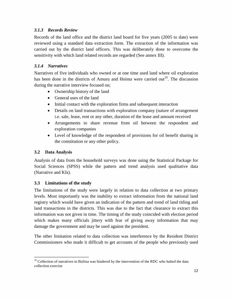
3.1.3 Records Review ...................................................................................................................... 12
3.1.4 Narratives ............................................................................................................................... 12
3.2 Data Analysis .................................................................................................................................. 12 3.3 Limitations of the study ................................................................................................................. 12
4 FINDINGS ................................................................................................................................................ 14
4.1 Social Profile ................................................................................................................................... 14 4.2 Economic Profile ............................................................................................................................ 15 4.3 Settlement patterns and Tenure Arrangements............................................................................ 16 4.4 Land holding and Acquisition ......................................................................................................... 16 4.5 Patterns and Trends of Land transactions ..................................................................................... 17 4.6 Land related Problems and their Causes ....................................................................................... 18 4.7 Interactions between oil and communities ................................................................................... 19 4.8 Level of Knowledge of laws/policy related to land and oil ............................................................ 20 4.9 Effects of oil exploration ................................................................................................................ 21
iii
4.9.1 Benefits .................................................................................................................................. 21
4.9.2 Adverse effects of Oil exploration ......................................................................................... 22
5 Conclusions ............................................................................................................................................ 24
6 Recommendations ................................................................................................................................. 27
References ................................................................................................................................................. 28 Annexes .......................................................................................................................................................... 29
List of Tables
Table 3-1: Scope of coverage for Household Survey ..................................................................................... 11
Table 4-1: Attributes of Respondents ............................................................................................................ 14
Table 4-2: Land size and Utilization rates among Survey Households .......................................................... 15
Table 4-3: Trend of land transactions at District Land Boards and District Land Offices .............................. 18
Table 4-4: Knowledge of Land and Oil related laws among leaders .............................................................. 21
Table 4-5: Benefits accruing to communities from oil prospecting ............................................................... 22
Table 4-6: Negative effects due to oil exploration ........................................................................................ 22
List of Figures
Figure 2-1: Map showing allocation of exploration blocks in the Albertine Graben ....................................... 7
Figure 4-1: Reasons for inward migration ..................................................................................................... 16
Figure 4-2: Types of land holding ................................................................................................................... 17
Figure 4-3: Rating of relationship between oil prospecting companies and the communities ..................... 20

iv
Acronyms ALC Area Land Committee
CDO Community Development Officer
DLB District Land Board
HIV/AIDS Human Immuno Deficiency Virus/Acquired Immuno Deficiency Syndrome
KI Key Informant
LC Local Council
LRA Lords Resistance Army
NOGP National Oil and Gas Policy
PSA Production Sharing Agreements
ULA Uganda Land Alliance
ULC Uganda Land Commission

v
Executive Summary
This report is in relation to a study on the Land Tenure and Livelihood Issues in the Albertine
Graben Region. The study was carried out in three districts of Amuru Buliisa and Hoima. The
study specifically focused on tenurial arrangements and land transactions in the region. The
ultimate outcome of this study will be drawing of policy issues for policy engagement and
dialogue towards a comprehensive policy direction to land governance in the Albertine Graben.
The study was guided by three key questions namely; how oil exploration has impacted on land
tenure and livelihoods in the Albertine Graben, what are the characteristics of the new land
acquisitions in the Albertine Graben, and what are the business practices of the oil exploration
companies and the Government and how they relate with communities.
The study utilized three main methods of data collection including household surveys, key
informant interviews, records review and Narratives. The household survey covered a total of 300
households in five sub-counties in the three study districts. Key Informant Interviews following a
semi structured questionnaire were conducted for; LC 1 officials, Sub County chiefs, Chairperson
Area land committee Chairperson District Land Boards and Resident District Commissioner.
Findings
Settlement Patterns and Land Tenure
Information collected during the survey on settlement patterns of the respondents suggests that
there is a substantial rate of inward migration (47%). On the whole customary land holding
pervades all the three districts although most prominent in Amuru district. The means of
acquisition expectedly showed a related pattern with inheritance of land being the commonest
means of land acquisition at 41% followed by land purchase at 35%.
Land Transactions
The level of land transactions among respondents was very low with up to 11% of them attesting
to having been involved in a land transaction in the preceding two years. Information extracted
from the District Land Boards shows an increasing trend in conversion of land from customary
tenure to formal tenures-leasehold and more recently freehold.
The number of applications for sub-divisions and transfers of land suggests low level transactions
over registered. This coupled with the level of applications for conversions and applications
suggests that most transactions are on unregistered land which is increasingly being converted to
freehold.
Land Related Problems
The most common land related problems mentioned include among others; land grabbing and
encroachment (42%), increased land disputes apparently due to oil discovery (27%), and land
vi
fragmentation (21%). The leading causes of land related problems include corruption among the
land administrators (21%), population growth (18%) and absence of clear boundaries (14%).
Relationship between Communities and Oil Exploration Companies/Government
Responses from the local leaders in Buliisa and Hoima districts indicate that the community relates
with the companies through a liaison officer (Community Development Officer) for Tullow Oil
directly as well as through local leaders. Some leaders viewed the relationship as being unclear and
largely adhoc without clear communication channels. Leaders in Amuru district indicated absence
of a relationship (direct or otherwise) between the prospecting companies and the communities.
Level of Knowledge about Land and Oil Related Laws
The respondents exhibited very little knowledge of laws on both land and oil with 40% and 67%
attesting to knowing nothing about the respective laws. The level of knowledge among the local
leaders on the same also appears to be low.
Impact of Oil Exploration on the Communities
It is clear that the impact of oil exploration in the study areas is dependent on stage. Oil
exploration process in areas of Bunyoro (Buliisa and Hoima) is more advanced nearing oil
production while the process is at prospecting stage in Amuru. In Buliisa and Hoima districts, there
has been remarkable improvement in public infrastructure and social services undertaken by
central and local government, as well as by the oil companies themselves, in support of oil-
prospecting activities or as part of their social corporate responsibility. The same cannot be said of
Amuru district where oil exploration is still at infant stage.
On the social front, oil discovery has been associated with increase in land disputes in all the three
districts. Furthermore, in ward migration into the area particularly in Buliisa and Hoima has led to
increase in prostitution and crime.
Conclusions and Recommendations
In general terms the level of transparency so far demonstrated particularly by government suggests
that the sector is on a different course from that suggested by the National Oil and Gas Policy. The
extent to which government functionaries go to protect information concerning oil activities is
alarming even at district level. Furthermore, the leaked PSAs suggest that there will be no
maximization of benefits for Uganda as a country. While there are many forces advocating for
greater share from oil revenue accruing to local governments, the share of land owners appears to
be disappearing from the discourse.

vii
Pressure on government to increase transparency and later on accountability should be sustained.
Also, the issue of sharing royalties –including share accruable to land owners- and the mode of
land acquisition should not be lost in the discourse over oil. The debate ought to be stretched to
include the important aspects of terms of use of land for oil related activities, disruption of
livelihoods such as access to natural resources.
Information on land transactions including transfers, conversions and dealings over unregistered
land at the district and sub-county (Area Land Committee) ought to be accessible to the general
public for scrutiny.
The government and the companies are largely organized yet the community members on the other
side are not. It is therefore important that community members in the oil exploration areas are
organized in a group in order to pool resources for common voice and ultimately negotiation.

1
1 Introduction
This report is in relation to a study on the tenure and livelihood issues in the Albertine
Graben Region1. The study was carried out in three districts of Amuru Buliisa andHoima.
In the 1930‟s the Albertine Graben region was considered an attractive oil prospecting
region given the natural oil seepage in the area. British Petroleum Companies explored
the area and in 1938 the first well was drilled. Later, production was suspended as a result
of World War II. The current estimates of the region‟s oil (around 1 to 1.5 billion barrels
or bbl of recoverable reserves) put Uganda among potential leading African oil producers
and among the world‟s top 50 (International Alert: 2009).
Article 244 of the Constitution of the Republic of Uganda 1995 puts oil and other
minerals under the protection of the Government and provides for benefit sharing
between the community, the local government and the individual owner of such land. The
study was premised on the notion that oil discovery in the region has brought about
unprecedented interest in land in the region as people rush to position themselves for
potential benefits from the oil either directly or indirectly. There have been reports of
increase in land titling in the region as well as land conflicts particularly in Buliisa2. The
oil has pitted the elite and resource rich individuals, companies and government on the
one hand against the poor uninformed citizens of the region on the other.
The Production Sharing Agreements (PSAs) signed between the government of Uganda
and the prospecting companies (Tullow oil, Dominion Oil, Heritage Oil) have remained a
closely guarded secret by both the Ugandan Government and the oil companies. The
Civil Society Coalition for Oil in Uganda3 obtained draft copies which on further enquiry
were likely to be the same as the signed PSAs. None of these contracts have to date been
made public by either the government or the oil companies. This has created a lot of
suspicion and mistrust from various segments of society.
1.1 Background to the Study
For Uganda Land Alliance, an organization working for the protection of the rights of the
poor and vulnerable, land has a multidimensional character – land is of economic, social,
political, cultural, and environmental meaning and importance. It is our view that the
1 The Albertine Graben in the Western part of Uganda consists of the nine districts of Hoima, Masindi
Buliisa, Fort portal, Kasese, Bundibujo, Kanungu, Nebbi and Amuru. 2 Bagungu – Balaalo Clashes
3 The civil society coalition on oil (CSCO) is a network of twenty civil society entities both at national and
district level hosted by the Advocates coalition on environment and Development (ACODE) a national
NGO working on Environmental governance in Uganda. ULA is part of this network. The CSCO is making
significant contribution in improving petroleum accountability, good governance, awareness, policy
advocacy and knowledge on best practices of promoting maximum benefits to the people of Uganda from
the development of its petroleum resources

2
multidimensional significance of land for people can only be taken seriously through the
lens of a “human rights approach4”- it starts from the recognition of especially the most
vulnerable humans – that is, the “women, peasants, family farmers, indigenous peoples,
communities of artisanal fisherfolk, pastoralists, and landless peoples who are “rights-
holders” with respect to land.
With the lack of knowledge in the public domain on the oil exploration in Uganda, the
focus of the Civil Cociety Coalition on oil in Uganda has mainly been geared towards
raising awareness on the existence of the PSAs and to foster transparency in the oil deals.
Underlying these deals is a population that is facing enormous pressure from the elite and
wealthy to relinquish their rights to land. Although this has been reported in various
meetings and workshops, no evidences have accrued as to the volume of these
acquisitions, who is buying out, what are the terms of the land sales and whether the
people understand and are getting fair compensation for their land value.
Furthermore, to date, it is uncertain whether the PSA‟s contain benefit sharing
agreements with the land owners as a benefit which would not only accrue to the land
owner but to the community. The human face to oil in Uganda seems to have disappeared
and simply remained on paper under the constitutional provision.
Whereas small holder farmers utilize small pieces of land to meet their basic needs
including food, shelter, health and clothing, commercial farmers and land speculators
utilize large acreages of land with the sole aim of accumulating wealth for the individuals
or corporate entities owning the investment. As a result, commercial farming initiatives
and land speculating for the case of the Albertine Graben always address profit
maximizing opportunities irrespective of the cost to either the environment or the
communities in which the oil exploration is taking place.
This study initially set out to investigate land grabbing in the Albertine Graben region but
the scope was widened to include tenure and livelihood issues for three main reasons.
First is that a study on land grabbing was adjudged to be repulsive to the local leaders
who are not only the entry point into the community but are also witnesses in many land
transactions5 and would thus be an impediment to accessing the communities. Second
was that land grabbing was embodied in actions that reallocate rights to land including
ownership, access, transfer which are also elements of tenure. Third was to do with the
need to go beyond land grabbing and look at the impact of the land takes on livelihoods.
4 In a human rights-based approach, human rights determine the relationship between individuals and
groups with valid claims (rights holders) and State and non-state actors with correlative obligations (duty-
bearers). It identifies rights-holders and their entitlements and corresponding duty-bearers and their
obligations, and works towards strengthening the capacities of rights-holders to make their claims, and of
duty-bearers to meet their obligations (UNDP 2004). 5 The title in its original form carried with it the potential of being accusatory to local leaders among other
groups/individuals.

3
It was decided that the study investigates the effect of oil prospecting and discovery on
land tenure and livelihoods in the region with deliberate efforts being made to unearth
issues related to land grabbing. The study specifically focused on tenurial arrangements
and land transactions in the region. The ultimate outcome of this study will be drawing of
policy issues for policy engagement and dialogue towards a comprehensive policy
direction to land governance in the Albertine Graben. The study was guided by three key
questions indicated below6:
1. How has oil exploration impacted on land tenure and livelihoods in the Albertine
Graben?
2. What are the characteristics of the new land acquisitions in the Albertine Graben?
3. What are the business practices of the oil exploration companies and the
Government and how they relate with communities?
1.2 Conceptual framework
As already indicated, the gist of this study was to investigate the impact of oil discovery
on land tenure and livelihood issues in the region. Livelihood in this context is stretched
to encompass wealth and assets. The conceptual framework for this study is rooted in
World Development report 2004 where a case for putting a human face to development
by ensuring that part of the benefits from the resources accrue to the communities near to
these resources. It is argued that globalization exerts pressure on natural resources as
foreigners move in with their capital to extract the resources. The extractive industries
established usually have both direct (also immediate) and indirect (also differed) impacts
on the livelihoods of communities around the resources. Directly, eviction from land or
restriction of access to areas depended upon for livelihoods and the related
disenfranchisement may negatively impact on livelihoods. Indirect effects may include
destruction of the environment which further reduces the productivity of agriculture.
Indirectly also, speculation over land leads to increase in land prices, land grabbing and
tension over land with the potential of flaring into conflicts as has been seen in Buliisa
district.
This study draws from Anthony Bebbington‟s propositions on a framework for analyzing
peasant viability, rural livelihoods and poverty (1999) with the objective of maximizing
benefits. He sets minimum needs that the framework needs to address including: the
diverse assets that the rural people draw on in building livelihoods; the way in which
people are able to access, defend and sustain these assets; and the abilities of people to
transform those assets into income, dignity, power and sustainability-or otherwise; higher
consumption levels, better living conditions, ability to defend assets effectively and build
6 See annex I for the sub-questions for each of the key questions

4
an asset base that continually allows transformations. He further suggests two levels at
which livelihoods and human well being can be conceived; first is at the household level
at which four forms of capital-natural, produced7, human, social and cultural-that make
livelihood strategies possible and give people capability and the outputs that make
livelihoods meaningful. The second level is on the engagement of the household with the
market, state and civil society and the implications of these engagements for the
distribution and transformation of assets. The later requires that there is information to
enable the individual/household evaluate and choose the benefit maximizing option.
The centrality of land as an asset to both livelihoods and national efforts for
transformation in Uganda is clear. Land is viewed as the both produced capital- acquired-
whose productivity is greatly dependent on natural capital. The discovery of oil
introduces new actors and relationships that can potentially impact on the capacity of
households to transform land as an asset into livelihoods and wellbeing improving
strategies occurring at different levels. From the view point of maximizing benefits at
individual/household level, opportunities and how they can be ceased for the betterment
of the individual is very important (Opt Cit.). With oil discovery, the scope of benefits in
relation to land includes among other things8 increase in the value of land which is also
the incentive for speculators and share of royalties accruable to land owners. The
eligibility of a land owner for royalties emanate from the recognition of the right of
ownership. The transfer of ownership of land below the „real value‟ or by use of unlawful
means dampens the benefits accruing to the household. Restriction of access without
reparations has the same impact on benefits accruing to individuals/households.
1.3 Structure of the Report
This report comprises six chapters including the introduction which addresses the issue of
potential effects of oil discovery in land tenure and livelihoods in the Albertine Graben,
the objectives as well as the conceptual framework. The following section attempts to
contextualize land ownership and eligibility for benefit sharing by tracing the history of
land tenure in the relevant regions (Bunyoro and Acholi) and Uganda in general, the legal
framework in which benefit sharing will take place as well as experiences from
elsewhere on benefit sharing. Chapter three presents the methodology of the study and
sets out the methods of selection of respondents, data capture, scope of coverage and
limitations. Chapter four presents the findings of the study while in chapter five the
conclusions are drawn and recommendations presented.
7 Land can have both natural and produced capital aspects
8 Including improvement in infrastructure, creation of market for produce, bringing services closer to the
community which are not the primary focus of this study

5
2 Context:
This section focuses on the context of oil exploration in the study areas. The context of
oil exploration in these three districts like all the other oil exploration areas in the country
has been shaped by the historical perspectives of land tenure from the colonial era and the
internal conditions of the districts - economy and social fabric. The superimposition of
sharing benefits from oil on to this context is dependent on the legal framework in which
rights to land and resources are defined. The proceeding sub-sections expound on these
notions.
2.1 Historical Perspectives of Tenure in Bunyoro and Acholi
The three districts covered under the study fall in two historical socio-political regions of
Bunyoro (Hoima and Buliisa) and Acholi (Amuru). Colonial legacy and other random
events have greatly shaped land tenure in these two regions and Uganda alike. Bunyoro
Kitara under the rule of Omukama Kabalega went to war with the British and her arch
rival Buganda. At the end of the war in which the British emerged victorious, large
chunks of Bunyoro land were given to Buganda, and smaller chunks to the Tooro
Kingdom, leaving Bunyoro greatly impoverished. The annexations of land were
entrenched in the 1900 Buganda agreement in where indigenous Banyoro become
squatters on their own land, an event that up to today makes land matters especially
sensitive in the region. Later, the Bunyoro agreement 1933 put all land in Bunyoro under
the Governor (Section 25) but recognized the right of natives to use land and were
required to have a certificate of occupancy over the land (Section 27). Forests and
minerals were also put under the jurisdiction of the Governor although the natives were
granted rights to access salt deposits at Kigorobya (Sections 28-31). The governor
reserved the right to alienate any land in the territories of Bunyoro for forests, roads,
townships or any other public purpose (Section 26). There was also a declaration that
there would be no further proclamation of forests in Bunyoro (section 32) which was in
response to the wide spread view that most of the viable land had been gazetted leaving
less productive land for the natives.
All land in northern Uganda and Acholi under which Amuru district falls was since the
1900 Uganda Agreement crown land except for freeholds issued to individuals by
colonial government under the Crown Land Ordinance (1903). Customary user and
occupiers were tenants at will of the state and were entitled to compensation in event of
alienation of land to freehold or leasehold.
At independence, the Uganda Land Commission was established to hold the residual
interest and manage land formerly held by the crown. The 1969 public lands act for the
first time recognized customary occupiers of land and their right to compensation and
consent alienation. The land reform decree (1975) that followed the 1972 degazettement

6
by Amin9 government put all land under the ULC except land in urban areas and that
which had already been alienated. The protection accorded to customary occupiers by
preceding legislations was scrapped10
. The 1995 constitution recognizes customary tenure
as one of the four tenures11
under which land is held in Uganda and accords the right to
timely and fair compensation in the event of land expropriation for public use. The Land
Act (1998) as amended provides for the conversion of customary tenure to freehold.
This history appears to have created variations of land rights across geographic areas of
Uganda. However, in the case of Acholi and Bunyoro, three issues stand out. One is the
wide spread of customary tenure and communal claim and access to territorial domains
including resources. Second is the pre-dominance of leasehold as compared to Buganda,
Ankole and Tooro. Third is the sparse population that leaves large tracks on land un-
inhabited which creates the opportunity for intruders and other opportunists12
to grab
land. In Acholi region, this situation has been exacerbated by the protracted 20 year LRA
rebellion that resulted in displacement of about 1.8 million people who only started
returning home after the Juba Peace process (2006 – 2008).
2.2 Profile of Study Districts
2.2.1 Buliisa
Buliisa district formerly a county was curved out of Masindi district in 2006 and boarders
Lake Albert an area that has been found to be rich in oil deposits. The district comprises
six sub-counties and a town council which is the main urban center. Agriculture and
livestock production are the main economic activities. Fishing is another major economic
activity, particularly in the areas bordering Lake Albert. Buliisa falls within exploration
block two that was licensed to Hardman Resources and Energy Africa (now Tullow Oil)
in 2002 (International Alert: 2009). The figure below shows the parceling out of
exploration blocks in the Albertine Graben region.
2.2.2 Hoima
Hoima district comprises 24 sub counties with Hoima town as the main urban center.
According to the 2002 projections, the population of Hoima is 349,204 persons (50.4%
males and 49.6% females), with an annual population growth rate of 4.87%. Agriculture
is the main economic activity, with 80.2% of the households being actively engaged and
cultivating about 1,191 sq km of land. Livestock production is second in economic
importance to crop production. Fishing is also an important economic activity,
9 Idi Amin – The President of the Republic of Uganda (1971 – 1979)
10 Wildlife Society Uganda 2010
11 Others include Mailo, Freehold and Leasehold
12 Some of these are members of the community that use their privileged status to alienate portions of land
to the detriment of others

7
particularly on Lake Albert where fishing has greatly influenced the social and economic
development of the sub-counties of Kigorobya, Buseruka, Kabwoya, and Kyangwali.
Exploration in Hoima district largely falls under bloc two as well.
Figure 2-1: Map showing allocation of exploration blocks in the Albertine Graben
Source: International Alert (2009)

8
2.2.3 Amuru
Amuru District was established in 2006 having been curved out of Gulu district. By the
time of this study, plans were underway to partition the district into two giving birth to
Nwoya district. Subsistence agriculture is the backbone of the district economy,
employing 98% of the population. Prior to 2006, the insecurity in the district had greatly
affected activities in the region with some reports indicating that less than 5% of the area
was inhabited and under utilization. The situation is slowly improving with the return of
people from camps. Exploration in Amuru district falls under exploration blocks one and
five licensed to Hardman resources and Energy Africa (now Tullow Oil) in 2004 and,
Neptune Petroleum Uganda Limited (now Tower Resources ) in 2005 respectively.
2.3 Legal and Policy Framework for benefit sharing
The focus of this section is on the legal provisions for oil revenue sharing in Uganda.
Emphasis here is mainly on private benefits as opposed to community benefits which has
attracted relatively greater attention of civil society and academicians.
2.3.1 The National Constitution
The constitution largely provided for the formulation of laws by parliament to regulate
the exploitation, sharing of royalties arising from mineral exploitation, payment of
indemnities arising out of mineral exploitation, and restoration of mining area lands. The
interests of landowners, local and central government should be taken into account as
well as protection and preservation of the environment (Article 245).
2.3.2 The Land Act Cap 227
The Land Act Cap 227 provides for the tenure, ownership and management of land and
amends and consolidates the law relating to tenure, ownership and management of land
and other related or incidental matters. In pursuance of the constitution, the law vests all
land in Uganda in the citizens of Uganda and recognizes four land tenure systems under
which land is held in Uganda including; customary tenure, freehold, mailo and leasehold
tenure. The Act defines the rights and powers of lawful occupants and bonafide
occupants13
. It also places natural lakes, rivers, groundwater, natural ponds, natural
streams, wetlands, forest reserves, national parks and any other land reserved for
ecological or touristic purposes for the common good of the citizens of Uganda under
trust of Government or a local government. In relation to prospecting or ascertaining
suitability of land for public works, the act provides a mechanism for entering on land-
which may follow mutual agreement between the undertaker or following an order by the
minister where no agreement is reached.
13
The act provides for the creation of communal land associations in relation to communal and/or
customary lands

9
2.3.3 The Local Government Act, Cap 287
The local government act provides for the creation of sub national governments and
devolution of some services, functions and powers from the central government to local
government. The sub-national governments are charged with the management of some
natural resources such as local forest reserves and wetlands. The Local Governments Act
also provides for sharing of government revenue but does not explicitly address the issue
of sharing of revenue from natural resources
2.3.4 The Mining Act, 2003
The Mining Act regulates mineral exploration and extraction and vests all ownership of
minerals in the country to the Government of Uganda. The Act provides for mineral
agreements and prospecting licenses (Part 11). The holders of a mineral dealer‟s license
are, under Section 71, liable for payment of royalties due on any minerals bought,
received or exported. The Act under Section 98(2) provides for the sharing of royalties
between central government, local governments and owners or lawful occupiers of land
subject to mineral rights in the manner specified in the Second Schedule to the Act
.Under the Second Schedule, the distribution of the 3 percent royalty is as follows: central
government receives 80 percent; local governments receive 17 percent and the owners or
lawful occupiers of land subject to mineral rights are entitled to 3 percent. The Mining
Act has been singled out as the strongest precedent to the proposed derivation formula for
the oil and gas sector in Uganda and indeed share of land owners.
2.3.5 The National Oil and Gas Policy, 2008
The National Oil and Gas Policy (NOGP) recommends the upgrading of existing
regulatory framework by putting in place a new law for the administration and
management of oil revenues in accordance to the constitution. The NOGP in section 5
emphasizes openness and access to information as fundamental rights given the potential
impacts of oil discovery on individuals and communities. The NOGP commits to
promote high standards of transparency and accountability in licensing, procurement,
exploratory development production operations as well as management of revenues. It
promises agreements between land owners and the prospecting/drilling firms to cover
compensation for land surface interests as the main means of accessing land for related
activities. In recognition of the potential of oil discovery and associated industries
including distribution on land, the policy proposes acquisition of land by oil companies
and or government. Furthermore, the policy pledges to take into account the interests of
communities where oil and gas production is undertaken in sharing of royalties.

10
2.4 Revenue Sharing: Lessons from Other Countries
There is dearth information about the details of the Production Sharing Agreements
between Uganda and the Prospecting companies. This has become part and parcel of the
civil society discourse on oil and benefit sharing but has not brought government to bear.
In this sub-section, we expound on the petroleum fiscal system14
components and
classification used in some countries. The idea here is that experiences from elsewhere
would provide insights to the nature of benefits accruing under the different systems and
stages of exploration for purposes of informing recommendations as well as policy in
general. In most countries the resources are held by government on behalf of the citizens
and the government charges royalties as is the case in Uganda. In the United States, the
resource is owned directly by individuals and it is them that charge royalties.
The combination of royalties and tax for each country reflect the resource characteristics,
policy objectives and culture. For instance in countries that are net exporters (with
attractive resource base and market) tend to have higher royalties while the reverse is true
for net importers which have lower royalties to encourage production. Uganda being a net
importer of oil at the moment suggests that the royalties and taxes will have to be set low
to attract investors. Some fiscal policies apply before discovery of oil or gas including
bonuses, and land rental fees- it is these that are largely applicable in the case of Uganda
as of now. The majority of fiscal levies including royalties largely apply after production
begins15
. Countries such as China, Mexico, Saudi Arabia and Venezuela have national
corporations through which the state participates in the industry16
. This appears to be the
model on which the proposed National Oil and Gas Corporation is based (NOGP: 2008).
14
Of which royalties are part 15
Alberta Royalty Review 2007 16
In this case the state obtains a share of the corporate profits in addition to royalties and taxes.

11
3 Methodology
The study was conducted in five sub-counties in three districts of Amuru, Bulisa, and
Hoima (Table 3-1). This section presents the approaches to the study:- the sampling
criteria, methods of data collection and analysis and the limitations.
3.1 Data Collection Methods
The study utilized three main methods of data collection including household surveys,
key informant interviews, records review and Narratives which are discussed in detail in
the following sections.
3.1.1 Household survey
The household interviews were carried out using a predesigned questionnaire and largely
targeted the head of household or their spouse. Households covered in the study were
selected following mixed criteria at different levels. Apart from the districts, two sub-
counties per district and two villages per sub county where and around oil had been found
or prospecting was going on were selected purposively with the guidance of the local
leaders17
..
Twenty five households were selected by way of systematic random sampling from a
sampling frame for each village drawn by the study team under the guidance of Local
council chair persons. The table below presents a summary of the geographic dispersion
of the sample realized.
Table 3-1: Scope of coverage for Household Survey
District Sub-county Number of villages Households covered
Buliisa Butiaba 2 51
Kigwera 2 48
Hoima Buseruka 2 51
Kabwoya 2 50
Amuru Amuru 4 100
Total 12 300
3.1.2 Key Informant Interviews
Key Informant Interviews following a semi structured questionnaire were conducted for;
LC 1 officials, Sub County chiefs, Chairperson Area land committee Chairperson District
and Land Boards18
17
District and sub-county officials 18
Initially the Resident District Commissioners were supposed to be among the Key Informants but this
was abandoned after noting that they were using this interaction to impeding data collection in their
precincts.
12
3.1.3 Records Review
Records of the land office and the district land board for five years (2005 to date) were
reviewed using a standard data extraction form. The extraction of the information was
carried out by the district land officers. This was deliberately done to overcome the
sensitivity with which land related records are regarded (See annex III).
3.1.4 Narratives
Narratives of five individuals who owned or at one time used land where oil exploration
has been done in the districts of Amuru and Hoima were carried out19
. The discussion
during the narrative interview focused on;
Ownership history of the land
General uses of the land
Initial contact with the exploration firms and subsequent interaction
Details on land transactions with exploration company (nature of arrangement
i.e. sale, lease, rent or any other, duration of the lease and amount received
Arrangements to share revenue from oil between the respondent and
exploration companies
Level of knowledge of the respondent of provisions for oil benefit sharing in
the constitution or any other policy.
3.2 Data Analysis
Analysis of data from the household surveys was done using the Statistical Package for
Social Sciences (SPSS) while the pattern and trend analysis used qualitative data
(Narrative and KIs).
3.3 Limitations of the study
The limitations of the study were largely in relation to data collection at two primary
levels. Most importantly was the inability to extract information from the national land
registry which would have given an indication of the pattern and trend of land titling and
land transactions in the districts. This was due to the fact that clearance to extract this
information was not given in time. The timing of the study coincided with election period
which makes many officials jittery with fear of giving away information that may
damage the government and may be used against the president.
The other limitation related to data collection was interference by the Resident District
Commissioners who made it difficult to get accounts of the people who previously used
19
Collection of narratives in Buliisa was hindered by the intervention of the RDC who halted the data
collection exercise

13
the land where oil related installations have been put. Even where these people were
traced, some people declined to be interviewed for fear of reprisal by government agents.
14
4 FINDINGS
This section presents findings from the different sources of information employed by the
study including; the household survey, interviews with key informants, extraction from
the district land board and summary of narratives. The social and economic profiles of
the respondents during the survey are presented first. Analysis of the information
collected during the study revealed stark differences for Amuru compared to the other
two study districts of Hoima and Buliisa. This can be largely attributed to the fact that oil
exploration was at a relatively early stage in Amuru District.
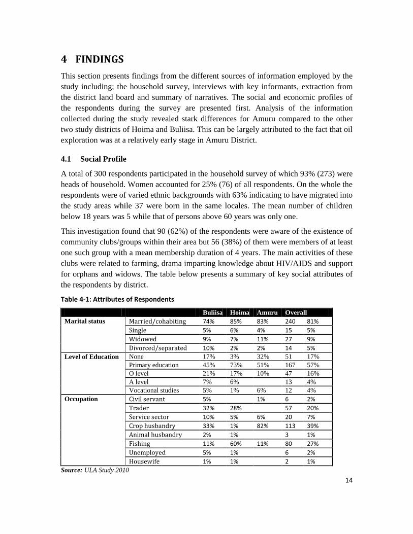
4.1 Social Profile
A total of 300 respondents participated in the household survey of which 93% (273) were
heads of household. Women accounted for 25% (76) of all respondents. On the whole the
respondents were of varied ethnic backgrounds with 63% indicating to have migrated into
the study areas while 37 were born in the same locales. The mean number of children
below 18 years was 5 while that of persons above 60 years was only one.
This investigation found that 90 (62%) of the respondents were aware of the existence of
community clubs/groups within their area but 56 (38%) of them were members of at least
one such group with a mean membership duration of 4 years. The main activities of these
clubs were related to farming, drama imparting knowledge about HIV/AIDS and support
for orphans and widows. The table below presents a summary of key social attributes of
the respondents by district.
Table 4-1: Attributes of Respondents
Buliisa Hoima Amuru Overall
Marital status Married/cohabiting 74% 85% 83% 240 81%
Single 5% 6% 4% 15 5%
Widowed 9% 7% 11% 27 9%
Divorced/separated 10% 2% 2% 14 5%
Level of Education None 17% 3% 32% 51 17%
Primary education 45% 73% 51% 167 57%
O level 21% 17% 10% 47 16%
A level 7% 6% 13 4%
Vocational studies 5% 1% 6% 12 4%
Occupation Civil servant 5% 1% 6 2%
Trader 32% 28% 57 20%
Service sector 10% 5% 6% 20 7%
Crop husbandry 33% 1% 82% 113 39%
Animal husbandry 2% 1% 3 1%
Fishing 11% 60% 11% 80 27%
Unemployed 5% 1% 6 2%
Housewife 1% 1% 2 1%
Source: ULA Study 2010

15
4.2 Economic Profile
Economic aspects in the context of this study, focused on land owned by the households,
land use and major sources of income. The 300 households covered use 486 parcels
bringing the average number of land holding to two for each household. The average size
of the land holdings was 1.35 for the two districts of Buliisa and Hoima. The average
land holding by households increased to 10.23 acres when Amuru with an average land
holding of 29.91 acres is included. Hoima district recorded the highest land utilization
rates with an average of 93% of the main parcel which is may be related to the relatively
smaller holdings in the area. The table below presents a summary of selected economic
attributes of the households.
Table 4-2: Land size and Utilization rates among Survey Households
Attribute Buliisa Hoima Amuru Total
No. of pieces of land
owned
Average 2 2 1 2
Maximum 4 3 4 4
Median (50%) 2 2 1 1
Parcel size (acres) Average 1.88 0.84 29.91 10.23
Maximum 15.00 10.00 200.00 200.00
Median (50%) 1.00 0.50 15.00 1.00
Average Level of utilization 81% 93% 71% 82%
Land Use Cultivation 38% 4% 95% 46%
Grazing 9% 2% 35% 15%
Commercial 33% 13% 15%
Major sources of
income
Trade in fish 35(37%) 87(88%) 2(2%) 124(42%)
Trade other 31(33%) 24(24%) 11(11%) 66(22%)
Sale of produce/ livestock 54(57%) 20(20% 83(83%) 157(53%)
Casual labor 7(7%) 2(2%) 21(21%) 30(10%)
Other 22(23%) 12(12%) 11(11%) 45(15%)
Source: ULA Study 2010
The table above depicts the differences across the oil prospecting areas in three districts;
In Butiaba and Kigwera (Buliisa district) and, Buseruka and Kabwoya (Hoima district),
oil prospecting and drilling is mainly along the shores of lake albert and therefore fishing
and trade in fish is a very important economic activity which partly explains the low
prevalence of land base land uses. Agriculture/farming is an important source of income
for the communities in Buliisa compared to Hoima where over 80% of the respondents
viewed trade in fish as the main source of income. In Amuru sub-county Amuru district,
the land holdings are relatively larger, agriculture is the main economic activity in terms
of land use, occupation and source of income.

16
4.3 Settlement patterns and Tenure Arrangements
Information collected during the survey on settlement patterns of the respondents
revealed that 53% of the respondents had actually been born in the area. For the 140
migrants, 55 (39%) indicated to have moved into the area over the last five years while
45 (32%) indicated to have moved in between six and ten years.
The respondents were also asked to indicate when they had first used the land on which
they were found at the time of the interview. The responses varied across the three
districts with 40% of the respondents in Buliisa indicating to have started using the land
before 1985, 32% and 63% of the respondents in Hoima and Amuru districts respectively
indicated to have started using the land within the last ten years. The migrants were
largely from elsewhere in the sub-county (59%) and other districts with in the respective
regions (23%). The reasons for migration are depicted in the figure below.
Figure 4-1: Reasons for inward migration
Source: ULA Study 2010
4.4 Land holding and Acquisition
There is often confusion over tenure among the population and therefore the survey
applied the term land holding. Land holding refers to how people relate to the land
particularly the nature of their claim to the land. The responses from Buliisa and Hoima
vary greatly from those from Amuru highlighting the historical differences between the
two respective regions. Most of the respondents indicated to be in possession of sales

17
agreements in Buliisa (35%) and Hoima (44%). A number of respondents indicated to be
Kibanja holders as indicated in the figure below. On the whole customary land holding
pervades all the three districts although most prominent in Amuru district.
Figure 4-2: Types of land holding
Source: ULA Study 2010
The means of acquisition expectedly showed a related pattern with inheriting land being
the commonest means of land acquisition at 41% followed by buying land at 35%. This
scenario makes many land holders invisible especially in areas where formal tenure exists
alongside informal tenure. Benefits may end up being given to a registered land lord at
the expense of holders of secondary rights- Kibanja. The absence of any kind of
documentation makes it difficult for the land holders to prove or indicate their ownership
when compensation happens.
4.5 Patterns and Trends of Land transactions
The level of land transactions in the study areas was very low with a prevalence of land
sales among respondents of only 2% in the preceding two years. The prevalence of
buying land was higher at but remains abysmal at 11%.None of the respondents from
Amuru district reported to have bought or sold land over this period.
Information was extracted from the records of the district land board to give insights on
conversion of tenure particularly to formal tenure namely leasehold and freehold. The
table below presents a summary of the operations of the District Land Boards.

18
Table 4-3: Trend of land transactions at District Land Boards and District Land Offices
2005 2006 2007 2008 2009 2010
H H
B H
B H A B H A B H A
No. of meetings 11 11 1 11 3 11 1 4 10 1 3 6 4
Av. People
attending
5 4 4 5 4 5 7 4 n/a 6 4 n/a 6
Lease application 337 315 118 4 10 78 8 10 8 1 - 262
Freehold
application
14 183 1 773 29 1234 1 35 985 15 60 395 26
Lease approvals 285 257 99 3 8 70 6 9 3 1 - 242
Freehold
approvals
14 171 1 653 21 928 - 27 913 9 6 341 28
No. sub-division
appn
12 17 18 18 n/a 4 27 n/a 2 16 n/a
No. of transfers 20 23 27 20 n/a 4 63 n/a 1 19 n/a
Source: ULA Study 2010
The table above shows an increasing trend in conversion of land to formal tenures-
leasehold and more recently freehold- over the years particularly in Hoima. It is
important to note that Hoima district is the oldest of the districts and its land
administration and management structures have been in place for longer which may
explain the difference in level of titling compared to other districts study districts. The
table also shows a shift from leasehold to freehold starting in 2007 this follows
amendment of (2004) to allow for conversion of customary land into freehold as opposed
to leasehold. The number of applications for sub-divisions and transfers of suggests low
level transactions over registered land compared to the other transactions. The local
leaders were of the view that land transactions over land had increased as well as prices
in all the three districts. This coupled with the level of applications for conversions and
applications suggests that most transactions are on unregistered land which is
increasingly being converted to freehold.
4.6 Land Related Problems and their Causes
The interest in land generated by the discovery of oil in the Albertine region has the
potential of exacerbating land disputes and escalating evictions as people move to
position themselves for potential benefits. This sub section focuses on the most common
problems related to land and their causes with specific focus on land disputes. The most
common land related problems mentioned include among others; land grabbing and
encroachment (42%), increased land disputes apparently due to oil discovery (27%), and
land fragmentation (21%). The leading causes of land related problems include
corruption among the land administrators (21%), population growth (18%) and absence
of clear boundaries (14%).

19
The overall prevalence of land disputes among the survey households is 42% with Hoima
registering lower levels (19%) compared to over 50% for the other two districts. In 56%
of cases neighbours were mentioned as the other disputant.
Table 4-4: Leaders’ Views on how to handle ensuing land disputes
Views on how land disputes ought to be handled Hoima Buliisa Amuru
Mediation should be first step 5 - -
Demarcation of boundaries 4 3
The district land board should be careful in its operations - 1 -
Provide Land information to the community - 2 1
Land titles issued recently should be checked for authenticity 1 - -
General sensitization of community members 2 5 1
Strengthening Area land committees 1 4 -
Formalize land owners and oil companies relationship
between
- 1 -
Source: ULA Study 2010
4.7 Interactions Between Oil Exploration Companies and Communities
Interaction between oil companies and on the one hand and the community on the other
can be viewed from two perspectives; one is communication defined by the frequency of
communication, the channels of communication, the object of communication. The other
is from transactions which two pronged - accrual of benefits and obligation/roles. The
issue of interaction between the oil companies and the community in this study were put
to local leaders who have a wider perspective compared to the community members.
Responses from the local leaders in Buliisa and Hoima districts indicate that the
community relates with the companies through a liaison officer (Community
development officer) for Tullow-directly- as well as through local leaders. Some leaders
viewed the relationship as being unclear and largely adhoc without clear communication
channels. Leaders in Amuru district indicated absence of a relationship direct or
otherwise between the prospecting companies and the communities.
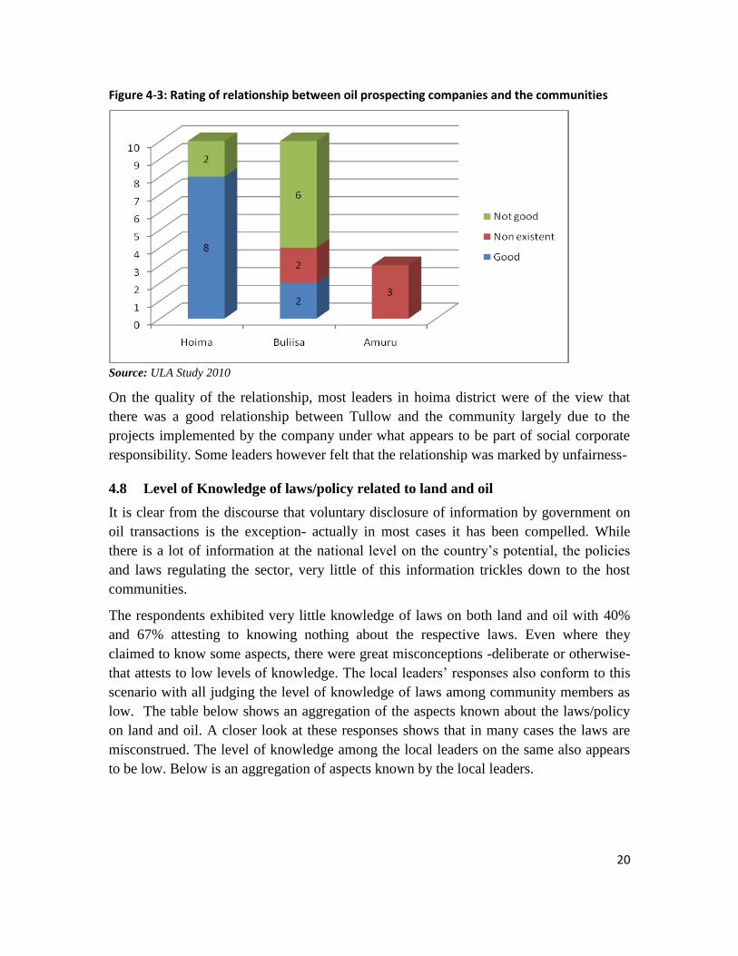
20
Figure 4-3: Rating of relationship between oil prospecting companies and the communities
Source: ULA Study 2010
On the quality of the relationship, most leaders in hoima district were of the view that
there was a good relationship between Tullow and the community largely due to the
projects implemented by the company under what appears to be part of social corporate
responsibility. Some leaders however felt that the relationship was marked by unfairness-
4.8 Level of Knowledge of laws/policy related to land and oil
It is clear from the discourse that voluntary disclosure of information by government on
oil transactions is the exception- actually in most cases it has been compelled. While
there is a lot of information at the national level on the country‟s potential, the policies
and laws regulating the sector, very little of this information trickles down to the host
communities.
The respondents exhibited very little knowledge of laws on both land and oil with 40%
and 67% attesting to knowing nothing about the respective laws. Even where they
claimed to know some aspects, there were great misconceptions -deliberate or otherwise-
that attests to low levels of knowledge. The local leaders‟ responses also conform to this
scenario with all judging the level of knowledge of laws among community members as
low. The table below shows an aggregation of the aspects known about the laws/policy
on land and oil. A closer look at these responses shows that in many cases the laws are
misconstrued. The level of knowledge among the local leaders on the same also appears
to be low. Below is an aggregation of aspects known by the local leaders.

21
Table 4-5: Knowledge of Land and Oil related laws among leaders
Aspects known about laws Hoima Buliisa Amuru T
he land law
Nothing 1
Consent of spouse and children required for sale of land 2
Compensation in case of government taking land 1
Four tenure of mailo, leashold, customary and freehold 1 8 1
Documentation of land ownership required 3 2
Wrong perception/interpretation 6 2 1
Land belongs to the people 1 1
The
poli
cy/la
w
on
oil
Nothing 4 7 1
Minerals belong/held by government 2
Compensation in the event of eviction 2 1
Sharing oil revenue between central and local
governments 1 1
Environmental Impact Assessment to be done 3
Source: ULA Study 2010
There are also indications that very little are known about related activities among the
community in all the three districts as indicated by some of the accounts of some
respondents. This goes for areas where Tullow oil is prospecting despite the company
having a fully fledged community development office for the region.
‘No one has ever come to inform us about oil related activities in our
area. All we see are helicopters flying over this area which is peculiar.
There are rumours that it is the prospectors trying to find oil.’
Respondent in Amuru
4.9 Effects of oil exploration
4.9.1 Benefits
This study focused on benefits from oil exploration that occur at two levels; first is the
micro level where benefits accrue to private individuals/households. There are indications
that some individuals had been paid by Tullow oil to lease land where installations are
erected including base camps in Kaiso Tonya area Hoima district. This could not be
verified during the study as the team could not identify people who had leased land to the
companies. Efforts to get their details from Tullow were futile.
At the community level, the benefits were restricted to Buliisa and Hoima districts which
may be due to the fact that the process of oil exploration in Amuru district is behind the
two districts. There has been remarkable improvement in public infrastructure and social
services undertaken by central and local government, as well as by the oil companies
themselves, in support of oil-prospecting activities or as part of their social corporate

22
responsibility strategies. Improved public infrastructure and utilities has spurred an
increase in inward migration as already mentioned. The table below shows respondents
on the benefits of oil exploration from the view point of the local leaders.
Table 4-6: Benefits accruing to communities from oil prospecting
Benefits from oil discovery/prospecting Hoima Buliisa
Infrastructural Roads have been constructed/improved 7 7
Improved water sources such as boreholes have been erected
6 2
Health centers have been constructed 5 3
Services Peer educators for HIV have been constructed 3 2
Mosquito nets have been distributed 2
Provision of scholastic materials 1 5
People have been provided with seedlings to
plant trees
Economic
benefits
Employment opportunities have been created
(casual labor)
6 7
Improved land value 1
Provided greater market for produce 4 2
Source: ULA Study 2010
The benefits indicated above have interacted to improve welfare of people- improved
infrastructure enabling increased movement goods and people which has in turn
increased local economic activity and increase in incomes.
4.9.2 Adverse effects of Oil exploration
While the effects can also be viewed at micro and macro levels, the most of the effects
cited largely permeate communities as they are mainly to do with social aspects as well
as access to resources. On the social front, oil discovery has been associated with increase
in land disputes in all the three districts. Furthermore, in ward migration into the area
particularly in Buliisa and Hoima has led to increase in prostitution and crime.
Table 4-7: Negative effects due to oil exploration
Negative effects of oil discovery Hoima Buliisa Amuru
Social effects Increase in crime rate and prostitution 5 3 -
Tenure insecurity among people due to fear
of what may happen
2 1 -
Increase in land grabbing - 4 2
Has caused unrealistic expectations - 1 -
Economic Increase in land prices - 1 -
High cost of goods and services 1 1 -
Disruption of economic/livelihood activities 5 7 -
Physical displacement 4 2 -
Source: ULA Study 2010

23
There were reports of restriction of access to prospecting areas including resources in the
three districts as a result of oil exploration. The restriction covers access to fishing
waters, grazing lands, watering points for animals, and cultural sites among others.
‘For a very long time we used to fetch firewood from the nearby game
reserve. However when the Wild Life Authority learnt about the existence
of oil, they stopped us from going into the reserve. The boundary of the
reserve was extended further into our land.’ Respondent in Hoima
‘The site at Ngasa is where we used to perform rituals which we were not
allowed to perform upon the discovery of oil. The spirits were annoyed
and the fish catch reduced which forced some people to migrate to other
areas.’ Respondent in Hoima
There is no clear indication of a mechanism for compensating for restricted access to the
communities that depend on the resources in the area whose importance has already been
demonstrated in section 4.2. This in many cases is a trigger for social unrest in oil rich
areas and should be guarded against in Uganda‟s case.

24
5 Conclusions
This section presents deductions from the findings on the objectives and guiding
questions of the study. It is clear that the impact of oil exploration in the study areas
dependent on stage. Oil exploration process in areas of Bunyoro (Buliisa and Hoima) is
more advanced nearing oil production while the process is at prospecting stage in Amuru.
In general terms the level of transparency so far demonstrated by particularly government
suggests that the sector is on a different course from that suggested by the National Oil
and Gas Policy. The extent to which government functionaries go to protect information
concerning oil activities is alarming even at district level. Furthermore, the leaked PSAs
suggest that there will be no maximization of benefits for Uganda as a country. While
there are many forces advocating for greater share from oil revenue accruing to local
governments, the share of land owners appears to be disappearing from the discourse.
5.1 Impact of Oil Exploration on Land Tenure and Livelihoods
Oil exploration has resulted into restriction of access to resources from which livelihoods
are derived. During prospecting, access to tracks of land previously used for cultivating,
grazing and other forms of resource extraction for communities and sectors of Lake
Albert was restricted. There are also allegations of expansion of gazatted land around
prospecting areas to restrict access to such areas. Without reparations or compensation to
those dependent on the affected resources, livelihoods have been strained by reduction in
incomes and production- agricultural and fishing. There is also a lot of anxiety among
surrounding communities over the future due to uncertainty over the course exploration
will take as well as the conduct of both the exploration companies and the government.
On the bright side, there has been tremendous improvement in infrastructure and social
services such as health and education around the oil exploration areas in Buliisa and
Hoim districts. This has led to increases in in-ward migration to the townships close to
these areas as people move in to take advantage of the economic opportunities that may
be created. Already a number of businesses are coming up in the centers which provide
alternative employment and income the people besides agriculture. The increased
population provides market for agricultural produce thereby improving the incomes of
surrounding farmers.
There is unprecedented interest in land in all the areas where oil prospecting is being
done. This appears to have increased land disputes and tenure insecurity fuelled by
corruption and suspicion due lack of information on land ownership and transactions.
Meanwhile, land transactions have increased in the areas while land holdings appear to
have reduced as a result of subdivision Buliisa and Hoima. The rate of increase of land
transactions in Amuru district is still below that in the other two study districts.

25
5.2 Characteristics of the New Land Acquisitions in the Albertine Graben
Owing to failure to extract information from the central land registry on land registration,
we rely on information from the district land offices and the local leaders to deduce the
characteristics of the new land acquisitions. Most of the new land acquisitions involve
people from outside the areas acquiring land from holders or local leaders. The
transactions also involve conversion of customary land to registered land - freehold
tenure. For applications the district land boards, agriculture is the main activity for which
the land is required. There are also reports of leasing of land by companies to erect
essential infrastructure from both holders and the district land board. The terms of the
leases are not clear.
5.3 Business Practices of the Oil Exploration Companies and the Government
This section focuses on the business practices of the companies and government while
dealing individuals and communities in the host communities. There is no specific
framework to regulate the transactions between the oil companies and government on the
one hand and the communities on the other. Such a framework is important for the
maximization of benefits accruing to those who deal with the powerful and more
knowledgeable companies.
There is also no clear communication channel among the actors- government, oil
companies and the community. In some instances the companies deal directly with land
owners or leaders through their liaison office as is the case with Tullow or other agents
while in others they go through government. The relationship is characterized by
information asymmetry un-favorable to community members. The compensation paid has
been viewed as being unfair.
Lack of information about oil exploration, policies, benefits and their accrual is costly to
the communities in two primary ways; first is that in case of grievances on compensation
or any other issue related to oil exploration activities, there is no clear avenue of raising
these issues as well as guarantees that they would be given due attention. This may saw
seeds of discord on which resource based violence feeds. Second is that decisions over
land taken without adequate information are below optimal. Such decision is the decision
to sale land and the price at which it is sold in light of potential streams of income in the
form of loyalties and/or future gains in land value. The information asymmetry between
the ignorant land seller and knowledgeable buyer dampens the former‟s benefits due to
oil discovery. Parties to a transaction should have access to information for decision
making.
Also, the infrastructural improvements so far undertaken by the oil exploration
companies have been misconstrued as being share of oil revenue accruing to the
community even when they are part of Social corporate responsibility programs. This

26
makes it difficult to raise the critical constituency to advocate for benefit sharing- there is
a false sense of having a share of oil revenues.

27
6 Recommendations
Pressure on government to increase transparency and later on accountability should be
sustained. This will increase discussions on the resource which is associated with
parsimonious utilization of resources, improvement of the terms of the PSAs as well as
revenue sharing among central and local governments and, land owners. More so the
pressure should involve groups from the oil producing areas so that the campaign is seen
to involve communities around the oil resources. Also, the issue of sharing royalties and
the mode of land acquisition should not be lost in the discourse over oil. Receiving
royalties and leasing of land may confer greater benefits to land owners compared to one
time land sale or compensation. Thus the debate ought to be stretched to include the
important aspects of terms of use of land for oil related activities, disruption of
livelihoods such as access to natural resources or simply access.
Information on land transactions including transfers, conversions and dealings over
unregistered land at the district and sub-county (Area Land Committee) ought to be
accessible to the general public for scrutiny. This will reduce the space for land
administrators to extract rents through sanctioning fraudulent land transactions. This level
of openness could also go a long way in allaying fears among community members of
behind the curtain deals.
The government and the companies are largely organized yet the community members on
the other side of the divide are not. This presents a number of challenges for negotiation
between the two groups. It is therefore important the community members in the oil
exploration areas are organized under some form of group in order to pull resources, for
common voice and ultimately negotiation. This could be spearheaded by the civil society.
The civil society also has the duty to ensure that information reaches people. This
information includes existing as well as that collected by the CSOs.

28
References
Government of Uganda (1995), The Constitution of the Republic of Uganda
___________________(1997), The Local Governments Act.
___________________(1998), The land Act
___________________(2003), The Mining Act
___________________(2008), The National Oil and Gas Policy
Alberta Department of Energy. Alberta‟s Oil Sands Fiscal System, Alberta Department of
Energy, Technical Report #1, March 2007, Alberta, Canada
Anthony Bebbington. Capitals and Capabilities: A Framework for Analyzing Peasant
Viability, Rural Livelihoods and Poverty. World Development Volume 27, Issue 12
December 1999, pages 2021-2044
International Alert. Harnessing Oil for Peace and Development in Uganda:
Understanding National, Local And Cross-Border Conflict Risks Associated With Oil
Discoveries in the Albertine Rift. Investing In Peace Issue No. 2 September 2009
Uganda Wildlife Society. Sharing Oil and Gas Revenue in Uganda. Oil and Gas series
#1. October 2008
United Nations Development Programme. Human Development Report 2004
29
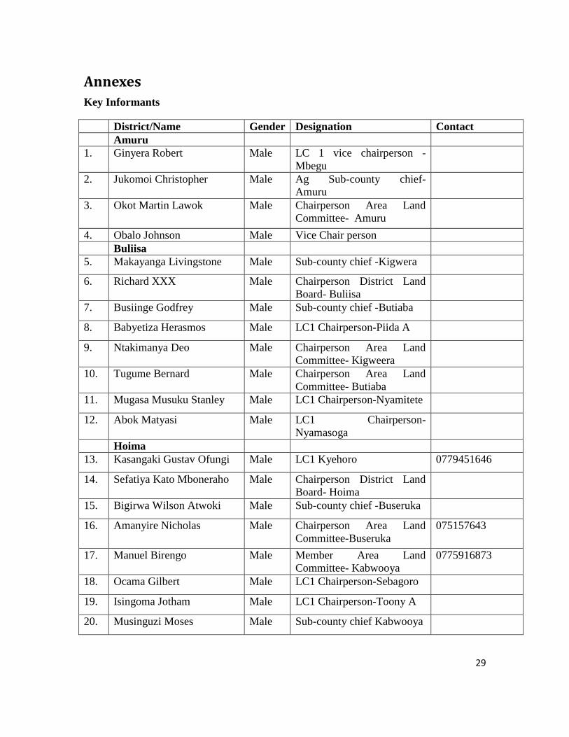
Annexes
Key Informants
District/Name Gender Designation Contact
Amuru
1. Ginyera Robert Male LC 1 vice chairperson -
Mbegu
2. Jukomoi Christopher Male Ag Sub-county chief-
Amuru
3. Okot Martin Lawok Male Chairperson Area Land
Committee- Amuru
4. Obalo Johnson Male Vice Chair person
Buliisa
5. Makayanga Livingstone Male Sub-county chief -Kigwera
6. Richard XXX Male Chairperson District Land
Board- Buliisa
7. Busiinge Godfrey Male Sub-county chief -Butiaba
8. Babyetiza Herasmos Male LC1 Chairperson-Piida A
9. Ntakimanya Deo Male Chairperson Area Land
Committee- Kigweera
10. Tugume Bernard Male Chairperson Area Land
Committee- Butiaba
11. Mugasa Musuku Stanley Male LC1 Chairperson-Nyamitete
12. Abok Matyasi Male LC1 Chairperson-
Nyamasoga
Hoima
13. Kasangaki Gustav Ofungi Male LC1 Kyehoro 0779451646
14. Sefatiya Kato Mboneraho Male Chairperson District Land
Board- Hoima
15. Bigirwa Wilson Atwoki Male Sub-county chief -Buseruka
16. Amanyire Nicholas Male Chairperson Area Land
Committee-Buseruka
075157643
17. Manuel Birengo Male Member Area Land
Committee- Kabwooya
0775916873
18. Ocama Gilbert Male LC1 Chairperson-Sebagoro
19. Isingoma Jotham Male LC1 Chairperson-Toony A
20. Musinguzi Moses Male Sub-county chief Kabwooya