Team: Andrea Claassen and Thomas Bales FR 5262, 12/13/2011 Instructor: Joe Knight.
16
Team: Andrea Claassen and Thomas Bales FR 5262, 12/13/2011 Instructor: Joe Knight
-
Upload
penelope-knight -
Category
Documents
-
view
218 -
download
1
Transcript of Team: Andrea Claassen and Thomas Bales FR 5262, 12/13/2011 Instructor: Joe Knight.

Team: Andrea Claassen and Thomas BalesFR 5262, 12/13/2011Instructor: Joe Knight

Goals of Study
Target cloudy water river areasInventory health analysis
Urban areasLower river
Change detection over 5 years

Data and MethodologyNAIP photographyRiver shapefiles from MetGISTarget specific areas for the study
Principal component analysisISO classification over entire river areaBreak up river in study areasUnsupervised and supervised
classificationsChange detection

Data LimitationsYear and environmental variables2004 to 2009 resolution (2m to 1m per pixel)Ortho photo mosaic of study areaLimited reference

Principal Component Analysis Pre test Isolate
general classifications
Determine water differences

General Unsupervised Classification
Results Above the
Falls Downtown Lower river

Target AreasNorth--Mississippi River
in North Minneapolis
South--Confluence of the Mississippi and Minnesota Rivers

Unsupervised Classifications200910 clusters
200410 clusters
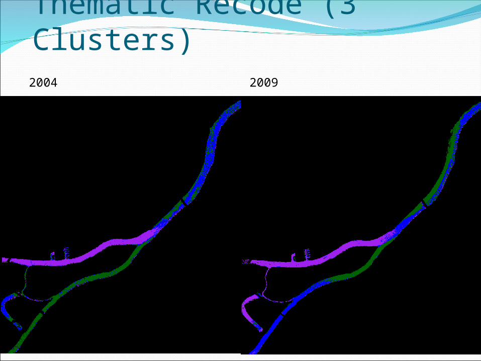
Thematic Recode (3 Clusters)20092004

North Minneapolis
Unsupervised classification using 10 clusters
2004 2009

North Minneapolis
Unsupervised classification using thematic recode combing clusters into 3 groupings.
2004 2009

2004 2009
Supervised Classification (Lower River)

Results--Change DetectionNorth area—No net change in water clarity.
South area (confluence)—Some changes in amount of sediments, locations different.
Buffered South area—Change not very apparent. May be dependent on classification accuracy.
Class % Change
Non-river 1.7
Clear Water -3.9
Medium Water -1.3
Silty Water 3.8

Accuracy assessmentUsed same NAIP imagery for classification
and reference data.Stratified random sampling methodOverall accuracy
2004: 65.4%2009: 66.0%

ConclusionsSome decrease in water clarity in South section
(confluence of Mississippi and Minnesota Rivers).
Different pattern of sedimentation between years.
Need to incorporate data on rainfall, agricultural runoff, etc. to better understand differences in sedimentation patterns between years.

•I dig it.•Meh. I nix it. •Love. •Take action. •Email: Thank
s!


![IS 12171 (1999): Cotton Bales · 2018-11-15 · IS 12171 (1999): Cotton Bales [TXD 31: Man-Made Fibres, Cotton and their Products] Title: IS 12171 (1999): Cotton Bales Author: Bureau](https://static.fdocuments.in/doc/165x107/5f05d8bb7e708231d415016a/is-12171-1999-cotton-bales-2018-11-15-is-12171-1999-cotton-bales-txd-31.jpg)