TEACHING GUIDE - lernerbooks.com (teacher, students) • Share the Continents books with students....
16
TEACHING GUIDE 2nd Grade Reading Level TEACHING Continents ISBN 978-0-8225-2349-9 Blue
Transcript of TEACHING GUIDE - lernerbooks.com (teacher, students) • Share the Continents books with students....

T E A C H I N G G U I D E
2nd Grade Reading Level
TEACHING
Continents
ISBN 978-0-8225-2349-9 Blue

T E A C H I N G C O N T I N E N T S2
StandardsGeography • Knows the location of places, geographic features, and patterns of the environment.
• Understands the physical and human characteristics of place.
Language Arts— • Demonstrates competence in the stylistic and rhetorical aspects of writing.Writing • Uses grammatical and mechanical conventions in written compositions.
• Gathers and uses information for research purposes.
Language Arts— • Demonstrates competence in the general skills and strategies of the reading process.Reading • Demonstrates competence in the general skills and strategies for reading a variety of
informational texts.
Visual Arts • Understands the characteristics and merits of one’s own artwork and the artwork ofothers.
Multiple Intelligences Utilized• Spatial, linguistic, logical-mathematical, interpersonal, and intrapersonal
Copyright © 2005 by Lerner Publishing Group, Inc.
All rights reserved. International copyright secured. Student pages may bereproduced by the classroom teacher for classroom use only, not for commercialresale. No other part of this teaching guide may be reproduced, stored in aretrieval system, or transmitted in any form or by any means—electronic,mechanical, photocopying, recording, or otherwise—without the prior writtenpermission of Lerner Publishing Group, Inc., except for the inclusion of briefquotations in an acknowledged review.
LernerClassroom A division of Lerner Publishing Group, Inc.241 First Avenue NorthMinneapolis, MN 55401 U.S.A.800-328-4929Website address: www.lernerclassroom.com
Manufactured in the United States of America2 3 4 5 6 7 — IG — 12 11 10 09 08 07
Books in the Continents seriesinclude:
AfricaAntarcticaAsiaAustraliaEuropeNorth AmericaSouth America

Read(students)• Students will read a different Continents book each
day for seven days.
Model(teacher)• Once students have read one Continents book, the
teacher will model how to fill out a page in thetravel log. Show students how to draw a map of thecontinent in the box at the top, and demonstratesummarizing skills to fill in information at thebottom.
Practice(students)• Students will complete one page in the travel log for
each Continents book they read.• Students will receive a stamp or a sticker in their
passports after completing each page of the travellog.
• By rotating the books each day, the students shouldcomplete their travel logs in seven school days.
Discuss(teacher, students)• Once their travel logs are completed, have students
work in groups to share the information theydeemed important about each continent.
• Ask the students if their classmates chose the sameinformation for their travel logs. Why do they thinksome information was the same and some wasdifferent?
Evaluate(teacher)• Assess each child’s travel log for completeness and
accuracy.• Display travel logs for classroom visitors to see.
Lesson 1Traveling aroundthe WorldPurpose: Students will read about the sevencontinents. They will record information they deemimportant in a passport/travel log.
Objectives• Recall information about each continent.• Summarize key facts about each continent.• Select significant information about each continent
to include in a book.• Illustrate physical characteristics of a continent.• Create a descriptive book to share with others.• Compare and contrast the different continents.
Activity Procedures
Prepare (teacher)• Copy Passport Cover p. 8 for each student.• Make seven copies of Passport Travel Log p. 9 for
each student.• Staple Passport Cover p. 8 and Passport Travel Logs
p. 9 together to make a book for each student.
Pretest(teacher, students)• What is a passport? Why do people use passports?• Show an example of a real passport to students.• Show the students their classroom Passport/Travel
Log. Explain why and how they will be used in theclassroom.
Materials• Continents books• Passport Cover p. 8 • Passport Travel Logp. 9
• stapler• pencils• crayons, coloredpencils, or markers
T E A C H I N G C O N T I N E N T S 3
Pretest(teacher, students)• Share the Continents books with students. • What are physical characteristics?• Ask students to describe some of the physical
characteristics of each continent.• Show students a raised relief globe. Have students
feel the physical characteristics on the globe.
Read(students)• Have each student choose and read one Continents
book.• Have students write down the physical characteristics
of the continent they’ll be mapping.
Model(teacher)• Show students how to cut out a continent map and
trace it on a tortilla. (Place the tortilla on cardboardfor durability.)
• Put homemade dough on top of the tortilla to makethe continent. Use more dough to make mountains,valleys, and other physical features.
Practice(small groups, partners)• Students will create a 3-D map for their chosen
continent as demonstrated by the teacher.• Leave completed maps out in the classroom to dry.
If maps are not complete after one class period, theywill need to be stored in an airtight container.
• Students should paint their dry maps using the colorson the Continents covers.
Discuss(teacher, students)• How did you use the play-dough to represent the
physical characteristics of each continent?
Evaluate(teacher)• Evaluate maps for accuracy.• Display maps in the classroom.
T E A C H I N G C O N T I N E N T S4
Lesson 23-D Continent MapPurpose: Students will make a three-dimensionalmap of a continent, re-creating the continent’sphysical features.
Objectives• Identify the seven continents by shape.• Distinguish continents by physical characteristics.• Map a continent’s physical characteristics.• Distinguish between water and land characteristics.• Create a 3-D map of a continent.• Compare physical characteristics of each continent.
Activity Procedures
Prepare(teacher)• Make play-dough. (The recipe below is enough for
one map.)• 1 cup flour, 1 cup warm water, 2 tsp. cream of
tartar, 1 tsp. oil, 1⁄4 cup salt• Mix all ingredients in pan. Stir over medium
heat until smooth. Remove from pan andknead dough.
• Place dough in bag or other airtight container.• Copy Continent Maps pp. 10–15. (You may choose
to enlarge the smaller maps.)• Cut cardboard slightly bigger than the maps.
Materials• Continents books• Continent Mapspp. 10–15
• homemade play-dough (see recipebelow)
• 1 8–10" flour tortillafor each continentmap
• cardboard• scissors• black markers• tempera paint• raised relief globe

Model(teacher)• Demonstrate how to complete Landmarks Around
the World p. 16, using one of the landmarks fromthe list on the board. Show students how to drawthe landmark, describe where the landmark is, andgive other important information about thelandmark on the poster.
• Explain to students that they will each read aContinents book. While reading the book, theyshould find an important landmark found on thatcontinent.
Read(students)• Students will read selected Continents books.
Practice(students)• Each student will complete Landmarks Around the
World p. 16 using a selected landmark from theContinents book he or she read.
Discuss(teacher, students)• Students will share their landmark posters with the
class. • Why did you choose that particular landmark? Have
you or anyone in the class ever seen that landmark?Would you like to visit it?
Evaluate(teacher)• Evaluate Landmarks Around the World p. 16.• Display landmark posters in the classroom.
T E A C H I N G C O N T I N E N T S 5
Lesson 3Where in the World Is . . .Purpose: Students will learn about landmarks andidentify important landmarks for each of the sevencontinents.
Objectives• Define landmark.• Give examples of landmarks.• Discover landmarks throughout the world.• Differentiate between landmarks found on different
continents.• Summarize the importance of various landmarks.• Describe the importance of a landmark to its locale.
Activity Procedures
Prepare(teacher)• Copy Landmarks Around the World p. 16 for each
student.
Pretest(teacher, students)• What is a landmark?• Identify a landmark in your town or state.• Make a list of these landmarks on the board.
Materials• Continents books• Landmarks Aroundthe World p. 16
• pencils• crayons, markers, orcolored pencils

Read(teacher, students)• Read pp. 4-5 of any Continents book for correct
continent placement on a world map and spelling ofcontinent names.
Model(teacher)• Show students how to make a world map from
memory. Cut out and color the Continent Mapspp. 10–15 and arrange them on the blue posterboard or butcher paper as best you can. Then usepp. 4–5 of any Continents book to check foraccuracy.
Practice(students)• Students will cut and color Continent Maps
pp. 10–15.• Students will place Continent Maps pp. 10–15 on
blue poster board or butcher paper to make a worldmap from memory.
• Students will use pp. 4–5 of any Continents book tocheck for accuracy. If their map is not correct, havestudents close the book and try again.
Discuss(teacher, students)• Are you able to put together an accurate map of the
world?• How can you remember the locations of the
continents?• Are some continents easier to place than others? If
so, which ones?
Evaluate(teacher)• After several days of practice, the teacher will place a
continent puzzle on a table in the room. Individualstudents will come to the table and create a worldmap for the teacher by memory.
• Students will be evaluated on correct placement andidentification of the continents.
T E A C H I N G C O N T I N E N T S6
Lesson 4Continents PuzzlePurpose: Students will identify each continent’s placeon a world map and be able to place it thereaccordingly.
Objectives• Name each of the seven continents.• Distinguish between the seven continents.• Prepare a replica of each of the seven continents.• Identify the location of each continent on a world
map.• Design a world map using replicas of the continents.• Compare a self-made world map to a standard map.
Activity Procedures
Prepare(teacher)• Copy one set of Continent Maps pp. 10–15 for each
student.• Gather one piece of blue poster board or butcher
paper for each student.
Pretest(teacher, students)• Show students a world map and discuss how the
continents relate to one another. • List the seven continents on the board and discuss
the spelling of their names.
Materials• Continents books• Continent Mapspp. 10–15
• scissors• crayons, markers, orcolored pencils
• large piece of blueposter board orbutcher paper foreach student
• large world map

Sayre, April Pulley. Good Morning, Africa! Brookfield,CT: Millbrook Press, 2003.Students will learn all about the people andhabitats of Africa.
Sayre, April Pulley. Greetings, Asia! Brookfield, CT:Millbrook Press, 2003.Asia comes to life in this informative book.Spectacular photography.
Sayre, April Pulley. Hello Europe! Brookfield, CT:Millbrook Press, 2003.Learn all about Europe, its cultures, andarchitecture.
Sayre, April Pulley. Hooray for Antarctica! Brookfield,CT: Millbrook Press, 2003. Read and learn about this cool continent!
Sayre, April Pulley. South America, Surprise.Brookfield, CT: Millbrook Press, 2003.This book introduces children to the geography,plant and animal life, weather, and humansettlement of South America.
Sayre, April Pulley. Welcome to North America!Brookfield, CT: Millbrook Press, 2003.Clear, concise text and brilliant photographyteach students all about North America.
Weatherby, Myra. South America. Plymouth, MN:The Child’s World, Inc., 2003.This is a brief and simple introduction to SouthAmerican geography.
WEBSITESWorld Geography
http://www.enchantedlearning.com/geography/continents/This website contains fun facts and activities aboutthe seven continents, with printable maps andactivity books.
GeoSpyhttp://www.nationalgeographic.com/geospyThis website features an interactive continentsgame and more.
T E A C H I N G C O N T I N E N T S 7
AAddddiittiioonnaall RReessoouurrcceessBOOKSArnold, Helen. Postcards from Australia, Vol. 1.
Austin, TX: Steck-Vaughn, 1995.This book is a collection of fictional postcardswritten by children traveling through Australia.
Carmi, Rebecca. Expedition Down Under. New York:Scholastic, 2002.Miss Frizzle’s class travels to Australia in search ofa kookaburra. They discover many of Australia’sinteresting animals while they are there.
Cowcher, Helen. Antarctica. New York: Farrar, Strausand Giroux, 1991.This book describes the daily life of animals thatlive on Antarctica.
Knight, Margy Burns. Africa Is Not a Country.Brookfield, CT: Millbrook Press, 2002.Knight describes daily life in some of Africa’sfifty-three countries. She highlights thedifferences and diversity of the African continent.
Olawasky, Lynn Ainsworth. Colors of Australia.Minneapolis: Carolrhoda, 1997.This book uses colors to share the history,physical features, and culture of Australia.
Onyefulu, Ifeoma. A Is for Africa. New York: Puffin,1997.Text and photographs show twenty-six thingsfrom A to Z that are representative of Africanpeople.
Petersen, David. South America. New York: ScholasticLibrary Publishing, 1999.This is a brief overview of the geography, wildlife,history, and people of South America.
Press, Judy. Around the World Art and Activities:Visiting the Seven Continents through Craft Fun.Nashville, TN: Ideal Publications, 2000.This book contains craft activities related to theseven continents. Simple instructions areincluded.
Ryan, Zoe Alderfer, and Liv Arnesen. Ann and LivCross Antarctica: A Dream Come True. NewYork: DaCapo Press, 2003.Read about the journey of the first two womento ski across Antarctica.
Sayre, April Pulley. G’Day Australia! Brookfield, CT:Millbrook Press, 2003.Learn fascinating facts about the land downunder with this photo-filled book.

8
Teaching Continents
PASSPORT
Travel Logfor

9
Name of Continent Visited
Draw the continent in the box.
What is one place you visited on this continent?
What is one animal found on this continent?
What is one interesting thing you would like to share about this continent?
Teaching Continents

10
Teaching Continents
Africa

Asia11
Teaching Continents
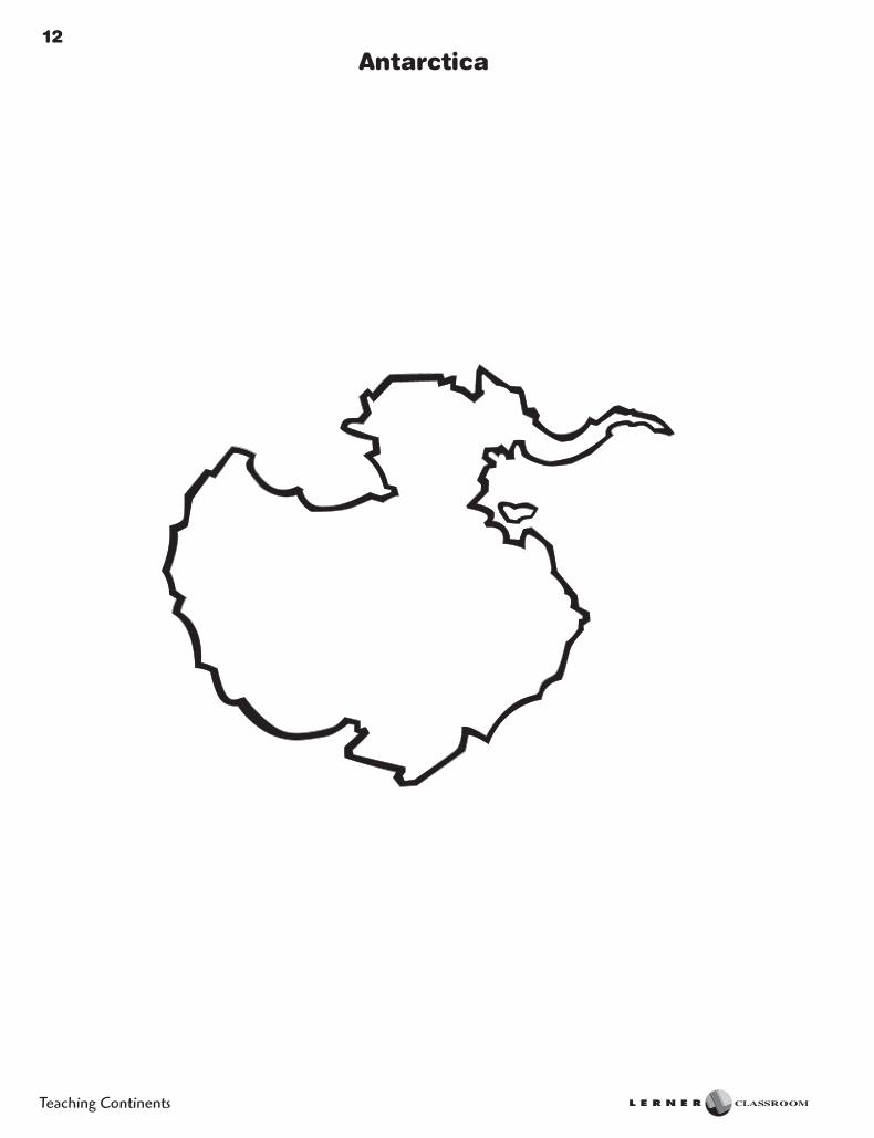
12
Teaching Continents
Antarctica

13
Europe and Australia
Teaching Continents

14
Teaching Continents
North America

15
South America
Teaching Continents

16
Teaching Continents
Landmark
Landmarks Around the World
By: