Taking GIS Retrospective to the Federal Level: Comment on ... · Comments on the Slide Presentation...
15
Taking GIS Retrospective to the Federal Level: Comments on the Slide Presentation Outlining Seminar Roots Dr. Barry Wellar Seminar Organizer and Chair Principal, Wellar Consulting Inc. Professor Emeritus, University of Ottawa Applied Research Seminar Mining U.S. Federal Agency Materials for GIS Nuggets February 24–25, 2016 | Washington, DC FedGIS Conference
Transcript of Taking GIS Retrospective to the Federal Level: Comment on ... · Comments on the Slide Presentation...

Taking GIS Retrospective to the Federal Level: Comments on the Slide
Presentation Outlining Seminar Roots
Dr. Barry Wellar
Seminar Organizer and Chair
Principal, Wellar Consulting Inc.
Professor Emeritus, University of Ottawa
Applied Research Seminar
Mining U.S. Federal Agency Materials for GIS Nuggets
February 24–25, 2016 | Washington, DC
FedGIS Conference

Taking GIS Retrospective to the Federal Level: Comments on the Slide Presentation Outlining Seminar Roots
2
Taking GIS Retrospective to the Federal Level: Comments on the Slide Presentation Outlining Seminar Roots
In these comments I briefly explain the content and purpose of each slide used to introduce
the seminar. As indicated by the title, emphasis is on seminar roots, which for the purposes of
this report are comprised of thoughts, drivers, activities, and goals. I believe that the remarks
are of particular value to those not in attendance at the seminar, or did not participate in
discussions with me or presenters during the conference.
S L I D E 2 Taking GIS Retrospective to the Federal Level: A Snapshot of the Federal GIS Retrospective Seminar
Comment. The snapshot text of this
slide is what it is, namely a brief
statement which fits on a PPT slide
and can be overviewed in about 90
seconds for some audiences, and 30
seconds for others, such as that at
the 2016 Esri FedGIS Conference.
However, let us not underestimate
what lies behind the snapshot. In
this innovative seminar, via
presentations by leading-edge U.S.
federal agencies – Census Bureau, Department of Defense, Geological Survey, and
Smithsonian Institution – we are “running with the big dogs” in the evolution of GIS technology
and GiScience methodology and their uses.
Further, as a result of GIS retrospective work to date, we have compiled a substantial body of
readings which are also leading edge in terms of tying together contributions to the past,
present, and future literature on GIS technology, GIScience methodology, and their uses.
In the remainder of the commentary I provide a paragraph and occasionally several
paragraphs about each slide, and include links to pertinent materials which are available
online.

Taking GIS Retrospective to the Federal Level: Comments on the Slide Presentation Outlining Seminar Roots
3
S L I D E 3 Taking GIS Retrospective to the Federal Level: Initial Insights from Four Core Agencies: Census, DoD, SI, and USGS
Comment. The agencies selected
for this seminar have outstanding
records of using GIS technology and
GIScience methodology over many
years for policy, program, plan, and
operations purposes. In addition, the
seminar benefits from the diverse
and societally important mix of
spatially distributed subject matter
which is considered by individual
agencies, and by the group of
agencies collectively.
S L I D E 4 Seminar Roots: Thoughts, Drivers, Activities, Goals: Origins of the GIS Retrospective Approach
Comment. Many readers no doubt
incorporated the retrospective
approach in productions during their
careers in academe, government,
and business, and especially in
situations such as expert witness
cases and other activities explicitly
involving precedents. However,
generally speaking the retrospective
aspect was likely just one of many
elements of research design.
The idea of an innovative GIS and GIScience project which focuses on the retrospective
approach began to take root during the production of Foundations of Urban and Regional
Information Systems and Geographic Information Systems and Science, a book
celebrating 50 years of annual conferences (1963-2012) sponsored by the Urban and
Regional Information Systems Association.
While discussions with a number of people about the design of the Foundations book were
helpful in developing GIS retrospective concepts, exchanges with the late W.L. (Bill) Garrison

Taking GIS Retrospective to the Federal Level: Comments on the Slide Presentation Outlining Seminar Roots
4
(UC-Berkeley) were most instructive regarding the factors at play in the evolution of GIS
technology and GIScience methodology.
Our communications covered many topics, including: contributions of original research and
derivative research to the unfolding of scientific inquiry; relationships between curiosity-driven
(or pure) and client-driven (or applied) research; options and alternatives left behind or set
aside when policy, program, planning, and research decisions are made; and, the often
unquestioned or easy acceptance of purportedly new ideas which are not new at all but have
actually been around for years. Prof. Garrison’s offer to provide counsel was instrumental in
the decision to test drive the GIS retrospective idea.
S L I D E 5 Seminar Roots: Thoughts, Drivers, Activities, Goals: Origins of the Idea of Mining “The Literature” for GIS Nuggets
Comment. In 2005 I participated in
the Symposium on Projecting
Geography in the Public Domain in
Canada. The symposium was
sponsored by Royal Canadian
Geographical Society, Canadian
Association of Geographers,
Canadian Council on Geographic
Education, and Ontario Association
of Geographers, and my
commissioned assignment was to
prepare the report on Geography
and the Media.
The long story short is that to put the media (a.k.a. popular literature) in context, I identified
eleven different bodies of literature which could be pertinent sources of publications on
geographic matters – Learned; Popular (Media); Legal; Regulatory Agency; Oversight
Agency; Professional; Public Interest; Special Interest or Vested Interest;
Corporate/Institutional-Public; Corporate/Institutional-Private; and, Other Productions.
While there could well be more bodies of literature, the eleven bodies identified during the
Geography and the Media project are sufficient to make a key point. That is, when it comes to
the education, training, research, operations, management, and other aspects of developing
and using GIS science and technology, there is potentially a very diverse and large ‘literature”
which has been accumulating over the past 50 or so years.
Taking GIS Retrospective to the Federal Level: Comments on the Slide Presentation Outlining Seminar Roots
5
And, in a similar vein, there is potentially a very diverse and very large “literature” which has
been accumulating over the past 50 or so years on the logical constructs of GIScience
inquiry, namely, catalogues-cataloguing, hypotheses-hypothesizing, and theories-theorizing,
which in turn serve two primary objectives of scientific research: add to geographic data,
information, and knowledge, and add to ways of continuing to add to geographic data,
information, and knowledge on spatial patterns, distributions, flows, processes, interactions,
dynamics, etc.
The idea of mining this literature for GIS nuggets probably stems from my upbringing in
Northern Ontario (hardrock mining country), and then graduate school when I spent four
years (two years at the masters level, two years at the PhD level) in a seemingly non-stop
examination of books, dissertations, journal articles, manuscripts, conference proceedings,
and most any other form of publication that I encountered through course readings, literature
searches, referrals, etc. As some readers may recall or are currently in the process of
experiencing, establishing that one’s research is in fact “original” can be a daunting task.
For those not familiar with the mining process of extracting a small but valuable amount of
gold, silver, uranium, and other precious metals from a much larger amount of ore, perhaps
reference to the principle of “total due diligence” might convey what I have in mind regarding
value-added findings.
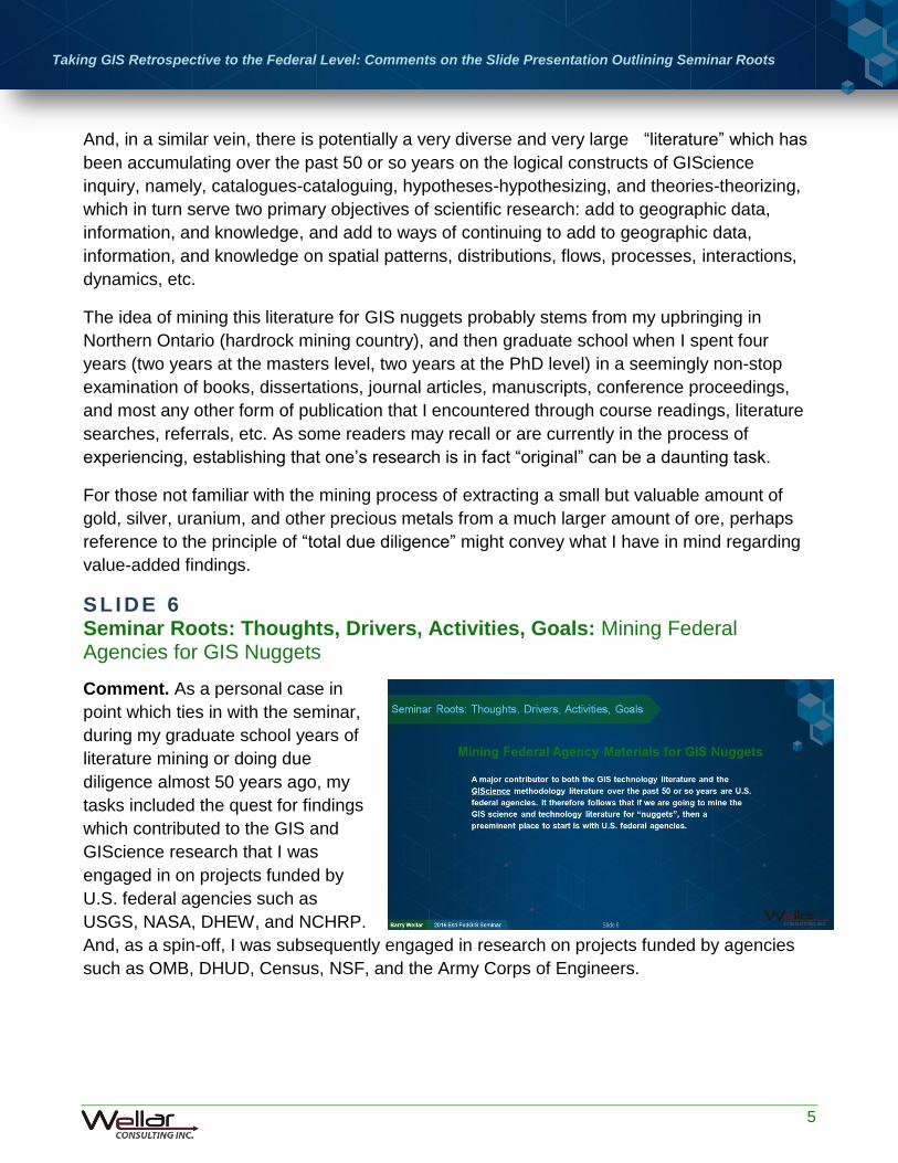
S L I D E 6 Seminar Roots: Thoughts, Drivers, Activities, Goals: Mining Federal Agencies for GIS Nuggets
Comment. As a personal case in
point which ties in with the seminar,
during my graduate school years of
literature mining or doing due
diligence almost 50 years ago, my
tasks included the quest for findings
which contributed to the GIS and
GIScience research that I was
engaged in on projects funded by
U.S. federal agencies such as
USGS, NASA, DHEW, and NCHRP.
And, as a spin-off, I was subsequently engaged in research on projects funded by agencies
such as OMB, DHUD, Census, NSF, and the Army Corps of Engineers.

Taking GIS Retrospective to the Federal Level: Comments on the Slide Presentation Outlining Seminar Roots
6
In all cases I was obliged to take into account pertinent data, information, and knowledge that
had already been published, on paper, and now I am involved in asking some of these same
federal agencies about their thoughts on mining their own literature.
At the risk of stating the obvious, major contributors to both the GIS technology literature and
the GIScience methodology literature over the past 50 or so years are U.S. federal agencies.
It therefore follows that if we are going to mine the GIS technology and GIScience literature
for “nuggets”, a preeminent place to start is with these agencies.
S L I D E 7 Seminar Roots: Thoughts, Drivers, Activities, Goals: Defining GIS Nuggets
Comment. As for the term nuggets,
in the GIS retrospective project
nuggets are findings but, as
indicated in the slide titled Defining
GIS Nuggets, and the comments
above, these findings are not of your
everyday or trivial variety. Rather,
these findings are deemed to be
nuggets because of the level of
value-added that they bring to
significantly advancing thoughts and
actions involving GIS science and technology, and their uses.
The findings presented in Table 1 are among the kinds of findings that came to mind when
developing the idea of mining the literature for GIS (and GIScience) nuggets.
Table 1. A Selection of the Kinds of “Findings” that Could Arise as a Result of Mining the Literature for GIS Nuggets
1. Finding GIS lessons already learned which inform about things yet to be done.
2. Finding GIS lessons learned which inform about things that should not be done.
3. Finding useful GIS applications developed previously.
4. Finding that GIS applications thought to have been developed were not developed.
5. Finding that a GIS application already exists for a current need.
6. Finding that a GIS application does not exist for a current need.
7. Finding GIS maxims that are pertinent now.
8. Finding GIS maxims that are not pertinent now.
9. Finding that a GIS maxim was adopted by some but not by others.
10. Finding a GIS advisory that was not adopted.

Taking GIS Retrospective to the Federal Level: Comments on the Slide Presentation Outlining Seminar Roots
7
Table 1. A Selection of the Kinds of “Findings” that Could Arise as a Result of Mining the Literature for GIS Nuggets (CONTINUED)
11. Finding that a GIS advisory was not properly implemented.
12. Finding that a GIS issue debated today is not new.
13. Finding that research already exists for a GIS issue raised today.
14. Finding that a GIS problem raised today is not new.
15. Finding that answers already exist for GIS questions raised today.
16. Finding that a GIS proposal presented today is not new.
17. Finding that research already exists for a GIS proposal presented today.
18. Finding that GIS claims made today are already a matter of record.
19. Finding earlier GIS circulars that are pertinent now.
20. Finding earlier GIS images that are pertinent now.
21. Finding earlier geospatial data series that are pertinent now.
22. Finding earlier GIS performance tests that are pertinent now.
23. Finding earlier GIS studies that are pertinent now.
24. Finding earlier GIS experiences that are pertinent now.
25. Finding earlier geospatial decisions that are pertinent now.
26. Finding that procedures already exist for deriving “analytics” currently touted/promoted.
27. Finding that procedures already exist for deriving “analytics” currently in demand.
28. Finding that performance measures previously developed are more robust than those
in preparation.
29. Finding that current documentation procedures permit future searches for GIS nuggets.
30. Finding that current documentation procedures inhibit future searches for GIS nuggets.
S L I D E 8 Seminar Roots: Thoughts, Drivers, Activities, Goals: AutoCarto Six Retrospective
Comment. After the 1983 AutoCarto
Symposium, I remained in contact
with many of the contributors to the
technical program and to the
Proceedings (two volumes, more
than 200 authors, 110 papers, 50
abstracts, 1100 pages of text).
Common features that I encountered
among contributors were their

Taking GIS Retrospective to the Federal Level: Comments on the Slide Presentation Outlining Seminar Roots
8
continued enthusiasm for GIS-related education, training, research, operations, applications,
and management initiatives, and an inclination to reflect on the why’s, how’s, and
implications of GIS science and technology evolution.
Following from the URISA Foundations experience, and numerous exchanges with GIS and
GIScience colleagues, including Bill Garrison in particular, it was decided to celebrate
AutoCarto Six by inviting authors to re-visit papers and abstracts written 30 years previously
about numerous technical, technological, methodological, operational, political, societal, and
other aspects of GIS and GIScience.
Important consequences associated with the retrospective visit to AutoCarto Six include the
publication of 25 papers by 37 authors in AutoCarto Six Retrospective, and the decisions by
Jack Dangermond, President of Esri, to provide funding to support that publication, and then a
follow-on GIS retrospective colloquium at the Esri campus in Redlands, CA.
S L I D E 9 Seminar Roots: Thoughts, Drivers, Activities, Goals: GIS Retrospective Colloquium
Comment. Authors of colloquium
papers and slide decks were asked
to assume a directive research
posture, and prepare written and
verbal advocacy statements on
behalf of a body of literature. The
objective was to begin to assemble
arguments which promote mining a
body of literature, or component of
that body of literature, for GIS
nuggets. Then, using the papers and
slide decks as starting points, participants in colloquium discussions were encouraged to
share ideas about whether, why, and how to (retrospectively) mine the respective bodies of
literature for GIS nuggets.
Two colloquium outcomes pertinent to the seminar were achieved. First, upon review of
colloquium materials and associated discussions, Esri made a business decision to support a
follow-on GIS retrospective project. It was mutually agreed that a seminar was a logical
follow-on to the colloquium.
Second, since the colloquium was the equivalent of a small-scale pilot study, only a limited
number of bodies of literature could be considered in presentations and discussions.
Colloquium participants agreed that publications by U.S. federal agencies are central to the

Taking GIS Retrospective to the Federal Level: Comments on the Slide Presentation Outlining Seminar Roots
9
evolution of GIS technology and GIScience methodology, and their uses, and represent a
prime body of documentation to be mined for GIS nuggets.
The seminar is therefore an immediate derivative of the colloquium, which underscores or
highlights the value of reviewing the colloquium papers and slide decks in preparation for the
seminar, and/or for putting the federal agency presentations in context.
S L I D E 10 Seminar Roots: Thoughts, Drivers, Activities, Goals: Esri’s Motivation and Passion Underlying Its Support for the GIS Retrospective Initiative Comment. Esri is a leader in GIS
technology research, development,
and applications, and has occupied a
premier place in the GIS industry for
more than four decades. As a result,
Esri is a major contributor, directly
and indirectly, to most if not all the
eleven bodies of literature identified
in the slide titled Origins of the Idea
of Mining “The Literature” for GIS
Nuggets.
However, Esri is not a research institute affiliated with a university or a government, nor is it a
government agency, each of which tends to be regarded as more appropriate supporters of
the AutoCarto Six Retrospective project, the GIS Retrospective Colloquium, and this seminar.
It is therefore appropriate to acknowledge and applaud the support by Esri, which has been
instrumental in bringing together people and ideas. I believe that the seminar will reward that
support by generating more ideas, engaging more people, and creating and implementing an
action agenda to promote and guide using the retrospective approach to vigorously mine
federal agency materials for GIS nuggets.
I therefore strongly recommend that readers have all due regard for the whole and each of the
parts in the statement by Jack Dangermond.
As participants in the GIS retrospective initiative are aware, the thoughts expressed --
Reflecting and sharing experiences... history and memories matter... our visions,
efforts, successes … and sometimes failures … provide context and the foundation for
creating the future -- are pertinent to Esri’s support of the AutoCarto Six Retrospective
project, the Colloquium on Using the Retrospective Approach to Mine the Literature for GIS
Nuggets, and the seminar, Taking GIS Retrospective to the Federal Level.
Taking GIS Retrospective to the Federal Level: Comments on the Slide Presentation Outlining Seminar Roots
10
In addition, however, the Dangermond statement is pertinent to developing and implementing
a robust action agenda which includes creating opportunities, as well as taking advantage of
opportunities, to mine “The Literature” for GIS science and technology nuggets.
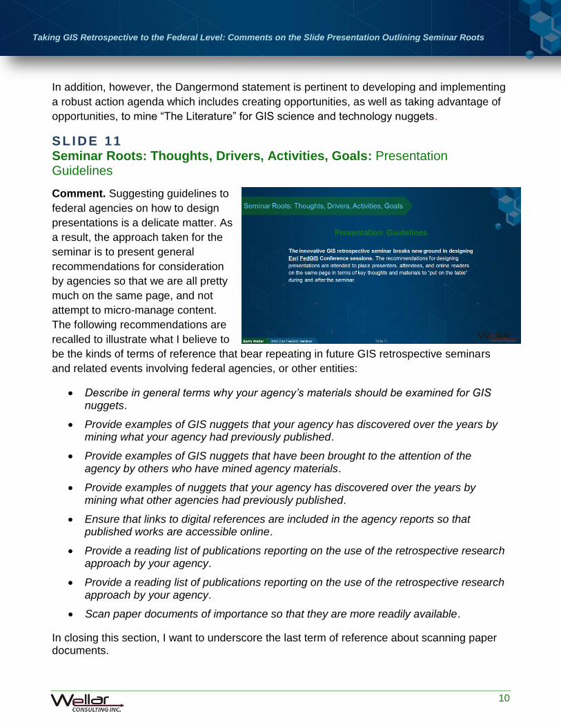
S L I D E 11 Seminar Roots: Thoughts, Drivers, Activities, Goals: Presentation Guidelines
Comment. Suggesting guidelines to
federal agencies on how to design
presentations is a delicate matter. As
a result, the approach taken for the
seminar is to present general
recommendations for consideration
by agencies so that we are all pretty
much on the same page, and not
attempt to micro-manage content.
The following recommendations are
recalled to illustrate what I believe to
be the kinds of terms of reference that bear repeating in future GIS retrospective seminars
and related events involving federal agencies, or other entities:
Describe in general terms why your agency’s materials should be examined for GIS nuggets.
Provide examples of GIS nuggets that your agency has discovered over the years by mining what your agency had previously published.
Provide examples of GIS nuggets that have been brought to the attention of the agency by others who have mined agency materials.
Provide examples of nuggets that your agency has discovered over the years by mining what other agencies had previously published.
Ensure that links to digital references are included in the agency reports so that published works are accessible online.
Provide a reading list of publications reporting on the use of the retrospective research approach by your agency.
Provide a reading list of publications reporting on the use of the retrospective research approach by your agency.
Scan paper documents of importance so that they are more readily available.
In closing this section, I want to underscore the last term of reference about scanning paper documents.

Taking GIS Retrospective to the Federal Level: Comments on the Slide Presentation Outlining Seminar Roots
11
It cannot be over-emphasized that many early, fundamental contributions to the literature on GIS technology, GIScience methodology, and their uses, were paper productions. These contributions to the literature may have been relatively difficult to obtain at the time of publication, with perhaps only 500 or even just 200 copies of a conference proceedings being published, and are likely to be even more difficult to obtain today if they are only available in their original paper form.
Several significant cases in point were encountered when assembling the reading list (Reading List: Using a Retrospective Approach to Mine the Literature for GIS and GIScience Nuggets), leading to their being scanned by Esri Canada and Wellar Consulting for the convenience of readers. It is expected that agencies engaged in GIS retrospective activities would reap an excellent return from such a scanning service.
S L I D E 12 Seminar Roots: Thoughts, Drivers, Activities, Goals: Background Readings for the Applied Research Seminar: Mining U.S. Federal Agency Materials for GIS Nuggets.
Comment. Four bodies of literature comprise the initial reading list, which can be viewed at http://www.wellar.ca/wellarconsulting/SeminarReadingList.pdf.
1. Papers prepared for AutoCarto Six Retrospective (section A); 2. Papers and slide presentations prepared for the Research Colloquium on Using the
Retrospective Approach to Mine for GIS Nuggets (section B); 3. Retrospective project papers published in the International Journal for Applied
Geospatial Research (section C); and 4. Publications from academic, government, professional organization, and other sources
to supplement the AutoCarto Six Retrospective papers, and the colloquium papers and slide presentations (section D).
For two reasons, the list of
references compiled for the seminar
is a modest, illustrative effort by
design.
First, a comprehensive search of
“the literature”, of which 11 sub-
literatures are identified in a
previous slide, is beyond the
purview of the GIS retrospective
seminar project. Hence, the reading
list is presented as being illustrative

Taking GIS Retrospective to the Federal Level: Comments on the Slide Presentation Outlining Seminar Roots
12
and suggestive. It is my perception that there are many worthy entries to be added to section
D, which looks outside the GIS retrospective project productions to publications from
academic, government, professional organization, and other sources.
Second, the seminar is more an element of a pilot study than of a pre-test or a trial run, so it is
appropriate to cast a wide and engaging net when selecting references to include in a
preliminary compilation. It is my expectation that the agency presentations will be instructive
as to how other federal agencies could contribute references to the file of retrospective GIS
science and technology publications.
S L I D E 13 Seminar Roots: Thoughts, Drivers, Activities, Goals: Friday Lunch Discussion Club (FLDC) Presentation, “The Emergence of Geographic Information Systems as a Core Public Policy Research Tool: Comments on the Paradigm Shift”
Comment. Since the mid-1960s,
which marks my beginnings in the
field of GIS science and technology,
there have been numerous paradigm
shifts among words, numbers, and
maps by municipal, provincial/state,
and federal or national governments
conducting policy research involving
spatial entities. (There were word-
number-map paradigm shifts before
the mid-1960s of course, but that is a
topic for another day.)
In the FLDC presentation I identify dozens of policy research domains of a spatial nature, and
I emphasize that paradigm shifts among words, numbers, and maps in the policy research
process do not usually occur “willy-nilly”. Rather, and more often than not, the shifts among
paradigms are justified on the basis of reasons deemed appropriate by those responsible for
policy research choices and outcomes.
The FLDC presentation directly ties in with the seminar in that it points to a very significant if-
then relationship. That is, if there is limited documentation on the reasons behind paradigm
shifts from words to maps, numbers to maps, maps to words, or maps to numbers, then there
is limited information available for policy researchers or anyone else wanting to know more
about the role played by the respective paradigms in policy research situations.

Taking GIS Retrospective to the Federal Level: Comments on the Slide Presentation Outlining Seminar Roots
13
At the risk of belaboring the obvious, time is of the essence in documenting past paradigm
shifts. The seminar is therefore a useful means of beginning to get a handle on the challenges
and opportunities which characterize the state of mining federal agency productions for
information about paradigm shifts and, potentially, about GIS nuggets.
And, the seminar is also a useful venue for contemplating the future value of documenting the
reason(s) behind present-day spatial policy research paradigm shifts.
S L I D E 1 4 Seminar Roots: Thoughts, Drivers, Activities, Goals: IJAGR Papers
Comment. The three papers in the
International Journal of Applied
Geospatial Research provide a
comprehensive overview of the GIS
retrospective project from its origins
through to the time of the seminar.
They are therefore pertinent
readings for seminar presenters,
attendees, and non-attendees who
view seminar materials published
online.
In addition to their value to the seminar, however, the fact that they are published in IJAGR
has its advantages because of the IJAGR mission to
“… provide planners and policy analysts, practitioners, academicians, and
others using GIS&T [geographic information science and technology]
useful studies that might support decision-making activities.”
I believe that the papers published in IJAGR will help to broaden the base of GISPs in
particular, and researchers in general who become engaged in using the GIS retrospective
approach to mine materials of federal agencies (and other entities) for GIS science and
technology nuggets.

Taking GIS Retrospective to the Federal Level: Comments on the Slide Presentation Outlining Seminar Roots
14
S L I D E 1 5 Seminar Roots: Thoughts, Drivers, Activities, Goals: Barry Wellar Bio-Note
Barry Wellar, Principal, Wellar Consulting Inc., and President, Information Research Board
(IRB) Inc., was retained by Esri to organize the GIS retrospective seminar. He is Professor
Emeritus, University of Ottawa, a past president of the Urban and Regional Information
Systems Association, and among other honours he is recipient of the Horwood Award in
Information Systems, recipient of the Ullman Award in Transportation, recipient of the
Anderson Medal of Honor in Applied Geography, and a member of the GIS Hall of Fame.
Dr. Wellar was Director of the 1983 AutoCarto Six Technical Program and editor of the
proceedings, Automated Cartography: International Perspectives on Achievements and
Challenges. In 2012 he edited Foundations of Urban and Regional Information Systems and
Geographic Information Systems and Science, celebrating the 50th anniversary conference of
the Urban and Regional Information Systems Association.
In 2013 he edited AutoCarto Six Retrospective, a 30-year commemorative volume, which was
the basis of the GIS retrospective activity supported by Esri. He organized the GIS
Retrospective Research Colloquium held at the Esri campus in Redlands in 2015, and is
responsible for the Applied Research Seminar, Mining U.S. Federal Agency Materials for GIS
Nuggets, 2016 Esri FedGIS Conference.
A number of his GIS science and technology presentations and documents are accessible
online at various websites, including: slideshare.net, transportaction.ca,
urbanneighbourhoods.ca, cag.org, wellarconsulting.ca, geomatics.uottawa.ca, and
urisa.org.

Taking GIS Retrospective to the Federal Level: Comments on the Slide Presentation Outlining Seminar Roots
15
S L I D E 1 6 Seminar Roots: Thoughts, Drivers, Activities, Goals: Acknowledgements
Comment. Successfully arranging a
seminar of this nature requires
receiving a considerable amount of
support, with emphasis on serious
buy-in by those in conversations with
agencies about making a
presentation, and by officials making
presentations on behalf of agencies.
I am most appreciative of that
assistance, and I would be pleased
to discuss how lessons learned
during preparations for Taking GIS Retrospective to the Federal Level might be of value in the
organization of a subsequent government, business, academic, or professional association
GIS retrospective seminar, colloquium, or related activity.