STUDY FOR OREWA BEACH REEF CHARITABLE …€¦ · SAFETY ASPECTS OF REEF DEVELOPMENT PROPOSAL AT...
28
Larry Robbins OBE FNI PO Box 35-401 Browns Bay Auckland 0753 [email protected] 09 478 4782 Copyright ©2011 STUDY FOR OREWA BEACH REEF CHARITABLE TRUST - NAVIGATION AND SAFETY ASPECTS OF REEF DEVELOPMENT PROPOSAL AT OREWA BEACH
Transcript of STUDY FOR OREWA BEACH REEF CHARITABLE …€¦ · SAFETY ASPECTS OF REEF DEVELOPMENT PROPOSAL AT...

Larry Robbins OBE FNI PO Box 35-401
Browns Bay Auckland 0753
09 478 4782
Copyright ©2011
STUDY FOR OREWA BEACH REEF CHARITABLE TRUST - NAVIGATION AND
SAFETY ASPECTS OF REEF DEVELOPMENT PROPOSAL AT OREWA BEACH

STUDY : Navigation and Safety Aspects of Reef Development Proposal at Orewa Beach
Larry Robbins OBE FNI Project Ref 11041 July 2011 p 2
CONTENTS
PAGE
1.0 INTRODUCTION 3 1.1 Overview 3 1.2 Objectives of the Study 3 1.3 Qualifications & Experience Relevant to this Study 3 1.4 Methodology 4 1.5 Costs 4 1.6 Conflicts of Interest 4 2.0 THE PROJECT 4 2.1 Background and Aims of the Project 4 2.2 Location of the Reefs 4 2.3 Nature of the Proposed Reefs 6 3.0 PORT & HARBOUR RISK ASSESSMENT 6 3.1 Introduction 6 3.2 Harbours and Ports 7 3.3 Navigation Safety bylaw 8 3.4 Pilotage Area 9 3.5 Sailing Directions – Routes etc 9 3.6 Anchorages & Moorings 9 3.7 Boat Ramps and Access Lane 10 3.8 Orewa Beach - Utilisation 12 3.9 Existing Navigational Hazards 13 3.10 Assessment 14 4.0 ADDITIONAL COMMENTS & RECOMMENDATIONS 14 4.1 Width of access lanes 14 4.2 Hazards posed by proposed reefs 14 4.3 Increased hazards to watercraft 16 4.4 Navigational Marks - General 17 4.5 Navigational Marks – Proposed Reefs 18 5.0 CONSTRUCTION OF THE REEFS 20 5.1 Precautions during Construction 20 5.2 Navigation warnings etc during construction 20 6.0 CONCLUSIONS 21
6.1 Conclusions 21
APPENDICES 21 A. References 22
B. Assessment in line with the Port and Harbour Marine Safety Code
24
Cover Photograph: Orewa Beach looking south, 8 June 2011, 2 hours before High Water

STUDY : Navigation and Safety Aspects of Reef Development Proposal at Orewa Beach
Larry Robbins OBE FNI Project Ref 11041 July 2011 p 3
1.0 INTRODUCTION 1.1 Overview This report has been commissioned by Neil Rasmussen (Resource Management Solutions Ltd) on behalf of the Orewa Beach Reef Charitable Trust. The Orewa Beach Reef Charitable Trust (OBRCT) proposes to construct a multi-purpose reef system at Orewa Beach. Resource Consent was applied for. The Auckland Regional Council (ARC) refused to accept the application, seeking (Reference 2), inter alia, “a detailed study of the possible hazards and issues that may arise from the proposed reefs … [to] form the basis of a Port and Harbour Safety Code Assessment“ and requiring an Assessment in line with the New Zealand Port and Harbour Marine Safety Code (Reference 2) “ … of all aspects of the application that may affect navigation and safety …”. Auckland Council, which has now assumed responsibility from ARC, has requested further assessment, in line with the Port and Harbour Safety Code (PHSC) on the navigation and safety aspects of the proposal. In this report the following abbreviated terms are used:
The Author – Larry Robbins OBE FNI The Trust – Orewa Beach Reef Charitable Trust (OBRCT) The Council – Auckland Council The Project – the development of an artificial offshore reef at Orewa Beach The Code – New Zealand Port and Harbour Marine Safety Code An Assessment – a Port and Harbours Safety Code Assessment in terms of the New
Zealand Port and Harbour Marine Safety Code. 1.2 Objectives of the Study This study has been commissioned to review the Trust’s proposal from a navigational and maritime safety aspect, review the requirements of the Code, advise whether in my opinion a full Assessment is applicable, and comment on such aspects of the Code as may be readily assessed. 1.3 Qualifications & Experience Relevant to this Study. This study was undertaken by Larry Robbins whose relevant experience is as follows:
British Merchant Navy (5 years). Royal New Zealand Navy (26 years). Seaman officer, rising to rank of commander
in the Hydrographic Surveying Service of the RNZN and the position of Hydrographer RNZN. Commanded survey motor launches and inshore survey craft (total 3 years) and the survey ship HMNZS MONOWAI (4½ years) undertaking surveys around New Zealand and the South Pacific in support of national charting programmes. In 1976 was briefly engaged in beach surveys at Orewa in support of surveys of Whangaparaoa Bay being undertaken by the RNZN survey motor launches. These surveys form part of the current navigational chart of the area (Reference 5)
The Author holds the following relevant qualifications:

STUDY : Navigation and Safety Aspects of Reef Development Proposal at Orewa Beach
Larry Robbins OBE FNI Project Ref 11041 July 2011 p 4
Second Mates Certificate of Competency (seagoing licence was allowed to lapse in 2005)
Category A qualification as Hydrographic Surveyor recognised by the International Hydrographic Organisation (IHO) – the highest such qualification attainable internationally.
RNZN Certificate as Charge Hydrographic Surveyor (H0). RNZN Command Qualification (First Class). Certificate as Inshore Launch Master (ILM) - gained after leaving the Navy
The Author is a member of the following maritime-based organisations:
NZ Company of Master Mariners (Member) Australasian Hydrographic Society (Member Emeritus) Nautical Institute (Fellow)
1.4 Methodology The Author met with, or discussed the project with, the following people:
Mr Neil Rasmussen (Resource Management Services Ltd). Captain Jim Varney (Marine Consultant) – telephone conversation Mr David Thatcher ( Deputy Harbourmaster – Northern Area, Auckland Council) . Mr Christiaan Moss – (Deputy Harbourmaster, Auckland Council) – telephone
conversation.
The Author visited Orewa Beach and Whangaparaoa Peninsula. 1.5 Costs The costs for this study have been borne by the Trust. 1.6 Conflicts of Interest The Author has no known connection with the Trust or any other organisation in Orewa, or companies and organisations currently involved with, or consulted in respect of, the project. Apart from agreed professional fees for undertaking the study and compiling the report, the Author has received no remuneration or consideration from anyone connected with the Trust or the Project. 2.0 THE PROJECT 2.1 Background and Aims of the Project In summary, through this Project the Trust seeks to construct a series of reefs offshore at Orewa Beach that would modify and dissipate wave energy during extreme events to maintain and promote a wider beach area. The reefs would also provide some additional recreational benefits to surfers and the like. 2.2 Location of the Reefs According to the AEE Report (Reference 4) the proposal is to construct a series of three individual reef structures at four separate locations offshore of Orewa Beach. Each individual structure is approximately 110-150 metres in length located obliquely to the line of Mean High Water Springs (MHWS). The schematic presentation of the proposed reef structures at figure 1 is taken from the AEE report and the equivalent area from the current navigational chart NZ5321 (Reference 5) is shown at figure 2 which also shows the approximate position of the proposed reefs.

STUDY : Navigation and Safety Aspects of Reef Development Proposal at Orewa Beach
Larry Robbins OBE FNI Project Ref 11041 July 2011 p 5
Figure 1 - Schematic Presentation of the Proposed Reef Structures from AEE Report
Figure 2 - Portion of Chart NZ 5321 (published in 2003) showing approximate position of proposed reefs

STUDY : Navigation and Safety Aspects of Reef Development Proposal at Orewa Beach
Larry Robbins OBE FNI Project Ref 11041 July 2011 p 6
2.3 Nature of the Proposed Reefs The reefs “are to be positioned with the innermost segment extending seaward from the water line at lowest astronomical tide1 . The next segment seaward extends from approximately 0.75m depth to 1.25 metres depth with the segment furthest offshore extending to approximately 1.5 metres depth.” 2 The crest level of the reef system is set at Mean Low Water Springs (MLWS) (which inspection of tidal data on chart NZ 5321 indicates is 0.5m above Chart Datum3 at Orewa). “Analysis of the 18.6 year tidal cycle indicates that this means it [the reef crest] will be emergent <1% of the time – for example, at present and for the next few years we are at the peak in tidal heights due to the position of the moon, meaning that the crests would be emergent <0.5% of the time.”4 Mean High Water Springs (MHWS) is indicated as being 3.0 metres above Chart Datum. 3.0 PORT & HARBOUR RISK ASSESSMENT 3.1 Introduction Marine Consultant, Captain Jim Varney, in commenting upon a marina development proposal being put forward by Waiheke Marinas Ltd to the Auckland Council5 commented: “ The NZ Port & Harbour Marine Safety Code was published on the 28th April 2004. The Code serves as a framework for the preparation of safety management systems by Regional Councils. The aim is to establish a system covering all marine operations in ports and harbours which ensures that risks are both tolerable and as low as reasonably practicable. The Code is not law. It is an assessment of legal responsibilities under existing law applicable to the operation of NZ ports and harbours.6 It is also an assessment of where those responsibilities lie and is an agreed interpretation of NZ law and a statement of good practice. While compliance is not mandatory, prudent participants in the system will be able to use compliance with the Code to demonstrate they have taken all reasonable steps to ensure safe marine operations in ports and harbours. While the Minister of Transport is ultimately responsible for safety at reasonable cost within NZ maritime system, Maritime NZ is the Authority which has the statutory function of promoting a safe maritime environment and as such is empowered to review the maritime safety systems produced by the Regional Councils, in conjunction with major stake holders …
1 Lowest Astronomical Tide (normally abbreviated to LAT) is defined by the International Hydrographic Organisation thus: “the lowest tide level which can be predicted to occur under average meteorological conditions and under any combination of astronomical conditions.“ http://hd.iho.int/en/index.php/lowest_astronomical_tide 2 Reference 16 page 27. 3 Chart Datum is the level of water from which charted depths displayed on a nautical chart are measured. It is often defined as being “the level below which the tide seldom, if ever, falls” and it approximates very closely to LAT. The depth at any point on the chart will normally be the charted depth plus the height of tide. 4 Email from Dr. Shaw Mead, ASR Marine Consulting and Research, 6 July 2011 5 Proposed Marina Matiatia Bay Navigational and Safety Report – Captain Jim Varney, Marine Consultant, 1 February 2011. Paragraphs 2 and 3 (part) 6 Author’s emphasis added

STUDY : Navigation and Safety Aspects of Reef Development Proposal at Orewa Beach
Larry Robbins OBE FNI Project Ref 11041 July 2011 p 7
It was always recognized that the implementation of the code throughout NZ would be achieved in stages, as each Region submitted their Code for approval. The ARC received approval for their Risk Assessment of Operations in all Regions on the 22nd June 2007. The culmination of something like 4 years work. Auckland being one the first Port Companies and Regional Authority’s who were already working towards stricter standards of compliance having regard to work undertaken by the IMO and other International bodies in this field, before the final draft of the NZ Code was published in April of 2004. ” 3.2 Harbours and Ports The NZ Port and Harbour Marine Safety Code aims inter alia “to promote good practice in the conduct of safe marine operations in ports and harbour.”7 A ‘Harbour’ is defined, inter alia, as including “any other coastal or inland waters that a regional council determines are a harbour for the purposes of this Code in accordance with a Code application assessment.” The Council (or its predecessors) has not declared the area as “a harbour”. The area under consideration does not, therefore, fall within the Code’s definition of a harbour8. As the area is not occupied by a port company, the area does not meet the definition of “a port” and is unlikely to ever do so. Strictly speaking, the NZ Port and Harbour Marine Safety Code would not seem to apply to Orewa Beach. This appears to be borne out in the Auckland Regional Risk Assessment as discussed in the following sub-paragraphs. The Council’s Deputy Harbourmaster, Christiaan Moss, provided a digital copy of Auckland Regional Risk Assessment (Reference 14). This document (‘The Assessment’) was compiled, under the title of ‘Code Application and Risk Assessment Auckland Region’, by Swiftsure Marine Services for the Auckland Regional Council (ARC) in October 2006 and approved in June 2007. It has now been adopted by Auckland Council. Under a Memorandum of Understanding between the former Rodney District Council (RDC) and the ARC, RDC administered a distinct area shown in figure 3a below. Orewa Beach falls within this area. The Assessment considered the various areas of the region in turn. Orewa Beach lies at the northernmost end of the area described as “Whangaparaoa Peninsula and North Shore Area” and is considered in section 5.2 of the assessment (Figure 3b). The section looks at a number of specific localities. Orewa Beach is not among them. The Assessment concludes9 “This area was assessed as an area to which the code did not apply.”10 No risk assessment is therefore included in the document. Notwithstanding that the area technically falls outside of the scope of the Code, and that the Assessment determined that the code does not apply to the area in which Orewa Beach lies, the letter refusing to accept the application under the Resource Management Act (Reference 1) requires an assessment in line with the Code and a detailed study of the “possible hazards and issues that arise …”. The Author was thus commissioned to provide such assessment and comment. This assessment is tabulated at Appendix B with some comment in the following paragraphs.
7 Reference 3, page 5. Introduction. 8 Reference 3, page 5. Introduction. 9 Reference 14 page 40 (“Conclusion” box following section 5.2.8) 10 Author’s italics.

STUDY : Navigation and Safety Aspects of Reef Development Proposal at Orewa Beach
Larry Robbins OBE FNI Project Ref 11041 July 2011 p 8
Figure 3a – The Auckland Region, Taken from Auckland Regional Risk Assessment (Reference 14) showing the area falling under the responsibility of the Auckland Harbourmaster and to which the Assessment applies.
Figure 3b. Map showing the limits of area considered in section 5.2 of the Auckland Regional Risk Assessment (Reference 14) and in which Orewa Beach lies
In formulating the assessment the Author notes the statement in the guidelines (Reference 3) that “A risk assessment defines the risks”11 (as compared to a safety management system which manages the risks.) Accordingly it is outside of the formal assessment process to propose a system of marking the reefs for navigational purposes, although an outline comment is included. 3.3 Navigation Safety bylaw Reference 1 also requires that “relevant provisions of the ARC Navigation safety bylaw …” should be included in this assessment. According to the Council website:
“[Auckland Council is] carrying out a bylaw review programme that will enable Auckland bylaws to be integrated and rationalised. Our aim is to have less duplication and greater consistency across the region. From 1 November 2010, there will be two primary bylaw-making entities – the Auckland Council and Auckland Transport … Bylaws made by the existing local authorities will remain in force and are administered as follows:
Auckland Transport - bylaws which relate to transport are deemed to have been made or issued by the Auckland Transport CCO. These bylaws will remain in force until they are reviewed in accordance with the statute under which they are enacted, or were last reviewed. Auckland Council - all other bylaws are deemed to have been made by the Auckland Council and will remain in force until 31 October 2015 …”
11 Reference 3 page 6.

STUDY : Navigation and Safety Aspects of Reef Development Proposal at Orewa Beach
Larry Robbins OBE FNI Project Ref 11041 July 2011 p 9
The bylaw (Reference 6) therefore is extant and has been consulted. It applies to all navigable waters in the Auckland Region and thus includes Orewa Beach. The beach, however, is only mentioned specifically in paragraph 7.1.6 which designates “access lanes which are reserved for the purpose of allowing power driven vessel and power driven vessels towing water-skiers, wake boards or ski biscuits to navigate from a beach or launching area offshore to the 200m mark.” The relevant area is defined as: “Orewa Beach – that sea area off Orewa beach extending a minimum of 200 metres from the waters edge on a compass bearing of 043 degrees from the black and orange horizontally striped poles situated at approximately: (i) 36 degrees 35.04 minutes south latitude, 174 degrees 41.74 minutes east longitude; and (ii) 36 degrees 35.10 minutes south latitude, 174 degrees 41.79 minutes east longitude. “ The AEE report (Reference 4) suggests that the reefs can be configured so as not to interfere with this access lane and also suggests that additional access lanes could be defined to facilitate passage through the reefs. 3.4 Pilotage Area The Harbourmaster’s Directive – Pilotage (dated 20th April 2007 amended April 2010) and Maritime Rule 90 (issued by the Minister of Transport) define the Auckland Pilotage area. This lies, essentially, to the south and south east of Whangaparaoa Peninsula. 12 The area under consideration thus does not fall within any defined pilotage area. 3.5 Sailing Directions – Routes etc The Sailing Directions (or ‘Pilot’) for the area (Reference 7) indicate that the shipping channel lies well to the east of the area, running from Whangaparaoa Passage to the area of Flat Rock (off Kawau Island) or further east – at least 8 nautical miles distant from the area under consideration. Vessels such as tankers are advised to take a route further to the east (i.e. further from the area under consideration). 3.6 Anchorages & Moorings There is no recognised large ship anchorage off Orewa Beach and except in an emergency any merchant vessel will normally anchor in the Hauraki Gulf to the south of Whangaparaoa. The Sailing Directions (Reference 7) do not recommend Orewa Beach as an anchorage. Naval vessels may conceivably anchor in the general area off Orewa Beach during exercises and the like, although they tend to favour the various bays around Whangaparaoa Peninsula as, depending upon the prevailing wind and sea direction, these generally provide more shelter and better landing places.
12 Maritime Rule 90 applies to vessels over 500 gross tons and defines the pilotage area thus: “The area of tidal waters inside a straight line drawn from the northern extreme of the eastern head of the Tamaki River to the southern extreme of Park Point (Waiheke Island); then by the high water mark of ordinary spring tide to the northern extreme of the western entrance to Owhanake Bay; then by a straight line to the south-western most point of Rakino Island; then by a straight line from the northernmost point of Rakino Island to Shearer Rock, then by a straight line to the southernwest [sic] extreme of Tiritiri Matangi Island, then by a straight line to the southeastern extreme of Whangaparoa [sic] Peninsula.”

STUDY : Navigation and Safety Aspects of Reef Development Proposal at Orewa Beach
Larry Robbins OBE FNI Project Ref 11041 July 2011 p 10
The Author therefore considers it extremely unlikely that the reefs will prove to be a hazard to merchant vessels, and are very unlikely to prove hazardous to naval vessels. Various publications prepared for yachtsmen and ‘boaties’ have been consulted. These are listed as references 8-13 at Appendix A. In summary, none of the publications recommend, or even mention, Orewa Beach as being a small-craft anchorage, the only mention being that this is a popular beach in summer. Reference 11 mentions Nukumea Creek at the northern end of Orewa Beach as a good anchorage when the wind is from NW. Reference 13 mentions13 “for the deep-water boatman the six-mile strip of coast from Orewa Beach to …. Kawau Bay does not ordinarily hold much interest …” Orewa Beach is exposed to winds and seas/swells from south through east to north north east although the prevailing wind direction is generally from the south west. Except in very calm weather small vessels are inclined to anchor in the small bays and beaches of Whangaparaoa Peninsula or from Hatfields Beach northwards where there is more shelter than off Orewa Beach. This was borne out by comments from David Thatcher (who is, himself, an author of one of the guides)14 The Auckland Council website (which redirects to the former Rodney District Council website) 15 indicates that no small craft moorings exist off Orewa Beach. This was confirmed by visual inspection by the Author. 3.7 Boat Ramps and Access Lane There are a number of access points onto Orewa Beach, including areas where motor vehicles can approach the landward side of the beach. Of these latter, apart from the boat ramp at Marine View Road, vehicle access is either prevented by barriers or prohibited by signage. Three boat ramps are charted as existing at Orewa beach, although there is actually only one ramp. At Marine View Road there is a concrete boat ramp onto the beach, situated approximately midway between the access lane (paragraph 3.3 above) which is about 200 metres wide. David Thatcher indicated (paragraph 3.8 below) that this ramp is not heavily utilised. The access lane is marked by poles painted with orange and black stripes onshore at the back of the beach, with similarly marked piles situated in the water (see Figure 6 below). None of these markers are charted on NZ 5321. There is a second boat ramp which is accessed through the camp site at the southern end of the beach. Other boat ramps in the area - which David Thatcher indicated contribute to small vessel traffic at Orewa Beach - include those inside the Orewa River entrance (Western Reserve, west of the Hibiscus Highway bridge across the estuary), Hatfields Beach and at Manly and Stanmore Bay beaches. These latter are adjacent to boating clubs and both are concrete ramps extending into the water.
13 Reference 13 page 179 14 Reference 8 15 http://www.rodney.govt.nz/EnvironmentalCare/coastmarine/coastmarine/Pages/Moorings.aspx

STUDY : Navigation and Safety Aspects of Reef Development Proposal at Orewa Beach
Larry Robbins OBE FNI Project Ref 11041 July 2011 p 11
Southern seaward marker, Orewa Beach ski access lane Northern seaward marker, Orewa Beach ski access lane Figure 4 Marine View Rd, Boat ramp and access lane markers. 8 June 2011, 2 hours before High Water, taken from lookout point on SH1 looking south
Figure 5 – Marine View Rd, Boat Ramp looking seaward

STUDY : Navigation and Safety Aspects of Reef Development Proposal at Orewa Beach
Larry Robbins OBE FNI Project Ref 11041 July 2011 p 12
Southern seaward marker Southern Inshore marker Northern Inshore marker
Figure 6 – Marine View Boat Ramp, Orewa Beach Ski Access Lane markers
3.8 Orewa Beach - Utilisation No definitive figures are available for usage of the beach by watercraft. As noted above, boaties normally anchor in the bays around Whangaparaoa Peninsula. These afford good shelter from prevailing winds and are generally clear of swells and surge from seas off the beach. David Thatcher advises16: “Due to the shallow water depths the waters off Orewa Beach are primarily used by small recreational vessels and during the summer months there is a reasonably high volume of such vessel traffic in the area. There are boat launching ramps at Orewa Beach (x 3), at Hatfields Beach to the north of Orewa, and at Stanmore Bay and Manly Beach several nautical miles to the east of Orewa Beach. These are all popular boat launching locations with the exception of the ramp at Marine View on Orewa Beach. In addition there is an Access Lane at Orewa Beach adjacent to the ramp at Marine View. This access lane is often used by Personal Water Craft and not so frequently for water skiing.
16 Email, 10 June 2011 @11:46

STUDY : Navigation and Safety Aspects of Reef Development Proposal at Orewa Beach
Larry Robbins OBE FNI Project Ref 11041 July 2011 p 13
The waters off Orewa Beach are primarily used by the following groups: Smaller power craft (runabouts, PWCs) for general transit; water skiing; and a
limited amount of fishing Kayaks and other paddle craft Windsurfers and Kite surfers with Orewa Beach being a popular venue for these
activities during easterly wind conditions. Swimmers, surfing and other Surf Club activities including paddle boards. Occasional use for Thundercat racing and PWC racing.
We seldom see any sort of commercial vessel in this area nor is the area commonly used by larger sailing vessels.” In other discussions, David Thatcher, advised that there was not a great deal of water- skiing conducted off the beach, the principal motorised users being those with PWC. Informal discussions with two kayakers indicated that there is some use of the beach for kayaking, although other areas were considered ‘more interesting’. Other informal discussions indicated that there is the usual conflict between users of various types of watercraft including “Many people would be pleased if the reefs reduced use of jet skis” and “The wind surfers are a pain …” 3.9 Existing Navigational Hazards The navigational chart of the area is NZ 5321 “Mahurangi to Rangitoto Island”. The current edition17 was published on a scale of 1:40,000 by Land Information New Zealand in April 2008. It is based (in the Orewa Beach and offshore area) on surveys conducted by the Royal NZ Navy in 1975-76. The author was involved in these surveys. A portion of the chart (from an earlier edition) is shown at figure 2. Since publication of the current chart, six corrections have been made to the chart by Notice to Mariners along with one temporary (T) notice. None affect the area under consideration. The chart has been consulted. It does not show any prohibited anchorages, fish farms, outfalls or cables in the area of the proposed reef development. The ski access lane markers are not shown. An outfall is shown to the south of the Orewa River entrance. The chart shows the presence of natural rocky outcrops around, and to the north of, the north eastern extremity of Whangaparaoa Peninsula (between Wellington Rock and Huaroa Point) which lie in the area more commonly frequented by recreational vessels and in closer proximity to the recognised shipping lane. There are a number of bays around the northern side of Whangaparaoa Peninsula between Huaroa Point and the entrance to Orewa River. The coastline is generally rocky, with some isolated rocks generally close inshore with sandy beaches in the bays. Orewa Beach (the northern half of the western edge of Whangaparaoa Bay) is charted as a regularly shelving beach from depths (at Chart Datum)18 of 5 metres about 1200 metres offshore, bottom type Mud, into the beach (Sand). Offshore the seabed is charted as being
17 As at 7 July 2011 18 Chart Datum is defined as “the level below which the tide seldom, if ever, falls.” It is the level to which all soundings on a navigational chart are reduced. It equates very approximately, to Lowest Astronomical Tide (LAT). Thus in any position, except in extreme meteorological or astronomical conditions, the depth of water at a point will equal the charted depth plus the height of tide.
STUDY : Navigation and Safety Aspects of Reef Development Proposal at Orewa Beach
Larry Robbins OBE FNI Project Ref 11041 July 2011 p 14
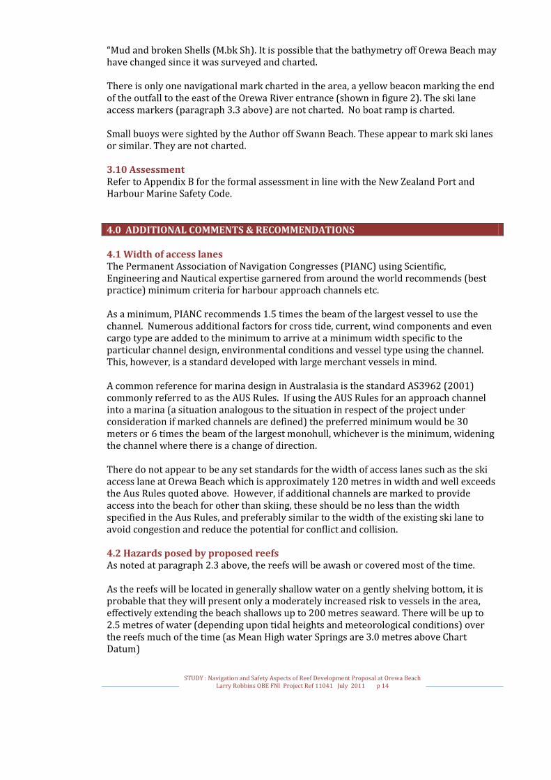
“Mud and broken Shells (M.bk Sh). It is possible that the bathymetry off Orewa Beach may have changed since it was surveyed and charted. There is only one navigational mark charted in the area, a yellow beacon marking the end of the outfall to the east of the Orewa River entrance (shown in figure 2). The ski lane access markers (paragraph 3.3 above) are not charted. No boat ramp is charted. Small buoys were sighted by the Author off Swann Beach. These appear to mark ski lanes or similar. They are not charted. 3.10 Assessment Refer to Appendix B for the formal assessment in line with the New Zealand Port and Harbour Marine Safety Code. 4.0 ADDITIONAL COMMENTS & RECOMMENDATIONS 4.1 Width of access lanes The Permanent Association of Navigation Congresses (PIANC) using Scientific, Engineering and Nautical expertise garnered from around the world recommends (best practice) minimum criteria for harbour approach channels etc. As a minimum, PIANC recommends 1.5 times the beam of the largest vessel to use the channel. Numerous additional factors for cross tide, current, wind components and even cargo type are added to the minimum to arrive at a minimum width specific to the particular channel design, environmental conditions and vessel type using the channel. This, however, is a standard developed with large merchant vessels in mind. A common reference for marina design in Australasia is the standard AS3962 (2001) commonly referred to as the AUS Rules. If using the AUS Rules for an approach channel into a marina (a situation analogous to the situation in respect of the project under consideration if marked channels are defined) the preferred minimum would be 30 meters or 6 times the beam of the largest monohull, whichever is the minimum, widening the channel where there is a change of direction. There do not appear to be any set standards for the width of access lanes such as the ski access lane at Orewa Beach which is approximately 120 metres in width and well exceeds the Aus Rules quoted above. However, if additional channels are marked to provide access into the beach for other than skiing, these should be no less than the width specified in the Aus Rules, and preferably similar to the width of the existing ski lane to avoid congestion and reduce the potential for conflict and collision. 4.2 Hazards posed by proposed reefs As noted at paragraph 2.3 above, the reefs will be awash or covered most of the time. As the reefs will be located in generally shallow water on a gently shelving bottom, it is probable that they will present only a moderately increased risk to vessels in the area, effectively extending the beach shallows up to 200 metres seaward. There will be up to 2.5 metres of water (depending upon tidal heights and meteorological conditions) over the reefs much of the time (as Mean High water Springs are 3.0 metres above Chart Datum)

STUDY : Navigation and Safety Aspects of Reef Development Proposal at Orewa Beach
Larry Robbins OBE FNI Project Ref 11041 July 2011 p 15
Deeper draught recreational vessels such as keel yachts will normally avoid such shallow areas and, as shown later, such traffic is extremely low. Shallow draft vessels such as PWC, dinghies etc will not be greatly inconvenienced, especially if the reefs, access lanes, and possibly marked channels, are clearly marked and it has been suggested that many users will find the increased wave system over the reefs to be attractive. As shown in the assessment matrices, a mechanical failure in a merchant vessel off Whangaparaoa Bay could, in on-shore winds, lead the vessel to drift towards Orewa Beach. Depths from the shipping lane westwards decrease from around 40 metres. The bottom is shown as being Mud (M) or Mud and broken Shells (M.bk.Sh), which generally provides good to reasonable holding for an anchor. Any merchant vessel should be able to anchor safely in mud in such depths and in any case, such vessels will almost certainly ground before reaching the area of the reefs. The presence of the reefs will, in this circumstance, present no more of a risk than the natural features in the area. Similar statements and considerations to those above can be made in respect of naval vessels, although for the most part naval vessels are generally smaller and of shallower draft. Any disabled naval vessel should be able to anchor safely before coming ashore and it could be argued that the reefs themselves may be more at risk from the vessel than the vessel is of the reef should they come ashore. David Thatcher advised19 the recreational users of the beach as being:
Smaller power craft (runabouts, PWCs) for general transit; water skiing; and a limited amount of fishing
Kayaks and other paddle craft Windsurfers and Kite surfers with Orewa Beach being a popular venue for these
activities during easterly wind conditions. Swimmers, surfing and other Surf Club activities including paddle boards. Occasional use for Thundercat racing and PWC racing.
Minor navigational incidents sometimes occur around the shallow areas of the area noted in paragraph 3.9 above, which are not marked by any buoys or beacons apart from the coloured section of the navigation light on Huaroa Point. Such accidents are not a frequent occurrence nor are they usually severe in their effect. The sandy nature of the proposed reefs would probably result in less damage to any vessel which ran aground there than would likely occur on the natural areas. Conceivably, depending upon wind and sea conditions, a recreational vessel which ran aground on the reef on a falling tide could capsize as the tide falls, though the vessel may as likely lie on its side. The risk to recreational vessels can be reduced by the sensitive placing of lighted buoys or beacons to mark the reefs, channels and access lanes, and mitigated by appropriate charting, notices at launching ramps and education through boat clubs etc. Similarly for personal watercraft although as these are generally operated at greater speeds and operators are renown for lack of attention, the risk here is greater – though similarly mitigated by buoys and beacons, notices at launching ramps and education through boat clubs etc.
19 Email, 10 June 2011 @11:46

STUDY : Navigation and Safety Aspects of Reef Development Proposal at Orewa Beach
Larry Robbins OBE FNI Project Ref 11041 July 2011 p 16
The reefs are not likely to present a significant hazard to any kayakers or other paddle craft which may launch from, or land onto, the beach especially if marked by buoys or beacons. The Watersports South Pacific (WSP) website20 ,which caters to windsurfers, states, in respect to Orewa: Wind Type: Works best in easterly or northeasterly [sic] winds. Great entry level or expert wave sailing, Orewa has a gentle beach break which can get quite big but is easily manageable, safe and highly recommended for first time wave sailors. It also has good slalom conditions when the surf is small, as well as good parking and grassy rigging areas. Sailing is best at low tide in surf conditions as a bit of a wind shadow occurs in the break zone at high tide. This venue is ideal for novice wave sailors to anyone trying loops and jumps, as the worst that happens is mild washing up onto the beach. It is very forgiving surf on your equipment because of the gently sloping beach which prevents sudden dumping of waves. The prevailing wind direction is, however, from the westerly quarter. The WSP website notes that there are excellent areas around the Whangaparaoa Peninsula in winds from any quarter and recommends East Coast Bays as being a “mecca” in NE winds. It may be surmised that there are a number of alternatives available for wind and kite-surfing if these activities are restricted by construction of the reefs. The Race Calendar on the Thundercat Racing website21 indicates that there are two “Club Surfcross” events annually at Orewa Beach (May and September). The site describes Surf-cross thus: Racing is run traditionally at surf beaches which provide spectacular jumps, thrills and spills with boats reaching 80kph in the surf. Surf-cross races start with a ‘Le-mans' style start where the driver dashes out into knee deep water to the co-pilot holding the boat. The teams then battle it out over several laps on a rectangular shaped course running parallel to the shoreline in as little as 300mm of water. The finish is dramatic as boats skid up the beach for co-pilots to leap out the front of their boats and run to the FINISH line. Thundercats appear to be shallow draft, high-speed craft which excel in surf conditions. The National Hydrographic Authority, responsible for maintaining and publishing navigational charts, is Land Information New Zealand (LINZ). Liaison will be required with LINZ and the Harbourmaster to ensure that they are advised of the construction so that the necessary Notices to Mariners (preliminary, temporary and permanent) are promulgated along with any appropriate amendments to the chart when the reefs are completed. 4.3 Increased hazards to watercraft The sponsoring trust has suggested that the existing access lane should be retained, although re-orientated slightly, and suggests that two additional marked channels could be provided to provide safe access through the reefs. Perhaps the greatest hazard to any
20 http://www.windsurfing.co.nz/?s1=info&s2=Location 21 http://www.thundercatracing.co.nz/index.php/ps_alias/racecalendar

STUDY : Navigation and Safety Aspects of Reef Development Proposal at Orewa Beach
Larry Robbins OBE FNI Project Ref 11041 July 2011 p 17
vessels using the area of the reefs is an increased risk of conflict or collision due to concentrating the vessels into access lane(s) or channel(s). Users such as Thundercats, wind and kite-surfers, and PWC users would presumably be moved slightly further off-shore but since they are shallow-draft vessels, the reefs would probably pose no greater hazards than at present except in the event that the reefs generated additional surf – although this itself may be a compensating advantage - and potentially at low water due to the height of the reefs. 4.4 Navigational Marks - General
Figure 7 Harbour Marks and Information
STUDY : Navigation and Safety Aspects of Reef Development Proposal at Orewa Beach
Larry Robbins OBE FNI Project Ref 11041 July 2011 p 18
The system of buoyage and beaconage in New Zealand, is defined in Reference 15, New Zealand’s System Of Buoys And Beacons, conforming to “the International Association of Marine Aids to Navigation and Lighthouse Authorities (IALA) System ‘A’ Maritime Buoyage System. This system uses Marks which have a variety of colours, shapes and light characteristics arranged in simple ways to show the side on which a buoy or beacon should be passed when heading in a given direction, indicated on the appropriate chart.”22 It is suggested that in the event that reefs at Orewa Beach needed to be marked a combination of Lateral and Cardinal Marks could be used:
Lateral Marks: red and green colours (coloured buoys, poles and lights) define the port and starboard sides of channels respectively when read in conjunction with the “Buoyage Direction” indicated on the appropriate chart. In the case of the reefs at Orewa, it is suggested that port (red) marks would mark the left side of the channel when proceeding in towards the beach. Cardinal Marks indicate that the deepest water in the area lies to the named side of the Mark, the colours and topmarks indicating the type of mark.
In addition, as will be noted and as are illustrated in earlier paragraphs, access lanes can be marked by pairs of orange and black striped piles/poles, which the user passes between, possibly coupled with leading marks (ranges) ashore. Normal Speed limits (as advised in the note at the bottom of Figure 7) do not apply in the designated Access Lane (refer to paragraph 3.3 above). 4.5 Navigational Marks – Proposed Reefs The Author suggests that there is no “right” way to mark a reef system such as is proposed for Orewa Beach and that maritime experts may not agree on the appropriate way of marking the system. A decision will need to be made as a balance between:
visibility of navigation marks aesthetics - for example Orewa residents may resent a large number of fixed piles
in the waters off the beach, clutter – as it is anticipated that the reefs will be attractive to surfers, authorities
will want to reduce the number of navigation marks to a minimum to avoid introducing physical hazards
simplicity - marks should be such as to enable an instinctive decision to be made about which side to pass
readily identifiable - navigation marks should be instinctively identifiable in respect of type, colour etc
maintenance cost – increasing complexity and number of marks implies increased maintenance cost
Generally speaking, piles may be preferred to buoys as they are more readily seen and generally require less maintenance although they may be considered to pose more of a physical hazard than buoys. If there is more than one access lane or marked channel through the proposed reef
22 Reference 15, page 4

STUDY : Navigation and Safety Aspects of Reef Development Proposal at Orewa Beach
Larry Robbins OBE FNI Project Ref 11041 July 2011 p 19
system, it will be necessary to take care to avoid confusion between the markers of adjacent lanes and in this case, the middle lane could be designated an access lane (and marked by striped black/orange piles) with those either side being marked channels with red and green buoys or piles). The Author suggests that the orientation of the proposed reef system coupled with the fact that users will primarily be recreational users, probably not using charts to aid interpretation, implies that primarily the access lane(s) should be marked with perhaps one marked channel to provide safe access into the beach if required. The figure below shows a minimalist scheme of navigation marks to mark the reefs. Two cardinal marks to the north and east of the reefs delineate the extremes and an access lane is marked.
Figure 8 Minimalist scheme for marking the proposed reefs. (diagrammatic – not to scale)
A south cardinal mark could be added to the south of the inshore end of the southernmost reef especially since there is a boat launching ramp from the motor camp a short distance to the south.

STUDY : Navigation and Safety Aspects of Reef Development Proposal at Orewa Beach
Larry Robbins OBE FNI Project Ref 11041 July 2011 p 20
As access lanes are there to provide lanes in which vessels towing skiers can exceed the normal 5 knot speed limits (which apply within 200 metres of the shore or a vessel exhibiting a dive flag and within 50 metres of any other vessel or swimmer), one or both of the other lanes may be marked by lateral marks (port and starboard (red and green) per figure 7 above) to provide safe access paths in to the beach. 5.0 CONSTRUCTION OF THE REEFS 5.1 Precautions during Construction It is understood that it is intended that the reef will be constructed from a barge, with sand and all equipment brought in from the sea rather than by land. The barge may be self-propelled or towed as a dumb barge and possibly supported by a pumping station on the beach. The nature of the seabed indicates that there should be few problems in mooring or anchoring the barge(s) as necessary during the construction phase. However during periods in which strong onshore winds are forecast or experienced, the barge should be removed from its station. Perhaps the greatest danger to the environment would occur if refuelling operations were conducted with the barge on station. In any case, the Harbourmaster’s standing instructions relating to refuelling must be complied with, but it is suggested that standard operating procedures during the construction should include:
Ensuring that all equipment is maintained in good mechanical condition A detailed environmental contingency plan to be developed and followed Strict compliance with Harbourmaster’s operating instructions A ban on all refuelling operations on-site Frequent inspection of equipment for (e.g.) hydraulic leaks etc Carriage of equipment (such as absorbent material) to cope with minor oil spills
5.2 Navigation warnings etc during construction During construction the barge and attendant/associated vessels will restrict navigation. Any risks can be mitigated by the issuing of navigation warnings and by sensible precautions onboard. The following steps are suggested:
Harbourmaster to promulgate an exclusion area around the barge and construction area
Construction area to be marked by buoys Land Information New Zealand to be requested to issue a Temporary Notice to
Mariners warning of the construction operation, exclusion area etc Appropriate warning signals (in accordance with the International Regulations for
Preventing Collisions at Sea supplemented by flag signals in accordance with the International Code of Signals) to be exhibited by the barge and attendant vessels
A lookout and listening watch on VHF Channel 16 to be maintained on the barge or a designated attendant vessel when on station to warn off any vessels approaching too close to the area
The barge to be fully lit during the hours of darkness

STUDY : Navigation and Safety Aspects of Reef Development Proposal at Orewa Beach
Larry Robbins OBE FNI Project Ref 11041 July 2011 p 21
6.0 CONCLUSIONS 6.1 Conclusions
In the Author’s opinion, strictly speaking, the New Zealand Ports and Harbour Marine Code (the Code) does not apply to the proposed reef development at Orewa Beach.
According to the Auckland Regional Risk Assessment the Orewa Beach area is an area to which the Code does not apply.
Notwithstanding the preceding points, an outline assessment has been made, in line with the Code, as required to allow an application for Resource Consent to be submitted.
Under normal circumstances the reefs will not prove a hindrance to naval and commercial vessels as these do not generally use or visit the Orewa Beach area.
Provided they are properly marked, the reefs should not prove to be a significant hazard to normal beach area users
Per the Assessment Matrix (Appendix B), the greatest hazard appears to be that of collision in the access lane. However, this risk is, arguably, no greater than in the existing access lane.
Although the various reports suggest that the reefs would generate additional surf, this has not been factored into the Assessment Matrix as provided the reefs are marked by buoys or beacons, the surf will occur within the delineated area and in extreme conditions when the surf may be assumed to break earlier, smaller vessels are unlikely to venture into the area. A meaningful numerical assessment is not, in the Author’s opinion, valid in this case as there are a large number of variables.
Although the Author has taken a subjective, but reasonably strict, application of the criteria in formulating the matrix, overall scores are reasonably low, primarily due to the small size of most likely users (and hence the cost to property, personnel and the environment in the event of any mishap)
APPENDICES
A. References B. Assessment in line with the New Zealand Port and Harbour Marine Safety
Code.

STUDY : Navigation and Safety Aspects of Reef Development Proposal at Orewa Beach
Larry Robbins OBE FNI Project Ref 11041 July 2011 p 22
APPENDIX A. References
1. ARC Letter 20 October 2010. File Ref 20198. Application Number 38588. “RESOURCE CONSENT REFUSAL TO ACCEPT APPLICATION”.
2. NEW ZEALAND PORT AND HARBOUR MARINE SAFETY CODE © Maritime Safety Authority 2004 (as downloaded from the Maritime New Zealand website www.maritimenz.govt.nz/Commercial/Ports-and-harbours/Port-and-harbour-safety-code.asp March 2011)
3. GUIDELINES FOR PORT AND HARBOUR RISK ASSESSMENT AND SAFETY MANAGEMENT SYSTEMS IN NEW ZEALAND © Maritime Safety Authority 2004 (as downloaded from the Maritime New Zealand website www.maritimenz.govt.nz/Commercial/Ports-and-harbours/Port-and-harbour-safety-code.asp March 2011)
4. Assessment and Effects on the Environment (AEE) Report – OBRCT
5. Chart NZ 5321 – Mahurangi Harbour to Rangitoto Island, Scale 1:40,000 published April 2008 by Land Information New Zealand (Corrected to small correction 2010-67)
6. Auckland Regional Council Navigation Safety Bylaw 2008 (as downloaded from the Auckland Council website http://www.arc.govt.nz/albany/fms/main/Documents/Environment/Coastal%20and%20marine/Harbourmaster/ARC%20Navigation%20Safety%20Bylaw.pdf June 2011)
7. NEW ZEALAND PILOT, NP51, Fourteenth Edition 1987 and amendments thereto.
8. HAURAKI GULF Boaties Atlas – Second Edition 2002 . David Thatcher ISBN 1 877197 16 5 Published by Captain Teach Press 2002
9. RECREATIONAL BOATING GUIDES – Auckland to Kawau Island. Published by David Bateman Ltd 2003. ISBN 1 86953 546-4
10. COASTAL CRUISING HANDBOOK – Seventh (Centennial) Edition. Royal Akarana Yacht Club 1995
11. CRUISING in New Zealand waters from The North Cape to Tauranga. G R Paul. The Pegasus Press 1961.
12. CRUISING NEW ZEALAND. Mike Pigneguy, Mark Airey. Spot X Publications 2004. ISBN 1-877374-69-5
13. WILLIAM OWEN’S HAURAKI GULF. William Owen (with Penny Owen) . David Bateman Ltd 1999. ISBN 1-86953-029-2

STUDY : Navigation and Safety Aspects of Reef Development Proposal at Orewa Beach
Larry Robbins OBE FNI Project Ref 11041 July 2011 p 23
14. Harbourmasters Office Auckland Regional Risk Assessment – Auckland Regional Council. Approved June 2007. (supplied in digital (pdf) format by Christiaan Moss, Deputy Harbourmaster)
15. NEW ZEALAND’S SYSTEM OF BUOYS AND BEACONS. Maritime New Zealand http://www.maritimenz.govt.nz/Publications-and-forms/Commercial-operations/Shipping-safety/New-Zealand-system-of-buoys-and-beacons.pdf
16. Proposed Multi-Purpose Reefs at Orewa Beach, Hibiscus Coast, Auckland. Resource Management Solutions Ltd September 2010.

STUDY : Navigation and Safety Aspects of Reef Development Proposal at Orewa Beach
Larry Robbins OBE FNI Project Ref 11041 July 2011 p 24
APPENDIX B. Assessment in line with the New Zealand Port and Harbour Marine Safety Code.

STUDY : Navigation and Safety Aspects of Reef Development Proposal at Orewa Beach
Larry Robbins OBE FNI Project Ref 11041 July 2011 p 25
Orewa Beach Reef Project - Derived Hazard List with Frequency and Consequence Scores Table B1
Haz
ard
No
Cat
ego
ry
Are
a
Ves
sel T
yp
e
Haz
ard
Tit
le
Haz
ard
Det
ail
Po
ssib
le C
ause
s
Mo
st L
ikel
y
Co
nse
qu
ence
Wo
rst
Cre
dib
le
Co
nse
qu
ence
Hazard Assessment
Remarks
Most Likely Worst Credible
Peo
ple
Pro
per
ty
En
vir
on
men
t
Stak
eho
lder
s’
Bu
sin
ess
Fre
qu
ency
Peo
ple
Pro
per
ty
En
vir
on
men
t
Stak
eho
lder
s’
Bu
sin
ess
Fre
qu
ency
1
Gro
un
din
g
Orewa Beach – proposed reef development
Deep Draught Vessel
Deep Draught vessel grounding
Grounding on artificial reef
Navigational error Mechanical failure (steering or main engine) Dragging anchor
Damage to hull plating Breach of hull plating and/or oil pollution. Possible damage to propeller and shafting due to contacting bottom (effect of surge or swell)
0 0 0 0 5 1 1 1 0 5
Considered unlikely as reefs are at least 8 nautical miles from recommended routes for large vessels. Vessel will take the ground before reaching the reef area.
2
Gro
un
din
g
Orewa Beach – proposed reef development
Large merchant vessel
Merchant vessel grounding
Grounding on artificial reef
Navigational error Mechanical failure (steering or main engine) Dragging anchor
Damage to hull plating Breach of hull plating and/or oil pollution. Possible damage to propeller and shafting due to contacting bottom (effect of surge or swell)
0 0 0 0 5 1 2 2 1 5
Considered unlikely as reefs are at least 8 nautical miles from recommended routes for merchant vessels. Vessel likely to take the ground before reaching the reef area.
3
Gro
un
din
g
Orewa Beach – proposed reef development
Other commercial vessels
Commercial vessel grounding
Grounding on artificial reef
Navigational error Mechanical failure (steering or main engine) Dragging anchor
Damage to hull plating Breach of hull plating and/or oil pollution. Possible damage to propeller and shafting due to contacting bottom (effect of surge or swell)
0 1 1 0 4 2 2 1 0 5
Note that few commercial vessels are understood to frequent the inshore area off Orewa Beach. Conceivably passenger vessels could chose to anchor in Whangaparaoa Bay off Orewa Beach. However, the vessel is likely to take the ground before reaching the reef area. Navigational error can be mitigated by adequate navigational marks, good charting etc.
4
Gro
un
din
g
Orewa Beach – proposed reef development
Naval vessel Naval vessel grounding
Grounding on artificial reef
Navigational error Mechanical failure (steering or main engine) Dragging anchor
Damage to hull plating Breach of hull plating and/or oil pollution. Possible damage to propeller and shafting due to contacting bottom (effect of surge or swell)
0 1 1 0 5 1 2 1 0 5
Large naval vessels likely to take the ground before reef area. Not a usual anchorage for naval vessels as better shelter is afforded in one of the bays of the Whangaparaoa Peninsula which protect from prevailing winds. Navigational error can be mitigated by adequate navigational marks, and appropriate Notices to Mariners and charting action.
5
Gro
un
din
g
Orewa Beach – proposed reef development
Sailing Yacht Yacht grounding
Grounding on artificial reef
Navigational error Mechanical failure (steering or engine) Dragging anchor
Minor hull or keel damage
Loss of vessel due to hull damage, capsize etc.
1 1 0 0 3 2 1 1 0 4
Note that few yachts venture inshore in this area due to shallow depths, exposure to prevailing winds and onshore swells. and proximity of more attractive boating areas. Not a major anchorage (and not recommended in boating guides) yachts unlikely to be moving into or around the area in darkness. Can be mitigated by adequate navigational marks, good charting, notices at boat clubs etc. and appropriate Notices to Mariners and charting action.
6
Gro
un
din
g
Orewa Beach – proposed reef development
Motorised recreational vessel
Recreational vessel grounding
Grounding on artificial reef
Navigational error Mechanical failure (steering or engine) Dragging anchor
Minor hull damage Loss of craft due to hull damage capsize etc.
1 2 1 0 3 2 2 2 0 4
Hazard most likely to occur to craft involved in water activities such as water skiing, etc. Motor cruisers rarely venture inshore in this area due to generally shallow depths exposure to prevailing winds and onshore swells and proximity to more attractive boating areas. Not a major anchorage (and not recommended in boating guides) . Motor cruisers unlikely to be moving into the area in darkness. Can be mitigated by adequate navigational marks, notices at boat ramps, enforcement of access lanes etc. and appropriate Notices to Mariners and charting action.

STUDY : Navigation and Safety Aspects of Reef Development Proposal at Orewa Beach
Larry Robbins OBE FNI Project Ref 11041 July 2011 p 26
7
Gro
un
din
g Orewa Beach – proposed reef development
Personal Water Craft (PWC) and small motorised dinghies
PWC /dinghy grounding
Grounding on artificial reef
Navigational error Mechanical failure Inattention of operator
Minor damage to underwater area
Loss of PWC /dinghy
0 0 0 0 2 1 0 0 0 3
Manoeuvrability and shallow draft of PWC/dinghy , reduce likelihood of grounding. Adequate navigation marks, visibility of reef, good signage at launch ramps and local knowledge make the detrimental effects of this hazard likely to be minor.
8
Co
llis
ion
Orewa Beach – proposed reef development
Sailing Yacht Yacht contacts navigation mark
Collides with navigation mark
Inattention by skipper, weather, visibility, mechanical or other equipment failure
Minor hull damage, damage to navigation mark, possible damage to steering and/or propeller if navigation mark is a buoy
Loss of vessel due to hull damage/water ingress. Minor oil spillage. Possible injury or loss of life.
0 1 0 0 2 1 1 1 0 4
Mitigated by maintaining navigation marks in good condition, well painted. Ensure all lights are working at night. Education at local boating clubs, signage at launching ramps etc.
9
Co
llis
ion
Orewa Beach – proposed reef development
Motorised recreational vessel
Motorised recreational vessel contacts navigation mark
Collides with navigation mark
Inattention by skipper, weather, visibility, mechanical or other equipment failure
Minor hull damage, damage to navigation mark, possible damage to steering and/or propeller if navigation mark is a buoy
Loss of vessel due to hull damage/water ingress. Minor oil spillage. Possible injury or loss of life.
0 1 0 0 2 1 1 2 0 4
Mitigated by maintaining navigation marks in good condition, well painted. Ensure all lights are working at night. Education at local boating clubs, signage at launching ramps etc.
10
Co
llis
ion
Orewa Beach – proposed reef development
Personal Water Craft
PWC contacts navigation mark
Collides with navigation mark
Inattention by operator, weather, visibility, mechanical or other equipment failure
Damage to PWC or navigation mark
Loss of PWC with possibility of minimal oil spillage. Possible injury. 0 1 0 0 2 1 0 0 0 4
Mitigated by maintaining navigation marks in good condition, well painted. Ensure all lights are working at night. Education at local boating clubs, signage at launching ramps etc.
11
Co
llis
ion
Access Lane23 or offshore area of Orewa Beach – proposed reef development
All vessels Collision Vessels/craft in collision
Generic – due to inattention or misjudgement by either vessel particularly during water skiing, inappropriate operation of PWC etc
Vessel damage (on varying scale depending on relative speeds and aspects of the vessels involved) Personal injury
Severe damage to one or both vessels Minor pollution due to fuel spillage Loss of life or severe injury Explosion or fire
2 2 1 0 3 2 3 2 0 4
Risk no more severe than for vessels currently using the existing access lane. Consider limiting activities to different areas of the beach.
12
Oil
Sp
ill
Orewa Beach – proposed reef development
Construction Barge and/or towing vessel
Oil Spill Spillage from barge
Spillage during fuel transfer, bunkering etc
Minor spill contained onboard
Larger spill into ocean
0 0 1 1 4 0 1 2 1 4
Mitigated by strict adherence to Harbourmaster’s instructions. Prohibition on refuelling or fuel transfer on site. Scuppers plugged if (for example) hydraulic pipe leaking. Carriage of absorbent materials. Work to stop immediately on spillage or leakage.
13
Co
llis
ion
Orewa Beach – proposed reef development Area
Construction Barge and/or towing vessel
Collision with barge
Vessel collides with barge
Inattention by other vessel operator
Damage to other vessel, and/or minor injury
Loss of other vessel and/or serious injury
2 1 1 0 4 2 2 1 0 4
Mitigated by: Notices to Mariners. Notices at boat clubs and launching ramps. Barge to be well illuminated at night.
14
Gro
un
din
g Orewa Beach – proposed reef development
Construction Barge and/or towing vessel
Barge and/or towing vessel Grounding
Barge and/or towing vessel drags anchor and grounds on beach
Anchor failure Little damage to vessel. Minor oil spillage possible. Project delay.
Major damage to vessel. Some oil spillage possible. Project delay. 0 0 0 0 5 0 2 2 1 5
Ensure adequate additional anchors. Remove barge if wind forecast to be over set limit onshore.
15
Co
llis
ion
Orewa Beach – proposed reef development
all vessels Collision with construction pipeline (if one is employed)
Vessel collides with pipeline
Inattention by skipper/operator
Minor damage to pipeline or vessel
Damage to pipeline or vessel
0 1 0 0 5 1 1 1 0 5
Mitigated by marking of exclusion area during construction and running any pipeline to the shore along the seabed rather than using a floating pipeline and/or utilising patrol boat..
23 Current access lane per ARC bylaw (Reference 6) or additional access lanes which may be established through the reefs.

STUDY : Navigation and Safety Aspects of Reef Development Proposal at Orewa Beach
Larry Robbins OBE FNI Project Ref 11041 July 2011 p 27
Orewa Beach Reef Project – Ranked Hazards with Risk Matrix Scoring Table B2 (Ranked)
Haz
ard
No
.
Ran
k N
o.
Cat
ego
ry
Are
a
Ves
sel T
yp
e
Haz
ard
Tit
le
Haz
ard
Det
ail
Po
ssib
le C
ause
s
Mo
st L
ikel
y
Co
nse
qu
ence
Wo
rst
Cre
dib
le
Co
nse
qu
ence
Assessed Risk
Most Likely Worst Credible
Peo
ple
Pro
per
ty
En
vir
on
men
t
Stak
eho
lder
s’
Bu
sin
ess
Peo
ple
Pro
per
ty
En
vir
on
men
t
Stak
eho
lder
s’
Bu
sin
ess
11 1
Co
llis
ion
Access Lane24 or offshore area of Orewa Beach – proposed reef development
All vessels Collision Vessels/craft in collision
Generic – due to inattention or misjudgement by either vessel particularly during water skiing, inappropriate operation of PWC etc
Vessel damage (on varying scale depending on relative speeds and aspects of the vessels involved) Personal injury
Severe damage to one or both vessels Minor pollution due to fuel spillage Loss of life or severe injury Explosion or fire
4 4 2 0 3 5 3 0
Risk no more severe than for vessels currently using the existing access lane. Consider limiting activities to different areas of the beach.
13 2
Co
llis
ion
Orewa Beach – proposed reef development Area
Construction Barge and/or towing vessel
Collision with barge
Vessel collides with barge
Inattention by other vessel operator
Damage to other vessel, and/or minor injury
Loss of other vessel and/or serious injury
3 2 2 0 3 3 2 0
Mitigated by: Notices to Mariners. Notices at boat clubs and launching ramps. Barge to be well illuminated at night.
6 3
Gro
un
din
g
Orewa Beach – proposed reef development
Motorised recreational vessel
Recreational vessel grounding
Grounding on artificial reef
Navigational error Mechanical failure (steering or engine) Dragging anchor
Minor hull damage Loss of craft due to hull damage capsize etc.
2 4 2 0 2 2 2 0
Hazard most likely to occur to craft involved in water activities such as water skiing, etc. Motor cruisers rarely venture inshore in this area due to generally shallow depths exposure to prevailing winds and onshore swells and proximity to more attractive boating areas. Not a major anchorage (and not recommended in boating guides) . Motor cruisers unlikely to be moving into the area in darkness. Can be mitigated by adequate navigational marks, notices at boat ramps, enforcement of access lanes etc. and appropriate Notices to Mariners and charting action.
12 4
Oil
Sp
ill
Orewa Beach – proposed reef development
Construction Barge and/or towing vessel
Oil Spill Spillage from barge
Spillage during fuel transfer, bunkering etc
Minor spill contained onboard
Larger spill into ocean
0 0 2 2 0 2 3 2
Mitigated by strict adherence to Harbourmaster’s instructions. Prohibition on refuelling or fuel transfer on site. Scuppers plugged if (for example) hydraulic pipe leaking. Carriage of absorbent materials. Work to stop immediately on spillage or leakage.
5 4
Gro
un
din
g
Orewa Beach – proposed reef development
Sailing Yacht Yacht grounding
Grounding on artificial reef
Navigational error Mechanical failure (steering or engine) Dragging anchor
Minor hull or keel damage
Loss of vessel due to hull damage, capsize etc.
2 2 0 0 3 2 2 0
Note that few yachts venture inshore in this area due to shallow depths, exposure to prevailing winds and onshore swells. and proximity of more attractive boating areas. Not a major anchorage (and not recommended in boating guides) yachts unlikely to be moving into or around the area in darkness. Can be mitigated by adequate navigational marks, good charting, notices at boat clubs etc. and appropriate Notices to Mariners and charting action.
3 4
Gro
un
din
g
Orewa Beach – proposed reef development
Other commercial vessels
Commercial vessel grounding
Grounding on artificial reef
Navigational error Mechanical failure (steering or main engine) Dragging anchor
Damage to hull plating Breach of hull plating and/or oil pollution. Possible damage to propeller and shafting due to contacting bottom (effect of surge or swell)
0 2 2 0 3 3 1 0
Note that few commercial vessels are understood to frequent the inshore area off Orewa Beach. Conceivably passenger vessels could chose to anchor in Whangaparaoa Bay off Orewa Beach. However, the vessel is likely to take the ground before reaching the reef area. Navigational error can be mitigated by adequate navigational marks, good charting etc.
24 Current access lane per ARC bylaw (Reference 6) or additional access lanes which may be established through the reefs.

STUDY : Navigation and Safety Aspects of Reef Development Proposal at Orewa Beach
Larry Robbins OBE FNI Project Ref 11041 July 2011 p 28
9 7 C
oll
isio
n
Orewa Beach – proposed reef development
Motorised recreational vessel
Motorised recreational vessel contacts navigation mark
Collides with navigation mark
Inattention by skipper, weather, visibility, mechanical or other equipment failure
Minor hull damage, damage to navigation mark, possible damage to steering and/or propeller if navigation mark is a buoy
Loss of vessel due to hull damage/water ingress. Minor oil spillage. Possible injury or loss of life.
0 3 0 0 2 2 3 0
Mitigated by maintaining navigation marks in good condition, well painted. Ensure all lights are working at night. Education at local boating clubs, signage at launching ramps etc.
8 8
Co
llis
ion
Orewa Beach – proposed reef development
Sailing Yacht Yacht contacts navigation mark
Collides with navigation mark
Inattention by skipper, weather, visibility, mechanical or other equipment failure
Minor hull damage, damage to navigation mark, possible damage to steering and/or propeller if navigation mark is a buoy
Loss of vessel due to hull damage/water ingress. Minor oil spillage. Possible injury or loss of life.
0 3 0 0 2 2 2 0
Mitigated by maintaining navigation marks in good condition, well painted. Ensure all lights are working at night. Education at local boating clubs, signage at launching ramps etc.
4 8
Gro
un
din
g
Orewa Beach – proposed reef development
Naval vessel Naval vessel grounding
Grounding on artificial reef
Navigational error Mechanical failure (steering or main engine) Dragging anchor
Damage to hull plating Breach of hull plating and/or oil pollution. Possible damage to propeller and shafting due to contacting bottom (effect of surge or swell)
0 2 2 0 1 3 1 0
Large naval vessels likely to take the ground before reef area. Not a usual anchorage for naval vessels as better shelter is afforded in one of the bays of the Whangaparaoa Peninsula which protect from prevailing winds. Navigational error can be mitigated by adequate navigational marks, and appropriate Notices to Mariners and charting action.
2 10
Gro
un
din
g
Orewa Beach – proposed reef development
Large merchant vessel
Merchant vessel grounding
Grounding on artificial reef
Navigational error Mechanical failure (steering or main engine) Dragging anchor
Damage to hull plating Breach of hull plating and/or oil pollution. Possible damage to propeller and shafting due to contacting bottom (effect of surge or swell)
0 0 0 0 1 3 3 1
Considered unlikely as reefs are at least 8 nautical miles from recommended routes for merchant vessels. Vessel likely to take the ground before reaching the reef area.
14 11
Gro
un
din
g Orewa Beach – proposed reef development
Construction Barge and/or towing vessel
Barge and/or towing vessel Grounding
Barge and/or towing vessel drags anchor and grounds on beach
Anchor failure Little damage to vessel. Minor oil spillage possible. Project delay.
Major damage to vessel. Some oil spillage possible. Project delay. 0 0 0 0 0 3 3 1
Ensure adequate additional anchors. Remove barge if wind forecast to be over set limit onshore.
10 12
Co
llis
ion
Orewa Beach – proposed reef development
Personal Water Craft (PWC)
PWC contacts navigation mark
Collides with navigation mark
Inattention by operator, weather, visibility, mechanical or other equipment failure
Damage to PWC or navigation mark
Loss of PWC with possibility of minimal oil spillage. Possible injury. 0 3 0 0 2 0 0 0
Mitigated by maintaining navigation marks in good condition, well painted. Ensure all lights are working at night. Education at local boating clubs, signage at launching ramps etc.
15 13
Co
llis
ion
Orewa Beach – proposed reef development
all vessels Collision with construction pipeline (if one is employed)
Vessel collides with pipeline
Inattention by skipper/operator
Minor damage to pipeline or vessel
Damage to pipeline or vessel
0 1 0 0 1 1 1 0
Mitigated by marking of exclusion area during construction and running any pipeline to the shore along the seabed rather than using a floating pipeline and/or utilising patrol boat..
1 14
Gro
un
din
g
Orewa Beach – proposed reef development
Deep Draught Vessel
Deep Draught vessel grounding
Grounding on artificial reef
Navigational error Mechanical failure (steering or main engine) Dragging anchor
Damage to hull plating Breach of hull plating and/or oil pollution. Possible damage to propeller and shafting due to contacting bottom (effect of surge or swell)
0 0 0 0 1 1 1 0
Considered unlikely as reefs are at least 8 nautical miles from recommended routes for large vessels. Vessel will take the ground before reaching the reef area.
7 15
Gro
un
din
g
Orewa Beach – proposed reef development
Personal Water Craft (PWC) and small motorised dinghies
PWC /dinghy grounding
Grounding on artificial reef
Navigational error Mechanical failure Inattention of operator
Minor damage to underwater area
Loss of PWC /dinghy
0 0 0 0 2 0 0 0
Manoeuvrability and shallow draft of PWC/dinghy , reduce likelihood of grounding. Adequate navigation marks, visibility of reef, good signage at launch ramps and local knowledge make the detrimental effects of this hazard likely to be minor.