Street Connectivity 1 - Lehigh Valley Planning Commission · 2 Street Connectivity Street...
20
Street Connectivity 1 Updated November 2015
-
Upload
trankhuong -
Category
Documents
-
view
216 -
download
2
Transcript of Street Connectivity 1 - Lehigh Valley Planning Commission · 2 Street Connectivity Street...

Street Connectivity 1
Updated November 2015

2 Street Connectivity Street Connectivity 1
Lehigh Valley Planning Commission961 Marcon Boulevard, Suite 310Allentown, Pennsylvania 18109
Phone: 610-264-4544Fax: 610-264-2616
E-mail: [email protected]: www.lvpc.org
TABLE OF CONTENTS
PURPOSE 1
INTRODUCTION 1
HISTORY 3
THE BENEFITS OF CONNECTIVITY 7
DISADVANTAGES 9
HOW MUCH CONNECTIVITY? 10
PRACTICAL STRATEGIES TO IMPROVE CONNECTIVITY 11
Micro-level strategies 11 Requiringandconnectingstubstreets 11 Settingasmallermaximumblocklength 11 Reducing the number of cul-de-sacs 13 Encouragingtheconstructionofsidewalks 14 PromotingTraditionalNeighborhoodDesign(TND) 15 UsingaConnectivityIndex 16
Macro-level strategies 17 Comprehensive Plans 18 OfficialMaps 19 Pedestrian/SidewalkConnectivityStudies 21 StreetConnectivityStudies 21
SUMMARY OF CHALLENGES AND SOLUTIONSTO IMPROVING CONNECTIVITY 23
CONCLUSION 24
EXAMPLES OF CONNECTIVITY IN THE LEHIGH VALLEY 24
BIBLIOGRAPHY 37
FIGURES
1 ProportionofService 2 2 ConnectivityDifferences 3 3 Radburn NJ: Birth of the Modern Subdivision 5 4 Comparison of Grid and Curvilinear Road Design 6 5 BenefitsofConnectivity 7 6 Stub Streets 12 7 ComparisonofDifferentBlockLengths 13 8 ConnectivityIndex 17
Thepreparationofthisreporthasbeenfinancedinpartthroughgrant(s)fromtheFederalHighwayAdministrationandFederalTransitAdmin-istration,U.S.DepartmentofTransportation,undertheMetropolitanPlanningProgram,Section104(f)ofTitle23,U.S.Code.Thecontentsofthisreportreflecttheviewsoftheauthorswhoareresponsibleforthefacts and the accuracy of the data presented herein. The contents do not necessarilyreflecttheofficialviewsorpoliciesoftheU.S.DepartmentofTransportation,FederalHighwayAdministration(FHWA),FederalTransitAdministration(FTA)ortheCommonwealthofPennsylvaniaatthetimeofpublication.Thisreportdoesnotconstituteastandard,specificationorregulation.
PURPOSEConnectivity is an analysis of the number and variety of connections serving origins such as residential neighborhoods and destinations like schools and shopping areas. Connectivity relates to the number of in-tersections along a segment of streets and how the entire area is connected to the system. Good street connectivity means providing a variety of ways to get from Point A to B, from using the car to walking. The recommendations in this report are geared toward improving the efficiency of mobility (i.e. ease of move-ment) and accessibility (i.e. the ability to go from an origin to a desired destination). The benefits of bet-ter connectivity go beyond improved mobility and accessibility and can include less traffic congestion, safer streets, municipal cost savings in the provision of services, and reduced need to improve arterial streets.
Residential streets are complex places that serve multiple and, at times, competing needs. Residents of a neighborhood expect a place that is relatively quiet, that connects rather than divides their neighbor-hood, where they can walk along and cross the street relatively easily and safely, and where vehicles move slowly. Other street users, including emergency service providers, school bus drivers, solid waste collec-tors, and delivery trucks, expect a place that they can safely and efficiently access and maneuver to per-form their jobs. The most effective strategies to improve connectivity occur before and during the subdivi-sion phase of development. We hope that the consideration of the strategies and examples will stimulate creative ideas for street design and broaden support for improved street connectivity as an important goal in Lehigh Valley municipalities.
INTRODUCTION
Streets play an important role in determining the form and function of our neighborhoods and communities as a whole. Neighborhoods and municipalities are largely defined by the streets inside them. Population size, systems of government, design techniques, building methods, paving techniques, transport technolo-gy, sewage and waste disposal, values and philosophy all influence streets - their width, geometry and des-tinations.
Ideally, local streets would form a well-connected, efficient network that provides for safe, direct, and con-venient access by a variety of means of transportation from walking to driving. A poorly-connected street network primarily encourages the use of the automobile over other travel modes. It creates longer trips, di-vides neighborhoods, limits alternative routes to places like schools and shopping areas, and concentrates traffic on a selected number of streets instead of spreading it out across the entire street network.
The “connectivity” of our street network (Figure 1, page 2) has come under increasing scrutiny due to the increased traffic on arterial streets as they reach capacity when the arterial streets can no longer handle the amount of traffic. Expensive projects to upgrade or fix those traffic problems are required, usually rely-ing on a limited amount of municipal or state funding to pay for the project. With the continued rise in the price of gasoline and materials, efficient and effective routes benefit everyone.
The unforeseen drawback to the modern design of our subdivisions is that we discovered while we are separated from other uses and neighbors, it is difficult to get anywhere. We found that our local trips to schools, neighbors, and shopping areas were longer. Emergency services, such as fire trucks and ambu-lances, along with delivery trucks and school buses often had to navigate inefficient routes that caused un-necessary delay. With streets being so infrequently connected, local trips to school or the store are forced on the arterial street. This in turn impacts the regional system by adding short vehicular trips to main arter-ies designed for longer trips. As arterial streets become congested, a domino effect begins. Collector and local streets become congested as people seek to find routes around the congestion, and discover, due to how the subdivisions were laid out in the initial planning stages, no good alternative routes exist.
L V CPLehigh Valley Planning Commission
Kent H. Herman, Esq., Chair
Liesel Dreisbach, Vice Chair
Stephen Repasch, Treasurer
Norman E. Blatt, Jr., Esq.
Christen T. Borso
John Brown
Shannon Calluori (alt.)
Gordon Campbell
Eugene Clater
John N. Diacogiannis, CPCU
Robert Donchez
Percy H. Dougherty, PhD
Karen Duerholz
Charles W. Elliott, Esq.
George F. Gemmel
Steven L. Glickman, RA, NCARB
Armand V. Greco
Darlene Heller, AICP (alt.)
Edward D. Hozza, Jr.
Robert A. Lammi
Kevin Lott
Richard Molchany (alt.)
Christina V. Morgan
Thomas Muller
Thomas J. Nolan
Sara Pandl, AICP, RLA
Salvatore J. Panto, Jr.
Edward Pawlowski
Pamela Pearson, MBA
Hayden Phillips
Lynn Prior
Kathy Rader
Michael Reph
Tina Roseberry (alt.)
Lisa Scheller
Kevin Schmidt
Lori Sywensky (alt.)
Julie Thomases
Elinor Warner
Donna Wright
COMMISSION
Becky A. Bradley, AICP, Executive Director
George G. Kinney, AICP, Director of Transportation Planning
Eric C. McAfee, AICP, LEED AP, Director of Community Planning
Geoffrey A. Reese, P.E., Director of Environmental Planning
Bruce R. Rider, Director of Administration
Tracy L. Oscavich, Associate Director of Development
William H. Deegan, Architectural/Urban Designer
David E. Manhardt, AICP, Chief Geographic Information Systems Planner
Ben Holland, GISP, Senior Geographic Information Systems Planner
Ngozi Obi, Senior Community Planner
Teresa Mackey, Senior Environmental Planner
Susan L. Rockwell, Senior Environmental Planner
Michael S. Donchez, Senior Transportation Planner
Gabriel F. Hurtado, Community Planner
Alice J. Lipe, Graphics & Publications Coordinator
Kathleen M. Sauerzopf, Executive Secretary
Brian Hite, Traffic Data Technician
STAFF
Cover Icon: Noun Project/Jakob Vogel

2 Street Connectivity Street Connectivity 3
Modern subdivision design decreased our ability to walk or bike to places like parks, schools and stores due to the lack of sidewalks and the use of cul-de-sacs. There is no place to walk and nowhere to go. Each subdivision is isolated from the land uses around it. As a result, the concept of “connectivity” has been of growing interest for the local planning commissions and municipalities faced with traffic issues with no inex-pensive or quick solutions.
Connectivity means that a street network provides multiple routes and connections between residential neighborhoods and destinations, such as schools and shopping areas (Figure 2, page 3). A well-connected network emphasizes various types of mobility: pedestrian, automobile and transit. It is a system of varied routes and cross connections, few closed end streets, many points of access, and narrow streets to calm traffic, with plenty of sidewalks for pedestrian access. Interconnected streets ease traffic flow problems be-cause they provide alternative routes, which help decrease the demand on any single street.
The Pennsylvania Department of Transportation (PennDOT) promotes a connected street network as part of its Smart Transportation strategy, defined as “partnering to build great communities for future genera-tions of Pennsylvanians by linking transportation investments with land use planning and decision-making”. In 2008, PennDOT, in conjunction with the New Jersey Department of Transportation (NJDOT), published the Smart Transportation Handbook. The handbook contains several strategies on improving local street connectivity. PennDOT funds connectivity projects through its Pennsylvania Community Transportation Ini-
tiative (PCTI) to support and encourage local transportation projects that exemplify the goals of their Smart Transportation program.
Locally, the Lehigh Valley Planning Commission promotes goals and strategies in the Comprehensive Plan The Lehigh Valley…2030 to encourage municipalities to have a connected local road network as a means of preserving the through traffic carrying function of arterial roads. We also believe that a connected local street network can make the transportation network more effective and efficient, sometimes making costly traffic or congestion related upgrades unnecessary.
HISTORYGreek and Roman civilizations used straight and parallel streets in their villages and cities and were the first civilizations to create design and construction standards for streets for the primary means of moving military units and commerce from one city to another.
In the United States, the grid was first used in Philadelphia, resembling the design of the London street net-work. The grid was a popular design for cities in the burgeoning United States due to its simplicity, cost ef-fectiveness and efficiency in laying out towns and cities for pedestrian and horse-drawn vehicles. The ap-proach provided for the standardization of lot sizes and multiple corner lots, which developers believed were more valuable than lots mid-block. The use of the grid in the developing towns and cities in the United States west of the original colonies was driven to a greater degree by market forces rather than by practic-es carried over to the United States from England.

4 Street Connectivity Street Connectivity 5
By the turn of the 20th century, however, the grid was criticized by architects and planners as Sir Ebene-zer Howard’s “Garden City” movement started gaining momentum, especially in Britain. The grid approach was considered monotonous, encouraged overcrowding, decay and disease, and was not very adaptable or flexible when the growing town found a river or mountain in the way of progress.
Curvilinear streets similar to those found in British subdivisions began to be constructed in American sub-divisions later in the 1920s as the use of the automobile grew. Clarence Perry, of the Regional Planning Association of America (RPAA), established a set of principles for suburban design that created distinct boundaries in the form of major streets and promoted the use of a hierarchy of streets based on the type and amount of traffic each street would be designed to carry. In 1929, Clarence Stein, also of the RPAA, used these principles in the design of his subdivision in New Jersey called Radburn.
Radburn’s development (Figure 3, page 5) was very unique for its time in the United States. It was based upon a street hierarchy that emphasized separation. It uniquely separated commercial areas from resi-dential areas by curved and narrow streets that discouraged automobile traffic. Until this point, there was very little separation of uses in land use planning. Radburn had an intricate network of pedestrian trails and bridges that separated the automobile from the pedestrian. The reduction of traffic in neighborhoods was accomplished by the prominent use of the dead end street. The intent was to eliminate the through move-ment of traffic on most residential streets and instead relegate them to collector streets and arterials. Stein reasoned:
“The automobile was a disturbing menace to city life in the U.S.A…. The flood of motors had al-ready made the gridiron pattern, which had formed the framework for urban real estate for over a century, as obsolete as a fortified town wall…. The checkerboard pattern made all the streets equally inviting to through traffic. Quiet and peaceful repose disappeared along with safety” (Southworth and Ben-Joseph 1997).
Radburn represented the beginning of a major shift in the design of residential subdivisions in the United States. The planning of neighborhoods and towns now shifted away from the master planning of local gov-ernment to the piecemeal approach of private developers building subdivisions with their own unique lay-outs and internal road networks. Figure 4 on page 6 compares the grid and curvilinear network.
During the early 1930s, the grid concept continued to lose support as the federal government continued to take the control of laying out towns and cities away from government and invested it in the private sector as a means of combating the economic effects of the Great Depression. The Federal Housing Administration (FHA), created in 1934 as part of the National Housing Act, offered Federal mortgage insurance to builders and developers and long-term, low interest loans to potential home-buyers. The FHA would only finance houses in suburbs that met approved standards in a guide called Standards for the Insurance of Mortgag-es on Properties Located in Undeveloped Subdivisions, first published in 1935 and revised three times until 1941. Connectivity was not an important consideration in the creation of the regulations, nor were contem-porary notions of accessibility for persons with disabilities, as protected in the 1988 amendment to the 1968 Fair Housing Act, as well as the Americans with Disabilities Act (ADA) of 1990. Instead, much like in Rad-burn, separation of uses and separation of cars from pedestrians were a primary focus.
According to the FHA, subdivisions should be designed to follow the topography of the area and have a hi-erarchical system of residential and collector streets. The standards included detailed regulations for the width of streets and intersections, the placement of trees, the size of blocks and lots, and sometimes even the style of architecture. The suggestions discouraged designs that would facilitate through traffic and showed a marked preference for cul-de-sacs and deep setbacks.
Influential support for the curvilinear approach came from the Institute of Traffic Engineers (ITE). The orga-nization proposed standards for street design based on studies of traffic accident rates in areas with var-ious street patterns in 1961. The study concluded that the majority of accidents occurred on streets de-
signed as a grid with four-way intersections. Curvilinear streets using cul-de-sacs had far fewer accidents. The ITE recommended to municipalities and developers alike that subdivisions should be designed with curvilinear streets and discontinuous streets ending in cul-de-sacs. The standards were revised in 1965 with increased widths for sidewalks and streets and increased radii for intersections and cul-de-sacs. These ITE guidelines, with periodic revisions, quickly became the standard for subdivision street design in the United States for the next four decades.
During the 1990s, planners and engineers started studying the effect of the hierarchical street network ap-plied thousands of times over to subdivisions across the United States due to the growing popularity of New Urbanism and Traditional Neighborhood Design. ITE published its first set of alternative standards as a “proposed recommended practice” intended to support walkability: Traditional Neighborhood Develop-ment Street Design Guidelines in 1997. The American Society of Civil Engineers (ASCE) concluded that street networks heavy on cul-de-sac design increased travel demand on arterial streets by 75% and on col-lector streets by 80%, compared to a 43% lower vehicle miles traveled (VMT) with a gridded street design

6 Street Connectivity Street Connectivity 7
(Taylor 2001). The ASCE study also found that the connected network reduced travel times and speeds, factors that impact street safety.
The curvilinear street system accommodated the market for housing created by the monetary and regula-tory influence of the FHA and the reduction in government controlled master planning. The design reduced through traffic, thus providing the privacy and isolation sought by families leaving the cities, and cul-de-sacs were seen by both the government and the public as the safest environment for raising children. As a result, the residential subdivision of the past and present largely accomplishes the goal of Radburn: sepa-ration. Residential subdivisions in the Lehigh Valley and across the United States, despite proximity to one another, are typically separated from and not connected to other types of surrounding development and dif-ferent neighborhoods.
THE BENEFITS OF CONNECTIVITYThe major benefit of street connectivity is that it attempts to redistribute traffic across an entire street net-work. If local streets are poorly connected, local trips are forced to use the arterial system, which is de-signed to handle longer trips. The combination of short and long trips using the same streets creates con-gestion problems. Connected local streets would help keep local trips off arterial streets and reduce the need for the widening and construction of improvements on collector or arterial streets.
Increased connectivity promotes transportation choices for a resident of a subdivision. It provides for dif-ferent modes of travel besides the automobile. Street connectivity offers the potential to increase trips by walking, bicycling or using transit because shorter travel distances can be created by linking sidewalks or streets to destinations.
Municipalities can greatly benefit from encouraging a more efficient local street network (Figure 5). The lack of local street connections increases the length of delivery trips and causes inefficient trip routes. For ex-ample, a municipality could save money in labor, gas and material while plowing roads in the winter if the plow truck does not have to plow numerous cul-de-sacs or go into a subdivision and unnecessarily “double back” to exit the subdivision given limited access points.

8 Street Connectivity Street Connectivity 9
THINKING ABOUT CHANGING YOUR STREET STANDARDS?
For municipalities interested in taking a look at revising local street standards and traffic calming measures, there are two excellent re-sources available to get started. The Pennsylvania Housing Re-search Center published Pennsylvania Standards for Residential Site Development in 2007. The PHRC coordinated an oversight commit-tee with the Hamer Center for Community Design from Pennsylvania State University. The committee, which was involved in the develop-ment of the guide, included representatives from the state agencies, design professionals,
such as engineers and surveyors, attorneys, municipal officials, represen-tatives from builder, municipal, development and emergency management agencies.
The second resource is the Smart Transportation Guidebook. The guide, published in March 2008, was developed through a partnership between PennDOT and the New Jersey Department of Transportation and includes detailed information on designing streets and roads in both rural and urban areas.
More importantly, emergency responders prefer greater connectivity because it provides greater, quick-er and more direct access to an incident. The provision of municipal and emergency services benefits from connected streets. The most demonstrative benefit of connectivity was produced by a 2008 study of munic-ipal services conducted by Charlotte, NC, which adopted connectivity standards in 2001. The City discov-ered the citywide average response time rose from 4.5 minutes in the mid-1970s to 5.5 minutes in 2002. This increase corresponds with the prevalence of street design patterns in conventional subdivision devel-opment with low connectivity. However, in new subdivisions constructed since 2001, the average response time had dropped thirty seconds, to 5 minutes. An interesting presentation of the study was the demonstra-tion that the completion of 300 feet of street between two subdivisions provided a 17% increase in service area for a fire station, and saved the city of Charlotte millions of dollars in having to construct a fire station to adequately serve the same area. The study further discovered that the typical coverage area of a snow plow operator is 12-15 miles of streets but dropped to 6-8 miles in areas that consist primarily of cul-de-sac streets.
The Raleigh, NC Transportation and Planning Department studied fire and emergency management sys-tem efficiencies in three different neighborhood types: (1) older, traditional, gridded development; (2) neigh-borhoods built in the 1970s and 1980s with limited connectivity; and (3) developments from the late 1980s and 1990s with very limited connections and many cul-de-sacs and dead-ends. According to the City of Ra-leigh Department of Transportation, “In all cases, the analysis showed far greater service efficiencies for those older neighborhoods with greater street connectivity. Even when discounting the density of devel-opment in these areas, the raw acreage covered in each case confirmed the greater efficiency in fire re-sponse coverage for areas with better street connectivity.”
Traffic safety can be improved with the combination of street connectivity and traffic calming measures such as using narrow streets in neighborhoods. A connected street system encourages slow, cautious driv-ing since drivers encounter cross traffic and intersections at more frequent intervals. Going back to the ASCE study described on page 7, the more connected a street network is, the more the number of vehicle miles traveled (VMT) will fall, which means less time people will spend in an automobile. Providing more lo-cal intersections through reduced block lengths can help reduce traffic speed, a primary cause in traffic ac-cidents. Neighborhoods with narrow streets slow traffic speed because of the greater attention required to navigate through the narrow street with the unpredictable parking pattern, if parking is allowed on one or both sides of the street. Narrow streets also discourage “through” or “cut-through” traffic in a neighborhood without the need for elaborate or expensive traffic calming measures such as center islands, medians or speed bumps. As noted in Figure 7 on page 13, simply adjusting block length can have a positive effect on traffic speed. However, these types of traffic calming objects are often resisted by emergency service pro-viders, due to the fact that they force them to slow the speed of their vehicles even as they are attempting to reach the scene of an emergency as quickly as possible. Municipalities must weigh the pros and cons of various methods of traffic calming to determine which are the most appropriate at achieving optimal re-sults.
Improved local connectivity protects the public investment in infrastructure. According to a 2011 report pub-lished by the Reason Foundation, Transportation for America and Taxpayers for Common Sense titled The Most for Our Money: Taxpayer Friendly Solutions for the Nation’s Transportation Challenges, improving street connectivity was identified as a top strategy to protect taxpayer investment in infrastructure. The re-port states “Perhaps the single most neglected part of the regional transportation network is the need for more local roads as well as collectors and boulevards to create better neighborhood connectivity and re-inforce a grid pattern. Increasing connectivity of the street network will help improve the efficiency of the transportation network, allowing limited federal funds to be prioritized for pressing transportation needs. Furthermore, with less local traffic on overburdened roadways, reduced wear and tear may prolong the life of many critical infrastructure links. The costs associated with maintaining roadways have grown consider-ably over the last few years and measures to extend their lifespan may reduce the burden of public expen-diture.”
Residents opposed the connection of a street between two municipalities. A planted tree in the middle of the street serves as a barrier to vehicular traffic.
Connectivity improves the efficiency and effectiveness of bus transit. Indirect trips as a result of a network consisting of curvilinear streets and cul-de-sacs add travel time and expense (cost of fuel and vehicle main-tenance) to each trip. Transit service often does not access suburban neighborhoods due to the street de-sign. Instead, service is usually kept on arterials adjacent to the neighborhood, with the responsibility for accessing the bus left to the rider. Increased connectivity on collector streets could provide more direct op-portunities for transit service.
DISADVANTAGESThe biggest disadvantage to improving street connectivity is the politics of implementation. Many Lehigh Valley municipali-ties have a variety of strategies outlined in this guide already in their land use ordinances. However, when stub streets are proposed to be connect-ed, municipalities can expect residents of the existing subdi-vision to oppose it due to per-ceived increases in traffic and traffic speed and infiltration of people into the otherwise pri-vate neighborhood.
Connectivity is not always aligned with current market forc-

10 Street Connectivity Street Connectivity 11
An example of where stub streets were not connected between an existing subdivi-sion built in the 1990s on the left and a newly constructed subdivision built in the late 2000s on the right.
es in the housing market. Connectivity standards often seek to reduce the number of cul-de-sacs, despite the fact that many residents prefer them. Homebuyers seek the seclusion that cul-de-sacs and limited ac-cess have provided, and are adamantly against connectivity. The 2008 Charlotte study revealed that resi-dents are often concerned that crime, traffic and accidents will increase as more connections, especially non-automobile connections such as pedestrian paths, are made in residential areas because of increased access to properties. It should be noted that, hypothetically, the less the traffic on a street, the more op-portunity a criminal has to work undisturbed by either pedestrians or automobiles passing by the house. A house on a cul-de-sac, or on any street near the back of a development, would be easier to burglarize un-noticed than a house on a through street.
Developers fear that if more connections are required through local ordinances that it will require more land for streets and less land for housing units and that the profitability and attractiveness of their subdivi-sions will be diminished. It is true that cul-de-sac development maximizes the number of building lots and minimizes the financial burden on the developer for infrastructure. Developers would rather sell land for a house than pay to pave it for a street. This concern can be lessened by allowing reduced street width stan-dards.
Greater numbers of connections on local streets can increase through traffic on residential streets. Port-land, Oregon, a city defined almost totally by a grid pattern of small blocks, discovered that as traffic in-creases on arterials, motorists will regularly use local streets to bypass congested intersections. High levels of connectivity appeared to increase the opportunity for cut-through traffic in neighborhoods. Similarly, as more motorists used the local streets, the arterial streets functioned better due to the diverted traffic. Better planning can help solve this problem. Cut-through traffic can be resolved by designing the street layout to remove “straight shot” streets that cut through the neighborhood. Staggering intersections and reducing the width of the street can also calm traffic.
HOW MUCH CONNECTIVITY?There is a critical balance between connectivity and through traffic. Enough connectivity should be provid-ed so that residents of a neighborhood can easily move to all edges of the neighborhood and adjacent land uses, but not so much that neighborhood streets become attractive choices for through traffic to avoid con-gestion and delay on arterials.
There is no one right answer to this question as the “level” of connectivity in any particular area or munici-pality is often guided by topography, historic development patterns, and the application of previous zoning and subdivision regulations. The available research provided by national planning and engineering organi-zations often compares the extremes—the traditional grid with a conventional suburban curvilinear pattern. Unlike these extremes, many Lehigh Valley municipalities have a mix of the two systems. This suggests that there are a host of practical strategies a municipality could use to improve connectivity without a dras-tic shift to requiring one specific system that would guide the layout of all future development.
The balance of desired land uses must also be considered when discussing street connectivity. There will be times when street connectivity may be detrimental to municipal and regional planning objectives. For ex-ample, a municipality may not want to have stub streets extended into land that is recommended for farm-land preservation; land that has environmental constraints, such as a floodplain or wetland; or land that is zoned for an incompatible land use. Connectivity may make sense for subdivisions in suburban or urban areas, but where there is interest to preserve land as open space or farmland, connectivity may encourage residential sprawl.
PRACTICAL STRATEGIES TO IMPROVE CONNECTIVITYThere are numerous approaches a municipality can explore to improve street and pedestrian connectivity from large projects such as developing official maps and conducting connectivity studies to smaller projects such as refining elements of subdivison design found in municipal land use ordinances.
Micro-level strategies
Requiring and connecting stub streets
One of the easier methods a municipality can use to im-prove connectivity is to require stub streets in new subdivi-sions. A majority of subdivision ordinances in the Lehigh Val-ley have specific requirements for the mandatory inclusion of stub streets to connect to adja-cent properties to allow for fu-ture connection.
Typically, stub streets exist be-cause original plans for subdi-visions were never completed or changed, or when an adja-cent subdivision is proposed, there is objection from the ex-isting neighborhood when connection to a subdivision is proposed. When connect-ing subdivisions with streets is not possible due to environ-mental constraints or adjacent incompatible uses (such as an industrial area with truck traffic) or lacks public support, connecting subdivisions via a sidewalk or path should be explored. Some connectivity is better than having none at all.
Stub streets are usually local or collector streets. The purpose of a local stub is to connect local streets (Figure 6 on page 12) on adjacent properties when they are developed. In contrast, collectors, such as the two examples on pages 30 and 35, should have logical, direct routes that make cross parcel and area driv-ing possible. Such streets can be built in sections as subdivisions are built. At full build out of an area, they provide an important function for carrying all of the subdivision traffic to a variety of destinations without us-ing nearby arterial streets.
Setting a smaller maximum block length
Block length is used in a number of ways to promote or measure connectivity. A shorter block can create more intersections and, therefore, shorter travel distances and a greater number of routes between loca-tions. Minimizing the block length allows better access for pedestrians, bicyclists and automobiles, and pro-vides some flexibility for street connections. Figure 7 on page 13 illustrates how block length can affect in-tersection spacing.

12 Street Connectivity Street Connectivity 13
A 2005 publication titled TND Design Rating Standards provided recommended block length standards to increase walkability and street connectivity.
Excellent: 250-400 feet
Good: 400-500 feet
Acceptable: 500-600 feet
Fair: 600-800 feet
Poor: More than 800 feet
Source: TND Design Rating Standards, Version 1.5 (2005), current update, 2.2
In the Lehigh Valley, subdivision ordinances provide for a large range of block lengths, anywhere from 500-1,600 feet. Imposing a specific block length would not be permitted for situations in which site condi-
tions such as topography or hydrology make this infeasible or undesirable. Developers desire the longer block lengths. The fewer number of cross streets increases the number of building lots and decreases the amount of land reserved for streets. However, to encourage better connectivity, suburban and urban munic-ipalities should encourage block lengths of no more than 800 feet, or alternatively, reduce the high point of the range from 1,600 feet to a lower range of 800-1,000 feet.
Reducing the number of cul-de-sacs
Municipalities can use the regulation of cul-de-sacs as a means to improve connectivity without requiring elaborate connectivity strategies. While cul-de-sacs provide benefits such as reducing traffic in a neighbor-hood and providing privacy to residents, an overabundance of subdivisions using cul-de-sacs can create neighborhood and regional street connectivity challenges. A subdivision that uses a great number of cul-de-sacs in the design can limit traffic circulation and confuse drivers. Access to interior lots can be blocked at the open end of a cul-de-sac. Traffic can be excessive to residences at the open end of a cul-de-sac if the street is long and access is provided to a large number of homes. Cul-de-sacs promote inefficient deliv-ery of services. All vehicles, including school buses, delivery trucks, and snow plows have to “double back”

14 Street Connectivity Street Connectivity 15
An example of a subdivision providing pedestrian connectivity when natural features such as a stream and floodplain make full street connectivity dif-ficult.
An example of a gated subdivision, with privately owned roads. Gates pro-hibit connectivity to adjacent neighborhoods. An unusual feature of the sub-division is that despite gates closing off the street, sidewalks are provided into and out of the subdivision, but do not connect to any existing sidewalk network.
The residential developments shown do not have a high level of street con-nectivity but were designed with a high level of pedestrian connectivity. The developments are linked to each other and a nearby grocery store with paved paths or sidewalks.
down the street which results in additional time and material cost. Some Lehigh Valley municipalities re-strict the length and number of cul-de-sacs.
The state of Virginia has employed a new method of restricting cul-de-sacs. In 2009, Virginia became the first state in the nation to both restrict cul-de-sacs in future development and require that all new subdivi-sions attain a certain level of “connectivity” based on a connectivity index discussed on page 16. The num-ber of cul-de-sacs affects the score. The more cul-de-sacs and dead end streets, the lower the index num-ber. If the streets do not meet the connectivity “index”, the state will not provide maintenance and snowplow services. Since the state maintains nearly 85% of the streets, it is a considerable disincentive. Virginia ad-opted the standards to improve the cost effectiveness of services and road maintenance, and improve the response time of emergency services.
Municipalities should also discourage gated subdivisions. While not common in the Lehigh Valley, a gated subdivision eliminates options for drivers in the neighborhood and prohibits potential for enhanced street connectivity in an area.
Encouraging the construction of sidewalks
Development in the United States pri-or to the 1930s considered sidewalks an essential part of a community. In the 1950s and 1960s, it become in-creasingly common to exclude them. In most subdivisions designed from the 1970s to the 1990s, they were either considered impractical, presumed to add unnecessary cost, or overlooked.
Subdivisions without sidewalks pro-mote a low level of connectivity and pedestrian safety. Many subdivision regulations in the Lehigh Valley require sidewalks but provide two waivers: 1) the request to waive the requirement to construct sidewalks all together or 2) the request to defer construction until a later date. The intent of these waivers is to provide relief in instances where strict compliance would result in an extraordinary hardship. However, the granting of waivers can be inconsistent and result in an incomplete network of sidewalks. Waivers are generally grant-ed for subdivisions that have a single cul-de-sac serving less than 25 lots or have no adjacent uses or subdivisions to which the sidewalks can connect.
Internal connectivity and accessibility, along with consideration of future development around the subdivi-sion, are often overlooked in the design and planning process. For many residents of subdivisions built in the Lehigh Valley over the last two decades, the only way to access another part of the subdivision or the nearby park is to walk in the street or drive.
When street connection is either im-possible or not wanted, providing a sidewalk can be a solution to improved connectivity and pedestrian safety. Sidewalks provide a safe means for pedestrians to access nearby attrac-tions such as schools, parks and adja-cent subdivisions and for recreation. In areas recommended for urban devel-opment, subdivisions should, at mini-mum, have sidewalks on one side of all streets when within two (2) miles of a school, or 0.5 miles of a greenway, park or shopping area, or when there is an existing sidewalk network adjacent to the proposed development. The two mile standard for schools is derived from the minimum distance for eligible infrastructure improvements set forth by the U.S. Department of Transporta-tion Safe Routes to School program. Providing sidewalks in the two mile dis-tance around the school will enhance student safety and/or promote walking and bicycling to school.
Promoting Traditional Neighborhood Design (TND)
Planners and engineers started looking for alternatives to the standard subdivision layout. The concept of Traditional Neighborhood Design (TND) became increasingly popular in the late 1980s as an alternative to
the perception that the “modern” sub-division was an inefficient use of land and infrastructure and lacked a sense of community. TND is a compact land development pattern that includes a variety of housing types, densities and land uses in a defined area. For example, TND elements such as front porches encourage social interaction, and alleys and garages to the rear of houses create strong pedestrian mo-bility and a unique community charac-ter. They are served by an intercon-nected street system that resembles the historic grid pattern. TNDs en-courage a sense of place by creating a unique, distinct neighborhood.
Relative to street connectivity, TND provides for access using an inter-connected network of narrow streets that provide safe and efficient access for both pedestrians and automobiles. The interconnected street pattern is

16 Street Connectivity Street Connectivity 17
meant to limit the use of the cul-de-sac. Short blocks create multiple routes and more direct ones for pe-destrians, bicyclists, and motorists. Independent networks of sidewalks and bikeways can further comple-ment the street network in a TND. The mixed uses of traditional neighborhood developments will also pro-mote walking if shops, offices, and public services and facilities are within walking distance.
For additional general information on TNDs, please see the Lehigh Valley Planning Commission publication Traditional Neighborhood Development.
Using a Connectivity Index
The Connectivity Index (CI) (Figure 8, page 17) is a useful measurement tool for municipal planning com-missions in evaluating and promoting connectivity in proposed subdivision plans. Nationwide, Connectivi-ty Indices have been incorporated into comprehensive plans and subdivision ordinances. The CI is the ratio of street segments and intersections and cul-de-sacs. Higher numbers indicate a higher level of street con-nectivity. Cul-de-sacs and street networks with one-way in and one-way out will generally lower the connec-tivity ratio.
There is no “one size fits all” index number. A higher level of connectivity may be desired in suburban or urban areas rather than in rural areas. Indices may vary across a municipality based on existing land use.
According to case studies of cities that adopted a CI and national references on the subject of street con-nectivity, an index of 1.4 to 1.8 represents an acceptable street network for subdivisions in suburban and urban areas.
Both municipalities and developers have found that using a Connectivity Index allows for greater flexibility than using specific block length requirements in designing a development to accommodate environmental features such as floodplains and steep slopes. To use the Connectivity Index in the subdivision review pro-cess, local planning commissions must first become familiar with the tool, applying it to recently approved subdivisions before incorporating the index into the subdivision regulations and using it as one of its tools to evaluate connectivity of proposed subdivisions.
Macro-level strategies
Little can be done to remedy the existing lack of connectivity in some areas. Existing cul-de-sacs that were constructed without due consideration to connectivity are difficult to retrofit due to topography or existing physical obstacles such as houses and other development.
The key is to promote connectivity at the “front end” of the development cycle by a two-pronged approach. The first step is to include connectivity goals and objectives in the municipal comprehensive plan. The sec-ond step is to create or update an official map to show desired streets and streets that will serve to ensure

18 Street Connectivity Street Connectivity 19
that those connections are made and that new developments provide adequate connections to neighboring undeveloped land.
Comprehensive Plans
The municipal comprehensive plan is a document that serves as a decision-making guide for both officials and residents. It is intended to assist the municipality in making decisions about future growth and develop-ment. The process of developing the plan is perhaps as important as the final document. The process ex-amines existing conditions and issues unique to the municipality and establishes goals and policies that support the municipality’s desired future character and form. Relative to street connectivity, the comprehen-sive plan can include objectives, strategies and recommended actions designed to ensure future develop-ment is interconnected with existing development.
Essentially a street map for the future, the goals and policies of the comprehensive plan serve as the docu-ment which the official map and/or municipal ordinances are based upon.
Some sample goals are outlined below.
1. Provide a highly connected transportation system within (Municipality) in order to provide choices for drivers, bicyclists, and pedestrians; promote walking and bicycling; connect neighborhoods to each other and to local destinations such as schools, parks, and shopping areas; reduce travel times; improve air quality; reduce emergency response times; increase effectiveness of municipal service delivery; and free up arterial capacity to better serve regional long distance travel needs.
2. New residential development should include local streets that encourage pedestrian and bicycle trav-el by providing short, direct, public right-of-way routes to connect residential uses with nearby existing and planned residential subdivisions, schools, parks and other neighborhood facilities.
3. New residential developments should minimize the number of cul-de-sacs to the extent practical and only be used to increase the number of lots by accessing land otherwise not accessible through a connected street pattern. Where cul-de-sacs are unavoidable, developments shall incorporate provi-sions for future vehicular connections to adjacent, undeveloped properties.
4. New residential subdivisions should have at least one stub street constructed into each adjacent undeveloped property of 10 acres or more. The design of future alignment of street extensions onto adjacent tracts should benefit the surrounding community. Subsequent development of these adja-cent tracts should connect to the original stub street.
5. New residential development should incorporate and continue all collector or local streets construct-ed to the boundary of the development plan by previously approved but not constructed development or existing development.
6. A Connectivity Index should be used to determine the adequacy of street layout design during the planning stages of a residential development. This is calculated as the ratio of the number of street segments and intersections/cul-de-sacs. The figure for a conventional cul-de-sac subdivision is often 1.0 or less. A minimum Connectivity Index of 1.4 to 1.8 represents an acceptable street network and each new subdivision should have an index above the threshold.
7. Sidewalks should be installed on at least one side of the street in all residential subdivisions if the street is located within two (2) miles of a school, or 0.5 miles of a greenway, park, or shopping area, or if there is an existing sidewalk network adjacent to the proposed development.
Official Maps
The official map is a land use management tool that can help municipalities plan the location and layout of future streets and public areas and preserve rights-of-way. It can give strength and validity to a municipali-ty’s wants and needs for future growth.
Article IV of the Pennsylvania Municipalities Planning Code (MPC) enables municipalities to prepare an of-ficial map and take proactive measures in shaping important components of their future development, in contrast to simply reacting to developers’ proposals. Adopted by ordinance, it serves as a visionary docu-ment that specifies properties the municipality wants to acquire for public improvements.
A wide variety of elements related to street connectivity can be shown on the map as long as they are con-sistent with the MPC. The official map can include features such as:
● Existing and proposed public streets, including widening, extensions, openings or closings, wa-tercourses, and public grounds. An example of a municipality proposing future streets appears on page 20. South Whitehall Township identifies future arterial, collector and local roads in the north-ern part of the Township on an official map adopted in 2010.
● Bike routes (both separate trails and those proposed along existing streets);
● Existing and proposed public parks, playgrounds, and open space reservations;
● Pedestrian ways and easements;
● Rail, street and transit rights-of-way and easements (including those that may be vacated or aban-doned and have potential use as trails).
The official map is not a taking of private land. If by virtue of the official map a landowner is denied reason-able use of his property, he or she can apply for a special encroachment permit that would allow him or her to build on the site. If a landowner notifies the municipality of his or her intention to develop a site identified on the map, the municipality has one year to acquire the site or the reservation of that land becomes inval-id. The landowner is free to use any unmapped portions of the land in accordance with the municipality’s zoning and subdivision regulations.
The official map need not be surveyed. A metes and bounds survey is not required until an actual purchase of land or easement is proposed by the municipality. It does not obligate the municipality to open, maintain or improve mapped streets or build the improvements cited on the map. It does not serve as the municipal-ity’s zoning map or comprehensive plan as it is a document of limited purpose and its legal impact is quite specific. The creation of the official map is not necessarily an expensive undertaking. It can be simple or complex, with varying levels of detail. The level of complexity largely depends on the vision and the role of the map in helping elected officials make land use decisions.
In the Lehigh Valley, the following jurisdictions have adopted official maps:

20 Street Connectivity Street Connectivity 21
Allen Township (May 2000, revised 2007) Bushkill Township (April 2005) Catasauqua Borough (January 2007) East Allen Township (August 2009) Hanover Township (Northampton County) (November 1996, revised July 2008) Lehigh County (revised 2007) Lower Saucon Township (2009) Moore Township (March 2003) South Whitehall Township (October 2010) Tatamy Borough (August 1986, currently under revision) Upper Milford Township (March 2010) Upper Saucon Township (January 2010) Whitehall Township (November 1998)
Pedestrian/Sidewalk Connectivity Studies
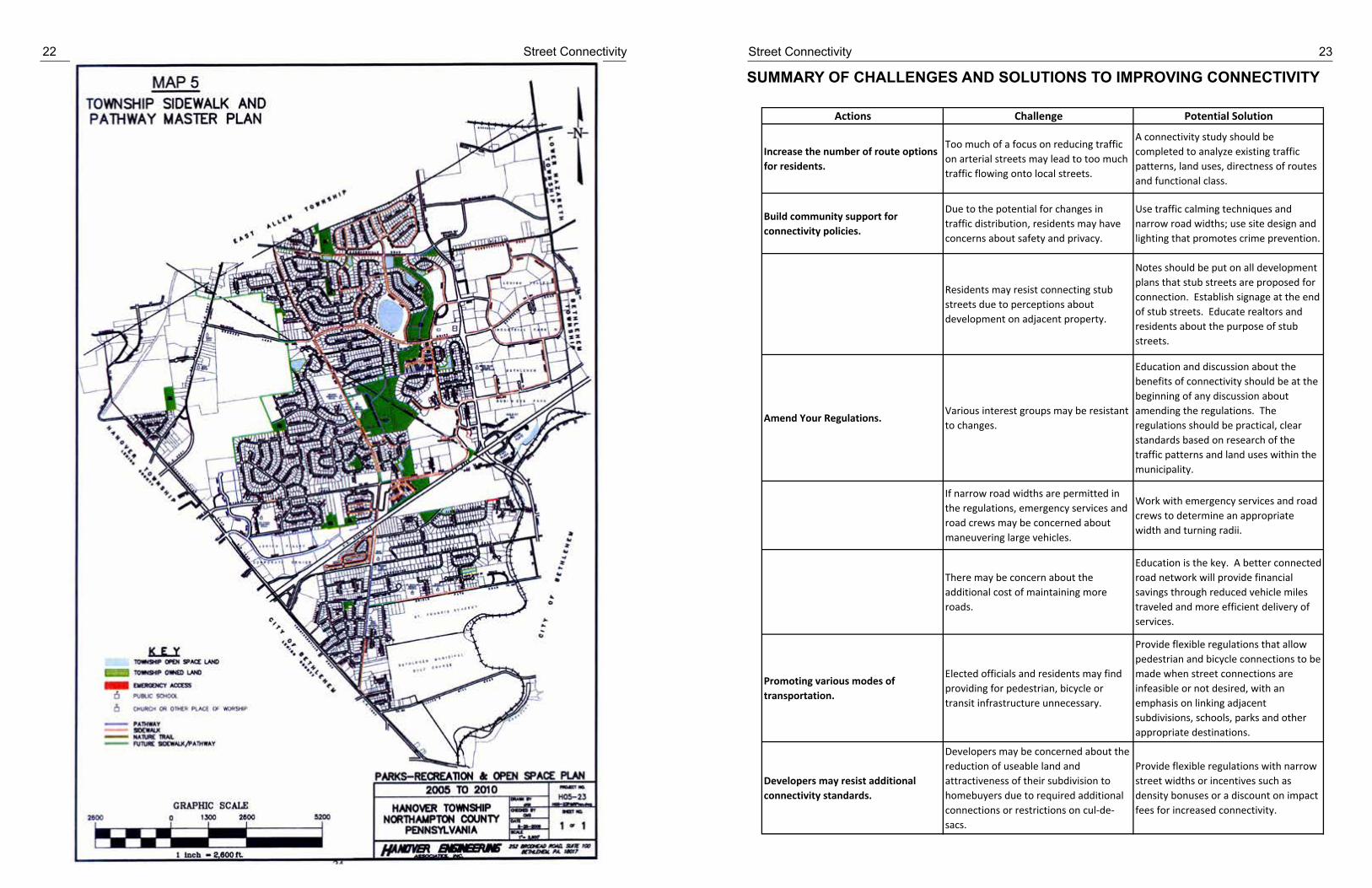
Connectivity is not just about streets and automobiles. Municipalities can improve pedestrian connectivi-ty with sidewalk plans. A sidewalk plan is a good way to proactively address gaps in a municipal pedestri-an network and complement existing sidewalks and trails. It can identify locations for sidewalks to be con-structed with future development along arterial and collector roads and provide standards for when the construction of sidewalks along local roads is appropriate. A sidewalk plan is intended to be a comprehen-sive framework for all decision-making as it relates to sidewalks within a municipality. From prioritizing side-walk or trail infill segments, to recommending changes to development regulations and addressing opera-tional issues, to evaluating funding opportunities, the plan can be a practical guide to use when evaluating development proposals. An example of a municipality identifying the existing sidewalk network appears on page 22. The benefit of examining the sidewalk network is that it can illustrate future opportunities for side-walk connections when vacant parcels are developed.
Street Connectivity Studies
A connectivity study conducts an analysis of the street network within the municipality or portions of a mu-nicipality. The study evaluates the historic trend of development within the area, collects and reviews ex-isting traffic data, and determines possible corridors for future streets that would serve as connections be-tween streets as a framework to guide street layout in future subdivisions.
As development occurs within the study area, the private sector will be responsible for building applicable elements of the street system that are consistent with the municipality’s street design guidelines and incor-porating sidewalks and/or bike/pedestrian amenities as appropriate.
The chart on page 23 summarizes the challenges and possible solutions to those challenges in improving street connectivity in your community.
22 Street Connectivity Street Connectivity 23
SUMMARY OF CHALLENGES AND SOLUTIONS TO IMPROVING CONNECTIVITY
Actions Challenge Potential Solution
Increase the number of route options for residents.
Too much of a focus on reducing traffic on arterial streets may lead to too much traffic flowing onto local streets.
A connectivity study should be completed to analyze existing traffic patterns, land uses, directness of routes and functional class.
Build community support for connectivity policies.
Due to the potential for changes in traffic distribution, residents may have concerns about safety and privacy.
Use traffic calming techniques and narrow road widths; use site design and lighting that promotes crime prevention.
Residents may resist connecting stub streets due to perceptions about development on adjacent property.
Notes should be put on all development plans that stub streets are proposed for connection. Establish signage at the end of stub streets. Educate realtors and residents about the purpose of stub streets.
Amend Your Regulations.Various interest groups may be resistant to changes.
Education and discussion about the benefits of connectivity should be at the beginning of any discussion about amending the regulations. The regulations should be practical, clear standards based on research of the traffic patterns and land uses within the municipality.
If narrow road widths are permitted in the regulations, emergency services and road crews may be concerned about maneuvering large vehicles.
Work with emergency services and road crews to determine an appropriate width and turning radii.
There may be concern about the additional cost of maintaining more roads.
Education is the key. A better connected road network will provide financial savings through reduced vehicle miles traveled and more efficient delivery of services.
Promoting various modes of transportation.
Elected officials and residents may find providing for pedestrian, bicycle or transit infrastructure unnecessary.
Provide flexible regulations that allow pedestrian and bicycle connections to be made when street connections are infeasible or not desired, with an emphasis on linking adjacent subdivisions, schools, parks and other appropriate destinations.
Developers may resist additional connectivity standards.
Developers may be concerned about the reduction of useable land and attractiveness of their subdivision to homebuyers due to required additional connections or restrictions on cul‐de‐sacs.
Provide flexible regulations with narrow street widths or incentives such as density bonuses or a discount on impact fees for increased connectivity.

24 Street Connectivity Street Connectivity 25
EXAMPLES OF CONNECTIVITYIN THE
LEHIGH VALLEY
CONCLUSIONConnections between subdivisions are critically important. Better local street and pedestrian connectivi-ty reduces the burden on providing municipal services and upgrades on collector and arterial streets that municipal and state governments cannot afford to build. Making road and pedestrian connections between places where we live, shop and work can have a profound effect on maintaining a good level of service on both local street networks and on the regional street network, making a community more functional and at-tractive for residents.
Municipalities and developers must change their understanding of suburban residential development. In-stead of considering each subdivision as an isolated island, residential subdivisions should be considered pieces in a larger community. As Lehigh Valley municipalities plan for future growth, there is an opportu-nity to begin developing a better connected network to serve shorter trips within the region. Municipalities do not have to adopt an all or nothing approach of strictly grid or curvilinear streets. They can encourage a greater degree of automobile and pedestrian connections with the modest revisions to their regulations and comprehensive plans outlined in this guide.
The issue of connectivity is ultimately a dialogue about the trade-offs and real solutions to local traffic prob-lems. Sustained political leadership on the long-term benefits of connectivity is essential, even when un-popular with residents. Unique issues will arise in each municipality. Close collaboration with fire and emergency service providers, public works agencies, refuse haulers, and residents must be maintained throughout the process. This will ensure that the standards developed to meet the general goals of munici-pal connectivity will also meet the specific needs of those who use the streets.
EXAMPLES OF CONNECTIVITY IN THE LEHIGH VALLEY On pages 26-36 are selected examples of low and high street and pedestrian connectivity in the Lehigh Valley. These examples were selected to generally illustrate some of the topics covered earlier in the guide.

26 Street Connectivity Street Connectivity 27

28 Street Connectivity Street Connectivity 29

30 Street Connectivity Street Connectivity 31

32 Street Connectivity Street Connectivity 33

34 Street Connectivity Street Connectivity 35

36 Street Connectivity Street Connectivity 37
BIBLIOGRAPHYBurden, Daniel and Paul Zykofsky. Emergency Response, Traffic Calming and Traditional Neighborhood
Streets. Sacramento, CA: Center for Livable Communities.
Handy, Susan, Robert G. Paterson and Kent Butler. “Planning for Street Connectivity: Getting from Here to There”, Planning Advisory Service Report No. 515. Chicago IL: American Planning Association, 2003.
Kentucky State Department of Planning. “Model Street Connectivity Standards”, www.planning.kytc.ky.gov/congestion/connectivity/WSDOT%20Connectivity%20Model%20Ordinance.pdf.
Institute of Traffic Engineers. Context Sensitive Solutions in Designing Major Urban Thoroughfares for Walk-able Communities. Washington, DC: Institute of Traffic Engineers, 2006.
Morris, Marya, Ed. “Planning Active Communities”, Planning Advisory Service Report No. 543/544, Chicago, IL: American Planning Association, 2007.
New Jersey State Department of Transportation. “New Jersey Long Range Transportation Plan, 2030: Street Connectivity”, 2010.
Portland Metro. “Street Connectivity: An Evaluation of Case Studies in the Portland Region. Portland: Port-land Metro, 2004.
Twaddell, Hannah. “Making the Connection”, Planning Commissioners Journal (58): 1-2, 2005.