STRATIGRAPHIG RELATIONS - USGS · For sale by the Superintendent of Documents, ... STRATIGRAPHIG...
28
If you do not need this report after it has served your purpose, please return it to the Geological Survey, using the official mailing label at the end UNITED STATES DEPARTMENT OF THE INTERIOR Harold L. Ickes, Secretary GEOLOGICAL SURVEY W. C. Mendenhall, Director Professional Paper 186—G STRATIGRAPHIG RELATIONS OF THE AUSTIN, TAYLOR, AND EQUIVALENT FORMATIONS IN TEXAS BY LLOYD WILLIAM STEPHENSON Shorter contributions to general geology, 1936 (Pages 133-146) UNITED STATES GOVERNMENT PRINTING OFFICE WASHINGTON : 1937 For sale by the Superintendent of Documents, Washington, D. C. ------- Price 10 cents
Transcript of STRATIGRAPHIG RELATIONS - USGS · For sale by the Superintendent of Documents, ... STRATIGRAPHIG...

If you do not need this report after it has served your purpose, please return it to the Geological Survey, using the official mailing label at the end
UNITED STATES DEPARTMENT OF THE INTERIOR Harold L. Ickes, Secretary
GEOLOGICAL SURVEY W. C. Mendenhall, Director
Professional Paper 186—G
STRATIGRAPHIG RELATIONSOF THE AUSTIN, TAYLOR, AND EQUIVALENT
FORMATIONS IN TEXAS
BY
LLOYD WILLIAM STEPHENSON
Shorter contributions to general geology, 1936
(Pages 133-146)
UNITED STATES
GOVERNMENT PRINTING OFFICE
WASHINGTON : 1937
For sale by the Superintendent of Documents, Washington, D. C. ------- Price 10 cents

CONTENTS
Page Abstract_________________.__________.____________________._________-____-__-___.. 133Introduction.___-_-_-_______________________-_____________________________-_-__-_________-____-----------___ 133Section in Travis County_____________________-__________.____________________________________________________ 133Sections along belt of outcrop to the south and to the north of Travis County-_________________________________________ 136
Vicinity of New Braunfels_______--____--______-______-_________-------------------_--------_-_--------__- 136North and west of San Antonio__________________________________________________________________________ 136Hondo and Seco Creeks, Medina County___-____-______________-------------__----_-___---_-----_-------___ 136Travis County to Falls County_-_----_-------_______-_-___._____-_____________________-_ 137Waco and vicinity.______________________________________________________________________________________ 137McLennan County to Dallas County___________________________________________________________________ 138Dallas and vicinity____________________________________________L_.____________________________________ 138Collin County_________________________________________________________________ 139Grayson, Fannin, and Lamar Counties__________.______________________________________________________ 139Chalks and marls in Red River County_______________________________________________________—— 141
Stratigraphic relations in Red River and Lamar Counties.-------------------------------------------------------- 141Section in Red River County compared with that in southwestern Arkansas_______________________________________ 143Texas and Alabama sections compared_________________________________________________________________________ 144Summary and conclusions__________________________________________________________________________________ 145
ILLUSTRATIONS
Page PLATE 44. Reconnaissance geologic map of parts of Lamar and Red River Counties, Tex_____________________________ 138FIGXJBE 7. Correlation of the exposed sediments of Austin and lower Taylor age in the Gulf Coastal Plain—_______________ 135
II

EXPLANATION OF FIGURE 7, PAGE 135, PROFESSIONAL PAPER 186-G
Numbers designate faunal zones as follows:7. Diploschiza cretacea minor zone (=Diploschisa cretacea zone in Alabama).6. Ostrea elegantula zone.5. Ostrea travisana zone.4. Ostrea centerensis zone.3. Exogyra tigrina zone.2. Gryphaea wratheri zone.1. Inoceramus undulato-plicatus zone.
ERRATUM
On page 133, first column (abstract), line 18 from bottom of page, south eastern Arkansas should read southwestern Arkansas.
135230—37U. S. GOVERNMENT PRINTING OFFICE: 193?

STRATIGRAPHIG RELATIONS OF THE AUSTIN, TAYLOR, AND EQUIVALENTFORMATIONS IN TEXAS
By LLOYD WILLIAM STEPHENSON
ABSTRACT
The relation of faunal zones in the upper part of the Austin chalk to the top of the chalk indicates the presence of an uncon formity of regional extent separating the Austin and beds of Austin age from the overlying Taylor marl and beds of Taylor age. The time value of this unconformity varies greatly from place to place along the strike, owing in part to unequal erosion at the top of the Austin and in part to differential warping in early Taylor time.
The maximum erosion at the top of the Austin is found in the vicinity of Waco, where the Taylor rests directly on the Inoceramus undulato-plicatus zone, and the minimum erosion is found in Fannin and Lamar Counties, where the top of the Gober tongue of the Austin chalk is estimated to be on the order of 400 feet above the same zone.
Differential warping caused the deposition of the Taylor sedi ments to begin earlier in the Waco area than elsewhere; there the thickness of lower Taylor sediments below the Pecan Gap chalk member is 900 feet; the minimum thickness or complete absence of lower Taylor sediments beneath beds of Pecan Gap age is between New Braunfels and San Antonio.
The Austin-Taylor unconformity is marked at most places by a thin phosphatic bed that forms the base of the Taylor marl. In northeastern Texas this bed is traceable from Lamar County, where it immediately overlies the Gober tongue of the Austin chalk, eastward to eastern Red River County, where it forms the basal bed of the Annona chalk immediately overlying the Brownstown marl.
The field relations of the traceable beds in Red River and Lamar Counties indicate that the Annona chalk as a whole is the time equivalent of the lower part of the Taylor marl, the Wolfe City sand member, and the typical Pecan Gap chalk.
The macrofauna in the Annona chalk and in the underlying Ozan formation in southeastern Arkansas and the unconformity at the base of the Ozan suggest that these two formations together are the time equivalents of the Annona chalk of Red River County, Tex. The Brownstown marl of Arkansas appears to be correctly correlated with the marl to which the same name has been applied in Texas.
A zone of concretions near the top of the Blossom sand in Red River County, Tex., which carries many shells of Ostrea elegantula White, is correlated with a marine sand carrying the same species, near Hatchechubbee, Russell County, Ala.; this sand is a facies corresponding in age to the lower part of the Selma chalk farther west in Alabama.
As both the Annona chalk and the Anacacho limestone include several hundred feet of beds older than the typical Pecan Gap chalk, and as these older beds are of the age of the Taylor marl (lower), which underlies the typical Pecan Gap chalk, the sup planting of the names "Annona" and "Anacacho" by "Pecan Gap" is not justified.
INTRODUCTION
In early accounts of the Upper Cretaceous formations of Texas, by Hill, 1 Vaughan,2 and other pioneer geolo gists, the Taylor marl is interpreted as resting conform ably on the Austin chalk, the implication being that the top of the Austin and the base of the Taylor are of about the same age throughout their geographic extent.
In 1929 the writer 3 presented evidence that an uncon formity separates the Austin and Taylor, at least from Travis County to the northern part of Ellis County. Evidence collected since 1929, particularly during the autumn of 1935, indicates that the two formations are separated by an unconformity of regional extent, that both the top of the Austin and the base of the Taylor differ in their stratigraphic positions from place to place, and that the maximum interval, measured in thickness of strata, approximates 900 feet.
The data given on the following pages are selected from a large amount of detailed information, as having a critical bearing on the stratigraphic relations of the Austin and Taylor sediments.
SECTION IN TRAVIS COUNTY
In its type area in Travis County the Austin chalk has an estimated thickness of 420 feet. The formation consists of interbedded layers of hard chalk, softer chalk, and chalky marl; some of the marly layers are rather strongly argillaceous, as in the upper part that Adkins 4 has called the Burditt marl, though this part of the formation is no more marly than other lower parts of the formation elsewhere in Texas.
The formation is capable of subdivision into faunal zones, and several zones recognized in its upper one- fourth in Travis County have been traced for consider able distances away from that area both toward the north and toward the south. These zones in ascending order are the Inoceramus undulato-plicatus zone,
i Hill, R. T., Geography and geology of the Black and Grand Prairies, Tex.: U. S. Geol. Survey 21st Ann. Kept., pt. 7, p. 330,1901.
i Hill, R. T., and Vaughan, T. W., U. S. Geol. Survey Geol. Atlas, Austin folio (no. 76), p. 5,1902.
3 Stephenson, L. W., Unconformities in Upper Cretaceous series of Texas: Am. Assoc. Petroleum Geologists Bull., vol. 13, pp. 1328-1330, pi. 13,1929.
* Adkins, W. S., Texas Univ. Bull. 3232, pp. 449-451,1932.
133

134 SHORTER CONTRIBUTIONS TO GENERAL GEOLOGY, 1936
Gryphaea wratheri zone, Exogyra tigrina zone, Ostrea centerensis zone, and Ostrea travisana zone.
The lowest and most persistent of the zones has been designated the "Inoceramus undulato-plicatus zone", because of the occurrence of great numbers of this large and easily recognized bivalve in the zone. This species was first described by Roemer,5 who found it at the classic exposure of the Austin chalk on the Guadalupe River, called by him the "Wasserfalle der Guadalupe", about 2 miles below the highway bridge at New Braun- fels, in Guadalupe County. In Travis County the species is contained in a hard, massive facies of the chalk exposed in the bed and banks of Little Walnut Creek upstream for 1,000 feet or more from a fault that crosses the creek 300 feet above the iron Sprinkle road bridge, now abandoned. Because of the faulting it is not possible to determine the exact position of the undulato-plicatus zone with respect to the Austin-Taylor contact, but the zone is obviously 100 feet or more stratigraphically below the contact; the observed thick ness of the massive chalk above the bed of the creek at this locality is 15 or 20 feetj
A few shells of the species Gryphaea wratheri Stephen- son were observed in the upper part of the massive chalk at the locality just described, indicating that the G. wratheri zone 6 closely overlies the Inoceramus undulato- plicatus zone; this is the normal relation of these two zones, as shown by other sections in Texas that will be described on subsequent pages.
The fault above mentioned crosses the creek ob liquely, striking approximately north and dipping 70°-75° E.; the beds are downthrown on the downstream side, and although the amount of the throw is unknown the massive chalk that appears on the upthrown side is dropped from sight below the stream bed. The sec tion exposed in the bluffs and upper slopes of the creek in the immediate vicinity of the old bridge and for 1,000 feet or so downstream therefrom comprises about 70 feet of chalk and chalky marl as described below.
Section on left bank of Little Walnut Creek, in the vicinity of the old Sprinkle road bridge (abandoned), Travis County
FeetTaylor marl: Marly clay, poorly exposed in upper slope. _ 10 Unconformity (not clearly exposed here). Austin chalk:
Alternating layers of massive marly chalk and harder chalk; contains Ostrea travisana Stephenson about 10 feet below top, Exogyra ponderosa var. errati- costata Stephenson, and toward the base Gryphaea aucella Roemer and Exogyra aff. E. laeviuscula Roemer_________________________________ 20 ±
Grainy chalk, irregularly indurated _______________ 3Chalky marl, slightly shaly______________________ 5Chalky marl containing many shells of Ostrea center,
ensis Stephenson____.________________________ 1
' Roemer, Ferdinand, Die Kreidebildungen von Texas, p. 12, Bonn, 1852. 6 Stephenson, L. W., New Upper Cretaceous Ostreidae from the Gulf region: U. S.
Oeol. Survey Prof. Paper 186-A, pp. 1-12,1936.
Austin chalk—Continued. p-eetChalky marl, slightly shaly, glauconitic in lower 2 or
3 feet; J. A. Cushman identified characteristic Austin Foraminifera in a sample taken 5 feet above base ________________________________________ 8^
Rather hard, grainy chalk, containing incompletely phosphatized internal molds of Cucullaea and other mollusks and many shells of Exogyra tigrina Stephenson (type locality)_-__-_----___--___-_- 1
Hard chalk containing many shells of a small smooth Exogyra related to E. laeviuscula Roemer and other larger Exogyras which have not been described; this resistant layer forms a bench along the bluff. _ 3
Hard, massive chalk with thinner intervening layers of relatively softer chalk; contains widely scattered shells of Exogyra ponderosa Roemer_____________ 23
. Hard chalk containing vast numbers of Gryphaea aucella Roemer and a few shells of Exogyra laevius cula Roemer and Exogyra ponderosa; to water's edge._______________________________________ 7
79/2
The 7-foot bed of chalk at the base of this section is conspicuous for the great number of the small shells of Gryphaea aucella Roemer that it contains. This species is not confined in its range to this bed but has been observed rarely at lower levels in the Austin chalk and is common at higher levels, particularly in a thin bed 15 or 20 feet below the top of the chalk in this section.
The hard chalk 23 to 26 feet above the Gryphaea aucella layer, which contains great numbers of a small, smooth Exogyra related to E. laeviuscula RoeiQer and other medium to large shells of Exogyra, probably belonging to two or more species, is resistant enough to produce a distinct bench along the bluff. The 1-foot layer of glauconitic chalk immediately above the hard bed is designated the l 'Exogyra tigrina zone" 7 because of the abundance of the shells of this Exogyra, which is notable for the preservation of its color markings. Although Adkins did not designate this bed as the lower limit of his Burditt marl, it is at the base of the marly portion of the section and should probably be so regarded. The 1-foot bed of chalky marl 8% feet above the Exogyra tigrina zone is appropriately called the "Ostrea centerensis zone." 8 The holotype and one paratype of Ostrea travisana Stephenson 9 were found in a chalk layer about 15 feet above the 0. centerensis zone and about 10 feet below the top of the Austin chalk. Although 0. travisana does not seem to form a continuous zone with a uniform distribution of indi vidual shells, the species has been found at several more or less widely separated localities near the top of the Austin chalk, and for the purposes of this paper it is convenient to refer to this part of the section as the Ostrea travisana zone.
i Stephenson, L. W., U. S. Nat. Mus. Proc., vol. 76, art. 18, pp. 4, 5, pi. 3, 1929. s Idem, pp. 2-4, pis. 1, 2.s Stephenson, L. W., New Upper Cretaceous Ostreidae from the Gulf region: U. S.
Geol. Survey Prof. Paper 186-A, pp. 4-5,193C.

STRATIGRAPHIC RELATIONS OF AUSTIN, TAYLOR, AND EQUIVALENT FORMATIONS 135
In a bluff on the right side of Little Walnut Creek, three-quarters of a mile downstream from the old Sprinkle road crossing, a sample of marly chalk taken 22 feet above the Ostrea centerensis zone yielded characteristic Austin Foraminifera (determined by Cushman).
The zones indicated above are important in deter mining the stratigraphic relation of the Austin chalk to the Taylor marl in central Texas, for in places some of the zones have been cut out by the erosion recorded in the unconformity that separates the two formations, allowing the marl to rest on successively lower beds of the chalk at least down to the top of the Inoceramus undulato-plicatus zone.
As shown beyond, the base of the Taylor marl is marked at most places by a bed of strongly phosphatic chalk or marl, which at some localities has the charac teristics of a thin basal conglomerate and is interpreted to indicate an unconformity. The Austin-Taylor contact is not clearly exposed in the section on Little Walnut Creek at the old Sprinkle road bridge, but good exposures are afforded by the banks and bluffs of the same creek both above and below the crossing of the Austin-Manor road (State Highway 20). The section given below is made up from outcrops extend ing from the bridge downstream for a quarter of a mile. The beds dip downstream, so that the lowest beds in the section appear under the bridge, and the Austin- Taylor contact passes beneath the stream bed about 0.2 mile below the bridge. The beds are broken here and there by minor faults.
Section on Little Walnut Creek from the crossing of the Manor road downstream for a quarter of a mile
Feet Pleistocene alluvium: Mainly calcareous loam________ 9Unconformity. Taylor marl:
Gray, slightly shaly, relatively soft calcareous clay or marl; contains imprints of large Inoceramus and Taylor Foraminifera (identified by Cushman) _ _ _ _ 23
Gray argillaceous chalk, slightly nodular, showing traces of filled borings and containing scattered phosphatic nodules and internal molds of mol- lusks; this rock is rather tough and much harder than the marl above and is not so brittle as typical chalk..____________________________________ 1
Unconformity (contact irregular in minor detail). Austin chalk: Interbedded layers of medium- to thick-
bedded hard chalk and thinner, softer marly chalk; an upper massive 2-foot layer of chalk is perforated with borings filled with material like the matrix of the phosphatic bed at the base of the overlying Taylor marl.___________________________________________ 14
47
From the Manor road crossing upstream to the old Sprinkle road bridge, an air-line distance of 1.8 miles, the outcrops along Little Walnut Creek reveal either the upper beds of the Austin chalk or the lower beds of the Taylor marl, or both. There is a general but
i ''|\|V
£ -2 S Ti
gentle dip of the beds downstream, but the regularity of this monoclinal structure is interrupted by faults, mostly of minor dis placement, which lo- < cally drop the Austin- Taylor contact below i the level of the creek; at a big bend about < three-quarters of a mile upstream from the Manor road < bridge, 40 or 50 feet of the gray marl of « the Taylor appears ; above water level in , the left bank. At a , point about 2,300 feet from the Manor road bridge the Austin- Taylor contact is well g exposed a few feet % above the creek bed 0| on the up thrown side of a fault; it is essen tially like the contact in the section below , the bridge.
An exposure in the right bank 1,100 feet upstream from the Manor road bridge on the upthrown side of a normal fault reveals 20 feet of massive- bedded chalk with subordinate interbed- ded layers ofjfsofter marly chalk; this sec tion shows that at least the upper 20 feet of the Burditt marl of Adkins is chalk com parable in all respects with the more typical chalk of the Austin.
East of Austin the width of the belt of outcrop of that part of the Taylor marl which lies between the top of the Austin chalk and the base of the Pecan Gap mem ber is only 2 or 3 miles, and its thickness is probably less than 300 feet. In comparison

136 SHOETEE CONTEIBUTIONS TO GENEEAL GEOLOGY, 1936
the width of the belt of outcrop of the lower Taylor, including the Wolfe City sand member, east of Waco, in McLennan County, exceeds 15 miles, and well logs show that its thickness below the Pecan Gap member is over 900 feet; the lower Taylor is therefore thinner by 600 feet or more in Travis County than it is in McLennan County. The thinning of this part of the Taylor section was recorded in 1934 in a valuable con tribution by Ellisor and Teagle,10 who found that the zone carrying a Pecan Gap microfauna progressively approaches the top of the Austin chalk from north to south and southwest.
SECTIONS ALONG BELT OF OUTCROP TO THE SOUTH AND TO THE NORTH OF TRAVIS COUNTY
Vicinity of New Braunfels.—The lower part of the Taylor becomes still thinner toward the southwest than in Travis County, for at New Braunfels 50 or 60 feet of chalky marl that was correlated by Ellisor and Teagle n with the Pecan Gap chalk is separated from the Austin chalk below by 50 feet or less of marl.
Before the power dam was constructed on the Gua- dalupe River just east of New Braunfels, the right bank of the river about 400 feet upstream from the Inter national-Great Northern Railroad bridge afforded a clean-cut exposure of the Austin-Taylor contact, which is now concealed by the impounded water; this is the classic "Furt der Guadalupe" of Roemer. The section here, as observed in 1911, is described below:
Section on right bank of Guadalupe River 400 feet upstream from International-Great Northern Railroad bridge, New Braunfels
Pleistocene terrace deposit: Feet Brown pebbly loam___________________________ 10Irregularly bedded sand and gravel.______________ 6-15
Unconformity. Taylor marl:
Dark clay marl______________________________ 0-10Sandy limestone containing phosphatic nodules___ 0-0. 6
Unconformity.Austin chalk: Hard chalky limestone containing Gryphaea
aucella Roemer (very abundant in layer 4 or 5 feet be low top), Exogyra ponderosa Roemer, and other fossils._ 0-13
The beds of the Austin and Taylor in this section dip perceptibly to the northwest; they are involved in block faulting that has tilted the Upper Cretaceous formations in the vicinity of New Braunfels toward a major fault of the Balcones fault zone, the scarp of which passes in a northeasterly direction just north of New Braunfels.
North and west of San Antonio.—Between New Braunfels and San Antonio the lower marl of the Taylor seems to pinch out entirely, for in the vicinity
i" Ellisor, A. C., and Teagle, John, Correlation of the Pecan Gap chalk in Texas: Am. Assoc. Petroleum Geologists Bull., vol. 18, pp. 1506-1536,1934.
« Idem, pp. 1522-1523.
of San Antonio the Austin chalk is immediately over lain by soft marly chalk which, on the basis of its contained Foraminifera, was classed by Ellisor and Teagle 12 as Pecan Gap chalk; in the opinion of the present writer this chalk, although approximately of Pecan Gap age, should be regarded as an eastward- thinning wedge of the Anacacho limestone. A section observed in 1933 in the main pit of the cement plant at Cementville, 4.7 miles north of the Alamo at San Antonio, is described below:
Section in pit of cement plant at Cementville, north of San Antonio
FeetAnacacho limestone: White brittle marly chalk, glauco-
nitic in the lower 6 inches, with a phdsphatic con glomerate 2 to 3 inches thick at the base; the phosphate is in the form of irregular nodules an inch or more in maximum length; the chalk contains the imprints of Inoceramus, Scaphites, Baculites, Placenticeras?, Para- pachydiscus?, Hamites, and other fossils———_________ 45 +
Unconformity (contact sharp and gently undulating). Austin chalk: Hard, tough, massive chalk with layers
containing many shells of Gryphaea aucella Roemer and a few of Exogyra laeviuscula Roemer; one 2-foot layer full of G. aucella lies 3 feet below the top.___________ 50
The 95 feet of strata described are not seen in one continuous vertical section; as observed in 1933, the Austin-Anacacho contact was 50 feet above the floor of the pit toward the north end of the excavation, where the face of the pit was 60 feet high; near the middle of the pit the contact was dropped to a level within 15 feet of the floor by a normal fault, thus revealing about 45 feet of Anacacho above the contact; and at the south end another normal fault carried the contact below the floor.
The Anacacho limestone in the vicinity of San Antonio is estimated by A. N. Sayre 13 to be 200 or 250 feet thick. As indicated in the section at the cement plant, the Anacacho rests unconformably on the Austin chalk, the unconformity representing a large part of the lower Taylor beds. From San Antonio westward the Anacacho thickens rapidly in its lower part, and the marl becomes interbedded with the more typical impure limestones of the formation. The place nearest to San Antonio at which the impure limestone of the Anacacho was observed is in the bed and banks of Leon Creek from about 1.6 to 4 miles upstream from the Castroville road crossing.
Hondo and Seco Creeks, Medina County.—In Medina County impure limestone becomes the dominant rock of the Anacacho, though its full thickness cannot be determined from surface outcrops, owing to fault displacements. Some good exposures are afforded by the bed and banks of Hondo Creek, 2% to 4 miles north by west of Hondo. The well-known section at King's
» Ellisor, &.. C., and Teagle, John, op. cit., pp. 1533-1536. " Oral col raunication.
STRATIGRAPHIC RELATIONS OP AUSTIN, TAYLOR, AND EQUIVALENT FORMATIONS 137
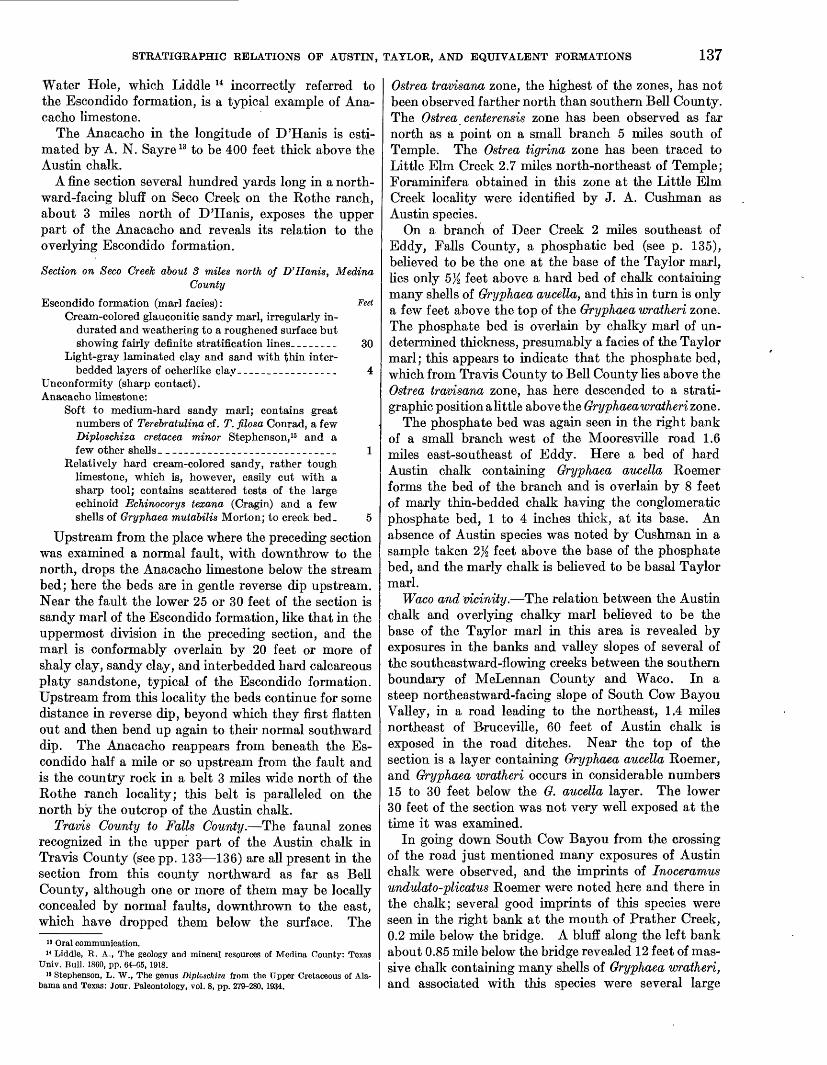
Water Hole, which Liddle u incorrectly referred to the Escondido formation, is a typical example of Ana- cacho limestone.
The Anacacho in the longitude of D'Hanis is esti mated by A. N. Sayre 13 to be 400 feet thick above the Austin chalk.
A fine section several hundred yards long in a north ward-facing bluff on Seco Creek on the Rothe ranch, about 3 miles north of D'Hanis, exposes the upper part of the Anacacho and reveals its relation to the overlying Escondido formation.
Section on Seco Creek about 3 miles north of D'Hanis, MedinaCounty
Escondido formation (marl facies): feetCream-colored glauconitic sandy marl, irregularly in
durated and weathering to a roughened surface but showing fairly definite stratification lines________ 30
Light-gray laminated clay and sand with thin inter- bedded layers of ocherlike clay _________________ 4
Unconformity (sharp contact). Anacacho limestone:
Soft to medium-hard sandy marl; contains great numbers of Terebratulina cf. T. filosa Conrad, a few Diploschiza cretacea minor Stephenson, 15 and a few other shells. _____________________________ 1
Relatively hard cream-colored sandy, rather tough limestone, which is, however, easily cut with a sharp tool; contains scattered tests of the large echinoid Echinocorys texana (Cragin) and a few shells of Gryphaea mutabilis Morton; to creek bed. 5
Upstream from the place where the preceding section was examined a normal fault, with downthrow to the north, drops the Anacacho limestone below the stream bed; here the beds are in gentle reverse dip upstream. Near the fault the lower 25 or 30 feet of the section is sandy marl of the Escondido formation, like that in the uppermost division in the preceding section, and the marl is conformably overlain by 20 feet or more of shaly clay, sandy clay, and interbedded hard calcareous platy sandstone, typical of the Escondido formation. Upstream from this locality the beds continue for some distance in reverse dip, beyond which they first flatten out and then bend up again to their normal southward dip. The Anacacho reappears from beneath the Es condido half a mile or so upstream from the fault and is the country rock in a belt 3 miles wide north of the Rothe ranch locality; this belt is paralleled on the north by the outcrop of the Austin chalk.
Trams County to Falls County.—The faunal zones recognized in the upper part of the Austin chalk in Travis County (gee pp. 133—136) are all present in the section from this county northward as far as Bell County, although one or more of them may be locally concealed by normal faults, downthrown to the east, which have dropped them below the surface. The
13 Oral communication." Liddle, R. A., The geology and mineral resources of Medina County: Texas
Univ. Bull. 1860, pp. 64-C5, 1918.15 Stephenson, L. W., The genus Diploschiza from the Upper Cretaceous of Ala
bama and Texas: Jour. Paleontology, vol. 8, pp. 279-280, 1934.
Ostrea travisana zone, the highest of the zones, has not been observed farther north than southern Bell County. The Ostrea centerensis zone has been observed as far north as a point on a small branch 5 miles south of Temple. The Ostrea tigrina zone has been traced to Little Elm Creek 2.7 miles north-northeast of Temple; Foraminifera obtained in this zone at the Little Elm Creek locality were identified by J. A. Cushman as Austin species.
On a branch of Deer Creek 2 miles southeast of Eddy, Falls County, a phosphatic bed (see p. 135), believed to be the one at the base of the Taylor marl, lies only 5). feet above a hard bed of chalk containing many shells of Gryphaea aucella, and this in turn is only a few feet above the top of the Gryphaea wratheri zone. The phosphate bed is overlain by chalky marl of un determined thickness, presumably a facies of the Taylor marl; this appears to indicate that the phosphate bed, which from Travis County to Bell County lies above the Ostrea travisana zone, has here descended to a strati- graphic position a little above the Gryphaea wratheri zone.
The phosphate bed was again seen in the right bank of a small branch west of the Mooresville road 1.6 miles east-southeast of Eddy. Here a bed of hard Austin chalk containing Gryphaea aucella Roemer forms the bed of the branch and is overlain by 8 feet of marly thin-bedded chalk having the conglomeratic phosphate bed, 1 to 4 inches thick, at its base. An absence of Austin species was noted by Cushman in a sample taken 2% feet above the base of the phosphate bed, and the marly chalk is believed to be basal Taylor marl.
Waco and vicinity.—The relation between the Austin chalk and overlying chalky marl believed to be the base of the Taylor marl in this area is revealed by exposures in the banks and valley slopes of several of the southeastward-flowing creeks between the southern boundary of MeLennan County and Waco. In a steep northeastward-facing slope of South Cow Bayou Valley, in a road leading to the northeast, 1.4 miles northeast of Bruceville, 60 feet of Austin chalk is exposed in the road ditches. Near the top of the section is a layer containing Gryphaea aucella Roemer, and Gryphaea wratheri occurs in considerable numbers 15 to 30 feet below the G. aucella layer. The lower 30 feet of the section was not very well exposed at the time it was examined.
In going down South Cow Bayou from the crossing of the road just mentioned many exposures of Austin chalk were observed, and the imprints of Inoceramus undulato-plicatus Roemer were noted here and there in the chalk; several good imprints of this species were seen in the right bank at the mouth of Prather Creek, 0.2 mile below the bridge. A bluff along the left bank about 0.85 mile below the bridge revealed 12 feet of mas sive chalk containing many shells of Gryphaea wratheri, and associated with this species were several large

138 SHORTER CONTRIBUTIONS TO GENERAL GEOLOGY, 1936
imprints of Inoceramus undulato-plicatus Koemer. The last place at which the Austin chalk was seen was a low exposure in the right bank about 1.2 miles below the bridge. Here the top of the chalk slopes downstream from 3 feet above water level at the upper end of a 100-foot stretch to water level at its lower end; the chalk is overlain by chalky marl, which is concealed by vegetation except at its lower end, where 6 inches of the marl is sharply separated from the chalk and has at its base a thin phosphatic conglomerate. A short distance farther downstream characteristic chalky marl rises 10 feet above water level in a steep bluff.
The phosphatic bed at the base of the chalky marl, resting unconformably upon the much harder Austin chalk, was observed at several places in the bed and low banks of North Cow Bayou 1.3 to 1.7 miles below the crossing of the old U. S. Highway 81. Here the chalk is broken by numerous minor faults.
On Bullhide Creek about 0.6 mile below the crossing of a public road leading to the northeast, 2% miles northeast of Lorena, the following section was ex amined near the east edge of a fault block tilted to the west:
Section on Bullhide Creek 2 l/i miles northeast of Lorena, McLennanCounty
FeetPleistocene terrace deposit: Silty loam with a gravel
bed at base._____________________________________ 8Unconformity. Taylor marl:
Gray chalky marl, weathering into angular, irregularfragments._ _________________________________ 10
Conglomerate composed of many phosphatic nodules and internal molds of mollusks and containing a few shells of Gryphaea wratheri mechanically in cluded from the underlying chalk_______________ %-%
Unconformity (contact sharp).Austin chalk: Hard massive-bedded chalk containing
shells of Gryphaea wratheri- ________________________ 1-5
On account of the westward dip the Austin-Taylor contact rises downstream, and within a few hundred feet 10 feet of chalk is exposed above water level; imprints of Inoceramus undulato-plicatus Koemer were seen in the lower part of the chalk exposure. A short distance still farther downstream, at the eastern edge of the fault block, the chalky marl has been brought down against the Austin chalk. About 0.4 mile up stream from the place where the preceding section was observed the west edge of the fault block is marked by a major fault, which brings the chalky marl down against the Austin chalk.
Adkins 16 has suggested that the chalky marl just described may represent his Burditt marl; opposed to this suggestion is the fact that none of the character istic macrofossils of his Burditt have been found in the marl, although the conditions appear to have been favorable for their existence, and the field relations
16 Adkins, W. S., The geology of Texas, pt. 2, The Mesozoic systems in Texas: Texas Univ. Bull. 3232, pp. 449-451, 1933.
suggest that the phosphate bed is the northward con tinuation of the one at the base of the Tayior on Little Walnut Creek, in Travis County. Confirmatory evi dence is afforded by Foraminifera obtained near the base of the chalky marl 1}_ miles southwest of Lorena, which were identified by J. A. Cushman as of Taylor age. Cushman also identified Taylor Foraminifera from a sample taken in the upper part of the chalky marl in a road ditch on the northward-facing slope of Bullhide Creek, 5% miles east by south of Lorena.
On North Flat Creek 5 miles south of Waco the phosphate bed has descended still lower and rests directly upon the Inoceramus undulato-plicatus zone with an abundance of the imprints of this characteristic species. The best exposure noted was in a low bank of the creek, 1,500 feet upstream from the crossing of the new U. S. Highway 81. Cushman noted an absence of characteristic Austin species in a sample of chalky marl taken 2 feet above the phosphate bed, and Austin species were wanting in a similar sample of chalky marl taken 350 feet downstream from the high way bridge.
McLennan County to Dallas County.—Northwest of Elm Mott, in McLennan County, the Austin chalk is completely cut out by a major normal fault, trending north-northeast, that drops the Taylor marl against the Eagle Ford shale; toward the north the throw of this fault decreases, and the chalk reappears on the upthrown side of the displacement. The first place north of McLennan County at which the Austin- Taylor contact was observed is on a small branch, 2}_ miles east-southeast of Bynum, Hill County; here the two formations are separated by an obvious uncon formity marked by a thin phosphatic layer at the base, but the zonal position of the top of the chalk was not determined. Good exposures of a conglomeratic phos phate bed were observed at the base of the Taylor at several localities between Bynum and the northern part of Ellis County; the one farthest north is on Bear Creek, 6}_ miles east-northeast of Sterrett. Inas much as the Gryphaea wratheri zone is exposed to its maximum observed thickness of 35 feet at a point 1 mile north of Sterrett, 5.7 miles west by south of the Bear Creek locality, it appears that the phosphatic bed rises stratigraphically toward the north.
Dallas and vicinity.—In Dallas County the' Inocer amus undulato-plicatus zone of the Austin chalk is well exposed just below the dam of White Rock Lake, at the northeastern outskirts of Dallas, and the overlying Cfryphaea wratheri zone may be seen in a cut on Gaston Avenue near the intersection of West Shore Drive, less than a mile west of the dam. From 40 to 50 feet of shaly chalk with several interbedded harder, more chalky layers is exposed in gullies in the northward- facing slope and in the banks of a small branch drain ing into White Rock Lake 1.6 miles northeast of the dam; the section is stratigraphically somewhat higher
STRATIGKAPHIC RELATIONS OP AUSTIN, TAYLOR, AND EQUIVALENT FORMATIONS 139
than the Inoceramus undulato-plicatus zone at the dam. The presence of the Qryphaea wratheri zone is indicated by a few shells of that species in the banks of the branch low in the section, and Qryphaea aucella occurs in abundance in a 1-foot layer 20 or 25 feet higher in the sec tion, about 20 feet below the level of U. S. Highway 67.
The Austin-Taylor contact is fully 4 miles east of the Gaston Avenue locality and must be at a consid erably higher stratigraphic position than the Gryphaea wratheri zone—perhaps as much as 200 or 250 feet. The upper 50 or 60 feet of the Austin in Dallas County consists of interbedded layers of chalk, marly chalk, and chalky marl.
No phosphatic material was observed at the Austin- Taylor contact in Dallas County, but the contact is marked by a bed of limestone ranging in thickness from less than 1 inch to 6 inches, which lies at the base of the Taylor; this limestone is granular in texture and contains scattered shells of Diploschiza n. sp. and frag ments of the shells of Inoceramus and ostreids. Al though at most places this limestone is nearly parallel to. the bedding of the underlying chalk, at one locality on Prairie Creek, 1,000 feet upstream from an east- west road, IK miles northeast of Pleasant Grove, a marked angular discordance was observed between the limestone and the chalk; in a horizontal distance of 100 feet the limestone bed rises from a stratigraphic position 2 feet above a traceable layer of chalk to 9 feet above it, thus apparently indicating an unconformity. Localities in Dallas County, in addition to the one on Prairie Creek, at which this limestone with its character istic Diploschiza shells have been observed are in a gully on the bank of Cottonwood Creek, 200 feet east of the Southern Pacific Kailroad bridge north of Wilmer; on a branch of Prairie Creek just above a public-road bridge 1.15 miles east of Pleasant Grove; and at the heads of gullies in the northward-facing slope of a small branch of Kowlett Creek, south of U. S. Highway 67, 1.3 miles east of the public square at Garland.
The sediments immediately above the thin limestone consist of soft gray marl weathering yellow, typical oi the Taylor and lacking chalky layers. The limestone is interpreted to be the basal bed of the Taylor marl, resting with unconformable relations upon the Austin chalk, and this conclusion is supported by the micro- faunal evidence; on the authority of J. A. Cushman, a sample taken 1 foot below the limestone contained Austin Foraminifera, and one taken 1 foot above the limestone yielded Taylor Foraminifera.
Collin County.—North of Dallas County the first place at which the exact contact between the Austin chalk and Taylor marl was seen was in a crooked east- west second-class road 0.85 mile east of Lucas and 6.2 miles east by south of Alien, Collin County. The ditch at the side of the road exposed about 1 foot of the chalk, overlain by 2 or 3 feet of soft yellowish marl;
78739—37——2
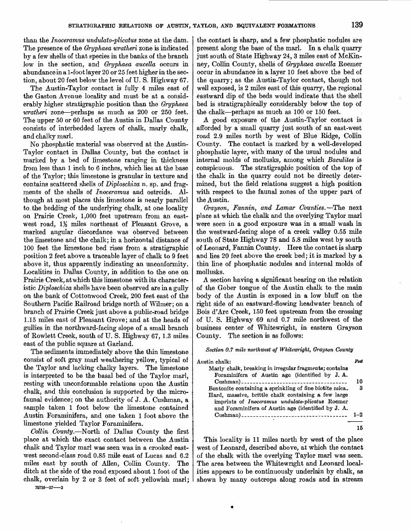
the contact is sharp, and a few phosphatic nodules are present along the base of the marl. In a chalk quarry just south of State Highway 24, 3 miles east of McKin- ney, Collin County, shells of Gryphaea aucella Roemer occur in abundance in a layer 10 feet above the bed of the quarry; as the Austin-Taylor contact, though not well exposed, is 2 miles east of this quarry, the regional eastward dip of the beds would indicate that the shell bed is stratigraphically considerably below the top of the chalk—perhaps as much as 100 or 150 feet.
A good exposure of the Austin-Taylor contact is afforded by a small quarry just south of an east-west road 2.9 miles north by west of Blue Ridge, Collin County. The contact is marked by a well-developed phosphatic layer, with many of the usual nodules and internal molds of mollusks, among which Baculites is conspicuous. The stratigraphic position of the top of the chalk in the quarry could not be directly deter mined, but the field relations suggest a high position with respect to the faunal zones of the upper part of the Austin.
Grayson, Fannin, and Lamar Counties.—The next place at which the chalk and the overlying Taylor marl were seen in a good exposure was in a small wash in the westward-facing slope of a creek valley 0.55 mile south of State Highway 78 and 5.8 miles west by south of Leonard, Fannin County. Here the contact is sharp and lies 20 feet above the creek bed; it is marked by a thin line of phosphatic nodules and internal molds of mollusks.
A section having a significant bearing on the relation of the Gober tongue of the Austin chalk to the main body of the Austin is exposed in a low bluff on the right side of an eastward-flowing headwater branch of Bois d'Arc Creek, 150 feet upstream from the crossing of U. S. Highway 69 and 0.7 mile northwest of the business center of Whitewright, in eastern Grayson County. The section is as follows:
Section 0.7 mile northwest of Whitewright, Grayson County
Austin chalk: Feet Marly chalk, breaking in irregular fragments; contains
Foraminifera of Austin age (identified by J. A.Cushman) ________________________— ___ —— __ 10
Bentonite containing a sprinkling of fine biotite ruica_ 3 Hard, massive, brittle chalk containing a few large
imprints of Inoceramus undulato-plicatus Roemerand Foraminifera of Austin age (identified by J. A.Cushman)______-___-___-____---______--______ 1-2
15
This locality is 11 miles north by west of the place west of Leonard, described above, at which the contact of the chalk with the overlying Taylor marl was seen. The area between the Whitewright and Leonard local ities appears to be continuously underlain by chalk, as shown by many outcrops along roads and in stream

140 SHORTER CONTRIBUTIONS TO GENERAL GEOLOGY, 1936
banks. The chalk in this area may be regarded as the root of the Gober tongue. If the southward dip of the strata amounts to as much as 50 feet to the mile, the thickness of the chalk in the interval of 11 miles would be 500 feet or more. If the conservative figure of 40 feet to the mile is assumed, the thickness would be at least 400 feet. The evidence therefore appears to indicate that the Austin-Taylor contact rises strati- graphically from a position immediately above the Inoceramus undulato-plicatus zone in McLennan County, south of Waco, to a position at least 400 feet above that zone in Fannin County, west of Leonard.
North and northeast of Whitewright the lower beds of the Austin chalk merge eastward along the strike into the facies unit to which the name "Bonham clay" has been given. In east-central Fannin County the upper part of the Bonham merges eastward into the Blossom sand and perhaps also into the lower part of the overlying Brownstown marl; however, the strati- graphic relations of the formations in this area have not been determined in detail.
From the Whitewright-Leonard area the belt of outcrop of the Gober tongue of the Austin chalk extends first northeastward and then eastward through Fannin and Lamar Counties; the tongue becomes progressively thinner in that direction and finally pinches out, as such, a little less than 4 miles northeast of Pattonville, before reaching the Red River County line. As the upper part of the Gober, which consists of 10 feet or less of cream-colored tough, .soft chalk or limestone, suitable for building stone, has been traced continu ously from the vicinity of Bailey, in Fannin County, to the eastern terminus of this tongue, it appears that the top of the tongue is at one stratigraphic position throughout this distance; the tongue thins therefore at the expense of its lower portion, successively higher beds of which probably merge toward the east into the Brownstown marl facies.
A foraminiferal sample taken in an eastward-facing slope in a public road just east of its junction with U. S. Highway 69, 1 mile east of Trenton, Fannin County, was determined by J. A Cushman to contain an Austin fauna; this locality is estimated to be ap proximately in the middle of the Gober tongue as it is developed in this area. Another sample of chalk taken near the top of the Gober tongue in a small branch about a quarter of a mile southeast of Bailey, Fannin County, yielded Foraminifera which Cushman referred to the Austin.
The top of the Gober tongue crops out on State Highway 24, 4.3 miles south of the Texas & Pacific Railway at Paris, and the width of the belt of outcrop of tnis tongue along the highway is only about 1J£ miles. Between this belt and the railroad at Pa.ris the country is underlain by Brownstown marl. In a small creek at the southwest edge of Paris shells of Ostrea travisana are present in a phosphatic, glauconitic
marl that forms the base of the Brownstown. At a southward dip of 50 feet to the mile, the thickness of the strata between the base of the Brownstown marl and the top of the Gober tongue more than 4 miles to the south would be at least 200 feet. If Ostrea travisana is a reliable index fossil marking the upper part of the Austin chalk in central Texas, as it is believed to be, its presence in the base of the Brownstown marl near Paris indicates that the con taining bed there corresponds to the uppermost part of the Austin chalk in Travis County. It follows, therefore, that in Fannin and Lamar Counties the top of the Gober tongue lies stratigraphically 200 feet or more higher than the top of the typical Austin chalk in Travis County. The Gober tongue at its thick end in southwestern Fannin County would neces sarily include representatives of the Burditt marl of Adkins.
To return to consideration of the contact between the Austin chalk (Gober tongue) and the Taylor marl, examination of a large quarry in the building-stone facies at the northwestern edge of the village of Gober showed that this rock is overlain by several feet of typical Taylor marl, and the sharp contact between the Gober and the Taylor is marked by a thin line of phosphatic nodules and internal molds of mollusks. No attempt was made to determine the presence or absence of phosphate at the top of the Gober tongue between Gober and eastern Lamar County, but at a small quarry a quarter of a mile west of a north-south road 3 miles north of Pattonville (pi. 44), phosphatic material of the usual type was observed in great abundance at the top of the Gober tongue. This locality is near the eastern tip of the Gober tongue, for within the next 3 or 4 miles to the east the chalk disappears as such and is replaced by marl.
The phosphatic bed seen at the locality last men tioned does not come to an end with the pinching out of the chalk but continues eastward and was seen well developed in fields on each side of a north-south road about 4 miles northeast of Pattonville and 1% miles west of the Red River County line. The phosphate bed crops out in shallow gullies about 25 feet below the crest of the hill. It is only a few inches thick but contains many of the typical nodules and internal molds of mollusks in a matrix of slightly glauconitic marl; these weather out in the soil in great numbers. Here the bed is not underlain by chalk but by clay marl, which is interpreted to be the upper part of the Brownstown marl. The phosphate bed is immediately overlain by several feet of slightly sandy marl contain ing numerous thin flakes of fine sandy limestone of varying sizes, one-eighth to one-fourth inch thick and having a maximum length of about 3 inches; as shown below, these flakes are useful markers in identifying this phosphate bed at other localities farther to the east in Red River County.

STRATIGRAPHIC RELATIONS OF AUSTIN, TAYLOR, AND EQUIVALENT FORMATIONS 141
Chalks and marls in Red River County.—About 11 miles east of the locality just described the continua tion of the phosphatic bed was observed intersecting U. S. Highway 82, 1.8 miles south-southeast of Bag- well, Red River County. The bed is poorly exposed in the road ditch, is only a few inches thick, and has a matrix of glauconitic marl; it can be traced along the slopes in the adjoining fields by the great abundance of phosphatic nodules and molds of mollusks, which weather out in the soil and are scattered down the slope from the outcrop. Here, as at the locality last described, the marl within a few feet above the phos phate bed contains thin laminae of sandy limestone, the flaky fragments of which weather out in the soil in profusion. About 20 feet of gray marl (Browns- town) is exposed in the gullies below the phosphate bed; a sample of marl taken 20 feet below the phos phate bed yielded Foraminifera of Austin age, as determined by Cushman. Above the phosphate bed 30 feet of Taylor marl, poorly exposed, makes up the slope to the crest of the hill. Exposures of chalky marl are afforded by ditches along the highway 2% to 3 miles south-southeast of Bagwell; Cushman deter mined a sample of this marl, taken 2.8 miles from Bagwell, to be of lower Taylor age.
The next observed exposure of the phosphate bed to the east is near the crest of a northward-facing slope on the road leading north by east from Clarksville, at a point 1 mile south of Vandalia. The phosphate bed is at the base of the chalky marl that weathers white, about 10 feet lower than the crest of the hill. The phosphatic materials occur in a matrix of glau conitic marl, and here again flakes of a sandy limestone occur in the chalky marl immediately above the phos phatic layer. .
The phosphatic bed intersects the road to Reed's store IK miles north of White Rock, 0.8 mile north of a small cemetery, and about 8% miles northeast of Clarksville; the bed may also be seen poorly exposed in the northward-facing slopes within half a mile east of the road. Here the phosphatic nodules and molds are abundant and characteristic. Particular interest attaches to this locality because here the phosphatic bed lies at the base of the thick body of chalk that forms numerous bald spots in the White Rock neigh borhood, whereas at all the other localities examined west of White Rock in Red River and Lamar Counties the material overlying the phosphate bed is either chalky marl or marl. As confirmatory evidence that this is the eastward continuation of the phosphate bed observed at the other localities described above, one rather poor exposure about 1,000 feet east of tl^e road to Reed's store revealed the presence of the tell tale flakes of sandy limestone in the chalk within a few feet above the phosphate bed.
As the phosphate bed that lies at the base of the chalk north of White Rock continues westward through
Red River County into Lamar County, where it lies at the base of the Taylor marl, resting upon the Gober chalk, it follows that the chalk at White Rock corre sponds in age to the lower part of the Taylor marl, which, in Lamar and Fannin Counties, overlies the Gober tongue; in other words, the chalk may be looked upon as a facies that merges westward through marly chalk and chalky marl into the nonchalky Taylor marl. This conclusion is not in harmony with the interpretation of Ellisor and Teagle 17 that the Annona chalk in Red River County, including the chalk at White Rock, should be classed as Pecan Gap chalk, which at its type locality, in northwestern Delta County, is only 40 or 50 feet thick and lies stratigraphically some 400 or 500 feet higher than the top of the Gober chalk.
STRATIGRAPHIC RELATIONS IN RED RIVER AND LAMAR COUNTIES
The correlations presented in this paper seem to accord with the known facts as expressed in the accom panying geologic map (pi. 44). Hill 18 as early as 1901 recognized the fact that the Annona chalk in Red River County is younger than the Austin chalk, and he correctly correlated the Annona with the chalk at White Cliffs on the Little River, in southwestern Arkansas.
The Pecan Gap chalk member of the Taylor marl at its type locality, in Delta County, is 50 feet or less in thickness. The chalk enters Lamar County from Delta County in the valley of the South Fork of the Sulphur River, 12 miles south of Paris, where, at the crossing of State Highway 24, its belt of outcrop is so narrow that it is completely concealed by the alluvium of the river; its width can scarcely be more than half a mile. The chalk continues as a thin, sharply defined unit in a general east-northeasterly direction through Lamar County past Deport and into Red River County in the direction of Clarksville; it maintains a narrow width of outcrop, less than half a mile to perhaps a mile, at least as far as McCoy Creek, 5 miles west- southwest of Clarksville; between McCoy Creek and Clarksville the Pecan Gap chalk passes into and forms the upper part of the Annona chalk. (See pi. 44.)
The Wolfe City sand member of the Taylor marl, which at its type locality, in Hunt County, is 100 feet or less in thickness, underlies the Pecan Gap chalk and extends eastward beneath the chalk into southeastern Lamar County, where it appears to merge into marl. The Wolfe City sand at its type locality is underlain by an estimated thickness of 400 feet or more of Taylor marl, which in turn rests upon the Gober tongue of the Austin chalk. This marl section thins somewhat as it passes eastward through Lamar County
" Ellisor, A. C., and Teagle, John, Correlation of the Pecan Gap chalk in Texas: Am. Assoc. Petroleum Geologists Bull., vol. 18, pp. 1506-1536, 1934.
"Hill, R. T., Geography and geology of the Black and Grand Prairies, Tex.: U. S. Geol. Survey 21st Ann. Eept., pt. 7, p. 340,1901.

142 SHOETEE CONTRIBUTIONS TO GENEEAL GEOLOGY, 1936
into Red River County, where it merges into the Annona chalk.
The width of the belt of outcrop of the Annona chalk east of Clarksville in the longitude of White Rock is 4 miles. The thickness of this chalk has not been ac curately determined but is estimated to be 300 or 400 feet. The facts given in the foregoing text and the field relations as expressed in plate 44 indicate that the Annona as a whole in the longitude of White Rock is the age equivalent of the combined Taylor marl (lower), Wolfe City sand member, and Pecan Gap chalk mem ber in Lamar, Delta, and Fannin Counties.
A phosphatic bed at the base of the Pecan Gap chalk at Pecan Gap is interpreted by Ellisor and Teagle as marking an unconformity of considerable importance. This bed is present at the base of the chalk through southeastern Lamar County into Red River County, and they assume that it continues to the northeast past Clarksville and is continuous with the phosphate bed at the base of the Annona chalk north of White Rock. A necessary corollary of this interpretation is that the unconformity cuts out the lower beds of the Taylor marl and the Wolfe City sand member, which, in the longitude of western Delta County, intervene between the Gober tongue and the Pecan Gap chalk. As shown on preceding pages, the phosphate bed at the base of the Annona is not continuous with the one at the base of the Pecan Gap but extends with a more nearly west ward strike across Red River County into Lamar County, where it is continuous with a phosphate bed at the base of the Taylor marl, resting on the Gober chalk; in Lamar County this phosphate bed is 400 or 500 feet stratigraphically lower than the one at the base of the Pecan Gap chalk.
Ellisor and Teagle divide the Annona chalk (their Pecan Gap chalk) of northeastern Texas into three faunal zones—in ascending order, the Flabellamina compressa zone, the Diploschiza cretacea zone, and the Bolivina incrassata zone. Foraminifera identified from these zones are tabulated on pages 1529-1532 of their paper. They recognize all three of the zones in the Annona chalk of eastern Red River County. They also recognize the three zones at different places within the limits of the narrow belt of chalk (true Pecan Gap chalk of the present writer) that extends from Pecan Gap, Delta County, to McCoy Creek, 5 miles west of Clarksville, in Red River County (pi. 44). The species listed in the table total 106; of these, 64 range through all three zones, 26 range through the Flabellamina com pressa and Diploschiza cretacea zones, and 6 range through the Diploschiza cretacea and Bolivina incrassata zones. One species is restricted to the Flabellamina compressa zone, 6 species are restricted to the Diplo schiza cretacea zone, and 2 species are restricted to the Bolivina incrassata zone. Flabellamina compressa ranges through all three zones. Bolivina incrassata is restricted to the zone that bears its name and is said to
occur in abundance in that zone. No information is given as to the range of the species in the sediments older and younger than the three zones.
The foregoing analysis does not disclose wholly con vincing evidence of the distinctiveness of the three faunal zones recognized. Such faunal differences as may appear among samples from different localities in any series of closely related sediments may perhaps be accounted for by facies differences in the sediments, or by other environmental differences, rather than by differences in the time of sedimentation. Conversely, the recurrence of similar faunal assemblages in beds of different ages, as shown by the field relations, may per haps reasonably be ascribed to the recurrence of simi lar favorable environmental conditions in the later beds.
The individual beds of chalk and chalky marl that compose the Annona chalk east, northeast, and north of Clarksville are not readily traceable across the county, but the phosphate bed at the base of the An nona can be easily recognized, not only in good expo sures but in the intervening fields, where the resistant phosphatic nodules and internal molds of mollusks weather out in the soil in great numbers. The distri bution of this bed across Red River County north of the latitude of Clarksville, as shqwn in plate 44, deter mines the general strike of the beds to be 7° or 8° north of east. If it were true that this bed is contin uous with the similar bed at the base of the Pecan Gap chalk, the strike of the beds above the phosphatic layer should be at least 25° north of east. The map accompanying the paper by Ellisor and Teagle (their fig. 1, p. 1516) is on too small a scale and is too much generalized to indicate the direction of strike accurately.
Confirmation of the strike of the Cretaceous beds in Red River County north of the latitude of Clarksville, as determined by the trace of the phosphate bed at the base of the Annona chalk, is afforded by two other easily traceable beds stratigraphically lower than the Annona. Another phosphatic bed, at the base of the Brownstown marl, has an east-west zone of outcrop across both Red River and Lamar Counties, and a few feet below it, in the Blossom sand, a bed marked by hard glauconitic, calcareous concretions is known to extend nearly across Red River County; the latter bed is here designated the Ostrea elegantula zone 19 on account of the abundance of the shells of this oyster in the concretions. Localities where one or both of these beds have been examined are described below.
On the road to Reed's store 1.5 to 1.9 miles north of the store at White Rock the Brownstown marl is poorly exposed below the Annona chalk in the north ward-facing slope of Pecan Bayou Valley. Near the foot of the slope 2 miles north of the store 10 feet of glauconitic sand formmg the upper part of the Blossom
i« Stephenson, L. W., New Upper Cretaceous Ostreidae from the Gulf region: U. S. Oeol. Survey Prof. Paper 186-A, pp. 2, 6-8,1936.

STRATIGRAPHIC RELATIONS OF AUSTIN, TAYLOR, AND EQUIVALENT FORMATIONS 143
sand is well exposed in a cut and ditch on the east side of the road; the Blossom-Brownstown contact is not exposed, but it is estimated to be about 75 feet verti cally lower than the phosphate bed at the base of the Annona. In the sand are hard, concretionary sand stones containing many shells of Ostrea elegantula White, a few individuals of Placenticeras sp., and a few other fossils. The oyster is known in northeastern Texas only at this and the few other localities described below and is believed to be restricted in its vertical range to a very narrow zone.
In a small draw in a field west of the Clarksville- Vandalia road 0.4 mile south of Vandalia fossiliferous concretions like those at the locality just described weather out in the soil. They contain many shells of Ostrea elegantula and a few shells of Inoceramus sp., Aphrodina sp. (large), and other fossils. About 0.15 mile south of this point a few phosphatic internal molds of mollusks were found weathered out in the soil in the road ditch; these came from the phosphatic bed marking, the base of the Brownstown marl.
Imprints of Ostrea elegantula were obtained from weathered ferruginous, glauconitic sandstone in a small earthen tank east of the Dimple road, toward the foot of the northward-facing slope of a branch valley of Tanyard Bayou 4.2 miles north by west of the public square at Clarksville. The phosphatic bed at the base of the Brownstown marl was observed poorly exposed in a small headwater branch about three- quarters of a mile southwest of the tank locality.
The base of the Brownstown marl with its character istic phosphatic materials is poorly exposed in a public- road ditch half a mile west of the Cherry settlement, about 5 miles northwest of Clarksville.
Glauconitic, phosphatic marl marking the base of the Brownstown marl is exposed in the ditch of the old Clarksville road 2.2 miles east-southeast of Detroit. A few specimens of Ostrea elegantula were obtained from an indurated layer in the Blossom sand about 3 feet below the phosphatic bed.
An exposure of the Blossom-Brownstown contact is afforded by a ravine just east of the old Clarksville road 1.4 miles southeast of Detroit. The section consists of about 15 feet of glauconitic sand overlain by 10 feet of marl; the sand-marl contact is marked by a thin bed of phosphatic nodules and molds of the usual character. A concretionary sandstone about 3 feet below the contact contains shells of Exogyra ponderosa Roemer and internal molds of a very large nautiloid of the genus Eutrephoceras. One shell of Ostrea elegantula was found in the sand about 6 feet below the contact, and several loose pieces of concretionary sandstone in the ravine at the base of the section, which had fallen from above, contained great numbers of this small oyster in a fairly good state of preservation.
Phosphatic materials weathered from the base of the Brownstown marl immediately above the Blossom
sand were observed along the old Paris-Clarksville road south of the Texas & Pacific Railway at three places within a stretch 1% to 3% miles west by south of Blossom, Lamar County.
Glauconitic, phosphatic marl at the base of the Brownstown marl is poorly exposed beneath an alluvial covering at several places along a small creek in the southwestern outskirts of Paris, about a quarter of a mile southeast of the crossing of the Texas & Pacific Railway and Texas & New Orleans Railroad. This bed is believed to correspond approximately in strati- graphic position to the top of the Austin chalk in Travis County, as indicated by the presence of shells of Ostrea travisana. (See p. 138.) In this connection it is worthy of note that the shells of Oryphaea aucella Roemer are present in marl exposed along U. S. High way 271 at two places, 4% and 7 miles north of the public square at Paris; each of these localities also yielded Foraminifera determined by Cushman to be of Austin age. The paleontologic evidence indicates that the beds cropping out in an east-west belt 7 or 8 miles wide, having its southern boundary just south of Paris, correspond in age to the upper part of the typical Austin chalk in Travis County. From north to south this belt includes the upper part of the Bonham clay, consisting in part of marl and in part of clay and sandy clay; the Blossom sand, which forms a sandy belt about 2 miles wide in the vicinity of Paris; and the lowermost part of the Brownstown marl.
SECTION IN RED RIVER COUNTY COMPARED WITH THAT IN SOUTHWESTERN ARKANSAS
From Red River County, Tex., the Annona chalk is traceable eastward through Bowie County into Arkan sas, past Rocky Comfort, Little River County, to White Cliffs, Sevier County. According to Ellisor and Teagle,20 the massive white chalk that forms the upper 60 feet of the section at White Cliffs comprises the upper one of the three faunal zones into which they divide the Pecan Gap chalk; they consider that near Clarksville, Tex., this upper zone is completely cut out by the unconformity which there separates the Annona chalk from the overlying Taylor marl (upper). Although a phosphatic conglomerate containing also a few water-worn novaculite pebbles is present at the base of this marl near Clarksville and is believed to mark an unconformity, it remains to be established that the upper 60 feet of the White Cliffs section is completely unrepresented in the Clarksville area; the occurrence of the large echinoid Echinocorys texana (Cragin) both in the upper part of the chalk near Clarksville and in the upper 60 feet of massive chalk at White Cliffs suggests approximate age equivalency of the containing beds, for this species is supposedly
2° Ellisor, A. C., and Teagle, John, Correlation of the Pecan Gap chalk in Texas: Am. Assoc. Petroleum Geologists Bull., vol. 18, pp. 1609-33,1934.

144 SHORTER CONTRIBUTIONS TO GENERAL GEOLOGY, 1936
restricted to a narrow vertical range. Dane 21 refers the lower 50 feet of the section at White Cliffs to the upper part of his Ozan formation, and it appears that the Ozan as a whole is a sandy facies corresponding to the middle and lower parts of the Annona in Red River County. The correlation of the unconformity that Dane 22 recognized at the base of the Ozan forma tion with the unconformity marked by the phosphatic bed at the base of the Annona chalk in Red River County is probably correct.
The ostreid species Gryphaea vesicularis Lamarck (var.) is frequently mentioned by Ellisor and Teagle as present in the Diploschiza cretacea zone (the middle one of their three Pecan Gap zones). Most of the shells of this genus in this zone should more properly be referred to Gryphaea convexa (Say); examples of the species are illustrated in Dane's Arkansas report 23 under the name ''Gryphaea sp." Although this species is common at about the horizon of the Diploschiza cretacea zone, it is known to have considerable vertical range in beds of lower Taylor age and is hardly a safe index fossil in close correlation; its abundance at any given locality may be due to favorable local environ mental conditions.
The beds in northeastern Texas to which the name "Brownstown marl" has been applied appear to be correctly correlated with the typical Brownstown marl of southwestern Arkansas. Israelsky 24 has correlated the latter with the Bonham clay of Texas, but he does not state where he obtained his sample or samples of Bonham clay. As shown in figure 7, the Blossom sand appears to merge westward in Fannin County into less sandy or nonsandy clay or marl; the body of clay in the vicinity of Bonham, to which the name "Bonham" has been given, probably includes repre sentatives of the Blossom and perhaps also the Browns- town marl. A sample collected a mile or two south of Bonham might very well yield a Brownstown micro- fauna, whereas a sample collected in the beds mapped as Bonham north of Paris, Lamar County, would be stratigraphically lower than the typical Brownstown and presumably would be of Tokio age. As inter preted in the present paper the main body of the Brownstown marl merges westward into the Gober tongue of the Austin chalk (fig. 7), the upper part of "which is younger than the youngest beds of the typical Austin chalk in Travis County.
TEXAS AND ALABAMA SECTIONS COMPARED
The down-warped Mississippi embayment, which dates from early Upper Cretaceous time, has produced a wide geographic gap between the outcrops of the
21 Dane, C. H., Upper Cretaceous formations of southwest Arkansas: Arkansas Geol. Survey Bull. 1, pp. 58-79,1929.
22 Idem, p. 76 and fig. 3, p. 81.23 Idem, pi. 11, fig. 2, and pi. 12, figs. 3, 4.24 Israelsky, M. C., Correlation of the Brownstown (restricted) formation of
Arkansas: Am. Assoc. Petroleum Geologists Bull., vol. 13, pp. 683-684, 1929. See also Stephenson, L. W., idem, pp. 1073-1074.
Upper Cretaceous sediments of Texas and Arkansas on the one hand and those of Mississippi and Alabama on the other. The differences in the successions of sediments making up the sections in the two areas and the paucity of fossils of sufficiently restricted vertical range to serve as index markers have rendered the exact correlation of the sections somewhat difficult.
Fossil floras from the Woodbine sand of Texas and from the Tuscaloosa formation of Alabama, studied by Berry,25 have been correlated with each other, with the Raritan formation of Maryland and New Jersey, and with the Cenomanian of Europe. The Eagle Ford shale (Turonian) of Texas, which is last seen in Lamar County, in the northeastern part of the State, has not been recognized at the surface east of the Mississippi River and is believed to be repre sented in an unconformity that is now known to separate the Tuscaloosa from the Eutaw formation entirely across Alabama. There is a paucity of fossils in the lower and middle parts of the Eutaw formation, but the few that have been found suggest an age younger than that of the Eagle Ford shale.
The Tombigbee sand member, which forms the upper part of the Eutaw formation (see fig. 7), is fos- siliferous in its upper part. Some of the fossils are not known outside of the eastern Gulf region; some have not been critically studied, and their meaning in long-distance correlation is not well known; a few have value as time markers, but it happens that these few are more useful in correlating the containing beds with sections in distant areas than with the Texas section. For example, the free-floating crinokl Marsupites americanus Springer, found in the Tom bigbee sand at Plymouth Bluff, on the Tombigbee River in Mississippi, has a close analog in M. testudi- narius Schlotheim, in the upper Santonian of Europe, and Marsupites sp. is present in the Telegraph Creek formation of Montana, which immediately overlies beds of Niobrara age. The ammonite genus Texa- nites (Mortoniceras of authors) is represented in the Tombigbee sand by species related to Texanites dela- warense (Morton) from the Merchantville clay of New Jersey. Ammonites of this group have a considerable range in Texas from beds of uppermost Austin age up into about the lower one-fourth of the Taylor marl and beds of lower Taylor age, and the group is represented in the Eagle sandstone of Montana, which immediately overlies the Telegraph Creek formation. This group of ammonites, although indicating approxi mate correspondence in the age of the containing beds in different areas, has a considerable stratigraphic range and in our present state of knowledge does not afford a basis for the exact correlation of narrowly restricted zones; a better knowledge of the species of the group may later afford such a basis. Gryphaea
25 Berry, W. E., Upper Cretaceous floras of the eastern Gulf region: U. S. Geol Survey Prof. Paper 112, pp. 39-41,1919.
STRATIGRAPHIC RELATIONS OF AUSTIN, TAYLOR, AND EQUIVALENT FORMATIONS 145
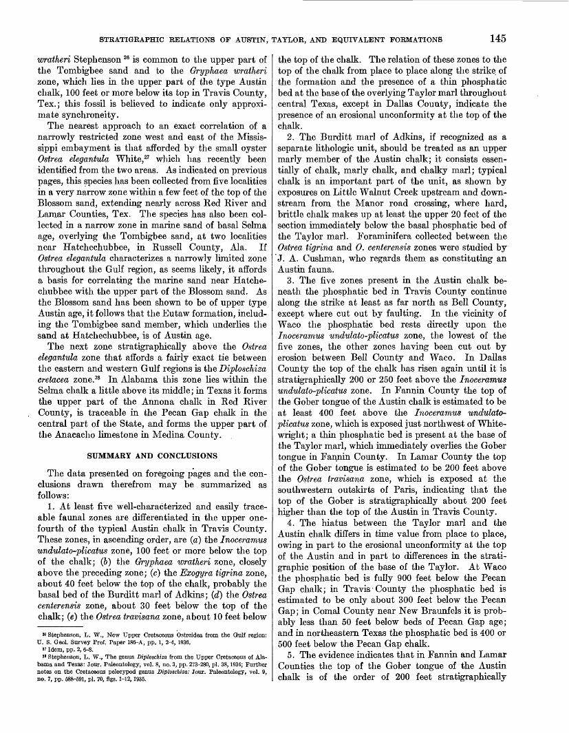
wratheri Stephenson 26 is common to the upper part of the Tombigbee sand and to the Gryphaea wratheri zone, which lies in the upper part of the type Austin chalk, 100 feet or more below its top in Travis County, Tex.; this fossil is believed to indicate only approxi mate synchroneity.
The nearest approach to an exact correlation of a narrowly restricted zone west and east of the Missis sippi embayment is that afforded by the small oyster Ostrea elegantula White,27 which has recently been identified from the two areas. As indicated on previous pages, this species has been collected from five localities in a very narrow zone within a few feet of the top of the Blossom sand, extending nearly across Ked Kiver and Lamar Counties, Tex. The species has also been col lected in a narrow zone in marine sand of basal Selma age, overlying the Tombigbee sand, at two localities near Hatchechubbee, in Kussell County, Ala. If Ostrea elegantula characterizes a narrowly limited zone throughout the Gulf region, as seems likely, it affords a basis for correlating the marine sand near Hatche chubbee with the upper part of the Blossom sand. As the Blossom sand has been shown to be of upper type Austin age, it follows that the Eutaw formation, includ ing the Tombigbee sand member, which underlies the sand at Hatchechubbee, is of Austin age.
The next zone stratigraphically above the Ostrea elegantula zone that affords a fairly exact tie between the eastern and western Gulf regions is the Diploschiza cretacea zone.28 In Alabama this zone lies within the Selma chalk a little above its middle; in Texas it forms the upper part of the Annona chalk in Ked Kiver County, is traceable in the Pecan Gap chalk in the central part of the State, and forms the upper part of the Anacacho limestone in Medina County.
SUMMARY AND CONCLUSIONS
The data presented on foregoing pages and the con clusions drawn therefrom may be summarized as follows:
1. At least five well-characterized and easily trace able faunal zones are differentiated in the upper one- fourth of the typical Austin chalk in Travis County. These zones, in ascending order, are (a) the Inoceramus undulato-plicatus zone, 100 feet or more below the top of the chalk; (6) the Gryphaea wratheri zone, closely above the preceding zone; (c) the Exogyra tigrina zone, about 40 feet below the top of the chalk, probably the basal bed of the Burditt marl of Adkins; (d) the Ostrea centerensis zone, about 30 feet below the top of the chalk; (e) the Ostrea travisana zone, about 10 feet below
» Stephenson, L. W., New Upper Cretaceous Ostreidea from the Gulf region: U. S. Geol. Survey Prof. Paper 186-A, pp. 1, 2-4, 1936.
« Idem, pp. 2, 6-8.28 Stephenson, L. W., The genus Diploschiza from the Upper Cretaceous of Ala
bama and Texas: Jour. Paleontology, vol. 8, no. 3, pp. 273-280, pi. 38,1934; Further notes on the Cretaceous pelecypod genus Diploschiza: Jour. Paleontology, vol. 9, no. 7, pp. 588-591, pi. 70, figs. 1-12,1935.
the top of the chalk. The relation of these zones to the top of the chalk from place to place along the strike of the formation and the presence of a thin phosphatic bed at the base of the overlying Taylor marl throughout central Texas, except in Dallas County, indicate the presence of an erosional unconformity at the top of the chalk.
2. The Burditt marl of Adkins, if recognized as a separate lithologic unit, should be treated as an upper marly member of the Austin chalk; it consists essen tially of chalk, marly chalk, and chalky marl; typical chalk is an important part of the unit, as shown by exposures on Little Walnut Creek upstream and down stream from the Manor road crossing, where hard, brittle chalk makes up at least the upper 20 feet of the section immediately below the basal phosphatic bed of the Taylor marl. Foraminifera collected between the Ostrea tigrina and 0. centerensis zones were studied by
"J. A. Cushman, who regards them as constituting an Austin fauna.
3. The five zones present in the Austin chalk be neath the phosphatic bed in Travis County continue along the strike at least as far north as Bell County, except where cut out by faulting. In the vicinity of Waco the phosphatic bed rests directly upon the Inoceramus undulato-plicatus zone, the lowest of the five zones, the other zones having been cut out by erosion between Bell County and Waco. In Dallas County the top of the chalk has risen again until it is stratigraphically 200 or 250 feet above the Inoceramus undulato-plicatus zone. In Fannin County the top of the Gober tongue of the Austin chalk is estimated to be at least 400 feet above the Inoceramus undulato- plicatus zone, which is exposed just northwest of White- wright; a thin phosphatic bed is present at the base of the Taylor marl, which immediately overlies the Gober tongue in Fannin County. In Laniar County the top of the Gober tongue is estimated to be 200 feet above the Ostrea travisana zone, which is exposed at the southwestern outskirts of Paris, indicating that the top of the Gober is stratigraphically about 200 feet higher than the top of the Austin in Travis County.
4. The hiatus between the Taylor marl and the Austin chalk differs in time value from place to place, owing in part to the erosional unconformity at the top of the Austin and in part to differences in the strati- graphic position of the base of the Taylor. At Waco the phosphatic bed is fully 900 feet below the Pecan Gap chalk; in Travis• County the phosphatic bed is estimated to be only about 300 feet below the Pecan Gap; in Comal County near New Braunfels it is prob ably less than 50 feet below beds of Pecan Gap age; and in northeastern Texas the phosphatic bed is 400 or 500 feet below the Pecan Gap chalk.
5. The evidence indicates that in Fannin and Lamar Counties the top of the Gober tongue of the Austin chalk is of the order of 200 feet stratigraphically
146 SHORTER CONTRIBUTIONS TO GENERAL GEOLOGY, 1936
higher than the top of the type Austin in Travis County. This relation was recognized by the writer in former papers, but owing to failure to recognize a regional unconformity between the Austin and Taylor, the upper part of the Gober tongue was correlated with the lower part of the Taylor marl; it is now believed that the uppermost beds of the Gober are older than the Taylor and are assignable in time to the hiatus separating the Austin and Taylor; it follows also that the Browns- town marl is older than the Taylor. A foraminiferal fauna collected near the top of the Gober tongue near Bailey, Fannin County, was assigned by J. A. Cushman to the Austin.
6. The evidence of the Foraminifera, as interpreted by Cushman, tends strongly to confirm the conclusion here expressed, that the Austin chalk and Taylor marl in outcrop are separated by a pronounced erosional unconformity.
7. The Annona chalk, which in eastern Red River County is estimated to be 300 or 400 feet thick, is the time equivalent of the combined lower part of the Taylor marl, Wolfe City sand member, and Pecan Gap member of Lamar, Delta, and Fannin Counties. The phosphatic bed that forms the base of the Annona chalk north of White Rock, in Red River County, has been traced westward and found to be continuous with a phosphatic bed at the base of the Taylor marl just above the Gober tongue of the Austin chalk in Lamar County. The tracing of the phosphatic bed is facili tated by the presence of thin flakes of characteristic sandy limestone in the material immediately above it; in eastern Red River County these limestone flakes are in the base of the Annona chalk, whereas farther west in the same county and in eastern Lamar County they are in the base of the Taylor marl.
8. The Pecan Gap chalk is traceable from its type locality near Pecan Gap east-northeast in a narrow belt through Delta County, southeastern Lamar County, and western Red River County; it passes into and forms the upper part of the Annona chalk in central and eastern Red River County.
9. The interpretation of the stratigraphy in Red River County, as expressed above, is supported by the strike of the beds through the northern parts of Red River and Lamar Counties; the phosphatic bed at the base of the Annona chalk (strike, 7° or 8° north of east and its westward continuation at the base of the Taylor marl are approximately paralleled by a similar phos phatic bed at the base of the stratigraphically lower
Brownstown marl and by a narrow zone of fossiliferous concretions within a few feet of the top of the still lower Blossom sand; the concretions are characterized by the presence in great numbers of the small oyster species Ostrea elegantula White.
10. In southwestern Arkansas the Annona chalk and the underlying Ozan formation are together the ap proximate time equivalent of the Annona chalk in Red River County, Tex.; however, in Red River County an undetermined though probably small thickness of chalk has been removed from the top of the Annona by erosion, as shown by an unconformity separating the Annona from the overlying Taylor (upper). The phosphatic bed at the base of the Ozan formation is believed to be the eastward continuation of the phos phatic bed at the base of the Annona chalk in Red River County.
11. The species Ostrea elegantula White occurs in a narrow zone in marine sand of basal Selma age near Hatchechubbee, Russell County, Ala., and is believed to indicate the time equivalence of the containing bed there with the upper part of the Blossom sand (of upper Austin age) of northeastern Texas, which also carries this species in a narrow zone of concretions.
12. The Tombigbee sand member of the Eutaw formation of Alabama and Mississippi underlies the Selma chalk; the Tombigbee carries a fauna which relates it in age to the upper one-fourth or less of the typical Austin chalk in Travis County, and this fauna and the meager fauna of the more typical part of the Eutaw formation below are definitely younger than the fauna of the Eagle Ford clay of Texas. The Eutaw is separated from the still lower Tuscaloosa formation (Cenomanian) by an unconformity that is believed to be the time representative in the eastern Gulf region of the Eagle Ford clay (Turonian).
13. The name "Pecan Gap chalk" is used by Ellisor and Teagle essentially in the sense of a faunal zone, rather than a lithologic unit. It is made to supplant the formational names "Annona chalk" and "Anacacho limestone", both of which have many years' priority; each of these units embraces a thicker section (several hundred feet) and a much longer time period than the typical Pecan Gap chalk (thickness less than 60 feet). There is no justification, either in priority or in the actual relations of beds, for extending the application of the name "Pecan Gap chalk" to include these two formations, and to attempt to do so tends to obscure and confuse the true stratigraphic relations.
o

The use of the subjoined mailing label to return
this report will be official business, and no
postage stamps will be required
UNITED STATES DEPARTMENT OF THE INTERIOR
GEOLOGICAL SURVEY
PENALTY FOR PRIVATE USE TO AVOID PAYMENT OF POSTAGE, $300
OFFICIAL BUSINESS
This label can be used only for returning official publications. The address must not be changed.
U. S. GEOLOGICAL SURVEY,
WASHINGTON, D. C.


If you do not need this report after it has served your purpose, please return it to the Geological Survey, using the official mailing label at the end
UNITED STATES DEPARTMENT OF THE INTERIOR Harold L. Ickes, Secretary
GEOLOGICAL SURVEY W. C. Mendenhall, Director
Professional Paper 186—L
THE CORRELATION OF THE UPPER CAMBRIAN SECTIONSOF MISSOURI AND TEXAS WITH THE SECTION
IN THE UPPER MISSISSIPPI VALLEY
BY
JOSIAH BRIDGE
Shorter contributions to general geology, 1936
(Pages 233-237)
UNITED STATES
GOVERNMENT PRINTING OFFICE
WASHINGTON : 1937
For sale by the Superintendent of Documents, Washington, D. C. Price 5 cents


THE CORRELATION OF THE UPPER CAMBRIAN SECTIONS OF MISSOURI AND TEXAS WITH THE SECTION IN THE UPPER MISSISSIPPI VALLEY'
By JOSIAH BRIDGE
The Upper Cambrian section in the upper Mississippi Valley has long been accepted as the standard for North America, largely because it was the first to be studied in detail, because it contains a large number of distinct faunas, and because it is still the best-known and the most complete Upper Cambrian section in the Middle West. Various classifications have been proposed from £ime to time, but the latest and most detailed is that used by the ninth annual field conference of the Kansas Geological Society in the summer of 1935.2
It is not the purpose of this paper to discuss the merits and demerits of the Kansas Geological Society's classification, which is frankly a compromise that will require further elaboration, refinement, modification, and the elimination of certain names and their replace ment by others before it can be generally accepted. Reference to it in this paper does not imply that it has been accepted either by the writer or by the United States Geological Survey. The proposed reduction of formations to three or four is certainly a step forward, for the Conference seems to have kept the definition of a formation—that is, a cartographic unit—firmly in mind and has drawn the boundaries on that basis. Whether some of the units now classed as members should be regarded as formations or not is beyond the scope of this paper. The proposed column is note worthy in that it presents the most complete sequence of faunas published to date, and in then* proper order, thereby facilitating the correlation with other sections.
Table 1 of this paper presents a tentative correlation of the Upper Cambrian of three different areas—the upper Mississippi Valley, Missouri, and central Texas. The sequence of faunas as worked out in the upper Mississippi Valley is shown in the first column, and the presence of these faunas in the various stratigraphic units is indicated by a dot, or, if doubtful, by an interro gation point.
The determination of the succession of faunas is largely the work of Ulrich and Resser, Edwards, and Raasch; and although they are not in complete agree ment concerning details of the stratigraphy, they and all other students of the Upper Cambrian of the Pacific province of North America agree very closely as to the details of the faunal succession.
1 Presented before the Paleontological Society, Dec. 27,1935.2 Kansas Geol. Soc., Guidebook, Ninth Annual Field Conference, upper Missis
sippi Valley, p. 18, fig. 1 and elsewhere, 1935.
79233—37
The upper Mississippi Valley section is dominantly clastic, whereas the sections in Missouri and Texas are in the main calcareous. Therefore, lithologic correlations have been of very little value. Many of the faunas and especially certain elements of them are distinctly facies faunas, and this, together with the lack of study of the Missouri and Texas sections and certain miscorrelations in the upper Mississippi Valley section which have only recently been corrected, has greatly retarded correlations among these three areas.
Recent work in Texas by Miss Christina Lochman and the writer has shown that the section in the Central Mineral Region is nearly as complete as the upper Mississippi Valley section and that most of the faunal zones of the latter are present there. As now classified by the United States Geological Survey for the forth coming geologic map of Texas, the Upper Cambrian of Texas comprises three formations and part of a fourth. These formations were all established on the basis of lithology and without direct reference to the newly proposed upper Mississippi Valley classification. There is, however, a striking similarity between the two classifications.
The Hickory sandstone, which forms the base of the Texas Cambrian section, appears to grade upward into the limestones of the Cap Mountain formation, and together these formations make a unit which is roughly the equivalent of the Dresbach formation of the Conference classification.
As the Hickory thickens the Cap Mountain thins, the combined thickness of the two formations remaining about constant. A further proof of the gradational character of the two formations is the presence of the Cedaria zone in both formations. This relationship will be more fully described in a forthcoming paper by Miss Lochman. The Crepicephalus zone is present, although Crepicephatus itself is not a common form. The domi nant genera of this zone are Tricrepicephalus, which extends downward into the Cedaria zone, and Coosia. The Aphelaspis zone, characterized by Aphelaspis depressa (Shumard), is well developed and is probably the most widespread of all the Cap Mountain faunal zones. It occurs in the highest limestone beds of the formation immediately beneath a thick bed of glau- conitic sandstone which Paige 3 included in the Cap
3 Paige, Sidney, U. S. Geol. Survey Geol. Atlas, Llano-Burnet folio (no. 183) p. 45 (field ed.), p. 6 (library ed.), 1912.
233

234 SHORTER CONTRIBUTIONS TO GENERAL GEOLOGY, 1936
TABLE 1. — Tentative correlation of Upper Cambrian of upper Mississippi Valley, Missouri, and central Texas
Faunas
Gasconadia.
Burenoceras.
Plethopeltis.
Acheilops.
Eurekia-Euptychaspis.
Dikelocephalus minneso- tensis.
Scaevogyra.
Lower Dikelocephalus.
Briscoia.
Prosaukia.
Ptychaspis.
Billingsella.
Eoorthis.
Camaraspis.
Hypseloconus, a local shore phase of the Camaraspis fauna.
Aphelaspis. Crepicephalus. Cedaria.
73t-t
o
Upper Cambrian
Upper Mississippi Valley (Kansas Geological Society Conference classification, 1935)
Oneota dolomite •
Not represented
Trempealeau formation
Franconia formation
Dresbach formation
Madison [sandstone] member •
Jordan sandstone of Ulrich
Jordan [sandstone] member •
Norwalk sandstone of Ulrich •
Lodi [shale and siltstone] member •
St. Lawrence dolomite [member] •
Mazomania formation of Ulrich
Franconia formation of UJrich
Bad Axe [sandstone] member •
•
Hudson [sandstone] member •
•
• Goodenough [sandstone] member
•
• Ironton [sandstone] member
•
Galesville [sandstone] member
• Eau Claire [sandstone] member •
•
Mount Simon [sandstone] member
Missouri (U. S. Geological Survey, 1936)
Gasconade dolomite •
Van Buren formation •
•
Eminence dolomite •
?
Potosi dolomite •
Elvins group
Doe Run dolomite
?
Derby dolomite
•
•
Davis formation
•
•
Bonneterre dolomite
• •
Lamotte sandstone
Texas (II. S. Geological Survey,
1936)
•
?
?
Ellenburger limestone (lower part) •
• t
?
•
•
Wilberns formation ?•
•
•
Lion Mountain sand stone member
Cap Mountain for- • ~~~~~~ — -~__mation •• ~""~"~^—- -~~ ;
Hickory sandstone
Mountain formation. This sandstone, which is per haps the best horizon marker in the Central Mineral Region, is here designated the "Lion Mountain sand stone member of the Cap Mountain formation." The name is taken from Lion Mountain, in the northwestern part of the Burnet quadrangle. The section of the Cap Mountain formation exposed along State Highway 29 on the southwest side of Lion Mountain is much thicker and far superior to the type section on Cap Mountain.
The presence of the three faunas in both the upper Mississippi Valley and Texas definitely establishes the equivalence of this part of the section. Whether the Lion Mountain sandstone member is to be considered the full equivalent of the Galesville member of the Conference classification is, of course, purely con jectural.
In Missouri the lower portion of the Upper Cambrian section is composed of the Lamotte sandstone and the Bonneterre dolomite. The contact between the two formations is believed to be gradational, although St. Clair 4 has postulated an unconformity between them. The Cedaria fauna has been found in the lower 50 feet of the Bonneterre dolomite along the Farmington anti cline east of the St. Francois Mountains, where the basal beds are predominantly limestone, and this occurrence serves to tie this portion of the section with the uppermost Hickory and basal Cap Mountain of Texas and with the lower part of the Eau Claire member of the Conference classification for the upper Mississippi Valley. The Crepicephalus and Aphelaspis faunas
4 St. Olair, Stuart, Geology of Ste. Genevieve County, Mo.: Missouri Bur. Geology and Mines, vol. 22, pp. 37, 44, 1928.

CORRELATION OF UPPER CAMBRIAN SECTIONS OF MISSOURI AND TEXAS 235
have not been found in Missouri, but one or both of them might well occur in the upper portion of the Bonneterre dolomite, which thus far has yielded no fossils.
Overlying the Cap Mountain formation in Texas is the Wilberns formation, which comprises all the strata between the top of the Lion Mountain sandstone mem ber and the base of the Ellenburger limestone. It is almost exactly the equivalent of the Franconia of the Conference classification, or of the Franconia and Mazomanie of Ulrich's classification.5 The base of the Wilberns is marked by the widespread Cama raspis fauna, which serves to correlate it with the Ironton sandstone member of the Franconia. The other important trilobite genera in this asemblage are Elvinia, Burnetia, Housia, IrvingeUa, and Pterocephalia. Overlying the Camaraspis zone are the Eoorthis and BUlingsdla or Taenwephalus faunules, which together make up the Conaspis zone and serve to correlate this portion of the Wilberns with the Goodenough member of the Conference classification. The upper zones of the Wilberns are not as definitely known, but the Ptychaspis, Prosaukia, and Briscoia faunas are known to be present, and there are indications of the lower Dikelocephalus zone. These are contained in the so- called "post-Wilberns beds—Fort Sill and Signal Mountain faunal equivalents" of Dake and Bridge,6 but until these formations are better known it seems wise to restrict the names "Fort Sill" and "Signal Mountain" to rocks in the type areas (Wichita and Arbuckle Mountains, Okla.). Beds carrying these faunas were locally included in the Wilberns formation by Paige, although at places he assigned beds at the same horizons to the Ellenburger limestone. The Wilberns as now defined includes these beds.
In Missouri the Camaraspis, Eoorthis, and Taeniceph- alus faunas occur in the Davis formation and serve to correlate it with the lower portion of the Wilberns and with the lower part of the Franconia (Ironton and Goodenough members of the Conference classifica tion). A further tie between Missouri and the upper Mississippi Valley is found in the peculiar assemblage of gastropods known as the Hypseloconus fauna. This is distinctly a facies fauna characteristic of shallow- water conditions along a rocky coast and at present is known from only three localities—one at the base of the Franconia at Taylors Falls, Minn., the other two at the base of the Davis in Missouri.
* Ulrich, E. 0., Notes on new names in table of formations and on physical evi dence of breaks between Paleozoic systems in Wisconsin: Wisconsin Acad. Arts, Sci., and Letters Trans., vol. 21, pp. 72-94, 1924.
6 Dake, C. L., and Bridge, Josiah, Faunal correlation of the Ellenburger limestone Of Texas: Qeol, Spc. America Bull., vol. 43, pp. 725-741, 1932,
The presence of the Camaraspis fauna in the base of the Davis is another reason for assuming that the non- fossiliferous portion of the Bonneterre may represent the Crepicephalus and Aphelaspis zones.
Overlying the Davis are two thin dolomitic forma tions—the Derby and Doe Run dolomites—which have yielded practically no fossils. Their position in the upper Mississippi Valley and Texas sections is there fore doubtful, but they are believed to represent the upper half of the Wilberns formation and the upper half of the Franconia, either wholly or in part. There is one tie with the Texas section which of itself is of no great value but which when taken with the general sequence of faunas is at least significant. Near the base of the upper half of the Wilberns formation, in what was called the "Fort Sill faunal equivalent," there are several layers of limestone filled with small spherical bodies which show traces of structure and have been provisionally identified as Girvanella sp.7 These bodies occur above the Billingsella zone and beneath the Prosaukia zone. In Missouri small spher ical bodies of approximately the same size are found at a definite horizon in the Derby dolomite, but dolomit- ization has destroyed all traces of structure. These bodies occur above the Taenicephalus zone, but as previously stated the Prosaukia zone has not been recognized in Missouri.
A further reason for correlating the Derby and Doe Run formations with the upper part of the Franconia (Hudson and Bad Axe members of the Conference classification) and with the upper half of the Wilberns is found in the presence of the Scaevogyra fauna in the overlying formation in all three areas. This fauna is characterized by various species of the gastropod Scaevogyra and the trilobites Plethometopus and Platy- colpus. It occurs in the St. Lawrence dolomite member of the Trempealeau formation of the Conference classification, in the Potosi dolomite of Missouri, and in the basal portion of the Ellenburger limestone in sections along the Colorado River, Tex., thus serving to correlate the beds in these three areas. This same fauna has been found about 500 feet beneath the top of the Copper Ridge dolomite in eastern Tennessee.
The Trempealeau of the Conference classification is the youngest of the three formations recognized in that classification. It contains several lithologic units, many of which have been accorded formational rank by others. Most of these units contain distinctive faunas. The various classifications in current use are indicated in table 2.
' See The geology of Texas, vol. 1: Texas Univ. Bur. Econ. Geology Bull. 3232, 1932,
79233—37-

236 SHOKTEK CONTRIBUTIONS TO GENERAL GEOLOGY, 1936
TABLE 2.—Various classifications of the late Upper Cambrian strata in the upper Mississippi Valley
Kansas Qeol. Soc. Conference, 1935 (K. G. S. Guidebook, fig. 2)
a0'•§
1o3
r2'oS 0>1o>S
Madison sandstone member
Jordan sandstone member
Lodi shale member
St. Lawrence dolomite member
Franconia formation Bad axe sandstone member
Ulrich, 1935 (personal communication)
Madison sandstone
Jordan sandstone
Trempealeau formation
Norwalk sandstone
Lodi shale
St. Lawrence dolomite
Mazomanie formation
U. S. Geol. Survey (present classification)
Madison sandstone
Jordan sandstone
St. Lawrence formation
Sandstone
Norwalk sandstone member
Lodi shale member
Mendota dolomite member
Shale
Minnesota, 1935 (K. G. S. Guidebook, fig. 2)
Jordan sandstone
St. Lawrence formation (includes at base shales and sandstones placed in underlying formations in other classifications).
Overlying the St. Lawrence dolomite member of the Conference classification is the Lodi shale member, which carries the Dikelocephalus fauna, "universally (but with little justification) held to be the type fossil for the Upper Cambrian of the Pacific province." 8 Beds carrying this fauna are not known in Missouri and Texas. Some ascribe this absence to nondeposition of a Lodi equivalent, or to deposition and subsequent erosion, although neither region shows conclusive evidence of a hiatus between the beds carrying the pre- and post-Dikelocephalus faunas. An alternative interpretation is that the Dikelocephalus fauna is made up of forms that lived in the mud and are restricted to areas in which the deposits are shales. This expla nation receives additional support from the upper Mississippi Valley, where at some places, according to Raasch,9 the shales and siltstones of the Lodi shale member grade laterally into coarser clastic deposits, which have been called "Norwalk" by Ulrich, and "Jordan" by the Conference; and where this occurs the characteristic Dikelocephalus fauna is replaced by other forms. There are no shales in this part of the section in either Missouri or Texas, and this would explain the absence or scarcity of this fauna.
The Norwalk or lower Jordan faunas are still im perfectly known, and more detailed studies must be made before exact correlations are possible. However, Raasch 9 claims that all the genera described from the Eminence dolomite of Missouri 10 occur in the Jordan and Madison of Wisconsin. Characteristic genera among the trilobites are Euptychaspis, Triarthropsis, Calvinella, Stenochilina, and StenopUus. The gastropod Sinuopea is sparingly represented in the Eminence and is abundant at one horizon in the Jordan; these two occurrences mark the first appearance of that genus in these two regions. Near the top of the
• Baasch, G. O., Paleozoic strata of the Baraboo area: Kansas Geol. Soc. Guide book, Ninth Annual Field Conference, p. 407, 1935.
' Raasch, G. O., personal communication. 10 See Missouri Geol. Survey, vol. 24, ch. 6,1930.
Eminence is a zone characterized by several large species of Plethopeltis and Calvinella, which may correspond to the Madison. Raasch records the unique trilobite Entomaspis from the Madison, and the same genus occurs in both the Eminence and Proctor dolomites of Missouri. The Proctor is a unit which some consider to be a distinct formation but which the writer considers to be the upper part of the Eminence formation in certain areas.
The correlation of the Eminence with a zone in the Ellenburger limestone lying above the Scaevogyra zone has been established by the presence of several Eminence species in the Elleoburger, among them Euptychaspis typicalis Ulrich and various species ,of StenopUus and Plethopeltis. 11
In Wisconsin the Madison sandstone is overlain by the Oneota dolomite, of Lower Ordovician age. This formation carries a large molluscan fauna which can be divided into several faunules. It is a wide spread fauna and has been recognized in practically every important area of early Ordovician rocks in North America. By means of this fauna the equiv alence of the Oneota dolomite with the Gasconade dolomite of Missouri and with beds at a horizon near the middle of the Ellenburger of Texas (the so-called Gasconade faunal equivalent) has been definitely established. All stratigraphers familiar with, this portion of the section agree with this correlation.
Among the characteristic gastropods that occur in the three areas under consideration are Gasconadia putilla (Sardeson), Helicotoma uniangulata (Hall), Pelagiella paucivolvata (Calvin), and many species of Ophileta. The cephalopods are represented by several genera, among them Clarkeoceras and Cameroceras, and many species are common to all three areas.
Beneath the Gasconade in Missouri is another forma tion of Lower Ordovician age, the Van Buren, which
11 Dake, C. L., and Bridge, Josiah, Faunal correlation of the Ellenburger limestone of Texas: Geol. Soc. America Bull., vol. 43, pp. 730-732, 1932.

CORRELATION OF TIPPER CAMBRIAN SECTIONS OF MISSOURI AND TEXAS 237
carries a fauna related to but different from that of the overlying formation. It is composed primarily of gastropods and cephalopods. Among the gastropods are numerous species of Sinuopea and Schizopea. 12 Among the cephalopods which appear in this formation in great abundance, various species of Burenoceras and Dakeoceras are especially characteristic. For this reason it is termed the "Burenoceras zone." Strata carrying this fauna are unknown in the upper Missis sippi Valley and at present are only doubtfully known from Texas, though there now seems to be reason for believing that this fauna occurs in the Ellenburger limestone in strata lying between beds carrying the Eminence and Gasconade faunas. It is known to occur in the Arbuckle limestone beneath beds carrying the Gasconade fauna. The strata carrying this fauna were probably the initial deposits of the advancing early Ordovician submergence, which did not reach the upper Mississippi Valley.
The correlation of these early Ordovician zones is well established, and the chief innovation of the present correlation is the placing of the Eminence and Potosi of Missouri and their Ellenburger equivalents as correlatives of the Trempealeau formation of the Conference classification.
It has been claimed that correlations based on similar associations of genera are of little or no value, and that the only correlations that can be trusted are those founded on a comparison of finely discriminated species. It is also assumed by some that a fauna, once developed, becomes practically universal in the sea in which it lives, and that it should be present in all the strata deposited in this sea during the time this particular fauna was living. However, there are many examples on record in which strata carrying faunas far more strikingly dissimilar than the ones that are considered to be homotaxial in this paper are correlated with one another because of their stratigraphic position between strata carrying cosmopolitan faunas. Also it is well known that the sea bottom today is not uniformly and universally populated, but that it contains areas which
' 2 Butts, Charles, Geology of Alabama: Alabama Geol. Survey Special Eept. 14, p. 88, pi. 14, figs. 23, 24,1926. The name Schizopea Ulrich, 1926, takes precedence over Rhachopea Ulrich and Bridge (Missouri Bur. Geology and Mines, vol. 24, pp. 190-193, 1930), and S1. washburim Butts must be regarded as the genotype.
are crowded with living forms and other areas which are practically barren of life. It is just as logical to assume that two faunas which are for the most part specifically and even generically dissimilar can exist a few hundred miles apart in the same epeiric sea under slightly different environmental conditions as it is to invoke crustal warpings and erosion or nondeposition in order to make two very similar faunas occur in one area at one time and recur in another area at a later time. It is difficult to imagine a sea invading the continent from the southwest, as the Upper Cambrian seas are believed to have done, which would leave a series of deposits such as the Trempealeau formation (Conference classification) in the upper Mississippi Valley and at the same time fail to leave any record of its presence in any of the Cambrian areas to the south of it. It is also equally difficult to imagine how a second sea could come in from the same quarter (it must have done so, because it contains so many identical genera) and leave a second set of deposits in all the areas from which the first set were either eroded or never deposited and at the same time fail to leave a well-defined record in the one area where these earlier deposits remain. Yet these are the assumptions that must be made if the Potosi and Eminence formations of Missouri and the beds of pre-Gasconade age in the Ellenburger of Texas are to be considered as being younger than the Jordan sandstone of the upper Mississippi Valley. No one today questions the practical equivalence of the Cedaria, Crepicephalus, Aphelaspis, Camaraspis, Eoorthis, Taenicephalus, Ptych- aspis, Prosaukia, lower Dikelocephalus, and Gasconadia faunas in the three areas under consideration. In view of this striking parallelism it seems more logical to the writer to regard the four known occurrences of the Scaevogyra fauna as a single zone instead of making the occurrence in the St. Lawrence of the Conference classification older than the other three. Similarly it seems best for the present to consider the occurrence of similar forms in the Jordan and Madison of the upper Mississippi Valley, in the Eminence of Missouri, and hi the lower'part of the Ellenburger of Texas as repre senting a single horizon instead of placing the upper Mississippi Valley forms in an earlier zone and the others in a later one.
o