Stotts Island, Tweed River - Upstreampaddle
4
right: Mt Warning from the Tumbulgum boat ramp below: Stotts Island from Terranora Heights Stotts Island, Tweed River The sign at the coffee shop and art gallery opposite the Tumbulgum boat ramp said .. SPECIAL ....... Water Skiers breakfast.... I didn't see any ski boats then, but before the morning was through, I had seen and been passed by half a dozen. This morning they must have been drinking slow juice, as the boat wake waves I encountered were minimal, easliy riden over by turning into them. I crossed over the Tweed River on the bridge just north of Tumbulgum, and went along Mcauleys Road beside the river 2.5 kilometres to the boat ramp.
Transcript of Stotts Island, Tweed River - Upstreampaddle
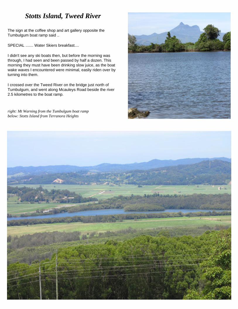
right: Mt Warning from the Tumbulgum boat ramp below: Stotts Island from Terranora Heights
Stotts Island, Tweed River
The sign at the coffee shop and art gallery opposite the Tumbulgum boat ramp said ..
SPECIAL ....... Water Skiers breakfast....
I didn't see any ski boats then, but before the morning was through, I had seen and been passed by half a dozen. This morning they must have been drinking slow juice, as the boat wake waves I encountered were minimal, easliy riden over by turning into them.
I crossed over the Tweed River on the bridge just north of Tumbulgum, and went along Mcauleys Road beside the river 2.5 kilometres to the boat ramp.

After launching my kayak at the Rayes Lane and Mcauley Road junction, on a clean gravel ramp, I paddled the 150 metres across the channel to the island, and immediately sighted a National Park NO ACCESS sign on the island shore.
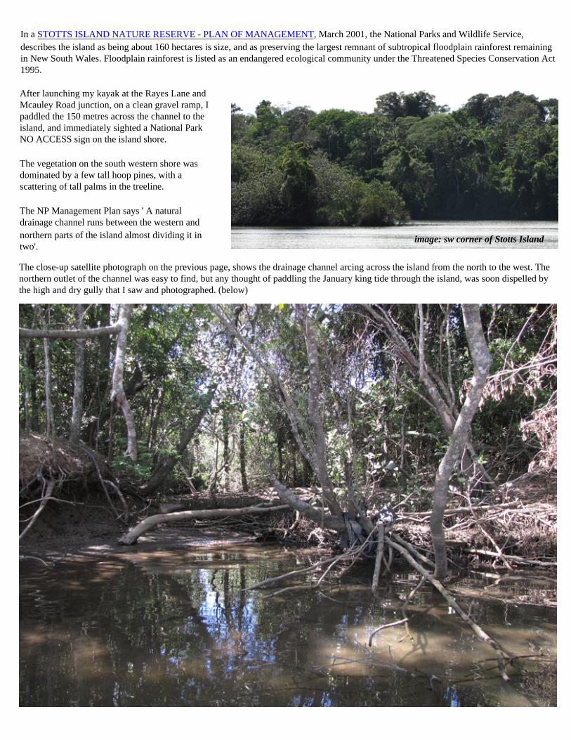
The close-up satellite photograph on the previous page, shows the drainage channel arcing across the island from the north to the west. The northern outlet of the channel was easy to find, but any thought of paddling the January king tide through the island, was soon dispelled by the high and dry gully that I saw and photographed. (below)
In a STOTTS ISLAND NATURE RESERVE - PLAN OF MANAGEMENT, March 2001, the National Parks and Wildlife Service, describes the island as being about 160 hectares is size, and as preserving the largest remnant of subtropical floodplain rainforest remaining in New South Wales. Floodplain rainforest is listed as an endangered ecological community under the Threatened Species Conservation Act 1995.
The vegetation on the south western shore was dominated by a few tall hoop pines, with a scattering of tall palms in the treeline.
The NP Management Plan says ' A natural drainage channel runs between the western and
,,image: sw corner of Stotts Island northern parts of the island almost dividing it in two'.

Once around the south eastern corner, and out into the main Tweed River channel, the mosquitos vanished. I passed a large stand of tall palms, and could not find the western entry to the Stott Island drainage channel; the entire western island bank was heavily overgrown.
If the visitor has never been in this locality before, and is returning north via Tweed Heads to the home front, it is worth following Mcauley Road up to Terranora Heights, and then on to Benora, for elevated views of the river.
It is 5.8 kilometres around the island. Once I got into the channel between the island and the road to Murwillumbah, I started to have to fight off mosquitos.
About halfway down the eastern side of the channel is a small park, and the Bruce Chick Conservation Park. About 200 metres further on a fallen tree had completely blocked the channel (January 2010), and it was with some difficulty I forced my way through the vines, and limbo-ed under the tree trunk. I guess I could have exited onto the eastern bank, and relaunched upstream past the obstruction.
above: NE corner of Stotts Island, looking down to the Bruce Chick Conservation Park
above: halfway down the eastern side of Stotts Island, in a narrowing channel
above: trees meeting overhead from both banks, Stott Island channelabove: boat ramp, Mcauley Road