Stepping Back from the Water Implementation
21
Jay S. White Aquality Environmental Consulting Ltd. 19 September 2019 Stepping Back from the Water Implementation M.Sc., P.Biol, QAES, Authenticating Professional
Transcript of Stepping Back from the Water Implementation
Jay S. White
Aquality Environmental Consulting Ltd.19 September 2019
Stepping Back from the Water Implementation
M.Sc., P.Biol, QAES, Authenticating Professional
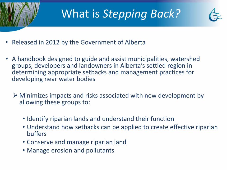
History of Stepping Back from the Water• Released in 2012 by the Government of Alberta
• A handbook designed to guide and assist municipalities, watershed groups, developers and landowners in Alberta’s settled region in determining appropriate setbacks and management practices for developing near water bodies
Minimizes impacts and risks associated with new development by allowing these groups to:
• Identify riparian lands and understand their function • Understand how setbacks can be applied to create effective riparian
buffers • Conserve and manage riparian land• Manage erosion and pollutants
What is Stepping Back?
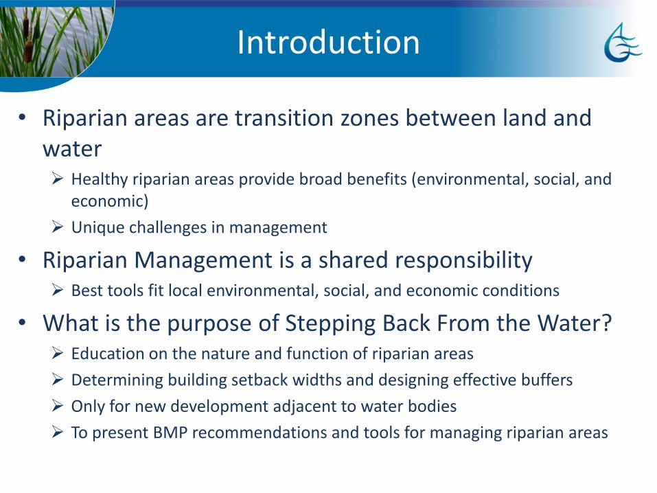
Introduction
• Riparian areas are transition zones between land and water Healthy riparian areas provide broad benefits (environmental, social, and
economic)
Unique challenges in management
• Riparian Management is a shared responsibility Best tools fit local environmental, social, and economic conditions
• What is the purpose of Stepping Back From the Water? Education on the nature and function of riparian areas
Determining building setback widths and designing effective buffers
Only for new development adjacent to water bodies
To present BMP recommendations and tools for managing riparian areas
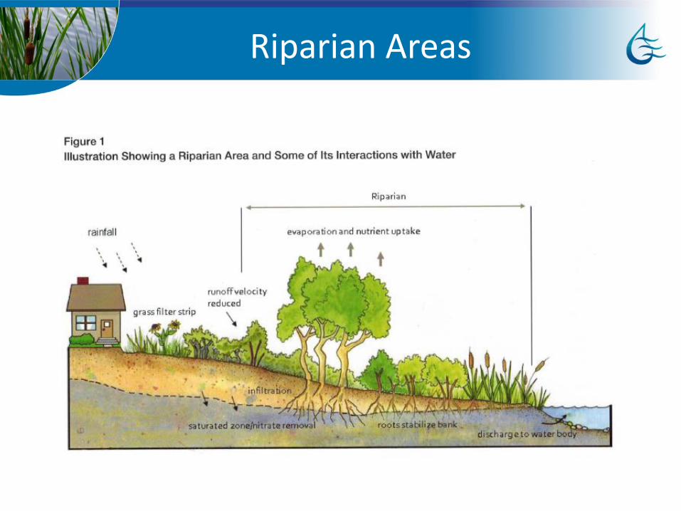
Riparian Areas
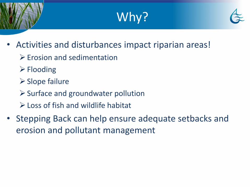
Why?
• Activities and disturbances impact riparian areas!
Erosion and sedimentation
Flooding
Slope failure
Surface and groundwater pollution
Loss of fish and wildlife habitat
• Stepping Back can help ensure adequate setbacks and erosion and pollutant management

How?
• Determination of filter strip width, unstable ground, erosion-prone areas, and flood plain
• Checklist:
1. Define scenario
2. Summarize key information
3. Floodplain mapping
4. Determine width of VFS
5. Determine setbacks relative to site constraints
6. Additional considerations

Recommended Data
Waterbody Classification• Permanent body of water vs. ephemeral/intermittent streams vs.
non-permanent wetlands
• Different classes of water bodies have broadly different functions and requirements for protection
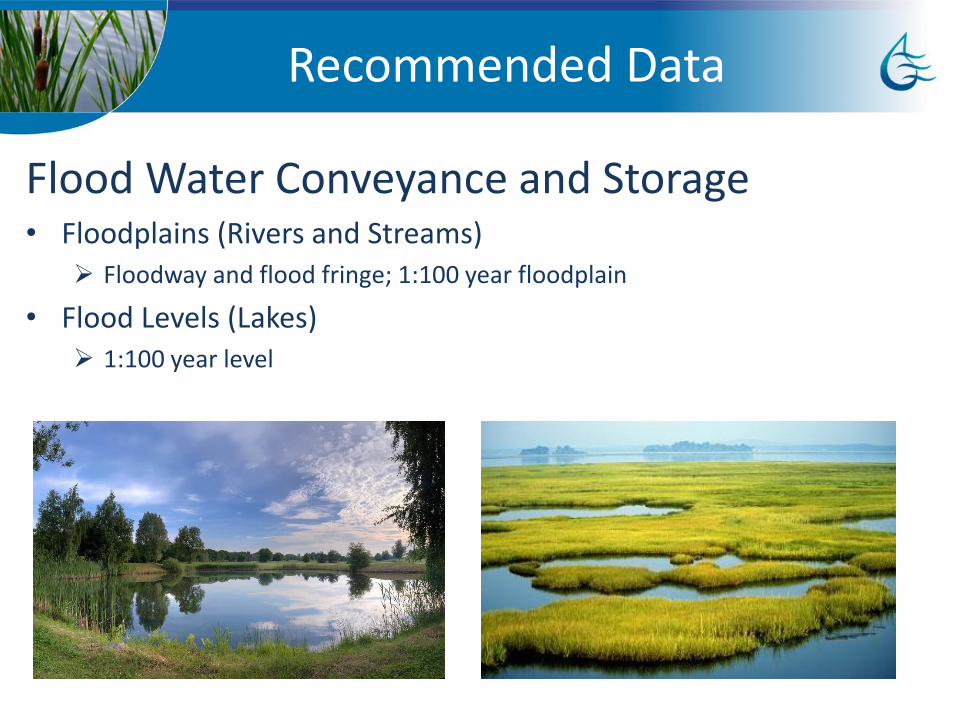
Recommended Data
Flood Water Conveyance and Storage• Floodplains (Rivers and Streams)
Floodway and flood fringe; 1:100 year floodplain
• Flood Levels (Lakes) 1:100 year level
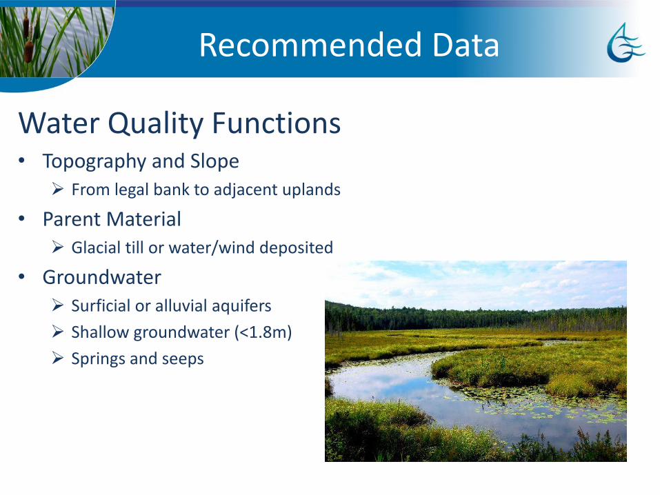
Recommended Data
Water Quality Functions• Topography and Slope
From legal bank to adjacent uplands
• Parent Material Glacial till or water/wind deposited
• Groundwater Surficial or alluvial aquifers
Shallow groundwater (<1.8m)
Springs and seeps
Recommended Data
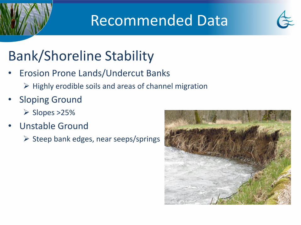
Bank/Shoreline Stability• Erosion Prone Lands/Undercut Banks
Highly erodible soils and areas of channel migration
• Sloping Ground Slopes >25%
• Unstable Ground Steep bank edges, near seeps/springs

Recommended Data
• Active channels
Use width of meander belt
Setbacks measured from edge of meander belt
• Fish bearing channels
Minimum 30m buffer
Recommended Data(additional considerations)
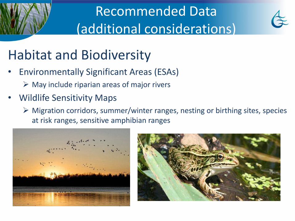
Habitat and Biodiversity• Environmentally Significant Areas (ESAs)
May include riparian areas of major rivers
• Wildlife Sensitivity Maps Migration corridors, summer/winter ranges, nesting or birthing sites, species
at risk ranges, sensitive amphibian ranges

Recommended Data(additional considerations)
Habitat/Biodiversity• Rare Species
Species at risk that use riparian areas (N. leopard frog, peregrine falcon, prairie falcon, bald eagle, great blue heron, etc.)
• Vegetation Cover type and composition (discussed but not addressed directly by
original document)

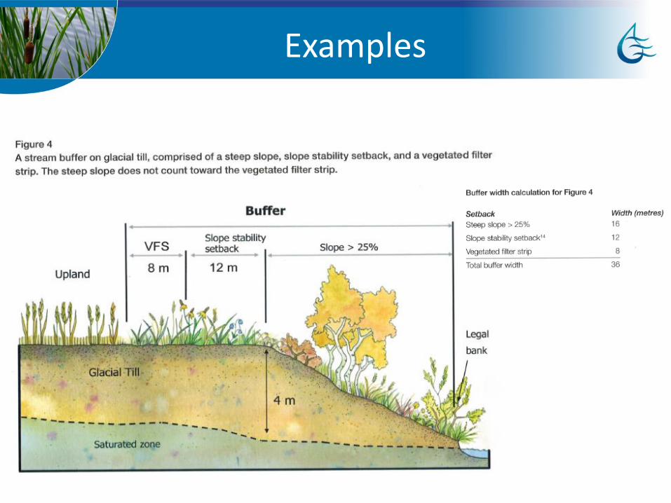
Examples
Examples

Examples
Examples
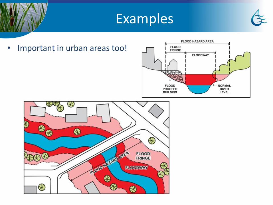
• Important in urban areas too!
Issues with implementation
• The original document takes a narrative approach rather than workflow to determining setbacks
• Some implementation details are not clear from text Can largely be reverse engineered from text and examples, though some
details are open to interpretation
• Examples don’t provide full range of scenarios for exploring potential setback requirements
Updates from current project
• Development of toolkit including workflow documents detailing approach Detailed implementation, but somewhat unwieldy for quick assessments
Explanations of requirements for end-users to improve familiarity with approach
• Web application Minimal implementation
Good for determining setbacks when parameters and model implementation are already well understood by user

Web Application
• http://webapps.aquality.ca/apps/steppingback/
• Application takes user input to determine recommended setback for site
• Does not account for e.g. environmentally significant areas or rare/sensitive species Requires site-by-site determination based on expert knowledge
May not require changes to setbacks but rather
Conclusions
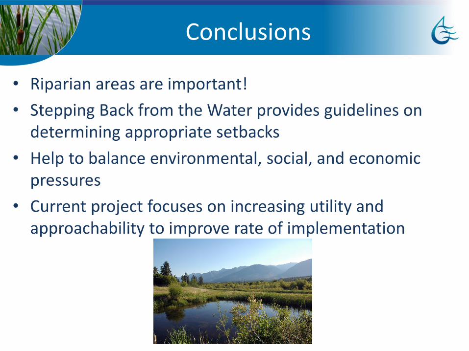
• Riparian areas are important!
• Stepping Back from the Water provides guidelines on determining appropriate setbacks
• Help to balance environmental, social, and economic pressures
• Current project focuses on increasing utility and approachability to improve rate of implementation