STEM Preparation through Marine Engineering, Science and ...averma/nsf/DeepSea Salvage IM 9... ·...
52
MarineTech 2009 - 2011 STEM Preparation through Marine Engineering, Science and Technology Experiences Dr. Alok K. Verma & Ameya Erande Lean Institute - ODU 1 Deep Sea Salvage Operations
Transcript of STEM Preparation through Marine Engineering, Science and ...averma/nsf/DeepSea Salvage IM 9... ·...

MarineTech
2009 - 2011
STEM Preparation through Marine Engineering, Science and Technology Experiences
Dr. Alok K. Verma & Ameya Erande Lean Institute - ODU 1
Deep Sea Salvage
Operations
MarineTech
2009 - 2011
STEM Preparation through Marine Engineering, Science and Technology Experiences
Dr. Alok K. Verma & Ameya Erande Lean Institute - ODU 2
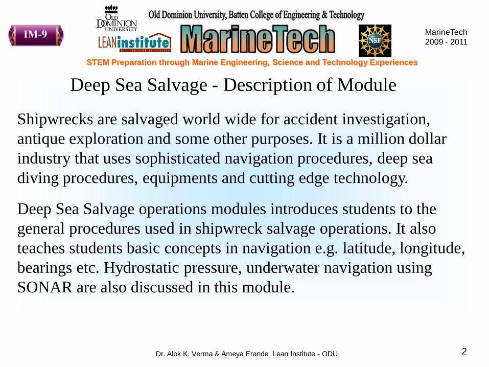
Deep Sea Salvage - Description of Module
Shipwrecks are salvaged world wide for accident investigation,
antique exploration and some other purposes. It is a million dollar
industry that uses sophisticated navigation procedures, deep sea
diving procedures, equipments and cutting edge technology.
Deep Sea Salvage operations modules introduces students to the
general procedures used in shipwreck salvage operations. It also
teaches students basic concepts in navigation e.g. latitude, longitude,
bearings etc. Hydrostatic pressure, underwater navigation using
SONAR are also discussed in this module.

MarineTech
2009 - 2011
STEM Preparation through Marine Engineering, Science and Technology Experiences
Dr. Alok K. Verma & Ameya Erande Lean Institute - ODU 3
Topics Covered
Shipwreck Operations 10 min.
Locate Points on Maps 05 min.
Latitudes and Longitudes 10 min.
Hands-on Activity – 1 20 min.
Compass and Bearings 15 min.
Hands-on Activity – 2 15 min.
Bearings to Calculate Distance 10 min.
Hands-on Activity – 3 45 min.
Hydrostatic Pressure 30 min.
SONAR 15 min.
Class Project – Lets Scratch 45 min.
MarineTech
2009 - 2011
STEM Preparation through Marine Engineering, Science and Technology Experiences
Dr. Alok K. Verma & Ameya Erande Lean Institute - ODU 4
NOAA Titanic Expedition 2004 Video

MarineTech
2009 - 2011
STEM Preparation through Marine Engineering, Science and Technology Experiences
Dr. Alok K. Verma & Ameya Erande Lean Institute - ODU 5
How would you locate the exact location of Titanic which is not
directly visible from the surface
How was the Titanic Wreck Located?
Researchers had last reported position radioed by Titanic‟s Radio
Officer to start with
Then why did it take 73 years to discover the wreck?

MarineTech
2009 - 2011
STEM Preparation through Marine Engineering, Science and Technology Experiences
Dr. Alok K. Verma & Ameya Erande Lean Institute - ODU 6
The answer to this question lies in the State of Technology
„Dr. Ballard noted that his crew had paid out 12,500 feet (3,810 m) of
the sonar's tow cable at the time of the discovery of the wreck,[61]
giving an approximate depth of the seabed of 12,450 feet (3,795 m).‟
Crushing Pressure at this depth makes human dives impossible
Pressure at this depth is 378 atm. = 5567 PSI
Even if you reach this depth, its pitch black; sunlight cannot reach
these unfathomed depths
MarineTech
2009 - 2011
STEM Preparation through Marine Engineering, Science and Technology Experiences
Dr. Alok K. Verma & Ameya Erande Lean Institute - ODU 7
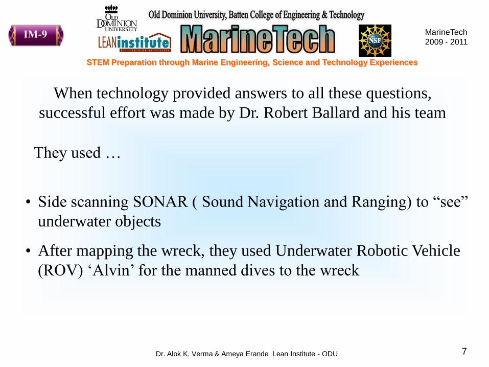
When technology provided answers to all these questions,
successful effort was made by Dr. Robert Ballard and his team
They used …
• Side scanning SONAR ( Sound Navigation and Ranging) to “see”
underwater objects
• After mapping the wreck, they used Underwater Robotic Vehicle
(ROV) „Alvin‟ for the manned dives to the wreck

MarineTech
2009 - 2011
STEM Preparation through Marine Engineering, Science and Technology Experiences
Dr. Alok K. Verma & Ameya Erande Lean Institute - ODU 8
Titanic Sank Somewhere in Between Europe and America
But where exactly?
MarineTech
2009 - 2011
STEM Preparation through Marine Engineering, Science and Technology Experiences
Dr. Alok K. Verma & Ameya Erande Lean Institute - ODU 9
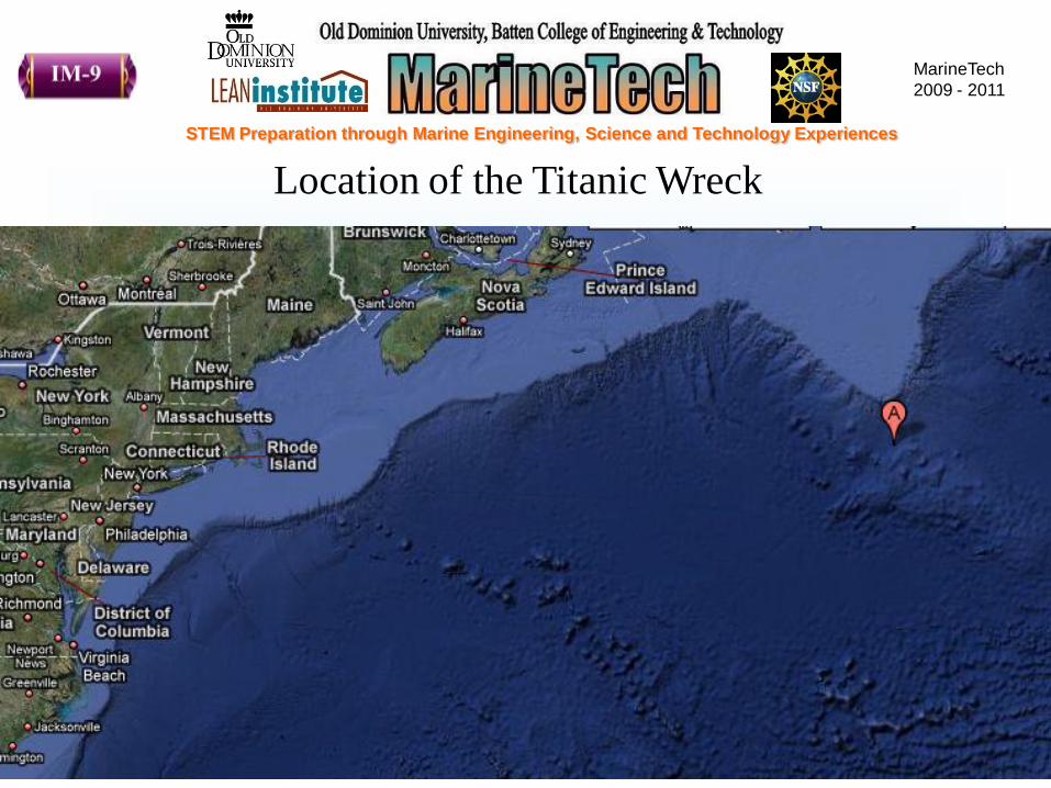
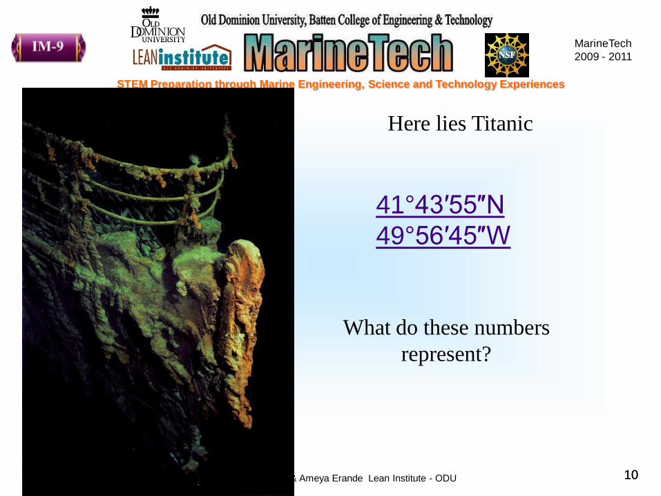
Location of the Titanic Wreck
MarineTech
2009 - 2011
STEM Preparation through Marine Engineering, Science and Technology Experiences
Dr. Alok K. Verma & Ameya Erande Lean Institute - ODU 1010
41°43′55″N
49°56′45″W
What do these numbers
represent?
Here lies Titanic

MarineTech
2009 - 2011
STEM Preparation through Marine Engineering, Science and Technology Experiences
Dr. Alok K. Verma & Ameya Erande Lean Institute - ODU 11
Latitude and Longitude
MarineTech
2009 - 2011
STEM Preparation through Marine Engineering, Science and Technology Experiences
Dr. Alok K. Verma & Ameya Erande Lean Institute - ODU 12
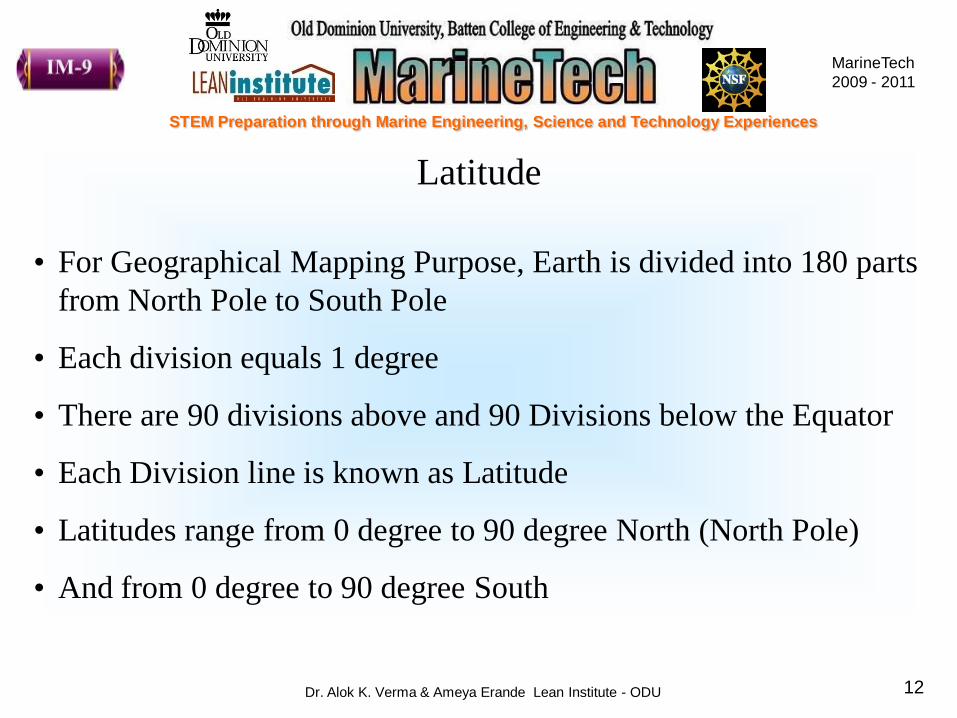
Latitude
• For Geographical Mapping Purpose, Earth is divided into 180 parts
from North Pole to South Pole
• Each division equals 1 degree
• There are 90 divisions above and 90 Divisions below the Equator
• Each Division line is known as Latitude
• Latitudes range from 0 degree to 90 degree North (North Pole)
• And from 0 degree to 90 degree South

MarineTech
2009 - 2011
STEM Preparation through Marine Engineering, Science and Technology Experiences
Dr. Alok K. Verma & Ameya Erande Lean Institute - ODU 13
Latitude – Pictorial Representation

MarineTech
2009 - 2011
STEM Preparation through Marine Engineering, Science and Technology Experiences
Dr. Alok K. Verma & Ameya Erande Lean Institute - ODU 14http://www.worldatlas.com/aatlas/imagee.htm
23.50 N
66.56° N
Arctic Circle
66.56° S
Antarctic Circle23.50 S
Latitudes to Remember – Tropics and Polar Circles

MarineTech
2009 - 2011
STEM Preparation through Marine Engineering, Science and Technology Experiences
Dr. Alok K. Verma & Ameya Erande Lean Institute - ODU 15
Longitude
• For Geographical Mapping Purpose, Earth is divided into 360
parts from East to West round the globe
• Each division equals 1 degree
• Each Division line is known as Longitude
• Longitude range from 0 degree (Greenwich Meridian) to 180
degree East
• And from 0 (Greenwich Meridian) degree to 180 degree West
What is Greenwich Meridian? Search and post your answers on
Openclassroomserver or write in your Project Journal

MarineTech
2009 - 2011
STEM Preparation through Marine Engineering, Science and Technology Experiences
Dr. Alok K. Verma & Ameya Erande Lean Institute - ODU 16
Longitude – Pictorial Representation
With Latitude and Longitude, we can locate ANY point on the Earth
MarineTech
2009 - 2011
STEM Preparation through Marine Engineering, Science and Technology Experiences
Dr. Alok K. Verma & Ameya Erande Lean Institute - ODU 17
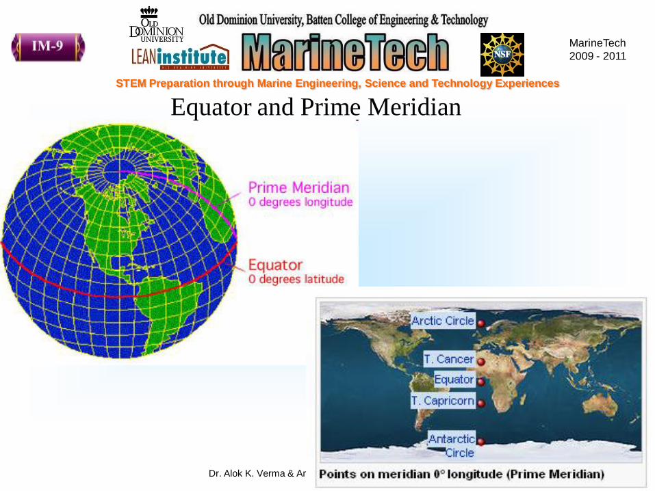
Equator and Prime Meridian

MarineTech
2009 - 2011
STEM Preparation through Marine Engineering, Science and Technology Experiences
Dr. Alok K. Verma & Ameya Erande Lean Institute - ODU 18
Latitude
Surface
distance
per 1° change
in latitude
Surface distance
per 1° change
in longitude
0° 110.574 km 111.320 km
15° 110.649 km 107.551 km
30° 110.852 km 96.486 km
45° 111.132 km 78.847 km
60° 111.412 km 55.800 km
75° 111.618 km 28.902 km
90° 111.694 km 0.000 km
25°N 80°W
47°N 122°W
Relation between Latitude, Longitude and Surface Distance
Try to find out distance
between following two
points
Miami
Seattle
Virginia Beach 36°N 75°W
37°N 122°WSan Francisco

MarineTech
2009 - 2011
STEM Preparation through Marine Engineering, Science and Technology Experiences
Dr. Alok K. Verma & Ameya Erande Lean Institute - ODU 19
Development of Earth – Maps and Charts
Maps and charts
represent
development of
spherical Earth in
2-D form
What did you just learn? What is the use of previous exercise?

MarineTech
2009 - 2011
STEM Preparation through Marine Engineering, Science and Technology Experiences
Dr. Alok K. Verma & Ameya Erande Lean Institute - ODU 20
Check on Learning
0 degrees latitude is also known as __________
0 degrees longitude is also known as __________
________ divide Earth from North to South in 180
equal parts
____&______ are used to represent Earth in 2-D
Latitudes
Equator
Prime Meridian
Maps Charts
MarineTech
2009 - 2011
STEM Preparation through Marine Engineering, Science and Technology Experiences
Dr. Alok K. Verma & Ameya Erande Lean Institute - ODU 21
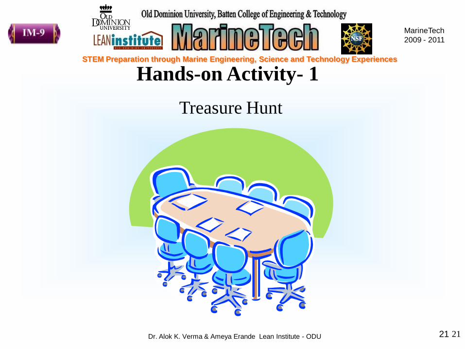
Hands-on Activity- 1
21
Treasure Hunt

MarineTech
2009 - 2011
STEM Preparation through Marine Engineering, Science and Technology Experiences
Dr. Alok K. Verma & Ameya Erande Lean Institute - ODU 22
Hands-on Activity 1
Treasure Hunt
This activity teaches use of coordinates to locate specific locations on
the Earth.
• Use Google maps to locate following coordinates of some famous
shipwrecks around the globe
• Type given coordinates in the search bar in Google maps and locate
the point on the map.
• Note down the details of locations in the observation column (e.g.
vicinity to any country, island, or any specific sea feature like
Mariana Trench etc.)

MarineTech
2009 - 2011
STEM Preparation through Marine Engineering, Science and Technology Experiences
Dr. Alok K. Verma & Ameya Erande Lean Institute - ODU 23
5 Minutes
MarineTech
2009 - 2011
STEM Preparation through Marine Engineering, Science and Technology Experiences
Dr. Alok K. Verma & Ameya Erande Lean Institute - ODU 24
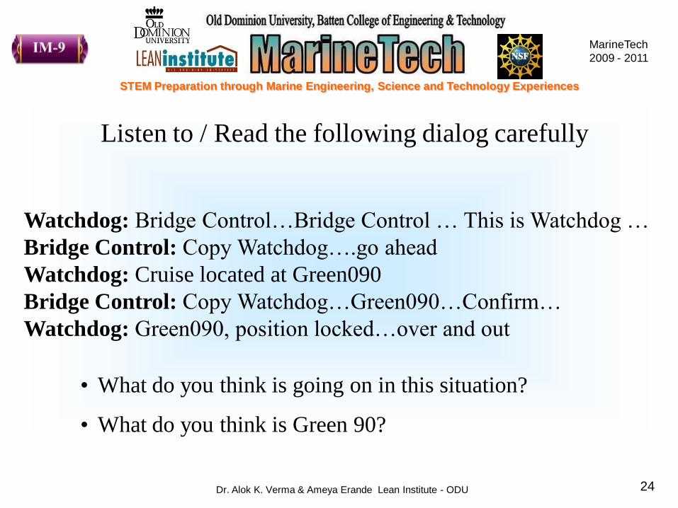
Watchdog: Bridge Control…Bridge Control … This is Watchdog …
Bridge Control: Copy Watchdog….go ahead
Watchdog: Cruise located at Green090
Bridge Control: Copy Watchdog…Green090…Confirm…
Watchdog: Green090, position locked…over and out
Listen to / Read the following dialog carefully
• What do you think is going on in this situation?
• What do you think is Green 90?

MarineTech
2009 - 2011
STEM Preparation through Marine Engineering, Science and Technology Experiences
Dr. Alok K. Verma & Ameya Erande Lean Institute - ODU 25
Bearings
Can you identify the object shown in
this picture?
Compass
What is the use of compass?
Compass is a navigational
instrument for determining
direction relative to the Earth‟s
magnetic poles

MarineTech
2009 - 2011
STEM Preparation through Marine Engineering, Science and Technology Experiences
Dr. Alok K. Verma & Ameya Erande Lean Institute - ODU 26
Navigation Prior to Compass
Which navigational tools
were in practice before
invention of compass?
With the help of starts like the
Pole star and constellations like
Big Dipper (Ursa Major)
But these techniques had inherent limitations as far as
intercontinental travels were concerned

MarineTech
2009 - 2011
STEM Preparation through Marine Engineering, Science and Technology Experiences
Dr. Alok K. Verma & Ameya Erande Lean Institute - ODU 27
• 4 Cardinal Points N E W S
• 4 Quarters, each measuring 900
• Angular bearing is measured
clockwise
Red marking on compass dial indicates Magnetic North of the Earth
• e.g. 113 ESE
Using Compass..
MarineTech
2009 - 2011
STEM Preparation through Marine Engineering, Science and Technology Experiences
Dr. Alok K. Verma & Ameya Erande Lean Institute - ODU 28
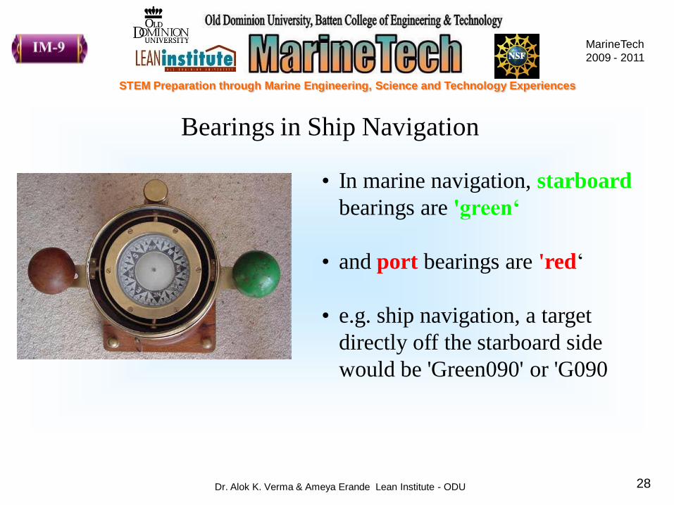
• In marine navigation, starboard
bearings are 'green‘
• and port bearings are 'red„
• e.g. ship navigation, a target
directly off the starboard side
would be 'Green090' or 'G090
Bearings in Ship Navigation

MarineTech
2009 - 2011
STEM Preparation through Marine Engineering, Science and Technology Experiences
Dr. Alok K. Verma & Ameya Erande Lean Institute - ODU 29
Check on Learning
True or False
• Compass uses principle of Earth‟s magnetic field
• The pole star, Big Dipper, Little Dipper can be used for finding
out directions
• Green 45 represents bearing of an object on the left side of the
ship
• The correct procedure to use compass to measure bearing is by
keeping it on iron table and then reading the bearing
True
True
False
False

MarineTech
2009 - 2011
STEM Preparation through Marine Engineering, Science and Technology Experiences
Dr. Alok K. Verma & Ameya Erande Lean Institute - ODU 30
Hands-on Activity- 2
SOS

MarineTech
2009 - 2011
STEM Preparation through Marine Engineering, Science and Technology Experiences
Dr. Alok K. Verma & Ameya Erande Lean Institute - ODU 31
Hands – on Activity 2
SOS
Watchdog: Bridge Control…Bridge Control … This is Watchdog …
Bridge Control: Copy Watchdog….go ahead
Watchdog: Cruise located at Green090
Bridge Control: Copy Watchdog…Green090…Confirm…
Watchdog: Green090, position locked…over and out

MarineTech
2009 - 2011
STEM Preparation through Marine Engineering, Science and Technology Experiences
Dr. Alok K. Verma & Ameya Erande Lean Institute - ODU 32
Use compass to find out bearings of other ships
MarineTech
2009 - 2011
STEM Preparation through Marine Engineering, Science and Technology Experiences
Dr. Alok K. Verma & Ameya Erande Lean Institute - ODU 33
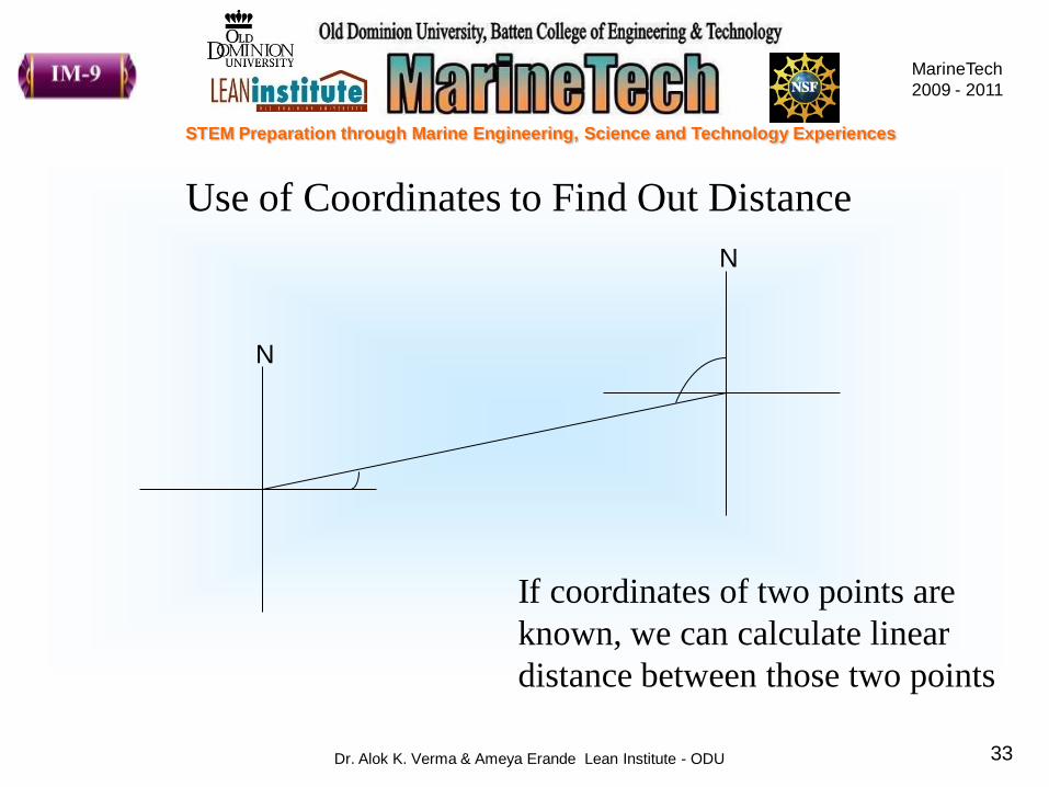
Use of Coordinates to Find Out Distance
N
N
If coordinates of two points are
known, we can calculate linear
distance between those two points
MarineTech
2009 - 2011
STEM Preparation through Marine Engineering, Science and Technology Experiences
Dr. Alok K. Verma & Ameya Erande Lean Institute - ODU 34
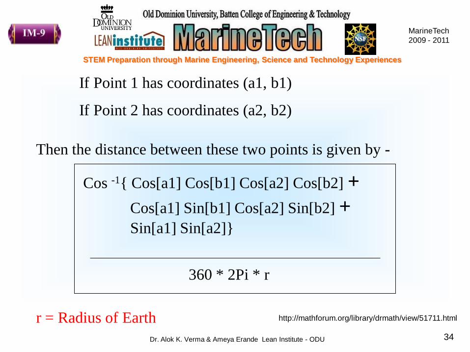
Cos -1{ Cos[a1] Cos[b1] Cos[a2] Cos[b2] +
Cos[a1] Sin[b1] Cos[a2] Sin[b2] + Sin[a1] Sin[a2]}
http://mathforum.org/library/drmath/view/51711.html
360 * 2Pi * r
If Point 1 has coordinates (a1, b1)
If Point 2 has coordinates (a2, b2)
Then the distance between these two points is given by -
r = Radius of Earth
MarineTech
2009 - 2011
STEM Preparation through Marine Engineering, Science and Technology Experiences
Dr. Alok K. Verma & Ameya Erande Lean Institute - ODU 35
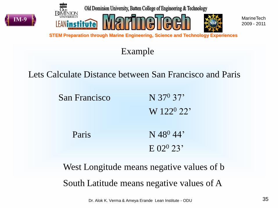
Example
Lets Calculate Distance between San Francisco and Paris
San Francisco N 370 37‟
W 1220 22‟
Paris N 480 44‟
E 020 23‟
West Longitude means negative values of b
South Latitude means negative values of A

MarineTech
2009 - 2011
STEM Preparation through Marine Engineering, Science and Technology Experiences
Dr. Alok K. Verma & Ameya Erande Lean Institute - ODU 36
5 Minutes
MarineTech
2009 - 2011
STEM Preparation through Marine Engineering, Science and Technology Experiences
Dr. Alok K. Verma & Ameya Erande Lean Institute - ODU 37
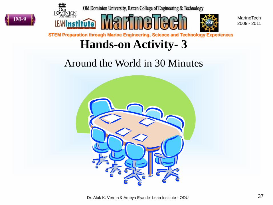
Hands-on Activity- 3
Around the World in 30 Minutes

MarineTech
2009 - 2011
STEM Preparation through Marine Engineering, Science and Technology Experiences
Dr. Alok K. Verma & Ameya Erande Lean Institute - ODU 38
Hands-on Activity 3
Around the World in 30 Minutes
• You are provided with a world map showing latitudes and
longitudes
• Plot following locations on the given map
• Join all the points and see if you get any shipping route
• Also calculate distance between the two points and hence total
distance between point of origin and final destination

MarineTech
2009 - 2011
STEM Preparation through Marine Engineering, Science and Technology Experiences
Dr. Alok K. Verma & Ameya Erande Lean Institute - ODU 39
Till now we have learned-
• How to locate point on the maps with the help of coordinates
• How to use compass to measure bearings
• How to calculate distances between points using bearings
Now Let us DIVE
But WAIT..!!!!!!! What about the tremendous water pressure
down there?

MarineTech
2009 - 2011
STEM Preparation through Marine Engineering, Science and Technology Experiences
Dr. Alok K. Verma & Ameya Erande Lean Institute - ODU 40
This pressure is called as Hydrostatic Pressure
Pressure at the Titanic Wreck site is 378 atm.
This is 378 times the current pressure of air in this room
Hydrostatic Pressure increases with the depth of ocean
We need strong cover that can withstand this pressure
MarineTech
2009 - 2011
STEM Preparation through Marine Engineering, Science and Technology Experiences
Dr. Alok K. Verma & Ameya Erande Lean Institute - ODU 41
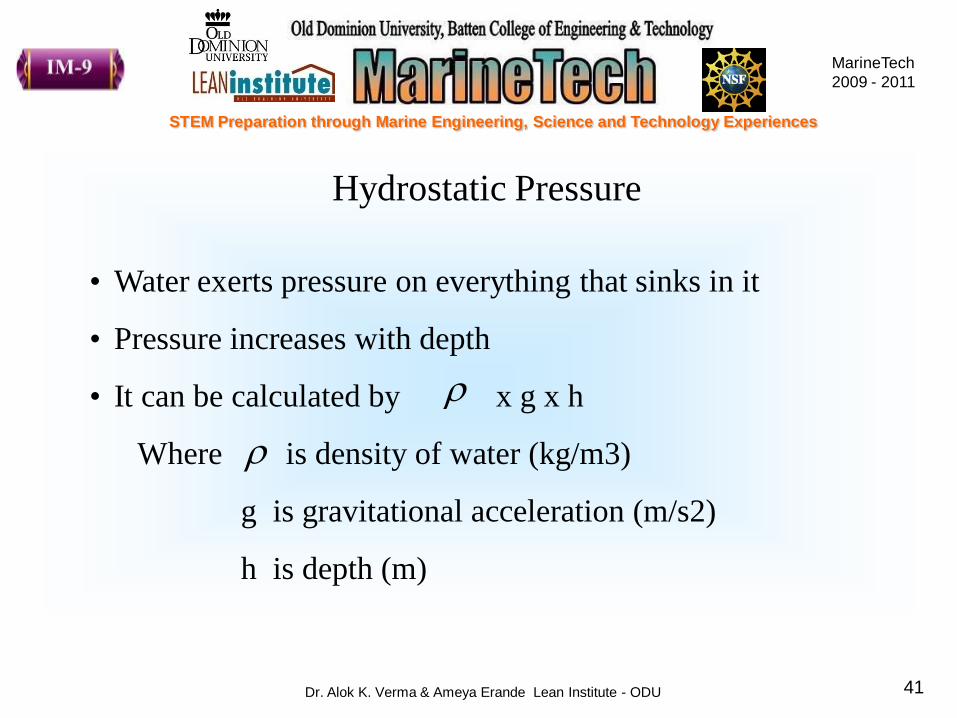
Hydrostatic Pressure
• Water exerts pressure on everything that sinks in it
• Pressure increases with depth
• It can be calculated by x g x h
Where is density of water (kg/m3)
g is gravitational acceleration (m/s2)
h is depth (m)
MarineTech
2009 - 2011
STEM Preparation through Marine Engineering, Science and Technology Experiences
Dr. Alok K. Verma & Ameya Erande Lean Institute - ODU 42

MarineTech
2009 - 2011
STEM Preparation through Marine Engineering, Science and Technology Experiences
Dr. Alok K. Verma & Ameya Erande Lean Institute - ODU 43
Using the formula for hydrostatic pressure, calculate the
pressure at the following locations and prepare a bar chart
• Lake Superior – 180 meter
•Calypso Deep (Mediterranean) – 5267 meter
• Puerto Rico Trench in Atlantic – 8605 meter
•Mariana Trench in Pacific – 10,911 meter
•Java Trench in Indian Ocean – 7258 meter

MarineTech
2009 - 2011
STEM Preparation through Marine Engineering, Science and Technology Experiences
Dr. Alok K. Verma & Ameya Erande Lean Institute - ODU 44
We have reached the bottom of the Ocean
Hey…But it is pitch black here, I can‟t see anything
NOW WHAT?
Lets use SONAR……
What is that?

MarineTech
2009 - 2011
STEM Preparation through Marine Engineering, Science and Technology Experiences
Dr. Alok K. Verma & Ameya Erande Lean Institute - ODU 45
SONAR is an acronym for…
Sound Navigation and Ranging

MarineTech
2009 - 2011
STEM Preparation through Marine Engineering, Science and Technology Experiences
Dr. Alok K. Verma & Ameya Erande Lean Institute - ODU 4646
Sound waves transmitted by sender bounce back from the
object in their path and are detected by the receiver

MarineTech
2009 - 2011
STEM Preparation through Marine Engineering, Science and Technology Experiences
Dr. Alok K. Verma & Ameya Erande Lean Institute - ODU 47
Velocity = Distance Traveled
Time
= 2 * r
Time
Why the distance between the object and source of sound
multiplied by 2?
Formula to Calculate Distance of an Object Using SONAR
MarineTech
2009 - 2011
STEM Preparation through Marine Engineering, Science and Technology Experiences
Dr. Alok K. Verma & Ameya Erande Lean Institute - ODU 4848
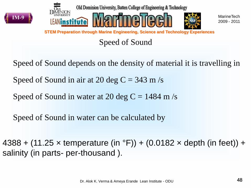
Speed of Sound
4388 + (11.25 × temperature (in °F)) + (0.0182 × depth (in feet)) +
salinity (in parts- per-thousand ).
Speed of Sound depends on the density of material it is travelling in
Speed of Sound in air at 20 deg C = 343 m /s
Speed of Sound in water at 20 deg C = 1484 m /s
Speed of Sound in water can be calculated by

MarineTech
2009 - 2011
STEM Preparation through Marine Engineering, Science and Technology Experiences
Dr. Alok K. Verma & Ameya Erande Lean Institute - ODU 49
5 Minutes

MarineTech
2009 - 2011
STEM Preparation through Marine Engineering, Science and Technology Experiences
Dr. Alok K. Verma & Ameya Erande Lean Institute - ODU 50
MarineTech
2009 - 2011
STEM Preparation through Marine Engineering, Science and Technology Experiences
Dr. Alok K. Verma & Ameya Erande Lean Institute - ODU 51
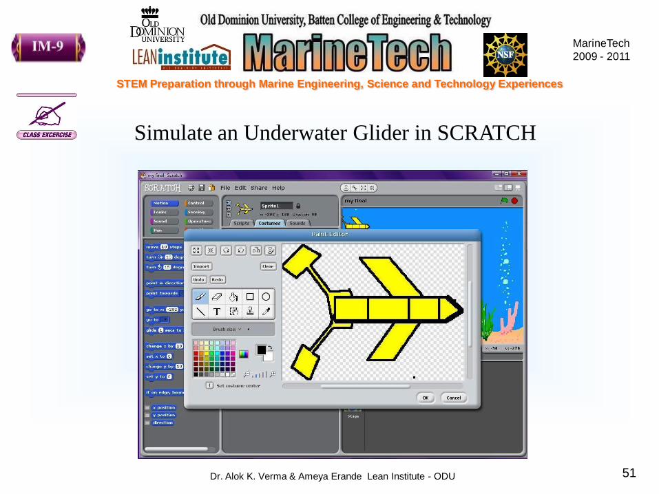
Simulate an Underwater Glider in SCRATCH

MarineTech
2009 - 2011
STEM Preparation through Marine Engineering, Science and Technology Experiences
Dr. Alok K. Verma & Ameya Erande Lean Institute - ODU 52
Review of Topics
• Overview- Shipwreck Salvage Operations
• Locate Points on Maps
• Latitudes and Longitudes
• Compass and Bearings
• Bearings in Ship Navigation
• Hydrostatic Pressure
• SONAR
• Class Project using SCRATCH