STATE WATER RESOURCES CONTROL BOARD...donald moore 301 dante john nomellini 360 timothy grunsky 435...
320
1 STATE OF CALIFORNIA CALIFORNIA ENVIRONMENTAL PROTECTION AGENCY STATE WATER RESOURCES CONTROL BOARD Public Hearings to Determine Whether to Adopt Cease and Desist Orders against: Woods Irrigation Company, Middle River in San Joaquin County. ~~~~~~~~~~~~~~~~~~~~~~~~~~~~~~~ ) ) ) ) ) ) ) ) JOE SERNA JR./CalEPA BUILDING 1001 I STREET COASTAL HEARING ROOM SACRAMENTO, CALIFORNIA VOLUME II THURSDAY, JUNE 24, 2010 9:04 A.M. LINDA KAY RIGEL, CSR CERTIFIED SHORTHAND REPORTER LICENSE NUMBER 13196
Transcript of STATE WATER RESOURCES CONTROL BOARD...donald moore 301 dante john nomellini 360 timothy grunsky 435...

1
STATE OF CALIFORNIA
CALIFORNIA ENVIRONMENTAL PROTECTION AGENCY
STATE WATER RESOURCES CONTROL BOARD
Public Hearings to DetermineWhether to Adopt Cease and DesistOrders against:
Woods Irrigation Company, MiddleRiver in San Joaquin County.~~~~~~~~~~~~~~~~~~~~~~~~~~~~~~~
))))))))
JOE SERNA JR./CalEPA BUILDING
1001 I STREET
COASTAL HEARING ROOM
SACRAMENTO, CALIFORNIA
VOLUME II
THURSDAY, JUNE 24, 2010
9:04 A.M.
LINDA KAY RIGEL, CSRCERTIFIED SHORTHAND REPORTERLICENSE NUMBER 13196

ii
A P P E A R A N C E S
CO-HEARING OFFICERS
Walter G. Pettit
Frances Spivy-Weber, Vice-Chair
HEARING TEAM:
Marianna Aue, Staff CounselErnest Mona, Water Resource Control EngineerCharles (Larry) Lindsay, Hearings Unit Chief
PROSECUTORIAL TEAM:
David Rose, Staff CounselState Water Resources Control Board1001 I StreetSacramento, CA 95814

iii
APPEARANCES continued
WOODS IRRIGATION COMPANY
John Herrick, Esq.4255 Pacific AveStockton, CA [email protected]
CENTRAL DELTA WATER AGENCY, SOUTH DELTA WATER AGENCY
Harris, Perisho & RuizBy: Dean Ruiz, Esq.3439 Brookside Road, Suite 210Stockton, CA [email protected]
SAN JOAQUIN COUNTY AND THE SAN JOAQUIN COUNTY FLOODCONTROL & WATER CONSERVATION DISTRICT
Neumiller & BeardsleeBy: DeeAnne M. Gillick509 W. Weber AvenueStockton, CA [email protected]
MODESTO IRRIGATION DISTRICT
O'Laughlin & Paris LLPBy: Tim 0'Laughlin117 Meyers Street, Suite 110Chico, CA [email protected]

iv
APPEARANCES continued
SAN LUIS & DELTA-MENDOTA WATER AUTHORITY, WESTLANDSWATER DISTRICT
Diepenbrock, HarrisonBY: Jon D. Rubin
Valerie Kincaid400 Capitol Mall, Suite 1800Sacramento, CA [email protected]
STATE WATER CONTRACTORS
Kronick, Moskovitz, Tiedemann & GirardBY: Stanley C. Powell400 Capitol Mall, 27th FloorSacramento, CA [email protected]

v
INDEX OF PROCEEDING
--o0o--Page
Proceedings convened; evacuationprocedures announced
299
Continuation of cases-in-chief 301
Hearing continued 611
Certificate of Reporter 612
--o0o--

vi
INDEX OF EXAMINATION
--o0o--
WITNESSES CALLED BY WOODS IRRIGATION COMPANY:
Page
DONALD MOORE 301DANTE JOHN NOMELLINI 360TIMOTHY GRUNSKY 435TERRY PRICHARD 435CHRISTOPHER H. NEUDECK 510
DONALD MOORE
CROSS-EXAMINATION BY MS. GILLICK 301QUESTIONS FROM STAFF ATTORNEY AUE 317REDIRECT EXAMINATION BY MR. HERRICK 319CROSS-EXAMINATION BY MR. RUBIN 332CROSS-EXAMINATION BY MR. O'LAUGHLIN 350
DANTE JOHN NOMELLINI
DIRECT EXAMINATION BY MR. HERRICK 360CROSS-EXAMINATION BY MS. KINCAID 384CROSS-EXAMINATION BY MR. O'LAUGHLIN 401
TIMOTHY GRUNSKY and TERRY PRICHARD
DIRECT EXAMINATION BY MR. HERRICK 435CROSS-EXAMINATION BY MR. ROSE 450CROSS-EXAMINATION BY MR. RUBIN 453CROSS-EXAMINATION BY MR. O'LAUGHLIN 465REDIRECT EXAMINATION BY MR. HERRICK 488RECROSS-EXAMINATION BY MR. ROSE 498RECROSS-EXAMINATION BY MR. RUBIN 502RECROSS-EXAMINATION BY MR. O'LAUGHLIN 504
CHRISTOPHER H. NEUDECK
DIRECT EXAMINATION BY MR. HERRICK 510CROSS-EXAMINATION BY MR. ROSE 548CROSS-EXAMINATION BY MR. RUBIN 558

1
2
3
4
5
6
7
8
9
10
11
12
13
14
15
16
17
18
19
20
21
22
23
24
25
299
P R O C E E D I N G S
--o0o--
CO-HEARING OFFICER PETTIT: Good morning,
everyone. It's a few minutes after 9:00 so I think we
may as well get started.
Good morning. We're here today to continue the
June 7, 2010, Woods Irrigation Company CDO Hearing.
This hearing is being continued in accordance with the
Notice of Continuance dated June 10, 2010.
I am State Water Board Member Walt Pettit.
Vice-Chair Frances Spivy-Weber is ill today and will not
be joining us.
Also present are staff counsel Marianna Aue and
staff engineer Ernest Mona.
In the event there's a fire or fire drill, you
will be required to vacate this room immediately. I
know you've heard this announcement many times.
Please look around now and identify the exits
that are closest to you that you might be able to use,
and take all your valuables with you if you do have to
leave.
The evacuees should exit down the stairs, not
the elevators. If anyone has problems with the stairs,
please make sure we know about it so we can get you
whatever kind of assistance you might need.

1
2
3
4
5
6
7
8
9
10
11
12
13
14
15
16
17
18
19
20
21
22
23
24
25
300
The hearing will be webcast to the public. It
will be recorded by both audio and video, and in
addition a court reporter is present to prepare a
transcript of the proceeding. Anyone who wants a copy
of the transcript must make separate arrangements with
the court reporter.
Vice-Chair Spivy-Weber advised me about an hour
ago that she's going to be watching us on the webcast,
so I will attempt to maintain her usual high standard.
And Frances, we hope you get well and get back with us
quickly.
The hearing continues the WIC CDO hearing that
we began on June 7th. During the June 7th hearing, we
completed the Prosecution Team's case-in-chief, and we
began the case-in-chief for Woods and concluded the
direct testimony of Mr. Moore and cross-examination by
Mr. Rubin and Mr. O'Laughlin.
So we'll resume with the cross-examination of
Mr. Moore in a moment by Central Delta and San Joaquin
County.
The hearing will continue in the same order
that we originally specified with each party who
submitted testimony in evidence having the opportunity
to present a case-in-chief followed by cross-examination
and recross, if any.
1
2
3
4
5
6
7
8
9
10
11
12
13
14
15
16
17
18
19
20
21
22
23
24
25
301
After all cases-in-chief have been submitted,
there will be an opportunity to present rebuttal
testimony.
If necessary, and I'd like to emphasize if
necessary, this hearing will be continued on June 25th,
tomorrow, and June 28th, next Monday.
Before we begin, are there any procedural
questions that anyone needs to raise? Seeing none,
we're ready to start.
Mr. Herrick, I believe the next thing up is
cross-examination of Mr. Moore by Mr. Ruiz.
MR. RUIZ: Mr. Pettit, the County is going to
cross-examine Mr. Moore at this point in time, and if
there's anything -- I just have a few questions but it
might be more efficient if the County goes first at this
time and I follow if there's anything she doesn't get
to.
CO-HEARING OFFICER PETTIT: That's fine. Thank
you.
MR. RUIZ: Okay.
--o0o--
DONALD MOORE
Previously called by WOODS IRRIGATION COMPANY
CROSS-EXAMINATION BY MS. GILLICK
FOR SAN JOAQUIN COUNTY AND THE SAN JOAQUIN COUNTY FLOOD

1
2
3
4
5
6
7
8
9
10
11
12
13
14
15
16
17
18
19
20
21
22
23
24
25
302
CONTROL & WATER CONSERVATION DISTRICT
--o0o--
MS. GILLICK: Good morning. DeeAnne Gillick on
behalf of the County of San Joaquin.
You know, Mr. Moore, I kind of have to remember
where we were a couple weeks ago. During direct
testimony I think we were looking at Exhibits 2J and 2K
which were maps, aerial photo maps of the Woods
Irrigation Company area of the county.
So I think it might be helpful, Mr. Lindsay, if
we could pull up 2J and 2K, is what my notes indicate.
CHIEF LINDSAY: This is 2J.
MS. GILLICK: Okay. Mr. Moore, I'm sorry, this
is -- I'm not familiar with this. I don't look at
aerial photos often, but to me when I look at this photo
it's just a bunch of shading and some different contrast
lines.
Can you tell me -- I mean, how can you tell
from looking at this photo that there were historical
watercourses or even the current watercourse on this
photo just from the shading of the white areas, et
cetera? Can you explain to me how you can do that?
MR. MOORE: Yes. What we have here is an
overlay and a transparency. The color you see is from
the 2005 photos of San Joaquin County. The squiggly

1
2
3
4
5
6
7
8
9
10
11
12
13
14
15
16
17
18
19
20
21
22
23
24
25
303
lines and so on that you asked about are from an overlay
of the 1937 or the 1940 aerial photos.
MS. GILLICK: Can I stop you there.
So I understand, the coloring in the fields is
from the 2005 crop pattern and what was there in 2005,
the colored fields?
MR. MOORE: That's correct.
MS. GILLICK: So then the kind of the white
contrast, you say it's an overlay. What does that mean?
MR. MOORE: That's an overlay of the photos.
Just to clarify that, if they could drop back to
Exhibit 2E.
This is the same photo with no enhancement.
The black and white you see is the 1937. If you look in
the upper left-hand corner, you see the date of 8-13-37,
I believe that is.
Those are those photos that are rectified and
registered to fit on the 2005 photo base, the 2005 being
the color that you can see to the top of the photo for
the areas where the black-and-white photos didn't color
it.
Now, what we are looking at here where we're
not doing any enhancement games is the various features.
One, to make it very clear, is Duck Slough. This is
Burns Cutoff.

1
2
3
4
5
6
7
8
9
10
11
12
13
14
15
16
17
18
19
20
21
22
23
24
25
304
When we see Duck Slough coming down in a
southwesterly direction, we can see the features here.
One in particular is this horseshoe shape here which is
an oxbow meander that does not exist today.
In addition to that there are many, many --
MS. GILLICK: Can I stop you there.
You say that horseshoe meander, but it doesn't
exist there today, so what is that showing you?
MR. MOORE: That's the original waterway.
When you zoom in on this and you look more
closely, and when you view the photos in the standard
procedure of looking at stereo viewing, which gives an
enhanced three-dimensional display of the surface, this
is very clear the channel that was flowing at this time.
This same channel is also shown on the 1909 and 1913
topographic maps of the area.
MS. GILLICK: So you're saying --
MR. RUBIN: Excuse me. Hearing Officer Pettit,
I apologize for interrupting the cross-examination, but
the questions that are being asked are open-ended
questions. They're -- in essence, the testimony that's
being elicited is much more akin to testimony that's
elicited on direct testimony.
We're put at a severe disadvantage by having
gone through our cross-examination, asked leading

1
2
3
4
5
6
7
8
9
10
11
12
13
14
15
16
17
18
19
20
21
22
23
24
25
305
questions of the witness as you are supposed to be doing
on cross-examination.
I would ask that you direct Ms. Gillick to ask
leading questions and not open-ended questions that
elicit testimony as if it were on direct.
MS. GILLICK: I think under cross you can do
either. I think if you are --
CO-HEARING OFFICER PETTIT: Excuse me, what did
you say?
MS. GILLICK: I think under cross it's not
required that it has to be a leading question. It tends
to be a leading question if you want to elicit yes/no
answers, but that's not a requirement under cross.
I'm not trying to go through -- and I believe
under cross-examination there was quite a few questions
regarding the direct testimony that was put forth and
the ability to actually see water and see what's there
and by looking at the photo being able to evaluate and
come to the conclusions that Mr. Lajoie did.
So on cross -- on my cross, and even on the
direct I think it was talked about but I don't think in
detail what it was.
I'm just trying to elicit the detail of how he
can come to these conclusions that there is water in
those -- or was water in those areas.
1
2
3
4
5
6
7
8
9
10
11
12
13
14
15
16
17
18
19
20
21
22
23
24
25
306
CO-HEARING OFFICER PETTIT: My recollection is
that under the previous cross-examination that Mr. Moore
indicated on a number of occasions that he -- other than
the general indication of what the map shows as to
previous waterways that he couldn't give specific
quantities, times, or water qualities. And so much of
the questioning is beginning to sound somewhat
repetitive, so I guess I'd ask where you are going with
this.
MS. GILLICK: Okay. Well, I can just be
mindful of that and keep it focused to try to, you know,
not be repetitive.
CO-HEARING OFFICER PETTIT: I'd appreciate it.
Thank you.
MS. GILLICK: Okay.
So we were talking about this photo along the
horseshoe shape. And so you were -- is it correct that
this 1937 photo depicts that there was actual water in
that Duck Slough at that location in 1937?
MR. MOORE: That's correct. There are numerous
places in these obvious stream features that are
dominant on this '37. In many of them, it is clear
there is water in them.
MS. GILLICK: Can you identify some of the
areas that you can tell that there was water in them in

1
2
3
4
5
6
7
8
9
10
11
12
13
14
15
16
17
18
19
20
21
22
23
24
25
307
1937 in the Woods Irrigation Company service area?
MR. MOORE: Yes. In fact, other ones, I don't
believe it shows in this series, but with the
overlapping photos -- we do have additional photos that
I don't think are in this display where you can actually
see sunlight reflections off of the water.
And in many cases -- in fact, if we could zoom
in to either this area and just to the right, to the
Burns Cutoff area -- okay. We'll have to pan down
towards the bottom. Okay, that's good.
Again, here's what we're talking about. In
current photos and today's maps this feature and this
feature above it do not show. These are classic stream
meanders. We have the features here, and coming down
here. We have streams coming down here. We have
streams running through here in 1937.
If you could just pan down a little bit more.
MS. GILLICK: And just the general area, if you
could describe that area that you're -- it's south of
Burns Cutoff? Kind of what general area are we...
MR. MOORE: Yes. This is along Duck Slough.
This is following to the southwest, south of Highway 4
and continuing southwest from Highway 4 along Duck
Slough.
MS. GILLICK: Going south along Duck Slough?

1
2
3
4
5
6
7
8
9
10
11
12
13
14
15
16
17
18
19
20
21
22
23
24
25
308
MR. MOORE: Yes. Correct. And we can see a
waterway continuing in this light-colored field
following southwest along Duck Slough down towards the
Mussi parcel. That is water in this slough.
If we just shift this photo over to 2F, this is
the same area and same -- it appears to be rotated.
There we go. Again, if we can zoom into this same area
right here where we were just concentrating along Duck
Slough before. That's good.
The same area we were just looking at along
Duck Slough, we now see the water is gone. Between '37
and 1940, that stream that was flowing right down
parallel to Duck Slough or Inland Drive, High Ridge
Levee, the various names it was called, that had been
filled in. Excavation equipment had filled that slough
in. And in 1937, it was obvious there was water in that
slough.
MS. GILLICK: And is it your opinion that this
stretch and course at Duck Slough was an historic route
of Duck Slough? I know these photos we're looking at
are 1937 and 1940, but was Duck Slough located here
before that?
MR. MOORE: Yes, that is the historic channel.
Again, if we could go back to 2E. Again, just to --
stop right there.

1
2
3
4
5
6
7
8
9
10
11
12
13
14
15
16
17
18
19
20
21
22
23
24
25
309
Again, this was the waterway we are talking
about that in 1940 photos has been filled in. There's
clearly water in this.
As we continue down following Duck Slough
coming into the Mussi parcel, we can see all the
indications of stream meanders, oxbow meanders coming
through there.
When we come down to the Robinson or Tanaka we
can see classic oxbow meanders coming off the
current-day Duck Slough. You can see those same angles
down here. So all along that slough there are classic
indications of sloughs and streams.
MS. GILLICK: Okay. So the oxbow, when you say
that's a classic indication, that's an indication to you
that it's a natural historical watercourse?
MR. MOORE: That's correct. Oxbow is a
geologic or geomorphic term for a meander, a kind of a
horseshoe-shaped meander in a stream, correct.
One other thing to clarify this. If we pan
back up to the north and over to the right back to Burns
Cutoff -- now go to the right.
Right in here where we can see Burns Cutoff, we
can see -- okay, just a little more to the right.
That's good. And then down just a little bit.
Again, we see natural waterways coming right

1
2
3
4
5
6
7
8
9
10
11
12
13
14
15
16
17
18
19
20
21
22
23
24
25
310
off of Duck Slough -- I mean, excuse me. Here is Duck
Slough again. We can see the old natural course of the
slough coming right from Burns Cutoff following Duck
Slough to the southwest around the meander we just
talked about, the oxbow.
We can see two historic channels that flowed
through that area.
And we can see a continuation of one of the
channels coming off here. About half of this was
irrigation, about half was natural.
We can see a natural waterway coming off to the
south from the railroad tracks.
And what's very important coming from just to
the east again coming off of Burns Cutoff, these are
classic natural stream meanders. We can even see where
they go over right in here.
This is what is now the sewage ponds. And we
can see these stream meanders where they continued
before the sewage ponds were in place and continued down
as natural waterways right through this area.
This is where the 1909 irrigation maps show
waterways.
I don't know if we can see it here, but if we
could zoom right into this area here.
This doesn't show quite as clearly as I would
1
2
3
4
5
6
7
8
9
10
11
12
13
14
15
16
17
18
19
20
21
22
23
24
25
311
like, but in this portion of this natural waterway
coming down from Burns Cutoff you can see water, you can
see trees growing, and it's about this point here where
it takes on more improved techniques. But you can see
the old classic stream meanders followed by the canal
system.
MS. GILLICK: So if it's not showing on this
photo, how is it that you can see that?
MR. MOORE: This is a reduced resolution photo.
CO-HEARING OFFICER PETTIT: Excuse me. I'm
going to interrupt here for a moment. I've got a
question for Ms. Gillick.
I think this information, subject to the extent
to which the Board accepts the technology, is certainly
useful for establishing Mr. Moore's analysis of the
hydrology of the area at the time.
However, looking back at the CDO, the CDO
specifically asks for information about what's going on
in Woods' service area, and I would be more interested
in hearing questions that are responsive to that.
And Mr. Moore, with all due respect, sir, I
think the answers that you're giving are going beyond
the questions that are asked, and they also appear to me
to be the same information you testified to on the 7th,
and I'm hearing the same answers, and I think those

1
2
3
4
5
6
7
8
9
10
11
12
13
14
15
16
17
18
19
20
21
22
23
24
25
312
answers are in the record.
So I would ask that, Ms. Gillick, you propose
to focus this to be more responsive to the CDO.
And Mr. Moore, if we continue with this
discussion, I would like to see you just limit the
response to the questions rather than the extent of the
analysis which you're giving which you did give the
other day.
MS. GILLICK: And I appreciate that. And I've
got several questions I can direct that are focused.
But I do think the CDO asked about riparian
water rights, the riparian water rights that the
District -- the Company is serving to those riparian
lands. So I do think it's relevant.
Mr. Moore is not my witness, but I do think it
is relative to the CDO because the CDO specifically
asked about riparian lands, riparian water that's being
served.
MR. RUBIN: Hearing Officer Pettit, I would
like an opportunity to respond to that.
CO-HEARING OFFICER PETTIT: Go ahead,
Mr. Rubin.
MR. RUBIN: Very briefly. We have been
reserving raising any objections, but I completely
disagree with Ms. Gillick's statement about the

1
2
3
4
5
6
7
8
9
10
11
12
13
14
15
16
17
18
19
20
21
22
23
24
25
313
relevance of testimony about riparian rights.
The question before you, as I understand it, is
whether Woods Irrigation Company has water rights.
Unless there is an assertion, and I don't believe there
is one, that Woods Irrigation Company owns property, I
don't see how a riparian right is relevant to whether
Woods Irrigation Company holds a water right.
And I don't -- I understand the preference of
the hearing officer to wait until the testimony comes in
before we raise our objections, and we'll be doing that.
I only wanted to preserve our right to do that given
Ms. Gillick's statement.
CO-HEARING OFFICER PETTIT: Thank you,
Mr. Rubin. And as you can probably tell from my
question a moment ago -- is this thing working? Can you
hear me in the back there? Are you having trouble,
John?
MR. HERRICK: It's a little low. No offence.
CO-HEARING OFFICER PETTIT: I'll try and speak
up a little more then.
Well, Ms. Gillick, you know my concern. And
I'll let this go on for a bit longer, but I do want to
keep it focused, and I don't want to hear repetitive
testimony that we've heard already.
MS. GILLICK: I'll move on in my questions.

1
2
3
4
5
6
7
8
9
10
11
12
13
14
15
16
17
18
19
20
21
22
23
24
25
314
CO-HEARING OFFICER PETTIT: Thank you.
MS. GILLICK: Mr. Moore, you mentioned during
your direct testimony a reference to the Atwater study,
and I didn't understand or know what that Atwater study
was referring to. Can you identify what the Atwater
study is?
MR. MOORE: The Atwater study was a soils and
water survey done in the 1970s, I believe published in
1982. In Mr. Lajoie's testimony, he referred to it.
And the results of Mr. Atwater's study is he
used 1960 aerial photos to identify historic stream
courses in the Woods Irrigation District and the
surrounding area for his study of basically the Holt
Quadrangle.
MS. GILLICK: And are your conclusions today
consistent with the Atwater study?
MR. MOORE: Correct. Most of the features that
I saw that are natural streams and sloughs coincided
near perfectly with Mr. Atwater's, but with the
technology available today, we were able to identify
considerably more features using the enhancement
techniques and computers that were not available at the
time he did that study.
MS. GILLICK: There was some testimony
regarding Exhibit 2D, so maybe if we could pull up

1
2
3
4
5
6
7
8
9
10
11
12
13
14
15
16
17
18
19
20
21
22
23
24
25
315
Exhibit 2D.
And during some previous testimony -- and let's
focus in on the area of the Woods Irrigation Company
service area. So that would be Roberts Island, right?
Number 60 and 70 on the map, indications of 60
and 70, is that the general area of the Woods Irrigation
Company service area?
MR. MOORE: Yes. In the center there is the
San Joaquin River, so we're looking to the west or left
of the numbers. Those numbers are for soils.
Overlaid onto this topographic map was an old
soil survey from the '20s or whenever it was. So that's
all those numbers refer to is the soil type.
MS. GILLICK: And there was reference during
your testimony to lines, but there was no indication
what those lines were referring to or indicating. Do
you have an opinion or reference you can explain what
the lines on the map refer to or indicate?
MR. MOORE: Yes. There are a number of these
lines. An example is this area here where they're
showing old -- in 1911 when this was surveyed where
they're showing stream courses and sloughs that were
mapped at that time.
MS. GILLICK: Can you describe those lines just
for the record? Are they the orange lines?

1
2
3
4
5
6
7
8
9
10
11
12
13
14
15
16
17
18
19
20
21
22
23
24
25
///
///
316
MR. MOORE: Yes. We're talking south of Burns
Cutoff along the west side of the Stockton Quadrangle.
This is Burns Cutoff here.
MS. GILLICK: So below the number 80 and below
the railroad tracks, in that area?
MR. MOORE: Yes. We're going from Burns Cutoff
near the west side of the map continuing down to the
south. The indications on the map, they're showing what
were irrigation features. They're showing sloughs and
streams that were mapped in 1911.
MS. GILLICK: And the date of this map, then,
was 1911?
MR. MOORE: 1911 was when it was surveyed. It
was published in 1913.
MS. GILLICK: Okay. Thank you. I have no
further questions.
CO-HEARING OFFICER PETTIT: Mr. Ruiz, did you
have anything?
MR. RUIZ: Ms. Gillick has covered it.
CO-HEARING OFFICER PETTIT: Pardon me?
MR. RUIZ: Ms. Gillick has covered it.
CO-HEARING OFFICER PETTIT: Thank you, sir.
Ms. Aue or Mr. Mona?

1
2
3
4
5
6
7
8
9
10
11
12
13
14
15
16
17
18
19
20
21
22
23
24
25
317
--o0o--
QUESTIONS FROM STAFF ATTORNEY AUE
FOR THE STATE BOARD
--o0o--
STAFF ATTORNEY AUE: Ms. Gillick brought up an
Atwater study. Is that in evidence? Is there a
reference to that?
MR. MOORE: No, that's in the Mr. Lajoie
testimony in the beginning of the proceedings.
STAFF ATTORNEY AUE: Beginning of this
proceeding?
MR. HERRICK: No. Atwater was a source used by
Mr. Lajoie in producing documents for the Mussi, Pak and
Young hearing.
STAFF ATTORNEY AUE: So it's not in evidence in
this hearing?
MR. HERRICK: Not in evidence here. Just for
you guys, we intend to just put those all in, I guess,
on rebuttal, just so they're there so you know what
they're talking about, although I don't think we have
any testimony regarding them but we might cite to them
or something. So they are available. They will be
available.
MR. RUBIN: I would like to make a
clarification. Mr. Herrick I don't believe made a

1
2
3
4
5
6
7
8
9
10
11
12
13
14
15
16
17
18
19
20
21
22
23
24
25
318
correct representation.
The study by Mr. Atwater, I don't know if that
has been marked as an exhibit in any proceeding before
the State Water Resources Control Board. There has been
references in other proceedings, but I don't believe
we've seen the study.
MR. HERRICK: If I misspoke, I apologize.
Mr. Lajoie relied upon them. Mr. Lajoie's testimony is
in the Pak and Young but not those Atwater study
documents.
MS. GILLICK: And just for the record, it is a
reference in Mr. Moore's testimony as well regarding
Exhibit 2K.
There is a reference where his maps he's
depicted the Atwater study lines, and that again is a
reference to Mr. Moore's testimony regarding 2K.
STAFF ATTORNEY AUE: Thank you.
CO-HEARING OFFICER PETTIT: I believe that
completes the cross-examination for Mr. Moore. And we
should be ready to move on unless there is some recross,
which I skipped. Okay.
Mr. Herrick.
MR. HERRICK: Yes, Mr. Chairman. John Herrick
for Woods again. I do have a little bit of redirect
just to cover a few issues that were touched upon in

1
2
3
4
5
6
7
8
9
10
11
12
13
14
15
16
17
18
19
20
21
22
23
24
25
319
cross.
--o0o--
REDIRECT EXAMINATION BY MR. HERRICK
FOR Woods IRRIGATION COMPANY
--o0o--
MR. HERRICK: Mr. Moore, it's been a few weeks
now, but you were asked questions by Mr. Rubin regarding
how you might know whether or not any of the lines on
the maps you were checking dealt with irrigation or
something else. Do you recall those questions?
MR. MOORE: Yes, I do.
MR. HERRICK: And is it correct to say that you
examined a Woods map dated approximately 1909, a
Hendersen and Billwiller map dated 1914, a Woods
Irrigation Company map dated 1941, the 1911 topo map,
and from those maps you made certain conclusions about
what is and isn't an irrigation ditch; is that correct?
MR. MOORE: Yes, that's correct.
MR. HERRICK: And that's because some of those
maps actually label the lines as main irrigation ditch
or drainage ditch or canal, et cetera; is that correct?
MR. MOORE: Yes.
MR. HERRICK: And so in your work then you
overlaid those maps' features designated as irrigation
or drainage ditches and matched them to the historical

1
2
3
4
5
6
7
8
9
10
11
12
13
14
15
16
17
18
19
20
21
22
23
24
25
320
geomorphic features that you had seen; correct?
MR. MOORE: That's correct.
MR. HERRICK: And so it's not speculation that
any of those channels were used for irrigation. It's
based on the information you were presented with on the
maps; is that correct?
MR. MOORE: Yes, that's correct.
MR. HERRICK: And some of the maps have the
word "gates" and stuff like that indicating control of
water through that channel, correct?
MR. MOORE: Yes.
MR. HERRICK: And those maps also indicate that
the lines that were designated irrigation ditches or
canals all merged together at the main irrigation point
of the Woods Irrigation Company, right?
MR. MOORE: Yes.
MR. HERRICK: And given your general knowledge
of the area, water was then diverted from Woods into
those canals, correct?
MR. MOORE: Yes.
MR. HERRICK: So when you've designated
something irrigation or drainage ditches, those aren't
assumptions or guesses; they are based on the facts
before you, correct?
MR. MOORE: Yes. Those are all on the maps and

1
2
3
4
5
6
7
8
9
10
11
12
13
14
15
16
17
18
19
20
21
22
23
24
25
321
the labels on the maps, and there was near-perfect
correlation with the natural stream and slough features
that are identifiable on the aerial photographs.
MR. HERRICK: Mr. Moore, there were also
questions dealing with your photo enhancement work and
related activities and the words altered or stitched or
mosaicked were used; do you recall those?
MR. MOORE: Yes.
MR. HERRICK: Now, in your analysis and use of
these various maps, did you do anything that altered the
data in the maps?
MR. MOORE: No.
MR. HERRICK: So your techniques you used may
highlight one thing so you could better discern
differences, but you didn't change any of the features
to the map, correct?
MR. MOORE: That's correct.
MR. HERRICK: And it's typical or normal or the
usual practice in your industry to do this sort of
matching or stitching together or mosaicking of maps in
order to make them fit together, correct?
MR. MOORE: Yes. That's a standard procedure.
If you look at Google maps or anything else, virtually
any map you see has been rectified and mosaicked or
stitched today. This is just a common standard practice

1
2
3
4
5
6
7
8
9
10
11
12
13
14
15
16
17
18
19
20
21
22
23
24
25
322
in the industry.
MR. HERRICK: And in your work on this matter
doing the maps that you've presented, did any of this
stitching or mosaicking of maps create features that
weren't there before?
MR. MOORE: No, absolutely not.
MR. HERRICK: You had questions with regards to
your use of the term riparian features and whether or
not those were watercourses at any particular time; do
you recall those?
MR. MOORE: Yes.
MR. HERRICK: And is it correct to say that in
your analysis of documents, including up through the
1937 aerial photographs, you specifically did identify
water in certain channels or features; is that correct?
MR. MOORE: Yes, that's true. It was clearly
identifiable for a number of reasons. With even minimal
enhancement of the photos, we could identify water.
In most of those areas, there was near-perfect
correlation with some of the maps, particularly the
1911/1913 maps that we just pointed out a few minutes
ago. In many cases, there was near-perfect correlation
in the overlays.
MR. HERRICK: And I just want to confirm that
part of your work relied upon the expert testimony

1
2
3
4
5
6
7
8
9
10
11
12
13
14
15
16
17
18
19
20
21
22
23
24
25
323
Mr. Lajoie presented at different hearing, correct?
MR. MOORE: That's correct. And I did work
with Mr. Lajoie on that, and I did use his work,
particularly the Atwater and his soils map studies and
so on.
MR. HERRICK: And you actually worked with him
to produce that material that you are relying upon here;
is that correct?
MR. MOORE: That's correct. Ken and I worked
shoulder-to-shoulder on some of these projects.
MR. HERRICK: And among other things, your
Exhibit 2K is one of the maps presented by Mr. Lajoie in
that previous hearing?
MR. MOORE: That's correct. That shows the --
the heavy red areas are his soils, and the lines labeled
A, B, C and D. Could we -- maybe we could put that up
there, 2K.
MR. HERRICK: 2K, please.
MR. MOORE: Yes. All of the heavy red areas
represent the soils work that Ken had taken from 1952
San Joaquin soil surveys. That was all his work. I did
participate in that, but 90 percent of it was
Mr. Lajoie.
These lines that show up a little faintly, the
red squiggly lines where you see the A, B, C and D,

1
2
3
4
5
6
7
8
9
10
11
12
13
14
15
16
17
18
19
20
21
22
23
24
25
324
those are the overlays of the features identified by
Mr. Atwater by the Atwater report that Mr. Lajoie used.
The blue lines are the additional riparian features that
myself -- that mainly myself, I identified.
MR. HERRICK: Could you put 2H up, please.
Mr. Moore, you were questioned a little bit
about your Exhibit 2H and whether or not -- oops, sorry.
Excuse me. Well, these are my words now -- whether or
not you were confusing different elevations based upon
the map you had produced here. Do you recall those
questions?
MR. MOORE: Yes, I do.
MR. HERRICK: And could you briefly describe
how you differentiate between different elevations and
determine whether or not one feature is higher than
another when examining maps like 2H.
MR. MOORE: In conjunction with doing these,
this is what is called a linear directional filter --
excuse me, a directional filter. That's a standard
procedure used in remote sensing and image enhancement
for studying geomorphic features.
And so in conjunction with doing the
enhancement where you can see the Burns Cutoff and
rivers and so on more clearly, all of these features,
the standard nonaltered aerials, were always

1
2
3
4
5
6
7
8
9
10
11
12
13
14
15
16
17
18
19
20
21
22
23
24
25
325
side-by-side with the computer to evaluate to make sure
that nothing was incorrect.
In fact, if you zoomed in on these, you could
even see how the enhancement technique would enhance
writing on the photos.
Right up there, for instance, you can see how
the enhancement techniques raised and made it more clear
to see the labeling on the photograph.
So this is how the enhancement technique works
to -- if you pan down a little bit, please, down towards
the bottom. Again, you see it -- stop. Yeah.
So this shows clearly the features, but you do
have to be careful and study the nonaltered photos to
make sure that you're looking at natural features and
not lettering or some other manmade feature on the
photo.
MR. HERRICK: So when you're analyzing this
sort of relief map or picture, you are also taking into
consideration other maps of the area to sort of
calibrate what you're doing and not make mistakes; is
that correct?
MR. MOORE: Absolutely. That's completely
necessary and standard procedure using this technique
because the keyword is directional. If you run the
filter one direction the relief shows up correctly; if

1
2
3
4
5
6
7
8
9
10
11
12
13
14
15
16
17
18
19
20
21
22
23
24
25
326
you run it the opposite direction it will reverse it.
So you run it perpendicular to a feature like the slough
coming down this area, but you always check the feature
to make sure that something didn't reverse.
A good sample right here, you can see the
labeling on the photo. This shows it was depressed or
going into the ground. The previous examples of the
labeling on the photo, they were raised coming out of
the ground.
So these are the type of things that you always
use and view the nonaltered photos to crosscheck
everything you identify.
MR. HERRICK: Do you have any doubt that the
features you've identified as ridges or levees or
channels are somehow incorrect and the levees you've
identified might be holes in the ground or the holes in
the ground might be levees?
MR. MOORE: No, there is no doubt whatsoever,
because all of the final judgments were done from the
nonaltered photos.
This was mainly done as a demonstration
technique so features would stand out more clearly for
demonstration as we're doing right now.
It's also a good technique to bring different
features to your attention for further analysis. But no

1
2
3
4
5
6
7
8
9
10
11
12
13
14
15
16
17
18
19
20
21
22
23
24
25
327
conclusions were made off of these. They just led us to
points to look at on the nonaltered photos with standard
stereo viewing techniques.
MR. HERRICK: Mr. Moore, you were questioned on
Exhibit 2K. Let me -- that may not be correct.
Mr. Moore, you were asked some questions as to
why features you've identified were on one map and not
another. Do you recall those questions?
MR. MOORE: Yes, I do.
MR. HERRICK: And is it correct to say that
some maps may indicate fields that don't have a crop on
them at a certain time unless you can see the underlying
soil structure, whereas other maps might have crops on
them and the structures are then hidden?
MR. MOORE: Yes, that's correct. Most of the
relief in this entire area is just a few feet, usually
less than 5 feet.
So just a heavy crop like alfalfa -- a good
example, if we go back to photo 2E, and if we could pan
to the west. A little bit more. Then down just a
little bit. We want to go into this area right here.
That's probably good enough.
This area right here which is along Duck
Slough --
MR. HERRICK: Again, give us more of a

1
2
3
4
5
6
7
8
9
10
11
12
13
14
15
16
17
18
19
20
21
22
23
24
25
328
description of where you're indicating, please.
MR. MOORE: This is just west of the Mussi
parcel along Duck Slough on the west side of Duck
Slough. This is the 1937 photo. You notice it's dark.
There was probably something like alfalfa growing there.
We can see very few features in this area.
If we go to photo -- I mean Exhibit 2F. We'll
be zooming into the same area. Pan down. Right there.
If we could zoom into this area. We're in the same area
here near the Mussi parcel along Duck Slough. Now, in
the same area -- that's good.
Notice there's no heavy crop there, now it's
very clear. We can see a blow-out and a riparian
feature coming off of Duck Slough.
When we come up, we can see those same features
very clearly in 1940. They were hardly discernable on
the 1937s just due to crop growth.
So everything was always looked at on two
different sets of photos. I even obtained some 1963
photos of the areas. And so we used about three
different series of photos plus all of the maps before
we made any conclusions.
But this is a perfect example of how in 1937
you could see virtually nothing due to heavy crop
growth; in 1940 there were very clear riparian and

1
2
3
4
5
6
7
8
9
10
11
12
13
14
15
16
17
18
19
20
21
22
23
24
25
329
slough features.
MR. HERRICK: So the features aren't appearing
and disappearing, they're just still there and they're
either covered or not covered by something like a crop?
MR. MOORE: Correct. These features, the
relief on these is probably just a couple of feet, so a
thick crop like alfalfa could totally cover them up.
CO-HEARING OFFICER PETTIT: Mr. Herrick, during
the cross-examination on the 7th, Mr. Moore was asked a
number of questions. In many cases he had to respond
that he didn't know the answer when it came to specifics
about quantities of water that were involved and
diversion points and so on.
And so I feel obligated to give him a chance to
defend what he has established with these techniques,
but I hope we're not going to repeat the three or four
hours of explanation of the techniques that we went
through the other day because I think he explained them
pretty fully at that time.
So I just am concerned about whether you intend
to plow the same ground again or not.
MR. HERRICK: I'm not trying to drag this out,
Mr. Chairman. I just -- during the cross-examination
whenever the questioner brings up an issue that I
thought might need better explanation, I try to recover

1
2
3
4
5
6
7
8
9
10
11
12
13
14
15
16
17
18
19
20
21
22
23
24
25
330
that. So it is going back over the same ground. I
don't mean to be duplicative, I just mean to make sure
it's clear that the suggestions in the questions are
fully answered.
But bearing in mind what you just said, I will
try to shorten what I'm doing here so we don't beat it
too much.
CO-HEARING OFFICER PETTIT: Thank you.
MR. HERRICK: Mr. Moore, on cross-examination
you were presented with what's been designated MSS
No. 2; do you recall that?
MR. MOORE: Yes, I do.
MR. HERRICK: And I believe it was two pages.
One page was the blowup of the -- I'll call it the
legend, and then the full diagram. And it's a map, as
I'm reading from the exhibit. It's a map showing
location of Cross Levee and proposed irrigation ditch
along base of levee.
Do you have that in front of you?
MR. MOORE: Yes, I do.
MR. HERRICK: You were asked some questions
about whether or not and why this didn't show any
indication of Duck Slough; do you recall that?
MR. MOORE: Yes, I remember that question.
MR. HERRICK: Now, as you look at this map, it

1
2
3
4
5
6
7
8
9
10
11
12
13
14
15
16
17
18
19
20
21
22
23
24
25
331
has a line running along what you've previously
identified as the feature that was Duck Slough; is that
correct?
MR. MOORE: Correct.
MR. HERRICK: And along this line in a couple
points it says Cross Levee; is that correct?
MR. MOORE: That's correct.
MR. HERRICK: But again, the map is a map of a
proposed ditch; is it not?
MR. MOORE: Whatever it says on it. That's
what I was told when I was given it.
MR. HERRICK: So do you know whether or not the
person who drew this map meant the line to be either the
proposed ditch or the Cross Levee or the Cross Levee and
the proposed ditch or the Cross Levee and the proposed
ditch and the remnants of an old slough?
MR. MOORE: I have no idea what their intent
was, but Cross Levee and Inland Drive and Duck Slough
seem to be used interchangeably for the area, for the
general area.
MR. HERRICK: And it's clear on this map, is it
not, that many other features in the area simply aren't
included because they're not relevant to the proposed
line of irrigation ditch; is that correct?
MR. MOORE: Right. I can't tell. I don't

1
2
3
4
5
6
7
8
9
10
11
12
13
14
15
16
17
18
19
20
21
22
23
24
25
332
think anyone can tell if this line indicated the road
that was on the levee or the natural course of the
waterway that was the original watercourse in the area.
I don't think that can be discerned from this map.
MR. HERRICK: That's all I have. Thank you,
Mr. Chairman.
CO-HEARING OFFICER PETTIT: Thank you,
Mr. Herrick. Any recross, Mr. Rose?
MR. ROSE: No. Thank you.
CO-HEARING OFFICER PETTIT: Mr. Rubin,
Mr. O'Laughlin, and Mr. Powell?
MR. O'LAUGHLIN: We hopefully will have
Mr. Rubin go first, and hopefully he'll cover most of
our points and be moving the hearing along.
CO-HEARING OFFICER PETTIT: Thank you. Please
proceed, Mr. Rubin.
--o0o--
CROSS-EXAMINATION BY MR. RUBIN
FOR SAN LUIS & DELTA-MENDOTA WATER AUTHORITY
--o0o--
MR. RUBIN: Thank you. My name is Jon Rubin,
attorney for San Luis & Delta-Mendota Water Authority.
Good morning.
MR. MOORE: Good morning.
MR. RUBIN: Mr. Moore, on redirect Mr. Herrick

1
2
3
4
5
6
7
8
9
10
11
12
13
14
15
16
17
18
19
20
21
22
23
24
25
333
asked you some questions about photos that depicted
water in a feature that you've identified as Duck
Slough; do you recall that?
MR. MOORE: Yes.
MR. RUBIN: And the photos that you're
referring to are photos that were taken in 1937; is that
correct?
MR. MOORE: Yes.
MR. RUBIN: And the 1937 photos -- are the
original photos that you examined an exhibit to your
testimony?
MR. MOORE: Yes.
MR. RUBIN: Which exhibit has the original
photographs?
MR. MOORE: Exhibit 2E has the original 1937
photographs.
MR. RUBIN: Mr. Moore, Exhibit 2E has multiple
photographs depicted on it; isn't that correct?
MR. MOORE: Yes. These 1937 photographs were
shot with 60 percent overlap so that 60 percent of the
photos overlap. And I believe there was about six
photos that were rectified and stitched together for
this exhibit.
MR. RUBIN: And is it my understanding in the
top right corner there's a photograph that depicts the
1
2
3
4
5
6
7
8
9
10
11
12
13
14
15
16
17
18
19
20
21
22
23
24
25
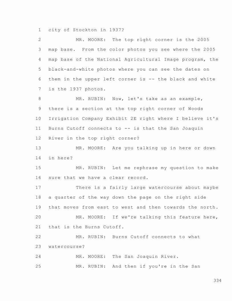
334
city of Stockton in 1937?
MR. MOORE: The top right corner is the 2005
map base. From the color photos you see where the 2005
map base of the National Agricultural Image program, the
black-and-white photos where you can see the dates on
them in the upper left corner is -- the black and white
is the 1937 photos.
MR. RUBIN: Now, let's take as an example,
there is a section at the top right corner of Woods
Irrigation Company Exhibit 2E right where I believe it's
Burns Cutoff connects to -- is that the San Joaquin
River in the top right corner?
MR. MOORE: Are you talking up in here or down
in here?
MR. RUBIN: Let me rephrase my question to make
sure that we have a clear record.
There is a fairly large watercourse about maybe
a quarter of the way down the page on the right side
that moves from east to west and then towards the north.
MR. MOORE: If we're talking this feature here,
that is the Burns Cutoff.
MR. RUBIN: Burns Cutoff connects to what
watercourse?
MR. MOORE: The San Joaquin River.
MR. RUBIN: And then if you're in the San

1
2
3
4
5
6
7
8
9
10
11
12
13
14
15
16
17
18
19
20
21
22
23
24
25
335
Joaquin River traveling from the east to the west,
starting at the right side of the page there's a -- you
can make a turn into Burns Cutoff?
MR. MOORE: Yes. It appears you can turn to
the south off the San Joaquin River.
MR. RUBIN: Yes. And then if you travel down
Burns Cutoff there is another watercourse that you can
make a left turn into; is that correct?
MR. HERRICK: Mr. Rubin, if you don't mind, I'm
getting confused.
MR. RUBIN: Let me use the pointer and have
Mr. Moore describe the area.
MR. HERRICK: If I may without incurring the
wrath, the larger waterway that starts going east to
west and then angles up to the northwest is the San
Joaquin River, but it's the deep water ship channel.
The sinuous line coming from the bottom right
going northwest then going back northeast joining that
larger one is the original San Joaquin River channel.
But it does merge with that deep water ship channel
becoming the San Joaquin again.
MR. RUBIN: And so just so the record's clear,
Burns Cutoff connects to, as Mr. Herrick described, the
deep water channel of the San Joaquin River off of a
portion of Burns Cutoff, Mr. Moore, the original San

1
2
3
4
5
6
7
8
9
10
11
12
13
14
15
16
17
18
19
20
21
22
23
24
25
336
Joaquin River exists; is that correct?
MR. MOORE: That's my understanding. The
original river is in the lower right area as you just
pointed to.
MR. RUBIN: And I wanted to focus your
attention on the area where the San Joaquin River, the
original San Joaquin River, joins Burns Cutoff, and
specifically the parcel just to the right of the
original San Joaquin River as it joins Burns Cutoff.
MR. MOORE: Okay. I see what you mean.
MR. RUBIN: And I was hoping that maybe
Mr. Lindsay can focus us on that area of the map, the
area that I just described.
Now, the area that I just described is a place
where apparently two maps have come together. It's an
area where there's a black-and-white photograph that
joins with a color photograph; is that correct?
MR. MOORE: That's correct.
MR. RUBIN: And if I understand, on the color
photograph, again in the area just east of the
confluence of the San Joaquin River and Burns Cutoff is
some sort of developed property?
MR. MOORE: Yes. I can see modern buildings
there, yes.
MR. RUBIN: And is it correct that the modern

1
2
3
4
5
6
7
8
9
10
11
12
13
14
15
16
17
18
19
20
21
22
23
24
25
337
buildings that are depicted on your color photograph are
also reflected on the black-and-white photograph?
MR. MOORE: Well, on this I can't see that for
sure on this. I didn't study that area in particular
for my analysis. And from this I can't really see that.
I do have high res versions of these photos.
Again, this was a reduced resolution for display only,
so some of the features are not as clear.
MR. RUBIN: Is there any reason why we would
see features that are depicted on the color photograph
on the black-and-white photograph if they exist post
1937?
MR. MOORE: Say that again. I didn't follow
you.
MR. RUBIN: Is there any reason why we would
see on the black-and-white photograph features that
exist post 1937?
MR. MOORE: I don't -- I don't see what you're
saying there, and I can't see anything clearly on this
of what you're even talking about.
MR. RUBIN: Let me ask my question, and I'll
try to rephrase it so it's more clear.
If I am looking at Woods Irrigation Company
Exhibit 2E, if I understand you correctly, the
black-and-white areas, the areas that are depicted in

1
2
3
4
5
6
7
8
9
10
11
12
13
14
15
16
17
18
19
20
21
22
23
24
25
338
black and white, are areas that are reflected in the
1937 photograph; is that correct?
MR. MOORE: On the black-and-white is a 1937
photograph; the color is a 2005 photograph.
MR. RUBIN: So there is no reason if I'm
looking at a portion of the area that's in black and
white that there would be a feature that only exists
post 1937?
MR. MOORE: The -- I run -- on this particular
photograph, you're on a low-quality edge of the photo,
and I -- in that display, I can't see anything of what
you're talking about. I'm not sure what you're saying
there.
MR. RUBIN: Let me ask another question then.
Is it possible that when you layer photographs
that features from one photograph appear to exist on
another photograph?
MR. MOORE: Normally there would not be unless
we dropped the transparency of it. In this case there
was no reduction of the transparency.
If some bled through or if there's some area --
you've got to understand on this you're looking at the
very edge of the photograph which is the poorest quality
of any photo, and I can't see anything of a correlation
from what you're asking there. I don't see it on this.

1
2
3
4
5
6
7
8
9
10
11
12
13
14
15
16
17
18
19
20
21
22
23
24
25
339
MR. RUBIN: Okay. Let me change subjects for a
second. There was some discussion about a report done
by a gentleman by the name of Atwater; is that correct?
MR. MOORE: Correct.
MR. RUBIN: Mr. Atwater -- I assume it's a
mister; is that correct?
MR. MOORE: That's my understanding, yes.
Brian -- I believe it was Brian Atwater.
MR. RUBIN: Mr. Atwater. You did not work with
Mr. Atwater directly when you prepared your testimony?
MR. MOORE: No, I didn't.
MR. RUBIN: Did you talk to Mr. Atwater as you
were preparing your testimony?
MR. MOORE: No, I did not.
MR. RUBIN: Did you independently verify the
work that Mr. Atwater did?
MR. MOORE: Just in conjunction with
Mr. Lajoie. He did most of that. I just contributed a
small amount to it.
MR. RUBIN: Did you independently review the
work that Mr. Lajoie did?
MR. MOORE: Yes.
MR. RUBIN: So every conclusion that Mr. Lajoie
drew, you traced back to the source information to
ensure that Mr. Lajoie rendered a proper conclusion?

1
2
3
4
5
6
7
8
9
10
11
12
13
14
15
16
17
18
19
20
21
22
23
24
25
340
MR. MOORE: That's correct.
MR. RUBIN: Okay. Did you review Mr. Atwater's
work?
MR. MOORE: I reviewed the diagrams that were
presented in the Lajoie testimony and all, I did that.
I did not read the full Atwater report because a lot of
it did not apply to this.
MR. RUBIN: Do you know if Mr. Atwater has made
any corrections to the report or updated his report
since it was originally produced?
MR. MOORE: I'm not aware of that. I don't
know.
MR. RUBIN: Thank you.
Now, Mr. Moore, Mr. Herrick quickly referenced
a bunch of -- numerous maps that you reviewed as you
identified irrigation features; is that correct?
MR. MOORE: That's correct.
MR. RUBIN: Can you provide me that list of
maps?
MR. MOORE: The primary ones I used were the
1909 map labeled Wood Brothers Lands.
MR. RUBIN: Let's go one at a time.
MR. MOORE: That would be Exhibit 2A.
MR. RUBIN: Okay. Now, let's start there and
go one at a time.
1
2
3
4
5
6
7
8
9
10
11
12
13
14
15
16
17
18
19
20
21
22
23
24
25
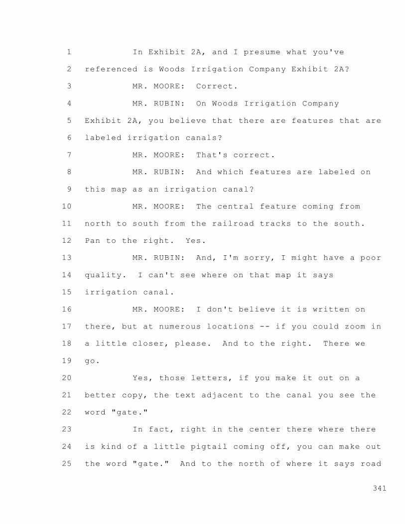
341
In Exhibit 2A, and I presume what you've
referenced is Woods Irrigation Company Exhibit 2A?
MR. MOORE: Correct.
MR. RUBIN: On Woods Irrigation Company
Exhibit 2A, you believe that there are features that are
labeled irrigation canals?
MR. MOORE: That's correct.
MR. RUBIN: And which features are labeled on
this map as an irrigation canal?
MR. MOORE: The central feature coming from
north to south from the railroad tracks to the south.
Pan to the right. Yes.
MR. RUBIN: And, I'm sorry, I might have a poor
quality. I can't see where on that map it says
irrigation canal.
MR. MOORE: I don't believe it is written on
there, but at numerous locations -- if you could zoom in
a little closer, please. And to the right. There we
go.
Yes, those letters, if you make it out on a
better copy, the text adjacent to the canal you see the
word "gate."
In fact, right in the center there where there
is kind of a little pigtail coming off, you can make out
the word "gate." And to the north of where it says road

1
2
3
4
5
6
7
8
9
10
11
12
13
14
15
16
17
18
19
20
21
22
23
24
25
342
there it says "dam."
So at numerous locations along this -- and this
also corresponds with later maps -- you see all the
water indication or canal indications showing --
MR. RUBIN: Okay. Now, the fact that the
feature we're discussing has a label of dam or gate
indicates to you that there's water in that feature?
MR. MOORE: Yes. Yeah, that would be a correct
assumption.
MR. RUBIN: Is it possible that a dam or a gate
exists to regulate drainage water?
MR. MOORE: Well, it regulated water. Which
direction it was going, I'm not aware of on that.
MR. RUBIN: So the fact that there is a
reference of a gate or a dam doesn't necessarily
indicate that water is being used for irrigation; it
could be that water is being drained from lands?
MR. MOORE: Well, that's a possibility.
But also on this there's a very close overlay
with the aerials and all where we can see a natural
slough that corresponds to the location of this feature.
MR. RUBIN: Thank you.
Now, what other map -- is there another map
that you relied upon for your conclusion that features
are labeled as irrigation canals?

1
2
3
4
5
6
7
8
9
10
11
12
13
14
15
16
17
18
19
20
21
22
23
24
25
343
MR. MOORE: On 2B, if you go to the next, which
is the map of the San Joaquin Delta. Again, if we could
zoom in and a little to the right.
Again, this same feature, this was a
combination -- actually, they used the Holt and the
Stockton Quadrangles.
MR. RUBIN: Mr. Moore, let me interrupt you
just to make sure that we adhere to the direction of the
Hearing Officer and not have you repeat your testimony.
My specific question to you is: Where on this
map is there a feature that's labeled irrigation canal?
MR. MOORE: There is no label here. Just the
location corresponds with the 1909 map.
MR. RUBIN: Thank you.
Mr. Moore, is there another map that you relied
upon for your conclusion?
MR. MOORE: Oh, excuse me. If you could go
back to that, please. I overlooked the legend at the
bottom of the map. If you could pan down and to the
right.
There is a legend there that indicated the
canals. Again, unfortunately, the resolution coming
through here is a little bit low, but this is the legend
that indicated it was either a canal or irrigation.
MR. RUBIN: That is my question. I had trouble

1
2
3
4
5
6
7
8
9
10
11
12
13
14
15
16
17
18
19
20
21
22
23
24
25
344
reading this legend as well, but I did not see a part of
the legend that indicated irrigation canal. It might
have indicated canal; is that correct?
MR. MOORE: That's possible. I can't make that
out myself either.
MR. RUBIN: Mr. Moore, was there any other maps
you relied upon to base your conclusion that canals were
used for irrigation as opposed to drainage?
MR. MOORE: Yes. In 2C and 2D, which are both
the U.S. geologic survey maps of the area.
MR. RUBIN: Let's start with 2C. Is 2C a part
of Woods Irrigation Company?
MR. MOORE: Well, this was -- something went
wrong with this photo. This doesn't cover our area.
MR. RUBIN: Then let's focus on 2D. Let me ask
you first, you indicated this map is a 1910 map? Is
that correct?
MR. MOORE: It was surveyed in 1911 and
published in 1913.
MR. RUBIN: And in 1911 when they did the
surveying, they also surveyed for soils; is that your
understanding?
MR. MOORE: No. The soils were done later.
I'm not sure which year. I believe in the '20s, but
they just used that map as a base to map their soils on.

1
2
3
4
5
6
7
8
9
10
11
12
13
14
15
16
17
18
19
20
21
22
23
24
25
345
MR. RUBIN: I'm confused now. The map 2D
you've identified as a 1911 survey map that was
published 1913?
MR. MOORE: Yes. If you pan down to the lower
left corner maybe we could read that.
MR. RUBIN: But you also indicated that this
map reflects soil surveys; is that correct?
MR. MOORE: Yes. Pan to the right and then
zoom in. That shows the date right up -- who has the
pointer?
If you could just zoom on that point right
there and pan down to the legend to the right. There
you can see the date up there, 1913.
MR. RUBIN: But you've also testified, I
believe, that the map reflects soil samples.
MR. MOORE: Later on. Years later, probably 10
or 20 years later, somebody used this map to draw lines
indicating a soil survey.
So right there, like numbers 30 and 60,
somebody later, many years later, drew those lines on
there to identify soil types for that area.
MR. RUBIN: Okay. So the map that we're
looking at, what's been marked Woods Irrigation Company
Exhibit 2D, is not the map that was produced in 1913?
MR. MOORE: No, it is the map that's produced

1
2
3
4
5
6
7
8
9
10
11
12
13
14
15
16
17
18
19
20
21
22
23
24
25
346
in 1913, and somebody added data to it later.
MR. RUBIN: Do you know what else might have
been added after 1913 to Exhibit 2D?
MR. MOORE: I don't know.
MR. RUBIN: Okay. Thank you.
And is there any other map that you relied upon
to base your conclusion that canals were serving for
irrigation purposes as opposed to drainage?
MR. MOORE: Yes. Later on -- not in this
testimony because they came in later. There was a --
MR. RUBIN: If it's not part of your testimony,
I would prefer that you not expand on it because it
would be outside the scope of your testimony.
MR. MOORE: Well, yeah, for this testimony --
MR. HERRICK: Well, just a minute. You asked
him a question, and he can answer if he's looked at
something.
MR. RUBIN: He can answer and then I'll move to
strike it as outside the scope of the testimony before
us.
MR. HERRICK: You can't do that. You asked him
is there any map that you reviewed, and he said yes, and
then you said, well, don't tell me because it was in
some other area.
MR. RUBIN: Well, Mr. Pettit, I'll withdraw my

1
2
3
4
5
6
7
8
9
10
11
12
13
14
15
16
17
18
19
20
21
22
23
24
25
347
question. The logical response here is it's not
responsive to my question.
My question was what maps he reviewed to form
his conclusion that is reflected in his testimony. If
he reviewed something afterwards, that clearly could not
have been the basis of his conclusion because he drew
his conclusion at the time he submitted the testimony.
CO-HEARING OFFICER PETTIT: Yeah, I was going
to ask you to restate the question. Can you answer
that, Mr. Moore?
MR. MOORE: Yes.
(Discussion between counsel and witness)
MR. RUBIN: If Mr. Herrick wants to testify,
he's more than welcome. Otherwise --
MR. HERRICK: I'd love to --
MR. RUBIN: -- it's --
MR. MOORE: What I was referring to --
CO-HEARING OFFICER PETTIT: Wait, wait, wait.
One at a time --
MR. MOORE: In the Mr. Lajoie testimony, he
used a --
CO-HEARING OFFICER PETTIT: Mr. Moore, excuse
me, sir.
The process at the moment is Mr. Rubin is
cross-examining a witness, and so the two people who

1
2
3
4
5
6
7
8
9
10
11
12
13
14
15
16
17
18
19
20
21
22
23
24
25
348
should be talking are Mr. Rubin and the witness.
And anyone else who wishes to talk should be
addressing the Chair first. And I don't want to hear
people talking over each other. Please proceed.
MR. RUBIN: I'll withdraw my question and move
past this.
Mr. Moore, you talked about a feature that I
believe appears on Woods Irrigation Company Exhibit 2E,
and I believe that you referred to it as an oxbow. Do
you recall that testimony?
MR. MOORE: On Duck Slough by the railroad
tracks, that's correct.
MR. RUBIN: Now, it's your belief that the
feature that you've described as an oxbow provides
evidence that a natural waterway existed in the
location?
MR. MOORE: Yes. And if you could zoom in one
more level there, please.
MR. RUBIN: And just yes or no rather than
re-testifying.
MR. MOORE: Yes, the features I see there
clearly indicate there was a stream or a slough and
there was water in it, correct.
MR. RUBIN: And if I understand your testimony
correctly, you believe that that feature existed

1
2
3
4
5
6
7
8
9
10
11
12
13
14
15
16
17
18
19
20
21
22
23
24
25
349
sometime within the last 15,000 years?
MR. MOORE: 15,000 years is a period of
geologic time. That's your recent Holocene time, so it
was within that area. A more recent would be within the
last thousand years, but we know the feature was there
in 1937 and 1940.
MR. RUBIN: Thank you.
MR. MOORE: It goes back at least hundreds of
years if not thousands before that.
MR. RUBIN: Thank you.
And I believe you in response to a question
Mr. Herrick asked said that there was near correlation
between the sources of information that you relied upon;
is that correct?
MR. MOORE: Yes, near to exact when we overlaid
the various maps, the ones we just mentioned -- '14s,
'11s, '9s and so on. When they were rectified and
registered, there was near-perfect correlation with the
riparian features we could identify on the aerial
photographs.
MR. RUBIN: How precise of a correlation do you
believe exists in terms of the location of this
riparian -- or watercourse?
MR. MOORE: They will not be exact, but they
were close. Within feet.

1
2
3
4
5
6
7
8
9
10
11
12
13
14
15
16
17
18
19
20
21
22
23
24
25
350
MR. RUBIN: Between --
MR. MOORE: 20, 30, 50 feet, something like
that.
MR. RUBIN: Okay, thank you.
Now, you also indicated that your conclusions
-- excuse me. You also indicated in response to a
question Mr. Herrick asked that your conclusions that
are reflected in your testimony were based upon the
nonaltered photographs as well as the stereo pairs; is
that correct?
MR. MOORE: Correct. We used the nonaltered
individual photographs and viewed those with the stereo
viewer to make all the final conclusions.
MR. RUBIN: Okay.
I have no further questions.
CO-HEARING OFFICER PETTIT: Thank you,
Mr. Rubin. Mr. O'Laughlin?
--o0o--
CROSS-EXAMINATION BY MR. O'LAUGHLIN
FOR MODESTO IRRIGATION DISTRICT
--o0o--
MR. O'LAUGHLIN: Good morning. Tim O'Laughlin
representing Modesto Irrigation District.
Can you put up 2D please?
Mr. Moore, can you tell me, is this map part of

1
2
3
4
5
6
7
8
9
10
11
12
13
14
15
16
17
18
19
20
21
22
23
24
25
351
a larger map?
MR. MOORE: You're talking the entire map.
That's --
MR. O'LAUGHLIN: Yep.
MR. MOORE: -- a portion.
MR. O'LAUGHLIN: Part of a larger map.
MR. MOORE: It's part of a series of maps that
were done for the area.
MR. O'LAUGHLIN: Is there any reason why you
didn't include in your testimony the area to the west,
the western portion of Roberts Island or the areas on
the south or include Roberts Island as a totality in
this exhibit?
MR. MOORE: The map to the west is the Holt
Quadrangle, and when you go back to that there --
something happened, a computer glitch or something.
But 2C came through incorrectly. It did not
show the entire Holt Quadrangle, but that was used for
the analysis.
MR. O'LAUGHLIN: I'm -- can you tell by looking
at this map what portion of this map is the original
1911 work as opposed to later additions that were added
to it?
MR. MOORE: Most cases, yes, you can. You can
see from the original map legend, and you can identify

1
2
3
4
5
6
7
8
9
10
11
12
13
14
15
16
17
18
19
20
21
22
23
24
25
352
the contours and features.
And then the numerals as mentioned earlier, the
50s and 30s and black lines were added for a soils
survey at a later time.
MR. O'LAUGHLIN: What about the coloring? When
was the coloring added to the map and what -- because
there's no legend down below depicting color, and I was
wondering when that was added and what significance is
that?
MR. MOORE: The color was part of the original
map.
MR. O'LAUGHLIN: Okay. The coloring was?
MR. MOORE: Yes. Except possibly the text
there where it says Reclamation District 524 or
something. That very likely was added later.
But the coloring along the streams and all was
part of the original map.
MR. O'LAUGHLIN: And do you know what the
coloring is supposedly depicting?
MR. MOORE: Well, they're depicting map
features. You would have to go to the legend to see, of
the area. But they're showing contour lines, roads,
streams --
MR. O'LAUGHLIN: No, no, no. You have a
tendency to wander. Look at -- I asked a specific
1
2
3
4
5
6
7
8
9
10
11
12
13
14
15
16
17
18
19
20
21
22
23
24
25
353
question: The coloring of the map. Okay?
So you said it was on the original map. And
I'm -- I have no reason to agree or disagree with that.
My question is: Where is the legend to tell us
what the coloring is?
MR. MOORE: Well, there was a standard. It's
not on this map.
MR. O'LAUGHLIN: Okay. So you --
MR. MOORE: It is not --
MR. O'LAUGHLIN: You have --
MR. MOORE: -- on this map.
MR. O'LAUGHLIN: You have no idea what the
coloring means as far as the legend.
MR. MOORE: It was standard coloring for map
legends. If you went to the USGS, you could get that
information, but they do not print it on each individual
map.
MR. O'LAUGHLIN: Mr. Chairman, it would be
helpful if he would answer just the questions.
The questions are pretty simple, and they
basically call for yes and no responses; and I would
just appreciate a yes-or-no response, and we can move
on. It will make things a lot quicker.
MR. HERRICK: Mr. Chairman, may I? Excuse me.
The problem is the question is argumentative.

1
2
3
4
5
6
7
8
9
10
11
12
13
14
15
16
17
18
19
20
21
22
23
24
25
354
He asked him about the coloring, and then he said it's
on a legend on a different piece. And he said so you
don't know.
Well, that's argumentative. It misstates what
his answer was. We can ask and --
MR. O'LAUGHLIN: Okay.
MR. HERRICK: -- ask and answer simple
questions, and the witness will certainly cooperate.
MR. O'LAUGHLIN: Do you know what the coloring,
the legend coloring, means?
MR. MOORE: The coloring was standard coloring,
magenta coloring for maps that were used -- have been
used up to the present day --
MR. O'LAUGHLIN: Yes. What does it mean? What
does --
MR. MOORE: -- contour lines and --
CO-HEARING OFFICER PETTIT: Mr. Moore, can
you --
MR. O'LAUGHLIN: Just say yes or no: You know
or you don't know.
MR. MOORE: Yes, I know that it means.
MR. O'LAUGHLIN: Okay. What does it mean?
MR. MOORE: The coloring varies for the feature
that's being demonstrated, being displayed.
MR. O'LAUGHLIN: Okay. What -- we have a red

1
2
3
4
5
6
7
8
9
10
11
12
13
14
15
16
17
18
19
20
21
22
23
24
25
355
color. What does that display? What does that mean?
MR. MOORE: Red coloring where?
MR. O'LAUGHLIN: On the map. Or magenta,
whatever you want to call that. What does that --
MR. MOORE: The squiggly magenta lines indicate
the topographic -- elevate the contour lines, the
elevation contour lines.
MR. O'LAUGHLIN: What about the ones along the
river? What do those depict?
MR. MOORE: Those depict the boundary of the
river.
MR. O'LAUGHLIN: Is it a boundary or a levee?
MR. MOORE: I don't know. I'm not looking
at --
MR. O'LAUGHLIN: Well, then you don't --
MR. MOORE: -- the legend.
MR. O'LAUGHLIN: That gets to my point. See?
It's -- he doesn't know the answer.
CO-HEARING OFFICER PETTIT: Mr. Moore, can you
tell what those features mean without having the key map
that USGS produces to describe what the features on
their maps mean?
MR. MOORE: Some of them I can, where the same
features are in use today. And some of them in 1913, I
don't know without looking at a legend.

1
2
3
4
5
6
7
8
9
10
11
12
13
14
15
16
17
18
19
20
21
22
23
24
25
356
CO-HEARING OFFICER PETTIT: I'm not going to
try and help you with your testimony but -- other than
the extent maybe I have -- but I would appreciate it if
you would try and focus in and keep those answers as
narrow as possible.
And I mentioned the key maps because I think
that might clear up that question a little bit, so.
MR. O'LAUGHLIN: All right.
On the map, it appears that there are
horizontal and vertical lines depicted in black. Do you
know -- and they appear to depict roads. Do you know if
those roads were in existence on the original map or if
they were added later?
MR. MOORE: Those were on the original map.
MR. O'LAUGHLIN: Okay. Also depicted in the
lower right-hand corner in dotted red is a notation:
South San Joaquin Irrigation District. Do you know if
that was in existence in 1911 or added later?
MR. MOORE: I don't know that.
MR. O'LAUGHLIN: Okay. Also there appear to be
heavy black lines depicted on the map around the city of
Stockton. Do you know if those were in existence in
1911 or added later?
MR. MOORE: Well, which ones are you talking
about now?
1
2
3
4
5
6
7
8
9
10
11
12
13
14
15
16
17
18
19
20
21
22
23
24
25
357
MR. O'LAUGHLIN: Where basically it's almost a
square around the downtown area of what is noted as
Stockton. Do you know if that was on the original map
or added later?
MR. MOORE: I don't know that.
MR. O'LAUGHLIN: Okay. Do you know -- is the
railroad line depicted on this map going through Roberts
Island?
MR. MOORE: What was that -- say again?
MR. O'LAUGHLIN: Do you know if the railroad is
depicted on this map going through Roberts Island?
MR. MOORE: Yes, it is depicted on this map.
MR. O'LAUGHLIN: Do you have in your possession
the original series of USGS survey maps that were done
for 1911, the originals?
MR. MOORE: Not -- this was as close to the
original as I have is this map here. I don't have an
original, nonaltered copy from USGS, no, I do not have
that.
MR. O'LAUGHLIN: Who did you get this from?
How did you obtain it?
MR. MOORE: That was supplied from Mr.
Nomellini.
MR. O'LAUGHLIN: Do you know where
Mr. Nomellini got it?

1
2
3
4
5
6
7
8
9
10
11
12
13
14
15
16
17
18
19
20
21
22
23
24
25
358
MR. MOORE: No, I don't.
MR. O'LAUGHLIN: I'm assuming then -- one last
question. I'm assuming since you don't have the
original 1911 map that you've never reviewed the
original 1911 map.
MR. MOORE: No.
MR. O'LAUGHLIN: Okay. No, you have not
reviewed the 1911 map, the original?
MR. MOORE: Not an original nonaltered copy
from the USGS. No, I did not.
MR. O'LAUGHLIN: Oh, I'm sorry. Like most
lawyers, I don't tell the truth.
I thought earlier in our -- in your
cross-examination that you had not reviewed the 1937
photos for cropping patterns; is that correct?
The 1937 photos you had not reviewed for
cropping patterns?
MR. MOORE: Cropping patterns? You're talking
about agricultural crops?
MR. O'LAUGHLIN: Yeah. What crops were grown
on those?
MR. MOORE: No, I did not do that.
MR. O'LAUGHLIN: Okay. Do you have any
expertise in the area of looking at aerial photos and
denoting what kind of crops are being grown at what

1
2
3
4
5
6
7
8
9
10
11
12
13
14
15
16
17
18
19
20
21
22
23
24
25
359
time?
MR. MOORE: No.
MR. O'LAUGHLIN: Thank you.
I have no further questions. Thank you.
CO-HEARING OFFICER PETTIT: Mr. Powell, any?
MR. POWELL: No.
CO-HEARING OFFICER PETTIT: Thank you.
Mr. Ruiz?
MR. RUIZ: Nothing, Mr. Pettit.
MS. GILLICK: No questions.
CO-HEARING OFFICER PETTIT: Thank you. Both of
you.
CO-HEARING OFFICER PETTIT: We're going to take
about a 15-minute break.
(Recess)
CO-HEARING OFFICER PETTIT: Mr. Herrick, are
you ready to go with Mr. Neudeck? I was just reminded
that you changed the order.
MR. HERRICK: Yes. Mr. Nomellini had a
conflict later today. I was going to see if we could
get him on. He's supposed to be somewhere this
afternoon.
I appreciate the Board's indulgence. I didn't
mean to not move Mr. Moore's evidence into -- his
testimony into evidence. We can do that at the end or

1
2
3
4
5
6
7
8
9
10
11
12
13
14
15
16
17
18
19
20
21
22
23
24
25
360
now, up to the Board.
CO-HEARING OFFICER PETTIT: Let's go ahead with
Mr. Nomellini, and we can -- I was aware you hadn't
moved it. We can deal with it at any time along here.
--o0o--
DANTE JOHN NOMELLINI
Called by WOODS IRRIGATION COMPANY
DIRECT EXAMINATION BY MR. HERRICK
--o0o--
MR. HERRICK: Mr. Nomellini, you have before
you WIC Exhibit 7 which is a statement of
qualifications; is that correct?
MR. NOMELLINI: Yes.
MR. HERRICK: Is that a true and correct
statement of your qualifications?
MR. NOMELLINI: It is.
MR. HERRICK: And you also have in front of you
Exhibit WIC 8. Do you have that?
MR. NOMELLINI: Yes.
MR. HERRICK: And that is your testimony for
this proceeding?
MR. NOMELLINI: Yes, it is.
MR. HERRICK: And subject to any changes or
corrections you may make, that is a true and correct
copy of your testimony here; is that right?

1
2
3
4
5
6
7
8
9
10
11
12
13
14
15
16
17
18
19
20
21
22
23
24
25
361
MR. NOMELLINI: Yes.
MR. HERRICK: Would you please summarize your
testimony?
MR. NOMELLINI: First of all, I've got a lot of
experience in this area, both as a farmer and as a
lawyer. And I've done some engineering as well.
I've represented adjoining reclamation
districts for many years. I'm familiar with the Woods
Irrigation area and their system.
And my particular farming individually was just
to the west of this location, and I have had interest
through family farming entities that were spread
throughout the Delta area.
The first part of my testimony I'd like to
emphasize is that I believe that the current
investigation associated with the Cease and Desist
Orders is wrongfully focused solely on a stream approach
to the Delta that would be applicable farther up in the
watershed, and I think the Delta is both a combination
of stream flows as well as a pool of water akin to a
lake for which riparian rights would attach.
The Delta pool itself has been recognized,
although not with legal certainty, in the previous water
right investigations both by the State and by the Bureau
of Reclamation, and I've made reference to those in my

1
2
3
4
5
6
7
8
9
10
11
12
13
14
15
16
17
18
19
20
21
22
23
24
25
362
testimony.
If I could put up on the screen -- I tried to
pick a couple of elements out of the references, and
I've added one.
If you could go to WIC 8M. It's not on the
list. It's in the thumb drive. And this I -- I
informed counsel for the other side that I put this in.
This wasn't part of my original testimony.
It's a map of the Delta lowland, simply out of
the Delta atlas.
CHIEF LINDSAY: What page please? What page in
your presentation?
MR. HERRICK: What page.
MR. NOMELLINI: It's not in the presentation.
It's in the thumb drive I gave you.
CHIEF LINDSAY: That's what I'm showing right
now.
MR. NOMELLINI: Okay. Keep going. It's about
the fourth page from the end.
CHIEF LINDSAY: From the end.
MR. NOMELINI: There it is.
MR. HERRICK: Maybe 29.
MR. NOMELLINI: I gave it an 8M.
CHIEF LINDSAY: It's your presentation. You're
going to have to tell me where it is.

1
2
3
4
5
6
7
8
9
10
11
12
13
14
15
16
17
18
19
20
21
22
23
24
25
363
MR. NOMELINI: Keep going.
CHIEF LINDSAY: Which way.
MR. NOMELINI: Down. Not there? All right.
Anyway.
MR. HERRICK: Wait, wait. 26.
MR. NOMELINI: There you go.
This is simply from the Delta atlas. I would
ask that the Board take judicial notice of it.
It simply depicts the area of Delta lowlands
that was assumed for the purpose of those water right
investigations as being riparian.
And I think that that isn't conclusive in any
way on this Board's determination, of course, but it's
an indication that others have seen and recognized the
Delta pool as requiring a more unique examination.
First of all, these lands that we're dealing
with in Woods are all swamp and overflow lands, so they
were granted by the federal government to the State of
California pursuant to the Arkansas Act of 1950.
And as such, the state undertook the obligation
to reclaim these lands and make them productive.
And when you levee off these lands and drain
them, you then, in order to make them productive, have
to be managing your water and irrigation, I would submit
was a significant part of that plan and those features.

1
2
3
4
5
6
7
8
9
10
11
12
13
14
15
16
17
18
19
20
21
22
23
24
25
364
So any implication that would come from an
assumption that a transfer of land in the Delta lowland
areas or swamp and overflow lands should be assumed to
sever the water right I think runs against the policy of
the State, and in particular against the obligation of
the State to carry out in good faith the reclamation of
swamp and overflow lands pursuant to the grant from the
federal government.
So setting that aside for the moment, I would
like to -- let's go back and go to the study -- let's go
to the -- one of the first slides. All right.
Focussing in on this, irrigation in the Delta
in the swamp and overflow lands involved a combination
use of sloughs, drains, and irrigation facilities.
Just because this is designated a drain doesn't
mean it wasn't used for irrigation.
My experience as a farm worker was irrigating
lands on Venice Island where we, during the irrigation
season, would close the drainage pumps off, and we would
bring the water up for subirrigation and we would block
what we call the 4 foot ditches and trap the water in
these drains during the irrigation season.
After the irrigation season, we would open that
system up so that we could get the drainage.
So the dual purpose of sloughs, canals,

1
2
3
4
5
6
7
8
9
10
11
12
13
14
15
16
17
18
19
20
21
22
23
24
25
365
irrigation, and drainage still exists today. As
reported on the -- this is an excerpt from the
Settlement Geography of the -- well, this is San Joaquin
County, excuse me, Thompson, History of the Delta 1879.
This was written in 1879. And it says:
The numerous creeks or sloughs running
from the main rivers into the interior,
though necessitating extensive treatment
to dam them effectively at or near their
outlets are admittedly beneficial
features of the land, constituting as
they do main arteries for drainage,
irrigation and navigation. And in the
early days, of course, some of these
features were left open and not dammed
because navigational access was critical
before the roads were built, the bridges,
and ferries.
So I think the multiple purpose in the early
days of these features has to be recognized. And this
of course I think, because it's an 1879 publication, is
deserving of historical credibility on that subject.
Then they say:
Ingeniously contrived tidal gates as an
adjunct to the dams regulate and control

1
2
3
4
5
6
7
8
9
10
11
12
13
14
15
16
17
18
19
20
21
22
23
24
25
366
the egress and ingress of water from or
to the lands according as draining or
irrigation is temporarily desired.
So my experience, and of course my experience
with regard to that practice on Venice Island, involved
highly organic soils.
Now these areas in the Woods Irrigation Company
area probably had less organic soil than on Venice
Island. And there was a period of time when there was
organic soil in these areas.
Let's go to the next slide.
All right. This is from the Settlement
Geography of the Delta. They talk about the history of
irrigating in the Delta. Basically what it tells us is
that irrigation really started mostly after 1870.
And they talk about:
Flood irrigation had been tried on small
grain by 1871 but was given up because of
excessive weed growth. . . . For other
crops, land soaking before planting or
flood irrigation were practices in use
during the 1870s.
And importantly, subirrigation which is still a
part of the organic soil irrigation practice, was a
major factor in the early days.

1
2
3
4
5
6
7
8
9
10
11
12
13
14
15
16
17
18
19
20
21
22
23
24
25
367
So people were working with the features of the
land and kind of going with it. Along these various
historic sloughs, there were alluvial deposits which
were heavier soils. And they talk about in the history,
Settlement Geography of the Delta, it says:
Water delivery systems independent of
drainage ditches were in use by the
latter 1870s. These systems were
maintained by the farmer, only the
drainage system being the responsibility
of the reclamation districts. Water
wheels, windmills, and low-head pumps
were used on the higher alluvial banks.
So along these higher soils where the natural
levees were deposited by the flow of water from the
upstream areas, those areas were the areas that were
first irrigated with pumps.
So starting in the 1870s, they were utilizing
pumps. This would be in combination with the drains and
the irrigation facilities, dams and gates. There's
blockages even today. And drainage systems to allow the
water to come up so people could pump it out or else
bring it up for subirrigation.
So they were used interchangeably over the
years. Let's go to the next slide.
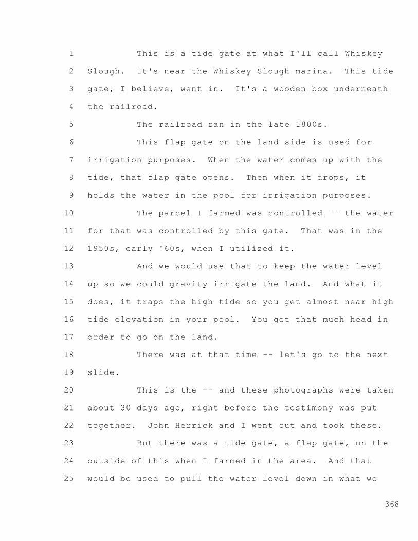
1
2
3
4
5
6
7
8
9
10
11
12
13
14
15
16
17
18
19
20
21
22
23
24
25
368
This is a tide gate at what I'll call Whiskey
Slough. It's near the Whiskey Slough marina. This tide
gate, I believe, went in. It's a wooden box underneath
the railroad.
The railroad ran in the late 1800s.
This flap gate on the land side is used for
irrigation purposes. When the water comes up with the
tide, that flap gate opens. Then when it drops, it
holds the water in the pool for irrigation purposes.
The parcel I farmed was controlled -- the water
for that was controlled by this gate. That was in the
1950s, early '60s, when I utilized it.
And we would use that to keep the water level
up so we could gravity irrigate the land. And what it
does, it traps the high tide so you get almost near high
tide elevation in your pool. You get that much head in
order to go on the land.
There was at that time -- let's go to the next
slide.
This is the -- and these photographs were taken
about 30 days ago, right before the testimony was put
together. John Herrick and I went out and took these.
But there was a tide gate, a flap gate, on the
outside of this when I farmed in the area. And that
would be used to pull the water level down in what we

1
2
3
4
5
6
7
8
9
10
11
12
13
14
15
16
17
18
19
20
21
22
23
24
25
369
call Whiskey Slough or Trapper Slough, the portion
that's to the south of this. And that would let water
out. And then when the tide came in, it would come in
so we could artificially keep the water level low.
This I believe is typical of many of the tide
gate structures that were involved including those at
Woods, and I have some photographs of those.
Now, other mechanisms involved screw gates
rather than the flap gate. So you fill the channel up,
close the gate, you know, before the tide drops, then
irrigate out of it, and then manually operate the gate
rather than just have the flap.
Let's go to the next slide.
This is a gate that's in place today at Middle
River and Trapper Slough. It's a screw gate. It's used
just as they would have used it historically, only they
do it manually rather than with an articulating flap or
gate.
Let's go to the next photo.
That's the other side of it. There is a flap
gate on that. And so this flap gate also helps trap the
higher water in there because the water can't go out --
that's a metal flap gate, a more modern one.
Next exhibit.
This is a control structure at the Woods
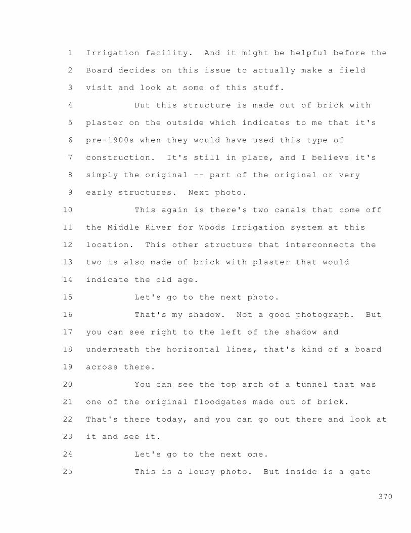
1
2
3
4
5
6
7
8
9
10
11
12
13
14
15
16
17
18
19
20
21
22
23
24
25
370
Irrigation facility. And it might be helpful before the
Board decides on this issue to actually make a field
visit and look at some of this stuff.
But this structure is made out of brick with
plaster on the outside which indicates to me that it's
pre-1900s when they would have used this type of
construction. It's still in place, and I believe it's
simply the original -- part of the original or very
early structures. Next photo.
This again is there's two canals that come off
the Middle River for Woods Irrigation system at this
location. This other structure that interconnects the
two is also made of brick with plaster that would
indicate the old age.
Let's go to the next photo.
That's my shadow. Not a good photograph. But
you can see right to the left of the shadow and
underneath the horizontal lines, that's kind of a board
across there.
You can see the top arch of a tunnel that was
one of the original floodgates made out of brick.
That's there today, and you can go out there and look at
it and see it.
Let's go to the next one.
This is a lousy photo. But inside is a gate

1
2
3
4
5
6
7
8
9
10
11
12
13
14
15
16
17
18
19
20
21
22
23
24
25
371
that's still operated on that tunnel on the water side.
And you can -- again, a visit to the field would give
you a better idea.
Let's go to the next one.
This is just to the south of that previous
tunnel. The tunnel that's here is buried in the dirt,
as I understand it. It was filled in. And therefore,
it no longer operates as a tide gate, and these pumps
are the sole operating mechanism for moving water into
this side of the facility.
Thank you for that. I'm sorry. This is WIC
Exhibit 8I, photo 11.
(Discussion between counsel and witness)
MR. NOMELLINI: Thank you for that admonition.
Do we want to go back through those, Mr.
Pettit, and I'll just identify quickly?
CO-HEARING OFFICER PETTIT: Why don't we do it
quickly just so it's clear in the transcript.
MR. NOMELINI: Let's go back in the photos at
least.
CO-HEARING OFFICER PETTIT: Apologize for not
catching that earlier.
MR. NOMELINI: I apologize as well. I'm sorry.
Photo 1 is an attachment to my testimony. It's
the flap gate at Whiskey Slough or near Whiskey Slough

1
2
3
4
5
6
7
8
9
10
11
12
13
14
15
16
17
18
19
20
21
22
23
24
25
372
Harbor that goes -- a wooden box going underneath the
railroad.
All right. Next.
This is the water side of that same flap gate
and this is photo 2.
Photo 3 is the screw gate at Trapper Slough and
Middle River.
Next.
Photo 4 is the inland side or the Trapper
Slough side of that same floodgate, and it has a flap
gate on it made out of metal. That's photo 4.
WIC Exhibit 8I, photo 7, is the control
structure on the most westerly or northerly canal of
Woods Irrigation Company at Middle River, and it has the
brick with the plaster construction.
Next.
WIC Exhibit 8I, photo 8, shows a control
structure connecting the -- call it the east and west
canals at Woods Irrigation Company. And again, that
shows the brick and plaster.
Next.
This is the westerly floodgate at Woods. It's
a tunnel. You can see the brick. This is WIC Exhibit
8I, photo 9. You can see the brick arch at the top of
the tunnel.
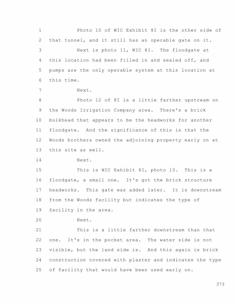
1
2
3
4
5
6
7
8
9
10
11
12
13
14
15
16
17
18
19
20
21
22
23
24
25
373
Photo 10 of WIC Exhibit 8I is the other side of
that tunnel, and it still has an operable gate on it.
Next is photo 11, WIC 8I. The floodgate at
this location had been filled in and sealed off, and
pumps are the only operable system at this location at
this time.
Next.
Photo 12 of 8I is a little farther upstream on
the Woods Irrigation Company area. There's a brick
bulkhead that appears to be the headworks for another
floodgate. And the significance of this is that the
Woods brothers owned the adjoining property early on at
this site as well.
Next.
This is WIC Exhibit 8I, photo 13. This is a
floodgate, a small one. It's got the brick structure
headworks. This gate was added later. It is downstream
from the Woods facility but indicates the type of
facility in the area.
Next.
This is a little farther downstream than that
one. It's in the pocket area. The water side is not
visible, but the land side is. And this again is brick
construction covered with plaster and indicates the type
of facility that would have been used early on.

1
2
3
4
5
6
7
8
9
10
11
12
13
14
15
16
17
18
19
20
21
22
23
24
25
374
Next photo.
CHIEF LINDSAY: This one was 8I, photo 14.
MR. NOMELLINI: Yes, thank you for that. 8I,
photo 14.
This is 8I, photo 15. This is at the westerly
edge of the pocket area. And up in the upper -- this is
photo 15 of 8I. Up in the upper left-hand corner is a
pipe going through headworks that's no longer in use.
There is farther to the west a currently used
pump station, so we're looking at generations of
irrigation facilities at this location.
But right here is a remnant of a major sized
floodgate. It can be viewed in the field, it has not
been excavated, but it can be for examination.
And again, this is typical of the facilities in
the area, and this could have been used as well in
service of the lands in the Woods Irrigation District
area.
All right. Let's go to the next slide.
This is a -- this is WIC 8I, photo 16. This is
a Woods Irrigation facility -- Irrigation Company
facility that is westerly of the two main facilities,
and this location could very well have had a floodgate.
It's a -- you can see there's two generations
of pump stations here. And it's likely there was a

1
2
3
4
5
6
7
8
9
10
11
12
13
14
15
16
17
18
19
20
21
22
23
24
25
375
floodgate at this location, although there is no visible
brick head wall or anything like that. It just -- I
think it's likely that there's one buried in here
someplace.
Next photo.
This is the lower Roberts Island which is to
the north of Middle Roberts and the area of Woods
Irrigation Company. And this is a 1927 map, and there
are 30 floodgates on this map.
I simply show you that as to indicate the
general practice in the area was to use these floodgates
for irrigation and drainage.
Is there a problem?
CHIEF LINDSAY: What exhibit number is this?
MR. NOMELINI: It's an attachment to my
testimony, so it's exhibit number -- it should be 8, so
it's in WIC Exhibit 8, simply an attachment to my
testimony.
CHIEF LINDSAY: You started off describing this
as a photo, so I just wanted to be clear.
MR. NOMELINI: All right. Okay. Let's go to
the next slide.
There have been various examinations of the
Delta and what the sources of water that feed the Delta
lands. And in my opinion, the Delta lowlands cannot be

1
2
3
4
5
6
7
8
9
10
11
12
13
14
15
16
17
18
19
20
21
22
23
24
25
376
physically severed from the water in the channels
because of the interconnection of the flow of water
which both from seepage and deep-seated waters that come
up in the particular area, and I think that's been
pretty well demonstrated in a lot of the studies.
This is from a DWR report number 4, Quantity
and Quality of Waters Applied to and Drained From the
Delta Lowlands. It was done in 1956.
Let's go to the next slide.
When Lower Jones Tract -- well, really -- yeah.
Photo 5 is an attachment to my WIC Exhibit 8.
When Jones Tract -- Upper Jones actually
suffered the levee break. It flooded in 2004. The mere
fact that the Jones Tract's areas were flooded caused
seepage to go into the adjoining area that was not
otherwise in that area due to the river flow.
So the interconnection of all these flows and
interrelationship of the Delta pool to the Delta lands
is absolutely clear; and if we go ahead and attempt to
discontinue irrigation of the lands which includes
cultivation to keep the vegetation down, drainage, the
Delta will actually revert either to a water body or to
a tule swamp again, and the water use will be much
greater than what's used by agriculture.
Let's go to the next slide.

1
2
3
4
5
6
7
8
9
10
11
12
13
14
15
16
17
18
19
20
21
22
23
24
25
377
This is the same kind of problem. When Lower
Jones had water in it in 2004, this was water that
flooded the fields on McDonald Island. That's photo 6
to attachment -- to my WIC 8.
Next photo, or next slide.
This again is from WIC 8F, page 2. There's a
significant lateral movement of water through the soil
onto the islands which causes the high water table.
This has been pretty well demonstrated in all
the studies, and I've attached those studies. I mean
they are exhibits in our testimony, and I reference it
here in WIC 8F on page 2.
This is related to the -- there was a water
transfer by Delta Wetlands to the Metropolitan Water
District of Southern California. And in connection with
that transfer, there was an examination of what amount
of water can be saved by fallowing the land, and the
State Board was involved in this.
And as I understand it, they went through and
did a comprehensive study and concluded that in that
particular case for the water transfer that if they keep
the land well-disced, free of weeds, keep the drainage
water down, that it would have a net savings about 8/10
of an acre foot per acre, far below what we would
normally think could be a savings.
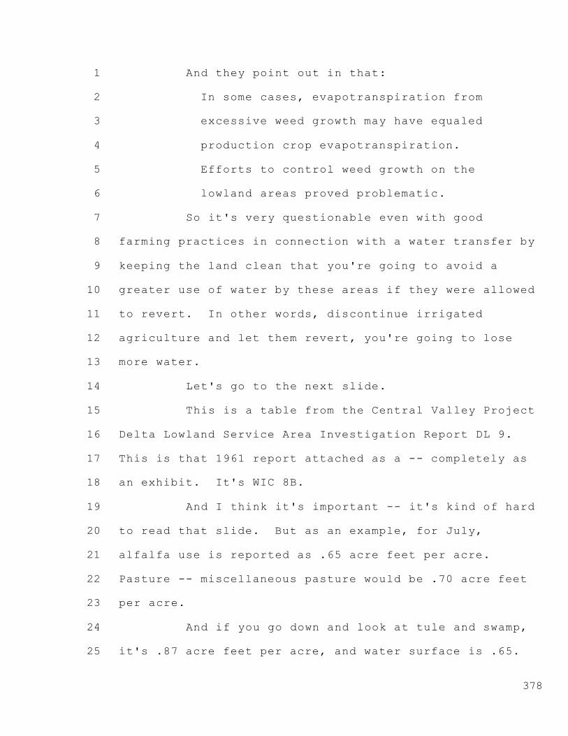
1
2
3
4
5
6
7
8
9
10
11
12
13
14
15
16
17
18
19
20
21
22
23
24
25
378
And they point out in that:
In some cases, evapotranspiration from
excessive weed growth may have equaled
production crop evapotranspiration.
Efforts to control weed growth on the
lowland areas proved problematic.
So it's very questionable even with good
farming practices in connection with a water transfer by
keeping the land clean that you're going to avoid a
greater use of water by these areas if they were allowed
to revert. In other words, discontinue irrigated
agriculture and let them revert, you're going to lose
more water.
Let's go to the next slide.
This is a table from the Central Valley Project
Delta Lowland Service Area Investigation Report DL 9.
This is that 1961 report attached as a -- completely as
an exhibit. It's WIC 8B.
And I think it's important -- it's kind of hard
to read that slide. But as an example, for July,
alfalfa use is reported as .65 acre feet per acre.
Pasture -- miscellaneous pasture would be .70 acre feet
per acre.
And if you go down and look at tule and swamp,
it's .87 acre feet per acre, and water surface is .65.

1
2
3
4
5
6
7
8
9
10
11
12
13
14
15
16
17
18
19
20
21
22
23
24
25
379
So the idea that allowing this area to revert
away from irrigated agriculture -- and of course,
everything isn't just alfalfa or pasture. There are
other crops as well.
The rule of thumb that I'm aware of over the
years is that agriculture in the Delta saves about 2
acre feet per acre on average for the Delta as a whole.
That's because the various crops involve cultivation of
land where many times for many days it's dry.
It doesn't have any vegetation on it, it's in a
cultivated condition, and therefore it doesn't suffer
from the evapotranspiration that you would have from a
water body or a vegetated area.
All right. Next slide.
This is another -- this is WIC 8E, page 28.
This is an additional table.
You'll find that the comparable information on
evapotranspiration rates doesn't vary, very much. On
this one it still has -- if you look at alfalfa, you end
up -- and this is in inches. So inches per acre instead
of acre feet per acre.
But you can see that the 6.4 can be compared to
like riparian vegetation, 7.9. Water surface was at
another 7.9.
So in any event, I think the evidence is clear

1
2
3
4
5
6
7
8
9
10
11
12
13
14
15
16
17
18
19
20
21
22
23
24
25
380
that the Delta, in a nonreclaimed state or nonfarmed --
and we need to farm in order to maintain the levees and
the drainage. There's no reason to keep them drained if
we're not going to keep productive agriculture going.
So to an area like an upstream area or even a
downstream area, putting the Delta irrigators out of
commission is going to cost more water than they're
using now.
CO-HEARING OFFICER PETTIT: Mr. Herrick, we've
gone somewhat over the 20 minutes that we targeted
for --
MR. NOMELLINI: Okay.
CO-HEARING OFFICER PETTIT: -- the summary of
the direct testimony.
MR. NOMELINI: I'll wrap up very briefly then.
CO-HEARING OFFICER PETTIT: I realize we caused
you to back up there for a while too. Are we close to
the end?
MR. HERRICK: Yes. If we could just have a few
more minutes. Because of the number of witnesses and
we're breaking them up and everything, we are going to
take more than our allotted time. I appreciate the
consideration of the Board.
CO-HEARING OFFICER PETTIT: Thank you.
MR. NOMELINI: Also in my testimony, I've

1
2
3
4
5
6
7
8
9
10
11
12
13
14
15
16
17
18
19
20
21
22
23
24
25
381
looked at the -- there's a biography of both of the
Woods brothers, and I've attached it.
They were two brothers John Newton Woods and
E.W.S. Woods who they called Smithy. He had a pretty
long name, and I'm not sure I can pronounce his first
name properly. Like Erensweigel -- Ezekiel.
Anyway, Smithy is the way I'd like to refer to
him if the Chair would allow it.
The two brothers amassed a significant area in
the Delta that is now the Woods Irrigation Company area.
And the -- let's go to the next slide. I think I have
it on there. Let's go a little farther. Next.
Let's go next.
Next one.
Maybe I don't have it on there.
Anyway, what they did prior to the 1900s, they
put together their farming acreage, was reported to be
as much as 12,000 acres and is generally thought in the
more -- in the 1900s, early 1900s, to be about 8700
acres.
But they were farmers, and they had this
operation. They were flooded out in 1893 when the levee
broke near Burns Cutoff. They managed to get their
crops out.
But these people were farming this land. And

1
2
3
4
5
6
7
8
9
10
11
12
13
14
15
16
17
18
19
20
21
22
23
24
25
382
in order to farm it -- there's an indication that in the
1914s they had large amounts of alfalfa in these
areas -- they were irrigating.
Irrigation, as I indicated earlier, started in
about 1870. And in the history Settlement Geography of
the Delta it's explained that they started off with
windmills and water wheels, things of that type. But
there were also steam-driven pumps, gasoline-driven
pumps.
And electricity came in in the early 1900s. So
they go to electric pumps in 1900, 1906 range, something
like that, to 1911.
So the irrigation practices involved pumping to
a great extent in the area.
The Woods brothers were operating together.
They had all this extensive irrigation system in place.
And then John Newton Woods died in 1909, and his
daughters, Douglass and Wilhoit, were the heirs.
So in order to -- they weren't farmers. They
wanted to subdivide. And in order to accommodate the
irrigation through these joint facilities that would now
be serving, there was a partition of the Woods property,
the Woods brothers properties.
The westerly part went to Smithy. The easterly
part went to the heirs of John Newton Woods.

1
2
3
4
5
6
7
8
9
10
11
12
13
14
15
16
17
18
19
20
21
22
23
24
25
383
So they had to have a mechanism in order to
operate the system which was to operate to serve water
to 40-acre parcels. This was because the girls wanted
to sell off the land. They created the Woods Irrigation
Company in order to operate that.
If you look at the documents that we have in
there, there's a decree of distribution for the Woods
estate, John Newton Woods, that explains how they
divided that up.
There's farm equipment in there, including
alfalfa-type equipment. And it's clear to me that these
operations or these systems were operated prior to 1914,
prior to 1911, and even prior to 1909. I think it's
clear from the record.
So I think with that -- let me just check my
notes to see if I want to bring up any other point to
emphasize out of my testimony.
I think that's it.
There's also data in here, studies that were
made that during the irrigation season the Delta
accumulates salt. And Walt, you may -- I mean
Mr. Chairman, you may know that from your past history
those studies that show there's an improvement of water
quality in the Delta from the drainage because the salt
is stored in the land during the irrigation.

1
2
3
4
5
6
7
8
9
10
11
12
13
14
15
16
17
18
19
20
21
22
23
24
25
384
That salt, of course, comes out in the winter
like in January and February when we get the winter
rains on top of it.
So irrigation in the Delta, keeping these
people irrigated, should not be subject to some kind of
assumption or presumption that somebody transferring the
land would want to sever the water from the land.
The presumption should be the other way,
because of the swamp and overflow grant and the
necessity of having the adjoining lands contribute their
fair share from productivity towards the maintenance of
levees and drains. Otherwise, we're going to use more
water.
Thank you very much.
CO-HEARING OFFICER PETTIT: Thank you, Mr.
Nomellini.
Mr. Rose, any cross?
MR. ROSE: We have no cross-examination of
Mr. Nomellini.
CO-HEARING OFFICER PETTIT: Thank you.
--o0o--
CROSS-EXAMINATION BY MS. KINCAID
FOR SAN LUIS & DELTA-MENDOTA WATER AUTHORITY
--o0o--
MS. KINCAID: Good morning, Mr. Nomellini.

1
2
3
4
5
6
7
8
9
10
11
12
13
14
15
16
17
18
19
20
21
22
23
24
25
385
Valerie Kincaid for San Luis & Delta-Mendota Water
Authority.
Mr. Nomellini, did you take the oath in this
hearing?
MR. NOMELLINI: Yes, I did.
MS. KINCAID: Great.
MR. NOMELLINI: I'll take it again. I swear to
tell the truth, and I've been telling the truth.
MS. KINCAID: That's okay. I just want to make
sure the record's clear. Thank you.
Mr. Nomellini, in the second paragraph on page
1 of your written testimony, marked as Exhibit Woods
Irrigation Company 8?
MR. NOMELLINI: Yes.
MS. KINCAID: You discuss your Delta pool
theory. Is that correct?
MR. NOMELLINI: Yes.
MS. KINCAID: And have you previously presented
this theory to the State Water Board?
MR. NOMELLINI: Not in this form, no.
MS. KINCAID: Not in this form?
MR. NOMELLINI: Not in this form. Not this
particular argument. At least that I recall.
MS. KINCAID: Do you recall -- one second.
Do you recall submitting a closing brief in the

1
2
3
4
5
6
7
8
9
10
11
12
13
14
15
16
17
18
19
20
21
22
23
24
25
386
Phelps matter for the South Delta Water Agency?
MR. NOMELLINI: I participated. I don't recall
all the detail. But our firm was involved in the action
on behalf, I believe, of the Central Delta Water Agency.
But we were involved.
MS. KINCAID: And do you recall putting forth
the argument perhaps with the heading that the subject
of Term 91 is unfair due to the Delta pool theory?
MR. NOMELLINI: Absolutely.
MS. KINCAID: And do you recall whether the
State Water Board accepted that theory?
MR. NOMELLINI: The Board did not.
MS. KINCAID: Okay. Great.
MR. NOMELLINI: You want me to --
MS. KINCAID: No, that's fine. Thanks for your
answer.
MR. NOMELLINI: Okay.
MS. KINCAID: Earlier in your oral testimony
today, you testified that there was a time when organic
soils existed in these areas. Do you recall that
testimony?
MR. NOMELLINI: Yes.
MS. KINCAID: And when you referenced these
areas, do you mean lands within Roberts Island?
MR. NOMELLINI: Yes. Parts of it, yeah.

1
2
3
4
5
6
7
8
9
10
11
12
13
14
15
16
17
18
19
20
21
22
23
24
25
387
MS. KINCAID: Parts of it. And can you
identify which parts?
MR. NOMELLINI: Well, I think so.
I think if you look at the maps that show the
alluvial deposits from the streams, those would be areas
that would have less organics.
And as you get away from those alluvial
deposits, those would have been the tule marshes that
would have had the organic soils that have since
oxidized and vanished.
MS. KINCAID: Okay. In the last paragraph of
your written testimony, Woods Irrigation Company
Exhibit 8, on the last paragraph on page 2, you express
your opinion that if left fallow the Woods Irrigation
Company service area would become tule and swamplands.
Is that correct?
MR. NOMELLINI: That's my opinion, yes.
MS. KINCAID: And in fact, you testified today
that you believe that the tules would consume more water
than currently used to irrigate crops?
MR. NOMELLINI: Correct.
MS. KINCAID: Under California water law, can a
person lawfully divert water without a right simply
because the diversion does not injure other water users?
MR. NOMELLINI: No. Not simply for that
1
2
3
4
5
6
7
8
9
10
11
12
13
14
15
16
17
18
19
20
21
22
23
24
25
388
reason, no.
MS. KINCAID: And under California water law,
can a person lawfully divert water without a right
simply because a person's diversion benefits other water
users?
MR. NOMELLINI: No. I believe you need a right
to divert.
MS. KINCAID: Great. Thank you.
Mr. Nomellini, do you believe Duck Slough is a
natural watercourse?
MR. NOMELLINI: Yes.
MS. KINCAID: And is it correct that you
believe Duck Slough existed on Roberts Island?
MR. NOMELLINI: Yes.
MS. KINCAID: And is it your belief that Duck
Slough ran from Middle River to Burns Cutoff?
MR. NOMELLINI: If you want to call it Duck
Slough, yes. I know the references are different. Some
places, it's like High Ridge Levee.
But it's my opinion that the serpentine path
that the term High Ridge Levee and Duck Slough have been
applied to was a natural slough. And I'm willing to
call it Duck Slough.
MS. KINCAID: Okay. Great.
On page 3 of your testimony, Woods Irrigation
1
2
3
4
5
6
7
8
9
10
11
12
13
14
15
16
17
18
19
20
21
22
23
24
25
389
Company Exhibit 8, you discuss reclamation features of
the Delta. And in that discussion, you cite the
Settlement Geography of the Sacramento and San Joaquin
Delta which is your Exhibit 8D; is that correct?
MR. NOMELLINI: Correct.
MS. KINCAID: And do you believe Exhibit 8D is
a document upon which the State Water Board can rely?
MR. NOMELLINI: Yeah. I think it has -- I mean
it's not perfect in all respects, but I think it is
valuable evidence to take into consideration.
MS. KINCAID: Okay. And Mr. Nomellini, I'm
going to hand you map 13 from your Exhibit 8D, the
Settlement Geography of the Sacramento and San Joaquin
Delta, and it appears on page 91.
Thank you, Mr. Rubin.
Can you tell me if this map portrays Duck
Slough?
MR. NOMELLINI: I think it does.
MS. KINCAID: And in map 13 of your Woods
Irrigation Company Exhibit 8D, does the line that you
believe depicts Duck Slough connect to Middle River?
MR. NOMELLINI: In this map, they do not.
MS. KINCAID: Thank you.
CHIEF LINDSAY: I'm sorry. I didn't see any
maps in Exhibit 8D.

1
2
3
4
5
6
7
8
9
10
11
12
13
14
15
16
17
18
19
20
21
22
23
24
25
390
MS. KINCAID: Just for the record, 8D is an
excerpt. I believe Mr. Nomellini included only portions
thereof. It was submitted in the Pak and Mussi matter.
MR. NOMELINI: Refer to the page number,
perhaps?
MS. KINCAID: It's page 91. And I'm unsure of
the exact number in the Pak and Mussi matter, but I
believe it was submitted in its entirety.
And Mr. Lindsay, I'd be more than happy to
provide you with this map if you want to scan it in.
CHIEF LINDSAY: Okay. We'll take it --
MS. KINCAID: I'm not sure we have that
capability.
CHIEF LINDSAY: It's up to the Hearing Officer.
I just point out that I can't find that for you, so I'm
curious if the Hearing Officer wants that.
MS. KINCAID: Okay. We can make copies, and we
can mark it as an exhibit if that's the easiest way to
go about it.
MR. O'LAUGHLIN: Would that be MSS 3?
MS. KINCAID: Yes. It would be.
MR. O'LAUGHLIN: Thank you.
MS. KINCAID: Mr. Nomellini, on the top of page
4 of your written testimony, Woods Irrigation Company
Exhibit 8, you include a quote about irrigation

1
2
3
4
5
6
7
8
9
10
11
12
13
14
15
16
17
18
19
20
21
22
23
24
25
391
practices in the Delta?
MR. NOMELLINI: Yes.
MS. KINCAID: And that quote describes the
practices of the Delta generally; is that correct?
MR. NOMELLINI: I think -- yeah, I think it's
generally applicable and consistent with my experience
as well.
MS. KINCAID: And it doesn't specifically
describe the practices on the Woods Irrigation Company
service area?
MR. NOMELLINI: It's more generic.
MS. KINCAID: Great. And you mentioned your
experience. Your experience farming does not include
any farming experience in the Woods Irrigation Company
service area; is that correct?
MR. NOMELLINI: That, I think, is correct.
MS. KINCAID: Okay. And you attached a number
of photos to your testimony, and we went over them
earlier in your direct. If we could revisit a couple of
those.
It's my understanding that the pictures that
actually depict photos of conveyance facilities on the
Woods Irrigation Company service area are photos 7
through 10 and 16. Can you verify if that's correct?
MR. NOMELLINI: I think I can. Let me take a

1
2
3
4
5
6
7
8
9
10
11
12
13
14
15
16
17
18
19
20
21
22
23
24
25
392
look.
MS. KINCAID: Great. Thank you.
MR. NOMELLINI: Photo 7 is of Woods Irrigation
Company facility. 8 is also. 9 also Woods. 10, Woods.
11, Woods Irrigation Company.
MS. KINCAID: And just to clarify, photo 11
says that it's a headwall of abandoned tide gate just
upstream of the Woods Irrigation main river diversion.
Is it your testimony that that photo is still
on the Woods Irrigation service area?
MR. NOMELLINI: It is. I didn't characterize
it as main. The one in the photo number 11 appears to
have been larger than the one downstream that you can
still see the tunnel.
MS. KINCAID: But it's your testimony that
photo 11 is a conveyance facility on -- that would
convey water in the Woods Irrigation Company service
area?
MR. NOMELLINI: Yes, it is.
MS. KINCAID: Okay. And -- sorry. Can we
continue. 12? Is 12 also in the Woods Irrigation?
MR. NOMELLINI: No. That's not part of the
Woods Irrigation Company. But that's farther upstream,
and that was on Woods brothers property.
MS. KINCAID: Okay.
1
2
3
4
5
6
7
8
9
10
11
12
13
14
15
16
17
18
19
20
21
22
23
24
25
393
MR. NOMELLINI: At one time it was Woods
brothers property.
MS. KINCAID: And similarly 14 and 15, I
believe, are not in the Woods Irrigation Company service
area; is that correct?
MR. NOMELLINI: That's correct.
MS. KINCAID: Okay. And in your oral testimony
on photo 11, you indicated that the photo did not
directly show any facilities that you believed were
dated before 1914; is that correct?
MR. NOMELLINI: No. There's -- it doesn't --
it doesn't show the brick tunnel-type structure, but it
does appear. If you look in between on photo 11 of 8,
WIC 8I, you can see where they blocked a -- what appears
to be the floodgate. Right in the middle of the photo,
kind of down, I don't know, about halfway.
MS. KINCAID: Okay.
MR. NOMELINI: And I think it would be, if
there's any kind of an issue on this, it would be good
to take a visit to the field. All this stuff is still
there.
MS. KINCAID: Okay. And is the purpose of
photos similar to photo 11 to show that these
structures -- that structures were in place before 1914?
MR. NOMELLINI: Yes.

1
2
3
4
5
6
7
8
9
10
11
12
13
14
15
16
17
18
19
20
21
22
23
24
25
394
MS. KINCAID: And in any of the photos -- I'm
sorry; let me rephrase that.
Are there any photos that picture a structure
with an actual date in the photo or on the structure?
MR. NOMELLINI: A gate?
MS. KINCAID: A date.
MR. NOMELLINI: Oh, a date.
MS. KINCAID: Any pipes stamped with the date,
any --
MR. NOMELLINI: I didn't see any date.
MS. KINCAID: So is it fair to say in your
opinion it's an estimate that these facilities were
built around 1914?
MR. NOMELLINI: It's my opinion. I think it's
more than an estimate.
I mean we have documentary evidence of
agreements that talk about these facilities being in
place. These are the type of facilities that were being
used. And these people were farmers. They were farming
big time from the 1800s, so.
MS. KINCAID: Thanks.
MR. NOMELLINI: They weren't out there with
idle ground.
MS. KINCAID: Do you think that any of the
structures are of the type that could have been built in

1
2
3
4
5
6
7
8
9
10
11
12
13
14
15
16
17
18
19
20
21
22
23
24
25
395
the 1920s?
MR. NOMELLINI: I think these metal gates that
were added on some of these structures could have been
later. I mean those -- you got to look at them, but I
mean there's been an evolution of equipment.
But yeah, I think some of them could have been
the gate structure, but I don't think the tunnels were
built in the 1920s.
MS. KINCAID: Okay, thanks.
And from these photos, were you able to
determine the quantity of water that was delivered to
Woods before 1914?
MR. NOMELLINI: From the photos?
MS. KINCAID: Right. In your testimony, you
said you rely on these photos to --
MR. NOMELLINI: Well, not solely from the
photos. But from the acreage being served, I have an
opinion as to what the quantity of diversion would have
been.
MS. KINCAID: And what is your opinion of the
quantity of diversion --
MR. NOMELLINI: My opinion --
MS. KINCAID: -- before 1914?
MR. NOMELLINI: About 90 cubic feet per second.
MS. KINCAID: Thank you.
1
2
3
4
5
6
7
8
9
10
11
12
13
14
15
16
17
18
19
20
21
22
23
24
25
396
MR. NOMELLINI: That's based on the acreage
being served, primarily.
MS. KINCAID: And from these photos, were you
able to determine the season that water was diverted to
the Woods Irrigation Company service area before 1914?
MR. NOMELLINI: From these photos, no.
But we know what they were being -- the water
was being used for agriculture. So I would expect the
evapotranspiration rates that they would be serving
would have been higher during the warmer periods,
similar to these charts that I put up.
Current evapotranspiration rates which get
highest like in July and August or June.
And then in the wintertime, of course, you have
rain and other things that you wouldn't need to divert
as much water.
MS. KINCAID: And is it your opinion that these
facilities were not used in any season?
MR. NOMELLINI: I don't think you would have
used them during a rainstorm, you know, a long period of
storm.
And typically irrigation -- although there is
some irrigation practice that does use water in the
winter. They may have used some water, like asparagus
historically has been watered in the winter. There's

1
2
3
4
5
6
7
8
9
10
11
12
13
14
15
16
17
18
19
20
21
22
23
24
25
397
winter flooding of corn ground.
At that time, I don't know for sure whether
they -- how much they used in the winter. But I think
we could expect water use similar to what we experience
today with evapotranspiration.
So lower in the winter, higher in the spring
and summer.
MS. KINCAID: And that belief is not based on
these photos, is that correct? It's based on other
evidence you have submitted?
MR. NOMELLINI: Yeah. The photos help me by
showing me there were facilities there. That coupled
together with the documentary evidence which is recorded
has rates of diversion at particular points in the
documents.
Same thing if somebody would have filed a
notice for a pre-1914 right. They have got that
information in those documents that were of record in
1911.
So you take the combination of that with the
knowledge that the Woods brothers were big time farmers.
And I think -- it's clear to me. I mean there's no
doubt in my mind. They were applying water that would
have met irrigation requirements for pasture and alfalfa
and those kinds of things in those days.

1
2
3
4
5
6
7
8
9
10
11
12
13
14
15
16
17
18
19
20
21
22
23
24
25
398
MS. KINCAID: And from these photos were you
able to determine the quality of water delivered to the
Woods Irrigation Company service area before 1914?
MR. NOMELLINI: No, but I've seen information
that would indicate it's a lot better than it is today.
MS. KINCAID: Great. Thanks.
Mr. Nomellini, under California water law, what
are the elements required to establish a pre-1914 water
right?
MR. NOMELLINI: I think it's proof of diversion
prior to 1914 and establishment of a use and a rate of
diversion.
MS. KINCAID: And have you ever advised Central
Delta Water Agency of these required elements?
MR. NOMELLINI: I don't remember an occasion
where I have done that specifically no, but --
MS. KINCAID: And have you ever advised South
Delta Water Agency of these requirements?
MR. NOMELLINI: No.
MS. KINCAID: And with those requirements in
mind, is it correct that you do not present any evidence
as to the quantity of water that may have been diverted
by Woods Irrigation Company before 1914?
MR. NOMELLINI: If I understand the question,
my answer would be no, I think I have provided evidence

1
2
3
4
5
6
7
8
9
10
11
12
13
14
15
16
17
18
19
20
21
22
23
24
25
399
and that the record is clear that there was water use
prior to 1914.
MS. KINCAID: Let me restate my question.
MR. NOMELLINI: Okay.
MS. KINCAID: Have you presented any evidence
as to the quantity of -- specifically to the quantity of
water?
MR. NOMELLINI: Yeah. I told you 90 cubic feet
per second I think was the diversion rate to serve the
approximately 8700 acres of the Woods Irrigation Company
prior to 1914.
MS. KINCAID: Can you point me to where the 90
acre feet number exists?
MR. NOMELLINI: I can tell you how I arrived at
it.
MS. KINCAID: Okay.
MR. NOMELLINI: There's 8700 acres. Alfalfa
would use approximately .65 acre feet per acre in the
month of July based on the table 8 I put up there.
So if you multiply 8700 by .65, you get 5,655
acre feet per month. That was for the month of July.
I divided it by 31. I ended up with 182.42
acre feet per day.
We know that 1.98 acres -- acre feet per cfs,
so you divide the 182.42 by 1.98. I end up with 92.1

1
2
3
4
5
6
7
8
9
10
11
12
13
14
15
16
17
18
19
20
21
22
23
24
25
400
cubic feet per second.
MS. KINCAID: And in this calculation --
correct me if I'm wrong -- you're assuming that all
lands in the Woods Irrigation Company service area are
irrigated?
MR. NOMELLINI: Yes. The 87 -- this
calculation would assume that.
And implicit in my assumption is that alfalfa
is representative of what would be occurring either with
pasture, or even if you wanted to leave some swamp and
tule there for livestock feed it would be consuming
water, and if you wanted to keep irrigating you'd have
to supply that water need as well.
MS. KINCAID: And do you provide any evidence
to support your conclusion that all lands in the Woods
Irrigation Company service area were irrigated before
1914?
MR. NOMELLINI: Well, I think it's unlikely
that they were all irrigated. But I think that the
water use would have been there, and therefore it would
take a water demand.
So you're either going to supply the swamp and
tule that's not farmed with subirrigation -- you know,
you're going to lose water from the system when you send
the water down the canals or earthen banks.

1
2
3
4
5
6
7
8
9
10
11
12
13
14
15
16
17
18
19
20
21
22
23
24
25
401
So I think it's a reasonable basis to support
the inclusion, even with the assumption that not all the
land, not every bit of the land would have been
irrigated.
MS. KINCAID: And can you point me to evidence
in your testimony or supporting your testimony that
indicates the cropping pattern of Woods Irrigation
Company service area before 1914?
MR. NOMELLINI: There are exhibits that were
submitted by others that I'm aware of.
MS. KINCAID: But there's nothing in your --
MR. NOMELLINI: In my direct testimony itself,
no.
MS. KINCAID: No. Okay.
Thank you, Mr. Nomellini.
--o0o--
CROSS-EXAMINATION BY MR. O'LAUGHLIN
FOR MODESTO IRRIGATION DISTRICT
--o0o--
MR. O'LAUGHLIN: Good morning, Mr. Nomellini.
Tim O'Laughlin representing Modesto Irrigation District.
MR. NOMELLINI: Good morning.
MR. O'LAUGHLIN: In your calculation that you
just performed for the use of 90 cfs, is .67 the highest
evapotranso for crop use?
1
2
3
4
5
6
7
8
9
10
11
12
13
14
15
16
17
18
19
20
21
22
23
24
25
402
MR. NOMELLINI: I think it's the highest on
that table. I'd have to look at it. But I was looking
at alfalfa. I didn't look at the whole table.
MR. O'LAUGHLIN: If other crops were grown
other than alfalfa, the number would go down, correct?
MR. NOMELLINI: That's correct. Some other
crops would take less. Yes.
MR. O'LAUGHLIN: Okay. Did you include in your
calculation transpiration losses in the canals?
MR. NOMELLINI: I did not.
MR. O'LAUGHLIN: Okay.
MR. NOMELLINI: But it's in my assumption that
-- as the reasonableness of my number.
MR. O'LAUGHLIN: Okay. What about --
MR. NOMELLINI: It could have been higher, you
know, if you got losses but we got some water that is
coming in from seepage and --
MR. O'LAUGHLIN: Okay. What about percolation
for the actual -- into the ground?
Your number that you use was evapotranso. So
that's just -- that's just the application of water that
evaporates and goes in the atmosphere.
MR. NOMELLINI: That's exactly correct, yes.
MR. O'LAUGHLIN: Okay. So did your number
include water that would go to deep percolation?
1
2
3
4
5
6
7
8
9
10
11
12
13
14
15
16
17
18
19
20
21
22
23
24
25
403
MR. NOMELLINI: Only insofar that I took that
into consideration as to reasonable magnitude of the
number, but I made no specific adjustment for
percolation or seepage losses.
MR. O'LAUGHLIN: Okay.
MR. NOMELLINI: Or for water table furnishing
the crop.
MR. O'LAUGHLIN: Okay. What about crop demand
when you did your calculation? Did you include the
amount of water the actual crop would use? So you have
evaporation going up, you have percolation going down,
and you actually have crop consumption --
MR. NOMELLINI: I used the table.
MR. O'LAUGHLIN: Just the table. Okay. Thank
you.
Have you done any study or analysis of cropping
patterns in Woods Irrigation Company over the years?
MR. NOMELLINI: Study?
MR. O'LAUGHLIN: Yeah. Analysis, review.
MR. NOMELLINI: I have not in modern time, but
I -- you know, I'm aware of the exhibits that we have.
There's that one that shows the 1914 alfalfa
pasture and things of that type in the general vicinity,
and I think that's correct.
In the -- if you look at the decree of

1
2
3
4
5
6
7
8
9
10
11
12
13
14
15
16
17
18
19
20
21
22
23
24
25
404
distribution for John Newton Woods, you'll see a half
interest in alfalfa-type equipment is listed as personal
property in the decree of distribution.
MR. O'LAUGHLIN: Did you review the aerial
photographs for 1937?
MR. NOMELLINI: Did I -- yeah, I looked at them
a little bit. I looked at Wee's -- or Johnson, your
witness's attachments to them.
MR. O'LAUGHLIN: Did you look at the cropping
pattern in 1937 to ascertain what was being grown in
Woods Irrigation Company at that time period?
MR. NOMELLINI: I did not, but the photos that
I saw looked to me like it was mostly irrigated.
MR. O'LAUGHLIN: Mostly irrigated?
MR. NOMELLINI: Yeah. The ones that somebody
said didn't show any sign of irrigation, I don't think
that's correct.
MR. O'LAUGHLIN: Okay. Do you have any -- so
your statement would be in 1937 your review of the
aerial photographs that more than 50 percent of Woods
Irrigation District was under irrigation?
MR. NOMELLINI: I didn't look at the entire
district, but I would say more than 50 percent, without
even looking at the photographs, in 1950 was irrigated.
MR. O'LAUGHLIN: '37.

1
2
3
4
5
6
7
8
9
10
11
12
13
14
15
16
17
18
19
20
21
22
23
24
25
405
MR. NOMELLINI: '37, I would say the same
thing.
MR. O'LAUGHLIN: Okay. Did you review the 1937
aerial photos in stereo when you reviewed them?
MR. NOMELLINI: No, but I learned what stereo
means. I was wondering about it. But no.
MR. O'LAUGHLIN: Okay. In regards to the tide
gates that you've put into evidence with the photos, you
said you have documentary evidence.
Are you aware of how Woods Irrigation District
functions?
MR. NOMELLINI: If I understand the question,
yes.
MR. O'LAUGHLIN: Okay. Is it your
understanding that basically in Woods Irrigation Company
based on the 1911 agreements that there would be an
adding up of the costs associated with the distribution
system and that the individual landowners would pay
their proportionate share?
MR. NOMELLINI: That's my understanding, yes.
MR. O'LAUGHLIN: Have you reviewed any
documents prior to 1915 of installations of facilities
such as the ones you showed there in the cost associated
thereto in regards to Woods Irrigation Company?
MR. NOMELLINI: I don't know.

1
2
3
4
5
6
7
8
9
10
11
12
13
14
15
16
17
18
19
20
21
22
23
24
25
406
MR. O'LAUGHLIN: You --
MR. NOMELLINI: I may have, but -- prior to
1915?
MR. O'LAUGHLIN: Prior to 1915. 1915, 1914.
What I'm driving at here, Mr. Nomellini, is if we agree
that the Woods Irrigation Company would have costs and
those costs would be associated to the landowners, my
understanding is at the end of the year Woods adds up
the amount of money due and owing and assesses its
landowners.
So prior to 1915, I'm assuming those works cost
money and that there would be a budget item for it, and
we would be able to see it.
MR. NOMELLINI: Those works -- the floodgates,
in my opinion, were in there well before 1914.
MR. O'LAUGHLIN: Well before. Okay.
MR. NOMELLINI: Absolutely.
MR. O'LAUGHLIN: Okay. So they were -- let me
ask you another question then. Were they -- they were
in existence prior to the 1911 agreement?
MR. NOMELLINI: Absolutely. The 1911 agreement
talks about existing facilities, and they were the
facilities that served the Woods brothers when they
jointly owned all those properties.
MR. O'LAUGHLIN: In regards to that, what

1
2
3
4
5
6
7
8
9
10
11
12
13
14
15
16
17
18
19
20
21
22
23
24
25
407
specific evidence or document can you refer to me that
calls out the specific tide gates you've shown us in
your presentation?
MR. NOMELLINI: The specific tide gates, I
can't point to that. But I think those Woods 1911
documents make it clear that the system was there
previously.
MR. O'LAUGHLIN: Okay.
MR. NOMELLINI: The Woods brothers had it.
MR. O'LAUGHLIN: I know. I understand the
1911. But is there a document or a statement in the --
and take your time -- in the 1911 document that says,
you know, there are 15 existing tide gates, there are 17
miles of canal, and those are put into the company? Is
there any --
MR. NOMELLINI: I don't remember seeing that in
those documents --
MR. O'LAUGHLIN: Is there --
MR. NOMELLINI: -- but those documents are
lengthy. If you want me to review them, I can again,
but --
MR. O'LAUGHLIN: Sure.
MR. NOMELLINI: -- there are maps that we have
we think are dated in 1909 that show some of those
facilities.

1
2
3
4
5
6
7
8
9
10
11
12
13
14
15
16
17
18
19
20
21
22
23
24
25
408
MR. O'LAUGHLIN: Okay. Is there an inventory
list that you are aware of that Woods Irrigation Company
has ever come up with inventorying the scope and extent
of the canals that existed prior to 1915?
MR. NOMELLINI: Other than the maps, you know,
there are maps attached to those 1911 agreements.
MR. O'LAUGHLIN: Other than those maps?
MR. NOMELLINI: Other than those documents, I
don't know of a specific inventory.
MR. O'LAUGHLIN: How -- do you know how water
was ordered prior to 1915 in Woods Irrigation Company?
MR. NOMELLINI: Of course I didn't live in 1915
or irrigate in Woods Irrigation Company, but the method
would have been for, logically, would have been for
whoever it was that wanted water to notify the Woods
Irrigation Company that they're ready to irrigate.
MR. O'LAUGHLIN: Is it your understanding that
prior to 1915 that -- you said something earlier that
caught my attention, that prior to -- oh -- that in
19 -- prior to 1915 that Woods -- within Woods
Irrigation Company they were using pumps to move
irrigation water.
MR. NOMELLINI: That's my belief.
MR. O'LAUGHLIN: Okay. Your belief. All
right.

1
2
3
4
5
6
7
8
9
10
11
12
13
14
15
16
17
18
19
20
21
22
23
24
25
409
Now if there's pumping involved, there would be
a charge associated with the pumping, correct?
MR. NOMELLINI: Not necessarily. It could have
been the farmer pumping from the canal onto his field,
or there could have been pumps at the intake on Middle
River.
MR. O'LAUGHLIN: Okay. So let's focus on
Woods, though, not the individual farmer.
On Woods Irrigation Company, what evidence did
you have that Woods Irrigation Company employed pumps
prior to 1915?
MR. NOMELLINI: I think logically --
MR. O'LAUGHLIN: I want --
MR. NOMELLINI: Oh, specific --
MR. O'LAUGHLIN: Yeah.
MR. NOMELLINI: -- written evidence of some
kind, I can't point you to -- prior to what, 19?
MR. O'LAUGHLIN: 15.
MR. NOMELLINI: Yeah. I don't think I have
anything specific in mind.
MR. O'LAUGHLIN: Okay. Now if there were in
fact -- Woods Irrigation Company was pumping prior to
1915, there would be a charge associated with the use of
some energy source, correct?
MR. NOMELLINI: I would think so. It would

1
2
3
4
5
6
7
8
9
10
11
12
13
14
15
16
17
18
19
20
21
22
23
24
25
410
either be steam, gas, or electricity.
MR. O'LAUGHLIN: It would be something.
Have you reviewed the Woods Irrigation
Company's budgets to ascertain if in fact there were any
charges prior to 1915 for gas, diesel, or electric?
MR. NOMELLINI: I haven't looked at them.
MR. O'LAUGHLIN: Do you have those records
available?
MR. NOMELLINI: I don't know. Are they in the
minutes? I had a pile of minutes. I looked at some of
them.
MR. O'LAUGHLIN: You previously provided us
with minutes from Woods Irrigation Company in regards to
a subpoena.
MR. NOMELLINI: I don't think I did. I think
Mr. Herrick did, but.
MR. O'LAUGHLIN: Mr. Herrick. Okay.
Is there -- at Woods -- what I'm trying to --
maybe I should ask this a different way.
One of the statements being made is that
records were destroyed at Woods Irrigation Company.
MR. NOMELLINI: I didn't make that statement.
MR. O'LAUGHLIN: Okay. Are you aware of that
statement?
MR. NOMELLINI: I don't know.

1
2
3
4
5
6
7
8
9
10
11
12
13
14
15
16
17
18
19
20
21
22
23
24
25
411
MR. O'LAUGHLIN: Okay.
MR. NOMELLINI: I haven't heard that. But
anyway.
MR. O'LAUGHLIN: Do you know how the canals
were constructed in Woods Irrigation Company, what they
were made of prior to 1914?
MR. NOMELLINI: Well, common sense tells me,
and based on my experience, that there were earth
canals. I've seen some maps that show flumes in
particular locations which I assume were wooden flumes
of some type.
MR. O'LAUGHLIN: Prior to 1914, what -- did
Woods Irrigation Company have any diversion structures
on the mainstem of the San Joaquin River?
MR. NOMELLINI: I haven't seen any evidence of
an irrigation structure for Woods Irrigation Company on
the San Joaquin River, mainstem of the San Joaquin.
MR. O'LAUGHLIN: Prior to 1914, did Woods
Irrigation Company have a diversion structure on Burns
Cutoff?
MR. NOMELLINI: The Woods brothers -- I'm not
sure. The Woods brothers had land along Burns Cutoff,
and they had a right to take water from Burns Cutoff.
And whether that was integrated into the Woods
agreements when they formed the Woods Irrigation

1
2
3
4
5
6
7
8
9
10
11
12
13
14
15
16
17
18
19
20
21
22
23
24
25
412
Company, I don't know. But there is -- there is a Woods
ownership, Woods brothers, all the way up to Burns
Cutoff.
MR. O'LAUGHLIN: Prior to 1914, was there a
diversion by Woods Irrigation Company on Middle River?
MR. NOMELLINI: Yeah, I believe so.
MR. O'LAUGHLIN: Okay. How many diversions
were there?
MR. NOMELLINI: I think there were probably
three.
MR. O'LAUGHLIN: Okay. Do you have a map
depicting the three locations of the diversions on
Middle River prior to 1914, where the locations would
be?
MR. NOMELLINI: I think we have all kinds of
maps that show -- the pictures I took, two of the
diversion points are in the pictures.
MR. O'LAUGHLIN: And the --
MR. NOMELLINI: Actually three of them, all
three that I'm thinking about.
MR. O'LAUGHLIN: And I gathered that from your
testimony, but my problem is the pictures don't have a
location on --
MR. NOMELLINI: Okay.
MR. O'LAUGHLIN: -- a map. You just say --

1
2
3
4
5
6
7
8
9
10
11
12
13
14
15
16
17
18
19
20
21
22
23
24
25
413
MR. NOMELLINI: Okay.
MR. O'LAUGHLIN: -- they're on Middle River.
MR. NOMELLINI: I think I do.
MR. O'LAUGHLIN: And my understanding --
MR. NOMELLINI: Let's look at 6A.
MR. O'LAUGHLIN: 6A. Okay. Let's look at 6A.
MR. NOMELLINI: If we can.
(Interruption by the reporter)
MR. NOMELLINI: Let me try with the pointer.
The tunnel -- the top of the tunnel floodgate.
Okay. Starting with Howard Road and Middle
River, which is in the lower part of the map about
midway, the westerly tunnel is the one closest to the
Howard Road Bridge.
And then the easterly facility is where the
tunnel has been filled in.
And those would be two.
And then there's a third one where Stark Road
runs south up onto the right bank levee of Middle River.
MR. O'LAUGHLIN: Okay. What is -- have you
tried to -- or in your ascertainment of the tunnel one
first at the end of Howard Road, did you try to
ascertain an elevation of the invert of that tunnel?
MR. NOMELLINI: At Howard Road and which -- I
don't understand which one you're talking about.
1
2
3
4
5
6
7
8
9
10
11
12
13
14
15
16
17
18
19
20
21
22
23
24
25
414
MR. O'LAUGHLIN: The one with the tunnel.
MR. NOMELLINI: Okay. The one that actually
shows the top part of the tunnel?
MR. O'LAUGHLIN: Yes.
MR. NOMELLINI: I did not.
MR. O'LAUGHLIN: Okay.
MR. NOMELLINI: But I believe somebody in our
group did. I think the engineers might know.
MR. O'LAUGHLIN: Okay. Do you know what the
dimensions of the tunnel are?
MR. NOMELLINI: Well, I didn't measure it, but
it looked to me like it was about 8 feet in diameter.
MR. O'LAUGHLIN: In talking about the elevation
of the invert, the other thing I wanted to know is: I'm
assuming the tunnel goes to the river. Do you know what
the invert of the tunnel is as it hits the river?
MR. NOMELLINI: I didn't measure it, but the
common practice was to set it down as far below low tide
as you could.
Normally, you could get a couple feet just
going out there at low tide and putting a few boards or
something to keep the water out while you set the bottom
of the tunnel.
MR. O'LAUGHLIN: Okay.
MR. NOMELLINI: Or the box, you know, lot of

1
2
3
4
5
6
7
8
9
10
11
12
13
14
15
16
17
18
19
20
21
22
23
24
25
415
them were wooden boxes. Some were pipes. You can go
deeper than that if you use other techniques.
MR. O'LAUGHLIN: Okay. Do you know when they
built the tunnel? Do you know if -- how far the canal
extended before it hit a -- let me ask it a different
way. How many diversion points were there off of this
tunnel canal?
MR. NOMELLINI: I haven't tried to count them,
but I don't really know how many.
MR. O'LAUGHLIN: Here's my question: How was
it prior to 1914 that when water was, let's say,
hypothetically turned in that people knew what amount of
water to take and how they would take it? And doesn't
that affect the carrying capacity of the canal as well?
MR. NOMELLINI: I think it was sufficiently
large to accommodate -- there was Woods brothers, two
brothers, were running this thing prior to 1909.
MR. O'LAUGHLIN: Okay.
MR. NOMELLINI: And they were farmer types.
They had big land holdings in the Tulare Lake Basin
prior to coming up into the Delta.
So they knew what those broad scale irrigation
practices were. And the typical farmer, if he couldn't
get enough through the canal, he would make it larger.
So I'm quite confident that these people on the
1
2
3
4
5
6
7
8
9
10
11
12
13
14
15
16
17
18
19
20
21
22
23
24
25
416
scale that they were operating were building canals of
sufficient capacity.
MR. O'LAUGHLIN: But as you sit here today --
one of the things is, looking at this diagram, 6A, one
of the assertions has been is that off of that Howard
Road intake going straight up Roberts Island depicts a
canal. Do we know what the size or width or depth of
that canal is?
MR. NOMELLINI: Today?
MR. O'LAUGHLIN: No, back in 1914.
MR. NOMELLINI: I think it would be sufficient
to irrigate all the ground they had.
MR. O'LAUGHLIN: Do you have --
MR. NOMELLINI: Those multiple --
MR. O'LAUGHLIN: Sorry.
MR. NOMELLINI: Multiple facilities would be
sized to accommodate their irrigation needs.
MR. O'LAUGHLIN: Can you point to anything that
you are aware of, a specific document at Woods
Irrigation Company or anywhere else, that would
accurately describe the construction of the canals as
they existed prior to 1914, the width, the depth, the
slope?
MR. NOMELLINI: I'm not aware of it, but I mean
that -- there's some topography in the -- on a couple of
1
2
3
4
5
6
7
8
9
10
11
12
13
14
15
16
17
18
19
20
21
22
23
24
25
417
the maps that have some elevations on them.
MR. O'LAUGHLIN: Would you generally agree
with -- if irrigation was by gravity prior to 1920,
would you agree that it was probably less water would be
able to be applied for irrigation purposes than if it
was pumped?
MR. NOMELLINI: Sure. You could pump more
water than you could move with gravity, but I don't
know. If they were taking the water out at the same
time they were putting water in, there should not have
been any limitation on the sizing of these canals. If
the present gates structures, which I took pictures of,
show the size, they wouldn't have any trouble gravity
feeding as long as they were taking water out.
MR. O'LAUGHLIN: Would it be safe to say that
for the other two diversions on Middle River that you do
not know the elevation of the invert?
MR. NOMELLINI: A floodgate would have been
placed so it could accommodate water at the low tide.
MR. O'LAUGHLIN: But you don't know the
elevation of the invert; is that correct?
MR. NOMELLINI: I didn't measure the elevation,
no. But I mean we can tell low tides. You get down to
about a minus 1.5 feet below sea level in June and most
years, 1.8.

1
2
3
4
5
6
7
8
9
10
11
12
13
14
15
16
17
18
19
20
21
22
23
24
25
418
MR. O'LAUGHLIN: I'm confused by the testimony
that's been given to date in this matter.
Is it your assertion that the sloughs are
natural watercourses and had water in them all the time
naturally? Or is it the assertion that the sloughs were
some type of geographic feature that got turned into a
canal and improved?
MR. HERRICK: I would just object to the
question. It needs more specificity about what sloughs
we're talking about because the area, pursuant to other
testimony, had sloughs in numerous places, and I don't
know if he's referring to just the ones that have been
matched up to irrigation or drainage lines or something
else.
MR. O'LAUGHLIN: Just the one matched up to
irrigation and drainage lines. Are the sloughs --
MR. NOMELLINI: I would say both.
MR. O'LAUGHLIN: Okay.
MR. NOMELLINI: The depth, if -- any kind of
depth in this area below land surface, any significant,
two or three feet, would have water in it.
And of course, during the spring flows and the
flood period, you could have water, you know, many, many
feet over the top of the whole area.
MR. O'LAUGHLIN: When you were talking earlier

1
2
3
4
5
6
7
8
9
10
11
12
13
14
15
16
17
18
19
20
21
22
23
24
25
419
about mineral and organic soils, I forget which exhibit
it was by Mr. Lajoie which had all the red on it.
Remember that?
MR. NOMELLINI: I think those are the alluvial
soils.
MR. O'LAUGHLIN: Okay. And I gather from your
testimony that if, based on what you said, that if we
looked at Roberts Island that the alluvial soils would
be the more mineral soils. And then if we looked at
that map, the organics would basically be what
everything else is at Roberts Island?
MR. NOMELLINI: That's my opinion, yes.
MR. O'LAUGHLIN: Okay. Now, if the topographic
feature on let's say Roberts Island was at zero, okay?
Elevation on the island. Is it your belief then that
through hydraulic pressure and gradient that that
property would receive waters basically subirrigating it
if the tide and everything else on the outboard bank was
above that?
MR. NOMELLINI: If your elevation zero is what
I would call mean sea level?
MR. O'LAUGHLIN: Sure.
MR. NOMELLINI: The normal high tide would be
up to like 3.4 feet above mean sea level, so yes. Water
would try to seek its own level.

1
2
3
4
5
6
7
8
9
10
11
12
13
14
15
16
17
18
19
20
21
22
23
24
25
420
In addition, if it's near the surface, it would
support vegetation. And that's why I think the studies
pick 5 feet above mean sea level for the delineation of
the Delta lowlands.
MR. O'LAUGHLIN: Have you tried to go back
around and look at the 1911 topo and map the lands
within Woods Irrigation Company that were above 5 feet
and the lands that were below 5 feet?
MR. NOMELLINI: I looked at those contours, and
I don't know, you know, if they're right or wrong. But
there could be areas that were 5 feet above sea level.
MR. O'LAUGHLIN: Would that change your opinion
as to whether or not irrigation water was applied to
lands above 5 feet?
MR. NOMELLINI: No. I think they would have
used pumps of some type to get the water on there or
waterwheels, just like the Settlement Geography of the
Delta described.
MR. O'LAUGHLIN: And if lands were at zero mean
sea level or below, they may not need surface water
because they were getting it subsurfacely, correct?
MR. NOMELLINI: Well, when you put the levees
up and you run drainage pumps, you know, you control
that water level.
MR. O'LAUGHLIN: Okay.

1
2
3
4
5
6
7
8
9
10
11
12
13
14
15
16
17
18
19
20
21
22
23
24
25
421
MR. NOMELLINI: So it's a function of the
situation at the time.
MR. O'LAUGHLIN: Okay. Are you aware of
drainage pumps existing in Woods Irrigation Company
prior to 1915?
MR. NOMELLINI: I know drainage pumps went in
the area, even in the lower area like in Lower Roberts
in the 1800s. Late 1800s.
MR. O'LAUGHLIN: Okay.
MR. NOMELLINI: I think that would have been an
other that got drainage pumps after the area where Woods
was.
MR. O'LAUGHLIN: Okay.
MR. NOMELLINI: Which is in Middle Roberts
primarily.
CO-HEARING OFFICER PETTIT: Mr. O'Laughlin.
MR. O'LAUGHLIN: I'm sorry.
CO-HEARING OFFICER PETTIT: Are we at a good
point to stop for lunch, or are you close to being done?
MR. O'LAUGHLIN: Oh, I'm sorry.
CO-HEARING OFFICER PETTIT: Not a problem. I
just was curious about whether this was a good time.
MR. O'LAUGHLIN: Why don't we break for lunch.
I probably have maybe -- then I can collect my notes and
stuff, and then come back and I may have maybe five, ten

1
2
3
4
5
6
7
8
9
10
11
12
13
14
15
16
17
18
19
20
21
22
23
24
25
422
more minutes.
CO-HEARING OFFICER PETTIT: Sounds good.
Before you all leave, there's a couple of
things I'd like to bring up.
Number one, I think it would be helpful,
Mr. Nomellini and Mr. O'Laughlin, in view of that last
series of questions about the locations of those pumps,
I'm concerned about the clarity of the hearing record,
and pointing to things on the wall doesn't make a --
isn't a great deal of assistance.
I'm wondering if during the break or sometime
soon Mr. Nomellini could take a hard copy of that map
and mark the locations of those photographs on the hard
copy of the map, and maybe Ms. Aue could give me some
advice as to how we could consider using that in the
future if we have to get it in the record.
MR. O'LAUGHLIN: Oh. If they're agreeable,
we'll make -- we have a hard copy, and if they're
agreeable, when we come back Dante can mark it, and then
we'll just mark it MSS 4.
CO-HEARING OFFICER PETTIT: I would think that
would suffice, and I think it would be a lot clearer as
to what you were talking about, so.
MR. O'LAUGHLIN: And I -- actually in addition
to that, it would be helpful when we do that, Dante, to

1
2
3
4
5
6
7
8
9
10
11
12
13
14
15
16
17
18
19
20
21
22
23
24
25
423
remember to mark it to the photo as well.
MR. NOMELLINI: Okay. I think we ought to do
that. And sometime before we close the hearing, we
probably ought to put our heads together and see if we
can't make the record as clear as we can. We're liable
to be looking at it for some time.
CO-HEARING OFFICER PETTIT: We are very much
interested in doing that.
MR. NOMELLINI: We are actually talking about
it, Mr. Pettit, amongst ourselves as to how we could put
this together in a fashion that --
CO-HEARING OFFICER PETTIT: Okay. Couple other
things -- I'm sorry. Go ahead, Mr. O'Laughlin.
MR. O'LAUGHLIN: What time would you like us
back?
CO-HEARING OFFICER PETTIT: I'll get to that in
just a moment. Couple of other things.
I think Mr. Mona sent out an e-mail advising
everybody that I'd like to consider going a little later
tonight to cover as much ground as we can. And I hadn't
settled on an hour or anything, but is that going to
inconvenience anybody tremendously if we stay an extra
hour or two tonight?
I'd like to keep this thing moving as much as
we can since it's going pretty slow anyhow.

1
2
3
4
5
6
7
8
9
10
11
12
13
14
15
16
17
18
19
20
21
22
23
24
25
424
MR. HERRICK: Mr. Chairman, it doesn't
necessarily inconvenience us. I just want to give you
our thoughts how the rest of the days would go because
we have the witness who is not here, so he has to be
tomorrow for us.
Then there's some other cases-in-chief,
although they won't take long.
I was assuming, and I believe others were too,
that left Monday for rebuttals to start so we had time
to think and consider all the evidence before we put the
rebuttal on.
CO-HEARING OFFICER PETTIT: As much as I would
like to be an optimist, I was think along the same lines
because I suspect that's what's going to happen.
MR. O'LAUGHLIN: For scheduling purposes, my
understanding is we can finish up Mr. Nomellini this
afternoon and then -- it's your case. I don't know if
you are going to put on Mr. Neudeck or Neudeck next.
That's going to take two and a half or three hours easy.
Then Mr. Grunsky is probably going to take
another couple hours as well.
So my expectation is whether it's 5:00 or 5:30
or 6:00, we will probably be hopefully done with your
case-in-chief.
My case-in-chief is an hour, hour and a half,

1
2
3
4
5
6
7
8
9
10
11
12
13
14
15
16
17
18
19
20
21
22
23
24
25
425
two hours at the most with Mr. Wee, and I don't know if
anybody else has a case-in-chief.
So we could start rebuttal as soon as maybe
tomorrow afternoon.
CO-HEARING OFFICER PETTIT: That brings up
another question that the sooner we could get to see
some of the rebuttal exhibits and testimony the more
help it would be in preparing for it.
So if any of you can get that information
distributed to all the parties ahead of time, we'd
appreciate it and they probably would too.
MR. O'LAUGHLIN: Well, okay. Let's ask -- I
think that's a great question. If we're going to set
Monday aside for rebuttal --
CO-HEARING OFFICER PETTIT: Why don't you get
together amongst yourselves at lunchtime and maybe we
can see if we can come up with something that way.
And the only other thing I was thinking is I
realize we're getting a lot of information. I'm
probably going to be pretty liberal about letting stuff
into the record with the caveat that I'm sure my
colleagues and I can evaluate how much weight to give it
and the competence of the individual testimony.
So I'm pretty comfortable with that, and I'm
probably going to be pretty liberal about letting it in

1
2
3
4
5
6
7
8
9
10
11
12
13
14
15
16
17
18
19
20
21
22
23
24
25
426
and we'll use it to the extent that we think it's
useful.
That brings me to a reminder of what the key
issues were in this hearing, and the first one was
should the State Water Board issue the CDO?
And the second one was: If not, what
modifications to it would be necessary?
We've -- or if so. I said if not. If we do
issue it, what modifications to it might be appropriate.
And maybe the time hasn't come for you to give
us those suggestions, but to the extent the testimony
can keep in mind those two objectives, I would
appreciate it, and we would like to keep this thing
moving along as much as possible.
So with that, it's ten after 12, will an hour
be sufficient? Let's resume at 1:15.
MR. RUBIN: Thank you.
(Lunch recess)

1
2
3
4
5
6
7
8
9
10
11
12
13
14
15
16
17
18
19
20
21
22
23
24
25
427
AFTERNOON SESSION
--o0o--
CO-HEARING OFFICER PETTIT: We're ready to
resume with the rest of the cross-examination of
Mr. Nomellini.
Before we do that, Ms. Kincaid is going to have
Mr. Nomellini mark out the points on the map he was
testifying to with respect to his photographs, and we'll
take a few minutes to get that done since I suspect he
would rather not be cross-examined at the same time he
is marking the map.
Let's get the map settled first.
MR. NOMELLINI: Settle the map off the record,
is that what you're suggesting, then --
CO-HEARING OFFICER PETTIT: No, you're the one
that has to mark it, so I thought we were going to do it
now. So if that's the case, we'll have to hold off
until you get that done.
And I think Ms. Kincaid is going to help tie
the points to the map; is that correct?
MS. KINCAID: That's correct.
Just to make sure the record's clear, I believe
what Mr. Nomellini is doing is identifying on the map
that we'll be marking MSS 4 the points identified in his
photographs.

1
2
3
4
5
6
7
8
9
10
11
12
13
14
15
16
17
18
19
20
21
22
23
24
25
428
And Mr. Nomellini, if you could identify which
photograph, you know, just -- I guess identify your
photo 8I-7, for example, on specific points, that would
be helpful.
MR. RUBIN: Mr. Pettit, again -- excuse me;
Hearing Officer Pettit. Just so the record is clear, I
believe what Mr. Nomellini is marking is his
understanding of where diversion facilities existed
prior to 1914, and his testimony was that the maps
reflect those locations.
And therefore he'll be able to identify which
map corresponds to the diversion location that
Mr. Nomellini believes existed prior to 1914.
CO-HEARING OFFICER PETTIT: And does that
include marking on the maps the photo -- the structures
you showed in the photos?
MR. NOMELLINI: I think they're in the same
locations.
CO-HEARING OFFICER PETTIT: That was my point.
MR. HERRICK: I don't want to make this any
more confusing.
Mr. Nomellini is marking on a map that is dated
1941. So I don't want the record to think that it's a
map 1914 or before.
He's got a 1941 map that he'll put where he

1
2
3
4
5
6
7
8
9
10
11
12
13
14
15
16
17
18
19
20
21
22
23
24
25
429
believes or is located the diversions that he just
agreed were there before 1914.
CO-HEARING OFFICER PETTIT: My main concern was
just making sure that when we read this thing some time
in the future that we know what point he was talking
about.
MR. NOMELINI: Okay. Do you want -- I'll just
focus on the Woods photos and the Woods locations.
MS. KINCAID: Right. I assume only the Woods
photos would be able to be located on the Woods map.
MR. NOMELINI: Okay. (Marking document)
Okay. I have them marked. And this document,
the map I marked them on, has an Exhibit 48 on the side.
It doesn't have the other exhibit number. What number
did you want to give it?
MS. KINCAID: It will be MSS 4.
MR. NOMELLINI: Okay. I've marked on MSS 4 the
locations that correspond to photographs.
The most westerly is Exhibit 8I-16, and that
photograph in my opinion is at the same location that I
would have expected there to be a floodgate.
I've marked on the two control gates, one 8I-7,
and the photograph of that, and that is the most
westerly control structure that is landward of the river
facilities on Woods.
1
2
3
4
5
6
7
8
9
10
11
12
13
14
15
16
17
18
19
20
21
22
23
24
25
430
And then to the east of that is 8I-8 which is
another control structure that interconnects the two
diversion facilities, and I believe they were in
existence prior to 1914.
Then I marked for the westerly tunnel 8I,
photographs 9 and 10. 9 was the tunnel part on the land
side, and 10 was of the river side where the gate is.
Then I marked easterly of that 8I-11 which
shows that bad picture underneath the pump structure of
what appears to be the headgate of a filled-in tunnel.
MS. KINCAID: And I believe 8I-12, did you mark
that photograph? I believe you testified earlier that's
also a Woods Irrigation photo?
MR. NOMELINI: Okay. 8I-12 I'll mark. It is
upstream. And I don't know that to be a Woods
Irrigation structure, but it was on the -- on the
property that belonged to the Woods brothers.
That was my testimony, that that would have
been serving the Woods brothers. I don't know that it's
ever been integrated into Woods Irrigation Company, but
I'll mark that. That's 8I-12. And I believe that was
in existence prior to 1914.
MS. KINCAID: Great.
CO-HEARING OFFICER PETTIT: Thank you.
Now Mr. Nomellini, you won't be here in the

1
2
3
4
5
6
7
8
9
10
11
12
13
14
15
16
17
18
19
20
21
22
23
24
25
431
morning?
MR. NOMELLINI: I've got to be gone. Now I can
be available in the morning if there is some reason for
me to be here.
CO-HEARING OFFICER PETTIT: I don't know if
it's necessary. The only thing I was thinking of, we
can have copies made of that mark-up for all the
parties, and I don't know if anybody would have any
further questions about it or not, but I'd like to give
them the opportunity.
MR. NOMELINI: I can be here in the morning.
CO-HEARING OFFICER PETTIT: And we can have the
copies back and available tomorrow morning, and then
everybody can look at them and decide whether they raise
any questions or not, I think.
MR. NOMELINI: That's fine.
MR. RUBIN: Hearing Officer Pettit, I don't
think we'll have any questions. I don't want
Mr. Nomellini to travel up here just for the potential,
at least -- and then not have any questions asked of him
if he wasn't otherwise planning on being here.
At least from San Luis & Delta-Mendota Water
Authority, we would not expect to ask any questions.
MR. ROSE: Nor would we.
CO-HEARING OFFICER PETTIT: Okay. As a default

1
2
3
4
5
6
7
8
9
10
11
12
13
14
15
16
17
18
19
20
21
22
23
24
25
432
worst-case scenario, will you be here Monday?
MR. NOMELINI: Yes.
CO-HEARING OFFICER PETTIT: In that case, we
could cover it Monday if we had to. But I appreciate
you respecting his time. I guess you won't need to be
here tomorrow then. Thank you.
Thank you Ms. Kincaid.
MR. NOMELINI: Thank you.
CO-HEARING OFFICER PETTIT: Before we start the
next cross-examination, I was wondering if any of you
were able to come to a conclusion about submittal of
rebuttal testimony? If not, that's okay. I didn't know
if you had anything to tell us or not.
MR. HERRICK: I had a brief discussion with
Mr. O'Laughlin. He's ready to exchange rebuttal
testimony, but we're not. I apologize for that.
Because of the new reporting requirements for
diverters from surface waterways, our time between now
and Monday is filled to help other people besides this
proceeding.
So I just have to apologize that we won't be
able to get something ahead of time, so I certainly
won't ask Mr. O'Laughlin to give me his because I can't
give him mine.
MR. RUBIN: And Hearing Officer Pettit, just --

1
2
3
4
5
6
7
8
9
10
11
12
13
14
15
16
17
18
19
20
21
22
23
24
25
433
maybe Mr. O'Laughlin rethought his response to
Mr. Herrick.
We have been working on development of rebuttal
testimony, and we had a near-final draft of the rebuttal
testimony that we intend to present, but there may be
some changes that we're going to want to make based upon
the testimony provided today and tomorrow.
So there is some benefit we see to give us some
time to think about and consider the evidence that was
submitted the last couple of days before we submit it on
Monday.
CO-HEARING OFFICER PETTIT: I appreciate the
constraints. I thought it was worth a try. We'd like
to get it as soon as we can, of course, and I'm sure the
rest of you would too.
Let's move on. Mr. Ruiz, do you have anything
before we --
MR. RUIZ: No, we have not, Central and South
Delta.
CO-HEARING OFFICER PETTIT: Okay.
Ms. Aue and I are having a debate here. Did
Ms. Gillick also indicate she had no cross?
MS. GILLICK: I'm sorry. I shook my head. I
thought you saw it. I don't have any cross.
CO-HEARING OFFICER PETTIT: I saw it.

1
2
3
4
5
6
7
8
9
10
11
12
13
14
15
16
17
18
19
20
21
22
23
24
25
434
STAFF ATTORNEY AUE: I didn't.
CO-HEARING OFFICER PETTIT: Mr. Herrick, are
you bringing Mr. Neudeck up next?
MR. HERRICK: Yes, I can do that.
Since I haven't done anything in order here to
date, I wonder if the Board would mind if I just put on
Mr. Terry Prichard and Mr. Grunsky just because they
keep sitting around for a small bit of testimony. I
thought maybe we'd get them done and the rest of the day
would be Mr. Neudeck.
CO-HEARING OFFICER PETTIT: That's fine.
MR. HERRICK: If Mr. Prichard and Mr. Grunsky
would come up here, I'll get my stuff here.
MR. RUBIN: Mr. Herrick, just for the record, I
might have missed this, but you had no redirect of
Mr. Nomellini? Is that --
MR. HERRICK: I had some very piercing
redirect, but Mr. Nomellini said he did everything
perfectly and would not agree to answer any more
questions. Not a joke.
(Laughter)
MR. RUBIN: A piece of housekeeping.
During cross-examination of Mr. Nomellini,
there was reference to a map that is included in a
document, part of which is marked as an exhibit for
1
2
3
4
5
6
7
8
9
10
11
12
13
14
15
16
17
18
19
20
21
22
23
24
25
435
Woods Irrigation Company.
During the break, we obtained a copy of the map
and have multiple copies available to the parties, so I
was going to distribute them. It's marked as MSS
Exhibit 3, and so I will distribute those.
CO-HEARING OFFICER PETTIT: Fine. Next
witnesses? We're ready if you are.
MR. HERRICK: Thank you, Mr. Chairman. John
Herrick again for Woods Irrigation Company.
On this panel, we have witnesses Mr. Timothy
Grunsky and Mr. Terry Prichard.
--o0o--
TIMOTHY GRUNSKY
TERRY PRICHARD
Called by WOODS IRRIGATION COMPANY
DIRECT EXAMINATION BY MR. HERRICK
--o0o--
MR. HERRICK: I'll start with Mr. Grunsky.
Mr. Grunsky, would you state your name and
business address for the record.
MR. GRUNSKY: Timothy Grunsky, 1310 West
Charter Way, Stockton, California 95204.
MR. HERRICK: Mr. Grunsky, you have in front of
you WIC Exhibit 11; is that correct?
MR. GRUNSKY: Testimony, yes.

1
2
3
4
5
6
7
8
9
10
11
12
13
14
15
16
17
18
19
20
21
22
23
24
25
436
MR. HERRICK: That is a true and correct copy
of your testimony for the proceedings?
MR. GRUNSKY: Yes, it is.
MR. HERRICK: And I guess just as an offer of
proof, you're just stating that you're the president of
Woods, you are familiar with the corporate records
generally, and you are here to not only provide a copy
of the original bylaws but then to confirm that certain
portions of minutes used in other people's testimony
were indeed from the minutes of Woods Irrigation
Company; is that correct?
MR. GRUNSKY: That's correct.
MR. HERRICK: Mr. Prichard, would you please
state your name and business address for the record.
MR. PRICHARD: Yes. My name is Terry Prichard.
My business address is 6601 Stanley Road, Stockton,
California.
MR. HERRICK: And WIC Exhibit No. 9 is a
statement of your qualifications; is that correct?
MR. PRICHARD: Yes, it is.
MR. HERRICK: And WIC Exhibit 10 is your
testimony for this proceeding; is that correct?
MR. PRICHARD: Correct.
MR. HERRICK: And is WIC Exhibit 10 a true and
correct copy of your testimony?

1
2
3
4
5
6
7
8
9
10
11
12
13
14
15
16
17
18
19
20
21
22
23
24
25
437
MR. PRICHARD: Yes, it is.
MR. HERRICK: Would you please summarize your
testimony?
MR. PRICHARD: I was asked by Mr. Herrick to
take a look at the map entitled San Joaquin The Gateway
County of California map which was thought to be dated
from 1910 to 1914.
The purpose of my review was to comment and/or
come to a conclusion about the water use in the areas
designated by the specific crops and locations which
were upon that map.
The map specified that the crops grown at that
time were beans and alfalfa on portions of the north of
the Middle River and south of the Highway 4.
You know, although these soils can change over
time, I also took a look at the current soils map for
that area and overlaid that current soils map over this
old map and added to that the -- across the top of the
current positions of Google Earth.
Essentially, the type of soils that are
designated in these areas were -- the series were
Egbert, Ryde and Merritt. Those are the predominant
type soils series which are associated.
There are also smaller areas of more
mineralized soils which are the Dello and Grangeville

1
2
3
4
5
6
7
8
9
10
11
12
13
14
15
16
17
18
19
20
21
22
23
24
25
438
sandier soils.
All of these in fact are mineral soils that are
not very conducive to subsurface irrigation. And so
from this, I can conclude that, depending on the crop, I
can make a reasonable conclusion whether or not these
were irrigated by surface irrigation or subsurface
irrigation.
First, beans. They're predominantly shown on
the map in the relevant area. And since the roots on
the beans is relatively shallow they draw their moisture
from around 18 to 36 inches and they extract most of
that from the upper 18 inches.
It's obvious a bean-growing season which
includes summer months would require some sort of
irrigation. And since those beans are grown on these
mineral soils, the most likelihood is for that to be
surface irrigation.
A similar analysis was done for alfalfa.
Alfalfa can be irrigated from -- it's a deeper-rooted
crop and can be irrigated using subsurface irrigation
methods.
But the locations on this hand-drawn map make
it difficult to determine exactly what crop was in
exactly what soil series.
The final conclusion that I have is I believe

1
2
3
4
5
6
7
8
9
10
11
12
13
14
15
16
17
18
19
20
21
22
23
24
25
439
it's a reasonable conclusion that the surface irrigation
was occurring in these areas for those crops. However,
I did not rule out the fact that subsurface irrigation
for an alfalfa crop could have occurred.
MR. HERRICK: I guess that's direct. Thank
you.
MR. RUBIN: Hearing Officer Pettit, I know you
like to follow a little bit of a different procedure in
terms of objections, but I think the testimony that you
just heard is particularly contrary to the rules, even
the lax rules that are before you.
Mr. Prichard's testimony references a map. I
don't know where that map is. It wasn't provided to me,
as far as I'm aware.
And as a result of that, Mr. Prichard's
testimony is complete hearsay and is not supported by
any nonhearsay evidence, and under your rules you are
precluded from admitting that evidence into the record.
MR. HERRICK: If I may.
All of the maps that have been talked about
today and will be talked about in the future were
provided to Mr. O'Laughlin based on a records request.
So we gave him everything, especially the
Gateway map that's been referred to.
Mr. Prichard just used that map and is

1
2
3
4
5
6
7
8
9
10
11
12
13
14
15
16
17
18
19
20
21
22
23
24
25
440
testifying from a source alfalfa and beans were grown in
the areas of Woods and based on his other analysis is
making a conclusion.
I think that's perfectly appropriate.
If you want us to bring that other map in
later, which has again already been provided to the
other side, we can.
But there's no trick here. It's just
Mr. Prichard constituted his testimony this way.
CO-HEARING OFFICER PETTIT: Let me take a quick
moment to look at the map that I was looking at and see
where we stand.
So we weren't talking about the map that's
attached to his testimony that was submitted; is that
correct?
MR. HERRICK: Mr. Prichard can answer better
than I, but I believe the map attached to his testimony
is an outline of the Woods area, and he's telling us he
put that on a Google Earth map, and based on a map that
had alfalfa and beans in our area in some time around or
before 1914 he's made some conclusions.
But he can better say it.
MR. PRICHARD: Yes, all three maps are on
there.
CO-HEARING OFFICER PETTIT: Are combined in
1
2
3
4
5
6
7
8
9
10
11
12
13
14
15
16
17
18
19
20
21
22
23
24
25
441
this one map?
MR. PRICHARD: They are combined in one with
overlay.
CO-HEARING OFFICER PETTIT: Okay. And the two
original maps, I guess, are not?
MR. PRICHARD: It's the Woods Irrigation
Company lands of the -- served by the Woods Irrigation
Company as well as the Gateway map which had the crops
illustrated on those and with Google Earth and the soil
survey information.
CO-HEARING OFFICER PETTIT: Okay. But are
those, first two, have they been submitted?
MR. HERRICK: The 1941 Woods map is an exhibit
to a number of people's testimony. I don't know if the
Gateway map is separately presented by anybody except
here through Mr. Prichard.
CO-HEARING OFFICER PETTIT: Okay.
Mr. Rubin, is it the Gateway map that you were
concerned about?
MR. RUBIN: Yes. The foundation for his
testimony is the Gateway map and crops that are
apparently or allegedly depicted on that map. That is
the map that I'm concerned with.
There is a description of Exhibit 10A within
the written testimony, and it's described as a:

1
2
3
4
5
6
7
8
9
10
11
12
13
14
15
16
17
18
19
20
21
22
23
24
25
442
Google Earth map of the area over which I
have placed the current soils types.
There is no reference there to the overlaying
as well the San Joaquin, The Gateway County of
California map.
And I'll speak to the issue that Mr. Herrick
raised as well in terms of documents that may have been
provided in response to the subpoena that Mr. O'Laughlin
made.
There's a number of issues there. The most
fundamental is the volume of material that was provided
in terms -- in response to the subpoena is very large.
And if the standard here is that any document
that was submitted in response to that subpoena is
something that we have an obligation to find, I think
that creates an unfair, undo burden on us.
It also puts a lot of the other participants in
this process at a severe disadvantage. As an example,
the Prosecution Team I don't believe have copies of any
of those documents. Maybe they do. I know we haven't
provided any copies to them.
CO-HEARING OFFICER PETTIT: I think this does
present something of a problem, Mr. Herrick, because
relying on the material that was obtained by the
subpoena I think makes things a little bit too broad for

1
2
3
4
5
6
7
8
9
10
11
12
13
14
15
16
17
18
19
20
21
22
23
24
25
443
this proceeding.
However, we do accept hearsay testimony. We
don't accept it as evidence unless it's corroborated by
something else, so I'm not too concerned about the end
result of this, and my inclination is to allow this
testimony with that caveat.
MR. RUBIN: Hearing Officer Pettit, can I speak
to that issue?
CO-HEARING OFFICER PETTIT: Sure.
MR. RUBIN: In terms of the evidentiary rules,
I understand that hearsay is -- hearsay evidence is
admissible under certain circumstances but it's only if
it's -- and I will quote to you 11513 subsection D of
the California Government Code:
Hearsay evidence may be used for the
purpose of supplementing or explaining
other evidence but over timely objections
shall not be sufficient in itself to
support a finding.
And in this circumstance, Mr. Prichard has
offered no other evidence to support his testimony. And
I guess, if I understand your ruling, you may admit it
but you cannot use it.
MR. HERRICK: If I may comment, Mr. Chairman,
that's incorrect.

1
2
3
4
5
6
7
8
9
10
11
12
13
14
15
16
17
18
19
20
21
22
23
24
25
444
The other evidence that we've submitted, you
know, without overstating it, includes numerous bits of
evidence dealing with whether or not water was delivered
to lands and used for irrigation.
The fact that Mr. Prichard's testimony doesn't
include that other evidence doesn't mean anything you
allege he's using is hearsay is unacceptable. That's
not the rule.
Now we can -- if you want, we can bring him
back on rebuttal, you know, or -- we're not trying to
hide the ball.
When we submit testimony somewhere that
mentions the Gateway map that we previously provided to
them, it's not my intent to be tricking them or
anything. But they could have looked up the map, and
from the stuff we gave them, it's titled Gateway map,
and, you know.
CO-HEARING OFFICER PETTIT: I think it would
solve the problem if you brought it back and did present
it at rebuttal.
Mr. Rubin, I think the Board's specific
regulations with respect to hearsay may differ from the
statute that you concluded a little bit.
And we do accept hearsay. We don't really
consider it unless it's corroborated by other evidence.

1
2
3
4
5
6
7
8
9
10
11
12
13
14
15
16
17
18
19
20
21
22
23
24
25
445
So I'm not sure it's that big an issue.
MS. GILLICK: Hearing Officer Pettit, I'm
sorry, but I believe the Gateway map is in the other
Cease and Desist Order proceeding, and I'm trying to
locate it.
If I do, then it's something that we can have
today at the hearing to pull up and have a reference.
Just sharing the information. It's referenced in the
other hearing. I'm tying to locate it.
MR. O'LAUGHLIN: Can I ask a question? I'm
perplexed.
If I'm understanding correctly, the ruling is:
You'll admit the hearsay, but -- you'll admit it, but if
there's not corroborating testimony, then you don't use
it?
CO-HEARING OFFICER PETTIT: That's consistent
with my understanding of our regulations.
MR. O'LAUGHLIN: Well, how do we know at what
point in time there is corroborating evidence to
testimony that's hearsay?
CO-HEARING OFFICER PETTIT: I'm sorry. Two
people talking at once.
MR. O'LAUGHLIN: I'm sorry. I didn't know you
were talking to counsel.
CO-HEARING OFFICER PETTIT: Go ahead.

1
2
3
4
5
6
7
8
9
10
11
12
13
14
15
16
17
18
19
20
21
22
23
24
25
446
MR. O'LAUGHLIN: What I'm confused about -- and
I'm not picking on just this one case or individual -- I
think this can be revolved.
But my question goes to a deeper question which
is, you know, we're still going to make objections after
this is all done because you told us to wait, but at
what point in time does the -- do we find out where the
corroborating evidence is for the hearsay?
Because see, you're letting all the hearsay in.
I get it. But our question is you can't because there's
nothing corroborating it. When do we get rulings on
that?
Or are you saying that we don't get rulings
until you don't make findings on it?
That doesn't make any sense that you'd let
evidence in upon which there's no corroborating evidence
because you can't make findings on it.
CO-HEARING OFFICER PETTIT: I don't think we
know yet that there's no corroborating evidence.
MR. O'LAUGHLIN: Okay.
CO-HEARING OFFICER PETTIT: And why don't we
hold off on ruling --
MS. GILLICK: Hearing Officer, just for the
record, if anyone cares, it is in the Mussi hearing.
It's Mussi Exhibit 8. The Gateway map is indicated with

1
2
3
4
5
6
7
8
9
10
11
12
13
14
15
16
17
18
19
20
21
22
23
24
25
447
the crops reference.
Don't know if that's your pleasure, but it is
accessible to us.
MR. HERRICK: Which means it was reviewed by
all counsel here.
CO-HEARING OFFICER PETTIT: Okay. Yeah.
I still have a problem about it being in this
record, and that maybe begs the question of how we're
going to come to a conclusion on all these closely
relate matters, but I think it does need to be before us
in this proceeding. Okay.
Are you going to bring it back then?
MR. HERRICK: I'm sorry?
CO-HEARING OFFICER PETTIT: Are you going to
see that it gets in?
MR. HERRICK: Absolutely.
MR. O'LAUGHLIN: John, if I could make a
suggestion since Mr. Prichard is here, why don't you ask
somebody to get a copy of it, mark it, and then we'll
mark it for identification purposes, and you can include
it in the testimony right now?
There's no sense bringing him back later just
to identify that it's the Gateway map.
MR. HERRICK: I don't mind doing that at all.
I doubt if I have the Mussi hearing stuff. If somebody

1
2
3
4
5
6
7
8
9
10
11
12
13
14
15
16
17
18
19
20
21
22
23
24
25
448
has that.
MS. GILLICK: For our record, if we could pull
it up on the overhead and him identify it as Mussi
Exhibit 8A and identify it for the record, and we can
provide paper copies tomorrow, if that's an option.
CO-HEARING OFFICER PETTIT: Can you get to it,
Mr. Lindsay?
CHIEF LINDSAY: Give me a moment here, and I'll
find it. That was Mussi Exhibit 8?
MS. GILLICK: Correct. The map attached to the
Mussi Exhibit 8, so the map. You see the first one,
says Gateway. Yeah.
MR. HERRICK: If I may, I believe it's four
pages, different parts of the map including the legend
or title. Page -- so all of the pages.
Right now on the screen is the map from which
Mr. Prichard started, the portion of the map.
CO-HEARING OFFICER PETTIT: Okay. Do you want
to have Mr. Prichard confirm that, that this is what he
was referring to?
MR. HERRICK: Mr. Prichard, we have had a
discussion about the basis upon which you made some of
your conclusions and the information on which you
relied.
On the screen now is a portion of the
1
2
3
4
5
6
7
8
9
10
11
12
13
14
15
16
17
18
19
20
21
22
23
24
25
449
attachment to Rudy Mussi's testimony in the Mussi et al
matter which is Exhibit 8 in that matter for Mussi.
And would you confirm that this is the map from
which you drew information to use in your -- in
preparing your testimony?
MR. PRICHARD: Yes. That's the Gateway map.
CO-HEARING OFFICER PETTIT: Are we going to
mark that for this hearing?
MR. HERRICK: Yes. Again, the attachment to
Mr. Mussi's includes, I believe, four pages. And so
let's mark all four of those pages Exhibit WIC 11C.
Excuse me. Excuse me. I'm looking at Mr. Grunsky's.
I'm sorry. WIC 10B. I'm sorry.
CHIEF LINDSAY: And it appears to be pages 4,
5, 6, and 7 of Mussi 8.
MR. HERRICK: Yes. That is correct.
CO-HEARING OFFICER PETTIT: And I gather
Ms. Gillick volunteered to have paper copies of that
tomorrow?
MR. HERRICK: I'll make sure those --
CO-HEARING OFFICER PETTIT: Between you and
her, we will have paper copies tomorrow?
MR. HERRICK: Absolutely.
CO-HEARING OFFICER PETTIT: Thank you.
Does that complete your cross-examination of

1
2
3
4
5
6
7
8
9
10
11
12
13
14
15
16
17
18
19
20
21
22
23
24
25
450
this panel, Mr. Herrick, or your direct --
MR. HERRICK: Yes.
CO-HEARING OFFICER PETTIT: -- of this panel?
Okay.
Mr. Rose?
--o0o--
CROSS-EXAMINATION BY MR. ROSE
FOR PROSECUTION TEAM
--o0o--
MR. ROSE: Good afternoon, Mr. Prichard,
Mr. Grunsky. David Rose for the Prosecution Team.
Mr. Prichard, a few questions for you briefly.
We now have WIC Exhibit 10B is the map we've
been discussing at length at this point. Is that
correct?
MR. PRICHARD: Yes.
MR. ROSE: Okay. I'm not entirely clear from
your written or oral testimony. When you are looking at
Exhibit 10A -- maybe you could put that up on the
screen.
At least 10A as it was described in your
written testimony, the Google Earth map over which the
current soil types were overlaid. I'll wait till this
is up.
Exhibit 10A, that's showing current soil types;

1
2
3
4
5
6
7
8
9
10
11
12
13
14
15
16
17
18
19
20
21
22
23
24
25
451
is that correct?
MR. PRICHARD: Yes, it is.
MR. ROSE: Not showing soil types as they
existed prior to 1914?
MR. PRICHARD: No, it's not.
MR. ROSE: And the WIC Exhibit 10B doesn't show
soil types particularly, does it?
MR. PRICHARD: No, it does not.
MR. ROSE: Okay. So just to be clear from your
written and oral testimony, in places where you say were
or use the past tense, you're talking about soil types
as they exist today?
MR. PRICHARD: Yes.
MR. ROSE: Okay. And you don't have any
information as to what the exact soil types were prior
to 1914; is that correct?
MR. PRICHARD: Most of these soils were mineral
now and were probably mineral then also.
MR. ROSE: I mean I don't expect huge changes
in the soil necessarily, but you don't have any
information showing what the soils were prior to 1914?
MR. PRICHARD: No, I do not.
MR. ROSE: Okay, thank you.
I have a few questions for Mr. Grunsky.
Mr. Grunsky, does Woods Irrigation Company own
1
2
3
4
5
6
7
8
9
10
11
12
13
14
15
16
17
18
19
20
21
22
23
24
25
///
///
452
any of the lands that it serves water to?
MR. GRUNSKY: Just where the pumps are.
MR. ROSE: Just where the pumps are. Are any
of those lands that Woods owns irrigated --
MR. GRUNSKY: No.
MR. ROSE: -- where the pumps are?
MR. GRUNSKY: No.
MR. ROSE: Okay. How many points of diversion
does Woods operate?
MR. GRUNSKY: Two.
MR. ROSE: Two points of diversion. Does
anyone else divert water through those points of
diversion?
MR. GRUNSKY: No.
MR. ROSE: So Woods is the only entity
diverting water through those points of diversion that
it uses?
MR. GRUNSKY: Yes.
MR. ROSE: I have no further questions. Thank
you.
MR. O'LAUGHLIN: Mr. Pettit, Mr. Rubin will go
first this time, and I'll follow up with any cleanup
questions we need to do. Thanks. I'm sure I will.
1
2
3
4
5
6
7
8
9
10
11
12
13
14
15
16
17
18
19
20
21
22
23
24
25
453
--o0o--
CROSS-EXAMINATION BY MR. RUBIN
FOR SAN LUIS & DELTA-MENDOTA WATER AUTHORITY
--o0o--
MR. RUBIN: Good afternoon, gentlemen. Jon
Rubin, San Luis & Delta-Mendota Water Authority.
Mr. Grunsky, in your written testimony, Woods
Irrigation Company Exhibit 11, you indicate that some of
the corporate records for Woods Irrigation Company are
missing or destroyed; is that correct?
MR. GRUNSKY: Yes.
MR. RUBIN: What corporate records do you
believe are missing?
MR. GRUNSKY: I have no idea. I was just --
I've been president for maybe 10 or 12 years. When I
got on the Board, our attorney mentioned there was a gap
in records.
I really don't know how that occurred other
than when we moved from attorney to attorney or somebody
said there was a fire. But I have no verification of
it.
MR. RUBIN: So Mr. Grunsky, when you also
reference records being destroyed, you don't know how
those records were destroyed?
MR. GRUNSKY: No.

1
2
3
4
5
6
7
8
9
10
11
12
13
14
15
16
17
18
19
20
21
22
23
24
25
454
MR. RUBIN: Or when?
MR. GRUNSKY: I was told it was in the '30s,
but I don't know.
MR. RUBIN: Okay. Mr. Grunsky, do you
understand -- do you have an understanding of how Woods
Irrigation Company has maintained its corporate records
over time?
MR. GRUNSKY: No. The -- I mean I do from my
time. But prior to that, the attorneys have had the
records.
MR. RUBIN: So all corporate records prior to
the time that you became involved with Woods Irrigation
Company were held by the attorneys for Woods Irrigation
Company?
MR. GRUNSKY: That's my understanding, but I'm
not sure if that's factual. It has been since I've been
there.
MR. RUBIN: Okay. Mr. Grunsky, do you have an
occasion to review the minutes of Woods Irrigation
Company's board meetings?
MR. GRUNSKY: Recent meetings?
MR. RUBIN: Just generally. Do you review the
minutes?
MR. GRUNSKY: No. I review our meetings. When
we have a meeting now, I review it before the next

1
2
3
4
5
6
7
8
9
10
11
12
13
14
15
16
17
18
19
20
21
22
23
24
25
455
meeting.
MR. RUBIN: Historically -- or do you have a
sense of whether the historic minutes for Board meetings
of the Woods Irrigation Company exist?
MR. GRUNSKY: I'm sure they do. I mean I'm
sure the same practice has been carried on.
MR. RUBIN: Then is it your understanding that
there may be minutes that exist for the Board meetings
of the Woods Irrigation Company, but it would not be a
complete record because some would be missing or
destroyed?
MR. GRUNSKY: It's hard for me to speculate on
something like that. I mean I can speak for the time
I've been there, but it's hard for me to speculate on
past practices.
MR. RUBIN: And so you have no understanding of
records of the Woods Irrigation Company prior to you
working for Woods Irrigation Company?
MR. GRUNSKY: No, other than what I've
generally reviewed over the years when we have had an
issue come up. But no, I haven't gone back and done a
historical study of it.
MR. RUBIN: Now do you have records of the
quantity of water that Woods Irrigation Company delivers
to lands within its boundaries?

1
2
3
4
5
6
7
8
9
10
11
12
13
14
15
16
17
18
19
20
21
22
23
24
25
456
MR. GRUNSKY: No.
MR. RUBIN: Do you have records of the amount
of electricity that's used to pump water into Woods
Irrigation Company facilities?
MR. GRUNSKY: Yeah, we could get that. I don't
have it, but we certainly get PG&E bills for the
irrigation pumps and drain pumps.
MR. RUBIN: Do those bills -- can you identify
which bills are for drainage pumps versus which bills
are for irrigation facilities?
MR. GRUNSKY: Sure.
MR. RUBIN: Mr. Grunsky, in your written
testimony, Woods Irrigation Company Exhibit 11, I
believe you conclude that Woods Irrigation Company has
been delivering water from at least 1910; is that
correct?
MR. GRUNSKY: Yes.
MR. RUBIN: Upon what records do you base that
opinion?
MR. GRUNSKY: Based on my grandmother telling
me her grandfather has been farming out there since the
1890s, and they were growing lots of crops.
MR. RUBIN: And in your written testimony,
Woods Irrigation Company Exhibit 11, I believe you state
that your opinion is based upon your familiarity with

1
2
3
4
5
6
7
8
9
10
11
12
13
14
15
16
17
18
19
20
21
22
23
24
25
457
records and the history of the corporation.
MR. GRUNSKY: Through -- I mean the history I
know about is from what my great great grandfather --
and I never knew him. It's -- my grandmother used to
talk about it, and that's just a little bit of verbal
history. It's not much.
MR. RUBIN: And in terms of your familiarity
with records, you don't have a familiarity with records
that predate your employment with Woods Irrigation
Company, do you?
MR. GRUNSKY: I have a general familiarity. I
don't have like total recall of meetings of Woods
Irrigation Company, that's for sure.
MR. RUBIN: Well --
MR. GRUNSKY: Prior to me, anyway.
MR. RUBIN: In terms of what you do recall of
documents that may support your conclusion, what
documents can you recall?
MR. GRUNSKY: Well, specifically, none.
MR. RUBIN: Okay.
MR. O'LAUGHLIN: If that's the answer, I would
like to move to strike the testimony because he says in
his testimony that he's reviewed the records and it
leads him to conclude that they have been delivering
since 1910.

1
2
3
4
5
6
7
8
9
10
11
12
13
14
15
16
17
18
19
20
21
22
23
24
25
458
And now he's just testified that he has no
recollection of any specific document anywhere in the
record that would lead him to that conclusion.
I get the oral history part. I understand
that. But as far as the records are concerned, he has
none.
MR. HERRICK: Mr. Chairman, I believe on
redirect I will clear this up easily, so --
MR. O'LAUGHLIN: Wait. You can't -- I'm sorry.
You can't clear up what the witness just plainly said.
He said he had no specific recollection of any
specific document to support his statement.
I get the verbal history part about talking to
his grandmother and everything else. But he can't say
in his testimony that he has records and has reviewed
them and that sports his opinion and conclusion. That
portion of his testimony should be stricken.
MR. HERRICK: Mr. Chairman, if I may. I'm
sorry. I know this is confusing because we're having
different hearings, and I'm not trying to blend the two
together.
The counsel who are objecting have already
cross-examined Mr. Grunsky in other proceedings involved
with this, reviewing other documents that specifically
go to this question.

1
2
3
4
5
6
7
8
9
10
11
12
13
14
15
16
17
18
19
20
21
22
23
24
25
459
And whether or not Mr. Grunsky unfortunately
didn't remember or has forgotten, I can clear that up.
But it's not a case of somebody refuting his
testimony. It's a case of questions leading him to a
statement that appears to conflict with his testimony.
But again, I can clear that up as soon as we
get to redirect.
CO-HEARING OFFICER PETTIT: Well, I was just
going to point out to Mr. Grunsky I think it does need
clarification because we've got testimony right in front
of us that says you're making that statement based on
records, and we just heard you testify that it's based
on conversations with your grandmother.
And I think we need to know which it is because
at the moment I have to agree with Mr. O'Laughlin, that
I'm not inclined to admit testimony that -- written
testimony that you have just contradicted.
So maybe Mr. Herrick can clear it up, and I'm
not sure how you want to go about that.
MR. HERRICK: If it's not inappropriate, I can
ask two or three questions right now which I think will
get things back on track.
MR. O'LAUGHLIN: I would prefer that we go
through the normal cross-examination, and if he wants to
put it in -- if you're denying my motion, I understand

1
2
3
4
5
6
7
8
9
10
11
12
13
14
15
16
17
18
19
20
21
22
23
24
25
460
that, and we'll -- and he can try to clean it up in
redirect. But there's no reason to interrupt this
cross-examination.
CO-HEARING OFFICER PETTIT: Okay. I agree, and
I'm not sure I denied your request since I'm telling him
that I want him to clear it up too.
So let's do it.
MR. RUBIN: Mr. Prichard, one more question
about the statement that we're talking about. You
indicate that you -- that Woods Irrigation Company has
been delivering water to all of the lands within its
boundaries from at least 1910 to the present.
That's not a correct statement, is it?
MR. GRUNSKY: Are you talking to me?
MR. RUBIN: Yes, I'm sorry, Mr. Grunsky. I
apologize. Let me rephrase my question. I do realize,
Mr. Grunsky, I referred to Mr. Prichard.
Mr. Grunsky, in your written testimony, Woods
Irrigation Company Exhibit 11, the statement we've been
talking about indicates that Woods Irrigation Company
has been delivering water to all of the lands within its
boundaries. Do you see that phrase?
MR. GRUNSKY: Yes.
MR. RUBIN: It is not correct that Woods
Irrigation Company has been delivering water to all of

1
2
3
4
5
6
7
8
9
10
11
12
13
14
15
16
17
18
19
20
21
22
23
24
25
461
its lands since 1910, correct?
MR. GRUNSKY: I don't know why that would not
be correct.
MR. RUBIN: So it's your belief based upon the
information that you can recall today that all lands
within Woods Irrigation Company have received water from
at least 1910?
MR. GRUNSKY: Again, that's -- that would be my
opinion, yes.
MR. RUBIN: Okay. Thank you.
Now Mr. Grunsky, are you familiar with the
rules and regulations of Woods Irrigation Company?
MR. GRUNSKY: Yes.
MR. RUBIN: Mr. Grunsky, are you familiar with
Rule 3 of the rules and regulations?
MR. GRUNSKY: Specifically, no.
MR. RUBIN: Mr. Grunsky, I'm going to give you
a document that I will have marked as MSS 5.
Mr. Grunsky, I have given you a document, MSS
Exhibit 5. Does that appear to be rules and regulations
adopted by Woods Irrigation Company on or about
January 25th -- excuse me.
Does that reflect the rules and regulations of
Woods Irrigation Company?
MR. GRUNSKY: You're speaking of a specific

1
2
3
4
5
6
7
8
9
10
11
12
13
14
15
16
17
18
19
20
21
22
23
24
25
462
rule. I don't see it there at all.
MR. RUBIN: If you turn to the second page,
there is a provision that has a heading: Rules and
Regulations of Woods Irrigation Company?
MR. GRUNSKY: Yes.
MR. RUBIN: And there is a Rule 3 that's
referenced on the second page of MSS Exhibit 5.
MR. GRUNSKY: I see that.
MR. RUBIN: And the rule -- let me give you a
few minutes to read the rule.
MR. GRUNSKY: (Reviewing document)
MR. RUBIN: Have you read the rule?
MR. GRUNSKY: Yes.
MR. RUBIN: Mr. Grunsky, are you familiar with
how long Rule 3 has been in effect within Woods
Irrigation Company?
MR. GRUNSKY: No, I'm not. But reading this,
it says 1940, this particular meeting.
MR. RUBIN: If I may have one minute. Thank
you.
Mr. Grunsky, is it your understanding Rule 3 of
Woods Irrigation Company rules and regulations precludes
the delivery of water within the company between
September 15th and January 1st except and unless
additional charges are paid?

1
2
3
4
5
6
7
8
9
10
11
12
13
14
15
16
17
18
19
20
21
22
23
24
25
463
MR. GRUNSKY: That's what it says.
MR. RUBIN: And Mr. Grunsky, are you familiar
with Rule 4 of the rules and regulations of Woods
Irrigation Company.
MR. GRUNSKY: I mean I can read it, but it's
pretty much impossible to keep water out of it. Just,
you know, water seeps into it.
MR. RUBIN: Mr. Grunsky, Rule 4, if I
understand it correctly, precludes water from being
furnished by Woods Irrigation Company during January 1st
through April 15th of each year unless special
permission is provided by the board of directors; is
that correct?
MR. GRUNSKY: It does say that, yes.
MR. RUBIN: Now, Mr. Grunsky, you provide the
State Water Resources Control Board with no records of
Woods Irrigation Company that reflect an additional
charge -- excuse me -- an additional cost charged by
Woods Irrigation Company to furnish water within the
September 15th to January 1st period, do you?
MR. GRUNSKY: No. Or did we?
MR. RUBIN: That's correct: Did you?
MR. GRUNSKY: Not that I'm aware of.
MR. RUBIN: And similarly, you provide the
State Water Resources Control Board with no records that

1
2
3
4
5
6
7
8
9
10
11
12
13
14
15
16
17
18
19
20
21
22
23
24
25
464
reflect the board of directors providing special
permission to furnish water between January 1st and
April 15th, do you?
MR. GRUNSKY: I did not, no.
MR. RUBIN: Okay. Mr. Grunsky, are you aware
of whether pumps moved water into the Woods Irrigation
Company facilities prior to 1914?
MR. GRUNSKY: Am I personally aware, no, but I
would assume they did.
MR. RUBIN: What would be the basis of your
assumption?
MR. GRUNSKY: To move the water from the one
side to the other side.
MR. RUBIN: Is it possible water was moved with
the power of gravity prior to 1914?
MR. GRUNSKY: In my opinion, no.
MR. RUBIN: What --
MR. GRUNSKY: Not that far.
MR. RUBIN: And what would you base your
opinion on?
MR. GRUNSKY: Just the slope. The slope -- in
my opinion. Again, I'm not an expert. My opinion, the
slope wouldn't get it all the way to the other end.
MR. RUBIN: Okay.
MR. GRUNSKY: That's for a, you know, water

1
2
3
4
5
6
7
8
9
10
11
12
13
14
15
16
17
18
19
20
21
22
23
24
25
465
specialist.
MR. RUBIN: Let me ask you: Based upon your
knowledge of the area within Woods Irrigation Company,
how far would water go if there weren't a pump? How far
into Woods?
MR. GRUNSKY: I don't even want to venture a
guess. I couldn't tell you.
Depends on the tides, depends on, you know, the
rivers. The river level changes during the year, not to
mention the tides.
MR. RUBIN: I have no further questions. Thank
you.
CO-HEARING OFFICER PETTIT: Mr. O'Laughlin, did
you have any?
MR. O'LAUGHLIN: Yes, thank you.
--o0o--
CROSS-EXAMINATION BY MR. O'LAUGHLIN
FOR MODESTO IRRIGATION DISTRICT
--o0o--
MR. O'LAUGHLIN: Good afternoon, gentlemen. My
name is Tim O'Laughlin. I represent Modesto Irrigation
District. I'll start with Mr. Prichard.
In preparation for your testimony here today,
did you review any -- other than the Gateway map, did
you review any cropping records in San Joaquin County

1
2
3
4
5
6
7
8
9
10
11
12
13
14
15
16
17
18
19
20
21
22
23
24
25
466
prior to 1940?
MR. PRICHARD: No, I did not.
MR. O'LAUGHLIN: Okay. Are you aware if any
such cropping information is available in San Joaquin
County?
MR. PRICHARD: Only on a county-wide basis.
MR. O'LAUGHLIN: You use a -- what soils --
what year is the soils map that you use? From what
year?
MR. PRICHARD: That is the web version of the
current available soil map for San Joaquin County.
MR. O'LAUGHLIN: Did you go back and look at to
ascertain if there were earlier soil maps that were done
for Roberts Island prior to the one that you used?
MR. PRICHARD: I did not.
MR. O'LAUGHLIN: Is it standard -- wouldn't it
be standard practice in your field to try to -- if
you're ascertaining what's growing out in a certain area
earlier to ascertain probably the earliest soils map
possible?
MR. PRICHARD: Early soils maps were conducted
on a larger scale than the current maps are, so they're
probably not that valuable.
MR. O'LAUGHLIN: Okay. Were you present in
court today when Mr. Nomellini testified? Were you here

1
2
3
4
5
6
7
8
9
10
11
12
13
14
15
16
17
18
19
20
21
22
23
24
25
467
today?
MR. PRICHARD: Yes, I was.
MR. O'LAUGHLIN: Sorry. Court. I was
confused. Sorry, judge.
Were you here earlier this morning when
Mr. Nomellini testified?
MR. PRICHARD: For most of it, I believe.
MR. O'LAUGHLIN: Okay. He made a statement
that in regard -- have you reviewed either Mr. Lajoie or
Mr. Moore's testimony prior to today?
MR. PRICHARD: I have not.
MR. O'LAUGHLIN: Okay. Mr. Grunsky, in regards
to Mr. Rubin's question in regards to a gravity-fed
system prior to 1914, you were present when
Mr. Nomellini testified earlier today; is that correct?
MR. GRUNSKY: No.
MR. O'LAUGHLIN: Okay. How many -- prior to
1914, how many diversions did Woods Irrigation District
have from the San Joaquin River?
MR. GRUNSKY: I would guess the same, two.
MR. O'LAUGHLIN: From the San Joaquin River?
MR. GRUNSKY: Oh. From the San Joaquin, I
don't know of any.
MR. O'LAUGHLIN: Okay. Burns Cutoff?
MR. GRUNSKY: That's where water's pumped into.

1
2
3
4
5
6
7
8
9
10
11
12
13
14
15
16
17
18
19
20
21
22
23
24
25
468
I'm not aware of any diverting out of there.
MR. O'LAUGHLIN: Okay. Then on Middle River,
how many diversions prior to 1914 did Woods Irrigation
Company have?
MR. GRUNSKY: The same two.
MR. O'LAUGHLIN: Same two. Okay.
And those are located at the -- can we just
throw up a map generally of Woods or the facility? Is
that the current pumping location?
MR. GRUNSKY: Same spot.
MR. O'LAUGHLIN: Fine. I know exactly where it
is then. All right.
Now, do you know -- are there any records at
Woods Irrigation Company depicting the location of the
canals that were in place prior to 1914?
MR. GRUNSKY: We have maps. I'm not sure if
it's prior to '14 or it is '14 and it shows similar
spots.
MR. O'LAUGHLIN: Okay. Other than that, are
there any engineering drawings or cross-sections showing
how the canals were constructed?
MR. GRUNSKY: I don't believe the canals were
constructed. I think they were just there. They were
basically old streambeds, like that through the island.
MR. O'LAUGHLIN: So in your opinion then -- and

1
2
3
4
5
6
7
8
9
10
11
12
13
14
15
16
17
18
19
20
21
22
23
24
25
469
this is a question I asked earlier. I get confused
about this. So your understanding is that there were
existing kind of meanders or sloughs or watercourses
that were dug out and improved to deliver water for
Woods Irrigation Company?
MR. GRUNSKY: I don't think they were dug out.
I think they were just there.
MR. O'LAUGHLIN: Okay. Now, earlier in
Mr. Nomellini's testimony he talked about the tules and
growth in the Delta. Would those sloughs and waterways
have tules and those types of vegetation in them
naturally?
MR. HERRICK: Mr. Chairman, I don't really mind
the line of questioning, but I see no connection between
the direct testimony and questions about what
Mr. Nomellini described in his direct.
MR. O'LAUGHLIN: Well, this is going to go to
the question which is on the last statement that they
have been delivering water to all the lands within the
boundaries.
I want to get at the scope and extent of how
they could move water through the system. And if you're
using an artificial construct channel, you may be able
to deliver water farther with pumping, but if you're
using natural channels and the natural topography and

1
2
3
4
5
6
7
8
9
10
11
12
13
14
15
16
17
18
19
20
21
22
23
24
25
470
gravity, it may be entirely different. I just want to
explore that.
MR. RUBIN: Hearing Officer Pettit, I would
like to add that the scope of cross is not limited to
direct testimony. If that were the case, I think a
number of people here have violated the rule.
CO-HEARING OFFICER PETTIT: And I think in view
of some of the testimony we have heard up till now, I'm
going to allow those questions.
MR. O'LAUGHLIN: Thank you.
So were there tules and stuff in the drainage
-- in the sloughs and natural waterways?
MR. GRUNSKY: I would have no way of knowing
that other -- today? Yes.
MR. O'LAUGHLIN: Do you know what effect having
tules and other vegetation in a water-delivery system
does with the ability to deliver water?
MR. GRUNSKY: It obstructs water.
MR. O'LAUGHLIN: Okay. Now you said earlier
that in regards to Mr. Rubin's testimony -- questions,
water wouldn't get to the other end. And I want to
explore that a little bit.
So my understanding from you is that there's
two diversions prior to 1914; is that correct?
MR. GRUNSKY: I mean that's -- yes. That's my

1
2
3
4
5
6
7
8
9
10
11
12
13
14
15
16
17
18
19
20
21
22
23
24
25
471
opinion.
MR. O'LAUGHLIN: Right. And as we sit here
today, you don't know the depth of the channel of those
canals, is that correct? Prior to 1914.
MR. GRUNSKY: No. Prior to 1914, no.
MR. O'LAUGHLIN: And you don't know the width,
correct?
MR. GRUNSKY: I'm assuming they're similar to
today, but I don't know what it was then.
MR. O'LAUGHLIN: And you don't know the
gradient, correct?
MR. GRUNSKY: Correct.
MR. O'LAUGHLIN: Okay. Now you did make an
assumption or statement that it wouldn't get to the
other side. Is that based on the head or is that based
on the gradient of the channel?
MR. GRUNSKY: Again, I'm not a water guy. I'm
making an assumption that the flow from where the pumps
are to where it's going to drain with the -- just to say
a mean tide, an average tide, wouldn't move very much
water.
MR. O'LAUGHLIN: All right.
And that's because the slope is uphill, so to
speak?
MR. GRUNSKY: No, it's not uphill, but it's

1
2
3
4
5
6
7
8
9
10
11
12
13
14
15
16
17
18
19
20
21
22
23
24
25
472
not -- in my opinion. Again, I'm not a water expert.
Not downhill enough to move through the whole district.
MR. O'LAUGHLIN: Okay. I want to talk a little
bit about these records. You said at one time that the
attorneys kept your records. So when you came on board,
who was the attorney for Woods Irrigation Company that
was keeping the records?
MR. GRUNSKY: Don Geiger recently became the
attorney, and I'm not sure who the attorney was prior to
that.
MR. O'LAUGHLIN: Okay. So are the records --
are all of the records for Woods Irrigation Company kept
with Mr. Geiger, or are they kept someplace else?
MR. GRUNSKY: I think Mr. Geiger has some. I
think Mr. Nomellini has some. I think Mr. Herrick has
some. I think they each have -- I'm assuming. I know
Geiger has them.
MR. O'LAUGHLIN: So who is the custodian -- let
me ask it a different way. Who is the custodian of
record for the company?
MR. GRUNSKY: Geiger.
MR. O'LAUGHLIN: Now when you say three
separate attorneys have records, are any specific
records held by one attorney as opposed to another
attorney --

1
2
3
4
5
6
7
8
9
10
11
12
13
14
15
16
17
18
19
20
21
22
23
24
25
473
MR. GRUNSKY: No.
MR. O'LAUGHLIN: -- or they're given copies?
MR. GRUNSKY: Just copies. Don's -- we pay
him. He's our attorney, our district attorney --
company attorney, I should say.
MR. O'LAUGHLIN: Mr. Geiger?
MR. GRUNSKY: Yes.
MR. O'LAUGHLIN: Are you the person most
knowledgeable about Woods Irrigation Company?
MR. GRUNSKY: No.
MR. O'LAUGHLIN: Who in your opinion is the
person most knowledgeable about Woods Irrigation
Company?
MR. GRUNSKY: You asked me this before, and I
said it was Dan Nomellini.
MR. O'LAUGHLIN: Okay.
MR. GRUNSKY: And I still believe that.
MR. O'LAUGHLIN: It's funny --
MR. GRUNSKY: Different hearing, wasn't it?
MR. O'LAUGHLIN: I don't mean to bore you with
the same questions --
MR. GRUNSKY: I'm sorry.
MR. O'LAUGHLIN: -- but we have two different
hearings going on.
Are there accounting documents kept by Woods

1
2
3
4
5
6
7
8
9
10
11
12
13
14
15
16
17
18
19
20
21
22
23
24
25
474
Irrigation Company on a yearly basis?
MR. GRUNSKY: Yes.
MR. O'LAUGHLIN: Are all those records
maintained by either Mr. Geiger, Mr. Nomellini, or Mr.
Herrick?
MR. GRUNSKY: Mr. Geiger.
MR. O'LAUGHLIN: Mr. Geiger. If it was -- if
it was -- if a circumstance arose, and I'm looking at
the exhibit that was marked by Mr. Rubin, MSS 5.
If somebody paid a water charge under Rule 3,
do you know if that would show up as a separate entry in
the Woods Irrigation Company accounting records?
MR. GRUNSKY: There -- it's billed yearly for
irrigation and drainage.
MR. O'LAUGHLIN: I understand -- let me see if
we get the understanding correct on the irrigation.
My understanding is that at the end of the year
Woods Irrigation Company adds up its total costs for
operating in a year; is that correct?
MR. GRUNSKY: No.
MR. O'LAUGHLIN: No.
MR. GRUNSKY: We have a flat per-acre fee for
drainage and irrigation.
MR. O'LAUGHLIN: Right, right, right.
But what I'm saying is that that flat

1
2
3
4
5
6
7
8
9
10
11
12
13
14
15
16
17
18
19
20
21
22
23
24
25
475
irrigation or drainage is based on the amount of cost
expended in a year. So your guess is that if you have
$500,000 in costs and you divide it up between
irrigation and drainage, you apply a flat rate per acre.
But if it goes to $1 million to cover it, you're going
to change your flat rate, right?
MR. GRUNSKY: The rate can change depending on
future projects we may have to -- you know, for
improvements.
MR. O'LAUGHLIN: Or current costs?
MR. GRUNSKY: Sure.
MR. O'LAUGHLIN: If diesel goes through the
roof.
MR. GRUNSKY: Utilities go up, sure.
MR. O'LAUGHLIN: Right. So then -- now, I've
never understood in looking at your minutes. Do you --
what do you -- do you try to capture that money going
forward, or is it looking back in hindsight?
MR. GRUNSKY: It's forward.
MR. O'LAUGHLIN: Okay. So let me get back to
this question then: If someone in Rule No. 3 had pumped
water and was charged 30 percent -- 30 cents an hour
from September through January for that ability to do
that, would that show up in Woods Irrigation Company as
a book entry saying additional pumping costs?

1
2
3
4
5
6
7
8
9
10
11
12
13
14
15
16
17
18
19
20
21
22
23
24
25
476
Because that's additional and over and above
the flat rate, isn't it?
MR. GRUNSKY: No, our flat rate's --
MR. O'LAUGHLIN: Yeah, but this says right
here, if you look at it, it says:
Unless an additional charge therefor be
paid in advance at the time of demanding
water, said charge shall be 30 cents per
hour for the time a pump must be
operated.
So that's additional, correct?
MR. GRUNSKY: I saw what that says, but we
charge, you know, irrigation and drainage once a year.
MR. O'LAUGHLIN: I know. So you're saying that
this Rule No. 3 was never implemented?
MR. GRUNSKY: Not since I've been there.
MR. O'LAUGHLIN: Okay. So -- but what I'm
asking is: In the company records would we be able to
go back in 1940 and find whether or not there are --
there's an accounting of money coming in to Woods for
additional charges under Rule No. 3?
MR. GRUNSKY: No, I couldn't tell you if there
was in 1940. I don't have -- I have never been privy to
those records for those books.
MR. O'LAUGHLIN: Who has those records, if you

1
2
3
4
5
6
7
8
9
10
11
12
13
14
15
16
17
18
19
20
21
22
23
24
25
477
know? Who has the accounting records prior to 1940?
MR. GRUNSKY: I couldn't tell you that. Geiger
has them all now. I don't know how far -- I don't know
how far they go back.
MR. O'LAUGHLIN: Okay. Is it -- if we go back
prior to 1940, is it your understanding then that if
capital projects were undertaken that that cost would be
borne by the landowners in the amount of acreage that
had been irrigated?
So let's say hypothetically -- I'll just give
you a hypothetical. Let's say Woods spends $10,000 in
1920 to build an extension on the canal. Would that
show up as a capital cost that we could track to show
the development of the irrigation company?
MR. GRUNSKY: I just can't speak back to 1940.
I don't...
MR. O'LAUGHLIN: Okay. Well, then let's go to
your statement to 1910.
Tell me the scope and extent of documents that
you believe support your statement -- I got your
statement about talking to your grandmother -- that
support your statement that water has been delivered to
all lands within Woods Irrigation Company?
MR. GRUNSKY: Well, I mean I've looked at the
bylaws. I think it was formed in 1909, and I can't

1
2
3
4
5
6
7
8
9
10
11
12
13
14
15
16
17
18
19
20
21
22
23
24
25
478
imagine they didn't form it to not move water.
MR. O'LAUGHLIN: But even in the 1909
formation, isn't it true that certain lands were already
noted not to be able to be served because they were high
lands?
MR. GRUNSKY: Objection. That misstates the
documents.
MR. GRUNSKY: I'm not aware of that.
MR. HERRICK: The articles of incorporation
describe the company, not any operations or lands to be
served.
MR. O'LAUGHLIN: Sorry. Okay.
Have you reviewed the 1911 agreement? The 1911
agreement between Woods and the landowners?
MR. GRUNSKY: Have I reviewed it lately, no.
MR. O'LAUGHLIN: All right. And actually prior
to 1940, in this first whereas under the MSS 5, it says
certain lands had already been excluded from Woods
Irrigation District. Do you see that?
MR. GRUNSKY: I'll get there. Yeah.
MR. O'LAUGHLIN: Have you -- are you aware of
anybody in Woods since the articles of incorporation
were drafted in 1909 to the present who has done a
mapping of how Woods Irrigation Company boundary lines
have changed over time?

1
2
3
4
5
6
7
8
9
10
11
12
13
14
15
16
17
18
19
20
21
22
23
24
25
479
MR. GRUNSKY: No.
MR. O'LAUGHLIN: Okay. I got the 1909 articles
of incorporation. What other documents do you rely upon
for your statement that water had been served to all
lands in Woods prior to -- up to 1910?
MR. GRUNSKY: That was just basically an
assumption that they formed this company to move water,
you know, through the lands that the brothers owned.
I don't know why they would have -- what's the
value of lands that you're not going to irrigate?
MR. O'LAUGHLIN: Do you know how dry land
farming for wheat was done back in 1912, the cultivation
practices?
MR. GRUNSKY: No. I know how it's done today.
MR. O'LAUGHLIN: Okay. If you don't know,
those are perfectly fine answers to say that you know or
I don't know.
MR. GRUNSKY: Okay.
MR. O'LAUGHLIN: Can you help me on Rule 11 in
regards to MSS 5. Couple questions beforehand.
Are you aware in the minutes for Woods
Irrigation Company if there are any other prior rules of
the company, prior to this 1940 document?
MR. GRUNSKY: I'm not aware.
MR. O'LAUGHLIN: Do you know if or how long any

1
2
3
4
5
6
7
8
9
10
11
12
13
14
15
16
17
18
19
20
21
22
23
24
25
480
of these specific rules contained within this document
remained in force and effect?
MR. GRUNSKY: No.
MR. O'LAUGHLIN: It says in here under Rule 11:
Seasonal irrigation shall be deemed to be
four irrigations per season.
What is your understanding of seasonal
irrigation?
MR. GRUNSKY: The general season for
irrigating, just practical purposes, is say October
to -- excuse me -- from March to October, typically.
Maybe early November sometimes.
MR. O'LAUGHLIN: Okay. That would match up
kind of with Rule No. 3 and with Rule No. 4, correct?
MR. GRUNSKY: Generally. It's saying it's a
seasonal --
MR. O'LAUGHLIN: Okay.
MR. GRUNSKY: -- situation.
MR. O'LAUGHLIN: Now in regards to it says will
be four irrigations per season. Do you know what amount
of quantity or diversion rate or quantity was to be
supplied within those four irrigations to a particular
piece of property?
MR. GRUNSKY: No.
MR. O'LAUGHLIN: On Rule No. 12, it talks about

1
2
3
4
5
6
7
8
9
10
11
12
13
14
15
16
17
18
19
20
21
22
23
24
25
481
headgates. Do you know what type of delivery system
prior to, I don't know, 1940, 1930, there was from the
canal to the farm?
MR. GRUNSKY: No.
MR. O'LAUGHLIN: Do you know -- I want to go --
I missed a point, sorry, on Rule 11. Again, it says --
in the season, it says:
If more irrigation is desired or
requested, additional irrigation will be
charged at the rate of 30 cents per hour.
Are you aware of any records at Woods which
would denote that we could look to see if people took
more than four irrigations in any particular irrigation
season?
MR. GRUNSKY: No.
MR. O'LAUGHLIN: Are there -- in a lot of
districts, they have -- farmers have order forms to get
water delivered to their property. Do you know if Woods
Irrigation Company has a form of ordering water?
MR. GRUNSKY: You're talking about now?
MR. O'LAUGHLIN: Historically or at any time.
MR. GRUNSKY: We don't now. We just call the
ditch tender, and he takes care of it, so.
MR. O'LAUGHLIN: Okay. Are you aware of any
records at Woods Irrigation Company that would show an

1
2
3
4
5
6
7
8
9
10
11
12
13
14
15
16
17
18
19
20
21
22
23
24
25
482
ordering of water by landowners at any time to deliver
water to a specific piece of property?
MR. GRUNSKY: No.
MR. O'LAUGHLIN: Are you aware of any
measurements at any time that Woods Irrigation District
has done of flow in any of its canals?
MR. GRUNSKY: No.
MR. O'LAUGHLIN: Are you aware of any
measurements by Woods Irrigation Company of any amounts
of water diverted to any particular party or parcel at
any particular flow rate?
MR. GRUNSKY: No, other than the work Mark and
those guys did. I'm not aware of any flow rates.
MR. O'LAUGHLIN: Okay. Then let me go more
generally. Are you aware of any records maintained by
Woods Irrigation Company denoting any measurement of
water within Woods Irrigation Company?
MR. GRUNSKY: No.
MR. RUBIN: Mr. O'Laughlin, can I just make
sure the record is clear.
The witness answered the question just before
this with a reference to "Mark," that the only work he
was aware of is the work that Mark had done.
I assume that -- well, I ask whether the
witness was referring to the Prosecution Team and

1
2
3
4
5
6
7
8
9
10
11
12
13
14
15
16
17
18
19
20
21
22
23
24
25
483
specifically Mr. Stretars?
MR. GRUNSKY: Yes. And that's the only flow
rates I'm aware of.
MR. O'LAUGHLIN: Okay. Yeah. That was my
understanding, the flow rates Mr. Stretars took when he
came out and measured.
Are you aware of any records at Woods
Irrigation Company denoting cropping patterns within the
company in any particular year?
MR. GRUNSKY: No.
MR. O'LAUGHLIN: Are you aware if -- my
understanding is Woods is asserting a right to 77.7 cfs,
a pre-14 right.
If Woods is delivering more than 77.7 cfs, how
does it make a determination of the individual water
rights that are being asked for above that?
MR. HERRICK: If I could just ask the question
be restated. A number of times it's been mentioned here
that Woods is asserting a right of 77.7.
That's the number totaled by the prosecution
staff from the agreements.
Wood's submittal which is within the
Prosecution Team's testimony, doesn't assert any amount,
number. So I don't want the witness to think that
somewhere else Woods has taken the position that that is

1
2
3
4
5
6
7
8
9
10
11
12
13
14
15
16
17
18
19
20
21
22
23
24
25
484
the number.
MR. O'LAUGHLIN: Thank you for that
clarification.
If 77.7 cfs is assumed or asserted to be the
pre-14 right of Woods Irrigation Company, how is it that
Woods makes a determination if people order water above
that to deliver to their properties?
MR. GRUNSKY: I think -- my personal opinion, I
think there's riparian rights and pre-1914 rights.
MR. O'LAUGHLIN: And now, has -- are you -- and
I appreciate that.
Is there -- based on that belief, are there
actual records at Woods Irrigation Company denoting what
parcels of land within Woods Irrigation Company have a
riparian right, a pre-14 right or riparian right?
MR. GRUNSKY: Well, I -- that was all one ranch
at one time, and it was on the river. That's where I'm
getting my assumption of riparian rights.
MR. O'LAUGHLIN: I'm not -- just -- I'm not
arguing with that point.
I just want to know what documents you have at
Woods Irrigation Company that would tell you that an
individual piece of property would have either a
riparian right or a post-14 right or riparian right that
you would then be able to say we can deliver water to

1
2
3
4
5
6
7
8
9
10
11
12
13
14
15
16
17
18
19
20
21
22
23
24
25
485
that parcel above the 77.7.
MR. GRUNSKY: I would defer to -- we've done
some work on that, but -- yeah, we've done work on it,
but I don't think it's -- I don't think it's part of the
proceeding yet.
MR. O'LAUGHLIN: Okay.
MR. GRUNSKY: I know we spent a lot of time on
it.
MR. O'LAUGHLIN: Okay. So do you -- are there
documents at Woods that you are aware of that would set
forth Woods Irrigation Company's understanding of what
the rights are of farmers within its district?
(Discussion between counsel and witness)
MR. O'LAUGHLIN: Two things. I know John's
sitting right there. Unfortunately, he can't answer.
And you can't ask him questions, and he can't testify.
So if you know, it's great to say --
MR. GRUNSKY: I know our engineer has done a
lot of extensive work on it. I wasn't here this
morning, so I don't know if they've been here and
testified or not.
MR. O'LAUGHLIN: Who is your engineer?
MR. GRUNSKY: Kjeldsen and Sinnock. They have
done some work on riparian rights within the District.
MR. O'LAUGHLIN: Is that Mr. Neudeck?

1
2
3
4
5
6
7
8
9
10
11
12
13
14
15
16
17
18
19
20
21
22
23
24
25
486
MR. GRUNSKY: Yes.
MR. O'LAUGHLIN: Okay. Thanks.
MR. GRUNSKY: I'm not sure if he's testified or
not this morning.
MR. O'LAUGHLIN: No, he hasn't. So I would be
in a better position to ask Mr. Neudeck the questions
about riparian and pre-14 and post-14 water rights?
MR. GRUNSKY: Yes.
MR. O'LAUGHLIN: Thank you. Is Mr. Geiger
located in Stockton?
MR. GRUNSKY: Yes.
MR. O'LAUGHLIN: Did -- I find these things
interesting. You talked to your grandmother about the
history of your family. Were there documents, photos,
heirlooms left to you over time depicting your family's
history on Roberts Island in the large farm that was
there?
MR. GRUNSKY: Inherited the ranch, but no, no
documents.
MR. O'LAUGHLIN: One quick second. Let me
review my notes. I believe I'm done.
Thank you both. Appreciate it very much. I'm
done, Mr. Pettit.
CO-HEARING OFFICER PETTIT: Thank you,
Mr. O'Laughlin. Mr. Ruiz?

1
2
3
4
5
6
7
8
9
10
11
12
13
14
15
16
17
18
19
20
21
22
23
24
25
487
MR. RUIZ: We have no cross.
MS. GILLICK: The County has no cross.
CO-HEARING OFFICER PETTIT: Thank you both.
I have one question, Mr. Grunsky. You
mentioned your ditch tender getting orders for delivery
of water. Can you tell me just what a user tells the
ditch tender when he wants water?
MR. GRUNSKY: Yeah. He'll call and say, you
know, I'm going to irrigate my tomatoes. Say I'd like
to irrigate them Wednesday. Say he's calling on a
Sunday night.
And the ditch tender will, you know, see who is
irrigating upstream and, you know, give him a time
frame, say so-and-so's going to be finished on Monday.
So-and-so's going to be finished on Tuesday. Somebody
else has got it Wednesday before it gets to you. We
can't get you the water until Thursday.
He just tries to coordinate when he can get the
water.
CO-HEARING OFFICER PETTIT: Is the -- I assume
that means he may release some extra water or judge the
timing based on what other irrigators are doing.
Is the amount he might decide he needs based on
practice, or do you have some formula for that?
MR. GRUNSKY: It's based on his expertise. He
1
2
3
4
5
6
7
8
9
10
11
12
13
14
15
16
17
18
19
20
21
22
23
24
25
488
doesn't push more water down than -- because we have to
drain -- we have to pay, you know, PG&E to pump it out.
CO-HEARING OFFICER PETTIT: So basically the
delivery orders are based on the ditch tender's and the
diverter's long practice or experience with it.
MR. GRUNSKY: Yeah. Because you want as little
water as possible to get to the end because it saves on
utilities cost.
CO-HEARING OFFICER PETTIT: I understand that.
No numbers or anything at the moment that you have?
MR. GRUNSKY: No.
CO-HEARING OFFICER PETTIT: Thank you.
Mr. Herrick, I understand you're going to do
some redirect?
MR. HERRICK: Yes.
--o0o--
REDIRECT EXAMINATION BY MR. HERRICK
FOR WOODS IRRIGATION COMPANY
--o0o--
MR. HERRICK: Let me just follow up briefly on
the Chairman's question there.
The operation of the Woods diversions is based
on an analysis done by the person in charge of how much
pump is needed to get how much water to a certain place
trying to minimize the excess water at the end of the

1
2
3
4
5
6
7
8
9
10
11
12
13
14
15
16
17
18
19
20
21
22
23
24
25
489
system that has to be pumped out as drainage; is that
correct?
MR. GRUNSKY: Correct.
MR. HERRICK: And to your knowledge, during
your familiarity with Woods, that's the way it works;
isn't that correct?
MR. GRUNSKY: Yes.
MR. HERRICK: And there's no record of -- kept
by Woods of calls for water or what pumps were on what
days or what bleed-offs may be done on any pumps; is
that correct?
MR. GRUNSKY: That's correct.
MR. HERRICK: Okay. So you would not expect
any earlier records to show that data, would you?
MR. GRUNSKY: I wouldn't.
MR. HERRICK: Okay. Now following on that,
Mr. Rubin asked you questions about electrical bills.
And do you have an understanding how far back any
electrical bills for Woods have been kept?
MR. GRUNSKY: I don't.
MR. HERRICK: Okay. And an electrical bill
would tell you the number of hours electrical -- I'm
going to say this wrong -- number of kilowatt hours used
for the pump; is that correct?
MR. GRUNSKY: Yes.

1
2
3
4
5
6
7
8
9
10
11
12
13
14
15
16
17
18
19
20
21
22
23
24
25
490
MR. HERRICK: But the ditch tender when he
operates the pumps, although the pump may be going at
full speed, they may be bleeding off part of that water,
correct? Back into the river rather than pumping the
full amount into the channel -- into the supply ditch?
MR. GRUNSKY: I don't know what you mean,
bleeding off.
MR. HERRICK: There is a -- some or all of the
pipes allow the ditch tender to bleed off some of the
water being pumped back into the river rather than into
the Woods supply ditch; isn't that correct?
In other words, he runs the pump at one RPM,
but he adjusts how much water is actually going into the
channel.
MR. GRUNSKY: Yeah, he adjusts.
MR. HERRICK: So an electrical record will show
you that a pump was running, but that doesn't
necessarily translate into how much water was reaching
the ditch, correct?
MR. GRUNSKY: Making that assumption, I guess,
yes.
MR. HERRICK: That's all right. Maybe you're
not that familiar with it.
MR. GRUNSKY: I'm not that familiar with it.
I know he, based where he's got to go, he hits

1
2
3
4
5
6
7
8
9
10
11
12
13
14
15
16
17
18
19
20
21
22
23
24
25
491
the pumps and gets it there, and he knows the size of
the man's field and how much water tomatoes take, and he
gets it as close as he can.
MR. HERRICK: All right. We'll follow that up
with someone else maybe.
Mr. Grunsky, you were asked about the records
upon which you based your testimony which in fact your
testimony says that you do. Remember that -- do you
recall that?
MR. GRUNSKY: Yes.
MR. HERRICK: To refresh your memory, and as
was touched on by a later question, attached to your
testimony are the articles of incorporation for Woods;
is that correct?
MR. GRUNSKY: Yes.
MR. HERRICK: That's one of the documents upon
which you relied that water was being delivered to Woods
since somewhere around 1910; is that correct?
MR. GRUNSKY: Yeah, I just -- when I said that,
I wasn't -- I just assumed everybody knew about that. I
wasn't --
MR. HERRICK: That's all right. We're just
doing a follow-up here.
MR. GRUNSKY: Okay.
MR. HERRICK: And in addition to that, in your

1
2
3
4
5
6
7
8
9
10
11
12
13
14
15
16
17
18
19
20
21
22
23
24
25
492
prior testimony and as was referenced today, you've at
least partially reviewed the two 1911 agreements to
supply water upon which the Woods district provides
water to various acres; is that correct?
MR. GRUNSKY: Yes.
MR. HERRICK: And again, without testing your
knowledge, you have reviewed those, and from those
documents you also conclude that since somewhere around
1910 water has been delivered to those lands; is that
correct?
MR. GRUNSKY: Yes.
MR. HERRICK: And part of the reason you make
that conclusion is that the documents don't talk about
building a system; they talk about an existing system.
Is that correct?
MR. GRUNSKY: Correct.
MR. HERRICK: And since the Woods brothers then
owned the land before the company was formed, you are
assuming then that they were supplying themselves with
water before the company was constituted; is that
correct?
MR. GRUNSKY: Right. Well, they formed the
company.
MR. HERRICK: Right. And in addition to that,
although you may not have read the entire document, you
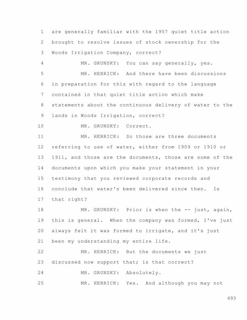
1
2
3
4
5
6
7
8
9
10
11
12
13
14
15
16
17
18
19
20
21
22
23
24
25
493
are generally familiar with the 1957 quiet title action
brought to resolve issues of stock ownership for the
Woods Irrigation Company, correct?
MR. GRUNSKY: You can say generally, yes.
MR. HERRICK: And there have been discussions
in preparation for this with regard to the language
contained in that quiet title action which make
statements about the continuous delivery of water to the
lands in Woods Irrigation, correct?
MR. GRUNSKY: Correct.
MR. HERRICK: So those are three documents
referring to use of water, either from 1909 or 1910 or
1911, and those are the documents, those are some of the
documents upon which you make your statement in your
testimony that you reviewed corporate records and
conclude that water's been delivered since then. Is
that right?
MR. GRUNSKY: Prior is when the -- just, again,
this is general. When the company was formed, I've just
always felt it was formed to irrigate, and it's just
been my understanding my entire life.
MR. HERRICK: But the documents we just
discussed now support that; is that correct?
MR. GRUNSKY: Absolutely.
MR. HERRICK: Yes. And although you may not

1
2
3
4
5
6
7
8
9
10
11
12
13
14
15
16
17
18
19
20
21
22
23
24
25
494
have read them all, you are familiar with the existence
of the early minutes for Woods Irrigation Company going
back to whatever date they go back to?
MR. GRUNSKY: I know there are some, and I know
there's a gap. Talking earlier, I don't know -- I heard
rumors of how they got lost, a fire.
MR. HERRICK: Thank you.
You were asked questions about rules from 1940
apparently for Woods Irrigation Company. Do you recall
that?
MR. GRUNSKY: Yes.
MR. HERRICK: To your knowledge, are those
rules that deal with limitations on delivery of water,
are those in effect today?
MR. GRUNSKY: Not that I'm aware of. But the
general cycle of irrigating is the same. It's very
similar.
MR. HERRICK: But to your knowledge, there
aren't any additional fees paid for people dependent
upon needs of water that may be in conflict with the
strict requirements of these 1940 rules; is that
correct?
MR. GRUNSKY: That's correct.
MR. HERRICK: And you have no knowledge of
whether or not back in 1940 these rules were actually

1
2
3
4
5
6
7
8
9
10
11
12
13
14
15
16
17
18
19
20
21
22
23
24
25
495
enforced, do you?
MR. GRUNSKY: No. Yeah, that's before my time.
MR. HERRICK: That's right. And would it be
correct to say that all you're aware of is that each
year, to your knowledge, Woods assesses an amount for
irrigation and for drainage?
MR. GRUNSKY: Yes.
MR. HERRICK: And that's not based upon extras.
It's based upon a per-acre amount for the costs and any
potential capital improvements they're going to do in
the future or any other expenses?
MR. GRUNSKY: Yeah.
MR. HERRICK: And again, to your knowledge,
there aren't any separate or other accounting records
which may break out any sort of costs like that that are
held by Woods?
MR. GRUNSKY: Not that I am aware of.
MR. HERRICK: Okay. And -- okay. Thank you.
I do want to clarify the discussion about who
holds the corporate records. And your corporate
attorney is Mr. Don Geiger; is that correct?
MR. GRUNSKY: Correct.
MR. HERRICK: As far as you know, the corporate
records, whatever they may be, are maintained at his
office; is that correct?

1
2
3
4
5
6
7
8
9
10
11
12
13
14
15
16
17
18
19
20
21
22
23
24
25
496
MR. GRUNSKY: That's correct.
MR. HERRICK: And although Mr. Nomellini and I
are involved in this current issue, we don't hold
corporate records except maybe copies that we've gotten
from him.
MR. GRUNSKY: Correct.
MR. HERRICK: Okay. Mr. Grunsky, you were
asked questions about billings back in 1914 and past
that. Are you aware of whether or not the board of
directors for Woods back in 1914 billed people
prospectively or retrospectively?
MR. GRUNSKY: I have no idea.
MR. HERRICK: Do you know whether or not --
that's fine.
Turning to Mr. Prichard. You were asked a
couple questions with regard to soil types. Are you
generally familiar with Roberts Island soils?
MR. PRICHARD: Yes, I am.
MR. HERRICK: And do you think that your use of
a current soils map materially affects your conclusions
with regard to whether or not certain crops would have
been irrigated back around 1914?
MR. PRICHARD: No, it does not.
MR. HERRICK: And -- okay. Thank you.
One more question for Mr. Grunsky; I apologize.

1
2
3
4
5
6
7
8
9
10
11
12
13
14
15
16
17
18
19
20
21
22
23
24
25
497
You described Woods as having two points of
diversion; is that correct?
MR. GRUNSKY: That's correct.
MR. HERRICK: Now just as a visual, Middle
River runs generally north along Upper Roberts going
downstream to the north, and then it takes sort of a
bend around Middle Roberts which is mostly Woods
Irrigation Company area, right?
MR. GRUNSKY: Right.
MR. HERRICK: And at one of those bends near
Howard Road, the Woods Irrigation Company has two
structures, each of which has six pumps on it -- excuse
me -- each of which has three pumps; is that correct?
MR. GRUNSKY: Correct.
MR. HERRICK: So there are actually two
platforms with six pumps?
MR. GRUNSKY: Correct.
MR. HERRICK: But they're are only, what, 30
yards apart, 20 yards apart?
MR. GRUNSKY: Yeah. 50 feet.
MR. HERRICK: And you're considering that one
diversion point?
MR. GRUNSKY: That's correct.
MR. HERRICK: That's generally referred to as
the main diversion points for Woods?

1
2
3
4
5
6
7
8
9
10
11
12
13
14
15
16
17
18
19
20
21
22
23
24
25
498
MR. GRUNSKY: Yes.
MR. HERRICK: So although its two platforms and
six pumps --
MR. GRUNSKY: One point of diversion.
MR. HERRICK: That's what I want to clarify.
When you said two points of diversion, that's one.
MR. GRUNSKY: Yeah.
MR. HERRICK: Okay. And then the second one
is, I don't know, maybe half a mile downstream which is
north-ish, and it's a much smaller, one-pump diversion;
is that correct?
MR. GRUNSKY: Yes.
MR. HERRICK: I just want to make sure there's
no confusion when you say two, and there's three
platforms or whatever, there's seven pumps or something.
Thank you.
That's all I have. Thank you, Mr. Chairman.
CO-HEARING OFFICER PETTIT: Thank you,
Mr. Herrick.
Mr. Rose?
--o0o--
RECROSS-EXAMINATION BY MR. ROSE
FOR PROSECUTION TEAM
--o0o--
MR. ROSE: This will obviously be very brief

1
2
3
4
5
6
7
8
9
10
11
12
13
14
15
16
17
18
19
20
21
22
23
24
25
499
because it's only within the scope of the questions just
asked.
Mr. Grunsky, is it my understanding that the
operation of diverting water, delivering it to your
service area, is not done with any particular
consideration of water rights; is that correct?
MR. GRUNSKY: I really don't understand that
question.
MR. ROSE: You said in response to some
questions from Mr. Herrick that the operation of your
diversion system is done based on the experience of the
ditch tender and the request of the particular
irrigator; is that correct?
MR. GRUNSKY: Request of the farmers to the
ditch tender.
MR. ROSE: That's what I mean. The farmer
makes a request to the ditch tender; the ditch tender
provides some amount of water. Is that correct?
MR. GRUNSKY: That's correct.
MR. ROSE: Okay. Nowhere in that calculation
is any consideration of water rights; is that correct?
MR. HERRICK: You mean by the ditch tender?
MR. ROSE: By either party as to whether
there's the existence of sufficient water rights for
those deliveries.

1
2
3
4
5
6
7
8
9
10
11
12
13
14
15
16
17
18
19
20
21
22
23
24
25
500
I'm not suggesting in that question that they
do or do not exist, but that's not part of the
consideration, is it?
MR. GRUNSKY: No, the fact that they are a
member of Woods. We feel we have pre-1914 and riparian
rights, if that's the consideration you're looking for.
MR. ROSE: All I was --
MR. GRUNSKY: Obviously we're --
MR. ROSE: -- looking for -- sorry. I didn't
mean to interrupt or talk over you.
But looking for a specific answer to that
question is: When the call is made and when the water
is put into the ditch, there is no particular
consideration as to the amounts or availability of water
under particular water rights; is that correct?
MR. GRUNSKY: The -- I mean just the --
obviously, has to be a member of the irrigation company.
MR. ROSE: They are a member of the irrigation
company making these calls.
MR. GRUNSKY: Yes.
MR. ROSE: Obviously. But there is no
consideration of water rights in that calculus; is that
correct?
MR. GRUNSKY: I would guess yes, yeah.
MR. ROSE: Yes, there is a consideration?

1
2
3
4
5
6
7
8
9
10
11
12
13
14
15
16
17
18
19
20
21
22
23
24
25
501
MR. GRUNSKY: No, there is -- I would agree
with you.
MR. ROSE: Okay. No --
MR. GRUNSKY: Yeah.
MR. ROSE: There's no consideration. Thank
you. I just wasn't sure.
MR. GRUNSKY: Yeah.
MR. ROSE: Okay. And Woods doesn't maintain
any records of particular water rights of its
landowners? Is that correct?
MR. GRUNSKY: On specific landowners?
MR. ROSE: Does Woods maintain records? And
this is a records question, so you can say yes or no,
you don't know: Does Woods, that you are aware of,
maintain any records of water rights held by any entity
other than itself?
MR. GRUNSKY: As I spoke earlier, the engineers
have done some work on that, but I haven't seen the
testimony to it.
MR. ROSE: Okay.
MR. GRUNSKY: Yeah. Generally I'm not aware.
MR. ROSE: Okay. And my question
specifically -- and you can say you're not aware. I
just want to be clear as to records.
You're not aware of any records held by Woods

1
2
3
4
5
6
7
8
9
10
11
12
13
14
15
16
17
18
19
20
21
22
23
24
25
502
of rights held by any of its particular landowners?
MR. GRUNSKY: No.
MR. ROSE: Okay. And you also are not aware of
any records of how much water is diverted at those
particular PODs, points of diversion?
MR. GRUNSKY: No.
MR. ROSE: No measuring devices or anything
like that?
MR. GRUNSKY: No.
MR. ROSE: Thank you. I have no further
questions.
CO-HEARING OFFICER PETTIT: Thank you,
Mr. Rose.
Mr. Rubin.
--o0o--
RECROSS-EXAMINATION BY MR. RUBIN
FOR SAN LUIS & DELTA-MENDOTA WATER AUTHORITY
--o0o--
MR. RUBIN: Jon Rubin for the San Luis &
Delta-Mendota Water Authority. Just hopefully a
clarifying question or two, Mr. Grunsky.
In response to questions that Mr. Herrick asked
of you, it appears as though your conclusion that's
reflected in Woods Irrigation Company Exhibit 11 is
based upon three records as well as some historic

1
2
3
4
5
6
7
8
9
10
11
12
13
14
15
16
17
18
19
20
21
22
23
24
25
503
accounts from family members; is that correct?
MR. GRUNSKY: Briefly, it's based on the
formation of the company, and I've glanced with John at
the other records.
MR. RUBIN: Okay. That's what I want to --
just what I want to clear up. It's -- I think your
testimony's been clear that your conclusion is based in
part on communications that you had with family members,
specifically your grandmother?
MR. GRUNSKY: Right.
MR. RUBIN: And then the records that you base
your conclusion on, there are three as I understand it:
The 1909 articles of incorporation, maybe --
MR. GRUNSKY: Yes.
MR. RUBIN: -- four.
Then there's two agreements from 1911 that you
base your upon on?
MR. GRUNSKY: I know of an agreement from 1911.
I don't know of two agreements from 1911.
MR. RUBIN: But then the third piece of
information is a complaint that Mr. Herrick referenced
in a question to you; is that correct?
MR. GRUNSKY: Yes.
MR. RUBIN: And the complaint is a complaint of
quiet title?

1
2
3
4
5
6
7
8
9
10
11
12
13
14
15
16
17
18
19
20
21
22
23
24
25
504
MR. GRUNSKY: Yeah. And I just don't know much
about it other than I've seen it.
MR. RUBIN: And you saw it at a meeting with
Mr. Herrick?
MR. GRUNSKY: Yes.
MR. RUBIN: And did you read it, or did Mr.
Herrick explain it to you?
MR. GRUNSKY: No, just -- I didn't read it.
MR. RUBIN: Thank you. I have no further
questions.
CO-HEARING OFFICER PETTIT: Mr. O'Laughlin?
--o0o--
RECROSS-EXAMINATION BY MR. O'LAUGHLIN
FOR MODESTO IRRIGATION DISTRICT
--o0o--
MR. O'LAUGHLIN: Mr. Grunsky, in regards to the
articles of incorporation, what was the starting
capitalization for Woods Irrigation Company?
MR. GRUNSKY: Oh, gosh. It was --
MR. O'LAUGHLIN: $10,000 ring a bell?
MR. GRUNSKY: Yeah, I think it was $10,000.
MR. O'LAUGHLIN: After the initial
capitalization of the corporation, when was the first
time that Woods Irrigation Company charged the lands
within Woods Irrigation Company for operation and

1
2
3
4
5
6
7
8
9
10
11
12
13
14
15
16
17
18
19
20
21
22
23
24
25
505
maintenance charges?
MR. GRUNSKY: I don't know.
MR. O'LAUGHLIN: At this -- I'm just going to
clear up this. So now we're clear that there -- there's
two platforms currently in existence that have three
pumps each or six pumps each?
MR. GRUNSKY: Three.
MR. O'LAUGHLIN: Three each. So six total.
MR. GRUNSKY: Yes.
MR. O'LAUGHLIN: Okay. Do you know what the
horsepower is on those pumps?
MR. GRUNSKY: They vary from 20 to 50.
MR. O'LAUGHLIN: Okay. Now, is that canal
that's currently there, the canal that we -- that has --
people have been talking earlier that Mr. Nomellini
talked about where the tunnel came out, went into this
main canal, and then basically goes up kind of the
center of Roberts Island, is that it?
Do the pumps -- let me ask it a different way.
Do the pumps that are currently there deliver
into one main canal or two separate canals?
MR. GRUNSKY: There's two separate canals.
MR. O'LAUGHLIN: Okay. And so it's your
understanding that previously then that if there were
two separate diversion structures there, they would

1
2
3
4
5
6
7
8
9
10
11
12
13
14
15
16
17
18
19
20
21
22
23
24
25
506
deliver into the two separate canals, correct? That
Mr. Nomellini described earlier?
MR. GRUNSKY: There's -- yeah, there's two
platforms and two different canals.
MR. O'LAUGHLIN: Okay. So Mr. Nomellini showed
us earlier what he called the headgates or tide gates
that appeared to connect to those two separate canals.
Okay.
So if I understand your testimony now
correctly, there's three pumps on each canal, and the
horsepower is 20 to 50 --
MR. GRUNSKY: Mostly 20s and 30s. There could
be a 50 on there. I don't want to misspeak. There
could be a 50.
MR. O'LAUGHLIN: Do you know the efficiency of
those pumps?
MR. GRUNSKY: No, sure don't.
MR. O'LAUGHLIN: Follow-up on a question that
Mr. Herrick asked you. If Woods Irrigation Company was
pumping water, let's say in the 1920s or '30s, there
would be some type of what I'll call fuel charge, either
gas, diesel, or electric that was incurred by the
company to pump, am I correct?
MR. GRUNSKY: I don't know.
MR. O'LAUGHLIN: Okay. What's the earliest
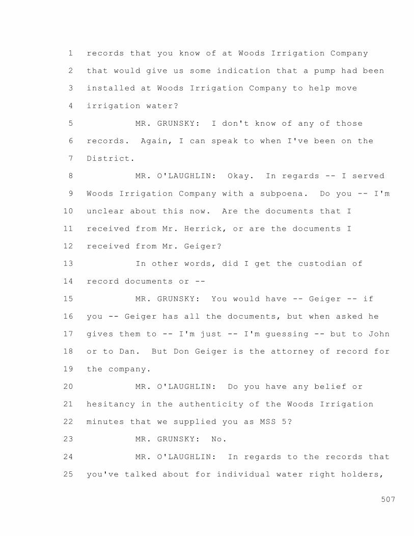
1
2
3
4
5
6
7
8
9
10
11
12
13
14
15
16
17
18
19
20
21
22
23
24
25
507
records that you know of at Woods Irrigation Company
that would give us some indication that a pump had been
installed at Woods Irrigation Company to help move
irrigation water?
MR. GRUNSKY: I don't know of any of those
records. Again, I can speak to when I've been on the
District.
MR. O'LAUGHLIN: Okay. In regards -- I served
Woods Irrigation Company with a subpoena. Do you -- I'm
unclear about this now. Are the documents that I
received from Mr. Herrick, or are the documents I
received from Mr. Geiger?
In other words, did I get the custodian of
record documents or --
MR. GRUNSKY: You would have -- Geiger -- if
you -- Geiger has all the documents, but when asked he
gives them to -- I'm just -- I'm guessing -- but to John
or to Dan. But Don Geiger is the attorney of record for
the company.
MR. O'LAUGHLIN: Do you have any belief or
hesitancy in the authenticity of the Woods Irrigation
minutes that we supplied you as MSS 5?
MR. GRUNSKY: No.
MR. O'LAUGHLIN: In regards to the records that
you've talked about for individual water right holders,

1
2
3
4
5
6
7
8
9
10
11
12
13
14
15
16
17
18
19
20
21
22
23
24
25
508
those are records that Woods has done in the last year
or so in preparation for these proceedings?
MR. GRUNSKY: Yes.
MR. O'LAUGHLIN: Thank you. No further
questions.
CO-HEARING OFFICER PETTIT: Mr. Powell?
MR. POWELL: No questions.
CO-HEARING OFFICER PETTIT: Mr. Ruiz?
Ms. Gillick.
MS. GILLICK: No questions.
CO-HEARING OFFICER PETTIT: Thank you.
STAFF ATTORNEY AUE: No.
CO-HEARING OFFICER PETTIT: Couple of quick
questions.
Mr. Grunsky, do I understand that all the
present pumps are electrical driven, electric pumps?
MR. GRUNSKY: Pardon me?
CO-HEARING OFFICER PETTIT: Are all your
present pumps driven by electric motors?
MR. GRUNSKY: Yes.
CO-HEARING OFFICER PETTIT: And has PG&E or
anybody else ever done a pump test to correlate the
demand with the water output?
MR. GRUNSKY: PG&E has done pump tests. They
are just -- we've done a couple times over the years to

1
2
3
4
5
6
7
8
9
10
11
12
13
14
15
16
17
18
19
20
21
22
23
24
25
///
///
509
make sure they are efficient, you know. I can't recall
the last one. Probably within the last couple of years.
CO-HEARING OFFICER PETTIT: Thank you.
MR. HERRICK: You want to bring on Mr. Neudeck,
or do you want to take a five, ten-minute break?
CO-HEARING OFFICER PETTIT: I suspect we'd
better take a break. Thank you, Mr. Herrick. Let's
take another 15 minutes and try and be back on time.
(Recess)
CO-HEARING OFFICER PETTIT: Let's go back on
the record. Mr. Herrick, is Mr. Neudeck appearing by
himself? We thought you were going to have him and
Mr. Landon appear as a panel -- or Mr. Blake, I'm sorry.
MR. HERRICK: Mr. Blake is unavailable today.
We did try to discuss the unavailability of a couple of
witnesses at the first hearing, so he'll be here
tomorrow.
I think we can get through Mr. Neudeck or
close. I'd rather not wait to put them both on. That
would be a long complicated day I think.
CO-HEARING OFFICER PETTIT: Okay. Let's
proceed then.
MR. HERRICK: Thank you.

1
2
3
4
5
6
7
8
9
10
11
12
13
14
15
16
17
18
19
20
21
22
23
24
25
510
--o0o--
CHRISTOPHER H. NEUDECK
Called by WOODS IRRIGATION COMPANY
DIRECT EXAMINATION BY MR. HERRICK
--o0o--
MR. HERRICK: Once again, John Herrick for
Woods Irrigation Company. The next is Mr. Christopher
Neudeck. Mr. Neudeck, would you give your name and
business address for the record.
MR. NEUDECK: Yes. It's Christopher H.
Neudeck. Business address is 711 North Pershing Avenue,
Stockton, California 95203.
MR. HERRICK: And I have been remiss. You did
take the oath when the proceeding began?
MR. NEUDECK: Yes, I did.
MR. HERRICK: You have in front of you WIC
Exhibit No. 3 which is your statement of qualifications;
is that correct?
MR. NEUDECK: That's correct.
MR. HERRICK: And it is a true and accurate
representation of those qualifications?
MR. NEUDECK: Yes, it is.
MR. HERRICK: You also have in front of you
Exhibit WIC 4, and that is your testimony for this
proceeding?

1
2
3
4
5
6
7
8
9
10
11
12
13
14
15
16
17
18
19
20
21
22
23
24
25
511
MR. NEUDECK: That's correct.
MR. HERRICK: And it is, absent any corrections
or errors that you'll correct on the way, it is a true
and correct copy of your testimony; is that correct?
MR. NEUDECK: Yes, it is.
MR. HERRICK: Would you please summarize your
testimony?
MR. NEUDECK: Certainly.
MR. O'LAUGHLIN: Can I ask a favor of the
Chairman and counsel?
This testimony is very important. There's a
ton of information that's going to be delivered in this
testimony. And I would request that if Mr. Neudeck
needs additional time to do that and fully explain to
the Hearing Officer and the participants his viewpoints,
he should and shouldn't be held to the 20-minute time
limit.
It's a very extensive record that he has, and I
just would ask the Hearing Officer's indulgence on that.
CO-HEARING OFFICER PETTIT: Mr. O'Laughlin
obviously just saw us set the clock. I think we can
accommodate that request.
I have looked at Mr. Neudeck's testimony, and I
agree that there's a lot of meat there, and we don't
want to cut it off too short.

1
2
3
4
5
6
7
8
9
10
11
12
13
14
15
16
17
18
19
20
21
22
23
24
25
512
So with some reservation about not letting it
go forever, don't feel too constrained by the 20
minutes.
MR. NEUDECK: I'll do my best.
CO-HEARING OFFICER PETTIT: Thank you, sir.
MR. NEUDECK: Thank you.
As a matter of background, I'm a Registered
Civil Engineer in the state of California. I have been
practicing with my firm, Kjeldsen, Sinnock & Neudeck,
for almost 30 years. My testimony states 25 years.
I've been in the business over 28 years,
primarily practicing in the field of water resource
engineering with an expertise in the area of flood
control and drainage, particularly in the Sacramento-San
Joaquin Delta.
In particular our firm, Kjeldsen, Sinnock &
Neudeck, represents the Roberts Island area,
specifically Reclamation Districts 5, 44, and 524 which
are Upper Roberts and Middle Roberts, Middle Roberts
being mainly the area we're speaking of today, as well
as the surrounding reclamation districts, Union Island 1
and 2 and Reclamation District 17.
Today's testimony that I'm going to be
delivering is basically broken up into three parts.
The first part relates to reiterating testimony

1
2
3
4
5
6
7
8
9
10
11
12
13
14
15
16
17
18
19
20
21
22
23
24
25
513
that was delivered in my June 9th testimony with Mr.
Mussi, Mussi et al, which is in my package of exhibits
as WIC Exhibit 4A.
Secondly I'm going to relate back to some
Term 91 testimony that was delivered in 2003 related to
the Delta pool.
Then thirdly, I'm going to relate to some of
the quantities and diversion rates by which Woods
Irrigation Company has provided.
So I'll get started.
The first item, as I've indicated, is WIC
Exhibit 4A which is my Mussi testimony that I've
incorporated entirely. The purpose of that is to relate
to the existence of Duck Slough.
Duck Slough has been referred to in much of the
testimony throughout this hearing as well as prior
hearings generally along the area known as Inland Drive.
And we've demonstrated that we've established
water in it through 1911, and we believe as well through
1913. And since that testimony in the Mussi case, I now
derived a conclusion that water likely existed in -- in
through probably 1926.
There are two exhibits, I will not bring them
up, but for reference sake they are parts of the
testimony which was a 1911 Quadrangle map that shows

1
2
3
4
5
6
7
8
9
10
11
12
13
14
15
16
17
18
19
20
21
22
23
24
25
514
water in Duck Slough as well as the existence of canals
in 1913 on the Denny's map.
The additional evidence that draws my
conclusion to indicating that Duck Slough likely had
water in it through 1926 is a case in the Third District
Court of Appeal. It's the case of Nelson et al versus
Robinson where there was a dispute between landowners
over seepage and drainage.
This particular case -- and I think,
Mr. Lindsay, if you could pull up Exhibit 4C at this
time it would be helpful to give everyone a picture as
to where these properties exist so I can speak to that.
STAFF ATTORNEY AUE: With the Hearing Officer's
permission I just wanted to ask before we get into
testimony about Duck Slough.
It's my understanding from the maps that Duck
Slough does not abut the Woods Irrigation District
lands. Is that the case?
MR. NEUDECK: Woods Irrigation Company -- it
actually runs through it. Woods is on either side.
STAFF ATTORNEY AUE: So the service area --
MR. NEUDECK: Correct.
STAFF ATTORNEY AUE: -- includes --
MR. NEUDECK: Original service area.
STAFF ATTORNEY AUE: But not the service area

1
2
3
4
5
6
7
8
9
10
11
12
13
14
15
16
17
18
19
20
21
22
23
24
25
515
today?
MR. NEUDECK: Correct. The drainage area is to
the right. The 1911 service -- the agreement from 1911.
STAFF ATTORNEY AUE: Okay. So it's being
submitted to show that it's a natural water body, but
it's not adjacent to any of the lands being served
today?
MR. HERRICK: If I may? And the Chairman can
tell me to be quiet if he wants.
As was the case in the Term 91 matter, a
showing that a riparian land maintained connection
through an agreement to provide water in that hearing
was found to be good enough to have preserved the
riparian right.
That's a general statement.
So in this instance, we're making the case that
Duck Slough was one of the water bodies to which some
lands were riparian up through the time of the 1911
agreement which then was a way of preserving an ability
to get water to those lands, thus maintaining a riparian
right even if later connections to any waterways were
severed.
Does that make sense?
CO-HEARING OFFICER PETTIT: I think it does.
And I guess if the original 1911 situation included

1
2
3
4
5
6
7
8
9
10
11
12
13
14
15
16
17
18
19
20
21
22
23
24
25
516
lands on both sides of Duck Slough, is that what you're
saying?
MR. HERRICK: (Nodding head)
CO-HEARING OFFICER PETTIT: I would guess it
has some weight with respect to the history of what
might be left, anyway. So okay. Go ahead.
MR. NEUDECK: Briefly, Mr. Lindsay, if you
could pan down -- I'm sorry. Pan up. I apologize. Get
my directions correct here.
It's very difficult to see. If you could
rotate it. Sorry. Only goes around one way. Very
difficult to see.
But this is the Nelson property to the west of
Duck Slough, and this is the Robinson property to the
east of Duck Slough.
This is the alignment of Duck Slough as it runs
down to Middle River. So my pointer's on Middle River,
and the termination point of Duck Slough or the
commencement point of Duck Slough. And then Nelson's on
the west. Robinson's on the east.
MR. HERRICK: Why don't you describe the
pocket.
MR. NEUDECK: This is also referred to -- the
Nelson area, the Nelson property, is also referred to as
the pocket area, the area between this levee here and

1
2
3
4
5
6
7
8
9
10
11
12
13
14
15
16
17
18
19
20
21
22
23
24
25
517
Duck Slough, High Ridge Levee and the Robinson property
to the east of Duck Slough.
The importance of this exhibit is to
demonstrate the existence of Duck Slough. And within
this Third District Court of Appeals case, there was an
issue raised about seepage coming from the Duck Slough
area.
The Mussi property at the time is the area just
directly in this pocketed area here, so that's the
general reference to the Mussi property here.
The case goes on to speak to where seepage
became visible in 1926, and in response to the
plaintiffs -- plaintiffs being Nelson. Nelson was the
plaintiff; Robinson was the defendant. That Robinson
was -- the grounds from Robinson were seeping onto
Nelson, and the case was to eliminate that seepage.
If you look at Exhibit 4C -- let me get the
right page on here. I apologize. It's 4B. And turn to
page 8. Eight of ten.
See the top three, four lines here state:
Defendants engaged men and equipment and
spent time and money on plaintiff's land,
levelling the same and eliminating a
slough which said defendant maintained
full of water immediately east of

1
2
3
4
5
6
7
8
9
10
11
12
13
14
15
16
17
18
19
20
21
22
23
24
25
518
defendant's land during 1926.
Now this, I believe, it's my opinion they are
referring to Duck Slough with the exception there is a
typographical error there.
If you recall the prior photograph, the
plaintiff was on the west with the slough in the middle.
The defendant was on the east. So calling the slough to
the east would mean in this particular case the slough
would be on the opposite side of the Robinson property,
and the likeliness of that slough seeping through
Robinson onto Nelson is unlike.
Point here being is this particular case
demonstrates there was water in Duck Slough, and in 1926
there was reference made to it, and that was the purpose
of bringing that into my testimony here.
Another next point of my testimony, I'd like to
refer back to the Term 91 hearings which were conducted
in February of 2003. This is the part where we speak to
the issue related to the Delta pool.
Within that testimony, the statement was made
by me that the entire Delta is one big pool of water,
some in channel and some in the soils.
There's no net difference in the amount of
water in the Delta channels. When local diverters take
from neighboring channels, pump from shallow groundwater
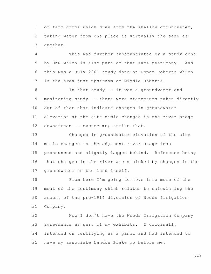
1
2
3
4
5
6
7
8
9
10
11
12
13
14
15
16
17
18
19
20
21
22
23
24
25
519
or farm crops which draw from the shallow groundwater,
taking water from one place is virtually the same as
another.
This was further substantiated by a study done
by DWR which is also part of that same testimony. And
this was a July 2001 study done on Upper Roberts which
is the area just upstream of Middle Roberts.
In that study -- it was a groundwater and
monitoring study -- there were statements taken directly
out of that that indicate changes in groundwater
elevation at the site mimic changes in the river stage
downstream -- excuse me; strike that.
Changes in groundwater elevation of the site
mimic changes in the adjacent river stage less
pronounced and slightly lagged behind. Reference being
that changes in the river are mimicked by changes in the
groundwater on the land itself.
From here I'm going to move into more of the
meat of the testimony which relates to calculating the
amount of the pre-1914 diversion of Woods Irrigation
Company.
Now I don't have the Woods Irrigation Company
agreements as part of my exhibits. I originally
intended on testifying as a panel and had intended to
have my associate Landon Blake go before me.

1
2
3
4
5
6
7
8
9
10
11
12
13
14
15
16
17
18
19
20
21
22
23
24
25
520
But there is two exhibits, Exhibit Nos. 6O and
6P, which the 1911 agreement to commit Woods Irrigation
Company to deliver water to the lands owned by both
E.W.S. Woods and Jessie Wilhoit Mary Douglass.
In those agreements, there's reference to the
rate of delivery. The E.W.S. agreement states a
delivery of 44.8 cfs while the Wilhoit Douglass makes
reference to delivery of 32.86 cfs.
Now, at its face value, that seems a little odd
given the time frame and history that they had such
specific numbers for the rate of delivery; but as you
carry on through the agreement, you can see the reason
for that was it directly related to their acreage.
The E.W.S. Woods agreement describes the
acreage stating that they contained 4480 acres, more or
less, whereas the Wilhoit Douglass states that they
contained 3286.37 acres, more or less.
Doing the math, that relates to 1 cfs per
hundred acres of land.
However, there is a mistake that was made here
as well. If you look at the E.W.S. agreement closely,
there's actually three parcels in that agreement. When
you add all three parcels, you get a greater quantity
than the 4480.
The first parcel described is an area 12.74

1
2
3
4
5
6
7
8
9
10
11
12
13
14
15
16
17
18
19
20
21
22
23
24
25
521
acres. The second parcel is an area of 769.32. And
third parcel is an area of 4480 acres. If you take all
three of those, which is where the apparent mistake was
made, you come up with 5262.06 acres, a greater amount
than the original 44 acres (sic).
I believe the agreement in 1911 commits Woods
Irrigation Company to furnish water to all the lands,
not just the 4480.
So I believe it was an incorrect statement made
that they were to deliver the 4480. If you do the math
at this point, the 5262 results in a higher diversion
rate relating to 52.62 cfs.
Before I get into the follow-on calculations,
there was additional correction to that diversion.
In the minutes of the Woods Irrigation Company
in April 14, 1913, the Board ratified an agreement where
they referenced releasing 370 acres from their 1911
agreement. That was with the E.W.S. Woods agreement.
So that 370 would be coming off of what was
originally presented as the 4480, as I read, added the
5262. So taking that into account and doing the math,
5262 less 370, you come up with a net 4892 for the
E.W.S. Woods.
All right. As a result of this and looking at
other minutes, it's my belief that Woods Irrigation
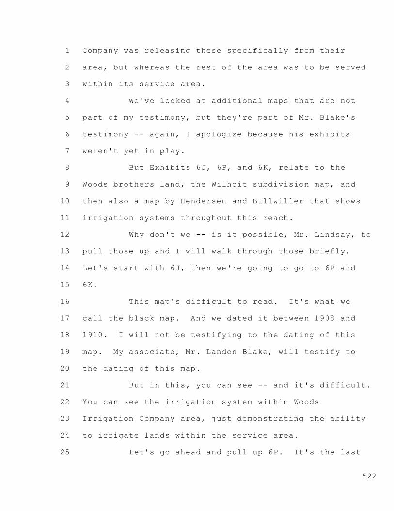
1
2
3
4
5
6
7
8
9
10
11
12
13
14
15
16
17
18
19
20
21
22
23
24
25
522
Company was releasing these specifically from their
area, but whereas the rest of the area was to be served
within its service area.
We've looked at additional maps that are not
part of my testimony, but they're part of Mr. Blake's
testimony -- again, I apologize because his exhibits
weren't yet in play.
But Exhibits 6J, 6P, and 6K, relate to the
Woods brothers land, the Wilhoit subdivision map, and
then also a map by Hendersen and Billwiller that shows
irrigation systems throughout this reach.
Why don't we -- is it possible, Mr. Lindsay, to
pull those up and I will walk through those briefly.
Let's start with 6J, then we're going to go to 6P and
6K.
This map's difficult to read. It's what we
call the black map. And we dated it between 1908 and
1910. I will not be testifying to the dating of this
map. My associate, Mr. Landon Blake, will testify to
the dating of this map.
But in this, you can see -- and it's difficult.
You can see the irrigation system within Woods
Irrigation Company area, just demonstrating the ability
to irrigate lands within the service area.
Let's go ahead and pull up 6P. It's the last

1
2
3
4
5
6
7
8
9
10
11
12
13
14
15
16
17
18
19
20
21
22
23
24
25
523
page of this.
There again, this is the subdivision of the
west Wilhoit tract. Mr. Nomellini referred to this
earlier, the west -- excuse me -- Wilhoit Douglass.
Apologize.
Wilhoit Douglass subdivided their ground. The
easterly half of the Woods Irrigation Company. They
were anticipating not farming and selling off parcels to
smaller farmers.
So this again shows the facility through the
service area to serve and irrigate those areas within
the irrigation company area.
The last map is 6K. This is a map by Hendersen
and Billwiller. It's a 1914 map. Rotate that. Well,
actually probably the thing to do would be to go down to
the lower left-hand corner first. Actually this --
we've seen this map earlier.
The word canals is here. It's a -- it's this
line right here. It's very difficult to see. But if
you pan back up, Mr. Lindsay.
That, we believe, is showing these areas within
the Woods service area again as canals, particularly the
Duck Slough area. This would be in 1914.
As I indicated earlier, we did not find any
other references within the minutes of the board

1
2
3
4
5
6
7
8
9
10
11
12
13
14
15
16
17
18
19
20
21
22
23
24
25
524
reducing the area for the service area. And as shown in
Exhibit 4F, there's a statement in there where it shows
the board fixing rates and assessments and a tax
necessary to pay the expenses and maintenance of the
system -- of irrigation, the cost of furnishing water as
evidenced in that exhibit.
From this I conclude that Woods Irrigation
Company was in fact delivering water to all its lands
except the 1913 exception, the 370 acres.
Now I'd like to move into what was referred to
earlier -- I think with the prior panel on the 1957
complaint to quiet title, corporate stock and
declaratory relief. This is Exhibit 4J -- 4G, excuse
me. I apologize.
Turn to page 5 of that exhibit. Right here,
starting with the word attached:
Attached hereto and marked as Exhibit B
and incorporated by reference herein is a
legal description of the exterior
boundaries of the tract of land irrigated
by the plaintiff since it commenced
operations in 1911. Continuously since
the date of said agreement, the plaintiff
was irrigating and draining the lands so
described and set forth.

1
2
3
4
5
6
7
8
9
10
11
12
13
14
15
16
17
18
19
20
21
22
23
24
25
525
Again, evidence that they have been continually
irrigating the area within their service area.
As a result of this, it's my conclusion that
Woods Irrigation Company has been providing water to all
its area since 19 -- between 1911 through 1957.
Now getting back to some of the calculations.
As indicated previously, the 4892 acres is my
corrected calculation based off of the acreage in the
E.W.S. Woods coupled with the Wilhoit Douglass lands,
the 3286, totals the acreage of both agreements of
8178.43 acres.
Using the 1 cfs per hundred acres as
anticipated in the 1911 agreement yields a diversion
rate of 81.78 cfs. This is the amount we believe, or I
believe, was putting -- was being put to use by Woods
before and thereafter in 1914.
Furthermore, it's my understanding that the
Regional Board -- the State Board staff has another
estimate for usage on land which estimates 1 cfs per 80
acres average use of water in the Delta, not the hundred
acres that was used in the 1911 agreement.
If you take this total amount of the 8178
divide that by 80, that yields a diversion rate of
102.23 cfs.
What I'm demonstrating is a diversion rate of

1
2
3
4
5
6
7
8
9
10
11
12
13
14
15
16
17
18
19
20
21
22
23
24
25
526
somewhere between 81.78 cfs to 102.23 cfs is Woods
Irrigation Company's pre-1914 right.
It's my belief that Woods is able to divert
this amount under its pre-1914 right, and any additional
amounts will be pursuant to their riparian rights for
land within the service area.
That concludes my testimony.
MR. HERRICK: Mr. Chairman, Mr. Neudeck's
testimony also included the Mussi testimony that dealt
with Duck Slough.
I think it would be beneficial if he would
generally just march through that because I anticipate a
lot of cross-examination questions on it.
Again, he was just sort of incorporating it
trying to save time, but these Hearing Officers haven't
heard that testimony. So Mr. Neudeck, perhaps you could
march through that.
MR. NEUDECK: Should I grab my file?
MR. HERRICK: Certainly.
MR. O'LAUGHLIN: I would agree with that. I
think that would be well worthwhile for this hearing
since you have not heard the testimony, and we would
support that.
I know it's going to run a little bit long, but
I think this is a key issue in the case, and lots of

1
2
3
4
5
6
7
8
9
10
11
12
13
14
15
16
17
18
19
20
21
22
23
24
25
527
testimony would be worthwhile.
CO-HEARING OFFICER PETTIT: I think if we can
maybe answer some of the questions in advance, it's
worth it, so let's do it.
MR. NEUDECK: Okay. I apologize. I wasn't
aware I was going to be doing this. Okay. I won't go
through my qualification since I've already done that.
The Mussi testimony basically relates to two
areas, the review of mapping and title documents
together with the summary of irrigation and drainage
practices.
The chain of title work that was done for the
Mussi property was done by a gentleman name of Thurl
Pankey Central Valley Land Service Company.
We reviewed -- and initially what I'll do is
walk through the Mussi property, and maybe what we can
do is bring up the Exhibits 3, and I'll just walk
through those really briefly.
So if you could bring up 3A, Mr. Lindsay, and
we'll just start walking through those.
CHIEF LINDSAY: Let me understand. This is 3A
in Mussi?
MR. NEUDECK: Mussi. These are both -- no,
that's --
MS. GILLICK: But wasn't that also submitted in

1
2
3
4
5
6
7
8
9
10
11
12
13
14
15
16
17
18
19
20
21
22
23
24
25
528
this proceeding as 4A, part of Mr. Neudeck's testimony,
4A?
MR. HERRICK: It's 4A in this testimony.
CHIEF LINDSAY: Okay. Thanks. That's fine.
MR. NEUDECK: The exhibits are --
MS. GILLICK: Stay in the record in this
proceeding.
MR. HERRICK: If you could just find the
exhibits for 4A and start going through them, that will
be work too.
CHIEF LINDSAY: You're going to have to help me
out with a page number.
MR. NEUDECK: Okay. 3A is the -- this is the
first one here. Rotate it to the -- clockwise.
CHIEF LINDSAY: You got it.
MR. NEUDECK: It just gives you an idea where
Mussi property is currently. This is a current APN,
131-170-03.
This is the Mussi property to the west of what
is demonstrated here on this APN as Inland Drive, also
known as Duck Slough and High Ridge Levee.
It's this triangular area also identified as
the circled 3 here. This is the current APN.
The next Exhibit 3 -- well, 3B for me. Am I
doing this correctly, or I should I be calling them

1
2
3
4
5
6
7
8
9
10
11
12
13
14
15
16
17
18
19
20
21
22
23
24
25
529
something else?
We go to the last page of this. What I'm going
to do is walk you through briefly the chain of title for
the Mussi property.
If we go to the last page of 3B, there is a
map. What this demonstrates is the first grant from the
State of California to J.P. Whitney. This is done
November 24th, 1876.
You can see Duck Slough running through the
center of this picture. It's a very large grant that
takes this area to the right.
Almost to the right of this map is the San
Joaquin River. The area to the bottom of the map is
Middle River.
Duck Slough runs through about the middle.
Burns Cut is the -- kind of the northeast corner.
Mussi property is right below the fold in this
area here.
The next grant is 3C. Once again, the last
page of this.
This is a grant from J.P. Whitney to M.C.
Fisher. This was done January 17, 1877. This now is
all to the east side of the High Ridge Levee, Duck
Slough containing the Mussi property within this area,
nearly extending out to the mainstem of the San Joaquin,

1
2
3
4
5
6
7
8
9
10
11
12
13
14
15
16
17
18
19
20
21
22
23
24
25
530
Middle River to the south, Burns Cutoff to the north.
And it includes the current Woods service area as well.
The next exhibit is 3D.
This transfers -- again very sizable transfer
from Fisher to Stewart. This is March 15, 1877. Again,
a large transfer. Mussi property here to the left of
the picture up against the Duck Slough, High Ridge Levee
area just below the fold.
Again similar service area to the Woods
Irrigation Company. Burns Cutoff to the north.
Mainstem of the San Joaquin to the east, right-hand side
of the picture. Then Middle River to the south.
Next transfer is 3E.
This brings us down very closely to the size of
the -- I don't have that mapped.
MR. HERRICK: Mr. Neudeck, since this is
incorporated testimony, this part now gets specific onto
Mussi's property which doesn't necessarily relate to
Woods, so you could probably skip this.
MR. NEUDECK: Okay.
MR. HERRICK: Move on.
MR. NEUDECK: So I'll jump down to my
discussion related to the assessor's maps? Okay. I
apologize for the confusion as a witness. I'm just
trying to follow all this. I wasn't necessarily

1
2
3
4
5
6
7
8
9
10
11
12
13
14
15
16
17
18
19
20
21
22
23
24
25
531
prepared to take these both on.
The first item is -- let's go to 3I.
CHIEF LINDSAY: Do you know about what page
that is?
MR. NEUDECK: 3I is -- 3H is all the assessor's
maps. I thought we had separate --
MR. HERRICK: We do.
MR. NEUDECK: Looking for 3I.
MR. HERRICK: There's a page, says 3I, and
following it is an assessor's map.
CHIEF LINDSAY: These appear not to have
scanned very well.
MR. NEUDECK: If this is the quality of the
assessor's map, we're not going to be able to -- not
going to work.
MR. HERRICK: I believe they did appear fairly
clear in the Mussi hearing. Perhaps we could go to 3I
in the Mussi hearing.
MR. O'LAUGHLIN: Do you mind if I bring up a
procedural issue?
CO-HEARING OFFICER PETTIT: Go ahead.
MR. O'LAUGHLIN: My understanding from counsel
and my discussions is that the State may not have -- or
may have rebuttal testimony, but if they do it may be
oral.

1
2
3
4
5
6
7
8
9
10
11
12
13
14
15
16
17
18
19
20
21
22
23
24
25
532
And my understanding from Mr. Herrick is that
his testimony, if anything, won't be available till
Monday, so we're all going to make our rebuttal
testimony available on Monday, and we're going to switch
the order up slightly.
The San Luis & Delta-Mendota Water Authority
will go first with rebuttal followed by Mr. Herrick's
client, and then the State will go last.
CO-HEARING OFFICER PETTIT: Mr. Rose,
Mr. Herrick, that okay with both of you?
MR. HERRICK: Yes.
MR. ROSE: That's fine with us.
CO-HEARING OFFICER PETTIT: Okay. So be it.
MR. NEUDECK: Okay. This Exhibit 3I is an 1876
assessor's map. We have made reference to this in prior
hearings.
What this does is very faintly shows the
alignment roughly of where Duck Slough/High Ridge Levee
is. This is a very rough rendition of this. This is
not the actual configuration. It was almost 130 years
ago, so the mapping at this time was not very accurate.
But it does depict a blue line which it's my
opinion is referencing Duck Slough.
This is Middle River at the bottom of the
assessor's map. The top is Burns Cutoff. And then

1
2
3
4
5
6
7
8
9
10
11
12
13
14
15
16
17
18
19
20
21
22
23
24
25
533
connecting the two is what we construe to be Duck Slough
and High Ridge Levee.
The next exhibit is 3J. I can speak to this.
This relates to the formation of Duck Slough. This is
referencing to the dredging of Duck Slough, and it comes
out of the Settlement Geography of the San Joaquin
Delta, specifically page 267.
And the quote there was that the Samson
dredge's first job was on Duck Slough. This is
extending from Burns Cutoff, heading in a what otherwise
would be construed to be upstream direction,
constructing parts of Duck Slough.
And this is a confirmation that Duck Slough was
a natural slough being enlarged by a channel.
The reference in the document speaks to the
Samson dredge needed a body of water to float in and was
creating a channel to head its way upstream on the
configuration of 30 feet wide by 7 feet deep in order to
float its dredge, then it disposed of the spoils on
either bank.
So again, referencing Duck Slough, this came
specifically out of this 1957 Settlement Geography.
From this I conclude that from very early on
1875, you know, Duck Slough -- well, in this case, I'm
repeating what relates to the Mussi property.

1
2
3
4
5
6
7
8
9
10
11
12
13
14
15
16
17
18
19
20
21
22
23
24
25
534
So let's move on to Exhibit 3L. 3L is just a
slightly greater improvement over what was shown earlier
on the assessor's maps.
Here you can see the configuration of Duck
Slough starting to take a greater formation of what it
looks like in reality.
But again, we have Burns Cutoff to the upper
right of the assessor's map extending down through,
tying in to Middle River. This is an assessor's map
dating between 1881 and 1882 demonstrating the location
of Duck Slough at that time.
Moving to 3M, M as in Michael.
This is an 1883 map by Tucker and Smith, a map
of the lands owned by Fisher. And here, you'll see -- I
apologize. I was looking down. You need to pan down.
Thank you. Down. I apologize.
This what's now designated Cross Levee. And
this Cross Levee follows the configuration -- and you've
heard in some of the previous testimony: High Ridge
Levee, Cross Levee, Duck Slough, Inland Drive. They're
all synonymous of this sinuous configuration that we're
showing here.
So you'll hear this terminology from a number
of different sources, but this is what is Duck Slough.
The importance here is the map is showing a

1
2
3
4
5
6
7
8
9
10
11
12
13
14
15
16
17
18
19
20
21
22
23
24
25
535
dash then a straight line which demonstrates -- the dash
is showing the levee, and the straight line is showing a
watercourse.
If you pan up -- I believe that's the correct
direction. Push the picture up. Stop right there.
You can see this area I'm highlighting in the
middle of the photo which is the different -- the
separation between Middle Roberts Reclamation District
524 to the top of the photo and Reclamation District 544
to the bottom of the photo which is actually upstream.
This Cross Levee is just a dash on the map here
which demonstrates there is no water. It's just a
separation between two tracts of land.
Historically these levees were built to prevent
back flooding. They would not prevent downstream
flooding because the higher water surface would tend to
overtop them if a levee broke upstream of this levee.
But if a levee broke in this area, it would prevent
Upper Roberts from flooding.
So they would separate these districts by these
somewhat lower cross levees. They were probably 5 to 6
feet lower than the levees along the mainstem of the San
Joaquin or along the Middle River.
All right. Let's move to Exhibit 3N. This is
an 1886 map. This is the California State Engineer
1
2
3
4
5
6
7
8
9
10
11
12
13
14
15
16
17
18
19
20
21
22
23
24
25
536
Department of Topography and Irrigation map. And the
purpose of this is to -- probably going to need to focus
in. Zoom. Thank you.
What I want to -- pan up a little. Right in
this area here. It's a very little difficult, but this
is the alignment of Duck Slough.
So again, an indication that Duck Slough
existed. And this was the 1886 time frame, and this is
on a State map.
MR. HERRICK: Why don't you describe better
where that is. Doesn't it say Duck Slough?
MR. NEUDECK: Yeah, if you were to really blow
this up, you could actually see the term Duck Slough on
it.
Extends again from Burns Cutoff in a
southwesterly direction, down to Middle River. And you
can see in the upper reach here where my highlighter is
right now the term Duck Slough. You have to really blow
this up to see it. I'm not sure this quality of map
will show that.
Right there. It -- Duck, D-u-c-k. SL being
the abbreviation for slough. So it's right in this area
here. This is in 1886.
Okay. Let's move to the next exhibit which is
3O. This is an 1894 map. Stockton-Bellota Drainage

1
2
3
4
5
6
7
8
9
10
11
12
13
14
15
16
17
18
19
20
21
22
23
24
25
537
District map.
And again, it shows Duck Slough extending from
Burns Cutoff. The term Duck Slough is written right
along its alignment in a southwesterly direction down to
Middle River in the middle of this photo here. Just
another demonstration of the existence of Duck Slough in
1884. Excuse me. Correct that. 1894.
Exhibit 3P is the 1911 USGS Quadrangle map.
This is the map that was produced in 1913, 1911 data.
And here, this is the map we've referred to
throughout prior hearings, but this is the alignment of
Duck Slough. And you can see blue, if you blow this up,
within the Duck Slough region.
But this is the Duck Slough alignment tied into
Middle River, pocket area to the west, Kingston School
here in the middle of the photo.
As you extend up, you can see the blue actually
shown on this quadrangle map done by the US Geological
Survey. This is a 1911 survey.
Yeah, I say that, even though the map is
published in 1913.
The next exhibit is 3Q. This is a 1921 map.
This is a map by Captain Weathers and Petzinger. These
are navigational maps.
The importance of this map is to show right

1
2
3
4
5
6
7
8
9
10
11
12
13
14
15
16
17
18
19
20
21
22
23
24
25
538
down here by the pocket area -- it doesn't -- this is
not demonstrating Duck Slough, and you might ask why is
it not demonstrating Duck Slough?
This is a navigation map. This is a slough to
show you the navigational areas. The importance of it
is this slough right here where the T is in the area
called the pocket, this is a major slough just to the
west of where Duck Slough ties into Middle River.
And it's an area that demonstrates a major
slough coming off of Middle River, and it was shown on a
navigation map. And that was the importance of bringing
this map into my exhibits, to demonstrate a major slough
coming off of Middle River into this region.
Next exhibit is 3R.
This is a 1941 Woods map. The purpose behind
this is to show the irrigation systems throughout the
Woods as well as Duck Slough.
You can see in 1941 they do have, you know,
some of the service area now being shown on this area
here as being drainage only. The majority of the
irrigated lands now in the center of this region here.
Whereas the mainstem of the San Joaquin is to
the right of this map, Duck Slough is to the left and
west of this map. Then we have the main feeders for the
irrigation system running kind of northerly direction

1
2
3
4
5
6
7
8
9
10
11
12
13
14
15
16
17
18
19
20
21
22
23
24
25
539
off of Middle River.
MR. HERRICK: Mr. Neudeck, the purpose of this
map is also to show the continued existence of that
slough you previously -- on the previous map; is that
not correct?
MR. NEUDECK: That is correct. The Duck
Slough.
MR. HERRICK: Excuse me.
MR. NEUDECK: Oh, I apologize.
The -- a predominant feature on this is to show
this slough to the west of Duck Slough which was where
the Weathers and Petzinger map showed. And here's this
major slough coming off the Middle River up to the area
known as Kingston School area as of 1941.
The next map, 3S, is a 1913 map. This is
what's called a San Joaquin County Denny's pocket map.
The importance here is -- let's rotate this.
That's right. I apologize. I'm sorry. I was
looking at my own exhibit and looking up too quickly
here.
If you come down to the legend, you'll see the
term -- if you can blow that up. There you can read it.
Canals. That's the key feature here. Now I need you to
expand back out.
Go to the Duck Slough area. You can see this

1
2
3
4
5
6
7
8
9
10
11
12
13
14
15
16
17
18
19
20
21
22
23
24
25
540
area here. Here is Burns Cutoff. Here is the alignment
of Duck Slough. Here's other canals throughout the
Woods Irrigation service area. Here is this main slough
we just spoke about with the Weathers Petzinger map as
well as the Woods map off to the west of the pocket
area.
3T. This is what's known as DWR Areal Geology
map. And the importance of this map is -- this is a
1976 map, and the importance of this, if you can blow
this up. Let's see if I can get in the area.
This area right here. Here's the Duck Slough
alignment. This area right here is still showing water
in it which is the large slough the Petzinger Weathers
map showed.
This is in 1976. So we're showing water in
this main slough that comes off of Middle River as late
as 1976 and shown on this DWR map.
That was the importance of showing that major
watercourse off of Middle River.
CO-HEARING OFFICER PETTIT: Excuse me,
Mr. Neudeck. Mr. Lindsay, can you show the title or the
legend on that map? Can you get to it?
CHIEF LINDSAY: I think it's -- there it is.
Here. Right here.
CO-HEARING OFFICER PETTIT: Okay. That's what
1
2
3
4
5
6
7
8
9
10
11
12
13
14
15
16
17
18
19
20
21
22
23
24
25
541
I was interested in, and Mr. Neudeck will appreciate,
was the spelling of aerial.
MR. NEUDECK: I looked up areal in every
possible source, and I've never seen it spelled this way
so.
CO-HEARING OFFICER PETTIT: I was making the
distinction between that and an aerial photograph.
MR. NEUDECK: I'm assuming it's -- I have not
found from my own limited research why it's spelled this
direction. I mean this manner. I don't know.
CO-HEARING OFFICER PETTIT: Well.
MR. NEUDECK: I mean it's an areal -- it comes
from the root --
MR. HERRICK: Area.
MR. NEUDECK: Area. And I don't know exactly.
I don't have an explanation for that, why it's not
i-a-l.
CO-HEARING OFFICER PETTIT: I understand, and I
agree. But I think there is a distinction between the
two terms, and that's what I wanted to make sure we were
clear on.
MR. NEUDECK: Okay.
(Discussion between counsel and witness)
MR. NEUDECK: Just in summary to the balance of
this testimony would be to kind of speak to the history

1
2
3
4
5
6
7
8
9
10
11
12
13
14
15
16
17
18
19
20
21
22
23
24
25
542
of irrigation and drainage and to speak a little bit to
how levees in general were created in the Sacramento-San
Joaquin Delta.
Initially the Delta was originally formed along
the original banks of the sloughs and rivers.
Sloughs and rivers would -- dendritically were
created throughout the Delta region, and as they
overflowed their banks they would create high banks,
immediately depositing the heavier materials along the
channels themselves.
Those basically were referred to as shoestring
levees. The initial settlers started to construct
levees on those. We believe in some cases levees remain
there, but on the larger stem rivers, San Joaquin, Old
River, Middle River, they actually would reclaim the
land by setting those levees back and allowing the river
to expand its capacity.
One of the key elements of this was as they
started to reclaim this land, they closed off those
dendritic channels to the original mainstem.
So there was -- as has been shown in much of
the testimony from Lajoie, as they started to close
those off, they didn't close them off permanently. They
installed floodgates.
And the reference to floodgates is extremely

1
2
3
4
5
6
7
8
9
10
11
12
13
14
15
16
17
18
19
20
21
22
23
24
25
543
important for our Woods Irrigation Company because
that's how the irrigation was transmitted into their
canals initially, through floodgates.
Those floodgates in many cases were constructed
probably, you know, around the turn of the century.
Reclamation started in the mid 1800s, for the most part
was completed by the early 1900s, and then improvements
ever since then.
But for the most part, that reclamation, when
you closed off that channel you installed a control
feature.
As time went on, those control features were
replaced. They weren't as efficient. Maybe the gravity
system didn't serve in many cases. Those floodgates
turned into pumps, and those floodgates were either
removed or remained in place.
We have documents that were testified earlier
by Mr. Nomellini. You saw the actual photographs of the
Woods Irrigation Company diversion points made out of
brick, very historical in nature.
These floodgates that he made reference to that
exist along Lower Roberts exist throughout the Delta.
My firm and myself personally have removed several of
these as they become a problem.
Many of them are buried in place. You don't

1
2
3
4
5
6
7
8
9
10
11
12
13
14
15
16
17
18
19
20
21
22
23
24
25
544
know they exist until you get a high-water event and all
of a sudden something starts leaking and you notice --
someone either, one, is aware of the old floodgate or,
two, by investigation you find them.
But they're down low. They're down typically
at or below the normal tide level. And they're a lot of
times made out of wood or brick that tend to collapse.
So they are a historical reference. There is
these throughout. That was a means of irrigating. And
for the most part, the more efficient methodology
nowadays is to pump where you can control water to a
greater extent.
With that, I think that pretty much summarizes
the Mussi testimony for purposes of this hearing. Is
that correct?
MR. HERRICK: Mr. Neudeck, let me just ask you
a couple summary questions to make sure the record's
clear with regard to your testimony in Duck Slough.
Your testimony with regard to Duck Slough is
that a number of historic records, including assessor's
and various other maps, indicate the presence of that
feature through the early 1900s; is that correct?
MR. NEUDECK: That's correct.
MR. HERRICK: Then you have a map, a US
Geological quad map dated 1913 with 1911 information
1
2
3
4
5
6
7
8
9
10
11
12
13
14
15
16
17
18
19
20
21
22
23
24
25
545
which shows water in that feature as of that late date;
is that correct?
MR. NEUDECK: That is correct.
MR. HERRICK: And then you show a later map, a
1913 map called the Denny's pocket map, which appears to
connect a number of surface water features including the
Duck Slough, thus maintaining a connection --
maintaining water in those features; is that correct?
MR. NEUDECK: That's correct.
MR. HERRICK: And one of those features is that
apparently significant slough running north from Middle
River up to Kingston School, correct?
MR. NEUDECK: Yes. That's what's shown on that
that Denny's map.
MR. HERRICK: In fact that slough apparently
existed not only through a 1941 map but appears as a
water feature on a 1976 map, correct?
MR. NEUDECK: That's correct.
MR. HERRICK: And so it's your testimony then
that Duck Slough in its -- Duck Slough then was a water
feature well past the 1911 date of the Woods agreements;
is that correct?
MR. NEUDECK: That's correct. And that's
further substantiated by the 1926 case where the
Woods -- I mean the Robinson Nelson case where there was

1
2
3
4
5
6
7
8
9
10
11
12
13
14
15
16
17
18
19
20
21
22
23
24
25
546
reference made to water being in it as well that causes
seepage.
MR. HERRICK: In fact, the case referenced that
slough being maintained full of water for irrigation,
didn't it?
MR. NEUDECK: That's correct.
MR. HERRICK: Okay.
MR. NEUDECK: In addition, there is the 1937
aerial photos that we have that show water within Duck
Slough as well.
MR. HERRICK: Thank you, Mr. Chairman. I was
just trying to make sure there wasn't too much
confusion. Mr. Neudeck's testimony covers a lot of
areas, and hopefully we can get through it all.
I believe that will end our direct examination.
CO-HEARING OFFICER PETTIT: Sometimes leading
questions can promote efficiency.
MR. HERRICK: Yes.
CO-HEARING OFFICER PETTIT: Mr. Rose? While
Mr. Rose is coming up, I have a question for Mr. Ruiz
and Ms. Gillick.
When the other parties and I were discussing
rebuttal testimony little while ago, I didn't ask for
your opinion because it didn't change your order in the
scheme of things, but I just wanted to make sure that
1
2
3
4
5
6
7
8
9
10
11
12
13
14
15
16
17
18
19
20
21
22
23
24
25
547
was okay with you.
MR. RUIZ: That's fine with us.
MS. GILLICK: And that's fine with the County
as well.
CO-HEARING OFFICER PETTIT: Thank you.
I just have a question that isn't process, but
we've just been discussing the fact that some of these
exhibits are pretty near unreadable or illegible.
And considering that this matter is likely to
be around for a while and to go further, we don't really
want a hearing record with things that we can't read,
and I was just wondering what would be the most
efficient way of correcting that deficiency so when we
have to start copying this record for others and so on
that we have something legible to copy.
MR. HERRICK: Mr. Chairman, we would certainly
be willing to resubmit -- or perhaps, since the Mussi
testimony which is the exact same thing with the exact
same numbering, maybe that could just be transferred
over and replace the bad copies.
CHIEF LINDSAY: That was 4A. In this hearing,
all those were just 4A.
MR. RUBIN: Hearing Officer Pettit, we began
today with a bit of a discussion about the record and
some issues that the parties are discussing.

1
2
3
4
5
6
7
8
9
10
11
12
13
14
15
16
17
18
19
20
21
22
23
24
25
548
Rather than take too much time today, maybe we
could talk a little bit about how we are looking to
proceed and either come back to you tomorrow or at the
latest Monday with some thoughts.
CO-HEARING OFFICER PETTIT: I wasn't suggesting
we stop and do that now. I was just raising it as
something for all of us to start thinking about as to
how we're going to correct that situation.
MR. HERRICK: We will.
CO-HEARING OFFICER PETTIT: Thank you.
Mr. Rose, go ahead.
MR. ROSE: Thank you.
--o0o--
CROSS-EXAMINATION BY MR. ROSE
FOR PROSECUTION TEAM
--o0o--
MR. ROSE: Good afternoon, Mr. Neudeck. David
Rose, State Water Board Prosecution Team.
I have some questions for you regarding your
testimony in the Mussi matter. I think I'll save those
for that matter. I do have some questions that are
specific to the Woods matter, though.
In particular, in your testimony -- I believe
that's WIC Exhibit 4. On page 3, you say in regards to
the two 1911 agreements, and those are WIC Exhibit 6O

1
2
3
4
5
6
7
8
9
10
11
12
13
14
15
16
17
18
19
20
21
22
23
24
25
549
and 6P, those agreements to serve water, that it appears
the parties made an error. Is that correct?
MR. NEUDECK: That is correct.
MR. ROSE: You don't have any first-hand
knowledge of how these agreements were crafted, do you?
MR. NEUDECK: No, I do not.
MR. ROSE: You don't have any first-hand
knowledge of the intent of the parties in crafting these
agreements, do you?
MR. NEUDECK: I'm hesitating to answer that
question only from the standpoint that I think the
general intent was to draft an agreement that provided
water to the service area, but that may not be
responsive to your question so I may have to answer no
to your question.
MR. ROSE: That's just first-hand knowledge.
Obviously you have testified as to your opinion as to
what the intent was.
But you don't have any first-hand knowledge as
to the intent of the parties in crafting these
agreements.
MR. NEUDECK: That's correct.
MR. ROSE: Okay. Now on page 4 of your
testimony, you do some calculations using a 1 cubic feet
per second per 100 acres factor.

1
2
3
4
5
6
7
8
9
10
11
12
13
14
15
16
17
18
19
20
21
22
23
24
25
550
That diversion rate doesn't appear anywhere in
the 1911 agreements, does it?
MR. NEUDECK: Not my adjusted calculation, no.
Those are my calculations premised off what I believe to
be the error in summation of the E.W.S. Woods total
acreage.
MR. ROSE: Okay. And in your answer, you're
talking about your calculations where you go forward
with that 1 cfs per 100 acres factor, and then you
calculate that out to get different direct diversion
rates?
MR. NEUDECK: Yes.
MR. ROSE: That's what you were --
MR. NEUDECK: Yes.
MR. ROSE: -- just answering as to?
Now in particular maybe there is a better term,
and you can help me out with this. But that 1 cfs per
100 acres factor: That doesn't appear anywhere in the
agreements, does it?
MR. NEUDECK: No. That was a conclusion that
was reached, and as I indicated based off of the math of
the agreement. It seemed to be a little unusual that
they had such a very specific diversion rate, but as you
read on, it made sense.
MR. ROSE: No, I --

1
2
3
4
5
6
7
8
9
10
11
12
13
14
15
16
17
18
19
20
21
22
23
24
25
551
MR. NEUDECK: That's --
MR. ROSE: -- understand.
MR. NEUDECK: -- the reason for it.
MR. ROSE: Sorry to talk over --
MR. NEUDECK: That's fine.
MR. ROSE: -- you. To understand your process
for getting that.
But you don't see anywhere in here that they
mention 1 cubic feet per second per 100 acres?
MR. NEUDECK: No, I do not.
MR. ROSE: And you also use a -- do some
calculations using a 1 cubic foot per 80 acres factor.
That rate, that factor, doesn't appear anywhere in the
1911 agreements, does it?
MR. NEUDECK: No, it does not.
MR. ROSE: The agreements don't specify any
particular calculation for the amount of water to be
served based on acreage, do they?
MR. NEUDECK: No.
MR. ROSE: The agreements do, however, specify
a direct diversion rate, don't they?
MR. NEUDECK: Correct.
MR. ROSE: Do you have those agreements with
you, WIC Exhibit 6O and WIC 6P?
MR. NEUDECK: Yes.

1
2
3
4
5
6
7
8
9
10
11
12
13
14
15
16
17
18
19
20
21
22
23
24
25
552
MR. ROSE: I'm going to read some language from
that agreement to you, and you can tell me if this is
accurate from this agreement.
MR. NEUDECK: Can you refer to which exhibit
you're --
MR. ROSE: Yes. I'll start with WIC Exhibit
6O. Starting on the third line from the bottom of the
second paragraph. If it's more helpful, that's also the
fourth line from the top of the second paragraph.
I'll begin reading the middle of the sentence
where it says:
The first party agrees under terms,
conditions, limitations, and restrictions
herein stated to furnish the second party
water not exceeding at any one time 44
point -- I believe that's 8 -- cubic feet
per second.
Does that appear to be what the agreement says
to you?
MR. NEUDECK: Yes.
MR. ROSE: Okay. I'm going to read from the
other agreement as well, WIC Exhibit 6P, starting in
roughly the same place, third line from the bottom of
the second paragraph:
The first party agrees under the terms,

1
2
3
4
5
6
7
8
9
10
11
12
13
14
15
16
17
18
19
20
21
22
23
24
25
553
conditions, limitations, and restrictions
herein stated to furnish the second
party -- parties, in the case -- water
not exceeding at any one time 32.8 -- or
86; whatever that is -- cubic feet per
second.
Is that accurate?
MR. NEUDECK: That's correct.
MR. ROSE: Okay. Now both of these agreements
use the words "not exceeding," don't they? Not
exceeding?
MR. NEUDECK: Yes, they do. I just wanted to
confirm that. I apologize. That was my understanding,
but I wanted to read both of them before I agreed.
MR. ROSE: Sure. Sorry for rushing you on
that.
Now briefly, on page 4 you extrapolate using
both of those calculations that we previously discussed,
the 1 cfs per 100 acres and 1 cfs per 80 acres, what
amount of water would have actually been put to use
immediately before and after 1914; is that correct?
You do some calculations using those factors?
MR. NEUDECK: That's correct.
MR. ROSE: Okay. Now you don't have any
first-hand knowledge to support that either of these

1
2
3
4
5
6
7
8
9
10
11
12
13
14
15
16
17
18
19
20
21
22
23
24
25
554
diversion rates were actually being applied prior to
1914, do you?
MR. HERRICK: I'll just ask for clarification.
You keep asking for first-hand knowledge. You mean
within his personal knowledge? Or other testimony,
documents? Or -- what are you looking for? He
certainly was not alive in 1911.
MR. ROSE: Right. So I'll ask it both ways.
MR. NEUDECK: I'm pausing because I'm trying to
absorb all this. I apologize.
MR. ROSE: That's fine. I'll ask the question
again. Even where the answers are obvious.
You don't have any personal first-hand
knowledge to support that either of these diversion
rates were actually being applied prior to 1914?
MR. NEUDECK: No, I do not.
MR. ROSE: And you don't have any supporting
documentation that is conclusive that either one of
these diversion rates was being applied prior to 1914,
do you?
MR. NEUDECK: I do not have conclusive evidence
that these diversion rate were being applied, no.
MR. ROSE: You don't have any conclusive
evidence -- or first-hand knowledge, but let's go with
evidence -- to support any particular diversion rate
1
2
3
4
5
6
7
8
9
10
11
12
13
14
15
16
17
18
19
20
21
22
23
24
25
555
other than the ones laid out in the agreements, do you?
MR. NEUDECK: Well, the diversion rates were
what the agreements agreed to service the area.
Lots of evidence as to the area being serviced.
Relating it to a specific diversion rate, I don't have a
direct measurement for that.
Maybe I'm speaking beyond where I should be in
this answer, but there's a lot of evidence as to that
area being farmed, that area being irrigated. We -- I
personally have put in a lot of evidence to that extent
that the systems existed.
But the specific diversion rates as stated here
on page 4 of my testimony, no, I do not have specific
measurement of those diversion rates at that time.
MR. ROSE: That's fair. Maybe it will be more
clear if I ask it this way: Could the rates identified
in the agreements, the maximum diversion rates
identified in the agreements, actually have irrigated
the lands identified in those agreements?
MR. NEUDECK: Yes.
MR. ROSE: And are you anywhere suggesting that
1 cubic foot per second is necessary to irrigate 100
acres?
I'll strike that question. Your previous
question has the same answer.

1
2
3
4
5
6
7
8
9
10
11
12
13
14
15
16
17
18
19
20
21
22
23
24
25
556
I have no further questions at this time.
CO-HEARING OFFICER PETTIT: Thank you,
Mr. Rose.
I'll ask for some advice from Mr. Rubin,
Mr. O'Laughlin, Mr. Powell. We've been going for just a
little over an hour. Do you have any suggestion as to
whether we keep going for a while little longer, take a
break now?
That may relate to how much time you anticipate
for your cross, but if you have any thoughts, I'd
appreciate hearing them.
MR. O'LAUGHLIN: Okay. What we were thinking
about is that I do not believe we can finish our
cross-examination today of Mr. Neudeck.
So what we were planning is if you want to take
a short break, and Mr. Rubin could start and he can
probably take us to around 5:30 or 6:00. We'll stop.
I'll finish tomorrow, and then we can start the direct
of the other parties.
CO-HEARING OFFICER PETTIT: Sounds like a plan.
Let's take --
MR. ROSE: Mr. Pettit -- Board Member Pettit,
sorry.
I just realized, before we get off of my turn,
if you would call it that, I do have one additional

1
2
3
4
5
6
7
8
9
10
11
12
13
14
15
16
17
18
19
20
21
22
23
24
25
557
question. I could do it when we get back or now. I
hate to be a bother.
CO-HEARING OFFICER PETTIT: Do it now.
MR. ROSE: Okay.
MR. O'LAUGHLIN: It better be good.
(Laughter)
CO-HEARING OFFICER PETTIT: I answer to any of
those names, Mr. Rose, so don't worry about it.
MR. ROSE: Mr. Neudeck, one final question.
You don't have any evidence that the 1911
agreements have been changed between 1911 and 1914, do
you?
MR. NEUDECK: I have introduced in my testimony
the 1913 reduction in irrigated area, the 370 acres.
Outside of that, I don't know of any evidence of
changing these agreements.
MR. ROSE: Okay. More specifically -- turn my
one question into two -- you don't have any evidence
that the agreements were changed between 1911 and 1914
as to the direct diversion rates, the max direct
diversion rates, as identified in those agreements?
MR. NEUDECK: No, I do not.
MR. ROSE: Thank you. Now I'm done.
CO-HEARING OFFICER PETTIT: Let's be back at 20
to 6:00 -- or 20 to 5:00.

1
2
3
4
5
6
7
8
9
10
11
12
13
14
15
16
17
18
19
20
21
22
23
24
25
558
(Recess)
CO-HEARING OFFICER PETTIT: I guess we're ready
to proceed, Mr. Rubin.
--o0o--
CROSS-EXAMINATION BY MR. RUBIN
FOR SAN LUIS & DELTA-MENDOTA WATER AUTHORITY
--o0o--
MR. RUBIN: Good afternoon, Mr. Neudeck. Jon
Rubin, San Luis & Delta-Mendota Water Authority. I have
some questions for you this afternoon.
MR. NEUDECK: Good afternoon.
MR. RUBIN: Mr. Neudeck, you acknowledge that
prior to 1914 there were lands within Woods Irrigation
Company that were cultivated but not irrigated with
surface water, correct?
MR. NEUDECK: They were -- there was lands that
were considered high lands that were not -- that
facilities were not yet constructed to; that's correct.
MR. RUBIN: So there were lands in 1914 and
prior that were cultivated but not irrigated with
surface water?
MR. NEUDECK: I don't necessarily know the
degree of cultivation, so I can't speak to that. But I
can speak that there were lands within the service area
that did not have facilities extending thereto.
1
2
3
4
5
6
7
8
9
10
11
12
13
14
15
16
17
18
19
20
21
22
23
24
25
559
So I don't have any knowledge as to their
degree of cultivation.
MR. RUBIN: Okay. Let's get to the more
specific question. There were lands in 1914 and prior
within Woods Irrigation Company that were not receiving
surface water for irrigation purposes?
MR. NEUDECK: That's correct.
MR. RUBIN: In your written testimony, Woods
Irrigation Company Exhibit 4, you discuss testimony that
you prepared for another State Water Board enforcement
proceeding, correct?
MR. NEUDECK: That's correct.
MR. RUBIN: And you indicate in your written
testimony, Woods Irrigation Company Exhibit 4, that
since you prepared the testimony for that other
proceeding a court of appeal decision was discovered; is
that correct?
MR. NEUDECK: That's correct.
MR. RUBIN: And the court of appeal decision is
marked for identification purposes as Woods Irrigation
Company Exhibit 4B?
MR. NEUDECK: Yes.
MR. RUBIN: You did not discover that opinion,
did you?
MR. NEUDECK: No, I did not, sir.

1
2
3
4
5
6
7
8
9
10
11
12
13
14
15
16
17
18
19
20
21
22
23
24
25
560
MR. RUBIN: Do you know who discovered that
opinion?
MR. NEUDECK: I believe -- and I'll refer to
them as our team, and I know you're going to ask
questions about this, and I'm not trying to be sarcastic
but there's been a team of us working on this for quite
some time.
So it's been my firm jointly together with
South Delta, Central Delta, and a number of other
independent contractors.
So I don't have specific knowledge as to who
brought the case forward, but the team brought it to our
attention.
MR. RUBIN: Okay. I appreciate your honest
answer.
MR. NEUDECK: All right.
MR. RUBIN: All we're here for.
Let me talk a little bit about your scope of
work. Were you retained by Woods Irrigation Company?
MR. NEUDECK: No, not specifically. I was
actually retained by South Delta Water Agency and
Central Delta Water Agency to work on this case.
MR. RUBIN: And was there a scope of work that
you were provided with?
MR. NEUDECK: No. The scope has evolved over

1
2
3
4
5
6
7
8
9
10
11
12
13
14
15
16
17
18
19
20
21
22
23
24
25
561
time in response to the CDO hearing.
MR. RUBIN: Do you recall your -- the first
direction you were provided by South Delta and Central
Delta Water Agencies?
MR. NEUDECK: Mainly dealt with chain of title
mapping. My staff, Mr. Blake, that you'll hear from
tomorrow, and related to that aspect of it historically.
MR. RUBIN: It's your opinion that Woods
Irrigation Company holds a 1914 -- a pre-1914 water
right?
MR. NEUDECK: Yes, that's correct.
MR. RUBIN: Is it your opinion that Woods
Irrigation Company also holds riparian rights?
MR. NEUDECK: I have not expressed that opinion
in my testimony.
MR. RUBIN: Is it your opinion that Woods
Irrigation Company holds a riparian water right?
MR. NEUDECK: The -- I have not expressed that
in my direct testimony. The lands within the Woods
Irrigation Company have riparian rights. My firm has
been working on those, and testimony tomorrow will
relate to that.
As to whether Woods is the owner of those
riparian rights, I don't offer any opinion to.
MR. RUBIN: Okay. As to your conclusion that

1
2
3
4
5
6
7
8
9
10
11
12
13
14
15
16
17
18
19
20
21
22
23
24
25
562
Woods Irrigation Company holds a pre-1914 water right,
your conclusion that Woods holds a pre-14 water right is
based upon your analysis of the information that you
reviewed for this proceeding?
MR. NEUDECK: That's correct.
MR. RUBIN: And your analysis indicates that
prior to 1914 lands within Woods Irrigation Company were
receiving water from Woods Irrigation Company?
MR. NEUDECK: That's correct.
MR. RUBIN: If I owned a parcel of land within
Woods and I was receiving water prior to 1914, would I
also have a pre-1914 water right?
MR. NEUDECK: I think that requires a legal
conclusion, one to which I don't have.
MR. RUBIN: Let me --
MR. NEUDECK: And I just -- I understand
there's a lot of legal issues in this case. I've been
sitting throughout all the testimony. And I don't have
an answer to that question.
MR. RUBIN: Let me explore this a little bit.
You've testified today that Woods Irrigation
Company, you believe, holds a pre-1914 water right?
MR. NEUDECK: That's correct.
MR. RUBIN: Is it possible that a landowner
within Woods also holds a pre-1914 water right?
1
2
3
4
5
6
7
8
9
10
11
12
13
14
15
16
17
18
19
20
21
22
23
24
25
563
MR. NEUDECK: I would -- my assumption would be
correct -- yes. The answer is yes, through the 1911
service agreements.
MR. RUBIN: Okay. And again, if I were a
landowner that owned land prior to 1914 within Woods
Irrigation Company that was addressed within the 1911
agreement that you just referenced, it's your opinion
that both Woods Irrigation Company and I would hold
pre-1914 water rights?
MR. NEUDECK: Yes.
MR. RUBIN: And if I'm receiving water today,
if I were lucky enough to live that long, if I were
receiving water today, would I be receiving water under
Woods Irrigation Company pre-1914 water right or under
my water right?
MR. NEUDECK: That's where I think the legal
conclusion comes, and I don't have a response to that.
MR. RUBIN: Okay. Thank you.
Now, getting back to the court of appeal
decision, you reference the court of appeal decision
which has been marked Woods Irrigation Company
Exhibit 4B, because you believe it establishes an
important fact for this proceeding; is that correct?
MR. NEUDECK: That's correct.
MR. RUBIN: And the fact that you believe the

1
2
3
4
5
6
7
8
9
10
11
12
13
14
15
16
17
18
19
20
21
22
23
24
25
564
court of appeal decision establishes is the existence of
Duck Slough?
MR. NEUDECK: That's correct.
MR. RUBIN: And Woods Irrigation Company
Exhibit 4C is a map that depicts the land that was
discussed in the court of appeal decision?
MR. NEUDECK: Yes.
MR. RUBIN: And the lands that were discussed
in the court of appeal decision lie within sections 34
and 35 as those sections are depicted in Exhibit 4C for
Woods Irrigation Company?
MR. NEUDECK: That's correct.
MR. RUBIN: Mr. Lindsay, if I may ask that you
put up Exhibit 4C? Thank you.
Mr. Neudeck, you also believe the court of
appeal decision, Woods Irrigation Company Exhibit 4B,
supports your position that Duck Slough is the unmarked
feature reflected on Woods Irrigation Company 4C as a
line that runs through section 34, heads north through
section 27, and then east?
MR. HERRICK: If I may, just before he answers
that, I should have noted earlier that the map is not a
good copy on the overhead either, so we should make sure
that's clarified later because the map in the --
attached to the testimony has landowner names written in

1
2
3
4
5
6
7
8
9
10
11
12
13
14
15
16
17
18
19
20
21
22
23
24
25
565
it. But I just want to make sure we --
MR. RUBIN: Let me ask you a question,
Mr. Neudeck, to make sure the record is clear based on
the information we have before us right now.
Woods Irrigation Company Exhibit 4C includes
some section numbers?
MR. NEUDECK: That's correct.
MR. RUBIN: And one of the very clear section
numbers is 34 which appears roughly in the center of the
exhibit at the bottom?
MR. NEUDECK: Yes.
MR. RUBIN: If I read this exhibit correctly,
Exhibit 4C, the section above 34 is section 27?
MR. NEUDECK: That's correct.
MR. RUBIN: And I was asking you about the
feature that runs through section 34, heads north into
section 27, and then roughly to the east. Do you see
that feature?
MR. NEUDECK: Yes. I see the line on the map
and you're referring to as a feature. Yes, I do.
MR. RUBIN: And that feature is the feature
that you believe is depicting Duck Slough?
MR. NEUDECK: Yes -- yes. The answer is yes.
MR. RUBIN: And if I understand your testimony
correctly, Exhibit 4C is a portion of an assessor's

1
2
3
4
5
6
7
8
9
10
11
12
13
14
15
16
17
18
19
20
21
22
23
24
25
566
parcel map?
MR. NEUDECK: Correct.
MR. RUBIN: Is assessor's parcel map -- is the
assessor's parcel map from 1919?
MR. NEUDECK: That, I don't recall.
MR. RUBIN: Can you maybe to refresh your
recollection review page 4 -- excuse me, page 2 --
MR. NEUDECK: I apologize. Yes. Yes. I --
I -- there's a lot of testimony, and I get --
MR. RUBIN: Mr. Neudeck --
MR. NEUDECK: Thank you for clarifying my
testimony, Mr. Rubin.
MR. RUBIN: No need to --
MR. NEUDECK: I apologize. We have a lot of
maps in front of us, and I am a little bit -- I've got
too much on my mind right now.
MR. RUBIN: And it's been a long day.
MR. NEUDECK: Yes, thank you.
MR. RUBIN: Again, just to make sure the record
is clear: Exhibit 4C is a portion of an assessor's
parcel map for San Joaquin County that was dated 1919?
MR. NEUDECK: That's correct.
MR. RUBIN: And are you familiar with the full
assessor's parcel map dated from 1919?
MR. NEUDECK: We have copies of it. I don't

1
2
3
4
5
6
7
8
9
10
11
12
13
14
15
16
17
18
19
20
21
22
23
24
25
567
have a direct recollection if there's a feature that you
are referring to.
The purpose of this map was to give you an
orientation of the landowners relative to Duck Slough.
MR. RUBIN: Sure. Do you know if the feature
that we just described that runs through section 34 and
27 is labeled on the assessor's parcel map for San
Joaquin County dated 1919?
MR. NEUDECK: I don't know if it's labeled, but
I have no doubt in my mind that's Duck Slough. That's
clearly Duck Slough. I've looked at many maps, seen
many exhibits. It's Duck Slough.
MR. RUBIN: I appreciate that. My question was
whether it was labeled. Let me --
MR. NEUDECK: Answer is I don't know.
MR. RUBIN: Let me provide you a copy of the
assessor's parcel map from 1919 and see if that
refreshes your recollection.
MR. NEUDECK: Okay. And it's labeled in this
case -- the only label shown on this map is "levee."
MR. RUBIN: Thank you.
MR. NEUDECK: You're welcome.
MR. RUBIN: Again, just for the record, after
refreshing your recollection, the feature that appears
on Woods Irrigation Company Exhibit 4C that runs through

1
2
3
4
5
6
7
8
9
10
11
12
13
14
15
16
17
18
19
20
21
22
23
24
25
568
sections 34 and 27 is labeled on the assessor's parcel
map as a levee?
MR. NEUDECK: Yes. It's "levee." But as I --
in my direct testimony, this particular line has been
labeled Cross Levee, High Ridge Levee, Duck Slough.
So there is a number of labels all depicting
the configuration set forth in this exhibit here that
we're referring to as Duck Slough.
MR. RUBIN: Let me ask you some additional
questions based upon your response.
I have marked as MSS -- I believe the next in
order is 5. 6, excuse me -- another assessor's parcel
map. This one is I believe from 1883.
I'm going to -- Mr. Neudeck, I'm going to
approach, if you don't mind, and ask that you hold on to
this. I have some questions.
MR. NEUDECK: Okay.
MR. RUBIN: Mr. Neudeck, what I provided to you
is an assessor's parcel map; that is correct?
MR. NEUDECK: That's correct.
MR. RUBIN: And are you familiar with the
assessor's parcel map that I provided to you?
MR. NEUDECK: I'm familiar generally with it,
yes.
MR. RUBIN: Is it from 1883? Did I see that

1
2
3
4
5
6
7
8
9
10
11
12
13
14
15
16
17
18
19
20
21
22
23
24
25
569
correct?
MR. NEUDECK: Yes. Yeah. I'm trying to look
at -- 1883.
MR. RUBIN: And I provided you with a marker.
And this is not going to be a precise exercise, but I
was hoping that you might be able to help me here.
You've indicated that there is a feature that
runs from Burns Cutoff to Middle River that's Duck
Slough, and that's a waterway.
You have also indicated that there's a feature
that runs from Duck Slough -- excuse me -- from Burns
Cutoff to Middle River that's called the High Ridge
Levee.
And you've indicated that there is a feature
that runs from Burns Cutoff to Middle River that's
called Inland Drive.
And I was hoping that you might be able to take
that marker and just indicate generally where those
three features are.
MR. NEUDECK: Okay. I can explain. If you
want me to circle it, it's all same feature.
MR. RUBIN: Well --
MR. NEUDECK: Which I have no problem.
MR. RUBIN: I guess what I'm tying to get a
better sense of is Inland Drive is a road; is that

1
2
3
4
5
6
7
8
9
10
11
12
13
14
15
16
17
18
19
20
21
22
23
24
25
570
correct?
MR. NEUDECK: That's correct.
MR. RUBIN: And High Ridge Levee is a levee; is
that correct?
MR. NEUDECK: That's correct.
MR. RUBIN: And Duck Slough is a watercourse?
MR. NEUDECK: That's correct.
MR. RUBIN: I'm trying to understand where
those lie. Does the Inland Road exist on top of the
levee?
MR. NEUDECK: It exists --
MR. HERRICK: Let me interrupt for
clarification. Are you asking if Inland Drive exists in
1883?
MR. RUBIN: No, I apologize. I provided the
map just so that Mr. Neudeck can provide a depiction of
the locations as he understands that they have existed.
MR. NEUDECK: And I think you started to answer
my own answer.
As I see them depicted, as I understand, Inland
Drive follows the old alignment of Duck Slough. High
Ridge Levee follows the alignment of Duck Slough.
MR. RUBIN: Let me -- I apologize. But -- so
according to your understanding, at some point in
history Duck Slough existed and was a watercourse that

1
2
3
4
5
6
7
8
9
10
11
12
13
14
15
16
17
18
19
20
21
22
23
24
25
571
ran from Burns Cutoff to Middle River?
MR. NEUDECK: That's correct.
MR. RUBIN: Then at some point later in
history, Duck Slough was filled in?
MR. NEUDECK: That's correct.
MR. RUBIN: And not only was it filled in, but
a levee was constructed on top of it?
MR. NEUDECK: No. I believe the levee existed
probably from the very early stages of Duck Slough.
To what degree its height was a factor and
which side of the slough it was, I'm not specifically
clear when it comes to, like say for instance, the
alignment of Inland Drive.
MR. RUBIN: Okay. That's what I was trying to
get at is: On what side of the levee did Duck Slough
exist? When you -- if I were standing --
MR. NEUDECK: I understand the question. Let
me answer it.
MR. RUBIN: But just so the record is clear:
If I were standing at Middle River, and I was looking
straight down or straight up, however you to want to
look at it, where these features exist, according to
your testimony so far what you've said is there would
be -- you would have a place where Duck Slough existed;
on top of that, you would have Inland Drive. Is that
1
2
3
4
5
6
7
8
9
10
11
12
13
14
15
16
17
18
19
20
21
22
23
24
25
572
correct?
MR. NEUDECK: I'm going to ask you to repeat
that. It -- I want to make sure I understood the
question. I apologize.
I know you're trying to get to a point, but
I -- you're asking me a very specific question, and the
way I'm going to phrase my answer, I have to understand
what you just said there.
MR. RUBIN: Describe for me the location as you
were going to of the location of Inland Drive, Duck
Slough. And the levee.
MR. NEUDECK: Okay. Let me take two steps
back.
What appears to be the direction of questioning
is that there's only one levee. I've never testified
that there's only one levee.
In fact, I've testified that there's two
levees. Not necessarily direct testimony today, but
there is mapping that demonstrated there was two levees.
That's the way the slough was formed. The
slough was formed initially with high banking on either
side, natural deposits.
Now it appears -- there is some records --
there is one record that contradicts it, a map that I
showed you today. But it appears that the High Ridge

1
2
3
4
5
6
7
8
9
10
11
12
13
14
15
16
17
18
19
20
21
22
23
24
25
573
Levee was on the west side of Duck Slough. That's what
most of our predominant mapping is showing.
But there was also a levee on the east side of
Duck Slough. Maybe not as prominent.
Now where did Inland Drive go? I don't know.
MR. RUBIN: Okay.
MR. NEUDECK: If they backfilled it, they may
have backfilled directly over that and shifted the road
over the top of it.
Most likely, because the levee was a
predominant feature, that's where the road went.
Because it was --
MR. RUBIN: The High Ridge Levee.
MR. NEUDECK: High Ridge Levee. Because it was
predominant use and it was -- would be taken out of
what, you know, cultivation, that would be a good place
to put a county road rather than an area they could
otherwise put to good cultivation.
MR. RUBIN: That's answers my question. Thank
you.
Now returning again to the court of appeal
decision which has been marked Woods Irrigation Company
Exhibit 4B, is it your view that the court of appeal
decision reflects Duck Slough existing until at least
1926?

1
2
3
4
5
6
7
8
9
10
11
12
13
14
15
16
17
18
19
20
21
22
23
24
25
574
MR. NEUDECK: That's correct.
MR. RUBIN: Mr. Lindsay, might you place on the
overhead MSS Exhibit 2?
Mr. Neudeck, I believe this was the subject of
discussion earlier today. MSS Exhibit 2 is a map that
was prepared in 1924, correct?
MR. NEUDECK: That's correct.
MR. RUBIN: And the map indicates a Cross
Levee; is that correct?
MR. NEUDECK: Yes.
MR. RUBIN: And the Cross Levee depicted on MSS
2 is in roughly the same place as the feature that's
depicted on Woods Irrigation Company Exhibit 4C; is that
correct?
MR. NEUDECK: Yes.
MR. RUBIN: And according to MSS Exhibit 2,
there was a proposed irrigation ditch as well; is that
correct?
MR. NEUDECK: Yes. This is a map showing the
location of the Woods Robinson Vasquez irrigation ditch.
I said proposed -- yeah. Proposed irrigation ditch.
MR. RUBIN: So it's your opinion that in 1924
the Cross Levee existed?
MR. NEUDECK: Yes.
MR. RUBIN: And is it your opinion that Duck

1
2
3
4
5
6
7
8
9
10
11
12
13
14
15
16
17
18
19
20
21
22
23
24
25
575
Slough was also in existence at that time but just not
depicted on this map?
MR. NEUDECK: Yes. That's not the purpose of
this map.
MR. RUBIN: I understand.
And is it your opinion that Duck Slough
appeared on the right side of the Cross Levee?
MR. NEUDECK: I would be misstating my prior
testimony to reverse that decision. I just stated that
the predominant levee was likely on the west side. So
in this particular case, so -- the answer is yes.
MR. RUBIN: So --
MR. NEUDECK: I apologize. I was trying to
explain my response to -- the answer is yes.
MR. RUBIN: So again, just to make sure we're
clear here: On MSS Exhibit 2, there's a depiction of a
Cross Levee, and it's your opinion that there was a Duck
Slough at that time not depicted on this map, and it
would have existed on the right side of where the Cross
Levee is depicted?
MR. NEUDECK: Yes.
MR. RUBIN: And it's your opinion that even
though Duck Slough appeared there, there was a proposal
to build an irrigation ditch along either the Cross
Levee or Duck Slough?

1
2
3
4
5
6
7
8
9
10
11
12
13
14
15
16
17
18
19
20
21
22
23
24
25
576
MR. NEUDECK: Yeah. This irrigation ditch was
up against the levee. It was tightly held to the High
Ridge Levee.
MR. RUBIN: Okay.
MR. NEUDECK: And that feature exists today.
So the Duck Slough was east of the irrigation ditch that
was proposed for the Woods Robinson Vasquez.
MR. RUBIN: Now we're going to get into another
terrible exercise.
MR. NEUDECK: Okay.
MR. RUBIN: But according to your testimony
today, as the features depicted on MSS Exhibit 2, you
would have the Cross Levee, Duck Slough, and then the
irrigation canal.
MR. NEUDECK: No.
MR. RUBIN: Being proposed?
MR. NEUDECK: No. I apologize.
Cross Levee, proposed irrigation, then Duck
Slough. The irrigation ditch would be up tight against
the Cross Levee, then Duck Slough would be to the east
of that. So Cross Levee, irrigation ditch, then Duck
Slough.
MR. RUBIN: Now, the Woods Robinson Vasquez
system, did that take water from Middle River?
MR. NEUDECK: Yes.

1
2
3
4
5
6
7
8
9
10
11
12
13
14
15
16
17
18
19
20
21
22
23
24
25
577
MR. RUBIN: And did it take it all the way
through -- all the way up as depicted on the map here?
Did it -- did they irrigate lands at the top of this
map?
MR. HERRICK: Just for clarification -- excuse
me, Mr. Chairman.
This is a 1924 map of a proposed pipeline. I
just want to make sure if the question is dealing with
at this time or after the ditch was installed or what?
MR. RUBIN: Thank you. I believe the witness
testified that the ditch was constructed.
So once the ditch was constructed, did the
ditch continue along the Cross Levee to lands at the top
of the map as depicted on MSS 2?
MR. NEUDECK: I'm hesitating because this
exhibit is not the -- this is a blow-up of the exhibit,
and I don't have the original exhibit, but you have the
full exhibit.
And what happens is there's a point with which
this proposed irrigation ditch crosses to the west side
of the Cross Levee, and it's not depicted here.
So when you say top of map, I don't want this
to go into the record and then you look at the wrong top
of map.
MR. RUBIN: Thank you. Maybe, Ms. Kincaid, you

1
2
3
4
5
6
7
8
9
10
11
12
13
14
15
16
17
18
19
20
21
22
23
24
25
578
can give Mr. Neudeck a copy of the map.
MR. NEUDECK: Follow-on questions. Thank you.
Okay. Thank you.
MR. RUBIN: And according to the map that you
are looking at which I have marked MSS Exhibit 7,
similar to MSS Exhibit 2 but continues further to the
north.
MR. NEUDECK: That's correct. You see in the
middle of the page -- I'm going to ask you to reiterate
the question you just asked.
Because you referenced a MSS. I don't have any
MSS on this, so I'm not sure that's correct. I'm
answering assuming the exhibit's correct that I'm
looking at.
MR. RUBIN: Just make sure the record's clear.
You have in your hand a document. I have marked it as
MSS Exhibit 7. And it's a map that is similar to MSS
Exhibit 2 which is already on the screen in front of us
but provides more detail. It includes lands to the
north of MSS 2.
MR. NEUDECK: Okay.
MR. RUBIN: That's correct?
MR. NEUDECK: Yes. And I'm not trying to be --
I just know you guys are trying to get the record
straight.

1
2
3
4
5
6
7
8
9
10
11
12
13
14
15
16
17
18
19
20
21
22
23
24
25
579
What this particular map shows is about midway
you see the word Cross Levee that runs -- appears to be
east-west direction. The word Vasquez is to the east of
that line.
And then there's some wordage there that I
can't pick up. Looks like benchmark, railroad spike.
At that point, the irrigation ditch crosses
over and runs along the west side of the Duck Slough up
to the point where it terminates which is the Honker
Lake Tract, top of the Honker Lake Tract.
MR. RUBIN: Mr. Neudeck, do you know when the
irrigation canal for the Woods Robinson Vasquez system
was constructed?
MR. NEUDECK: I need a point of clarification.
I guess I can refer to my other testimony because under
the Pak and Young testimony I made reference to
knowledge of Mike Robinson.
The District was formed in '25, but
evidently -- from my -- my understanding was that the
ditch was created earlier than that and the system was
created earlier than that. So pre '25. Pre-1925.
MR. RUBIN: Okay. So it's your opinion that
the proposed ditch that's reflected on MSS Exhibit 7 as
well as MSS Exhibit 2 was constructed in 1925?
MR. NEUDECK: Yeah. Or maybe right then, right

1
2
3
4
5
6
7
8
9
10
11
12
13
14
15
16
17
18
19
20
21
22
23
24
25
580
in '24.
MR. RUBIN: And then so it's your testimony
today that there was a ditch constructed for the Woods
Robinson Vasquez system in either 1924 or 1925 and that,
based upon the court of appeal decision, Woods
Irrigation Company Exhibit 4B, Duck Slough no longer
existed as a feature in 1926?
MR. NEUDECK: No. My -- I think you
misrepresented my testimony.
I was saying it did exist in 1926. And I
confirm my conclusion there was water in 1926, and
that's where the seepage was emanating from.
MR. RUBIN: Mr. Neudeck, I believe you
testified earlier that based upon your understanding of
Woods Irrigation Company Exhibit 4B and the findings by
the court that the feature you described as Duck Slough
no longer existed or no longer existed after 1926.
MR. NEUDECK: In this region it was backfilled.
So the exact timing of when it was backfilled, I
don't -- but it was during this time frame. So water
there and then it was backfilled.
So in this very area that we're speaking of
between the Nelson and Robinson property because of the
seepage impacts, the Robinsons moved to backfill it to
reduce the impacts to their neighbor.

1
2
3
4
5
6
7
8
9
10
11
12
13
14
15
16
17
18
19
20
21
22
23
24
25
581
MR. RUBIN: Do you know if the Woods Robinson
Vasquez canal that was constructed in either 1924 or
1925 was concrete lined?
MR. NEUDECK: I don't know at the time.
MR. RUBIN: Would you suspect that it was an
earthen canal?
MR. NEUDECK: I don't have an opinion to that.
MR. RUBIN: Mr. Neudeck, in your written
testimony, Woods Irrigation Company Exhibit 4, you also
discuss the testimony -- excuse me -- you also discuss
that the testimony you prepared for the other State
Water Board proceeding references a DWR study; is that
correct?
MR. NEUDECK: Yes.
MR. RUBIN: And in your written testimony, you
cite to the DWR study to support your conclusion that
any ditch, canal, or slough that is deep enough and
unlined will fill with water because it is connected to
surrounding channels?
MR. NEUDECK: That's correct.
MR. RUBIN: Do you believe that statement
applies to ditches, canals, and sloughs within Roberts
Island?
MR. NEUDECK: Yes, I do.
MR. RUBIN: When is a ditch on Roberts Island

1
2
3
4
5
6
7
8
9
10
11
12
13
14
15
16
17
18
19
20
21
22
23
24
25
582
deep enough to fill with water?
MR. NEUDECK: Provided it's below the mean high
tide, it will fill with water.
If it's, say, something on the order -- and
I'll give you reference to elevations. There's been
reference to elevations by Mr. Nomellini that he's
talking a mean tide around 3 and a half. I think that's
relatively good. It might be a little lower, say
elevation 3.
So if you have a ditch flow line that's above
elevation 3, it likely is not going to be seeped into.
Below 3, then you have the ability to get water into it
by seepage.
MR. RUBIN: Do you have a sense of the
elevation of the lands within Roberts Island?
MR. NEUDECK: I do.
MR. RUBIN: And do you have a sense of the
elevation of lands within Woods Irrigation Company?
MR. NEUDECK: Yes, I do.
MR. RUBIN: What is the elevation of lands
within Woods Irrigation Company?
MR. NEUDECK: They're -- they have elevations
in excess of what I just stated which was elevation 3.
Elevation 5. There's -- you know, historically land was
not entirely level. But predominantly it probably falls
1
2
3
4
5
6
7
8
9
10
11
12
13
14
15
16
17
18
19
20
21
22
23
24
25
583
from -- there was earlier testimony, 5 to minus 5. I
think it's probably more along the orders of probably a
2 to about a minus 5, minus 7.
When I say fall, that's from Middle River to
Burns Cutoff. So there is areas -- which I think is the
point of your question -- there is areas that would not
be seeped into that are above that normal average tide.
MR. RUBIN: I'm sorry. You said the average
tide was?
MR. NEUDECK: 3.
MR. RUBIN: 3 to 3 and a half feet.
MR. NEUDECK: Right.
MR. RUBIN: Above mean --
MR. NEUDECK: And I said there was areas of
ground that was 5. So that would be above the 3. These
are elevations.
MR. RUBIN: And like the canal, if there were
land that were at or below the mean tide level, those
lands could be subirrigated; is that correct?
MR. NEUDECK: That's correct.
MR. RUBIN: Mr. Neudeck, if I own some land
within Woods Irrigation Company that existed at or below
the mean tide level, I could again irrigate my crops
using subsurface water?
MR. NEUDECK: That's correct.

1
2
3
4
5
6
7
8
9
10
11
12
13
14
15
16
17
18
19
20
21
22
23
24
25
584
MR. RUBIN: I also could obtain water from
Woods Irrigation Company?
MR. NEUDECK: I'm hesitating because the
response is both sub and surface could be obtained
vis-a-vis Woods Irrigation Company. So I don't know if
you were excluding subirrigation from a delivery from
Woods Irrigation Company.
Woods Irrigation Company can deliver a canal
full of water. You can pull off of that, pull what we
call spud ditches and run your water down the spud
ditches and then subirrigate from that point.
And I will clarify spud ditches if that's
important.
So Woods Irrigation Company can provide water
for both subirrigation as well as top application of
water.
MR. RUBIN: Let me make sure we're clear in
terms of my questioning.
MR. NEUDECK: All right.
MR. RUBIN: If I own land within Woods
Irrigation Company that lies at zero sea level, that
land could be cultivated, and I could rely upon water
that's within the ground without regard for any surface
water that Woods Irrigation Company might deliver; is
that correct?

1
2
3
4
5
6
7
8
9
10
11
12
13
14
15
16
17
18
19
20
21
22
23
24
25
585
MR. NEUDECK: I need to qualify my statement
because, first of all, I'm not sure the land you're
within -- you were speaking about lands, I think you
said, within the Woods Irrigation service area.
The -- my answer is no. And the reason for it
is that the groundwater is controlled.
In other words, if it wasn't controlled, if it
was precontrolling, then the answer would be yes because
the water would naturally seep into that.
But because Woods is a controlled system now,
we drain and irrigate. So they tend to bring for the
most part that drainage water down below a subirrigation
level.
MR. RUBIN: Thank you. That's very helpful.
Now -- so if I were farming within -- on
Roberts Island in 1900, and my property was at zero sea
level, I wouldn't need to try to find a way to bring
surface water to my field. I could plant and rely upon
water that's within the ground; is that correct?
MR. NEUDECK: Yeah, that ability would be
there.
MR. RUBIN: And today, if I were planting on
that same ground, I would have to depend upon surface
water because of the drainage system that's in place?
MR. NEUDECK: Yes, but you could still

1
2
3
4
5
6
7
8
9
10
11
12
13
14
15
16
17
18
19
20
21
22
23
24
25
586
subirrigate.
MR. RUBIN: I understand that. But you would
be subirrigating with surface water?
MR. NEUDECK: That's correct.
MR. RUBIN: Okay. Now, if I were farming in
1900, and I could farm my land because it's at zero sea
level without surface water, why would I pay to install
canals to bring surface water to my property?
MR. NEUDECK: Probably from the standpoint of
efficiency and how the water is applied. You might have
part of the field that's subirrigated and part of the
field that -- in 1900, those -- that ground was not
level.
So to get -- trying to find the right
terminology -- a reasonable application rate, top
application would give that to you.
I'm not a farmer. I value farmers, and I'm
around them most of my life. But that's my explanation
of farming. I think the top application is applicable.
If you have level fields, much of the central
Delta is still subirrigated today because of the nature
of the soil type, and it's a very efficient way of
irrigating.
I think back in the 1900s it might not have
been as efficient because of the nature of the

1
2
3
4
5
6
7
8
9
10
11
12
13
14
15
16
17
18
19
20
21
22
23
24
25
587
topography.
MR. RUBIN: I apologize. I don't mean to be
argumentative here. But the reality is you don't know
why somebody who was irrigating in 1900 with subsurface
might agree to pay for surface water, a conveyance
system?
MR. NEUDECK: Not other than what I just
testified to.
MR. RUBIN: And what you testified to is
speculation.
MR. NEUDECK: That's correct.
MR. RUBIN: Mr. Neudeck, in your written
testimony, you also discuss two recorded agreements that
are dated September 9, 1911 -- excuse me. September 29,
1911, is that correct?
MR. NEUDECK: That's correct.
MR. O'LAUGHLIN: Thank you, Mr. Herrick, for
the correction.
Those two agreements reference diversion rates
of 44.80 and 32.86 cubic feet per second; is that
correct?
MR. NEUDECK: That's correct. Those two
agreements, the E.W.S. Woods at 44.8, and the Wilhoit
Douglass is 32.86.
MR. RUBIN: Now it's your belief that the 1911

1
2
3
4
5
6
7
8
9
10
11
12
13
14
15
16
17
18
19
20
21
22
23
24
25
588
agreements provide a commitment by Woods Irrigation
Company to furnish at least 77.66 cubic feet per second,
the combination of the 44.80 and the 32.86 cubic feet
per second? Is that correct?
MR. NEUDECK: Provided you say at least because
I think there was an error made. That's correct.
MR. RUBIN: Do you know if Woods Irrigation
Company ever diverted water in 1914 at a rate of at
least 77.66 cubic feet per second?
MR. NEUDECK: As I testified to the Prosecution
Team, I do not know the actual diversion rates.
MR. RUBIN: And you don't know the actual
diversion rates in 1914 or earlier, correct?
MR. NEUDECK: No. I just know what they were
provided.
MR. RUBIN: Now, do you know when, if ever,
Woods Irrigation Company diverted at least 77.66 cubic
feet per second?
MR. NEUDECK: Based on a calculation that was
done in my presence both prior to this testimony and
again today in front of this Board by Mr. Nomellini, I'd
say there was the ability based off the cropping pattern
that was part of his response to divert all of the 77,
premised off the application scenario he put forth.
MR. RUBIN: I understand that.
1
2
3
4
5
6
7
8
9
10
11
12
13
14
15
16
17
18
19
20
21
22
23
24
25
589
My question was more specific than whether
there was an ability to divert that much water --
MR. NEUDECK: Okay.
MR. RUBIN: -- based upon Mr. Nomellini's
testimony.
My question was specific as to: Do you know
when, if ever, Woods Irrigation Company diverted at
least 77.66 cubic feet per second?
MR. NEUDECK: No, I don't know that.
MR. RUBIN: In fact, nothing in your testimony
quantifies the amount of water Woods Irrigation Company
delivered in or before 1914?
MR. NEUDECK: It does not speak directly to the
diversion, the actual diversion measurements, no.
MR. RUBIN: And nothing in your testimony
identifies the season the Woods Irrigation Company
diverted water in or before 1914?
MR. NEUDECK: No.
MR. RUBIN: Now I think you alluded to this in
your testimony today, and it's in your written
testimony, that the 1911 agreements identify dry lands;
is that correct?
MR. NEUDECK: Correct.
MR. RUBIN: And at the time the 1911 agreements
were executed, dry lands were not irrigated with surface

1
2
3
4
5
6
7
8
9
10
11
12
13
14
15
16
17
18
19
20
21
22
23
24
25
590
water, were they?
MR. NEUDECK: That's correct. The facilities
were not constructed to reach those areas.
MR. RUBIN: And dry lands were generally lands
with higher elevation?
MR. NEUDECK: That's correct.
MR. RUBIN: And is it your understanding that
the dry lands could not be served by Woods Irrigation
Company because Woods Irrigation Company depended upon a
gravity system?
MR. NEUDECK: That was not delineated within
the agreement, and I don't know why. It was stated
these -- this is an existing system, and they may have
taken an area that they perceived they would be able to
construct facilities to. And I believe with the
exception of 370 acres, the balance of that area was all
served ultimately.
MR. RUBIN: Now is it your opinion that in 1911
Woods Irrigation Company had a system that was powered
by gravity?
MR. NEUDECK: I believe the system -- well, the
answer is yes.
MR. RUBIN: Thank you.
MR. NEUDECK: But I still believe there was a
likeliness of pumps. I don't disregard the fact that

1
2
3
4
5
6
7
8
9
10
11
12
13
14
15
16
17
18
19
20
21
22
23
24
25
591
there may have been pumps.
I don't have evidence of pump. I don't have
electrical -- this is anticipating, maybe, some
questions -- but I don't have electrical records of
pumps.
Pumps were in existence. They were in
existence back in the 1870s. They -- you know, we had
dredgers. We had lots of pumps.
But the point being is they had the floodgates.
The floodgates are still in existence today. Gravity.
I believe the gravity was adequate to irrigate this
area. Pumps were more efficient.
MR. O'LAUGHLIN: And based upon your answer,
you have no reason to believe that there were pumps in
1911, correct?
Excuse me. Let me rephrase just to make sure
we're clear.
That based upon testimony today, you have no
reason to believe there were pumps being used to move
water within -- into the Woods Irrigation Company's
system?
MR. NEUDECK: I do not have any specific
references to pumps. But pumps were -- there were pumps
available, and there may have been pumps assisting this
operation. I don't have any records of that.

1
2
3
4
5
6
7
8
9
10
11
12
13
14
15
16
17
18
19
20
21
22
23
24
25
592
MR. RUBIN: I understand that, but I just want
to make sure we're clear: There may have been pumps,
but you have no information to say there were pumps?
MR. NEUDECK: That is correct.
MR. RUBIN: The only information you have is
the fact that pumps existed in this world in 1911?
MR. NEUDECK: Yes.
MR. RUBIN: Now I believe in your testimony on
page 4 you assume that in 1913 all lands within Woods
Irrigation Company service area except those released
from the 1911 agreement were irrigated with surface
water?
MR. NEUDECK: Yes.
MR. RUBIN: And this is an assumption you're
making, correct?
MR. NEUDECK: That's correct. Based off the
information that I reviewed.
MR. RUBIN: Let's talk about the information
that you reviewed. What information did you review to
make your assumption?
MR. NEUDECK: Well, I make reference to it in
my testimony. There was several maps that relate to
irrigation systems. That's Exhibits 6J, 6P, and 6K.
MR. RUBIN: And if I recall, Exhibit 6 -- let
me strike that.

1
2
3
4
5
6
7
8
9
10
11
12
13
14
15
16
17
18
19
20
21
22
23
24
25
593
Is your assumption that all lands within Woods
Irrigation Company except those released from the 1911
agreement were irrigated with surface water based upon
Exhibit 6J, 6P, and 6K only.
MR. NEUDECK: That's what I made reference in
my direct testimony. There's been a whole series of
maps presented throughout these hearings that make
reference to the facilities throughout Woods.
Furthermore, I did not find any further
exceptions within the minutes of the Woods Irrigation
Company. And by not having any further exceptions, I
drew the conclusion that the balance of the area was
being served.
MR. RUBIN: Let's start with Woods Irrigation
Company 6J. I believe that's what you referred to as
the black map, or somebody referred to as the black map?
MR. NEUDECK: Because the background is black.
Maybe it was the wrong reference.
MR. RUBIN: That's -- I want to make sure we're
talking about the same thing.
There's nothing on this map, Woods Irrigation
Company 6J, that identifies the amount of acreage that
was being irrigated with surface water, is there?
MR. NEUDECK: No, nothing specifically.
MR. RUBIN: And 6P, Exhibit 6P, is a 1911
1
2
3
4
5
6
7
8
9
10
11
12
13
14
15
16
17
18
19
20
21
22
23
24
25
594
agreement; is that correct?
MR. NEUDECK: That's correct. It's the
subdivision of the Wilhoit Douglass property, and it
shows a distribution system throughout that region.
MR. RUBIN: But again, there's nothing in here
in Exhibit 6P that says what lands are being irrigated
with surface water, is there?
MR. NEUDECK: There's nothing specific that
says this land is being irrigated.
The facilities are present. This is farm land.
Farm land is not going to grow a crop without being
irrigated.
So it's a general perception. It's the weight
of what I've been reviewing over time and recognizing
the use of the land.
MR. RUBIN: Let's talk about that.
You indicated that crop land will not -- excuse
me -- farm land will not grow a crop unless it's being
irrigated. That's the foundation for much of your
testimony, correct?
MR. NEUDECK: That's correct.
MR. RUBIN: But that's not true, is it?
MR. NEUDECK: Well, you're asking me to refute
what I just testified to. I don't think I should do
that.

1
2
3
4
5
6
7
8
9
10
11
12
13
14
15
16
17
18
19
20
21
22
23
24
25
595
MR. RUBIN: Crop land, in order to grow a crop,
needs irrigation, but it doesn't need surface water for
irrigation?
MR. NEUDECK: That's not the question you asked
me.
MR. RUBIN: I just asked you a question, if you
might answer it.
MR. NEUDECK: Okay. It could be subirrigated
as well as surface irrigated.
And when we talk about surface irrigation, is
that irrigated top application or surface irrigated used
for subirrigation? There's a number of ways to get
water to the roots of the crop.
MR. RUBIN: And again, on Roberts Island, if I
were a farmer and my property lied at zero sea level,
and there was a system in place -- excuse me; strike
that.
If I were a farmer in Roberts Island and my
property was at zero sea level, I could rely upon
groundwater to subirrigate my crops, correct?
MR. NEUDECK: What time frame? Could you
clarify the time frame?
MR. RUBIN: In the date of exhibit Woods
Irrigation Company 6P. So 1911.
MR. NEUDECK: I don't know the conditions of

1
2
3
4
5
6
7
8
9
10
11
12
13
14
15
16
17
18
19
20
21
22
23
24
25
596
the drainage system at the time at the level they kept
the water. They may very well have.
Another fact that I didn't make note of earlier
that if you -- some of the documents will show there's
dams and gates throughout these irrigation canals that
provide for the ability to back water up.
So even though the water itself would otherwise
naturally drain out, the system of gates and canals will
cause that water to back up. That's another means to
subirrigate. So --
MR. RUBIN: Let's talk a little bit about that
then because this is another area I'm a little bit
confused about.
MR. NEUDECK: All right.
MR. RUBIN: There's canals that are depicted in
the map that's part of Woods Irrigation Company
Exhibit 6P that have -- the maps have canals on them,
correct?
MR. NEUDECK: Correct.
MR. RUBIN: And you've just indicated that
those canals could have been used to collect drainage
water?
MR. NEUDECK: Yes.
MR. RUBIN: Mr. Neudeck, is it possible that a
landowner would pay for infrastructure like a canal that

1
2
3
4
5
6
7
8
9
10
11
12
13
14
15
16
17
18
19
20
21
22
23
24
25
597
the landowner was not using because it wanted to
preserve a right to use it in the future?
MR. NEUDECK: Possibly, yes.
MR. RUBIN: Mr. Neudeck, I believe Exhibit 4G
is a complaint that you have cited to as support for
diversions by Woods Irrigation Company; is that correct?
MR. NEUDECK: That's correct.
MR. RUBIN: And the complaint is a complaint to
quiet title; is that correct?
MR. NEUDECK: Yes.
MR. RUBIN: Do you know what a complaint to
quiet title is?
MR. NEUDECK: Not exactly. I generally know
the purpose of it. At the time was they had the east
and west portions of the Woods Irrigation Company, and
there was an issue over the stock ownership.
I've read the case, but I don't possess the
ability to understand exactly what the quiet title
action or quiet title complaint to quiet title really
means. But I know it was an issue over stock ownership.
MR. RUBIN: I have a couple of questions. I'm
not going to get too deep into the complaint --
MR. NEUDECK: Thank you.
MR. RUBIN: -- itself.
Is it your understanding that the complaint,

1
2
3
4
5
6
7
8
9
10
11
12
13
14
15
16
17
18
19
20
21
22
23
24
25
598
Exhibit 4G, was prepared in 1957?
MR. NEUDECK: That's correct.
MR. RUBIN: And do you have an understanding
who prepared the complaint?
MR. NEUDECK: I think the plaintiff was one of
the parties. The defendant was the other. So I don't
know whether it was the E.W.S. Woods side. I need to go
back and refer. I haven't read it recently.
MR. RUBIN: Mr. Neudeck, I would like your
honest answer here, and I wouldn't want you to
speculate.
Mr. Lindsay, if you could go to the top of the
document.
Does the information that's provided in lines 3
through 4 provide any indication to you as to who may
have prepared the document?
MR. NEUDECK: Well, yeah. The firm Jones,
Lane, Weaver & Daley would be the law firm that prepared
it on behalf of the Woods Irrigation Company.
MR. RUBIN: Thank you.
MR. NEUDECK: Sorry for not understanding the
clearness of your question. I was going down another
path.
MR. RUBIN: And it's your opinion that the
complaint provides additional support that all lands

1
2
3
4
5
6
7
8
9
10
11
12
13
14
15
16
17
18
19
20
21
22
23
24
25
599
within Woods Irrigation Company were irrigated with
surface water from 1914 to 1957?
MR. NEUDECK: That's correct.
MR. RUBIN: And that's not completely accurate,
is it? There are provisions within the complaint that
indicate lands were not being irrigated? If it would
help, Mr. Neudeck, to refresh your recollection, I
would --
MR. NEUDECK: Yeah, I'd ask for a direct
reference. My -- the reference I made were lines 7
through 12 on page 5 that made the statements
continually since day of said agreements plaintiff has
been irrigating, draining all lands.
But if there's a specific statement within the
document itself that relates to an area not being
irrigated, I would defer to you pointing it out.
MR. RUBIN: Mr. Neudeck, if you read from the
bottom of page 4 where -- line 31 to line 4 on page 5.
MR. NEUDECK: Want me to do that out loud?
MR. RUBIN: No. You can read that to yourself.
THE WITNESS: (Reviewing document)
MR. RUBIN: Page 5, line 4 -- excuse me. Yeah,
line 4 indicates that certain lands were able to be
brought under production with surface water and some
lands were not?

1
2
3
4
5
6
7
8
9
10
11
12
13
14
15
16
17
18
19
20
21
22
23
24
25
600
MR. NEUDECK: That's what it --
MR. HERRICK: Wait, wait, wait. Excuse me.
The language says what it says, and it doesn't
say what Mr. Rubin just said.
MR. RUBIN: Mr. Herrick, you'll have the
opportunity to correct or help clarify.
MR. HERRICK: Yes, but we're doing a battery of
quick questions, and when you misstate what the document
says, we're going to get incorrect answers
unintentionally.
MR. RUBIN: If Mr. Neudeck needs more time to
review the text of the agreement, of the complaint, I'll
provide him as much time as he needs it.
MR. NEUDECK: Okay. Let's start over.
This is going to be the difficult part for an
engineer to work through, but I'm going to try and read
the words as they specifically state.
MR. RUBIN: Mr. Neudeck, let's do this a little
bit differently.
Woods Irrigation Company Exhibit 6G on page 4,
line 31 says that:
Said contracts to furnish water described
in paragraph 3 hereof expressly set forth
that certain designated portions of land
described therein were not capable of

1
2
3
4
5
6
7
8
9
10
11
12
13
14
15
16
17
18
19
20
21
22
23
24
25
601
being irrigated at the date of the
execution of said agreements.
Correct? Is that --
MR. NEUDECK: That's what it states.
MR. RUBIN: Then says that:
Certain of said lands have since been
brought under irrigation and certain
proved not to be capable of irrigation.
Correct?
MR. NEUDECK: That's what it says.
MR. RUBIN: Does that affect your decision that
this agreement -- excuse me -- this complaint supports
your conclusion that all lands within Woods Irrigation
Company were irrigated with surface water from prior to
1914 until 1957?
MR. NEUDECK: Well, it doesn't change it
because I don't understand it.
MR. RUBIN: Okay.
MR. NEUDECK: I really don't know what it's
referring to.
MR. RUBIN: Mr. Neudeck, again, it's your
conclusion that Exhibits 6J, 6P, and 6K show an
irrigation system able to deliver water to all of Woods
Irrigation Company lands prior to 1914?
MR. NEUDECK: That was my testimony, correct.

1
2
3
4
5
6
7
8
9
10
11
12
13
14
15
16
17
18
19
20
21
22
23
24
25
602
MR. RUBIN: However, there is nothing in
Exhibit 6J, 6P, or 6K that identifies a feature as an
irrigation canal; is that correct?
MR. NEUDECK: I need to pull those back up.
For instance, 6P -- if you pull 6P up, I believe the
main irrigation canal that runs through it states such.
I think it says irrigation and drainage canal.
Can you zoom in -- can you pan down. I'm
sorry. Drag -- yeah. Okay. Right -- see a dashed
line. Can you zoom in on that part there?
CHIEF LINDSAY: Looking for the upper part.
MR. NEUDECK: Yeah, about the top third there.
Right along the sinuous channel there. Right
just to the left of where your cursor just was. Right
in that area in there.
CHIEF LINDSAY: I don't think the legibility of
this is going to improve.
MR. NEUDECK: Okay. I may not have -- there
may not be the actual verbiage on the map, but I know
those are irrigation canals.
MR. RUBIN: Mr. Neudeck, are you familiar with
the rules and regulations of Woods Irrigation Company?
MR. NEUDECK: No.
MR. RUBIN: Aside from the exhibits that are
attached to your written testimony, do you have any

1
2
3
4
5
6
7
8
9
10
11
12
13
14
15
16
17
18
19
20
21
22
23
24
25
603
other evidence that you believe demonstrates that
specific lands within Woods Irrigation Company were
irrigated? Excuse me. Irrigated with surface water?
MR. NEUDECK: I am familiar with the map that
was referred to in the prior panel, the Gateway map,
which has on that map alfalfa.
Alfalfa is an irrigated crop. So by reference
to that. That's the only crop map that I've looked at
for this area.
All the rest of my exposure is from the 1980s
forward which is where my experience is, there's a lot
of irrigated crops out there. But there is a gap
otherwise.
MR. RUBIN: So you reviewed the Gateway map
that we've discussed earlier today?
MR. NEUDECK: Yes, I looked at it.
MR. RUBIN: And on that map, it does not
indicate whether crops were grown using surface water or
were subirrigated?
MR. NEUDECK: Not to my knowledge.
MR. RUBIN: Now, I believe one of your exhibits
is testimony that you submitted in the Phelps case; is
that correct?
MR. NEUDECK: That was the -- yes, the Term 91
case. February 2003.

1
2
3
4
5
6
7
8
9
10
11
12
13
14
15
16
17
18
19
20
21
22
23
24
25
604
MR. RUBIN: And I believe that's Woods
Irrigation Company Exhibit 4D; is that correct?
MR. NEUDECK: That's correct.
MR. RUBIN: Do you know the results of the
enforcement action in which you submitted testimony,
Woods Irrigation Company Exhibit 4D?
MR. NEUDECK: Not entirely. Generally know
that we were not successful in making our point.
MR. RUBIN: Do you know if either the State
Water Resources Control Board or the court, whether
either accepted your testimony?
MR. NEUDECK: Accepted it into the record?
MR. RUBIN: Whether they relied upon it to
support their decision?
MR. NEUDECK: I have one minor understanding
about a dispute as to my testimony to the nexus of
various channels to the mainstem channel.
There was apparently not a nexus. They didn't
have good sound -- good evidence that there was
floodgates or some other diversion structure to fill
those sloughs, so that there was a -- that was a
problem.
I don't have any of the other specifics.
MR. RUBIN: Do you know if the State Water
Resources Control Board or the court found your
1
2
3
4
5
6
7
8
9
10
11
12
13
14
15
16
17
18
19
20
21
22
23
24
25
605
testimony credible?
MR. NEUDECK: No, I do not.
MR. RUBIN: I would like to -- a few more
questions on some of the exhibits that you discussed
that were submitted in the Mussi matter.
And Mr. Lindsay, I know it's late in the day,
but if you wouldn't mind placing on the overhead
Exhibit 3N as in Nancy.
If you wouldn't mind enlarging the area roughly
in the middle of the map.
Now Mr. Neudeck, is there a feature depicted on
Mussi Exhibit 3N that's labeled Duck Slough?
MR. NEUDECK: Yes, there is. Do you want me to
highlight that?
MR. RUBIN: If you wouldn't mind, and maybe you
could identify the section numbers on which it's
located.
MR. NEUDECK: No, I can't. I really --
unfortunately, my eyes are not that good.
MR. RUBIN: Mr. Lindsay, is it possible to zoom
in a little further in the center of the exhibit?
Now Mr. Neudeck, there is a feature labeled
Duck Slough, correct?
MR. NEUDECK: Correct.
MR. RUBIN: Does Duck Slough exist from a point
1
2
3
4
5
6
7
8
9
10
11
12
13
14
15
16
17
18
19
20
21
22
23
24
25
606
roughly in the middle of Burns Cutoff and travel
southwest?
MR. NEUDECK: That's correct.
MR. RUBIN: And if I see this correctly, it
travels through what are labeled sections 13, 14, 23,
22, then 27?
MR. NEUDECK: That's correct.
MR. RUBIN: It doesn't connect to Middle River
on this map, does it?
MR. NEUDECK: This map does not depict showing
it connecting to Middle River?
MR. RUBIN: Thank you.
Mr. Lindsay, if you don't mind placing
Exhibit 3O, and if you wouldn't mind focusing our
attention in the same, roughly the same location.
Mr. Neudeck, what we're looking at is a map in
the area of Burns Cutoff; is that correct?
MR. NEUDECK: Yes.
MR. RUBIN: And coming from roughly the middle
is a feature that's labeled Duck Slough, in the middle
of Burns Cutoff?
MR. NEUDECK: That's correct.
MR. RUBIN: And there's a future that continues
on this map from Burns Cutoff to Middle River; is that
correct?

1
2
3
4
5
6
7
8
9
10
11
12
13
14
15
16
17
18
19
20
21
22
23
24
25
607
MR. NEUDECK: Yes. The Duck Slough feature
does.
MR. RUBIN: Let's talk a little bit about that.
There's a line that moves from the middle of Burns
Cutoff to Middle River, correct?
MR. NEUDECK: Yes.
MR. RUBIN: And the line moves through roughly
two sections, and that line is dark; is that correct?
MR. NEUDECK: It is darker at the northeast
end -- yeah. Northeast end of it. Under the name Duck
Slough, it is a wider line.
MR. RUBIN: And then it becomes a lighter line
or thinner line after it travels through those first two
sections?
MR. NEUDECK: Yes, it does.
MR. RUBIN: Is it possible that the change in
the way that that line is depicted reflects a change in
the features that exist in the different sections?
MR. NEUDECK: Could very well have been. It
could have been where the Samson dredge stopped.
We don't have any record of where the Samson
dredge dredged to, but we know it commenced at Burns
Cutoff and headed in an upstream direction, so maybe
that was a wider section of Duck Slough at the north
end.
1
2
3
4
5
6
7
8
9
10
11
12
13
14
15
16
17
18
19
20
21
22
23
24
25
608
MR. RUBIN: And therefore -- but it's also
possible that Duck Slough stopped after it traveled
through those first two sections, and the levee that
you've talked about as High Ridge Levee continued?
MR. NEUDECK: No, that's not possible.
MR. RUBIN: That's not possible?
MR. NEUDECK: No.
MR. RUBIN: So your conclusion, based upon this
map, is that the first two sections in which the line
exists is a watercourse, and that watercourse continues
through the remainder of the sections?
MR. NEUDECK: That's correct.
MR. RUBIN: And is it your belief that the
first two sections are darker because it's a larger
watercourse?
MR. NEUDECK: That's my general -- that's my
opinion at this point, yes.
MR. RUBIN: And upon what do you base that
opinion?
MR. NEUDECK: The width of the feature is --
throughout this map shows a more, you know, a larger
watercourse. So the mapper was evidently trying to
depict a wider watercourse.
MR. RUBIN: Hearing Officer Pettit, could I
have one minute? Thank you.

1
2
3
4
5
6
7
8
9
10
11
12
13
14
15
16
17
18
19
20
21
22
23
24
25
609
Mr. Neudeck, I would now ask you to focus your
attention and Mr. Lindsay to place on the screen
Exhibit 3T in the Mussi matter.
And again, Mr. Lindsay, if you wouldn't mind
focusing our attention in the area we've just been
discussing, the area of Burns Cutoff. And again, if you
might focus as close as you can without distorting the
resolution.
Mr. Neudeck, as you look at this exhibit, 3T in
the Mussi matter, does it appear as though a line exists
from the middle of Burns Cutoff and travels south and to
the west?
MR. NEUDECK: Yes.
MR. RUBIN: Is that a continuous line as
depicted on Exhibit 3T in the Mussi matter?
MR. NEUDECK: It looks as though there's a
break just north of 4 south -- excuse me. North of
Highway 4 and south of the railroad. I'm not exactly
certain, but there does appear to be a break there.
MR. RUBIN: And not only is there a break
there, but the feature depicted on Exhibit 3T changes in
the manner in which it's depicted; is that correct?
MR. NEUDECK: I'm not sure what you're
referring to.
MR. RUBIN: There's a feature that exists from

1
2
3
4
5
6
7
8
9
10
11
12
13
14
15
16
17
18
19
20
21
22
23
24
25
610
Burns Cutoff moving south and west. That is not a
single line, is it?
MR. NEUDECK: No. There's two lines there.
MR. RUBIN: And the feature after the break
that you described near Highway 4 is a single line?
MR. NEUDECK: Correct.
MR. RUBIN: And that single line continues down
towards the south and towards the west, correct?
MR. NEUDECK: That's correct.
MR. RUBIN: That single line feature does not
connect to Middle River, does it?
MR. NEUDECK: No, it does not. But keep in
mind this is 1976, this map.
MR. RUBIN: Thank you.
Mr. Pettit, I have no further questions.
CO-HEARING OFFICER PETTIT: Thank you.
I presume that we're done for today then, and
we're going to resume with Mr. O'Laughlin's cross
tomorrow morning; is that correct?
MR. O'LAUGHLIN: Correct. And we come back at
9:00 a.m., right?
CO-HEARING OFFICER PETTIT: That's correct
also. And are there any other questions or issues to
raise before we adjourn?
Seeing none, we're done for the evening. Thank

1
2
3
4
5
6
7
8
9
10
11
12
13
14
15
16
17
18
19
20
21
22
23
24
25
611
you all. It's been a long day.
* * *
(Thereupon the WATER RESOURCES CONTROLBOARD hearing was continued at 5:55 p.m.)

1
2
3
4
5
6
7
8
9
10
11
12
13
14
15
16
17
18
19
20
21
22
23
24
25
612
CERTIFICATE OF REPORTER
I, LINDA KAY RIGEL, a Certified Shorthand
Reporter of the State of California, do hereby certify:
That I am a disinterested person herein; that
the foregoing WATER RESOURCES CONTROL BOARD hearing was
reported in shorthand by me, Linda Kay Rigel, a
Certified Shorthand Reporter of the State of California,
and thereafter transcribed into typewriting.
I further certify that I am not of counsel or
attorney for any of the parties to said meeting nor in
any way interested in the outcome of said meeting.
IN WITNESS WHEREOF, I have hereunto set my hand
this July 7, 2010.
_LINDA KAY RIGEL, CSRCertified Shorthand ReporterLicense No. 13196


![Clergy Appointments - TNUMC.org...Sep 02, 2020 · 162 Donald Moore Ln (931) 316-5042 Sparta TN 38583-4658 Warren County Charge: Shiloh (3995) Danny Moore (9) SY [1/4] 323 Mountain](https://static.fdocuments.in/doc/165x107/611de709d8048150276db4fd/clergy-appointments-tnumcorg-sep-02-2020-162-donald-moore-ln-931-316-5042.jpg)