STAFF REPORT ACTION REQUIRED Simcoe Street … · Simcoe Street Pedestrian Promenade Plan, ......
22
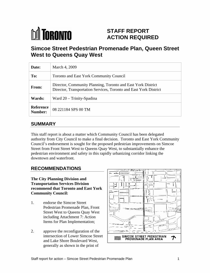
Staff report for action – Simcoe Street Pedestrian Promenade Plan 1 STAFF REPORT ACTION REQUIRED Simcoe Street Pedestrian Promenade Plan, Queen Street West to Queens Quay West Date: March 4, 2009 To: Toronto and East York Community Council From: Director, Community Planning, Toronto and East York District Director, Transportation Services, Toronto and East York District Wards: Ward 20 – Trinity-Spadina Reference Number: 08 221184 SPS 00 TM SUMMARY This staff report is about a matter which Community Council has been delegated authority from City Council to make a final decision. Toronto and East York Community Council’s endorsement is sought for the proposed pedestrian improvements on Simcoe Street from Front Street West to Queens Quay West, to substantially enhance the pedestrian environment and safety in this rapidly urbanizing corridor linking the downtown and waterfront. RECOMMENDATIONS The City Planning Division and Transportation Services Division recommend that Toronto and East York Community Council: 1. endorse the Simcoe Street Pedestrian Promenade Plan, Front Street West to Queens Quay West including Attachment 7: Action Items for Plan Implementation; 2. approve the reconfiguration of the intersection of Lower Simcoe Street and Lake Shore Boulevard West, generally as shown in the print of
Transcript of STAFF REPORT ACTION REQUIRED Simcoe Street … · Simcoe Street Pedestrian Promenade Plan, ......
Staff report for action – Simcoe Street Pedestrian Promenade Plan 1
STAFF REPORT ACTION REQUIRED
Simcoe Street Pedestrian Promenade Plan, Queen Street West to Queens Quay West
Date: March 4, 2009
To: Toronto and East York Community Council
From: Director, Community Planning, Toronto and East York District Director, Transportation Services, Toronto and East York District
Wards: Ward 20 – Trinity-Spadina
Reference Number:
08 221184 SPS 00 TM
SUMMARY
This staff report is about a matter which Community Council has been delegated authority from City Council to make a final decision. Toronto and East York Community Council’s endorsement is sought for the proposed pedestrian improvements on Simcoe Street from Front Street West to Queens Quay West, to substantially enhance the pedestrian environment and safety in this rapidly urbanizing corridor linking the downtown and waterfront.
RECOMMENDATIONS
The City Planning Division and Transportation Services Division recommend that Toronto and East York Community Council:
1. endorse the Simcoe Street Pedestrian Promenade Plan, Front Street West to Queens Quay West including Attachment 7: Action Items for Plan Implementation;
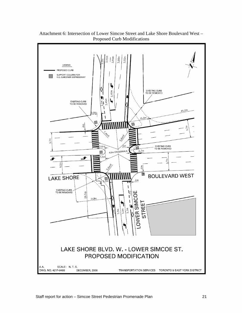
2. approve the reconfiguration of the intersection of Lower Simcoe Street and Lake Shore Boulevard West, generally as shown in the print of
Staff report for action – Simcoe Street Pedestrian Promenade Plan 2
Drawing No. 421F-9488, dated December 2008, in Attachment 6;
3. direct Transportation Services staff to modify curbs, paint new four metre wide zebra striped crosswalks and provide four metre wide sidewalk curb cuts at the intersection of Lake Shore Boulevard West and Lower Simcoe Street in conjunction with the proposed modifications in recommendation 2;
4. direct Transportation Services staff to design and install a pedestrian crossing, as a marked crosswalk, on the east side of Simcoe Street at Station Street and install any necessary pedestrian advisory features subject to necessary funds being approved;
5. direct Transportation Services staff to report on the installation of bike lanes on the section of Simcoe Street from Queen Street West to Front Street West by Summer 2009; and
6. direct City Planning staff to report on the Simcoe Street Pedestrian Promenade Plan, between Front Street West to Queen Street West, by Summer 2009.
FINANCIAL IMPACT
The recommendations in this report have no financial impact. Most of the improvements presented in this report can be secured through development applications that are or may be approved in the area such as 151 Front Street West, 18 York Street (west block), 16 York Street and 25 Lower Simcoe Street. Any shortfall may be dealt with by funding within the Transportation Services Capital Budget as future budgets permit. Some of the improvements need to be further developed and assessed in terms of their potential financial impact and funding requirements. These financial impacts, including the identification of any potential funding partnerships with other levels of government, will be addressed in any future reports required for the approval of these specific improvements.
The painting of crosswalks and the removal of the right-turn channels at the southwest and northeast corners of Lower Simcoe Street and Lake Shore Boulevard can be completed with the funds obtained from Marathon Realty Company Limited (now Fairmont Developments Ltd.). The payment in the amount of $20,599.60 for the Lower Simcoe Street and Lakeshore Boulevard West intersection improvement has been received by the City and deposited a Customer Account.
Staff have a site plan application for 25 Lower Simcoe Street which abuts the right-turn channel at the northeast corner of Lower Simcoe Street and Lake Shore Boulevard West. This right-turn channel is currently closed due to Enwave construction. Although the right-turn channel would be removed, curbs adjusted and temporary asphalt pavement installed prior to the development of this site, the developer will have the obligation to install final paving treatment as part of the development. A similar approach was taken when the two right-turn channels were removed at the northeast and northwest corners of
Staff report for action – Simcoe Street Pedestrian Promenade Plan 3
York Street and Lake Shore Boulevard West. When development is completed at 15 York Street and 16 York Street, the developer will have the responsibility to construct upgraded pavement in the area.
The installation of bird caging and river rock under the F. G. Gardiner Expressway, as set out in this report, is estimated to cost $150,000. This can be accommodated in the Transportation Services budget for capital work under the Gardiner Expressway (Transportation Capital Account CTP122-1-49).
Many of the streetscape improvements will be completed through the opening of the Simcoe Street tunnel (painting crosswalks at Front Street West and Simcoe Street, painting a crosswalk at Station Street and Lower Simcoe Street, and crosswalks at Bremner Boulevard and Lower Simcoe Street), Union Station Revitalization Project (wayfinding signage) and requirements of Official Plan Amendment, Rezoning, Site Plan Approval applications for residential, mixed use and office buildings along Simcoe Street (upgraded landscaping and paving).
DECISION HISTORY
Toronto and East York Community Council, at its meeting of November 27 2007, in adopting as amended, Item TE11.5, “York Street Pedestrian Promenade Plan, Front Street West to Queens Quay West (Ward 20 – Trinity-Niagara and Ward 28 – Toronto Centre-Rosedale)”, among other things, directed the Chief Planner and Executive Director, City Planning to develop a pedestrian promenade plan for Simcoe Street, from Queen Street West to Queens Quay West, and report the results to Toronto and East York Community Council in 2008.
ISSUE BACKGROUND
At community consultation meetings for development applications in the vicinity of Simcoe Street, between Front Street West and Queens Quay West, residents expressed concerns over the poor pedestrian environment on Simcoe Street. While the F. G. Gardiner Expressway poses a barrier between the Financial District and Central Waterfront, residents have stressed that the non-pedestrian friendly environment at the and Lake Shore Boulevard West crossing is a bigger barrier to pedestrian movement.
The Official Plan and Making Waves (the Central Waterfront Secondary Plan) have policies which require improving connections between the Financial District and the waterfront. These include removing the barrier effect of the Lake Shore Boulevard and improving conditions for cyclists.
The Railway Lands East precinct agreements require pedestrian improvements to Simcoe Street between the railway and Lake Shore Boulevard West. In particular, improvements to remove the barrier effect of Lake Shore Boulevard/Harbour Street were required from Marathon Realty and funds were secured to improve pedestrian conditions.
Staff report for action – Simcoe Street Pedestrian Promenade Plan 4
Bike lanes for the section of Simcoe Street between Front Street West and Queens Quay West were approved by City Council in 2008.
In February 2009, City Council approved the Pan Am Games bid facilities plan for 2015. Simcoe Street is located in the vicinity of two main facilities proposed to be used for the games, the Rogers Centre and Air Canada Centre.
COMMENTS
1. Studies, Guidelines and Plans
Attachment 1 provides studies, guidelines and plans that were used in the review of the pedestrian promenade changes to Lower Simcoe Street.
2. Existing Conditions
Attachment 2 provides the existing streetscape amenities for this section of Lower Simcoe Street from Queens Quay West to Front Street West. Simcoe Street, between Queen Street West and Front Street West, operates one-way southbound, with generally a three lane section, with left turn lanes at Front Street West. Between Front Street West and the Railway there are two southbound and one northbound lane. Between Bremner Boulevard and Queens Quay West there are two southbound and two northbound lanes. The Simcoe Street underpass is under construction and scheduled to open in this Spring. This will provide a substantive new link for pedestrian and vehicles connecting the city core and waterfront.
The pavement width of Simcoe Street is generally 14.1 metres wide.
3. Future Conditions
Simcoe Street is evolving to be a focal point for the Financial District South and residential neighbourhoods of Central Bayfront, Railway Lands East and east section of Harbourfront. The buildout population of Railway Lands East (Front Street, Lower Simcoe Street, Yonge Street and F. G. Gardiner Expressway) is anticipated to be approximately 6,500 people. The buildout population of the Central Bayfront (F. G. Gardiner Expressway, York Street, Lake Ontario, and Freeland Street) is anticipated to be approximately 11,000 people. The buildout population of the east section of Harbourfront (Rees Street, F. G. Gardiner Expressway, York Street and Lake Ontario) is anticipated to be approximately 4,100 people. In total, approximately 21,600 people are anticipated to live within 0.5 kilometre of Simcoe Street south of Front Street West.
4. Improvement Area Initiatives
Planting at northwest corner of University Avenue/Front Street West Fall 2008 Union Station South Entrance and Union Plaza (north side of Bremner Boulevard east of York Street)
2009
Staff report for action – Simcoe Street Pedestrian Promenade Plan 5
Simcoe Tunnel 2009 Bike lanes on Simcoe Street, Yonge Street and Bay Street 2009 PATH bridge over York Street at south side of railway 2010 PATH bridge over Bremner Boulevard between the expanded Air Canada Centre and 15 York Street (Maple Leaf Square)
2009
PATH tunnel under York Street between 15 York Street (Maple Leaf Square and 16 York Street (future mixed use development)
2012
Bike parking and repair facility in the York West Teamway 2009 West 8 Queens Quay streetscape improvements 2009 Beautification of the area under the F. G. Gardiner Expressway between York Street and Spadina Avenue
Ongoing
South Linear Park (Concord Adex) and walkway between Spadina Avenue and Yonge Street, on the north side of the F. G. Gardiner Expressway
2008
Other Planned Improvements
York East Teamway Construction date unknown
Weather protecting the Union Station moat Construction date unknown
5. Development Applications in the vicinity of Simcoe Street
149/151 Front Street West/20 York Street/7 Station Street
36-storey office building to be constructed over 151 Front Street West, Station Street and the Skywalk
16 York Street Mixed use with 55- and 65-storey residential condominiums and 31-storey office building
18 York Street 26-storey office building (on the eastern part of the block abutting York Street) and a 37-storey hotel and residential condominium (on the western part of the block abutting Simcoe Street)
180 University Avenue Shangri-La 65-storey hotel and residential condominium
126 Simcoe Street/11 Nelson Street 19-storey residential condominium building (western part of block) and 35-storey residential condominium building (eastern part of the block abutting Simcoe Street)
155 Wellington Street West RBC Centre 42-storey office building 181 Wellington Street West Ritz-Carlton 52-storey hotel and residential
condominium building 25 Lower Simcoe Street Mixed use with 16- and 35-storey residential
condominium buildings
Staff report for action – Simcoe Street Pedestrian Promenade Plan 6
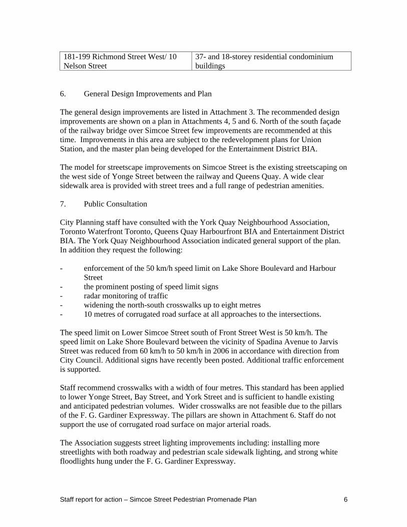
181-199 Richmond Street West/ 10 Nelson Street
37- and 18-storey residential condominium buildings
6. General Design Improvements and Plan
The general design improvements are listed in Attachment 3. The recommended design improvements are shown on a plan in Attachments 4, 5 and 6. North of the south façade of the railway bridge over Simcoe Street few improvements are recommended at this time. Improvements in this area are subject to the redevelopment plans for Union Station, and the master plan being developed for the Entertainment District BIA.
The model for streetscape improvements on Simcoe Street is the existing streetscaping on the west side of Yonge Street between the railway and Queens Quay. A wide clear sidewalk area is provided with street trees and a full range of pedestrian amenities.
7. Public Consultation
City Planning staff have consulted with the York Quay Neighbourhood Association, Toronto Waterfront Toronto, Queens Quay Harbourfront BIA and Entertainment District BIA. The York Quay Neighbourhood Association indicated general support of the plan. In addition they request the following:
- enforcement of the 50 km/h speed limit on Lake Shore Boulevard and Harbour Street
- the prominent posting of speed limit signs - radar monitoring of traffic - widening the north-south crosswalks up to eight metres - 10 metres of corrugated road surface at all approaches to the intersections.
The speed limit on Lower Simcoe Street south of Front Street West is 50 km/h. The speed limit on Lake Shore Boulevard between the vicinity of Spadina Avenue to Jarvis Street was reduced from 60 km/h to 50 km/h in 2006 in accordance with direction from City Council. Additional signs have recently been posted. Additional traffic enforcement is supported.
Staff recommend crosswalks with a width of four metres. This standard has been applied to lower Yonge Street, Bay Street, and York Street and is sufficient to handle existing and anticipated pedestrian volumes. Wider crosswalks are not feasible due to the pillars of the F. G. Gardiner Expressway. The pillars are shown in Attachment 6. Staff do not support the use of corrugated road surface on major arterial roads.
The Association suggests street lighting improvements including: installing more streetlights with both roadway and pedestrian scale sidewalk lighting, and strong white floodlights hung under the F. G. Gardiner Expressway.
Staff report for action – Simcoe Street Pedestrian Promenade Plan 7
With the construction of new buildings staff will insure that more streetlights be installed. Attaching lights to the underside of the F. G. Gardiner Expressway may not be feasible. Furthermore, Toronto Hydro may not assume responsibility for pedestrian scale lighting. As redevelopment occurs on the abutting blocks of land, staff will seek improvements to lighting under the F. G. Gardiner Expressway.
The Entertainment District B.I.A. advise that the plan is a positive improvement in all aspects - particularly in improving north-south connectivity via the new Simcoe tunnel but also under the Gardiner Expressway, as well as the linear open space connection on the north side of Lake Shore Boulevard West between Roundhouse Park and Air Canada Centre. The plan acknowledges the B.I.A. Master Plan and its recommendations with respect to Simcoe Street. The plan defers consideration of the streetscape improvements for Simcoe Street north of Front Street West, in part to give the B.I.A. an opportunity to prepare a coordinated streetscape strategy which will inform the design. B.I.A. staff believe that this will be the very first considerable streetscape opportunity that will be implemented with the design vocabulary that the B.I.A. may decide to prepare. The primary focus of this report being the segment south of Front Street West is in keeping with the already established coordinated streetscape vocabulary.
The B.I.A. may in future consider gateway elements or signage opportunities for wayfinding, which can be introduced within the current design proposed. The B.I.A. staff question the quality of the crosswalks; concrete is a far better quality and visual feature than the zebra painted lines. They believe that at a future time a better approach to crosswalks at key intersection and important pedestrian streets ought to be considered.
The Queens Quay Harbourfront B.I.A. staff are in full support for the proposed improvements on Simcoe Street. They advise that every attempt to humanise the overall environment with further landscaping, and to induce greater pedestrian and bicycle movement from the Entertainment District to the Central Waterfront is much appreciated. They are concerned that the overall sign system in the region of Front Street on all major north-south corridors is still very haphazard. They would like to see plans for a coordinated and uniform system of signage clearly indicating that Toronto's great waterfront is a three-minute walk away.
They encourage the installation of bright overhead illumination at the pedestrian crossings of Lake Shore Boulevard and Harbour Street, and that this idea is carried out uniformly for all north-south crossings.
Planning staff will work with staff at Waterfront Toronto, Toronto Hydro, Transportation Services and the B.I.A. offices to ensure that the above noted improvements from the B.I.A. are implemented.
8. Operational Features and Recommended Improvements
a. Deferral of Reporting on the Section Between Queen Street West and Front Street West
Staff report for action – Simcoe Street Pedestrian Promenade Plan 8
Staff request that recommendations on this section of Simcoe Street be deferred to 2009 for the following reasons:
- a report on bike lanes for this section is anticipated in the first half of 2009; - the operation of Simcoe Street will be reviewed in light of the soon to be open
underpass; - there are issues to be resolved such as bus drop-off and pick-up for Roy
Thompson Hall; and - the Entertainment District BIA Master Plan is under development with
anticipated completion in early 2009 (this document will help inform the design for the north section of Simcoe Street).
b. Wayfinding Signage and Special Attraction Signs
Most of the wayfinding signage is provided for drivers and not pedestrians. There are only two roadway special attraction signs including:
- “Convention Centre South” High level pole sign on the northeast and southwest side of Simcoe Street at Front Street West
- “Air Canada Centre”, “Convention Centre”, and “CN Tower” on the southeast side of Simcoe Street at Bremner Boulevard.
There are no pedestrian scale wayfinding signs. As GO Transit expands service and stairways, staff anticipate additional GO signage in the Simcoe Street tunnel. Downtown Discovery Walk signage exists at Bremner Boulevard. Staff will seek to develop a wayfinding signage program in conjunction with the implementation of the Union Station District Plan.
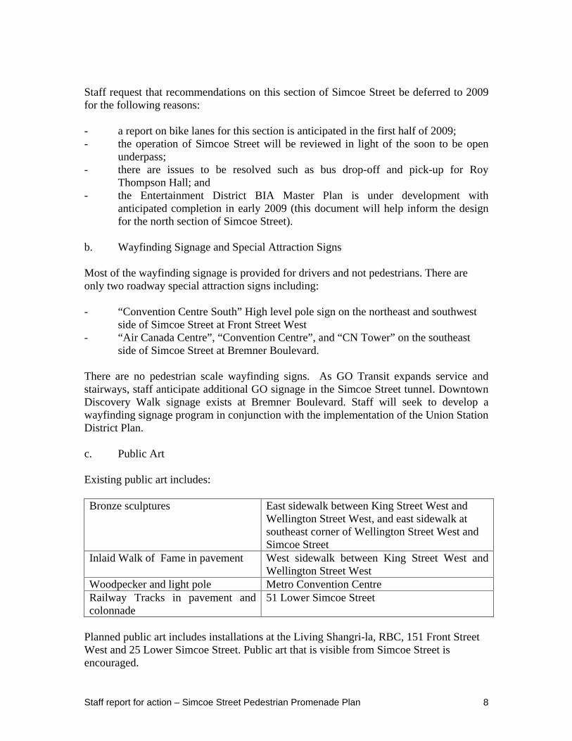
c. Public Art
Existing public art includes:
Bronze sculptures East sidewalk between King Street West and Wellington Street West, and east sidewalk at southeast corner of Wellington Street West and Simcoe Street
Inlaid Walk of Fame in pavement West sidewalk between King Street West and Wellington Street West
Woodpecker and light pole Metro Convention Centre Railway Tracks in pavement and colonnade
51 Lower Simcoe Street
Planned public art includes installations at the Living Shangri-la, RBC, 151 Front Street West and 25 Lower Simcoe Street. Public art that is visible from Simcoe Street is encouraged.
Staff report for action – Simcoe Street Pedestrian Promenade Plan 9
d. Sidewalks
All sidewalks are concrete. Sidewalks will generally be widened as buildings are constructed in the area.
Staff recommend that a pedestrian crossing be provided, either by installing a concrete sidewalk or a marked pedestrian crosswalk at Station Street.
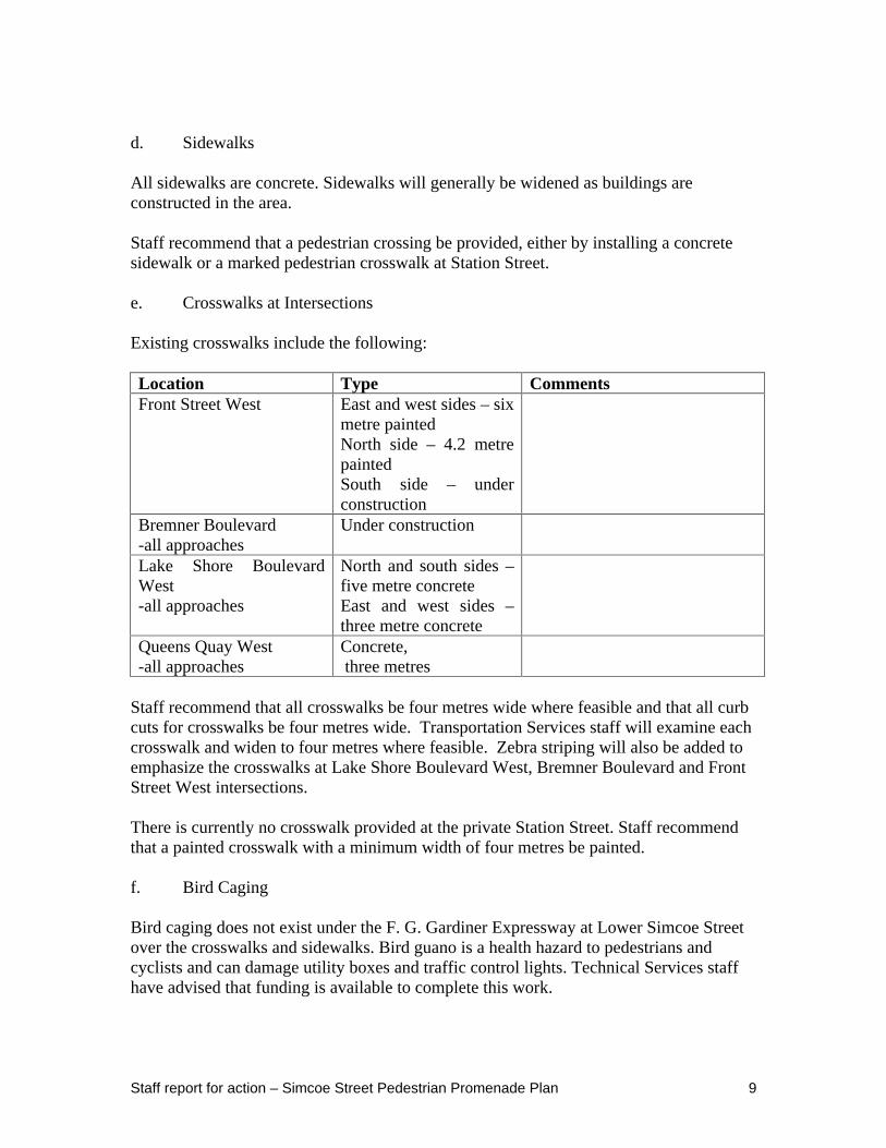
e. Crosswalks at Intersections
Existing crosswalks include the following:
Location Type Comments Front Street West East and west sides – six
metre painted North side – 4.2 metre painted South side – under construction
Bremner Boulevard -all approaches
Under construction
Lake Shore Boulevard West -all approaches
North and south sides – five metre concrete East and west sides – three metre concrete
Queens Quay West -all approaches
Concrete, three metres
Staff recommend that all crosswalks be four metres wide where feasible and that all curb cuts for crosswalks be four metres wide. Transportation Services staff will examine each crosswalk and widen to four metres where feasible. Zebra striping will also be added to emphasize the crosswalks at Lake Shore Boulevard West, Bremner Boulevard and Front Street West intersections.
There is currently no crosswalk provided at the private Station Street. Staff recommend that a painted crosswalk with a minimum width of four metres be painted.
f. Bird Caging
Bird caging does not exist under the F. G. Gardiner Expressway at Lower Simcoe Street over the crosswalks and sidewalks. Bird guano is a health hazard to pedestrians and cyclists and can damage utility boxes and traffic control lights. Technical Services staff have advised that funding is available to complete this work.
Staff report for action – Simcoe Street Pedestrian Promenade Plan 10
g. Graffiti
Graffiti is generally not a serious problem in the area.
h. Street Furniture
In 2007, City Council approved a new coordinated street furniture program. This section of Simcoe Street would be an ideal candidate to introduce street furniture due to the proximity of the Rogers Centre, Air Canada Centre and Harbourfront. Staff recommend that Transportation Services Public Realm Unit – Street Furniture staff give consideration to designating this section of Simcoe Street as a priority for the roll out of coordinated street furniture in 2009.
i. Weather Protection
Goals in the Official Plan, Central Waterfront Secondary Plan and Railway Lands East Secondary Plan include providing connections between the Financial District and the waterfront. The zoning by-law for the Railway Lands East requires continuous weather protection in the form of three metre or deeper canopies or colonnades along York Street, Bay Street, Yonge Street, Lower Simcoe Street, Lake Shore Boulevard and Bremner Boulevard. All of the developments approved or proposed reflect the zoning by-law requirement.
j. Bicycle Post and Lock Up Rings
Staff recommend that Pedestrian and Cycling Infrastructure staff review the following locations:
- east side between the railway and Lake Shore Boulevard West - both sides between Lake Shore Boulevard and Queens Quay
Bicycle post and lock up rings will be installed where feasible. This will be coordinated with the streetscape plans for new developments and the coordinated street furniture program.
k. River Rock
Different sized river rock to form patterns has been used in the Clean and Beautiful City project by Transportation Services for the area under the F. G. Gardiner Expressway in sections between Yonge Street and Rees Street. Staff recommend that river rock continue to be installed in this area to improve its appearance.
l. Guiderails
Guiderails exist in the vicinity of Simcoe Street.
Staff report for action – Simcoe Street Pedestrian Promenade Plan 11
The beautification project for the underside of the F. G. Gardiner Expressway, between Yonge Street and York Street resulted in the removal of guiderails where safety would not be compromised. The guiderails where replaced with decorative splash guards and river rock set in concrete. Staff recommend that where feasible guiderails continue to be removed within 20 metres of Simcoe Street and that river rock, splash guards or other suitable amenity be used to direct pedestrian movement.
m. Improvements to the Intersection of Lower Simcoe Street and Lake Shore Boulevard West
The Railway Lands East agreements require the removal of the right-turn channels at Lower Simcoe Street and Lake Shore Boulevard West to improve the pedestrian environment of Lake Shore Boulevard West. As part of the Lower Yonge Street Pedestrian Promenade Plan, in 2006 the right-turn channel from southbound Yonge Street to westbound Lake Shore Boulevard was removed. The right-turn channels at York Street and Lake Shore Boulevard West were removed in December 2008.
Transportation Services staff has reviewed the intersection of Lower Simcoe Street and Lake Shore Boulevard West to determine what changes could be made to improve the environment for pedestrians.
East Side of Lower Simcoe Street
Presently, pedestrians on the east side of Lower Simcoe Street must cross the westbound to northbound right-turn channel to a traffic island. This crossing is problematic for pedestrians because it is unprotected and vehicles have the right-of-way.
Removal of the westbound-to-northbound right-turn channel would eliminate this uncontrolled pedestrian crossing. Although there will now be conflicts between pedestrians crossing Lower Simcoe Street on the north side of the intersection and westbound motorists turning right on a green signal, the overall environment should improve for pedestrians.
Minor changes are recommended to the east side median on Lake Shore Boulevard West to allow for a greater pedestrian storage area.
West Side of Lower Simcoe Street
Presently, pedestrians on the west side of Lower Simcoe Street cross the eastbound-to- southbound right-turn channel to a traffic island. The existing traffic island is small and cannot accommodate significant volumes of pedestrians. Removal of the eastbound-to-southbound right-turn channel will provide pedestrians with more sidewalk space and will improve the environment. There will be an increase in delays and queuing for motorists turning right from Lake Shore Boulevard West to Lower Simcoe Street. However, the displaced right-turning vehicles can readily be accommodated through the traffic signal.
Staff report for action – Simcoe Street Pedestrian Promenade Plan 12
Attachments 5 (Simcoe Street Pedestrian Promenade Plan, south section) and 6 (Drawing No. 421F-9488, dated December 2008) show the removal of the right-turn channels and modification to the crosswalks, at Lake Shore Boulevard West and Lower Simcoe Street.
A walkway on the north side of Lake Shore Boulevard West between Spadina Avenue and Yonge Street has recently been constructed. The removal of the right-turn channels will also assist with improving east-west connections along the walkway.
The York Quay Neighbourhood Ratepayers Association requested that the north-south crosswalks on Lower Simcoe Street at Lake Shore Boulevard West be reduced in length by narrowing the roadways. The minimum recommended lane width is 3.3 metres and four metres for a curb lane. Most of the lane widths are greater than four metres. A minor roadway narrowing at the northeast corner of the intersection is proposed. Due to the high volume of trucks and buses in the area other lane narrowings are not advisable at this time. With tight turning radii it would be difficult for large vehicles to manoeuvre safely with narrowed lanes. As well, such measures would require extensive construction and substantial capital costs.
n. Street Trees
Although there are no dead street trees on Lower Simcoe Street, between Queens Quay West and Bremner Boulevard, trees are generally in poor condition. The trees are placed in large trenches. Staff recommend that Urban Forestry add street trees to the west side of Lower Simcoe Street, between Grand Trunk Crescent and Lake Shore Boulevard West.
o. Landscaping Opportunities
Buried tree trenches are recommended similar to the existing ones on the west side of Lower Simcoe Street north of the F.G Gardiner Expressway. The planter boxes may be constructed in conjunction with abutting buildings. They would be maintained by the owner of the abutting property.
p. Litter/Recycling Receptacles
EcoMedia garbage bins are located in the following locations:
Southwest corner of Lower Simcoe Street and Queens Quay West Northeast corner of Lower Simcoe Street and Queens Quay West Northwest corner of Lower Simcoe Street and Lake Shore Boulevard West Southwest corner of Lower Simcoe Street and Bremner Boulevard
Additional bins are recommended at all four corners of Bremner Boulevard and Lower Simcoe Street as well as the northeast corner of Lower Simcoe Street and Lakeshore Boulevard West. This request has been forwarded for consideration under the coordinated street furniture implementation in 2009.
Staff report for action – Simcoe Street Pedestrian Promenade Plan 13
q. Double Poles
Like many neighbourhoods with streetcar routes in downtown Toronto, there are redundant (double) poles on Lower Simcoe Street. Staff recommend that the redundant (double) pole at the northeast corner of Lower Simcoe Street and Queens Quay West be removed by TTC and Toronto Hydro staff. This will provide design consistency with the single poles that exist on the other corners of Lower Simcoe Street and Queens Quay West.
r. PATH
The PATH system will be expanded to include indoor routes between Union Station and the southeast corner of Front Street West and Simcoe Street, and northeast corner of Lake Shore Boulevard West and Lower Simcoe Street. Proper PATH signage will be secured when these developments are constructed.
s. East-West Connections to Simcoe Street
A Clean and Beautiful City initiative has been the beautification of the area under the F. G. Gardiner Expressway between Yonge Street and Spadina Avenue. The portion between York Street and Yonge Street has been completed. A South Linear Park and walkway route has been created between Spadina Avenue and Yonge Street along the north side of the F. G. Gardiner Expressway and opened in September 2007. Eventually, much of this route will be weather protected through abutting buildings.
t. Simcoe Street Underpass
The underpass is expected to open in early 2009. The design includes decorative pedestrian scale lights over the sidewalks. In the future GO Transit has plans to add stairways connecting Lower Simcoe Street to the track level.
9. Plan Implementation
The plan will be implemented through the reconstruction of the streetscape abutting new buildings and redevelopment of Union Station. The removal of the right-turn channels at
Staff report for action – Simcoe Street Pedestrian Promenade Plan 14
Lower Simcoe Street and Lake Shore Boulevard West is estimated to be $280,000. Funding for this improvement is available from a required contribution made by Marathon Realty Company Limited (now Fairmont Developments Ltd.).
CONCLUSION
Simcoe Street is a rapidly being developed with large mixed use developments. It is a key connection between the Financial District and waterfront. It will serve as a major pedestrian and cyclist route with the opening of the Simcoe Tunnel in 2009. Staff recommend the City Council endorse the Simcoe Street Pedestrian Promenade Plan as outlined in this report.
CONTACT Al Rezoski, Acting Manager, Downtown Section Andre Filippetti, Manager, Traffic Toronto and East York District Planning Tel. No. 416-392-1791 Transportation Services Division Fax No. 416-392-1330 Tel. No: 416-392-7713 E-mail: [email protected] Fax: No 416-392-1920
E-mail: [email protected]
SIGNATURES
_______________________________ ________________________________
Raymond David, Director Peter Noehammer, Director Community Planning Transportation Services Toronto and East York District Toronto and East York District
(p:\2009\Cluster B\pln\Teycc30629344056) - tm
ATTACHMENTS
Attachment 1: Studies/Guidelines and Plans Attachment 2: Existing Streetscape Amenities – Lower Simcoe Street Attachment 3: General Design Objectives for the Simcoe Street Pedestrian Promenade
Plan (Front Street West to Queens Quay West) Attachment 4: Simcoe Street Pedestrian Promenade Plan (north section) Attachment 5: Simcoe Street Pedestrian Promenade Plan (south section) Attachment 6: Intersection of Lower Simcoe Street and Lake Shore Boulevard West –
Proposed Curb Modifications, (421F-9488, dated December 2008) Attachment 7: Action Items for Plan Implementation
Staff report for action – Simcoe Street Pedestrian Promenade Plan 15
Attachment 1: Studies/Guidelines and Plans
Railway Lands East Secondary Plan designation
“Improved at-grade Pedestrian Routes and Rail Corridor Underpasses”, Front Street West/Station Street to Lake Shore Boulevard West
Central Waterfront Secondary Plan
“Key Pedestrian Links”, and “Bicycle Lanes (on-street)” King Street West to Queens Quay West
Union Station District Plan “North South Connection”, Wellington Street West to Harbour Street
Queens Quay Harbourfront B.I.A.
A plan for area in the BIA between Harbour Street and Queens Quay West is under development
Entertainment District B.I.A. A plan for area in the BIA between just south of Queen Street West and Lake Shore Boulevard West is under development (draft documents designate the section between Queen Street West and Wellington Street West as a heritage street, Wellington Street West to Queens Quay West as a green street, the section between King Street West and Wellington Street West is also designated a red carpet (open spaces)).
Revised Precinct B Precinct Agreement, dated November 29, 1996, as amended by Amending Agreement No. 1 registered on February 14, 2002 and further Amending Agreement No. 2, dated June 28, 2002
These agreements, among other things, secured funds to undertake work on Lower Simcoe Street to reduce the barrier effect of the F. G. Gardiner and to improve pedestrian flows, including provisions for improvements to the pedestrian crossings at Lake Shore Boulevard West and Lower Simcoe Street
Cultural Districts in the Public Realm – Roy Thomson Hall + Bell Lightbox Section
Recommendations for the area approximately from Adelaide Street West to Front Street West between University Avenue and Peter Street
Staff report for action – Simcoe Street Pedestrian Promenade Plan 16
Attachment 2: Existing Streetscape Amenities – Lower Simcoe Street
Streetscape Amenities Number North of Front Street, South of Front Street
Comments
Benches 2 (private),8 Mailboxes 4, 1 Newspaper boxes 8,5 Traffic control signals
Pedestrian crosswalk lights
Yes
All
All except at Richmond Street West and Queen Street West; new traffic control signals at Bremner Boulevard were activated in December 2008
Countdown pedestrian signals have been installed at all existing crosswalks
Teamways None TTC stops None No TTC route on this section of
Simcoe Street Wayfinding signage Yes only at Front
Street West, Only at Bremner Boulevard
Sign for Convention Centre
Discovery Walk – crosses Simcoe Street at Bremner Boulevard, and signs for the Air Canada Centre, Convention Centre, CN Tower
PATH connections 3 Southwest corner of King Street West (Roy Thompson Hall), southeast corner of Station Street (Skywalk), and Skywalk over Simcoe Street at south limit of the railway (Convention Centre South Building)
PATH signage Yes 1 location
Southeast corner of Station Street
Heritage signage None Cultural corridor No Abutting heritage buildings
5, 2
Discovery route signage No, Yes “Downtown Toronto”, the route is on Bremner Boulevard, signs are at the southwest corner of Bremner Boulevard and Simcoe Street.
Bike post and rings 16, 13 All on west side south of Front Street Pedestrian scale lighting Yes, yes Variety, and railway to Queens Quay
Staff report for action – Simcoe Street Pedestrian Promenade Plan 17
West there are Railway Lands globe lights
Street trees Yes,
Yes
Sporadic and not healthy
Temporary planting railway to Bremner Boulevard, east side and south of Bremner Boulevard to Grand Trunk Crescent, and planting Lake Shore Boulevard West to Queens Quay West
The street generally lacks pedestrian amenities due to the narrow sidewalks and current hoarding around construction sites. There are approximately 14 million visitors to Harbourfront per year, many that use Lower Simcoe Street.
Staff report for action – Simcoe Street Pedestrian Promenade Plan 18
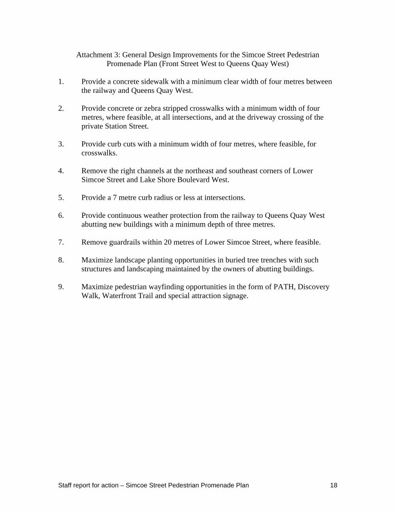
Attachment 3: General Design Improvements for the Simcoe Street Pedestrian Promenade Plan (Front Street West to Queens Quay West)
1. Provide a concrete sidewalk with a minimum clear width of four metres between the railway and Queens Quay West.
2. Provide concrete or zebra stripped crosswalks with a minimum width of four metres, where feasible, at all intersections, and at the driveway crossing of the private Station Street.
3. Provide curb cuts with a minimum width of four metres, where feasible, for crosswalks.
4. Remove the right channels at the northeast and southeast corners of Lower Simcoe Street and Lake Shore Boulevard West.
5. Provide a 7 metre curb radius or less at intersections.
6. Provide continuous weather protection from the railway to Queens Quay West abutting new buildings with a minimum depth of three metres.
7. Remove guardrails within 20 metres of Lower Simcoe Street, where feasible.
8. Maximize landscape planting opportunities in buried tree trenches with such structures and landscaping maintained by the owners of abutting buildings.
9. Maximize pedestrian wayfinding opportunities in the form of PATH, Discovery Walk, Waterfront Trail and special attraction signage.
Staff report for action – Simcoe Street Pedestrian Promenade Plan 19
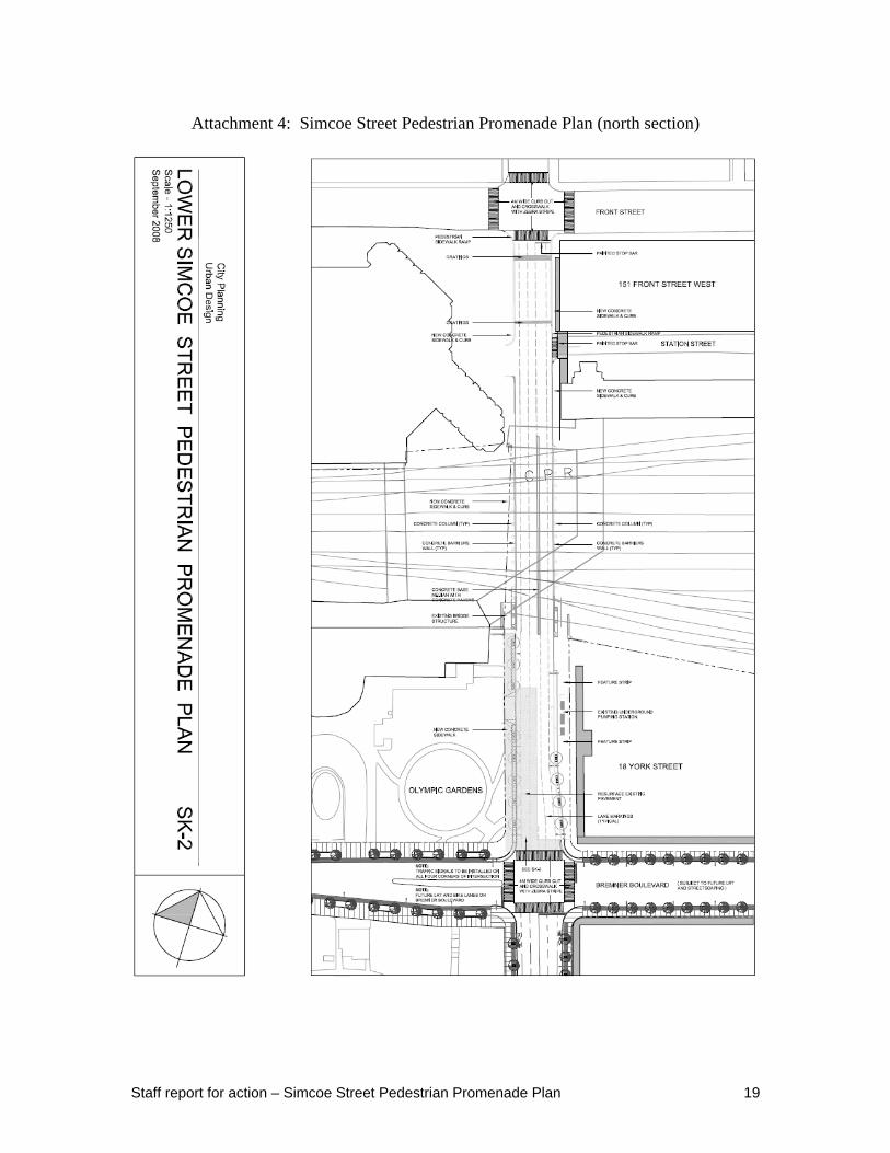
Attachment 4: Simcoe Street Pedestrian Promenade Plan (north section)
Staff report for action – Simcoe Street Pedestrian Promenade Plan 20
Attachment 5: Simcoe Street Pedestrian Promenade Plan (south section) [See attached 11X17 fold out]
Staff report for action – Simcoe Street Pedestrian Promenade Plan 21
Attachment 6: Intersection of Lower Simcoe Street and Lake Shore Boulevard West – Proposed Curb Modifications
Staff report for action – Simcoe Street Pedestrian Promenade Plan 22
Attachment 7: Action Items for Plan Implementation
Action Items
Technical Services
1. Technical Services staff to install bird caging under the F. G. Gardiner Expressway, at the intersection with Lower Simcoe Street over the crosswalks and sidewalks.
Transportation Services
2. Transportation Services staff to install river rock along Lake Shore Boulevard West west and east of Lower Simcoe Street.
3. Transportation Services staff to remove, where feasible guiderails within 20 metres of Lower Simcoe Street.
4. Public Realm Unit – Street Furniture staff to locate litter/recycling receptacles at the four corners of Lower Simcoe Street and Bremner Boulevard.
City Planning
5. City Planning staff to require continuous weather protection with a minimum depth of three metres for all building walls abutting Lower Simcoe Street.
6. City Planning staff to require that all buildings with PATH connections have a PATH logo on the Lower Simcoe Street façade, and a PATH map and ceiling compass inside the Lower Simcoe Street doors.
Urban Forestry
7. Urban Forestry staff to add street trees to the west side of Lower Simcoe Street between Grand Trunk Crescent and Lake Shore Boulevard West (abutting Roundhouse Park).