Spatial Data Analysis Network (SPAN) iiii N e w s l e t t e r · iiii Spatial Data Analysis Network...
15
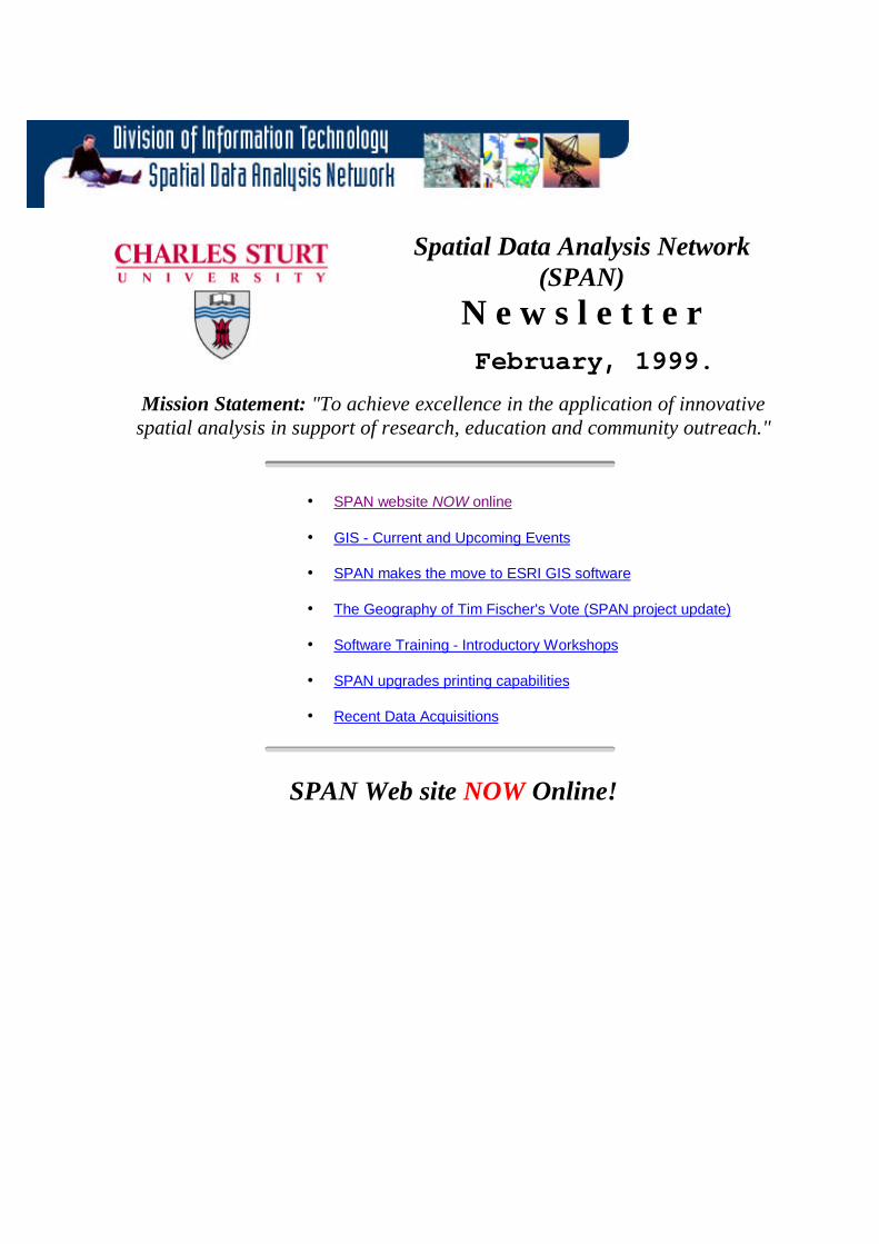
iiii Spatial Data Analysis Network (SPAN) N e w s l e t t e r February, 1999. Mission Statement: "To achieve excellence in the application of innovative spatial analysis in support of research, education and community outreach." • SPAN website NOW online • GIS - Current and Upcoming Events • SPAN makes the move to ESRI GIS software • The Geography of Tim Fischer's Vote (SPAN project update) • Software Training - Introductory Workshops • SPAN upgrades printing capabilities • Recent Data Acquisitions SPAN Web site NOW Online!
Transcript of Spatial Data Analysis Network (SPAN) iiii N e w s l e t t e r · iiii Spatial Data Analysis Network...
iiii
Spatial Data Analysis Network(SPAN)
N e w s l e t t e rFebruary, 1999.
Mission Statement: "To achieve excellence in the application of innovativespatial analysis in support of research, education and community outreach."
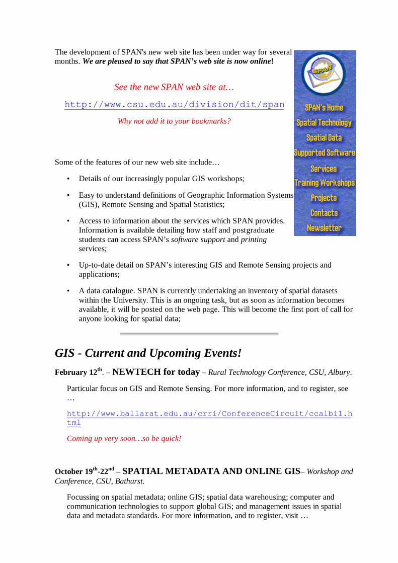
• SPAN website NOW online
• GIS - Current and Upcoming Events
• SPAN makes the move to ESRI GIS software
• The Geography of Tim Fischer's Vote (SPAN project update)
• Software Training - Introductory Workshops
• SPAN upgrades printing capabilities
• Recent Data Acquisitions
SPAN Web site NOW Online!
The development of SPAN's new web site has been under way for severalmonths. We are pleased to say that SPAN’s web site is now online!
See the new SPAN web site at…
http://www.csu.edu.au/division/dit/span
Why not add it to your bookmarks?
Some of the features of our new web site include…
• Details of our increasingly popular GIS workshops;
• Easy to understand definitions of Geographic Information Systems(GIS), Remote Sensing and Spatial Statistics;
• Access to information about the services which SPAN provides.Information is available detailing how staff and postgraduatestudents can access SPAN’s software support and printingservices;
• Up-to-date detail on SPAN’s interesting GIS and Remote Sensing projects andapplications;
• A data catalogue. SPAN is currently undertaking an inventory of spatial datasetswithin the University. This is an ongoing task, but as soon as information becomesavailable, it will be posted on the web page. This will become the first port of call foranyone looking for spatial data;
GIS - Current and Upcoming Events!February 12th. – NEWTECH for today – Rural Technology Conference, CSU, Albury.
Particular focus on GIS and Remote Sensing. For more information, and to register, see…
http://www.ballarat.edu.au/crri/ConferenceCircuit/ccalbi1.html
Coming up very soon… so be quick!
October 19th-22nd – SPATIAL METADATA AND ONLINE GIS– Workshop andConference, CSU, Bathurst.
Focussing on spatial metadata; online GIS; spatial data warehousing; computer andcommunication technologies to support global GIS; and management issues in spatialdata and metadata standards. For more information, and to register, visit …

http://clio.mit.csu.edu.au/admin/metadata.html
or contact Leanne Jones, School of Information Technology, CSU, Bathurst.
Ph: (+612) 6338 4724 Fax: (+612) 6338 4649 Email: [email protected]
SPAN Makes the Move to ESRI GISSoftwareSPAN has switched its top end GIS software from GenaMap to ARC/INFO. Produced byEnvironmental Systems Research Institute (ESRI) of Redlands, California, ARC/INFO is oneof the world’s leading GIS software packages. Used for research and development by over100,000 users worldwide, ARC/INFO facilitates sophisticated, high-end geoprocessingoperations. ARC/INFO integrates tabular DBMS data with the following data types: vector,raster, photographs, scanned documents, satellite images, CAD drawings, and sound/video.To complement ARC/INFO SPAN has also purchased ArcView GIS software (ARC/INFO’syounger sibling) to facilitate easy data querying and map creation. With ARC/INFO youcan…
• create and maintain geographic information;
• Manage large, multi-user spatial databases;
• Integrate multiple data types;
• Perform sophisticated spatial analysis;
• Produce high-quality maps for publication;
SPAN has initially purchased 10 ARC/INFO and 10 ArcView licenses, which will beavailable to users across the University. The addition of ARC/INFO to SPAN’s suite ofsoftware products hails exciting times ahead, for both existing and potential GIS users withinthe University. New workshops will be offered to train staff in the use of this software.
The Geography of Tim Fischer’s Vote – SPAN ProjectUpdate.

Some interesting patterns have already emerged. Whilst Tim Fischer managed to retain hisseat, a swing of 13% was recorded against the Nationals. Most of this swing went to the OneNation party, but it was not a uniform swing. Our results show that support for One Nationwas particularly strong in the West of the electorate. Also of interest was the above averagesupport for the ALP in the major towns of Albury and Deniliquin, and along the RiverMurray. With further research, we hope to reveal some of the factors contributing to thespatial variation in voter behaviour.
Left: 1998 Federal Election - Voting Patterns in Albury
Software Training - Introductory GIS WorkshopsSPAN finished 1998 by running a number of training workshops including Introductory GISand S-PLUS workshops in both Bathurst and Albury. SPAN will continue to offer a series ofGIS training workshops in Albury, Bathurst and Wagga throughout 1999.
SPAN’s GIS training workshops are designed to provide hands-on training in a variety ofGIS software packages (see above). Our major aim is to train workshop participants to a level
where they can comfortably perform simple GIS tasks such as data querying and mapping.Additionally, we are keen for participants to form an appreciation of the potential uses of GIS
in their particular area of endeavour.
SPAN is currently undertaking a research project to examine the spatial nature of voterbehaviour within the Federal Division of Farrer; the seat currently held by the Deputy PM, TimFischer (National Party), in association with Associate Professor Jim Forrest (Geography Dept.,Macquarie University) and Associate Professor Margaret Alston (Centre for Rural SocialResearch, CSU Wagga). Tim Fischer’s seat resides in Southern NSW, running along the MurrayRiver from Khancoban in the East to the South Australian border in the West (see right).Election results from the 1996 and 1998 elections have been analysed using an entropy processwhich attempts to group together polling booths which displayed similar patterns of
voting.

SPAN can (if requested) customise existing courses or develop new ones to meet the specificneeds of users. SPAN has up until now made extensive use of GenaMap (Genasys) softwarein its training courses, but with our move to ESRI software (ARC/INFO & ArcView), thisfocus is likely to change. Training courses are also run using MapInfo software (PC baseddesktop GIS). Ongoing technical support and further training is available to participants ofour training courses.
Introductory GIS Workshop Dates for 1999…
LocationAlbury Bathurst Wagga Wagga
Friday 5th March Friday 5th March Friday 30th April
Friday 7th May Friday 2nd July Friday 11th June
Friday 2nd July Friday 17th September Friday 13th August
1999Dates
*Tuesday 30th November Tuesday 30th November Friday 1st October
* Workshop dates may be subject to change.Check with your local SPAN representative for the latest information.
S-Plus Spatial Statistics Workshop Dates for 1999...
At each campus, an S-Plus workshop will be run one day prior to the Introductory GISWorkshops.
You can register for a workshop by visiting the SPAN web site at … workshops
Or by contacting your local SPAN representative.
SPAN Upgrades Printing Capabilities.SPAN has recently acquired a large format Hewlett-Packard Designjet2500CP Printer. Capable of producing photo-realistic images, thisprinter is ideal for producing high quality conference posters, maps andimage presentations. This printer is capable of printing a variety of fileformats, including Adobe Postscript and can print up to A0 sizesheets (84cm x 118cm). This printer becomes the obvious choice forcreating high quality, eye-catching output. If you are interested inmaking use of this facility, contact SPAN in Wagga on 32 165.

Recent Data Acquisitions.
Reduced Output Spatial Data
SPAN has purchased Reduced Output Spatial Data for three Australian mainland states -New South Wales, Victoria and the ACT. This is a map dataset (see example to right) whichcan be used to display towns, roads (3 levels of detail), rivers (2 levels), lakes, features (suchas hospitals, parks, schools etc.), and national park locations… amongst others. This datashould facilitate the production of high quality maps for inclusion in reports and publishedarticles.
for more information on ROSD see...
http://www.datamall.com.au/Catalog/product.asp?pid=1550
Integrated Regional Database ‘98
SPAN has also purchased the latest Integrated Regional Database (IRDB98) from theAustralian Bureau of Statistics. This dataset covers the whole of Australia, and providesusers with the ability to access and analyse regionalised economic and social data from awide range of ABS and non-ABS collections.
IRDB98 can be used for a whole range of applications including…
• developing regional business profiles (including tourism & retail sectors);
• identifying trends in regional agricultural production;
• employment patterns analysis;
• providing information for broad or specific regional demographic analysis;
• providing information for socio-economic analysis (eg. a region’s incomedistribution);
see http://www.statistics.gov.au for more information onIRDB98.
SPAN has recently received funding from an Research Management Committee Block Grant topurchase a number of datasets which should prove very useful to CSU researchers. Thesedatasets are valuable additions to SPAN’s collection, which already includes ABS census data
from the 1991 and 1996 census’ of the Australian population.

Where to find the Spatial Data Analysis Network (SPAN)…Based in Wagga, SPAN also has staff in Albury and Bathurst.
Correspondence to… PO Box 588, Wagga Wagga, NSW 2678.
Albury Chris MedlinRm 235, New Building,Thurgoona Campus.Ph: (02) 6051 9922Fax: (02) 6931 6919E-mail: [email protected]
Bathurst Jannine NivenRoom 215, Building S1Bathurst.Ph: (02) 6338 4676Fax: (02) 6338 4298E-mail: [email protected]
Wagga Wagga CraigPoynterGround Floor, Building 10,Wagga Wagga.Ph: (02) 6933 2165Fax: (02) 6933 2735E-mail: [email protected]
or link to contacts
Spatial Data Analysis Network (SPAN)
NEWSLETTER
OCTOBER 1999
Mission Statement: "To achieve excellence in the application of innovative spatialanalysis in support of research, education and community outreach."
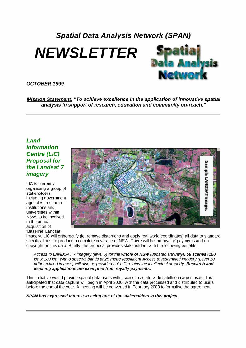
LandInformationCentre (LIC)Proposal forthe Landsat 7imagery
LIC is currentlyorganising a group ofstakeholders,including governmentagencies, researchinstitutions anduniversities withinNSW, to be involvedin the annualacquisition of‘Baseline’ Landsatimagery. LIC will orthorectify (ie. remove distortions and apply real world coordinates) all data to standardspecifications, to produce a complete coverage of NSW. There will be ‘no royalty’ payments and nocopyright on this data. Briefly, the proposal provides stakeholders with the following benefits:
Access to LANDSAT 7 imagery (level 5) for the whole of NSW (updated annually). 56 scenes (180km x 180 km) with 8 spectral bands at 25 metre resolution! Access to resampled imagery (Level 10orthorectified images) will also be provided but LIC retains the intellectual property. Research andteaching applications are exempted from royalty payments.
This initiative would provide spatial data users with access to a state-wide satellite image mosaic. It isanticipated that data capture will begin in April 2000, with the data processed and distributed to usersbefore the end of the year. A meeting will be convened in February 2000 to formalise the agreement.
SPAN has expressed interest in being one of the stakeholders in this project.

New Raster Data Acquisition – Digital Topographic Maps…
SPAN and the Farrer Centre have jointly purchased scanned images of the topographic maps of theNSW. This data can be used as a backdrop to the airborne video system capture and will help the pilot
navigate during flight sessions.
The data consists of scannedimages (175dpi) of thetopographic maps. There are atotal of 1100 images coveringNSW, comprising of a range ofmedium to small scale topomaps (750 maps @ 1:25000 ,230 maps @ 1:50000, 120maps @ 1:100000). This datawill provide state-widecoverage of NSW and can beused as a backdrop for variousGIS and Remote Sensingresearch applications.Copyright on the data requiresthat consultancy projects paya 10% royalty, whilst teachingand research applications areexempt.
CSU’s New Airborne Video System –Approaching Completion
After several years of design, development and construction CharlesSturt University's new multispectral airborne digital imagingsystem (MADIS) is finally approaching completion. A Wagga AirCentre Cessna 310 now has a hole cut in its floor to accommodatethe MADIS. After a rebuild of the camera mount, the MADIS now hasa clear field of view out of the aircraft. The MADIS has been in theaircraft, run off aircraft power and has been confirmed to not interferewith aircraft instruments. A final modification is being made to mountthe data acquisition system above the cameras in the aircraft. Thisone piece architecture will facilitate rapid installation and removal ofthe MADIS.
This new system has several advantages over the old system. At 1mspatial resolution the new system covers 1008m x 1008m with a 10bit data depth compared to the old system's coverage of 740m x 576m at 8 bit data depth. The newcameras used are progressive scan cameras which eliminates the annoying "shear" distortion ( odd andeven rows of the image offset by 0 - 4 pixels ) inherent in the old system due to it's interlaced cameras. Acombination of variable electronic shutter speed and fixed camera apertures instead of fixed shutterspeed and belt driven apertures is expected to greatly improve the radiometric calibration of the system.In addition, sourcing power from the aircraft instead of from batteries greatly reduces the weight andincreases the running time of the new system. Staff interested in MADIS imagery should contactSPAN, Wagga.

Move to ERDAS IMAGINE software proposed forRemote Sensing.
SPAN is proposing to change its remote sensing software. SPAN recentlylearnt that future development of ERMapper will be tailored towards PC market.This means that there will be no future upgrades for the UNIX version of thesoftware. Therefore, SPAN proposes a move to ERDAS IMAGINE toaccommodate UNIX-based research applications. A 15 seat licence is being considered. SPAN plans toconduct training workshops next year to introduce new users to this software.
Latest Developments in GIS software.
CSU has renegotiated the existing GIS software license agreement with ESRI, subsequently purchasingan ESRI Site License. The Faculty of Science and Agriculture and the Division of InformationTechnology are financing the $20K annual fee. This development means that ArcInfo/ArcView will be theprimary software platform for GIS research and teaching within the University. GIS users will now enjoyunlimited and multi-platform access to both ArcInfo and ArcView.
Please note - the long tradition of UNIX enjoying better softwarefunctionality than the PC/NT counterpart is over. The new release ofArcInfo 8 has new GUI features for NT only.
Referendum 1999 – Preliminary Analysis andObservations
In the week or so after the republic referendum on November 6th, SPANwas able to undertake some preliminary investigations into thereferendum voting patterns exhibited by Australian voters.
These preliminary results make for some veryinteresting viewing.
At first glance it would appear that the whole of Australiavoted against the proposed changes. Of 12,387,729enrolled voters, 45.13% voted YES whilst 54.87% votedNO. And whilst in every state (with the exception of theACT) the overall result was a NO vote, there are someinteresting patterns within the states.
These patterns seem to indicate that the YES vote waspredominantly an urban vote, as there were only 2electorates outside of the major cities where an overall YES
vote was recorded. The cities of Melbourne and Sydney saw the highest levels of support for the YESvote, particularly in the central and eastern parts of both cities, whilst the division of Maranoa in outbackQueensland recorded the highest NO vote (78%). Interestingly, further investigation seems to show thatthe electorates which recorded a YES vote were fairly evenly divided amongst those held by sitting Laborand Liberal members. The indication here is that the YES/NO vote was divided strongly alongCity/Country lines. Another interesting observation was the degree to which the NO vote seemed tostrengthen, according to an electorate’s distance from the major cities, with electorates in outbackQueensland and NSW recording NO votes of around 70%. The degree to which the results variedaccording to location is certainly very interesting and would not doubt benefit from further investigation.

For a complete Australia-wide map of the referendum results, please contact SPAN.
GIS Database Management
The following projects are currently at various stages of development… .
Riverina Eastern Regional Organisation of Councils (REROC)
SPAN will assist this group to extend the use of GIS technology to the rural communities. SPAN isdeveloping a program to train council based GIS users and provide on-going database support andmanagement. The group is interested in the asset management applications of GIS technology.Preparation of project costing is under way. The project will require a research assistant full-time for 5months and part-time for the duration of the year; computer leasing etc…
Regional Rural NSW GIS database
SPAN and The Centre for Rural Social Research are costing the feasibility of organising this data for thePremiers Department of NSW. The plan is to centralise and standardise the data in SPAN. The datafocuses on social services for the regional NSW. Preparation of project costing is under way.
Please note that the above databases are accessible for teaching and research applications withinCSU.
Farrer Centre GIS Database
Discussions are under-way to cost managing the Farrer Centre Remote Sensing and GIS databaseswithin SPAN.
How to Analyse your Census Data with MS EXCEL.
Along with the FREE census data available for CSU researchers, SPAN has produced someinstructional materials showing how sample analyses that can be done in Microsoft EXCEL. Theseexample analyses can be viewed by downloading the following document from SPAN’s website at
http://www.csu.edu.au/division/dit/span/workshops/online_courses/WorkingWithCensus.doc
Census data can be obtained on the networkonce you have a "spanw" and "Oracle"account (available through SPAN). In this MSWord document, you are taken on a step bystep journey from the point of obtaining thedata, to producing meaningful analysis. Themanual starts by explaining how to extractyour data from Oracle (which is on the spanwserver), through to producing summary piegraphs of age, education and income for thelocal government areas of Albury, Bathurstand Wagga. It also suggests some ideas forfurther analyses. For further information onthis and other online training courses visit…
http://www.csu.edu.au/division/dit/span/workshops/online_courses/splus_online.htm

Training – Census andIRDB Databases.
SPAN recently conducted aninformation and training session forDr M. Alston and four Postgraduatestudents from the School ofHumanities and Social Sciences.During the two hour session,participants were introduced tobackground information on censusdata and were provided with hands-on training in accessing census data.Data was accessed from SPAN'sOracle database and from theIntegrated Regional Database(IRDB98), an Australian Bureau ofStatistics product. Census data stored within SPAN's Oracle database for the 1991 and 1996 census’can be accessed from all campuses, while data contained within the IRDB, can be accessed bycontacting SPAN.
Further information about census data that SPAN has acquired can be found on our website atwww.csu.edu.au/division/dit/span by following the Spatial Data link.
Network Analysis
Work continues on the Network Analysis component of research undertaken into the voting patternsobserved during the 1998 Federal election in the seat of Farrer. A method was sought to try and assigncensus districts (or more correctly parts thereof) to particular polling stations in an effort to establish a"social profile" of potential electors. Based on the road network, Network Analysis was used to establishcatchment areas for polling stations. Census data was allocated to the polling station at the centre ofeach catchment area according to the proportion each census district overlapping each catchment. Workhas since been undertaken to review the methodology in an effort to validate it. Whilst this is work inprogress, it is hoped that continued fine tuning of the model used will allow effective allocation of censusdata to point locations.

SPAN PromotionalPoster
SPAN is currently distributing thisposter to schools/centres within theUniversity. The poster outlines theservices and facilities that SPANoffers. If you are interested inobtaining a copy of this poster,please email [email protected].

ABS CURFS data
In 1999, CSU made 7 applications for the following tables:
SPAN applications
Time Use Survey 1997 Time Use Survey 1992 Child Care Survey March 1996 Australians’employment and unemployment patterns 1994-1997 Mental Health and Wellbeing of Adults, Australia1997
Alcohol and Tobacco Consumption Pattern, 1997*
*Please note, this table was wrongly dated and contains information for 1977. Subsequently,SPAN will not be sourcing this table.
School of Biomedical Sciences’ application
National Health Survey 1995
CSU users of the above data are as follows:
SPAN School of Biomedical Sciences School of Environmental and Information SciencesPublications The Gilmore Centre Human Movement Studies Unit
School of Social Sciences and Liberal Studies
Please note that these datasets are only accessible to CSU staff and researchers that havesubmitted application forms.
Costs to CSU:
Annual cost for all universities in 1999/2000 is $172,000.
In 1999, there are 21 participating universities and the fee is approximately $8,200.
In 2000, there are 29 participating universities and the fee is adjusted to $4,000 for the currentparticipants.
GIS researchers – CSU staff profiles…
Xihua Yang - GIS lecturer, School of Information Technology,Bathurst.
Completed his PhD thesis at UNSW, Sydney. He has a BSc. And M.Sc.from Chinese Agricultural University.
His research interests include GIS applications in water resources with afocus on water quality modelling; remote sensing applications inagriculture with focus on soil moisture and evapotranspiration estimation;and multimedia GIS and GIS application system development.
Ph: (02) 633 84780
Email contact: [email protected]
Maria H Tang – Associate Lecturer, School of Environment and Information Science, Albury.
Maria is new to CSU having recently completed her PhD thesis at Melbourne University. She has a

BaEng in Geology, MsAppSci in GIS and GradCert Edu (IT).
Her research interests include: GIS visualization, system integration and multimedia. Her PhD researchfocussed on the development of an integrated interactive visualization system for forest planning andmanagement. Maria has plans to continue research in this area.
Ph: (02) 605 19617
Email contact: [email protected]
Jerry Ratcliffe - Lecturer in Policing (Intelligence), School of Policing Studies, NSW PoliceAcademy, Goulburn.
Jerry is also new to CSU. Jerry holds a BSc from the University ofNottingham, completing his PhD at Nottingham in May 1999. From 1984 to1993 Jerry worked at various locations in London as a Metropolitan PoliceOfficer. Jerry’s current research interests include GIS techniques for crimeanalysis; implementation of crime mapping systems; LISA spatial statistics;spatial and temporal GIS techniques; visualisation of point pattern data; andgeocoding accuracy.
Ph: (02) 48232634
Email contact: [email protected]