
Southern Middlesex - 20/20 Perfect Vision i2 Document ...
124
Southern Middlesex - 20/20 Perfect Vision i2 Document Detail Report Current datetime: 9/30/2020 11:07:53 AM Doc# Document Type Town Book/Page File Date Consideration 174826 NOTICE 75761/24 09/30/2020 0.00 Property-Street Address and/or Description 217,219,21 NEW BOSTON ST Grantors 217-219 NEW BOSTON STREET LLC, RGK REALTY LLC, 217-219 NEW BOSTON STREET CONDOMINIUM TRUST Grantees References-Book/Pg Description Recorded Year Registered Land Certificate(s)-Cert# Book/Pg
Transcript of Southern Middlesex - 20/20 Perfect Vision i2 Document ...

Southern Middlesex - 20/20 Perfect Vision i2 Document Detail Report
Current datetime: 9/30/2020 11:07:53 AM
Doc# Document Type Town Book/Page File Date Consideration
174826 NOTICE 75761/24 09/30/2020 0.00
Property-Street Address and/or Description
217,219,21 NEW BOSTON ST
Grantors
217-219 NEW BOSTON STREET LLC, RGK REALTY LLC, 217-219 NEW BOSTON STREET CONDOMINIUM TRUST
Grantees
References-Book/Pg Description Recorded Year
Registered Land Certificate(s)-Cert# Book/Pg

Bk:75761 Pg:24
Middlesex South Registry of Deeds
Electronically Recorded Document
This is the first page of the document - Do not remove
Recording Information
Document Number Document Tvoe Recorded Date Recorded Time
Recorded Book and Paae Number of Paaes/includina cover sheet) Receiot Number Recording Fee
: 174826 :NOT : Seotember 30, 2020 : 10:29:32 AM
: 75761 / 24 : 123
: 2528684 : $105.00
Middlesex South Registry of Deeds Maria C. Curtatone, Register
208 Cambridge Street Cambridge, MA 02141
617-679-6300 www.middlesexsouthregistry.com

Bk:75761 Pg:25
Industri-Plex Superfund Site Notice of Activity and Use Limitation Page l of28
Property Address: 219A New Boston St (Tax Lot 09-02-06-03 (fo1merly known as Tax Map Lot 9-2-5)), Woburn, MA 0180 l Property Address: 219B New Boston St (Tax Lot 09-02-06-04 (formerly known as Tax Map Lot 9-2-5)), Woburn, MA 01801 flan of Restricted Areas LoJ IC-05 Property Address: 217 New Boston St (Tax Lot 09-02-06-0 l (formerly known as Tax Map Lot 9-2-6)), Woburn, MA 01801 Property Address: 21 ?R New Boston St (Tax Lot 09-02-06-02 (formerly known as Tax Map Lot 9-2-6)), Woburn, MA 01801 Plan of Restricted Ar!e!!s1ot IC-06
Note: Pursuant to 310 CMR 40.1074(5), upon transfer of any interest in or a right to use the property or a portion thereof that is subject to this Notice of Activity and Use Limitation, the Notice of Activity and Use Limitation shall be incorporated either in full or by reference into all future deeds, easements, mortgages, leases, licenses, occupancy agreements or any other instrument of transfer. Within 30 days of so incorporating the Notice of Activity and Use Limitation in a deed that is recorded or registered, a copy of such deed shall be submitted to the Department of Environmental Protection.
NOTICE OF ACTIVITY AND USE LIMITATlON 42 U.S.C. § 9601, et seq.; 40 CFR Part 300; M.G.L. c. 21E, § 6; and 310 CMR 40.0000
[Note: This Notice ofActivity and Use Limitation has been recorded pursuant to 310 CMR 40.0111 as part ofan institutional control for a site that is both a federal Superfund site, listed on the National Priorities List pursuant to Section 105 of CERCLA, 42 U.S.C. § 9605, and a disposal site under MG.L. c. 21E.]
Superfund Site Name: lndustri-Plex Superfund Site Site Location: Woburn, MA EPA Site Identification Number: MAD076580950 MassDEP Release Tracking No.(s): 3-0001731

Bk:75761 Pg:26
Industri-Plex Superfund Site Property Address: 219A New Boston St (Tax Lot 09-02-06-03 Notice of Activity and Use Limitation (fonnerly known as Tax Map Lot 9-2-5)), Woburn, MA 01801 Page 2 of28 Property Address: 219B New Boston St (Tax Lot 09-02-06-04
(formerly known as Tax Map Lot 9-2-5)), Woburn, MA 01801 Plan of Rl,!Sl,i:_ic_tgd Arens Lot IC-05 Property Address: 217 New Boston St (Tax Lot 09-02-06-01 (formerly known as Tax Map Lot 9-2-6)), Woburn, MA 01801 Property Address: 217R New Boston St (Tax Lot 09-02-06-02 (formerly known as Tax Map Lot 9-2-6)), Woburn, MA 01801 Plan of Restricted Areas Lot IC-06
TABLE OF CONTENTS
L Terms and Conditions 8 2. Definitions 8 3. Activities and Uses Consistent with Maintaining the Remedy 8 4. Activities and Uses Inconsistent with Maintaining the Remedy 11 5. Obligations and Conditions Necessary to Maintain the Remedy 13 6. Emergency Excavation 18 7. Proposed Changes in Activities and Uses; Amendments 20 8. Notices; Change of Address 21 9. Violations 23
10. Incorporation into Deeds, Mortgages, Leases and Instruments of Transfer 23 11. Reservation of Rights 23
Exhibits A. Definitions B. Legal Description of the Property C. Photo-reduced copy of the Plan of Restricted Areas D. Legal Description of the Restricted Areas E. Monsanto and !CI NAUL Use Request and Consent Letter F. EPA and MassDEP NAUL Use Approval and Consent Letter G. Owner NAUL Use Consent H. IC Design Statement I. Work Protocols J. Cover Inspection Plan (For Class C or D Land Only)
K. Evidence of Authority

Bk:75761 Pg:27
Industri-Plex Superfund Site Notice of Activity and Use Limitation Page 3 of28
Property Address: 219A New Boston St (Tax Lot 09-02-06-03 (formerly known as Tax Map Lot 9-2-5)), Woburn, MA 01801 Property Address: 219B New Boston St (Tax Lot 09-02-06-04 (formerly known as Tax Map Lot 9-2-5)), Woburn, MA 01801 l'lon ul'.Restricted /\reos Lot IC-05 Property Address: 217 New Boston St (Tax Lot 09-02-06-01 (formerly known as Tax Map Lot 9-2-6)), Woburn, MA 01801 Property Address: 2 I7R New Boston St (Tax Lot 09-02-06-02 (formerly known as Tax Map Lot 9-2-6)), Woburn, MA 01801 Plan ofKc,stricted /\rca,_L,ntJC-06
This Notice of Activity and Use Limitation ("Notice") is made as of this i 2.-11. day of _/: u l5':'.S 1- , 2020, by 217-219 New Boston Street, LLC, a Massachusetts limited liability company, having an address of217R New Boston Street, Woburn, Middlesex County, Massachusetts O1801, in its capacities as both unit owner and trustee of the 217-219 New Boston Street Condominium Trust (the "Trust") under Declaration of Trust dated October 16, 2009 and recorded with the Middlesex South Registry of Deeds (the "Registry") on April 28, 2010 in Book 54598, Page 431, and RGK Realty, LLC (a/k/a RGK Realty LLC), a Massachusetts limited liability company, having an address of 217 New Boston Street, Woburn, Middlesex County, Massachusetts 01801, in its capacities as both unit owner and as trustee of the Trust, together with their respective successors and assigns (collectively "Owner"). All capitalized terms used herein without definition shall have the meaning given to them in Exhibit A ("Definitions"), attached hereto and made a part of hereof; or if not defined therein, then as ascribed to them in the consent decree entered on April 24, 1989 by the United States District Court for the District of Massachusetts in the matter styled United States v. Stauffer Chemical Company et al., Civil Action No. 89-0195-MC, and the Commonwealth ofMassachusetts v. Statiffer Chemical Company et al., Civil Action No. 89-0196-MC and recorded at the Registry in Book 19837, Page 476 (the "Consent Decree"); the Comprehensive Environmental Response, Compensation, and Liability Act of 1980, 42 U.S.C. §9601, et seq., as amended ("CERCLA"); the National Contingency Plan, 40 C.F.R. 300.400, et seq. (the "NCP"), as amended; the Massachusetts Oil and Hazardous Materials Release, Prevention and Response Act, M.G.L. c. 21E, as amended ("Chapter 21 E"); and the Massachusetts Contingency Plan, 310 CMR 40.0000, as amended (the "MCP"), as applicable.
WITNESS ETH:
WHEREAS, the Property (as hereinafter defined) was submitted to the provisions of Massachusetts General Laws Chapter 183A pursuant to Master Deed of 217-219 New Boston Street Condominium dated October 16, 2009 and recorded with the Registry in Book 54598, Page 410 on April 28, 20 IO so as to create a condominium known as the 217-219 New Boston Street Condominium with respect thereto (the "Condominium") consisting of four (4) Units located in three buildings situated on the two parcels of land, which parcels are together referred to as the "Property" and are more particularly bounded and described in Exhibit B ("Legal Description of the Property") attached hereto and made a part hereof;
WHEREAS, the Trust is the organization of unit owners of the Condominium and is acting hereunder in accordance with the provisions of Massachusetts General Laws, Chapter 183A;

Bk:75761 Pg:28
lndustri-Plex Superfund Site Property Address: 219A New Boston St (Tax Lot 09-02-06-03 Notice of Activity and Use Limitation (formerly known as Tax Map Lot 9-2-5)), Woburn, MA 01801 Page 4 of28 Property Address: 219B New Boston St (Tax Lot 09-02-06-04
(formerly known as Tax Map Lot 9-2-5)), Woburn, MA 01801 Plan gfJlestricted Areas Lot IC-05 Property Address: 217 New Boston St (Tax Lot 09-02-06-0 I (formerly known as Tax Map Lot 9-2-6)), Woburn, MA 01801 Property Address: 21 ?R New Boston St (Tax Lot 09-02-06-02 (formerly known as Tax Map Lot 9-2-6)), Woburn, MA 01801 Plan of!lestricted Areas Lot IC-0.6
WHEREAS, 217-219 New Boston Street, LLC is the owner in fee simple of two (2) Units of the Condominium, being designated Units 219A and 2198, respectively, and having a 28.23% and 32.45%, respectively, undivided ownership interest in the Property, pursuant to deeds filed with the Land Registration Office of the Registry (the "Land Registration Office") on October 16, 2009 as Document No. 1515992 creating Certificate ofTitle 245168 and Document No. 1515990 creating Certificate ofTitle 245167 and Confirmatory Deed recorded with the Registry on April 28, 2010 in Book 54598, Page 466, which land has been de-registered pursuant to that Order Allowing Voluntary Withdrawal of Land from the Registration System recorded in the Registry on April 22, 2010 in Book 54575, Page 124 and filed with the Land Registration Office on April 22, 2010 as Document No. 1530300, and RGK Realty, LLC (a/k/a RGK Realty LLC) is the owner in fee simple of two (2) Units of the Condominium, being designated Units 217 and 217R, respectively, and having a 23.36% and 15.96%, respectively, undivided ownership interest in the Property, pursuant to Unit Deeds recorded with the Registry on April 28, 2010 in Book 54598, Page 475 and on June 1, 2015 in Book 65465, Page 503, respectively;
WHEREAS, the parcels comprising the Property are shown as Lots 26 and 28 on Land Court Plan No. 73121 filed and recorded with Certificate of Title 144365 in Book 852, Page 15 on February 19, 1975;
WHEREAS, those certain portions of the Property subject to this Notice have each been designated a certain "class of land," such classes of land being Class 8 Land and Class C Land (collectively, all of the foregoing restricted areas comprising the "Restricted Areas"), said Restricted Areas being identified on a certain plan consisting of five (5) sheets, entitled "Plan of Restricted Areas (Locus & Survey Control Network) prepared for (now or formerly) 217-219 New Boston Street, LLC and RGK Realty, LLC (a/k/a RGK Realty LLC), Lots IC-05 and IC-06, Woburn, Massachusetts", prepared by Fieldstone Land Consultants, PLLC, dated January 12, 2004, as revised through revision K, dated August 23, 2019, and recorded in the Registry as Plan No. (, 13 of 2020 (the "Plan of Restricted Areas"); a photo-reduced copy of which is attached hereto as Exhibit C;
WHEREAS, a legal description of the Restricted Areas by metes and bounds is set forth in Exhibit D ("Legal Description of the Restricted Areas"), attached hereto and made a part hereof;
WHEREAS, the land court bearing system upon which Land Court Plan No. 73121 and the Legal Description of the Property are based is orientated 0° O' 51" in a clockwise direction from the project orientation upon which the Plan of Restricted Areas and the Legal Description of the Restricted Areas are based, all as described in more detail in Note No. 7 to the first page of the Plan of Restricted Areas;

Bk:75761 Pg:29
lndustri-Plex Superfund Site Property Address: 219A New Boston St (Tax Lot 09-02-06-03 Notice of Activity and Use Limitation (formerly known as Tax Map Lot 9-2-5)), Woburn, MA 01801 Page 5 of28 Property Address: 219B New Boston St (Tax Lot 09-02-06-04
(formerly known as Tax Map Lot 9-2-5)), Woburn, MA 01801 Plan of Restricted Areas Lot IC-0_5 Property Address: 217 New Boston St (Tax Lot 09-02-06-0 I (formerly known as Tax Map Lot 9-2-6)), Woburn, MA 01801 Property Address: 2 l 7R New Boston St (Tax Lot 09-02-06-02 (formerly known as Tax Map Lot 9-2-6)), Woburn, MA 01801 Plan of Restricted Areas Lot IC-06
WHEREAS, pursuant to Section 105 ofCERCLA, 42 U.S.C. § 9605, and the National Contingency Plan, 40 CFR §§ 300.1, et seq. (the "NCP"), the United States Environmental Protection Agency, an agency established under the laws of the United States ("EPA"), having its New England regional office at Five Post Office Square, Boston, Massachusetts 02109, placed land containing the Property on the National Priorities List, set forth at 40.C.F.R. Part 300, Appendix B, by publication in the Federal Register on September 8, 1983, 48 Fed. Reg. 40658, due to a release of hazardous substances, as that term is defined by Section I 04 of CERCLA, 42 U.S.C. § 9604 ("Hazardous Substances"), such land being a federal Superfund Site known as the Industri-Plex Superfund Site ("Superfund Site", or "Site");
WHEREAS, pursuant to Chapter 21E and the MCP, the Massachusetts Department of Environmental Protection, an agency established under the laws of the Commonwealth of Massachusetts, having its principal office at One Winter Street, Boston, Massachusetts 02108 ("MassDEP"), assigned to releases of oil and/or hazardous materials occurring at, from or onto the Property (MassDEP Release Tracking Number 3-0001731 ), and all places where such oil and/or hazardous materials have come to be located, are a disposal site under Chapter 21 E and the MCP (the "Disposal Site");
WHEREAS, EPA regulates activities at disposal sites pursuant to CERCLA and the NCP; and MassDEP regulates activities at disposal sites pursuant to Chapter 21E and the MCP;
WHEREAS, in a document entitled, "Record of Decision, Industri-Plex Superfund Site, Woburn, Massachusetts," dated September 30, 1986 (the "ROD"), said ROD being on file at the EPA Region I Record Center located at Five Post Office Square, Boston, Massachusetts ("EPA Region I Record Center"), EPA, with the concurrence ofMassDEP, as evidenced by a letter of concurrence, from S. Russell Sylva, Commissioner, to Michael Deland, Regional Administrator, dated September 29, 1986, has selected one or more response actions (collectively, the "Remedy") for the Superfund Site in accordance with CERCLA and the NCP; which Remedy includes and requires Institutional Controls in the nature of deed restrictions to ensure the longterm effectiveness of the Remedy by preventing certain activities and uses in the Restricted Areas, and by requiring certain operations and maintenance activities; and may select further response actions for the Site;
WHEREAS, pursuant to Attachment B ("Institutional Controls") of Appendix I ("Remedial Design/ Action Plan") of the Consent Decree, the paramount purpose of the institutional controls is the preservation of the continued effectiveness of the remedial actions in order to protect human health and the environment; and to the extent that it is feasible to do so consistent with this paramount purpose, EPA and MassDEP may permit designs of institutional controls that permit the greatest possible use and enjoyment of the Site or parts of the Site;

Bk:75761 Pg:30
Industri-Plex Superfund Site Property Address: 219A New Boston St (Tax Lot 09-02-06-03 Notice of Activity and Use Limitation (formerly known as Tax Map Lot 9-2-5)), Woburn, MA 01801 Page 6 of28 Property Address: 2198 New Boston St (Tax Lot 09-02-06-04
(formerly known as Tax Map Lot 9-2-5)), Woburn, MA 0180 I Plan of Restricted Areas Lot IC-05 Property Address: 217 New Boston St (Tax Lot 09-02-06-0 I (formerly known as Tax Map Lot 9-2-6)), Woburn, MA 01801 Property Address: 2 I 7R New Boston St (Tax Lot 09-02-06-02 (formerly known as Tax Map Lot 9-2-6)), Woburn, MA 01801 Plan of Restricted Areas Lot IC-06
WHEREAS, Stauffer Chemical Company, Stauffer Management Company, ICI American Holdings, Inc., and Monsanto Company, and/or their successors and assigns, ("the Affected Settling Defendants") request approval for and consent to the use oflnstitutional Controls in the nature of a notice of activity and use limitation at the Property, rather than Institutional Controls in the nature of deed restrictions, as shown in the Monsanto and ICI NAUL Use Request and Consent Letter, attached hereto as Exhibit E and made a part hereof;
WHEREAS, EPA and MassDEP consent to the use oflnstitutional Controls in the nature of a notice of activity and use limitation at the Property, rather than Institutional Controls in the nature of deed restrictions; as shown in the EPA and DEP NAUL Use Approval and Consent Letter attached hereto as Exhibit F and made a part hereof;
WHEREAS, Owner is a Settling Party to the Consent Decree or a Successor-in-Title to such Settling Party, under Section X of the Consent Decree, Owner is obligated to establish and comply with Institutional Controls (as that term is defined in the Consent Decree) with respect to the Property;
WHEREAS, Owner consents to the use of Institutional Controls in the nature of a notice of activity and use limitation at the Property, rather than Institutional Controls in the nature of deed restrictions, as shown in the Owner NAUL Use Consent attached hereto as Exhibit G and made a part hereof;
WHEREAS, in a document entitled "Institutional Control Design Statement Industri-Plex Superfund Site Operable Unit l," dated November 16, 2016 (the "IC Design Statement"), said IC Design Statement being attached hereto as Exhibit H, EPA approved a remedial design for land use restrictions and other Institutional Controls at the Superfund Site;
WHEREAS, the IC Design Statement contains a description of the basis for land use restrictions, and the release event(s) or site history that resulted in the contaminated media subject to this Notice, including (a) a statement that specifies why the Notice is necessary to the Remedy; (b) a description of the release event(s) or site history that resulted in the contaminated media subject to the Notice (i.e., date of the release(s), to the extent known, release volumes(s), and response actions taken to address the release(s)); (c) a description of the contaminated media (i.e., media type(s) and approximate vertical and horizontal extent) subject to the Notice, (d) a statement of which activities and uses are consistent, and which are inconsistent, with maintaining the Remedy, and ( e) a description of all other components of the institutional and land use controls at the Property;
WHEREAS, pursuant to 310 CMR 40.0111(1), MassDEP shall deem response actions at a disposal site subject to CERCLA adequately regulated for purposes of compliance with the

Bk:75761 Pg:31
lndustri-Plex Superfund Site Property Address: 219A New Boston St (Tax Lot 09-02-06-03 Notice of Activity and Use Limitation (formerly known as Tax Map Lot 9-2-5)), Woburn, MA 01801 Page 7 of28 Property Address: 219B New Boston St (Tax Lot 09-02-06-04
(formerly known as Tax Map Lot 9-2-5)), Woburn, MA 01801 Plan of Restricted Areas Lot IC-05 Property Address: 217 New Boston St (Tax Lot 09-02-06-0 I (formerly known as Tax Map Lot 9-2-6)), Woburn, MA 01801 Property Address: 217R New Boston St (Tax Lot 09-02-06-02 (formerly known as Tax Map Lot 9-2-6)), Woburn, MA 01801 Plan of Restricted Areas Lot I C-06
MCP provided certain enumerated conditions are satisfied, including disposal sites subject to CERCLA with respect to which MassDEP has issued a letter of concurrence;
WHEREAS, pursuant to 310 CMR 40.0111, land use controls may be implemented at disposal sites deemed adequately regulated under CERCLA by means of a Notice of Activity and Use Limitation;
WHEREAS, pursuant to 310 CMR 40.0111 ( I 0), disposal sites adequately regulated under CERCLA at which (a) remedial actions have been completed in accordance with the ROD for the site, (b) subsequent design, constmction, and other pertinent plans have been approved by EPA, and (c) EPA has certified completion of the remedial action, will be considered to have achieved a Permanent Solution under M.G.L. c. 21 E and the MCP for those hazardous substances subject to such remedial actions;
WHEREAS, the Plan of Restricted Areas shows the relationship of the Property and the Restricted Areas to the boundaries of the Superfund Site and Disposal Site, to the extent such boundaries have been established;
WHEREAS, the Property is situated within the Site, which Site contains Class A Land, Class B Land, Class C Land, and Class D Land, as defined herein in Exhibit A ("Definitions");
WHEREAS, Owner is a Settler, a tmst established by the Consent Decree known as the Custodial Tmst, or successor in title to either, pursuant to the Consent Decree;
WHEREAS, pursuant to the Consent Decree, all Settlers who are landowners, the Custodial Trust, and their respective successors in title, are required to inaugurate these Institutional Controls; and
WHEREAS, pursuant to the Consent Decree, in the event that any Settler who is a landowner, the Custodial Trust, and their respective successors in title, (i) fails to comply with any requirement of Section X of the Consent Decree (relating to Institutional Controls), including without limitation the requirement in Section X.A. that: "No Settler or Successor-inTitle shall cause or permit the disturbance or modification of any cap or cover to be constructed at the Site, or of any ground-covering structure or feature currently existing or to be constructed at the Site, except in accordance with the mechanisms and procedures developed as Institutional Controls, or otherwise in accordance with this Consent Decree." or (ii) refuses or denies access to property required by Section XV.A of the Consent Decree, may be required to pay to EPA and the Commonwealth stipulated penalties, as identified in Section XXIII.C. of the Consent Decree;

Bk:75761 Pg:32
Industri-Plex Superfund Site Property Address: 219A New Boston St (Tax Lot 09-02-06-03 Notice of Activity and Use Limitation (formerly known as Tax Map Lot 9-2-5)), Woburn, MAO 180 I Page 8 of28 Property Address: 2198 New Boston St (Tax Lot 09-02-06-04
(formerly known as Tax Map Lot 9-2-5)), Woburn, MA 01801 Plan of Restricted Areas.Lot)C-05 Property Address: 217 New Boston St (Tax Lot 09-02-06-01 (formerly known as Tax Map Lot 9-2-6)), Woburn, MA 01801 Property Address: 21 ?R New Boston St (Tax Lot 09-02-06-02 (formerly known as Tax Map Lot 9-2-6)), Woburn, MA 01801 Plan of Restricted Areas Lot IC:,06
NOW, THEREFORE, notice is hereby given that the activity and use limitations required by the ROD, the Consent Decree, and more particularly set forth in the IC Design Statement are as follows:
I. Terms and Conditions. The terms and conditions of said Institutional Controls are set forth, below, and in Exhibit A ("Definitions"), Exhibit B ("Legal Description of the Property"), Exhibit D ("Legal Description of the Restricted Areas"), Exhibit E ("Monsanto and ICI NAUL Use Request and Consent Letter"), Exhibit F ("EPA and MassDEP NAUL Use Approval and Consent Letter"), Exhibit G ("Owner NAUL Use Consent"), Exhibit H ("IC Design Statement"), Exhibit I ("Work Protocols"), and Exhibit J ("Cover Inspection Plan") to this instrument, all of which are attached hereto and made a part hereof, as aforesaid.
2. Definitions. The terms used in the Institutional Controls, including all appendices, shall have the meanings set forth in Exhibit A ("Definitions"), or if not defined therein, then as ascribed to them in the Consent Decree, in Section 101 ofCERCLA, in the NCP, in Section 2 of Chapter 21 E, and/or in the MCP, as applicable.
3. Activities and Uses Consistent with Maintaining the Remedy. The following Activities and Uses are consistent with maintaining the Remedy for Class D Land, Class C Land, Class B Land and Class A Land, respectively, as such classes ofland are specified below, and, as such, may occur in, on, upon, through, over and under the following Restricted Areas, or portions thereof, which are situated within the Property, without compromising the Permanent Solution that has been achieved for the Site:
A. For Class D Land:
1. excavation or other disturbance of the Engineered Cover for the limited purposes of landscaping and horticulture, using only herbaceous and small woody, shallow-rooted plants which will not penetrate or otherwise adversely affect the geotextile or geomembrane portion of the Engineered Cover; and installing, maintaining and repairing fences, irrigation systems and/or exterior lighting systems, if:
a. such excavation or other disturbance, if within twelve (12) inches of the geotextile or geomembrane, is conducted solely by hand (i.e., without the use of any power equipment or power tools);
b. such excavation or other disturbance does not penetrate the geotextile or geomembrane portion of the Engineered Cover;

Bk:75761 Pg:33
Industri-Plex Superfund Site Property Address: 219A New Boston St (Tax Lot 09-02-06-03 Notice of Activity and Use Limitation (formerly known as Tax Map Lot 9-2-5)), Woburn, MA 01801 Page 9 of28 Property Address: 219B New Boston St (Tax Lot 09-02-06-04
(formerly known as Tax Map Lot 9-2-5)), Woburn, MA 01801 Plan of Restricted Areas Lot IC-05 Property Address: 217 New Boston St (Tax Lot 09-02-06-0 I (formerly known as Tax Map Lot 9-2-6)), Woburn, MA 01801 Property Address: 21 ?R New Boston St (Tax Lot 09-02-06-02 (formerly known as Tax Map Lot 9-2-6)), Woburn, MA 01801 Plan of Restricted Areas Lot IC-06
c. such excavation or other disturbance, including any associated temporary on-site storage of excavate, is conducted in a timely manner;
d. any disturbed portion of such Engineered Cover is restored to its original thickness or greater and to the same type of Cover, both as shown on the As Built Records and/or Cover Certification Report, immediately upon completion of the excavation or other disturbance; and
e. no project involving work conducted under this provision exceeds sixty (60) days in duration;
ii. disturbance of the Cover for the purpose of performing Normal Maintenance, subject to the following conditions:
a. such disturbance is capable of being conducted, and is being conducted, without exposing or coming into contact with the soil or groundwater underlying the Cover; and
b. such disturbance does not result in a Permanent Cover Modification; and
111. extraction and use of groundwater for the purposes of sampling monitoring wells, if such extracted groundwater is disposed of in accordance with applicable federal, State or local laws, regulations or ordinances.
B. For Class C Land:
1. excavation or other disturbance of the Engineered Cover for the limited purposes of landscaping and horticulture, using only herbaceous and small woody, shallow-rooted plants which will not penetrate or otherwise adversely affect the geotextile or geomembrane portion of the Engineered Cover; and installing, maintaining and repairing fences, irrigation systems and/or exterior lighting systems if:
a. such excavation or other disturbance, if within twelve (12) inches of the geotextile or geomembrane, is conducted solely by hand (i.e., without the use of any power equipment or power tools);
b. such excavation or other disturbance does not penetrate the geotextile or geomembrane portion of the Engineered Cover;
c. such excavation or other disturbance, including any associated temporary on-site storage of excavate, is conducted in a timely manner;

Bk:75761 Pg:34
Industri-Plex Superfund Site Property Address: 2 I 9A New Boston St (Tax Lot 09-02-06-03 Notice of Activity and Use Limitation (formerly known as Tax Map Lot 9-2-5)), Woburn, MA 01801 Page IO of28 Property Address: 219B New Boston St (Tax Lot 09-02-06-04
(formerly known as Tax Map Lot 9-2-5)), Woburn, MA 01801 Plan of Restricted Areas Lot IC-05 Property Address: 217 New Boston St (Tax Lot 09-02-06-01 (formerly known as Tax Map Lot 9-2-6)), Woburn, MA 0180 I Property Address: 217R New Boston St (Tax Lot 09-02-06-02 (formerly known as Tax Map Lot 9-2-6)), Woburn, MA 01801 Plan of Restricted Areas Lot IC-06
d. any disturbed portion of such Engineered Cover is restored to its original thickness or greater and to the same type of Cover, both as shown on the As Built Records and/or Cover Certification Report, immediately upon completion of the excavation or other disturbance; and
e. no project involving work conducted under this provision exceeds sixty (60) days in duration;
11. disturbance of the Cover for the purpose of performing Normal Maintenance, subject to the following conditions:
a. such disturbance is capable of being conducted, and is conducted, without exposing or coming into contact with the soil or groundwater underlying the Cover; and
b. such disturbance does not result in a Permanent Cover Modification; and
m. extraction and use of groundwater for the purposes of sampling monitoring wells, if such extracted groundwater is disposed of in accordance with applicable federal, State or local laws, regulations or ordinances.
C. For Class B Land:
1. excavation and backfilling outside the boundaries of Clean Corridors, including the removal of debris and accumulated soil and sediment from drainage areas and structures (e.g., culverts, channels, basins) if:
a. the total volume of material excavated anywhere within the Property does not exceed ten ( 10) cubic yards;
b. the depth of the excavation does not exceed three (3) feet;
c. such excavation shall only be permitted provided that no soil is disposed of, or is required to be disposed of, off of the Property; and
d. such excavation, including any associated temporary on-site storage of excavate, is conducted in a timely manner; not to exceed sixty (60) days in duration;
11. excavation and backfilling within the boundaries of Clean Corridors:

Bk:75761 Pg:35
Industri-Plex Superfund Site Property Address: 219A New Boston St (Tax Lot 09-02-06-03 Notice of Activity and Use Limitation (formerly known as Tax Map Lot 9-2-5)), Woburn, MA 01801 Page 11 of28 Property Address: 219B New Boston St (Tax Lot 09-02-06-04
(formerly known as Tax Map Lot 9-2-5)), Woburn, MA 01801 Plan of Restricted Areas Lot IC-05 Property Address: 217 New Boston St (Tax Lot 09-02-06-0 I (formerly known as Tax Map Lot 9-2-6)), Woburn, MA 01801 Property Address: 2 l 7R New Boston St (Tax Lot 09-02-06-02 (fonnerly known as Tax Map Lot 9-2-6)), Woburn, MA 0 180 1 Plan of Restricted Areas Lot IC-06
a. such excavation is only within the bounds of the geotextile or other material bounding the Clean Corridors, and does not penetrate such geotextile or other material nor otherwise disturb the soil or other material outside such bounds; and
b. such excavation, if within twelve (12) inches of the geotextile, is conducted solely by hand (i.e., without the use of any power equipment or power tools); and
111. extraction and use of groundwater for the purposes of sampling monitoring wells, provided such extracted groundwater is disposed of in accordance with applicable federal, State or local laws, regulations or ordinances.
D. For Class A Land:
1. extraction and use of groundwater for the purposes of sampling monitoring wells, if such extracted groundwater is disposed of in accordance with applicable federal, State or local laws, regulations or ordinances.
4. Activities and Uses Inconsistent With Maintaining The Rc•medy. The following Activities and Uses are inconsistent with maintaining the Remedy for Class D Land, Class C Land, Class B Land and Class A Land, or portions thereof, which are situated within the Property, and, as such, may not occur in, on, upon, through, over or under the following Restricted Areas, without compromising the Permanent Solution that has been achieved for the Site:
A. For Class D Land:
1. excavating, drilling, or otherwise disturbing the Cover and/or the soil underlying the Cover, unless in strict compliance with the Work Protocols;
11. extracting, pumping, consuming, exposing, or otherwise using groundwater, unless in strict compliance with the Work Protocols;
111. planting vegetation which would impair the effectiveness of the Cover, including, without limitation, deep-rooted trees and other vegetation the roots of which would likely grow to breach or otherwise impair the geotextile or geomembrane portion of the Cover;
1v commercial or industrial activity or use;

Bk:75761 Pg:36
lndustri-Plex Superfund Site Property Address: 219A New Boston St (Tax Lot 09-02-06-03 Notice of Activity and Use Limitation (formerly known as Tax Map Lot 9-2-5)), Woburn, MA 01801 Page 12 of28 Property Address: 219B New Boston St (Tax Lot 09-02-06-04
(formerly known as Tax Map Lot 9-2-5)), Woburn, MA 01801 Plan of Restricted Areas Lot IC-05 Property Address: 217 New Boston St (Tax Lot 09-02-06-01 (formerly known as Tax Map Lot 9-2-6)), Woburn, MA 01801 Property Address: 2 I 7R New Boston St (Tax Lot 09-02-06-02 (formerly known as Tax Map Lot 9-2-6)), Woburn, MA 01801 Plan of Restricted Areas Lot IC-06
v. residential activity or use;
v1. daycare or school activity or use;
v11. agricultural activity or use; or
vm. any activity or use which would interfere with, or would be reasonably likely to interfere with, the implementation, effectiveness, integrity, operation or maintenance of the Remedy.
B. For Class C Land:
1. excavating, drilling, or otherwise disturbing the Cover and/or the soil underlying the Cover, unless in strict compliance with the Work Protocols;
ii. extracting, pumping, consuming, exposing or otherwise using groundwater, unless in strict compliance with the Work Protocols;
111. planting vegetation which would impair the effectiveness of the Cover, including without limitation deep-rooted trees and other vegetation the roots of which would likely grow to breach or otherwise impair the geotextile or geomembrane portion of the Engineered Cover;
iv. residential activity or use;
v. daycare or school activity or use;
v1. agricultural activity or use; or
vn. any activity or use which would interfere with, or would be reasonably likely to interfere with, the implementation, effectiveness, integrity, operation or maintenance of the Remedy.
C. For Class B Land:
1. excavating, drilling, or otherwise disturbing the soil or ground covering features, including building foundations, slabs and/or underlying soils, unless in strict compliance with the Work Protocols;

Bk:75761 Pg:37
Industri-Plex Superfund Site Property Address: 219A New Boston St (Tax Lot 09-02-06-03 Notice of Activity and Use Limitation (formerly known as Tax Map Lot 9-2-5)), Woburn, MA 01801 Page 13 of28 Property Address: 219B New Boston St (Tax Lot 09-02-06-04
(formerly known as Tax Map Lot 9-2-5)), Woburn, MA 01801 Plan of Restricted Areas Lot lC-05 Property Address: 217 New Boston St (Tax Lot 09-02-06-01 (formerly known as Tax Map Lot 9-2-6)), Woburn, MA 01801 Property Address: 2 l 7R New Boston St (Tax Lot 09-02-06-02 (formerly known as Tax Map Lot 9-2-6)), Woburn, MA 01801 Plan of Restricted Areas Lot lC-06
11. extracting, pumping, consuming, exposing or otherwise using groundwater, unless in strict compliance with the Work Protocols;
111. residential activity or use;
1v. daycare or school activity or use:
v. agricultural activity or use; or
vi. any activity or use which would interfere with, or would be reasonably likely to interfere with, the implementation, effectiveness, integrity, operation or maintenance of the Remedy.
D. For Class A Land:
1. extracting, pumping, consuming, exposing or otherwise using groundwater, unless in strict compliance with the Work Protocols;
ii. residential activity or use;
111. daycare or school activity or use: or
1v. any activity or use which would interfere with, or would be reasonably likely to interfere with, the implementation, effectiveness, integrity, operation or maintenance of the Remedy.
5. Obliuations and Comlitiqns Necessary to Maintain !he Remedy. The following obligations and/or conditions are necessary and shall be undertaken at each OUl Property to maintain the Remedy and to avoid compromising the Permanent Solution that has been achieved for the Site:
A. lnspecLion, lnspedion Report. Owner must engage an Independent Professional or a Professional Engineer (P.E. Civil), who: (i) familiarizes himself with the Property and that portion of the Remedy situated on the Property and on any abutting properties, including the activities and uses inconsistent with maintaining the Remedy listed in this Notice and any related construction plans and documentation (including, if the Property contains any Class C Land or Class D Land, the As Built Records and/or the Cover Certification Report); (ii) conducts periodic visual, non-intrusive inspections of the Restricted Areas to ensure that Owner is in compliance with these restrictions; and, (iii) if the Property contains any Class C Land or Class D Land, also conducts periodic visual,

Bk:75761 Pg:38
lndustri-Plex Superfund Site Property Address: 219A New Boston St (Tax Lot 09-02-06-03 Notice of Activity and Use Limitation (formerly known as Tax Map Lot 9-2-5)), Woburn, MA 01801 Page 14of28 Property Address: 219B New Boston St (Tax Lot 09-02-06-04
(formerly known as Tax Map Lot 9-2-5)), Woburn, MA 01801 !'Jan of Restricted Areas Lot IC-05 Property Address: 217 New Boston St (Tax Lot 09-02-06-0 l (formerly known as Tax Map Lot 9-2-6)), Woburn, MA 01801 Property Address: 2 l 7R New Boston St (Tax Lot 09-02-06-02 (formerly known as Tax Map Lot 9-2-6)), Woburn, MA 01801 Plan of Restricted Areas Lot!C::,Oli
non-intrusive inspections of the Cover in order to monitor its condition and protectiveness to ensure that it is maintained in accordance with the As Built Records and/or the Cover Certification Report, as the case may be. Performance of this obligation includes the following:
i. Conducting all such inspections at least once every calendar year during the three-month period beginning on March I st and ending on May 31st, or with such greater frequency as the Independent Professional or Professional Engineer, MassDEP and EPA, or Owner may determine is warranted taking into consideration the particular activities and uses at the Property and, if applicable, the condition of the Cover; and, if the Property contains any Class C Land or Class D Land, within seven (7) days ofreceipt of written notice from MassDEP and EPA of the occurrence ofa twenty-five (25) year, twentyfour (24) hour storm event; or, with the written approval ofMassDEP and EPA, with such lesser frequency as MassDEP and EPA, in their sole discretion, may determine is warranted taking into consideration the particular activities and uses at the Property.
11. No later than fourteen (14) days after conducting each such inspection, Owner must submit to MassDEP and EPA, respectively, with a copy to Settlers, a written inspection report, prepared by the Independent Professional or Professional Engineer who performed the inspection, summarizing the results of the inspection and stating:
a. whether any activities or uses inconsistent with maintaining the Remedy have occurred or are occurring on the Property;
b. if applicable, whether the Cover is in good condition and repair;
c. including any supporting information upon which such determinations are based, as applicable; and
d. including with each such inspection report a written statement, signed by Owner, stating that (a) Owner has personally reviewed the inspection report and that (b) the inspection report is true, accurate and complete; if Owner is a corporate entity, a duly authorized officer of the corporation must sign the inspection report on behalf of Owner.
iii. All inspections and reports required for Class C Land and Class D Land pursuant to this subparagraph 5 .A. must be performed and prepared,

Bk:75761 Pg:39
lndustri-Plex Superfund Site Property Address: 219A New Boston St (Tax Lot 09-02-06-03 Notice of Activity and Use Limitation (formerly known as Tax Map Lot 9-2-5)), Woburn, MAO 180 I Page 15 of28 Property Address: 219B New Boston St (Tax Lot 09-02-06-04
(formerly known as Tax Map Lot 9-2-5)), Woburn, MA 01801 Plan of Restricted Areas Lot IC-05 Property Address: 217 New Boston St (Tax Lot 09-02-06-0 I (formerly known as Tax Map Lot 9-2-6)), Woburn, MA 01801 Property Address: 2 l 7R New Boston St (Tax Lot 09-02-06-02 (formerly known as Tax Map Lot 9-2-6)), Woburn, MA 01801 Plan of Restricted Areas Lot IC-06
respectively, in accordance with the Cover Inspection Plan, set forth in Exhibit J ("Cover Inspection Plan").
B. N.onngl Mainlcnau~-<:. The provisions of this subparagraph 5.B. only apply if the Property contains Class C Land or Class D Land. Owner must perform Normal Maintenance of Class C Land and Class D Land, in a timely fashion as required to maintain the integrity and effectiveness of that portion of the Remedy situated on the Property, and no later than ninety (90) days from the time when Owner first knows or reasonably should have known of the condition requiring the performance of such Normal Maintenance. In determining whether Normal Maintenance is needed, and in the performance of Normal Maintenance, Owner must consider not only information that a landowner would ordinarily possess, but also info1mation contained in the Cover Certification Report and obtained during the inspections performed at the Property pursuant to subparagraph 5.A ("Inspection, Inspection Report").
1. Provided, however, that in the event that Owner believes that such Normal Maintenance is needed as the result of a Defect in the Remedy, then in lieu of performing such Normal Maintenance within the required time period set forth above, Owner may instead, within the same time period, submit a written request to EPA for a determination under the Consent Decree of whether such Normal Maintenance is needed as the result of a Defect in the Remedy. Owner must provide a copy of such submittal to MassDEP and Settlers. Owner's submittal must include a written statement by an Independent Professional asserting that, in his or her professional opinion, the need for such Normal Maintenance is due to a Defect in the Remedy, and explaining the basis for such opinion. This statement must be signed by the Independent Professional, and must be accompanied by his or her supporting analysis, and other documentation as appropriate. The time period for this submittal may only be extended with the prior, written approval of MassDEP and EPA
11. If EPA determines, pursuant to the Consent Decree, that such Normal Maintenance is needed as the result of a Defect in the Remedy, then Owner's obligations to fund and perform such Normal Maintenance would be determined (along with those of other parties bound under Section IV.A of the Consent Decree) pursuant to and in accordance with the terms and provisions of the Consent Decree and its appendices, including without limitation Sections VII.A, VII.B, VII.C(8) and X.D of the Consent Decree and Section F.3.e of Appendix I (Remedial Design/ Action Plan) of the Consent Decree. Otherwise, Owner must fund and perform such Normal Maintenance in accordance with the terms and provisions of this Notice.

Bk:75761 Pg:40
lndustri-Plex Superfund Site Property Address: 219A New Boston St (Tax Lot 09-02-06-03 Notice of Activity and Use Limitation (formerly known as Tax Map Lot 9-2-5)), Woburn, MA 0180 I Page 16 of28 Property Address: 2198 New Boston St (Tax Lot 09-02-06-04
(formerly known as Tax Map Lot 9-2-5)), Woburn, MA 01801 Plan.of Restricted Areas Lot IC-05 Property Address: 217 New Boston St (Tax Lot 09-02-06-01 (formerly known as Tax Map Lot 9-2-6)), Woburn, MA 01801 Property Address: 2 l 7R New Boston St (Tax Lot 09-02-06-02 (formerly known as Tax Map Lot 9-2-6)), Woburn, MAO 1801 Plan of Resti:icted Areas Lot IC-06
m. Nothing herein is intended to impair or otherwise affect whatever rights Owner may possess pursuant to the Consent Decree, if any, to pursue and obtain recovery from any other person or entity for costs associated with Normal Maintenance.
C. Operalion and Maintenance Plan. The provisions of this subparagraph 5.C. only apply if the Property contains Class C Land or Class D Land. Owner may be obligated to fund and implement the activities required by the Operation and Maintenance Plan at the Property, in accordance with the terms and provisions of the Consent Decree, including without limitation its appendices, and any obligations under this Notice would not limit or modify any additional obligations to perform such activities on the Property or elsewhere within the Site under the Consent Decree, including without limitation its appendices.
D. Remedy Failure: Prdiminurv Ac1io11, Noliltcntion and Repair. The provisions of this subparagraph 5.D. only apply if the Property contains Class C Land or Class D Land.
1. In the event of any Remedy Failure, Owner must immediately implement such preliminary action as is reasonably necessary to prevent potential human exposure to, and/or releases of, soil and/or groundwater due to the Remedy Failure.
11. Unless the work necessary to repair the Remedy Failure falls within the definition of Normal Maintenance, Owner must notify MassDEP, EPA, and Settlers of such Remedy Failure, orally no more than twenty-four (24) hours from the time Owner first knows or reasonably should have known of such Remedy Failure, and in writing no more than five (5) business days from the time that Owner first knows or reasonably should have known of such Remedy Failure.
m. Owner must, within twenty-one (21) days of such written notification, prepare and submit to MassDEP and EPA, respectively, with a copy to Settlers, a work plan for the repair of the Remedy Failure, in accordance with the Work Protocols. After submittal of such work plan and any review and approval required pursuant to the Work Protocols, Owner must promptly conduct the repair in accordance with such work plan and otherwise comply with all applicable requirements of the Work Protocols.

Bk:75761 Pg:41
Industri-Plex Superfund Site Property Address: 219A New Boston St (Tax Lot 09-02-06-03 Notice of Activity and Use Limitation (fonnerly known as Tax Map Lot 9-2-5)), Woburn, MA 01801 Page 17of28 Property Address: 2198 New Boston St (Tax Lot 09-02-06-04
(formerly known as Tax Map Lot 9-2-5)), Woburn, MA 01801 Plan.of Restricted _AreasLotJC-05 Property Address: 217 New Boston St (Tax Lot 09-02-06-01 (formerly known as Tax Map Lot 9-2-6)), Woburn, MA 01801 Property Address: 2 l 7R New Boston St (Tax Lot 09-02-06-02 (formerly known as Tax Map Lot 9-2-6)), Woburn, MA 01801 Plan.QfRestri,ted.Are.as.. l,Qt.IC-06
1v. Provided, however, that in the event that Owner believes that such Remedy Failure is the result of a Detect in the Remedy, then in lieu of submitting such work plan within twenty-one (21) days of the date when such written notification is due, Owner may instead, within the same time period, submit a written request to EPA for a determination under the Consent Decree of whether such Remedy Failure is the result of a Defect in the Remedy. Owner must provide a copy of such submittal to MassDEP and Settlers. Owner's submittal must include a written statement by an Independent Professional asserting that, in his or her professional opinion, the Remedy Failure is the result of a Defect in the Remedy, and explaining the basis for such opinion. This statement must be signed by the Independent Professional, and must be accompanied by his or her supporting analysis, and other documentation as appropriate. The time period for this submittal may only be extended with the prior, written approval of MassDEP and EPA.
v. IfEPA determines, pursuant to the Consent Decree, that such Remedy Failure is the result of a Defect in the Remedy, then Owner's obligations to fund and perfo1m response actions to cure the Remedy Failure, beyond those response actions taken pursuant to subparagraph 5.D.i., above, would be determined (along with those of other parties bound under Section IV.A of the Consent Decree) pursuant to and in accordance with the terms and provisions of the Consent Decree and its appendices, including without limitation Sections VILA, VILB, VILC(8) and X.D of the Consent Decree and Section F.3.e of Appendix I ("Remedial Design/ Action Plan") to the Consent Decree. Otherwise, Owner must fund and perform response actions to cure such Remedy Failure in accordance with this Notice.
v1. Nothing herein would impair or otherwise affect whatever rights Owner may possess pursuant to the Consent Decree, if any, to pursue and obtain recovery from any other person or entity for costs incurred to cure a Remedy Failure.
E. Notification of Other Violations. Owner must timely notify MassDEP and EPA of any violation of this Notice of which Owner becomes aware, except to the extent otherwise required or waived in subparagraph 5.D, above.

Bk:75761 Pg:42
lndustri-Plex Superfund Site Property Address: 219A New Boston St (Tax Lot 09-02-06-03 Notice of Activity and Use Limitation (formerly known as Tax Map Lot 9-2-5)), Woburn, MA 01801 Page 18 of28 Property Address: 219B New Boston St (Tax Lot 09-02-06-04
(formerly known as Tax Map Lot 9-2-5)), Woburn, MA 01801 Plan of Restricted Areas Lot IC-05 Property Address: 217 New Boston St (Tax Lot 09-02-06-0 I (formerly known as Tax Map Lot 9-2-6)), Woburn, MA 01801 Property Address: 217R New Boston St (Tax Lot 09-02-06-02 (formerly known as Tax Map Lot 9-2-6)), Woburn, MA 01801 Plan of Restricted Areas Lot IC-06
F, )'ci:mit am! Approval Related Notifications,
1, Owner, at the time that it submits any application to obtain a permit or approval from any governmental or other authority for any use or activity within the Restricted Areas, must provide that authority with a copy of this Notice and with written notification of the nature and extent of the restrictions on activities and uses established herein,
11, Owner, at the time that it submits any building permit application for construction within the Restricted Areas to the City of Woburn, must submit to MassDEP and EPA a copy of its building permit application, and, upon receipt, a copy of any certificate of use and occupancy or other final permit or approval issued in connection with its building permit application,
6, Emerg~ncy Excavitlion, If it becomes necessary to excavate within the Restricted Areas as part of a response to an emergency (for example, repairing utility lines or responding to a fire or flood), the provisions of Paragraph 4 ("Activities and Uses Inconsistent with Maintaining the Remedy"), above, which would otherwise restrict such excavation, shall be temporarily suspended with respect to such excavation to the extent necessary to permit such response, provided that the Owner satisfies the following:
A, orally notifies the following persons of such emergency as soon as possible but no later than two (2) hours after having learned of such emergency, and referencing this Notice:
1. EPA National Response Center at (800) 424-8802 and EPA Region 1, Superfund and Emergency Management Division, Emergency Planning and Response Branch at (617) 918-1236; and
11, MassDEP Emergency Response at (888) 304-1133 and MassDEP Northeast Regional Office of Emergency Response Section at (978) 694-3200;
or such other persons as MassDEP and EPA, respectively, may identify in writing, from time to time, to Owner for such oral emergency response notifications;
B. notifies EPA and MassDEP in writing of such emergency no later than five (5) days after having learned of such emergency, such notifications to be sent to the following addresses:

Bk:75761 Pg:43
lndustri-Plex Superfund Site Property Address: 219A New Boston St (Tax Lot 09-02-06-03 Notice of Activity and Use Limitation (fonmerly known as Tax Map Lot 9-2-5)), Woburn, MA 01801 Page 19 of28 Property Address: 2198 New Boston St (Tax Lot 09-02-06-04
(fonmerly known as Tax Map Lot 9-2-5)), Woburn, MA 01801 Plan of Restricted Areas Lot IC-05 Property Address: 217 New Boston St (Tax Lot 09-02-06-0 I (formerly known as Tax Map Lot 9-2-6)), Woburn, MAO 1801 Property Address: 2 l 7R New Boston St (Tax Lot 09-02-06-02 (formerly known as Tax Map Lot 9-2-6)), Woburn, MA 01801 Plan.of_Restricted Areas. LotJC-06
1. lndustri-Plex Site Remedial Project Manager US EPA Region 1 - New England 5 Post Oflice Square, Suite 100 Mail Code: 07-4 Boston, MA 02109-3912; and
11. Department of Environmental Protection Bureau of Waste Site Cleanup One Winter Street, 31'° Floor Boston, MA 02108
Attention: Jndustri-Plex Superfund Site Project Manager;
111, Coordinator for the Settling Parties Mr. Todd Majer c/o de maximis, inc. 200 Day Hill Road Suite 200 Windsor, CT 06095
or to such addresses as MassDEP, EPA or Coordinator for the Settling Parties, respectively, may each identify in writing, from time to time, to Owner for such written emergency response notifications;
C. limits the actual disturbance involved in such excavation to the minimum reasonably necessary to adequately respond to the emergency;
D. implements all measures necessary to limit actual or potential risk to the public health and environment;
E. manages and disposes of any soils, sediments, and/or groundwater removed in connection with such excavation in accordance with Paragraph 14 ("Materials Management and Sampling Protocol") of the Work Protocols;
F. reinstates the Cover, if applicable, in accordance with Paragraph 15 ("Cover and Clean Corridors Protocol") of the Work Protocols;

Bk:75761 Pg:44
Industri-Plex Superfund Site Property Address: 219A New Boston St (Tax Lot 09-02-06-03 Notice of Activity and Use Limitation (formerly known as Tax Map Lot 9-2-5)), Woburn, MA 01801 Page 20 of28 Property Address: 2198 New Boston St (Tax Lot 09-02-06-04
(formerly known as Tax Map Lot 9-2-5)), Woburn, MA 01801 )'Ian of Restricted Areas Lot IC-05 Property Address: 217 New Boston St (Tax Lot 09-02-06-0 I (formerly known as Tax Map Lot 9-2-6)), Woburn, MA 01801 Property Address: 21 ?R New Boston St (Tax Lot 09-02-06-02 (formerly known as Tax Map Lot 9-2-6)), Woburn, MA 01801 Plan of Restricted Areas Lot IC-06
G. engages an Independent Professional to oversee implementation of the activities in subparagraphs 6.C through 6.F;
H. no later than thirty (30) days following the date of the emergency, submits an emergency excavation report to MassDEP and EPA prepared by an Independent Professional documenting that the excavation activity conducted as part of the emergency response was conducted in compliance with this Paragraph ("Emergency Excavation"). The emergency excavation report must contain, at a minimum, the following:
1. the name and address of the Owner, the hazardous waste professional and, if different, the person that conducted the emergency response;
11. a detailed description of the nature of the emergency, the emergency response and the time frame within which it occurred;
m. the address where the emergency response took place, and a map illustrating the location of the emergency response;
1v. all monitoring data, sampling analytical results, disposal location(s), and soil and groundwater volume estimates, if applicable, obtained, used and/or developed in connection with the emergency response. If the emergency response involved the disposal of Contaminated Soil or Contaminated Groundwater off of the Site, then a copy of the documentation evidencing the disposal facility's acceptance of the media and all other transport manifest documentation; and
v. the written opinion of an Independent Professional stating that all of the requirements of subparagraphs 6.D, 6.E., and 6.F., above, if applicable, have been satisfied.
7. Proposed Changes jn ActiyjJies and Uses: A111endments. Pursuant to 310 CMR 40.01 l 1(8)(c), the Owner must notify and obtain approval from EPA and MassDEP of any proposed change in activities and uses at the Property that is not provided for in this Notice. Pursuant to 310 CMR 40.0111 (8)( d), the Owner must obtain EPA and MassDEP approval of any Amendment or Termination of this Notice. All EPA and MassDEP approvals of any Amendment or Termination of this Notice must be in writing and be recorded and/or registered with the appropriate Registry(ies) of Deeds and/or Land Registration Office(s) to be effective.

Bk:75761 Pg:45
lndustri-Plex Superfund Site Property Address: 2 l 9A New Boston St (Tax Lot 09-02-06-03 Notice of Activity and Use Limitation (formerly known as Tax Map Lot 9-2-5)), Woburn, MA O180 l Page21 of28 Property Address: 2 l 9B New Boston St (Tax Lot 09-02-06-04
(formerly known as Tax Map Lot 9-2-5)), Woburn, MA 01801 Plan of Restricted Areas Lot IC-05 Property Address: 217 New Boston St (Tax Lot 09-02-06-0 I (formerly known as Tax Map Lot 9-2-6)), Woburn, MA 01801 Property Address: 2 l 7R New Boston St (Tax Lot 09-02-06-02 (formerly known as Tax Map Lot 9-2-6)), Woburn, MA 01801 Plan of Restricted Areas Lot IC-06
8, Notices; Change, of Address.
A. General, Any notice, delivery or other communication under this Notice, including those notices made pursuant to subparagraph 8.B., inclusive, unless otherwise provided in this instrument, must be in writing and sent by reliable overnight delivery service, delivered in hand or mailed by postage-paid registered or certified mail, return receipt requested. Upon instruction from MassDEP or EPA, a duplicate or electronic copy shall be included with any submittal. All such notices or other communications will be deemed given, if by overnight delivery service, on the first business day following deposit with such delivery service; ifby hand, on the date of the receipt evidencing the hand delivery thereof; or, ifby registered or certified mail, three (3) days after deposit in the United States mails; provided that notice of change of address will be deemed effective only upon receipt.
B. MassDEI' nnd EPA. Whenever, under the terms of this instrument, written notice is required to be given or a document is required to be sent to (i) MassDEP and/or (ii) EPA, as the case may be, it shall be directed to both MassDEP and EPA, to the individuals at the addresses specified below, or as otherwise directed in writing by MassDEP and/or EPA, respectively.
As to MassDEP:
Department of Environmental Protection Bureau of Waste Site Cleanup One Winter Street, 3rd Floor Boston, MA 02108
Attention: Industri-Plex Superfimd Site Project Manager
As to EPA:
EPA Remedial Project Manager Industri-Plex Superfund Site, Woburn, Massachusetts United States Environmental Protection Agency, Region I 5 Post Office Square, Suite 100 (MC 07-4) Boston, MA 02109-3912
and to:

Bk:75761 Pg:46
lndustri-Plex Superfund Site Property Address: 219A New Boston St (Tax Lot 09-02-06-03 Notice of Activity and Use Limitation (formerly known as Tax Map Lot 9-2-5)), Woburn, MA 01801 Page 22 of28 Property Address: 219B New Boston St (Tax Lot 09-02-06-04
(formerly known as Tax Map Lot 9-2-5)), Woburn, MAO 180 I Pl.an.Rf.Restricted Areas Lot IC-05 Property Address: 217 New Boston St (Tax Lot 09-02-06-0 I (formerly known as Tax Map Lot 9-2-6)), Woburn, MA 01801 Property Address: 2 I 7R New Boston St (Tax Lot 09-02-06-02 (formerly known as Tax Map Lot 9-2-6)), Woburn, MAO 180 I Plan.of.Restricted Areas Lot IC-06
EPA Enforcement Counsel Industri-Plex Superfund Site United States Environmental Protection Agency, Region I 5 Post Office Square, Suite l00 (MC 04-3) Boston, MA 02109-3912
C. Settlers. Whenever, under the terms of this instrument, written notice is required to be given or a document is required to be sent to Settlers, it shall be directed to the designated recipient for notice to the Settlers ("Coordinator for Settling Parties") at the address specified below, or as otherwise designated in writing by Settlers:
Mr. Todd Majer c/o de maximis, inc. 200 Day Hill Road Suite 200 Windsor, CT 06095
D. Owner. Whenever, under the terms of this instrument, written notice is required to be given or a document is required to be sent to Owner, it shall be directed to the individuals at the addresses specified below:
217-219 New Boston Street LLC 217R New Boston Street Woburn, MA 01801 Attn: John M. Koster, Manager Gary R. Koster, Manager; and
RGK Realty, LLC (a/k/a RGK Realty LLC) 217 New Boston Street Woburn, MA 01801 Attn: Richard G. Koster, Manager
E. Clmng,;s of Address. Owner must notify MassDEP, EPA, and Settlers of any change of the mailing address specified above. Any party giving such notice must do so in writing, within thirty (30) days of such change in address. Such notice will be effective upon receipt, unless such notice provides for a later effective date (e.g., in the case of advance notice).

Bk:75761 Pg:47
Industri-Plex Superfund Site Property Address: 219A New Boston St (Tax Lot 09-02-06-03 Notice of Activity and Use Limitation (formerly known as Tax Map Lot 9-2-5)), Woburn, MA 01801 Page 23 of28 Property Address: 2198 New Boston St (Tax Lot 09-02-06-04
(formerly known as Tax Map Lot 9-2-5)), Woburn, MA 01801 Plan ofRestrJctedAreas Lot IC-05 Property Address: 217 New Boston St (Tax Lot 09-02-06-01 (formerly known as Tax Map Lot 9-2-6)), Woburn, MA 01801 Property Address: 217R New Boston St (Tax Lot 09-02-06-02 (formerly known as Tax Map Lot 9-2-6)), Woburn, MA 01801 Plan of Restricted Areas L,_ot IC-06
9. Violations.
i. The activities, uses and/or exposures upon which this Notice is based must not change at any time to (a) cause risks that are not protective of human health or the environment, pursuant to the criteria set forth in the NCP at 40 CFR 300.430(e)(2)(i), (b) interfere with the Remedy, or (c) cause a significant risk of harm to health, safoty, public welfare, or the environment pursuant to Chapter 21E and the MCP.
ii. Compliance with the terms and conditions of this Notice is subject to enforcement pursuant to Chapter 21E, the MCP, M.G.L. c. 21A, § 16 and 310 CMR 5.00 and CERCLA and the NCP. Such enforcement may include, without limitation, enforcement with respect to (a) any activities or uses that may occur that are described in Paragraph 4 of this Notice as being inconsistent with the Remedy, (b) any failure to undertake any obligations and conditions described in Paragraph 5 of this Notice as being necessary to maintain the Remedy, and (c) any other failure to maintain the Remedy or Permanent Solution resulting from a failure to act consistently with this Notice.
10. Incorporation Into Deeds. Mortv,ages. Leases, and lnslrnmcnts of Transfer. This Notice shall be incorporated either in full or by reference into all future deeds, easements, mortgages, leases, licenses, occupancy agreements or any other instmment of transfer, whereby an interest in and/or a right to use the Property or a portion thereof is conveyed in accordance with 310 CMR 40.1074(5).
11. Reservation of Rights. This instrument shall not limit or otherwise affect the right of EPA and/or MassDEP to obtain access to, or restrict the use of, the Property pursuant to CERCLA, Chapter 21E, or any other applicable statute or regulation.
This instmment shall not release the Owner or any other party from liability for releases of oil or hazardous substances or materials, nor shall this instrument excuse the Owner or any other party from complying with CERCLA, Chapter 21 E, or any other applicable federal, state or local laws, regulations, or ordinances or by-laws.
Owner hereby authorizes and consents to the filing and recordation and/or registration of this Notice, said Notice to become effective when recorded and/or registered with the appropriate Registry(ies) of Deeds and/or Land Registration Office(s).

Bk:75761 Pg:48
lndustri-Plex Superfund Site Notice of Activity and Use Limitation Page 24 of 28
WITNESS the execution hereof under seal this
217-219 NEW BOSTON STREET, LLC, in its capacities as unit owner and as Trustee of the 217-219 New Boston Street Condominium Trust
:;.;: ·•,; .. 1A- I )By: " \ 'f ,.,_ d fl /. I'"'
/ Na 1e: Johi1 M. Koster Prtlc: Manager
Property Address: 219A New Boston St (Tax Lot 09-02-06-03 (formerly known as Tax Map Lot 9-2-5)), Woburn, MA 01801 Property Address: 2198 New Boston St (Tax Lot 09-02-06-04 (fotmerly known as Tax Map Lot 9-2-5)), Woburn, MA 01801 Plan of Restricted Areas Lot IC-05 Property Address: 217 New Boston St (Tax Lot 09-02-06-01 (formerly known as Tax Map Lot 9-2-6)), Woburn, MA 01801 Property Address: 2 l 7R New Boston St (Tax Lot 09-02-06-02 (formerly known as Tax Map Lot 9-2-6)), Woburn, MA 01801 Plan of Restricted AreasJ,ot IC-06
f rJ.. Jh day of m-au~L, 2020.
By: Nafue: Title:
COMMON WEAL TH OF MASSACHUSETTS
1\! 1acJ 1 ( x,\l .ss __r'-.,/1;)...._____2020
On this JiL day of_ a0? r/J f, 2020, before me, the undersigned notary public, personally appeared John M. Koster, proved to me through satisfactory evidence of identification, which were ~lC~l]J e, NI] -····· to be the person whose name is signed on the preceding or attached document, and acknowledged to me that he signed it voluntarily for its stated purpose as Manager of 217-219 New Boston Street, LLC, a Massachusetts limited liability company.

Bk:75761 Pg:49
Industri-Plex Superfund Site Property Address: 2 l 9A New Boston St (Tax Lot 09-02-06-03 Notice of Activity and Use Limitation (formerly known as Tax Map Lot 9-2-5)), Wobum, MA 01801 Page 25 of28 Property Address: 2 l 9B New Boston St (Tax Lot 09-02-06-04
(formerly known as Tax Map Lot 9-2-5)), Woburn, MA 01801 Plan of Restricted Areas Lot IC-05_ Property Address: 217 New Boston St (Tax Lot 09-02-06-0 l (formerly known as Tax Map Lot 9-2-6)), Woburn, MA 01801 Property Address: 21 ?R New Boston St (Tax Lot 09-02-06-02 (formerly known as Tax Map Lot 9-2-6)), Woburn, MA 01801 Plan of Restricted Areas Lot IC-06
COMMONWEALTH OF MASSACHUSETTS
Ll.idcLu sc,r, ~uO/~. 2020.ss
On this 1.1:_ day or l,})() US ~ . 2020, before me, the undersigned notary public, personally appe~r~d Gary R. Kostcr:7t)rovcd to me through satisfactory evidence of identification, which were kli!J \\( ,ll'i,\ (;__. . to be the person whose name is signed on the preceding or attached document, and acknowledged to me that he signed it voluntarily for its stated purpose as Manager of217-219 New Boston Street, LLC, a Massachusetts limited liability company.
--r- '.I ·1Aa(A✓ (1 Ct,:> £>( ,
(o!licia( signa\(i c and seal ofno iry)
· ~ Tracy A CaseyG\'it ·· Notarv Public \ ~.f· ~CCM~ONWEALlH UF M/\SSACI IUStTTS\t~ ·f'
1 My commission Exp1r•!s
~ ::;._-:•.- .. - 06,'1lli2{l26

Bk:75761 Pg:50
Industri-Plex Superfund Site Property Address: 219A New Boston St (Tax Lot 09-02-06-03 Notice of Activity and Use Limitation (formerly known as Tax Map Lot 9-2-5)), Woburn, MA 01801 Page 26 of 28 Property Address: 219B New Boston St (Tax Lot 09-02-06-04
(formerly known as Tax Map Lot 9-2-5)), Woburn, MA 01801 Plan of Restricted Areas Lot IC-05 Property Address: 217 New Boston St (Tax Lot 09-02-06-01 (formerly known as Tax Map Lot 9-2-6)), Woburn, MA 01801 Property Address: 2 l 7R New Boston St (Tax Lot 09-02-06-02 (formerly known as Tax Map Lot 9-2-6)), Woburn, MA 0180 I Plan of Restricted Areas Lot IC-06
RGK REALTY, LLC (A/KIA RGK REALTY LLC), in its capacities as unit owner and as Trustee of the 217-219 New Boston Street Condominium Trust
,d£J_1f!s_~By: Name: Richard G. Koster Title: Manager
COMMONWEALTH OF MASSACHUSETTS
~h dd \c:>c\.J .ss _Al__~l_J~l, 2020
On this I1- day of /lt)ffUSI--. 2020, before me, the undersigned notary public, personally appeared Richard G. Koster, proved to me through satisfactory evidence of identification, which were ll\A UL.r .n:i ,{._,, , to be the person whose name is signed on the preceding or attached document, and acknowledged to me that he signed it voluntarily for its stated purpose as Manager ofRGK Realty, LLC (a/k/a RGK Realty LLC), a Massachusetts limited liability company.
. -l"{it \J~ U ~~trL ~ (offici81 signatu1j and seal ofnot·ry
',,__.

Bk:75761 Pg:51
lndustri-Plex Superfund Site Notice of Activity and Use Limitation Page 27 of28
Propeiiy Addrcs.s: .1 191\ New BosL011 SL (fox I .ol ()9-112-06-01 U-Onncrly kr1t1w11 n~ Tax Map 1.0\ 9<:!-,i)), Woburn, MA 01~01 Property Address: 2 l 9!3 N~\V 0-o~ton St (Tax Lot (Jt),02-06-04 (forrnerly km)wn as; fax Map Lot 9-2-5,). \-Volmm, MA Ol&OI Plan., t>f Restricted A1:sTu,l,()l_ IC-05 Property Address: 217 New lloston St (Tax J.ol ()'l.,.(l2-ll6-0 I (fornw·ly snown as Tax Map Loi 9-2-6)). Wohum. MA O I 80 I Property Address: 2 I 7R New Bmtnn St (Tax Lot O'J·02-06-ll2 (formerly known'" ra., Map Loi 9-1-61), Wohurr,, MA ill 3111 Plan.. ~)f Restric!.t:d Arca~ Lol _IC-06
In accordance with CERCLA, 42 U.S.C. § 9601, el seq., and the National Contingency Plan, the United States Environmental Protection Agency, Region I, h,:teby JPPIPvcs this Notice of
:vify ~;,TLilllltmioo :1?% Ii ~~·····-··· Director, Supcrfund and Emergency Management Division
U.S. Environmental Protection Agency, Region I
In accordance with M.G.L. c. 21 E, § 6, and the Massachusetts Contingency Plan (310 CMR 40.0000), the Department of Environmental Protection hereby approves this Notice of Activity and Use Limitation (as to form only).
Assistant Commissioner of the Bureau of Waste Site Cleanup Department of Environmental Protection

Bk:75761 Pg:52
lndustri-Plex Superfund Site Property Address: 219A New Boston St (Tax Lot 09-02-06-03 Notice of Activity and Use Limitation (formerly known as Tax Map Lot 9-2-5)), Woburn, MA 01801 Page 28 of28 Property Address: 219B New Boston St (Tax Lot 09-02-06-04
(formerly known as Tax Map Lot 9-2-5)), Woburn, MA 01801 Plan of Restricted Areas Lot IC-05 Property Address: 217 New Boston St (Tax Lot 09-02-06-01 (formerly known as Tax Map Lot 9-2-6)), Woburn, MA 01801 Property Address: 21 ?R New Boston St (Tax Lot 09-02-06-02 (formerly known as Tax Map Lot 9-2-6)), Woburn, MA 01801 Plan of Restricted Areas Lot IC-06
List of Exhibits:
Exhibit A: Definitions Exhibit B: Legal Description of the Property Exhibit C: Photo-Reduced Copy of Plan of Restricted Areas Exhibit D: Legal Description of the Restricted Areas Exhibit E: Monsanto and ICI NAUL Use Request and Consent Letter Exhibit F: EPA and MassDEP NAUL Use Approval and Consent Letter Exhibit G: Owner NAUL Use Consent Exhibit H: IC Design Statement Exhibit I: Work Protocols Exhibit J: Cover Inspection Plan (For Class C or D Land On(y) Exhibit K: Evidence of Authority
Return to:
Mr. Todd Majer de maximis, inc, 200 Day Hill Road Suite 200 Windsor, CT 06095

Bk:75761 Pg:53
Industri-Plex Superfund Site Notice of Activity and Use Limitation
Property Address: 219A New Boston St (Tax Lot 09-02-06-03 (formerly known as Tax Map Lot 9-2-5)), Woburn, MA 01801 Property Address: 219B New Boston St (Tax Lot 09-02-06-04 (formerly known as Tax Map Lot 9-2-5)), Woburn, MA 01801 Plan of Restricted Areas LotJC-05 Property Address: 217 New Boston St (Tax Lot 09-02-06-01 (formerly known as Tax Map Lot 9-2-6)), Woburn, MA 0180 I Property Address: 2 l 7R New Boston St (Tax Lot 09-02-06-02 (formerly known as Tax Map Lot 9-2-6)), Woburn, MA 01801 Plan of Restricted Areas Lot IC-06
EXHlBrr A
DEFINITl()NS

Bk:75761 Pg:54
lndustri-Plex Superfund Site Property Address: 219A New Boston St (Tax Lot 09-02-06-03 Notice of Activity and Use Limitation (formerly known as Tax Map Lot 9-2-5)), Woburn, MA 01801 Exhibit A Property Address: 219B New Boston St (Tax Lot 09-02-06-04 Page I of 5 (formerly known as Tax Map Lot 9-2-5)), Woburn, MA 01801
!'lanofRestricted Areas Lot IC-05 Property Address: 217 New Boston St (Tax Lot 09-02-06-01 (formerly known as Tax Map Lot 9-2-6)), Woburn, MA 01801 Property Address: 2 l 7R New Boston St (Tax Lot 09-02-06-02 (formerly known as Tax Map Lot 9-2-6)), Woburn, MAO 1801 !'!an of Restricted Areas Lot IC-06
EXHIBIT A
Definitions
The following terms shall have the meanings set forth, below:
A. "As Built Records" shall mean the engineering drawings and other records, as amended, which depict the location and details of Clean Corridors and/or that portion of the Remedy situated within the Property as constructed, or otherwise designated, a copy of which is on file at the Document Repository.
8. "Business Day" shall mean a calendar day, exclusive of those calendar days which fall on a Saturday, Sunday or federal holiday.
C. "Class A Land" shall mean that portion of the Property, if any, identified as Class A Land on the Plan of Restricted Areas; a legal description thereof by metes and bounds being set forth in Exhibit D ("Legal Description of the Restricted Areas"). Class A Land may contain soil contamination above levels considered safe for unrestricted activity and use (i.e., residential, day care and schools), and Contaminated Groundwater.
D. "Class B Land" shall mean that portion of the Property, if any, identified as Class B Land on the Plan of Restricted Areas; a legal description thereof by metes and bounds being set forth in Exhibit D ("Legal Description of the Restricted Areas"). Class B Land may contain Contaminated Soil and Contaminated Groundwater.
E. "Class C Land" shall mean that portion of the Property, if any, identified as Class C Land on the Plan of Restricted Areas; a legal description thereof by metes and bounds being set forth in Exhibit D ("Legal Description of the Restricted Areas"). Class C Land contains Contaminated Soil and Cover, and may contain Contaminated Groundwater.
F. "Class D Land" shall mean that portion of the Property, if any, identified as Class D Land on the Plan of Restricted Areas; a legal description thereof by metes and bounds being set forth in Exhibit D ("Legal Description of the Restricted Areas"). Class D Land contains Contaminated Soil and Cover, and may contain Contaminated Groundwater. Class D Land also comprises the East, West, East-Central and South Hide Piles, as shown on the As Built Records; and the location of which are generally depicted on the Plan of Restricted Areas.
G. "Clean Corridors" shall mean all soil or other material, bounded below and to the sides by geotextile or other material as shown on the As Built Records, and bounded above

Bk:75761 Pg:55
lndustri-Plex Superfund Site Property Address: 219A New Boston St (Tax Lot 09-02-06-03 Notice of Activity and Use Limitation (formerly known as Tax Map Lot 9-2-5)), Woburn, MA 01801 Exhibit A Property Address: 219B New Boston St (Tax Lot 09-02-06-04 Page 2 of 5 (formerly known as Tax Map Lot 9-2-5)), Woburn, MA 01801
Plan.of.Restricted Areas Lot IC-05 Property Address: 217 New Boston St (Tax Lot 09-02-06-0 I (formerly known as Tax Map Lot 9-2-6)), Woburn, MA 01801 Property Address: 2 l 7R New Boston St (Tax Lot 09-02-06-02 (formerly known as Tax Map Lot 9-2-6)), Woburn, MA 01801 Plan of Restricted Areas Lot IC-06
by those portions of the Property, if any, referred to as Clean Corridors on the Plan of Restricted Areas. Clean Corridors are situated within Class B Land and are constructed so as to clearly delineate their boundaries. Generally, Clean Corridors provide an area which does not contain Contaminated Soil, where work may be performed, usually related to utilities or other infrastructure that require frequent access for maintenance.
H. "Contaminated Groundwater" shall mean any groundwater within the Site contaminated with arsenic, chromium, lead, benzene, toluene, ammonia, naphthalene or other hazardous materials and/or substances exceeding applicable local, State and/or Federal standards.
I. "Contaminated Soil" shall mean soil, sediment, fill or other earthen material within the Site containing arsenic at or above a concentration of three hundred (300) parts per million; lead at or above a concentration of six hundred (600) parts per million; chromium at or above a concentration of one thousand (1,000) parts per million; animal hides, or their constituents, from which emanate odors; and/or other hazardous materials and/or substances exceeding applicable local, State and/or Federal standards.
J. "Cover" shall mean Engineered Cover and Equivalent Cover, collectively.
K. "Cover Certification Report" shall mean a report prepared for the Property containing such infom1ation as is necessary to document the completion of the Cover situated on the Property, as amended, including the As Built Records, as applicable, and/or other construction and survey plans, and quality assurance and control documentation, a copy of which is on file at the Document Repository.
L. "Cover Inspection Plan" shall mean the plan set forth in Exhibit J ("Cover Inspection Plan"), attached hereto and made a part hereof.
M. "Day" or "Days" shall mean a calendar day or days, except where expressly otherwise provided.
N. "Defect in the Remedy" shall mean any lack, insufficiency or imperfection in the design or construction of the Remedy, excluding Equivalent Cover, under conditions and use for which the Remedy was designed (but for such lack, insufficiency or imperfection), which results in or may result in a Remedy Failure.
0. "Document Repository" shall mean the records center located at the Woburn Public Library, at 45 Pleasant Street in Woburn, MA, and the EPA Records Center, located at US EPA New England at 5 Post Office Square - Suite I 00 in Boston, MA, established for the Site

Bk:75761 Pg:56
Industri-Plex Superfund Site Property Address: 219A New Boston St (Tax Lot 09-02-06-03 Notice of Activity and Use Limitation (formerly known as Tax Map Lot 9-2-5)), Woburn, MA 01801 Exhibit A Property Address: 219B New Boston St (Tax Lot 09-02-06-04 Page 3 of 5 (formerly known as Tax Map Lot 9-2-5)), Woburn, MAO 1801
Plm:i..ol.Restricted Areas Lot IC-05 Property Address: 217 New Boston St (Tax Lot 09-02-06-0 I (formerly known as Tax Map Lot 9-2-6)), Woburn, MA 01801 Property Address: 2 l 7R New Boston St (Tax Lot 09-02-06-02 (formerly known as Tax Map Lot 9-2-6)), Woburn, MA 01801 Plan.ofRestricted Areas Lot IC-06
pursuant to the ROD and/or Consent Decree. The Document Repository contains documents, drawings, reports, data, specifications and other pertinent detailed information pertaining to the Remedy, the Consent Decree, and related documents.
P. "Effective Date" shall mean the date of Recordation and/or Registration of this Activity and Use Limitation, as the case may be.
Q. "Engineered Cover" shall mean all physical barriers situated in, on, or under those portions of the Property, if any, referred to as Engineered Cover on the Plan of Restricted Areas. Engineered Cover was designed and constructed by the lndustri-Plex Site Remedial Trust as part of the response activities at the Site to prevent exposure to Contaminated Soil on Class C Land and Class D Land, as shown on the original As Built Records, or as shown on approved permanent modifications to those As Built Records. Engineered Cover may be comprised of one or more of the following materials: geotextile, geomembrane, soil, gravel, bituminous concrete and/or asphalt.
R. "Equivalent Cover" shall mean all physical barriers preventing exposure to underlying soil, sediment, fill or other earthen material within the Site, situated in, on, or under those portions of the Property, if any, referred to as Equivalent Cover on the Plan of Restricted Areas. Equivalent Cover, although not designed as part of the Engineered Cover, functions to prevent exposure to Contaminated Soil on Class C Land and Class D Land, as shown on the original As Built Records, or as shown on approved permanent modifications to those As Built Records. Equivalent Cover may be comprised of one or more of the following ground covering structures or features, or portions of such structures or features: buildings; foundations; slabs; paved driveways, walkways, parking lots and/or roads; or other such ground covering structures or features.
S. "Hazardous Substances" shall mean any substance defined as a "hazardous substance," "pollutant" or "contaminant" under CERCLA; a "hazardous waste" under Section 1004(5) of the Solid Waste Disposal Act, as amended, 42 U.S.C. §6903; a "hazardous material" under Section 2 of Chapter 21 E; and/or animal hides, or their constituents, from which emanate odors.
T. "Independent Professional" shall mean a person who is a licensed Hazardous Waste Site Cleanup Professional, pursuant to M. G. L. c. 21A and 309 C. M. R. §§ 1.0 to 8.0 (a "Licensed Site Professional" or "LSP"), and either (i) is also a Professional Engineer (P.E., Civil), licensed by the Massachusetts Board of Registration of Professional Engineers and Professional Land Surveyors, pursuant to M. G. L. c.112 §§ 81D to SIT and implementing regulations; or (ii) is acting, as necessary, in reliance on such a Professional Engineer (P.E., Civil) and other professionals, as needed. In addition, an Independent Professional shall be

Bk:75761 Pg:57
Industri-Plex Superfund Site Property Address: 219A New Boston St (Tax Lot 09-02-06-03 Notice of Activity and Use Limitation (formerly known as Tax Map Lot 9-2-5)), Woburn, MA 01801 Exhibit A Property Address: 219B New Boston St (Tax Lot 09-02-06-04 Page 4 of 5 (formerly known as Tax Map Lot 9-2-5)), Woburn, MA 01801
plan of Restricted Areas Lot IC-05. Property Address: 217 New Boston St (Tax Lot 09-02-06-01 (formerly known as Tax Map Lot 9-2-6)), Woburn, MA 01801 Property Address: 21 ?R New Boston St (Tax Lot 09-02-06-02 (formerly known as Tax Map Lot 9-2-6)), Woburn, MA 01801 plan of Restricted Areas Lot IC-06
familiar with the requirements of this Notice of Activity and Use Limitation, including its exhibits.
U. "Normal Maintenance" shall mean any and all activities a landowner would routinely need to perform in order to keep his or her property in good condition and repair, exclusive ofrepair ofdamage to the geotextile or geomembrane portion of the Engineered Cover. For purposes of this instrument, Normal Maintenance may include, without limitation, activities such as lawn cutting, watering and reseeding; repair of erosion and filling in ruts; bituminous or concrete pavement and asphalt seal coating, bituminous or concrete pavement and asphalt stripe painting, overlaying bituminous or concrete pavement and asphalt, sealing cracks and filling potholes; maintaining and repairing interior building sumps, sump pumps and drainage systems; maintaining and repairing building foundations; removal of unwanted vegetation; removal ofdebris and accumulated soil and sediment from drainage areas and structures (eog,, culverts, channels, basins).
V. "Pem1anent Cover Modification" shall mean a permanent change to the Cover, such that the Cover has been altered from that depicted in the As Built Records, the Cover Certification Report and/or on the Plan of Restricted Areas.
W. "Plan of Restricted Areas" shall mean the plan consisting of five (5) sheets, entitled "Plan of Restricted Areas (Locus & Survey Control Network) prepared for (now or formerly) 217-219 New Boston Street, LLC and RGK Realty, LLC (a/k/a RGK Realty LLC), Lots IC-05 and IC-06, Woburn, Massachusetts", prepared by Fieldstone Land Consultants, PLLC, dated January 12, 2004, as revised through revision K, dated August 23, 2019, and recorded in the Middlesex South Registry of Deeds as Plan No. _J,, 73 of 2020. The Plan of Restricted Areas depicts the surveyed locations of the Restricted Areas and certain other foatures of the Remedy, including without limitation any Engineered Cover or Equivalent Cover, situated on the Property.
X. "Qualified Professional" shall mean a professional with no less than five (5) years of experience in the field of hazardous waste site assessment and remediation, including experience in hazardous waste management, construction methods and terminology, and preparation and interpretation of remediation and construction plans and documents. In addition, such profossional shall be familiar with the requirements of this Notice of Activity and Use Limitation, including its exhibits. A Qualified Professional may be, but is not necessarily required to be, an Independent Professional.
Y. "Recorded and/or Registered" and its various conjugations shall mean, as to unregistered land, recorded with the appropriate registry of deeds; and as to registered land, filed with the appropriate land registration office; each conjugated as appropriate.

Bk:75761 Pg:58
lndustri-Plex Superfund Site Property Address: 2 l 9A New Boston St (Tax Lot 09-02-06-03 Notice of Activity and Use Limitation (formerly known as Tax Map Lot 9-2-5)), Woburn, MA 01801 Exhibit A Property Address: 219B New Boston St (Tax Lot 09-02-06-04 Page 5 of 5 (formerly known as Tax Map Lot 9-2-5)), Woburn, MA 01801
pJan of Restricted Areas Lot IC-05 Property Address: 217 New Boston St (Tax Lot 09-02-06-0 l (formerly known as Tax Map Lot 9-2-6)), Woburn, MA 01801 Property Address: 217R New Boston St (Tax Lot 09-02-06-02 (formerly known as Tax Map Lot 9-2-6)), Woburn, MA 01801 Plan of Restricted Areas .LotJC-06
Z. "Remedy" shall mean the Cover and remediated, restored, and/or created wetlands, all as depicted (i) in the Cover Certification Report and/or on the Plan of Restricted Areas to the extent that each such element of the Remedy is situated on the Property and (ii) in any such similar cover certification reports and/or on any such similar plans of restricted areas prepared or recorded, respectively, with respect to any and all other properties at the Site, pursuant to the Consent Decree; and/or any other activity, including any resultant structures, required by the Consent Decree; as originally performed or subsequently modified in accordance with the Consent Decree and, as applicable, this instrument.
AA. "Remedy Failure" shall mean any condition at the Property which (i) prevents the Cover from fulfilling its ground-covering function and exposes potentially Contaminated Soil, including without limitation (a) potholes and other structural damage to pavement, concrete, hardtop, cement, foundations or other such types of Cover; and (b) washouts and other significant Cover deterioration or damage; and/or (ii) prevents any portion of the Remedy from fulfilling its intended function.
BB. "Restricted Areas" shall mean, collectively, those portions of the Property bounded and described in Exhibit D ("Legal Description of the Restricted Areas"), attached hereto and made a part hereof. The Restricted Areas encompass all portions of the Property subject to this Notice of Activity and Use Limitation, and are shown on the Plan of Restricted Areas.
CC. "Settlers" shall mean Settlers as defined in Section III, Paragraph Z of the Consent Decree, at page 11, and their successors and assigns; provided, however, that for purposes of this definition, Settlers shall exclude the Mark Phillip Trust.
DD. "Site" shall mean Site as defined in Section III, Paragraph AA of the Consent Decree, at pages 11-12.
EE. "Work Protocols" or "Protocols" shall mean the procedures, practices and standards set forth in Exhibit I ("Work Protocols").

Bk:75761 Pg:59
lndustri-Plex Superfund Site Property Address: 219A New Boston St (Tax Lot 09-02-06-03 Notice of Activity and Use Limitation (formerly known as Tax Map Lot 9-2-5)), Woburn, MA 01801
Property Address: 219B New Boston St (Tax Lot 09-02-06-04 (fom1erly known as Tax Map Lot 9-2-5)), Woburn, MA 01801 Pl;!IlgfRestricted Areas Lot IC-05 Property Address: 217 New Boston St (Tax Lot 09-02-06-01 (fom1erly known as Tax Map Lot 9-2-6)), Woburn, MA 01801 Property Address: 217R New Boston St (Tax Lot 09-02-06-02 (formerly known as Tax Map Lot 9-2-6)), Woburn, MA 01801 P!;!Il of Restricted Areas Lot IC-06
EXIIIBIT B
LEGAL DESCRIPTION OF Tl-IE PROPERTY

Bk:75761 Pg:60
Industri-Plex Superfund Site Property Address: 219A New Boston St (Tax Lot 09-02-06-03 Notice of Activity and Use Limitation (formerly known as Tax Map Lot 9-2-5)), Woburn, MA 01801 Page I of2 Property Address: 219B New Boston St (Tax Lot 09-02-06-04
(formerly known as Tax Map Lot 9-2-5)), Woburn, MA 01801 Plan of Restricted.Areas Lot IC-05 Property Address: 217 New Boston St (Tax Lot 09-02-06-0 I (formerly known as Tax Map Lot 9-2-6)), Woburn, MA 01801 Property Address: 2 l 7R New Boston St (Tax Lot 09-02-06-02 (formerly known as Tax Map Lot 9-2-6)), Woburn, MA 01801 Plan of Restricte.d Areas Lot IC-06
EXHIBITB
Legal Description of the Property (Lot IC-05 and Lot IC-06)
The land situated in Woburn in the County ofMiddlesex and Commonwealth ofMassachusetts,
described as follows:
NORTHERLY by Lot 19 as shown on a plan hereinafter mentioned, one hundred one and 30/100 feet;
NORTHEASTERLY by land now or formerly ofBoston and Maine Railroad, four hundred seventeen and 92/100 feet;
SOUTHERLY by Lot 24 on said plan, two hundred thirty-one and 82/100 feet; and
NORTHWESTERLY by Lots 27 and 29 on said plan, three hundred forty-two and 68/100 feet
Said land is shown as Lots 26 and 28 on plan ofland titled "Subdivision Plan of Land in Woburn, Harry R. Feldman, Inc. Andrew E. Szemplinski, Surveyor, December 14, 1972" filed in the Land Registration Office as Plan No. 7312J.
All of the boundaries are determined by the Court to be located as shown on said subdivision plan, as approved by the Court, filed in the Land Registration Office with Certificate ofTitle 144365 in Registration Book 852, Page 15.
For title reference, see deed ofJohn M. Koster and Gary R. Koster, as Trustees of the John G. Koster Revocable Trust ofOctober 13, 1995 to 217-219 New Boston Street, LLC, dated October 9, 2009, filed with the Land Registration Office of the Middlesex South Registry ofDeeds (the "Land Registration Office") on October 16, 2009 as Document No. 1515992 creating Certificate ofTitle 245168; deed of John M. Koster and Gary R. Koster, as Trustees ofthe Koster Nominee Trust 13, 1995 to 217-219 New Boston Street Realty, LLC, dated October 9, 2009, filed with the Land Registration Office on October 16, 2009 as Document No. 1515990 creating Certificate ofTitle 245 I67 and Confirmatory Deed from said Trustees to 217-219 New Boston Street, LLC dated April 27, 2010, recorded with the Middlesex South Registry of Deeds ("Registry") on April 28, 2010 in Book 54598, Page 466; deed of217-219 New Boston Street, LLC to RGK Realty LLC, dated April 27, 2010, recorded with the Registry on April 28, 2010 in Book 54598, Page 475; and deed of217-219 New Boston Street, LLC to RGK Realty LLC, dated June I, 2015, recorded with the Registry on June 1, 2015 in Book 65465, Page 503. Further

Bk:75761 Pg:61
lndustri-Plex Superfund Site Property Address: 219A New Boston St (Tax Lot 09-02-06-03 Notice of Activity and Use Limitation (formerly known as Tax Map Lot 9-2-5)), Woburn, MAO 180 I Page 2 of2 Property Address: 219B New Boston St (Tax Lot 09-02-06-04
(formerly known as Tax Map Lot 9-2-5)), Woburn, MA 01801 Plan_of Restricted Areas Lot JC-05 Property Address: 217 New Boston St (Tax Lot 09-02-06-0 I (formerly known as Tax Map Lot 9-2-6)), Woburn, MAO 180 I Property Address: 217R New Boston St (Tax Lot 09-02-06-02 (formerly known as Tax Map Lot 9-2-6)), Woburn, MA 01801 !'J!!!l of Restricted Areas Lot JC-06
reference is made to the Order Allowing Voluntary Withdrawal of Land from the Registration System recorded in the Registry on April 22, 2010 in Book 54575, Page 124 and filed with the Land Registration Office on April 22, 2010 as Document No, 1530300,
Also shown as Lot IC-05 and Lot IC-06 on a plan consisting offive (5) sheets entitled "Plan of Restricted Areas (Locus & Survey Control Network) Prepared for (now or formerly) 217-219 New Boston Street Realty, LLC and RGK Realty, LLC (a/k/a RGK Really LLC), Lots !C-05 and IC-06, Woburn, Massachusetts", prepared by Fieldstone Land Consultants, PLLC, dated January 12, 2004, as revised through revision K dated August 23, 2019, and recorded in the Registry as Plan No, & 13,__ of2020,
The land court bearing system upon which Land Court Plan No, 7312J and the Legal Description ofthe Property are based is orientated 0° O' 51" in a clockwise direction from the project orientation upon which the Plan ofRestricted Areas and the Legal Description of the Restricted Areas are based, all as described in more detail in Note No, 7 to the first page of the Plan ofRestricted Areas,

Bk:75761 Pg:62
Industri-Plex Superfund Site Property Address: 219A New Boston St (Tax Lot 09-02-06-03 Notice of Activity and Use Limitation (formerly known as Tax Map Lot 9-2-5)), Woburn, MA 01801
Property Address: 219B New Boston St (Tax Lot 09-02-06-04 (formerly known as Tax Map Lot 9-2-5)), Woburn, MA 01801 Plan of Restricted Areas Lot IC-05 Property Address: 217 New Boston St (Tax Lot 09-02-06-0 I (formerly known as Tax Map Lot 9-2-6)), Woburn, MA 01801 Property Address: 2 l 7R New Boston St (Tax Lot 09-02-06-02 (formerly known as Tax Map Lot 9-2-6)), Woburn, MA 01801 Plan of Restricted Areas Lot lC-06
EXHIBITC
PIIOTO-REDUCED COPY OF TllE PLAN OF RESTRICTED AREAS

_
MASSACHUSETTS BAY TRANSPORTAT/ON AUTHORITY
!LOT IC-15!
I
I I
- 834 ~
I
I
\ I
\ /"')\'o ~
rv''\
!LOT IC-33!
.,, 974 LOT IC-35
982
I I I
I
rJ....978
IC-38!
FOR IIE<l/$TRY USE
SURVEY CONTROL NETWORK POINTS f"OINi NORTHING
# (FEET)
9 554787.93 117 554935.71 118 554997.69 119 554977.42 120 556005.46 128 555312.88 129 555279.16 132 554847.71 133 555058.90 134 555102.46 135 555142.01 216 553575.07 218 554038.23 219 554833.75 220 554921.67 221 554863.96 301 552991.99 302 552983.08 303 552824.40 828 552989.66 831 555171.27 834 555080.77 850 553166.01 858 553407.27 871 553005.63 872 553190.49 873 553293.14 874 553152.45 887 553569.05 888 553762.69 889 553895.58 890 553542.21 893 552536.04 894 553002.10 895 552730.89 919 55464809 920 553826.01 921 553411.21 922 552932.88 923 553120.20 924 553462.61 925 553842,55 926 554203.87 927 553812.75 928 552561.74 929 552790.55 930 553018.55 931 554521.49 932 554421.26 933 554251.87 937 553114.85 938 552836.93 945 554503.77 947 552692.72 948 552343.09 949 552438.47 950 552035.73 951 551631.65 952 551433.89 953 551087.91 955 551532.44 956 551861.31 957 552364.26 960 554579.37 961 554434.15 962 553960.20 963 55361209 964 553810.04 965 553424.46 966 553373.67 967 553106.66 968 552790.10 971 554878.15 972 555073.02 973 555324.98 974 555328.29 978 555236.37 979 555115.28 980 554926.03 981 554828.02 982 554608.27 983 554337.911....:.c..;._'-'-''-"-'"---'-'--'-....;.;...:.:.;.,;.:_;_....__:..c..c:"--'-.c;:.;;~c:.w.----'------'----'----'----lLOT IC-31 10-01-07 100 ATLANTIC AVENUE ....._ -- ....._
09-02-02 NEW ~OSTON STREET • .} ' ·-.,_ '~-~~---------------------~~1LOT IC-32 K 8 23 19 EPA & DEP COMMENTS THRU 6 6 19 ISRT DEB MOP J 2 28 17 DEP COMMENTS OF 2 27 17 ISRT DEB MDP ~gi :~=~~
LOT IC-35LOT IC-36 LOT IC-37 LOT IC-38 LOT IC-39 LOT IC-40 LOT IC-41 LOT IC-42
8 4 16 UPDATE OWNER AND PLAN INFO ISRT SES MOP H 10/14 09 OWNER'S NAME AND MINOR REVISIONS RJD RJD G 9 28/07 EPA & DEP COMMENTS OF 8/29 07 JF CAC MOP F 1 19 07 EPA & DEP COMMENTS 12 19 06 ISRT CAC MOP
E 11 8 06 EPA & DEP COMMENTS 10 26 06 ISRT CAC MOP D 8 8 06 EPA & DEP COMMENTS OF 6 20 06 KL MOP JGK C 2/9/05 EPA & DEP COMMENTS OF 7/12/04 KL MOP JGK
LOT IC-43 LOT IC-44
8 5/17/04 EPA COMMENTS OF 3/11/04 JF JGL MOP A 1/12/04 PLAN SUBMISSION JGL MOP
REV. DATE DESCRIPTION c/o DR CK
g~=g1=g§ ~~~ ~~:g~~~~ ~~~ ~~R;;!~B~;:~sl~~N;~zc~~ ':;~~M:Rw~~,u~~7~'(r:::~~M~~'=8:o·,DA::R:.· LQi,QUS:......... ......... ~ ...._
LOT IC-45 LOT IC-46 LOT IC-47 LOT IC-48
................ ......._ ......._05-04-03 PRESIDENTIAL WAY OF TITLE NO 140477 BOOK 832 p G£ 127 R£CORD£D AS PLAN NO i:11 , ......._,
05-04-02 200 PRl':SIDENTIAL WAY • )I , • SCALE.· ••, .. ,j_._,_,_.• =200 ± ......._ ...._ ......._05-04-06 PRESIDENTIAL WAY 7312H ON OCT 4, 1973 AT SOUTH REGISTRY DISTRICT OF MIDDL£S£X .. -......._ ...._ ......._ 05-04-04 300 !'RESIDENTIAL WAY COUNTY. c • .c.i 0 ...._
...._05-04-05 400 !'RESIDENTIAL WAY GRAF'.!'+l('{t SCALES ■---• -......._ --... 0
,';? ~'\'- ...._10-01-16 101 COMMERCE WAY 4. "INDEX PLAN OF - LAND COURT SUBDIVISION - IN - WOBURN, MA" " v "f:J ...._ 10-01-02 112 COMMERCE WAY PR£PAR£D FOR TH£ NORTHEAST REGIONAL TRANSPORTATION C£NT£R BY 200' 100' 0 ..·"_.•.· • 400' 600' ' j: '•2··,c,;_·,_·.,_·_·
10-01 -19 103 COMMERCE WAY '""' 99 COMMERCE WAY MASSACHUSETTS PORT AUTHORITY, DATED OCTOBER 21, 1996, SH££TS IMPERIAt, 1)t200 (IN:FT) -......._10_01 _20
10-01-18 COMMERCE WAY 1-6. LCC 7312. -......._ CLASS C LAND N/A COMMER_·CE WAY (ROADWAY) N/A COMMERCE WAY (ROADWAY) 5. "PLAN OF R£LOCA TION OF A PORTION OF N£W BOSTON STR££T, c~,_5 BLAND
SOM O 100M 200MWOBURN, AS ORDERED BY TH£ COUNTY COMMISSIONERS, 1978, SCALE 100M ......._N/A WOR81ilRN R.O.W./ROADS METRIC.: 1¼l4 (CM:M) ......._1"=40 "', SH££TS 4 Jr 5 OF 5. DOCUMENT NO. 579260.N A 1-93 ll!ITERCHANGE RAMPS
tASTING ELEV. DESC. (FEET) (FEET)
695334.79 93.29 MAGNL(S) 696605.05 119.44 I.PIN(F) 696744.31 124.49 I.PIN(F)
1.PIN(F)696743.93 125.72 696613.05 95.27 C.B.(F)
1.PIN(F)696740.29 115.51 696890.59 117.47 I.PIN(F) 694915.95 78.43 I.PIN(F) 695126,18 96.01 P.K.(F) 695256.34 96.55 I.PIN(F) 695222,63 90.28 P.K.(F) 697396.19 72.34 DISK
I.PIN(S)696400.64 91.30 696498.97 113.51 DISK
D.H.(F)695784.06 73.06 695486.38 98.35 P.K.(F)
G.B.(F)695650.71 67,70 G.B.(F)695726.35 68.00
695720.82 66.92 G.B.(F) 695203.96 72.68 RRSPK(S) 696067.95 92.16 PIN/C(S) 695290.39 96.82 PIN/C(S) 695458.74 66.79 P.K.(F) 694721.18 73.66 P.K.(S) 694989.59 75.27 P.K.(S) 694871.47 74,38 P.K.(S) 694886.21 73.74 PIN/C(S) 695225.83 72.96 P.K.(S)
G.B.(S)697762.19 74.67 698088.18 75.46 G.B.(F) 698391.10 74.41 PIN/C(S) 698649.64 72.97 G.B.(S)
G.B.(S)698702.70 69.67 698412.19 69.40 MAGNL(S) 697787.70 67,50 MAGNLS) 696120.30 106.02 PIN/C(S) 695995.76 79.40 PIN/C(S) 696193.36 78.92 PIN/C(S) 696420.08 71.72 DISK 696816.46 72.78 DISK 697331.77 68.39 DISK 697009.22 94,88 PIN/C(S) 697060.28 79.00 DISK 696737.39 107.69 PIN/C(S) 696815.28 88.15 PIN/C(S) 697119.09 71.75 PIN/C(S) 697429.53 68.02 DISK 694626.27 87,39 D.H.(F) 694348,31 101.39 G.B.(F) 694364.55 90.95 PIN/C(S)
PIN/C(S)694221.58 97,94 DISK ~iNTl1NCooi~:11u:s~ctrrN1ciESi::-~~~~~T~Ax~M~AP~~::::::;~A~D~DR~E~s~s=====~ CLASS694953.72 80,60 p K(F) !POINT NORTHING EASTING ELEV. DESC. LOT IC-01 09-02-01-03 229 Ni:W BOSTON STREET \ /;} B LAND
694824.96 74,68 · · FEET) (FEET) (FEET 09-02-01-04 231 NEW BOSTON STREET . o, - . - . - .695376.15 65,92
~'.:~(S) 1=98=4::::::j~55=4=07=3=.1=5:t::69::::76=3=8.=96:::::t::::7=6.=58::::j:P=IN=/C=(=S):::j LOT IC-02 &~=&~=81=81 ~~~ ~~ ~8~+8~ ~~~H ~-.:-.-: _ ' !LOT IC-30! D LAL,N695555.77 63.57 696030.92 71.73 DISK 985 554090.37 697850.88 75.15 PIN/C(S) LOT IC-03 09-02-03 223 Ni:W BOSTON STREET R - - . ~ . . · -s 65004 696313.53 68.40 G.B.(S) 986 553791.19 697828.87 72.71 G.B.(F) LOT IC-04 09-02-04 223 Ni:\\' BOSTON STREET 948 ,,...,.,,,....,..,,..-~ \-......._ , ,, #fl·
697151.14 65.87 ~l~K 10874 553119.80 695375.82 69.28 GB(F) LOT IC-05 8~=8~=8~=8~ ~1~~ ~~~ ~iWrg~ STREET ,\ !LOT IC-08! ~........ ,< .· CLASS~-_ '• - tv,t\697800.32 73.68 69 88o:s~ ]~~~ ~~~~~:;~ ~~g~11:~~ · GB.(Fl LOT 1c-06 09-02-06-01 217 Wi:W BOSTON STREET -......._ \_ -......._ ......._, e LAND , oJ-ss_,,.,,698466.50 63.64
DISK 52003 553504.76 694675.40 ~~--~~ ~~J(F) 09-02-06-02 217R NEW BOSTON STREIT -......._ \ -......._ .......__ . ·1y--698410.23 63.71 DISK 60500 5528ll.04 GBfF) LOT IC-07 09-02-07 211 NEW BOSTON STREET -......._ .\ -......._ - L....-698260.16 65.21 694811 _44 8143 . · · LOT IC-08 09-02-08 NEW BOSTON STREET -......._ ~ -......._
698003.18 67.73 G.B.(F) 60504 553493.08 694795.99 68.28 G.B. F) LOT IC-09 09-07-03 MERRIMAC STREET -......._ \_ -......._ 695677.56 96.32 G.B.(S) 60505 553431.74 694740.48 72.60 G.B.(F) LOT IC-10 09-01-19 MERRIMAC STREET -......._ \ -......._ 695071.84 85.91 60511
G.B.(S) ~~~~~t~; ~~;~~~i~ ~~:~: :~:~1~l 09-01-06 ri:~tJi.2.i-~;RiJ ......... ·')g_g50LOT IC-11 ......._695295.87 79.76 gi~JS) ~~;i~ 551650.24 696B99,13 59.14 C.B.(F) LOT IC-12 09-01-07 225 M~RIMAC STREET REFERENCE PLANS ·-..... ......I_LOT IC-16! -......._ ..__695462.70 78.81 60519 553266.67 696998.63 71.39 1.PIN(F) LOT IC-13 09-01 -08 216 NEW BOSTON STREIT ....._GB (s)696003.71 79.67 · · 60557 551335.71 698564.07 N/A C.B.(F) LOT IC-14 09-07-04 210 Ni:\\' BOSTON STREET 1. "REGIONAL TRANSPORTATION C£NT£R- WOBURN, MASSACHUSETTS" -......._
696186.34 79,67 gi~i/s) 60558 551388.23 698534.25 N/A G.B.(F) t8+:g=i~ n=gf=n ~6~MERCE WAY ALT£RNAT£ COVER DESIGN- ISSUED FOR £PA/D£P APPROVAL. DAT£ ......._ ......._695576.30 77.68 DISK 60615 553385.09 694695.50 75.40 1.PIN(F) LOT IC-17 10-01-08 41 ATl.:ANTIC AVENUE ISSUED: MAY 16, 1995 LATEST ISSUE: JULY 26, 1996, BY VANASSE. ---.._695ii95.24 76.92 DISK 62001 553285.48 694294.18 77.01 I.PIN(F) LOT IC-18 10-01-05 20 ATLANTIC AVENUE HANG£N BRUSTLIN, INC., WATERTOWN, MA ...._ ...._ . ,'i,'0695786.11 73.69 PIN/C(S) 65000 552990.73 694384.08 81.27 DISK LOT IC-19 10-01-04 10 ATLANTIC AVENUE '-. v696698.61 129.11 65001 554187.89 694605.57 73.26 G.B.(Sl LOT IC-20 10-01-03 120 COMMERCE WAY 2. "INDUSTRIAL-PL£X SIT£ - WOBURN, MASSACHUSETTS - 100% DESIGN ,c.,S C,
696822.69 125.79 PIN/C(S\ 65002 553508.43 695088.74 70.95 G.B.(S LOT IC-21 10-01-10 130 COMMERCE WAY REPORT, PART I - R£M£DIAL WORK FOR SOIL, S£DIM£NTS AND AIR- ~ ·...._ 697186.40 117.15 ~l1(~()S 65003 552503.26 696521.21 65.89 G.B.((S)) t8f :~-~~ rn-gi-6~ c~r~~iE A~~~UE VOLUME 7 OF 8", PREPARED BY GOLDER ASSOCIATES, MT. LAUREL, N.J., ...._ -..... . ...._697548,91 96.63
Gi(s) ~~i gg~~~tg: ~~~n~::~ ~tlg ~i~i/ LOT 1c=24 10=01=12 COMM; WAY & ATLANTIC AVE APRIL 25, 1992. .........060518 ...... ,697940:64 70:49 65006 552744.10 697194.90 65.26 DISK LOT IC-25 10-01-17 COMMERCE WAY LOT 5 -......._ -../...,1; -......._PIN/c(s)698015.18 87.78 LOT IC-26 05-01-01 SEE IC-28 3A. "SUBDIVISION PLAN OF LAND IN WOBURN - PERFORMED BY HARRY -......._ ·-- _ -......._
PIN/C(S) 65008 555217.20 697514.54 90.27 G.B.(F) LOT IC-27 05-01-03 LOT 1-_·.·B INDUSTRIAL-PLEX " " ' '698008.18 80.93 () R. FELDMAN INC. D£C£MB£R 14, 1972, SCALE 1 =100, CERT. OF ....._ -- ......._, 697781.52 67.51 G.B.(S) ~~1~ 55~33~f9.73 698214.01 76.93 G.B.(F) LOT IC-28 05-01-01 315 NEW BOSTON STREET TITLE NO. 144365 BOOK 852 PAG£ 15, R£CORD£D AS PLAN NO. 7312J -......._• •• -- -._ -......._
1 31 698725 05 66 57697-650.96 76.95 DISK · 2- - - G.B. F LOT IC-29 o4-o7-ll NEW 80STON STREET R2 ON FEBRUARY 19, 1975 AT SOUTH REGISTRY DISTRICT OF MIDDL£S£X .•_ ;( ILOT IC-16J ·- --......... -......._ MAGNL(S) 65018 552588.82 698672.03 69.10 G.B.(F) LOT IC-"30 10-01-06 30 ATLANTIC AVENUE COUNTY. --...- - - -- ..___;_c;-_·697697.91 77.28
\
\!LOT \
IC-32!
CLASS 8 LAND
CLASS BLAND
!LOT IC-3H
·1--- --·"~" I
I I
I
!LOT
CLAss C LAND ,·
I
I IC-28! I
I I' '\'b
ILOT IC-27!
CLASS 8 LAND
!LOT IC-24!
.----- -
\
' \
IC-45!
I I
I
w-•-•
!-----& -·-·-·
---~-';L.-:~:(',.,,,~,,,¢"' !LOT IC-221 i ...
I
\
',919
I
,...lb980
\ \ \ \ NOTES-1N
\ \ \ _\ 1. TH£ owN£RS. tlr fl£.OORD'i.rJi£ors. 1c-os &- 1c-06 ARi (Now oR roRM£fl~'f') 217...219 I , 1_,. \ N£W BOSTON S'fllf£T /¥ALTY, .Lt,C AND RGK REALTY, LLC (A/K/A RGK R£ALT'fi/..LC) AS
\ 1- \ OWNERS OF UN/JS Wl'FHIN TH£ 2{7-219 NEW BOSTON StR££T CONDOMINIUM. 2l17-219_ N£W\ \ \0' BOSTON STR££T C~INtUM. tRt:Jsr UNDER DECLARATION OF TRUST DATED OfJ.!fOB£R 16,
\ \~\ \ ~\ 2009 AND R£~(ll).£.D WJcTH t#t MIDDLESEX SOUTH REft/STf/Y OF D££DS (nf?£Gf$.TR'f") QN ~ 1 , -, , APRIL 28, 2atf} I# BtXJK 5~, PAG£ 431, IS TH£ OflGANIZATION OF UNIT OWNEli.S f}F
\ \ti\\ \ 'X. \ TH£ CONDOMINl/:JJif, Ii/(£{} R£f£fl£NC£ IS TO (i) DEEDS -DArtl) JANUARY 6, 2atJ9, FILED WITH
\ \":sl \ \ ...\ TH£ LAND REGISTRAtlON OFFICE or TH£ MIDDL£S£X SO/JtH IJISTRICT R(G/STRY ar fJEEIJS\~ \ \Q \ ("LAND R£GIST!rAi'/ON 0/tFIC(") (jN OCTOBER 16, 2009 AS D.OCUM£NT NO. t5./p992
\ \ ~\ \ C.\ g;~1;~~Tir:~r,/1J::: ::sr:.,trw0'cg::1:::::r ~~igM:::c:~,.;: 1 s;:a2i11A;~;ORD£D
\ \~\ \"g_\ WITH TH£ REGISTRY ON APRJt, 28, 2010 IN BOOK 54598, PA.CJ,£ 466, (iii) D£(/j_.DAT£f) APRIL
,\ti\ '\ \~ 11
27, 2010, R£C.Of/DEIJ W./TH 1/fft RtGISTRY ON APRIL 2$, 2(}10 IN BOOK 545~{PAGl 475, AND (IV) DEED -DA,r@ ,/UN£ 1, 2015 R£CORD£D WITH TH£ 1?£G/STRY ON JUN£ 7, 2015 IN
\ \CD \ I BOOK 65465, PA(;.£ 5()$, FUlfTH;£R R!f£R£NC£ IS MADE ro T.H£ ORDER ALLOWR!{IJI~\ \- \ VOLUNTARY WITHDRl4WAL OF l,e.Nf) FROM TH£ R£GISTflATfON S.YST£M RECORDEI) WITH TH£
\ \ , 1"&\ REGISTRY ON APR'JJ. 22, 2/)ff). /N 8()()1( 54575, PAGt 124 AND FILED WITH TH( LAND
\ \ \~, REGISTRATION ()fFICE ON AP!ift. 22, 2010 AS DOCUMENT NO. 1550300.
\ \~\\~I.~\ 2. TH£ PURPOSE •OF THIS PLA'N str IS TO D£FIN£ AND t0CA-T£ INSTITUTIONAL CONTROLS, IN \ V# V*,\ i TH£ FORM OF £JTJ./Ef? A NOrJal or ACTIVITY US£ LIMlfA:flON OR A GRANT Of
\ Q · ' ~ ~ £NVIRONM£NTAL _lJE$TRl(}rJ0/i,f.;l,NO fA$EM£NT. THIS PLAN $£T WILL D£FJN£ L/Ml'tS OF TH£
\ \ C:.\ \'1>\ 0 R£STRICT£D AREA'S UPfJN LOT$ IC-05 & IC-06. TH£ RlSltRJCT£D AREAS CONSl~r OF ON£
1 -\\ • -\I OR MOR£ "CLAS$!$ OF LANDr" CLASS A, CLASS B, CLASS C AND CLASS D t;/ND, TO TH£ 1 'S,1 \~\ £XT£NT THAT LO!fiS IC-05 .&- 1c...-0B CONTAIN £4CH SUCH CLASS OF LAND. Tfil$ PLAN SIT
\ \ \ \ . WILL ALSO DEF'lNl LIMIT$ tJF £NGINEER£D AND £0UIVAl.£N!fi COVEi? WITHIN TH£. ;(fi£STRICT£D 1~ \'CD\ AREAS.
\ \ ~- \~ 3. TH£ INFORMA!flON CONTAf1#$11 ~£REIN IS TH£ RES/JLT OF AN ON-SIT£ FJ£L/)(SURV£Y \ \~\ \ \ P£RFORM£D BY ~IIIDJAN LA.WI SEf(VfC£S, INC. OUl?ING. _THt PERIOD OF SfPTl/jBER, f993
!LOT IC-48!
889
- THROUGH JANUARY, 2(JIJO. REflS/ONS TO PLAN SET 8£GINN!Na AT R£V. •1• WfH'E \ \~ \ \ 1 P£RFORM£D BY F1£UjST<;JN£ lAND CONSULTANTS, PLLC.
\ \, \_\
1 4. IN GENERAi., _PLAN GRAP~$ SUCH AS BUILDINGS, WALKWAYS, CONCRETE P/@S, £Df$£S. OF PAV£M£NT, fJQR,B/N(;; !)f?4Jl!!J.,fJE F£4 TURES, £TC. WeRE L£)CAT£D Ff?OM A F(l_l.D SURVEY
\ \
\ \ \ \ BY THIS orFIC£. ADDt'l/(}NAL ~•PHIC R£PRES£NTA TJON$, NOT FJELD LOCATED, '$/}CH A$ \ , NON-GERMAN£ .£/)(J£$ or PA~NT, F£NC£ LINES, WATER CO/Jfi/S£S AND ABUf{JNG D!TAIL
\ · 1 W£R£ TAKEN FR(!j/g..8£.F£R£-N(g£ PLANS _1 AND 2. TH£ LA7'TER MENTIONED DETAfl!e. WILL 8£ \ R£F£R£NC£D ON TH( PLAN Wf.lHIN TH£ APPROPl?IAT£ AREAS;
\ \ \
\
\ \
-'-J
IS\890
5. TH£ CONST8YC1/<JN SU/i/VtY .CQNTROL NETWORK USED l!JY THIS PLAN S£T. K',!S DeRIVED £NTIR£L Y FROM rHt £){JST/N$.. SIT£ CONTROL POINTS PRiJ.'tltiltD BY GOLDER ASS<f)CIA TES .ANli! VHB, INC., AS SH.OWN ON RE:#l.~tNC£ PLAN 1, SHEET C-2 AND R£F£R£NC£ P~N 2, $HlttS 11-IA THRU 11-lfJ.
5. TH£ COORDl[yA;T£S AND £LlVA1I0N$ OF TH£ EXISTING SIT£ CONTROL PO/NTS!ARt Ell,,$£D ON MASSACHU5-£;1/1S GRID C~l'JINATt SYST£M/NAIJ-27 {NORTH AMERICAN DA~M (}F J927) AND NGVD-29 .('tHf NA_'flQNAt. t;EO'DETIC VERTICAL DA'ftiM 0F 1929), AS STAT;J? IN THE REFERENCE PLAN 2 NOT£ :J. --~- SiJ!JSEQ/JENTL Y VER!f/EIJ BY MERIDIAN LAND SE./f;VIC£S, INC. VIA GPS (GLOBAL POSITIONIN.$.) IN 2001.
7. A BOUNDARY ~'ff£ ft,t• StiflV(Y WAS PERFORMED BY MER/DIAN LAND SERVIC(.$, INC, PROPERTY LIN£$ SHOWN HfRfaN WEI<£ COMPILED ANO MATHEMATICALLY COMP"f:#.t£O Ffi/OM
LOT IC-03 ~ CLASS C ND ii.OT IC-40! 1/r/t£f?uf6oi:lft:Yi~f/: 3 L~NbHf!J,ffttf7/ifL%Lf:fAl/t;ff5fl::J!"Jf£ THt
R£F£R£NC£ Pl.AN #J F(Ji .. NJJARY LINES P£RTAIN!Ntj ro .tHIS PARCEL. USE ~EFERttf(:E
...._ '-
.----------------- g
SITE
CLASS 8 LAND !LOT
!LOT IC-17!
!LOT IC-42!
!LOT}li~-20!
!LOT IC-19!
PLAN #3, WHICH IS A -Rt PRECISE B(}UN'DARY PLAN, ro CONVEY TH£ rt£ Tith!. TO TH£ PROPERTY. ANSULAR NC{ ro CONVERT FROM T#IS PROJECT ORlfNif'#TJON TO 7H£ LAND COURT BfARJNG SYSttM JS o·0'51" (IN A CLOCKWISE DIR£CTION).
8. LAND CLASSIFICAtlON LIN($ .SHOWN HEREON W£R£ TAf(tN FROM R£F(fil£N-Ct\PLAN 2.
9. FOR MOR£ JN,f!rJRMATION 1.E.fJARfJING TH£ REMEDY OR CLEAN CORRIDORS, P4£AS£ $££ TH£ COVER C£RTIF1CA~/()N RtPORifANl)/()fl AS-BUILT RECORDS ON FILE AT THE tf!JI RECORDS CENTER, OR TH£ W06J;J!?N PI/J.1$.IC t.1.fJRARY. TH£ 2008 CO'it.°R CERT/FICA TIOft(- REPOJ/T FOR IC-05 LOT WAS {D.ENiJFttf:J AS TAX MAP 119-2-!5 AND FOR IC-OfJ\LOT WAS ID£NTIFl£D AS T<AX M<AP 119•=2-6.
CERTIFICAT'l0tl$1
573 ~/ " '- ...._/ "872
\
!LOT IC- !LOT IC-12!
.
CLASS BLAND
'- ·, !LOT IC-18!
'-!LOT IC-31 j '-!LOT IC-07! '-
'-'-
LOT IC-15 LOT ICHAR\l' \
MY£Y CONTROL NETWORK POINTS
/ //
!LOT IC~kt~il / /
/ /
.. ,,, .,,. /
•·• I·_:/ / h
••m, AREAS f;.YCl.ASSES OF LAND CLA ··
OF.ii LAND.!:'.
A
B
C
D
••U @. -......._
.r;{o''" -......._
D£SCR/PT/(}N
~f¥ CONTAIN CONTAMINATED GROUNDWATER
~y CONTAIN CONTAMINATED GROUNDWATER, A--)□ MAY CONTAIN{ONTAMINATED SOILS. N•~· (OVER WAS Rtnurnrn WITHIN CLASS B.~,y CONTAIN C0NJAM_INATED GROUNDWATER, ~;o CONTAINS CONtiM'11NATEO SOIL ANO COVER.
Ml~Y CONTAIN CONTAMINATED GROUNDWATER, AT/1!0 CONTAINS C0lHAMINATED SOIL AND COVER. l:l•ASS O ALSO CONTAINS FOUR ANIM_Al HIDE PILES.
-......._
TH£ UND£RSIGN£(),_ A D.tlLY R$,t1IS'ft.li.£t) Pfi/OF£SSIONAL )AND $URV£YOR UNDER.lHE LAIVS OF TH£ COMMONW£ALTH OF MA~f;HUSETTS, H£R£BY CERTHtftS THAT TH£ INFORMl;'f!ON ON THESE RECOl?D Pt.AMS CONTA11!1.tfJ HeREIN CONFORMS. T:O Y:HE RULES AND f?E(Jf)/iA T/ONS OF TH£ REGISTER Of 'f}(ffJS, Of "id(fJDLES£X COUNTY. .
I CERTIFY THA r rHt PROPE_lat:'ff LINES SHOWN AR£ TH£ LIN£$ DIVIDING EX/SrJNGy OWNt!{SHIPS, THAT TH£ LINES' or Jt8£CS. ~NI) WAYS SHOWN AH£ rHO/Ft l)F PUBLIC 0/il P/rtfATE stRttrs OR WAYS ALREA'IJ:Y ESTABLISl!IE_l!J, AND THAT NO N£W LINES F(JR DIVISION Of f."XIST/NG OWN£RSHIP OR FOR •NEW WAY:$ ARE SHOWN.
RECORD BOUNDARY LINE TH£ C£RTIFICA 'f!()N ·SH<J.K'N A~V[ IS INTENDED TO MEET 7'H£ ·1,IIDDL£SfX COUN'l/t( REGISTRY
SURVEY CONTROL LINE OF D££DS RfOl;l!fi!MENTS AN{) 1$ NOT A C£RT/FICAT/ON TO THE TITLE OR OW/!iftiSHIP OF TH£ PROPERTY SHOWN -fft'RtON,
RECORD RIGHT-OF-WAY LINE
IPLEX SITE LIMIT
CLASS OF LAND LINE
!LOT IC-12! SITE SPECIFIC LOT NUMBER
LIMIT OF SITE PARCEL~ • 999 SURVEY CONTROL POINT NO.
0 I.PIN/C SET/FOUND TRAV
@ D.H. SET/FOUND TRAV
• P.K. SET/FOUND TRAV
0 I.PIN SET/FOUND TRAV
8 G.B. SET/FOUND TRAV
• DISK SET
. Z{?:·bltt ND SURVE\'01'1' DATE
Pll.~11 OF RESTRICTliD-ARl!AS . .( LOCU$, 6. SURVEY COiffRQL NETWOIJ( >
PREPARIID :FOR, (NOW OR FO...ILY>
217·219 .,,aosTON STRIIT .REALTY, ILC AND RGK :MALTY, LLC (A/KIA l:GI( REAL1Y LLC>
LOTS IC•OS AND IC•06 W,O.URN, MASSACMUSETTS
SCALlt: 1" = 200' JANUARY 1,\1, 2004
Surveiiitl@ ♦ Engin~ting ♦ Land Planning♦ Permitting ♦ Sepic Designs
,) FIELDSTSNE w~;'-447">E t~•••c..->;N$,Q-,tr.A.N..-s._:.i,i,a;;"'i l
20G Elm Street, 1\\f:i;tfortl, NH 0305:i·
Phone: (OU3)-b72:-545ei 1--ax: (bU3)-4;(13-545b
www.Fieldstonet.an.dConsultants.com.
PROJ. NO. 307.00 PACE NO. 1 ~F 5

874
RESJ'RICTED AAEAS f!OINTS CHART
SURVEY CONTROL (DISK SET)
PLAN NO {;. 7 3 ,-o,0OF #966-, SHEET-~.,,."--- OF ~· ~· _
\ \ ~ N
I \ I \
' I \"1 .,., \<b'.
<V1/ \ IFOR REBISTRY IJIIE \
\
NUMBER lllORTHING EASTING
30102 30103 30104 30.1.0 7 30108
.552991 .0 $52991 3 553042.5 553053.3 553047. 0
695648.4 695649. 2 695625. 0 69551$.9 [email protected]. 6
.
NOTES• I. FOR MOR£ lNl'f)RM,47!kJN REGA.RD/NG THE R£M£0Y OR CLEAN CQ~IDORS, PLEAS£ SEE TH£ COVER. CERTIFICATION REPORT ANO/OR AS-BUILT:'{?ECORDS ON FILE AT THE EPA RECORDS CENTER, OR THE WOBURN PUBLIC ~/BRARY.
2. THIS PllfN IS INT&NDEO .FOR PURPOSES OF £St.APL/SH/NG INSTl'ftJTlONAL CONTROLS ?.ff/0 MAY fi¥ RELtED UPON FOR CON:V&Y{NG EITHER A GJANT (!)F ENVIRONME111TAJ. RESTfCT/ONS AND EASEMENTS OR A NOTICE OF ACTIVITY US£ LIM/TA rtON FOR 1/HA'T PIJRPOSE.
3. USE R{f£J?ENC£ PU.NS #3A & 38 ON SHEET #1, WHICH AR£ fi£COR0£D PRECISE 8()/)NOARY PLANS, ro CONVEY TH£ F'££ TITLE TO TH£ PR()F>tRTY.
LEBBIDI !!_551,000
GRID LINE TIE COURSE SURVEY CONTROL LINE RECORD BOUNDARY LINE RECORD RIGHT-Of-WAY LINE ABUTTING PROPERTY LINES
ASPHALT, CONCRETE, GRANITE CURB CLASS Of LAND LINE
EDGE OF EXISTING PAVEMENT -0-0--0- LIMIT CHAIN LINK FENCE
BACK EDGE OF PLANTER
===== ASBUILT CULVERT
EXISTING CONCRETE STRUCTURE
EXISTING EASEMENT LINE
EXISTING M.B.T.A. RAILROAD TRACKS011:ftHUJUIIJIDJfD
11111 CATCH BASIN (SQUARE)
• BOLLARD
@ DRAIN MANHOLE
® SEWER MANHOLE
SURVEY CONTROL NO. & LOCATION (SEE SHEET 1)
POINT MARKER (SEE POINTS CHART)
EXISTING SIGN
"cl' EXISTING GAS SHUT Off
tJ EXISTING GAS METER
□ EXISTING BUILDING
CLASS A LAND~ CLASS B LANO~ CLASS C LANO~ CLASS D LAND~
E3 LIMITS Of EXISTING EASEMENT (SEE PLAN VIEW FOR TYPE)
134.19'(R) RECORD DISTANCE
134.22'(C) CALCULATED DISTANCE
GRAPHIC SCALES
40' 20· 0 IMPERIAL:
40' 1 :40 (IN:FT)
80'
20M 10M 0 METRIC: 1 :4.8
20M (CM:M)
\ \
N 553150 0 0
\ :;:; \ ~
\ w
. -. :_':__~______ ..· -+---+--~,_,_ SURVEY CONTROlil
(DISK SET) #967
THE UND~SlGN{O, .A JJUL Y REGISTERED PROF£S~/0NAL LAND SUfi/~EYOR IJND£R TH£ LAWS OF 7!H£ COMMJJ)I1W.£ALTH OF MASSACHUSETTS, HEREBY C£RT;ffl[S THAT TH£ INFORMATION .. ON .THESE RtC(JRD PLANS CONTAINED HEREIN CONf(#.RMS tO TH£ RULES ANlJ RtJJULAT#!!NS aF TH£ REGISTER OF DEEDS, OF MIDDLtSEX COUNTY.
I C£RTIF.Y THAT PH£ 1,ROP£RTY LINES SHOWN ARt TH£ LIN£$ DIVl'DING tXISTING OWNERSHIPS, THAT THE LINES OF STREETS AN:D WAYS SHOWN AR{ THO$£ OF PUBLIC (JR Pfi/lVATE :STRf;ETS OR WAYS ALRC,Af)f (STABL/SH£lJ, A/ill:) 'fHAT NO NEW LINES F()R 'OIVISION €JF £XIST/NG OWNERSHIP OR FOR N£W WA rs ;;I.RE SHOW'N.
THE CER/fJJ!'JCATlON SFl;(l.\l(N ABOVE IS INT£ND£0 TO ME£T TH£ MIEJl)J.tSEX COJJNTY R£GISTR'l IJ1F D££DS li'lEC!fJIREMENTS AND IS N()T A CERTIFICATION;TO TH£ TITLE OR OWN£RSfelfP OF tH£ .PROPERTY SHOWN HEREON.
, !LOT IQ~14i /
N/F -
WJP REAii.TY TRUST (PARCEL. 1)_/~_-"'o.+---+-
/1/
~!;::EYoR 7-~~~
-- 134.1-/o 134.2;::;.~ ~ I tJ)
' I/ WL____-4-JJ---._.-,.i/-----' N 552950
II ~ jI
PLAN OF RESTRICTED AREAS' (. RE-CORO. BOUNDARY, TIES TO SURVEY:\ CONTROL,
ANO AESTRICTED AREAS OELINEAltON }
PREPAREO FOR, <NOW OR FORt,,'IERLY>
211-219 NEW BOSTON STREET RE~LTY, LLC RGK REALTY, LLC (A/Kl.A RGK RE~LTV LLC)
LOTS IC-05 AMO IC-06 ,
WOBURN, MASSACHUSEtTS $CALE: t" = 40' JANUAtY 1i, 2004
120· RESTRICTED AREA$ BY CLASSES OF LAND
CLASS DESCRIPTIONOF
LA.ND
MAY CONTAIN CONTAMINATED GROUNDWATERA
40M
206 Ehn 'Street, Mil£ord, NTT fnO:iS
Phone: (G03)-672-S4~6 Fax: (603)-4:13-5456
W¼"WvFicldstoneLandConsultajfits.cotn
PROJ. NO. 301.00 PAtE MO. 2 OF 5
K J I H G F E D C B A
8./23/19 EPA & DEP COMMENTS THRU 6/6/19 2/28./17 DEP COMMENTS OF 2/27/17 8/4/16 UPDATE OWNER AND PLAN INFO
10/14/09 OWNER'S NAME AND MINOR REVISIONS
9/28/07 EPA & DEP COMMENTS OF 8/29/07
1/19/07 EPA & DEP COMMENTS 12/19/06
11 /8/06 EPA & DEP COMMENTS 10/26/06 8/8/06 EPA & DEP COMMENTS OF 6/20/06 2/9/05 EPA & DEP COMMENTS OF 7/12/04 5/17/04 EPA COMMENTS Of 3/11/04 1/12/04 PLAN SUBMISSION
REV. DATE DESCRIPTION
ISRT DEB MDP ISRT DEB MDP ISRT SES MOP
RJD RJD JF CAC MOP
ISRT CAC MOP ISRT CAC MDP KL MOP JGK Kl MDP JGK JF JGL MOP
JGL MOP
C/0 DR CK
MAY CONTAIN CONTAMINATED GROUNDWATER. ANO MAY CONTAIN CONTAMINATE*'B NO COVER WAS REQUIRED WITHIN CLASS 8. MAY CONTAIN CONTAMINATED GROUNDWATER, ANO CONTAINS CONTAMINATED SIi COVER
MAY CONTAIN CONTAMINATED GROUNDWATER, ANO CONTAINS CONTAMINATED S\l{ D COVER. CLASS D ALSO C
D CONTAINS FOUR ANIMAL HIDE PILES.
Bil£: ·· ~l'Rl'ij...o\iJ<icdwg" ' ~-
~
' '
N25'/8'0/"W0.53'
4'14'.JI 't CLASS C L.At0 1.07'
DETAIL: NOT TO SCALE

---
- - - - -
- - -
\
III
~
' i I \
- -.--.-+,T SURVEY CONl'ROL (DISK SET)
#967 ' .. ~;
~I"'.I
~ ·!.., I :z:":::;
\ \
Plt:S,IRCTED AREAS POl:Nl"S CHART
NUM:BER NORTHING EASTING
30ll97 3 0 0.9 8 3010 1
5.52945. 5 552932.3 552988.0
695501.5 695515.5 695641 .6
NOTESI 1. FOR MOR£ .INFOJ?MATION R£GARDING THE REMEDY OR CL£AN Qf)RRIJJaRS, PL£AS£ $££ 'fH£ COV:£R C£RTIFICATION REPORT AND/OR AS-SUIIJT R£C()RDS ON Fil.£ AT TH£ £PA .RECORDS CENTER, OR THE WOBURN PUBLI{{ LIBRARY.
2. THJS .PLAN 1$ IN'lt(NDE;D FOR PURPOSES OF ESTABLISHING IN$:1ITUrtONAL CONTROLS AND MAY BE RELIED UPON FOR CONVEYING £/THER A{GRANT OF f:NVlRONM£NtAL RESf/CTIONS AND £AS£M£NTS OR A NOTICE OF ACT/VfTY US£ LIMITATION FOR THAT PURPOS£.
3. US£ REFERENCE PLANS #3A & 38 ON SH£Et #1, WHICH A/?t: RECORDED PR£CISE BOUNDARY PUNS, TO CONVEY THE FEE TITLE TO THE f}ROPER'ltY.
THE UNDER$JGNED, A f:>lJ/.Y REGISTERED PROF£SSl(?NAL UND SURV£YOR UNDER THE LAWS OF THE COMMO}:IWEALTH OF MASSACHUSETTS, HERf:BY CERtl/'1£:S tHAT TH£ INFORMAtiON ON TH£$£ RECORD PLANS CONtAlNEl!J HEREIN CONF<icRMS to TH£ RULf:S A/ill!J .R£(it.JJ,,ATl()NS OF THE Rf:GISTER OF DlJEDS, OF MJDDL~$£X CO./JNTY.
I CERTIF"t .THAT TH£ PROPERTY LINES SHOWN ARE TH£ LINES DIV/f/!JNG EXISTING OWNERSHIPS, THAT fH£ UNES OF STRf:f:TS ANO WAYS SHOWN ARI THOSE OF PUBLIC OR PRIVATE $1'/fl:£T$ OR WAYS ALREADY £:STABLISHED, AN'/J THAT NO NEW L/Nf:S FOR DIVIS{ON w f:XISTING OWNf:RSHIP Of? FOR NEW WA rs AR£ SHOWN.
TH£ C£RtfFtCAT/ON SHlJ;WN ABOV£ IS INTENDED TO ME£T THE MJDlf/J.£SEX COUNTY R£GISTRY <:IF D£;£(JS ~QIJIR£M£NTS AND IS NOT A C£RTIF/CA TION :;l;O THE TITLE OR OWN£RSH{P OF me PRCJPERTY SHOWN Hf:Rf:ON.
7-211,1'.?P DATE
PLAN OF RESTRICTED AREAS <ECOFI> BOUNDARY, TIES TO SURVEY fiCON'fROL,
ANO RESTRICTED AREA$ DELINEA tllON l
PREPARl;O FOR, (NOW OR FORMERLY>
211~219 NEW BOSTON STREET REA~TY, LLC RGK REA,LTY, LLC (A/KIA RGK REM.TY LLC)
LOTS IC-05 AND IC-06
WO:SURN, MASSI\CHUSET"'TS SCALE: 1" ::: 40' JANUARY 12, 2004
$um,,eying ♦ EngJrieering ♦ Land Planning ♦ Permitting ♦ Jleptic Designs
/-\ FIELDSTSNE
205 Eirn Str¢ct, MJUord., NH o;ios 5
Phone: (603)-672-54'56 Fax: (6'03)-4.13-5456
www.Fieldsto:t:reLa.ndCunsLilt.anfs.com
PROJ. NO. 307.00
PLAN•NO. ,.73 . OF _:l..()jf? SHEEt'--'".3...,.•··--0F _,_f ···:_-
K J I H G F E D C B A
REV.
FOR RE<llSTRY USE
LEGEND: N 551,000
GRID LINE TIE COURSE SURVEY CONTROL LINE RECORD BOUNDARY LINE RECORD RIGHT-OF-WAY LINE ABUTTING PROPERTY LINES
ASPHALT, CONCRETE, GRANITE CURB CLASS OF LAND LINE
EDGE Of EXISTING PAVEMENT -0-0--0- LIMIT CHAIN LINK FENCE
BACK EDGE Of PLANTER ===== ASBUILT CULVERT
EXISTING CONCRETE STRUCTURE
EXISTING EASEMENT LlNE
HHU,BIIUAJUE EXISTING M.B.T.A. RAILROAD TRACKS
1111 CATCH BASIN (SQUARE)
CATCH BASIN {ROUND)
• BOLLARD
@ DRAIN MANHOLE
874 SURVEY CONTROL NO. & LOCATION X (SEE SHEET 1)
)99999 POINT MARKER {SEE POINTS CHART)
= EXISTING SIGN
EXISTING BUILDING
CLASS A LANO
CLASS B LANO
CLASS C LAND
CLASS D LAND
LIMITS Of EXISTING EASEMENT (SEE PLAN VIEW FOR TYPE)
134.22'(C) CALCULATED DISTANCE
134. 19 '(R) RECORD DISTANCE
GRAPHIC SCALES
I I 40' 80'
IMPERIAL: 1:40 (IN:FT)
I I 2OM 1OM 0 2OM
METRIC: 1:4.8 (CM:M)
8/23/19 EPA & DEP COMMENTS THRU 6/6/19 2/28/17 DEP COMMENTS OF 2/27/ 17 8/5/16 UPDATE OWNER AND PLAN INFO
10/14/09 OWNER'S NAME AND MINOR REVISIONS 9/28/07 EPA & DEP COMMENTS OF 8/29/07 1/19/07 EPA & DEP COMMENTS 12 19 06 11 /8/06 EPA & DEP COMMENTS 1 0 26 06 8/8/06 EPA & DEP COMMENTS OF 6/20/06 2/9/05 EPA & DEP COMMENTS Of 7/12/04 5/17/04 EPA COMMENTS OF 3/11/04 1/12/04 PLAN SUBMISSION
DATE DESCRIPTION
I 120·
ISRT ISRT ISRT
JF ISRT ISRT KL KL JI'
C/0
DEB DEB SES RJD CAC CAC CAC MOP MOP JGL JGL
DR
MDP MDP MDP RJD MDP MDP MDP JGK JGK MOP MDP
CK
I 4OM
----------. I
I, i I
I I
I ' J \ MATCH
LINE \
I I .
- ----------1 \
ILQ;I' IC-14I .. ' I I
N/F WJP REALTY TRUST (PARCEL 1)
SURVEY ' CONTROL (RRSPK SET)
#856
I
N
I
_,..,...-;
ILOT IC-051
j LOT IC-15I
~
DETAIL: NOT TO SCALE
SURVEY CONTROL (DISK SET)
#968
~ - - - -
- - .
f. 1 ILOT IC-07! "
N/F STEPHEN & ADELINE DAGATA 11 (PARCEL 1)Ii
RESTRICTED AREAS BY CLASSES OF LAND
CLASS OF
LAND
A
B
C
D
DESCRIPTION
MAY CONTAIN CONTAMINATED GROUNDWATER
MAY CONTAIN CONTAMINATED GROUNDWATER, AND MAY CONTAIN CONTAMINATED SOILS. NO COVER WAS REQUIRED WITHIN CLASS B. MAY CONTAIN CONTAMINATED GROUNDWATER, AND CONTAINS CONTAMINATED SOIL
MAY CONTAIN CONTAMINATED GROUNDWATER. AND CONTAINS CONTAMINATED SOIL CONTAINS FOUR ANIMAL HIDE PILES.
CLASS O AL$.O
-

SHEET
FOR REtllSTRY IJSE
COVER TYPE POINT CHART
~~'-¾
·~------------ILOT IC·13J
Nlf P.X. REALTY TRUST
II
II
1 ~
N 553300 0 0 <D II) a, <D
w
l
150 0 0
" II) 01 <D
w
N NOTESI I. THI$ SHEET lJ£P~TS ALL ENGINEERED COVER ANO EQUIVALENt COVER S/TUA TEO. wrtHJN LOT tc--os. /()£NTIF/£D AS /Nl}JCATED IN TH£ LE~ND. EACH COVER TYP£ 1$> COMPRISED OF ON£ OR lill)R£ DISTINCT AR£AS AS SHOWN ()N- THIS SH&_£T. TH£ BOUNDARIES OF £4,CH OF THESE ARfAS AR£ THE LIN'F.S .CONNEC'(tfil,{J. A SERIES OF NUMBERliifJ COORDINATE POl/4:TS (INDICATE/) BY "POINt MARKERSu). THE COVEi rYPE POINT CHAS7! SHOWN ON THIS SJ4££,T (Of SH£tT 2) PROVIDES SURVEY£() DATA (NORTHING AND EASTING) Stlff'lC/£NT TO !Jt:TERMINE TH£ LOCAttONS OF EACH NUf,/IB£R£DCOORDINAT£ Pl!)/NT.
2. FOR 1,,/fJRt ftilFO.l(~ATJON REGARDING THE £NOINEER£D COVER *ND EOUIVALEMT COVER Qfl CLEAN CORRIDORS ON THIS PARCEL, PLEA~ $££ TH£ COVER C£RTlfJCArlON RtPORT AND/OR AS-(JUIL,.T RECORDS ON f/~£ AT THE £PA R(CORD-S CENTGR, OR THE WOBURN PUBLIC LIBRARY. ·•
3. ADDl110NAL INFOl't_MATION. REGARDING S/JB-+ TYPES OF COVER ~AN 8£. FOUND WJTHfN THE 'C,OVER CERT/FICA TION RtPORt AND AS BUILT .(rECORl/'J.S,
CERTIPIO,l110NSI
TH£ UNtJlff$/(JN£.tJ, ~ (){)LY REGISTERED PROFE$S,Jt)NAL LAND SV8:lfEYOR UNDER TH£ LAWS ot .'f'HE GQM~f/l'l•WEAt.TH OF MASSACHUS£T1'S, HEREBY CEl{F.tF!ES THAT THE INFORMA'lilON ON THE.,S,£. R£CORfJ PLANS CONTAINED HEREIN CON!F'fµMS TO rHE RULES AND REG/JLAfffJNS OF TH£ REGISTER or fJ££DS, Of MIDDL'tSEX COUNTY.
I CERTlfY>THAt THt P-ROPERTY LINES SHOWN .AR£ THE LINES DlV#)ING tXISTING OWNERS.HilP$, tHAr 11,fl:E LINES OF STREETS ANIJ) WAYS SHOWN A(rf: THOSE OF PUBLIC. Of PRt~ATE STRtETS OR WAYS Alf?EAl/'J,Y ·fSTABLISHED, A/ii,D THA t NO NEW LIN£$ F'Olil DIVISION .OF EXISTING OWNERSHIP OR FOR NEW WAYSiAR£ SHOWN.
TH£ C£RT'ffiCAf:ION SHOWN ABOVE IS INTENDED. TO MEET TH£ Mf()if!)U::S£X COUNTY REGISTRY l~F {}£ft()$ 'l{EOUtR£M£NTS AND IS _NOT A CERTIFICATION<'ro TH! TITLE OR OWNERSHIP OF TH£ PROP£RTY SHOWN HEREON. .
CLASS B LA MATCH LINE SEE SHEET 50F 6
7~l,$'..~~c) DATE
•
NUMBER NORTHING* EASTING* LENGTH 40426 553187 9 695502.9 40427 553182. 3 695517.1 -· 15 . 2 '
40428 553190 0 695535.3 1 9 8'
40426 : 553187 9 695502.9 32 .5'
40429 553191 1 695553 3 40430 553169.1 695564 9 24.9'
40463 553149.7 695574 4 21. 6' ····-
40464 553191.2 695554 .7 46.0'
40429 553191. 1 ; 695553 .3 1 . 4 '
-
~. _,__ 40437 553140. 7 695507.3 40438 553138.2 695502.8 5.2'
40439 553133.2 695504.4 ', . 3 '
40459 553135.7 695509.8 6.0'
40437 553140.7 695507 .3 5.6' ~ -----
3 0 1 0 8 553047.0 695502.6 3 0 1 0 7 553053.3 695515.9 14 . 8'
41645 553049.8 695551 .7 36. O'
40460 553129.4 69 5 5 1 2 8 ~ 8 6' ..
40440 553126.9 . 6 0 '
695507. 3 540441 553104.4 695518.4 2 O'
6 9 5 5 1 6 . 1 ~3 · "' 40442 553101.5 ' ·-
40443 553092.6 695496 4 21 7'
40423 553089.6 695493.a: 3 9'
3 0 1 0 8 553047,0 695502. 6 f------1'- 3 . 5_ ' ____
40430 553169. 1 695564. 9 c
40437 553140 7 695507. 3 64. 2'
41645 • 553049. 8 695551 . 7 1 0 1 . 2'
30104 • 553042 .5 695625 .0 7 3 . 7'
40463 '553149 7 695574. 4 . 1 1 8 . 6' ·- 2 1 . 6'
40430 ,553169.1 695564. 9
40425 553184.7 695453. 6 40426 553187.9 695502 .9 49. 4'
40427 553182.3 695517.1 1 5 . 2'
40428 553190.0 695535.3 1 9 . 8'
40429 553191. 1 695553.3 18 0 ' ----
-· 24.9'40430 553169 1 695564.9 40431 553154.7 695535.7 32.5·
40432 553167.9 695529.2 1 4 7 · - ·-
40433 553152.5 695497.8 35.0'
40434 553151.5 695498.4 1 . 1 '
40435 553158.6 695512.8 1 6 . 1 '
40436 553146.3 695518.6 1 3 . 6 .
40437 553140.7 695507.3 1 2 . 6 ' - 5. 2'40438 553138.2 695502.8 40439 553133.2 695504.4 5. 3'
40440 553126.9 695507.3 7. O' ----- --
40441 553104.4 695518.4 2 5 0'
40442 553101,5 695516 1 3. 7'
40443 553092.6 695496.4 2 1 7 '
40422 553092. 1 695495.8 0 7'
....4 0 42 3 553089.6 6 95 4 9 3 . 8 1 3 2'
6 3 40424 553148.9 695471 .3
4'
40425 553184.7 695453.6 3 9 . 9 '
---- .
3 0 1 0 2 552991 .0 695648. 4 41694 552990.9 695649. 4 1 . 1 '
3 0 10 3 Q C '
'552991.3 695649.2 ' -3 0 1 0 2 : 552991 .0 695648.4
0 . 9 '
* HORIZONTAL POSJTION REPRESENTED BY DATA LISTED
ILOT IC-06! 217·219 NEW BOSTON STREET
' ~(CONDOMINIUMS)
RECORD BOUNDARY LINE RECORD RIGHT-OF-WAY LINE ABUTTING PROPERTY LINES ASPHALT, CONCRETE, GRANITE CURB CLASS OF LAND LINE
N 551,000 GRID LINE PLAN OF RESTRICTED AREA,$EDGE OF EXISTING PAVEMENT
( CO-VER TYPE DELf~ATION ANO{/ 0ACLASS BLAND---0------0--0- LIMIT CHAIN LINK FENCE
GROUND SURFAGE El.EVATION: )===== ASBUILT CULVERT EXISTING CONCRETE STRUCTURE PREPARSI FOR, EXISTING EASEMENT LINE (NOW OR FOR-MERLY)
3°0102
llti 10! iii UH UUU IllHI EXISTING M.B.T.A. RAILROAD TRACKS 2if..219 NEW BOSTON STREET RE-LTY, LLC OVERHEAD WIRES & POLES RB REALTY, LLC (A/KIA RGK REALTY LLC)ABOVE WAS '416941
& 4 ON SHEET 1) UTILITY POLE & GUY LOTS IC-05 AND IC-06 EXISTING GAS METER WOBURN, MASSACHUSETTS EXISTING GAS SHUT OFF
SCALE: 1" = 40' JANUAttY 12, 200499999· POINT MARKER (SEE POINTS CHART)
I $cirveying +- jngineering ♦ Land Planning ♦ Permitting if Septit Designs GRAPHIC SCALES EQUIVALENT COVER□
40' 20' 0 40' 80' 120' 1/l) FIELDSTSNE;v--/ ''' ,·:•.'' ···, ... ...... ·,,ENGINEERED COVERIMPERIAL: 1 :40 (IN:FT) ·.-..·· E.. ...'"'"'"_.,..............N·. •i•• •LlL.·_•:...........1I • AN·····o>~~ ...W _::: __-.._.:-._ ·.:..._-.,~~~-~-~~:-a::,~"'·-_.,_:x~:::~1:::':~,'-~'.: ____'·•:~.
" ''DETAIL=□.
NOT TO SCALE1OM 0 2OM 4OM ' EXISTING BUILDING
206 Elm: iStte'et, M:ilfurd, NI-t JJ3055" Phu.n.e: (603)-672~545G Fax: (~O'.--J)-4:L:i-5456METRIC: 1 :4.8 (CM:M) □
t3 ¼""'\,VVv'.Fie·ld:storieLandco:nsul~ts.c:ontLIMITS OF EXISTING EASEMENT (SEE PLAN VIEW FOR TYPE)
PROJ. HO. 307.00 PAGE Ito. 4 0~ 5
DEVELOPED FROM VARIOUS SOURCES. (SEE NOTES 3
K 8/23 19 J 2/28 17 I 8/4/16 H 10/14/09 G 9/28/07 F 1/19 07 E 11 /8 06 D 8/8/06 C 2/9/05 B 5/17/04 A 1/12/04
REV. DATE
EPA & DEP COMMENTS THRU 6/6/19 ISRT DEB MDP DEP COMMENTS OF 2/27/17 ISRT DEB MDP
UPDATE OWNER AND PLAN INFO ISRT SES MDP OWNER'S NAME AND MINOR REVISIONS RJD RJD EPA & DEP COMMENTS OF 8/29/07 JF CAC MDP
EPA & DEP COMMENTS 12/19/06 ISRT CAC MDP EPA & DEP COMMENTS 10/26/06 ISRT CAC MDP
EPA & DEP COMMENTS OF 6/20/06 KL MDP JGK EPA & DEP COMMENTS OF 7/12/04 KL MDP JGK
EPA COMMENTS OF 3/11/04 JF JGL MDP PLAN SUBMISSION JGL MOP
DESCRIPTION C/0 DR CK
2OM

- -
----------
PLAl',tf<l'O, .G. 7 3 OF ,-o2J? SHErtf ;"-S OF 16 ,.0
FOR REGISTRY USE
COVER TYPE POINT CHART
K J I H G F E D C B A
REV.
GRAPHIC SCALES
40' 20' 0 40' 80' IMPERIAL: 1:40 (IN:FT)
i 10M 0 20M
METRIC: 1:4.8 (CM:M)
8/23/19 EPA & DEP COMMENTS THRU 6/6/19 2/28/17 DEP COMMENTS OF 2/27/17 8/5/16 UPDATE OWNER AND PLAN INFO
10/14/09 OWNER'S NAME AND MINOR REVISIONS 9/28/07 EPA & DEP COMMENTS OF 8/29/07 1/19/07 EPA & DEP COMMENTS 12/19/06 11 /8/06 EPA & DEP COMMENTS 10/26/06 8/8/06 EPA & DEP COMMENTS OF 6/20/06 2/9/05 EPA & DEP COMMENTS OF 7/12/04
5/17/04 EPA COMMENTS OF 3/11/04 1/12/04 PLAN SUBMISSION
DATE DESCRIPTION
120'
I 40M
ISRT DEB ISRT DEB ISRT SES
RJD JF GAG
ISRT GAG ISRT CAC KL MDP KL MDP JF JGL
JGL
c/o DR
MDP MDP MDP RJD MDP MDP MDP JGK JGK MDP MDP
CK
NUMBER NORTHING* EASTING* LENGTH 30097 552945.5 695501 .5 30098 552932.3 695515.5 1 9 3·
4 1 6 4 8 552937.1 695526.6 1 2 . 1 '
4 0 4 9 1 552875.2 695518.7 6 2 5·
40492 552877 .7 695495. 3 2 3 6' 4.0'40493 552881.2 695493.3
30097 552945.5 695501 .5 64 9·
C
40523 552849.2 695514. 4 -·
40495 552852.3 695490.4 24 2' f---- -------- - --- - - --------- 0 1 ' 40496 552852.4 695490.4 40497 552856.3 695491.9 4 2 .
40498 552850.6 695514.6 2 3 5·
40499 552844.2 695564.2 so 0'
40500 552837.9 695613.8 . s.o o· 4 0 5 0 1 552832.2 695658.7 45 3 .
40502 552827.5 695696.5 38 0'
40522 552824. 7 695718.8 22. 5'
40532 552823.0 695719.6 1 . 9 '
40523 552849.2 695514.4 206.9'
-
4 1 6 4 7 552949.3 695554.0 40490 :552866.7 695583. 3 87 6 .
4 0 4 9 1 552875.2 695518.7 65 1 .
4 16 4 8 552937.2 695526.6 6 2 5·
4 1 6 4 7 552949.3 695554.0 29 9'
4 0 5 1 1 552966.8 695603. 7 0.9'4 1 6 4 6 552967. 7 695603. 7
4 0 5 1 8 552969.8 695648. 7 45.0'
4 0 5 1 9 552953.7 695656.3 1 7 8'
40520 552954.5 695657. 7 1 6'
40505 552887.1 695689. 3 74 4' --------
.. ............ 1 0 7'40506 552881.0 695680.5 40507 552888.0 695674.3 9 4'
40508 552885.2 695671 1 4 2'
40509 552889.2 695667.6 5 4'
4 0 5 1 0 552892.0 695670.7 4 2·
4 0 5 1 1 552966.8 695603.7 1 0 0 . 5' ..........
4 1 6 4 7 552949.3 695554.0 40490 552866.7 695583.3 87 6'
4 0 4 9 1 552875.2 695518.7 65 1 .
40492 552877.7 695495. 3 23 6' 0'40493 552881.2 695493. 3 4
40494 552852.4 695489. 6 29 0' 40495 552852.3 695490. 4 0 8'
040496 552852.4 695490.4 1 '
40497 552856.3 695491.9 4 2' 5·40498 552850.6 695514.6 23
40499 552844.2 695564.2 so 0'
40500 552837.9 695613. 8 50 0'
4 0 5 0 1 552832.2 695658. 7 45 3'
40502 552827 .5 695696. 5 38 o· 40503 552872.1 695683.5 46 4'
40504 552878.4 695693.5 1 1 8'
40505 552887.1 695689. 3 9 6'
40506 552881.0 695680.5 1 0 7'
40507 552888.0 695674.3 9. 4'
40508 552885.2 695671 1 4 2·
40509 552889.2 695667 .6 5. 4'
4 0 5 1 0 552892.0 695670.7 4 2'
4 0 5 1 1 552966.8 695603.7 100 . 5' C .. . - ---- 0. 9'4 1 6 4 6 552967.7 695603.7 4 0 5 1 8 552969 .8 695648.7 45. o· 4 0 5 1 9 552953. 7 695656. 3 1 7 8'
40520 552954. 5 695657.7 1 . 6 '
30101 552988 .0 695641 .7 37 2·
4 1 6 4 7 552949. 3 695554.0 95 8'
-------
40504 552878.4 695693.5 40522 552824.7 695718.8 59.4'
40502 552827.5 695696.5 22.5'
40503 552872. 1 695683.5 4 6. 4.
40504 552878.4 695693.5 1 1 . 8 '
* HORIZONTAL POSITION REPRESENTED BY DEVELOPED FROM VARIOUS SOURCES.
N
/ CLASS ·CL.Ass.
NOTl!S: 1. THIS SHfJ:T D£f'ICTS ALL £NGIN££R£D COVER AND £QUIVAL£NT ~OVER SITUATED WJ'fHIN LOT ./C....()6, ID£Nr!Fl£D AS INDICA tED IN TH£ LEGl'.fr/D. EACH COV£ft' TYP£ JS COMPRIS£D OF ON£ OR MOR£ DISTINCT AREA$ AS SHOWN ON 1{1:IJS SH£(.f. TH£ BOUNDARIES OF EACH OF T'HESE: ARE.~$ AR£ THE: LINES fJONNECT/NG A SERIES OF NUMBERED COORDINATE POINT~ (IND/CA TED tfr "POINT MARKERS"), TH£ COVER TYPE POINT CHART ~HOWN ON THIS SHEET .(()!? $H££T :$) PROVIDES SURVEY£/) DA TA (NORtHING Ai/J.D EASTING) SUl'rlCJ£NT 1'I:!/ tJ£T£RMIN£ TH£ LOCArtONS OF EACH NUlifJ/iKRED COORDINATE.. POJNt.
2. FOR MOR£ fNFOl?f,fAJTION !?£GARDING THE ENGINF;ERED COVER Af>I.J;> £OU/VALENT fj(JVER OR CLEAN CORRIDORS ON THIS PARCEL, PLEAS! 5££ THE COVER C£ft'/!(FfCAT/ON HEPORT AND/OR AS-BUILT R£CORDS ON FILE!AT TH£ £PA RECORDS CENTER,. OR THE WOBURN PUBLIC LIBRARY.
3. ADD/tleJNAL /1,/F(!)RJilAttON REGARDING SUB- tYPES OF COVER CA/rl 8£ FOUND WITH.IN TH£ €/()VCR CERTIFICATION R£PORT AND AS BUILT R£1!;0f?DS.
SEE SHEET 4 OF 6 - MATCH LINE-
CLASS BLAND
CERTIFIC:A.TIONS:c
THE UN0£8$[GN£D, A ])'JillY REGISTERED PRaFES$,IONAL LAND SUf?VE]tPR UNDEf? rHE LAWS OF THE COMMONWEALTH (!)F MASSACHUSETTS, HEREBY CERTlfAES THAT THE INFORMA TtON ON TH£$!£ RtCORD PLANS CONTAIN£[} H£R£/N CONFO,_S TO THE RULES AND REG/JLA.TIONS OF TH£ REGISTER Of' /)£EDS, (!)F MIDDLE$,fX C(!)UNTY.
I CERTIFY TNAT Tt/1£ PR,OPERTY LINES SHOWN ARE THE LINES DIVJtJt/f!:G EXISTING OWNERSHIP:$; rHAT TH/£ LINES OF STREETS AND WAYS SHOWN ARE :;iHOSE or PUBLIC OR fflfVAtE st~£ts OR WAYS ALREADY ESTABLISHED, AND,tHAt NO NEW LINES FOR t:)lVISJON 01" £)(/STING OWNERSHIP OR FOR NEW WAYS A~£ SHOWN.
THE CERTJFl(l.A,TtaN SH()W,N ABOVE IS INTENDED to M££T THE MIODt,,fS£X COUNTY REGISTRY or. /!)££OS R£'€1Ulff£MENTS AND IS NOr A CERTIFICA Tf(!)N T(!) TH£ TlrL£ OR40501 405021 OWNERSHIP :Of rHt PRt).P£RtY SHOWN HEREON, .
'ttfr~
rr~~ -/797'~~'77--n-~77~J•·~,~;: ' / / / '/ ; /;!~!~.'. / /
.il.liT IC-07! N/F STEP.if\\ ADELINE DAG$TA
•·· k~~RCEL 1 )
7.ze,.2PJlJi'. DATE
RECORD BOUNDARY LINE RECORD RIGHT-OF-WAY LINE ABUTTING PROPERTY LINES ASPHALT, CONCRETE, PLAN OF RESTF:IICTED AREAS CLASS OF' LAND LINE
RGI FEALTY, LLC (A/KIA RGK REALTY LLC)
<OOVER TYPE DELIN!ATION AND !1 OR GRID LINE GROUND SURFACE ELEVATION(>EDGE OF EXISTING PAVEMENT PREPARB> :FOR,LIMIT CHAIN LINK FENCE (NOW OR FORMERLY>ASBUILT CULVERT EXISTING CONCRETE STRUCTUftE 211-218 NEW BOSTON SliREET REAtTYr LLC EXISTING EASEMENT LINE
EXISTING M.B.T.A. RAILROAD LOTS IC-05 AND IC-08
OVERHEAD WIRES & POLES w,o.BURN, MASSACHUSE1TS UTILITY POLE & GUY
JANUA~Y 12, 2004POINT MARKER (SEE POINTS •· .·fl
S1.1:rveyi1119 ♦ 01:ng.ineering ♦ Land Planning, ♦ Permitting +:,:Septic Designs EQUIVALENT COVER
___JJ'1';\ FIEL.OST$1NEENGINEERED COVER W~-+++P.-.,...1.~ J.•i..A•NO!·•·~Q-$Q,1..;t~l!il\Jif$.i1•1..c••I
EXISTING BUILDING 206 Elm St:re-et, Milford, NH Ot305S
Phone: (603)-67205456 l'ax: (6\l),<)-4~3-5456LIMITS OF EXISTING EASEMENl www.FieldStott~andCon.sultab.'.ts.com (SEE PLAN VIEW FOR TYPE)
" ""'
PROJ. NO. 307.00 PAGE M, 5 OF$1<11$: ~li71!P:OS,.;OJK~.dw9
ILOT IC-14I N/F WJP REALTY TRUST
(PARCEL 1)
II I1
1
◊
N 551,000
--0----0----0--
II HHill RU !IIIH iii IHI I!
.__0.1-/------.
a__.
99999
I ~ l.:....:J
□.
□ [3DATA LISTED ABOVE WAS
'"
(SEE NOTES 3 & 4 ON SHEET 1)

Bk:75761 Pg:68
lndustri-Plex Superfund Site Notice of Activity and Use Limitation
Property Address: 219A New Boston St (Tax Lot 09-02-06-03 (formerly known as Tax Map Lot 9-2-5)), Woburn, MA 01801 Property Address: 219B New Boston St (Tax Lot 09-02-06-04 (formerly known as Tax Map Lot 9-2-5)), Woburn, MA 01801 Plan of Restricted Areas LoUC-05 Property Address: 217 New Boston St (Tax Lot 09-02-06-01 (formerly known as Tax Map Lot 9-2-6)), Woburn, MA 01801 Property Address: 2 l 7R New Boston St (Tax Lot 09-02-06-02 (formerly known as Tax Map Lot 9-2-6)), Woburn, MA 01801 Plan of Restricted Areas Lot I C-0()
EXHIBITD
LEGAL DESCRIPTION OF THE RESTRICTED AREAS

Bk:75761 Pg:69
lndustri-Plex Superfund Site Property Address: 219A New Boston St (Tax Lot 09-02-06-03 Notice of Activity and Use Limitation (formerly known as Tax Map Lot 9-2-5)), Woburn, MA 01801 Exhibit D Property Address: 219B New Boston St (Tax Lot 09-02-06-04 Page I of4 (formerly known as Tax Map Lot 9-2-5)), Woburn, MA 01801
Plan of Restricted Are.as. Lot IC-05 Property Address: 217 New Boston St (Tax Lot 09-02-06-0 I (formerly known as Tax Map Lot 9-2-6)), Woburn, MA 01801 Property Address: 2 l 7R New Boston St (Tax Lot 09-02-06-02 (formerly known as Tax Map Lot 9-2-6)), Woburn, MA 01801 Plan of Restricted AreaLLDI IC-06
EXHIBITD
Legal Description of Restricted Areas Located within Lot IC-115 and Lot IC-06
I, Restricted Areas Located within Lot IC-115
Class "B" Land consists ofthe following described area:
Land of 217-219 New Boston Street, LLC and RGK Realty, LLC (a/k/a RGK Realty LLC)
Woburn, Massachusetts
Beginning at the southwesterly corner of land of 217-219 New Boston Street, LLC and RGK Realty, LLC (a/k/a RGK Realty LLC) (Lot IC-05) at a point on the easterly sideline of New Boston Street at the common comer of land now or formerly of said 217-219 New Boston Street, LLC and RGK Realty, LLC (a/k/a RGK Realty LLC) (Lot IC-06), thence by the Northeasterly sideline of New Boston Street
I. Northerly by a curve to the left having a radius of335.60 feet a distance of57,21 feet to a point, thence through Lot IC-5
2. North 64° 27' 24" East - 14.74 feet to a point, and
3. South 84° 18' 14" East - 109.69 feet to a point on the common line ofland now or formerly of Massachusetts Bay Transportation Authority (Lot IC-15), thence by Lot IC-15
4. South 25° 18' 0I" East - 56,55 feet to a point, thence through Lot IC-05
5. South 66° 09' 51" West - 0.92 feet to a point on the common line of Lot IC-15, thence by Lot IC-15
6. North 84° 14' 31" West- 8.56 feet to a point at Lot IC-06, thence by Lot IC-06
7. South 89° 11' 27" West - 134.22 feet to the point of beginning.
Also shown on a plan consisting of five (5) sheets entitled "Plan of Restricted Areas (Locus & Survey Control Network) Prepared for (now or formerly) 217-219 New Boston Street, LLC and RGK Realty, LLC (a/kla RGK Realty LLC), Lots JC-05 and IC-06, Woburn, Massachusetts",

Bk:75761 Pg:70
lndustri-Plex Superfund Site Property Address: 219A New Boston St (Tax Lot 09-02-06-03 Notice of Activity and Use Limitation (formerly known as Tax Map Lot 9-2-5)), Woburn, MA 01801 Exhibit D Property Address: 219B New Boston St (Tax Lot 09-02-06-04 Page 2 of 4 (formerly known as Tax Map Lot 9-2-5)), Woburn, MA 01801
Plan of Restricted Areas_Lot IC-05 Property Address: 217 New Boston St (Tax Lot 09-02-06-01 (formerly known as Tax Map Lot 9-2-6)), Woburn, MA 01801 Property Address: 2 I 7R New Boston St (Tax Lot 09-02-06-02 (formerly known as Tax Map Lot 9-2-6)), Woburn, MA 01801 Plan of Restricted Areas_Lot IC-06
prepared by Fieldstone Land Consultants, PLLC, dated January 12, 2004, as revised through revision K dated August 23, 2019, and recorded in the Middlesex South Registry of Deeds as Plan No. ~:J~ of2020 (the "Plan of Restricted Areas").
Class "C" Land consists of the following described two areas, area one being:
Land of 217-219 New Boston Street, LLC and RGK Realty, LLC (a/k/a RGK Realty LLC)
Woburn, Massachusetts
Beginning at the northwesterly corner of land of 217-219 New Boston Street, LLC and RGK Realty, LLC (a/k/a RGK Realty LLC) (Lot IC-05) at a point on the northeasterly sideline ofNew Boston Street at the common comer of land now or formerly of Aero Realty Trust (Lot IC-04), thence by Lot IC-04
I. North 86° I 8' 30" East - IO 1.30 feet to a point at the common line ofland now or formerly of Massachusetts Bay Transportation Authority (Lot IC-15), thence by Lot IC-15
2. South 25° 18' 01" East - 164.53 feet to a point, thence through Lot IC-05
3. North 84° 18' 14" West - 109.69 feet to a point, and
4. South 64° 27' 24" West - 14.74 feet to a point on the easterly sideline of New Boston Street, thence by the sideline of New Boston Street
5. Northwesterly by a curve to the left having a radius of 335.60 feet a distance of 107.09 feet to the point of beginning.
Also shown on said Plan of Restricted Areas.

Bk:75761 Pg:71
lndustri-Plex Superfund Site Property Address: 219A New Boston St (Tax Lot 09-02-06-03 Notice of Activity and Use Limitation (formerly known as Tax Map Lot 9-2-5)), Woburn, MA 01801 Exhibit D Property Address: 2198 New Boston St (Tax Lot 09-02-06-04
Page 3 of4 (formerly known as Tax Map Lot 9-2-5)), Woburn, MA 01801 Plan of Restricted Areas Lot IC-05 Property Address: 217 New Boston St (Tax Lot 09-02-06-0 I (formerly known as Tax Map Lot 9-2-6)), Woburn, MA 01801 Property Address: 2 l 7R New Boston St (Tax Lot 09-02-06-02 (formerly known as Tax Map Lot 9-2-6)), Woburn, MA 01801 Plan of Restricted Areas LotJC::-06
and area two being:
Land of 217-219 New Boston Street, LLC and RGK Realty, LLC (a/k/a RGK Realty LLC)
Woburn, Massachusetts
Beginning at the southeasterly corner of land of 217-219 New Boston Street, LLC and RGK Realty, LLC (a/k/a RGK Realty LLC) (Lot IC-05) at the common comer ofland now or formerly of Massachusetts Bay Transportation Authority (Lot IC-15), thence by Lot IC-15
L North 84° 14' 31" West - 1.07 feetto a point, thence through Lot IC-05
2, North 66° 09' 51" East - 0,92 feet to a point on the common line of Lot IC-15, thence by Lot IC-15
3, South 25° 18' 01" East - 0,53 feet to the point of beginning,
Also shown on said Plan of Restricted Areas,
H. Restricted Areas Located within Lot IC-06
Class "B" Land consists of tile following described area:
Land of 217-219 New Boston Street, LLC and RGK Realty, LLC (a/k/a RGK Realty LLC)
Woburn, Massachusetts
Beginning at the northwesterly corner of land of217-219 New Boston Street, LLC and RGK Realty, LLC (a/k/a RGK Realty LLC) (Lot IC-06) at a point on the easterly sideline of New Boston Street at the common comer of land now or formerly of 217-219 New Boston Street, LLC and RGK Realty, LLC (a/k/a RGK Realty LLC) (Lot IC-05), thence by Lot IC-05
I, North 89° 11' 27" East- 134,22 feet to a point at the common line ofland now or formerly of Massachusetts Bay Transportation Authority (Lot IC-15), thence by Lot IC-15
2, South 25° 18' 01" East-4.23 feet to a point, thence through Lot IC-06
3, South 66° 09' 51" West - 137,87 feet to a point, and

Bk:75761 Pg:72
Industri-Plex Superfund Site Property Address: 2 I 9A New Boston St (Tax Lot 09-02-06-03 Notice of Activity and Use Limitation (formerly known as Tax Map Lot 9-2-5)), Woburn, MAO 180 I Exhibit D Property Address: 219B New Boston St (Tax Lot 09-02-06-04 Page 4 of4 (formerly known as Tax Map Lot 9-2-5)), Woburn, MA 01801
Plan.of Restricted Areas Lot IC-05 Property Address: 217 New Boston St (Tax Lot 09-02-06-01 (formerly known as Tax Map Lot 9-2-6)), Woburn, MA 01801 Property Address: 21 ?R New Boston St (Tax Lot 09-02-06-02 (formerly known as Tax Map Lot 9-2-6)), Woburn, MA 01801 Plan of Restricted Areas Lot IC-06
4. North 46° 36' 09" West - 19.31 feet to a point on the easterly sideline of New Boston Street, thence by the sideline ofNew Boston Street
5. North07° 16' 18"East-12.66feettoapointofcurve,and
6. Northerly by a curve to the left having a radius of 335.60 feet a distance of 3 I .92 feet to the point of beginning.
Also shown on the Plan of Restricted Areas.
Class "C" Land consists of the following described area:
Land of 217-219 New Boston Street, LLC and RGK Realty, LLC (a/k/a RGK Realty LLC)
Woburn, Massachusetts
Beginning at the southwesterly comer of land of 217-219 New Boston Street, LLC and RGK Realty, LLC (a/k/a RGK Realty LLC) (Lot IC-06) at a point on the easterly sideline of New Boston Street at the common comer of land now or formerly of Stephen & Adeline Dagata (Lot IC-07), thence by the sideline of New Boston Street
1. North 07° 16' 18" East-93.91 feet to a point, thence through Lot IC-06
2. South 46° 36' 09" East - 19.31 feet to a point, and
3. North 66° 09' 51" East - 137.87 feet to a point at the common line ofland now or formerly of Massachusetts Bay Transportation Authority (Lot IC-15), thence by Lot IC-15
4. South 25° 18' 0 l" East - I 82.45 feet to a point at the common comer of Lot IC-07, thence by Lot IC-07
5. North 82° 43' 42" West - 231.87 feet to the point of beginning.
Also shown on said Plan of Restricted Areas.

Bk:75761 Pg:73
Industri-Plex Superfund Site Notice of Activity and Use Limitation
Property Address: 217 New Boston St., #217 (formerly known as Tax Map Lot 9-2-5)), Woburn, MA 01801 Property Address: 219B New Boston St (Tax Lot 09-02-06-04 (formerly known as Tax Map Lot 9-2-5)), Woburn, MA 01801 Plan_J,ifB,estricted Areas Lot IC-05 Property Address: 217 New Boston St (Tax Lot 09-02-06-0 I (formerly known as Tax Map Lot 9-2-6)), Woburn, MA 01801 Property Address: 2 l 7R New Boston St (Tax Lot 09-02-06-02 (formerly known as Tax Map Lot 9-2-6)), Woburn, MA 01801 l'!,m2fRestricted Areas Lot IC:Q6
EXl-llBIT E
MONSAN1'0 AND ICl NAlJL USE REQUES'f AND CONSENT LE'fTER

Bk:75761 Pg:74
REMEDIAL TRUST~ INDUSTRI-PLEX SITE _ •.. ., .,
October 21, 2016
Jennifer McWeeney, Project Manager Department of Environmental Protection Bureau of Waste Site Cleanup One Winter Street, 6th Floor Boston, MA 02 I08
Joseph LeMay lndustri-Plex Site Remedial Project Manager US EPA- New England 5 Post Office Square, Suite I00 Mail Code: OSSR07-4 Boston, MA 02109-3912
Re: Industri-plex Superfund Site, Woburn, Massachusetts; MassDEP Release Tracking Number 3-0001731 and EPA ID# MAD076580950 (the "Site"), Operable Unit 1 ("OUl") - Modification oflnstitutional Controls to Allow Use ofNAULs
Consent Decree entered on August 24, 1989 by the United States District Court for the District of Massachusetts in the matter styled, United States ofAmerica v. Stauffer Chemical Company, et al., Civil Action No_ 89-0195MC and Commonwealth ofMassachusetts v, Stauffer Chemical Company, el al., Civil Action No. 89-0196-MC; and recorded at the Middlesex South Registry of Deeds in Book 19837, Page 476 (the "OUl Consent Decree")
Monsanto and IC[ NAUL Use Request ond Consent Letter
Dear Ms. McWeeney and Mr. LeMay:
On behalf of Stauffer Chemical Company, Stauffer Management Company, ]Cl American Holdings, Inc., and their respective successors and assigns ("ICI"), and Monsanto Company and its successors and assigns ("Monsanto"), the lndustri-Plex Site Remedial Trust ("ISRT") makes the following request. Namely, the ISRT requests that the Massachusetts Department of Environmental Protection ("MassDEP") and the United States Environmental Protection Agency ("EPA") (together, MassDEP and EPA are referred to herein as the "Agencies") issue a joint letter approving the use ofNotices of Activity and Use Limitation ("NAULs") as an alternate form oflnstitutional Controls at OU! properties at the Site where a Grant of Environmental Restriction and Easement ("GERE") would otherwise be required pursuant the OU! Consent Decree.
The NA ULs wou Id be substantially in the form of the attached Site-specific model

Bk:75761 Pg:75
NAUL, and the use of a NAUL at each individual property would be subject to the written consent of each of the Owner Defendants (as defined in the OU! Consent Decree), individually, at the time the NAUL is established. Similarly, NAULs would also be available for eacl:i. lndustri-plex Site Custodial Trust ("the Custodial Trust") OU! property at the Site, subject to the Custodial Trust's written consent.
In June, 2014, MassDEP promulgated revisions to the Massachusetts Contingency Plan, 310 CMR 40.0000 (the "MCP") which, inter a/ia, provide that land use controls required as part ofa selected remedy at disposal sites deemed by MassDEP to be adequately regulated pursuant to 310 CMR 40.0111, such as certain federal Superfund sites, may be implemented through a NAUL in accordance with 310 CMR 40.l070(1)(c).
The implementation ofNAULs at OU! properties in lieu ofGEREs represents a change to the OU! Consent Decree that will not materially affect the OUl Consent Decree. Tbe change from GEREs to NAULs would, however, affect Monsanto, !Cl and any of the Owner Defendants who elects to execute a NAUL for an applicable OU! property. The OU! Consent Decree permits modifications lo its terms and conditions that do not materially affect the OU! Consent Decree, upon the written consent of all Parties affected by the modification. 1
Attached for Agencies' review and approval are the Site-specific model NAUL, along with Monsanto's and !Cl's signed consents to the use ofNAULs at OU! properties. As noted, any of the Owner Defendants or the Custodial Trust, who agrees to use a NAUL for an applicable OU! prope1ty in lieu ofa GERE, must execute and submit a written consent upon submission of the NAUL for approval by the Agencies in the form attached as Exhibit G (''Owner NAUL Use Consent Letter") to the Site-specific model NAUL.
This letter ("Monsanto and !CI NAUL Use Request and Consent Letter") and the Agencies· approval letter ("EPA and DEP NAUL Use Approval and Consent Letter") will be attached to the property-specific NAULs as Exhibits E and F, respectively.
Tiiank you for your consideration of this request.
Sincerely,
~tf/$,jt,r Todd Ma.j.61_ JSRT Coordinator
cc: Michael Parker, Esq. David Peterson, EPA Andy Cohen, MassDEP
Attachments: Site-specific model NAUL (including all exhibits) Monsanto and !CI Signed Consents to Use ofNAULs at OU! properties in lieu ofGEREs
1 Scclion XXXI. Madificatitin of the Consent Decree at 77.

Bk:75761 Pg:76
STAUFFER MANAGEMENT COMPANY LLC i800 Concord Pike
PO Box 10437
Wilrn111gton D!::: 19850-5437
October 21.2016
Consent to IJse of NA\ll.s 111 Qfilumpertjcs in lieu ofGF.RF.s lndustri-plex Superfund Site (OU- I ) Woburn. Massachusetts EPA Site ID# MAD076580950 MassDEP Release Tracking # 3-0001731
The undersigned Stauffer Managemen1 Company LLC, as:
I) litigation agent to Bayer CropScience Inc. ( as successor to Stau!Ter Chemical
Company).
2) successor to Stauffer Management Company (a Delaware corporation). and
3) assignee from ICI American Holdings. Inc ..
hereby consents to the request from various entities and other parties, as described in the attached letter from the lndustri-Plex Site Remedial Trust to the United States Environmental Protection Agency. Region I and the Massachusetts o.,partment of Environmental Protection dated October 21, 2016. to the use of Notices of Activity and Use Limitations at the OU I properties at the lndustri-Plex Superfund Site as an alternative to the use of Grants of Environmental Restriction and Easement.
This consent is made and provided subject to all the terms and conditions of said letter. which are incorporated herein by reference.
Name: Charles Elmendorf, Senior Director. Environmental Remediation On behalfofStautler Management Company 1.1.C'. as I) litigation agent to Bayer C'ropScience Inc .. 2) successor to Stauffer Management Company (a Delaware corp.oration)."'~' l assignee from ICI t\,n.1erican Holdings. l_~c-() Q
.....~..c•-~--- ..___......... 1-..::~, .~L).._.,,.--- C ~---. J"V......_i......'--1'.,._,\,'-.J.,/ {7 e.,-~J,cu\,~

Bk:75761 Pg:77
MONSANTO ti\ MOtlS/d/TO Cot,IPMlY
LAI'( Dn>ARll.llllf
800, NOftTU LIUODEROl l DOULEVMO
Sl. LOUIS, MISSOURI 61167
hll1>://www.monsanlo.corn
Plrnrm~cin LLC (!lrn Monsanto Company) Consent to Use of NAULs at Out properties In lieu of Gl~REs
lndustri-plex Superfund Site (OU I) Wobum, Massachusetts EPA Site ID# MAD076580950 MassDEP Release Tracking# 3-0001731
The undersigned Phannacia LLC (flea Monsanto Company) and its respective successors and assigns hereby consent to the request from said entities and other parties, as descdbed in the attached letter from the ISRT to the United States Environmental Protection Agency, Region I and the Massachusetts Department of Environmental Protection dated October 21, 2016, to the use of Notices of Activity and Use Limitations at the OUI properties at the Site as an alternative to the use of Grnnts of Environmental Restriction and Easement.
This consent is made and provided subject to all the terms and conditions of said Jetter, which are incorporated herein by reference.
,\vi~;;;t;;P<f?/~_J_.- Date: October 21, 2016 iAII ~
On behalf of Pharmacia LLC by its attorney-in-fact Monsanto Company1
L. Gl~,1 k.tJ,atJ.3b~ vrre.c-lo.; Env:n,ritv1e,r·f11,/ A-{{.!.-.11r~ /Jl/('11S.,,/110G,;'Vl,a,:,./\y
1 This Monsanto entity Is not asuccessor to or assignee of Pharmacia LLC wllh respect to lndustrl-Plex OUl matters but rather Is, by contract, defending and Indemnifying Pharmacia.

Bk:75761 Pg:78
lndustri-Plex Superfund Site Property Address: 219A New Boston St (Tax Lot 09-02-06-03 Notice of Activity and Use Limitation (formerly known as Tax Map Lot 9-2-5)), Woburn, MA 01801
Property Address: 219B New Boston St (Tax Lot 09-02-06-04 (formerly known as Tax Map Lot 9-2-5)), Woburn, MA 0180 I Plan of.Restricted Area[ Lot IC-05 Property Address: 217 New Boston St (Tax Lot 09-02-06-01 (formerly known as Tax Map Lot 9-2-6)), Woburn, MA 01801 Property Address: 2 l7R New Boston St (Tax Lot 09-02-06-02 (formerly known as Tax Map Lot 9-2-6)), Woburn, MA 01801 Plan of ~estricted.Areas L,ot IC:9!1
EXHIBIT F
EPA AND MASSDEP NAUL USE APPROVAL AND CONSENT LETTEI~

Bk:75761 Pg:79
Commonwealth of Massachusetts Executive Office of Energy & Environmental Affairs
Department of Environmental Protection One Winter Street Boston, MA 021 OB• 617-292-5500
Charli;,s D Baker Governor
Karyn E Polito Lievten.rnt Governor
Mallhaw A. Beaton Secrnt,u·t
Martin SU\lberg Comrnissione:
November .J...,f 2016
Mr. Todd Majer, ISRT Coordinator c/o de maximis, inc. 200 Day Hill Road Suite 200 Windsor, CT 06095
Re: lndustri-plex Superfund Site, Woburn, Massachusetts; MassDEP Release Tracking Number 3-0001731 and EPA ID# MAD076580950 (the "Site"), Operable Unit I ("OUI ") - Agencies Approval of Modification of Institutional Controls to Allow Use ofNAULs
Consent Decree entered on August 24, 1989 by the United States District Court for the District of Massachusetts in the matter styled, United States of America v, Stauffer Chemical Company, et al., Civil Action No. 89-0195MC and Commonwealth of Massachusetts v. Stauffer Chemical Company, et al., Civil Action No. 89-0196-MC; and recorded at the Middlesex South Registry of Deeds ln Book 19837, Page 476 (the "OUI Consent Decree")
EPA and DEP NAUL Use Approval and Consent Letter
Dear Mr. Majer:
The Massachusetts Department of Environmental Protection ("MassDEP") and the United States Environmental Protection Agency ("EPA") (together, MassDEP and EPA are referred to herein as the "Agencies") have reviewed your request, in your capacity as Coordinator of the lndustri-plex Site Remedial Trust ( .. ISRT"), made on behalf of Stauffer Chemical Company, Stauffer Management Company, !Cl American Holdings, Inc., and their respective successors and assigns ("ICI"), and Monsanto Company and its successors and assigns ("Monsanto") in a letter, dated October 21, 2016. You requested that the Agencies issue a joint letter approving the use of Notices of Activity and Use Limitation ("NAULs") as an alternate form oflnstitutional Controls at individual QUI properties at the Site where a Grant of Environmental Restriction and Easement ("GERE") would otherwise be required pursuant the OU I Consent Decree.
Your request (i) states that the NAULs would be substantially in the form of the Sitespecific model NAUL attached to your requesl, (ii) includes Monsanto's and ICI's signed Thia Jnform111Jon Is available In alle-rna1e format. Call lhe MaaaOEP Diversity OHlce at 617•155&-1139, TTY# MaaeRelay Servlco 1•8CI0•439-2370
Ma... sOEP Website W'/!{W mass QOV/dep
Pnnled on Recycled Paper

Bk:75761 Pg:80
Todd Majer, ISRT Coordinator November .l_, 2016 Page2
consents to this change, and (iii) further states that the use of a NAUL at each individual property would be subject to the written consent of each of the Owner Defendants (as defined in the OU I Consent Decree), individually, at the time each NAUL is established. Your request also states that, similarly, NAULs would be available for each lndustri-plex Sile Custodial Trust ("the Custodial Trust") OU I property at the Site, subject to the Custodial Trust's written consent.
As your request notes, the use ofNAULs at the Site would be pursuant MassDEP's June, 2014 promulgation ofrevisions to the Massachusetts Contingency Plan, 310 CMR 40.0000 (the "MCP"), which, inter alia, provide that land use controls required as part of a selected remedy at disposal sites deemed by MassDEP to be adequately regulated pursuant to 310 CMR40.0111, such as certain federal Superfund sites, may be implemented throt1gh rut NAUL in accordance with 310CMR 40.1070(l)(c).
Your request also notes that the implementation ofNAULs al individual OU! properties in lieu of a GERE represents a change to tl,e OU I Consent Decree that will aot materially affect the DUI Consent Decree. You further note that the OU! Consent D~cree pem1its modifications to its tenns und conditions that do not materially affecl the OU l Consent Decree, upon the written consent of all Parties affected by the modi fication. 1 The Agencies agree thnt this change wou Id not materially affect the OU I Consent Decree.
Aller review of your request, including the Site-specific model NAUL [including all of its exhibits) and Monsanto's and ICl's writ!en consents, the Agencies hereby approve the use of NAULs as an alternate form of Institutional Controls at the Site's OU I properties subject to tile following requirements:
(i) each property-specific NAUL shall be substantially in the form of the Site-specific model NAUL attached to your request; and
(ii) in accordance with the Consent Decree, in addition to the Agencies' written consents included with this letter (see below), and Monsanto's and !Cl's written consents submitted by you with your request letter, each of the Owner Defendants (as defined i11 the OU! Consent Decree), individually, or the Custodial Trust, as applicable, must also sign a written consent to the use ofan NAUL at cach's individual property in lieu ofa GERE, at the time such NAUL is established.
Accordingly, this approval letter also includes the Agencies' written consents to the use ofNAULs at the OU! properties as an alternative to GEREs.
We note that each property-specific NAUL is subjccl to the Agencies' writlen approval. In addition, and once you have developed an NAUL Inauguration Plan, and obtained the Agencies' approval of the same, each property-specific NAUL should be established in accordance with the Inauguration Plan.
If you have any questions, please contact either Jennifer McWeeney, MassDEP Project Manager, at (617) 654-6560; or Joe LeMay, EPA lndustri-Plex Site Remedial Projecl Manager, at (617) 918-1323.
C}n.,fl L/1.),<_.,,.-r,,,.,( ~7/47?~) Janifer McWeency J epb LeMay MassDEP Project Manager =ri-Plex Site Remedial Project Manager
1 Section XXXI. Modification of the Consent Decree at 77.

Bk:75761 Pg:81
Todd Majer, ISRT Coordinator November _.L, 2016 Page 3
cc: Andy Cohen, MassDEP David Peterson, USEPA Michael Parker, Esq., ISRT
Attachment: MassDEP and EPA Signed Consents to Use ofNAULs at OU! properties in lieu ofGEREs

Bk:75761 Pg:82
Commonwealth of Massachusetts Executive Office of Energy & Environmental Affairs
Department of Environmental Protection One Winter Street Boston, MA 021 DB• 617-292-5500
Char:cs D Baker Manhew A Beato:, Go•Jl')r/\l)I Ser:1eta1 y
Kaiyn E Polt!o fJlart1n SuuMr9 L1euto::11~r\l Governor Comm1ss1one:
MnssDEP ond !!:PA Consent to Use of NAULs at OUI properties in lieu of GEREs
lndustri-plex Superfund Site (OU l) Woburn, Massachusetts EPA Site ID# MAD076580950 MassDEP Release Tracking II 3-0001731
The undersigned United States Environmental Protection Agency, Region I and Massachusetts Department of Environmental Protection hereby consent to the request from the lndustri-plex Site Remedial Trust, made on behalf of Stauffer Chemical Company, Stauffer Management Company, ICI American Holdings, Inc., and their respective successors and assigns, and Monsanto Company and its successors and assigns. as described in the attached letter from the Agencies dated November L, 2016, to the use ofNotices of Activity and Use Limitations at the OU I properties at the Site as an alternative to the use of Grants of Environmental Restriction and Easement.
This consent is made and provided subject to all the tem1s and conditions of said letter, wh<h ,re ;,ro,,..,,d h•;;;~•-
Bryan Olson, Dircc r Date; ii / I / / (;;--~-~--
Office of Site Remediation and Restoration U. S. Environmental Protection Agency, Region I
(/' ))_,/~ '-..__ ·:::, s:;J;.":'c,.C--../-=--~-.-c=-- Date;_/IL /; ft
Paul W. Lock'c:~ · ant Commissioner Bureau of Waste Site Cleanup Massachusetts Department of Environmental Protection
attachment; EPA and DEP NAUL Use Approval and Consent Letter
This Information I& av11IIablv In alternate format. Call tho MasaOEP OlvorsllV Office at 617-556-1139. TTY# MassRalay Service 1-800-4JS.:;;iJ70 Ma&!IDEP WebSlle: www mass govtdep
Pnnled on Recycled P-11per

Bk:75761 Pg:83
lndustri-Plex Superfund Site Property Address: 219A New Boston St (Tax Lot 09-02-06-03 Notice of Activity and Use Limitation (fonnerly known as Tax Map Lot 9-2-5)), Woburn, MA 01801
Property Address: 219B New Boston St (Tax Lot 09-02-06-04 (fonnerly known as Tax Map Lot 9-2-5)), Woburn, MA 01801 Plan ,of Restricted.Areas.Lot IC-05 Property Address: 217 New Boston St (Tax Lot 09-02-06-01 (fonnerly known as Tax Map Lot 9-2-6)), Woburn, MA 01801 Property Address: 2 l 7R New Boston St (Tax Lot 09-02-06-02 (forn1erly known as Tax Map Lot 9-2-6)), Woburn, MA 01801 Plan of Restricted Areas Lot IC-06
EXHIBIT(;
OWNER NAUL USE CONSENT

Bk:75761 Pg:84
lndustri-Plex Superfund Site Property Address: 219A New Boston St (Tax Lot 09-02-06-03 Notice of Activity and Use Limitation (formerly known as Tax Map Lot 9-2-5)), Woburn, MA 01801 Exhibit G Property Address: 219B New Boston St (Tax Lot 09-02-06-04 Page 1 of 5 (formerly known as Tax Map Lot 9-2-5)), Woburn, MAO 1801
Plan of Restricted Areas Lot IC-0.5. Property Address: 217 New Boston St (Tax Lot 09-02-06-01 (formerly known as Tax Map Lot 9-2-6)), Woburn, MA 01801 Property Address: 2 l 7R New Boston St (Tax Lot 09-02-06-02 (formerly known as Tax Map Lot 9-2-6)), Woburn, MA 01801 P.l.an. of Restricted Areas Lot IC-06
EXHIBITG
OWNER NAUL USE CONSENT
WHEREAS, the United States Environmental Protection Agency ("EPA") and the Massachusetts Department of Environmental Protection ("MassDEP") ( collectively EPA and MassDEP are referred to hereinafter as the "Agencies") and certain parties ("Settlers") entered into a consent decree that was entered on August 24, 1989 by the United States District Court for the District of Massachusetts in the matter styled, United States ofAmerica v. Stauffer Chemical Company, et al., Civil Action No. 89-0195MC and Commonwealth ofMassachusetts v. Stauffer Chemical Company, et al., Civil Action No. 89-0 I 96-MC; and recorded at the Middlesex South Registry of Deeds in Book 19837, Page 476 ("Consent Decree"). The Consent Decree set forth the Settlers' obligations for, among other things, the remedial actions ("Remedy") to be performed for Operable Unit I ("OU!") at the Industri-Plex Superfund Site located in Woburn, Massachusetts, MassDEP Release Tracking Number 3-0001731 and EPA ID# MAD076580950 (the "Site");
WHEREAS, Section X of the Consent Decree obligated the Settlers who were Landowners ofland within OUI and any and all of their Successors-In-Title, to inaugurate and subsequently comply with the Institutional Controls, which run with the land, described at Attachment B to the Remedial Design/ Action Plan, found at Appendix I to the Consent Decree;
WHEREAS, the Industri-Plex Site Custodial Trust ("the Custodial Trust") was established pursuant to Section IX of the Consent Decree to receive, hold, manage, and/or sell real property and other assets to be conveyed by the Mark-Phillip Trust and William F. D'Annolfo, which land is also within OUI; and is required to inaugurate and comply with Institutional Controls;
WHEREAS, 217-219 New Boston Street, LLC and RGK Realty, LLC (a/k/a RGK Realty LLC), in their capacities as unit owners and Trustees of the 217-219 New Boston Street Condominium Trust, are OUI landowners who are Settlers or Successors-In-Title to a Settler who was a landowner and currently own the property described at Attachment A (the "Property");
WHEREAS, the final form oflnstitutional Controls contemplated by the Consent Decree is a Grant of Environmental Restriction and Easement ("GERE");
WHEREAS, in June, 2014, MassDEP promulgated revisions to the Massachusetts Contingency Plan, 310 CMR 40.0000 (the "MCP") which, inter alia, provide that land use controls required as part of a selected remedy at disposal sites deemed by MassDEP to be

Bk:75761 Pg:85
lndustri-Plex Superfund Site Property Address: 219A New Boston St (Tax Lot 09-02-06-03 Notice of Activity and Use Limitation (formerly known as Tax Map Lot 9-2-5)), Woburn, MA 01801 Exhibit G Property Address: 219B New Boston St (Tax Lot 09-02-06-04 Page 2 of5 (formerly known as Tax Map Lot 9-2-5)), Woburn, MA 01801
Plan of Restricted Areas Lot IC-05 Property Address: 217 New Boston St (Tax Lot 09-02-06-0 I (formerly known as Tax Map Lot 9-2-6)), Woburn, MA 0180 I Property Address: 2 l 7R New Boston St (Tax Lot 09-02-06-02 (formerly known as Tax Map Lot 9-2-6)), Woburn, MAO 180 I Plan of Restricted Areas Lot IC-06
adequately regulated pursuant to 310 CMR 40,0111, such as certain federal Superfund sites, may be implemented through a Notice of Activity and Use Limitation ("NAUL"), in accordance with 310 CMR40.1070(l)(c);
WHEREAS, the implementation ofNAULs at OU! properties in lieu of GEREs represents a change to the OU! Consent Decree that will not materially affect the OU! Consent Decree, The change from GEREs to NAULs would, however, affect (i) the Agencies; (ii) Stauffer Chemical Company, Stauffer Management Company, !CI American Holdings, Inc,, and their respective successors and assigns ("!CI"), and Monsanto Company and its successors and assigns ("Monsanto"), and (iii) any of the Owner Defendants who elects to execute an NAUL for an applicable OU! property, at the time such NAUL is established at each such property, The OU 1 Consent Decree permits modifications to its terms and conditions that do not materially affect the OU! Consent Decree, upon the written consent of all Parties affected by the modification; 1
WHEREAS, Monsanto and ICI submitted to the Agencies a request to use NAULs at individual properties at the Site as an alternative to the use of GEREs, where such NAUL would be substantially in the form of a proposed Site-specific model NAUL, and where the use of an NAUL at each individual property would be subject to the written consent of each of the Owner Defendants (as defined in the OU! Consent Decree), individually, at the time the NAUL would be established, Similarly, NAULs would also be available for each Industri-Plex Site Custodial Trust ("the Custodial Trust") OU! property at the Site, subject to the Custodial Trust's written consent;
WHEREAS, Monsanto and !CI submitted signed consents to the use ofNAULs at OU! properties in lieu of GEREs, as described above;
WHEREAS, the Agencies issued a letter, dated November I, 20 I 6, approving the use of an NAUL at individual OU! properties at the Site substantially in the form of the Site-specific model NAUL, where a GERE would otherwise be required pursuant to the Consent Decree, and subject to each of the Owner Defendants, individually, or the Custodial Trust, as applicable, written consent to the use of an NAUL at each's individual property in lieu of a GERE, at the time such NAUL is established;
WHEREAS, the Agencies issues their respective written consents to the use ofNAULs at OU I properties in lieu of GEREs, as described above; and
WHEREAS, 217-219 New Boston Street, LLC and RGK Realty, LLC (a/k/a RGK
1 Section XXXL Modification of the Consent Decree at 77
2
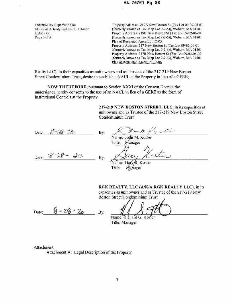
-----------
Bk:75761 Pg:86
lndustri-Plcx Supcrfund Site Property Address: 219A New Boston St (Tax Lot 09-02-06-03 Notice of Activity and Use Limitation (formerly known as Tax Map Lot 9-2-5)), Woburn, MA 01801 Exhibit G Properly Address: 219B New Boston St (Tax Lot 09-02-06-04 Page 3 of5 (formerly known as Tax Map Lot 9-2-5)), Woburn, MA 01801
Plan of Restricted Areas Lot IC-05 Property Address: 217 New Boston St (Tax Lot 09-02-06-01 (formerly known as Tax Map Lol 9-2-6)), Woburn, MA 01801 Property Address: 217R New Boston St (Tax Lot 09-02-06-02 (formerly known as Tax Map Lot 9-2-6)), Woburn, MAO 1801 Plan of Restricted Areas Lot IC-06
Realty LLC), in their capacities as unit owners and as Trustees of the 217-219 New Boston Street Condominium Trust, desire to establish a NAUL at the Property in lieu ofa GERE;
NOW THEREFORE, pursuant to Section XXXI of the Consent Decree, the undersigned hereby consents to the use ofan NAUL in lieu ofa GERE as the form of Institutional Controls at the Property.
217-219 NEW BOSTON STREET, LLC, in its capacities as unit owner and as Trustee of the 217-219 New Boston Street Condominium Trust
By:
Date: By:
RGK REALTY, LLC (A/KIA RGK REALTY LLC), in its capacities as unit owner and as Trustee of the 217-219 New Boston Street Con ominium Trust
Date:__'d-=------'2=-'0-""----.,~Zo"""'--- By: Name Title: Manager
Attachment Attachment A: Legal Description of the Property
3

Bk:75761 Pg:87
Industri-Plex Superfund Site Property Address: 219A New Boston St (Tax Lot 09-02-06-03 Notice of Activity and Use Limitation (fonnerly known as Tax Map Lot 9-2-5)), Woburn, MA 01801 Exhibit G Property Address: 219B New Boston St (Tax Lot 09-02-06-04 Page 4 of5 (fonnerly known as Tax Map Lot 9-2-5)), Woburn, MA 01801
Plan of Restricted Areas Lot IC-0~ Property Address: 217 New Boston St (Tax Lot 09-02-06-0 I (fonnerly known as Tax Map Lot 9-2-6)), Woburn, MA 01801 Property Address: 217R New Boston St (Tax Lot 09-02-06-02 (fonnerly known as Tax Map Lot 9-2-6)), Woburn, MA 01801 !'lanofRestrictedAreas Lot IC-06
ATTACHMENT A
Legal Description of the Property (Lot IC-05 and Lot IC-06)
The land situated in Woburn in the Cowity ofMiddlesex and Commonwealth ofMassachusetts,
described as follows:
NORTIIERLY by Lot 19 as shown on a plan hereinafter mentioned, one hwidred one and 30/100 feet;
NORTHEASTERLY by land now or formerly ofBoston and Maine Railroad, four hwidred seventeen and 92/ 100 feet;
SOUTIIERLY by Lot 24 on said plan, two hundred thirty-one and 82/100 feet; and
NORTHWESTERLY by Lots 27 and 29 on said plan, three hundred forty-two and 68/100 feet
Said land is shown as Lots 26 and 28 on plan ofland titled "Subdivision Plan ofLand in Woburn, Harry R. Feldman, Inc. Andrew E. Szemplinski, Surveyor, December 14, 1972" filed in the Land Registration Office as Plan No. 73121.
All ofthe boundaries are determined by the Court to be located as shown on said subdivision plan, as approved by the Court, filed in the Land Registration Office with Certificate ofTitle 144365 in Registration Book 852, Page 15.
For title reference, see deed ofJohn M. Koster and Gary R. Koster, as Trustees ofthe John G. Koster Revocable Trust ofOctober 13, 1995 to 217-219 New Boston Street, LLC, dated October 9, 2009, filed with the Land Registration Office ofthe Middlesex South Registry ofDeeds (the "Land Registration Office") on October 16, 2009 as Document No. 1515992 creating Certificate ofTitle 245168; deed of John M. Koster and Gary R. Koster, as Trustees of the Koster Nominee Trust 13, 1995 to 217-219 New Boston Street Realty, LLC, dated October 9, 2009, filed with the Land Registration Office on October 16, 2009 as Document No. 1515990 creating Certificate ofTitle 245167 and Confirmatory Deed from said Trustees to 217-219 New Boston Street, LLC dated April 27, 2010, recorded with the Middlesex South Registry of Deeds ("Registry") on April 28, 2010 in Book 54598, Page 466; deed of217-219 New Boston Street, LLC to RGK Realty LLC, dated April 27, 2010, recorded with tl1e Registry on April 28, 2010 in Book 54598, Page 475; and deed of217-219 New Boston Street, LLC to RGK Realty LLC, dated June 1, 2015, recorded with the Registry on June 1, 2015 in Book 65465, Page 503. Further reference is made to the Order Allowing Voluntary Withdrawal of Land from the Registration
4

Bk:75761 Pg:88
Industri-Plex Superfund Site Property Address: 219A New Boston St (Tax Lot 09-02-06-03 Notice of Activity and Use Limitation (formerly known as Tax Map Lot 9-2-5)), Woburn, MA 01801 Exhibit G Property Address: 219B New Boston St (Tax Lot 09-02-06-04 Page 5 of5 (formerly known as Tax Map Lot 9-2-5)), Woburn, MA 01801
Plan of Restricted Areas L,ot IC-05 Property Address: 217 New Boston St (Tax Lot 09-02-06-01 (formerly known as Tax Map Lot 9-2-6)), Woburn, MA 01801 Property Address: 217R New Boston St (Tax Lot 09-02-06-02 (formerly known as Tax Map Lot 9-2-6)), Woburn, MA 01801 Plan of Restricted Areas Lot IC-06
System recorded in the Registry on April 22, 2010 in Book 54575, Page 124 and filed with the Land Registration Office on April 22, 2010 as Document No. 1530300.
Also shown as Lot IC-05 and Lot IC-06 on a plan consisting offive (5) sheets entitled "Plan of Restricted Areas (Locus & Survey Control Network) Prepared for (now or formerly) 217-219 New Boston Street Realty, LLC and RGK Realty, LLC (a/Ida RGK Realty LLC), Lots IC-05 and IC-06, Woburn, Massachusetts", prepared by Fieldstone Land Consultants, PLLC, dated January 12, 2004, as revised through revisionK dated August 23, 2019, and recorded in the Registry as Plan No. _I,. ,3 of2020.
The land court bearing system upon which Land Court Plan No. 7312J and the Legal Description of the Property are based is orientated 0° O' 51" in a clockwise direction from the project orientation upon which the Plan ofRestricted Areas and the Legal Description ofthe Restricted Areas are based, all as described in more detail in Note No. 7 to the first page ofthe Plan ofRestricted Areas.
5

Bk:75761 Pg:89
Industri-Plex Superfund Site Property Address: 219A New Boston St (Tax Lot 09-02-06-03 Notice of Activity and Use Limitation (formerly known as Tax Map Lot 9-2-5)), Woburn, MA 01801
Property Address: 219B New Boston St (Tax Lot 09-02-06-04 (formerly known as Tax Map Lot 9-2-5)), Woburn, MA 01801 Plan of R~trictedAreas LoUC,05 Property Address: 217 New Boston St (Tax Lot 09-02-06-01 (formerly known as Tax Map Lot 9-2-6)), Woburn, MA 01801 Property Address: 2 l 7R New Boston St (Tax Lot 09-02-06-02 (formerly known as Tax Map Lot 9-2-6)), Woburn, MAO 180 I Plan of Restricted Areas Lot I C-06
EXHIBIT 1-1
IC DESIGN STATEMENT

Bk:75761 Pg:90
UNITED STATES ENVIRONMENTAL PROTECTION AGENCY New England Region
Five Post Office Square -- Suite 100 Boston, Massachusetts 02109-3912
INSTITUTIONAL CONTROL DESIGN STATEMENT INDUSTRI-PLEX SUPERFUND SITE OPERABLE UNIT 1
I. Introduction
Pursuant to the Comprehensive Environmental Response, Compensation, and Liability Act, 42 U.S.C. § 9601, et seq., ("CERCLA") and the National Contingency Plan, 40 CFR Part 300 (the "NCP"), this document contains a description of the basis for land use restrictions, the release event(s) or site history that resulted in the contaminated media that require institutional controls in the fonn of Activity and Use Limitations, and the uses and activities that are consistent and inconsistent with the Remedy (as described below).
Notices of Activity and Use Limitation ("NAULs") are necessary and appropriate at the lndustriplex Superfund Site located in Woburn, Massachusetts; Massachusetts Department of Environmental Protection ("MassDEP") Release Tracking Number 3-0001731 and United States Environmental Protection Agency ("EPA") ID# MAD076580950 (the "Site"). The Site is listed on EPA's National Priorities List because contaminants remain in place at levels higher than those appropriate for unlimited use or unrestricted exposure; groundwater underlying the Site contains contaminants at levels that present an unacceptable risk of exposure; and certain remedial measures existing or constructed at the Site must be protected and maintained to ensure that the Remedy remains protective.
EPA's Record of Decision ("ROD") for Operable Unit 1 ("OUl ") of the Site, dated September 30, 1986, specified the need for Institutional Controls to ensure the long-term performance and protectiveness ofthe Remedy. Accordingly, the Institutional Controls described herein are necessary and appropriate to ensure that the Remedy remains protective of human health and the environment. The remedy for the Site as described in the ROD and in any ROD Amendments or Explanation ofSignificant Differences is referred to herein and in the Notice as the "Remedy."
2. Development of Institutional Controls for the Site
A. Development of Institutional Controls for the Site in the form of a GERE
The Institutional Controls were developed pursuant to a judicially approved consent decree in connection with the OU 1 ROD, entered into in August 1989 among the United States of America, the Commonwealth ofMassachusetts and various potentially responsible parties
Page 1 ofl5 Illllll lllll lllll lllll 111111111111111111
SEMS Doc ID 595520

Bk:75761 Pg:91
involved with the Site (the "Consent Decree"). 1 Pursuant to the Consent Decree, certain response actions were specified for OU I and then current landowners and all subsequent landowners within OU! were required to adopt and comply with certain Institutional Controls which would run with the land (as further defined in the Consent Decree). The Consent Decree specified that the paramount purpose of the Institutional Controls would be the preservation of the continued effectiveness of the Remedy in order to protect human health and the environment. In addition, the Consent Decree provides that, to the extent that it is feasible to do so consistent with this paramount purpose, EPA and MassDEP (collectively, the "Agencies") may permit designs ofinstitutional Controls that permit the greatest possible use and enjoyment of the Site or parts of the Site.
In 1992, EPA approved the I00% Remedial Design for the Remedy (prepared by Golder Associates). In 2008, the Master Cover Certification Report for the Remedy (soil, sediment and air response actions) was completed documenting construction completion of the Remedy (i.e., for soil and sediments, various engineered and equivalent covers; and for air, a gas collection and treatment system) and its location on each property. In addition, Cover Certification Reports relevant to each OU! property were prepared, distributed to each OU! property owner, and published on www.epa.gov/superfuncl/industriplex ("EPA' s Region I website"). Any further approved modifications to the Cover Certification Reports are documented in As-Built Record Drawings, which are also published on EPA' s Region I website.
Subsequently, EPA, MassDEP and the Industri-plex Site Remedial Trust ("ISRT'') developed instructions for inaugurating the Institutional Controls (the "Inauguration Plan") on each OU! property; these were then approved by MassDEP and EPA.
The ISRT is one of two trust entities that were created pursuant to the Consent Decree, and it is involved with funding, supervising and coordinating OU!. The form ofInstitutional Controls contemplated in the Inauguration Plan is a Grant of Environmental Restriction and Easement ("GERE"). On August 23, 2002, the Agencies distributed a draft GERE to OU! landowners for review and comment; and, after considering the comments that were submitted, the Agencies developed and approved the Model GERE, dated March 12, 2005, which is published on EPA Region l's website.
Property-specific GEREs have been inaugurated for three of the OU! properties.
B. Modification ofInstitutional Controls to Allow Use ofNAULs
In June 2014, MassDEP promulgated revisions to the Massachusetts Contingency Plan, 310 CMR 40.0000 (the "MCP") which, inter alia, provide that land use controls required as part of a
1 The Consent Decree was entered on August 24, 1989 by the United States District Court for the District of Massachusetts in the matter styled, United States ofAmerica v. Stauffer Chemical Company, et al., Civil Action No. 89-0195MC and Commonwealth ofMassachusetts v. Stauffer Chemical Company, et al., Civil Action No. 89-0196-MC; and recorded at the Middlesex South Registry of Deeds in Book 19837, Page 476. A copy ofthe Consent Decree can be found at EPA' s Region 1 website.
Pagel of 15

Bk:75761 Pg:92
selected remedy at disposal sites deemed by MassDEP to be adequately regulated pursuant to 310 CMR40.0111, such as certain federal Superfund sites, may be implemented through an NAUL, in accordance with 3 IO CMR 40. I070(1 )( c ) •.
On October 21, 2016, following a prior request and review by theAgencies, ICI2 and Monsanto3
submitted a proposal ("Monsanto and ICI NAUL Use Request and Consent Letter'')4 for Owner Defendants5 and the Custodial Trust6 to have the option to establish an NAUL at the individual properties owned by Owner Defendants and the Custodial Trust throughout the Site, in lieu of establishing a GERE at each such property, based on a Site~specific model NAUL. ICI's and Monsanto's proposed Site-specific model NAUL included this Design Statement and its exhibits (the "Site-specific model NAUL") and their respective signed, written consents to the same, subject to the Agencies' approval
On November I, 2016, the Agencies issued a joint approval letter ("EPA and DEP NAUL Use Approval and Consent Letter") 7 approving the use of an NAUL at each individual OU! property at the Site based upon the Site-specific model NAUL, where a GERE would otherwise be required pursuant to the Consent Decree. The Agencies' approval was issued subject to each Owner Defendant's or the Custodial Trust's written consent, respectively, for each individual OU! property where an NAUL is established.
Once finalized from the Site-specific model NAUL, each Owner Defendant and Custodial Trust proprety-specific NAUL also requires the Agencies' written approval.
The Monsanto and ICI NAUL Use Request and Consent Letter, including the Site-specific model NAUL, and the EPA and DEP NAUL Use Approval and Consent Letter are also each puplished
2 As defined in the Consent Decree, ICI means Stauffer Chemical Company, Stauffer Management Company, IC! American Holdings, Inc., and their successors and assigns. ' As defined in the Consent Decree, Monsanto means Monsanto Company and its successors and assigns. 4 See Monsanto and !CI NAUL Use Request and Consent Letter, at Exhibit E to the NAUL 'As defmed in the Consent Decree, the Owner Defendants mean each of the following and their successors and assigns: ATLANTIC AVENUE ASSOCIATES, INC.; BOSTON EDISON COMPANY; THE BOYD CORPORATION; STEPHEN DAGATA and ADELINE DAGATA; MARYE. FITZGERALD and JOHN J. MULKERIN, as TRUSTEES OF TIIE NODRAER REALTY TRUST; HIRO K. GANGLANI and SUNDER K. GANGLANI; 'MICHAEL A. HOWLAND, individually and as TRUSTEE OF ATLANTJC AVENUE TRUST; LIPTON INDUSTRIES, INC.; RONALD F. LISS; MASSACHUSETTS BAY TRANSPORTATION AUTIIORITY; RICHARD G. MIZZONI, METROPHANE ZAYKA, JR., NICHOLAS ZAYKA, and PETER ZAYKA, as TRUSTEES OF TiiE AERO REALTY TRUST; PAUL X. O'NEILL and PHYLLIS O'NEILL, as TRUSTEES OF THE P.X. REALTY TRUST; PEBCO COMPANY; POSITIVE START REALTY, INC.;A{JGUSTINE P. SHEEHY; PETER J. VOLPE; THE WELLES COMPANY; WINTER HILL STOREHOUSE, INC.; CITY OF WOBURN; and WOODCRAFT SUPPLY CORPORATION. 6 The Industri-plex Site Custodial Trust ("the Custodial Trust") was established pursuant to the Consent Decree to receive, hold, manage, and/or sell real property and other assets to be conveyed by the Mark-Phillip Trust and William F. D'Annolfo, and to arrange for payment of the proceeds or value realized from those assets as directed in the Consent Decree. As defmed in the Consent Decree, Mark-Phillip Trust means WILLIAM A D'ANNOLFO, FRANK P. D'ANNOLFO, SHIRLEY J. MARTINEK, JOHN A. DELROSSI, and SAMUEL SAITZ, individually and as present and fonner TRUSTEES ofTHE MARK-PHILLIP TRUST, and all successor ttustees. 7 See EPA and DEP NAUL Use Consent Letter, at Exhibit F to the NAUL.
Page 3 of IS

Bk:75761 Pg:93
on EPA's Region 1 website.8
The option to implement NAULs at OUl in lieu of GEREs represents a change to the Consent Decree that will not materially affect the Consent Decree. The change from GEREs to NAULs would, however, affect the following parties to the Consent Decree: EPA on behalf of the United States, MassDEP on behalf of the Commonwealth ofMassachusetts, Monsanto, ICI and each Owner Defendant who elects to execute an NAUL for an applicable OU! property in lieu of a GERE. In addition, the Custodial Trust, created pursuant to the Consent Decree but not a party to the Consent Decree, would also be affected with respect to each OU! property it owns. The Consent Decree permits modifications to its terms and conditions that do not materially affect the Consent Decree, upon the written consent of all Parties affected by the modification.9
Any Owner Defendant or the Custodial Trust who agrees to use this Design Statement and associated NAUL for an applicable OU! property in lieu ofa GERE must execute and submit a written consent upon submission of the NAUL for approval by the Agencies, in the form attached as Exhibit G ("Owner NAUL Use Consent Letter") to the NAUL. The Monsanto and ICI NAUL Use Request and Consent Letter, the EPA and DEP NAUL Approval and Use Consent Letter and the applicable Owner NAUL Use Consent Letter shall be recorded with each NAUL.
The terms used in this Design Statement, including all exhibits, which are expressly identified as being defined in the Consent Decree, shall have the meanings set forth in the Consent Decree. All other terms used in this Design Statement, including all exhibits, shall have the meanings set forth in Exhibit A ("Definitions") of the NAUL; or ifnot defined therein, then as ascribed to them in the Consent Decree; in Section 101 ofCERCLA; in the National Contingency Plan, 40 CFR Part 300; in Section 2 of Massachusetts General Laws Chapter 21E; and/or in the MCP, as applicable.
3. Site Histozy/Background
The Site is a 245-acre industrial park located in Woburn, Massachusetts. Various manufacturing facilities op~rated on the Site from 1853 to 1968. From 1853 through 1931, OUl of the Site was home to various chemical manufacturing operations that produced chemicals for the local textile, leather, and paper industries, the main products being sulfuric acid and related chemicals. Other chemicals produced at OU 1 include arsenic insecticides and organic chemicals such as phenol, benzene, picric acid, toluene, and trinitrotoluene. Beginning in 1935, OUl was used for the manufacturing of glue from animal hides, which continued until mid-1969, when operations ceased. The waste products resulting from 115 years of industrial activities were disposed of throughout a large portion of OU!. In addition, waste deposits from some areas within OU! were excavated and relocated elsewhere within OUl during re-development activities conducted between 1970 and 1979. These redevelopment activities caused significant releases of odors
'www.~na.g1ivl1uL1<rfw1<llindustrJpJex• Section XXXI. Modification ofthe Consent Decree at 77..
Page 4 of15

Bk:75761 Pg:94
(e.g. hydrogen sulfide) to the atmosphere within the commwtlty and surrounding cities/towns and disrupted public welfare leading to investigations and incorporation into the federal Superfund Program. Together, these activities resulted in the release ofhazardous substances to soil (e.g. arsenic, lead, chromium, etc.,) and groundwater (arsenic, chromium, benzene, toluene, ammonia, naphthalene, etc.,) within much ofOUl.
Extensive investigation of conditions within OUl of the Site was performed between 1982 and 1990. Based on this investigative work, EPA selected the Remedy that is being implemented by the potentially responsible parties. The Remedy includes the following elements:
A. Design and construction ofpermeable caps over approximately I 05 acres of soils and sediments contaminated with lead, arsenic and chromium in excess of concentrations of 300 parts per million ("ppm"), 600 ppm, and 1000 ppm, respectively. The permeable caps consist of various designed covers containing 16 inches of clean fill and a geotextile fabric placed over the contaminated soils and sediments, and equivalent covers such as concrete foundations or bituminous parking lots (i.e., from existing buildings, structures and pavement). This element of the Remedy serves to prevent physical contact with the contaminated soils and sediments, including areas ofOUl containing concentrations of waste animal hides and hide residues, referred to as the West, East-Central and South Hide Piles;
B. Design and construction of an impermeable cap over the approximately five acres of the East Hide Pile, including as part of a gas collection and treatment system. This element of the Remedy prevents the infiltration of water through the hide pile, and prevents the release ofhydrogen sulfide gas into the atmosphere;
C. Design and construction ofan interim groundwater treatment system to treat a groundwater hot spot contaminated with toluene and benzene. This interim system was designed to reduce the concentration of the hot spot by eighty percent and to limit contamination migration off-site; 10
D. Implementation of a Groundwater and Surface Water Investigation Plan (GSIP) to evaluate the degree of groundwater and surface water contamination at the Site; and
E. Design and implementation of Institutional Controls for OU! which will restrict future land use.
The Remedy includes areas designated as "Class D Land" and "Class C Land" on the Plan of
'° The 2006 Record ofDecision for Operable Unit 2 of the Site ("OU2") selected a pennanent OU2 groundwater remedy that supersedes the interim groundwater remedy component ofOU I. As a result of investigations perfonned pursuant to the OU2 groundwater remedy, additional land included in OUI may in the future be designated as Class A Land, which is described below.
Page 5 of 15

Bk:75761 Pg:95
Restricted Areas. These areas are covered with an engineered cover or equivalent cover (consisting of ground-covering structures and/or features), both of which are intended to prevent exposure to contaminated soil. A portion of Class D Land also includes a gas collection and treatment system. Groundwater beneath these areas may also be contaminated with arsenic, chromiwn, lead, benzene, toluene, ammonia, naphthalene or other hazardous materials and/or substances exceeding applicable local, State and/or federal standards.
In other areas within OU!, designated as "Class B Land" on the Plan of Restricted Areas ( defined below), soil is not known to contain hazardous substances within the top O" - 36" interval at levels requiring remedial action to protect hwnan health and/or the environment based upon limited data collected during the OU! Remedial Design. Soil conditions at depths greater than 36 inches are unknown. However, given the proximity of such soils to Class C and/or Class D Land, they may contain hazardous substances at such levels in some isolated locations or 36" below the ground surface.
In those areas of OU! designated as "Class A Land" on the Plan ofRestricted Areas, soil does not contain hazardous substances exceeding action levels under CERCLA, but groundwater may contain hazardous substances at levels that present an unacceptable risk ofexposure.
Institutional Controls are required for all properties within OU! which contain areas classified as Class A, B, C and/or D Land. The Institutional Controls will notify landowners of activities and uses consistent and inconsistent with maintaining the Remedy for each class of land, and of obligations and conditions necessary to maintain the Remedy for each class of land. Attached at Exhibit C to the NAUL is a photo-reduced copy of the plan of the Site which shows information such as the Site boundaries and individual properties within the Site, including a lot identification number established for each property for purposes oflnstitutional Controls ("IC Lot Number"), and the various classes ofland located within OU!. A similar but full-size copy of the plan will be recorded with each NAUL (along with property-specific plans showing additional detail) which identifies (by IC Lot Number) the parcel that is subject to the NAUL (collectively, these plans will be referred to as the "Plan of Restricted Areas"). Also, see attached to this Design Statement a drawing depicting the Restricted Areas for all the OU! properties entitled "Plan ofRestricted Areas, Industri-plex Superfund Site, Operable Unit 1 Properties, Woburn, Massachusetts." More detailed information about OU! can be found in the OU! ROD and in the Master Cover Certification Report for OU!, both of which are on file (along with many other Site reports and other documentation) at the Woburn Public Library, 45 Pleasant Street, Woburn, Massachusetts, and at the EPA Records Center, located at EPA Region I, 5 Post Office Square, Boston, Massachusetts. The information is also available on EPA's Industri-Plex Superfund Site web site (www.epa.gov/superfund/industriplex).
4. Summary of Required Institutional Controls. In order to preserve the integrity of the Remedy so that it remains protective ofhuman health and the environment in the long term, the following Institutional Controls are necessary.
A. Uses And Activities Consistent With Maiataining IJ)e Remedy. Uses and activities consistent with maintaining the Remedy for Class D Land, Class C
Page 6 oflS

Bk:75761 Pg:96
Land, Class B Land and Class A Land, as such classes ofland are specified below, are:
i. For Class D Land:
a. excavation or other disturbance of the Engineered Cover for the limited purposes oflandscaping and horticulture, using only herbaceous and small woody, shallow-rooted plants which will not penetrate or otherwise adversely affect the geotextile or geomembrane portion of the Engineered Cover; and installing, maintaining and repairing fences, irrigation systems and/or exterior lighting systems, if:
(1) such excavation or other disturbance, if within twelve (12) inches of the geotextile or geomembrane, is conducted solely by hand (i.e., without the use of any power equipment or power tools);
(2) such excavation or other disturbance does not penetrate the geotextile or geomembrane portion of the Engineered Cover;
(3) such excavation or other disturbance, including any associated temporary on-site storage ofexcavate, is conducted in a timely manner;
(4) any disturbed portion of such Engineered Cover is restored to its original thickness or greater and to the same type of Cover, both as shown on the As Built Records and/or Cover Certification Report, immediately upon completion of the excavation or other disturbance; and
(5) no project involving work conducted under this provision exceeds sixty (60) days in duration;
b. disturbance ofthe Cciver for the purpose ofperforming Normal Maintenance, subject to the following conditions:
(1) such disturbance is capable of being conducted, and is be conducted, without exposing or coming into contact with the soil or groundwater underlying the Cover; and
(2) such disturbance does not result in a Permanent Cover Modification; and
c. extraction and use of groundwater for the purposes of sampling monitoring wells, if such extracted groundwater is disposed of in accordance with applicable federal, State or local laws, regulations or ordinances.
ii. For Class C Land:
a. excavation or other disturbance of the Engineered Cover for the limited purposes of landscaping and horticulture, using only herbaceous and small woody, shallow-rooted plants which will not penetrate or
Page 7 oflS

Bk:75761 Pg:97
otherwise adversely affect the geotextile or geomembrane portion of the Engineered Cover; and installing, maintaining and repairing fences, irrigation systems and/or exterior lighting systems if:
(1) such excavation or other disturbance, ifwithin twelve (12) inches of the geotextile or geomembrane, is conducted solely by hand (i.e., without the use of any power equipment or power tools);
(2) such excavation or other disturbance does not penetrate the geotextile or geomemhrane portion of the Engineered Cover;
(3) such excavation or other disturbance, including any associated temporary on-site storage of excavate, is conducted in a timely manner;
(4) any disturbed portion of such Engineered Cover is restored to its original thickness or greater and to the same type ofCover, both as shown on the As Built Records and/or Cover Certification Report, immediately upon completion of the excavation or other disturbance; and
(5) no project involving work conducted under this provision exceeds sixty (60) days in duration;
b. disturbance ofthe Cover for the purpose ofperforming Normal Maintenance, subject to the following conditions:
(I) such disturbance is capable of being conducted, and is conducted, without exposing or coming into contact with the soil or groundwater underlying the Cover; and
(2) such disturbance does not result in a Permanent Cover Modification; and
c. extraction and use of groundwater for the purposes of sampling monitoring wells, if such extracted groundwater is disposed of in accordance with applicable federal, State or local laws, regulations or ordinances.
iii. For Class B Land:
a. excavation and backfilling outside the boundaries of Clean Corridors, including the removal of debris and accumulated soil and sediment from drainage areas and structures (e.g., culverts, channels, basins) if:
(I) the total volume ofmaterial excavated anywhere within the Property does not exceed ten (10) cubic yards;
(2) the depth of the excavation does not exceed three (3) feet;
(3) such excavation shall only be permitted provided that no soil is disposed of, or is required to be disposed of, offof the Property; and
Page 8 of15

Bk:75761 Pg:98
(4) such excavation, including any associated temporary on-site storage of excavate, is conducted in a timely manner; not to exceed sixty (60) days in duration;
b. excavation and backfilling within the boundaries of Clean Corridors if:
(I) such excavation is only within the bounds of the geotextile or other material bounding the Clean Corridors, and does not penetrate such geotextile or other material nor otherwise disturb the soil or other material outside such bounds; and
(2) such excavation, if within twelve (12) inches of the geotextile, is conducted solely by hand (i.e., without the use of any power equipment or power tools); and
c. extraction and use of groundwater for the purposes of sampling monitoring wells, provided such extracted groundwater is disposed of in accordance with applicable federal, State or local laws, regulations or ordinances.
iv. For Class A Land:
a. extraction and use of groundwater for the purposes of sampling monitoring wells, if such extracted groundwater is disposed of in accordance with applicable federal, State or local laws, regulations or ordinances.
B. Uses And Activities Inconsistent With Maintaining The Remedy. Uses and activities inconsistent with maintaining the Remedy for Class D Land, Class C Land, Class B Land and Class A Land, as such classes of land are specified below, are:
i. For Class D Land:
a. excavating, drilling, or otherwise disturbing the Cover and/or the soil underlying the Cover, unless in strict compliance with the Work Protocols;11
b. extracting, pumping, consuming, exposing, or otherwise using groundwater, uriless in strict compliance with the Work Protocols;
c. planting vegetation which would impair the effectiveness of the Cover, including, without limitation, deep-rooted trees and other vegetation the roots of which would likely grow to breach or otherwise impair the geotextile or geomembrane portion of the Cover;
11 Whenever the NAUL identifies an activity or use as inconsistent with maintaining the Remedy, unless conducted in strict compliance with the Work Protocols, or otherwise requires compliance with the Work Protocols in order to maintain the Remedy, the NAUL refers to the requirements set forth in the Work Protocols, attached as Exhibit I to theNAUL.
Page 9 oflS

Bk:75761 Pg:99
d. commercial or industrial activity or use;,
e. residential activity or use;
f. daycare or school activity or use;
g. agricultural activity or use; or
h. any activity or use which would interfere with, or would be reasonably likely to interfere with, the implementation, effectiveness, integrity, operation or maintenance of the Remedy.
ii. For Class C.J,and:
a excavating, drilling, or otherwise disturbing the Cover and/or the soil underlying the Cover, unless in strict compliance with the Work Protocols;
b. extracting, pumping, consuming, exposing or otherwise using groundwater, unless in strict compliance with the Work Protocols;
c. planting vegetation which would impair the effectiveness of the Cover, including without limitation deep-rooted trees and other vegetation the roots of which would likely grow to breach or otherwise impair the geotextile or geomembrane portion of the Engineered Cover;
d. residential activity or use;
e. daycare or school activity or use;
f. agricultural activity or use; or
g. any activity or use which would interfere with, or would be reasonably likely to interfere with, the implementation, effectiveness, integrity, operation or maintenance of the Remedy.
iii. For Class B Land:
a. excavating, drilling, or otherwise disturbing the soil or ground covering features, including building foundations, slabs and/or underlying soils, unless in strict compliance with the Work Protocols;
b. extracting, pumping, consuming, exposing or otherwise using groundwater, unless in strict compliance with the Work Protocols;
c. residential activity or use;
d. daycare or school activity or use;
e. agricultural activity or use; or
f. any activity or use which would interfere with, or would be reasonably likely to interfere with, the implementation, effectiveness, integrity, operation or maintenance of the Remedy.
iv. For Class A Land:
Page 10 of IS

Bk: 75761 Pg: 100
a. extracting, pumping, consuming, exposing or otherwise using groundwater, unless in strict compliance with the Work Protocols;
b. residential activity or use;
c. daycare or school activity or use; or
d. any activity or use which would interfere with, or would be reasonably likely to interfere with, the implementation, effectiveness, integrity, operation or maintenance ofthe Remedy.
5. Obligations and Conditions Necessary to Maintain the S.elected R~II1ec!y. The following obligations and/or conditions are necessary and shall be undertaken at each OU! property to maintain the Remedy and to avoid compromising the Permanent Solution that has been achieved for the Site.
A. Inspection, Inspection Report. Owner must engage an Independent Professional or a Professional Engineer (P.E. Civil), who: (i) familiarizes himself with the Property and that portion of the Remedy situated on the Property and on any abutting properties, including the uses and activities inconsistent with maintaining the Remedy listed in this NAUL and any related construction plans and documentation (including, if the Property contains any Class C Land or Class D Land, the As Built Records and/or the Cover Certification Report); (ii) conducts periodic visual, non-intrusive inspections of the Restricted Areas to ensure that Owner is in compliance with these restrictions; and, (iii) if the Property contains any Class C Land or Class D Land, also conducts periodic visual, non-intrusive inspections of the Cover in order to monitor its condition and protectiveness to ensure that it is maintained in accordance with the As Built Records and/or the Cover Certification Report, as the case may be, Performance of this obligation includes the following:
1. Conducting all such inspections at least once every calendar year during the three-month period beginning on March Ist and ending on May 31st, or with such greater frequency as the Independent Professional or Professional Engineer, MassDEP and EPA, or Owner may determine is warranted taking into consideration the particular uses and activities at the Property and, if applicable, the condition of the Cover; and, if the Property contains any Class C Land or Class D Land, within seven (7) days of receipt ofwritten notice from MassDEP of the occurrence ofa twenty-five (25) year, twentyfour (24) hour storm event; or, with the written approval ofMassDEP and EPA, with such lesser frequency as MassDEP and EPA, in its sole discretion, may determine is warranted taking into consideration the particular uses and activities at the Property.
ii. No later than fourteen (14) days after conducting each such inspection, Owner must submit to MassDEP and EPA, respectively, with a copy to
Page 11 of IS

Bk:75761 Pg: 101
Settlers,12 a written inspection report, prepared by the Independent Professional or Professional Engineer who performed the inspection, swnmarizing the results of the inspection and stating:
a. whether any uses or activities inconsistent with maintaining the Remedy have occurred or are occurring on the Property;
b. if applicable, whether the Cover is in good condition and repair;
c. including any supporting information upon which such determinations are based, as applicable; and
d. including with each such inspection report a written statement, signed by Owner, stating that (a) Owner has personally reviewed the inspection report and that (b) the inspection report is true, accurate and complete; if Owner is a corporate entity, a duly authorized officer of the corporation signing the inspection report on behalf of Owner.
iii. Performance and preparation ofall inspections and reports required for Class C Land and Class D Land pursuant to this subparagraph 5.A., respectively, in accordance with the Cover Inspection Plan, set forth in Exhibit J ("Cover Inspection Plan") to the attached NAUL.
B. Normal Maintenance. The provisions of this subparagraph 5.8. shall only apply if the Property contains Class C Land or Class D Land. Owner must perform Normal Maintenance of Class C Land and Class D Land, in a timely fashion as requited to maintain the integrity and effectiveness of that portion of the Remedy situated on the Property, and no later than ninety (90) days from the time when Owner first knows or reasonably should have known of the condition requiring the performance of such Normal Maintenance. In determining whether Normal Maintenance is needed, and in the performance ofNormal Maintenance, Owner must consider not only information that a landowner would ordinarily possess, but also information contained in the Cover Certification Report and obtained during the inspections performed at the Property pursuant to subparagraph 5 .A. ("Inspection, Inspection Report").
i. Provided, however, that in the event that Owner believes that such Normal Maintenance is needed as the result of a Defect in the Remedy, then in lieu ofperforming such Normal Maintenance within the required time period set forth above, Owner may instead, within the same time period, submit a written request to EPA for a determination under the Consent Decree of whether such Normal Maintenance is needed as the result of a Defect in the Remedy. Owner shall provide a copy of such submittal to MassDEP and Settlers Owner's submittal shall include a written statement by an
12 The tenn "S~lers" is identified in the Consent Decree and in Exhibit A to the NAUL. The NAUL establishes a procedure for providing the notice of such submissions to the appropriate parties.
Page 12 ofl5

Bk: 75761 Pg: 102
Independent Professional asserting that, in his or her professional opinion, the need for such Normal Maintenance is due to a Defect in the Remedy, and explaining the basis for such opinion. This statement must be signed by the Independent Professional, and must be accompanied by his or her supporting analysis, and other documentation as appropriate. The time period for this submittal may only be extended with the prior, written approval ofMassDEP and EPA.
11. IfEPA determines, pursuant to the Consent Decree, that such Normal Maintenance is needed as the result of a Defect in the Remedy, then Owner's obligations to fund and perform such Normal Maintenance would be determined (along with those of other parties bound under Section IV.A of the Consent Decree) pursuant to and in accordance with the terms and provisions of the Consent Decree and its appendices, including without limitation Sections VII.A, VII.B, VII.C(8) and X.D of the Consent Decree and Section F.3.e of Appendix I (Remedial Design/Action Plan) of the Consent Decree. Otherwise, Owner would fund and perform such Normal Maintenance in accordance with the terms and provisions of the NAUL.
iii. Nothing herein is intended to impair or otherwise affect whatever rights Owner may possess pursuant to the Consent Decree, ifany, to pursue and obtain recovery from any other person or entity for costs associated with Normal Maintenance.
C. Operation and Maintenance Plan. The provisions of this subparagraph 5.C. shall only apply if the Property contains Class C Land or Class D Land. Owner may be obligated to fund and implement the activities required by the Operation and Maintenance Plan at the Property, in accordance with the terms and provisions of the Consent Decree, including without limitation its appendices, and any obligations under this NAUL would not limit or modify any additional obligations to perform such activities·on the Property or elsewhere within the Site under the Consent Decree, including without limitation its appendices.
D. Remedy Failure: Preliminary Action, Notification and].J,Qair. The provisions of this subparagraph 5.D shall only apply if the Property contains Class C Land or Class D Land.
1. In the event ofany Remedy Failure, Owner must immediately implement such preliminary action as is reasonably necessary to prevent potential human exposure to, and/or releases of, soil and/or groundwater due to the Remedy Failure.
ii. Unless the work necessary to repair the Remedy Failure falls within the definition ofNomial Maintenance, Owner must notify MassDEP, EPA, and Settlers of such Remedy Failure, orally no more than twenty-four (24) hours from the time Owner first knows or reasonably should have known of such Remedy Failure, and in writing no more than five (5) business days from the
Page 13 of IS

Bk: 75761 Pg: 103
time that Owner first knows or reasonably should have known of such Remedy Failure.
iii. Owner must, within twenty-one (21) days of such written notification, prepare and submit to MassDEP and EPA, respectively, with a copy to Settlers, a work plan for the repair of the Remedy Failure, in accordance with the Work Protocols. After submittal of such work plan and any review and approval required pursuant to the Work Protocols, Owner must promptly conduct the repair in accordance with such work plan and otherwise comply with all applicable requirements of the Work Protocols.
iv. Provided, however, that in the event that Owner believes that such Remedy Failure is the result of a Defect in the Remedy, then in lieu of submitting such work plan within twenty-one (21) days of the date when such written notification is due, Owner may instead, within the same time period, submit a written request to EPA for a determination under the Consent Decree of whether such Remedy Failure is the result of a Defect in the Remedy. Owner must provide a copy of such submittal to MassDEP and Settlers. Owner's submittal must include a written statement by an Independent Professional asserting that, in his or her professional opinion, the Remedy Failure is the result of a Defect in the Remedy, and explaining the basis for such opinion. This statement must be signed by the Independent Professional, and must be accompanied by his or her supporting analysis, and other documentation as appropriate. The time period for this submittal may only be extended with the prior, written approval of MassDEP and EPA.
v. IfEPA determines, pursuant to the Consent Decree, that such Remedy Failure is the result ofa Defect in the Remedy, then Owner's obligations to fund and perform response actions to cure the Remedy Failure, beyond those response actions taken pursuant to subparagraph 5.D.i., above, would be determined (along with those of other parties bound under Section IV.A of the Consent Decree) pursuant to and in accordance with the terms and provisions of the Consent Decree and its appendices, including without limitation Sections VII.A, VII.B, VII.C(S) and X.D of the Consent Decree and Section F.3.e of Appendix I ("Remedial Design/ Action Plan") to the Consent Decree. Otherwise, Owner must fund and perform response actions to cure such Remedy Failure in accordance with this NAUL.
vi. Nothing herein would impair or otherwise affect whatever rights Owner may possess pursuant to the Consent Decree, if any, to pursue and obtain recovery from any other person or entity for costs incurred to cure a Remedy Failure.
E. Notification of Other Violations. Owner must timely notify MassDEP and EPA of any violation of this NAUL of which Owner becomes aware, except to the extent otherwise required or waived in subparagraph 5.D, above.
Page 14 of IS

Bk: 75761 Pg: 104
F. Permit and Approval Related Notifications.
i. Owner, at the time that it submits any application to obtain a permit or approval from any governmental or other authority for any use or activity within the R~stricted Areas, must provide that authority with a copy ofthis NAUL and with written notification of the nature and extent ofthe restrictions on uses and activities established herein.
ii. Owner, at the time that it submits any building permit application for construction within the Restricted Areas to the City of Woburn, must submit to MassDEP and EPA a copy of its building permit application, and, upon receipt, a copy of any certificate of use and occupancy or other final permit or approval issued in connection with its building permit application.
6. All Other Institutional and Land Use Controls.
A. Emergency Excavation. Excavation in case ofemergencies such as utility line repair or responding to fire or flood is permitted in accordance with a standard provision as set forth in paragraph 6 ("Emergency Excavation") of the NAUL attached to this Design Statement.
7. Implementation ofNotices. For the reasons described above and in relevant EPA decision documents, Notice(s) of Activity and Use Limitation should be implemented and recorded at the Site pursuant to CERCLA, the NCP, and regulations set forth in the Mas~husetts Contingency Plan at 310 Code of Massachusetts Regulations Sections 40.0111(8), 40.1070(4), and (as applicable) 40.1074.
Office of Site Remediation and Restoration Environmental Protection Agency, Region I
Page 15 oflS

Bk: 75761 Pg: 105
'1 ri 1n~rmiJ111mn ff~mlm!grliUJ.,,MH,t1ffiU1!i~1fo111mbt!11uftlnllr,1~ ~;;~.·~!~•:;::a a~~~~~= 51:!~ ~~ ~: ~, ~= :=1:~2~n~;=~1~ ~n~2 ~,,; ~[nu~1:g~ ~~~ ~:~~i; ~ i=~a ~=f ~ ~ 1• uim1mmmmm1mmmm111m11mm111mum1mmn11i1mmm1111111 '=
,~--~,! Emm1immmmmmmmunmu1n1m1miim11mnmmmmmmmu::I, ...;:,~~!!!e~!!!!!F.H~GlitUll~a'IIIHiUHUU.nnilHH&ilUS!HUIIEIIUHiiliililHilliilHIIHiiiliUUUlilnl

Bk: 75761 Pg: 106
lndustri-Plex Superfund Site Property Address: 219A New Boston St (Tax Lot 09-02-06-03 Notice of Activity and Use Limitation (fonnerly known as Tax Map Lot 9-2-5)), Woburn, MA 01801
Property Address: 219B New Boston St (Tax Lot 09-02-06-04 (formerly known as Tax Map Lot 9-2-5)), Woburn, MA 01801 Plan of Restricted.Areas Lot IC-05 Property Address: 217 New Boston St (Tax Lot 09-02-06-01 (formerly known as Tax Map Lot 9-2-6)), Woburn, MA 01801 Property Address: 217R New Boston St (Tax Lot 09-02-06-02 (formerly known as Tax Map Lot 9-2-6)), Woburn, MA 01801 Plan of Restricted l\rnll.S Lot IC-06
EXHIBIT I
WORK PROTOCOLS

Bk: 75761 Pg: 107
Industri-Plex Superfund Site Property Address: 219A New Boston St (Tax Lot 09-02-06-03 Notice of Activity and Use Limitation (formerly known as Tax Map Lot 9-2-5)), Woburn, MA 01801 Exhibit I Property Address: 219B New Boston St (Tax Lot 09-02-06-04 Page I of21 (formerly known as Tax Map Lot 9-2-5)), Woburn, MA 01801
Plan of Restricted Areas Lot IC-05 Property Address: 217 New Boston St (Tax Lot 09-02-06-01 (formerly known as Tax Map Lot 9-2-6)), Woburn, MA 01801 Property Address: 2 l 7R New Boston St (Tax Lot 09-02-06-02 (formerly known as Tax Map Lot 9-2-6)), Woburn, MA 01801 Plan of Restricted Areas Lot IC-06
EXHIBIT I
Work Protocols
SECTION I. GENERAL
I. Title. This exhibit, which will be referred to as the "Work Protocols," is an attachment to an instrument entitled "Notice ofActivity and Use Limitation" (hereinafter, the "Institutional Controls" or '"NAUL"), dated II v~,,I 12., • 2020 and recorded and/or registcr<c:d herewith. in the Middlesex South Rcg\:try of Deeds/Land R<::gislrnlion Ollice.
2. Definitions. Unless otherwise defined herein, the terms used in the Work Protocols will have the meanings set forth in Exhibit A ("Definitions") of the NAUL.
3. Applicability. Whenever the NAUL identifies an activity or use as inconsistent with maintaining the Remedy for a particular class of land, as specified in Paragraph 4 of the NAUL, unless conducted in strict compliance with the Work Protocols (hereinafter, an "Inconsistent Activity or Use"), or otherwise requires compliance with the Work Protocols, Owner must comply with the terms and provisions of this exhibit, including without limitation Paragraphs 4 through 15, inclusive, in order to maintain the Remedy and to avoid compromising the Permanent Solution that has been achieved for the Site.
4. Submissions. All submissions made pursuant to the Work Protocols must be made in accordance with the requirements of Paragraph 8 ("Notices; Change of Address") of the NAUL.
5. (JCJ)t!rnl Requirement.
A. The Work Protocols require Owner:
i. to prepare and submit a work plan in connection with the proposed Inconsistent Activity or Use; and in order to comply with certain obligations to cure a Remedy Failure;
11. to obtain certain approvals where specified;
111. to prepare and submit a completion report when the work described in the work plan is finished;

Bk: 75761 Pg: 108
Industri-Plex Superfund Site Property Address: 219A New Boston St (Tax Lot 09-02-06-03 Notice of Activity and Use Limitation (formerly known as Tax Map Lot 9-2-5)), Woburn, MA 0180 I Exhibit I Property Address: 219B New Boston St (Tax Lot 09-02-06-04 Page 2 of21 (formerly known as Tax Map Lot 9-2-5)), Woburn, MA 01801
Plan of Restricted Areas Lot IC-05 Property Address: 217 New Boston St (Tax Lot 09-02-06-0 I (formerly known as Tax Map Lot 9-2-6)), Woburn, MA 01801 Property Address: 2 l 7R New Boston St (Tax Lot 09-02-06-02 (formerly known as Tax Map Lot 9-2-6)), Woburn, MA 01801 Plan of Restricted Areatl,ot IC-06
iv. if the proposed Inconsistent Activity or Use would result in a permanent change to the Institutional Controls, to modify the Institutional Controls by preparing and submitting revised As Built Records and/or an amendment to the NAUL, and related documentation, for review and approval;
v. to engage an Independent Professional or, where permitted, a Qualified Professional to perform certain of these requirements; and
vi. in some instances, to retain other professionals, such as a registered land surveyor, to prepare certain submittals.
B. More particularly:
i. Owner must prepare and submit in writing to MassDEP and EPA, with a copy to Coordinator for Settling Parties:
a. a work plan, prior to conducting the proposed Inconsistent Activity or Use at the Property, or when required as part of an obligation to repair a Remedy Failure;
b. a revised work plan, if certain contingencies arise; and
c. a completion report after completing the work; and
d. under certain circumstances, if specified, proposed revised As Built Records and/or a proposed amendment to the Institutional Controls, in accordance with Paragraph 7 ("Proposed Changes in Activities and Uses; Amendments") of the NAUL.
ii. Owner must prepare all submittals, obtain any necessary approvals, provide any necessary notifications, and record and/or register any approved amendment, all in accordance with the requirements set forth in Section II, below, according to the class of land where the work is to be performed, and Paragraph 7 ("Proposed Changes in Activities and Uses; Amendments"), if a NAUL amendment is required. Owner must engage an Independent Professional or, where permitted, a Qualified Professional to perform certain requirements, as specified in Section II, below. In the event that the Inconsistent Activity or Use will be performed on multiple classes of land, then the requirements for the most restrictive class of land would apply,

Bk: 75761 Pg: 109
Industri-Plex Superfund Site Property Address: 219A New Boston St (Tax Lot 09-02-06-03 Notice of Activity and Use Limitation (formerly known as Tax Map Lot 9-2-5)), Woburn, MA 01801 Exhibit I Property Address: 219B New Boston St (Tax Lot 09-02-06-04 Page 3 of2 l (fonrnerly known as Tax Map Lot 9-2-5)), Woburn, MA 01801
Plan of Restricted Areas Lot IC-05 Property Address: 217 New Boston St (Tax Lot 09-02-06-01 (fonrnerly known as Tax Map Lot 9-2-6)), Woburn, MA 01801 Property Address: 2 l 7R New Boston St (Tax Lot 09-02-06-02 (fonrnerly known as Tax Map Lot 9-2-6)), Woburn, MA 01801 Plan of Restricted Areas Lot IC-06
except for those technical requirements which are specific to each separate class of land. For purposes of the preceding requirement, Class D Land is the most restrictive and Class A Land is the least restrictive.
iii. Owner must perform all work in accordance with the work plan and/or revised work plan, as submitted or, if applicable, as approved. Once Owner has begun work pursuant to an approved work plan, the terms and conditions of the work plan, as approved, and all related requirements of the Work Protocols will be enforceable by MassDEP, in the same manner as an obligation or condition as set forth in Paragraph 5 ("Obligations and Conditions Necessary to Maintain the Remedy") in the NAUL; and EPA may have additional enforcement authority pursuant to the Consent Decree.
iv. Owner must satisfy all other applicable requirements of the Work Protocols.
6. Financial Assurance Reguir~rnc11L If the estimated total cost of performing a proposed work plan, as approved, exceeds twenty-five thousand dollars ($25,000), then Owner must provide written financial assurance of Owner's ability to perform such work plan, in a form approved by MassDEP and EPA, such as a surety bond guaranteeing payment, a surety bond guaranteeing performance, an irrevocable standby letter of credit, or such other financial mechanism as may be accepted by MassDEP and EPA. MassDEP and EPA reserve the right to require Owner to establish a standby trust in connection with Owner's written financial assurance. The financial assurance must provide that, upon MassDEP's or EPA's determination that Owner has failed in whole or in part to comply with the terms of the work plan or the NAUL, MassDEP or EPA (as MassDEP and EPA may agree) will have the right to promptly obtain, without the consent of Owner, exclusive direction and control over the transfer, use and disbursement of the secured funds or performance benefits to complete the actions, in whole or in part, required by the work plan or the NAUL.
7. Establishment of Standard Work Plans.
A. Owner may submit to MassDEP and EPA, with a copy to Coordinator for the Settling Parties, a written request to approve a standard work plan for a routine, recurring Inconsistent A\:tivity or Use, each occurrence of which would not require an amendment to the NAUL, in lieu of submitting a work plan for each occurrence of such Inconsistent Activity or Use.

Bk: 75761 Pg: 110
Industri-Plex Superfund Site Property Address: 219A New Boston St (Tax Lot 09-02-06-03 Notice of Activity and Use Limitation (formerly known as Tax Map Lot 9-2-5)), Woburn, MA 01801 Exhibit I Property Address: 219B New Boston St (Tax Lot 09-02-06-04 Page 4 of21 (formerly known as Tax Map Lot 9-2-5)), Woburn, MA 01801
Plan.of Restricted Areas Lot lC-05 Property Address: 217 New Boston St (Tax Lot 09-02-06-01 (formerly known as Tax Map Lot 9-2-6)), Woburn, MA 01801 Property Address: 2 l 7R New Boston St (Tax Lot 09-02-06-02 (formerly known as Tax Map Lot 9-2-6)), Woburn, MA 01801 Plan of Restricted Areas Lot IC-06
B. Each proposed standard work plan must be submitted in writing, must be prepared or reviewed by an Independent Professional, and must include his or her opinion that the particular standard work plan complies with the applicable requirements of Paragraph 13 ("Health and Safety Plan"), Paragraph 14 ("Materials Management and Sampling Protocol") and Paragraph 15 ("Cover and Clean Corridors Protocol") of this exhibit, and any applicable requirements of the NAUL.
C. Any approval of a standard work plan by MassDEP and EPA will only be valid ifin writing, and may be made upon such terms and conditions as MassDEP and EPA deem appropriate. Any such terms and conditions will be deemed a part of that particular approved standard work plan. MassDEP' s and EPA' s approval of a particular standard work plan will remain in effect until the approval either expires by its terms or is withdrawn by MassDEP or EPA in writing.
D. An Inconsistent Activity or Use conducted pursuant to an approved standard work plan would not otherwise be subject to the Work Protocols, in order to maintain the Remedy and avoid compromising the Permanent Solution that has been achieved at the Site, provided that Owner satisfies all of the following requirements.
i. Advance Written Notice. Owner provides MassDEP and EPA, respectively, with a copy to the Coordinator for the Settling Parties, fourteen (14) days' advance written notice of the start date of the work to be performed pursuant to a standard work plan. The notice must identify:
a. the location of the Inconsistent Activity or Use to be performed,
b. the applicable approved standard work plan,
c. the entity which will perform the Inconsistent Activity or Use, and
d. if required by the approved standard work plan, the name and license number of the Independent Professional or, where permitted, the Qualified Professional whom Owner has engaged to oversee the Inconsistent Activity or Use;
ii. Terms and Conditions. Owner complies with the terms and conditions of the applicable approved standard work plan; and

Bk: 75761 Pg: 111
Industri-Plex Superfund Site Property Address: 219A New Boston St (Tax Lot 09-02-06-03 Notice of Activity and Use Limitation (formerly known as Tax Map Lot 9-2-5)), Woburn, MA 01801 Exhibit I Property Address: 2 I 9B New Boston St (Tax Lot 09-02-06-04 Page5of21 (formerly known as Tax Map Lot 9-2-5)), Woburn, MA 01801
Plan.of Restricted Areas Lot IC-05 Property Address: 217 New Boston St (Tax Lot 09-02-06-01 (formerly known as Tax Map Lot 9-2-6)), Woburn, MAO 180 I Property Address: 2 l 7R New Boston St (Tax Lot 09-02-06-02 (formerly known as Tax Map Lot 9-2-6)), Woburn, MA 0180 I Plan of Restricted Areas Lot IC-06
iii, Compktion R,port. Owner prepares and submits a completion report in accordance with the requirements of Section III ("Completion Report Requirements"), below.
SECTION II. WORK PLAN REQUIREMENTS
8. Work Plan Requirements for Class C Land and Cla,55 D Land. For any Inconsistent Activity or Use, and/or when required to repair a Remedy Failure, to be performed in whole or in part within Class C Land and/or Class D Land, the following requirements must be satisfied. If approval for a work plan is not expressly required, then a work plan would be presumptively approved after the requisite time period has expired, barring notice from MassDEP or EPA.
A. Activj!y or Use above Contaminated Media. If the Inconsistent Activity or Use would disturb the Cover, but not fully penetrate through to the Contaminated Soil or Contaminated Groundwater below, then:
i. a Qualified Professional must prepare or review the work plan, unless the Inconsistent Activity or Use would result in a Permanent Cover Modification, in which case an Independent Professional must prepare and/or review the work plan;
ii. the work plan must be submitted no less than thirty (30) days prior to the initiation of the Inconsistent Activity or Use;
m. the work plan must include the following items:
a, a description of the proposed Inconsistent Activity or Use as it pertains to the Remedy, including without limitation any disturbance of the Cover;
b. a schedule for the performance of the Inconsistent Activity or Use, including without limitation a schedule of times and duration for any open excavation;
c. a map and, if necessary, a surveyed plan showing the location of the proposed Inconsistent Activity or Use, which MassDEP or EPA may also require at either's respective sole discretion;
d. the names, addresses and telephone numbers of Owner's primary contacts for the proposed Inconsistent Activity or Use,

Bk: 75761 Pg: 112
Industri-Plex Superfund Site Property Address: 219A New Boston St (Tax Lot 09-02-06-03 Notice of Activity and Use Limitation (formerly known as Tax Map Lot 9-2-5)), Woburn, MA 01801
Exhibit I Property Address: 219B New Boston St (Tax Lot 09-02-06-04 Page 6 of2I (formerly known as Tax Map Lot 9-2-5)), Woburn, MA 01801
Pla11 01·Res11ic,JL<J.hrca, Lot IC-05 Property Address: 217 New Boston St (Tax Lot 09-02-06-0 I (formerly known as Tax Map Lot 9-2-6)), Woburn, MA 01801 Property Address: 21 ?R New Boston St (Tax Lot 09-02-06-02 (formerly known as Tax Map Lot 9-2-6)), Woburn, MA 01801 Plan uf Rcstricte<J. AJtiJS Loi IC-06
including without limitation Owner, its lessees or other parties responsible for submitting the work plan, its or their contractors and consultants, and the Qualified Professional or, if applicable, the Independent Professional, engaged to prepare or review the work plan;
iv. the work plan must satisfy the applicable requirements of Paragraph 15 ("Cover and Clean Corridors Protocol") of this exhibit; and
v. the Qualified Professional or the Independent Professional, as the case may be, must provide a written opinion that the work plan complies with the applicable requirements of Paragraph 15 ("Cover and Clean Corridors Protocol") of this exhibit, and any applicable requirements of the NAUL.
B. Aci;:ldcntal Exposure of Contaminated Media. In the event that Owner or any other party performing an Inconsistent Activity or Use pursuant to subparagraph 8.A. of this exhibit, above, fully penetrates the Cover through to the Contaminated Soil or Contaminated Groundwater below, then Owner or such other party must:
i. immediately cease work in the area where the Cover penetration occurred until a revised work plan is approved, as set forth below, and secure the area in order to prevent the release of, or exposure to, such material, or any run-on or run-off, and otherwise comply with the requirements of section ii. ("Temporary On-Site Storage") of subparagraph 14.A. ("Management of Soils and Sediments") and section ii. ("Temporary On-Site Storage") of subparagraph 14.B. ("Management of Groundwater and Water from Dewatering");
ii. immediately orally notify MassDEP and EPA of such event, and no later than seven (7) days after the date of such event submit written notification thereof to MassDEP and EPA, respectively, with a copy to the Coordinator for the Settling Parties;
iii. submit a revised work plan in accordance with the requirements of subparagraph 8.C. ("Activity or Use within Contaminated Media"), except that it must be submitted no later than thirty (30) days after the date of such event rather than sixty (60) days prior to initiation of the Inconsistent Activity or Use; and
iv. promptly perform the approved work plan.

Bk: 75761 Pg: 113
lndustri-Plex Superfund Site Property Address: 219A New Boston St (Tax Lot 09-02-06-03 Notice of Activity and Use Limitation (formerly known as Tax Map Lot 9-2-5)), Woburn, MA 01801 Exhibit I Property Address: 2198 New Boston St (Tax Lot 09-02-06-04 Page 7 of21 (formerly known as Tax Map Lot 9-2-5)), Woburn, MA 0180 I
Plan of Restricted Areas Lot IC-05 Property Address: 217 New Boston St (Tax Lot 09-02-06-0 I (formerly known as Tax Map Lot 9-2-6)), Woburn, MA 01801 Property Address: 2 I 7R New Boston St (Tax Lot 09-02-06-02 (formerly known as Tax Map Lot 9-2-6)), Woburn, MA 01801 Plan of Restricted Areas Lot IC-06
C. Activity or Use within Contaminated Media. If the Inconsistent Activity or Use would fully penetrate the Cover through to the Contaminated Soil or Contaminated Groundwater below, or otherwise disturb Contaminated Soil or Contaminated Groundwater, then:
i. an Independent Professional must prepare or review the work plan;
ii. Owner must obtain MassDEP's and EPA's written approval of the work plan before commencing the proposed Inconsistent Activity or Use;
iii. the work plan must be submitted no less than sixty (60) days prior to initiation of the Inconsistent Activity or Use;
1v. the work plan must include the following items:
a. a description of the proposed Inconsistent Activity or Use as it pertains to the Remedy, including without limitation any disturbance of the Cover;
b. a schedule for the performance of the Inconsistent Activity or Use, including without limitation a schedule of times and duration for any open excavation;
c. a map and, if necessary, a surveyed plan showing the location of the proposed Inconsistent Activity or Use, which MassDEP or EPA may also require at either's respective sole discretion;
d. the names, addresses and telephone numbers of Owner's primary contacts for the proposed Inconsistent Activity or Use, including without limitation Owner, its lessees or other parties responsible for submitting the work plan, its or their contractors and consultants, and the Independent Professional engaged to prepare or review the work plan;
e. a Health and Safety Plan, prepared in accordance with the requirements of Paragraph 13 ("Health and Safety Plan") of this appendix;
f. estimates of the volume of soils, sediments, surface water, and/or groundwater that would be excavated, stored, contained and/or disposed of;

Bk: 75761 Pg: 114
Industri-Plex Superfund Site Property Address: 219A New Boston St (Tax Lot 09-02-06-03 Notice of Activity and Use Limitation (formerly known as Tax Map Lot 9-2-5)), Woburn, MA 01801 Exhibit I Property Address: 219B New Boston St (Tax Lot 09-02-06-04 Page8of21 (formerly known as Tax Map Lot 9-2-5)), Woburn, MA 01801
Plan of Restricted.Areas Lot IC-05 Property Address: 217 New Boston St (Tax Lot 09-02-06-01 (formerly known as Tax Map Lot 9-2-6)), Woburn, MA 01801 Property Address: 2 l 7R New Boston St (Tax Lot 09-02-06-02 (formerly known as Tax Map Lot 9-2-6)), Woburn, MA 01801 Plan of Restricted f\rells LotJ<::-0.!i
g. an estimate of the total cost of performing the proposed work plan, including all construction (e.g., labor and materials) and related transactional costs (including, but not limited to, planning, engineering design, inspection, and documentation costs); and
h. a financial assurance, ifrequired by Paragraph 6 ("Financial Assurance Requirement") of this exhibit, as provided therein;
v. the work plan must satisfy the following requirements:
a. the requirements of Paragraph 14 ("Materials Management and Sampling Protocol") of this exhibit; and
b. the requirements of Paragraph 15 ("Cover and Clean Corridors Protocol") of this exhibit; and
vi. the Independent Professional must provide a written opinion that the work plan complies with the requirements of Paragraph 13 ("Health and Safety Plan"), Paragraph 14 ("Materials Management and Sampling Protocol") and Paragraph 15 ("Cover and Clean Corridors Protocol") of this exhibit, and any applicable requirements of the NAUL.
9. Work Plan Requirements for Class A Land and Class B Land. For any Inconsistent Activity or Use to be performed in whole or in part within Class A Land and/or Class B Land:
A. an Independent Professional must prepare or review the work plan;
B. the work plan must be submitted no less than thirty (30) days prior to initiation of the Inconsistent Activity or Use;
C. the work plan must include the following items:
i. a description of the proposed Inconsistent Activity or Use;
ii. a schedule for the performance of the Inconsistent Activity or Use;
iii. a map and/or, upon the request ofMassDEP or EPA, a surveyed plan showing the location of the proposed Inconsistent Activity or Use;

Bk: 75761 Pg: 115
lndustri-Plex Superfund Site Property Address: 219A New Boston St (Tax Lot 09-02-06-03 Notice of Activity and Use Limitation (formerly known as Tax Map Lot 9-2-5)), Woburn, MA 01801 Exhibit I Property Address: 2198 New Boston St (Tax Lot 09-02-06-04 Page 9 of21 (formerly known as Tax Map Lot 9-2-5)), Woburn, MA 01801
Plan of Restricted Areas Lot IC-05 Property Address: 217 New Boston St (Tax Lot 09-02-06-0 I (formerly known as Tax Map Lot 9-2-6)), Woburn, MA 01801 Property Address: 2 I 7R New Boston St (Tax Lot 09-02-06-02 (formerly known as Tax Map Lot 9-2-6)), Woburn, MA 01801 Plan of Restricted A.reas Lot IC-06
iv, the names, addresses and telephone numbers of Owner's primary contacts for the proposed Inconsistent Activity or Use, including without limitation Owner, its lessees or other parties responsible for submitting the work plan, its or their contractors and consultants, and the Independent Professional engaged to prepare or review the work plan; and
v, a Health and Safety Plan, prepared in accordance with the requirements of Paragraph 13 ("Health and Safety Plan") of this exhibit, unless the Inconsistent Activity or Use is to be performed wholly within_Class A Land, in which case ifit can be demonstrated to the satisfaction of the MassDEP and EPA that Contaminated Groundwater is not present in or near the area of all proposed intrusive work, then such a health and safety plan would not be required;
D, the work plan must satisfy the following requirements:
i, the applicable requirements of Paragraph 14 ("Materials Management and Sampling Protocol") of this exhibit; and
ii, a financial assurance, if required by Paragraph 6 ("Financial Assurance Requirement") of this exhibit, as provided therein;
E, the Independent Professional must provide a written opinion that the work plan complies with the requirements of Paragraph 13 ("Health and Safety Plan"), the applicable requirements of Paragraph 14 ("Materials Management and Sampling Protocol"), and any applicable requirements of the NAUL; and
F, in the event that Owner or any other party performing an Inconsistent Activity or Use pursuant to subparagraphs 9,A, through 9,E, of this exhibit, above, discovers Contaminated Soil during the performance of such Inconsistent Activity or Use, then Owner or such other party must:
i, if the work plan was prepared for an Inconsistent Activity or Use solely within Class A Land, immediately cease work in the area where the Contaminated Soil was discovered, until a revised work plan is approved, as set forth below, and secure the area in order to prevent the release of, or exposure to, such material, or any run-on or run-off, and otherwise comply with the requirements of section ii, ("Temporary On-Site Storage") of subparagraph 14,A ("Management of Soils and Sediments");

Bk: 75761 Pg: 116
Industri-Plex Superfund Site Property Address: 219A New Boston St (Tax Lot 09-02-06-03 Notice of Activity and Use Limitation (formerly known as Tax Map Lot 9-2-5)), Woburn, MA 01801 Exhibit I f>roperty Address: 219B New Boston St (Tax Lot 09-02-06-04 Page 10 of2 I (formerly known as Tax Map Lot 9-2-5)), Woburn, MA 01801
Plan of Restricted Areas Lot IC-0.5 f>roperty Address: 217 New Boston St (Tax Lot 09-02-06-01 (formerly known as Tax Map Lot 9-2-6)), Woburn, MA 01801 Property Address: 2 I 7R New Boston St (Tax Lot 09-02-06-02 (formerly known as Tax Map Lot 9-2-6)), Woburn, MA 01801 Plan of Restricted Areas Lot IC-06
ii. immediately orally notify MassDEP and EPA of such discovery, and no later than seven (7) days after the date of such event submit written notification thereof to MassDEP and EPA, with a copy to the Coordinator for the Settling Parties
iii. submit a revised work plan in accordance with the requirements of subparagraph 8.C ("Activity or Use within Contaminated Media"), as applicable, no later than thirty (30) days after the date of such discovery, containing a proposal either:
a. to reclassify the land to Class C Land or Class D Land, requiring a new Cover over the Contaminated Soil, in which case the revised work plan must demonstrate that the applicable requirements of Paragraph 15 ("Cover and Clean Corridors Protocol") of this exhibit are satisfied; or
b. to excavate and dispose of the Contaminated Soil, in which case the revised work plan must demonstrate that the applicable requirements of Paragraph 14 ("Materials Management and Sampling Protocol") of this exhibit are satisfied;
iv. promptly submit, along with the revised work plan, the written opinion of an Independent Professional that the revised work plan complies with the requirements of subparagraph 9.F.iii., above, and any applicable requirements of the NAUL;
v. obtain MassDEP's and EPA's written approval of the revised work plan prior to the commencement of the Inconsistent Activity or Use set forth in the revised work plan; and
vi. promptly perform the approved revised work plan.
SECTION III. COMPLETION REPORT REQUIREMENTS.
IO. Completion Report_Rcquircmen!s for Class C Land and Class D Land. After completion of any Inconsistent Activity or Use conducted in whole or in part within Class C Land or Class D Land requiring submission of a work plan in order to maintain the Remedy and avoid compromising the Permanent Solution that has been achieved at the Site, including without limitation any Inconsistent Activity or Use conducted pursuant to Paragraph 7

Bk: 75761 Pg: 117
lndustri-Plex Superfund Site Property Address: 219A New Boston St (Tax Lot 09-02-06-03 Notice of Activity and Use Limitation (formerly known as Tax Map Lot 9-2-5)), Woburn, MA 01801 Exhibit I Property Address: 219B New Boston St (Tax Lot 09-02-06-04 Page 11 of21 (formerly known as Tax Map Lot 9-2-5)), Woburn, MA 01801
Plan of Restricted Areas. Lot IC-05 Property Address: 217 New Boston St (Tax Lot 09-02-06-0 I (formerly known as Tax Map Lot 9-2-6)), Woburn, MA 01801 Property Address: 2 l 7R New Boston St (Tax Lot 09-02-06-02 (formerly known as Tax Map Lot 9-2-6)), Woburn, MA 01801 Plan of Restricted Areas. Lot IC-06
("Establishment of Standard Work Plans") of this exhibit, or Paragraph 5 ("Obligations and Conditions Necessary to Maintain the Remedy") of the NAUL:
A. If the Inconsistent Activity or Use disturbed the Cover without fully penetrating through to the Contaminated Soil or Contaminated Groundwater below, then:
i. the completion report must be submitted in writing, no more than thirty (30) days following completion of all work pursuant to the work plan;
ii. the completion report must be prepared or reviewed by a Qualified Professional, and must include his or her opinion that the Inconsistent Activity or Use has been performed in compliance with the work plan, as approved, including sufficient supporting information; and
iii. if, as a result of the Inconsistent Activity or Use, a Permanent Cover Modification is implemented, then Owner must also:
a. obtain MassDEP's and EPA's written approval of the revised As Built Records, including fully and adequately addressing any comments or concerns that MassDEP or EPA may identify in connection with either's respective review prior to issuing such approval, and no later than thirty (30) days after MassDEP and EPA issue such approval, Owner must submit two (2) copies of the revised As Built Records, as approved, to MassDEP and to EPA for retention in the Document Repository; and
b. if such Permanent Cover Modification results in or requires, as MassDEP and EPA, in either's respective sole discretion, may determine, a change in the areal extent of the boundaries of any of the Restricted Areas, the Engineered Cover and/or the Equivalent Cover as shown on the Plan of Restricted Areas, then Owner must also comply with the requirements of Paragraph 7 ("Proposed Changes in Activities and Uses; Amendments") of the NAUL;
B. If the Inconsistent Activity or Use fully penetrated the Cover through to the Contaminated Soil or Contaminated Groundwater below, or resulted in a Permanent Cover Modification and/or new or replacement Cover, then:

Bk: 75761 Pg: 118
Industri-Plex Superfund Site Notice of Activity and Use Limitation Exhibit I Page 12 of2 l
Property Address: 219A New Boston St (Tax Lot 09-02-06-03 (formerly known as Tax Map Lot 9-2-5)), Woburn, MA 01801 Property Address: 219B New Boston St (Tax Lot 09-02-06-04 (formerly known as Tax Map Lot 9-2-5)), Woburn, MA 01801 Plan of Restricted Areas Lot IC,05 Property Address: 217 New Boston St (Tax Lot 09-02-06-0 I (formerly known as Tax Map Lot 9-2-6)), Woburn, MA 01801 Property Address: 2 l 7R New Boston St (Tax Lot 09-02-06-02 (formerly known as Tax Map Lot 9-2-6)), Woburn, MA 01801 Plan of Restricted Areas Lot IC-_QQ
i. the completion report must be submitted in writing, no more than sixty ( 60) days following completion of all work pursuant to the work plan;
ii, the completion report must demonstrate compliance with the work plan and Section IV ("Technical Requirements") of this exhibit, and must include without limitation sufficient supporting information such as sampling results, disposal information, if applicable, and any Independent Professional opinion(s) required by Section IV ("Technical Requirements") of this exhibit;
iii, the completion report must be prepared or reviewed by an Independent Professional, and must include his or her opinion that the Inconsistent Activity or Use has been performed in compliance with the work plan, as approved; and
iv. if, as a result of the Inconsistent Activity or Use, a Permanent Cover Modification and/or new Cover is implemented, then the completion report must also include an Independent Professional's opinion in accordance with subparagraph 15.C.vi. of this exhibit, and Owner must also:
a. obtain MassDEP's and EPA's written approval of the revised As Built Records, including fully and adequately addressing any comments or concerns that MassDEP or EPA may identify in connection with either's respective review prior to issuing such approval, and no later than thirty (30) days after MassDEP and EPA issue such approval, Owner must submit two (2) copies of the revised As Built Records, as approved, to MassDEP and to EPA for retention in the Document Repository; and
b. if such Permanent Cover Modification results in or requires, as MassDEP or EPA, in either's respective sole discretion, may determine, a change in the areal extent of the boundaries of any of the Restricted Areas, the Engineered Cover and/or the Equivalent Cover as shown on the Plan of Restricted Areas, then Owner must also comply with the requirements of Paragraph 5 ("Proposed Changes in Activities and Uses; Amendments") to the NAUL.

Bk: 75761 Pg: 119
Industri-Plex Superfund Site Property Address: 219A New Boston St (Tax Lot 09-02-06-03 Notice of Activity and Use Limitation (formerly known as Tax Map Lot 9-2-5)), Woburn, MA 01801 Exhibit I Property Address: 219B New Boston St (Tax Lot 09-02-06-04 Page 13 of2 l (formerly known as Tax Map Lot 9-2-5)), Woburn, MA 01801
Plan of Restricted Areas Lot IC,05 Property Address: 217 New Boston St (Tax Lot 09-02-06-01 (formerly known as Tax Map Lot 9-2-6)), Woburn, MA 01801 Property Address: 2 l 7R New Boston St (Tax Lot 09-02-06-02 (formerly known as Tax Map Lot 9-2-6)), Woburn, MA 01801 Plan ofRestrict~d Areas Lot IC:96
11. Completion Repon Requirements for Class A Land and Class B Land.
A. Except as provided in subparagraph 1 l.B., of this exhibit, after completion of any restricted Inconsistent Activity or Use conducted in whole or in part within Class A Land or Class B Land, including without limitation any Inconsistent Activity or Use conducted pursuant to Paragraph 7 ("Establishment of Standard Work Plans") of this exhibit:
i. the completion report must be submitted in writing no more than thirty (30) days following completion of all work pursuant to the work plan;
ii. the completion report must demonstrate compliance with the work plan and Section IV ("Technical Requirements") of this exhibit, and must include without limitation sufficient supporting information such as sampling results, disposal information, if applicable, and any other Independent Professional opinion(s) required by Section IV ("Technical Requirements") of this exhibit;
iii. the completion report must be prepared or reviewed by an Independent Professional, and must include his or her opinion that the Inconsistent Activity or Use has been performed in compliance with the work plan, as approved; and
iv. if, as a result of the Inconsistent Activity or Use, an existing Clean Corridor is permanently modified or a new Clean Corridor is established, then Owner must also:
a. obtain MassDEP's and EPA's written approval of the revised As Built Records, including fully and adequately addressing any comments or concerns that MassDEP or EPA may identify in connection with either's respective review prior to issuing such approval, and no later than thirty (30) days after MassDEP and EPA issue such approval, Owner must submit two (2) copies of the revised As Built Records, as approved, to MassDEP and to EPA for retention in the Document Repository; and
b. if such permanent modification to an existing Clean Corridor results in or requires, as MassDEP or EPA, in either's respective sole discretion, may detennine, a change in the areal extent of the boundaries of the Clean Corridor as shown on the Plan of

Bk: 75761 Pg: 120
Property Address: 219A New Boston St (Tax Lot 09-02-06-03
Notice of Activity and Use Limitation (formerly known as Tax Map Lot 9-2-5)), Woburn, MA 01801
Exhibit I
Industri-Plex Superfund Site
Property Address: 219B New Boston St (Tax Lot 09-02-06-04
Page 14 of21 (formerly known as Tax Map Lot 9-2-5)), Woburn, MA 01801 l'lan ol' Reslrict,iLArca, Lot IC0:i_ Property Address: 217 New Boston St (Tax Lot 09-02-06-01 (formerly known as Tax Map Lot 9-2-6)), Woburn, MA 01801 Property Address: 21 ?R New Boston St (Tax Lot 09-02-06-02 (formerly known as Tax Map Lot 9-2-6)), Woburn, MA 01801 l'ian of Restric10.~_Ar0a, Lot IC-06
Restricted Areas, and/or if Owner establishes any new Clean Corridors, then Owner must also comply with the requirements of Paragraph 7 ("Proposed Changes in Activities and Uses; Amendments") of the NAUL.
B, If, during the performance of any Inconsistent Activity or Use pursuant to Paragraph 9 of this exhibit, Owner elects to reclassify a portion of land to Class C Land or Class D Land and constructs new Cover over the Contaminated Soil pursuant to subparagraph 9.F. of this exhibit, then, for any Inconsistent Activity or Use conducted in that area of the Property, in lieu of complying with the requirements of subparagraph I I .A. of this exhibit, Owner must comply with the completion report requirements for Class C Land and Class D Land applicable to new Cover, set forth in subparagraph 10.B. of this exhibit
SECTION IV. TECHNICAL REQUIREMENTS
12. Reference Information. Technical documents at the Document Repository and other documents or information pertaining to the Site may be reviewed as reference material for satisfying the requirements of this Section IV ("Technical Requirements"). For Class C Land and Class D Land, original As Built Records and/or other plans are contained in the Cover Certification Report.
13. Health and Safetv Plan. The Health and Safety Plan (the "HSP") must be prepared in accordance with the requirements in 29 CFR §1910.120, as amended, and/or any and all similar and relevant laws, rules, or regulations then existing. The HSP must be approved by a Certified Industrial Hygienist ("CIH"). The plan must include, but not be limited to, the following items:
A. Contaminant Information. Information on the nature, extent and concentrations of Contaminated Soil, Contaminated Groundwater and other Hazardous Substances, if any, which are anticipated to be present in the media that would be impacted by the Inconsistent Activity or Use proposed in the work plan;
B. DescripLion of Tasks. A description of tasks which may involve exposure to Contaminated Soil, Contaminated Groundwater and other Hazardous Substances;
C. Sa1etv Precautions. A description of anticipated actions to protect the health, safety, and welfare of workers and the general public during the performance of the Inconsistent Activity or Use proposed in the work plan. Actions may include, but would not necessarily be limited to, air monitoring, dust control, odor control, and

Bk:75761 Pg: 121
Industri-Plex Superfund Site Property Address: 219A New Boston St (Tax Lot 09-02-06-03
Notice of Activity and Use Limitation (formerly known as Tax Map Lot 9-2-5)), Woburn, MA 01801
Exhibit l Property Address: 2198 New Boston St (Tax Lot 09-02-06-04
Page 15 of21 (formerly known as Tax Map Lot 9-2-5)), Woburn, MAO 1801 PlanofRestricted Areas LotJQ,05 Property Address: 217 New Boston St {Tax Lot 09-02-06-01 (formerly known as Tax Map Lot 9-2-6)), Woburn, MA 01801 Property Address: 2 l 7R New Boston St (Tax Lot 09-02-06-02 (formerly known as Tax Map Lot 9-2-6)), Woburn, MA 01801 Plan of Restricted Areas LotJQ,O_§
erosion and sedimentation control measures. Such measures must be employed when the Independent Professional and/or the Safety Officer designated in the HSP determines through site-specific research, visual or olfactory observations and/or monitoring that they are necessary. Intrusive activities into groundwater in any class of land may cause exposure to volatile organic compounds and/or elevated metal levels (particularly arsenic). Monitoring of volatile organic compounds and appropriate direct contact protection measures must be conducted for such activities. For intrusive activities performed in Class B Land, Class C Land, and Class D Land, whether into groundwater or only soils, an action level for total particulates must be established to trigger immediate dust suppression measures and the upgrade of the level of protection as necessary. In addition, such activities may cause the release of hydrogen sulfide and other odorous gases from Contaminated Soils. An action level must also be established for such odorous gases. A supply of odor control materials ( e.g., clean fill and/or odor suppressant foam) must be readily available for use in the area where the intrusive activities are conducted;
D. Physical and Biological Hazards. Discussion of all relevant potential physical and biological hazards;
E. Informing Workers. A requirement that all persons engaged in the work read and acknowledge the provisions of the HSP, and document compliance with said provisions; and
F. Worker Training. A requirement that all persons engaged in the work have received appropriate and current training in matters of Health and Safety in accordance with 29 CFR §1910.120, as amended, and/or any and all similar and relevant laws, rules, or regulations then existing.
14. Materials Management and Sampling Protocol.
A. Managemenl ofS_oils and Sediments. For Class B Land, Class C Land and Class D Land, the following management requirements must be applied to soils and sediments, associated materials and personal protective equipment:
i. General. Excavated soils and sediments generated while performing work at the Property must be stored, sampled and analyzed by an Independent Professional prior to disposal. All soil, sediments and associated materials and personal protective equipment, must be managed and disposed of in accordance with the opinion of an Independent Professional and in

Bk: 75761 Pg: 122
lndustri-Plex Superfund Site Property Address: 219A New Boston St (Tax Lot 09-02-06-03 Notice of Activity and Use Limitation (formerly known as Tax Map Lot 9-2-5)), Woburn, MAO 180 I
Exhibit I Page 16 of21
Property Address: 219B New Boston St (Tax Lot 09-02-06-04 (formerly known as Tax Map Lot 9-2-5)), Woburn, MA 01801 Plan of Restricted_ Areas Lot IC-05 Property Address: 217 New Boston St (Tax Lot 09-02-06-0 I (formerly known as Tax Map Lot 9-2-6)), Woburn, MA 01801 Property Address: 2 I 7R New Boston St (Tax Lot 09-02-06-02 (formerly known as Tax Map Lot 9-2-6)), Woburn, MA 01801 Plan of Restricted_Areas Lot IC-06
compliance with all applicable federal, state and local laws, regulations and ordinances;
Tcm porary On-Site Storage. Excavated soils and sediments stored on the Property must be covered with and stored on impermeable material to contain the excavated soil and prevent precipitation infiltration. The excavation and the excavated soil must be bermed around its perimeter to collect precipitation run-off and prevent run-on. Saturated soils requiring dewatering must be dewatered and water from such dewatering must be collected and managed in accordance with subparagraph 14.B. The excavation and the excavated soil must be designed and marked appropriately to prevent unauthorized access. Soils and sediments excavated, collected, used, and subsequently placed and/or stored onsite must be sampled and properly disposed of within ninety (90) days from the date such on-site storage is commenced;
iii. Soil brought onto, or moved from within, the l'rQperty. Soil brought on to, or moved from within, the Property to be used as Cover or within Clean Corridors must first be sampled and analyzed to show that it is below the applicable MCP Reportable Concentration standards;
iv. Due Care. Care must be taken to avoid mixing Contaminated Soil with clean fill; and
v. Disposal l'-IJcrnatives. Subject to the requirements of subparagraph 14.A.i, disposal alternatives for soils and sediments include, but are not limited to, the following options:
a. Sampled Soils and Sedimentswhich are Contaminated Soils. Any soils and sediments which are determined to contain Contaminated Soils after sampling and analysis:
(i) may be disposed of at a permitted off-site facility, compliant with 40 C.F .R. § 300.440, following fifteen (15) days' advance, written notice to MassDEP and EPA; or
(ii) may be placed below the Cover anywhere within OU 1 with the permission of the owner of the property where such placement would occur and subject to and in accordance with the requirements of the NAUL applicable to that property,

Bk: 75761 Pg: 123
lndustri-Plex Superfund Site Property Address: 219A New Boston St (Tax Lot 09-02-06-03 Notice of Activity and Use Limitation (formerly known as Tax Map Lot 9-2-5)), Woburn, MA 01801 Exhibit I Property Address: 219B New Boston St (Tax Lot 09-02-06-04 Page 17 of21 (formerly known as Tax Map Lot 9-2-5)), Woburn, MA 01801
Plan of Restricted Areas Lot lC-05 Property Address: 217 New Boston St (Tax Lot 09-02-06-0 I (formerly known as Tax Map Lot 9-2-6)), Woburn, MA 01801 Property Address: 21 ?R New Boston St (Tax Lot 09-02-06-02 (formerly known as Tax Map Lot 9-2-6)), Woburn, MAO 180 I Plan of Restricted Areas Lot IC-06
provided that the Independent Professional's opinion includes a determination that such placement would not degrade the receiving area by introducing new contaminants;
b, Unsamplcd Soils nnd Scdi111e1lls, Unsampled, excavated soils and sediments may be placed back into the excavation from which they were originally removed, below the Cover, if any, and within the same Class of Land, Alternatively, unsampled, excavated soils may be placed below the Cover, if any, within the same Class of Land, elsewhere on the Property, subject to the Work Protocols applicable to Class B Land, Class C Land and/or Class D Land, as the case may be,
B, Management of Groundwater and Water from D,watcring, For all Restricted Areas, the following management requirements must be applied to groundwater, water from dewatering activities, associated materials, and personal protective equipment:
L General, Groundwater and water from dewatering activities generated while performing work at the Property must be contained, sampled and analyzed by an Independent Professional prior to disposal, Such water, associated materials and personal protective equipment must be managed, treated as necessary, and disposed of in accordance with the opinion of an Independent Professional and in compliance with all applicable federal, state and local laws, regulations and ordinances;
ii, Iemporary On-Site Stornµ,e, Groundwater, water from dewatering activities, and other contaminated materials (e,g,, personal protective equipment) extracted, pumped, excavated, collected, and subsequently placed and/or stored on the Property must be properly disposed of within ninety (90) days from the date such on-site storage is commenced,
C, Sampling, For all Restricted Areas, the following sampling requirements must be applied:
i, G,mcraL Sampling of all relevant media (e,g,, soil, sediment, groundwater, surface water and other materials) must be sufficient to assure adequate characterization for the end use of the materials (including any discharge or disposal) in accordance with state and federal law and this

Bk: 75761 Pg: 124
Industri-Plex Supertimd Site Property Address: 219A New Boston St (Tax Lot 09-02-06-03 Notice of Activity and Use Limitation (formerly known as Tax Map Lot 9-2-5)), Woburn, MA 01801 Exhibit I Property Address: 2 l 9B New Boston St (Tax Lot 09-02-06-04 Page 18 of2l (formerly known as Tax Map Lot 9-2-5)), Woburn, MAO 180 I
Plan of Restricted Areas Lot IC-05 Property Address: 217 New Boston St (Tax Lot 09-02-06-0 I (formerly known as Tax Map Lot 9-2-6)), Woburn, MA 01801 Property Address: 2 I 7R New Boston St (Tax Lot 09-02-06-02 (formerly known as Tax Map Lot 9-2-6)), Woburn, MA 01801 Plan of Restricted.Areas. Lot IC-06
Section IV ("Technical Requirements"), and as required by an Independent Professional;
ii, Confinnatorv S0111pl ing. The work plan must specify sampling details and identify sampling locations. For purposes of reclassification or after removal of Contaminated Soil, sampling must include, at a minimum, the bottom and all four sides of an excavation and/or sufficient coverage of the subject area, as required by the Independent Professional.
15. Cover and Clean Corridors Protocol.
A. Excavation. In the excavation of Cover and Clean Corridors, the following protocol must be applied:
1. Soil. C,eolex!ile and/or Ucomembrnne Cover.
a. Unless the approved work plan provides otherwise, digging within twelve (12) inches of the geotextile fabric or geomembrane material of the Cover must be done with care by hand to locate and avoid damage or penetration of the geotextile/geomembrane material, and to prevent mixing soil from above the geotextile/geomembrane material with Contaminated Soil from below; and
b. Unless the approved work plan provides otherwise, soil from above the geotextile fabric or geomembrane material must be removed and segregated prior to cutting the geotextile/geomembrane material so that mixing of such soil and Contaminated Soil from below does not occur;
ii. {\.splwlt or Co11crc·Lc Cover. Broken asphalt or concrete Cover may be reused below the Cover in accordance with all applicable federal, state, and local regulations, policies and guidelines. No asphalt or concrete Equivalent Cover may be disposed of off the Property, unless the work plan includes a plan for the prior decontamination of the asphalt or concrete, or other alternative procedures;
iii. lnspectiuns. Owner must fully cooperate with MassDEP and EPA and their respective representatives seeking to inspect the work; and

Bk: 75761 Pg: 125
Industri-Plex Superfund Site Property Address: 219A New Boston St (Tax Lot 09-02-06-03 Notice of Activity and Use Limitation (formerly known as Tax Map Lot 9-2-5)), Woburn, MAO 180 I Exhibit I Page 19 of21
Property Address: 219B New Boston St (Tax Lot 09-02-06-04 (formerly known as Tax Map Lot 9-2-5)), Woburn, MA 0180 I Plan of Restricted Areas Lot IC-02_ Property Address: 217 New Boston St (Tax Lot 09-02-06-0 I (formerly known as Tax Map Lot 9-2-6)), Woburn, MA 01801 Property Address: 2 l 7R New Boston St (Tax Lot 09-02-06-02 (formerly known as Tax Map Lot 9-2-6)), Woburn, MA 0180 I Plan of Restricted Areas Lot IC-06
iv, Sup~rvision of Work, Owner must retain an Independent Professional to supervise the excavation, if an Independent Professional developed or reviewed the work plan, Owner must retain a Qualified Professional to supervise the excavation, if a Qualified Professional developed or reviewed the work plan,
R l,2_csign,
L R~placement Cover and Clean Corridors, For the replacement of Cover and/or Clean Corridors, engineering plans and specifications of the work, stamped by a Professional Engineer (P,E,, Civil), must be submitted with the work plan, Such plans must illustrate that, after the work, the structure and type of original Cover or Clean Corridor will be reproduced in accordance with the Cover Certification Report, as amended,
ii, Permanent Cover Modification and New Cover, For the design of a Permanent Cover Modification and/or new Cover, the following protocols must be applied:
a, Design Drawi 11gs, New or revised design drawings, stamped by a Professional Engineer (P,E, Civil), must be submitted with the work plan;
b, Equivalent Proteuinn, The new or revised design of the Cover must provide protection ofhuman health and the environment, equivalent to or greater than that provided by similar types of Cover included as a part of the original I 00% Remedial Design for OU I prepared by Golder and distributed for bidding in April 1992, a copy of which is on file in the Document Repository; and
c, ))esign Criteria, The new or revised Cover design must address the following design criteria:
(i) containment and isolation of Contaminated Soil to prevent contact by human receptors;
(ii) prevention of erosion by water, wind or use of the Property;
(iii) adequate resistance to frost action/heaving;

Bk: 75761 Pg: 126
lndustri-Plex Superfund Site Property Address: 219A New Boston St (Tax Lot 09-02-06-03 Notice of Activity and Use Limitation (formerly known as Tax Map Lot 9-2-5)), Woburn, MA 01801 Exhibit I Property Address: 2198 New Boston St (Tax Lot 09-02-06-04 Page 20 of2l (formerly known as Tax Map Lot 9-2-5)), Woburn, MA 01801
Plan of Restricted.Areas.Lot IC-05 Property Address: 217 New Boston St (Tax Lot 09-02-06-0 I (formerly known as Tax Map Lot 9-2-6)), Woburn, MA 01801 Property Address: 217R New Boston St (Tax Lot 09-02-06-02 (formerly knowr as Tax Map Lot 9-2-6)), Woburn, MA 01801 Plan of Restricted.Areas.Lot IC-06
(iv) prevention of settlement or subsidence;
(v) management of surface water during and after construction, including provisions to withstand the effects of 25-year return period storms;
(vi) ability to withstand customary and expected activities and uses;
(vii) long-term protectiveness; and
(viii) location-specific requirements of all applicable federal, state and local laws, regulations and ordinances.
m. Permanent Modifications to Exi.sting Clean C'orriJors and New Clean Corridors. For the design of permanent modifications to existing Clean Corridors and new Clean Corridors, design drawings, stamped by a Professional Engineer (P.E., Civil), must be submitted with the work plan.
C. Construction. In the construction of replacement and new Cover and Clean Corridors, and Permanent Cover Modifications and permanent modifications to existing Clean Corridors, unless the approved work plan provides otherwise, the following protocol must be applied:
i. Patching Gcotextilc or GeomcmbJilll"• A patch of replacement or added geotextile or geomembrane layer of the Cover or Clean Corridor must be done in accordance with the original or most recent applicable design specifications for OU I, and in accordance with the following requirements:
a. a patch of replacement or added geotextile must be sewn to the existing geotextile with a continuous seam if installed on a slope or, if it is not installed on a slope, the patch may be sewn as described above or placed with each edge overlapping the original Cover or Clean Corridor geotextile by a minimum of three (3) feet; and
b. a patch of replacement or added geomembrane must be bonded to existing geomembrane in a manner that will provide equivalent strength and durability to that of the original design;

Bk: 75761 Pg: 127
lndustri-Plex Superfund Site Property Address: 219A New Boston St (Tax Lot 09-02-06-03 Notice of Activity and Use Limitation (formerly known as Tax Map Lot 9-2-5)), Woburn, MA 01801 Exhibit I Page21 of21
Property Address: 2198 New Boston St (Tax Lot 09-02-06-04 (formerly known as Tax Map Lot 9-2-5)), Woburn, MA 01801 PiiHUJJJlcstrll.'.t~d Areil.-:. .L!JLl_C,'~05 Property Address: 217 New Boston St (Tax Lot 09-02-06-01 (formerly known as Tax Map Lot 9-2-6)), Woburn, MA 01801 Property Address: 217R New Boston St (Tax Lot 09-02-06-02 (formerly known as Tax Map Lot 9-2-6)), Woburn, MA 01801 l:'J,.111\/U,e,lricted Areas LoU<;;-06
ii. Transitions ,ind Tie-Ins. Transitions within the Cover (i.e., where one type of Cover abuts a different type of Cover, or land without a Cover) and tie-ins for the Clean Corridors must be constructed in accordance with the original or most recent applicable design specifications for OU I;
iii. lrn;pi:i:.tions. Owner must fully cooperate with MassDEP and EPA and their respective representatives seeking to inspect the work;
iv. Supervision. If the work would fully penetrate through the Cover or Clean Corridor to the Contaminated Soil or Contaminated Groundwater below, then Owner must retain an Independent Professional to supervise the construction and ensure compliance with the engineering plans and specifications. Otherwise, Owner may retain a Qualified Professional to supervise the construction and ensure compliance with the engineering plans and specifications;
v. Surveying During Construction. As necessary, Owner must retain a Massachusetts registered land surveyor to horizontally and vertically locate all aspects of the new Cover, replacement Cover and new Clean Corridors as they are being constructed, including but not limited to, the location of geotextile, geomembrane, clean fill, final ground elevation and all structures associated with the Cover or Clean Corridor design; and
vi. As Built Records. For the completion report, Owner must produce new or revised As Built Records for new Cover, new Clean Corridors, Permanent Cover Modifications, and permanent modifications to Clean Corridors, as applicable. The As Built Records must be stamped by a Professional Engineer (P.E., Civil). For new Cover and Permanent Cover Modifications, the Independent Professional must also provide a written opinion that the As Built Records continue to support his or her original opinion on the protection of human health and the environment. The As Built Records must be of the same or equivalent quality and detail as the original As Built Records for the Property, if any, and must include without limitation the survey by the Massachusetts registered land surveyor, locating the horizontal and vertical extent of the Cover or Clean CmTidor, required in subparagraph 15.C.v, above.

Bk: 75761 Pg: 128
lndustri-Plex Superfund Site Notice of Activity and Use Limitation (formerly known as Tax Map Lot 9-2-5)), Woburn, MAO 180 I
Property Address: 219A New Boston St (Tax Lot 09-02-06-03
Property Address: 2198 New Boston St (Tax Lot 09-02-06-04 (formerly known as Tax Map Lot 9-2-5)), Woburn, MA 01801 Plan of Restricted Areas Lot IC-05 Property Address: 217 New Boston St (Tax Lot 09-02-06-0 I (formerly known as Tax Map Lot 9-2-6)), Woburn, MA 01801 Property Address: 2 l 7R New Boston St (Tax Lot 09-02-06-02 (formerly known as Tax Map Lot 9-2-6)), Woburn, MA 01801 Plan of Restricted Areas Lot IC-06
EXHIBIT J
COVER INSPECTION PLAN (FOR CLASS C & D LAND llNLY)

Bk: 75761 Pg: 129
lndustri-Plex Superfund Site Property Address: 219A New Boston St (Tax Lot 09-02-06-03 Notice of Activity and Use Limitation (formerly known as Tax Map Lot 9-2-5)), Woburn, MA 01801 Exhibit J Property Address: 219B New Boston St (Tax Lot 09-02-06-04 Page I of3 (fotmerly known as Tax Map Lot 9-2-5)), Woburn, MA 01801
Plan of Restricte\l Ar.eas I,otJC:05 Property Address: 217 New Boston St (Tax Lot 09-02-06-0 I (formerly known as Tax Map Lot 9-2-6)), Woburn, MA 01801 Property Address: 2 l 7R New Boston St (Tax Lot 09-02-06-02 (formerly known as Tax Map Lot 9-2-6)), Woburn, MA 01801 Plan of Restricteg;l,r,eas J:,qt !C:Ot5
EXHIBIT J
Cover Inspection Phm
I. Title, This exhibit, which will be referred to as the "Cover Inspection Plan," is an attachment to an instrument entitled "Notice of Activity and Use Limitation" (hereinafter, "Institutional Controls" or ''NAU!,"), dated il'1£j)5l: 12,,,.., 2020, and recorded and/or registered herewith, in the Middlesex South Registry ol' Deeds/Land Registration Oftice,
2. Definitions, Unless otherwise defined herein, the terms used in the Cover Inspection Plan will have tl1e meanings set forth in Exhibit A ("Definitions") of the NAUL
3, ApQlicabiljty, In accordance with Paragraph 5 ("Obligations and Conditions Necessary to Maintain the Remedy") of the NAUL, Owner must comply with the provisions of this exhibit when performing an inspection of the Cover or preparing a Cover inspection report, in order to maintain the Remedy and to avoid compromising the Permanent Solution that has been achieved for the Site.
4, Purpose, In order to ensure that Owner adequately fulfills its obligations to perform periodic Cover inspections and submit Cover inspection reports necessary to maintain the Remedy and to avoid compromising the Permanent Solution that has been achieved for the Site, Paragraphs 5 through 8 of this exhibit, inclusive, set forth the minimum Cover inspection and Cover inspection report requirements necessary in order to maintain the Remedy and to avoid compromising the Permanent Solution that has been achieved for the Site.
5, Consideration of Potential Distmb_<tnce to the Cover. Owner must consider potential disturbances to the Cover which may reasonably be anticipated to occur, including, without limitation:
A, insufficient vegetation resulting in erosion of the Cover by storm water runoff and/or wind;
B, woody growth whose roots could penetrate the Cover;
C. animal bmTOws;
D, cracks or fissures of the Cover resulting from excessive differential settlement;
E, potholes and other structural damage to the Cover;

Bk: 75761 Pg: 130
lndustri-Plex Superfund Site Property Address: 219A New Boston St (Tax Lot 09-02-06-03 Notice of Activity and Use Limitation (formerly known as Tax Map Lot 9-2-5)), Woburn, MA 01801 Exhibit J Property Address: 219B New Boston St (Tax Lot 09-02-06-04 Page 2 of3 (formerly known as Tax Map Lot 9-2-5)), Woburn, MA 01801
Plan of Restricted Areas_LotJC-05 Property Address: 217 New Boston St (Tax Lot 09-02-06-0 I (formerly known as Tax Map Lot 9-2-6)), Woburn, MA 01801 Property Address: 2 l 7R New Boston St (Tax Lot 09-02-06-02 (formerly known as Tax Map Lot 9-2-6)), Woburn, MA 01801 Pl@ of Restricted Areas Lg!JC-06
F. disturbances or damage to the Cover by personnel and/or equipment; and
G. damage to the permanent surveyed monuments or any security fences.
6. Minimum Cover lnspectionJscquireine,Hs. Each Cover inspection must at a minimum include a walkover of the Property and the establishment ofa visual record of the inspection by means of video and/or photographs. Special attention must be given to each of the following:
A. Cover Integrity. The integrity of the Cover and documentation of wash-outs, erosion gullies, damage or deterioration and other breaks ( such as cracks, potholes and ruts) in the Cover affecting its ability to prevent direct contact with underlying Contaminated Soils;
B. Subsidence. Any subsidence which may occur as a result of differential settlement must be recorded, especially as may affect the integrity of the geotextile fabric;
C. Vegetation. Vegetation must be monitored for (i) bare areas and/or areas without sufficient growth to prevent wind and/or water erosion, which must be noted for reseeding as part ofNormal Maintenance; (ii) any woody growth, which must be noted for removal as part ofNormal Maintenance before the roots can penetrate the geotextile fabric; and (iii) any undesirable wetland vegetation (e.g., phragmites, purple loosestrife, etc.), which must be noted for removal as part ofNormal Maintenance;
D. Drainage Structures. The Cover associated with drainage areas and structures must be inspected for any damage which interferes with the original design and performance of the structure, or the structure's ability to serve as a Cover. The inspection must note any blockages which could impede or change the course of flow and cause erosion. Culverts must be noted for cleaning out as patt of Normal Maintenance as appropriate to prevent tlooding of upstream areas. The storm water storage areas must be checked for erosion, clogging, and accumulation of sediment; and
E. Survey Monuments. The permanent surveyed monuments delineating the boundaries of the Restricted Areas and the Property, and the security fences, must be inspected for possible damage; any such damage must be noted for repair or replacement as part of Normal Maintenance.

Bk:75761 Pg: 131
lndustri-Plex Superfund Site Property Address: 219A New Boston St (Tax Lot 09-02-06-03 Notice of Activity and Use Limitation (formerly known as Tax Map Lot 9-2-5)), Woburn, MA 01801 Exhibit J Property Address: 2198 New Boston St (Tax Lot 09-02-06-04 Page 3 of3 (fonnerly known as Tax Map Lot 9-2-5)), Woburn, MA 01801
Plan of Restricted Areas Lot IC-05 Property Address: 217 New Boston St (Tax Lot 09-02-06-01 (fonnerly known as Tax Map Lot 9-2-6)), Woburn, MAO 180 I Property Address: 217R New Boston St (Tax Lot 09-02-06-02 (formerly known as Tax Map Lot 9-2-6)), Woburn, MA 01801 Plan of Restricted Areas Lot !C-06
7. lnrnection Conditions. Inspections of the Cover must be performed when snow and ice are not covering the ground and no more than three (3) days after mowing of the Cover vegetation, if inspected during the summer months.
8. Documentation and Reporti1111,.
A. The written inspection report must include a visual record of the inspection by means of videos and/or photographs with date stamp(s). Any required repair and/or maintenance work must be assessed and noted in the inspection report for performance in accordance with the Normal Maintenance provisions and Remedy Failure provisions (including the Work Protocols) of the NAUL, as appropriate. Written records of any interviews held with parties involved at the Property, particularly with its operation and maintenance, must be included in the inspection report.
B. Owner must retain copies of the inspection reports it submits.

Bk: 75761 Pg: 132
Industri-Plex Superfund Site Property Address: 219A New Boston St (Tax Lot 09-02-06-03 Notice of Activity and Use Limitation (formerly known as Tax Map Lot 9-2-5)), Woburn, MA 01801
Property Address: 219B New Boston St (Tax Lot 09-02-06-04 (formerly known as Tax Map Lot 9-2-5)), Woburn, MA 01801 l'lanqfRestricted Areas Lot IC-05 Property Address: 217 New Boston St (Tax Lot 09-02-06-01 (formerly known as Tax Map Lot 9-2-6)), Woburn, MA 01801 Property Address: 2 l 7R New Boston St (Tax Lot 09-02-06-02 (formerly known as Tax Map Lot 9-2-6)), Woburn, MA 01801 Plan.of Restricted Areas Lot IC-06
EXHIBrr K
EVIDENCE OF AU'fHOI{rfY

Bk: 75761 Pg: 133
lndustri-Plex Superfund Site Property Address: 219A New Boston St (Tax Lot 09-02-06-03 Notice of Activity and Use Limitation (formerly known as Tax Map Lot 9-2-5)), Woburn, MA 0180 Exhibit K Property Address: 2198 New Boston St (Tax Lot 09-02-06-04 Page 1 of 14 (formerly known as Tax Map Lot 9-2-5)), Woburn, MA 01801
!'la11of Restricted Areas. Lot IC-05 Property Address: 217 New Boston St (Tax Lot 09-02-06-0 I (formerly known as Tax Map Lot 9-2-6)), Woburn, MA 01801 Property Address: 2 I 7R New Boston St (Tax Lot 09-02-06-02 (formerly known as Tax Map Lot 9-2-6)), Woburn, MA 01801 !'J~1L11.L!~es1ritted A.,:~,l~Lf" IC-06
EXHIBITK
217-219 NEW BOSTON STREET, LLC
MANAGERS' CERTIFICATE OF INCUMBENCY AND DUE AUTHORITY
In connection with the execution and delivery by 217-219 New Boston Street, LLC, a Massachusetts Limited Liability Company having a usual place of business at 217R New Boston Street, Woburn, Middlesex County, Massachusetts 01801 (the "Company") on this date ofa Notice of Activity and Use Limitation, together with associated Exhibits (the "NAUL"), the Owner's letter consenting to use of the NAUL, the Recipient for Notice Designation and all other documents associated with or related to the NAUL, including, if applicable, a discharge or release instrument terminating temporary institutional controls established prior to the NAUL, ( collectively the "NAUL Documents"), the undersigned hereby certify as follows:
1. We, the undersigned, are the duly appointed, qualified and currently serving Managers of the Company, and our signature on this Certificate and on the NAUL Documents is genuine.
2. The Company has taken all action, as evidenced by the attached Certified LLC Vote, required by its Operating Agreement and any other governing docun1ents to authorize the execution, delivery, recording/registering and performance of the NAUL Documents, and the undersigned, as Managers, are duly authorized and directed consistent with terms of the Operating Agreement and any such other governing documents and pursuant to such action to sign, seal, deliver and record/register or have recorded/registered the NAUL Documents for and on behalf of the Company.

Bk: 75761 Pg: 134
IN WITNESS WHEREOF, the undersigned has executed this Certificate as an instrument under seal as of the~ day of Au,9 U5J, '2020,
COMMONWEAL TH OF MASSACHUSETTS
~i ·····' 2020
On this __l_L day of _Q UC 5 r ,2020, before me, the undersigned notary public, personally appec1rcd John M, Koster, roved to me through satisfactory evidence of identification, which were _\/:~A \1Uf)'.)€..,, , to be the person whose name is signed on the preceding or attached document, and acknowledged to me that he signed it voluntarily for its stated purpose as Manager of217-219 New Boston Street, LLC, a Massachusetts limited liability company.
,,-.........--........-----,~ Tracy A Casey
~(i; .ll,7r Notary Public ,, \\1• i 'COMMONWEALTH OF MASSACHUSETTS '~·-)" l My Commission Expiress.~· 0611912026
lndustri-Plex Superfund Site Notice of Activity and Use Limitation Exhibit K Page 2 of 14
Property Address: 219A New Boston St (Tax Lot 09-02-06-03 (formerly known as Tax Map Lot 9-2-5)), Woburn, MAO 1801 Property Address: 2198 New Boston St (Tax Lot 09-02-06-04 (formerly known as Tax Map Lot 9-2-5)), Woburn, MA 01801 Plan of Resjricted Areas Lot IC-05 Property Address: 217 New Boston St (Tax Lot 09-02-06-01 (formerly known as Tax Map Lot 9-2-6)), Woburn, MA 01801 Property Address: 2 I 7R New Boston St (Tax Lot 09-02-06-02 (f01merly known as Tax Map Lot 9-2-6)), Woburn, MA 01801 Plan of Restricte<LAreas Lot I C-06

Bk: 75761 Pg: 135
Industri-Plex Superfund Site Notice of Activity and Use Limitation Exhibit K Page 3 of 14
Property Address: 219A New Boston St (Tax Lot 09-02-06-03 (fom1erly known as Tax Map Lot 9-2-5)), Woburn, MA 01801 Property Address: 2 l 9B New Boston St (Tax Lot 09-02-06-04 (formerly known as Tax Map Lot 9-2-5)), Woburn, MA 01801 Plan of Restricted Areas LotJC,O5 Property Address: 217 New Boston St (Tax Lot 09-02-06-0 I (formerly known as Tax Map Lot 9-2-6)), Woburn, MA 01801 Property Address: 21 ?R New Boston St (Tax Lot 09-02-06-02 (formerly known as Tax Map Lot 9-2-6)), Woburn, MA 01801 Plan of Restricted Areas Lot IC-06
COMMONWEAL TH OF MASSACHUSETTS '
tl1ctdJ~x>:L. , ss
On this JL_ day of J..IJ~\)5 ~ , 2020, before me, the undersigned notary public, personally appeared Gary R. Koster, roved to me through satisfactory evidence of identification, which were ....IN.A......... Il ll.fb,L , to be the person whose name is signed on the preceding or attached docwnent, and acknowledged to me that he signed it voluntarily for its stated purpose as Manager of 217-219 New Boston Street, LLC, a Massachusetts limited liability company.
il'.:> Tracy A Cas.ey:-;.,,·•7 Notary Public,: ib· ,';icOMMONWEALTH OF MASSACHusms \\\)( ,f My Commission Expires "'~; 06/19/2026

Bk: 75761 Pg: 136
lndustri-Plex Superfund Site Property Address: 219A New Boston St (Tax Lot 09-02-06-03 Notice of Activity and Use Limitation (formerly known as Tax Map Lot 9-2-5)), Woburn, MA 01801 Exhibit K Property Address: 219B New Boston St (Tax Lot 09-02-06-04 Page 4 of 14 (formerly known as Tax Map Lot 9-2-5)), Woburn, MAO 180 I
Plan of Restrict_e_d Axeas Lot JC-05 Property Address: 217 New Boston St (Tax Lot 09-02-06-0 I (formerly known as Tax Map Lot 9-2-6)), Woburn, MA 01801 Property Address: 2 I 7R New Boston St (Tax Lot 09-02-06-02 (formerly known as Tax Map Lot 9-2-6)), Woburn, MA 01801 Plan of Restricted Area_;; Lot IC-06
CERTIFIED LLC VOTE
We, the undersigned, do hereby certify:
THAT, at a meeting of the Members of 217-219 New Boston Street, LLC, a Massachusetts limited liability company, having a principal place of business at 2 l 7R New Boston Street, Woburn, Massachusetts 0180 I, (the "LLC") duly called and held at the office of the LLC on the ~ day of _jlu_!'.,¼$1:: _, 2020. all Members being present and voting at all times, the following resolution was unanimously adopted:
VOTED: That any person (hereinafter an "Authorized Person") designated as a Manager be, and any one of them is, hereby authorized and directed in the name and on behalf of the LLC to sign, in the name and on behalf of the LLC, acknowledge and deliver, a certain document entitled a Notice of Activity and Use Limitation, together with associated Exhibits (the "NAUL"), the Owner's letter consenting to use of the NAUL, the Recipient for Notice Designation and all other documents associated with or related to tl1e NAUL (collectively the "NAUL Documents"), dated flv-l5'u9· 1..., .1020. in order to comply with certain actions r~quircd by the Massachusetts Departmenl of Environmental Protection and/ur the United Stales Envirormwntal Protection Agency pursuant to the Consent Decree entered on April 24, 1989, by the United States District Court for the District of Massachusetts in the matters styled United States v. Stauffer Chemical Company et al., Civil Action No. 89-0195-MC and Commonwealth of Massachusetts v. Stauffer Chemical Company et al., Civil Action No. 89-0196-MC, and recorded at the Middlesex South Registry of Deeds in Book 19837, Page 476.
This vote shall remain in full force and effect until an instrument revoking the same shall have been recorded in the Middlesex South Registry of Deeds and/or the Land Registration Office of the Middlesex South Registry, as applicable.
WE DO FURTHER CERTIFY that the above vote is still in force and effect and has not been altered, amended, rescinded or repealed.
WE DO FURTHER CERTIFY THAT the LLC is a duly organized LLC; that the foregoing vote is in accordance with the Operating Agreement of the LLC; that the undersigned as of the date said NAUL is executed are Managers of the LLC.

Bk: 75761 Pg: 137
lndustri-Plex Superfund Site Property Address: 219A New Boston St (Tax Lot 09-02-06-03 Notice of Activity and Use Limitation (formerly known as Tax Map Lot 9-2-5)), Woburn, MAO 180 I Exhibit K Property Address: 2198 New Boston St (Tax Lot 09-02-06-04 Page 5 of 14 (formerly known as Tax Map Lot 9-2-5)), Woburn, MA 01801
Plan of Restricted Areas Lot IC-05 Property Address: 217 New Boston St (Tax Lot 09-02-06-01 (formerly known as Tax Map Lot 9-2-6)), Woburn, MA 01801 Property Address: 2 l 7R New Boston St (Tax Lot 09-02-06-02 (formerly known as Tax Map Lot 9-2-6)), Woburn, MA 01801 !'Ian of Restricted Areas Lot IC-06
Dated this /2. day of nq;vsl, 2020
_:: '} /.. ;/ ~ ..ATTEST: ( __ 'r ~- 1r-, t.....,z.c::::-c.e
Nmne·: JojY/1 'ivf Koster Title: Mnnager
1ATTEST ----,)jC,vi.,-x lo-ir~,C/_v_ Name: Gary r, Koster Title: Manager
COMMONWEAL TH OF MASSACHUSETTS
. ss /4 \!)1101 Iz..:...... ·2020
On this JL day of __A_L.l<j\J5J_ ,2020, before me, the undersigned notary public, personally appeared John M. Koster, proved to me through satisfactory evidence of identification, which were ~lAI\ }IL~----· to be the person whose name is signed on the preceding or attached document, and acknowledged to me that he signed it voluntarily for its stated purpose as Manager of 217-219 New Boston Street, LLC, a Massachusetts limited liability company.
J1 ( C&u,Lll , (official signa re an~~T~ry)
f:,, Tracy A Casey I•~~ Notary Public ~\ . " COMMONWEALTH, OF, MASSAC~USETTS ,\ 1 . My Commission Expires ~:c· 06/19/2026

Bk: 75761 Pg: 138
Industri-Plex Superfund Site Notice of Activity and Use Limitation Exhibit K Page 6 of 14
Property Address: 219A New Boston St (Tax Lot 09-02-06-03 (formerly known as Tax Map Lot 9-2-5)), Woburn, MA 01801 Property Address: 219B New Boston St (Tax Lot 09-02-06-04 (formerly known as Tax Map Lot 9-2-5)), Woburn, MA 01801 Plan of Restricted Areas Lot IC-05 Property Address: 217 New Boston St (Tax Lot 09-02-06-01 (formerly known as Tax Map Lot 9-2-6)), Woburn, MA 0180 I Property Address: 2 l 7R New Boston St (Tax Lot 09-02-06-02 (formerly known as Tax Map Lot 9-2-6)), Woburn, MA 0180 I Plan of Restricted.Areas Lot IC-06
COMMONWEAL TH OF MASSACHUSETTS
A~~1~2--__., 2020
On this l'L day of Av9 usl ,2020, before me, the undersigned notary public, personally appeared Gary R, Koster, 'vrovcd to me through satisfactory evidence of identification, which were ~J,\/\ \\ t lY\':i( _, to be the person whose name is signed on the preceding or attached document, and acknowledged to me that he signed it voluntarily for its stated purpose as Manager of 217-219 New Boston Street, LLC, a Massachusetts limited liability company,
e, Tracy A Casey •~~, Notary Publicr-J') COMMONW!;.Alnt OF MASSACHUSl.:.TTS
,~\,M My Commission Expires~ ""- 06/1912026

Bk: 75761 Pg: 139
Industri-Plex Superfund Site Property Address: 219A New Boston St (Tax Lot 09-02-06-03 Notice of Activity and Use Limitation (formerly known as Tax Map Lot 9-2-5)), Woburn, MA 01801
Exhibit K Property Address: 2198 New Boston St (Tax Lot 09-02-06-04
Page 7 of 14 (formerly known as Tax Map Lot 9-2-5)), Woburn, MA 01801 Plan of f~tmr)cwd Areas l.,QJJ~'-05 Property Address: 217 New Boston St (Tax Lot 09-02-06-01 (formerly known as Tax Map Lot 9-2-6)), Woburn, MA 01801 Property Address: 217R New Boston St (Tax Lot 09-02-06-02 (formerly known as Tax Map Lot 9-2-6)), Woburn, MA 01801 Plan of Res.tricted Areas Lot JC,06
RGK REALTY, LLC (A/KIA RGK REALTY LLC)
MANAGER'S CERTIFICATE OF INCUMBENCY AND DUE AUTHORITY
In connection with the execution and delivery by RGK Realty, LLC (a/k/a RGK Realty LLC), a Massachusetts Limited Liability Company having a usual place of business at 217 New Boston Street, Woburn, Middlesex County, Massachusetts 01801 (the "Company") on this date of a Notice of Activity and Use Limitation, together with associated Exhibits (the "NAUL"), the Owner's letter consenting to use of the NAUL, the Recipient for Notice Designation and all other documents associated with or related to the NAUL, including, if applicable, a discharge or release instrument terminating temporary institutional controls established prior to the NAUL, (collectively the "NAUL Documents"), the undersigned hereby certifies as follows:
I. I, the undersigned, am a duly appointed, qualified and currently serving Manager of the Company, and my signature on this Certificate and on the NAUL Documents is genuine.
2. The Company has taken all action, as evidenced by the attached Certified LLC Vote, required by its Operating Agreement and any other governing documents to authorize the execution, delivery, recording/registering and performance of the NAUL Documents, and the undersigned, as Manager, is duly authorized and directed consistent with terms of the Operating Agreement and any such other governing documents and pursuant to such action to sign, seal, deliver and record/register or have recorded/registered the NAUL Documents for and on behalf of the Company.

Bk: 75761 Pg: 140
Industri-Plex Superfund Site Property Address: 219A New Boston St (Tax Lot 09-02-06-03 Notice of Activity and Use Limitation (formerly known as Tax Map Lot 9-2-5)), Woburn, MA 01801 Exhibit K Property Address: 219B New Boston St (Tax Lot 09-02-06-04 Page 8 of 14 (formerly known as Tax Map Lot 9-2-5)), Woburn, MA 01801
Pllm..of Restricted Areas L,ot IC-05 Property Address: 217 New Boston St (Tax Lot 09-02-06-0 I (formerly known as Tax Map Lot 9-2-6)), Woburn, MA 01801 Property Address: 21 ?R New Boston St (Tax Lot 09-02-06-02 (formerly known as Tax Map Lot 9-2-6)), Woburn, MAO 180 I PlangJRestricted Areas LotJC-011
IN WITNESS WHEREOF, the qndersigned has executed this Certificate as an instrument under seal
asofilie~d,yof OU!JU•'f .2020. //4 ~ --------'--"~- . ~ Name: Richard G. Koster Title: Manager
COMMONWEAL TH OF MASSACHUSETTS
;u9us-f I l- , 2020
On this _lL_ day of Jii]:;,J 'wt .2020, before me, the undersigned notary public, personally appear~d Richard G. Koster, proved to me through satisfactory evidence of identification, which were .kl:\;\· \ I ( 1ft':,i'_ ,to be the person whose name is signed on the preceding or attached document, and acknowledged to me that he signed it voluntarily for its stated purpose as Manager ofRGK Realty, LLC (a/k/a RGK Realty LLC), a Massachusetts limited liability company.
-- ~-,~) (\ ' .•-=rrtLl ~',..J0ft:L~ ( official si mr ure and seal of n(fjry)
t Tracy A Casey --,~~ Notary Public ~
'.·. ~COMMONW~AL'l'H Of MASSACl~l,JSfr.iTb\~i ,'f My Commission E,,1p1res~
~ {;l 06119.'2026

Bk: 75761 Pg: 141
lndustri-Plex Superfund Site Property Address: 219A New Boston St (Tax Lot 09-02-06-03
Notice of Activity and Use Limitation (formerly known as Tax Map Lot 9-2-5)), Woburn, MA 01801
Exhibit K Property Address: 219B New Boston St {Tax Lot 09-02-06-04
Page 9 of 14 (formerly known as Tax Map Lot 9-2-5)), Woburn, MA 01801 t1J'.JJLQ.f Restricted Areas. 1,,.QU.L'-05 Property Address: 217 New Boston St (Tax Lot 09-02-06-0 I (formerly known as Tax Map Lot 9-2-6)), Woburn, MAO 180 I Property Address: 2 l 7R New Boston St (Tax Lot 09-02-06-02 (formerly known as Tax Map Lot 9-2-6)), Woburn, MAO 1801 Plano[Restricted Areas Lg!JC::,0{!
CERTIFIED LLC VOTE
I, the undersigned, do hereby certify:
THAT, at a meeting of the Members of RGK Realty, LLC (a/k/a RGK Realty LLC), a Massachusetts limited liability company, having a principal place of business at 217 New Boston Street, Woburn, Massachusetts 01801 (the "LLC") duly called and held at the office of the LLC on the J2!"'dny of,A, ~,., .-,1- .. ' 2020, all Members being present and voting at all times, the following resolution w11s uminimously adopted:
VOTED: That any person (hereinafter an "Authorized Person") designated as a Manager be, and any one of them is, hereby authorized and directed in the name and on behalf of the LLC to sign, in the name and on behalf of the LLC, acknowledge and deliver, a certain document entitled a Notice of Activity and Use Limitation, together with associated Exhibits (the "NAUL"), the Owner's letter consenting to use of the NAUL, the Recipient for Notice Designation and all other documents associated with or related to the NAUL ( collectively the "NAUL Documents"), dated A'-'t,"'.!. ~ \L .....• 2020. in order to comply with ce1·tain actions required by the Massachusetts Department of Environmental Protection and/Dr !he United States Envirornncntal Prnt.ectio11 Agency pursuant to the Consent Decree entered on April 24, 1989, by the United States District Court for the District of Massachusetts in the matters styled United States v. Stauffer Chemical Company et al., Civil Action No. 89-0195-MC and Commonwealth of Massachusetts v. Stauffer Chemical Company et al., Civil Action No. 89-0196-MC, and recorded at the Middlesex South Regist1y of Deeds in Book 19837, Page 476.
This vote shall remain in full force and effect until an instrument revoking the same shall have been recorded in the Middlesex South Registry of Deeds and/or the Land Registration Office of the Middlesex South Registry, as applicable.
I DO FURTHER CERTIFY that the above vote is still in force and effect and has not been altered, amended, rescinded or repealed.
I DO FURTHER CERTIFY THAT the LLC is a duly organized LLC; that the foregoing vote is in accordance with the Operating Agreement of the LLC; that the undersigned as of the date said NAUL is executed is a Manager of the LLC.

Bk: 75761 Pg: 142
lndustri-Plex Superfund Site Notice of Activity and Use Limitation Exhibit K Page IO of 14
Dated this f?,, day of f\\)91>& f ,2020
Property Address: 219A New Boston St (Tax Lot 09-02-06-03 (formerly known as Tax Map Lot 9-2-5)), Woburn, MA 01801 Property Address: 219B New Boston St (Tax Lot 09-02-06-04 (fo1merly known as Tax Map Lot 9-2-5)), Woburn, MA 01801 Plan of Restricted Areas Lot_lC-05 Property Address: 217 New Boston St (Tax Lot 09-02-06-01 (fotmerly known as Tax Map Lot 9-2-6)), Woburn, MA 01801 Property Address: 2 l7R New Boston St (Tax Lot 09-02-06-02 (fomierly known as Tax Map Lot 9-2-6)), Woburn, MA 01801 Plan of Restricted Areas Lot IC,0§
COMMONWEAL TH OF MASSACHUSETTS
On this __ll_ day of AU~ l)ot , 2020, before me, the undersigned notary public, personally appeared Richard G. KoB ~ proved to me through satisfactory evidence of identification, which were __HLJ ICl V:)>(. ___, to be the person whose name is signed on the preceding or attached document, and acknowledged to me that he signed it voluntarily for its stated purpose as Manager ofRGK Realty, LLC (a/k/a RGK Realty LLC), a Massachusetts limited liability company.
' ... ,.-•·.,.-cll'!j.................._,....._
., Tracy A Casey 1, _ ~ Notary Public
, ,,) -'lCOMMONWEALfH.OF_ MASSAC~USETTS:,, ,.> , My Commrss,on Expires s.Y: 06/19/2026 'o
:a;c JU ... Cii,i iWi .... - :WWW, ·- .,,_.,

Bk: 75761 Pg: 143
Industri-Plex Superfund Site Property Address: 2 l 9A New Boston St (Tax Lot 09-02-06-03 Notice of Activity and Use Limitation (formerly known as Tax Map Lot 9-2-5)), Woburn, MA 01801 Exhibit K Property Address: 2 I 9B New Boston St (Tax Lot 09-02-06-04 Page 11 of14 (formerly known as Tax Map Lot 9-2-5)), Woburn, MA 01801
Plan of Restricted Areas Lot IC-05 Property Address: 217 New Boston St (Tax Lot 09-02-06-01 (formerly known as Tax Map Lot 9-2-6)), Woburn, MA 01801 Property Address: 2 l 7R New Boston St (Tax Lot 09-02-06-02 (formerly known as Tax Map Lot 9-2-6)), Woburn, MA 01801 Plan of Restricted Areas Lot IC-06
CERTIFICATE OF TRUSTEES OF 217-219 NEW BOSTON STREET CONDOMINIUM TRUST
217-219 New Boston Street, LLC and RGK Realty, LLC (a/k/a RGK Realty LLC), as Trustees of the 217-219 New Boston Street Condominium Trust under Declaration of Trust dated October 16, 2009 and recorded with Middlesex South Registry of Deeds (the "Registry") on April 28, 2010 in Book 54598, Page 431 (the "Trust"), the organization of Unit Owners of the condominium known as 217-219 New Boston Street Condominium created pursuant to Chapter 183A of the Massachusetts General Laws by Master Deed dated October 16, 2009 and recorded with the Registry on April 28, 2010 in Book 54598, Page 410, hereby certify that:
I. 217-219 New Boston Street, LLC and RGK Realty, LLC (a/k/a RGK Realty LLC) are the sole Trustees of the Trust.
2. The Trust is in full force and effect and has not been amended or modified and has not been revoked as of the date hereof.
3. Under the terms of the Trust, the Trustees have full power and authority to execute, record and file a certain document entitled Notice of Activity and Use Limitation dated f\t,\lt's~ 11- , 2020, together with associated Exhibits (the "NAUL"), the Owner's letter consenting to use of the NAUL, the Recipient for Notice Designation, and all other documents associated with or related to the NAUL ( collectively the "NAUL Documents") against certain premises comprising the common areas and facilities of the 217-219 New Boston Street Condominium, together with any other agreements, assignments, certificates, affidavits, and documents as may be necessaiy or desirable in effectuating said transaction, in order to comply with certain actions required by the Massachusetts Department of Environmental Protection and/or the United States Environmental Protection Agency pursuant to the Consent Decree entered on April 24, 1989, by the United States District Court for the District of Massachusetts in the matters styled United States v. Stauffer Chemical Compai1y et al., Civil Action No. 89-0195-MC and Commonwealth of Massachusetts v. Stauffer Chemical Company et al., Civil Action No. 89-0196-MC, and recorded at the Registry in Book 19837, Page 476.
4. The Trustees have taken all actions required by law or otherwise to authorize the execution, recordation, and filing of the NAUL Documents.
5. There are no facts which constitute conditions precedent to acts by the Trustees or which are in any other manner germane to affairs of the Trust.

Bk: 75761 Pg: 144
Industri-Plex Superfund Site Property Address: 219A New Boston St (Tax Lot 09-02-06-03 Notice of Activity and Use Limitation (formerly known as Tax Map Lot 9-2-5)), Woburn, MA 01801 Exhibit K Property Address: 219B New Boston St (Tax Lot 09-02-06-04 Page 12 of 14 (formerly known as Tax Map Lot 9-2-5)), Woburn, MA 01801
Plan of Restricted Areas.Lot!C-05 Property Address: 217 New Boston St (Tax Lot 09-02-06-0 I (formerly known as Tax Map Lot 9-2-6)), Woburn, MA 01801 Property Address: 2 l 7R New Boston St (Tax Lot 09-02-06-02 (formerly known as Tax Map Lot 9-2-6)), Woburn, MA 01801 j'lan of Restricted Areas 1,g!J<::,0(j
Executed as a sealed instrument under the pains and penalties of perjury this _/i2___ day of
nu,~\}~ r ,2020,
217-219 NEW BOSTON STREET, LLC, as Trustee of the 217-219 New Boston Street Condominium Trust
!By: .~- ... ,,;:r[.,·'·1~ /-__ -~_:_-:-,_"::-r~:z:,;~_r-... _=-·-·----·
Nanfc: h,l1ii'M. Koster Title: "Manngcr
By:
COMMONWEALTH OF MASSACHUSETTS
On tliis ) ·;i,, day nl" __/JI), \Y , 2020, before me, the undersigned notary public, personally appeared John M .•Koster.' roved to me through satisfactory evidence of identification, which were _jJ_~_Jl(i(\(1c: __. to be the person whose name is signed on the preceding or attached document, and acknowledged to me that he signed it voluntarily for its stated purpose as Manager of217-219 New Boston Street, LLC, a Massachusetts limited liability company, as Trustee of the 217-219 New Boston Street Condominium Trust
_:_Tu~:U \ U01: ..c_, . ( official signaldc and seal of no La , )

Bk: 75761 Pg: 145
Industri-Plex Superfund Site Notice of Activity and Use Limitation Exhibit K Page 13 of 14
Property Address: 219A New Boston St (Tax Lot 09-02-06-03 (fonnerly known as Tax Map Lot 9-2-5)), Woburn, MA 01801 Property Address: 2198 New Boston St (Tax Lot 09-02-06-04 (formerly known as Tax Map Lot 9-2-5)), Woburn, MA 01801 Plan of Restricted Areas Lot IC-05 Property Address: 217 New Boston St (Tax Lot 09-02-06-01 (formerly known as Tax Map Lot 9-2-6)), Woburn, MA 01801 Property Address: 2 l 7R New Boston St (Tax Lot 09-02-06-02 (formerly known as Tax Map Lot 9-2-6)), Woburn, MA 01801 Plan of Restricted Areas Lot IC-06
COMMONWEALTH OF MASSACHUSETTS
On this {,L clay of JicglJ" /- ,2020, before me. the undersigned notary public. personally appeared (iary R. Koster, proved to me through s,Hisfactory evidence ol'identi!ication. whi,h were _}lq_ Ii Cl/'Jr-'-<'._,,. . to hl' the person whose name is signed on the preceding or attached document. and acknowledged to me that he signed it voluntarily for its stated purpose as Manager of217-219 New Boston Street, LLC, a Massachusetts limited liability company, as Trustee of the 217-219 New Boston Street Condominium Trust.
:: . i-Uli.,UJ L1 Li/UA,
( official sigm(tje and seal of not, . )
1::::,, Tracy A Caseyr;f1 Notary Public )\_ 1, 1/coMMONWEALTH oF_MASsAcHusrns \~ · , r' My Commission Exp1res-~';f::1 06/19/2026

Bk: 75761 Pg: 146
lndustri-Plex Superfund Site Property Address: 219A New Boston St (Tax Lot 09-02-06-03 Notice of Activity and Use Limitation (formerly known as Tax Map Lot 9-2-5)), Woburn, MA 01801 Exhibit K Property Address: 2198 New Boston St (Tax Lot 09-02-06-04 Page 14 of 14 (formerly known as Tax Map Lot 9-2-5)), Woburn, MA 01801
Plan of Restricted Areas Lot IC-05 Property Address: 217 New Boston St (Tax Lot 09-02-06-0 I (formerly known as Tax Map Lot 9-2-6)), Woburn, MA 01801 Property Address: 2 l 7R New Boston St (Tax Lot 09-02-06-02 (formerly known as Tax Map Lot 9-2-6)), Woburn, MA 01801 Plan of Restricted Areas Lot IC-06
RGK REALTY, LLC (A/KIA RGK REALTY LLC), as Trustee of the 217-219 New Boston Street Condominium Trust
_£/J;!ZJ_~By: Name: Richard G. Koster Title: Manager
COMMONWEAL TH OF MASSACHUSETTS
lL .2020
On this _11_ day of _Av:yf,L_. 2020, before me, Lhe undersigned notary public, personally appeared Richard G. Ko~Li'.r, proved to me through satisfactory evidence ofidentificntion. which were .... }1\A \L(J'.{\S{ . , to be the person whose name is signed on the preceding or attached document, and acknowledged to me that he signed it voluntarily for its stated purpose as Manager ofRGK Realty, LLC (a/k/a RGK Realty LLC), a Massachusetts limited liability company, as Trustee of the 217-219 New Boston Street Condominium Trust.
--r--- a· \___J_[(,l~ ... ·, )JL. "_ (official sig11alff and seal ofnol,t
rc·f;;:;,,_, Tracy A Casey <~ 1r Notary P11bHcill;trJ/JCOMMONWEALTH. OF_ MASSAC!iUSETrS ~ My Comm,ss1on Expires~ - 0611912026