South Asia's Geography of Conflict
24
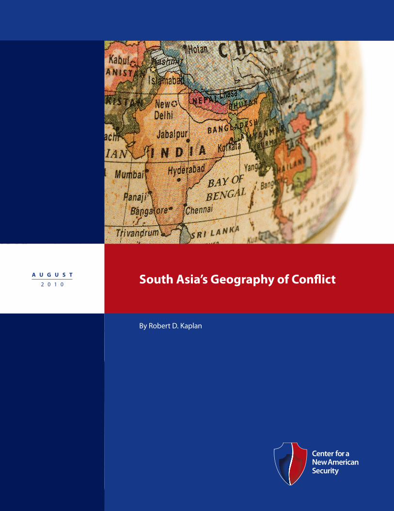
A U G U S T 2 0 1 0 South Asia’s Geography of Conflict By Robert D. Kaplan
Transcript of South Asia's Geography of Conflict
A u g u s t
2 0 1 0 south Asia’s geography of Conflict
By Robert D. Kaplan

Cover Image(ISTOCK)
AcknowledgmentsI wish to thank Center for a New American Security CEO Nathaniel Fick and President John Nagl, and especially Vice President and Director of Studies Kristin Lord for her meticulous editing. I also wish to thank Alyssa Ayres; Lieutenant General David W. Barno, USA (Ret.); Marshall Boutan; Richard Fontaine and C. Raja Mohan for their expert reading. All mis-takes are the author’s.
South Asia’s Geography of Conflict
By Robert D. Kaplan
A U G U S T 2 0 1 0
South Asia’s Geography of ConflictA U G U S T 2 0 1 0
2 |
About the Author
Robert D. Kaplan is is a senior fellow at the Center for a New American Security, the author of Monsoon: The Indian Ocean and the Future of American Power, a national correspondent of The Atlantic and a member of the Defense Policy Board.
| 3
E X E C U T I V E S U M M A R Y
By Robert D. Kaplan
India will emerge as the key Eurasian pivot state because of its effect on relations between the United States and China. To effectively deal with India, American policymakers must understand Indian geography and geopolitics throughout its long history. In particular, Indian geography is the story of invasions from a northwesterly direc-tion, and India’s strategic challenges still inhere in this fact. Afghanistan, in Indian eyes, is not part of Central Asia but part of the Indian subconti-nent. Afghanistan is linked organically to India on account of the record of empires past. This organic connection to India is also true of Central Asia and Iran. As for Pakistan, it is seen by Indians as the modern-day residue of medieval Muslim domi-nation over India. As the India-Pakistan dispute attests, nationalism is young and vibrant in the subcontinent, as it was in early modern Europe. The India-China rivalry, unlike the India-Pakistan one, is far less emotional because it is not borne of historical grievances. India is quietly testing the United States in Afghanistan, to see to what extent America will remain as a great power in Eurasia.
As the United States and China become great power rivals, the direction in which India tilts could determine the course of geopolitics in Eurasia in the 21st century. India, in other words, looms as the ultimate pivot state. But even as the Indian political class understands at a very intimate level America’s own historical and geo-graphical situation, the American political class has no such understanding of India’s. Yet, if Americans do not come to grasp India’s age-old, highly unstable geopolitics, especially as it con-cerns Pakistan, Afghanistan and China, they will badly mishandle the relationship.
Indeed, America has come to grief in the past by not understanding local histories. India is much too important for us to commit a similar mistake. In fact, India and South Asia in general have a dan-gerously misunderstood geography. Understanding that geography delivers one to the core of South
South Asia’s Geography of ConflictA U G U S T 2 0 1 0
4 |
like Java and Sumatra. India is another case entirely. Like China, India is possessed of geo-graphical logic, framed as it is by the Arabian Sea to the west and southwest, by the Bay of Bengal to the east and southeast, by the mountainous Burmese jungles to the east, and by the Himalayas and the knot of the Karakorams and Hindu Kush to the north and northwest. India, also like China, is internally vast. But to a lesser extent than China, India lacks a singular nursery of demo-graphic organization like the Wei Valley and lower Yellow River, from which a polity could expand outward in all directions. Even the Ganges River Valley could not provide enough of a platform for the expansion of a unitary Indian state unto the subcontinent’s deep, peninsular south. The sub-continent’s various river systems beside the Ganges – the Brahmaputra, Narmada, Tungabhadra, Kaveri, Godaveri and so on – further divide it. Moreover, India (along with Southeast Asia) has the hottest climate and most abundant and luxuri-ant landscape of all the Eurasian population hubs. Therefore its inhabitants, Fairgrieve tells us, lacked the need to build political structures for the orga-nization of resources, at least to the degree that the temperate-zone Chinese and Europeans did. This last point, of course, may be overly deterministic
Asia’s political dilemma, which is about borders that can never be perfect or even acceptable to all sides, so that the map of South Asia resembles that of war-torn, early-modern Europe, made worse by nuclear weapons. Indian history and geography since early antiquity constitutes the genetic code for how the world looks from the vantage point of New Delhi.
The broad arc of territory from Afghanistan southeastward into northern India was for long periods under the embrace of a single polity, so that Afghanistan is linked organically to India, even as Afghanistan matters more crucially to Pakistan. Thus, giving up on Afghanistan would carry momentous geopolitical implications for the United States, as it would affect how elites in New Delhi and other Asian capitals henceforth perceive Washington. Afghanistan is a tipping point for the American projection of power in Eurasia. It will affect at a visceral level how not just Indian, but also Pakistani and Chinese elites, see the United States. And the direction that Afghanistan takes will affect how successful India is in overcoming the problems on its borders in order to emerge as a world-class power. To give readers a rich sense of this, I first delve into South Asian geography and history at some length.
The Indian Subcontinent in the Context of EurasiaThe great centers of population on the Eurasian supercontinent are all on its peripheries: Europe, China, Southeast Asia and India. Chinese and European civilizations, as the British geographer James Fairgrieve wrote in 1917, grew outward in organic fashion from the nurseries of the Wei River Valley and the Mediterranean.¹ Southeast Asia’s civilizational development was more elaborate: with Pyu and Mon peoples, followed by Burmans, Khmers, Siamese, Vietnamese, Malays and oth-ers – in turn, influenced by southward migrations from China – coagulating along river valleys like the Irrawaddy and Mekong, as well as on islands
The key to understanding
India is the realization
that while as a
subcontinent India makes
eminent geographic sense,
its natural boundaries are,
nevertheless, quite weak
in places.
| 5
and perhaps inherently racist in its stark simplicity, a feature common to the era in which Fairgrieve wrote. Yet, Fairgrieve’s larger analysis of India is essentially correct.
While obviously constituting its own unique civilization, the Indian subcontinent, because of the above reasons, has through much of history lacked the political unity of China. What’s more, the subcontinent has been open to concentrated invasions from its northwest, the least defined and least protected of its frontier regions, where India is dangerously close to both the Central Asian steppe and the Persian-Afghan plateau. Motivating these invasions throughout history has been the welcom-ing fecundity of the Punjab, watered as it is by the Indus River and its tributaries at exactly the point where the Persian-Afghan plateau drops to the floor of the subcontinent. Indeed, it is the invasions and infiltrations from West and Central Asia that have disrupted the quest for unity and stability in the Indian subcontinent well into the modern era.
India’s advantages and disadvantages as it seeks great power status in the early 21st century inhere still in this wider subcontinental geography. As the late historian Burton Stein notes, a map of India through the medieval era would have extended into parts of Central Asia, Afghanistan and Iran, while at the same time showing only a tenuous link between the Indus Valley in the northwest and peninsular India south of the Ganges.² For just as today’s China represents a triumphant culmination of the relationship between the Inner Asian steppe-land and the floodplains of the Chinese heartland, India was for millennia heavily influenced by its higher-altitude neighbors such as Afghanistan and Burma, which, unlike China’s, it has yet to domi-nate, so that India remains the lesser power.
The ties between the Indian subcontinent and southeastern Afghanistan are obvious because of their contiguity, yet those between India and the Central Asian steppe-land, as well as those between
India and the Iranian plateau, are equally profound. India and Iran have shared the predicament of being on the receiving end of Mongol onslaughts from Central Asia, even as the dynamism of Iranian culture, abetted by invasions since the time of the Achaemenids (sixth to fourth centuries B.C.) led to Persian being the official language of India until 1835.³ Meanwhile, Urdu, the official language of Pakistan – the state that occupies the Indian sub-continent’s northwestern quadrant – draws heavily on Persian (as well as Arabic) and is written in a modified Arabic script.⁴ India, thus, is both a sub-continent and a vital extremity of the greater Middle East, with a highly organic relationship to it.
The key to understanding India is the realization that while as a subcontinent India makes emi-nent geographic sense, its natural boundaries are, nevertheless, quite weak in places. The result has been various states throughout history that do not conform to our spatial idea of India, and in fact lie astride it. In fact, the present Indian state still does not conform to the borders of the subconti-nent, and that is the heart of its dilemma: Pakistan, Bangladesh and (to a lesser extent) Nepal also lie within the subcontinent and pose significant security threats to India, robbing India of political energy that it would otherwise harness for power projection throughout much of Eurasia.
It is not that human settlement from early antiq-uity forward does not adhere to subcontinental geography. Rather, it is that India’s geography is itself subtle, particularly in the northwest, tell-ing a different story than the map reveals at first glance. At first glance, the relief map shows a brown layer of mountains and tableland neatly marking off the cool wastes of middle Asia from the green tropical floor of the subcontinent along the present border between Afghanistan and Pakistan. But the descent from Afghanistan to the Indus River, which runs lengthwise through the middle of Pakistan, is exceedingly gradual, so that for millennia similar cultures occupied both
South Asia’s Geography of ConflictA U G U S T 2 0 1 0
6 |
the high plateaus and the lowland riverine plains, whether Harappan, Kushan, Turkic, Mughal, Indo-Persian, Indo-Islamic or Pushtun, to name but a few categories. And this is to say nothing of the alkaline deserts of Makran and Baluchistan that unite Iran with the subcontinent, or the medieval sea traffic that united Arabia with India by virtue of the predictable monsoon winds. “The frontier of Al-Hind,” as the South Asia scholar Andre Wink calls the whole region from eastern Iran to western India, has throughout history been very much a fluid cultural organism, and defining state borders is inherently problematic.⁵
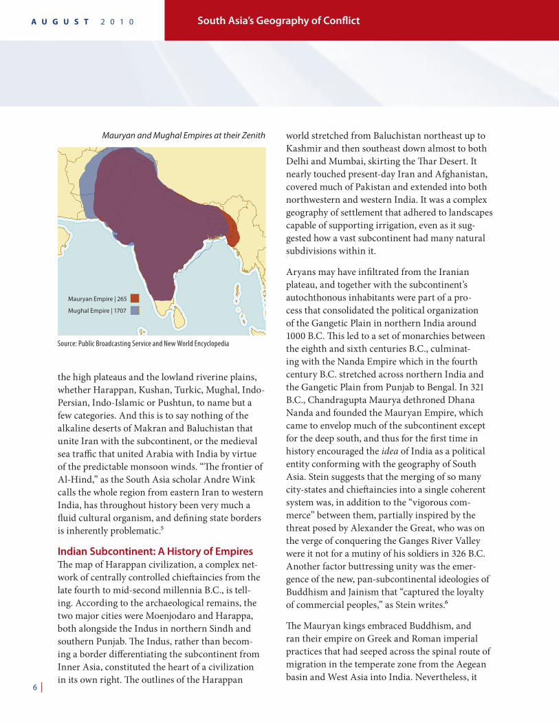
Indian Subcontinent: A History of EmpiresThe map of Harappan civilization, a complex net-work of centrally controlled chieftaincies from the late fourth to mid-second millennia B.C., is tell-ing. According to the archaeological remains, the two major cities were Moenjodaro and Harappa, both alongside the Indus in northern Sindh and southern Punjab. The Indus, rather than becom-ing a border differentiating the subcontinent from Inner Asia, constituted the heart of a civilization in its own right. The outlines of the Harappan
world stretched from Baluchistan northeast up to Kashmir and then southeast down almost to both Delhi and Mumbai, skirting the Thar Desert. It nearly touched present-day Iran and Afghanistan, covered much of Pakistan and extended into both northwestern and western India. It was a complex geography of settlement that adhered to landscapes capable of supporting irrigation, even as it sug-gested how a vast subcontinent had many natural subdivisions within it.
Aryans may have infiltrated from the Iranian plateau, and together with the subcontinent’s autochthonous inhabitants were part of a pro-cess that consolidated the political organization of the Gangetic Plain in northern India around 1000 B.C. This led to a set of monarchies between the eighth and sixth centuries B.C., culminat-ing with the Nanda Empire which in the fourth century B.C. stretched across northern India and the Gangetic Plain from Punjab to Bengal. In 321 B.C., Chandragupta Maurya dethroned Dhana Nanda and founded the Mauryan Empire, which came to envelop much of the subcontinent except for the deep south, and thus for the first time in history encouraged the idea of India as a political entity conforming with the geography of South Asia. Stein suggests that the merging of so many city-states and chieftaincies into a single coherent system was, in addition to the “vigorous com-merce” between them, partially inspired by the threat posed by Alexander the Great, who was on the verge of conquering the Ganges River Valley were it not for a mutiny of his soldiers in 326 B.C. Another factor buttressing unity was the emer-gence of the new, pan-subcontinental ideologies of Buddhism and Jainism that “captured the loyalty of commercial peoples,” as Stein writes.⁶
The Mauryan kings embraced Buddhism, and ran their empire on Greek and Roman imperial practices that had seeped across the spinal route of migration in the temperate zone from the Aegean basin and West Asia into India. Nevertheless, it
Mauryan and Mughal Empires at their Zenith
Source: Public Broadcasting Service and New World Encyclopedia
Mauryan Empire | 265
Mughal Empire | 1707
| 7
required all manners of human ingenuity to hold the Mauryan Empire together. Chandragupta’s advisor might have been one Kautilya, who penned a political classic, the Arthashastra or “Book of the State,” which shows how a conqueror can create an empire by exploiting the relationships between various city-states: Any city-state that touches one’s own should be considered an enemy because it will have to be subdued in the course of empire-building; but a distant city-state that borders an enemy should be considered a friend. Because holding such an immense subcontinental empire together was difficult, Kautilya believed in complex alliance networks and in benevolence toward the conquered, whose way of life should be preserved.⁷ The Mauryan was a decentralized empire, to say the least, with a heartland in the eastern Gangetic Plain and four regional centers by the time of Chandragupta’s grandson, Ashoka: Taxila in the northwest, outside the Pakistani capi-tal of Islamabad; Ujjain on the Malwa Plateau in western-central India; Suvarnagiri in the southern Indian state of Karnataka; and Kalinga along the Bay of Bengal south of Kolkata.
It was an extraordinary achievement this early in history, with only primitive means of transporta-tion and communications available, for one empire to cover so much of the subcontinent, and Indian policy intellectuals today are noticeably proud of it. The Mauryans demonstrated the potential for a single state to employ geographic logic over a vast area for quite some time. Alas, the decline of the Mauryans led to the familiar invasions from the northwest, notably through the Khyber Pass: Greeks in the second century B.C. and Scythians in the first century B.C. This encouraged the redivision of the subcontinent into regional dynas-ties: Sunga, Pandyan, Kuninda and so on. The Kushan Empire emerged in the first century A.D. in Bactria, where northern Afghanistan meets Tajikistan and Uzbekistan, and its Indo-European rulers conquered territory from the Ferghana
Valley in the demographic heart of Central Asia to Bihar in northeastern India. The very map of the Kushana domain is mind-boggling to our modern sensibilities, overlapping as it does for-mer Soviet Central Asia, Afghanistan, Pakistan and much of northern India’s Gangetic Plain. The Kushan Empire follows river valleys on one hand but crosses mountain ranges on the other, so that it both adheres to and contradicts geography. It also constitutes a signal lesson in the fact that current borders do not necessarily indicate the last word in political organization of Central and South Asia. (To be sure, geography is not destiny, even as we need to take it into account more than we have.)
The Gupta Empire (320 to 550 A.D.) restored a semblance of unity over the subcontinent, govern-ing from the Indus in the west to Bengal in the east, and from the Himalayas in the north to the Deccan Plateau in the center, albeit most of the south was outside its control, even as the Gupta rulers suffered incursions from Central Asian horsemen driving down from the northwest into Rajasthan and the western Gangetic Plain. Moreover, like in the way of the Mauryan, the Gupta was less a unitary state than a weak system of client states united by trade and tribute to the Ganges core.
For more than six centuries following the Gupta decline, which was hastened by the influx of Huns from Central Asia, came a congeries of small states indicating, yet again, that India was not quite China, with the latter’s greater propensity for centralization and political unity. Indeed, the post-Gupta kingdoms, in Stein’s words, were “defined less by administration than by language, sectarian affiliations and temples.”⁸
From the seventh through 16th centuries, writes Fairgrieve, Muslim peoples successively entered India. “The Arabs, as was natural, came first by land along the coast, and by sea coasting along the shores, but they effected nothing permanent; the Turks next, from a little before A.D. 1000 onward,
South Asia’s Geography of ConflictA U G U S T 2 0 1 0
8 |
over the plateau of Iran and through Afghanistan,” he says. “In little over a century, largely because of disputes between Hindu rulers, the whole northern plain had acknowledged Mohammedan rule.”⁹ The Indian subcontinent was indeed grafted to the Middle East. Among the highlights: Iraqi Arabs in the early eighth century occupied parts of Sind, Punjab, Rajasthan and Gujarat. The Turkic Mamluk warrior, Mahmud of Ghazni, headquar-tered in eastern Afghanistan, united in his early 11th-century empire present-day Iraqi Kurdistan, Iran, Afghanistan, Pakistan and northwestern India as far as Delhi, and raided Gujarat to the south on the Arabian Sea. From the 13th to the early 16th century, the so-called Delhi Sultanate featured rule over northern India and parts of the south by the Turkic Tughluq, the Afghan Lodi and other dynasties from Central Asia. At Delhi’s back was the Islamic world; in front of it the Hindu world. (By this time Buddhism had virtually disap-peared from India, the land of its birth, to move eastward and northeastward.) Geography has determined that the subcontinent in the northwest is less a fixed frontier than an interminable series of gradations, beginning in Iran and Afghanistan, and ending in Delhi.
The Mughal Empire was a cultural and political expression of this fact. Few empires have boasted the artistic and religious eclecticism of the Mughals – another dynasty that excites Indian elites these days. The Mughals vigorously ruled India and parts of Central Asia from the early 1500s to 1720 (after which the empire declined rapidly). Mughal is the Arabic and Persian form of Mongol, which was applied to all foreign Muslims from the north and northwest of India. The Mughal Empire was founded by Zahir-ud-din-Muhammad Babur, a Chaghtai Turk, born in 1483 in the Fergana Valley in today’s Uzbekistan, who spent his early adulthood trying to capture Tamarlane’s (Timur’s) old capital of Samarkand. After being decisively defeated by Muhammad
Shaybani Khan, a descendant of Genghis Khan, Babur and his followers headed south and cap-tured Kabul. It was from Kabul that Babur swept down with his army from the high plateau of Afghanistan into the Punjab. Thus, he was able to begin his conquest of the Indian subcontinent. The Mughal or Timurid Empire, which took form under Akbar the Great, Babur’s grandson, had a nobility composed of Rajputs, Afghans, Arabs, Persians, Uzbeks and Chaghatai Turks, as well as of Indian Sunnis, Shias and Hindus, not to men-tion other overlapping groups. It was an ethnic and religious world that began in southern Russia to the northwest and by the Mediterranean to the west.¹⁰ India was very much a depository of ongo-ing cultural and political trends to its west and northwest.
Kabul and Kandahar were a natural extension of this venerable Delhi-based dynasty, yet the strongly Hindu area in southern India around present-day Bangalore – India’s high-technology capital – was much less so. Aurangzeb, the “world-seizer,” under whose rule in the late 17th century the Mughal Empire reached the zenith of its expansion, was an old man in his 80s still fighting Maratha insurgents in India’s south and west. In fact, it was this long-running and intractable insurgency in southern India that sapped the cohesion and morale of the Mughal elite. Aurangzeb’s preoccupation with the Maratha warriors – to the exclusion of imperial problems elsewhere – made it easier for the Dutch, French and British East India companies to gain footholds on the coast, which led eventually to British rule in India.¹¹
To emphasize the point: Aurangzeb’s situation was that of Delhi-based rulers going back hun-dreds of years, as well as of even older rulers in the subcontinent stretching back to antiquity. That is, the vast region that today encompasses northern India along with Pakistan and much of Afghanistan was commonly under a single pol-ity, even as sovereignty over southern India was
| 9
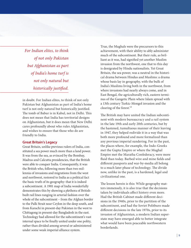
in doubt. For Indian elites, to think of not only Pakistan but Afghanistan as part of India’s home turf is not only natural but historically justified. The tomb of Babur is in Kabul, not in Delhi. This does not mean that India has territorial designs on Afghanistan, but it does mean that New Delhi cares profoundly about who rules Afghanistan, and wishes to ensure that those who do are friendly to India.
Great Britain’s LegacyGreat Britain, unlike previous rulers of India, con-stituted a sea power much more than a land power. It was from the sea, as evinced by the Bombay, Madras and Calcutta presidencies, that the British were able to conquer India. Consequently, it was the British who, following more than two mil-lennia of invasions and migrations from the west and northwest, restored to India as a political fact the basic truth of its geography: that it is indeed a subcontinent. A 1901 map of India wonderfully demonstrates this by showing a plethora of British-built rail lines ranging in arterial fashion over the whole of the subcontinent – from the Afghan border to the Palk Strait near Ceylon in the deep south, and from Karachi in present-day Pakistan in the west to Chittagong in present-day Bangladesh in the east. Technology had allowed for the subcontinent’s vast internal space to be finally united under one polity, rather than divided among several or administered under some weak imperial alliance system.
True, the Mughals were the precursors to this achievement, with their ability to ably administer much of the subcontinent. But their rule, as bril-liant as it was, had signified yet another Muslim invasion from the northwest, one that to this day is denigrated by Hindu nationalists. Yet Great Britain, the sea power, was a neutral in the histori-cal drama between Hindus and Muslims: a drama whose basis lay in geography, with the bulk of India’s Muslims living both in the northwest, from where invasions had nearly always come, and in East Bengal, the agriculturally rich, eastern termi-nus of the Gangetic Plain where Islam spread with a 13th century Turkic-Mongol invasion and the clearing of the forest.¹²
The British may have united the Indian subconti-nent with modern bureaucracy and a rail system in the late 19th and early 20th centuries, but by the hastened, tumultuous manner of their leaving in 1947, they helped redivide it in a way that was both more profound and more formalized than any previous imperial sundering. For in the past, the places where, for example, the Indo-Greeks met the Gupta Empire or where the Mughal Empire met the Maratha Confederacy, were more fluid than today. Barbed wire and mine fields and different passports and war-by-media all belong to a much later phase of technology. The divide now, unlike in the past, is a hardened, legal and civilizational one.
The lesson herein is this: While geography mat-ters immensely, it is also true that the decisions taken by individuals affect history even more. Had the British Cabinet made different deci-sions in the 1940s, prior to the partition of the subcontinent, and had the Soviet Politburo made different decisions in the late 1970s, prior to its invasion of Afghanistan, a modern Indian super-state may have emerged able to better integrate what would have been peaceable northwestern borderlands.
For Indian elites, to think
of not only Pakistan
but Afghanistan as part
of India’s home turf is
not only natural but
historically justified.
South Asia’s Geography of ConflictA U G U S T 2 0 1 0
10 |
Afghanistan and PakistanBut while counterfactuals are interesting to con-template, the current reality is what it is. To wit, from the historical perspective of India, Pakistan constitutes much more than a nuclear-armed adversary, a state sponsor of terrorism and a large, conventional army breathing down its neck on the border. Pakistan, lying to India’s northwest, where the mountains meet the plain, is now the very geographical and national embodiment of all the Muslim invasions that have swept down into India throughout its history. “Pakistan,” writes George Friedman, the founder of STRATFOR, “is the modern-day remnant of Muslim rule over medieval India,” even as Pakistan’s southwest is the subcon-tinental region first occupied by Arab Muslims invading from Iran and southern Afghanistan.¹³
To be sure, Indian decision makers are not anti-Muslim. India is home to 154 million Muslims, the third-largest Muslim population in the world after Indonesia and Pakistan itself. India has had three Muslim presidents. But India is a secular democracy by virtue of the fact that it has sought to escape from the politics of religion in order to heal the Hindu-Muslim divide in a Hindu major-ity state. Pakistan, while also a democracy, is an Islamic republic with radical elements. Thus, in some ways, it is an affront to the very liberal funda-mentals on which India is based.
The fact that India’s fear of Pakistan – and vice versa – is existential should not surprise any-one. Of course, India could defeat Pakistan in a conventional war. But in a nuclear exchange, or a war-by-terrorism, Pakistan could achieve a parity of a sort with India. And it goes beyond that because it is not only Pakistan that encom-passes, after a fashion, the threat of another Mughal onslaught without the Mughals’ redeem-ing cosmopolitanism, It is Afghanistan, too. For, as we know, the border separating Pakistan from Afghanistan is largely a mirage, both today and in history. Even at the official Khyber border
post, tens of thousands of ethnic Pushtuns pass through weekly without showing identity papers, while hundreds of jingle trucks pass daily unin-spected. The lack of procedures attests not only to the same tribes on both sides of the frontier, but also to the artificial nature of the Afghan and Pakistani states themselves, the ultimate cause of which is their lack of geographical coherence as the heart of Indo-Islamic and Indo-Persianate continuums through which it is nearly impossible to draw lines. The Achaemenid, Kushan, Indo-Greek, Ghaznavid, Mughal and other empires all took in both Afghanistan and Pakistan as part of their dominions, which either threatened India or included portions of it. Then there is the Central Asian Timur (Tamerlane) and the Turkmen Nader Shah the Great, who in 1398 and in 1739, respectively, vanquished Delhi from imperial bases in present-day Iran, Afghanistan and Pakistan.
This is a rich history that few in the West know of, while Indian elites know it in their bones. When Indians look at their maps of the subcontinent they see Afghanistan and Pakistan in the northwest, just as they see Nepal, Bhutan and Bangladesh in the northeast, as all part of India’s immediate sphere of influence, with Iran, the Persian Gulf, the former Soviet Central Asian republics and Burma as critical areas of influence. Not to view these places as such is, from the prospect of New Delhi, to ignore the lessons of history and geography.
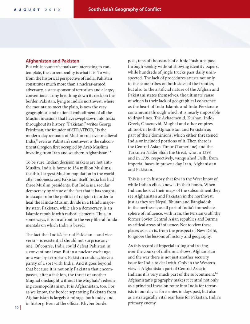
As this record of imperial to-ing and fro-ing over the course of millennia shows, Afghanistan and the war there is not just another security issue for India to deal with. Only in the Western view is Afghanistan part of Central Asia; to Indians it is very much part of the subcontinent.¹⁴ Afghanistan’s geography makes it central not only as a principal invasion route into India for terror-ists in our day as for armies in days past, but also as a strategically vital rear base for Pakistan, India’s primary enemy.
| 11
While India’s geographic logic is not perfect, Pakistan, right-angled to the course of inva-sions past, has no geographic logic at all, and Afghanistan has far too little. Pakistan is an artificial puzzle piece of a territory, straddling the frontier between the Iranian-Afghan plateau and the lowlands of the subcontinent, encompassing the western half of the Punjab but not the eastern half, uniting the Karakorams in the north (some of the highest mountains in the world) with the Makran Desert almost 1,000 miles to the south by the Arabian Sea.¹⁵ Pakistan is also the home of four major ethnic groups, each harboring hos-tility toward the others and each anchored to a specific region: Punjab to the northeast, Sindh to the southeast, Baluchistan to the southwest and the Pushtun-dominated North-West Frontier Province (Khyber Pakhtunkhwa). Islam was supposed to have provided the unifying glue for the state but it has signally failed in this regard. Even as Islamic groups in Pakistan have become more radical, Baluch and Sindhis continue to see Pakistan as a foreign entity overlorded by the Punjabis, with the Pushtuns in the northwest drawn more and more into the Taliban-infected politics of the Afghan-Pakistani border area. Without the Punjabi-dominated army, Pakistan might cease to exist.
Founded in 1947 by Mohammed Ali Jinnah, a London-Bombay intellectual, who was the son of a merchant from Gujarat, Pakistan was built on an ideological premise: that of a homeland for the Muslims of the Indian subcontinent. And it was true, the majority of the subcontinent’s Muslims lived in West and East Pakistan (which became Bangladesh in 1971), yet many tens of millions of Muslims remained in India proper, so that Pakistan’s geographical contradictions rendered its ideology supremely imperfect. Indeed, millions of Muslims and Hindus became refugees upon Pakistan’s creation. The fact is that the subconti-nent’s history of invasions and migrations makes
for a plenteous ethnic, religious and sectarian mix. For example, India is the birthplace of several reli-gions: Hinduism, Buddhism, Jainism and Sikhism. Zoroastrians, Jews and Christians have lived in India for hundreds and thousands of years. The philosophy of the Indian state accepts this reality and celebrates it; the philosophy of the Pakistani state is far less inclusive. That is partly why India is stable and Pakistan is not.
So central to India’s geopolitical fortunes over the course of near and distant history is Afghanistan. It is a country with a life expectancy rate of 44 years, with a literacy rate of 28 percent (and far lower than that for women), with only 9 percent of females attending secondary schools and with only a fifth of the population enjoying access to potable water. Out of 182 countries, Afghanistan ranks next to last on the United Nations’ Human Development Index. Iraq, on the eve of the U.S. invasion in 2003, was ranked 130, and its literacy rate is a reasonable 74 percent. While in Iraq urbanization stands at 77 percent, so that reduc-ing violence in greater Baghdad during the troop surge of 2007 had a calming effect on the entire country, in Afghanistan urbanization stands at
Afghanistan’s geography
makes it central not only
as a principal invasion
route into India for
terrorists in our day as for
armies in days past, but
also as a strategically vital
rear base for Pakistan,
India’s primary enemy.
South Asia’s Geography of ConflictA U G U S T 2 0 1 0
12 |
only 30 percent, meaning that counterinsurgency efforts in one village or region may have no effect on another.
Whereas Mesopotamia, with large urban clus-ters over a flat landscape, is conducive to military occupation forces, Afghanistan is, in terms of geography, barely a country at all. It is riven by cathedral-like mountain ranges that help seal divisions between Pushtuns and Tajiks and other minorities, even as comparatively little in the way of natural impediments separates Afghanistan from Pakistan, or Afghanistan from Iran. Looking at the relief map, and noting that more than half of the world’s 42 million Pushtuns live inside Pakistan, one could conceivably construct a coun-try called Pushtunistan, lying between the Hindu Kush mountains and the Indus River, thus overlap-ping the Afghani and Pakistani states. Some people recommend such an evolution as part of their plan to break up Afghanistan. But I do not. Afghans, in the way of dual-citizenship, have multiple identi-ties, national and ethnic. Breaking it up would only cause more hardship.
Afghanistan only emerged as a country-of-sorts in the mid-18th century, when Ahmad Khan, leader of the Abdali contingent in the Persian army of Nadir Shah the Great, carved out a buffer zone between Persia and a crumbling Mughal empire in the Indian subcontinent that was later to evolve into a buffer zone between Czarist Russia and British India. Thus, the case can be made that with the slow-motion dissolution of the former Soviet Empire in Central Asia, and the gradual weaken-ing of the Pakistani state, an historic realignment is now taking place that could see Afghanistan gradually disappear on the political map. In the future, for example, the Hindu Kush (the real northwestern frontier of the subcontinent) could form a border between Pushtunistan and a Greater Tajikistan. The Taliban, the upshot of Pushtun nationalism, Islamic fervor, drug money, corrupt warlords and hatred of the American occupation,
may, in the words of Asian specialist Selig Harrison, merely be the vehicle for this transition that is too broad and too grand to be in any way deterred by a foreign military run by impatient civilians back in Washington.
But there is another reality to counter this one, one that eschews such determinism. The fact that Afghanistan is larger than Iraq with a more dispersed population is basically meaningless: 65 percent of the country lives within 35 miles of the main road system, which approximates the old medieval caravan routes, making only 80 out of 342 districts key to centralized control. Afghanistan has been governed more or less from the center since Ahmad Khan’s time: Kabul, if not always a point of authority was at least a point of arbitration. Especially between the early 1930s and the early 1970s, Afghanistan experienced moderate and constructive government under the constitu-tional monarchy of Zahir Shah, a descendant of Ahmad Khan. The major cities were united by a highway system on which it was safe to travel, even as malaria was on the point of eradication through estimable health and development programs. There was, too, a strong Afghan national identity distinct from that of Iran, Pakistan or the Soviet Union. A fragile webwork of tribes it might have been, but it was also developing as more than just a buffer state. Pushtunistan might be a reality, but as in the way of dual citizenship, so very definitely is Afghanistan. Blame for the three coup d’états in Kabul in the 1970s that led to the country’s seem-ingly never-ending agony of violence rests as much with a great and contiguous power, the Soviet Union, as with the Afghans. As part of a process to firmly secure the country within its sphere of influ-ence, the Soviets unwittingly destabilized Afghan politics, which led to their December 1979 inva-sion. Afghanistan, as a geographical buffer between the Iranian Plateau, the Central Asian steppes and the Indian subcontinent, is breathtakingly strate-gic, and thus has been coveted by not just Russians
| 13
but also by Iranians and Pakistanis, even as Indian policymakers have always been obsessed with it.
Consider an Afghanistan that falls under Taliban sway threatens to create a succession of radicalized Islamic societies from the Indian-Pakistani bor-der to deep inside Central Asia. This would be, in effect, a greater Pakistan, giving Pakistan’s Inter-Services Intelligence Directorate (ISI) the ability to create a clandestine empire composed of the likes of Jallaluddin Haqqani, Gulbuddin Hekmatyar and Lashkar-e-Taiba – able to confront India in the manner that Hezbollah and Hamas confront Israel. Conversely, an Afghanistan at peace and governed more-or-less liberally from Kabul would give New Delhi the ability to extricate itself from its mil-lennia-old historical nemesis on its northwestern frontier, as well as to challenge Pakistan on both its western and eastern borders. That is why, dur-ing the 1980s, India supported the Soviet puppet regime in Kabul of Mohammed Najibullah, which was secular and even liberal compared with the pro-Pakistani Islamist mujahidin trying to topple it. For the same reason, India now supports Hamid Karzai’s Kabul government.
He or she who sits in Delhi with his back to Muslim Central Asia must still worry about unrest up on the plateaus to the northwest. The United States will draw down its troops one day in Afghanistan, but India will still have to live with the results, and therefore remain intimately
engaged. The quickest way to undermine U.S.-India relations is for the United States to withdraw precipitously from Afghanistan. In the process of leaving behind an anarchic and radi-calized society, which in and of itself is contrary to India’s interests, such a withdrawal would sig-nal to Indian policy elites that the United States is surely a declining power on which they cannot depend. Detente with China might then seem to be in India’s interest. After all, China wants a stable Afghanistan for trade routes; India, for security. Because of India’s history and geography, an American failure in Afghanistan bodes ill for our bilateral relationship with New Delhi. Put simply, if the United States deserts Afghanistan, it deserts India.
Indeed, India is quietly testing the United States in Afghanistan perhaps to the same intense degree as Israel is very publicly testing the United States in regards to a nuclear Iran. I do not suggest that we should commit so much money and national treasure to Afghanistan merely for the sake of impressing India. But I am suggesting that the deleterious effect on U.S.-India bilateral relations of giving up on Afghanistan should be part of our national debate on the war effort there, for at the moment it is not. The fact is that our ability to influence China will depend greatly on our ability to work with India, and that, in turn, will depend greatly on how we perform in Afghanistan.
In sum, the Indian subcontinent features among the least stable geopolitics in the world. The reg-ister of empires and invasions constitutes a vivid, living history because of its relevance to the deep-seated insecurities and political problems of today. Although, in many ways, greater India is like a map of early modern Europe. In early modern Europe, there were competing ethnic and national groups that were in the process of congealing into bureaucratic states, even as they were engaged in complex balance-of-power arrangements that, because of frequent interactions and subsequent
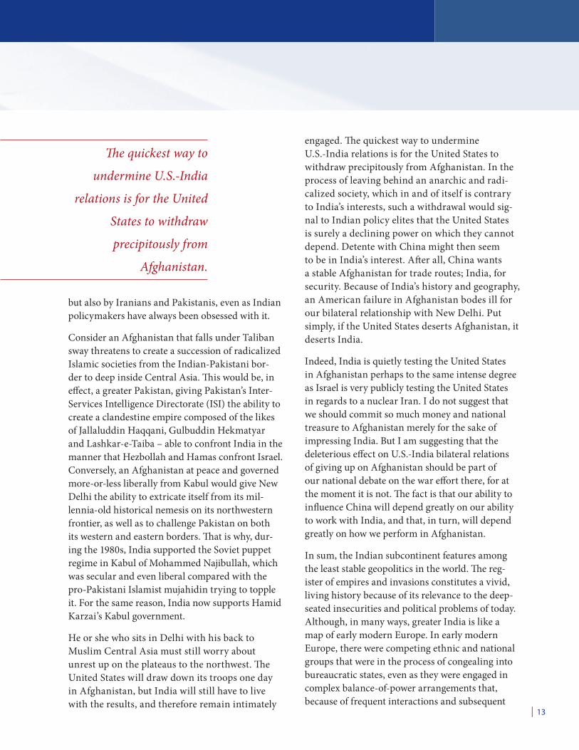
The quickest way to
undermine U.S.-India
relations is for the United
States to withdraw
precipitously from
Afghanistan.
South Asia’s Geography of ConflictA U G U S T 2 0 1 0
14 |
miscalculations, broke down periodically into open warfare. Modern nationalism was in a young and vigorous phase, as it is in South Asia today. But unlike the multipolarity of early modern Europe, South Asia evinces a bipolar struggle between India and Pakistan, with Afghanistan as the main battleground and the disputed Himalayan state of Kashmir as a secondary one. Unlike the bipolar-ity of the superpowers, however, there is nothing cool, dispassionate or ritualistic about this con-flict. This is not a clash of ideologies in which the opposing parties have no religious or historical hatred for each other and are separated by the wide berth of a hemisphere and Arctic ice. This is a clash between a Hindu-majority, albeit secu-lar, state and a Muslim one, both in full-blooded phases of modern nationalism and separated by a crowded, common border, with capitals and major cities nearby. Less than 200 miles separate Pakistan’s Indus River heartland from northern India’s Ganges River heartland.¹⁶ So, in addition to everything else about this geography, it is a claus-trophobic one.
ChinaIndia desperately wants to overcome this geog-raphy and this history. Its very competition and fixation with China forms an element of this escape. India’s rivalry with China, which we now consider, is not like the one with Pakistan at all: It is more abstract, less emotional and (far more significantly) less volatile. And it is a rivalry with no real history behind it.
It has been nearly half a century since India fought a limited war with China over a disputed Himalayan border, in which combat occurred at altitudes of 14,000 feet in the Aksai Chin region near Kashmir in the northwest and in Arunachal Pradesh near Bhutan in the northeast. The back-ground to this 1962 war, in which over 2,000 soldiers were killed and 2,744 wounded, was the 1959 uprising in Tibet that sent the Dalai Lama into exile in India, following the 1950 Chinese
invasion of Tibet. An independent or autonomous Tibet that was even vaguely pro-Indian would make Chinese strategists exceedingly nervous. Given the tensions of the Tibet crisis, China saw the establishment of Indian outposts north of disputed border lines a casus belli, and in one month of fighting in the autumn overran Indian forces. Neither side deployed its navy or air force, so the fighting was limited to remote regions where nobody lived, as opposed to the Indian-Pakistani border, which cuts through the agriculturally rich Punjab inhabited by millions in addition to passing through swamps and deserts.
The Indo-Chinese border is still in some areas a matter of dispute. Moreover, as the Chinese have built roads and airfields throughout Tibet, India now falls into the arc of operations of Chinese fighter pilots, even as the Indian air force is the world’s fourth largest, with over 1,300 aircraft spread over 60 bases. Then there is the rise of both countries’ navies. Because India has no equivalent of the Mediterranean, no enclosed seas and clusters of islands to lure sailors, even as the earth of the subcontinent is warm and productive, India until recently had been a land-bound nation framed against the open ocean. But that has suddenly changed: The growth of the Indian economy can finance major ship building and acquisition; the advances in military technology have compressed geography; and the threat of China itself has grown as China’s own naval aspirations move beyond the western Pacific into the Indian Ocean.
China has been building or upgrading ports all around India: in Kyaukpyu, Burma; Chittagong, Bangladesh; Hambantota, Sri Lanka; and Gwadar, Pakistan. In all of these countries, China is pro-viding substantial military and economic aid and political support. China already has a great mer-chant fleet and aspirations for a blue water-oceanic navy that will guard its interests and protect its trade routes between the hydrocarbon-rich Middle East and China’s Pacific coast. This is occurring
| 15
at the same time that India has aspirations for a Monroe Doctrine-style presence throughout the Indian Ocean from southern Africa to Australia. These overlapping naval spheres of interest com-pound the border issues in the Himalayan north that are still outstanding. China is merely seeking to protect its own sea lines of communications with friendly, state-of-the-art harbors along the way. But India feels surrounded. The possibility of a Pakistani-Chinese naval center of operations near the entrance to the Persian Gulf in Gwadar has led to the vast expansion of the Indian naval port of Karwar on the Arabian Sea. The port and energy pipelines China is building at Kyaukpyu in Burma have caused India to initiate its own port and energy complex at Sittwe, 50 miles to the north, as India and China quicken their competi-tion for routes and resources in Burma.
Still, one can only repeat, the Indian-Chinese rivalry represents a new struggle without the force of history behind it. The interactions that India and China have had in the distant past have usu-ally been productive: most famously, the spread of Buddhism from India to China in middle and late antiquity. Despite the issue of Tibet, in which Tibetan autonomy or independence is in India’s geopolitical interest but clearly harmful to that of China, the high wall of the Himalayas essen-tially cuts the two countries’ populations off from each other. Only in recent decades, as indigenous militaries in the East have developed sea, air and missile power, has a new potential Eurasian-wide geography of conflict come sharply into focus. The death of distance, much more than civilizational divides, is what ails India-China relations today. Only Indian policy elites worry about China, while the problem of Pakistan consumes the entire northern part of the country. Moreover, India and China constitute among the world’s most dynamic and complementary trading relationships. In a way, the tension between India and China illustrates the problems of success: the momentous economic
development that both New Delhi and Beijing can now utilize for military purposes, especially for expensive air and naval platforms. Certainly, the new India-China rivalry richly demonstrates Yale Professor Paul Bracken’s point that the technolo-gies of war and wealth creation go hand–in-hand, and the finite size of the earth is increasingly a force for instability, as military hardware and soft-ware shrink mileage on the geopolitical map.¹⁷
To wit, for the first few decades following the Cold War, India and China had relatively low-tech ground forces that were content to watch their own borders and to serve as bulwarks for national con-solidation. Thus, they did not threaten each other. But as planes, missiles and warships entered their military inventories, even as their armies became more expeditionary, suddenly they saw each other at opposite sides of a new battlespace. This is not only true of India and China, but of states across the broad sweep of Eurasia – Israel, Syria, Iran, Pakistan, North Korea and so on, who are in a new deathly geographical embrace of overlapping mis-sile ranges.
Behold, then, the Indian subcontinent. Bounded by seas and mountains, it is still internally vast, and its lack of a natural basis for early political unity and organization shows up still: China remains better organized and more efficiently governed than India, despite China’s lack of democracy. China adds more miles of highways per year than India has in total. Indian ministries are overbear-ing and, at the same time, inefficient compared to China’s. China may be wracked by strikes and demonstrations, but India is wracked by violent insurrections, notably that of the Maoist-trending Naxalites in the central and eastern portions of the country. In this regard, Fairgrieve’s description of a “less advanced” civilization compared to some external ones still holds.¹⁸
India is faced with a conundrum. Its great power status in the new century will be enhanced by both
South Asia’s Geography of ConflictA U G U S T 2 0 1 0
16 |
its political and military competition with China, even as it remains pinned down by weak frontiers bounding dysfunctional states inside the subconti-nent itself.
Nepal, Bangladesh and the Conflict in KashmirFollowing the dismantling of its monarchy and the coming to power of former Maoist insurgents, the Nepalese government barely controls the coun-tryside where 85 percent of its people live. Never having been colonized, Nepal never inherited a strong bureaucratic tradition from the British. Despite the aura bequeathed by the Himalayas, the bulk of Nepal’s population lives in the dank and humid lowlands along the barely policed border with India. Bangladesh, even more so than Nepal, has no geographical defense to marshal as a state: It is the same ruler-flat, aquatic landscape of paddy fields and scrub on both sides of the border with India. This artificially shaped blotch of territory – in succession Bengal, East Bengal, East Pakistan and Bangladesh – could metamorphose yet again amid the gale forces of regional politics, Muslim religious extremism and climate change itself. Like Pakistan, the history of Bangladesh is one of military and civilian regimes, none of which have functioned remotely well. Millions of Bangladeshi refugees have already crossed the border into India as illegals.
The subcontinent from early antiquity was politi-cally divided, and that is what ails it still.
Finally, now let us turn to the extreme north, where the Karakorams meet the Himalayas. Here is the territory of Kashmir, crammed in between Pakistan, Afghanistan, India and China. The Northern Areas of the Karakoram Range, with the town of Gilgit, are held by Pakistan and claimed by India, as is the slice of Azad (“Free”) Kashmir to the west. The Ladakh Range in the heart of Kashmir, with the towns of Srinagar and Jammu, are administered by India and claimed by
Pakistan, as is the Siachen Glacier to the north. To the far north and northeast lie the Shaksam Valley and Aksai Chin, administered by China and claimed by India. Furthermore, the Indian state of Jammu and Kashmir (the Ladakh Range) has a Muslim majority of 75 percent, a fact that has helped fuel jihadist rebellions for years. Osama bin Laden in his pronouncements has railed against Hindu-majority India’s domination of Kashmir. And yet much of Kashmir is high-altitude, uninhabitable badlands. But wars have been fought on these territories and over them, and may be fought still. The Chinese fought India in 1962 because they wanted to build a road from Xinjiang to Tibet through eastern Kashmir. India fought China to obstruct the common border between China and Pakistan.
Moreover, because of the effect of cyberspace and new media, Kashmir, like Palestine, fires hatred among millions, putting a solution to its tangle of problems further out of reach. The very technolo-gies that defeat geography also have the capability of enhancing geography’s importance. The subcon-tinent is a blunt geographical fact, but defining its borders will go on indefinitely.
ConclusionWithout a doubt, while India overwhelmingly dominates the subcontinent, the subcontinent’s frontiers are, in a geographical sense, subtle transi-tion zones that have allowed for other, smaller states to establish themselves. And because these other states, precisely because they occupy these transition zones, are often prone to ethnic, sec-tarian and regional divisions, they are also, in turn, prone to radical and unstable politics. Thus, India is stuck with neighbors that are volatile and dysfunctional, even as Indian history shows a long tradition of dominance over this entire region. Whereas Chinese dynasties of old almost com-pletely fall within the current borders of China, the dynasties to which India is heir, as we have seen, do not. Thus, India looks toward Afghanistan and
| 17
its other outlying regions with less serenity than does China toward its outlying regions, or shadow zones. India is a regional power to the degree that it is entrapped by this geography; it is a potential great power to the degree that it can get beyond it.
This millennia-old imperial history is something that Indian elites feel deeply about, whether or not they are intimate with all the details. For even as Americans separate Eurasia into smaller and more manageable geographical areas, Indians see the supercontinent holistically, so that both Afghanistan and China are part of one integrated map in which every place affects every place else. The United States should think likewise.
South Asia’s Geography of ConflictA U G U S T 2 0 1 0
18 |
1. James Fairgrieve, Geography and World Power: 253.
2. Burton Stein, A History of India (Oxford, England: Blackwell, 1998): 6-7.
3. Persian traveled to India as a literary language in the 12th century, with its formal role consolidated in the 16th.
4. Nicholas Ostler, Empires of the Word: A Language History of the World (New York: HarperCollins, 2005): 223.
5. Andre Wink, Al-Hind: The Making of the Indo-Islamic World. Volume I: Early Medieval India and the Expansion of Islam 7th-11th Centuries (Boston: Brill Academic Publishers, 1996): Chapter IV.
6. Stein, A History of India: 75-76.
7. Adam Watson, The Evolution of International Society: A Comparative Historical Analysis (London: Routledge, 1992): 78-82.
8. Stein: 121.
9. Fairgrieve: 261.
10. Robert D. Kaplan, Monsoon: The Indian Ocean and the Future of American Power (New York: Random House, 2010): 119 and 121.
11. Kaplan, Monsoon: 122-23. John F. Richards, The New Cambridge History of India: The Mughal Empire (New York: Cambridge University Press, 1993): 239 and 242.
12. Richard M. Eaton, The Rise of Islam and the Bengal Frontier, 1204-1760 (Berkeley, Calif.: University of California Press, 1993): xxii-xxiii and 313.
13. George Friedman, “The Geopolitics of India: A Shifting, Self-Contained World” (16 December 2008).
14. The geographical and cultural relationship between India and Iran is almost equally close.
15. The Punjab means “five rivers,” all tributaries of the Indus: the Beas, Chenab, Jhelum, Ravi and Sutlej.
16. Friedman, “The Geopolitics of India.”
17. Paul Bracken, Fire in the East: The Rise of Asian Military Power and the Second Nuclear Age (New York: HarperCollins, 1999): xxvi and 30.
18. Fairgrieve: 253.
E N D N oT E S


About the Center for a New American Security
The mission of the Center for a New American Security (CNAS) is to develop strong, pragmatic, and principled national security and defense policies. Building on the expertise and experience of its staff and advisors, CNAS aims to engage policymakers, experts and the public with innovative fact-based research, ideas, and analysis to shape and elevate the national security debate. A key part of our mission is to help inform and prepare the national security leaders of today and tomorrow.
CNAS is located in Washington, D.C., and was established in February 2007 by Co-founders Kurt M. Campbell and Michèle A. Flournoy. CNAS is a 501c3 tax-exempt nonprofit organization. Its research is nonpartisan; CNAS does not take specific policy positions. Accordingly, all views, positions, and conclusions expressed in this publication should be understood to be solely those of the author.
© 2010 Center for a New American Security.
All rights reserved.
Center for a New American Security1301 Pennsylvania Avenue, NW Suite 403 Washington, DC 20004
TEL 202.457.9400 FAX 202.457.9401 EMAIL [email protected] www.cnas.org
1301 Pennsylvania Avenue, NWSuite 403Washington, DC 20004
STRONG, PRAGMATIC AND PRINCIPLED NATIONAL SECURITy AND DEFENSE POLICIES
TEL 202.457.9400FAX 202.457.9401EMAIL [email protected]
www.cnas.org