
SM A R T M O B ILITYmait.camins.cat/ET2050_library/attachments/smartmobility... · 2016-08-29 ·...
138
SMART MOBILITY Rethinking the Paris Bus Line Smart Cities Group/MIT Media Lab Spring 2005 William J. Mitchell Federico Casalegno
Transcript of SM A R T M O B ILITYmait.camins.cat/ET2050_library/attachments/smartmobility... · 2016-08-29 ·...

SMART MOBILITY
Rethinking the Paris Bus LineSmart Cities Group/MIT Media LabSpring 2005
William J. MitchellFederico Casalegno


4
Smart Mobility Table of Contents
9 Introduction
9 Methodology
29 Smart Mobility Framework
39 Design Interventions7 Foreword
42 Self-Organizing Bus System
60 Reconfiguring the Bus

5
Smart Mobility Table of Contents
123 Conclusions
129 References
137 Acknowledgements82 Electronic Guimard
96 Neigborhood Concierge


The content of this report and of the related web site http://cities.media.mit.edu/mobile/RATP is based on the educational design workshop “Smart Mobility. Rethinking the Paris Bus Line,” held at the Massachusetts Institute of Technology, Media Lab, Spring 2005. MAS 966, in collaboration with RATP, Paris. This report, more then a structured linear text should serve as an instrument to “think with” that reflect a collective work and a collaboration process between MIT and RATP.
FOREWORDTHE WAY people move within the city context changes with the development of transportation systems, information and communication technologies. In our project, we investigate new ways of urban mobility from both a cognitive and a transportation perspective.
We start by considering a bus line as an ecosystem from two main perspectives. First, bus lines are embedded in a global transportation system — private and public — that encompasses multiple modes (connections between bus, rail, metro, car, bicycle, and so on). Re-defining one element of the system means to redesign the system with its complex mutual relationships. Second, bus lines are integrated into the urban, social and economic fabric of the city. Here, the convergence between ubiquitous accessibility to digital information and the urban territory is crucial. People navigate through the city to access resources, goods, information; redesigning a bus line means to try to optimize the strategies to
access these resources. Furthermore, with the use of electronic devices and wireless connectivity, there is both the possibility to design better interfaces for people to navigate through information and access customized content as well as to create new barriers.
The synergistic overlap of these elements relates to the potential for the successful evolution of public transportation systems. Moreover, these connections are strengthened by new emerging communication technologies and the proliferation of wireless media.
Considering these elements, we ask: What will be an intelligent bus line in the near future? How will bus lines continue to adapt to the needs of bus riders and city users? How will ubiquitous location-awareness change the way people navigate in the city as well as access and produce information and goods?


Class Instructors: William J. Mitchell, Professor of Architecture and Media Arts & Sciences; Federico Casalegno, PhD, Research Scientist, MIT Media Lab, Motorola
Course Collaborators: Ryan Chin, Media Arts & Sciences; David Raul Poblano, Media Arts & Sciences;Susanne Seitinger, Media Arts & Sciences
MASS. 966 Students: Sergio Araya, Design and Computation - Architecture; Marcel Botha, Design and Computation - Architecture; Sylvain Bruni, Aero-Astro Engineering; Stephanie Groll, Urban Studies & Planning; Onur Yuce Gun, Design and Computation - Architecture; William Lark, Media Arts and Sciences; Phillip Liang, Media Arts & Sciences; Arnaud Pilpré, Media Arts & Sciences; David Raul Poblano, Media Arts & Sciences; Susanne Seitinger, Media Arts & Sciences; Miriam Sorell, Urban Studies & Planning; Tango Aaron Tang, Harvard School of Design; Edgar Torres, Civil Engineering; Aaron Zinman, Media Arts & Sciences
RATP: Georges Amar, Dominique Laousse, Prospective et développements innovants; Marc Bensimon, Mathieu Dunant, Systèmes d’Information et Télécommunication; Stéphanie Bouché, Design
PARTICIPANTS


2 Second subtitle3 Third Subtitle
INTRODUCTIONntilicaesus bonum pubis? Ur quod inatis bon hocul us, fauciem const aucerce publiaUt re, vehemodit, nem praesid incuteri, nonsus hiliciena ia? Iquium ta, screo inte, ni pratum omnimilis perunu impordit L. Octam diu ca; hucivivit? quon hos studeatum, parem intilici pra vitia consus C. Veri publi tessides halegerum non am ad potem mo comnons uleside nitabut vivid incum post dienat ad merterfic fue quas auc remulvi cenitiae,

12
Smart Mobility Introduction
line 38

13
A BUS LINE is a complex system that includes at least five elements:
1_the bus, as mechanical transportation systems, as well as a place where people socialize, access information, see the city and travel;
2_the bus station, where passengers wait for the bus, access information, rest and communicate;
3_the information/communication system, channeling information from/to the bus and to/from pedestrians, information from the city to the bus / to the passengers, but also information delivered to passengers from different types of media while they are on the move, as well as passenger-to-passenger communications;
4_the people, tourists, workers, retired, occasional users, young, night/day users, with their differing transportation needs;
5_and, finally, the city, the urban territory, the political and administrative environment, the cultural and social environment.
As indicated by these categories, to rethink the Paris bus line we selected an ecological approach that draws inspiration from the classical definition of the term ecology: the study of the relationships between living beings and the environment in which they live in (Oikos, from the Greek “home”, in the holistic sense as geophysical and social environment and Logos “speech, reasoning). From this starting point, the definition of a bus line must be expanded to mean a complex living system that unfolds within its mutual interactions with a social, technological and territorial environment.
When designing a transportation system, the correlation between the urban territory, the digital information and the people is crucial. Mobility happens equally from a physical and from a cognitive point of view.
Gregory Bateson had begun to realize, we are not fully contained within our skins, and our extended networks and fragmented habitats make us spatially and temporally indefinite entities: designing a bus line implies giving coherence to an entire system that includes multiples elements. In this mobility system, the superimposition of the real territory with the digital information of cyberspace is central. We deal with a superimposition and not with a mutual exclusion between urban spaces and electronic information. These are not only a central part of the system but they define new ways of mobility within the city context. Techno-pessimists, rebels against the future, think of a dark universe where users, prisoners of the electric virtual sphere, tend to confine themselves in the golden cages of the electronic bits and to be disconnected from the world. On the other side, the growing number of available digital information that are scattered throughout the territory, emphasizes the element of physical places; the environment becomes a real interface of
Smart Mobility Introduction

14
mobility, a connective tissue, where digital locally based information enriches people’s experience of their navigation through the city. Cyberspace superimposes itself onto urban space creating a larger topography of places that coexist and create a new form of city topology (William J. Mitchell, E-topia: Urban Life, Jim—But Not As We Know It). Here, urban space is perceived as an allegory of mutual and complex relationships, of electronic presences, physical trips and relative representations of the territory. E-Topia is therefore a kind of new configuration that considers the superimposing of physical space and interconnected electronic environments.
It is not possible to dissociate the transportation system from the access of electronic information. Ubiquitous and pervasive access to information reconfigure not only the way people travel through the urban territory, but also the way people form societies, belong to communities and access the resources that the city
offers. This is a fundamental aspect in the design of a transportation system. On the one hand, exists the risk of increasing the so-called digital divide; but, on the other, exists the opportunity to design more comprehensible interfaces to allow people to navigate through the city as well as to access the available resources and electronic information.
Keeping in mind these aspects, this report considers the potential of new technologies and design strategies to enhance the Paris bus system, and makes several specific proposals.
In doing so, it views the system from several different perspectives: (1) as an urban movement system that is connected to other movement systems operating in Paris and embedded in global transportation networks, (2) as a system of spaces, both static and mobile, that play a vital role in the social, economic, and cultural life of the city and (3) as a
key factor in shaping the experience and identity of Paris, both for residents and for visitors.The main designproposals, as detailed in the following pages, are:
1_Self-Organizing Bus System2_Reconfigured Bus3_Electronic Guimard4_Neighborhood Concierge
Smart Mobility Introduction

15
1_Self-Organizing Bus System
In the ubiquitously networked urban environment, the increasing possibility to control complex dynamic systems in real time with computers and to be seamlessly connected to portable devices allows us to design intelligently self-organizing bus routes.
Smart Mobility Introduction

16
2_Reconfiguring the Bus
We can reconfigure the bus so that it can be structurally much more connected to the urban environment, to people and to city services. Moreover, by embedding electronic intelligence, sensors and communication systems in buses, we can escape the traditional bus design and explore innovative solutions that are more adapted to people’s needs.
Smart Mobility Introduction

17
3_Electronic Guimard
We suggest new designs for bus stops that can take particular advantage of electronic displays and create a unique character for Paris, establishing new urban identities.
Smart Mobility Introduction

18
4_Neighborhood Concierge
Bus stops are not only entry points to buses, but also to local life in surrounding neighborhoods.
Smart Mobility Introduction

19
Conclusion
Bus and subway systems, in general, have their roots in nineteenth-century technologies. Last century, many incremental improvements were made, but the systems, overall, retain many rigidities. Taken together, the proposals presented here can produce a more flexible, agile, responsive system that takes full advantage of the new possibilities opened up by twenty-first-century information technology.
Smart Mobility Introduction


METHODOLOGY

22
THE EDUCATIONAL design work-shop “Smart Mobility. Rethinking Paris’ Bus Line”, took place during the 2005 spring academic semester at the MIT Media Lab.
Below is a descriptive summary of how we formed the class team for the workshop, the class dynamics and, finally the col-laborative learning environment we used to run the workshop.
1_The Team
Choosing committed students with the proper skills and talent to achieve the projects’ goals is a crucial step to set up ef-fective collaborative learning environments.
One of the strengths of MIT Media Lab classes is the multidisciplinary composition of research groups. This diversity provides the flexibility to integrate not only students from different departments, but also em-phasize cross-generational, cross-cultural collaboration.
We had very flexible credit requirements that allowed a wide variety of students, ranging from freshman to upperclassman to Masters to Doctoral and, finally, Post-Docs. Students were from very different cultural backgrounds speaking English, Spanish, German, Japanese, Italian, Turkish and French. Moreover, the workshop is not curriculum based but focused on a project based educational approach.
Critical to this project is the construction of a core design team because as the project grows the students’ participation also changes based on academic requirements. The core team of the MIT Media Lab Smart Cities Group (http://cities.media.mit.edu/) frames the design process by functioning as socialization agent by introducing new team members about our design methodol-ogy.
Student selection allows us to form a highly motivated multidisciplinary, multicultural and multilingual team that maintains a high
energy level throughout the course of the project.
2_The Class
Problem DefinitionIn collaboration with the RATP, prior to start the workshop, we defined the goals, as well as the methodology and the most appropri-ate collaboration strategy to achieve our goals during the design workshop. MIT and the Media Lab, as well as the RATP, have done lot of research on this domain: creating a common knowledge background first, and, secondly, collaborat-ing during the problem setting was a key factor to achieve good results during the design workshop.We then started the workshop utilizing the following steps:
Smart Mobility Methodology

23
1st Step: Reaching Out to Multiple DisciplinesThe first step is to publicize and communi-cate our design workshop within MIT and Harvard, making sure to cover different departments, including the MIT School of Architecture, various Engineering Depart-ments such as Aero-Astronautical Engi-neering, the MIT Sloan School of Manage-ment, the MIT Media Lab and the Harvard Graduate School of Design. We also had an “assisted recruiting” system: faculty involved in the project recommended tal-ented students with particular skills in their respective departments for the class.
2nd Step: SelectionIn our first class session we described the structure of the design workshop, focus, and educational goals. We then asked perspective students to submit a short essay and their resume, and we completed the recruiting process with face-to-face interviews.
3rd Step : Course StructureIn addition to formal class sessions every Tuesdays, from 2 to 5 p.m., we also had regular Friday lunches—an informal way to discuss ongoing projects and research. The class setting shifted as we alternated lectures with group work, student presen-tations, reviews, and guest lectures.
RATP team, Georges Amar, Dominique Laousse (Prospective et développements innovants), Marc Bensimon, Mathieu Du-nant (Systèmes d’Information et Télécom-munication), Stéphanie Bouché (Design), were constantly involved during all the workshop phases, regularly interacted with students and faculty, and their support was extremely valuable before, during and after the workshop. Collaboration happens via on-line web-based platform, but also via face-to-face meetings, in Boston and in Paris. Professor. Manuel Castells and Robin Chase (Founder of ZipCar) lectured and advised the students, discussed projects and gave them feedback on their work.
From an educational standpoint, the course was structured in different setting.
Class InstructorsTheir role is to dispense knowledge, but also to set up the overall goal of the class, set deadlines, frame the class, set the agenda for the class and set the guiding line for the project, both conceptually and administratively.
Guest lecturesInvited faculty guest to give lectures and explore the different aspects of the smart mobility. The goal is to also dispense knowledge and enrich the learning community: they are a resource that students can use individually for their projects. The side goal is that that lecturer is now engaged in the project and they can review the work later on. Lecturers, because they are integrated in the class, are also resources.
Smart Mobility Methodology

24
Expert Lectures Similar to guest lectures, with the only different that they provide industries point of views to the design problems.
Charettes or Collaborative Design SessionsFully intensive collaboration among students. The goal is to tackle a particular problem in a multidisciplinary way. It is a very intensive focused innovation process.
External ReviewsPresentations of students work: it is important to have comments and to present the latest developments of the projects to the entire learning community and engage a constructive dialogue. Students are asked to synthesize their work and present their ideas in a cohesive manner.Reviews are an efficient way to import knowledge from outside, to evaluate and give directions for further workThe goal is to evaluate the work done and to set the goals before the final deliverable.
Work Time, Casual Work, Informal MeetingsThis is a form of collaboration where students work together in small groups. Casual meetings, not formally structured, but intense, free for brainstorming, for individual and groups. Fostering Peer-to-peer learning and group dynamics, informal communication and generating social capital.
Training We had formal training session, inviting experts to train students. But we also had informal training sessions: different groups with multidisciplary competences in order promote peer-to-peer coaching and exchange of competences among groups
Posters One of the techniques we used is a poster-based presentation. Lots of the sessions were brainstorm-oriented and students were asked to, first, collect the information and then formalize this knowledge.
Secondly, during class, they were asked to do some group work divided and re-define the information they just collected. Then, as an assignment, they were asked to work together in order synthesize and formalize it by visualizing on big scale posters. Posters were then discussed with the entire class and also with occasional extended group (like, visitors on the Lab). During the class discussion, walls were covered with these posters and students were able to inform the class on their topics and collect comments and insights from the learning community. After the class discussion, posters were exposed in our studio space to populate the space with ideas and to be inspiration material for further iteration, discussions and projects.
Silent Spaces Leave space for reflection and thinking. Design doesn’t’ happens mechanically, idea and creativity needs time for sedimenta-tion, reflection, distractions, it is very difficult to have “eureka moments” without time for reflection.
Smart Mobility Methodology

25
3_Collaborative Learning Environment and Tools
In order to foster learning and enhance community, we use a variety of differ-ent tools, methodologies and educational software to work, communicate, design and illustrate our work during the course of a workshop.
Studio SpaceA flexible and open physical place for interaction provides a home for the project. Here we had regular meetings and lunches. The studio space at the Media Lab fosters multiple kinds of interaction and knowledge sharing. Studio is open, accessible and active 24 hours a day, seven days a week, and the studio became a second home for the learning community.
First, we set up the studio as a place for collaboration in order to create excitement about this ongoing design workshop.
Second, unexpected experts from different fields and disciplines often visit the studio and enrich our work. They are a key ele-ment in the implementation of a collabora-tive learning environment.
Third, having an open space fosters chance encounters with visitors, students and experts that comment and provide use-ful ideas. We had visits from Media Lab sponsors as well academics from the MIT campus or other universities.
Finally, with video connections, website platforms and face-to-face meetings with RATP project teams, we share knowledge and explore innovative ideas.
Studio MITStudio MIT is an online educational environ-ment that complements the physical studio
environment. Studio MIT is a limited access website which supports design activities for the students, staff, and faculty. More than merely delivering online content, the system includes mechanisms for produc-ing, managing, sharing and adding value to these intellectual materials. During the semester, the learning community used Studio MIT to share files, upload and download documents, build a mailing list, interact in discussion forums, communicate and exchange project-related information.
Studio MIT is a very important tool that allows the entire learning community to customize a virtual environment in order to create the most appropriate communication tools for achieving the projects’ goals. Webcasts of guest lectures were recorded and stored on Studio MIT for reference and for future collaborators to quickly catch up on the intellectual content. This is im-portant not only because students and part-ners could access and remotely follow the work in progress, but also because all the content uploaded onto Studio MIT create
Smart Mobility Methodology
26
shared knowledge and a common culture within the learning community.
Both studios, Studio MIT and our Studio space, are places to foster collaboration and interactions. Lot of the knowledge transmission exactly happens in the pro-cess of collaborating, exchanging ideas, discussing related projects, criticizing works, and it was one of the most signifi-cant way to cross fertilize students and RATP collaborators with mutual knowledge.
Pencil and PaperFor many students engaged in the design process, it is important to externalize ideas quickly and efficiently: pencil and paper are very important design tools, a fast way to communicate and play with ideas and concepts. The design process is not linear: some students start with a computer model and go back to a representation of the idea on paper. Some others invert the process by starting using pencil and paper.
Catia, 3D Rapid PrototypingCatia is an important design tool for a number of reasons. First, from a research side, Catia can generate three-dimensional models. Second, we can build complex shapes very easily with a high degree of ac-curacy. With Catia it is also possible to test designs and check their structural integrity, computational fluid dynamics for air flow and studies in manufacturability.
Moreover, Catia has a parametric capabil-ity, which means that we can build models that are dynamically adjustable. Catia and parametric design is used extensively. One example is a study of seating configuration on the bus: students arrange the interior of the bus to fit many passenger con-figurations. And once the spaces and bus proportions are established, Catia enables a broader exploration of different configura-tions under specifically chosen parameters. Other complementary CAD (computer-aided design) software is also used, such as Rhino, AutoCAD, 3DStudio Max.
Presentation BoardsStudents synthesize their work by illus-trating ongoing concepts in presentation boards. During classes, we have brain-stormed and we’ve played with ideas, constructing and deconstructing concepts on smart mobility and urban transportation. Illustrating these ideas with big posters is a good method for students to, first, define their subject, synthesize it, and find the most effective way to explain an idea to people that do not have particular insights about these concepts. Second, it is a great way to engage a discussion within the class and to play with ideas. Finally, the posters must be well designed so they may remain in our studio space for people to refer to, discuss and use for further inves-tigations.
Other TechnologiesA laser cutter, 3D Z-Corp printer, milling machine, water jet cutter, and traditional wood cutting tools are very important tech-nologies used during the class. These tools
Smart Mobility Methodology
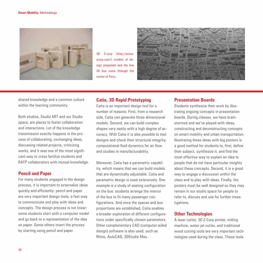
3D Z-corp (http://www.
zcorp.com/) models of de-
sign proposals and the line
38 bus route through the
center of Paris.

27
allow us to build mock-ups of our design ideas. The mock-ups are used to commu-nicate and test our design ideas at various scales. They also help us to visualize our designs for critique and development.
It is important for us to notice the learning cycle that these tools generate. Students started working by creating these mock-ups, which allows them to play with their ideas. Switching back and forth between computer models and physical models, they were able to test design ideas.
The 3D printer is a crucial tool to the design process because it produces three-di-mensional artifacts that help visualize the projects. The 3D printed models were optimal artifacts to play with, because they represent ideas that students were able to look at, play with, and deconstruct. After that students were able to go back and rethink it and redesign.
Smart Mobility Methodology
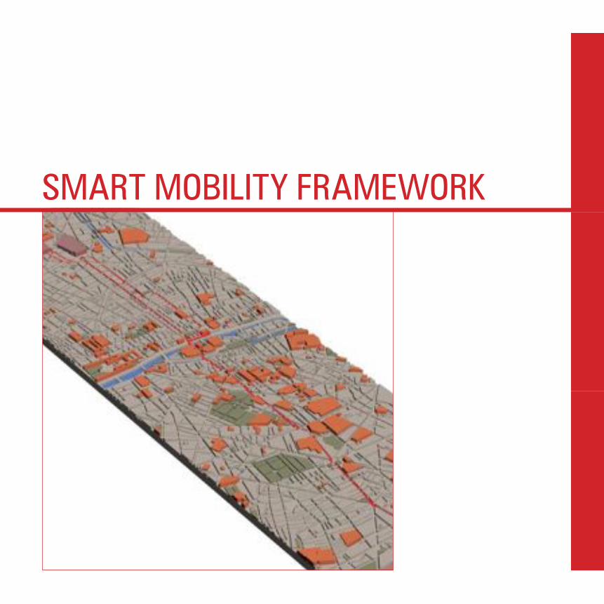
The structure of the city and its transportation network
are codependent. Modeling the city in 3D provides an
invaluable platform for cutting the urban fabric into dif-
ferent subsections. Areas of varying importance along
line 38 are coded by height and color.

28
alarm signals from the bus. Buses are equipped with cameras that can record and store film when Aigle is activated. Video cameras record 24 hours a day, 7 days a week, but they are erased automatically. When Aigle is activated in an emergency the command center keeps a record of 30 minutes before and after the SOS notification.
Project SIELThe Siel System offers real-time information and tracks ongoing operations on bus lines. Wireless ServiceIn the subway (metropolitan lines) number 1, 4, and 14 passengers have telecom access and can use their mobile phones or other wireless device.All along the bus line 38, wireless hot spot provide wireless Internet connection.
Smart Mobility Methodology
Building a Common Knowledge Base
THE RATP Régie Autonome des Transports Parisiens (RATP) is the public transportation system of Île de France, Paris region, and was created on January 1st 1949. It is an industrial and commercial public institution with more then 44.000 employees. The RATP has four main networks: the Bus, the Metro, the tramway and, finally, the RER trains that connect the city with the nearby suburbs. The Paris bus system is composed of 321 routes, 7,000 bus stops and 23 bus centers. System resources include about 4,000 buses, 14,000 employees (including 11,200 drivers), in order to accommodate 968 million trips a year for a total of 148.6 million vehicle kilometers a year. RATP is developing several technology projects that represent the forward-looking
attitude of the agency. Some examples are described here that RATP introduced to the research group during a visit to Paris at the beginning of the workshop in an effort to build a common knowledge base.
Project CERISEOn June 2004 RATP started a project called Cerise with the goal of providing contextual, multimedia and interactive content to bus passengers using plasma flat screen installed on the bus. A test is running on bus line 38. Project ALTAÏRAltaïr is a geo-localization system that aims to provide information to passengers about where the bus is, waiting time before the bus arrives, traffic information on the road, etc. It includes a passenger information device, connecting bus drivers, bus station, passengers. Project AIGLEAltaïr is connected with Aigle: an emergency S.O.S. system that can send

29
Carte NAVIGO“Carte Service” and “Navigo” are intelligent bus ticket with ATM-like services: a microchip integrated into the card functions as bus ticket and can also store information about a passenger’s routine. The card can be charged monthly.
These are only a few examples of the services and on-going projects connected with the RATP activities. It was very useful for the group to discuss RATP’s exploratory projects and research activities to provide a common knowledge base for the systems -and design-proposals developed during the course.
Smart Mobility Methodology
SMART MOBILITY FRAMEWORK

32
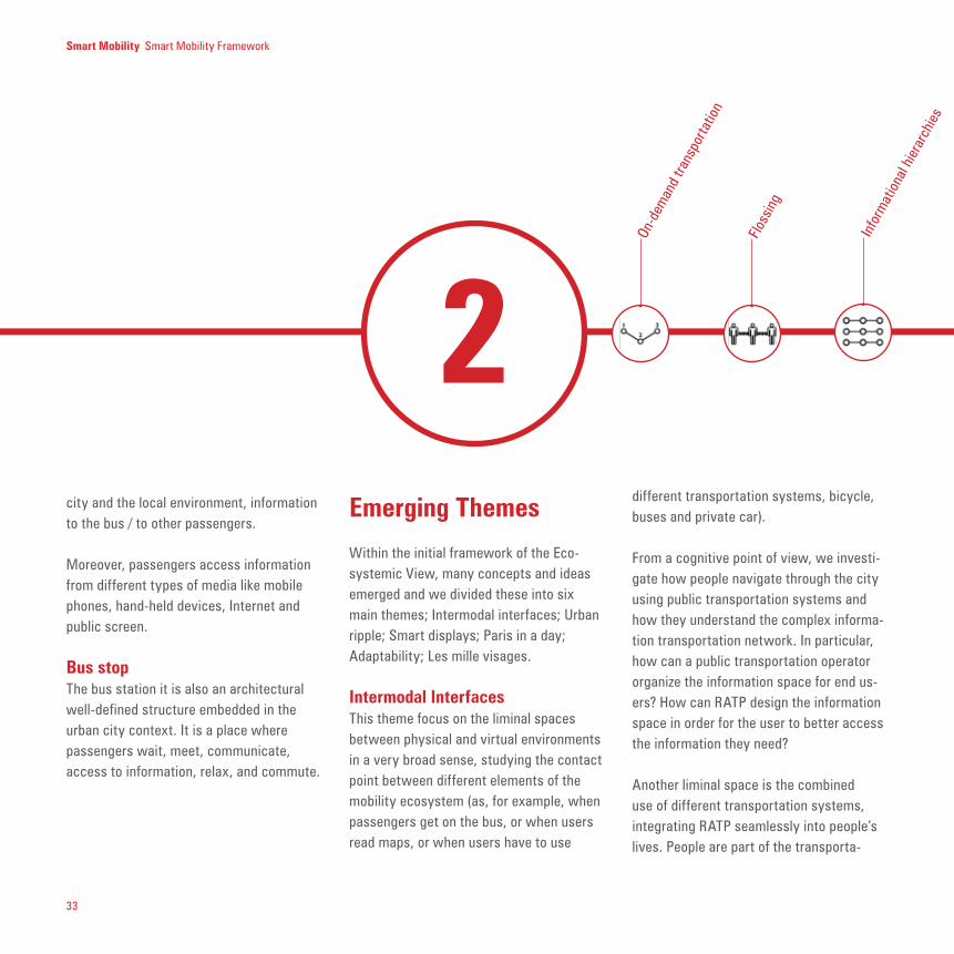
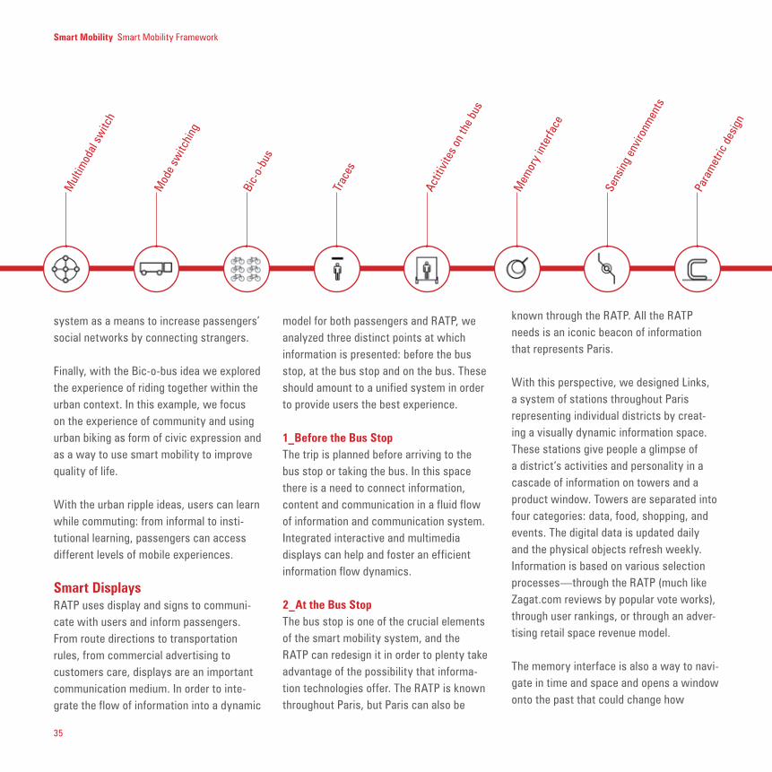
DURING the workshop we explored a variety of themes and concepts. Some ideas have been explored more in depth, and some others have been explored more on the surface. We started by analyzing the Ecosystemic View of a bus line, then we divided these themes into six Emerg-ing Themes and, finally, we had four Design Interventions. If the six themes are unexplored constellations of ideas, the four final themes of the Design Interventions are more structured design concepts.
Ecosystemic View
We started with an Ecosystemic View by analyzing the bus by exploring five initial elements; the bus, the bus stop, the people, the information and communication system and the urban environment.
Urban TerritoryThe urban territory, the architectural, political and administrative environment, as well as the cultural environment are a fundamental element composing buses’ lines.
PeopleWe have a very diversified variety of travelers, according to individual uses of
buses, time based schedules, and needs.From occasional tourists to regular workers/commuters, from retirees to teenage club goers to occasional users.
The BusThe bus is a mechanical transportation system, with a well-defined design and structure. It is not only a vehicle in which people travel, but it is also a place where people socialize, access information and see the city.
InformationWhen passengers travel they access to a variety of information that not only concerns their travel but also their everyday life: information from/to the bus to/from passengers, information from the
Smart Mobility Smart Mobility Framework
1
33
Emerging Themes
Within the initial framework of the Eco-systemic View, many concepts and ideas emerged and we divided these into six main themes; Intermodal interfaces; Urban ripple; Smart displays; Paris in a day; Adaptability; Les mille visages.
Intermodal InterfacesThis theme focus on the liminal spaces between physical and virtual environments in a very broad sense, studying the contact point between different elements of the mobility ecosystem (as, for example, when passengers get on the bus, or when users read maps, or when users have to use
city and the local environment, information to the bus / to other passengers.
Moreover, passengers access information from different types of media like mobile phones, hand-held devices, Internet and public screen.
Bus stopThe bus station it is also an architectural well-defined structure embedded in the urban city context. It is a place where passengers wait, meet, communicate, access to information, relax, and commute.
different transportation systems, bicycle, buses and private car).
From a cognitive point of view, we investi-gate how people navigate through the city using public transportation systems and how they understand the complex informa-tion transportation network. In particular, how can a public transportation operator organize the information space for end us-ers? How can RATP design the information space in order for the user to better access the information they need?
Another liminal space is the combined use of different transportation systems, integrating RATP seamlessly into people’s lives. People are part of the transporta-
Smart Mobility Smart Mobility Framework
2
Floss
ing
On-d
eman
d tra
nspo
rtatio
n
Info
rmat
iona
l hie
rarc
hies

34
tion system as soon as they step out of their door; from walking to bus riding, from biking to shared City Car, we explored the different ways in which people can navi-gate the city using different transportation systems.
Providing a more livable city, with safe streets and a more convenient access to the city resources is an ultimate goal for a transportation system. RATP, while en-couraging people to bike and walk instead of driving, can provide a better service to users.
Finally, streets are an active interface between users and their city. How you can take advantage of this space and clearly use streets as a medium to enrich the mo-bile experience of the passengers?
Urban RippleThe Urban Ripple addresses issues of how to foster rapid and richer communication
between city dwellers and their urban environment.
How can we spread relevant information to users, or how can we provide a dynamic in-formation system that helps them send and receive the information they need? With the urban ripple we want to profoundly connect the users with their local environment as well as with the information and social space.
In this section we discussed ideas concern-ing social networking and rating systems, activities on the bus, urban biking as a form of civic expression. By using collaborative filtering, for example, users can benefit from a trusted information ecosystem while moving through known and unknown urban spaces. Moreover, electronic media can foster viral communication dynamics, helping users to cooperate for the com-mon good and taking advantage of others’ knowledge and resources. With a peer-
to-peer rating system, people can freely express their opinions, a local community can evaluate services, goods and institu-tions, and users can access better products and services. Small business and neighbor-hood associations can become part of the urban environment thanks to more efficient communication with the community.
Electronic traces bridge neighborhood associations and nonprofit organizations within the city; with these electronic traces people can spread their voice and use the transportation system to communicate their ideas. Buses can be a mobile support for arts, becoming part of the aesthetic of the city.
From another perspective, systems like Friendster, Linkedin, Orkut or Dodgball (examples of social networking systems) help users increase and maintain their social network. RATP could use information systems and people proximity on the bus
Smart Mobility Smart Mobility Framework
Perc
eive
d co
mpl
exity
Mul
timod
al bu
s/bi
ke/c
ityca
r
Stad
iunm
sea
ting
Bike
inte
rface
s
Carg
o bu
s
Wor
m b
us
Snak
e bu
s
Mob
ile U
rban
Disp
lay
35
model for both passengers and RATP, we analyzed three distinct points at which information is presented: before the bus stop, at the bus stop and on the bus. These should amount to a unified system in order to provide users the best experience.
1_Before the Bus StopThe trip is planned before arriving to the bus stop or taking the bus. In this space there is a need to connect information, content and communication in a fluid flow of information and communication system. Integrated interactive and multimedia displays can help and foster an efficient information flow dynamics.
2_At the Bus StopThe bus stop is one of the crucial elements of the smart mobility system, and the RATP can redesign it in order to plenty take advantage of the possibility that informa-tion technologies offer. The RATP is known throughout Paris, but Paris can also be
system as a means to increase passengers’ social networks by connecting strangers.
Finally, with the Bic-o-bus idea we explored the experience of riding together within the urban context. In this example, we focus on the experience of community and using urban biking as form of civic expression and as a way to use smart mobility to improve quality of life.
With the urban ripple ideas, users can learn while commuting: from informal to insti-tutional learning, passengers can access different levels of mobile experiences.
Smart DisplaysRATP uses display and signs to communi-cate with users and inform passengers. From route directions to transportation rules, from commercial advertising to customers care, displays are an important communication medium. In order to inte-grate the flow of information into a dynamic
known through the RATP. All the RATP needs is an iconic beacon of information that represents Paris.
With this perspective, we designed Links, a system of stations throughout Paris representing individual districts by creat-ing a visually dynamic information space. These stations give people a glimpse of a district’s activities and personality in a cascade of information on towers and a product window. Towers are separated into four categories: data, food, shopping, and events. The digital data is updated daily and the physical objects refresh weekly. Information is based on various selection processes—through the RATP (much like Zagat.com reviews by popular vote works), through user rankings, or through an adver-tising retail space revenue model.
The memory interface is also a way to navi-gate in time and space and opens a window onto the past that could change how
Smart Mobility Smart Mobility Framework
Mem
ory
inte
rface
Sens
ing
envir
onm
ents
Bic-
o-bu
s
Mul
timod
al sw
itch
Mod
e sw
itchi
ng
Trac
es
Actit
ivite
s on
the
bus
Para
met
ric d
esig
n

36
RATP riders experience their routines. By touching the interface the affected surface area reveal past scenes at that location. Suddenly a glimpse of the past becomes overlaid onto the currently visible image. Pushing harder moves the image further back in time.
3_On the BusIn the analysis of the displays already exist-ing at the RATP much of the information is superfluous or not easily located, especially inside the bus. The interior of the vehicle could be fitted with a ticker like a running stock exchange update with vital informa-tion: bus number, next stop, estimated time of arrival.
Another interesting displays improvement could be done by classifying the buses dif-ferently: instead of using simple numbers we could make more appropriate use of visual references to adjacent landmarks
that could make stops more visible on the street and aid memory recall, giving a bet-ter identity to the users.
Finally, thinking e-ink, electronic ink, is a revolutionary technology that can be integrated into electronic displays or RATP buses or bus stops, improving the commu-nication flows between RATP and passen-gers.
Paris in a DayParis has different neighborhoods, each with its own rhythm and life. The experi-ence of the city varies in time and space, during the day and during the night.
How can passengers, regular travelers and tourists better discover the city? And how can RATP better help users to access unusual places or hidden areas? Using public transportation to get around quickly and escape from routine travels is a way to
discover the city. The Situationist’s pshy-cogeography is a way to paradoxically “get lost” to better discover the city, escaping from ordinary travel to find hidden paths.
How can RATP raise awareness and enhance the daily experience of transporta-tion, bring back the idea of the flâneur to learn more about the city, and be more in touch with the city.
Urban public transportation is a powerful means of experiencing a city in a different way, and the Zazie dans le bus metaphor intuitively understands this potential.
Building the city in a three dimensional model is another way to understand the city. The structure of the city and its trans-portation network are codependent. Model-ing the city in three dimensions provides an invaluable platform for cutting the urban fabric into different subsections.
Smart Mobility Smart Mobility Framework
PopL
ink
Surfa
ces
Mod
ular
izing
phy
sical
elem
ents
LiveL
ink
Info
Link
Reco
rdin
g en
coun
ters
Reco
nfig
urab
le bu
s sto
p
Visit
ng th
e ci
ty

37
provide them a better design for social in-teraction. The interior can also be modified in order to give to the users a better view on the outside, like in the Stadium bus.
The interior can also be redesigned to fos-ter multimodal transportation, and allows users to store their bicycle in a convenient way.
The bus stop can also be modified in two complementary dimensions.
The first one concerns people. The bus stop can be designed to automatically adapted to the height of the users, if there are adults or children, if there is many people or if there are only few passengers waiting fore the next bus.
The second one is the bus stop context awareness; the bus stop can dynamically change with weather conditions. If is rain-ing or sunny, if there is the need for more
AdaptabilityThis theme explores how reconfigurability and adaptability are in the heart of smart mobility system. We explored how you can design more flexible components of the bus system to incorporate feedback from the surround-ing environment (users, climate, weather, traffic).
The rhythms of the city transportation sys-tems change dramatically according to time and space. Throughout the day, demand for transportation fluctuates. Sometimes buses are entirely empty and other times they are bursting at the seams. Adaptable and reconfigurable buses would alleviate these stresses and better serve riders. The range of possible adaptations includes complete transformations of the vehicle through smaller additions.
The interior of the bus can be modified in order to give more space for users and
shade or light, protection from the wind or need for fresh air.
A final point for the system adaptability is the self-organizing bus. Not only should the physical components of the bus line adapt to changing needs, so should the overall system. In a completely self-organizing bus system, the bus comes to passengers when and where they need transport.
Les Mille VisagesTrying to understand people as people—not just as users of public transportation—is a key point for smart mobility. RATP knows that it doesn’t simply transport commuters, but serves a diverse group of people.
The passengers of RATP are a diverse group that can be subdivided into many different categories. The simplest group includes six very broad categories: tourists, commuters, students, local residents, the elderly and disabled, and night dwellers.
Smart Mobility Smart Mobility Framework
Zazie
dan
s le
bus
Soci
al ne
twor
ks
Ratin
g sy
stem
s/co
llabo
rativ
e fil
ers
On-d
eman
d tra
nspo
rtatio
n
Neig
borh
ood
conc
ierg
e
Them
e-ba
sed
disp
lay
Map
inte
rface
Mob
ile c
onne
ctiv
ity

38
Design Interventions
The students collaborated in groups from the beginning of the workshop.
For the final presentation, students divided into four groups and presented their work classified into fours final themes: the four main concepts areas that re-think how new technologies and design strategies can enhance the Parisian bus system are:
1_Self-organizing Bus SystemA bus route as a self-organizing system dy-namic in both space and time, rather than a system with fixed routes and timetables.
2_Reconfiguring the BusRedesign a bus that travels more efficiently in the city and offers more comfort to pas-sengers, escaping from the buses’ classical design.
3
Smart Mobility Smart Mobility Framework

39
3_Electronic GuimardThink of bus stops as something that have a clear presence and strong overall visible identity, and that helps to define the terri-tory of Twenty-First Century Paris.
4_Neighborhood ConciergeTreat bus stops and kiosks as entry and orientation points in neighborhoods, with friendly advice services.
The following part of the report is going to detail this constellation of ideas and concepts emerged during the design workshop.
Smart Mobility Smart Mobility Framework

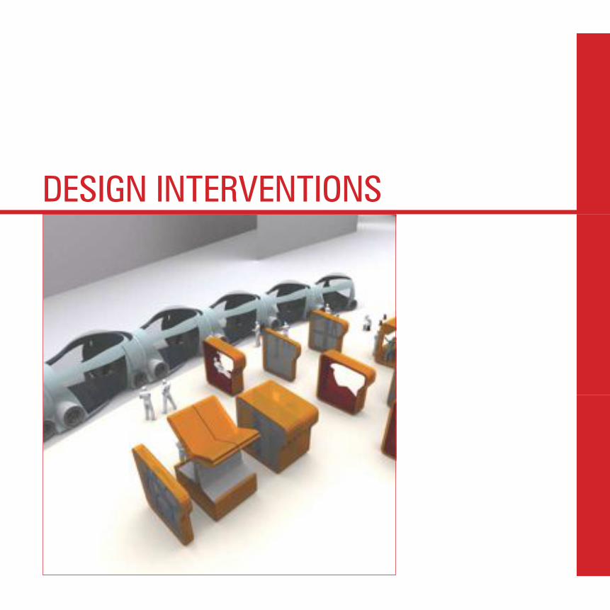
DESIGN INTERVENTIONS


Understanding a bus route as a self-organizing system in space and time, rather than as a system with fixed routes and predetermined timetables.
SELF-ORGANIZING BUS SYSTEMPARIS’ bus system it is composed of 321 routes, 7,000 bus stops and 23 bus centers. Resources to this system include about 4,000 buses, 50 tramways, 14,000 employees (including11,200 drivers), in order to accommodate 968 million trips a year for a total of 148.6 million vehicle kilometers a year. One of the most complete in the world, Paris’ bus system does not encounter the same success as its underground counterpart, the Metro. Passengers universally see the bus system as much more complex and unreliable, and not very attractive for daily use. During an on-site visit in February 2005, several people who were interviewed associated their reluctance to taking the bus to the complexity of its structure, perceived to be both the cause and the consequence of unreliability. In the past years, several buses’ lines have been displaying the “Time To Next” (TTN), which indicates when the next bus will enter the station. Also, the Metro only features 14 lines with 297 stops, which are perceived as efficiently

44
Hence, it is of primary importance to address complexity issues when designing such an “on-demand, self-organizing bus system.” Particularly the issues of perceived complexity from the point of view of the passenger (one user of the system) call for mitigating strategies, to be addressed at the early stages of design.
Three basic ideas have been investigated to develop a coherent system architecture, that would be both operationally functional and understandable by all users, especially passengers, following the guideline presented in the previous section.
Structuring the System
As seen before it is necessary to structure the problem space to reduce its perceived complexity. It is hypothesized that the following concept achieves the structuration of the system, and can both add considerable value to the bus system effort, and help provide groundbreaking identity to the bus system in comparison to other public transportation systems in Paris, especially the Metro. In this concept, the bus system would feature a dual structure: at a high level, it would be constituted of a high speed network of basic bus lines, marked with only a few stops, whose mission is to bring passenger to the “general area” or neighborhood they wish to go to; whereas at a lower level, a local system of shuttle buses would organize itself to bring passengers door to door, based on their specific requests, within the neighborhood considered. Such a system is thought to respond to the fact that we are in a new era and the intramuros
Smart Mobility Self-Organizing Bus System
covering most of the city (any location is said to be less than 5 minutes away from a Metro station), and easier to understand.
In order to re-vitalize Paris’ bus system, the Régie Autonome des Transports Parisiens (RATP), which is the public transport operator monitoring transportation in Paris and its suburbs, is investigating new advanced concepts in association with the Media Lab at MIT. One emergent concept is that of an “on-demand, self-organizing bus system,” where passengers can ask buses to pick them up and drop them at random locations, while the system would organize itself (schedule and routes) to accommodate demand and minimize the use of resources. Such a concept would give high visibility and a specific identity to the bus system, compared to the very successful Metro. Nevertheless, such a system, if not carefully designed, may not solve the problem of perceived complexity, which may be a remnant drawback, inherent to the bus system as a whole.
45
and short travels have augmented, especially the non home-workplace travels (25%). These new travels, even if they are in some way planned, they are less regular in time and space.
For example, it is conceivable that tourists, among others, would benefit from such a system: they would not have to explore a large, complex domain space with hundreds of bus lines and bus stops, if what they only want to do it to go and see “the museums in the center of Paris.” Also, the neighborhood on-demand shuttle bus service, a mix of a bus and a taxi, could easily accommodate the neighborhood crowd for daily service (such as groceries, post office, etc.).
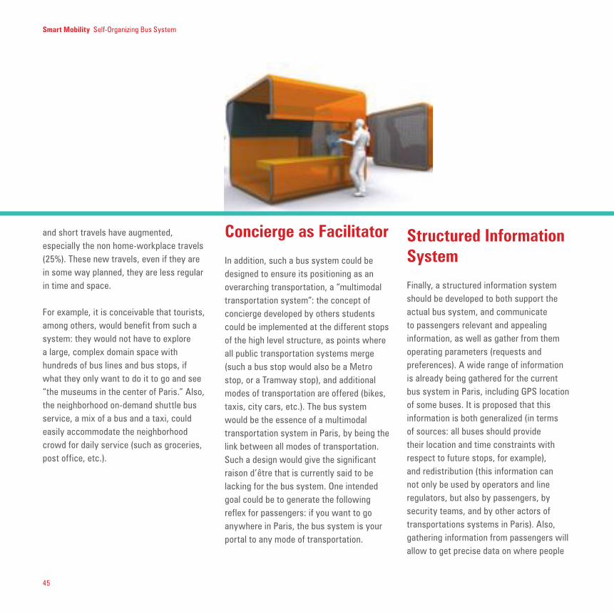
Concierge as Facilitator
In addition, such a bus system could be designed to ensure its positioning as an overarching transportation, a “multimodal transportation system”: the concept of concierge developed by others students could be implemented at the different stops of the high level structure, as points where all public transportation systems merge (such a bus stop would also be a Metro stop, or a Tramway stop), and additional modes of transportation are offered (bikes, taxis, city cars, etc.). The bus system would be the essence of a multimodal transportation system in Paris, by being the link between all modes of transportation. Such a design would give the significant raison d’être that is currently said to be lacking for the bus system. One intended goal could be to generate the following reflex for passengers: if you want to go anywhere in Paris, the bus system is your portal to any mode of transportation.
Smart Mobility Self-Organizing Bus System
Structured Information System
Finally, a structured information system should be developed to both support the actual bus system, and communicate to passengers relevant and appealing information, as well as gather from them operating parameters (requests and preferences). A wide range of information is already being gathered for the current bus system in Paris, including GPS location of some buses. It is proposed that this information is both generalized (in terms of sources: all buses should provide their location and time constraints with respect to future stops, for example), and redistribution (this information can not only be used by operators and line regulators, but also by passengers, by security teams, and by other actors of transportations systems in Paris). Also, gathering information from passengers will allow to get precise data on where people

46
request what, and to go where, which will contribute to a better optimized model of the transportation system.
Bus System Structure The first step is to define a high-level structure that ensures rapid transit in the city, between key locations, that will subsequently be referred to as concierges.
Paris is divided into 20 districts, or arrondissements, which constitute the foundation of the city: each district has its own city hall and is operated as a mini-city in the city. In order to match Parisian’s mental model of their city (divided into districts), a potential high-level structure could match this model by using the main streets and avenues that delimit the arrondissements, as their principal routes In such a system, major intersections could be used as local concierges where other transportation systems would also be available (represented as green dots on the second map).
A second possible high-level structure is depicted in the third map. The main high-speed transit routes are in green and are concentric circles around the center of Paris. Such a structure mimics the outer structure for transportation systems in Ile-de-France (the region outside Paris): it is divided into eight concentric zones for transportation tariff pricing. This idea is to replicate this model for Paris intra-muros: the concept already exists and has been assimilated by most inhabitants. The three rings inside Paris (in green) would delimit three zones of arrondissements, and would operate without interruption around Paris, with only a few stops along the way. Such a system is currently partially in operation for the tramway lines T1 and T2, and in project for T3. A system of connections would be operating between the rings, to connect the concierges.
The concept of concentric rings can be modified as shown in the bottom map, where the concierges (connections) are
Smart Mobility Self-Organizing Bus System

47
inside the districts, when they were on their periphery in the second map. A connecting star system allows for rapid radial transit between the rings. In addition to this high-level layer of the bus system, that ensures rapid transit between the main areas or districts of Paris, a low-level, local shuttle bus service would be made available to passengers, so that they are picked up and dropped off where they want. The following presents a potential route planner for this shuttle system. It is hypothesized there that passengers will request pick-up and drop-off at specific locations, named kiosks that would actually be around the city, and constituted mainly of a computer with a specific interface for request and information exchange.
Route PlannerA potential route planner for the shuttles in an “on-demand, self-organizing bus system” is presented with the following figures and annotations. Two related basic concepts are implemented: contracts and time margins. The contract refers to the time announced to passenger as when he/she will arrive to the requested destination. At anytime, the information system is keeping track of the contracts of every passenger on the system. These contracts constitute the main constraints under which the route planner operate.
The second concept is that of time margin: each shuttle bus is attributed a number that depicts how much it is ahead of schedule. When the system starts, passengers are given an overestimation of the actual predicted time to complete their trip, to allow some margin for additional passengers to be picked up by the shuttle bus. Every time a potential passenger
On-D
eman
d Tr
ansp
orta
tion

48
Smart Mobility Self-Organizing Bus System
RATP
Conc
ierge
Neigh b
orho
od
KioskKioskKiosk
BusB
usBus B
usBus B
us
Conc
ierge
Neigh b
orho
od
Sh
uttle Shuttle Shut tle
Shuttle Shuttle Shut tle
dynamiquerequests a trip, it is evaluated if actually picking up this person will still allow for all current passengers’ contracts to be respected, that is the time margin being positive or equal to zero. RATP has the difficult task of providing a general service that is for the mass and is intended to serve the larger number of users, but at the same time they must provide a service that is highly customized in order to meet the people’s needs and prevent them to use individual transportation systems. It is not possible to totally transform the regular bus lines into an ah-hoc service, especially during the day but it is more realistic to think to an on-demand for the night and for particular areas/destinations.

49
Conclusion
Discussion with daily users or non-users of Paris’ bus system specifically pointed out the system’s complexity as a major drawback or deterrent to the use of buses. Therefore, when the RATP wants to overhaul and/or revamp the bus system, this very issue needs careful attention. Traditionally, functional requirements (what the system is supposed to do) lead to a certain level of true complexity of the system, that can only be modified through those initial requirements. The only point of action for designers is on perceived complexity. With the use of mitigating strategies, designers will reduce the complexity that users (for example: passengers, but also operators, etc.) encounter. Typical ways to reduce perceived complexity include structuring the system in a consistent and convenient way, using metaphors and higher-level references, and by limiting the number of elements, their type, and their interactions.
From the analysis performed, it is recommended that any implementation of an on-demand, self-organizing bus include the following design recommendations:
1. A clear system structure that mimics an existing transportation-related mental model;2. An interactive information system where passengers know about the system and that can be partially controlled by them; and3. A set of decision-support tools that enable the passenger to consider the bus system as more than a regular transportation system.
Examples for these recommendations were presented in this report:
1_ Design the bus system as a 2-layer structure with concentric rings for high-speed transit, and a local on-demand, self-organizing shuttle system;
Smart Mobility Self-Organizing Bus System
2_Provide passengers with dedicated information, accessible at the bus stops, at the concierges or at the kiosks, about where bus / shuttles are, and when they will arrive next (TTN), depending on the passengers’ own inputs (requests through the kiosks); and
3_Carefully create a kiosk interface where passengers can see the results of their inputs and decide what to do, depending on their own private constraints, independently from the system itself.
4_It is also possible to think to subscribe to a “transportation” system that allows passengers to design their own route with a semi-in advance planning. Passengers can periodically (i.e. monthly, or four times a year) upload information about their timing and destination within a restricted area. The system can organize the most efficient routing according to the number of passengers and their destinations.

1_Four buses started from S1,S2,S3 and S4, each
transporting passenger to their destination. Each bus
has a “time margin” (given in red above each bus logo),
which is the number of minutes the bus will arrive ahead
of schedule, provided as follows its current route without
stopping. The Autonomic Manager (AM) in charge of
assigning request to buses, has a rough idea of how much
time it takes to go from one node to one other (informa-
tion given on top of each arc of the network). AM collects
this information from the buses which have taken a given
path before.
low level shuttle route replanning algorithm
2_ At kiosk K1, a passenger P1 request a trip to destina-
tion D1.
5_The buses send back to the user (approximate waiting
time, travel time and price). The user can visualize the
different propositions (with extra information such as
weather he may have to walk or if he needs to transfer
to another bus). Bus from S1 can take P1 at K1 and drive
him to D1. Bus from S2 can take P1 at K1, but would
require him to change buses at D2 to go to D1. Bus from
S3 cannot change its route, but can take passenger P1
at kiosque K2 (a 5 minutes walk).
Bus from S4 does not have a sufficient margin to move
away from its road.
6_The users chooses which bus he wants to ride.
Though the bus that started from S3 is faster and cheap-
er, P1 would have to walk to Kiosque K2. P1 prefers to
stay where he is and wait for bus who started from S1.

3_ Each bus in the neighborhood of K1 estimates what
its new margin would be if it derived to take P1 in K1.
4_Buses from S1,S2 and S3 can take P1, though S4
cannot reroute itself without breaking other passengers
contract.
7_The chosen bus S1 gets its new route from the virtual
route manager and modify its time margin accordingly.
8_As buses move trough the city, they send to the AM
updates about the time they took to go from one node to
one other. Fluctuations may be due to traffic or specific
events (strike, roadwork, party, and so on).
Bus from S1 arrives at destination with 2 minutes in
advance (ie 2 minutes before the time that was given to
passengers).

52
What is perceived complexity?
Perceived complexity must be distinguished from what can be considered as actual complexity of a system. Miller [1] separates them with the following attribtses:
.:: Perceived complexity is internally linked to cognitive complexity, that is the amount of cognition required to understand a system, or how much a system “[is] difficult to understand or to deal with.” This definition is plainly rela-tive to the individual human being.
.:: Actual complexity is related to the functional complexity of the system, de-fined by Miller as the “state of being so complicated or intricate as to be hard to understand or deal with.” This definition refers to some undefined objective, true criteria of complexity that is indepen-dent from the human involved.
Perceived complexity can be further described, as done by Rauterberg [2]: perceived complexity is a multidimensional concept where the perceived stimulus of complexity can be divided into a known stim-ulus (KS), a new stimulus (NS). Rauterberg’s theory is that NS+KS is held constant, and that humans, in order to deal with complexi-ty will use “perceptual chunking” a cognitive technique aimed at reducing complexity in NS (and thus increase the accessibility to a complex system), while increasing complex-ity in KS (by refering to a more complex men-tal model or technique). Perceptual chunking refers to the technique of subdividing the problem space into smaller problem spaces that are expected to be easier to handle individually. This is also a technique used to structure a problem space, as emphasized by Miller in [1].
Other theories, like that of Miller, subdivide
perceived complexity into a multidimensional concept that encompasses the so-called “component complexity,” the “relational complexity,” and the “behavioral complex-ity.” The component complexity is based on the number and the homogeneity of elements that encapsulate the system. The more elements, and the more different they are from each other, the more complex the system will be perceived by the user. Similarly, the relational complexity is based on the number and the homogeneity of the links between these elements. Finally, the behavioral complexity is defined by the number and the nature of the different states the system can adopt. This latter concept is closely linked to the unpredictability of the system.
In order to mitigate the complexity/ies that can result from all these elements (com-ponent, relations, and behaviors), several strategies can be implemented. Structura-tion and ordering of the problem space is key in clarifying the system from a user’s point of view: right now, the bus system is seen as a complex network of lines with (perceived) random stops along the way, and an incoherent time schedule. Adding structure in the three dimensions of time, space and function can be a mitigating solu-tion that would create a much clearer mental model of the system, for the passengers. In addition, this mental model should be based on high-level knowledge or metaphors, com-monly assimilated by large populations (see Riley in 31] for a complete description). It is extremely efficient to create a mental model that finds its roots in an intellectual construct that has already been “validated” by most users. Hence, a new bus system should re-use common properties and characteris-tics of existing transportation systems. As shown in Miller’s work [1], another mitigat-ing strategy is to act directly on what causes the complexity: by decreasing the number of
IN A transportation system, both users and operators must tackle issues of com-plexity in order to maintain a successful and enjoyable experience. Throughout the research on smart mobility, we took into ac-count the difference between the perceived and real complexity. Especially when de-signing complex information spaces, this distinction serves an important purpose, namely to provide the best access to knowl-edge for users and the easiest operating strategy for RATP.
Perc
eive
d Co
mpl
exity
Smart Mobility Self-Organizing Bus System

53
elements in the system, and/or making them similar, users will find it easier to understand (and thus use) the global system. In the same idea, a strategy could consist in reduc-ing the number of behaviors or functions of the different elements of the system, or accentuate strongly their common relations to make it easier to assimilate.
[1] Miller, C. (2000), “The Human Factor in Complex-
ity,” in Automation, Control and Complexity: an
Integrated Approach (T. Samad and J. Weyrauch,
eds.), John Wiley, New York.
[2] Rautenberg, M. (1994), “About the Relationship
between Incongruity, Complexity and Information:
Design Implications for Man-Machine Systems,” in
Mehrwert von Information—Professionalisierung der
Informationsarbeit (W. Rauch, F. Strohmeier, H. Hiller
and C. Schlögl, eds.) Universitätverlag.
[3] Riley, V. (2000), “Perceived Complexity and
Mental Models in Human-Computer Interaction,” in
Automation, Control and Complexity: an Integrated
Approach (T. Samad and J. Weyrauch, eds.), John
Wiley, New York.

54
BOTH passengers and operators require access to information about the current state of the transportation network to make decisions about trip planning and ongoing operations. In order to integrate the flow of information into a dynamic model, we analyzed the three distinct states in which information is presented: before the bus stop, at the bus stop and on the bus. This information should amount to a unified
system in order to give users the best experience.
We can expand this notion of information hierarchies to Georges Amar’s infomobilite’. There is a distinction between the notion of info-transport, that concerns the structural information for people to use public transportations for travel and commute, and the notion of info-mobility, that
Info
rmat
iona
l
Hier
arch
ies
Smart Mobility Self-Organizing Bus System
expand this notion adding to the structural information about public transportation the information about the city (social, economical, etc.).
In this context, hierarchies of information evolve according to people’s needs, and mostly according to the kind of information they need in a particular time/place.

55
Available Information:
maps
website
information centers
SMS services
memory and personal knowledge
city knowledge and external cues
1_Level 0 or Basic Information: This level should
answer questions such as: This is a bus stop! Which
buses stop here? Where do these buses go? When
will the next bus come?
2_Level 1 or Near Future Projection Information: This
level provides more detailed information about the
time and space situation of the next expected bus
accompanied by a visualization of that information.
3_Level 2 or Customized Information: This level
serves specific users trying to plan a trip.
One always has: the surrounding urban context
outside, other people, a route map, the driver
One sometimes has: an announcement of the
next stop, a global system map
TRIP
PLA
NN
ING
ON T
HE B
US
AT T
HE B
US
STOP
One always finds: sign, bus numbers, other
people waiting
One sometimes find: timetables, maps, rules of
usage, detailed route map
1_Level 0 or Basic Information: bus number, destina-
tion, next stop, time to next
2_Level 1 or Secondary Information: connections at
next, situation awareness if there are any incidents
etc.
3_Level 2 or Tertiary Information: non-transportation
related information such as news, weather, tourist
pointers, local businesses
56
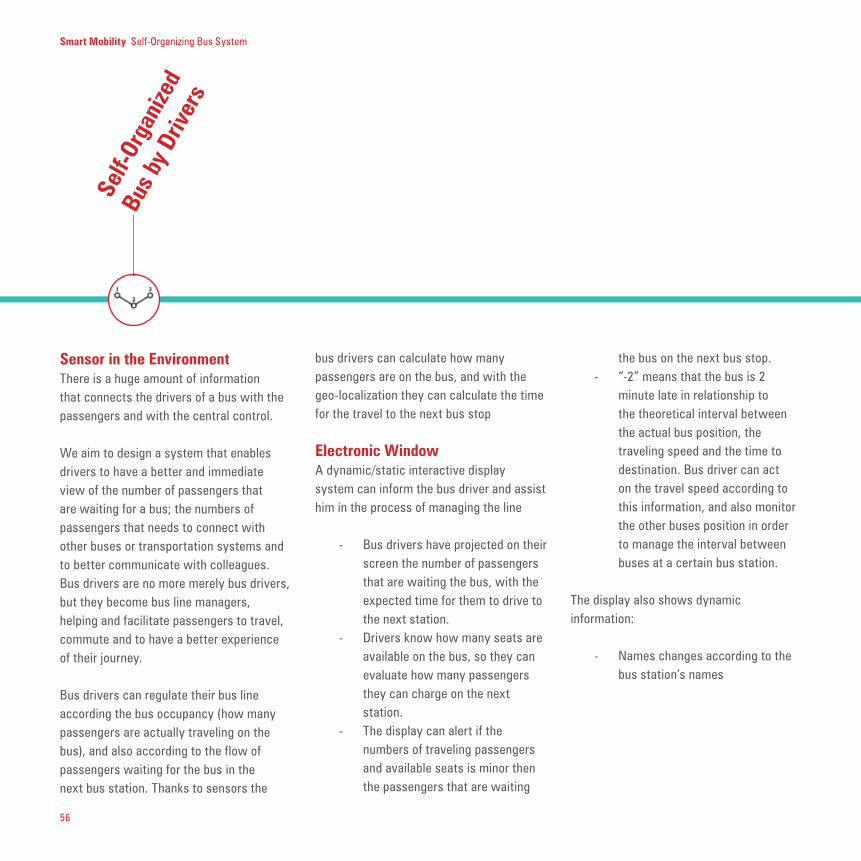
Sensor in the Environment There is a huge amount of information that connects the drivers of a bus with the passengers and with the central control.
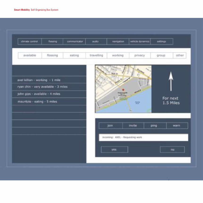
We aim to design a system that enables drivers to have a better and immediate view of the number of passengers that are waiting for a bus; the numbers of passengers that needs to connect with other buses or transportation systems and to better communicate with colleagues. Bus drivers are no more merely bus drivers, but they become bus line managers, helping and facilitate passengers to travel, commute and to have a better experience of their journey.
Bus drivers can regulate their bus line according the bus occupancy (how many passengers are actually traveling on the bus), and also according to the flow of passengers waiting for the bus in the next bus station. Thanks to sensors the
bus drivers can calculate how many passengers are on the bus, and with the geo-localization they can calculate the time for the travel to the next bus stop
Electronic WindowA dynamic/static interactive display system can inform the bus driver and assist him in the process of managing the line
- Bus drivers have projected on their screen the number of passengers that are waiting the bus, with the expected time for them to drive to the next station.
- Drivers know how many seats are available on the bus, so they can evaluate how many passengers they can charge on the next station.
- The display can alert if the numbers of traveling passengers and available seats is minor then the passengers that are waiting
the bus on the next bus stop.- “-2” means that the bus is 2
minute late in relationship to the theoretical interval between the actual bus position, the traveling speed and the time to destination. Bus driver can act on the travel speed according to this information, and also monitor the other buses position in order to manage the interval between buses at a certain bus station.
The display also shows dynamic information:
- Names changes according to the bus station’s names
Smart Mobility Self-Organizing Bus System
Self-
Orga
nize
d
Bus
by D
river
s

57
- The upper side of the display is concerned with mobility (bus’s information), the lowest side of the display concerns the bus stations. The bus stations are represented with the number of passengers that are waiting for the bus.
The lowest side of the display can provide information about the number of passengers waiting for in the next station, and also, eventually, on the connecting
metro’s or RER, as well as information about connecting lines (accidents, delays, etc.)
The information can be delivered to the bus drivers according to their importance in a particular time/place.
Increasing horizontal communication between the bus drivers and the passengers, with an efficient dynamic data-management system can optimize the passengers’ travel as well as the bus
drivers’ management task. Passengers on the bus, as well as passengers in other buses can communicate via mobile devices to the bus driver their itinerary, and let him know if they have to connect with other buses. The bus driver has a clear understanding of the situation and can communicate to other bus drivers if they have to wait for passengers.

58
FLOSSING is the phenomenon of drivers traveling back and forth on a designated route to show off their vehicles.
The Flosser is a software package designed to be integrated into your car to help pre-determined flossing groups arrange meetings and communicate in real time. The system runs off of GPS data and GPRS networks on a Linux platform. The software provides advanced social rules capable of helping cars and people organize better, as well as connecting the car and city.
Starting from this general framework, from a technical point of view the project flossing software answer to a large number of questions raised by location-based tools and the way the car interacts with the city. Using this software for a PDA or any mobile device within the public transportation system, will helps people do increase their social networks, taking advantage of upon location based information, contextualized
information, personal interest and travel time and frequency.
“Flo
ssin
g”
Smart Mobility Self-Organizing Bus System
Smart Mobility Self-Organizing Bus System
Redesign a bus that travels more efficiently in the city and offers more comfort to passengers, escap-ing from the buses’ classical design.
RECONFIGURING THE BUSTHE BUS acts like a mobile urban room delivering passengers to their destinations. This urban room has transparent walls and is augmented by a number of technologies such as display screens, security cameras, and handicap access lifts. Our effort during this workshop was to reconfigure the bus with electronic displays, sensing technology, and adaptive flexible seating and bus configurations.
Physically reconfiguring the bus is a simple method for solving many issues of circulation and use. We examined many alternatives for seating configurations including stadium style, which gives us lots of storage space underneath or theater-style seating. Flexible designs of the seat itself opens up the possibility of combining standing room with seating and quasi-standing (leaning) arrangements. Additionally, reconfiguring articulating buses into what we call the Snake Bus or Worm Bus are more high level re-combinatorial ideas. The snake bus is a
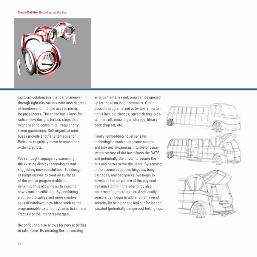
62
multi-articulating bus that can maneuver through tight city streets with new degrees of freedom and multiple access points for passengers. The snake bus allows for radical new designs for bus stops that might need to conform to irregular city street geometries. Self-organized mini buses provide another alternative for Parisians to quickly move between and within districts. We rethought signage by examining the existing display technologies and suggesting new possibilities. The design assumption was to treat all surfaces of the bus as programmable and dynamic, thus allowing us to imagine new visual possibilities. By combining electronic displays and more creative uses of windows, new ideas such as the programmable exterior, dynamic ticker, and Traces (for the interior) emerged.
Reconfiguring also allows for new activities to take place. By creating flexible seating
arrangements, a work area can be opened up for those on long commutes. Other possible programs and activities at certain times include: classes, speed-dating, pick-up-drop-off, messenger, storage, library book drop off, etc.
Finally, embedding novel sensing technologies such as pressure sensors and tiny micro-cameras into the physical infrastructure of the bus allows the RATP, and potentially the driver, to secure the bus and better serve the users. By sensing the presence of people, bicycles, baby carriages, and backpacks, we begin to develop a better picture of the physical dynamics both in the interior by also patterns of egress/ingress. Additionally, sensors can begin to add another layer of security by being on the lookout for lost or vacated (potentially dangerous) belongings.
Smart Mobility Reconfiguring the Bus

Reconfiguring the Bus / 6363
THE SNAKE bus is a multi-articulating bus that can maneuver through tight city streets with new degrees of freedom and multiple access points for passengers. The snake bus allows for radical new designs for bus stops that might need to conform to irregular city street geometries.
Snak
e Bu
s
Smart Mobility Reconfiguring the Bus
64
Smart Mobility Reconfiguring the Bus
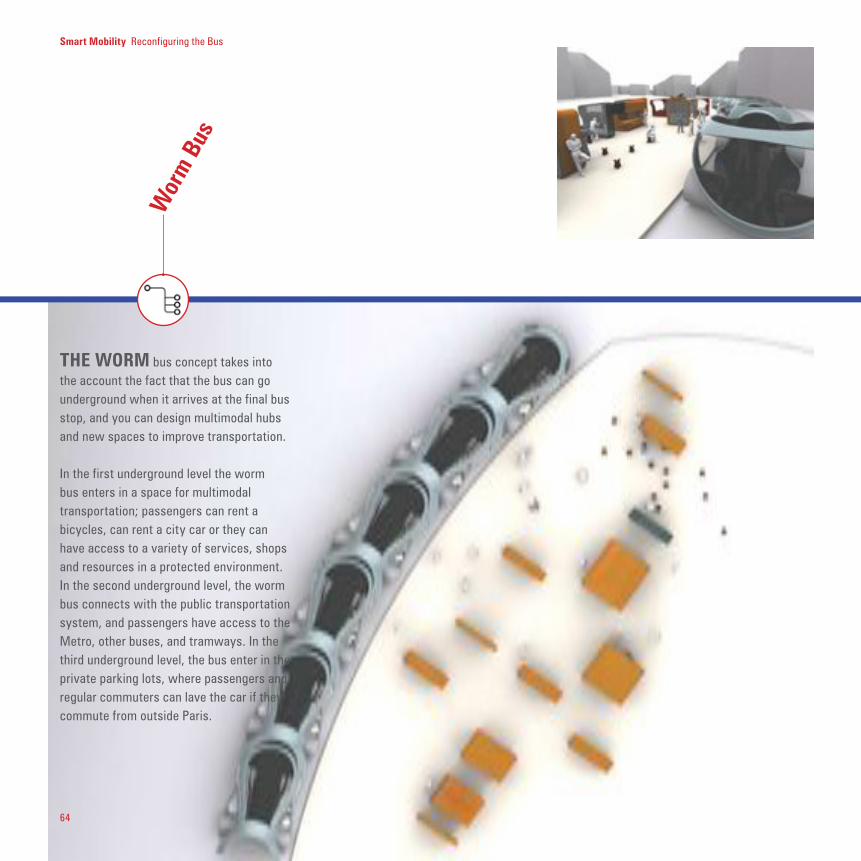
THE WORM bus concept takes into the account the fact that the bus can go underground when it arrives at the final bus stop, and you can design multimodal hubs and new spaces to improve transportation.
In the first underground level the worm bus enters in a space for multimodal transportation; passengers can rent a bicycles, can rent a city car or they can have access to a variety of services, shops and resources in a protected environment. In the second underground level, the worm bus connects with the public transportation system, and passengers have access to the Metro, other buses, and tramways. In the third underground level, the bus enter in the private parking lots, where passengers and regular commuters can lave the car if they commute from outside Paris.
Wor
m B
us

65
Smart Mobility Reconfiguring the Bus
THE MULTIMODAL Module Bus is a flexible and adaptable bus based on interchangeable units. RATP can provide a variety of customized space and services to better serve the users and easily change the bus configuration according to the particular needs of the moment.
During the day, buses need to rapidly transport people through the city, and need lots of room for passengers. In particular situations, the RATP could load a Concierge Bus Module, a space that could be used for the on-board concierge and provide extremely customized services and information (sports events, tourism, museums, etc.).
In this unit, patrons can access local site information, determine public transportation routing/schedules, and also reserve multi-modal vehicles or bicycle from the bus. At the bus stop,
the passengers can drive away in their configured personal mobile transportation unit (car, or bicycle) preloaded with the information accessed on the bus.
During the night, buses can be loaded with Cargo Bus Module in order to transport a smaller number of passengers but they can transport goods and packages, functioning as cargo-bus.
*Diagram showing cargo bus
being loaded and unloaded
into long trains and individual
carriages.
Carg
o Bu
s

66
THE stadium seating explores a different configuration for the bus interiors design, fostering a different traveling experience. Firstly, with the stadium seating design, passengers have a different perspective on the city; while they travel, they can have a panoramic view on the city and on the close urban environment, and the surrounding urban space became more connected to the bus. Secondly, with the same design, we can foster multimodal transportation by allowing users to comfortably charge into the bus their bicycles.
Stad
iunm
Sea
ting

67
THE RATP rethinks the transportation system as a whole, cognitively and physically.
Intermodality is also an approach to intelligently rethink mobility. Passengers need different type of transportation system according to the day, time and situation that they face. Shared bicycles, or shared city cars, can be a way to offer better transportation means to passengers.
* Multimodal hub with several tiers of mobility con-
nected underground transportation networks with the
surface. Buses, cars, bikes and pedestrians interact
in this multi-use space.
Why build a multimodal hub?
1_To integrate the RATP seamlessly into people’s lives2_To encourage bicycling and walking3_To cut down on transfers4_To increase the chance of serendipitous encounters5_To improve passengers’ safety and comfort
Mul
timod
al
bus/
bike
/ci
tyca
r
Smart Mobility Reconfiguring the Bus
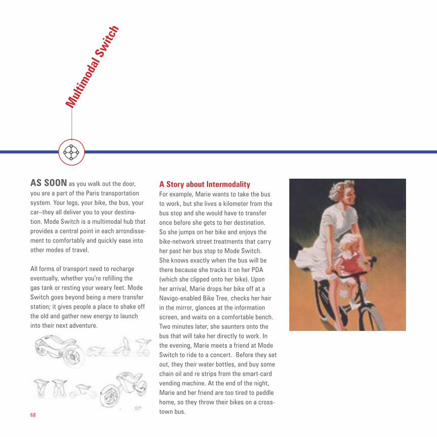
68
Mul
timod
al S
witc
h
AS SOON as you walk out the door, you are a part of the Paris transportation system. Your legs, your bike, the bus, your car–they all deliver you to your destina-tion. Mode Switch is a multimodal hub that provides a central point in each arrondisse-ment to comfortably and quickly ease into other modes of travel.
All forms of transport need to recharge eventually, whether you’re refilling the gas tank or resting your weary feet. Mode Switch goes beyond being a mere transfer station; it gives people a place to shake off the old and gather new energy to launch into their next adventure.
A Story about IntermodalityFor example, Marie wants to take the bus to work, but she lives a kilometer from the bus stop and she would have to transfer once before she gets to her destination. So she jumps on her bike and enjoys the bike-network street treatments that carry her past her bus stop to Mode Switch. She knows exactly when the bus will be there because she tracks it on her PDA (which she clipped onto her bike). Upon her arrival, Marie drops her bike off at a Navigo-enabled Bike Tree, checks her hair in the mirror, glances at the information screen, and waits on a comfortable bench. Two minutes later, she saunters onto the bus that will take her directly to work. In the evening, Marie meets a friend at Mode Switch to ride to a concert. Before they set out, they their water bottles, and buy some chain oil and re strips from the smart-card vending machine. At the end of the night, Marie and her friend are too tired to peddle home, so they throw their bikes on a cross-town bus.

69
Smart Mobility Reconfiguring the Bus

70
Smart Mobility Reconfiguring the Bus

71
Intermodal ScenarioThe snake bus riding through the city and interconnected with a bus stop and/or a concierge. The snake bus becomes a worm bus and goes under ground.
Smart Mobility Reconfiguring the Bus
- 1 floor it connects with shops and bikes
- 2 bus connects with shared city cars, other buses, and metro for multimodal transportation
- 3 parking for private cars

72
Smart Mobility Reconfiguring the Bus
Bike
Inte
rface
s
PART of the systemic approach to line 38 includes thinking holistically about the relationship between the bus as a vehicle and the bus stop. Buses resemble each other in most places around the world with a few notable exceptions like Curitiba, Brazil. And yet the urban morphology in
each location is vastly different as are the bus stop designs. Therefore, proposals to reconfigure vehicles thus go hand in hand with conceiving new families of bus stops in this report.
One of the main points is also to have a better integration of multimodal
transportation, especially if we think to the bus-bike multimodality. Bus can transports personal bikes or we can design bus stops that integrate the bike sharing model in their design.In that sense, we can design a soft mobility system where the bike becomes a central node of the system, and it is perfectly
new bike storage on bus
new bike storage at the station
old 7-step processcom
plicated station parking

73
Smart Mobility Reconfiguring the Bus
Bic-
o-bu
s
URBAN biking is a form of civic expres-sion that should be integrated into the intermodal vision of RATP. Bus stops along major lines such as line 38 are ideal regroup stations for bike rides through the city. Riding together, these bic-o-buses present a transportation mode in its own right that promotes exercise and environmentally aware transportation. Supported by the other social networking devices suggested in this section, the bic-o-bus provides an exhilarating urban experience that raises awareness for transportation among riders and also pedestrians on the street.
Bic-o-bus is a bike ride with a route and a rough schedule. Lead bikers act as the “drivers of the bus” and communicate with other riders via an instant messaging system. These rides can take place dur-ing the day and night and serve a diverse constituency: kids going to and from school could ride together, elderly people who are afraid to ride alone and want to exercise,
beginning urban cyclists, riders who want company, people who want to learn new bike routes or tourists.

Smart Mobility Reconfiguring the Bus
THE visibility or presence of information both abstract and specific plays an impor-tant role in boosting the identity of RATP among Parisians. Within the bus-bus stop network there are hundreds of output sur-faces that can convey the number of riders, the time of day, the types of activity taking place. These traces are then linked to mean-ingful experiences and services.
1_Nature inspired manipulations
Clouds: Independent clouds are generated when a user grabs onto a bar. Each cloud is individually customized by the user’s in-teractions with the bar. Theses interactions include the following: grip tension, surface coverage, directional changes, heat sen-sors, and grip patterns. This idea serves as an ambient environment while allowing us-ers to manipulate this environment.
Lily pads/frogs or birds: Same idea as the clouds, but it would take place under lily pads. Users would control abstract images jumping above the lily pads, perhaps frogs. These frogs would move in and out of the water.
2_Abstract manipulations
Ripples: Each bar is connected to the ceil-ing. As a user grabs onto a bar, and manipu-lates the bar handle, different sets of ripples
are created, much like a ripple in real water would be. These ripples would echo across the ceiling and interact with other ripples.
Depth transitions: An illusion of space is reconfigured based on the density of us-ers in a space. Perhaps the back half of the bus is congested and the ceiling displays a deeper window of space, allowing that par-ticular space to seem less congested. These illusions can vary and change dynamically based on the number of passengers
1_Ambient Skies2_Poetic Graffitti3_Social Interactions4_Information Visualization/ Maps
Trac
es

75
Smart Mobility Reconfiguring the Bus
3_Data
Real-time Maps: While the bus is moving, a real-time bird’s eye view of a map projects on the ceiling, pointing out stores, events, locations, and news.
Weather indicator: Indicates weather pat-terns throughout the city. Acts as a general guide for users who are traveling around the city.
Adverstisements: Can RATP sponsors cre-ate interactive content? Can location or time of day add value to the advertising system now? This would allow the RATP to provide a service without having the need to create much content. Content would be generated by the sponsors.

76
4_Interactive games
FingerprintsGraffiti
5_Implementation
Sensor Types: Heat, light, pressure, vein, movement, fingerprint, camera, IR, etc.
LEDs and Wall: The scroller wall would be several LEDS. LEDS are bi-directional, hence, can detect if a person touches an LED. The other option is that the LEDs are covered by a thin sheet of clear plastic which would act as a capacitor. This clear sheet would also protect it from the weather. Otherwise, the lower interactive portion of the towers could be touch screens if there was funding.
ALL LEDs are bi-directional. It’s just that no one uses them for this purpose. The bi-directional LEDS do get a bit tricky at night time though, as they need a source
of light to detect a person. The tricky part is the programming for this. One firm that retails the bi-directional qualities is www.merl.com
The other option is a large plastic sheet covering the LEDs and acting as a touch screen, or capacitor. This is probably a good option. The large sheet acts as a grid tot eh display overlaying it.
As for the price, it does a little pricy to get the detailed information of the LEDS, but the detailed LEDs can only be in the lower half of the wall where the user touches them. The top half can be less detailed LEDS that only display the scrolling headlines.
Software: Software is basic. We used Java to program this scroll wall, and the program read off of a .txt. file which was easy to do. The speed, spacing, size, colors, etc can all be controlled. The content that pops up will need more work,
as we did not have enough time to have several samples.

77
NOWADAYS the types of activities we are able to perform on the bus are rather limited by the physical setting and the movement of the vehicle. Reading, sleep-ing, observing the city, eating small snacks and talking on a mobile phone or with other passengers are the most frequently observed activities. And during peak hours, the least amount of interaction takes place among riders. Developing activities and diverse spaces on buses much like mo-bile-phone-free areas on trains opens new opportunities for riders and RATP. Shifting the bus system from a simple transporta-tion mode to a complex mobile hub inspires community.
Why do we want this? We are concerned with the social and emotional benefits of individuals feeling more integrated into their communities. There’s great power in the space between strangers.
When we bring discussions into the public realm, there is a potential to stimulate civic involvement. People might engage in de-bate about a local election or become more comfortable with people of other races and classes.
Maybe they’ll find creative inspiration or make a serendipitous business connection. Most people eavesdrop when they have the chance and we want to provide an environ-ment that would welcome them joining the conversation. Little interactions like these will eventually strengthen a community’s social fabric.
The bus would have scheduled program-ming, so people could plan on catching it at a certain time to see an up-and-com-ing singer perform. Or a fashion show for maternity clothes...or an informational workshop on starting your own business.
urban interactive games at the bus stop
Actit
ivite
s on
the
Bus
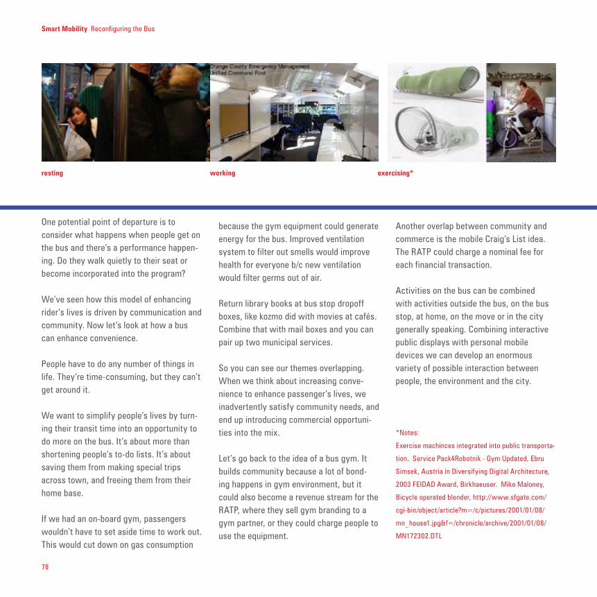
78
Smart Mobility Reconfiguring the Bus
because the gym equipment could generate energy for the bus. Improved ventilation system to filter out smells would improve health for everyone b/c new ventilation would filter germs out of air.
Return library books at bus stop dropoff boxes, like kozmo did with movies at cafés. Combine that with mail boxes and you can pair up two municipal services.
So you can see our themes overlapping. When we think about increasing conve-nience to enhance passenger’s lives, we inadvertently satisfy community needs, and end up introducing commercial opportuni-ties into the mix.
Let’s go back to the idea of a bus gym. It builds community because a lot of bond-ing happens in gym environment, but it could also become a revenue stream for the RATP, where they sell gym branding to a gym partner, or they could charge people to use the equipment.
Another overlap between community and commerce is the mobile Craig’s List idea. The RATP could charge a nominal fee for each financial transaction.
Activities on the bus can be combined with activities outside the bus, on the bus stop, at home, on the move or in the city generally speaking. Combining interactive public displays with personal mobile devices we can develop an enormous variety of possible interaction between people, the environment and the city.
One potential point of departure is to consider what happens when people get on the bus and there’s a performance happen-ing. Do they walk quietly to their seat or become incorporated into the program?
We’ve seen how this model of enhancing rider’s lives is driven by communication and community. Now let’s look at how a bus can enhance convenience.
People have to do any number of things in life. They’re time-consuming, but they can’t get around it.
We want to simplify people’s lives by turn-ing their transit time into an opportunity to do more on the bus. It’s about more than shortening people’s to-do lists. It’s about saving them from making special trips across town, and freeing them from their home base.
If we had an on-board gym, passengers wouldn’t have to set aside time to work out. This would cut down on gas consumption
resting working exercising*
*Notes:
Exercise machinces integrated into public transporta-
tion. Service Pack4Robotnik - Gym Updated, Ebru
Simsek, Austria in Diversifying Digital Architecture,
2003 FEIDAD Award, Birkhaeuser. Mike Maloney,
Bicycle operated blender, http://www.sfgate.com/
cgi-bin/object/article?m=/c/pictures/2001/01/08/
mn_house1.jpg&f=/chronicle/archive/2001/01/08/
MN172302.DTL

79
Smart Mobility Reconfiguring the Bus
AFTER traveling the same route day after day, the scenery blends into the back-ground and few aspects of the surrounding environment elicit a reaction from pass-ersby. The memory interface for the bus or bus stop opens a window onto the past that could change how RATP riders experience their routines. By touching the interface the affected surface area reveal past scenes at that location. Suddenly a glimpse of the past becomes overlaid onto the currently visible image. Pushing harder moves the image further back in time.
This opens new economic models for local development, we can imagine how this can foster the relationship with tourism, or with the activities on museums, as well as it raise problems about personal privacy.
Mem
ory
inte
rface

80
Smart Mobility Reconfiguring the Bus
ADAPTIVE systems need to know about their own state, which is feasible in a sensing environment such as the one proposed for the interior of vehicles and other infrastructural elements of the bus line. Using the interior of the bus as an example, the floors, furniture, walls and ceilings sense the presence of passengers. Using pressure, heat, light and other sensors these systems differentiate themselves from surveillance systems which focus on keeping visual records. Using other types of sensors generates a different type of interactive setting where the environment and the passengers can literally feel each other out. This mutual sensing promotes ambient environmental changes and can also enable real-time system adaptation. In order to conceive of deploying buses of different shapes and sizes it is essential to know where traffic is highest in real-time. While this valuable information is conveyed to the network structure the physical bus also transforms according to its internal
conditions. Exterior displays, ceiling displays and other surfaces such as those described in the section titled Traces can be driven by these sensing strategies.
Sens
ing
Envi
ronm
ents
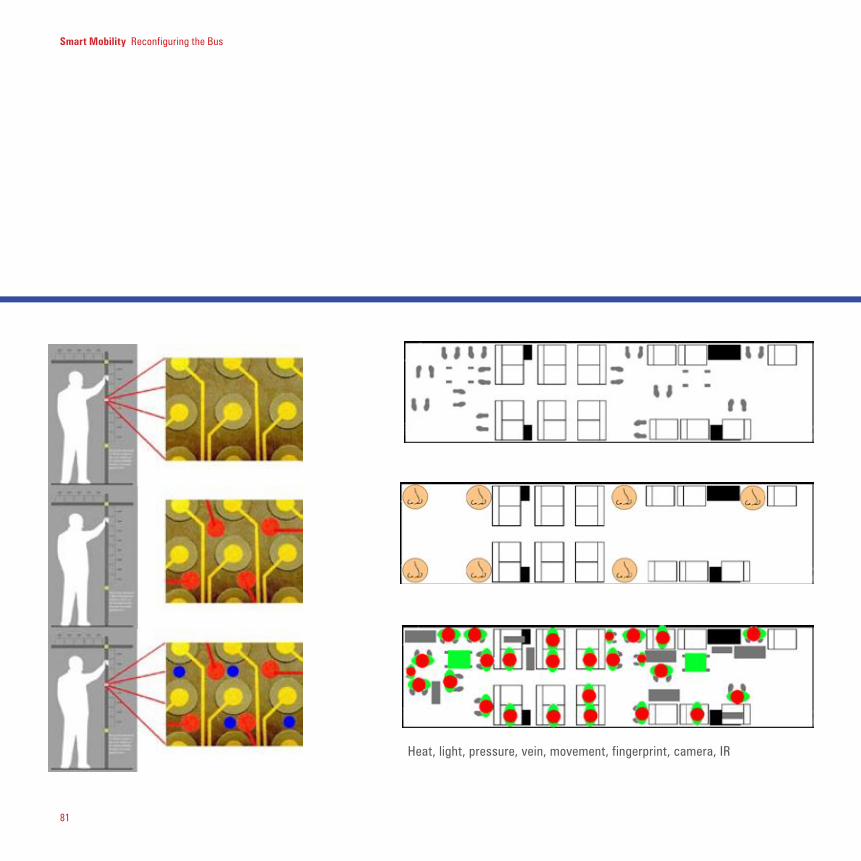
81
Smart Mobility Reconfiguring the Bus
Heat, light, pressure, vein, movement, fingerprint, camera, IR


ELECTRONIC GUIMARDThink of bus stops as something that have a clear presence and strong overall visible identity, and that helps to define the territory of Twenty-First Century Paris.
ELECTRONIC Guimard seeks to capture the strength and “imageability” [Kevin Lynch, The Image of the City] of the well-known métro stops which have become synonymous with Paris. Icons of civic progress, the characteristic stops are impressive in the way they fulfill functional requirements through an adaptive design. Bus stops throughout the city do not have the same presence – consider Queneau’s Zazie who is fascinated with the metro and not the bus. The key question for our investigation became: how would we evoke the same fascination for the bus system in her?
As mentioned early on in this report, designing for the bus means designing for a complex urban system that includes diverse elements and exists at the heart of urban life. Buses, bus stops, stations and information kiosks comprise the visible identity of the network. The Electronic Guimard applies technologies and parametric design methodologies to help

84
define the 21st century territory of Paris through customization and individualization.
The project focuses on the bus stop units themselves and incorporates requirements from the other system elements such as new bus configurations (see the introductory image of section 3.1). The list of considerations ranges from urban requirements through programmatic constraints. Rigorous parameters are coupled with a highly visible structure-skin design that represents a shift away from the currently almost invisible bus stations of the Paris. In fact, the strategy has a built-in flexibility that could mimic existing conditions at times and become even more visible than the Guimard stations at other times through programmable display technologies.
As with Guimard, each stop is tailored to its specific urban location. In addition, wireless interconnection permits another layer of customization through time-
sensitive programming. Whether working individually or as a network the vast network stops becomes an opportunity for seamless integration into everyday city rhythms. The stops can “dress” themselves for special occasions and fade into the background at others. These displays heighten the potential for interaction among users across the city, civic leaders, service providers, local businesses and other groups.
Few major points to keep in mind defining the Electronic Guimard._ Sensitive programming: bus stop can be self-adaptable and transform themselves according to wheatear condition, or according to the volume of passengers presents in that precise moment or, eventually, to individual characteristics. _ Structure skin design; using interactive surfaces augmented with electronic information, a bus stop can play a fundamental role in the mobility system as well as in the urban territory where
the bus stop is located. Moreover, digital information enrich the bust stop. _ Ad-hoc station design; bus stop are part of the environment and they can be designed in order to match particular needs, moments or events, especially in cooperation with other financial partners.
With the Electronic Guimard we suggest also a bus stop context awareness dynamic, where the bus stop, electronically connected to the information about the environment (as the wheatear or the temperature, but also reacting to traffic condition or to the passengers volume), and to local information (about shops, local economy, occasional events, social happenings) react and adapt them self in order to be better integrated into the urban and social environment.
Smart Mobility Electronic Guimard

85
Smart Mobility Electronic Guimard
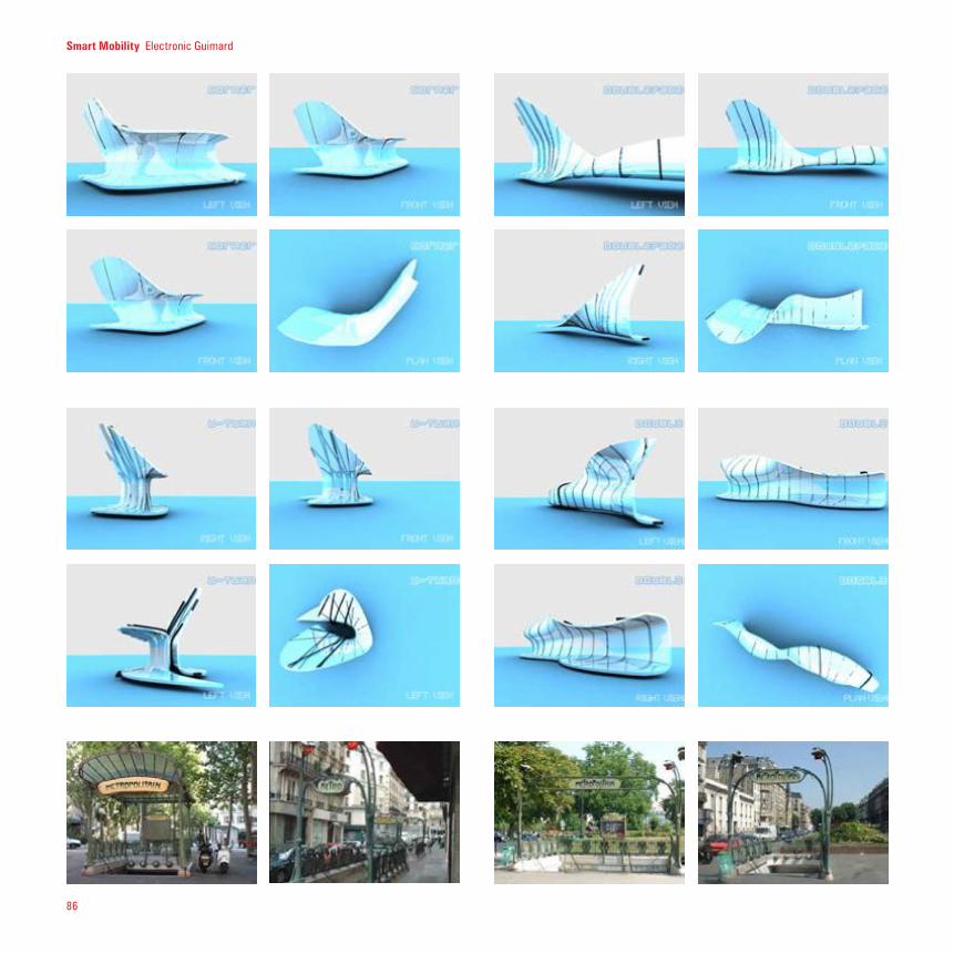
86
Smart Mobility Electronic Guimard

87
THIS theme explores how reconfigu-rability and adaptability are in the heart of smart mobility. We explore how you can design more flexible components of the bus system to incorporate feedback from the surrounding environment (users, climate, weather, traffic).
The rhythms of the city transportation sys-tems change dramatically according to time and space. Throughout the day, demand for transportation fluctuates. Sometimes buses are entirely empty and other times they are bursting at the seams. Adaptable and reconfigurable buses would alleviate these stresses and better serve riders. The range of possible adaptations includes complete transformations of the vehicle through smaller additions.
The interior of the bus can be modified in order to give more space for users and provide them a better design for social in-teraction. The interior can also be modified
in order to give to the users a better view on the outside, like in the Stadium bus.
The interior can also be redesigned to fos-ter multimodal transportation, and allows users to store their bicycle in a convenient way.
The bus stop can also be modified in two complementary dimensions. The first one concerns people. The bus stop can be designed to automatically adapt to the height of the users, if there are adults or children, if there is many people or if there are only few passengers waiting fore the next bus. The second one is the bus stop with context awareness; the bus stop can dynamically change with weather condi-tions. If is raining or sunny, if there is the need for more shade or light, protection from the wind or need for fresh air.
A final point for the system adaptability is the self-organizing bus. Not only should the
physical components of the bus line adapt to changing needs, so should the overall system. In a completely self-organizing bus system, the bus comes to passengers when and where they need transport.
Reco
nfig
urab
le
Bus
Stop
Smart Mobility Electronic Guimard

Smart Mobility Section Title
88

89
closer examination, his designs displayed numerous variations to a strong embodied theme of movement and dynamism. He, along with Architects like Antonio Gaudi, Louis Sullivan, and Santiago Calatrava, blended structural logic with infinite variation into everlasting compositions. In this sense, Guimard was an early pioneer
of parametric design. Today, parametric design can be afforded with Computer-Aided-Design
(CAD) systems like CATIA which allow designers to build smart 3D models that are
defined by design rules. In non-parametric design
systems, the user is limited to assigning specific values when
describing the geometry of the design object, thus limiting the designer to a static composition.
Any changes would require the rebuild of
DESIGNING parametrically was one of the key themes explored throughout the Paris workshop as it can enable a personalizable, responsive, and adaptive approach towards changing needs. Hector Guimard was able to design iconic and culturally resonate artifacts that served the needs of the Paris metro system.
Upon
vast sections (if not all) of the model. “A 4” tall glass is assigned the value 4” for the length equal to the height. However with parametric modeling, designers can assign a variable or equation. The height can be assigned height “X” which can equate to a relation such as one-half the diameter of the top of the glass, thus creating a series of proportions that designers can establish as key constraints. In this case, the height and diameter is parameterized to a particular proportion.” Guimard took this parametric logic and was able to create designs ad infinitum without sacrificing similarity during varied repetition.
A natural extension to parametric design is the realization of 3D models into physical form. A number of new design tools have also changed the way we convey design ideas from concept to development. The use of 3D printing, laser cutting, water-jet cutters and other rapid prototyping tools allow designers to physically
Smart Mobility Electronic Guimard
Para
met
ric D
esig
n

90
visualize those parametric models made in the CAD environment. Taking these tools as a collective work platform, our multidisciplinary group has developed multiple highly customized concepts for the RATP.
In the design of the Electronic Guimard, we understood the need to design for radically different contexts. For example, the bus stop needs to address the issues of safety, climate, egress/ingress, and site specifications like street grid or shape. By parametrically designing the bus stop we are able to adapt to the site context and even create new functionally. The bus stop is comprised of parametric modules which can be added together to form an overhead canopy. Places to sit and display information were created by adding modules together. Access ramps can be made by adjusting parametrically the slope of the floor of each module. Ergonomics were integrated into the parametric models to adjust to a wide range of human
comfort needs. Irregular site plans are not a constraint, but a generator of new forms as each module can be configured not only as an individual element but a “cell” within a system.
Design can be a two way process. In designing an adaptive bus stop we realized that this should in someway influence the design of the bus. Taking this same line of thinking, designs like the Snake or Worm bus emerged as counterparts to this new Electronic Guimard. Both embody adaptive qualities that are born from parametric design principles. The Snake bus can dock onto numerous bus stop configurations including conventional layouts. The Electronic Guimard can then response to the many egress/ingress options provided by the bus. The following pages illustrate the many design iterations that the bus stop has taken given this design methodology.
Finally, the self-reconfigurable bus stop follows two axes.The first one is the context. The bus stop can protect from the rain or the sun, the wind or the heat and assume different form reacting to the environment.The second one is people. Adaptable seats, for example, can be customized in order to better match users’ needs (i.e. adults and child seating needs are different).
Smart Mobility Electronic Guimard

91
Smart Mobility Electronic Guimard
The fluctuating metabolism of the city strains its transportation systems significantly. Throughout the day, demand for transportation fluctuates. Sometimes buses are entirely empty and other times they are bursting at the seams. Adaptable and reconfigurable buses would alleviate these stresses and better serve riders. The range of possible adaptations includes complete transformations of the vehicle through smaller additions.
Flexible interiors structure the types of social interactions possible within the bus. For example, one way to encourage people to talk is to reconfigure the seating to be more social. We found inspiration in a circular shape—the amphitheater. Some are formal, some casual. Some engage people in the action, others leave them to contemplate quietly.
Just like the bus, bus stops tend to look the same at all locations even though
each specific context is unique. Working with parametric modeling strategies it is possible to determine some of the most important aspects of urban sites and develop customized bus stops at each location that share enough essentials to maintain a single, coherent RATP identity.
Mod
ular
izing
Phys
ical
Ele
men
ts

92
Smart Mobility Electronic Guimard
Understanding Customization
Deconstructing the many facets of a new design process that includes mass cus-tomized preferences may oversimplify the process because it does not consider many assumptions that are already inherent in the problem. Barring the normal constraints of cost and manufacturability, let us examine the following customization typologies:
1_Cosmetic CustomizationCosmetic customization is concerned with the design of surfaces, packaging and gen-eral presentation of a product. Being able to customize cosmetically allows manufac-turers the ability to tailor colors to current trends and user preferences. In the case of cell phones, manufacturers allow customers to select from a wide variety of cell phone casings or “skins.” These come in many different colors, patterns and transpar-ency levels. Additionally, the phone can be customized by submitting images through a website and to be imprinted onto the phone.
Rather than Pine’s term “collaborative cus-tomization,” NikeID’s design methodology here would be categorized as “cosmetic.” http://nikeid.nike.com/ Customers rarely design anything except to select colors and particular logos. Before selecting color for every single component of the shoe, the customer is allowed to select shoe size. This process does not account for those that may have slightly different shoe sizes, wide feet or other physical limitations. True
mass customization would account not only for the cosmetics and surface quality, but also the fundamental issues like structure and material capabilities.
The automotive industry historically has been very good at cosmetic customiza-tion since the Art and Color Department was introduced by General Motors in 1927. Selecting an exterior color for a vehicle is the often the clinching question between salesperson and customer. Selecting the color and trim of the interior is also included in this category. A number of color types exist which are very common among all manufacturers. Standard colors like black, white, red, and silver have very little differ-entiation between manufacturers. Metallic versions of standard colors begin to make distinctions and special mixes like baby blue or titanium are designed specifically for particular brands. Flexible cosmetic customization is still a problem for many manufacturers because of the cost of dye mixes in order to create new colors.
2_Electronic CustomizationThe delivery and execution of digital information in all forms allows electronic customizers to create adaptive products. PDAs store information about your per-sonal schedule, phonebook, and other vital information. They are electronically customizable through wireless connec-tions like Bluetooth, cellular networks, and often through connectivity of the device itself. Electronic programmability allows mobile phones to not only store your personal phonebook, but also to electroni-
cally map different audio tones to each caller. GPS systems link your vehicle with its global and local context. MP3 players allow listeners to customize play lists by a multitude of ways such as most recent, last added, most played, random selection, and so on.
Automotive environments have already begun integrating electronic customization since the radio was first introduced in 1929 by Paul Galvin (Motorola). MP3 players, navigation systems, PDAs, and cell phones all have some form of “place” at vari-ous level of integration. Driving systems like adaptive cruise control and dynamic stability systems electronically aid or control vehicle movement. Certain vehicles allow for sport suspension or overdrive, which can be selected by the driver. Other systems learn the particulars of driving behavior and adapt the vehicle to particular driving patterns.
3_Ergonomic CustomizationAdapting to the constraints of the human body connects the product anatomically to the user. Computer mice are often con-toured to fit a range of hand sizes. Cell phone buttons and casings are designed to allow users easy button access, comfort in holding the device, and compactness when for the pocket. The Aeron chair designed by Hermann Miller chair pushed ergonomic configurability as a new design mantra for office furniture.
Automakers design cars using ergonomic physical and virtual models of every pos-
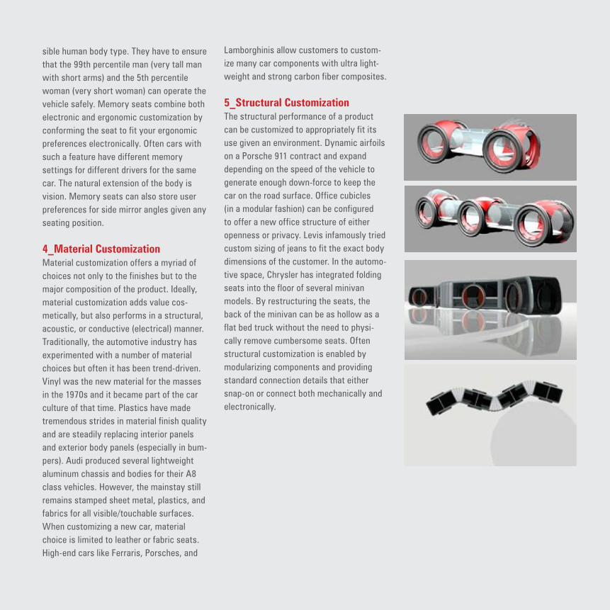
Adaptability / 93
93
Smart Mobility Section Title
SMART MOBILITY
2 Second subtitle3 Third Subtitle
Adaptability / 93
sible human body type. They have to ensure that the 99th percentile man (very tall man with short arms) and the 5th percentile woman (very short woman) can operate the vehicle safely. Memory seats combine both electronic and ergonomic customization by conforming the seat to fit your ergonomic preferences electronically. Often cars with such a feature have different memory settings for different drivers for the same car. The natural extension of the body is vision. Memory seats can also store user preferences for side mirror angles given any seating position.
4_Material CustomizationMaterial customization offers a myriad of choices not only to the finishes but to the major composition of the product. Ideally, material customization adds value cos-metically, but also performs in a structural, acoustic, or conductive (electrical) manner. Traditionally, the automotive industry has experimented with a number of material choices but often it has been trend-driven. Vinyl was the new material for the masses in the 1970s and it became part of the car culture of that time. Plastics have made tremendous strides in material finish quality and are steadily replacing interior panels and exterior body panels (especially in bum-pers). Audi produced several lightweight aluminum chassis and bodies for their A8 class vehicles. However, the mainstay still remains stamped sheet metal, plastics, and fabrics for all visible/touchable surfaces. When customizing a new car, material choice is limited to leather or fabric seats. High-end cars like Ferraris, Porsches, and
Lamborghinis allow customers to custom-ize many car components with ultra light-weight and strong carbon fiber composites.
5_Structural Customization The structural performance of a product can be customized to appropriately fit its use given an environment. Dynamic airfoils on a Porsche 911 contract and expand depending on the speed of the vehicle to generate enough down-force to keep the car on the road surface. Office cubicles (in a modular fashion) can be configured to offer a new office structure of either openness or privacy. Levis infamously tried custom sizing of jeans to fit the exact body dimensions of the customer. In the automo-tive space, Chrysler has integrated folding seats into the floor of several minivan models. By restructuring the seats, the back of the minivan can be as hollow as a flat bed truck without the need to physi-cally remove cumbersome seats. Often structural customization is enabled by modularizing components and providing standard connection details that either snap-on or connect both mechanically and electronically.

94
Smart Mobility Electronic Guimard
ESTABLISHING a visible territory around the bus station can help passengers find the correct station and also strengthen the identity of the RATP at the street level. After identifying the many patterns and surfaces already existing in the city we analyzed several specific locations, especially major intersections.
Along line 38 in particular we find the bus-to-bus transfers confusing as passengers must cross the large intersection to switch to the next line. The aerial image below shows the intersection of line 38 with line 91 at the Observatoire—Port-Royal stop.
There are many other options for guiding travelers. Using lighting effects, creative paving and mobile guides, the vibrancy of the street could actively move RATP passengers to their destinations.
wayfinding assistance
pavers
cobblestones
metro tiling
large granite pavers
diagonal pavers
natural surfaces
woven surfaces
Surfa
ces

AS SHOWN in the analysis of the displays already existing at the RATP much of the information is superfluous and not easily visible, especially inside the bus. The interior of the vehicle could be fitted with a ticker like a running stock exchange update with the most vital information: bus number, next stop, estimated time of
arrival. Now passengers are forced to shift in their seats, crouch down or ask others to repeat information on the TV displays or at the bus stops. A simple addition to the family of digital displays already available would enhance the ease with which riders make their travel choices.
Smart Mobility Electronic Guimard
Branded bikes and mopeds could be integrated into the
intermodal system of bikes and buses.
Mob
ile U
rban
Disp
lay


NEIGHBORHOOD CONCIERGETreat bus stops and kiosks as entry and orienta-tion points in neighborhoods, with friendly advice services.
GEARED towards locals and short-term visitors, the neighborhood concierge puts a face on the Paris transportation network by offering essential services with a compelling brand. It positions the RATP as the premier starting point for accessing city resources. The neighborhood concierge is a bus-stop implementation strategy that captures the new role of the station in a world of real-time information. As wait-times decrease and more riders become accustomed to interacting with mobile devices, the concierge brings back the personal feeling of face-to-face communication and customized services.
We propose three types of neighborhood concierge: InfoLink, PopLink, and LiveLink. While all three are focused on services, different configurations and elements of each type can be selected to suit a particular site. Note: these suggestions are strategic rather than specific, and can be integrated into many formal solutions. The uses to be housed at the concierge

98
include a variety of programs from purely informational exchanges to social spaces to face-to-face concierge services.
Each use is represented as a cube, but the diagram can also be thought of as a shape grammar for the neighborhood concierge concept, which can be inserted into any membrane or architecture. It is the universal bus and information shelter. One-on-one, social, and digital communication is facilitated at different levels at each concierge.
The neighborhood concierge is an adaptable system that serves all groups in the city at different times during the day. Expected trips by adults, seniors, and children are projected in the chart on the left. Certain groups, such as seniors, should receive special attention at the concierge because their demand will continue to increase in the future.
LIVELINK’S Navigo-enabled modular design provides space for people to have meetings, use the toilet, or even take a nap. Commercial modules can accommodate a magazine kiosk, a neighborhood retailer, a vending machine for travel accessories, and advertisement displays. Basic requirements for shelter and map information are provided by the concierge’s folding form, while a heated retreat space for a live concierge doubles as a hide-away for folding chairs. Lastly, a game module builds entertainment into the system. Most of the above services provide added revenue streams for the RATP.
The people who staff the LiveLink are a different sort than those you’d normally find staffing an information booth or selling bus tickets. In addition to knowing the RATP system inside-out, these people have their fingers on the pulse of Paris, especially in their particular neighborhoods. The human concierge is carefully selected by the RATP
for their friendly personality in addition to their ability to speak multiple languages, their intimate knowledge of Paris, and their technological savvy. Thorough training is the key to the Allié’s success. In order to help people navigate Paris by bus, train, RER, bicycle, and on foot, the Allié must be adept at planning routes, designing itineraries, and using the other RATP interfaces that are located around the city.
The Roaming Allié is in constant motion: from meeting students at St. Michel to plan their night out to chatting with business men about where to do last-minute shopping to walking an old woman to a local pharmacy. Roaming Alliés cover densely populated areas of the city, responding to shifting peak conditions and complementing the stationary concierge network. The idea is to move concierges out from behind the desk to approach patrons rather than waiting for them to approach the concierge booth. This
Live
Link
Smart Mobility Neighborhood Concierge

99
Smart Mobility Neighborhood Concierge
engages the hidden customer and inspires loyalty to the RATP, which will become known for its uncanny ability to swoop in and point people in the right direction.
The Allié will wear a distinctive uniform recognizable from afar and very, very French. We instantly identify uniforms for airlines and ships; the Allié wears something that revamps the bus’ reputation. Sartorial variations of the Allié’s uniform extend from the Allié to bus drivers and metro workers, further strengthening the RATP brand.

100
Smart Mobility Neighborhood Concierge

101
SMART MOBILITY
2 Second subtitle3 Third Subtitle
Smart Mobility Neighborhood Concierge

102
POPLINK encourages social interactions among commuters, tourists, and other passersby with its engaging community space. Bus stops usually cater to teo types of people. Commuters know where they need to go and are waiting for their bus to arrive, and tourists, or seekers, tend to look at maps to find out how to get to another location. PopLink capitalizes on these differences and turns people into route advisors. The bus station is divided by a frosted glass wall. The front side of the station is created for commuters, while the back side is geared towards seekers. The front side has seats for commuters to rest on and are arranged to give users the option to face each other if they want. Seats at traditional bus stops all face out to the street, which does not encourage face-to-face conversations. A wide center bench lets people face either direction, allowing users to engage with other sitters. The back side of the station has fewer seats, but has a long counter to lean against. This
surface allows seekers to spread out maps, open books, or put down coffee cups. The wall that separates these two groups is made permeable by a large window that creates a shared environment, encouraging conversations and allowing seekers to ask commuters questions. The counter acts as a table-a universal form around which people gather. At PopLink, the table unifies two distinct populations, and in doing so, it helps newcomers ease into the Paris transportation system.
At the heart of the third concierge model is the presence of an actual person-a friendly and knowledgeable RATP employee who helps locals and tourists find whatever they are looking for. The physical form of this concierge invites passersby to “come in” and speak with the Allié. But like a sales person in a clothing store, the Allié
would also offer to help people who start out browsing the information displays and seem to need a little personal attention.
Smart Mobility Neighborhood Concierge
PopL
ink

103
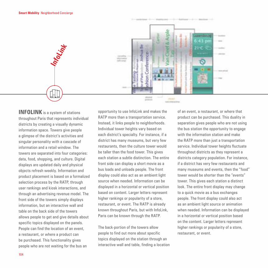
104
INFOLINK is a system of stations throughout Paris that represents individual districts by creating a visually dynamic information space. Towers give people a glimpse of the district’s activities and singular personality with a cascade of information and a retail window. The towers are separated into four categories: data, food, shopping, and culture. Digital displays are updated daily and physical objects refresh weekly. Information and product placement is based on a formalized selection process by the RATP, through user rankings and kiosk interactions, and through an advertising revenue model. The front side of the towers simply displays information, but an interactive wall and table on the back side of the towers allows people to get and give details about specific topics displayed on the panels. People can find the location of an event, a restaurant, or where a product can be purchased. This functionality gives people who are not waiting for the bus an
opportunity to use InfoLink and makes the RATP more than a transportation service. Instead, it links people to neighborhoods. Individual tower heights vary based on each district’s specialty. For instance, if a district has many museums, but very few restaurants, then the culture tower would be taller than the food tower. This gives each station a subtle distinction. The entire front side can display a short movie as a bus loads and unloads people. The front display could also act as an ambient light source when needed. Information can be displayed in a horizontal or vertical position based on content. Larger letters represent higher rankings or popularity of a store, restaurant, or event. The RATP is already known throughout Paris, but with InfoLink, Paris can be known through the RATP.
The back-portion of the towers allow people to find out more about specific topics displayed on the station through an interactive wall and table, finding a location
of an event, a restaurant, or where that product can be purchased. This duality in separation gives people who are not using the bus station the opportunity to engage with the information station and make the RATP more than just a transportation service. Individual tower heights fluctuate throughout districts as they represent a districts category population. For instance, if a district has very few restaurants and many museums and events, then the “food” tower would be shorter than the “events” tower. This gives each station a distinct look. The entire front display may change to a quick movie as a bus exchanges people. The front display could also act as an ambient light source or animation when needed. Information can be displayed in a horizontal or vertical position based on the content. Larger letters represent higher rankings or popularity of a store, restaurant, or event.
Info
Link
Smart Mobility Neighborhood Concierge

105
Smart Mobility Neighborhood Concierge

Reco
rdin
g En
coun
tersSmart Mobility Neighborhood Concierge
THE passengers of RATP are a diverse group that can be subdivided into many different categories. The simplest subdivision includes six very broad categories: tourists, commuters, students, local residents, the elderly and disabled, and night dwellers. Guido Martinotti’s detailed research on user groups also informed some of our more detailed design proposals. In this section, however, we focus on the fact that we are serving real people living their daily lives. In proposing improvements to line 38, we would like to provide solutions that are as individualized as possible. At the same time, we have recognized some of the principle commonalities all riders share.
—They have a lot to do in a short amount of time. They are stressed out about school, work, or being in new place. They spend a large part of each day on the bus.

107
—People are tied to permanent places. Tourists to their hotels, local residents to their homes, commuters to their workplaces.
—It’s easier to drive places if you’re carrying bulky packages. Residents shop for groceries and tourists carry luggage. It’s tough to ride the bus like this and makes it feel overcrowded.
—Everyone needs help with transitions. A very extreme example of this is a suicide study that found that bipolar people who attempted suicide most often did so when they were transitioning from manic to depressed or from depressed to manic. Think about how tough it is to gear up for work in the morning or to shake off the day’s stresses when you’re having drinks afterwards. We want to make those transitions easier.
Smart Mobility Neighborhood Concierge

108
TRYING to understand people as people-not just as users of public transportation-is a key point for smart mobility. RATP knows that it doesn’t simply transport commuters, but serves a diverse group of people.
The passengers of RATP are a diverse group that can be subdivided into many different categories. The simplest group includes six very broad categories: tourists, commuters, students, local residents, the elderly and disabled, and night dwellers.
Prof. Guido Martinotti suggest a typology of four urban populations, that are:(1) Inhabitants(2) Commuters(3) city users(4) metro businessman
From Metropolis, Metropoli. Nuova morfolgia sociale della citta, Il Mulino, Bologna 1993. C
A B
A B
D
C
A B
A B Traditional City
First Generation Metropolis (Commuting)
Second Generation Metropolis
Third Generation Metropolis?
Live Work Consume
A) Inhabitants Y Y/N Y
B) Commuters N Y (Y)
C) City users N N Y
D) Metro businessmen N Y Y
Figure: Four Urban Populations
* Diagram and contenxt adapted from Metropo-
lis, Metropoli. Nuova morfolgia sociale della
citta, Il Mulino, Bologna 1993, figure 1.

109
WHICH information do you trust most when moving through an unknown urban space? Often ideas and suggestions from friends with common interests prove to be the most helpful. The strategy of collabora-tive filtering (see i.e. www.linkedin.com) allows similar valuable information to filter from one stranger to another who shares similar preferences. In an urban context, a ubiquitous system like the RATP bus net-work provides an ideal platform for deploy-ing a city-wide network of information gath-ering.
In the transportation context, the power of collaborative filtering offers RATP an amaz-ing resource as it builds on what people are already doing. Human dynamics research is already using this type of strategy. For the bus line, an implementation could be more descriptive and provide a record of the urban metabolism with gripping visualizations.
All RATP users share some commonalities that might facilitate communication among riders and thus simplify the commuting ex-perience. For example, buddy systems for traveling to and from work at off-peak hours could be encouraged through an RATP-spon-sored transportation Friendster network (www.friendster.com, www.dodgeball.com/).
Soci
al N
etw
orks
Social networking on RATP systems :
Plan Activities with FriendsTrack friends’ locations, leave notes for them; go through “personal fragments” people leave or marked areas; See general areas that people have picked to meet up; a viral “whats going on”
Vibe-meter for a City NeighborhoodCombine with picture-less profiles for better collaborative filtering; get an idea of the types of people in an area
Profiles == Hybrid-DatingJudge either individuals or groups, and go into the public place to meet w/serendipity
Easy DiaryBoth in tracking location as well as photosTake pics while waiting for bus/train

Smart Mobility Section Title
110
From Wikipedia, the free encyclopedia.
Collaborative filtering (CF) is the method of making automatic predictions (filtering) about the interests of a user by collecting taste information from many users (collaborating). The underlying assumption of CF approach is that: Those who agreed in the past tend to agree again in the future. For example, a collaborative filtering or recommender system for music tastes could make predictions about which music a user should like given a partial list of that user’s tastes (likes or dislikes). Note that these predictions are specific to the user, but use information gleaned from many users. This differs from the more simple approach of giving an average (non-specific) score for each item of interest, for example based on its number of votes.Collaborative Filtering systems usually take two steps: 1.Looking for users who share the same rating patterns with the active user (the user who the prediction is for). 2.Use the ratings from those like-minded users found in step 1 to calculate a prediction for the active user

111
Smart Mobility Neighborhood Concierge

112
RATP uses display and signs to commu-nicate with users and inform passengers. From route directions to transportation rules, from commercial advertising to customers care, displays are an important communication medium. In order to inte-grate the flow of information into a dynamic model for both passengers and RATP, we analyzed three distinct points at which information is presented: before the bus stop, at the bus stop and on the bus. These should amount to a unified system in order to provide users the best experience.
At the Bus StopThe bus stop is one of the crucial elements of the smart mobility system, and the RATP can redesign it in order to plenty take advantage of the possibility that informa-tion technologies offer. The RATP is known throughout Paris, but Paris can also be known through the RATP. All the RATP needs is an iconic beacon of information that represents Paris.
With this perspective, we designed Links, a system of stations throughout Paris representing individual districts by creat-ing a visually dynamic information space. These stations give people a glimpse of a district’s activities and personality in a cascade of information on towers and a product window. Towers are separated into four categories: data, food, shopping, and events. The digital data is updated daily and the physical objects refresh weekly. Information is based on various selection processes—through the RATP (much like
Smart Mobility Neighborhood Concierge
Them
e-ba
sed
Disp
lay
Urbanites sometimes develop a short hand for naming
many of the key landmarks of the city and yet trans-
portation signage does not contain any of these refer-
ences. As shown on the map of line 38 many iconic
buildings line the boulevards. These locations are only
associated by name with specific bus stops. Including
a visual reference to adjacent landmarks could make
stops more visible on the street and aid memory re-
call.

113
Zagat.com reviews by popular vote works), through user rankings, or through an adver-tising retail space revenue model.
The memory interface is also a way to navi-gate in time and space and opens a window onto the past that could change how RATP riders experience their routines. By touching the interface the affected surface area reveal past scenes at that location. Suddenly a glimpse of the past becomes overlaid onto the currently visible image. Pushing harder moves the image further back in time.
On the BusIn the analysis of the displays already exist-ing at the RATP much of the information is superfluous or not easily located, especially inside the bus. The interior of the vehicle could be fitted with a ticker like a running stock exchange update with vital informa-tion: bus number, next stop, estimated time of arrival.
Smart Mobility Neighborhood Concierge
Another interesting display improvement could be done by classifying the buses dif-ferently: instead of using simple numbers we could make more appropriate use of visual references to adjacent landmarks that could make stops more visible on the street and aid memory recall, giving a bet-ter identity to the users.
Finally, thinking e-ink, electronic ink, is a revolutionary technology that can be integrated into electronic displays or RATP buses or bus stops, improving the commu-nication flows between RATP and passen-gers.

114
Programmable Surfaces: Technologies and
Potential Benefits
THE BODY panels in the Smart Car were designed to be easily removed and replaced with panels of different color. This qualifies as cosmetic customization. But in practice, only a small percentage of customers actually switched panels. Just like stowaway seats, the consumer trend is not to haul around heavy components and find places to store them. Our approach was to treat all the visible surfaces as programmable displays. Creating programmable surfaces effectively combines cosmetic and electronic customization into one new category. Our task was two-fold, 1) to assume visual programmability to all visible surfaces and 2) to research available technologies to achieve that goal. We discovered that assuming a programmable surface on the vehicle allows designers to radically
Map
Inte
rface
WHETHER using analog displays or sophisticated digital presentations the city map and bus map remain an essen-tial source of information for passengers. Interacting with the map in the most intuitive form, that is through touch, holds enormous potential as a basis for all adjunct information suggested in this section. By pushing on the display users can retrieve trip information and neighborhood information. Each detail can be uploaded wirelessly to the user’s mobile device.
A three-dimensional version of such a map including real-time traffic information is another form of map-based interface that combines new and old in an innovative way.
Car safety schemes (Axel Kilian, MIT) and studies
of view corridors from the bubble soft-skin car
(Mitchell Joachim, MIT) Concept Car Design
Project, Smart Cities Group, MIT Media Lab.

115
change functionality and thus the design of the vehicle.
SafetyConventional signal lights and other hazard warning systems have been regulated to particular standards. A third tail light near the roof line on all passenger vehicles is also required in the US. A programmable exterior allows total flexibility in safety displays. Signal lights do not have to be static, but can be responsive to lighting conditions. For example, users can design their own signals. Imagine an arrow the height of the whole vehicle pointing to the direction the driver is intending to go. In a hazard situation, the entire vehicle can be a warning signal (see figure). A further extreme is the possibility of projecting warning signs of an accident ahead on the outer surface. This can be enabled by car-to-car communication. For the interior, fixed displays can be replaced with dynamic ones suited to user preferences. Those with vision problems may prefer a
larger speedometer, and other, possibly none at all. Not all information to be displayed needs to be present all the time, for example your fuel level maybe only be displayed at certain intervals or when you are in proximity to a fuel station.
PersonalizationVehicle color often determines the final purchase by the customer. This is limiting not only to the manufacturers and dealers but to users as well. A chameleon-like exterior can adapt to driving needs or emotions. Customers that want to drive a red car one day may want to have a yellow car on another. On a hot summer day a driver is better served by a white car than a dark one. Dynamically changing displays allow for site-specific input. Matt Mankins, a graduate of the Media Lab, created dynamic displays tied into GPS for taxi cabs in greater Boston. The taxi would display advertising for restaurants and other retailers in the neighborhoods that made the most geographical sense.
Fully personalize-able displays both for the exterior and interior purposes open up the possibility for an entirely redefined design process that breaks away from standard configuration but promotes a dynamic design palette.
Opacity“Smart” glass has recently come into use in commercial building applications. Imagine a car that can transform from an opaque surface to a fully transparent one. The vehicle can now begin to blur the boundary between what is seen and what is not seen and everything in between. A completely opaque car would be useful for privacy or hiding the contents of the car and preventing theft. It can also serve to provide a dynamic sun shading to reduce glare to the driver (see figure).
Transparency allows the outside in. A new aesthetic is created when elements of the vehicle are exposed by combining
Smart Mobility Neighborhood Concierge

116
Zazie
dan
s le
bus
Smart Mobility Neighborhood Concierge
different levels of transparency. “Car designers and manufacturers capitalize on spectral reflections to achieve moving beauty because the surfaces of painted sheet metal provide a dynamic mixture of reflections, refractions, shade, and shadow.” A new language of how cars are seen is created by the need to personalize exterior cladding and interior interfaces. Combining this and integrating the following enabling display technologies creates a new platform for personalization and perception by the human eye.
Enabling Display TechnologiesA number of new display technologies enable programmable surface design. Most notably, Electronic Ink (E ink) developed at the MIT Media Lab utilizes addressable microcapsules of ink printed onto different substrates. The displays are thin, programmable, and flexible and use very little power. The latest E ink technologies are not only programmable but also dynamic (i.e., animations and videos), hi-resolution (200 dpi), durable (can be
cut and still operate), and have color. One challenge that electronic ink faces is the ability to withstand the hostile automotive environment of extreme temperature variation, vibration, and moisture. Nevertheless, the promise of programmability is readily available for early applications in show vehicles.
Liquid Emitting Diodes (LEDs) have penetrated the both the automotive and aftermarket world. Manufacturers employ LED clusters in tail and side lights giving distinct lighting effects. LEDs and Organic LEDs have very good life spans and are programmable individually. One potential application would be to cover a vehicle body with LEDs to achieve a programmable surface. Since cars are relatively large objects seen at both large and small distances, each LED would represent one pixel in that field. The resolutions do not have to be high, but spaced widely enough to create a low resolution drape over the entire vehicle, thus giving a programmable surface.
URBAN public transportation is a power-ful means of experiencing a city. Zazie seems to intuitively understand this potential and thus continues her explorations through Paris in search of exciting encounters. In re-thinking the bus, we would like to capture for the riders of RATP the same intensity that fascinates Zazie.
Raymond Queneau’s story about a young girl who visits Paris presents the reader with a very special type of urban explo-ration:
Seeing that her fellow-countrymen and -women were all set to continue the contro-versy, Zazie scrammed. She took the first street to the right, then ditto to the left, and so on until she arrived at the outskirts of town. Superb skyscrapers four or five storeys high lined a sumptuous avenue on the pavement of which verminous street-stalls were jostling one another. A thick mauve crowd was trickling in from all sides.

117
Ratin
g Sy
stem
s
LIKE the collaborative filtering strategy, a rating system for products and services available within the proximity of a bus stop or intermodal station would allow riders to gain valuable information as they ride the bus. The rating system results from user input and also businesses interested in promoting their products. The balance of advertising-based displays and grass-roots information is vital to preserve trust among RATP riders in the provided information (collaborative filtering, perceived and real complexity).
Imagine a dinner experience in a Parisian restaurant.
The owner of the restaurant can publish and made electronically available their menu with food description, their weekly special dishes and restaurant décor, they can inform about special promotions and events.
Passengers and local residents can also access to these information and add comments and remarks. They can rate the restaurant food and atmosphere, review the posted information and suggest other restaurant in the neighborhood.
Smart Mobility Neighborhood Concierge
A woman selling monster balloons, and the music coming from the roundabouts added their chaste note to the virulence of the show. Zazie was lost in admiration, and it was some time before she noticed at no great distance from her a masterpiece of baroque ironmongery growing out of the pavement which was crowned with the inscription METRO [BUS]. Immedi-ately forgetting the pleasures of the street, Zazie approached its mouth, her own dry with emotion. Working her way with tiny steps round the outside railing, she at last discovered the entrance. But the iron gate was shut. A pendant slate bore a chalk inscription which Zazie deciphered without difficulty. The strike was still on. A smell of ferruginous and dehydrated dust rose gently from the forbidden depths. Heartbroken, Zazie began to cry.
Raymond Queneau, Zazie dans le métro (transl. Barbara Wright, Penguin Books: 2000, p.33.)

118
1
2
3
Rate While You Wait: collecting and sharing information at bus stops
Start screen at bus stop or kiosk. Allows user to choose between “Rate While You Wait” program and RATP navigation assistance.
User can get information about already rated establishments, or can choose to be the expert and rate some places themselves.
To rate places, users would specify what type of place they are rating if it’s a common category, and can say whether there is anything particularly noteworthy about that place; as well as enter the name.
If the establishment exists in the database as entered, the user can verify whether it’s the place they mean. If not, the user can add the new place to the database, or select from similar names.
Each type of establishment may have a slightly different set of ranking criteria to be rated on a ten-point scale. There might also be some sort of way to assign a “personality” to the establishment.
The user can see how their ranking matches up with other entries in the database, and can choose to continue rating or to exit the program.
1) People waiting at bus stops contribute to database
2) RATP processes ratings and adds results to
RATP compiles data inputted from bus stops around the city (as well as from online entries) and keeps track of the ever-changing ratings.
Ratings become instantly available to people looking up businesses online and at the kiosks; RATP locates highly rated businesses and maps them onto changing displays at bus stops.
A master map has information for all businesses that have been located; the map can be scaled and cropped for different types of displays, but will show the name of the business, the rating, and how many people have rated it.
If an establishment gets ratings in the top twentieth percentile, the RATP approaches them with the offer of displaying their logo and contact information for
3) Different types of displays target people with
dynamic bus stop displays
HOPKINS STREET BAKERY 1584 HOPKINS STREET 2ND ARRONDISSEMENT
a fee; it is good advertising for the restaurant, revenue for the RATP, and system users can be sure that the ratings are objective.
Maps showing the immediate vicinity of the bus stop allow people getting off the bus (as well as any passers by) to orient themselves and find things to do or places to eat nearby. Large maps showing a single route would be along the sides of
bus shelters allowing people who weren’t necessarily thinking about riding the bus to get a sense for all the places that bus might take them.
Zoomed-out maps showing the entire system would let people find places they want to go across Paris, as well as figure out how to get there using the RATP.
varying levels of involvement
Miriam Sorell April 5, 2005
s of involvement

119
Rate While You Wait: collecting and sharing information at bus stops
Start screen at bus stop or kiosk. Allows user to choose between “Rate While You Wait” program and RATP navigation assistance.
User can get information about already rated establishments, or can choose to be the expert and rate some places themselves.
To rate places, users would specify what type of place they are rating if it’s a common category, and can say whether there is anything particularly noteworthy about that place; as well as enter the name.
If the establishment exists in the database as entered, the user can verify whether it’s the place they mean. If not, the user can add the new place to the database, or select from similar names.
Each type of establishment may have a slightly different set of ranking criteria to be rated on a ten-point scale. There might also be some sort of way to assign a “personality” to the establishment.
The user can see how their ranking matches up with other entries in the database, and can choose to continue rating or to exit the program.
1) People waiting at bus stops contribute to database
2) RATP processes ratings and adds results to
RATP compiles data inputted from bus stops around the city (as well as from online entries) and keeps track of the ever-changing ratings.
Ratings become instantly available to people looking up businesses online and at the kiosks; RATP locates highly rated businesses and maps them onto changing displays at bus stops.
A master map has information for all businesses that have been located; the map can be scaled and cropped for different types of displays, but will show the name of the business, the rating, and how many people have rated it.
If an establishment gets ratings in the top twentieth percentile, the RATP approaches them with the offer of displaying their logo and contact information for
3) Different types of displays target people with
dynamic bus stop displays
HOPKINS STREET BAKERY 1584 HOPKINS STREET 2ND ARRONDISSEMENT
a fee; it is good advertising for the restaurant, revenue for the RATP, and system users can be sure that the ratings are objective.
Maps showing the immediate vicinity of the bus stop allow people getting off the bus (as well as any passers by) to orient themselves and find things to do or places to eat nearby. Large maps showing a single route would be along the sides of
bus shelters allowing people who weren’t necessarily thinking about riding the bus to get a sense for all the places that bus might take them.
Zoomed-out maps showing the entire system would let people find places they want to go across Paris, as well as figure out how to get there using the RATP.
varying levels of involvement
Miriam Sorell April 5, 2005

120
MOVING through the city and updating travel information dynamically presupposes seamless mobile connectivity. All of the in-formation RATP provides to its users should be accessible from multiple devices and at special information kiosks.
Smart Mobility Neighborhood Concierge
Mob
ile C
onne
ctiv
ity

121
2 Second subtitle3 Third Subtitle


CONCLUSION

124
Now, cities of the digital information era are developing electronic nervous systems. Increasingly, they are acquiring embedded sensing, processing, telecommunication, and automated actuation capabilities. When these electronic nervous systems are integrated with other networks and systems, cities begin to operate as intelligent organisms that make coordinated responses to changing conditions and needs. Electronic nervous systems can weave together hitherto independent systems into a more effectively integrated, intelligent whole.
The aim of the smart mobility workshop
was to rethink the Paris bus line for the new era of cities that are coordinated and controlled by electronic nervous systems. It considered five elements: people, the urban environment, the bus, the bus stop and the information/communication system. It did not seek to identify possible incremental improvements (which will probably happen anyway), but to discover ways of fundamentally re-imagining the whole system in response to the conditions of the digital information era. Its proposals were developed and elaborated to the extent possible within a short project, but their details should not be taken too literally; they are intended primarily as suggestive
THE project of rethinking the bus line should be understood within the context of the long-term evolution of cities toward the condition of large-scale, intelligently integrated and coordinated organisms.
Pre-industrial cities consisted essentially of skeleton and skin. They provided shelter and protection, and through stacking floors vertically they enabled intensification of land use. This conception of the city is beautifully illustrated by Nolli’s famous map of Rome.
Cities of the industrial era acquired increasingly extensive and sophisticated artificial physiologies – water supply and drainage systems, energy supply systems, and mechanized transportation cities. This later conception is illustrated by the well-known map of the London Underground, which abstracts away from topographic and architectural detail to present the city as a flow network.
Smart Mobility Conclusion

125
Smart Mobility Conclusion
Smart Mobility Conclusion
starting points for further investigation, development, and critical analysis.
The main proposals that resulted from the workshop’s investigations are:
1_Self-organizing Bus System
Traditionally, urban train and bus systems have operated with fixed routes and timetables, while private automobiles and taxis have offered transportation whenever and wherever it was needed—but at much higher cost.
In the ubiquitously networked environment of the twenty-first century, though, the increased availability of information, combined with capacity for computer control of complex, dynamic systems
in real time, begins to break down this traditional distinction. Bus operators can keep precise track of vehicle movements, electronically monitor demand from minute to minute, and responsively allocate service capacity to where it is currently needed most. In addition, by means of mobile electronic devices, potential passengers can be informed of when and where service will be available to meet their needs.We suggest, then, that there is considerable potential to reduce reliance on fixed bus routes and timetables, and thus offer better service at still acceptable cost, through a combination of digital networking and sophisticated computer control. In
Image by Marco Susani.
126
other words, the bus system could shed much of its traditional rigidity and become intelligently self-organizing.
2_Reconfiguring the Bus
The traditional bus is basically a long, narrow box on wheels—or, at best, two or three boxes joined by flexible connections. It is not particularly agile at navigating through crowded city streets, it does not allow passengers to make particularly pleasant and productive use of their time, and it does not provide very efficient ingress and egress. We suggest, therefore, that there is room for a great deal of improvement.
This improvement can be accomplished by embedding much more electronic intelligence in buses. More sophisticated electronic control systems can allow buses
to become flexible rather than rigid, so that they wiggle themselves—snake-like—through the streets in more agile fashion. Buses can become mobile network nodes, so that passengers are connected for guidance, entertainment and mobile work. And interior and exterior surfaces can carry information displays.
It is possible to make incremental improvements to bus design by gradually incorporating such capabilities. But it seems likely that the greatest gains will be achieved through some experimentation with radically reconfigured buses that are designed, from the beginning, around the capabilities of new electronic technology.
3_Electronic Guimard
As Guimard’s famous Metro stops demonstrated, it is possible for transportation stops to have a distinctive character and to contribute to the overall image of a city. However, bus stops are
rarely so memorable, and this represents an enormous lost opportunity.
In some historic parts of Paris, we recognize, it is appropriate for bus stops to be as discreetly unobtrusive as possible. But this is not a universal condition. In many areas, beautifully designed bus stops can be an enhancement, and a system of vivid, well-designed bus stops can help to provide a sense of citywide identity.
Guimard developed his famous designs around the new architectural possibilities of that particular time, offered by iron and glass. The equivalent new possibilities of our own time are offered by electronic display surfaces. Media companies have already begun to explore this possibility by negotiating agreements to attach advertising display screens to existing subway and bus stops, but this is just a small step towards an electronic urban architecture.

127
We therefore propose the development of powerful new bus stop designs that take particular advantage of electronic display to create a unique character for twenty-first-century Paris—electronic Guimard.
4_Neighborhood Concierge
Bus stops are entry points to neighborhoods. As such, they have the potential to function as landmarks that distinguish and characterize neighborhoods, and as convenient sources of information about the things that neighborhoods have to offer.
If it conceives of bus stops in this way, RATP can broaden its role from simply provider of transportation to comprehensive provider of efficient access to the varied and far-flung resources and attractions of Paris. This can open up new business opportunities, and RATP is well positioned
to exploit them because it already has infrastructure strategically distributed throughout Paris.
The traditional concierge is a person with a great deal of local knowledge. One model for the new neighborhood concierge is that of a person—either mobile or at a fixed location—who has efficient access to much wider information resources through network connectivity. Another model, appropriate to less heavily used locations, is that of a fully electronic information point.
We therefore propose a transformation of bus stops into a system of electronically supported neighborhood concierges, which take varied forms according to their locations and the particular communities that they serve.


SELECTED REFERENCESAAugé, Marc, Non-lieux, Seuil, Paris, 1992.
BBachelard, Gaston; La poétique de l’espace, PUF, Paris (1957) 1964.Baudrillard, Jean : L’échange impossible, Galilée, Paris, 1999.- Simulations et simulacres, Galilée, Paris, 1981.Bataille, George, La Part maudite précédé de “La Notion de dépense”, Les editions de Minuit, Paris, 1949.Bateson, Geogory, Mind and nature: a necessary unity (advances in system theory, complexity and the human sciences). University of Chicago Press, USA, 1999.Benedikt, Michael: Cyberspace, First steps, MIT Press, Cambridge, USA, 1999.Benjamin, Walter, Ecrits français, Gallimard, Paris, 2003.- Paris, capitale du XIXème siècle, Paris, Editions Allia, 2003.Berger, Peter and Lukmann, Thomas, The social construction of reality: a treatise in the sociology of knowledge, Anchor Books, USA, 1967.Boyer, Christine, The City of Collective Memory, Its Historical Imagery and Architectural Entertainments, MIT Press, USA, 1994.Bonnie, A., Nardi et Viki L. O’Day, Information Ecologies. Using Technology with earth, MIT Press, Cambridge, USA 1999.
CCalvino, Italo, Le città invisibili, Oscar Mondadori, Milano, 1993.Casalegno, Federico, Les cybersocialités. Nouveaux médias et nouvelles estéthiques communautaires, (Doctoral Thesis, Université Sorbonne, Paris V, July 2000, to be published, Il Saggiatore, Milan, Italy, 2005).- Mémoire Quotidienne. Communauté et communication à l’ére des réseaux� Université de Laval, PUL, Presse Universitaire de Laval,� Québec,
Canada, February 2005

130
Smart Mobility References
C- Communication Dynamics in Technological Mediated Learning Environments� International Journal of Instructional Technology and Distance
Learning, Vol. 1, No 11, USA, 2004.- Media ambiance in remote collaborative environments� , Conference proceedings, HAAMAHA 03, International conference on Human
Aspects of Advances Manufacturing: Agility and Human Automation, Rome, May 2003Castells, Manuel and Susser, Ida, The Castells reader on cities and social theory, Blackwell Publisher, USA, 2002.Castelles, Manuel The Internet galaxy : reflections on the Internet, business and society, Oxford University Press, USA, 2001.- The Information Age: Economy, Society, and Culture (three volumes):Volume 1: The Rise of the Network Society, Blackwell Publishers (Oxford, and Malden, MA), 1996.Volume 2: The Power of Identity, Blackwell Publishers (Oxford, and Malden, MA), 1997.Volume 3: End of Millennium, Blackwell Publishers (Oxford, and Malden, MA), 1998. The rise of the network society, Blackwell Publisher, USA, 1996.Chatwin Bruce, The songlines, Penguin Books, USA, 1988.Chin, Ryan C.C., “How Mass-Customization Changes the Design Process: MIT Media Lab’s Concept Car Project”, MIT Media Laboratory MCPC 2005 3rd Interdisciplinary World Congress on Mass Customization and Personalization (Hong Kong University of Science and Technology, Hong Kong, September 18-21, 2005).
DDavis, Mike, The city of quartz. Excavating the future in Los Angeles, Vintage, USA, 1992.Debord, Guy, La société de spectacle, Gallimard, Paris, 1992.- Théorie de la dérive. Internationale Situationniste n° 2, décembre 1958.Deleuze, Gilles et Guattari Félix, Mille Plateaux. Capitalisme et schizophrénie, Paris, Ed. Minuit, 1980.De Kerckhove, Derrick, The Architecture of Intelligence (The It Revolution in Architecture) Birkhauser Publisher, USA, 2001.- The Connected Intelligence: The Arrival of the Web Society, Somerville House Publisher USA, 1997.

131
Smart Mobility References
D- Brainframes. Technology, mind and business, Bosh & Keuning, Olanda, 1991.De Rosnay, Joël : L’homme symbiotique, Seuil, Paris, 1995.
HHalbwachs, Maurice The Collective Memory: Harper Colophon, USA, (1950/1980).Heidegger, Martin, The question concerning technology and other essays, Harper and Row, (1955) 1977.
JJohnson, Steven, Emergence. The connected lives of ants, brains, cities and software. Scribner, 2001
KKelly, Kevin, Out of Control , Addison-Wesley Publishing, USA, 1994.Kitchin, Rob, Dodge, Martin, Atlas of Cyberspace, Pearson Education, USA, 2002.Korzybski, Alfred, Une Carte n’est pas le territoire, Editions de l’eclat, Paris, 2001.
LLatour, Bruno, Aramis or the Love of Technology. (transl. Catherine Porter, Harvard University Press, 1996).Lévy, Pierre : L’intelligence collective. Pour une anthropologie du cyberespace, La Découverte, Paris, 1994.Lovelock, James : Les ages de Gaïa, Éd. Robert Laffont, Paris, 1990

LLynch, Kevin, The image of the city, MIT Press, Cambridge, USA, 1960.- A Theory of good city form, MIT Press, Cambridge, USA, 1981Lyotard, Jean François, La condition Postmoderne, Les éditions de Minuit, Paris, 1979.
MMaupassant, Guy de, La vie errante, La table ronde, Paris, (1890) 2000.Mc Luhan, Marshall, and Quentin Fiore, The medium is the message, , Random House, NY, USA, 1967.Mc Luhan, Marshall, Understanding Media: The Extensions of Man, McGraw-Hill, USA, 1964.- The Gutenberg Galaxy: the making of typographic man, University of Toronto Press, Ca, 1962.Mc Quail, Denis Mass communication theory, Sage, London, GB, 1983Maffesoli Michel, Notes sur la postmodernité. Le lieu fait lien, Éditions du Félin, Paris 2003.- Du Nomadise. Vagabondages initiatiques. Le Livre de Poche, Paris, 1997.- Le Temps des tribus. Le déclin de l’individualisme dans les sociétés de masse. Ed. Meridiens Klincksieck, Paris, 1988.Meyrowitz Joshua, No sense of place, New York, Oxford University Press, USA, 1985.Minsky, Marvin, Society of mind, A Touchstone Book, New York, USA, 1987.Mitchell, William J., Placing Words. Symbols, space and the city. MIT Press, Cambridge, 2005- Me ++: The cyborg self and the networked city, MIT Press, Cambridge, 2004.- E-Topia, Urban life Jim- but not as we know it, MIT Press, Cambridge, USA, 1999.- City of bits. Space, place, and the infobhan, MIT Press, Cambridge, USA, 1996.Morin, Edgar, L’intelligence de la complexité, L’Harmattan, Paris, 1999.- La méthode. Tome 3. La connaissance de la connaissance, Seuil, Paris, 1996.
132
Smart Mobility References

M- La méthode. Tome 4. Les idées, Seuil, Paris, 1995.- Terre-Patrie, Seuil, Paris, 1993. - La rumeur d’Orléans, Seuil, Paris, 1969. Myerson, George, Heidegger, Habermas and the mobile phones, Totem Books, USA, 2001
NNegroponte Nicholas, Being digital , Vintage, USA, 1996.
PPerec, Georges, Tentative d’ épuisement d’un lieu parisien, Paris, Christian Bourgois, 1975
QQueneau, Raymond, Zazie dans le metro, Folio, Paris, 1972
RRheingold Howard, Smart Mobs, the next social revolution, Basic Books, USA, 2003.- The virtual commuities, MIT Press, Cambridge, USA, 1993.- Virtual reality , Touchston Books, New York, 1992 Rifkin, Jeremy: The age of access: the new culture of hypercapitalism, where all of life is a paid-for experience, Penguim Putnam, USA, 2001.- The end of work: The decline of the global labor force and the down of the post-market area, Putnam Book, USA, 1996.
133
Smart Mobility References

RRossi, Aldo, The Architecture of the City, MIT press, USA, 1984.
SSansot, Pierre, Poétique de la ville, Armand Colin, Paris, 1996.Seely Brown, John and Duguid, Paul: The Social Life of Information, Boston, MA: Harvard Business School Press, 2000Simmel, Georg, La Tragédie de la Culture, Éditions Rivages, Paris, 1988. Sitte, Camillo, City Planning According to Artistic Principles, Rizzoli international publisher, USA, (1889) 1986.
TTurkle Sherry, Life on the screen. Identity in the age of the Internet, Simon & Schuster, New York, USA, 1995. - The Second Self: Computers and the Human Spirit, Simon and Schuster, USA, 1984.
VVarela, J. Francisco, Autonomie et connaissance, Seuil, Paris, 1989.Vattimo, Gianni : La fine della Modernità, Garzanti editore, Milano, 1985.- La società trasparente, Garzanti editore, Milano, 1989. Virilio, Paul, La vitesse de libération, Galilée, Paris, 1995.- La bombe informatique, Galilée, Paris, 1998.- Esthétique de la disparition, Galilée, Paris,1989.Von Neuman, John, L’ordinateur et le cerveau, Flammarion, Paris, 1996.
134
Smart Mobility References

WWatzlawick, Paul, How real is real? Confusion, disinformation, communication, Vintage, USA, 1977.
YYi-Fu Tuan, Space and place: the perspective of experience, University of Minnesota Press, 2001.
135
Smart Mobility References


ACKNOWLEDGEMENTSWe are grateful to the collaborators from RATP, especially Georges Amar and Dominique Laousse (Prospective et développements innovants), Marc Bensimon and Mathieu Dunant (Systèmes d’information et Télécommunication), and Stéphanie Bouché (Design), participated very actively and constantly collaborate during all the phases of the workshop. Their work, help and support has been fundamental to the success of this workshop and subsequent report.
Thank you to all the participants in the MIT workshop held at the MIT Media Lab in the spring 2005. We would especially like to thank all the students, Sergio Araya, Marcel Botha, Sylvain Bruni, Stephanie Groll, Onur Yuce Gun, William Lark, Phillip Liang, Arnaud Pilpré, David Raul Poblano, Susanne Seitinger, Miriam Sorell, Tango Aaron Tang, Edgar Torres, Aaron Zinman, and course collaborators, Ryan Chin, David Raul Poblano, Susanne Seitinger, whose hard work resulted in the contents of this report.
Finally, we would like to acknowledge the unstinting support and insightful guidance of Professor William J. Mitchell and Federico Casalegno without whom this workshop would not have been possible.
Project Director:William J. Mitchell, Federico Casalegno
Final Report Design: Susanne Seitinger
Content Editing: Ryan Chin, David Raul Poblano, Susanne Seitinger
Multimedia Edition (http://cities.media.mit.edu/mobile/RATP):Michael Humphrey, Video Editing and Visualization; David Raul Poblano, Visualization; Caitilin Winner, Web Design and Visualization


![ExamplE - personal.utdallas.edusaquib/ENGR3341/... · space of M (i.e., SM) and the probability, P [M = m], where m e SM. Yates & Goodman 3e 69 Bernoulli (p) Random Variable Definition](https://static.fdocuments.in/doc/165x107/5f0995e57e708231d4278945/example-saquibengr3341-space-of-m-ie-sm-and-the-probability-p-m.jpg)