Slope
6
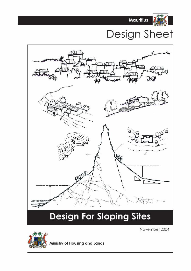
Ministry of Housing and Lands November 2004 Design Sheet Design For Sloping Sites Mauritius
description
slope
Transcript of Slope
Ministry of Housing and Lands
November 2004
Design Sheet
Design For Sloping Sites
Mauritius
DESIGN GUIDANCE Design For Sloping SitesMinistry of Housing and Lands, November 2004
DESIGN SHEET
Design For Sloping Sites
Pressure to develop mountain slopes in Mauritius has recently intensified. The pressure is particuarly intense on those slopes that offer a view out to sea.
The following criteria apply to plot layouts on sloping sites:
Slope Stability
• Development will not normally be permitted on slopes steeper than 1:5 (20%).
• Above slopes of 1:10 (10%), and in areas of poor bearing capacity, the ground conditions should be checked and proposed structures certified by a qualified engineer. A Site Constraint Analysis and written statement detailing all proposed mitigation measures should be submitted to and approved by the Permit Authority prior to the commencement of any on-site works.
Site Location and Visual Impact
• As a general guide development should not be any higher than 45 metres above the mountain base, or in the case of slopes facing the sea, 45 metres above Mean Sea Level.
• Building profiles should not visually break the ridge line of the slope, especially when seen from important vantage points and buildings should not be built on the crest of slopes. The hillside should act as a backdrop to the buildings.
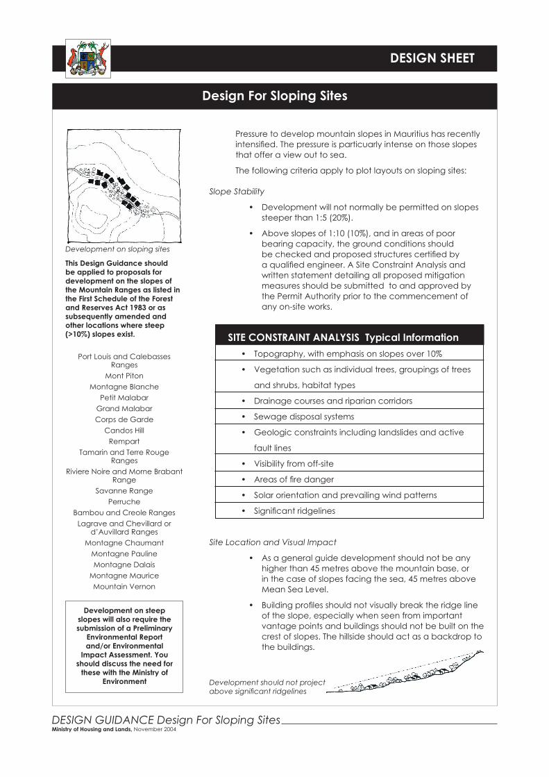
Development on sloping sites
This Design Guidance should be applied to proposals for development on the slopes of the Mountain Ranges as listed in the First Schedule of the Forest and Reserves Act 1983 or as subsequently amended and other locations where steep (>10%) slopes exist.
Port Louis and Calebasses Ranges
Mont PitonMontagne Blanche
Petit MalabarGrand MalabarCorps de Garde
Candos HillRempart
Tamarin and Terre Rouge Ranges
Riviere Noire and Morne Brabant Range
Savanne RangePerruche
Bambou and Creole RangesLagrave and Chevillard or
d’Auvillard RangesMontagne Chaumant
Montagne PaulineMontagne Dalais
Montagne MauriceMountain Vernon
SITE CONSTRAINT ANALYSIS Typical Information• Topography, with emphasis on slopes over 10%
• Vegetation such as individual trees, groupings of trees
and shrubs, habitat types
• Drainage courses and riparian corridors
• Sewage disposal systems
• Geologic constraints including landslides and active
fault lines
• Visibility from off-site
• Areas of fire danger
• Solar orientation and prevailing wind patterns
• Significant ridgelines
Development on steep slopes will also require the submission of a Preliminary
Environmental Report and/or Environmental
Impact Assessment. You should discuss the need for
these with the Ministry of Environment Development should not project
above significant ridgelines

DESIGN GUIDANCE Design For Sloping SitesMinistry of Housing and Lands, November 2004
DESIGN SHEET
Design For Sloping Sites
• Care should be taken to protect the view of dwellings both above and below any new development, and unit spacing should be such that views of the natural landscape are retained
• Buildings and structures should be set back far enough from ridges and cliff edges so that the structure does not appear to be perched on the edge
• The mountain or slope should act as the backdrop to the building. This is far more preferable to having the building project into a blue sky background. If the building or structure does break the plane of the natural backdrop, it should be designed to mimic the natural lines of the mountains and hillsides
Existing and new vegetation should be placed to soften the mass of building as viewed from off site
• Buildings should be placed far enough apart to reveal views of the mountain and the natural landscaped backdrop from other buildings and downslope
restricting new building to within this area will protect the views of units at a higher level
Protection of views
Inland FacingSeaward Facing
Limit of Development
Limit of Development
Plateau
Slope <4%
Slope >4%
Mountain base
45 m
45 m
Mean Sea Level
Scree Slopes
Height limitation of development on mountain slopes
Set buildings back from the edge of ridges and cliffs
O
P
OP
Avoid long unbroken building forms

DESIGN GUIDANCE Design For Sloping SitesMinistry of Housing and Lands, November 2004
DESIGN SHEET
Design For Sloping Sites
• Buildings sited to maximise views at the expense of natural vegetation should be resisted
Buildings should not appear overly prominent or obtrusive
• Buildings should be planned to enhance a site’s natural features. The form, mass, profile and architectural features should be designed to blend with the natural terrain and preserve the undulating profile of the slopes. Multi storey buildings on or close to ridge lines should be avoided and on all sites lower profile buildings should be encouraged
• In areas of varying topography, buildings higher than their surroundings are particularly prominent and due consideration must be given to distant views and important skylines. The same dwelling sited at different heights and locations can have very different impacts on the hillside and skyline. Permit applications for development on slopes must include sufficient information for judgements to be made regarding the acceptability of the development; for instance photo montages, elevations over a wide area showing the setting of the building as well as sections and contours.
• Existing vegetation should be used to soften structural mass and blend buildings into natural settings
O
Avoid the cumulative impact of buildings dominating slopes
Building is perpendicular to contours
O
Building is parallel with the contours
P
Use varied slopes and berms to resemble natural features
Sharp angles and uniform slope banks appear unnatural
O
P

DESIGN GUIDANCE Design For Sloping SitesMinistry of Housing and Lands, November 2004
DESIGN SHEET
Design For Sloping Sites
• Careful consideration should be given to the potential cumulative impacts of development within the hillside setting and upon existing ridgelines. Ensure sufficient space is retained between buildings to reveal appropriate views of ridges and the natural landscaped backdrop.
Architectural Form
• The form, massing and architectural features of buildings should be designed to blend with the natural terrain and preserve the undulations of the slopes. Roofs should be orientated in the direction of the slope and large gable ends should be avoided
• Contrasting and varied horizontal and vertical building planes should be used to create various light, shade, and shadow patterns to reduce perceived bulk. Large expanses of wall in a single plane on downhill elevations should be avoided
• The maximum height of buildings should not normally exceed 7.5m. The maximum height of a building’s combined elevation should not normally exceed 10.5m measured from the lowest part of the building to the highest
• The height of the lowest finished floor(s) of a structure, excluding basements, should not be more than 1.2m above existing grade to ensure buildings follow slopes
Building form reflects hillside form and setting:• Stepped into the slope• Use of natural materials• Small roof areas
O
P
O
P
P
The maximum height of buildings on sloping sites
10.5
m -
max
imum
hei
ght
of c
umul
ativ
e el
evat
ion
7.5m
M
ax
7.5m
M
ax
The maximum height of the lowest finished floor of a building 1.
2m M
ax

DESIGN GUIDANCE Design For Sloping SitesMinistry of Housing and Lands, November 2004
DESIGN SHEET
Design For Sloping Sites
• Retaining walls and structures should be planned in a curvilinear manner that reflects the natural contours of the landscape, and materials and finishes should harmonise both with the terrain and the buildings on the site
• Long unbroken rooflines should be avoided. Instead, roofs should be broken into smaller components to reflect the irregular natural hillside patterns. The roof should be orientated in the same direction of the slope contour and large gable ends on downhill elevations should be avoided
• Dark or earthtone colours should be used to make the building less conspicuous as seen from off site. White or light colours should be avoided. The colours used for buildings should harmonise with the natural colours of the hillside.
Infrastructure
Highways and utility infrastructure services should be of a high standard for developments on steep slopes:
• Roads should be laid out to avoid steep grades and should normally not exceed 1:8 (12.5%))
• Stormwater should be disposed of within the plot boundary or to a centralised stormwater soakaway system and should not be allowed to flow to adjacent plots or into road reserves
• Special care is needed to control surface water drainage and engineering studies should be provided to show the effect that drainage might have on other properties. Inadequate drainage may trigger land slips
• On-site sewage and waste water disposal systems must take account of soil characteristics. The use of septic tanks may not be possible, or special designs might be required, because of the risk of effluent appearing at the surface in land/properties below the site being developed
• Underground utility services and poles should not be placed in made-up ground
• Water pressure from Central Water Authority facilities should be adequate to reach the upper limits of development on a high slope. A minimum residual pressure of 10 metres at property boundary is recommended
• The provision of water to properties above the level of existing water storage reservoirs, or remote from the existing supply network may be difficult and/or costly to achieve. Early discussion should be held with the Central Water Authority.
Slope changes should appear as natural as possible
P
O
P
O
P