
SJ Geomatics Brochure
15
GPS - LAND - BUILDING - UNDERGROUND - BIM - SCANNING S U R V E Y O R S
-
Upload
steve-jones -
Category
Documents
-
view
45 -
download
0
Transcript of SJ Geomatics Brochure

GPS - LAND - BUILDING - UNDERGROUND - BIM - SCANNING S U R V E Y O R S
GPS - LAND - BUILDING - UNDERGROUND - BIM - SCANNING S U R V E Y O R S
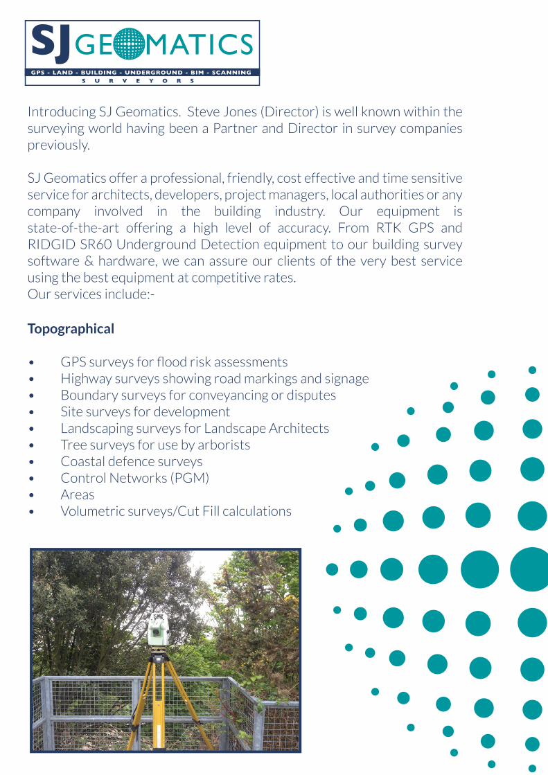
Introducing SJ Geomatics. Steve Jones (Director) is well known within the surveying world having been a Partner and Director in survey companies previously.
SJ Geomatics offer a professional, friendly, cost effective and time sensitive service for architects, developers, project managers, local authorities or any company involved in the building industry. Our equipment is state-of-the-art offering a high level of accuracy. From RTK GPS and RIDGID SR60 Underground Detection equipment to our building survey software & hardware, we can assure our clients of the very best service using the best equipment at competitive rates.Our services include:-
Topographical
• GPS surveys for flood risk assessments • Highway surveys showing road markings and signage • Boundary surveys for conveyancing or disputes • Site surveys for development • Landscaping surveys for Landscape Architects • Tree surveys for use by arborists • Coastal defence surveys • Control Networks (PGM) • Areas • Volumetric surveys/Cut Fill calculations

GPS - LAND - BUILDING - UNDERGROUND - BIM - SCANNING S U R V E Y O R S
GPS Surveys
GPS surveys for flood risk assessments • Boundary surveys which overlay with Ordnance Survey data • Real-time Setting Out • Large Scale topographical surveys at a fraction of the cost •
Measured Building Surveys
Scaled floor plans to suit specification and scale• General Arrangement Plans• Elevations (Basic or Detailed)• Street Scenes • Internal Elevations• Sections (minimum of 1 in each direction)• Photogrammetry • Roof Plans •
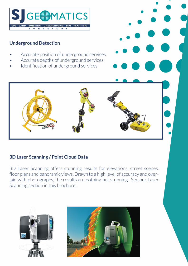
Underground Detection
• Accurate position of underground services • Accurate depths of underground services • Identification of underground services
3D Laser Scanning / Point Cloud Data
3D Laser Scanning offers stunning results for elevations, street scenes, floor plans and panoramic views. Drawn to a high level of accuracy and over-laid with photography, the results are nothing but stunning. See our Laser Scanning section in this brochure.
GPS - LAND - BUILDING - UNDERGROUND - BIM - SCANNING S U R V E Y O R S
GPS - LAND - BUILDING - UNDERGROUND - BIM - SCANNING S U R V E Y O R S
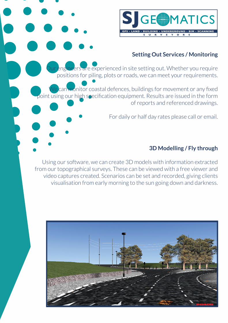
Setting Out Services / Monitoring
Our engineers are experienced in site setting out. Whether you require positions for piling, plots or roads, we can meet your requirements.
We can monitor coastal defences, buildings for movement or any fixed point using our high specification equipment. Results are issued in the form
of reports and referenced drawings.
For daily or half day rates please call or email.
3D Modelling / Fly through
Using our software, we can create 3D models with information extracted from our topographical surveys. These can be viewed with a free viewer and
video captures created. Scenarios can be set and recorded, giving clients visualisation from early morning to the sun going down and darkness.
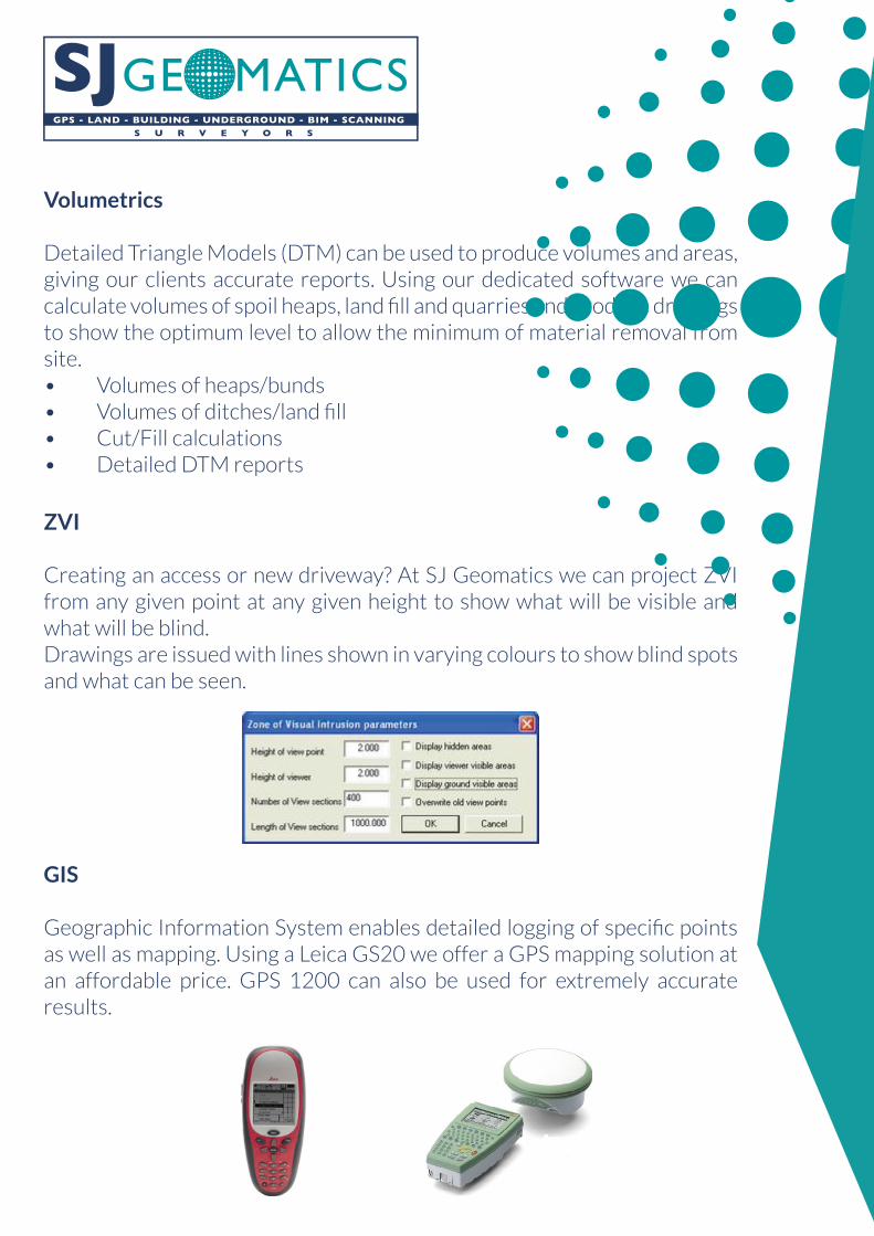
Volumetrics
Detailed Triangle Models (DTM) can be used to produce volumes and areas, giving our clients accurate reports. Using our dedicated software we can calculate volumes of spoil heaps, land fill and quarries and produce drawings to show the optimum level to allow the minimum of material removal from site.• Volumes of heaps/bunds • Volumes of ditches/land fill • Cut/Fill calculations • Detailed DTM reports
ZVI
Creating an access or new driveway? At SJ Geomatics we can project ZVI from any given point at any given height to show what will be visible and what will be blind.Drawings are issued with lines shown in varying colours to show blind spots and what can be seen.
GIS
Geographic Information System enables detailed logging of specific points as well as mapping. Using a Leica GS20 we offer a GPS mapping solution at an affordable price. GPS 1200 can also be used for extremely accurate results.
GPS - LAND - BUILDING - UNDERGROUND - BIM - SCANNING S U R V E Y O R S

GPS - LAND - BUILDING - UNDERGROUND - BIM - SCANNING S U R V E Y O R S
HDS Laser Scanning
Chemistries + foods
Heritage Forensic + Accident research
Large Products
Power plant + nuclear industry
Petrochemical industry
Process -automation
Forestry + Landscape
Architecture + Construction
Automotive Railway + Highway
Mining + Tunnel
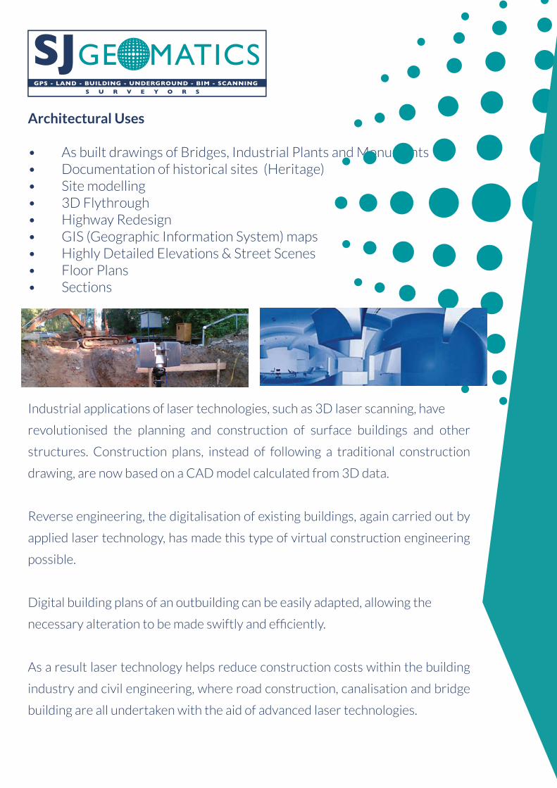
Architectural Uses
• As built drawings of Bridges, Industrial Plants and Monuments • Documentation of historical sites (Heritage)• Site modelling • 3D Flythrough• Highway Redesign • GIS (Geographic Information System) maps• Highly Detailed Elevations & Street Scenes• Floor Plans• Sections
Industrial applications of laser technologies, such as 3D laser scanning, have
revolutionised the planning and construction of surface buildings and other
structures. Construction plans, instead of following a traditional construction
drawing, are now based on a CAD model calculated from 3D data.
Reverse engineering, the digitalisation of existing buildings, again carried out by
applied laser technology, has made this type of virtual construction engineering
possible.
Digital building plans of an outbuilding can be easily adapted, allowing the
necessary alteration to be made swiftly and efficiently.
As a result laser technology helps reduce construction costs within the building
industry and civil engineering, where road construction, canalisation and bridge
building are all undertaken with the aid of advanced laser technologies.
GPS - LAND - BUILDING - UNDERGROUND - BIM - SCANNING S U R V E Y O R S

GPS - LAND - BUILDING - UNDERGROUND - BIM - SCANNING S U R V E Y O R S
Road & Rail
Road & rail construction naturally needs precise mobile measurement systems, like portable laser scanner and measurement devices, which can scan the entire project. Tailor made software solutions can deal with the
size of this information.
3D analysis software works with a Laser Scanner to translate data gathered by laser scanning during and after highway
construction into point cloud data.
Motorway construction, rail track construction and tunnel systems appear challenging to most measurement systems by the sheer size of the
infrastructure alone.
Laser Scanning is ideally suited to work of this kind, as it can operate mounted on a vehicle. Civil engineering further routinely employs portable
measurement devices such as the Laser Scanner and Laser Tracker in construction engineering, bridge building, tunnel construction work and
urban street construction.
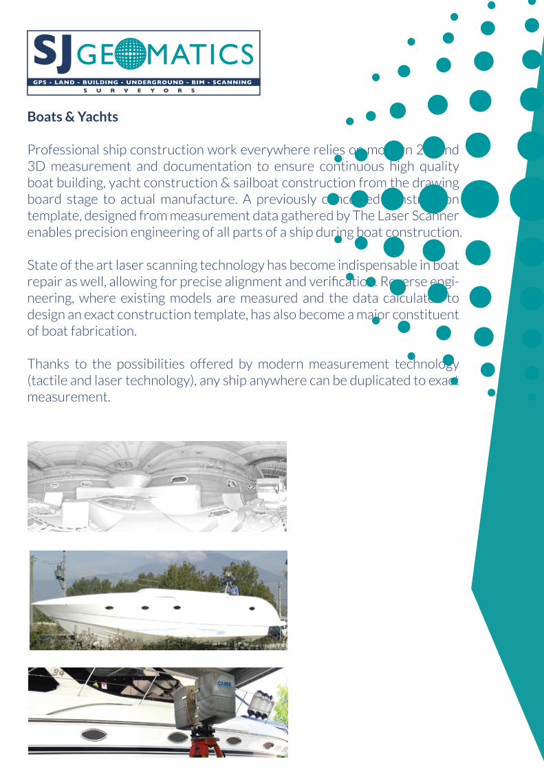
Boats & Yachts
Professional ship construction work everywhere relies on modern 2D and 3D measurement and documentation to ensure continuous high quality boat building, yacht construction & sailboat construction from the drawing board stage to actual manufacture. A previously conceived construction template, designed from measurement data gathered by The Laser Scanner enables precision engineering of all parts of a ship during boat construction.
State of the art laser scanning technology has become indispensable in boat repair as well, allowing for precise alignment and verification. Reverse engi-neering, where existing models are measured and the data calculated to design an exact construction template, has also become a major constituent of boat fabrication.
Thanks to the possibilities offered by modern measurement technology (tactile and laser technology), any ship anywhere can be duplicated to exact measurement.
GPS - LAND - BUILDING - UNDERGROUND - BIM - SCANNING S U R V E Y O R S
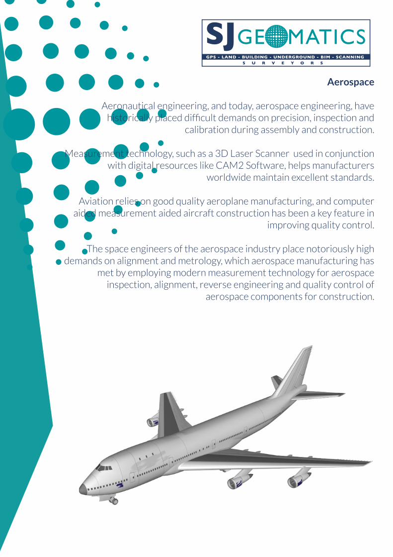
Aerospace
Aeronautical engineering, and today, aerospace engineering, have historically placed difficult demands on precision, inspection and
calibration during assembly and construction.
Measurement technology, such as a 3D Laser Scanner used in conjunction with digital resources like CAM2 Software, helps manufacturers
worldwide maintain excellent standards.
Aviation relies on good quality aeroplane manufacturing, and computer aided measurement aided aircraft construction has been a key feature in
improving quality control.
The space engineers of the aerospace industry place notoriously high demands on alignment and metrology, which aerospace manufacturing has
met by employing modern measurement technology for aerospace inspection, alignment, reverse engineering and quality control of
aerospace components for construction.
GPS - LAND - BUILDING - UNDERGROUND - BIM - SCANNING S U R V E Y O R S
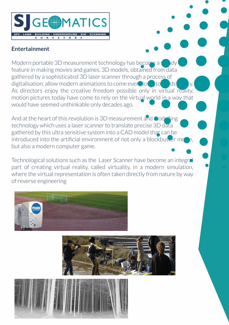
Entertainment
Modern portable 3D measurement technology has become a steady feature in making movies and games. 3D models, obtained from data gathered by a sophisticated 3D laser scanner through a process of digitalisation, allow modern animations to come ever closer towards reality. As directors enjoy the creative freedom possible only in virtual reality, motion pictures today have come to rely on the virtual world in a way that would have seemed unthinkable only decades ago.
And at the heart of this revolution is 3D measurement and modelling technology which uses a laser scanner to translate precise 3D data gathered by this ultra sensitive system into a CAD model that can be introduced into the artificial environment of not only a blockbuster movie, but also a modern computer game.
Technological solutions such as the Laser Scanner have become an integral part of creating virtual reality, called virtuality, in a modern simulation, where the virtual representation is often taken directly from nature by way of reverse engineering
GPS - LAND - BUILDING - UNDERGROUND - BIM - SCANNING S U R V E Y O R S
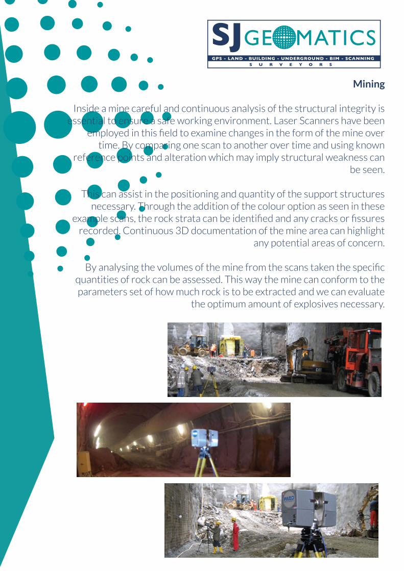
Mining
Inside a mine careful and continuous analysis of the structural integrity is essential to ensure a safe working environment. Laser Scanners have been
employed in this field to examine changes in the form of the mine over time. By comparing one scan to another over time and using known
reference points and alteration which may imply structural weakness can be seen.
This can assist in the positioning and quantity of the support structures necessary. Through the addition of the colour option as seen in these
example scans, the rock strata can be identified and any cracks or fissures recorded. Continuous 3D documentation of the mine area can highlight
any potential areas of concern.
By analysing the volumes of the mine from the scans taken the specific quantities of rock can be assessed. This way the mine can conform to the parameters set of how much rock is to be extracted and we can evaluate
the optimum amount of explosives necessary.
GPS - LAND - BUILDING - UNDERGROUND - BIM - SCANNING S U R V E Y O R S
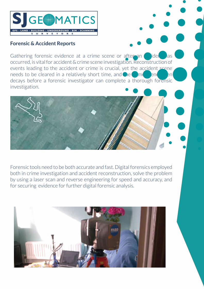
Forensic & Accident Reports
Gathering forensic evidence at a crime scene or after an accident has occurred, is vital for accident & crime scene investigation. Reconstruction of events leading to the accident or crime is crucial, yet the accident scene needs to be cleared in a relatively short time, and the crime scene often decays before a forensic investigator can complete a thorough forensic investigation.
Forensic tools need to be both accurate and fast. Digital forensics employed both in crime investigation and accident reconstruction, solve the problem by using a laser scan and reverse engineering for speed and accuracy, and for securing evidence for further digital forensic analysis.
GPS - LAND - BUILDING - UNDERGROUND - BIM - SCANNING S U R V E Y O R S
GPS - LAND - BUILDING - UNDERGROUND - BIM - SCANNING S U R V E Y O R S
Contact Us
27 Norwich Road, Halesworth IP19 8BX
Tel: 01986 874721 / 0844 6697544
Fax: 01986 875175 / 0844 6697545
Steve Jones - [email protected]
Also at:-
8 Speyside Court, Orton Southgate, Peterborough PE2 6SN