Sixth Grade Social Studies - Dearborn Public Schools · Sixth Grade Social Studies World Geography...
26
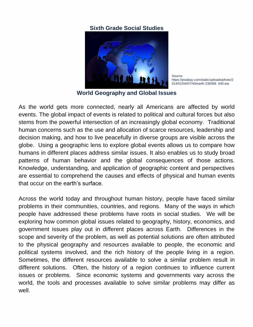
Sixth Grade Social Studies World Geography and Global Issues As the world gets more connected, nearly all Americans are affected by world events. The global impact of events is related to political and cultural forces but also stems from the powerful intersection of an increasingly global economy. Traditional human concerns such as the use and allocation of scarce resources, leadership and decision making, and how to live peacefully in diverse groups are visible across the globe. Using a geographic lens to explore global events allows us to compare how humans in different places address similar issues. It also enables us to study broad patterns of human behavior and the global consequences of those actions. Knowledge, understanding, and application of geographic content and perspectives are essential to comprehend the causes and effects of physical and human events that occur on the earth’s surface. Across the world today and throughout human history, people have faced similar problems in their communities, countries, and regions. Many of the ways in which people have addressed these problems have roots in social studies. We will be exploring how common global issues related to geography, history, economics, and government issues play out in different places across Earth. Differences in the scope and severity of the problem, as well as potential solutions are often attributed to the physical geography and resources available to people, the economic and political systems involved, and the rich history of the people living in a region. Sometimes, the different resources available to solve a similar problem result in different solutions. Often, the history of a region continues to influence current issues or problems. Since economic systems and governments vary across the world, the tools and processes available to solve similar problems may differ as well. Source: https://pixabay.com/static/uploads/photo/2 014/01/04/07/40/earth-238368_640.jpg
Transcript of Sixth Grade Social Studies - Dearborn Public Schools · Sixth Grade Social Studies World Geography...
Sixth Grade Social Studies
World Geography and Global Issues
As the world gets more connected, nearly all Americans are affected by world
events. The global impact of events is related to political and cultural forces but also
stems from the powerful intersection of an increasingly global economy. Traditional
human concerns such as the use and allocation of scarce resources, leadership and
decision making, and how to live peacefully in diverse groups are visible across the
globe. Using a geographic lens to explore global events allows us to compare how
humans in different places address similar issues. It also enables us to study broad
patterns of human behavior and the global consequences of those actions.
Knowledge, understanding, and application of geographic content and perspectives
are essential to comprehend the causes and effects of physical and human events
that occur on the earth’s surface.
Across the world today and throughout human history, people have faced similar
problems in their communities, countries, and regions. Many of the ways in which
people have addressed these problems have roots in social studies. We will be
exploring how common global issues related to geography, history, economics, and
government issues play out in different places across Earth. Differences in the
scope and severity of the problem, as well as potential solutions are often attributed
to the physical geography and resources available to people, the economic and
political systems involved, and the rich history of the people living in a region.
Sometimes, the different resources available to solve a similar problem result in
different solutions. Often, the history of a region continues to influence current
issues or problems. Since economic systems and governments vary across the
world, the tools and processes available to solve similar problems may differ as
well.
Source: https://pixabay.com/static/uploads/photo/2014/01/04/07/40/earth-238368_640.jpg

Sixth Grade World Geography and Global Issues
Michigan Citizenship Collaborative Curriculum Page 2 of 26 Copyright © 2010-2015 by Oakland Schools September 2, 2015
The goal of this course is to explore common issues that face humanity. Despite
the wide variation in geography, culture, history, and political and economic
systems, the bond we share – as members of humanity – enable us to learn from
each other as we address global issues. After all, we share the planet, so
developing a global perspective will benefit our collective future.
This course takes a global approach to world geography. It is designed to challenge
you to think globally in exploring public issues and to analyze global or cross
regional patterns and interactions. Such thinking and analyses are essential for you
to be successful in an increasingly flat, interconnected world.
This course contains the following units of study:
Foundations of World Geography
The World in Spatial Terms (Physical Geography)
Population and Migration
Culture
Human-Environment Interactions
Economics and World Trade
Civics, Government, and Global Politics
Source: https://www.flickr.com/photos/55524309@N05/5377717047

Sixth Grade World Geography and Global Issues
Michigan Citizenship Collaborative Curriculum Page 3 of 26 Copyright © 2010-2015 by Oakland Schools September 2, 2015
Unit 1: Foundations of World Geography
Below are three questions we will be investigating in this unit. Read the questions
and think about what you already know that can help you understand each one.
Focus Questions
1. How can the five themes of geography help us understand our world?
2. How can the approaches and perspectives of different social scientists help us
understand our world?
3. What makes an issue or problem global?
This unit will introduce you to the study of geography. While you have probably
explored geographic concepts before, this course focuses on a global perspective.
That means we are going to investigate the geography of the world. Since the world
is rather big, we are going to start with some foundational ideas.
What is geography?
Whether you know it or not, geography is a part of your every-day life. From the
foods you eat to the type of home you live in, geography affects your life.
Geography is the social studies field that investigates the earth and the ways
humans interact with it. An expert on geography is called a geographer.
Graphic.SS0601. MC3 Project

Sixth Grade World Geography and Global Issues
Michigan Citizenship Collaborative Curriculum Page 4 of 26 Copyright © 2010-2015 by Oakland Schools September 2, 2015
Geographers are social scientists who study Earth’s physical features, how people
use, modify, or adapt to those features, and the consequences of those actions.
Geographers work in many different areas such as education, disaster response,
city and county planning, community development, environmental management and
more. As we begin our examination of geography, we will start by exploring two
questions about places that may be familiar to you: “Where is it?” and “Why is it
there?”
Physical and Human Geography
Below is a list of definitions for geography from different sources:
Geography is the study of the earth as the home of people.
Geography is the study of the patterns and processes of human (built) and
environmental (natural) landscapes, where landscapes comprise real and
perceived space.
Geography studies the relationship between people and their environment.
Geography is the study of humans interacting with their environment including
the physical environment, the built environment and socially constructed
spaces.
Geography is a spatial perspective of all human and physical phenomena.
Geography is the study of the interaction between people and environments.
Geography is the study of relationships between humans and their
environment by emphasizing a spatial and environmental perspective at a
variety of scales.
Many of the definitions refer to physical
features of the earth and to people. This
is because there are two different areas of
geography: physical geography and
human geography. Physical geography is
the study of the natural characteristics of
Earth. This includes the study of
landforms, bodies of water, vegetation,
and climate. Human geography is the
study of the ways people interact with the
earth. When geographers investigate how
Graphic.SS0601.1. MC3 Project

Sixth Grade World Geography and Global Issues
Michigan Citizenship Collaborative Curriculum Page 5 of 26 Copyright © 2010-2015 by Oakland Schools September 2, 2015
humans interact with the earth, such as building a bridge over a waterway or a large
building in a city, then it involves human geography. Some other investigations that
fall under human geography deal with culture, migration, and population.
A common way to learn about geography is by studying small places first and then
expanding to larger regions. This is known as “expanding environments.” When
you learned about your local community, you probably used maps that enabled you
to see human and physical features of your community. Similarly, when you
explored Michigan in elementary school, you probably explored the natural beauty
of Michigan – its physical features such as Pictured Rocks, Sleeping Bear Dunes,
and the Great Lakes. From bridges to buildings, Michigan also has many human
features. Below are several geographic features found in Michigan.
Satellite view of the Great
Lakes
Source: https://commons.wikimedia.org/wiki/File:Great_Lakes_region_as_viewed_from_the_Moderate_Resolution_Imaging_Spectroradiometer_on_NASA%E2%80%99s_Aqua_satellite_on_28_August_2010_at_1330_Central_Daylight_Time.png
Sleeping Bear Dunes,
Michigan
Source: http://www.nps.gov/slbe/planyourvisit/psscenicdrive.htm
Indian Head, Pictured
Rocks, Michigan
Source: https://en.wikipedia.org/wiki/Pictured_Rocks_National_Lakeshore
The Mackinac Bridge
Source: http://www.michigan.gov/mdot/0,4616,7-151-9618_11016-273281--,00.html
The Capitol Building in Lansing
Source: http://mediad.publicbroadcasting.net/p/michigan/files/styles/related/public/201103/thetoad_2.jpg
One of the many lighthouses in Michigan
Source: https://www.unc.edu/~rowlett/lighthouse/miwl.htm as posted in White Shoal Light, Lake Michigan, January 200. Flickr Creative Commons photo by C.W. Bash
Sixth Grade World Geography and Global Issues
Michigan Citizenship Collaborative Curriculum Page 6 of 26 Copyright © 2010-2015 by Oakland Schools September 2, 2015
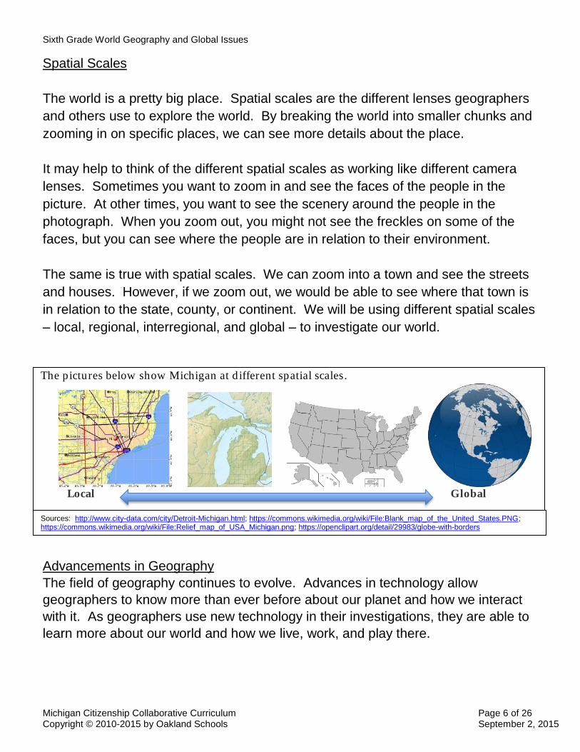
Spatial Scales
The world is a pretty big place. Spatial scales are the different lenses geographers
and others use to explore the world. By breaking the world into smaller chunks and
zooming in on specific places, we can see more details about the place.
It may help to think of the different spatial scales as working like different camera
lenses. Sometimes you want to zoom in and see the faces of the people in the
picture. At other times, you want to see the scenery around the people in the
photograph. When you zoom out, you might not see the freckles on some of the
faces, but you can see where the people are in relation to their environment.
The same is true with spatial scales. We can zoom into a town and see the streets
and houses. However, if we zoom out, we would be able to see where that town is
in relation to the state, county, or continent. We will be using different spatial scales
– local, regional, interregional, and global – to investigate our world.
Advancements in Geography
The field of geography continues to evolve. Advances in technology allow
geographers to know more than ever before about our planet and how we interact
with it. As geographers use new technology in their investigations, they are able to
learn more about our world and how we live, work, and play there.
The pictures below show Michigan at d ifferent spatial scales.
Local Global
Sources: http://www.city-data.com/city/Detroit-Michigan.html; https://commons.wikimedia.org/wiki/File:Blank_map_of_the_United_States.PNG; https://commons.wikimedia.org/wiki/File:Relief_map_of_USA_Michigan.png; https://openclipart.org/detail/29983/globe-with-borders
Sixth Grade World Geography and Global Issues
Michigan Citizenship Collaborative Curriculum Page 7 of 26 Copyright © 2010-2015 by Oakland Schools September 2, 2015
What is geographic inquiry?
Understanding the way in which social scientists investigate problems will help you
conduct your own investigations about problems or issues facing your community
and our world. Geographers use an inquiry process to answer geographic
questions. While the inquiry process in general applies to all social scientists, the
types of questions geographers ask, the evidence they use, and their ways of
knowing differ from other social scientists. By combining the perspectives of
different social scientists, we get a more complete picture of our world and our place
in it.
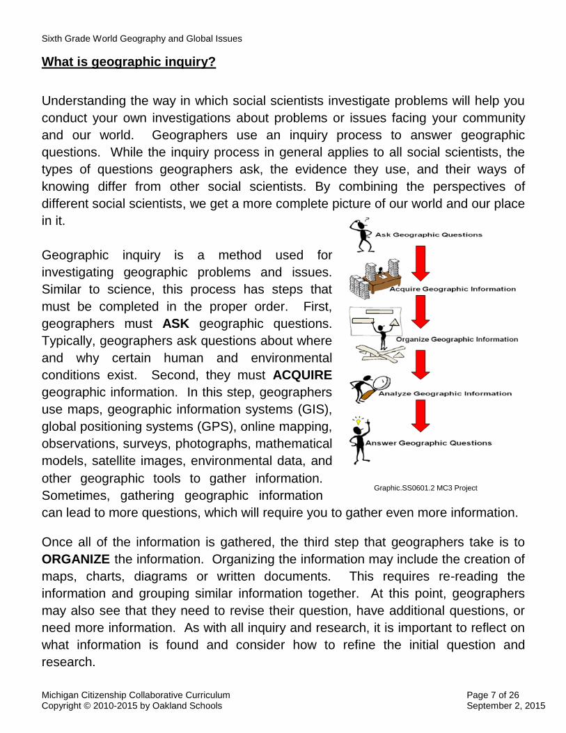
Geographic inquiry is a method used for
investigating geographic problems and issues.
Similar to science, this process has steps that
must be completed in the proper order. First,
geographers must ASK geographic questions.
Typically, geographers ask questions about where
and why certain human and environmental
conditions exist. Second, they must ACQUIRE
geographic information. In this step, geographers
use maps, geographic information systems (GIS),
global positioning systems (GPS), online mapping,
observations, surveys, photographs, mathematical
models, satellite images, environmental data, and
other geographic tools to gather information.
Sometimes, gathering geographic information
can lead to more questions, which will require you to gather even more information.
Once all of the information is gathered, the third step that geographers take is to
ORGANIZE the information. Organizing the information may include the creation of
maps, charts, diagrams or written documents. This requires re-reading the
information and grouping similar information together. At this point, geographers
may also see that they need to revise their question, have additional questions, or
need more information. As with all inquiry and research, it is important to reflect on
what information is found and consider how to refine the initial question and
research.
Graphic.SS0601.2 MC3 Project
Sixth Grade World Geography and Global Issues
Michigan Citizenship Collaborative Curriculum Page 8 of 26 Copyright © 2010-2015 by Oakland Schools September 2, 2015
The fourth task is to ANALYZE the geographic information. To look deeper into the
information, geographers search for patterns and connections within the data.
Analysis allows geographers to make predictions and inferences in order to answer
the initial geographic questions. Sometimes, however, an analysis can raise new
questions for investigation. If so, more research and organization may be needed.
Finally, geographers will ANSWER the questions by drawing conclusions from the
data they have collected and organized. However, it is not enough for a geographer
to simply find an answer. They also may make recommendations for action. An
important part of the geographic inquiry process is communicating to others in order
to implement an action plan. Geographers communicate orally and in writing. The
writing may be in either print or electronic media.
Throughout the year we will employ the geographic inquiry process as we study
global problems and issues. Remember, geographers ASK, ACQUIRE,
ORGANIZE, ANALYZE and ANSWER geographic questions.
What Tools and Technologies Do Geographers Use?
Geographers use a variety of tools and technologies in investigating geographic
questions. Maps and globes both represent the earth, but each has its own
advantages and disadvantages. A Global Positioning System (GPS) can help
geographers answer the question of “Where is it?” Aerial photographs and satellite
images can help geographers understand how places look today and how they have
changed over time. Graphs, charts, and diagrams provide geographers with a
means for recording, organizing, or categorizing the data they collect to find patterns
and trends.
Once a geographer identifies an issue or question such as “Why is a river polluted?”
he or she needs to acquire geographic information that can be helpful in answering
the question. In gathering this data, geographers use a variety of tools and
technologies.
What geographic tools do you think geographers use?
What geographic tools have you used?

Sixth Grade World Geography and Global Issues
Michigan Citizenship Collaborative Curriculum Page 9 of 26 Copyright © 2010-2015 by Oakland Schools September 2, 2015
Maps
Maps are probably the most common tool used to answer geographic questions.
They provide a visual description or portrayal of the earth or parts of the earth.
Maps can reflect a great variety of spatial scales. For instance, maps can represent
a place such as a town, a country, or even as large as a continent.
Maps illustrate information about geographic areas, and every map has at least one
purpose. For example, some maps show the natural features of a region such as
rivers, lakes, or mountains. Maps may also show human features as well. Some
common human characteristics found on maps include roads, railroad tracks,
airports, or homes. Since maps can be used to represent a variety of information, it
is important to ask, “What is the mapmaker trying to show me?” when first looking at
a map. By orienting yourself to the map’s purpose, it is easier to read and make
sense of the information on the map.
Maps have both advantages and disadvantages. One big advantage of maps is
that they are convenient to carry. Another advantage is that maps can be made to
represent a variety of different features about a place. However, maps do have a
major limitation. Can you think of what this may be?
Let’s try an experiment. Locate a cup or a mug and place it on the floor beside your
feet. Now stand over the cup. How would you draw what the cup looks like? Now
put the cup on a table in front of you, viewing it at eye level. Think about how the
cup looks now. If you draw the cup from this perspective, would your two drawings
look different? It is likely that the drawings are different because you viewed the
cup from two very different perspectives, and each drawing represents a different
view of the cup. Since the cup is three-dimensional, it is impossible to represent it
in two dimensions, such as a drawing, without losing some information.
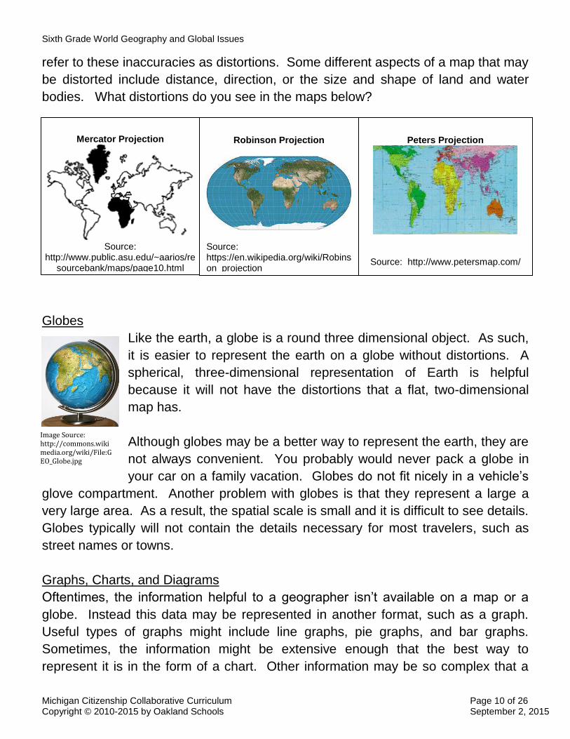
This is the same problem people face in creating maps. Earth is round and three
dimensional, but maps are flat and two-dimensional. The only way to represent the
spherical, three-dimensional earth on a flat, two-dimensional map is by stretching or
distorting certain areas. Different cartographers (map makers) have used different
ways, or projections, to represent the earth (a round three dimensional object) on a
map. In doing so, some information on the map becomes inaccurate. Geographers
Sixth Grade World Geography and Global Issues
Michigan Citizenship Collaborative Curriculum Page 10 of 26 Copyright © 2010-2015 by Oakland Schools September 2, 2015
refer to these inaccuracies as distortions. Some different aspects of a map that may
be distorted include distance, direction, or the size and shape of land and water
bodies. What distortions do you see in the maps below?
Globes
Like the earth, a globe is a round three dimensional object. As such,
it is easier to represent the earth on a globe without distortions. A
spherical, three-dimensional representation of Earth is helpful
because it will not have the distortions that a flat, two-dimensional
map has.
Although globes may be a better way to represent the earth, they are
not always convenient. You probably would never pack a globe in
your car on a family vacation. Globes do not fit nicely in a vehicle’s
glove compartment. Another problem with globes is that they represent a large a
very large area. As a result, the spatial scale is small and it is difficult to see details.
Globes typically will not contain the details necessary for most travelers, such as
street names or towns.
Graphs, Charts, and Diagrams
Oftentimes, the information helpful to a geographer isn’t available on a map or a
globe. Instead this data may be represented in another format, such as a graph.
Useful types of graphs might include line graphs, pie graphs, and bar graphs.
Sometimes, the information might be extensive enough that the best way to
represent it is in the form of a chart. Other information may be so complex that a
Mercator Projection
Source:
http://www.public.asu.edu/~aarios/resourcebank/maps/page10.html
Peters Projection
Source: http://www.petersmap.com/
Robinson Projection
Source: https://en.wikipedia.org/wiki/Robinson_projection
Image Source: http://commons.wikimedia.org/wiki/File:GEO_Globe.jpg
Sixth Grade World Geography and Global Issues
Michigan Citizenship Collaborative Curriculum Page 11 of 26 Copyright © 2010-2015 by Oakland Schools September 2, 2015
diagram might be the best representation of the information. Since graphs, charts,
and diagrams can serve different purposes, geographers use their best judgment in
determining which format to use.
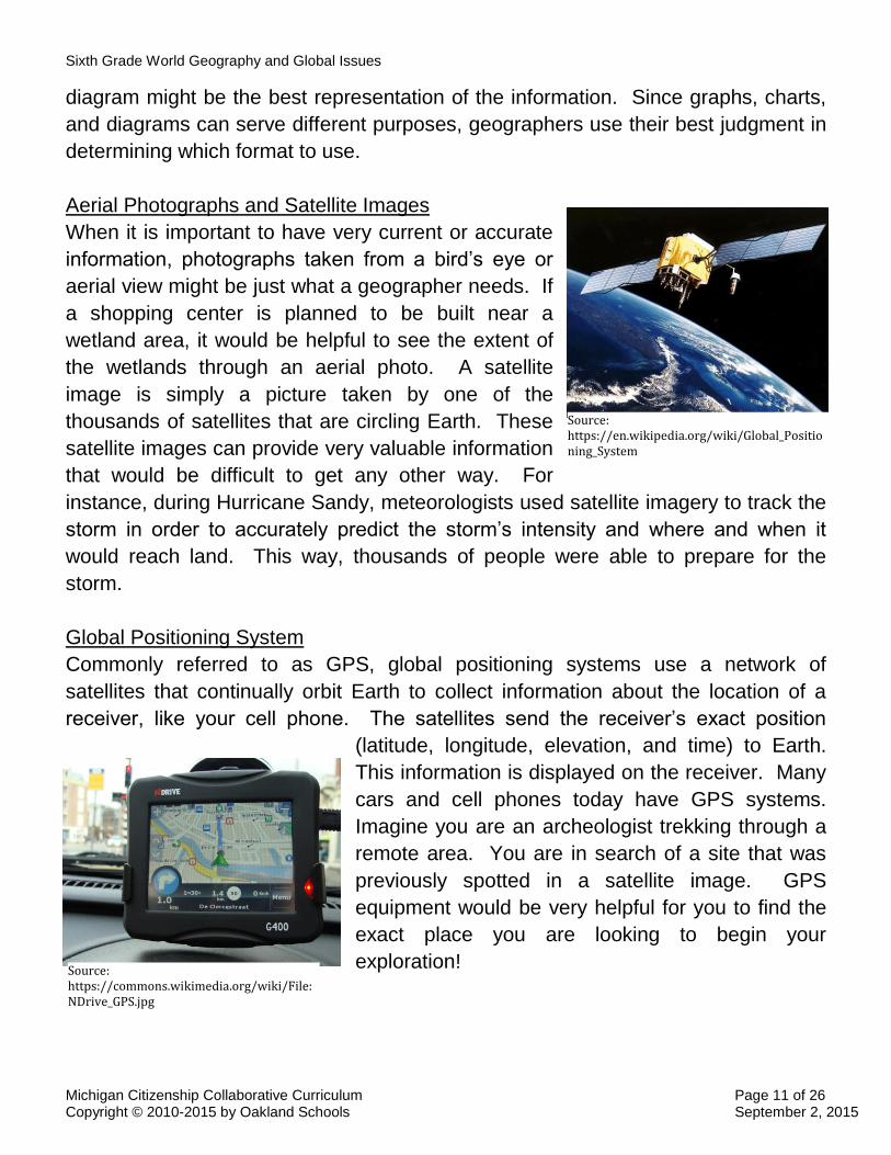
Aerial Photographs and Satellite Images
When it is important to have very current or accurate
information, photographs taken from a bird’s eye or
aerial view might be just what a geographer needs. If
a shopping center is planned to be built near a
wetland area, it would be helpful to see the extent of
the wetlands through an aerial photo. A satellite
image is simply a picture taken by one of the
thousands of satellites that are circling Earth. These
satellite images can provide very valuable information
that would be difficult to get any other way. For
instance, during Hurricane Sandy, meteorologists used satellite imagery to track the
storm in order to accurately predict the storm’s intensity and where and when it
would reach land. This way, thousands of people were able to prepare for the
storm.
Global Positioning System
Commonly referred to as GPS, global positioning systems use a network of
satellites that continually orbit Earth to collect information about the location of a
receiver, like your cell phone. The satellites send the receiver’s exact position
(latitude, longitude, elevation, and time) to Earth.
This information is displayed on the receiver. Many
cars and cell phones today have GPS systems.
Imagine you are an archeologist trekking through a
remote area. You are in search of a site that was
previously spotted in a satellite image. GPS
equipment would be very helpful for you to find the
exact place you are looking to begin your
exploration!
Source: https://en.wikipedia.org/wiki/Global_Positioning_System
Source: https://commons.wikimedia.org/wiki/File:NDrive_GPS.jpg
Sixth Grade World Geography and Global Issues
Michigan Citizenship Collaborative Curriculum Page 12 of 26 Copyright © 2010-2015 by Oakland Schools September 2, 2015
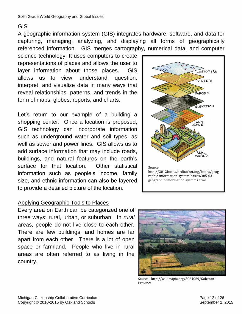
GIS
A geographic information system (GIS) integrates hardware, software, and data for
capturing, managing, analyzing, and displaying all forms of geographically
referenced information. GIS merges cartography, numerical data, and computer
science technology. It uses computers to create
representations of places and allows the user to
layer information about those places. GIS
allows us to view, understand, question,
interpret, and visualize data in many ways that
reveal relationships, patterns, and trends in the
form of maps, globes, reports, and charts.
Let’s return to our example of a building a
shopping center. Once a location is proposed,
GIS technology can incorporate information
such as underground water and soil types, as
well as sewer and power lines. GIS allows us to
add surface information that may include roads,
buildings, and natural features on the earth’s
surface for that location. Other statistical
information such as people’s income, family
size, and ethnic information can also be layered
to provide a detailed picture of the location.
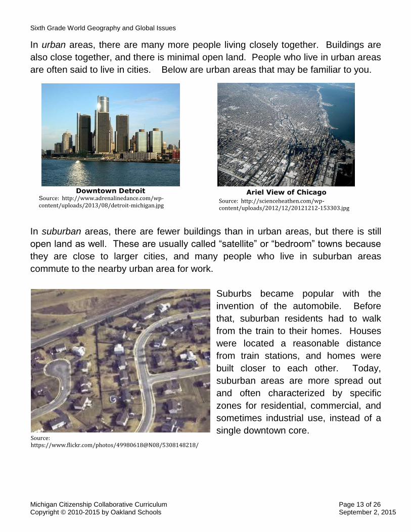
Applying Geographic Tools to Places
Every area on Earth can be categorized one of
three ways: rural, urban, or suburban. In rural
areas, people do not live close to each other.
There are few buildings, and homes are far
apart from each other. There is a lot of open
space or farmland. People who live in rural
areas are often referred to as living in the
country.
Source: http://wikimapia.org/8061069/Golestan-Province
Source: http://2012books.lardbucket.org/books/geographic-information-system-basics/s05-03-geographic-information-systems.html
Sixth Grade World Geography and Global Issues
Michigan Citizenship Collaborative Curriculum Page 13 of 26 Copyright © 2010-2015 by Oakland Schools September 2, 2015
In urban areas, there are many more people living closely together. Buildings are
also close together, and there is minimal open land. People who live in urban areas
are often said to live in cities. Below are urban areas that may be familiar to you.
In suburban areas, there are fewer buildings than in urban areas, but there is still
open land as well. These are usually called “satellite” or “bedroom” towns because
they are close to larger cities, and many people who live in suburban areas
commute to the nearby urban area for work.
Suburbs became popular with the
invention of the automobile. Before
that, suburban residents had to walk
from the train to their homes. Houses
were located a reasonable distance
from train stations, and homes were
built closer to each other. Today,
suburban areas are more spread out
and often characterized by specific
zones for residential, commercial, and
sometimes industrial use, instead of a
single downtown core.
Downtown Detroit Source: http://www.adrenalinedance.com/wp-content/uploads/2013/08/detroit-michigan.jpg
Ariel View of Chicago
Source: http://scienceheathen.com/wp-content/uploads/2012/12/20121212-153303.jpg
Source: https://www.flickr.com/photos/49980618@N08/5308148218/

Sixth Grade World Geography and Global Issues
Michigan Citizenship Collaborative Curriculum Page 14 of 26 Copyright © 2010-2015 by Oakland Schools September 2, 2015
The Five Themes of Geography
Geographers use the five themes of geography to organize
information in their study of Earth. The five themes are:
location, place, human-environment interaction, movement and
regions. Each of these themes focuses on different types of
questions about an area under investigation. Since
geographers use questions or problems to drive their
investigations, the five themes of geography is a useful
framework or thinking tool for organizing geographic questions.
We will use the five themes as we investigate questions
related to world geography and global issues.
Location
The theme of location asks the central geographic question,
“Where is it?” Geographers answer this question in two
different ways, using absolute and relative location. Perhaps
you have used your addresses, such as your home address,
as a way of locating places. This is using an absolute location.
For example, let’s pretend that your school’s address is 222
Bluebird Lane. That address tells you exactly where the
school is on Bluebird Lane.
However, not all places on Earth have addresses. Addresses only work when there
is a street and people have put a building at a particular place on that street.
Consider this: How would you answer the question, “Where is it?” when discussing
the highest point in the Andes Mountains? There are no streets and buildings to
use for an address. It would be impossible to give a street address to pinpoint the
location.
Since not all locations have a street address, geographers use a
more complex form of absolute location to answer the question,
“Where is it?” They use a grid or coordinate system to identify the
exact or precise place. By placing a grid over the earth,
geographers can use the grid to pinpoint exact locations, such as
the highest point of the Andes Mountains. Source: Global Grid
from the MC3 Project
Source: MC3 Project SS060104

Sixth Grade World Geography and Global Issues
Michigan Citizenship Collaborative Curriculum Page 15 of 26 Copyright © 2010-2015 by Oakland Schools September 2, 2015
Relative location, on the other hand, gives a general idea of where a place is
located in relation to another place. Relative location uses other places around the
target location to answer the question, “Where is it?” Some examples of using
relative location are listed below:
Michigan is north of Ohio.
My street is two blocks after the grocery store on the corner.
California is on the west coast of the United States. It is next to the
Pacific Ocean. It is north of Mexico and south of Oregon.
People use both relative and absolute location to answer the question, “Where is
it?”
Place
The geographic theme of place asks the question, “What is it like there?” To
answer this question, geographers examine both natural and human characteristics
of an area. Natural characteristics are the physical features that exist on Earth.
Some examples include landforms such as mountains, valleys, and plains, as well
as bodies of water like oceans, rivers, and lakes. Climate and vegetation in a place
also are natural characteristics. Human characteristics refer to the people living in
an area and the man-made features they put there. For example, the Mackinac
Bridge is a man-made feature in Michigan. Homes, buildings, and roads are other
human characteristics in your community. When people describe a place, they tend
to use both natural and human characteristics.
The Mackinac Bridge is a human characteristic.
Source: https://upload.wikimedia.org/wikipedia/commons/2/2d/Mackinac_Bridge_Sunset.jpg

Sixth Grade World Geography and Global Issues
Michigan Citizenship Collaborative Curriculum Page 16 of 26 Copyright © 2010-2015 by Oakland Schools September 2, 2015
So, what is it like in Michigan? Michigan is a state
that is made up of two peninsulas. A peninsula land
mass that is surrounded by water on all but one side.
The water bodies that surround Michigan’s two
peninsulas are known collectively as the Great Lakes.
Michigan’s two peninsulas are joined by a bridge over
the Straits of Mackinac. The Lower Peninsula has
more people and has sandy beaches on its western
shore. The Upper Peninsula varies from swampland
in the northeast near Lake Superior, to low mountains
in the west. Michigan’s capital city is Lansing. Other
major cities include Detroit, Grand Rapids, Flint, and
Ann Arbor. While much of the land in Michigan is
used for farming, manufacturing plants exist near major and mid-sized cities. How
would you describe your city or town? What human and natural characteristics
would you identify?
Human-Environment Interaction
The third theme of geography is human-environment interaction. The question that
drives this theme is, “How do people interact with the environment?” People
interact with their environment in one of three ways. They can use, modify, or adapt
to the environment.
People use the environment without changing it by
enjoying the natural beauty of a place. Swimming in Lake
Michigan or hiking among the cliffs, forests, and beaches
of Pictured Rocks are some examples of how people use
the environment in Michigan.
Sometimes, however, when people use the environment,
they end up changing it. In Michigan, we used our vast
forests to build houses and the sand around our
shorelines to make glass for automobiles. A whole mining industry developed in the
Upper Peninsula because of the rich mineral deposits found there. In all of these
examples, people ended up modifying the environment by their actions.
Pictured Rocks National Park
Source: https://commons.wikimedia.org/wiki/File:Indian_Head_Pictured_Rocks_Michigan.JPG
Source: http://www.cocorahs.org/Media/images/composite-MI-1100w.png
Sixth Grade World Geography and Global Issues
Michigan Citizenship Collaborative Curriculum Page 17 of 26 Copyright © 2010-2015 by Oakland Schools September 2, 2015
Other times, people modify their environment in order for it to serve a different
purpose. For instance, in southeastern Michigan, some lakes are man-made. By
draining the surrounding swamplands, people were able to use those areas for
building.
People also adapt to their environment in a variety of ways. If you
live in Michigan, you probably have experienced very cold winters.
As a result, homes are built with insulation and heating elements.
We also wear warm coats and hats in the winter. How might
people in Florida adapt to their climate differently than we do in
Michigan?
Human-environment interactions can have positive and negative
consequences for the environment. While attention is often given
to negative consequences of human-environment interactions,
such as factory pollution, humans can have positive effects on
their environment. Sometimes, people plant trees to replace
those lost in a fire. In recent years, experts and policy makers in
Michigan have sought ways to prevent invasive species such as Asian carp from
entering the Great Lakes from the Illinois River. Any modification to the environment
to prevent Asian carp from entering the Great Lakes would be considered a positive
consequence of human-environment interaction (unless, of course, the modification
causes other problems).
Movement
When geographers investigate movement, they
ask the question, “How is this place connected to
other places?” In doing so, they explore how
and why people, goods, and ideas move in and
out of a particular place. Transportation,
migration, communication, and trade all fall
within the theme of movement.
Children adapt to their environment by wearing warm clothes in the winter.
Source: https://en.wikipedia.org/wiki/Ski_suit
Railroads provide a way to move people and goods.
Source: https://en.wikipedia.org/wiki/Transcontinental_railroad

Sixth Grade World Geography and Global Issues
Michigan Citizenship Collaborative Curriculum Page 18 of 26 Copyright © 2010-2015 by Oakland Schools September 2, 2015
One type of movement is called migration. Migration occurs when people relocate
from one town to another. In exploring why people migrate, social scientists
consider both push and pull factors. A push factor is a force that drives people
away from a particular location. This could be for a variety of reasons including the
lack of a job, lack of freedom, or poor climate. A pull factor is the force that draws
people to a new location. A better job, more affordable housing, or other family
members living in a certain location can act as pull factors. The chart below shows
several push and pull factors of migration.
Push Factors
Unemployment
Lack of safety/war/civil unrest
Poverty
Lack of services
Drought or crop failure
Natural hazards/poor climate
Isolation
Pull Factors
Potential for employment
A safer environment
Greater wealth
More or better services
Fertile Land/ good food supplies
Less risk of natural hazards/favorable climate
Family and friends
Sixth Grade World Geography and Global Issues
Michigan Citizenship Collaborative Curriculum Page 19 of 26 Copyright © 2010-2015 by Oakland Schools September 2, 2015
Not only do people move, but goods move as well. Whether your school is in the
middle of the Manistee National Forest area or located in the center of a major city
like Lansing, your food supplies are delivered to your school. The computers in
your computer lab were also brought in from other places -- perhaps in your state,
elsewhere in the country, or even from overseas! These important deliveries are
examples of the movement of goods. People use different ways to transport goods
from one location to another such as airplanes, ships, trains or trucks. Throughout
history, people have created transportation routes to move goods.
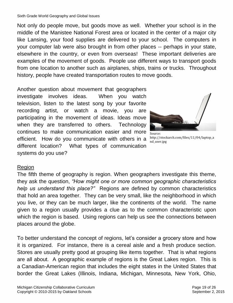
Another question about movement that geographers
investigate involves ideas. When you watch
television, listen to the latest song by your favorite
recording artist, or watch a movie, you are
participating in the movement of ideas. Ideas move
when they are transferred to others. Technology
continues to make communication easier and more
efficient. How do you communicate with others in a
different location? What types of communication
systems do you use?
Region
The fifth theme of geography is region. When geographers investigate this theme,
they ask the question, “How might one or more common geographic characteristics
help us understand this place?” Regions are defined by common characteristics
that hold an area together. They can be very small, like the neighborhood in which
you live, or they can be much larger, like the continents of the world. The name
given to a region usually provides a clue as to the common characteristic upon
which the region is based. Using regions can help us see the connections between
places around the globe.
To better understand the concept of regions, let’s consider a grocery store and how
it is organized. For instance, there is a cereal aisle and a fresh produce section.
Stores are usually pretty good at grouping like items together. That is what regions
are all about. A geographic example of regions is the Great Lakes region. This is
a Canadian-American region that includes the eight states in the United States that
border the Great Lakes (Illinois, Indiana, Michigan, Minnesota, New York, Ohio,
Source: http://stockarch.com/files/11/04/laptop_and_user.jpg

Sixth Grade World Geography and Global Issues
Michigan Citizenship Collaborative Curriculum Page 20 of 26 Copyright © 2010-2015 by Oakland Schools September 2, 2015
Pennsylvania and Wisconsin), as well as the Canadian province of Ontario. The
characteristic that all of these places have in common is that they border the Great
Lakes.
Geographers use the theme of regions to help them focus on a particular area by
asking, “How can the place be divided into regions?” Michigan can be divided into a
number of smaller parts. Geographers do this by using common characteristics for
classification. One simple way to divide Michigan into regions is by separating it
into two peninsulas.
Another way geographers use the theme of regions is to connect an area to a larger
area. Here, geographers would investigate the question, “To which regions does
this place belong?” Again, geographers look for places that share one or more
common characteristics. For example, Michigan is part of the mid-west region of
the United States, the Great Lakes region, or the eastern United States. Regions
are determined by the characteristics you are using to describe the place.
Questions to Consider
What common characteristic holds these states together?
What do you think this region is named?
Source: https://en.wikipedia.org/wiki/Northeastern_United_States
Source: https://commons.wikimedia.org/wiki/File:Map_of_USA_highlighting_Great_Lakes_region.png
Sixth Grade World Geography and Global Issues
Michigan Citizenship Collaborative Curriculum Page 21 of 26 Copyright © 2010-2015 by Oakland Schools September 2, 2015
Social Scientists Help Us Understand Our World
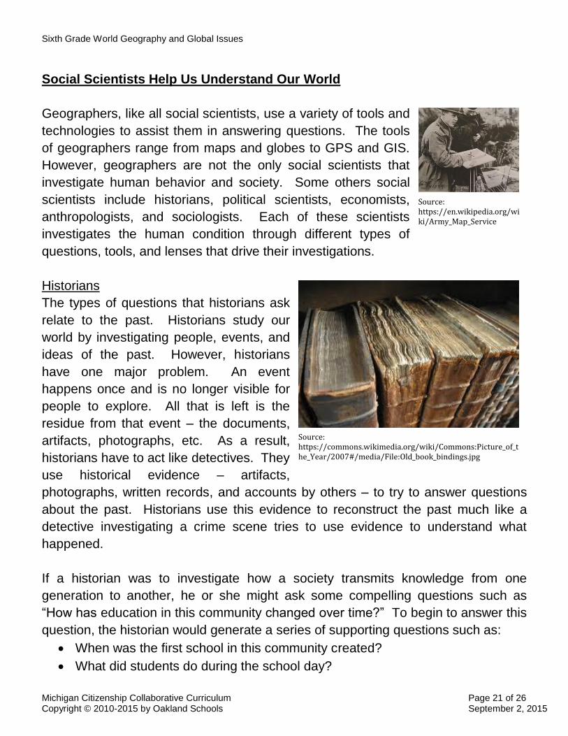
Geographers, like all social scientists, use a variety of tools and
technologies to assist them in answering questions. The tools
of geographers range from maps and globes to GPS and GIS.
However, geographers are not the only social scientists that
investigate human behavior and society. Some others social
scientists include historians, political scientists, economists,
anthropologists, and sociologists. Each of these scientists
investigates the human condition through different types of
questions, tools, and lenses that drive their investigations.
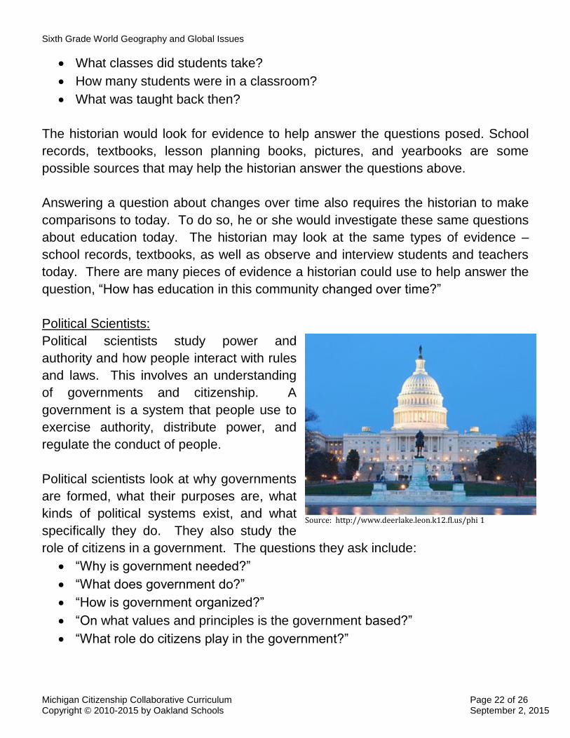
Historians
The types of questions that historians ask
relate to the past. Historians study our
world by investigating people, events, and
ideas of the past. However, historians
have one major problem. An event
happens once and is no longer visible for
people to explore. All that is left is the
residue from that event – the documents,
artifacts, photographs, etc. As a result,
historians have to act like detectives. They
use historical evidence – artifacts,
photographs, written records, and accounts by others – to try to answer questions
about the past. Historians use this evidence to reconstruct the past much like a
detective investigating a crime scene tries to use evidence to understand what
happened.
If a historian was to investigate how a society transmits knowledge from one
generation to another, he or she might ask some compelling questions such as
“How has education in this community changed over time?” To begin to answer this
question, the historian would generate a series of supporting questions such as:
When was the first school in this community created?
What did students do during the school day?
Image Source: http://en.wikipedia.org/w 1
Source: https://en.wikipedia.org/wiki/Army_Map_Service
Source: https://commons.wikimedia.org/wiki/Commons:Picture_of_the_Year/2007#/media/File:Old_book_bindings.jpg
Sixth Grade World Geography and Global Issues
Michigan Citizenship Collaborative Curriculum Page 22 of 26 Copyright © 2010-2015 by Oakland Schools September 2, 2015
What classes did students take?
How many students were in a classroom?
What was taught back then?
The historian would look for evidence to help answer the questions posed. School
records, textbooks, lesson planning books, pictures, and yearbooks are some
possible sources that may help the historian answer the questions above.
Answering a question about changes over time also requires the historian to make
comparisons to today. To do so, he or she would investigate these same questions
about education today. The historian may look at the same types of evidence –
school records, textbooks, as well as observe and interview students and teachers
today. There are many pieces of evidence a historian could use to help answer the
question, “How has education in this community changed over time?”
Political Scientists:
Political scientists study power and
authority and how people interact with rules
and laws. This involves an understanding
of governments and citizenship. A
government is a system that people use to
exercise authority, distribute power, and
regulate the conduct of people.
Political scientists look at why governments
are formed, what their purposes are, what
kinds of political systems exist, and what
specifically they do. They also study the
role of citizens in a government. The questions they ask include:
“Why is government needed?”
“What does government do?”
“How is government organized?”
“On what values and principles is the government based?”
“What role do citizens play in the government?”
Source: http://www.deerlake.leon.k12.fl.us/phi 1

Sixth Grade World Geography and Global Issues
Michigan Citizenship Collaborative Curriculum Page 23 of 26 Copyright © 2010-2015 by Oakland Schools September 2, 2015
A political scientist investigating education might ask questions involving who has
power and authority in schools, how decisions get made, and who makes the rules.
Economists:
Economists study how people produce,
distribute, and consume goods and services.
Put simply, they investigate how people and
governments use resources to fulfill
economic wants. They do this by exploring
different kinds of economic systems, natural
resources, human resources, and capital.
They study decision making by individuals
and societies. In examining individual
decision making, economists explore how
scarcity forces individuals to make choices.
When examining how societies allocate resources, economists investigate decisions
regarding specialization, trade, and interdependence among countries. They ask
questions such as:
“What is produced?”
“How is it produced?”
“Who gets what is produced?”
An economist investigating education might ask about the wants or needs schools
fulfill, the goods or services provided, and the types of resources needed to run a
school.
Anthropologists:
Anthropologists study how cultures
develop among humans. They
examine the elements that create a
culture including social customs and
beliefs. They look at how cultures
change over time. Questions
anthropologists might ask include:
“How has the culture of these
people influenced how they
Source: http://blog.firstprestonht.com/files/201 1
Source: http://cdn2.spiegel.de/images/image-1719 1
Sixth Grade World Geography and Global Issues
Michigan Citizenship Collaborative Curriculum Page 24 of 26 Copyright © 2010-2015 by Oakland Schools September 2, 2015
live?”
“What foods, clothing, or types of shelter are found among people who live
within this culture?”
“How do the customs and beliefs of this group of people influence decisions
they make in their community?”
“How do differences in cultures reflect how people solve similar human
problems?”
An anthropologist who is investigating education would ask questions about how the
culture passes on knowledge from one generation to another and influences how a
school is run (including the length of the school day or year). An anthropologist may
also investigate how cultural differences between the United States and China are
reflected in the education system of each nation.
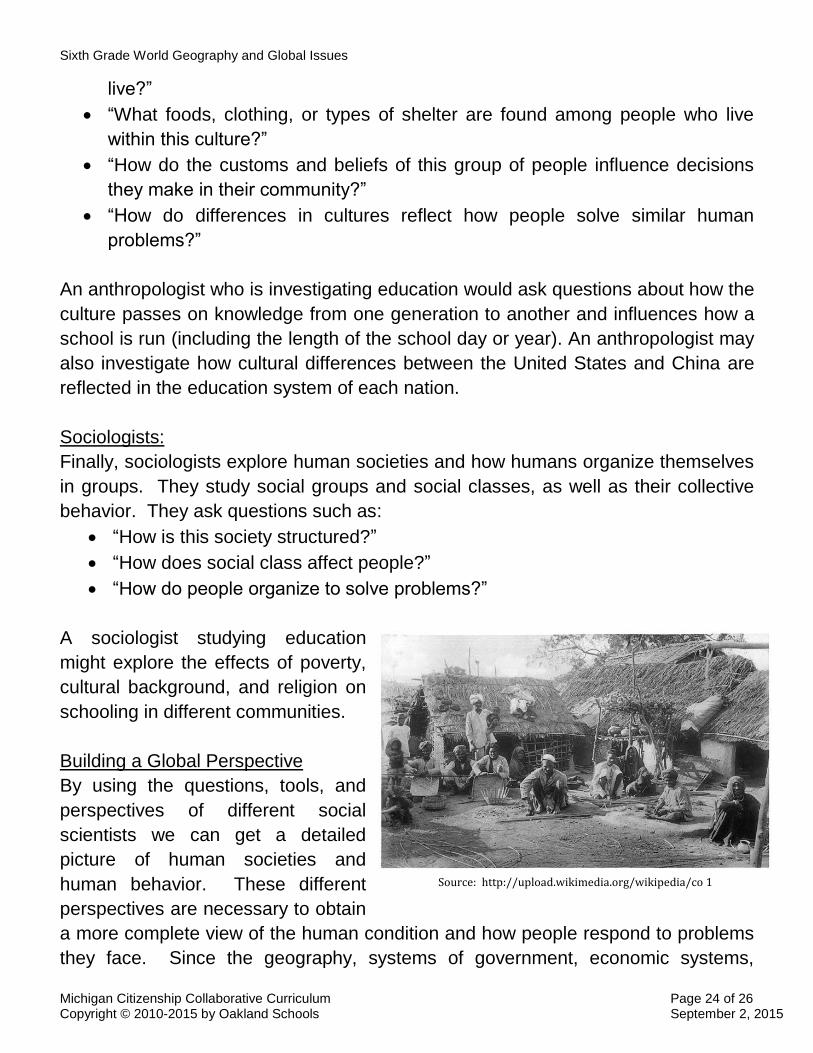
Sociologists:
Finally, sociologists explore human societies and how humans organize themselves
in groups. They study social groups and social classes, as well as their collective
behavior. They ask questions such as:
“How is this society structured?”
“How does social class affect people?”
“How do people organize to solve problems?”
A sociologist studying education
might explore the effects of poverty,
cultural background, and religion on
schooling in different communities.
Building a Global Perspective
By using the questions, tools, and
perspectives of different social
scientists we can get a detailed
picture of human societies and
human behavior. These different
perspectives are necessary to obtain
a more complete view of the human condition and how people respond to problems
they face. Since the geography, systems of government, economic systems,
Source: http://upload.wikimedia.org/wikipedia/co 1

Sixth Grade World Geography and Global Issues
Michigan Citizenship Collaborative Curriculum Page 25 of 26 Copyright © 2010-2015 by Oakland Schools September 2, 2015
culture, and history of people and places around the world vary, we will use all of
these social science perspectives to help us understand the world and our place in
it.
What Makes a Problem or Solution Global?
Human beings are meaning makers and problem solvers. Sometimes the problems
people encounter affect only them or the people right around them. In those
situations, it is easy to work together to find a solution. However, what if a solution
requires the cooperation of people from many different nations to ultimately solve it?
What if the problem is so big that it affects most or all of the people on the planet?
What are global problems?
Global problems are not just important problems or problems that affect many
people. Global problems affect the whole planet or potentially all of the people who
live on it. Examples of global problems include climate change, resource depletion,
and ocean pollution. These problems affect all of humanity and other living
organisms on Earth.
Let’s look at an example – climate change. It is a problem because the
consequences of humanly-generated changes in the atmosphere can affect
everyone on the planet. In other words, the consequences are universal. Moreover,
unless we profoundly change our collective behavior, climate change may well
result in irreversible changes in the climatic conditions of life. It is easy to see that
there will be no easy solution to the problem.
Global problems tend to be complex because they are connected to many other
social studies concepts and issues. The causes of the present climate situation are
related to our economic systems, our attitudes about nature, our political
organizations, our technological capacities and preferences, and the way we use
limited resources.
Sometimes solutions involve not just all communities and every country, but also
require cooperation, rather than individual approaches. Climate change is a global
problem because solving it will require the cooperation of different people from
Sixth Grade World Geography and Global Issues
Michigan Citizenship Collaborative Curriculum Page 26 of 26 Copyright © 2010-2015 by Oakland Schools September 2, 2015
different nations. Simply put, the example of climate change suggests that global
problems are difficult, complex, and make human society as a whole at risk.
The solution may be the deciding factor
What if a problem cannot be solved by one person or one country alone? Even a
local event may require a global solution. In the United States, most children are
vaccinated against diseases such as measles, small pox, and polio. In the
developing world, however, 1.5 million children die each year from vaccine-
preventable diseases. There are multiple reasons for this. Countries in Africa lack
the resources to combat this problem on their own. World organizations that have
tried to eliminate these diseases rely on governments to report outbreaks. To help
save lives, people from around the world bring medical supplies to these developing
areas in the hopes of treating and preventing these diseases from becoming global
problems once again.
Global problems are often connected to each other. This can be seen by looking at
one global issue – poverty. Relating to the global problem of poverty are the other
health issues such as hunger, medical needs, and nutritional issues. Moreover,
other global problems are interconnected with poverty. Crime, overpopulation,
urbanization, inequality, war and conflict, as well as migration issues are some of
the other global issues related to poverty..
People have attempted to address global problems in various ways. People can
work to improve the world through volunteerism, financial contributions, and raising
awareness of the problems. Collective action by a group of concerned individuals
can be a powerful way to improve our world. There are also governmental
organizations that attempt to address global problems. Established in 1945, the
United Nations is currently made up of 193 member countries. It seeks to address
issues confronting humanity in the 21st century such as climate change, sustainable
development, human rights, disarmament, terrorism, health and humanitarian
emergencies, and other global issues. The United States is a member state and
holds a leadership position in this organization.