Site View Reconstruction for Urban Planning Using … · Site View Reconstruction for Urban...
14
1 Site View Reconstruction for Urban Planning Using ArcGIS, Google Sketch up and Google Earth A Case Study of the University of Nigeria Enugu Campus Ndukwu, Raphael Ike Department of Geoinformatics & Surveying University of Nigeria, Enugu Campus. Chigbu, Njike Department of Surveying and Geoinformatics Abia State Polytechnic Aba Daberechi, Michael Department of Geoinformatics & Surveying University of Nigeria, Enugu Campus
Transcript of Site View Reconstruction for Urban Planning Using … · Site View Reconstruction for Urban...
1
Site View Reconstruction for Urban Planning Using ArcGIS, Google Sketch up and Google Earth
A Case Study of the University of Nigeria Enugu Campus
Ndukwu, Raphael Ike Department of Geoinformatics & Surveying University of Nigeria, Enugu Campus. Chigbu, Njike Department of Surveying and Geoinformatics Abia State Polytechnic Aba Daberechi, Michael Department of Geoinformatics & Surveying University of Nigeria, Enugu Campus

2
Introduction
3D computer visualization of our world is becoming common place, appearing on the internet through popular map and geospatial information sites.
Engineers and planners are becoming interested in the computer modeling of the environment to allow better visualization, greater understanding of the world, and for enhancing their decision making processes
In urban planning domain advancement in computer technology and information technologies (I.T.) has contributed to the shaping of new trends in the process of urban planning (Johanna, 2008).
Traditionally, urban planning involves the physical structure of development, generally following a master plan
3
However, when considering urban planning as a community decision- making process, participation and communication are fundamental to the process.
Public participation in the decisions taken about the projects is many times insufficiently promoted and excludes some community groups (Innes and Booher, 2004, Kingston, et al., 2000)
It is not uncommon that difficulties arise in understanding the urban environment and spatial relationships when plans are presented on 2-D maps or artists’ impressions.
Photo realistic 3D Scene reconstruction of an urban Scenario and visualization can enhance collaborative planning process by serving as a collaborative environment where users can actively take part in the decision-making process
Introduction
4
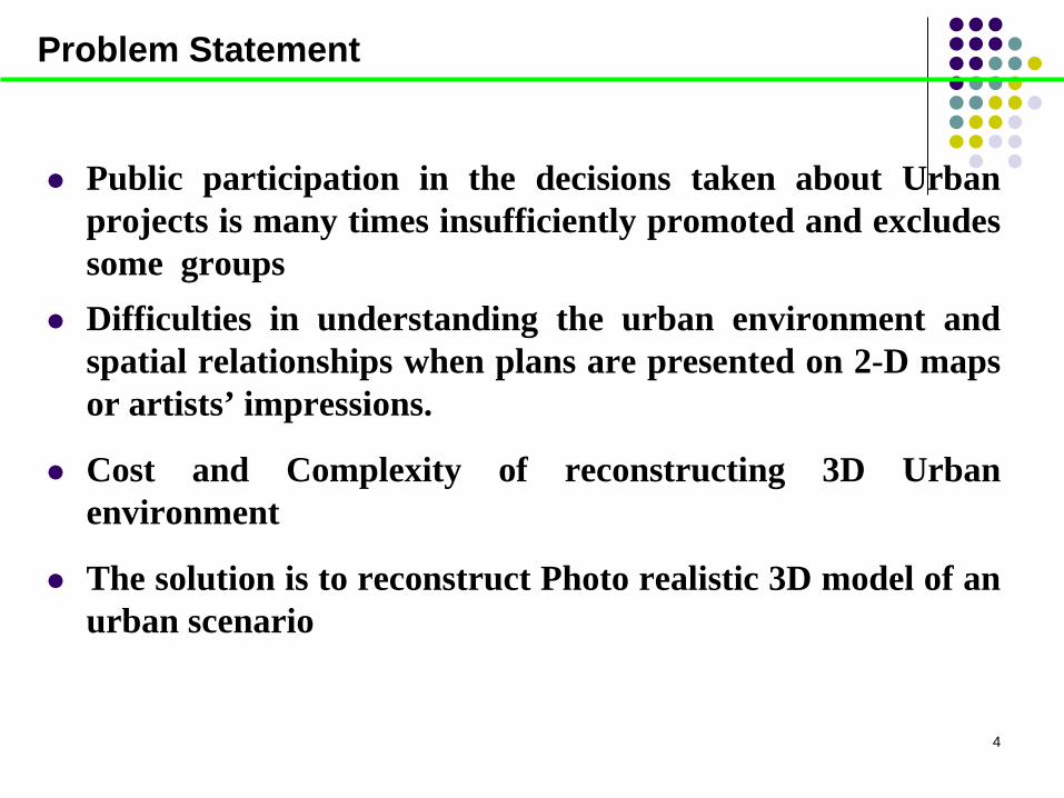
Public participation in the decisions taken about Urban projects is many times insufficiently promoted and excludes some groups
Difficulties in understanding the urban environment and spatial relationships when plans are presented on 2-D maps or artists’ impressions.
Cost and Complexity of reconstructing 3D Urban environment
The solution is to reconstruct Photo realistic 3D model of an urban scenario
Problem Statement
5
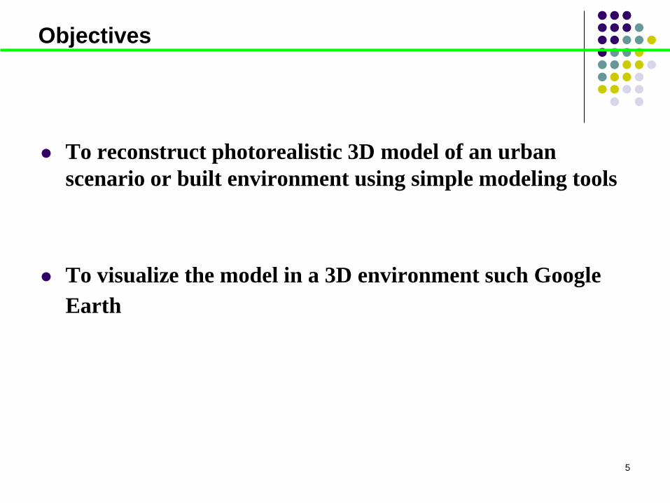
To reconstruct photorealistic 3D model of an urban scenario or built environment using simple modeling tools
To visualize the model in a 3D environment such Google
Earth
Objectives
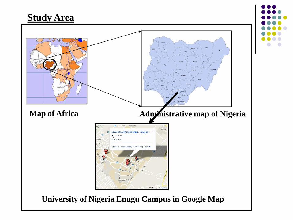
Administrative map of Nigeria Map of Africa
University of Nigeria Enugu Campus in Google Map
Study Area

Digitized 2.5D map of the study area .
Ikonos satellite image covering the study area.
Shuttle Rader Topographic Mission (SRTM).
Attribute dataset (height of building, Names ,elevation Values)
Materials
Dataset used for modeling
Material and Methods
2 giga bytes RAM size)
Core 2 Duo Intel processor of 2 giga bytes clock speed each
150 giga bytes of hard drive
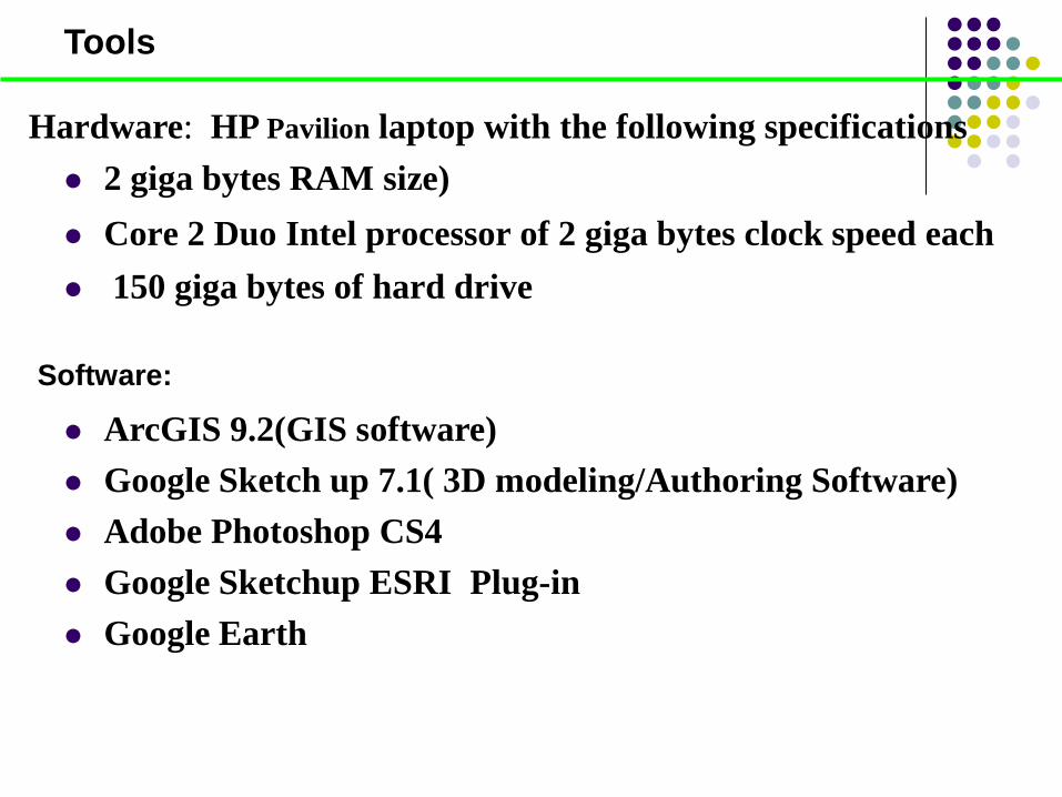
Tools
Hardware: HP Pavilion laptop with the following specifications
Software:
ArcGIS 9.2(GIS software) Google Sketch up 7.1( 3D modeling/Authoring Software) Adobe Photoshop CS4 Google Sketchup ESRI Plug-in Google Earth
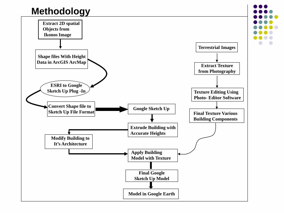
ESRI to Google Sketch Up Plug -In
Convert Shape file to Sketch Up File Format
Extrude Building with Accurate Heights
Apply Building Model with Texture
Modify Building to It’s Architecture
Model in Google Earth
Final Google Sketch Up Model
Google Sketch Up
Extract Texture from Photography
Terrestrial Images
Final Texture Various Building Components
Texture Editing Using Photo- Editor Software
Extract 2D spatial Objects from Ikonos Image
Shape files With Height Data in ArcGIS ArcMap
Methodology
10
Methodology
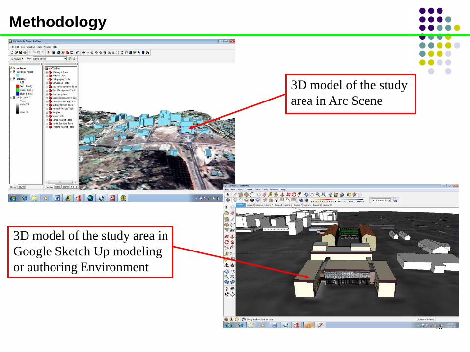
3D model of the study area in Arc Scene
3D model of the study area in Google Sketch Up modeling or authoring Environment
Results
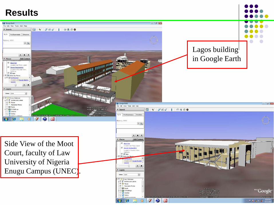
Lagos building in Google Earth
Side View of the Moot Court, faculty of Law University of Nigeria Enugu Campus (UNEC).
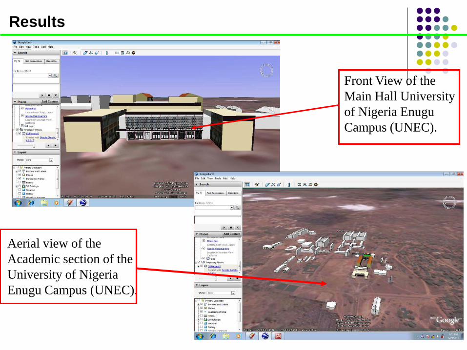
Front View of the Main Hall University of Nigeria Enugu Campus (UNEC).
Results
Aerial view of the Academic section of the University of Nigeria Enugu Campus (UNEC).
Conclusion
The study Presented concepts related to 3D modeling and visualization and some simple 3D modeling Tools
Explored the effective use of 3D modeling for visualization of urban scenario using the University of Nigeria Enugu campus as a case study
Demonstrate that simple photorealistic 3D model of urban built environment can be reconstructed with ArcGIS, Google Sketchup, and Google Earth
The generated model can be used in evaluating design proposals
Provide opportunity for urban planners and university official to properly visualize urban Scenario and making the right decision

14