SITE NAME: DATE OF INSCRIPTION: December 1999whc.unesco.org/uploads/nominations/899.pdf ·...
101
WHC Nomination Documentation File Name: 899.pdf UNESCO Region: EUROPE AND THE NORTH AMERICA __________________________________________________________________________________________________ SITE NAME: Droogmakerij de Beemster (Beemster Polder) DATE OF INSCRIPTION: 4 th December 1999 STATE PARTY: NETHERLANDS CRITERIA: C (i)(ii)(iv) DECISION OF THE WORLD HERITAGE COMMITTEE: Excerpt from the Report of the 23 rd Session of the World Heritage Committee The Committee inscribed the site on the World Heritage List on the basis of criteria (i), (ii), and (iv): Criterion (i): The Beemster Polder is a masterpiece of creative planning, in which the ideals of antiquity and the Renaissance were applied to the design of a reclaimed landscape. Criterion (ii): The innovative and intellectually imaginative landscape of the Beemster Polder had a profound and lasting impact on reclamation projects in Europe and beyond. Criterion (iv): The creation of the Beemster Polder marks a major step forward in the interrelationship between humankind and water at a crucial period of social and economic expansion. Referring to the particular character of the nominations of the Netherlands, the Observer of the Netherlands informed the Committee that very recently the parliament of the Netherlands had accepted a policy document on the integration of cultural heritage – archaeology, built heritage and cultural landscapes - in national, provincial and local planning policies. World Heritage preservation is explicitly incorporated in this document. The Netherlands would be pleased to share this kind of experience with other States Parties. BRIEF DESCRIPTIONS The Beemster Polder, dating from the early 17th century, is the oldest area of reclaimed land in The Netherlands. It has preserved intact its regular landscape of fields, roads, canals, dikes and settlements, laid out in accordance with the principles of classical and Renaissance planning. 1.b State, Province or Region: Province of Noord-Holland 1.d Exact location: 52° 32' N, 4° 55' E
-
Upload
phungxuyen -
Category
Documents
-
view
216 -
download
1
Transcript of SITE NAME: DATE OF INSCRIPTION: December 1999whc.unesco.org/uploads/nominations/899.pdf ·...
WHC Nomination Documentation File Name: 899.pdf UNESCO Region: EUROPE AND THE NORTH AMERICA __________________________________________________________________________________________________ SITE NAME: Droogmakerij de Beemster (Beemster Polder) DATE OF INSCRIPTION: 4th December 1999 STATE PARTY: NETHERLANDS CRITERIA: C (i)(ii)(iv) DECISION OF THE WORLD HERITAGE COMMITTEE: Excerpt from the Report of the 23rd Session of the World Heritage Committee The Committee inscribed the site on the World Heritage List on the basis of criteria (i), (ii), and (iv): Criterion (i): The Beemster Polder is a masterpiece of creative planning, in which the ideals of antiquity and the Renaissance were applied to the design of a reclaimed landscape. Criterion (ii): The innovative and intellectually imaginative landscape of the Beemster Polder had a profound and lasting impact on reclamation projects in Europe and beyond. Criterion (iv): The creation of the Beemster Polder marks a major step forward in the interrelationship between humankind and water at a crucial period of social and economic expansion. Referring to the particular character of the nominations of the Netherlands, the Observer of the Netherlands informed the Committee that very recently the parliament of the Netherlands had accepted a policy document on the integration of cultural heritage – archaeology, built heritage and cultural landscapes - in national, provincial and local planning policies. World Heritage preservation is explicitly incorporated in this document. The Netherlands would be pleased to share this kind of experience with other States Parties. BRIEF DESCRIPTIONS The Beemster Polder, dating from the early 17th century, is the oldest area of reclaimed land in The Netherlands. It has preserved intact its regular landscape of fields, roads, canals, dikes and settlements, laid out in accordance with the principles of classical and Renaissance planning. 1.b State, Province or Region: Province of Noord-Holland 1.d Exact location: 52° 32' N, 4° 55' E
DROOGMAKERIJ DE BEEMSTER (THE BEEMSTER POLDER)
THE NETHERLANDS
JUNE 1998

2
CREDITS
- Netherlands Department for Conservation (Rijksdienst voor de Monumentenzorg)/ Ministry of Education, Culture and Science)
Broederplein 41 3703 CD Zeist
P.O. Box 1001 3700 BA Zeist The Netherlands
Telephone: ++31 30 698 32 11; Telefax: ++31 30 691 61 89;
- Municipality of Beemster
Rijn Middelburgstraat 1
P.O. Box 7 1462 ZG Middenbeemster The Netherlands
Telephone: ++31 299 682 121; Telefax: ++31 299 681 771;
- Production: Netherlands Department for Conservation, in cooperation with: -Municipality of Beemster (Department for Regional Planning, Public Works and the Environment [Afdeling Ruimtelijke Ordening, Openbare Werken en Milieu], M.E. Smit); -Waterschap De Waterlanden (Water Board De Waterlanden), Middenbeemster (Head of General Affairs, G.J. Pielage); -Ministry of Agriculture, Nature Conservation and Fisheries, IKC Nature Conservation, Forest/Landscape dept. [afd. Bos/Landschap], Wageningen, Drs. A. Haartsen;
- Research: -Netherlands Department for Conservation (Rijksdienst voor de Monumentenzorg): Drs. Robert de Jong; -Municipality of Beemster (Department for Regional Planning, Public Works and the Environment, M.E. Smit); -Waterschap De Waterlanden, Middenbeemster (Head of General Affairs, G.J. Pielage); -Ministry of Agriculture, Nature Conservation and Fisheries, IKC Nature Conservation, Forest/Landscape department: Drs. A.J. Haartsen;
- Text: Drs. Robert de Jong, Netherlands Department for Conservation;

3
- Photography: A.J. van der Wal, Netherlands Department for Conservation;
- Translation: WTSbv, Zeist;
Zeist, June 1998

4
CONTENTS
Credits
- Contents
- Introduction
1. - Identification of the Property
1.1. Country 1.2. Province 1.3. Name of the property 1.4. Geographical location 1.5. Local council
2. - Justification
2.1. Statement of significance 2.2. Comparison with similar properties 2.3. Indication as to authenticity and integrity
2.4. Criteria under which inscription is proposed (and justification for inscription under these criteria)
3. - Description
3.1. Description of the property 3.2. History and development 3.3. Form and date of most recent records of the property 3.4. Present state of conservation
4. - Management
4.1. Ownership 4.2. Legal status 4.3. Protective measures and means of implementing them 4.4. Agency/agencies with management authority
4.5. Level at which management is exercised (e.g., on property, regionally) and the name and address of contact person4.6. Agreed plans related to the property (e.g., regional plan, local plan, conservation
plan, tourism development plan) 4.7. Sources and levels of finance 4.8. Sources of expertise and training in conservation and management techniques 4.9. Visitor facilities and statistics 4.10. Property management plan and statement of objectives
5
5.
- Factors Affecting the Property
5.1. Development Pressures (e.g. encroachment, adaptation, agriculture) 5.2. Environmental Pressures (e.g., pollution) 5.3. Visitor/tourism Pressures 5.4. Number of inhabitants within the property
6. - Monitoring
6.1. Key indicators for measuring state of conservation 6.2. Administrative arrangements for monitoring property
7. - Documentation
7.1. Photographs, slides, maps and plans7.2. Copies of property management plans and extracts of other plans relevant to the property
7.3. Bibliography 7.4. Address where inventory, records and archives are held
8. - Appendices

6
The nomination is presented in the manner as prescribed in paragraph 64 of the OperationalGuidelines for the Implementation of the World Heritage Convention, UNESCO, IntergovernmentalCommittee for the Protection of the World Cultural and Natural Heritage, [Paris], WHC-97/2,February 1997, and the Convention concerning the protection of the World cultural and naturalheritage/Format for the nomination of cultural and natural properties for inscription on the World Heritage List,[Paris], WHC-97/WS/6

7
INTRODUCTION
In 1995 The Netherlands informed the World Heritage Centre that it was categorising itscultural heritage nominations - relating to the built-up environment and architectonic monumentsof exceptional universal significance - for the UNESCO World Heritage List into three themes:The Netherlands - Water Land, the Republic of the Seven United Provinces in the 17th centuryand the Dutch contribution to the International Movement in architecture at the beginning ofthis century.
The first three nominations - the "Stelling van Amsterdam" (Defence Line of Amsterdam)(1995), the windmill complex at Kinderdijk-Elshout (1996) and the Wouda-Gemaal (WoudaPumpng Station) at Lemmer (1997) - related to the theme of The Netherlands - Water Land. Thenomination of the Beemster polder also falls within this category. At the same time, it must beseen as a nomination within the category of the Republic of the Seven United Provinces in the17th century.
In many ways the reclamation of the Beemster polder and the development of the historiccity centre of Amsterdam, with its unique 17th century ring of canals (nomination of this area forinclusion on the World Heritage List can be expected within a few years) have direct anddemonstrable cultural, conceptual and intellectual relationships with each other. The Beemsterpolder can only be viewed within the context of the economic, cultural and political environmentof Amsterdam at the beginning of the 17th century.
The Beemster polder is a unique monument, as is the canal belt of Amsterdam. It is a hydraulicand civil engineering monument of exceptional significance. The creation of De Beemster isparticularly the result of an intellectual concept based on theories of the Classics and the ItalianRenaissance regarding the 'ideal of the straight line', the 'città ideale' and the discipline ofnumbers, as worked out by Plato and St. Augustine. The layout of the area also reflects theVitruvian principles of 'firmitas, utilitas et venustas'. The principles of order, of reason, ofmathematics and well-considered planning reign here, implemented on a monumental scale.
The geometrically organised, strictly rational layout and pure composition of the land reclaimedfrom the water, with its spatial order of interconnected 'green chambers' simultaneously forms alink with other polders created by Dutchmen in many other European countries in latercenturies. De Beemster was also the model for reclaimed land and polders (Wieringermeer andNoordoostpolder) created in this century, as part of the Zuiderzee works, whereby TheNetherlands converted a large and unpredictable inland sea, the Zuiderzee, into an inland lake,the IJsselmeer.
The Beemster polder is a site as described in Article 1 of the World Heritage Convention.Furthermore, it is a landscape, a "designed landscape, created intentionally by man" as indicatedin Article 39 (i) of the Operational Guidelines for the Implementation of the World HeritageConvention.
The momentum of the intellectual, cultural concept that took hold in The Netherlands atthe beginning of the 17th century is of exceptional universal significance. The concept spread itsimage and application across Europe and is consequently part of the European cultural heritage.Town planning views prevailing in the Republic of the Seven United Provinces, which wereeffectuated in the Beemster polder, were not restricted to old Europe, but were also expandedand applied in the founding of cities in the New World.

8
The intellectual concept on which De Beemster was founded was both visionary and functional.It was so far ahead of its time that it is still in full use today. Despite subsequent societal changes,the concept has lost none of its currency. The creation, layout and composition of the Beemsterpolder of the past is still fully usable. The line of history continues here uninterrupted.
The literary image of De Beemster, as worded in 1732, still applies for the attentive audience oftoday.
"... Let everyone behold with me, with due attention,the most famous lake with pastures, farmland,and gardens, which was ever laid out,De Beemster, which can parade as a queenIn the Northern part of our Commonwealth,Where many a lord has laid down their estates,To enjoy this season,Which in due course will reward him with the fruit of his crops,From soil of clay and mud"
('Noordhollandsche Arkadia’, pp. 143, 144)
"How fine are your fields and pastures,That throw a cool shade,How fine your lanes wellplanted by a loving hand!Who would not find peace here,Among these oaks, elms and lime treesWhich with their multitude of greenFulfil the heart and eyes!"
('Noordhollandsche Arkadia', p. 157)
Jan Adriaenansz. Leeghwater, one of the people who executed the reclamation of the Beemster,wrote the following about De Beemster in his 'Haarlemmermeerboek' (Haarlemmermeer book)(1643) "Almighty God has blessed the Beemster with such abundance that it is the largest pleasure garden of Noord-Holland, in pastures, farmland, orchards, houses, gardens, etc. It is said and taken as truth that there is no more joyous and pleasurable road in Holland than the Volgerweg in the Beemster, where all those clean, wonderful houses and orchards are laid out..."
9
CHAPTER 1. IDENTIFICATION OF THE PROPERTY
1.1. COUNTRY
- The Netherlands
1.2. PROVINCE
- Noord-Holland
1.3. NAME OF THE PROPERTY
- Droogmakerij DE BEEMSTER (THE BEEMSTER POLDER)
1.4. GEOGRAPHICAL LOCATION
- Location:
For an overview of the total structure, please refer to the Topographical map 1:25,000 (sheets 19D, 19E, 19G, edition 1997) (Ill. 7.1.A.29.) and the Aerial View (perpendicular) (1997) (Ill. 7.1.B.1.);
- Coordinates:
(national grid: X=155.000m Y=463.000m)
119.500-128.500/ 502.000-514.000)
- The Beemster polder is situated within a ring canal, the Beemsterringvaart. The boundary of the municipality of Beemster lies in the middle of this canal, as does that of the property to be nominated (Ill. 7.1.A.29). The surface area of the municipality of Beemster is 7,185 hectares.
A 4 to 6 metre high ring-dike runs alongside the Beemsterringvaart at 2 metres on average above Mean Sea Level ("Nieuw Amsterdams Peil" or N.A.P.), with a ring- ditch on the landside of the dike. The dike is called the Oostdijk on the east side, the Westdijk on the west side, the Zuiddijk on the south side and the Noorddijk on the north side. The southern side of the Beemsterringvaart is part of the Noordhollandsch Kanaal, which was dug between 1818 and 1824 and is over 80 kilometres long. The Noordhollandsch Kanaal established a direct shipping link between Amsterdam and the North Sea;
- The municipality of Beemster consists of the following villages and hamlets: Halfweg, Klaterbuurt, Middenbeemster, Noordbeemster, Westbeemster and Zuidoostbeemster. The municipality has 8605 inhabitants;
- The municipality of Beemster is surrounded by the municipalities of

10
Westerkoggenland, Zeevang, Purmerend, Jisp, Graft-De Rijp and Schermer. Since 1991 parts of Jisp and Wormer have become part of the municipality of Beemster;
1.5. LOCAL COUNCIL
- Beemster

11
CHAPTER 2. JUSTIFICATION
2.1. STATEMENT Of SIGNIFICANCE
De Beemster is a 17th century polder (1607-1613) with a surface area of approximately 5 x8 kilometres and a ground level of 3.00 metres to 4.80 metres below Mean Sea Level (N.A.P.). Itscircumference follows the shores of a drained lake, the Beemster, which used to be linked directlyto the former Zuiderzee (now the IJsselmeer).Ground plan and parcelling in lots according to a rational geometric ground plan with a moduleof 900 x 900 metres (i.e. 5 x parcel sizes of 180 x 900 metres determined at the time ofcultivation). The road system (107 kilometres long) and watercourse system cross each otherorthogonally.The lots have a central axis running north to south, the Middenweg, which in turn is intersectedby the Middensloot/Rijperweg running east-west. Six 1,800 x 1,800 metre squares form therectangular grid of the centre of the polder, measuring the ideal classic measurement ratio of 2:3.The centre is the main town of Middenbeemster. The village of Noordbeemster lies north ofMiddenbeemster, where Middenweg and Oosthuizerweg intersect. Westbeemster is situated alongJisperweg.The Beemster is bordered by a circular line (approximately 48.9 kilometres) of ring-dikes andring-ditches. The reclaimed land is divided into four sections (Bovenpolder, Middenpolder,Arenbergpolder and Kilpolder). The slightly elevated roads and lanes in the open country havebeen planted with trees. There are farms built in the style of the "bell-jar" farmhouse; some 17thcentury farms along Middenweg are unique in terms of architecture (Ill. 7.1.B.33, 7.1.B.35).During the 19th and 20th century, five forts were built along the western, eastern and southernsides of De Beemster: a fort north of Purmerend (1912) (Ill.7.1.B.59), a fort along Nekkerweg(1913) (Ill.7.1.B.58), a fort along Middenweg (1913-1914) (Ill. 7.1.B.57), a fort along Jisperweg(1914) (Ill. 7.1.B.55) and a fort near Spijkerboor (1913) (Ill. 7.1.B.54). They were part of the'Stelling van Amsterdam' (the national defence line constructed between 1880 and 1920, toprotect the country's capital. Since 1996 included on the World Heritage List).The area was originally drained by means of approximately 40 windmills but these were replacedby two pumping stations (1877 and 1880, later modified, and now replaced) (Ill.7.1.B.44).Recent changes to the landscape due to the construction of the A7 highway (parallel toPumerenderweg) are incorporated into the grid of the Beemster layout. The A7 orthogonallyintersects the N244/S10 (parallel to Volgerweg) running from Edam/Volendam to Alkmaar.
The reclamation (also called 'impoldering') of 7,000 hectares of land from the large bodiesof water of the Beemster between 1607 and 1612 must be seen as a very important and uniquemoment in the history of land reclamation, in The Netherlands and abroad. The topography andthe morphology of the landscape of the north of Noord-Holland, the area to the north of the IJ,in particular, has drastically changed due to the successive reclamation of lakes and ponds.
Land reclamation took place not only in The Netherlands, but also in many other Europeancountries and further afield. Primarily 17th century Dutch engineers, defence engineers and dikebuilders had the knowledge and skill to reclaim land, design defences, design new cities orexpansions of cities and establish hydraulic engineering works throughout numerous countries inEurope. Examples: in England, Holland Fen, the marshland in the Fen District Bedford Level(1629) (300,000 acres), reclaimed by Cornelius Vermuyden (b. 1590) (he wrote 'Discourstouching the draining of the Great Fennes', ca. 1655); Dagenham (1621); Royal Park in Windsor(1621) and Hatfield Chase (1626-1629) (75,000 acres), also reclaimed by Vermuyden. Theyworked in Germany and Denmark (Amager, 1600; the diking in of the Bredstedt Vaerk, themarsh in Bredstedt, based on plans by Johan Sems, 1619; Sems may possibly have been involved
12
in the expansion of the city of Bredstedt. In 1617/1619 Sems prepared a design forChristianshavn by order of the Danish king.) Jan Claesz. Rolwagen diked in six polders with asurface area of approximately 2,000 hectares, by order of the Duke of Schleswig-Holstein, (1610-1613), in the Vistula delta in Sweden (Gothenburg), founded in 1603 by Karl IX, designed byHans Fleming and Peter Nicolaes de Kempe, destroyed in 1611, presumably rebuilt by Dutchengineers, in view of the formal affiliation with the urban development layout of Christianhavn(designed by Johan Sems [engineer, surveyor] [1616/1617]), and with the plan for Friedrichstadtin Schleswig-Holstein); in France, e.g., in Marais Vernier (1626) or in Petite Flandre (1607-1639)near Rochefort or in the Marseilette (1622-1625) to the north-east of Carcassone. They alsoworked in Italy on projects including the Pontine Marshes (the 'Dic Maestro' Gilles van denHouten, later succeeded by Nicolaas Cornelis de Wit, by Nicolaas van der Pellen and CornelisJansz. Meyer (who wrote 'Del modo di seccare le Paludi Pontine'), (1622-1623, 1637, 1659-1675,1707). They also carried out work in various places in Russia, albeit mainly after 1700.
The strict geometric layout of the reclaimed land in the Beemster polder is totally in linewith the plan-based approach to the ideal city layout, known, studied and applied in Europe sincethe theories of Greek antiquity. This layout also encompasses the Vitruvian principles of 'firmitas,utilitas et venustas'. The principles of order, of rationality, of mathematic principles and of well-considered planning are implemented here on a monumental scale. If in urban developmentmuch of the theoretical classical concepts were in practice restricted to considerations in treatises,these concepts were directly translated and applied in De Beemster. The concept of the 'idealcity', based on a geometric, rational basis became reality in the Beemster grid.
The Rijperweg and Middenweg, intersect in Middenbeemster. The Hervormde Kerk (ReformedChurch) was built in 1621-1623 at this intersection (Ill. 7.1.B.14/15). These intersecting roadstruly reflect the classical notion of 'cardo et decumanus'. By placing the church at the intersection,the planners aligned with the Christian symbolism as it had been expressed ever since the MiddleAges, based on the belief that in their day Jerusalem and Rome had also been divided into fourquarters, which were created by the intersection of roads.
The Beemster polder is the realisation, the materialisation, of classical literary-philosophicaland architectural treatises, of utopian idealistic perceptions of the 'citt‡ ideale'. Not only did the'citt‡ ideale' have an ideal spatial order, it was also a reflection of an ideal social order.
As a site and cultural landscape, De Beemster is an intellectual concept which was given form as adesigned landscape, an architectonic landscape. The natural landscape and the landscape designedby man, the urban and the rural, the natural and the cultural have merged in De Beemster. Thispolder was designed in the 17th century as a plantation for practical use and for pleasure, for'otium et negotium', for spending leisure time in the fresh country air and for working in thesweat of one’s face.
The slightly elevated roads offer a wie, impressive view of the surrounding area, a conceptpreviously advanced by Palladio for the roads in the Italian Po plain. De Beemster with itsrectangular road layout reflects what Andrea Palladio (1508-1580) described in the third book ofhis 'I quattro libri dell' architettura' (1570) as follows (Chapter I, Of roads):
'The roads ought to be short, commodius, safe, delightful and beautiful; they will be short andcommodius if made in a strait line, and if they be made ample, that so the carts and the cattlemeeting, do not impede one another........The conveniency they afford, and besides being inthem able to see at a great distance, and besides to discover a good deal of the country,

13
whereby great part of the fatigue is alleviated, and our minds (having always a new prospectbefore our eyes) find great satisfaction and delight'(Placzek, Andrea Palladio).
Speaking about roads outside of cities, Palladio wrote in that same book (Chap. III, Of the wayswithout the city) that,
'The ways without the city ought to be made ample, commodius, having trees on either side, bywhich travellers may be defended from the scorching heats of the sun, and their eyes receivesome recreation from the verdure'(Placzek, Palladio).
The spatial and orderly orthogonal layout and organisation of parcels, roads and ditches hasbeen maintained up to the present time and determines the harmony and proportion of thespatial picture. The 'interior' of the polder, with its set-up of 'green chambers' surrounded bytrees determines the characteristic and aesthetics of the layout.
From the 16th century until well into the 18th century, the ‘ideal city’ was based on thechessboard pattern. Circle-shaped or multi-cornered radial city designs as laid down in manualson architecture and town planning since the middle of the 16th century, were replaced by thechessboard pattern (Taverne, 'In 't land van belofte...', p. 31). These ideal-typical views regardingthe ideal city, which were later adopted in The Netherlands and 'translated' in the layout of theAmsterdam canal belt after 1613, in De Beemster and in the ground plan of the Utrecht canalsbased on the plan of Hendrick Moreelse, were introduced by Italian defence engineers and otherengineers in the service of the House of Habsburg.
Around 1600 in The Netherlands itself, Simon Stevin (1548-1620) worked as a theoretician on,inter alia, town planning (Vande oirdeningh der Steden, written prior to 1594 and later publishedby his son Hendrik Stevin, 1649). The work of Stevin forms a direct link in the transfer of theItalian architecture theories to the Northern Netherlands especially and from there to othercountries, in particular Germany, Denmark and Sweden. In his treatise Stevin was in turnstrongly led by the theoretical writing of the Italian Pietro Cataneo, 'I quatrro primi libri diarchitettura' (Venice, 1554). In his treatise on the shape of cities Stevin makes an interesting pointwhen he writes that in his opinion a four-sided rectangle set out on a flat piece of land is the mostsuitable plan for a city, so that with regard to the spatial layout, suitable rectangular constructionblocks, lots, houses, courtyards, markets and open spaces are created which cannot be achievedin any other way. The question arises as to whether Stevin derived this view of the 'citt‡ ideale'from the Polybius drawings of reconstructed Roman army camps.
Vitruvius (b. 84 BC) and Alberti (1404-1472) wrote about the ideally balanced layout of streetsand squares with regard to function and place. Numbers (numerus), dimensions (finitio) andorder (collocatio) played distinctive roles in the architecture of Alberti. Preferred numbers were 6and 10 (the length/width and length/girth ratio of man). Graphically these numbers can be'translated' into (square) grids. De Beemster reflects these theoretical considerations of Alberti.
To some extent the ideal plan of 1612 of De Beemster reminds one of the plan for the ideal citythat Polybius set out, based on the plan of a Roman army camp. In his plans, as in De Beemster,we see a grid that consists of squares. The square as shape and symbol was a special theme forScamozzi, a particularly well-loved and popular theoretician in The Netherlands of the 17thcentury. The square in the symbolic sense, because metaphorical meaning was considered theepitome of stability and cohesion. With these features the square returns to the principles of

14
'utilitas' (the polder as farmland), 'firmitas' (the square, the geometric pattern of lanes, roads,canals, plots, of strict perspective) and 'venustas' (the polder which offers spatial beauty throughits layout of spaces enclosed by trees, the 'green chambers').
A second source of inspiration for the modern views of the 16th century on town planningand landscape architecture avant-la-lettre was the more mathematical approach. This approachparticularly originated from the Leidse Academie (Leiden Academy), where the direction of the'Duytsche Mathematicque' was taught from 1600 onward to future constructional engineers offortresses and surveyors by professors Simon Fransz. van Merwen and the mathematician Ludolfvan Ceulen, succeeded after his death in 1610 by Franciscus van Schooten Sr. They taught the'ideal of the straight line', which was applied in urban development, garden art and the 'landscapearchitecture' of the time. Engineers primarily designed the fortifications and other defencestructures. Land surveyors mapped the grounds to be expropriated, drew up the street plans,plotted the lots, established the layout of streets, squares and canals. Following the principles ofmathematics, derived from Nature, the Classics (like Plato) and the Church Fathers (St.Augustine), this training focused on acquiring knowledge of geometry, arithmetic and proportion.It has been stated that "the increasing reputation of mathematics in the practice of public life wasinevitably accompanied by the reinforcement of the prestige and status of military engineers. Inno other country of the Europe of that time was this development stronger than in theNetherlands" (Taverne, 'In 't land van belofte...', p. 50). The primary purpose of the Academywas to train engineers who wanted to serve the country. This training had a great influence,domestically and abroad, on concepts of architecture and fortress building until well into the 17thcentury.
The Academy also attracted people interested in learning about fortress building and townplanning from neighbouring countries and from Scandinavia, where they were encouraged byKing Christian IV of Denmark and King Gustav II Adolf of Sweden and his successor Christina.At the time of Gustav II Adolf military staff was educated in defence engineering at theuniversity of Prins Maurits in the Northern Netherlands. Gustav II Adolf himself was in directcontact with Simon Stevin, the most important advisor to Prince Maurits in this field.
A common theme in the 17th century was how art could establish order, use and beauty inand to nature. Or, as it was put at the time, art makes everything orderly. It is art that makes itpossible to visualise the underlying order of nature, the harmony and regularity of nature. Orderand harmony in nature are achieved by applying the laws of symmetry. The geometry ofrectangles, circles and squares determined the gardening and landscape art of the 17th century.
The square was used as the basic principle for order in De Beemster. The six squares thatdetermine the spatial order of De Beemster are grouped from the intersection of Middenweg andMiddensloot (Ill. 7.1.A.8). Together these six squares form a rectangle with the ideal ratio of 2:3.Originally thirteen open spaces, square plazas, were projected for the intersections of theregistered grid of the rectangle. Settlements were intended for five of them, the others were to bemarket squares. The square in Middenbeemster, the core of the spatial composition of thegeometric rectangle and the heart of the polder, was actually realised.
The central rectangular space in Middenbeemster brings to mind what Palladio wrote about the'Piazze, and of the edifices that are made round them' (3rd book, Chp. xvi):
'Besides the streets, .......it is necessary that in cities, according to their bigness, there should bemore or fewer piazze comparted, in which people assemble to contract for things useful andnecessary for their wants: and as they are applied to different uses, so a proper and convenient
15
place ought to be given to each. Those ample places are left in cities, besides the saidconveniency, that there the people assemble to walk, to discourse, and bargain in; they affordalso a great ornament, when at the head of a street, a beautiful and spacious place is found,from which the prospect of some beautiful fabric is seen, and especially of some temple...'(Placzek, Andrea Palladio)
De Beemster received substantial attention from abroad. Cosimo de Medici (1642-1723),governor of Tuscany, visited this polder in 1669. William Temple too travelled along DeBeemster, in 1673. His description reads:
'the Bemster, being now the richest part of soil of the Province lying upon a dead flat, dividedwith Canals, and the ways through it distinguisht with rages of Trees, which make thepleasantest of Summer-landship of any country I have seen of that sort'(Van der Sluis, p. 100).
In 1696 William Mountague wrote "The dutch are great improvers of land, and planters of trees,of ornament as well as profit" (William Mountague, The delights of Holland, no pl., 1969).
De Beemster as a work of landscape art, laid out as a technical ideal shape, can be 'read' and'experienced' from the ring-dike which encircles it at an average height of 2 metres above MeanSea Level, as if looking down from a balcony. The lanes with their vegetation always offer a viewof the horizon. The vegetation functions as a screen, helping to establish and emphasise thethree-dimensional aspect of the spaces. In essence the polder is a large bowl inside the ring-dike,which is divided into artificially determined compartments, the 'green chambers' resulting incontinual spatial tension and variation. The farms, with their pyramid-shaped roofs, act assilhouettes and abstract spatial features.
The road network runs from north to south and from east to west. Greenery (trees alongsideroads, in gardens, orchards) and buildings run alongside the roads - originally only farms, later onresidences for farm-workers and gardeners. There were no buildings behind the farms. Thepolder is characterised by its openness.
The roadside greenery consists of ashes, poplars, elms and here and there fruit trees. The villagesilhouettes form a strong visual spatial element.
It is of exceptional cultural-historic significance that at the beginning of the 17th centurymathematical principles were followed when expanding the cities and, in the case of DeBeemster, when reclaiming land. De Beemster, in turn, with its utilitarian and architectoniclandscape, was the model for the reclamation of the Wieringmeerpolder, a polder in the provinceof Noord-Holland, situated in the former Zuiderzee (now the IJsselmeer), diked in from 1927onward (20,000 hectares of new land reclaimed in 1930). This polder in turn was the example forthe creation of the Noordoostpolder (which The Netherlands has included on the Tentative List).
If one looks at the 17th century plan-based and geometric city expansions of Amsterdam,one can see a remarkable parallel between the reclamation of De Beemster and the expansion ofAmsterdam. Amsterdam originally grew in accordance with the allotments, which correlated withthe existing development patterns, which had previously been drawn up when the peat wasextracted. When the city underwent substantial changes at the end of the 16th century and thebeginning of the 17th century as a result of increases in scale and far-reaching changes,particularly in an economic sense, a planned expansion was necessary. In 1609 Amsterdamreceived a patent from the States of Holland to expropriate the houses which had been built

16
outside of the existing rampart in order to expand the city. 3,330 houses were expropriated. Theexpansion was finally able to start in 1613. A number of people were involved in this process, thesame people who had also played a direct role in establishing the Beemster polder. At that timework started on two new canals, the Keizersgracht and the Prinsengracht (1615 and 1614respectively) now part of the historic canal belt of the Herengracht (which will also be nominatedfor inclusion on the World Heritage List). This expansion did not follow the earlier allotmentpattern. A geometric mathematical pattern was used with a hierarchical division with lots, streetsand side streets. Precise specifications were drawn up as to the width and depth of the groundsalongside the main canals, with broad quays, wider than usual. Special provisions were also drawnup to control the quality of the architecture of the planned houses. The side streets between thecanals were interconnected with the street pattern of the heart of the late Medieval city, so thatthe city in its entirety was more readily accessible by direct connections due to its radial layout.The expansion of 1613 extended to Heiligeweg, the later expansions of 1655 and 1662 extendedfrom that point eastward. These expansions gave Amsterdam the unique historical map that itacquired after 1662 through the town planning of the land surveyor Cornelis Danckertsz. deJonge, who designed the streets and canals with the city architect DaniÎl Stalpaert. In later yearsthis plan-based approach was the model for town planning and expansions of cities such asHaarlem and Utrecht.
The influence of Italian renaissance architecture was explicit in the architecture of theAmsterdam city expansion. Albeit not in an academic sense, this influence was incorporated inwhat was called the Dutch Renaissance, which was followed in the 1630s by Dutch Classicism,which was also inspired by Italy. Architects from Amsterdam also worked outside the city. TheAmsterdam architect Hendrick de Keyser (1565-1621), designer of the Zuiderkerk (1603) and theWesterkerk (1631) in Amsterdam designed the Reformed Church in Middenbeemster. PhilipVingboons (1607-1678) built the Cromhout houses along the Herengracht in 1660, a group offour monumental residential homes. In his 'Architectura moderna', published in 1631, theHaarlem painter and master builder Salomon de Bray considered Hendrick de Keyser a pioneeras an architect, who had been able to let go of the Medieval world of architecture.
The exceptional picture arose, that at the beginning of the 17th century new town planningwas created for acquiring new land or for founding country estates, such as in the reclaimed areaof 's-Graveland and alongside rivers such as the Vecht and the Amstel, whereby a social elite andintellectual elite of regents, statesmen and merchants set the course, rather than plans andinitiatives of engineers and master builders.
In the case of Amsterdam there was no comprehensive town planning. Upon further study it hasbecome apparent that a committee came up with proposals for the mathematical ground plan ofthe canals, which had nothing to do with the existing structure of the site. This also applies forthe layout of De Beemster.
2.2. COMPARISON WITH SIMILAR PROPERTIES
Due to the fast-growing population in Holland, a process was started up during the 17thcentury, mainly in the present-day provinces of Noord-Holland and Zuid-Holland, to drain largeexpanses of water (lakes) created in the Middle Ages.Approximately 31 reclamation projects were started between 1630 and 1631, the main ones beingWogmeer (1610), the Beemster (1607-1613), Purmer (1622) (Ill. 7.1.B.11), Wormer (1626) (Ill.7.1.B.12), Watergraafsmeer (1630) and Heerhugowaard (1630) (Ill. 7.1.B.12).
17
The 17th century Beemster polder was taken as an example for this as well as for the 20thcentury reclamation projects which were a part of the Zuiderzee/IJsselmeer project(Wieringermeer and Noordoostpolder).
De Beemster, in comparison with other polders created in the 17th century but also withthose developed in later centuries, may be considered a unique example within the series ofpolders reclaimed in previous centuries. It has shown the history of the continuous struggleagainst the water and the development of the landscape of Holland into an agricultural landscapeup to the present.
For a comparison with other impoldering and hydraulic engineering projects carried outelsewhere by the Dutch, the ones in the English Holland district, in Sweden, Denmark, Germany,France and in the lower reaches of the Po and in the Pontine marshes can be mentioned asexamples; however they do not have anywhere near the same importance as De Beemster.
2.3. INDICATION AS TO AUTHENTICITY AND INTEGRITY
The intellectual and architectonic concept on which the spatial layout of the Beemsterpolder was based has remained essentially unchanged since it was created. De Beemster hasretained its orthogonal, geometric and rational layout.The pattern of the roads with trees planted alongside them, the ground plan for the watercoursesand belt canal with ring-dike, the dimensions of the plots, the scale of construction, the locationof the farms, the historical structure of the settlements and the functional, because agrarian use ofthis 17th century polder has continued to be the determinative features.Virtually everywhere, one can feel the typical spatial visual perception of the absolute scope ofthe polder which it has possessed since its creation. The traditional use of brick and wood stillapplies.
The historic centre of Middenbeemster was designated a Conservation Area on 26November 1985, in accordance with the Dutch Monuments and Historic Buildings Act 1988(Article 35) (Appendices 8.2.). This designation was mainly justified by the systematic layout ofthis 17th century cruciform village (established 1608-1612), and the historical buildings which stillexist (e.g., the Reformed Church (1618-1623) and the former Town Hall (1826), both protectedas monuments).
Many monuments (farms, forts and houses) are protected in De Beemster by the Provinceof Noord-Holland or by the State .
With regard to the environmental policy of the De Beemster region, the StreekplanWaterland (1991) (Province of Noord-Holland's Marshland Regional Plan (1991)) stipulates:
'maintaining and where necessary reinforcing the present character of regions of natural, scenicand cultural-historical importance'.
It has also been noted that the historic land division pattern is of major importance. De Beemsteris included in the Nationaal Landschap Centraal Noord-Holland (National Landscape of CentralNoord-Holland).

18
2.4. CRITERIA UNDER WHICH INSCRIPTION IS PROPOSED (AND JUSTIFICATION FOR INSCRIPTION UNDER THESE CRITERIA)
Justification of 'outstanding universal value':
Criteria:
24 (a) (i), (ii), (iv), (vi):
- De Beemster, a clearly defined, systematically laid out reclaimed land, a complexdesigned and created as a cultural landscape by man, is a site of outstanding universal value fromthe point of view of history, art, (landscape) architecture, science and academia as well as being amonument in its own right, representing a unique masterpiece of human creative genius(24.(a)(i));
- It is also an outstanding example of an architectural ensemble and physicalenvironment that illustrates a significant stage in the history of land colonisation in TheNetherlands and abroad since the 17th century. The historic physical environment of TheNetherlands that has been brought to life and developed through ever-improved developments incivil water management techniques. A man-made landscape as a site in a river delta with largeareas consisting of fenlands (24.(a).(ii));
- De Beemster was drained, cultivated and colonised - a deliberate intervention in theundeveloped region - at the same time as the city of Amsterdam was first expanded during the17th century. This expansion was supported by the nouveau riches, by merchants and regents ofAmsterdam and was carried out by surveyors, city architects and administrators. They wereinvolved in the expansion of Amsterdam in 1613 as well as in De Beemster polder. At the time,town planning principles and architectural principles were applied that even today show a closerelationship to the classic and Italian theories and treatises concerning ideas about radial cities,about the 'citt‡ ideale', about chessboard patterns or laying straight, safe, paved and planted roads(Vitruvius/Palladio) (24.(a).(iv));
- There were two main reasons for creating De Beemster. Firstly, to control recurringflooding and reclaim new agricultural land, but also to find a safe way to invest funds. It had beendetermined as early as 1611 that the region should also realise the pastoral classical nature andagriculture model, because of its spatial design (with lanes, green compartments ('chambers'),pleasure gardens for the wealthy merchants of Amsterdam and plantations)
De Beemster with its rational geometric layout was designed as an architectural landscape.The theory of 17th century urban development and agricultural engineering for reclaiming landwas based on the 'ideal of the straight line', in addition to falling back on old-fashioned principlessuch as (geometric) structure, planning and linear monumentality, symmetry, harmony and order.A landscape in which the square, the basic pattern from analogy of the theories of Scamozzi,induces balance and diffusion (24.(a).(vi));
- The cultural-historical importance of De Beemster polder is determined in thepreserved authenticity of the design and setting and by its distinctive character in comparisonwith other polders (24.(b)(i)).
De Beemster satisfies the description of the term 'site' as set out in the OperationalGuidelines (WHC 91/2, February 1997, par. 23).

19
CHAPTER 3. DESCRIPTION
3.1. DESCRIPTION OF THE PROPERTY
The Beemster polder is situated to the north of Amsterdam and to the west of Purmerend.It is the result of hydraulic and civil engineering works. The initiative to drain the water of theBeemster was taken by a number of wealthy regents and merchants from Amsterdam and anumber of high-ranking civil servants in The Hague. In total there were 123 investors, whoreceived a return of 17% on their investment upon completion of the polder in 1612.
The Beemster
The part of Noord-Holland situated above the IJ, is the Noorderkwartier, also called the'Quarter of the northern land'. At the end of the 13th century the peat area of theNoorderkwartier consisted of a chain of peat bogs diked in by means of ring-dikes, protectedagainst the sea on the western side by the dunes of Kennemerland. The Zeevang to the east ofDe Beemster and the Waterlant and Zaanstreek to the south were encircled by ring-dikes. Inbetween there were stretches of water, such as the Beemster and the Schermer and the wide inlet,the Ye.
At high tide the water of the Zuiderzee flowed freely to the Beemster via the Korsloot. TheBeemster in turn flowed into the Purmer via the Weere, and into the Schermer through the Zwetat Schermerhoorn and into the Starnmeer via the Spijkerboor (Borger/Bruines, pp. 23, 24). Itdoes seem that at some point the Beemster was closed off on the north-eastern side. Accordingto archive data this was the case in 1343/1344. The Beemster no longer had an opening to theZuiderzee at that point.
Centuries of deposition and erosion (starting several thousand years before Christ), formeda stratum of peat layers along the North Sea behind the coast because the sea level rose lessquickly than it had hitherto, which offered favourable conditions for substantial peat production.The excess water flowed away through the lower sections of this peat stratum and throughnaturally formed peat watercourses. The Schermer and the Beemster were such streams('Bamestra', first mentioned in 1083). Bank erosion and flooding enlarged the watercourses. It isassumed that the peat watercourse of the Beemster ran more or less north-east to south-west andflowed into the IJ via the Zaan (the IJ was dammed off from the Zuiderzee in 1872).
It is also assumed that the former Beemstermeer was created by the gradual overflow andby low-lying peat land crumbling away after the Zuiderzee had found a way through to this area.The current size of the Beemster polder indicates the size of this body of water at the time. TheZuiderzee itself was created through the centuries. Through floods and storms the (Wadden) seamanaged to force its way south. It finally merged with the fresh water of the Almere, which wassituated in the heart of the country. This is how the Almere transformed into the Zuiderzee inthe 12th century.
The Beemstermeer was once the largest open water of the Noorderkwartier of TheNetherlands. It formed a link for the fairways through Noord-Holland. Research by means ofaerial photography of the Medieval allotments in the area which was later reclaimed and ofarchaeological discoveries which were made south of Oosterhuizerweg, give credence to thebelief that the Beemster became a lake around 1100.

20
The location and shape of the original lake and its course in a north-easterly direction showthat is was primarily the prevailing south-westerly wind that determined the direction and shapeof the water. The surface area of the Beemster is 8 x 5 kilometres, with a more or less straightedge on the western and southern sides contrasting with the undulating northern and easternsides.
The natural shape of the water of the Beemster must be seen as that of the delta-shaped estuaryof a peat watercourse, in this case the Bamestra. The promontories on the northern side make itclear that the water of the watercourse once flowed in two directions (north and east).
The reclamation of the Beemster
In the 16th century (the 60s and 70s) there were already plans to drain the Beemster. In1601 the States of Holland and West-Friesland discussed the desirability of diking in theBeemstermeer.
In 1607 a patent was granted by the States of Holland to sixteen people, gathered togetherin the 'Beemstercompagnie', including people from Amsterdam, who provided the requisitecapital. The patent speaks of "to work such, that it is possible to make Water into Land".
The investors were primarily Amsterdam merchants and regents who had interests in the EastIndia Company, and high-ranking civil servants of The Hague, e.g. those of the 'Hof vanHolland' (Court of Holland) or the 'Hoge Raad' (High Court of Holland). The most importantinitiators for having more than 7,000 hectares of the Beemster drained were the rich merchantDirck van Oss (ca. 1556-1615) - one of the founders and administrator of the East IndiaCompany (EIC) - and his brother Hendrick van Oss, the mayor of Amsterdam, together with asmall group of merchants and regents. The 'Beemstercompagnie' group also included JacobPoppen (1576-1624), the governor of the EIC, mayor of Amsterdam and trading partner ofDirck van Oss, Jan Claesz. Croock, goldsmith and shareholder of the EIC, Barthold Cromhout(1550-1624), merchant and mayor of Amsterdam, Nicolaas Cromhout (1561-1641), councilmember and president of the Hof van Holland, Frans Hendriksz. Oetgens (1558-1625),Rombout Hoogerbeets (1562-1625), member of the Hoge Raad, Adriaan Teding van Berkhout(1571-1620), Grand Pensionary of Monnickendam, later counsel to the Hof van Holland,shareholder in the EIC, Jan ten Grootenhuys (1573-1646), Amsterdam merchant, Arent tenGrootenhuys (1570-1615), Amsterdam merchant, Pieter Boom (d. 1609), Jan Basius, councillorand treasurer of Holland, Jan Buijes, counsel to the Hof van Holland, Elias van Oldenbarnevelt(ca. 1563-1612), merchant and Grand Pensionary of Rotterdam, Jan van Santen, member of theHoge Raad. The members of the 'Beemstercompagnie' immediately appointed themselves asmembers of the polder board ("ingelanden") of the Beemster upon reclamation.
In preparation of the work, surveyor Pieter Cornelisz. Cort of Alkmaar was instructed todraw up a map of the Beemster and environs (Ill. 7.1.A.2.). This map was necessary in order todetermine what the possible consequences of diking in the Beemster could be, because theBeemster was part of the Schermerboezem (Schermer reservoir), which in turn discharged water.It was a prerequisite of the Hoogheemraadschap van de Uitwaterende Sluizen (district waterboard for outlet sluices) (the reservoir, with an initial surface area of 40,000 hectares, was reducedto approximately 10,500 hectares due to the many 17th century drainage projects[Borger/Bruines, p. 156, Note 26]). This type of map was also needed to establish how thedraining of the Beemster itself was to be arranged. A significant issue for theHoogheemraadschap van de Uitwaterende Sluizen in Kennermerland and West-Friesland waswhether a diked-in Beemster, followed by several large diking projects for other lakes, which also

21
served as outlets, would substantially limit the draining of the marshland. On the other hand, thelakes themselves caused flooding and as a result of storms the shores were eroding, in turnenlargening the lakes.
The map was drawn up with the help of the 'triangulation' method, a method which works asfollows. First a distance is measured between two points on the bank. An astrolabe is used tomeasure the distance between these points and a point on the opposite bank. Because thebaseline and the size of both corners of the concomitant triangle are known, the length of theother sides of the triangle can be calculated.
Originally the Hoogheemraadschap went to the States of Holland to prevent the diking inof the Beemster; they did not succeed in this. One condition that the Hoogheemraadschap set forthe diking engineers of the Beemster was to dig a drainage canal to the Zuiderzee (now theIJsselmeer) for improved drainage of the outlet water.
After Cort's death (presumably in 1608), he was succeeded by Lucas Jansz. Sinck, landsurveyor in Amsterdam. It was he who laid out the first dike section for the Beemster polder(April 1608). Sinck drew up the plan together with Jan Pietersz. Dou (1573-1635) and JanAdriaansz. Leeghwater (1575-1650).
In 1608 the dike section between Purmerend and Neck was sub-contracted, as was the drainagecanal to the Zuiderzee (Ill. 7.1..B 46-51).
Areas such as those of the large lakes were often measured during the winter, across the ice. Atthe beginning of 1611 the chief members of the polder board decided to measure the Beemsterover ice in order to draw up a 'perfeckt mappe'. Six land surveyors were instructed to draw up themaps. Such a map was necessary in order to determine the layout of the polder. Dou mademeasurements with an instrument he had developed himself, an angle measuring instrument,called the 'Dutch circle' (Tractaet vant maken ende gebruycken eens nieu gheordonneerden mathematischeninstruments. Amsterdam, [Willem Jansz.], 1612). Dou had previously written Pracktijck des landmetens(1600) together with Johan Sems, who worked abroad.
It was decided in 1611 that Sinck would draw in the roads and canals. In that same year a startwas made on laying out the canals and roads to prepare for the allotment.
The weather often played a role, particularly in digging the drainage ditch. In 1610 the dikesburst as a result of the Waterlandse sea wall giving way. The digging work for the ring-ditch hadto be partly redone. The greater part of the Beemster was drained in the autumn of 1611. In 1611a start could be made on digging canals and laying a number of roads. In that year the chiefmembers of the polder board met to discuss the block layout for the first time,
"...on the mappe a division will be made of four roads length wise and four roads broadways,all being at an equal distance from each other and in squares ... and as regards the water outletsor ditches, five in the length and five in the breadth, in between the roads or in between thedikes..."(Van der Sluis, p. 59).
Within the allotments the owners would be allowed to dig as many canals and ditches as they sawfit. The blocks between the roads were to have a surface area of 400 morgen, divided by canalsinto four blocks of 100 morgen (1 morgen = approx. 0.85 hectares/2 acres). It was finallydecided to divide the land into five allotments. When the land was allotted it was decided to offer

22
the allotments in 'packages'. The value of each ‘package’ as compared to the others would be thesame, as poor soil was compensated by good.
In 1612 the land surveyor Lucas Jansz. Sinck drew up a plan which set out the variousallotment layouts within the allotment modules. The lots were then laid out in the recentlyreclaimed land.
Because of the differences in the soil relief it was necessary to set up different polder datum linesfor proper drainage. The higher lying land of the Bovenpolder is situated to the south; thesomewhat lower lying land of the Middenpolder lies to the west, while the Arenbergerpolder andKilpolder, which lie even lower, are situated to the east and north. The boundaries of thesepolders can be recognised by low embankments, which in turn follow the geometric pattern ofthe foundation. Within these four polders the direction of the lots is determined by where theexcess water is discharged into the ring-canal. The work, encompassing the ring-ditch with alength of some 48.9 kilometres, the building of the dike on firm soil, and the outlets, wascompleted in 1612. The two sluices are situated at Lutje Schardam (Ill. 7.1.B.46-51). The"wapensteen" (hewn stone) of the former Waterschap De Beemster (Beemster Water Board) (Ill.7.1.B.47) lies in the Hornsluis. The wooden sluice which was fitted in 1607/8 to compensate forthe reduction of the reservoir following the draining of the Beemster was replaced in 1735 by thestone sluice.
According to Lambert there was:
"A regular pattern of subsidiary dikes, some carrying roads and planted with fruit trees,divided the land into sections for drainage, while a network of ditches and minor canals carriedthe excess waters to the windmills which discharged into the encircling canal."(p. 216)
Shovels and pickaxes were used; reclamation was realised by means of 42 windmills. Thefirst windmills were built by various windmill builders, including Jan Adriaensz. Leeghwater (Ill.7.1.B.4). The reclamation of the Beemster ultimately took place with the construction of fifteenwindmill networks. The foundations for sluices and windmills were sunk with manual pile drivinginstallations operated by some 30 to 40 people.
It is not really certain how many windmills were finally used in the reclamation of the Beemster.The many maps which were drawn up of De Beemster show different numbers (see 7.1 Mapsand Plans; De Vries, p. 3). The Beemster polder is cartographically well known. Many maps weremade on the instructions of the Dijkgraaf (dike board) and Hoogheemraden (District WaterBoards). Particularly in the 17th century Amsterdam publishers included maps of De Beemster intheir atlases, which were distributed throughout the world.
It is known that at the end of 1607 the construction of 16 windmills was established (10 newwindmills, 6 windmills no more than 10 to 12 years old). Soon thereafter there were plans for theconstruction of another five windmills. According to the data there were supposed to have beena total of 26 windmills in 1609. The map of Balthasar Floris van Berckenrode, measured in 1640,shows 51 windmills with their waterwheels (see Ill. 7.1.A.10.1-4.). The windmills were set up innetworks of two or four (Ill.7.1.B.5.).
Further study of map material and archive data shows that during the centuries that windmillsdrained the land, there were fourteen windmill networks. The number of windmills in a givennetwork could vary over time. One of the most impressive networks was supposed to have been

23
at Kruisoord, where there were once 21 windmills. The former site of a number of thesewindmills can still be seen, as can the course of the watercourses (the outlets). At the beginningof the 19th century the water wheels of the windmills started being replaced by Archimedeanscrews to increase the draining capacity.
The artist Hans Belleman visually and symbolically represented the former windmill drainage. Hesank parts of windmill vanes into the ground at five locations where windmills once did theirwork.
It was presumably one of the chief members of the polder board, Dirck van Oss, whodevised a layout of five roads lengthwise and six roads across the width, and four drainage canalslengthwise and five across the width, with the help of the land surveyors Sinck and Gerrit Dirksz.Langedijk (ca. 1561 - 1623). The layout was based on squares.
The designer of the layout of De Beemster is unknown. In the 17th century it was commonto leave this up to the governing boards of the polders.
In Article XV of the Allotment Conditions of 1613 it was determined that,
"..five roads in the length and five roads cross-ways will be laid in the Beemster ... a drainagecanal will be laid between each road ... in such proportion and distance to each other, that theformation shall be square ..., wherein one end of the lot will touch upon the road and the otherend will touch upon one of the ... drainage canals..."(Bouman, p. 290)
The basic dimension of the allotments consists of an oblong lot of 180 x 900 metres. Theshort sides of the lots are connected by a drainage canal and an access road. The surface area of astandard lot was 20 morgen. Five such lots formed a unit, a module of 900 x 900 metres; four ofthese units in turn formed a large square of four hundred morgen. The direction of the sixsquares of 900 x 900 metres corresponded as much as possible with the original direction of theformer shorelines of the lake. This was set up in this manner so as to prevent being left with asfew unusable lots along the shoreline as possible. To the south, west and east side the size of theallotments was reduced on the polder side. There are narrow lots in the Kilpolder, large lotsalongside the Volgerweg and (very) small lots near Purmerend (intended for gardeners).
The Middenweg, running from north to south, is the axis of the even section of the six squaressituated in the heart of the polder. This road runs along the diameter and virtually over thelongest linear measurement of the Beemster. The crossroads of Middenweg andRijperweg/Middensloot is not orientated towards roads situated directly outside the polder. Itwas laid out in this manner so as to achieve the greatest possible area for rational division into sixsquares. In the area outside of the central rectangular area, five roads were shifted vis-‡-vis thesystem in order to align with the existing roads of the adjacent old land. Three roads weredirected to the church towers of Purmerend, Oosthuizen and Mijzen, while the two othersconnected with existing roads.
The heart of the polder, with its six modules, forms an even geometric grid. The layout of theallotments laid out between the ring-dike and these modules depends on the soil relief and thespatial situation at the actual site. These lots too had a surface area of 20 morgen. With theirvarying widths and lengths, the lots consequently reflect the course of the former shorelines. Onthe southside the lots have a maximum length at the shorelines, while the length is minimal onthe northern side. When a number of roads, such as the Purmerenderweg and the Zuiderweg,

24
were laid, care was taken that the shortest lots alongside the ring-dike were divided as equally aspossible into two sections.
The reclamation of the Beemster included both grounds which were governed by theCount of Holland (6700 morgen) and the Arenberg land (2300 morgen). The latter was landwhich was forfeited in 1600 and accrued to the States of Holland. By granting exemption fromvarious taxes up to twenty or twenty-five years after the land was reclaimed, the States of Hollandcontributed financially to the reclamation of the Beemster. The price per morgen of land -approximately 1 hectare - was NLG 27. The lands were distributed by drawing lots. On averagethe the owners had 100-250 morgen of count-owned land and 65-200 morgen of Arenberg land.The aforementioned Dirck van Oss received 900 morgen of count’s land and 250 morgen ofArenberg land.
The polder finally became a reality on 19 May 1612. In August 1612 the lands were allotted.The bye-law of 1616 includes conditions on 'plaents and trees'. This induced the creation of averitable ideal landscape from 1620 onward by planting the lanes with trees. First only thenorthern and western side of the roads were planted, so that the sun could dry the roads whichwere still wet. Originally only alders and willows were planted, replaced by elms in 1680, which inturn were replaced in the 19th century by ashes. These tree-lined lanes encircle and form as itwere the 'green chambers' inside the circle. The diminishing perspective of the lanes creates avisual tunnel effect, emphasising the effect of the horizon.
In the 17th century a new type of map was created, the polder map. These maps were bothfunctional and representative. The lot numbers were recorded on the maps, on the basis of whichthe taxes could be levied and the administration could be carried out for such things as landtransactions. As regards the representative character, these maps also gave district water boards,the governors of the polder and the polder prestige. These maps also gave the mapped area statusand prestige.
De Beemster in maps
D. de Vries has provided an overview of maps of De Beemster (see literature section).Maps which illustrate the development of De Beemster are:
- Map by Pieter Cornelisz. Cort, 1607, scale 1:40,000. Published by Willem Jansz. Bleau. Can be found in Leiden University Library, among other places.
This map shows the situation before the draining of the Beemster (Ill. 7..1.A.2.);
- Map, undated (presumably ca. 1611), General National Archive ('Algemeen Rijksarchief'), The Hague, Hingman Collection, No. 2500.
This map was to reflect the final land division (Keunen, p. 9);
- Map by Lukas Jansz. Sinck, ca. 1612, scale ca. 1:23,000 (Bodel Nijenhuis Collection, Leiden University Library) (Ill. 7.1.A.3.).
The map indicates the land division, windmills, main ditches, canals and roads. Believed to be the oldest printed map of the drained Beemster;

25
- Map by Pieter van den Keere (1571-ca. 1646), 1617, scale ca. 1:26,000 (Can be found in Leiden University Library (Ill. 7.1.A.8.), among other places.
The map is included in an Atlas of the Netherlands published by Van den Keere (Germania Inferior, Amsterdam, 1617);
- Map by Lukas Jansz. Sinck, after 1635, scale ca. 1:23,000 (Collection of Leiden University Library) (Ill. 7.1.A.9.).
This map is important because it shows the reclaimed land of the surrounding waters: the Schermer, Purmer, Wormer;
- Map by Balthasar Florisz. van Berckenrode (1591-1645), carved by Daniel van Breen, ca. 1646, scale ca. 1:11,500, 6 loose sheets, 92 x 117 centimetres (Can be found in Leiden UL), among other places (Ill. 7.1.A.10.1-4.).
- Map by Daniël van Breen and Jan Switzers, 1769, scale 1:24,000 (in Leiden UL, among other places).
Daniël van Breen made the map in 1658. On instructions of the chief members of the Beemster polder board the map was revised by Jan Switzers in 1769.
See also Maps and Plans, ill. 7.1.A.12-7.1.A..29.
Construction in De Beemster
The "bell-jar" farm ("stolpboederij") with its typical square base fits in particularly well inthe geometric pattern of the polder. The farm in itself can be considered a geometric modularunit.In 1640, 207 bell-jar farms had already been built. In addition to these farms, some 141residential homes had been built by 1640. It is also known that 100 barns were built, ten hay andseed stores, a corn mill, two timber wharves, three schools, a church and a parish hall (Lambert,p. 217).
In addition to these buildings a number of country estates had been built, like those alongthe Volgerweg: country homes with their formal gardens, intended as pleasure farms("lusthoven") and out-of-town houses (Lambert, p. 217). This group of houses, with a farm oftennearby, served as the summer residence for the urban (from Amsterdam) owners. Decorationand practical use interchanged in the design of orchards, arbours, kitchen gardens and footpaths.At the time there were some 52 pleasure gardens, primarily built by Amsterdam merchants andregents. In later years, however, they fell into disuse, and were demolished in the 18th century.What remains is a number of monumental entry gates to farms built at later dates. They wereusually located along the Volgerweg and the Zuiderweg.Along the Volgerweg, Rustenhoven (Ill. 7 .1.B.38-39.) recalls the classical, pastoral ideal of rurallife. Farms such as the Lepelaer (Ill. 7.1.B.33.) and the Eenhoorn (Ill. 7.1.B.34-35.) at theMiddenweg retain the image of the period in the history of De Beemster in which 'otium etnegotium' went hand in hand, fully in accordance with the views of Dutch humanistic ideology ofthe 17th century. Austerity, functionalism and usefulness were the determinative principles for acultural elite, which founded De Beemster, where it enjoyed the "sweetness of pastoral life" forone generation. It is also known that in 1640, 32 of the more than 50 country homes were onlyused during the summer.

26
Architectural-historic research has turned up a lot of knowledge about one of these defunctpleasure gardens, built as a summer country home: Vredenburgh, built by Frederick Alewijn(1603-1665), Amsterdam merchant, according to a design by the architect Philip Pieter Post(1608-1669), 1639-1648, who designed both the house and the layout of the gardens (Ill. 7.1.B.6.).Alewijn also instructed the Amsterdam master builder Philip Vingboons (1607-1678) to draftsome designs(Ill. 7.1.B.7-8.).Alewijn lived in Amsterdam in a house along the canal (a "grachtenpand") called 'Sonnewijser' atHerengracht 182. Frederick Alewijn loved architecture. The only Dutch translation of Palladio,1646, is dedicated to Alewijn (in fact, the Dutch translation of Pierre Lemuet’s French Palladioedition). With regard to the pilasters and proticos, the architecture of Vredenburgh was inspiredby Scamozzi. The central residence with lower proticos followed the designs of Palladio. In 1637Alewijn inherited a plot of land along the Zuiderweg, with a surface area of 226 x 188 metres.The plot consisted of three lots of land which he converted into two lots, both of different sizes.The lot along the Zuiderweg was doubled in size. Both lots were surrounded by a canal and awindbreak with four rows of trees (elms) on an encircling dike. The western part of thewindbreak on the dike was planted with five rows of trees. That part formed the main entrance tothe pleasure garden, accessible via a monumental gate on the Zuiderweg. The villa itself, thecountry home, faced south and was built on the biggest lot, which had a surface area of 130 x 110metres. The square forecourt in front of the house - a mirror-image of the squares of thegeometric layout of the polder - was planted with lime trees. This is also where the ornamentalgarden and an orchard were laid out. The smaller lot, 143 x 60 metres had a plantation, anorchard and a vegetable garden.
Agriculture in De Beemster
Originally the drained land was used for agriculture (grain). The patent of 1607 stated,
"that, for several years, men have planted land here with coleseed, lentil seed and other fruits, as one has been used to do".
As time went by this land gradually turned into pasture land for cattle (72% of the arable land).The reasons for this were the fact that the groundwater level and the soil composition produced aless favourable result for agriculture than the investors in agriculture had anticipated.Consequently De Beemster, along with other polders, turned into an area primarily suitable forcattle. In the 17th century the polder products, such as Beemster wool, butter, cheese and bulls,were famous; cheese production in particular developed into a strong industry.
Until the 1880s, De Beemster was primarily used for cattle breeding. With the introduction ofsteam-driven pumping stations it was possible to drain even deeper, so that more water could beremoved. This resulted in an enormous expansion into horticulture.
The current picture shows a variation in farmland and grazing pastures, fields and orchards (forexample, there are still a number of standard tree orchards, particularly along the Middenweg).Agriculture and horticulture account for 24% and 4% of the land use. In addition to dairyfarming there is agriculture, greenhouse horticulture and fruit farming. Around 200 hectares ofland is used for bulb-growing; the land used is varied annually (the same plot of land can be usedfor this purpose only once every six years).

27
The territory of the municipality of Beemster corresponds with that of the Beemster polder.The surface area encompasses 70.37 square kilometres (7,203 hectares); 5,334 hectares is used asarable land. The municipality has 8,605 inhabitants (1998) (in 1975 the number was 7,800).According to the Regional Plan (1991) the number of estimated inhabitants for the year 2000 is7,840. In 1978 De Beemster had more than 2,500 homes and farms. From its inception Beemsterhas been one administrative unit. Since the time of the French, from the beginning of the 19thcentury, Beemster has been an independent municipality.
Villages and roads in De Beemster
Of the residential centres originally projected for De Beemster in the 17th century, Midden-, West- and Noordbeemster were actually developed. Zuid- and Oostbeemster becameZuidoostbeemster. In addition, neighbourhoods arose such as Klaterbuurt, De Blikken Schel, hetHoekje, Kerkebuurtje, Halfweg, de Witte Kan, Assumerbuurt, het Eiland and Vlooijenkriek(Ill.7.1.A.29.).
The main watercourses from north to south are the Schermerhornersloot, Oosthuizersloot,Middensloot, Draaioordersloot and Zuidersloot, which run parallel to each other. From east towest are the Oostersloot, Beetstersloot, Jispersloot and Vrouwsloot, which also run parallel (Ill.7.1.A.29.).
The road layout is rigidly linear, corresponding with the geometric layout of the polder. Inthe middle there is the Middenweg, which runs north-east to south-west. Parallel to this, runningeast to west, are the Purmerenderweg, the Nekkerweg and the Jisperweg. At Middenbeemster,the Middenweg intersects the Rijperweg, which runs north-west to south-east. The main villageof Middenbeemster is situated at the crossroads. Parallel to the Rijperweg are the Mijzerweg (themost norhterly road), the Vrouwenweg (formerly the Westmyserpad), the Oosthuizerweg, theHobrederweg, the Rijperweg and the Zuiderweg (the most southerly road).
Of the polder roads, the Wormerweg has retained its old polder road profile. The trees along theVrouwenweg create a particularly impressive picture. There are no trees on the verges of thedikes along the canal and belt-canal alongside the Beemsterringvaart due to their dammingfunction. After the Second World War, poplars were planted on the dike. They form a prominentscreen, distinctively demarcating the polder in the open landscape of the Noorderkwartier.
There is a centrally situated geometric pattern that is formed by the area enclosed by theOosterhuizerweg, the Jisperweg, the Zuiderweg and the Oostersloot.
The Kruisoord polder is a former upland which is enclosed in the dikes of the polder.Before it was incorporated in the polder, Kruisoord was originally a peat island lying outside thedikes. Instead of a dike this area is surrounded by a quay. The area is characterised by a higherelevation with its own water level and isolated water management, some micro-relief, a differentsoil composition (peat) and a different land allotment pattern ("block allotment").
Middenbeemster
Middenbeemster, situated at the intersection of the Middenweg and the Rijperweg, is theprincipal town of De Beemster. An open rectangular space, the former cattle market, can be seenat the four arms of these crossroads. The Reformed Church, built after 1621 (Ill. 7 1.B.13-19.), islocated in the south-eastern corner. A former smithy, dating from the 18th century (Ill. 7 1.B.64-

28
65.), a school and the Heerenhuis [Manor] (rebuilt 1826; rebuilt and expanded in 1860), originallythe former Ghemeenlantshuys are also placed around this square.Neighbourhoods in Middenbeemster are 'het Eiland' (near the Prins Mauritsstraat of a later date),the Lindegracht, the Kerkebuurtje and the Buurt (around the Heerenhuis). Few changes occurredin Middenbeemster between 1640 and 1840. The buildings of that period were situated along theMiddenweg and the Rijperweg and became denser closer to the central open space. In the 19thcentury Middenbeemster underwent a new impulse. The former Raadhuis [town hall] (1826) withits adjoining pub was built and construction was carried out around 'het Landje' and theLindengracht, on 'het Landje' and along the Middenweg. Three of the four quadrants that formMiddenbeemster were built up one after the other in the 19th and 20th centuries. After 1995 thebiggest expansions took place to the north-west and the south-east.
The large, monumental bell-jar farms along the Middenweg (the Lepelaar, 1683, restored in 1971(Ill. 7.1.B.33.); the Eenhoorn, 1682, built for Antonie Houttuyn, mayor and field officer of Edam)(Ill. 7.1.B.34-35.) and the Volgerweg (the former country estate Rustenhove of 1798) (Ill.7.1.B.38-39.) are unique elements outside of the historic village centre.
In 1982 the historic centre of Middenbeemster was designated a protected townscapepursuant to the Monuments Act. The Notes on the designation as a protected townscape indicatethat the designation primarily emphasises the structure and the construction plan ofMiddenbeemster, viewed from within. The limits lie behind the boundaries of the properties backof the buildings along the Midden- and Rijperweg (see appendix 8.2.: Map 244I).
Westbeemster
Originally this centre was planned at the intersection of the Jisperweg and theHobrederweg. It was originally an agrarian hamlet. The church and the cemetery were placed tothe north of the intersection. Only after the Second World War did a few small expansionsactually take place. The buildings are mainly residential housing. Development was never basedon any town planning to speak of. The buildings form a ribbon development along the Jisperweg.
The Roman-Catholic community of De Beemster established itself here in Westbeemster.Because the parish here also covered the nearby Schermer, the large-scale neo-gothic church ofSt. John the Baptist with presbytery (1878, architect Y. Bijvoets), a convent of Our Lady ofLourdes (1910), a parish hall and a few Roman-Catholic schools were built in Westbeemster (Ill.7.1.B.62.).
Noordbeemster
Noordbeemster was originally an agrarian hamlet and lies to the north of Middenbeemster,along the Middenweg; it. The ribbon development becomes denser near the Oosthuizerweg.There are no expansion or town planning developments to speak of. The labourers' homes areone storey high with a pitched roof or mansard roof.
Zuidoostbeemster
From the time it was created Zuidoostbeemster was the place for horticulturalists. Thishorticulture area was formerly primarily geared toward Amsterdam. The area grew and grew.Over time it started to take the place of the 17th century country estates, which started todisappear at the end of the 18th century and the beginning of the 19th century. This part of the
29
Zuidoostbeemster is sometimes called the "Garden Corner". The village is situated at theintersection of the Purmerenderweg and the Zuiderweg.
From the middle of the 19th century onward, more and more retired farmers from DeBeemster settled here. Their many homes (called 'rentenierswoningen') along thePurmerenderweg and the Zuiderweg are testimony to this. The 'rentenierswoningen' are usuallyone-storey houses with a roof and an elevated midsection and many were built along thePurmerenderweg and the Zuiderweg mainly between 1898 and 1910 and 1910 and 1925respectively. This location allowed the retired farmers to stay in touch with the activities on themarketplace of nearby Purmerend, wihch was a regional centre.
Zuidoostbeemster expanded in the 1920s and after the Second World War. This expansionprocess was stopped after 1958, when the Province of Noord-Holland stipulated thatZuidoostbeemster was not permitted to expand any further because of its agrarian function.
Klaterbuurt
Klaterbuurt was originally an old working-class area. The neighbourhood lies to the westof Middenbeemster, near the Westdijk, at the end of the Rijperweg. The homes of the farmhandsare sometimes called 'kitchens'. The Klaterbuurt has never had any expansion to speak of. Theearly buildings have virtually disappeared. A few historic bell-jar farms and the stables of a formercountry estate which has been converted into a farm, Rijperweg 17, are the noteworthy featuresin this area.
Halfweg
Halfweg is an old working-class area; it lies along the Volgerweg and the intersectingNekkerweg. The labourers' homes consist of two houses under one pitched roof and are builtparallel to the road. An important element of Halfweg is the Fort at the Nekkerweg (part of theformer Stelling van Amsterdam [Defence Line of Amsterdam]). Here too there are primarilysmall labourers' homes. Situated in the south-eastern part of De Beemster, the main activity ishorticulture.
The Stelling van Amsterdam (Defence Line of Amsterdam) and De Beemster
Five forts, an inundation sluice (Ill. 7.1.B.53-59.) and two dam sluices (Ill. 7.1.B.60.)belonging to the Stelling van Amsterdam are located in the southern part of De Beemster.The first Fort is that to the north of Purmerend, situated at the eastern ring-dike (completed1912), which was built to protect the Beemsterringdijk, the Purmerenderweg and the Rijperweg(Ill. 7.1.B.59.). The Fort at the Nekkerweg, situated on the north-western side at the intersectionof Nekkerweg and Volgerweg was intended to defend both roads (Ill. 7.1.B.58.). It was builtbetween 1896 and 1913. The third fort is the Fort at the Middenweg (1895-1913/14), whoselocation near the southern ring-dike was intended to protect the Middenweg and the Zuiderweg(Ill. 7.1 .B.57.). The next fort at the southern ring-dike is the Fort at the Jisperweg. Its functionwas to close off the Jisperweg (Ill. 7.1.B.55.). The main fort was the Fort at Spijkerboor, 1910-1913 (Ill. 7.1.B.53-54.). It was built where the Noordhollandskanaal, the Knollerdammervaart andthe western part of the Beemsterringvaart intersect. Its purpose was to defend the western part ofthe belt canal.
Before the forts could be built, the soil was dug out and replaced by a sand core with thesame weight as the planned fort. A ditch was dug around the grounds of the fort. To the front,

30
the forts were faced with soil. Willows or hawthorns were planted along the ditch to prevent thesoil from sinking into the ditch (Fort Jisperweg, Ill. 7.1.B.55.). Naturally, the view on the sidefacing the field of fire has been kept open.
To the east side of the southern ring-dike there is also an inundation sluice of the Stelling (Ill.7.1.B.61.). The sluice was intended for the inundation of the Beemster polder. This componentwas built between 1890-1891.
The underlying principle in the inundation of De Beemster was that it was to take place intwo sections. In the northern part the water was to reach at such a height that the area wouldonly become marshy. The southern part was to be fully flooded. In order to achieve this, damsluices were built: one at the Rijperweg in Middenbeemster (1899) and one at the Volgerweg, bythe Jispersloot.
The water management of De Beemster polder
The water of the former Beemster once formed part of the Schermerboezem. The currentBeemsterringvaart (Beemster Belt Canal) and part of the Groot Noordhollandsch Kanaal (1819-1824, based on plans of the Inspector-General of the Water Authority, Jan Blanken Jansz.) arepart of the Schermerboezem (Schermer Reservoir). The reservoir discharges through both naturaland manmade watercourses into the Wadden sea (near Den Helder), the IJsselmeer (via theNaamsloot and at Lutje Schardam) and into the Noordzeekanaal (the Channel). Water is suppliedmainly from the IJsselmeer.
The water level of the Schermerboezem is managed by the Hoogheemraadschap van deUitwaterende Sluizen (District Water Board of the Discharging Sluices) in Kennemerland andWestfriesland.
Within the Beemster polder, which forms a closed drainage unit, there are 61 areas with theirown water level (see Level Chart 5400, Appendices 8.9).
A surface area of 7220 hectares of De Beemster produces water. There are heightdifferences within the polder. A band runs from east to west in the middle of the polder, which is50 centimetres lower than the adjacent areas. The average height of the low area is 3.80 metresbelow Mean Sea Level, with large areas up to 4.00 metres below Mean Sea Level. The higher-lying areas are 3.00 metres below Mean Sea Level. The polder is surrounded by the dike, which inturn is situated higher than the dikes on the other side of the belt canal. This construction waspurposely chosen in order to safeguard the large financial investment in the polder in the eventthat the Zuiderzeedijk might actually give way.
De Beemster is divided into three departments, each with its own water level: theBovenpolder, the Middenpolder and the Arenbergerpolder. There are two lower-lying areas in theMiddenpolder, namely, the Hoge Kilpolder and the Lage Kilpolder. Summer and winter waterleves vary between 10 to 30 centimetres.
The main watercourses of the various sections are connected by means of culverts. Thisenables the water of the higher-lying sections to flow to the lower, directly drained sections. Afterthe conversion from drainage by windmills to steam-driven pumping stations in the late 1800s(1877-1885), the water was discharged into the belt canal by three pumping stations. One waslocated at Oosthuizen (1877) to drain the Achterbergpolder, one at De Rijp (1880) to drain the
31
Bovenpolder and one at the end of the Schermerhornerweg, near Beets (1885), to drain theMiddelpolder.The pumping station at Oosthuizen was built in 1877 (the steam-driven machinery was replacedin 1921 by two centrifugal pumps, driven by two diesel engines, with a total capacity of 200 HP).125 cubic metres of water was displaced per minute. The steam-driven machinery of the pumpingstation at De Rijp were also replaced in 1925 by two centrifugal pumps driven by electric motors,with a total capacity of 260 HP and a water displacement of 140 cubic metres per minute. Thethird pumping station at Beets had two steam installations until 1962, with a total capacity of 280HP and a displacement of approx. 170 cubic metres per minute, in addition to a centrifugal pumpwith diesel engine (220 HP) and a water displacement of 100 cubic metres per minute. The pumpdates from 1947 and the engine from 1961.
De Beemster is now drained by the fully automated electric pumping station 'Wouter Sluis' alongthe Westdijk (Middensloot) and by the diesel pumping station 'Jacobus Bouman' along theOostdijk (Oosthuizersloot). The Kilpolders were no longer drained separately when these newpumping stations were implemented.
Six inlet sluices in the 45-kilometre long ring-dike let in water in the summer. The canalsaround the forts are fed by four inlet sluices, in addition to the inundation sluice.
There is a separate inlet sluice for Kruisoord or Hoogland in the north-eastern section.
A new water management plan was introduced for the Beemster in 1957. In 1962 the oldpumping stations were replaced by three new ones (along the Middensloot; at Spijkerboor; alongthe Oosthuizersloot). The Wouter Sluis pumping station came into operation in 1973.
The water from De Beemster is discharged into the IJsselmeer through the outlet whichruns along Oudendijk up to Lutje Schardam (Ill. 7.1.B.46-51), the Beemster discharge, andthrough the Naamsloot to the north, in the direction of Hoorn. A prerequisite for obtaining thepermission of the Hoogheemraadschap (District Water Board) to dike in De Beemster in 1607was that this Beemster discharge be constructed with a wooden sluice at Lutje Schardam. Thissluice was built between 1611 and 1616 (in 1735 it was replaced by the current stone sluice withthe 'wapensteen' (stone marker) of the Waterschap (Water Board) De Beemster (Ill. 7.1.B.47.).This discharge was also intended to discharge the water of the Schermer. The purpose of the damin the sea dike is to dam off the sea. A sluice had to be made in the Hoge Dam in Zaandam,1613, to drain the Beemster (the current situation, a large lock, dates from 1904).
3.2 HISTORY AND DEVELOPMENT
Lagoons and delta type areas take up the greater part of the Dutch land. Over the centuriesthis land was made habitable by means of land reclamation and protection against the water. Ofthe approx. 3,400,000 hectares which are now the Netherlands, a third is below sea level. It isbelieved that originally the lagoons and delta type areas covered some 2,000,000 hectares. If nodikes had been constructed and if there were no permanent, on-going drainage of excess water,approx. 65% of the Netherlands of today would be under water.
The northern Netherlands coastal area of the 'Kop van Noord-Holland' and along theWadden Sea was once a virtually interconnected series of mud-flats, that went all the way up tosouth-western Denmark. The earliest habitation was on knolls, locations which offeredprotection from the water before sea walls and dikes had been put up.
32
The need to 'create' new land arose from the damage which was caused by the continualflooding. An additional reason was, of course, the added bonus of obtaining excellent agriculturalland.
Five factors were of influence on the process of land reclamation: the availability of capital forinvestment, stable political and economic relationships, the availability of technical means,entrepreneurial spirit and good prices for farmland.
Man started his battle against the water early on, in the northern part of Noord-Holland, inthe area situated above the former open waters of the IJ, by keeping out the seawater. From the16th century onward efforts were geared toward draining lakes and ponds situated further inland.
Land reclamation took place by draining the big lakes, particularly in the northern part ofHolland. This process was made possible by the drastic improvement in pumping and drainingtechnology by means of windmills with waterwheels. Since the end of the Middle Ages 'the entirenorth of the IJ - Hollands Noorderkwartier - was enclosed within a ring of dikes. Butconsiderable areas of water survived within the individual polders and the centre of the regionwas still occupied by the large Schermer, Purmer and Beemster lakes' (Lambert, p. 112).
More and more land could be reclaimed when the technique of building dikes withdischarging structures (sluices) was developed. These developments are sometimes called thedeltaworks of the 17th and 18th century.
The use of wind power to drain the polders was applied at an early stage, through the use ofwind-driven water-pumping mills. It is known that around 1408 this technology was used in thearea around the city of Alkmaar, which is also situated in the province of Noord-Holland. Thefirst windmills were small and inefficient. They powered a paddle- or scoop-wheel, which couldonly lift the water up to a height of 1.5 to 2.0 metres (Lambert, p. 213). The 16th centurydevelopment of the revolving cap on windmills made it possible to drain the larger lakes. Inparticular, from the beginning of the 17th century onward it became possible to drain largebodies of water, such as the Beemster, by using networks of three or four windmills. Theinvention of this process is attributed to Simon Stevin (1548-1620).
The presence of these windmill networks had been a characteristic feature of drainage works forcenturies. Between 1533 and ca. 1875 polders were drained by windmills. The windmill was asindispensable for reclaiming 'new land' as it was to keep the existing polders dry. The requiredcapacity for drainage was determined by the surface area to be drained, the depth of the area thatwas below the water level of the reservoir, into which the water is discharged, and the excesswater resulting from precipitation and possibly from seepage.
Polders and reclaimed land
Internationally the term 'polder' does not always have the same meaning. In theNetherlands it is defined as follows:
"A polder is a level area which was originally subject to a high water level, either permanently orseasonally and due to either groundwater or surface water. It becomes a polder when it is separated from the surrounding hydrological regime so that its water level can be controlled independently of surrounding regimes"(Segere, in 'Polders of the World', p. 15).

33
Polders are found virtually throughout the world (e.g. in Japan, Bangladesh, Vietnam,Thailand, Guinea Bissau, Surinam, Canada, Germany, Hungary, Rumania, Spain, Portugal).
The term reclaimed land applies when lakes and ponds or areas which are permanentlyunder water are drained. Reclaimed laned is found primarily in Holland (the provinces of Noord-Holland and Zuid-Holland) and in the province of Friesland. The latest, 20th centuryreclamations are those of the IJsselmeer: the Noordoostpolder (reclaimed in 1942) and easternand southern Flevoland (reclaimed in 1957, with a surface area of 54,000 hectares; reclaimed in1968, with a surface area of 44,000 hectares). After their reclamation they jointly became thetwelfth province of the Netherlands. On an international level, the Dutch polders are unique.
Characteristic of the draining of an inland lake is the ring-dike with encircling (or belt) canaland ring-ditch. Windmills pumped the water from the lake to be drained into the higher-lying beltcanal. A ring-dike encompasses the relatively small area of drained arable land. The dike protectsthe reclaimed land from high water levels. Once the lake has been drained, the peat is dug up andthe old sea clay is exposed. The lake bottoms are often clay. The land dries during and afterreclamation, a stabilising process that occurrs with ever-decreasing speed (over a period of 70-100years). Furthermore, the land has to mature.
The water is drained from the plots by means of canals and/or ditches, as can be seen inDe Beemster. The water management system of a drained lake consists first and foremost of asystem for the agricultural area. The main elements of this system are the distance between thesub-surface drains or open field drains, the sub-surface drain depth or the depth of the open fielddrains, the polder water level, the percentage of open water and the pumping capacity. Thehydraulic transport system of a drained lake can consist of canals, main ditches and/or structures.In principle, the system has a double purpose, i.e. water storage and the transportation of waterto windmills or pumping stations.
Allotments, which are usually rectangular, are a characteristic feature of the layout of apolder. The long sides of the allotment are bordered by canals, one short side is bordered by 'aditch', which is the outlet of the canals, and on the other side there is a road along which thefarms are situated. The 'ditches' carry the water from the canals via the main ditches andwatercourses to the windmill(s) or the later pumping stations.
There are two types of polders. Polders that discharge directly into external waters (such asthe sea or rivers) and polders that discharge into a reservoir (usually a combination of ponds,lakes, rivers and watercourses). A reservoir is of vital importance: as long as water cannot bedischarged to external waters due to high water levels, it can temporarily be 'stored' in thereservoir.
The large reclamations were carried out up until the middle of the 17th century. This workwas only recommenced in the 19th century when steam power was used. For example, theHaarlemmermeer (where Schiphol Airport is now situated) was drained by three powerful steam-powered pumping stations. Around 1250 the water of the Haarlemmermeer encompassed asurface area of 9000 hectares and in 1800 it was 17,000 hectares. The last large impoldering afterthe construction of the Afsluitdijk (the IJsselmeer Dam) (1932) related to parts of the formerZuiderzee (now the IJsselmeer) of a total of 165,000 hectares, which now form the province ofFlevoland.
34
As far as can be determined, there are 445 drained lakes in The Netherlands with a totalarea of 311,710 hectares, mainly in the provinces of Friesland, Noord-Holland and Zuid-Hollandand Flevoland. They cover 8.5% of the land area of The Netherlands.
Drained lakes can be divided into two groups. The first group consists of drained lakes that cameinto being by reclaiming lakes or parts of the sea; this group encompasses some 242 drained lakes(227,010 hectares). The second group is formed by dried lakes whereby lakes or ponds werecreated by peat-digging (there are 203 lakes of this kind; 84,700 hectares). Only six drained lakesare larger than 5,000 hectares (Schultz, p. 25).Around 1750 some 39,500 hectares had already been laid dry. Of the above-mentioned 242drained lakes, 123 are in the province of Noord-Holland, covering a total surface area of 82,963hectares.
Over the past centuries, land reclamation has resulted in the following: - Low lying lands 1,335,000 hectares - Drained lakes 315,000 hectares - Land won from the sea 350,000 hectares(Schultz, in 'Polders of the World' (p. 33)).
Between 1607 and 1635, the following land was reclaimed in the province of Noord-Holland: - Wogmeer 1607-1608 2.0-2.5m below sea level; - Beemster 1607-1612 3.5m; - Purmer 1617-1622 4.0m; - Wormer 1624-1626 4.0m; - Heerhugowaard 1625-1631 2.5m; - Schermer 1631-1635 3.5m.(Lambert, p. 215) (See also Ill. 7.1.B.9-12.).Between 1550 and 1650, 30,000 hectares of new land was reclaimed in the Noorderkwartierthrough drainage and by diking in the mud flats
The water management in polders and reclaimed land
In principle, the water management system of polders and reclaimed land always consists ofthe following components: sluices, windmills or pumping stations, canals, main ditches, ditches,open or closed field drains ('Polders of the World', p. 39). This relates to both the drainage anddischarge and the supply of water in times of drought. The system of open and closed fielddrains, ditches, main ditches and canals in a polder is usually determined by the topography, thecondition of the soil and the requirements of agriculture. A good drainage system and good soilmanagement are prerequisites for polders. The primary functions of the water managementsystem of a polder are storing and removing water.
In the older polders, the work relating to drainage only concerned the construction ofdikes, the building of windmills to move the water (later replaced by pumping stations), drainageand the digging of ditches and canals. The ground was then sold or leased. If more canalssubsequently needed to be dug, this was left up to the farmers.
Accessibility and occupation of polders and reclaimed land
Polders are accessible from the edges; reclaimed land is accessible from the roads. Theallotment pattern for reclaimed land is rectangular. The density of the canals is related to theexpected flooding. Over the centuries the lots have become bigger and bigger.

35
On reclaimed land, houses are built far into the interior. This is made possible by high andsolid dikes around the reclaimed land. In polders (like the Buikslotermeer, the Broekermeer andthe Belmermeer) the farms were some distance from the encircling dike and not along themedium.
Reclaimed land in Holland
The first land to be reclaimed in Holland is said to have been in 1532, namely, theAchtermeer (35 hectares) to the south of Alkmaar. At the end of the 16th century (1597) theZijpe (6776 hectares) was laid dry after three failed attempts (Ill. 7.1.B.11.). This reclaimed landwas followed by many more in the first half of the 17th century: the Wogmeer (1608-1609) andthe Beemster (1607-1612) with a surface area of 7174 hectares (the first large reclamation). In1612 the Wieringerwaard was laid dry; diking in of this area commenced in 1610. This drainageproject covered a surface area of 1859 hectares. The Purmer was drained between 1617-1622(2680 hectares) (Ill. 7.1.B.11.). The Wijde Wormer followed in 1626 (reclaimed 1624-1626, 1661hectares) (Ill. 7.1.B.11.). Heerhugowaard, with a surface area of 3337 hectares, was reclaimed in1631 (Ill. 7.1.B.12.). In 1635 the last large reclamation project of the 17th century took place bymeans of 54 windmills: the 4 metre deep water of the Schermer, 4,828 hectares in size (Ill.7.1.B.9-10.).In total 32 drainage projects were carried out simultaneously between 1630 and 1631 (Cools, p.120).
After 1650 no more land was reclaimed. Initial plans for reclaiming the Alkmaardermeerwere not implemented then, or later. It was not until the 18th century, following a flood, thatanother polder was created in 1717, in the northern arm of the Wijkermeer.
Westfriese Omringdijk (West Frisian Ring Dike)
The course of the medieval Westfriese Omringdijk (declared a monument by the provinceof Noord-Holland in 1983), with a length of 126 kilometres, has undergone changes due toflooding over the course of the centuries. The current ground plan virtually corresponds withthat of the years 1320 and 1335.
It is not known precisely when this dike was built. It is assumed that most of what exists todaywas already there in 1250. The entire ring-dike is mentioned for the first time in 1320. The firstsections of this dike were probably laid out by local communities. The dike runs by Medemblik,Enkhuizen, Hoorn, Oudendijk, along the IJsselmeer and from Oudendijk to Alkmaar, Schagenand Medemblik. The course of the dike has also partly been determined by the shape of theformer lakes of the Beemster and the Schermer.
This dike is still used as a dam at a few locations to keep both the water of the IJsselmeer and ofthe North Sea at bay
In 1990, its original course was traced by means of aerial photographs. A few laterdeviations were traced as well. For example, to the north-east of the Beemster at Slimdijk locatedbetween Avenhorn and Oudendijk. This dike was originally located further to the west, in what isnow De Beemster (Omringdijk, p. 25).
36
Hoogheemraadschap van de Uitwaterende Sluizen in Kennemerland and Westfriesland (District Water Board of the Discharging Sluices in Kennemerland and Westfriesland) (since 1993 Hoogheemraadschap van de Uitwaterende sluizen in the Netherlands Noorderkwartier)
In order to solve the flooding problems in the northern part of Noord-Holland, called theNoorderkwartier, Kaiser Karl V made a decision on 5 July 1544 which led to the creation of theHoogheemraadschap van de Uitwaterende Sluizen in Kennemerland and Westfriesland. ThisHeemraadschap (Water Board), later a Hoogheemraadschap (District Water Board), formed in1565, was responsible for the water discharge for the entire region of the Noorderkwartier.The reason for this decision was the many complaints that Kaiser Karl V received fromWestfriesland and Kennemerland that the drainage via the waters of the Schermer, Beemster,Purmer, Wormer and Waart was deteriorating because the condition of the dikes and the estateswas deteriorating due to regular storms and floods, which caused a lot of damage. At the end of1544 Karl V decided by means of a patent that a reservoir had to be created which was closed offfrom the Zuiderzee. It was called the Schermerboezem.
On 1 April 1993 the Hoogheemraadschap van de Uitwaterende Sluizen in Kennemerlandand Westfriesland and the Hoogheemraadschap Noordhollands Noorderkwartier merged tocreate the Hoogheemraadschap van Uitwaterende Sluizen of Holland's Noorderkwartier. TheHoogheemraadschap is responsible for managing the water in the reservoir. TheBeemsteruitwatering (Beemster discharge) became the property of the formerhoogheemraadschap at the end of the '70s. The current Hoogheemraadschap is also responsiblefor this vital discharge component.
Waterschap De Waterlanden
Waterschap De Waterlanden (water board) was created in 1981 following a merger of anumber of water boards. It is in charge of water management in the Amsterdam area (shared),Beemster, Edam-Volendam, Landsmeer, Oostzaan, Purmerend, Waterland, Wester-Koggenland(shared), Wormerland, Zaandstad (shared) and Zeevang, in total an area of approx. 35,000hectares. One of De Waterlanden's special duties is to manage the (planting of) trees along thepublic roads of De Beemster. Waterschap De Waterlanden is responsible for water managementwithin De Beemster.
Farms in the northern part of Noord-Holland situated above the IJ
The oldest farm history can only be discovered (if at all) on the basis of archeological finds.In the very distant past it was a type of farm whereby the farmhouse and double-rowed cow-house abutted each other. The farmhouse and cow-shed were one large space. Later on, peoplestarted putting up partitions. Gradually this led to the distinction of the 'area for visitors' and thearea for everyday use. In the oldest farms the hay must have been put in a separate haystack orjust left outside.
However it is assumed that since the late Middle Ages it was common in the Frisian area aroundwhat was then the Zuiderzee for hay to be kept inside the farm, inside a square. This square arealay behind the living quarters and the place where the cows were stabled. The need for moreroom to store the hay entailed the need for a larger square area. Consequently, from the MiddleAges onward a type of farm with a raised shed was used, which over time developed into thetypical pyramid shape of the bell-jar farm ("stolpboederij"). It is assumed that around 1600 thebell-jar farm, which is now so characteristic of the area north of the IJ, became the standard farmdesign.

37
Characteristic for this type of farm is the compact, well-thought out floorplan (Ill. 7.1.B.2.). Inthe middle is the storage area for the hay, under the highest part of the pyramid roof. The livingand working quarters are grouped around this central area. Near the square, the cattle were linedup single file, against the outer wall.
The core of the construction consists of four vertical posts, which are linked together by beams,for example. This square construction is crowned by the enormous pyramid roof, which iscovered with roof tiles and/or thatch; the roof extends over the side aisles on all four sides. Theaisles are situated around the square. The square was used to store hay and crops. The living area,the threshing area, rooms for storage and for cattle are grouped around the square. The roof tilesare red, although on the front side, the 'first impression', they are often glazed black (Ill. 7.1B.43.,Zuiderweg 21). Because the weight of the roof construction rests on the square with its roofsupports, the walls could be kept light, so that the foundations could also be kept light.
The farms can be ten to fifteen metres high. There are also bell-jar farms with a 'tail' - theprojecting barn area. Some farms have the entrances facing the road or on the side of thebuilding (sometimes called the 'Westfriese' farmhouse) and some have the entrance to the rear ofthe building (also called the 'Noordhollandse' farm).
A later characteristic development was the use of wooden gables on the front (Ill. 7.1.B.23.,Hobrederweg 13). These gables, often made of wood, increasingly became 'translations' ofexamples of gables from urban architecture.Where there were cattle farms, the hay shed was placed behind the stables and surrounded by awooden structure.
There are a number of variations of this type of construction. The simplest version is theclosed square with the pyramid roof. Sometimes a structure was added to the front, which servedas living quarters (Ill. 7.1.B.29., Middenweg 112). Some farms may differ for practical reasons.For prestige reasons one farm may have a somewhat more imposing architecture than the other(Ill. 7.1.B.27., Middenweg 5; Ill. 7.1.B.25., Jisperweg 29). Prestige, presentation and representationplayed a role for farms which were built by city dwellers (e.g., merchants and regents) as aninvestment. The exterior shows how important status and prestige were to its former owners.The living quarters were usually to the front of the building. In the more imposing farms thissection was emphasised by, for example, placing gables above the front wall, or affixing adecoratively scrolled board along the eaves at the front, where the thatch and tiles met (called a'mirror' or ‘panel’).Urban owners used their farms as summer residences. In such cases the front part of the housewas built in a more extravagant architectural style. This section, encompassing the living quarters,was separated from the section where the farming was carried out. The farmer and his familylived and worked in the back of the building.
Elsewhere in Noord-Holland, for example in Wieringen, there are farms which are L-shaped. Thehay was placed in the side section so that all one had to do was push the hay to the cows throughhatches.The layout of what is called the mixed farm used to be different. The hay was kept next to thefarm, not on the side where the cows were, but on the side where the work was carried out.
A general feature of the farms to the north of the IJ is the design of the stables. In thetraditional layout the cows faced the outside wall, standing two by two between wooden

38
partitions. Behind them was a trough for the manure and for the feed. There was no separatecorridor for the cattle. This type of farm is called the 'Frisian house group'.
The archetypical farm in the northern section of Noord-Holland, to the north of the IJ,characteristic of the reclaimed land and historical impolderings, is the bell-jar farm with its highpyramid-shaped roof (Ill. 7.1.B.42., Beemster, Wormerweg 2). From the second decade of the17th century onward this type of farm became commonplace throughout the new polders of theBeemster, the Purmer, the Wormer and the Schermer. The zenith of the bell-jar farm wasbetween 1600 and 1640, the years of land reclamations and impolderings.
The 18th century saw a stagnation in the further development of the Beemster. Rustenhoven(Ill.7.1.B.38-39.) was still built along the Volgerweg, an imposing farm-cum-country estate. In the19th century, particularly between 1875 and 1885, once again bell-jar farms were built for cattlefarming (Ill. 7.1.B.41., Volgerweg 79). After 1885, when an agricultural crisis arose, only simplefarms were built (Ill. 7.1.B.28., Middenweg 95). The 20th century development has been to adaptbell-jar farms to meet modern housing requirements and to detach the living quarters from thefarming section.
The development of the various types of farms was partly dependent on social-cultural andeconomic developments, as well as differences in soil composition. Technological developmentsin construction also played a role. The tradition of wood construction was maintained in the areanorth of the IJ for a very long time. This was partly related to the weak sub-soil. This inhibitedthe use of brick (which was also partly due to the lack of brickworks). Furthermore, there wassubstantial wood import from Scandinavia, Germany and Russia, facilitated by the intensive shipconstruction industry in the Zaanstreek.
Urban expansion and land reclamation at the beginning of the 17th century
At the beginning of the 17th century, the Golden Age of the Republic of the NorthernNetherlands (also called the Republic of the Seven United Provinces, established after the Peaceof Westphalia in 1648), there was a great deal of urban expansion, especially in the cities in theprovinces of Holland and Utrecht. This development had already started in the 16th century.Or, as Lambert wrote:
'During the sixteenth and seventeenth centuries the inhabitants of the small, poorly-endowedterritories of the Seven United Provinces were able to defy the might of Spain, then the greatest military power in Europe, and at the same time present to the world an example of urban prosperity and artistic brilliance combined with a commercial enterprise which carried their merchant vessels from Archangel to the Cape and from Recife to Nagasaki'.(p. 179)
The glory days of the Republic of the Seven United Provinces occurred primarily after the Peaceof Westphalia, which recognised the Republic as a sovereign state and which closed the Scheldt,the link to Amsterdam's competitor Antwerp, to international shipping.
As a result of its religious tolerance the Northern Netherlands, in particular Holland, hadbecome a refuge for southern Germans, for people from the Rhinelands, for refugees fromAntwerp, and the Flemish, Walloons and Huguenots already in the 16th century. Spanish andPortugese Jews were able to settle here in safety. These refugees directly contributed to thematerial and spiritual wealth and well-being of the Republic.

39
The population, which had been growing steadily since the middle of the 16th century, requiredmore housing, particularly in the cities. The demand for farmland also increased.
There are some similarities between the history of early 17th century urban expansion and thelarge-scale draining of the big lakes. Reclaimed lands, with their rational allotment layout andgood discharge facilities, increased the yield of estates. Famous names in the process of landreclamation and urban expansion in the early 17th century are Simon Stevin, Jan Adriaensz.Leeghwater, carpenter and windmill builder in De Rijp, located at the edge of the Beemster. As awindmill builder and overseer, Leeghwater not only worked for the Beemster, but he also workedon the Purmer, the Wormer, the Bijlmer, the Waard and the Schermer, as well as abroad.
The substantial material wealth made it possible to invest in urban expansion and relaimedland. It was primarily city regents and merchants who provided the funds for these projects. Theybuilt homes for themselves, both within and outside the cities: merchant homes and countryestates. It is they who determined the scene along the Amsterdam canals (Prinsengracht,Herengracht and Keizergracht), as well as the arcadian world of life on the land with their manycountry estates along the rivers De Vecht, Angstel and Amstel.
The waters of the Beemster were drained by regents and merchants of The Hague andAmsterdam. They built their country estates on these newly reclaimed lands.
In his 'The Embarrassment of Riches, an interpretation of Dutch culture in the GoldenAge' (1987), the English historian Simon Schama looks at the battle of the Netherlands againstSpain from the middle of the 16th century until the 17th century and metaphorically comparesthe battle against the water in the northern Netherlands to the battle against Spain. He points outthat simultaneously with the struggle for freedom, the Dutch landscape underwent far-reachingchanges. Politically and geographically those years determined the creation of an independentnation, the Republic of the Seven United Provinces.The battle against the water, against floods, but also wresting land from the water wasallegorically seen as an exceptional privilege, a special gift from God, to be able to do all this, as acountry and as a nation. The Dutch believed that they were granted special permission, as it were,to create both a political nation and a new geographical land.
For example, to the north of Amsterdam farmland was increased by forty percent thanks to thedrainage projects. The drainage projects not only drastically changed the landscape, they alsochanged the economy. Amsterdam, which grew dramatically between the fourth quarter of the16th century and the middle of the 17th century, could well use this extra farm and pasturecountry.
Land surveyors
The land surveyors, whose work contributed so much to the 17th century drainage projectsin large sections of Noord Holland, in the area to the north of the IJ, did not practise thisprofession exclusively. They often held additional posts: mayor, dike warden, dike-grave or someother provincial officer's function. It was an exception that Lucas Jansz. Sinck, who was 'masterland surveyor' on the Beemster drainage project, was also a land surveyor of Amsterdam, wherehe worked on the third city expansion and on the layout of the Jordaan district. The landsurveyors were responsible for measuring and drawing the allotment map and laying out theallotments.
40
The office of land surveyor was official and the surveyor had to take an oath upon admission.Educated in 'geometria aritmetica', they had to sit exams before an admissions committee. Manysurveyors were educated in Leiden, where they studied defence engineering (the 'DuytseMathematicque').
A number of land surveyors worked in the Beemster, such as the afore-mentioned Sinck,Jan Pietersz. Dou (1573-1635) (who was also involved in the fifth city expansion of Leiden),Augustijn Bas and Maerten van de Eynde. Pieter Cornelisz. Cort, a land surveyor from Alkmaar,drew up a map in 1607 of the as yet undiked Beemster (printed by Blaeu) (Ill. 7.1.A..2.). Sinckdrew up the allotment map of 1612, together with a number of other land surveyors (Ill. 7.1.A.3.).
The plan of De Beemster
The original plan was to build five villages in De Beemster, each with its own church. Theonly one built in the 17th century was that of Middenbeemster. There were also plans to lay eightcrossroads for market squares, situated at the crossroads. It was decided that the squares "be wellplanted with high and lofty trees, be they elms, or others as are fit..." (Van der Sluis, p. 65). Thesquares were to be accessible by ship via canals (a situation which can be recognised inMiddenbeemster).It was already decided in 1616 not to proceed with the layout of eight squares. The maps fromafter 1616 therefore show five squares. Although construction of the Reformed Church inMiddenbeemster started on a somewhat hesitant note, it was decided in 1618 to plant treesaround the four future church squares.
Soon, in 1613, bye-laws came into effect which indicated what distance there should be betweenthe canals and the houses situated on the squares. The idea was to achieve a homogenoustownscape. To achieve this, another provision came into effect in 1615 regarding the distancebetween the houses themselves.
Another special element in the layout of De Beemster is the plan-based planting of trees alongthe roads. The first so-called plantation manager was appointed in 1612, a Laurens Jansz.Spieghel. Later on it was decided that an owner was allowed to plant trees on the section of landon the inner side of the ring-dike or verge that lay across from his piece of land. In various placesone can still see that it was common to plant fruit trees there.
3.3 FORM AND DATE OF MOST RECENT RECORDS OF PROPERTY
De Beemster has been the topic of a number of studies (see bibliography).
Inventories are: -J.J.F.W. van Agt, De Provincie Noordholland. Eerste stuk: Waterland en Omgeving. The Netherlands Monuments of History and Art. Illustrated Description published on behalf of the Rijkscommissie voor de Monumentenbeschrijving (National Committee for Description of Monuments). Staatsdrukkerij- en Uitgeverijbedrijf, 's- Gravenhage, 1953; -E.Raap, R.L. Lourijsen, Beemster. Monumenten Inventarisatie Project Noord-Holland. Provincial Authority of Noord-Holland, Haarlem, October 1993; -Monumenten Selectie Project. Gemeente Beemster. Province of Noord-Holland. Haarlem, April 1996;

41
-Register Stelling van Amsterdam. Het Noorden. Gemeenten Edam-Volendam, Zeevang, Beemster, Graft-De Rijp. Provincial Monuments of Noord-Holland. Province of Noord-Holland, Dienst Welzijn, Economie en Bestuur (Welfare, Economics and Administration Dept.), Haarlem, December 1990.
The Geïllustreerde Beschrijving van de Nederlandse Monumenten van Geschiedenis enKunst (Illustrated Description of the Netherlands Monuments of History and Art) is the official,governmental, scientific description of monuments, groups of monuments and of historiccityscapes and townscapes.Work on the Illustrated Description, the first volume of which appeared in 1912, and to whichnew volumes are systematically added, is carried out based on a Guideline which was establishedby the Minister of Culture (1983).The descriptions are based on a typological organisation of the cultural heritage. Separatedescriptions and reviews are given for important monuments. Especially over the last few years alot of emphasis has been placed on the research into the history of houses, of farm buildings andof the historical spatial environment. The volumes of the Illustrated Description are a referencework which provide details on the (construction) history of monuments and historic city andvillage centres. At the same time they provide material for studying construction in the past, aswell as providing information on restoration work.
In the last two years, two related inventories of town planning structures and monumentsdating from the period 1850-1940 were drawn up for the municipality of Beemster, as is done forall municipalities of the Netherlands. These inventories are related to a governmental (national,provincial and municipal government) countrywide inventory, the Monuments Inventory Projectfor Recent Town Planning and Architecture 1850-1940 (MIP) (1987-1993) and a selection, theMonuments Selection Project for Recent Town Planning and Architecture 1850-1940 (MSP)(1994-1998/99). The objective was to achieve a balanced overview of these topics in a shortperiod of time. The key point was to determine from the point of view of conservation whichworks from this time are important and which of those works should be designated as amonument or a protected cityscape or townscape.
The work was carried out on the basis of a manual and guidelines provided by the Minister ofCulture. Both projects were supervised by teams of experts.The projects served not only to provide an overview or to achieve legal protection. Theinformation is also used to evaluate new spatial developments and to help draw up regional andzoning plans as referred to in the Regional Planning Act ("Wet op de Ruimtelijke Ordening").
The Stelling van Amsterdam Register contains the official description of, e.g., the parts ofthe Stelling van Amsterdam that are situated in the municipality of Beemster and are protected asa monument by the province of Noord-Holland. These components are also part of the DefenceLine of Amsterdam, which was included on the World Heritage List in 1996.
3.4 PRESENT STATE OF CONSERVATION
The subsidy system that the Netherlands uses for restoring and maintaining monuments isgeared toward the architectural condition of historic monuments being systematically improvedand kept in good condition.The same applies for the maintenance, repair, improvement, redivision or redevelopment ofmunicipal land (pursuant to the Regional Development Act). This programme will continue untilthe beginning of the next century.

42
In the past it was common that every so many years (with an interim period of 30 to 50years) restoration work would be carried out on a protected monument. In view of the oftendrastic measures which would then have to be taken, the policy has increasingly moved in thedirection of limiting large restorations as much as possible and stimulating regular maintenance.Subsidies can only be awarded for work which is geared toward keeping the architecture of themonument in good condition for the future.
Municipalities are invited to draw up a multi-year programme for restorations. Themunicipality of Beemster has drawn up such a programme for the period 1997-2002. A total of 7monuments has been included.The national government has granted the municipality a restoration budget of NLG 98,980 forthe year 2002; NLG 100,077 for the year 2001; NLG 99,746 for the year 2000; NLG 103,489 for1999; NLG 88,549 for 1998. The monies can be given to owners as a subsidy toward the costswhich exceed normal maintenance and which relate to work aimed at maintaining the building asa monument.
Because as of 1997 additional national funds have become available for restorations (NLG275 million), the municipality of Beemster has the option of appealing for extra financial funds.For the years 1998, 1999 and 2000 it has an implementation programme for restoration subsidieswith an annual budget of NLG 117,964 for houses and farms, NLG 13,735 for religiousbuildings and NLG 5105 for other monumental buildings.

43
CHAPTER 4. MANAGEMENT
4.1 OWNERSHIP
In order to achieve an understanding of the ownership relationships of the monuments ofthe municipality of Beemster which are protected by the Monuments Act 1988, reference is madeto Appendices ... 'Excerpts from the Monument Register for the Municipality of Beemster'.
In total there are 62 monuments in De Beemster which are protected pursuant to theMonuments Act 1988. The province of Noord-Holland has protected five forts (FortSpijkerboor, the Fort at the Jisperweg, the Fort at the Middenweg, the Fort at the Nekkerweg,the Fort to the north of Purmerend, Ill. 7.1.B.53-59.), which formed part of the former Stellingvan Amsterdam (this Defence Line of Amsterdam was included on the World Heritage List ofUNESCO in 1996) (see map, Appendix 8.5). Two inlet sluices of the Stelling are situated here:one at Volgerweg 20 (Ill. 7.1.B.60.) and one at Zuiddijk, near No. 14 (Ill. 7.1.B.61.); there is also adam sluice in the centre of Middenbeemster.
Classified into categories of monuments, the following items are protected by the nationalgovernment:
- Reformed Church of Middenbeemster (Ill. 7.1.B.13-19.).
A rectangular church hall, construction of which must have commenced in 1618 or 1621 and which was finished in 1623. The architects were the Amsterdam master builders Hendrick de Keyser (1565-1621) and Cornelis Danckerts. It is the second protestant church built in the northern Netherlands after the Reformation. Additions were made to either side of the tower (vestry and fireplace/stoves with tiled hearth, Ill. ...) in 1626. The tower was built between 1618 (stone inscribed with date and municipal arms above the entrance) and 1621 (year on the clock). The crown of the tower was designed in 1660 by Pieter Post (1608-1669) - he was the architect of the Princes of Orange, later on the architect of the States-General, the States of Holland, the Hoogheemraadschap (District Water Board) of the Rhineland and of prominent private individuals) - and realised in 1661 - 1662 by Arent Lauren Heemskerck (master carpenter from Rijswijk in the province of Zuid-Holland). In the 19th century the steeple was renewed in its original design and renewed again in 1950 (design by C.W. Rooyaards). The church was restored in 1959. In the church hall itself stand an oak pulpit and a baptismal screen dating back to the first quarter of the 17th century and a few 17th century oak church pews. There is also a 17th century wooden panel, 156 x 129 centimetres, painted with a representation of the church and the arms of De Beemster (Ill. 7.1.B.19.).
The 18th century pillars of the entrance gate, Ill. 7.1.B.14., at the front of the church building which is situated on higher ground, originally belonged to farm 'Vredeveld in Zuidoostbeemster.
- Doopsgezinde Vermaning (Mennonite Admonition) at Middenweg 87, 88 (Ill. 7.1.B.20-21.)
According to a memorial stone, this building was constructed in 1784. The church hall and the parsonage, built as living quarters in the front of the church, form part of a building under a high hip roof. The simple rectangular interior of the church hall has a wooden barrel vault. The simple architecture and the situation of the church building at some

44
distance from the road are characteristic of the Mennonites in the Netherlands.
- The R.C. Church of St. John the Baptist at the Jisperweg in Westbeemster (Ill. 7.1.B.62.).
A neo-gothic cruciform basilica church based on the design of H. Bijvoets, 1878-1879. Most of the original fittings are still present. The organ stems from 1890, built by the Franssen brothers of Roermond.
- Former Orphanage, Middenbeemster, at the Rijperweg.
The orphanage is located along the Rijperweg, behind the Reformed Church. The orphanage was founded in 1681 and was in use until the beginning of this century. The building is currently a private residence.
- Examples of 17th century farms:
-Farm, Middenweg 103, with a plaque in the side wall with the inscription 'Duysburgh', with a picture of a castle and the year 1629 (Ill. 7.1.B.68.); -Farm, Middenweg 104, with a memorial stone in a side wall with the inscription 'DE OUDE LYNBAEN IS MYN NAEM' (The old Lynbaen is my name) (Ill. 7.1.B.67.); -Farm De Lepelaer, Middenweg 194, (Ill. 7.1.B.33.), with a picture of a spoonbill on a polychrome plaque and a brick inscribed with the year 1683; -Farm De Eenhoorn, Middenweg 196, (Ill. 7.1.B.34-35) with facade in the style of the Amsterdam architect Philip Vingboons. Cartouche above the entrance with the year 1682. AUnicorn bearing a shield sits atop the facade; -Farm Broedersbouw, Oostdijk 13 (Ill. 7.1.B.37.). The facade with elevated midsection, in the form of a Dutch gable, bears the name of the farm and the year 1642; -Hobrederweg 26, 17th or 18th century farm (Ill. 7.1.B.24.); -Farm Vredenrust, Volgerweg 42, originally 17th century, adapted in the 19th century.
- Examples of 18th century farms:
-Wooden bell-jar farm, Middenweg 105; -Farm Poortugal, Westdijk 6/5, which has a cartouche with the year 1780 on its facade.
- Examples of 19th century farms:
-Farm Hoogerlust, Jisperweg 103. Bell-jar farm. Plaque with a picture of a paper mill, 1774. There are stone crowns on the brick gate posts, dating from the second half of the 18th century (Ill. 7.1.B.26); -Bell-jar farm, Jisperweg 109. The wooden gable on the front side is a special feature dating from the first half of the 19th century; -Farm, Middenweg 185, dating from the second half of the 19th century; -Farm 'De Meerwaarde', 1892, Middenweg 189, with brick facade (Ill. 7.1.B.30.); -Middenweg 190, bell-jar farm built partly of wood, with brick facade (Ill. 7.1.B.31.); -Farm 'De Kleine Bijenkorf', Middenweg 193 (Ill. 7.1.B.32). The building itself dates from the 19th century. A polychrome wooden relief has been placed against the facade; the relief represents two angels holding a beehive and is decorated with garlands and the symbols of agriculture and fishery (second half of the 18th century).
- Examples of houses:
45
-Middenweg 178, Elisabeth (Betje) Wolff née Dekker (1738-1804) museum (founded 1950; restored 1976 at a cost of NLG 300,000). It is the former parsonage dating from 1666. A new facade with multi-cornered bay window was built in the 19th century. The writer Elisabeth Dekker, called Betje Wolff, lived here from 1759 to 1777. Until 1876 it was used as a parsonage and from then until 1950 it was used as a private residence (Ill.7.1.B.63); -The Heerenhuis (Manor) at the Rijperweg 83. Originally the town hall and hotel. The most important wing dates from 1826; because of the building's dual function there are two entrances. Restored between 1982-1983; -'Rustenhoven', Volgerweg 25. A prominent 18th century, symmetrically laid out house with two storeys, with the allure of a country estate. The year 1768 and an 'alliance arms’ are carved over the entrance. The farm is behind the house, which is two windows deep and positioned diagonally (Ill. 7.1.B.38-39, 66.); -House from ca. 1860, Volgerweg 41.
- Mill:
Flour mill 'De Nachtegaal', octagonal smock mill from ca. 1700, situated at Hobrederweg 4. Restored in 1973 (Ill. 7.1.B.22.);
- Buildings for the water authorities
-Former Polderhuis (Water Board House) at the Noorddijk (23, now used as a private residence) (Ill. 7.1.B.36.); -Building of the former 19th century pumping station (now in use for exhibitions, among other things) and separate double machinist's dwelling, Noorddijk 18 (Ill. 7.1.B.44-45.).
- Smithy:
Former smithy, situated at the intersection of the Rijperweg and the Middenweg, with an 18th century 'Travalje' (dated 1744). A 'travalje' , a trave, is a roof-covered structure where horses were shod (Ill. 7.1.B. 64-65.). Taken over by the municipality of Beemster around 1950 with the objective of preserving the smithy for the future.
- Monumental wrought-iron entrance gates:
-Middenweg 192. Belonged to the farm 'De Groote Bijenkorf'; -Volgerweg 25, entrance gate from the fourth quarter of the 18th century belonging to the Rustenhoven house (Ill. 7.1.B.66.).
- Bridges:
-Of the former country estate Zwaansvliet - built in 1628 for François van Oss - the brick arched bridge with brick gate posts at Volgerweg 83; -Arched bridge of the former country estate Volgerwijck, Volgerweg 36, with two gate posts crowned with lions, 17th century.
- Parts of the Stelling van Amsterdam: (data taken from the Monument Register of the Province of Noord-Holland)

46
-Fort at Spijkerboor Westdijk 46, 1464 PC Westbeemster
Land registry municipality: Beemster Section: F Number: 1331 Coordinates: 117.950 / 506.050
Owner: Association for the Preservation of Nature Reservations (Vereniging tot Behoud van Natuurmonumenten) Lessee: Netherlands Film Museum and two music bands Use: Military purposes
Zoning plan: Rural Area 1994 (adopted in 1994)
Status: Provincial Monument of Noord-Holland, 02.09.1992 Maintenance: Original condition, reasonable architectural condition Restoration: The armour-plated gun-turret was recently restored. Furthe restorations under preparation Access: Public access
Characteristics
Location: The fort is situated along the southern ring-dike, at the south- western corner of the Beemster polder. The front axis is directed to the north. The Noordhollands Kanaal runs behind the fort and the dike, while the Beemsterringvaart lies to the west Function: Closing off and defending the western Beemster ring-dike
Dates: 1889 - sand core fort island 1913 - completion of fort with concrete buildings
Design: Type B, built of concrete. As an exception this fort has two storeys, due to the height of the dike which had to be defended. Unique in the Stelling and extremely rare in Europe is the intact artillery in the turret (double quick-firing cannon of 10.5 cm 1.25, 1911, Krupp- Gruson). Other special features of the interior are the water reservoirs, the washing area and the lavatories. The fort watchman's house is situated on the inland side of the fort.
Nature: **
Environs: The original situation around the fort site remained unchanged: the open polder landscape outside the Stelling and the dike and watercourses along the fort.

47
- Fort along the Jisperweg Zuiddijk / Jisperweg, Middenbeemster
Land registry municipality: Beemster Section: F Number: 1212 Coordinates: 119.650 / 504.200
Owner: Association for the Preservation of Nature Reserves Lessee: - Use: Military purposes
Zoning plan: Rural Area 1994 (adopted in 1994)
Status: Provincial Monument of Noord-Holland, 09.02.1992 Maintenance: Original condition, good architectural condition Restoration: None Access: Not accessible
Characteristics
Location: The fort is situated along the southern ring-dike of the Beemster polder. The front axis is directed to the north. The Noordhollands Kanaal runs behind the fort and the dike. Function: Closing off and defending the Jisperweg
Dates: 1889 - sand core fort island 1914 - completion of fort with concrete buildings
Design: Type B, built of concrete; simplified version with a single control turret at the end of the postern at the site of the front building. Four machine-gun positions in the front rampart. Together with the Fort along the Middenweg, this is one of the last forts of the Stelling to be completed. Special features of the interior are the water reservoirs, the washing area, the water purifier and the pumping installation.
Nature: **
Environs: The original situation around the fort site has remained unchanged: the open polder landscape outside the Stelling and the dike and canal within.
- Fort at the Middenweg Zuiddijk / Middenweg, Middenbeemster
Land registry municipality: Beemster Section: E Number: 1029 Coordinates: 121.400 / 503.600
Owner: Association for the Preservation of Nature Reserves

48
Lessee: Eurometaal Use: Military purposes
Zoning plan: Urban Area 1994 (adopted in 1994)
Status: Provincial Monument of Noord-Holland, 02.09.1992 Maintenance: Original condition, reasonable architectural condition Restoration: None Access: Not accessible
Characteristics
Location: The fort is situated along the southern ring-dike of the Beemster polder. The front axis is directed to the north. The Noordhollands Kanaal runs behind the fort and the dike. To the east is the inundation sluice for the Beemster (Ill. 7.1.B.61.) Function: Closing off and defending the Middenweg and the Zuiddijk
Dates: 1889 - sand core fort island 1914 - completion of fort with concrete buildings
Design: Type B, built of concrete; simplified version with a single control turret at the site of the front building. Four machine-gun positions in the front rampart.One of the last completed forts of the Stelling. Special features of the interior are the water reservoirs, the washing area, the water purifier and the pumping installation. There is a fort watchman's house at the inland side of the fort.
Nature: **
Environs: The original situation around the fort site has remained unchanged: the open polder landscape outside the Stelling and the dike and canal within.
- Fort along the Nekkerweg Nekkerweg 24, 1461 LC Zuidoost-Beemster
Land registry municipality: Beemster Section: G Number: 576 Coordinates: 123.850 / 504.600
Owner: Province of Noord-Holland Lessee: Department of Roads, Traffic and Transportation Use: Military purposes
Zoning plan: Rural Area 1994 (adopted in 1994)
Status: Provincial Monument of Noord-Holland, 02.09.1992 Maintenance: Original condition, reasonable architectural condition Restoration: None

49
Access: Operations-related access
Characteristics
Location: The fort is situated not at the edge but somewhat forward in the Beemster polder, due to the height of the site. The front axis is directed to the north. To the south-west lies the inundation sluice for the Beemster. Function: Closing off and defending the Nekkerweg and the Volgerweg
Dates: 1889 - sand core fort island 1911 - completion of fort with concrete buildings
Design: Type B, built of concrete. Special features of the interior are the water reservoirs and the water purifier. There is a fort watchman's house at the inland side of the fort.
Nature: **
Environs: The original situation around the fort site has remained unchanged: the open polder landscape stretches from all sides.
- Fort Benoorden Purmerend Kwadijkerweg 8, 1461 DW Zuidoost-Beemster
Land registry municipality: Beemster Section: D Number: 3183 / 3184 / 3187 Coordinates: 125.850 / 505.450
Owner: J. Bart en Zoon Holding B.V. Lessee: J. Bart en Zoon Holding B.V. Use: Military purposes
Zoning plan: Rural Area 1994 (adopted in 1994)
Status: Provincial Monument of Noord-Holland, 02.09.1992
Maintenance: Original condition, reasonable architectural condition Restoration: Under preparation Access: Operations-related access
Characteristics
Location: The fort is situated along the ring-dike in the south-east of the Beemster polder. The front axis is directed to the north. Function: Closing off and defending the Beemsterringdijk and the Purmerenderweg and Rijperweg
Dates: 1886 - sand core fort island

50
1912 - completion of fort with concrete buildings
Design: Type B, built of concrete. Special features of the interior are the water reservoirs and parts of the kitchen. There is a fort watchman's house at the inland side of the fort.
Nature: **
Environs: The original situation around the fort site has remained unchanged: the open polder landscape outside of the Stelling and the dikes
- Dike between the forts to the north of Purmerend and at Spijkerboor;- Inundation sluice in the southern Beemsterringdijk (Ill. 7.1.B.61.);- Bridge/dam sluice in the Rijperweg in Middenbeemster;- Culvert in the Volgerweg - Jispersloot (Ill. 7.1.B.60.).
4.2. LEGAL AND ADMINISTRATIVE PROTECTION
Conservation of Monuments and Sites - State:
* Armour or Backbone. Cultural Policy 1997-2000 (Ministry of Education, Culture and Science, 1996)
In this document the State Secretary for Education, Culture and Science set out his policyon culture for the Lower Chamber of the States General. His document includes:
'Alongside cultural education, in the coming period selection will be a major theme in the fieldof cultural heritage. Selection is a continuous and critical process of surveying and appraisingand, depending on the results, preserving or putting aside. In the case of the cultural heritage,naturally one must take account of the past and, given its constant increase, of the future too......'(p. 49, Summary);
'Major changes to the environment will radically alter the look of the Netherlands. If we do notpay careful attention the result could be a levelling down, metaphorically, of town and country.So my aim is to strengthen the cultural contribution to physical planning. The link with the pastis an essential element in reshaping the Netherlands. The quality of the physical environment isenhanced by the conservation and development of cultural and historical values as embodied inviews of towns and villages or valuable man-made landscapes. The point is to use existingqualities as a base for new developments which should preferably be creative and inspiring, andwhere necessary restrictive... I therefore propose to strengthen the existing cooperation withthe Ministry of Agriculture, Nature Management and Fisheries and the Ministry of Housing,Spatial Planning and the Environment, for example by drawing up a joint policy memorandum'(op. cit., p. 50).
* The architecture of space. Paper on the architecture policy 1997-2000
This Paper was drawn up by the State Secretary of Education, Culture and Science, theMinister of Housing, Regional Development and the Environment, the Minister of Agriculture,Nature Management and Fisheries and the Minister of Transport and Public Works. These

51
ministers set out for the Lower Chamber their policy for 1997-2000 relating to architecture andhow it is expressed.The Paper reads:
"... It is therefore of great importance that environmental development takes the cultural-historical context into account. In many situations this context can be used as a starting pointfor further developments. This safeguards the recognition and identity of the every-day livingenvironment. Research into new dynamic concepts for the integration of existing and newenvironmental qualities will be stimulated. An analysis of historical environmentaldevelopments is indispensable in an integrated, quality policy. It can provide insight into theexisting characteristics and the development potential, which can entail an major quality impulsefor the plan-forming process..."(p. 50).
* 1988 Dutch Monuments Act (Ministry of Education, Culture and Science)
State monuments are defined as:
"1. Everything constructed over at least fifty years ago that is of public importance because of its beauty, its importance to science or its cultural-historical value; 2. Sites which are of public importance because of the presence of matters as mentioned in point 1"(Article 1, item a).
The following has been determined for their conservation:
"1. It is forbidden to damage or destroy a protected monument; 2. Without or in departure from a written permit, it is forbidden to: a. demolish, interfere with, move or in any way change a protected monument; b. restore or use a protected monument or allow it to be used, in a manner which can damage or endanger the monument."(Article 11).
Properties and their monumental value are described in the State Monument Register (1988Dutch Monuments Act, Art. 6).
Cityscapes and townscapes are:
"groups of real estate which are of general importance because of their beauty, their mutual spatial or structural relationship or their importance to science or their cultural-historical value and which include one or more monuments"(Art. 1.f, 1988 Dutch Monuments Act)
Protected cityscapes and townscapes:
"cityscapes and townscapes which have been designated as such by Our Minister and our Minister of Housing, Regional Development and the Environment in accordance with Article 35 of the 1988 Dutch Monuments Act, commencing on the date of publication of the designation in the Nederlandse Staatscourant (Netherlands Government Gazette)"(Art. 1.g, 1988 Dutch Monuments Act).

52
To preserve a protected cityscape or townscape, a local council must draw up a zoning planas referred to in the Regional Development Act (1985 Statute Book, 626) (Art. 36.1, 1988 DutchMonuments Act).
The Act not only regulates the procedure for the designation of monuments as protectedmonuments (Arts. 1-10), it also contains articles setting out the procedure for granting permits tomodify, demolish or remove protected monuments (Arts. 11-21). The Act also contains articlesregarding compensation grants for damage which it would be unreasonable for the owner to bearin whole or in part (Arts. 22-29), the use of forceable means (Arts. 30-33), subsidy grants (Art.35), as well as articles specifically geared toward archeological monuments. It also containsarticles relating to penalty clauses (Arts. 56-58).
The Netherlands implemented its first Monuments Act in 1961. The current act, a revisionof the act of 1961, came into effect in 1989.
In the meantime the national government has protected more than 43,000 monuments, coveringa wide range of categories (from border posts to factories) and designated 320 protectedcityscapes/landscapes.In the years 1987-1993, in conjunction with the provinces and the municipalities, there was anational stock-take of monuments from the period 1850-1940. At the time, areas with a specialhistorical spatial town planning significance were also traced.Between 1994 and 1998/99 selections will be made from the above study of properties which areeligible for protected status or designation as a protected cityscape/townscape. It is expected thatan additional 16,000 monuments will be awarded protected status and another 120cityscapes/townscapes will be designated as protected.
The municipality of Beemster has submitted a list of nominations to the nationalgovernment of 17 monuments from the period 1850-1940 for protection pursuant to the 1988Monuments Act. This would bring the total number of nationally protected monuments in themunicipality of Beemster to 77.
Conservation in the Netherlands is a direct joint responsibility of the three administrativelayers: the national, provincial and municipal governments.Protection of monuments and designation of protected cityscapes/townscapes is the task andresponsibility of the national government. Monuments are generally protected following aproposal of a local council. As the Netherlands has "open monument lists", any interested partycan submit a proposal to the Minister/State Secretary of Culture for including a structure on themonument list. As regards cityscapes/townscapes to be designated as protected by the nationalgovernment, such designation takes place after consultation with the municipalities where suchcityscapes or townscapes are situated.The national government also makes funds available for the restoration and regular architecturalmaintenance of protected monuments.The granting of a permit to modify or demolish a protected monument is in principle granted bythe municipalities after a recommendation from the national government. If the permit relates toa protected monument which lies outside of the built-up area, a recommendation from theprovincial government is required as well.If the issue concerns buildings within a protected cityscape or townscape which do not haveprotected monument status, the municipality must issue a permit for the entire or partialdemolition (Municipalities Act, article 125). This is to prevent total loss and to ensure thatprotected monumental values of the cityscape or townscape are protected.

53
It is also the municipalities who grant subsidies for the restoration and maintenance of protectedmonuments on the basis of funds allocated by the national government on the basis of multi-yearplans.
Regional Development - State
* Regional Development Act (Act dated 5 July 1962)
Re regional plans:
"The Provincial Executive (of a Province) does whatever is necessary in preparation of the stipulation of the Provincial policy concerning regional development...."(Art. 4, item 1, Regional Development Act)
"The Provincial Executive can determine a regional plan for one or more parts of the Province or for the whole Province. The regional plan outlines the future development of the area included in the plan. The Provincial Executive can also revise a previously determined regional plan"(Art. 4a, item 1, Regonial Development Act)
"A regional plan is reviewed at least once every ten years, subject to exemption granted by Our Minister for a maximum of ten years"(Art. 5, Regonial Development Act)
Re zoning plans:
A zoning plan is drawn up by municipalities, insofar as such is necessary for good spatial planning, for their areas
"not belonging to what is called a built-up area. The zoning plan designates the use of the land included in the plan. If necessary and in connection with the designation, the zoning plan stipulates regulations concerning the use of the land included in the plan and the structures situated on that land...."(Art. 10.1, Regionial Development Act)
Art. 44, item 1b of the Regional Development Act stipulates that when a permit has notbeen granted for activities requiring a permit in pursuance of the 1988 Dutch Monuments Act orin accordance with a Provincial or a municipal monuments bye-law, the municipal executive mustrefuse to grant what is called a development permit (a permit for carrying out activities that havea permanent impact on the use of the land).
"In departure from what is stated above the municipal executive shall postpone the decision concerning a permit request (....) if no grounds exist for refusing the permit and the permit request involves a project or an activity in an area belonging to a protected cityscape or townscape in the sense of the 1988 Dutch Monuments Act , for which no zoning plan covering its protection applies"(Art. 46, item 5, Regional Development Act)
This 'postponement' shall apply until a zoning plan which is to be determined or revised inorder to meet Art. 36 of the 1988 Dutch Monuments Act is irrevocably approved.

54
The municipal executive can
"grant a construction permit if the project or the activity does not conflict with the zoning plan being prepared for the preservation of the protected cityscape or townscape and the Provincial Executive (of a Province) has declared in advance that there are no objections to granting the permit'(Art. 46, item 10, Regional Development Act)
* Fourth Policy Document on the Extra Regional Development. On to 2015. Part III: Government opinion. Dutch Lower Chamber, 1990-1991 meeting year, 21 879, nos. 5-6. Ministry for Housing, Regional Development and the Environment. SDU Publishers,Plantijnstraat. [The Hague, 1991] (Relevant excerpt):
"The relationship to environmental development is given greater importance within the policy regarding the preservation of monuments and historic buildings aimed at maintaining and restoring cultural-historical values"
In this Paper the Beemster polder has been designated a rural area for which the so-called'brown course' applies. This entails that good options must be offered for the development ofsoil-related forms of agriculture.
* Nota Landschap. Regeringsbeslissing Visie Landscape (Agriculture Paper. Government Decision on Landscape Vision). Ministry of Agriculture, Nature Management and Fisheries. The Hague, October 1992
This Paper provides further details with regard to the vision of the national government onthe landscape and on the rural area for which the Fourth Paper on Additional RegionalDevelopment has already set out the general direction. The Agriculture Paper lays down thegovernment policy for agriculture. It is furthermore one of the building blocks for the GreenArea Structure Plan (see hereafter). The Agriculture Paper will apply for approximately 30 years.
"The main objective of the landscape policy reads as follows: To promote of the preservation, the restoration and the development of high quality landscape, i.e., a landscape where identity and sustainability are the focal point" (p. 10)
"In order to realise this objective a landscape must meet aesthetic, ecological and functional- economic requirements" (p. 92)
The Agriculture Paper speaks of a 'generic' landscape policy. This applies to all parts of theDutch culture landscape. It is aimed at:
"- Maintaining and improving the identity of the Dutch landscape; - Increasing social support for caring for the landscape" (p. 93)
The Paper specifies the following focus points for the ‘polder’-types landscapes:
"- Alignment with the rational layout of the polders and the landscape features that are

55
interrelated with this layout (e.g., main direction of the pattern of roads and watercourses, design and spaces); - Align new developments to - or contrast them with - this plan, in such a way that justice is done to the geometric, monumental character of the polders; -Attention for the design of the roads, watercourses and embankments and for the detailing of connecting points between these elements; -Align the range of choices and style of trees to the characteristics of the polders (substantial sizes, cultural and geometric character, good stand factors)p. 108, 109)
With regard to the landscape policy to be followed, the Government adheres to the 'Area VisionsFor Nature, Forests and Landscape'. These visions, to be drawn up jointly by the governmentand a province, set out a more concrete plan per area, based on integration of landscape, natureand forest management (p. 126);
* Structuurschema Groene Ruimte. Het landelijk gebied de moeite waard. Deel 3 Kabinetsstandpunt (Green Area Structure Plan. Rural land is worth the effort. Part 3, Position of the Cabinet). Ministry of Agriculture, Nature Management and Fisheries, The Hague, September 1993
(Relevant excerpts):
-"This planological core decision (PKB) summarises the objectives, the main outline and the most important measures of the national evenironmental policy for agriculture and horticulture, nature, landscape and cultural history, open air recreation, tourism, forestry and fisheries..." (p. 13);
-"This PKB relates to the period up to the year 2010. The formulated policy specifically relates to the period 1993 through 2000 (first phase). It includes a view to the year 2010 (second phase)" (p. 15).
A distinction is made between the 'generic' and 'specific' policy to be implemented by thegovernment. 'Generic' relates to a policy that applies to the entire country; 'specific' relates toparticular areas.The Structure Plan is a planological decision of the government. In the context of regionaldevelopment and with regard to their environmental policy, the provinces and the municipalitiesmust take into account the guidelines as set out in the Structure Plan. When the regional plans(provinces) and zoning plans (municipalities) are reviewed, they are checked among other thingsagainst the principles of the Structure Plan.
With regard to regional development for polders, the Structure Plan sets out the following'generic policy':
-Alignment with the rational layout of the polders and the landscape features which correlate with this layout (e.g., main direction of the pattern of roads and watercourses, design of the spaces); -Attention for the differences between the older and younger polders in the western Netherlands, the Ijsselmeer polders and the Frisian peat polders;-Align new developments to - or contrast them with - this plan, in such away that justice is done to the geometric, monumental character of the polders;-Attention for the design of roads, watercourses and embankments and for the detailing of

56
connecting points between these elements;-Attention for the specific character of the remaining upland in the polders;-Preservation of belt canals, ring-dikes and windmill networks;-Align the range of choices and style of trees with the characteristics of the polders (substantial measurements, cultural and geometric character, good stand factors).
Under the Structure Plan, De Beemster also has a 'specific' importance. This is theconservation and restoration of the existing landscape quality'. This relates to the conservationand restoration of cultural-historical and geographical elements and patterns, the small scale, thespatial interrelationships and its beauty (= the integrity of such a landscape).
The national policy does not allow environmental interventions and developments whichaffect the cultural-historical values, the spatial cohesiveness, beauty and/or geographical values.Only in the event of substantial societal interest can actions be taken that are contrary to thispolicy. The presence of such interest must be determined through prior research. According tothe Structure Plan, it must also be determined whether this interest can be met in some othermanner or some other place.
The Plan further indicates that "policy relating to the preversation of historical-geographicalelements and patterns in correlation with the policy for the preservation and management ofarcheological and historical-architectural elements is to be further developed".
According to the Structure Plan (Map 11), De Beemster forms part of the "recreativespatial structure" planned for the Netherlands.Under the Structure (Map 12), the Beemster polder forms part of the designated nationallandscape pattern, whereby the key issue is the preservation and restoration of the existinglandscape quality.
As in the Fourth Policy Document on the Extra Regional Development, the Structure Planfollows the 'brown course'.
With regard to De Beemster, the Structure Plan indicates that agriculture is the mainfunction of the area.
Conservation of Monuments and Sites - Province of Noord-Holland:
* Provincial Monument Decree 1996 (see Appendix 8.3)
Under the Decree a monument is defined as:
"real estate property, which is of public interest due to its cultural-historical value".
The Decree defines a cityscape or townscape as:
"a group of real estate properties which are of public interest due to their cultural-historical value, their spatial or structural cohesion, and in which group there are one or more monuments designated as protected by the national and/or provincial government".
Furthermore, the Decree sets out provisions regarding the procedures for includingmonuments on the provincial monument list, as well as prohibitory provisions and provisions
57
regarding the granting of permits. The procedure regarding designation as a protected cityscapeor townscape is a separate chapter in the Decree.
The province of Noord-Holland possesses a permanent independent advisory committeewhich advises the Board of the Provincial Executive on the Provincial Monument Decree 1996.
The province has an ordinance relating to restoration and maintenance of monumentsprotected by the Province, namely, the "Ordinance regarding the Restoration and Maintenance ofMonuments in Noord-Holland" (see Appendix 8.4). This ordinance came into effect in 1996.
The province can make funds available for the restoration and maintenance of monumentsprotected by the province of Noord-Holland (see Appendix 8.4). These funds can be in the formof subsidies, with a maximum of 40% of the restoration costs which the province has stipulatedas being eligible for subsidy. With regard to restoration, the province attaches the condition thatthe owner will not modify the building and will maintain it in the condition achieved throughrestoration (Ordinance, art. 5.a). After restoration the owner is also obliged to join theMonumentenwacht (Monument Trust).For maintenance the province can grant a subsidy of 40% of the costs eligible for subsidy with amaximum subsidy amount of NLG 40,000 per calendar year. Windmills can receive an annualsubsidy of NLG 5,000 to operate them.
Regional Development - Province of Noord-Holland
* Streekplan Waterland. Beschrijving en Toelichting. (Waterland Regional Plan. Description and Explanation). Province of Noord-Holland, September 1991
The regional plan sets out the environmental policy up to the year 2000. The main lines ofthe environmental policy are "geared toward the preservation and improvement of urban andlandscape structures ... The policy is further geared toward frugal use of the scarce space" (p. 16).When discussing rural areas, the Regional Plan states that the policy "is geared toward preserving,restoring and improving the unique characteristic and quality of the rural area and on thedifferentiation of town and country" (p. 20).
As regards the wind energy policy, the Regional Plan states on p. 22 that:
"there is a conservative policy for the placement of wind turbines for ... cityscapes and townscapes worthy of protection. Placing groups of medium-sized turbines far afield from any town is excluded, with the exception of the Beemster, Wijdewormer and Purmer polders".
(NB: the municipality of Beemster has stated that it does not agree with any plans for this in viewof the spatial character of the Beemster).
The Beemster polder is part of the National Central Landscape of Noord-Holland.
The Regional Plan states the following about the polders:
"Preservation and development of the agrarian function and the characteristic spatial structure are basic principles of the policy for the Beemster ... The historical allotment pattern is an essential fact." (p. 34).
"The withdrawal of farmland in the polders for other purposes must be restricted as much as

58
possible because of the good physical features of the soil and so as not to impede the required increases in scale, particularly in agriculture" (p. 34).
As regards traffic facilities in the Beemster it is stated that they:
"must fit within the geometric structure of the Beemster" and that "the Kruisoord polder may not be intersected" (p. 34).
The Regional Plan states that Zuidoostbeemster is characterised by a:
"relatively closed character as a result of a concentration of (greenhouse) horticulture" (p. 34).
In view of the open character of the Beemster greenhouse horticulture may only be expanded inZuidoostbeemster, while a more stringent policy will apply to the rest of the polder (p. 34).
From a landscape point of view, the dikes at Zuidoostbeemster must be:
"visually reinforced, while the foot of the dikes and the reed-land must allow for nature development in relation to the belt canal" (p. 35).
It is proposed that the forts along the northern side of the belt canal:
"be included in the framework of the Randstadgroenstructuur (Randstad Green Structure) in the development of recreational use, partly fr the benefit of Purmerend" (p. 35).
"From an ecological point of view, the uplands of the Beemster (Kruisoord) are important ... It is essential to keep the different soil, water level and allotment structure as distinct entities"(p. 35).
"Building capacity may not be expanded in the centres of Noordbeemster (situated at the Middenweg-Oosthuizerweg intersection), Westbeemster and Zuidoostbeemster"(p. 35).
"It is desired that the traffic facilities in Middenbeemster be improved by the municipality by means of a peripheral road to the south, directly along the built-up area"(p. 35).
Page 57 of the Explanation belonging to the Regional Plan states that it is possible toconnect the Oosthuizerweg to the A7 by means of a ‘semi-connection', i.e., only in southerlydirection. The objective of this connection is to alleviate the traffic on the Middenweg andpossibly the Purmerenderweg.
Conservation of Monuments and Sites - Municipality of Beemster
On 24 April 1991 the municipality of Beemster adopted a monument decree. The Decreewas revised in 1994 and then re-adopted as the '1994 Beemster Monument Decree ' (16 June1994).
On 8 July 1993 the Municipal Council of Beemster decided to appoint the StichtingNoordhollandse Welstandscommissie as its monument committee (as referred to in theMonuments Act 1988, Art. 15).

59
This committee advises the municipality on restoration plans for monuments protected by thenational government and on modification plans for buildings situated within the boundaries ofthe protected townscape of Middenbeemster.
Regional Development - Municipality of Beemster
* Zoning plan 'Zuid-Oost’ 1971' of the municipality of Beemster. Vink VandeKuilen N.V., Amsterdam
Adopted by the Municipal Council on 28.8.1971.
Relates to the Volgervaart area, the Beemsterringvaart, the Noordhollandskanaal and RijkswegA7;
* Zoning plan Middenbeemster Noordoost 1980. Municipality of Beemster. Vink VandeKuilen Klei BV. Architecture and Town Planning, Amsterdam, 1980.
Detailed Plan for 'Middenbeemster Noordoost - First Phase 1981' pursuant to Article 3 of the ' 1980 Middenbeemster Noordoost Regulations'. Municipality of Beemster. Vink VandeKuilen Klein BV, August 1981.
The zoning plan was adopted by the Municipal Council on 24.4.1980. It was approved bythe Board of the Provincial Executive of the province of Noord-Holland on 3 March 1981. TheDetailed Plan was adopted by the town council on 11.8.1981.
The zoning plan relates to the first construction, primarily residential construction, to takeplace in the north-eastern quadrant of Middenbeemster, the 'Leeghwater' plan.The area covers approx. 11 hectares. It is surrounded by lot boundaries to the north and east.The southern boundary is formed by the Rijperweg, the western boundary by the Middenweg.The land there was originally for agrarian purposes (cattle farming). The transition to theconstruction along the Rijperweg and the adjacent area of the former cattle market is demarcatedby the former Leeghwater farm, formerly the 'Kerkzicht' farm (plaque with the year 1722) andthe open space of the former plum garden, which has been reinstated.
The basic principle of the zoning plan was that the expansion was to connect up with theexisting construction of the cross-roads town of Middenbeemster. It is also to be a transition areato the surrounding area.A characteristic element in the construction of these houses is the requirement that the roofshave an angle of 51�, which is typical of De Beemster. In principle, the ridges run parallel to theroads.
* Zoning plan 'Middenbeemster 1983'. Municipality of Beemster. VVK Architektuur en Stedebouw BV, Amsterdam, September 1983
Adopted by the Municipal Council on 29.9.1983.
This zoning plan anticipates the formal designation of Middenbeemster as a protectedtownscape, in conformity with Art. 35 of the Monuments Act (the townscape was registered on26.11.1985).

60
Zoning regulations in the plan provide a number of safeguards which are to protect thehistoric spatial character. These regulations relate to construction on the building lines, the scaleof construction, reconstruction and rebuilding, as well as the partial or total constructioncharacter that exists or could arise.The use of colour and material, the design of the facades, the size and location of dormers arenot regulated. The building regulations committee provides guidelines in this respect (the buildingregulations refer to aspects of the form in relation to the environment).
The zoning plan further states:
"In anticipation of the designation and in order to protect the cultural-historical values in the original cross-roads village, a legal regime has been opted for the lands and structures which, in accordance with their current location and shape will be more stringently applied than has been done in the surrounding area. Specifically, the often characteristic primary form of the main building (construction profile, determined by the height of the gutter, the height of the ridge, the width of the front wall and the depth of the building, as well as the direction of the ridges and the angle of the roof), has been laid down for each building or group of buildings" (p. 23T).
The trees along the roads and lanes and on the squares which belong to the protected townscapemay not be cut down without a permit (Art. 28, p. 50T).
* Zoning plan 'Westbeemster 1986'. Municipality of Beemster. VVK Architektuur en Stedebouw BV, January 1987
Adopted by the Municipal Council on 22.1.1987.
* Zoning plan 'Middenbeemster Noordoost'. De Groene Poort, 1991. Municipality of Beemster. VVK Architektuur en Stedebouw BV, Amsterdam, May 1991
Adopted by the Municipal Council on 29.8.1991. Approved by the Board of the ProvincialExecutive of the Province of Noord-Holland on 31.12.1991.
The zoning plan relates to the expansion of Middenbeemster to the north-east, i.e., the landsituated to the north of the 'Leeghwater' plan in the north-eastern quadrant of Middenbeemster.The boundaries to the north and east of this plan are formed by allotment boundaries; to thesouth the plan is bordered by the built up area of the Leeghwater area; the boundary to the westis formed by the Middenweg (with De Groene Poort farm, from which the plan derives itsname).
Beemster forms part of the 'open space' specified by the national government. The surroundingtownships may not undertake any construction here.
An intermediate area of 110 metres has been planned between the residential area of 'De GroenePoort' and the Middenweg, so that this open space will offer free space between the buildingsalong the Middenweg and the new construction. This will do justice to the significance of thehistoric construction and its structure.
The plan stipulates, as does the Leeghwater plan, that the Netherlands Department ofConservation is to be informed of the plans for the most western part in view of the nearbyprotected townscape.
61
* Zoning plan 'Middenbeemster, zuidwest 1993'. Municipality of Beemster. Council offices of the Beemster, Department of Regional Development and the Environment, Technical Department of Beemster and Zeevang, Middenbeemster, December 1993
Adopted by the Municipal Council on 24.3.1994; approved by the Board of the ProvincialExecutive of the province of Noord-Holland, 27.9.1994.
The plan covers the south-western quadrant of Middenbeemster, the borders of which areformed by the Rijperweg, the Jispersloot to the western side, by the bounderies of the lots andthe ice-rink grounds to the south and by the Churchillpark, among other things, to the east.This area will house an institute, set up on the basis of anthroposophic principles, for thementally handicapped. The plan also covers business premises.
The plan also speaks of a future peripheral road at Middenbeemster to relieve the pressure in thetown centre and for accessibility of the business premises. The road must connect with the S10and subsequently the A7.
* Zoning plan 'Landelijk Gebied 1994' (1994 Rural Area). Municipality of Beemster. VVK Architektuur en Stedebouw BV, Amsterdam, March 1994
The zoning plan was approved by the Municipal Council of Beemster on 24 March 1994.The plan was adopted by the Board of the Provincial Executive of Noord-Holland on 1.11. 1994.
4.3 PROTECTIVE MEASURES AND MEANS FOR IMPLEMENTING THEM
Under the 1994 'Rural Area' zoning plan, the dimensions of 50, 20 and 10 metres have beenindicated for the primary, secondary and tertiary roads, depending on their function.
It has also been established in the zoning plan that the construction boundaries will be laiddirectly around bell-jar farms and that other construction boundaries will be placed further awayfrom the farms, so that the view of the bell-jar farms is not impeded. The objective is to maintainthe open spatial character of the bell-jar farms. For bell-jar farms protected as monuments, theconstruction border has been placed explicitly behind the back wall of the building.The farms have the functions of 'civilian use', 'characteristic building and 'monument' in thezoning plan.
The zoning plan specifies for the 'characteristic building’ category that such buildings are to begiven adequate zoning regulations. At the same time, restrictive provisions have been included inthe zoning plan (art. 32).
"In the first place it has been determined that the external principal shape, which greatlydetermines its character, is to be preserved."
The external principal shape determines the height of the gutters and ridges and the direction ofthe ridges, the shape of the roof, the angle of the roof, the design of the facade and the surfacearea.Characteristic and non-characteristic farmhouses which will no longer be used for agrarianpurposes can be given a residential function in accordance with a power of amendment in thezoning plan (Art. 38), if need be retaining their characteristic shape. These are new civilianresidences in the planning area of the zoning plan.

62
Farmhouses must have roof timbers, even those being newly built, in order to distinguish themfrom the other buildings, as well as to reinforce their rural character. Outbuildings and farmbuildings must also have roof timbers. These regulations relate to farms which are no longer usedfor agrarian purposes and which are being used as private residences.
For the period 1994-2004, the Waterschap De Waterlanden is bound by the Roadside TreesPolicy Plan (1994) for managing the trees along the 167 kilometres of roads in De Beemster. 28kilometres has been judged moderate/poor, 13.95 kilometres as reasonable and 125 kilometres asgood. The plan specifies when any replacement and replanting is to commence. The Policy Planalso sets out that a total of 33 kilometres of bare road sections will be planted: Purmerenderweg,Hobrederlaan, Hobrederweg (east), Oosthuizerweg (east) and the Zuiderpad. There are poplars,ashes, elms and lime trees in many parts of De Beemster.
The different types of trees on either side of the entrance from the public road to a farm areexceptional. The Policy Plan sets out that the water district board will continue to follow thishistoric use in the future. In many cases, chestnut trees have been used in addition to lime trees,sycamores and maple trees.
The trees along the roads are also covered by the Forestry Act. The Forestry Act has provisionsrelating to felling and replanting. Prior to felling, notice thereof must be given to the Ministry ofAgriculture, Nature Management and Fisheries. After felling one is obligated to replant withinthree years. In principle, the new tree or trees must be planted in the same spot.
The protection of monuments and the designation (of parts) of historic cities and towns asprotected cityscapes or townscapes takes place on the basis of the Monuments Act (see also 4.2).In other words, the national government is responsible for this protection. Provinces andmunicipalities can also draw up additional lists of monuments on the basis of their ownmonument ordinances, provided these properties are not already protected by the nationalgovernment. In principle, the provinces and municipalities are allowed to designate their ownprotected cityscapes and townscapes.
Monuments which are protected by the national government are included in the monumentregister which the Minister of Culture has set up for every eligible municipality (Art. 6.1, 1988Monuments Act). In the Netherlands there are only a few municipalities where no monumentsare protected by the national government.
Cityscapes and townscapes protected by the national government are included in the monumentregister which the Minister for Culture has established for every eligible municipality (Art. 35, 1,1988 Monuments Act). The municipal council of a municipality within which a protectedcityscape or townscape is situated must adopt a specific zoning plan for that area. This zoningplan is to protect the cityscape or townscape in view of the special character of the designatedarea
4.4 AGENCY/AGENCIES WITH MANAGEMENT AUTHORITY
- Municipality of Beemster Rijn Middelburgstraat 1
P.O. Box 71462 ZG Middenbeemster /The Netherlands
63
Telephone: ++31 299 682 121 Telefax: ++31 299 681 771
Alderman: Mrs J.B.P. Benningen-Harlaar
- Provincial Administration of Noord-Holland Dreef 3 2012 HR Haarlem The Neherlands
Telephone: ++31 23 514 31 43Telefax: ++31 23 531 44 82
- Waterschap 'De Waterlanden' Middenweg 181
P.O. Box 13 1462 ZG Middenbeemster The Netherlands
Telephone: ++31 299 682222 Telefax: ++31 299 681951
Dike-warden: H.A. van Alderwegen
- District Water Board for Discharging Sluices in Holland’s Northern Quarter (Hoogheemraadschap van Uitwaterende Sluizen in Hollands Noorderkwartier) Schepenmakersdijk 16 1135 AG Edam The Netherlands
Telephone: ++31 299 39 13 91
Dike-warden: J. van der Vlist
- Netherlands Department for Conservation (Rijksdienst voor de Monumentenzorg)/Ministry of Education, Culture and Science
Broederplein 41 3703 CD Zeist
P.O. Box 1001 3700 BA Zeist The Netherlands
Telephone: ++31 30 698 32 11 Telefax: ++31 30 691 61 89
Director: Drs. A.L.L.M. Asselbergs
- Association for the Conservation of Nature Monuments in the Netherlands (Vereniging

64
tot Behoud van Natuurmonumenten in Nederland)
(Relates to the former Spijkerboor forts, Fort at the Jisperweg, Fort at the Middenwegwhich belong to the Stelling van Amsterdam, which is included on the World HeritageList)
Noordereinde 60 1243 JJ 's-Graveland The Netherlands
Telephone: ++31 35 655 99 33
4.5 WHICH MANAGEMENT IS EXERCISED AND NAME ANDADDRESS OF THE CONTACT PERSON
The municipality of Beemster is the responsible authority. With regard to wter managementwithin De Beemster, responsibility lies with the Waterschap De Waterlanden.
See further under 4.2, 4.3 and 4.4.
4.6 AGREED PLANS RELATING TO THE PROPERTY
For list and description, see 4.4.
4.7 SOURCES AND LEVELS OF FINANCE
See under 3.4.
In general, restoration of protected monuments is financed on an on-going basis in theNetherlands. Although in the middle of the '80s the total restoration budget of the nationalgovernment decreased every year, this situation has now been reversed. For example, recently anextra donation of 275 million guilders was made available in order accelerate the restoration ofmany monuments up to the year 2003 on the basis of a Monument Preservation Work Plan(from 1995).In order to ensure that restoration and maintenance monies are awarded by the nationalgovernment in line with need and effectiveness, allocation is based on three schemes: NationalGovernment Subsidy Scheme for the Restoration of Monuments Decree (Brrm 1997), NationalGovernment Subsidy Scheme for Monument Conservation Decree (Brom) and the NationalGovernment Subsidy Scheme for Historic Country Estates (Brhb) (see Appendices 8.6, 8.7 and8.8). In the fiscal sense tax deductions apply for substantially conserving a protected monument.
Pursuant to the 1984 City and Town Renovation Act ("Wet op de Stads- endorpsvernieuwing") cities and towns in the Netherlands have been systematically restored in thepast few years, and will continue to be restored until the beginning of the 21st century
"in the area of town planning, but also in social, economic, cultural and environmental protection respects, geared toward conservation, restoration, improvement, reallocation ordemolition of built-up areas of the municipal territory"(City and Town Renovation Act, Art. 1.1).
65
The monuments and the historic public area are also part of the city and town renovationactivities.
In addition to the regular restoration budget of the national government there is also theoption of obtaining subsidies in the framework of the 1997-2000 Deltaplan for CulturalConservation for combatting environmental damage to protected monuments such as stainedglass, stone statues, gates, tombstones and the like. An annual amount of NLG 3 million hasbeen set aside for this.
The restoration of monuments is increasingly geared toward regular maintenance ratherthan carrying out substantial restoration every so many years. Not only financial considerations,but considerations of principle play a role.Implementing regular maintenance (maintenance which has been made possible by thegovernment) prevents intrusive restoration work with regard to historic building materials and/orconstructions, as is often the case with restorations. Thanks to this working method themonument will be better able to retain its significance as a historic material source.
One of the tools used in this respect is the existence of the Monument Trust (an equivalent of anautomobile association).For 25 years the Monument Trust has been carried out bi-annual inspections on the architecturalcondition of monuments that are registered with the Trust, in order to establish in due time what,usually minor, maintenance work has to be carried out to prevent unnoticed deterioration.45 teams of experienced architects work throughout the entire country, on a province-by-province basis.For a membership of approx. NLG 90 per year and for around NLG 32.50 per hour, owners ofnational, provincial and municipal monuments can have a specialised architectural employee ofthe Monument Trust carry out an inspection. In total there are some 12,500 inspections per year(500 public buildings; 50 defence structures; 3,500 churches; 5,500 houses; 550 agrarianbuildings). Minor defects are rectified on the spot. After the inspection the owner receives awritten report. On the basis of this report, long-range maintenance plans can be drawn up whichin turn can be used in the framework of the National Government Subsidy for MonumentConservation Decree (Brom).The plan is that 20,000 inspections are carried out annually by the year 2000.
The 1997 National Government Subsidy for the Restoration of Monuments Decree allowsfor a restoration subsidy for monuments protected by the national government. The reason forthe subsidy is the technical need for restoration. The following percentages apply: 40% forchurch monuments, 40% for windmills and pumping stations, 30% for provincial monumentsand 40% for monuments owned by institutions which seek to preserve the monuments. All othercategories receive 20%, which can be increased to 30% depending on the legal/fiscal position ofthe owner.
The National Restoration Fund is a special entity. It is a financial fund with which subsidieswhich will only become available later on can be pre-financed at a lower interest rate than thatused by the banks for mortgages.
The National Government Subsidsy for Monument Preservation Decree (Brom), whichrelates to a number of categories of monuments, has a subsidy percentage of 50%. This subsidyrelates to the maintenance of monuments such as country estates and castles, but also such thingsas former military forts or farms with thatched roofs which are still used for agriculturalpurposes. There are special options for church buildings. Their subsidy is granted to cover the
66
costs of maintenance which is carried out over a period of ten years on the basis of amaintenance plan which has been approved by the State Secretary of Culture in advance. For fiveyears after the work has been completed, the owners are obliged to draw up an annual report onthe architectural condition of the monument.
When proper conservation is in place and has been well-rooted in society, then it too willbe subject to changes following the social-cultural changes that occur in society. For example,there is the option of taking on experiments and projects which have to research newdevelopments within conservation (with regard to restoration and preservation) and which couldserve as national examples. The national government has made an annual amount of NLG 2.5million available for the next two years.
There is a provincial subsidy scheme for the protected monuments of the province ofNoord-Holland. See further under 4.3 above.
4.8 TOURISM
No specific tourism facilities have been set up for the Beemster. Tourists can obtaininformation about the polder at the VVV (Tourist Information Office) in Middenbeemster. TheBetje Wolff Museum also provides a picture of De Beemster as it was in the past.
The ANWB (Royal Dutch Touring Club) has set out a tourist route in the province ofNoord-Holland, the ‘Koggen’, which runs partly through De Beemster (see Appendix 8.10).Cyclists can follow a 38 kilometre route, the Beemsteroute, though the polder.Five cycling routes have been set out along the entire Stelling van Amsterdam. TheBeemsterlandroute goes past Fort Spijkerboor (which can be visited on the last Saturday of themonth), the Forts at the Jisperweg, the Middenweg and to the north of Purmerend (which has arestaurant).

67
Chapter 5 FACTORS AFFECTING THE PROPERTY
5.1 DEVELOPMENT PRESSURES
Urban and rural development in the Netherlands does not take place just like that.Government permits are required to expand existing buildings and for new construction. Plansmust be in accordance with the zoning plan which applies for a given municipality.
Municipalities are also obliged to review the zoning plan every ten years which does not alwaysoccur in practice.Zoning plans must be in accordance with the province’s regional plan. The regional plan must inturn further detail the environmental development policy as indicated by the national governmentfor the entire country by means of papers on regional development. For a further specification ofthe various papers and plans which apply (including for De Beemster), see 4.3.
An essential point for the spatial quality of De Beemster is that the regional plan does notpermit any further urban development in the small area of Zuidoostbeemster.
As described above, the historic centre of Middenbeemster was designated a protectedtownscape under the 1988 Monuments Act.
Gradual changes are occurring in agriculture, as the course of history and the abovediscourse shows. The provisions of the municipal zoning plan also apply to changes in farming.
5.2 ENVIRONMENTAL PRESSURES
This is not really an issue in De Beemster.
5.3 NATURAL DISASTERS
Large sections of the west of the Netherlands, in particular the provinces of Holland, werereclaimed throughout a centuries-long struggle against the water, the 'water wolf'. In particular,since the Middle Ages a system of collective water management, developed by the citizens andthe cities in the form of water boards, polder boards and district water boards, has developedwhich is permanently geared toward preventing the risk of floods. These are public authoritieswhich under the Water Authority Act are obliged to take care of dikes and water drainage. Theprovincial administration monitors these authorities.
It is the task of the Waterschap De Waterlanden and of the Hoogheemraadschap vanUitwaterende Sluizen in Hollands Noorderkwartier to permanently, i.e., day and night, monitorthe status of the water and the dikes in and around De Beemster. The same applies for thepolders surrounding De Beemster.
In contrast to the preceding centuries, De Beemster is no longer is any immediate risk offlooding by the IJsselmeer because the former Zuiderzee (now the IJsselmeer) was closed offfrom the Wadden Sea through the construction of the Afsluitdijk (the IJsselmeer Dam)(completed in 1932)

68
5.4 VISITOR/TOURISM PRESSURES
In view of what has been set out under 4.8, there are no demonstrable pressures caused bytourism.
5.5 NUMBER OF INHABITANTS WITHIN THE PROPERTY, BUFFER ZONE
As previously indicated, De Beemster has a population of 8,605.

69
CHAPTER 6 MONITORING
6.1 KEY INDICATORS FOR MEASURING THE STATE OF CONSERVATION
6.2 ADMINISTRATIVE ARRANGEMENTS FOR MONITORING PROPERTY
One of the key indicators is the long-range programme / requirement estimate, which amunicipality draws up with an eye to the National Government Subsidsy for the Restoration ofMonuments Decree (Brrm).An important tool in this respect can be the public register maintained by the MunicipalExecutive or the Minister of Culture. This register contains all permits which have been grantedpursuant to the 1988 Monuments Act (art. 12-21).
The permits which have been granted pursuant to a zoning plan can serve as a key indicatoron the basis of which regional development developments and changes in and to the area towhich the zoning plan relates can be measured and evaluated.
Further important factors are the annual budget articles of the province or the municipalityfor provisions for the public area.
Monitoring in accordance with policy can take place on the basis of the policy papers andplans set out under 4.3.
Actually, it is a type of of reactive monitoring, as the governmental policy in theNetherlands is periodically adjusted and updated on the basis of societal changes or as stipulatedby legislation and rules. In this process, the experiences of the preceding period are alwaysevaluated.
6.3 RESULTS OF PREVIOUS REPORTING EXERCISES
De Beemster has not yet been monitored in accordance with the Operational Guidelines.For insight into the level of maintenance, please refer to 3.4.

70
CHAPTER 7 DOCUMENTATION
7.1.A MAPS AND PLANS
- 7.1.A.1 Purmerend.[Reproduction from: R. Fruin, Nederlandsche steden in de 16e eeuw. Plattegronden vanJacob van Deventer. 111 teekeningen en 97 cartons in facsimile etc. (Dutch cities in the16th century. Maps by Jacob van Deventer.) Martinus Nijhof, The Hague,1916-1923].
The maps by Jacob van Deventer were made by order of the King Philip II ofSpain, 1588. The still undrained water of the Beemster is set out to the north-east of Purmerend.
- 7.1.A.2 'Caerte van de gheleghentheyt van de Beemster met de landen die daer ommeghelegen zijn, na rechte landmetersche conste op perfecte maet aldus ghestelt,Pieter Cornelisz Cort, 1607' (Map of the location of the Beemster with thelands surrounding it, drawn up to perfect scale after land survey, PieterConrelisz Cor, 1607). Willem Jansz. Blaeu, Amsterdam, 1607. Scale approx.1:40.000;
- 7.1.A.3 [Map of the Beemster inside the dikes with specification of the distribution ofland, windmills, watercourse, canals and roads. Lukas Jansz. Sinck, ca. 1612,Purmerend]. Scale approx. 1:23.000.[Bodel Nijenhuis Collection, Leiden University Library].
Believed to be the oldest printed map of the Beemster polder. The copperplate with which this map was printed is still in the archives of the WaterschapDe Waterlanden;
- 7.1.A.4. A/B 'Caerte vande Beemster, vertonende hoe deselve bedijckt, met WegenWateringen en Polders afgedeelt, en met Watermoles beset is, perfectelijckgemeten en afgesteken, door Mr. Luycas Jansz. Sinck, Mr. Augstijn BasMedenblick, Mr. Adriaen Bruijn, Mr. Jan Pietersz. dou, Mr. Gerrit Dircksz.Langedijck, Mr. Reyer Cornelisz. Schout, gesworen Lantmeters etc. Gedruckt t'Amsterdam, by Willem Jansz. opt Water inde Sonnewijzer'. [Map of theBeemster, showing how the said Beemster is diked in, laid out with roads,watercourses and polders, and furnished with windmills, perfectly measuredand set out by... sworn land surveyors, etc. Printed in Amsterdam] WillemJansz. Bleau, ca. 1613.
Map printed on two sheets. One copy of this map is known to exist. Showsthe situation shortly after the draining of the Beemster.
- 7.1.A.5 Novus XVII Inferioris Germaniae Provinciarum.[Reproduction from Pieter van den Keere, Germania inferior Amsterdam 1617.Theatrum Orbis Terrarum LTD, Amsterdam, 1956];
- 7.1.A.6 Hollandia Comitatus (Willem Blaeu). [Reproduction published by UitgeverijNoorderbroek, Groningen].

71
- 7.1.A.7 Hollandiae comitatus.[Reproduction from Pieter van den Keere, Germania inferior Amsterdam 1617.Theatrum Orbis Terrarum LTD, Amsterdam, 1956];
- 7.1.A.8 'Agri Biemstrani descriptio a P. Kaerio 1617'. P. v.d. Keere, Amsterdam, 1617.Coloured.From: P. Kaerius, Germania inferior, id est XVII Provinciarum ejus.....'.[Reproduction: Library of the University of Agriculture, Wageningen(Bibliotheek Landbouwuniversiteit Wageningen), dept. of Special Collections,Wageningen];
- 7.1.A.9 'BEEMSTER LANTS CAERTE. Met syne Dycken ende Ommelanden. Sooals de selve, inden Iare MDC en XII met XL meulens, droochge: malen Endein syne Weg: en, Wateringen, Polders en Cavelen respective, afge: leyt: Op denXXX. Iuly den Ingelanden ende Bedyckers derselve is toegecavelt'.[BEEMSTER LAND MAP. With its dikes and surrounds. As laid dry in theyear MDC and XII with XL windmills, with its roads, watercourses, poldersand lots. ") Lukas Jans. Sinck, Midden Beemster, after 1635. Scale approx.1:23.000;
- 7.1.A.10. 1-4 'Ware afbeeldinge vande bedyckte Beemster-landen inden iare 1644. Gemetenen opde mate gestelt door Baltasar Floris van Berckenrode...inden jare 1640. Incoper gesneden door Daniel van Breen tot Amsterdam inden jare 1644'. (Truepicture of the diked Beemster lands in the year 1644. Measured and set to scaleby ... in the year 1640. Engraved in copper by Daniel van Breen of Amsterdamin the year 1644") Amsterdam, 1644. Print.[Reproduction: Library of the University of Agriculture, Wageningen, dept. ofSpecial Collections, Wageningen];
- 7.1.A.11 Purmerendaa vulgo Purmer-eynd. F. de Wit. Scale 1:2.000. Print.[Reproduction from: Wit, Frederick de, Perfecte aftekeningen der steden van de XVIINederlandsche Provincien in plattegronden. (Perfect drawing of the cities of the XVIIDutch Provinces in maps) Amsterdam, ca. 1698. Facsimile published by VanHoeve, Amsterdam, 1980];
- 7.1.A.12 Municipality of Beemster[From: J. Kuyper, Gemeente atlas van de provincie Noord-Holland naar de officielebronnen bewerkt, 1869](Municipal map of the province of North-Hollandderived from the official sources);
- 7.1.A.13.A/B Page 19 Alkmaar.[Reproduction from: Topographical and military map of the Kingdom of the Netherlandsproduced by the Officers of the General Staff, printed at the Topographical Office of theMinistry of War on the Scale of 1:50.000].
The sheet, reproduced here in two parts, was explored in 1858 and engravedby the Topographical Office in 1864;
- 7.1.A.14 Chromotopographical map of the Nation, 1:25.000, p. 279, Schermer, explored 1892,partly revised 1904;

72
- 7.1.A.15 Chromotopographical map of the Nation, 1:25.000, p. 280, Beets, explored 1892,partly revised 1904;
- 7.1.A.16 Chromotopographical map of the Nation, 1:25.000, p. 295, De Rijp, explored 1892,partly revised 1904;
- 7.1.A.17 Chromotopographical map of the Nation, 1:25.000, p. 296, Midden Beemster, explored1892, partly revised 1906;
- 7.1.A.18 Topographical map of the Netherlands, 1:25.000, p. 19 D, Wormerveer, revised 1959,published 1961;
- 7.1.A.19 Topographical map of the Netherlands, 1:25.000, p. 19 D, Wormerveer, revised 1969,published 1971;
- 7.1.A.20 Topographical map of the Netherlands, 1:25.000, p. 19 D, Wormerveer, revised 1979,published 1983;
- 7.1.A.21 Topographical map of the Netherlands, 1:25.000, p. 19 E, Berkhout, explored 1939,partly revised 1946, published 1950;
- 7.1.A.22 Topographical map of the Netherlands, 1:25.000, p. 19 E, Berkhout, revised 1959,published 1961;
- 7.1.A.23 Topographical map of the Netherlands, 1:25.000, p. 19 E, Obdam, revised 1969,published 1971;
- 7.1.A.24 Topographical map of the Netherlands, 1:25.000, p. 19 E, Obdam, revised 1980,published 1983;
- 7.1.A.25 Topographical map of the Netherlands, 1:25.000, p. 19 G, Purmerend, explored 1939,partly revised 1946, published 1950;
- 7.1.A.26 Topographical map of the Netherlands, 1:25.000, p. 19 G, Purmerend, revised 1959,published 1961;
- 7.1.A.27 Topographical map of the Netherlands, 1:25.000, p. 19 G, Purmerend, explored 1969,published 1971;
- 7.1.A.28 Topographical map of the Netherlands, 1:25.000, p. 19 G, Purmerend, revised 1980,published 1983;
- 7.1.A.29 Topographical map of the Netherlands, 1: 25,000. Topographical Dept., Emmen.Page 19 E, Obdam (1997 edition);Page 19 D Wormerveer (1997 edition);Page 19 G Purmerend (1997 edition);
7.1.B PHOTOGRAPHIC DOCUMENTATION
- 7.1.B.1 Orthogonal aerial photos, scale 1:17.750, taken 1996, Topographical Dept.,Emmen:
73
Pages 19 413; 19 415 (northern section);Pages 19 513; 19 515; 19 517;Pages 19 612; 19 614; 19 616;Pages 19 711; 19 713; 19 715 (southern section)(In order from north to south and from west to east. The photos partlyoverlap);
- 7.1.B.2 Survey of farm at the Volgerweg 1, Beemster. [From: Landelijke bouwkunstNoord-Holland. (Rural Architecture In Noord-Holland) Stichting HistorischBoerderij-onderzoek (Historic Farm Research Association), Arnhem, 1989. 2pages];
- 7.1.B.3 No. XI Natrus, From: Natrus, Leendert van, Vuuren, Cornelis van, Polly,Jacob, Groot volkomen moolenboek of nauwkeurig ontwerp van Allerhande tot nog toebekende en verscheyde nieuwe, tot nu toe nooyt in het ligt gebragte, Soorten van Moolens.(Comprehensive mill book or exact design of all sorts of known and variousnew but as yet never described types of mills), Johannes Covens, CornelisMortier, Amsterdam, 1736;
- 7.1.B.4 Drawing of a Beemster windmill by Leeghwater, 1632;
- 7.1.B.5 Drawing of windmill network in the Beemster Arenbergpolder;
- 7.1.B.6 Original scale-model of ‘Huis Vredenburgh’ at the Zuiderweg, based on thedesign by Pieter Post, 1638-1649 (Betje Wolff Museum, Middenbeemster);
- 7.1.B.7 Wall version of ‘Huis Vredenburgh’, Middenbeemster, design by PhilipVingboons (1607-1678);
- 7.1.B.8 Cross-section of ‘Huis Vredenburgh’, Middenbeemster, design by PhilipVingboons (1607-1678);
- 7.1.B.9 'Caerte van de Scher-meer alsoo deselve is bedyckt, ende by cavels van 15morgen suyver landt door lotinge uytgedelt, op den 25 October Anno 1635ende aldus met groote verbeteringe int licht gegeven'. ("Map of the Schermeras diked, and the lots of 15 morgen of pure land allotted by lots, on 25October in the year 1635") W. en J. Blaeu, Amsterdam, ca. 1635. Coloured.
[Reproduction: Library of the University of Agriculture, Wageningen, dept. ofSpecial Collections, Wageningen];
- 7.1.B.10 'Caerte vande Scher-meer met hare dycken, wegen, wateringen ende cavel-slooten, in voegen als de selve is bedyckt, gerooyt, ende in cavels van vyfthienmorgens....suyver land verdeelt....op den 25. October 1635. Te samen gesteltende geteykent door Pieter Wils. Salomon Rogeri sculpsit'. ("Map of theSchermer with its dikes, roads, watercourses and lot canals, divided into lots offifteen morgen of pure land on 25 October 1635. Put together and drawn by...") Amsterdam, ca. 1635. Print.[Reproduction: Library of the University of Agriculture, Wageningen, dept. ofSpecial Collections, Wageningen];

74
- 7.1.B.11 'De Zype. Petrus Kerius caelavit. Beemster. De Purmer gemeten endegeteekent door Mr. Lucas Jansen Sinck Anno 1622. De Wormer. Caerte vanWaterland, vertonende de gelegentheyt der Meer en onlangs bedyckt alsBuyckslooter Broecker en Belmer meer met de naest gelegen steden. TotAmsterdam by Henricus Hondius'. ("The Purmer measured and drawn by ...1622. The Wormer. Map of water land, showing the situation of the lake andrecently diked in Buyckslooter Broecker and Belmermeer with the nearbycities.") H. Hondius, Amsterdam, ca. 1630. Print.[Reproduction of the Library of the University of Agriculture, Wageningen,dept. of Special Collections, Wageningen];
- 7.1.B.12 'Caerte van de Heer-Huygen-waert met de omliggende dorpen en huysen, soodie tegenwoordich bedyckt en afgegraven is, aen stuckken van 15 morgenssuyver landt, sonder slooten ofte wegen gemeten wesende Geestmerambachtsbinnebans maet, van 600 int morgen, ofte Zypsche dyckmaet.......aldus gecaveltende gemeten, by dees ondergheschreven geadmiteerde lantmeters AnthonisMetius Cornelis Corneliss, Baert Claess, Dirk verdoes en ThomasSevenhuysen. Anno 1631.' ("Map of the Heer-Huygen-waert with thesurrounding villages and houses, as now diked and dug out, in pieces of 15morgen of pure land, measured without canals or roads ... thus allotted andmeasured by the undersigned, recognised land surveyors ...") J. Visscher,Amsterdam, 1631. Print.[Reproduction: Library of the University of Agriculture, Wageningen, dept. ofSpecial Collections, Wageningen];
- 7.1.B.13 Middenbeemster. Drawing by C.E. Termitten, 1777;
- 7.1.B.14 Middenbeemster, Ref. Church, 1621-1623, with gate posts from former farmVredeveld;
- 7.1.B.15 Middenbeemster, Ref. Church, from the south-east;
- 7.1.B.16 Middenbeemster, Ref. Church, interior;
- 7.1.B.17 Middenbeemster, Ref. Church, organ;
- 7.1.B.18 Middenbeemster, Ref. Church, tiled room for stoves, to the side of the tower;
- 7.1.B.19 Middenbeemster, Ref. Church, painted panel depicting the Ref. Church andthe arms of De Beemster, 17th century;
- 7.1.B.20 Middenbeemster, Middenweg 87, Doopsgezinde Vermaning (MennoniteAdmonition), 1784;
- 7.1.B.21 Middenbeemster, Middenweg 87, Doopsgezinde Vermaning, interior;
- 7.1.B.22 Flour mill 'De Nachtegaal', ca. 1700, Hobrederweg 4;
- 7.1.B.23 Farm, Hobrederweg 13;
- 7.1.B.24 Farm, 17/18th century, Hobrederweg 26;

75
- 7.1.B.25 Farm, Jisperweg 29;
- 7.1.B.26 Farm ‘Hoogerlust’, 1st half of the 19th century, Jisperweg 103;
- 7.1.B.27 Farm, Middenweg 5;
- 7.1.B.28 Farm, Middenweg 95;
- 7.1.B.29 Farm, first quarter of the 19th century, Middenweg 112;
- 7.1.B.30 Farm, 19th century, Middenweg 189;
- 7.1.B.31 Farm, 19th century, Middenweg 190;
- 7.1.B.32 Farm 'De Kleine Bijenkorf', 19th century, wooden relief depicting a beehivebetween angels, 18th century, Middenweg 193;
- 7.1.B.33 Farm ‘De Lepelaer’, plaque 1683, Middenweg 194;
- 7.1.B.34 Farm ‘De Eenhoorn’, cartouche 1682, Middenweg 196;
- 7.1.B.35 Farm ‘De Eenhoorn’, Middenweg 196;
- 7.1.B.36 Former Polderhuis (seat of polder authority), Noorddijk 23;
- 7.1.B.37 Farm ‘Broedersbouw’, 1642, Oostdijk 11;
- 7.1.B.38 ‘Rustenhoven’, Volgerweg 25;
- 7.1.B.39 ‘Rustenhoven’, 1768, Volgerweg 25;
- 7.1.B.40 Entrance gate to ‘Volgerwijck’, 17th century, Volgerweg 36-37;
- 7.1.B.41 Farm, Volgerweg 79;
- 7.1.B.42 Farm, Wormerweg 2;
- 7.1.B.43 Farm, Zuiderweg 21;
- 7.1.B.44 Former pumping station, 1885, Noorddijk 18;
- 7.1.B.45 Machinist homes at former pumping station, Noorddijk 18;
- 7.1.B.46 Sluice at Lutje Schardam;
- 7.1.B.47 'Wapensteen', stone plaque bearing the arms of Beemsterlandt, 1735, sluice atLutje Schardam;
- 7.1.B.48 Sluice at Lutje Schardam, with 'wapensteen';

76
- 7.1.B.49 Sluice at Lutje Schardam, with 18th century 'wapensteen';
- 7.1.B.50 Sluices at Lutje Schardam, as seen from the IJsselmeer;
- 7.1.B.51 Sluice at Lutje Schardam, as seen from the IJsselmeer;
- 7.1.B.52 Demarcation post for the jurisdiction of the city of Hoorn, at the sluices ofLutje Schardam;
- 7.1.B.53 Stelling van Amsterdam (Defence Line of Amsterdam), Fort Spijkerboor;
- 7.1.B.54 Stelling van Amsterdam, Fort Spijkerboor;
- 7.1.B.55 Stelling van Amsterdam, Fort at the Jisperweg;
- 7.1.B.56 Stelling van Amsterdam, Fort at the Jisperweg;
- 7.1.B.57 Stelling van Amsterdam, Fort at the Middenweg;
- 7.1.B.58 Stelling van Amsterdam, Fort at the Nekkerweg;
- 7.1.B.59 Stelling van Amsterdam, Fort to the north of Purmerend;
- 7.1.B.60 Stelling van Amsterdam, sluice at the Volgerweg, near no. 20;
- 7.1.B.61 Stelling van Amsterdam, inlet sluice at the Zuiddijk;
- 7.1.B.62 Westbeemster, R.C. Church of St. John. the Baptist;
- 7.1.B.63 Middenbeemster, Musem Betje Wollf, Middenweg 178;
- 7.1.B.64 Middenbeemster, ‘Travalje’, a trave, Middenweg 171, (roof covered structurewhere horses were shod);
- 7.1.B.65 See 7.1.B.65;
- 7.1.B.66 Middenbeemster, Rustenhoven, Volgerweg 125, entrance gate (fourth quart18th Century);
- 7.1.B.67 Middenbeemster, Middenweg 104, memorial stone;
- 7.1.B.68 Middenbeemster, Middenweg 103, memorial stone (1629);
7.2 COPIES OF PROPERTY MANAGEMENT PLANS AND EXTRACTS OF OTHER PLANS RELEVANT TO THE PROPERTY
There is no specific management plan for the Beemster polder. The policy papers, plansand regulations set out under 4.2 apply to the entire Beemster area (the zoning plans inparticular).

77
In 1994 the Waterschap De Waterlanden drew up a Policy Plan and an ImplementationPlan for the trees along the roads in De Beemster, see 4.3. The plan is being implemented.
As regards the effects of the regulations that apply to the monuments and townscape ofMiddenbeemster which are protected pursuant to the 1988 Monuments Act, reference is made to4.2 and 4.3.
7.3 BIBLIOGRAPHY
A. 1. LITERATURE ON THE HISTORY OF THE BEEMSTER POLDER
- Agt, J.J.F.W. van, 'Waterland en omgeving'. De Nederlandse Monumenten van Geschiedenis enKunst. (Waterland and environment. The Dutch Monuments of History and Art).Illustrated Description published by the Governmental Committee for the Description ofMonuments. Province of Noordholland, first volume. Staatsdrukkerij- enUitgeverijbedrijf, The Hague, 1953;
- Beleidsplan wegbeplantingen (Roadside tree policy plan). Waterschap De Waterlanden. Agens,consultancy, Hoorn. Midden-Beemster, October 1994;
- Beleidsplan wegbeplantingen uitvoeringsplan (Roadside tree policy implementation plan).Waterschap De Waterlanden. Agens, consultancy, Hoorn. Midden-Beemster, October1994;
- Bouman, J., Bedijking, opkomst en bloei van de Beemster voorafgegaan door eene beschouwing van denvroegeren toestand van Noord-Holland. (Diking in, development and flourishing of DeBeemster, preceded by an contemplation of the former situation of Noord-Holland). J.Schuitemaker, Purmerend, 1857;
- Braasem, W.A., Bezoek bij Betje. Een museum in de Beemster. (A visit to Betje. A museum inDe Beemster). Esso Museum Series, Part 2. Uitgeverij Nijgh & van Ditmar, The Hague,1980;
- Bruijn, H.M. de, Nooij, F. de (et al), Portret van de Beemster 1962. Uitgegeven ter gelegenheid vanhet 350-jarig bestaan van de Beemster. (Portrait of De Beemster 1962. Published on theoccasion of the 350th anniversary of De Beemster);
- Bruins, Cl, Noordhollandsche Arkadia. Evert Visscher, Amsterdam, 1732 (facsimile,Kruseman's Uitgeversmaatschappij, The Hague, 1970);
- Danner, Helga, Van water tot land, van land tot water. Verwikkelingen bij de indijking van deBeemster. (From water to land, from land to water. Intricacies of diking in De Beemster).Hoogheemraadschap van de Uitwaterende Sluizen in Kennemerland and Westfriesland,Waterschap 'De Waterlanden', 1987;
- Deckwitz, Jan, De stolp van heden. Het gemeentehuis van Beemster (Today’s bell-jar. The townhall of Beemster). 1993;
- Groot, J. de, Midden-Beemster in oude ansichten. (Midden-Beemster in old postcards).European Library, Zaltbommel, 1991;
- Groot, Jan de, Zuidoostbeemster in oude ansichten. (Zuidoostbeemster in old postcards).European Library, Zaltbommel, 1990;
- Monumenten Selectie Project. Gemeente Beemster (Monument Selection Project. Municipality ofBeemster). Province of Noord-Holland. Haarlem, April 1996;
- Natrus, Leendert van, Vuuren, Cornelis van, Polly, Jacob van, Groot volkomen moolenboek ofnauwkeurig ontwerp van Allerhande tot nog toe bekende rn verscheyde nieuwe, tot nu toe nooyt in het ligtgebragte, Soorten van Moolens. (Complete mill book or accurate design of all sorts of knownand various but as yet new undescribed types of mills). Johannes Covens, CornelisMortier, Amsterdam, 1736;
78
- Keunen, G.H., 'Geschiedenis van de Bemaling'. (History of the Drainage) In: Kroniek vande Beemster (Beemster Chronicles). Uitgeversmij. Canaletto, Alphen aan den Rijn, 1981;
- Kölker, A.J., 'Kroniek van de Beemster'. In: Kroniek van de Beemster. Uitgeversmij.Canaletto, Alphen aan den Rijn, 1981;
- Raap, E, Lourijsen, R.L., Beemster. Monumenten Inventarisatie Project Noord-Holland(Monument Inventory Project of Noord-Holland). Provincial Administration of Noord-Holland, Haarlem, October 1993;
- Sluis, Catharina M. van der Sluis, Vier weghen inde lengte ende vier weghen inde breedte. Hetinrichtingsplan van de Beemster in de 17de eeuw. (Four roads lengthwise and four roads in thewidth. The design of De Beemster in the 17th century). Doctoral thesis in Art History,University of Leiden, June 1992 (manuscript);
- Vries, D. de, 'Beemsterlants Caerten. Een beredeneerde lijst van oude gedrukte kaarten'(A list of old printed maps). In: Kroniek van de Beemster'. Canaletto, Alphen aan den Rijn,1983;
- Zeeuw, Peter de, Steenbergen, Clemens, Jong, Erik de, 'De Beemster, Arena van natuur,kunst en techniek. Nederland als kunstwerk. Vijf eeuwen bouwen door ingenieurs. (De Beemster,Arena of nature, art and technology. Nederland as a piece of art. Five centuries ofconstruction by engineers). NAi Uitgevers, Rotterdam, 1995;
A. 2. Literature, general
- Armour or Backbone. Cultural Policy 1997-2000. Summary. OC&W, Ministery of Education,Culture and Science, September 1996;
- Baars, C., 'Bedijkingen in Sleeswijk-Holstein. Nederlandse bedijkingsdeskundigen in de16e...18e eeuw' (Dikes in Sleeswijk-Holstein. Dutch dike experts in the 16th...18thcenturies). PT/Civiele Techniek. Body of the Netherlands Association of Engineers NIRIA,vl. 37, November 1982;
- Baars, C., 'Cornelis Vermuyden. Nederlandse bedijkingsdeskundigen in de 16e...18eeeuw'. PT/Civiele Techniek. Body of the Netherlands Association of Engineers NIRIA, vl.37, December 1982;
- Goos, Abraham, Nieuw Nederlandsch Caertboeck. (New Dutch Atlast) Amsterdam, 1616;- Natrus, Leendert van, Vuuren, Cornelis van, Polly, Jacob, Groot volkomen moolenboek of
nauwkeurig ontwerp van Allerhande tot nog toe bekende rn verscheyde nieuwe, tot nu toe nooyt in het ligtgebragte, Soorten van Moolens. Johannes Covens, Cornelis Mortier, Amsterdam, 1736;
- Beenakker, J.J.J.M., Inventarisatie Cultuurhistorisch onderzoek naar dijken in Noord-Holland(Inventory of Cultural-historic research into dikes in Noord-Holland). Province ofNoord-Holland, May 1993;
- Borger, Guus J., Bruines, Saskia, Binnenwaters gewelt. 450 jaar boezembeheer in HollandsNoorderkwartier (Violent forces in Inland Waterways. 450 years of reservoir managementin Holland’s Northern Quarter). Published in the anniversary year of 1994 by theHoogheemraadschap van Uitwaterende Sluizen in Holland's Noorderkwartier, incooperation with Stichting Uitgeverij Noord-Holland, Wormerveer, Edam, 1994;
- Brandts Buys, L., De landelijke bouwkunst in Hollands Noorderkwartier. (The rural architecturein Holland’s Northern Quarter). Stichting Historisch Boerderij Onderzoek, Arnhem,1974;
- De architectuur van de ruimte. Nota over het architectuurbeleid 1997-2000. (The architecture ofspace. Paper on the 1997-2000 architecture policy). Ministry of Education, Culture andScience, Ministry of Housing, Regional Development and the Environment, Ministry ofAgriculture, Nature Management and Fisheries, Ministry of Transport and Public Works,September 1996;
79
- De omringdijk van West-Friesland. Provinciale monumenten Noord-Holland. (The Ring-dike ofWest-Friesland. Provincial monuments of Noord-Holland). Provincial Adminstration ofNoord-Holland, Haarlem, December 1990;
- Deventer, Jacob van, Nederlandsche steden in de 16e eeuw. Plattegronden van Jacob van Deventer.(Dutch cities in the 16th century. Maps by Jacob van Deventer). Martinus Nijhof, TheHague, 1916-1923;
- Eimer, G, Die Stadtplanung im schwedischen Ostseereich 1600-1715: mit Beitr‰ge zur Geschichteder Idealstadt. (Town planning in the Swedish Baltic Sea Region) Stockholm, 1961;
- Hameleers, Marc, West-Friesland in oude kaarten. (West Friesland in old maps) StichtingUitgeverij Noord-Holland, Wormer, 1987;
- Israel, Jonathan I, The Dutch Republic. Its Rise, Greatness, and Fall 1477-1806. ClarendonPress, Oxford, 1995;
- Jong, S. de, Vijf Noordhollandse boerderijbestekken uit de eerste helft van de 17de eeuw. Een studieover het ontstaan en de bouw van stolpboerderijen. (Five specifications for farms in Noord-Holland from the first half of the 17th century. A study of the development and theconstruction of bell-jar farms). Stichting Historisch Boerderij-onderzoek, Arhem, 1985;
- Karling,S, 'Dutch influence on Swedish architecture'. Actes du XVIIme CongrËs Internationald'Histoire de l'Art. La Haye, 1955;
- Keere, Pieter van, Germania Inferior. Amsterdam 1617. With an introduction by Dr. Ir. C.Koeman. Series of atlases in facsimile. Third Series, Volume III. Theatrum OrbusTerrarum LTD, Amsterdam, 1966;
- Hasselt, W.J.C. van, Het Haarlemmer-meer-boek van J. Asz. Leeghwater. (The Haarlemmer-meer-book by J. Asz. Leeghwater). G.J.A. Beijerinck, Amsterdam, 1838;
- Keunen, G.H., 'Waterbeheersing en de ontwikkeling van de bemalingstechniek in West-Nederland. De historische ontwikkeling van poldermolens en gemalen tot heden'. (Watermanagement and the development of the drainage technology in the west of TheNetherlands. The historical development of polder mills and pumping stations up totoday) In: Bijdragen en Mededelingen betreffende de Geschiedenis der Nederlanden. (Contributionsand Announcements concerning the History of The Netherlands). Netherlands HistoricalSociety, Part 103, Issue 4, 1988, pp. 571-585;
- Kuyper, J., Gemeente atlas van de provincie Noord-Holland naar officieele bronnen bewerkt, 1869.(Municipal atlas of the province of Noord-Holland adapted according to official sources,1869). Hugo Suringar, Leeuwarden;
- Lambert, Audrey M, The making of the Dutch Landscape, an historical geography of theNetherlands. Seminar Press, London, New York, 1971;
- Lambooij, Herman, Getekend Land. Nieuwe beelden van Hollands Noorderkwartier. (DrawnLand. New pictures of Holland’s Northern Quarter). Published by theHoogheemraadschap Noordhollandsnoorderkwartier in cooperation with StichtingUitgeverij Noord-Holland, Alkmaar, 1987;
- Landelijke bouwkunst Noord-Holland. (Urban architecutre Noord-Holland). StichtingHistorisch Boerderij-onderzoek, Arnhem, 1989;
- Neurdenburg, Elisabeth, Hendrick de Keyser, beeldhouwer en bouwmeester van Amsterdam.(Hendrick de Keyser, sculptor and master builder of Amsterdam). Scheltema &Holkema's Boekhandel and Uitgeverij-Maatschappij, Amsterdam;
- Nota Landschap. Regeringsbeslissing Visie Landschap. (Landscape Paper. GovernmentalDecision Landscape Vision). Ministry of Agriculture, Nature Management and Fisheries,The Hague, October 1992;
- Ottenheym, Koen, Philip Vingboons (1607-1678). Architect. De Walburg Pers, Zutphen,1989;
- Placzek, Adolf K., Andrea Palladio, The Four Books of Architecture. Dover Publications, NewYork, 1965;

80
- Polders of the World. Final Report International Symposium Lelystad The Netherlands.I.L.R.I., Wageningen, 1983;
- Reh, W, Steenbergen, C.M. (Ed.). Architectuur en landschap. De techniek van de rationele, formeleen picturale enscenering. (Architecture and landscape. The technique of the rational, formaland pictorial staging). Architecture of the Publication Office/Faculty of Architecture,Technical University Delft, Delft, 1992;
- Schama, Simon, Overvloed en onbehagen. De Nederlandse cultruur in the Gouden Eeuw (TheEmbarrassment of Riches. An Interpretation of Dutch Culture in the Golden Age).(Dutch edition published by Uitgeverij Contact, Amsterdam, 1988);
- Schilstra, J.J., Brandts Buys, L, Jong, C. de, De stolp te kijk. (Bell-jar on View). MartinLammes, Wogmeer, 1978;
- Schultz, E, Waterbeheersing van de Nederlandse droogmakerijen. Van Zee tot Land 58. (Watermanagement of the Dutch reclaimed land. From Sea to Land 58). Ministry of Transportand Public Works, Directorate-General of the Department of Public Works, FlevolandDirectorate, 1992 (Thesis);
- Terwen, J.J., Ottenheym, K.A., Pieter Post (1608-1669) Architect. Walburg Pers, Zutphen,1993;
- Taverne, Ed, In 't land van belofte: in de nieue stadt. Ideaal en werkelijkheid van de stadsuitleg in deRepubliek 1580-1680. (In the land of promise: in the new city. Ideal and reality of the citylayout in the Republic 1580-1680). Gary Schwartz, Maarssen, 1978;
- Taverne, Ed, Visser, Irmin, (Ed.). Stedebouw. De geschiedenis van de stad in de Nederlanden van1500 tot heden. (Urban development. The history of the city in the Netherlands from 1500to today). Uitgeverij SUN, Nijmegen, 1993;
- Topografische en militaire kaart van het Koninkrijk der Nederlanden vervaardigd door de Officieren vanden Generalen Staf, gegraveerd op het Topografisch Bureau, van het Ministerie van Oorlog op de Schaalvan 1:50:000. (Topographical and military map of the Kingdom of the Netherlandsproduced by the Officers of the General Staff, printed at the Topographical Office of theMinistry of War on the Scale of 1:50.000. Notes by J.A. van der Linden. TopographicalDepartment, Delft, 1973;
- Veen, Johan van, Dredge, Drain, Reclaim. The art of a nation. Martinus Nijhoff, The Hague,1955;
- Wieringa, Frouke (Ed.). Perfect gemeten. Landmeters in Hollands Noorderkwartier ca. 1550-1700.(Perfectly Measured. Land surveyors in Holland’s Northern Quarter ca. 1550-1700).Stichting Uitgeverij Noord-Holland, 1994;
- Wit, Frederick de, Perfecte aftekeningen der steden van de XVII Nederlandsche Provincien inplattegronden. (Perfect drawings of the cities of the XVII Dutch Provinces in maps).Amsterdam, ca. 1698. Facsimile edition Van Hoeve, Amsterdam, 1980;
7.4 ADDRESS WHERE INVENTORY, RECORDS AND ARCHIVES ARE HELD
- Netherlands Department for Conservation (Rijksdienst voor de Monumentenzorg)/Ministry of Education, Culture and Science)
Broederplein 41 3703 CD Zeist
P.O. Box 1001 3700 BA Zeist The Netherlands
Telephone: ++31 30 698 32 11

81
Telefax: ++31 30 691 61 89
- National archives of the province of Noord-Holland Kleine Houtweg 18 2012 CH Haarlem The Netherlands
Telephone: ++31 23 532 17 28
- Municipality of Beemster Rijn Middelburgstraat 1
P.O. Box 7 1462 ZG Middenbeemster The Netherlands
Telephone: ++31 299 682 121 Telefax: ++31 299 681 771
- Regional archive of Waterland Waterlandlaan 63 1441 RS Purmerend
Telephone: ++31 299 434 407
- Association for the Preservation of Nature Monuments in the Netherlands (Vereniging tot Behoud van Natuurmonumenten in Nederland) Noordereinde 60 1243 JJ 's-Graveland
Telephone: ++31 35 655 99 33
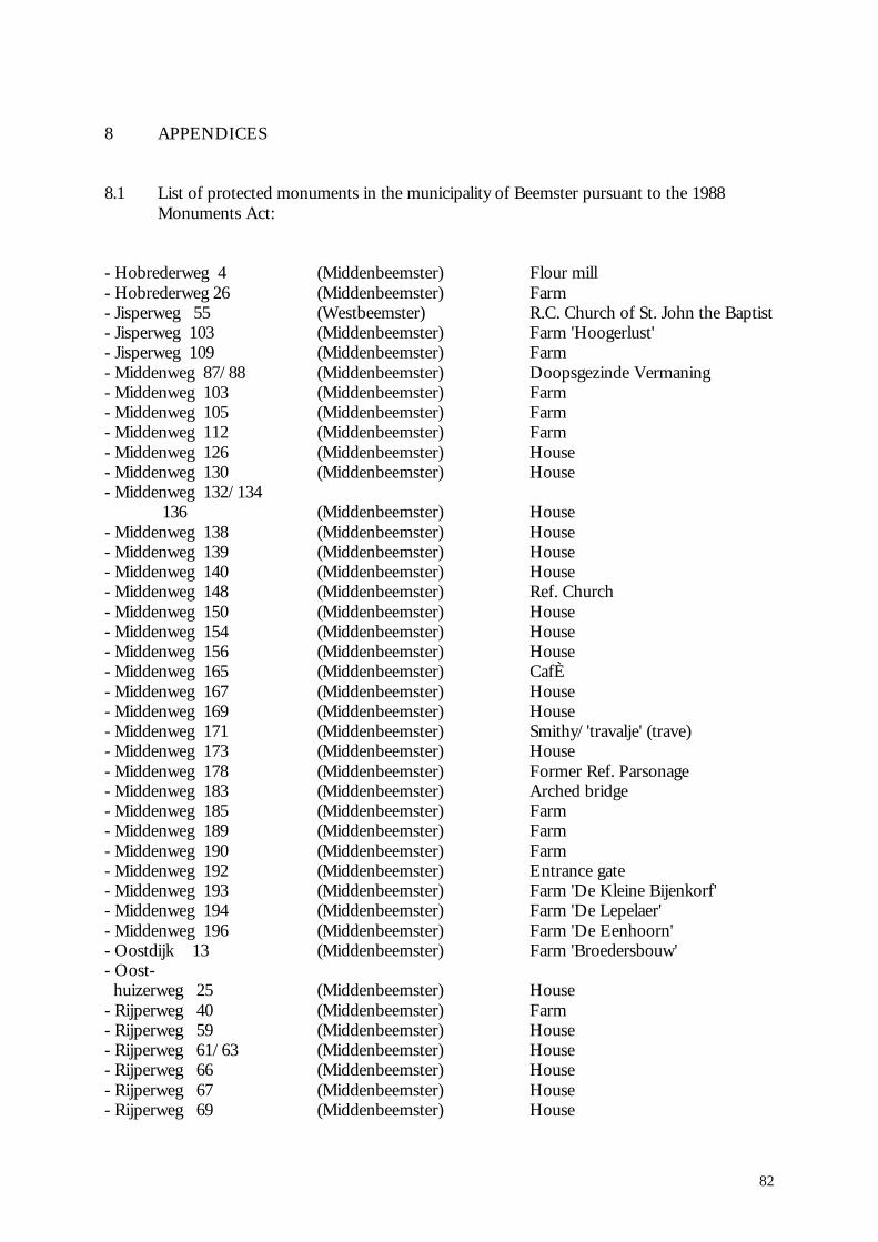
82
8 APPENDICES
8.1 List of protected monuments in the municipality of Beemster pursuant to the 1988Monuments Act:
- Hobrederweg 4 (Middenbeemster) Flour mill- Hobrederweg 26 (Middenbeemster) Farm- Jisperweg 55 (Westbeemster) R.C. Church of St. John the Baptist- Jisperweg 103 (Middenbeemster) Farm 'Hoogerlust'- Jisperweg 109 (Middenbeemster) Farm- Middenweg 87/88 (Middenbeemster) Doopsgezinde Vermaning- Middenweg 103 (Middenbeemster) Farm- Middenweg 105 (Middenbeemster) Farm- Middenweg 112 (Middenbeemster) Farm- Middenweg 126 (Middenbeemster) House- Middenweg 130 (Middenbeemster) House- Middenweg 132/134 136 (Middenbeemster) House- Middenweg 138 (Middenbeemster) House- Middenweg 139 (Middenbeemster) House- Middenweg 140 (Middenbeemster) House- Middenweg 148 (Middenbeemster) Ref. Church- Middenweg 150 (Middenbeemster) House- Middenweg 154 (Middenbeemster) House- Middenweg 156 (Middenbeemster) House- Middenweg 165 (Middenbeemster) CafÈ- Middenweg 167 (Middenbeemster) House- Middenweg 169 (Middenbeemster) House- Middenweg 171 (Middenbeemster) Smithy/'travalje' (trave)- Middenweg 173 (Middenbeemster) House- Middenweg 178 (Middenbeemster) Former Ref. Parsonage- Middenweg 183 (Middenbeemster) Arched bridge- Middenweg 185 (Middenbeemster) Farm- Middenweg 189 (Middenbeemster) Farm- Middenweg 190 (Middenbeemster) Farm- Middenweg 192 (Middenbeemster) Entrance gate- Middenweg 193 (Middenbeemster) Farm 'De Kleine Bijenkorf'- Middenweg 194 (Middenbeemster) Farm 'De Lepelaer'- Middenweg 196 (Middenbeemster) Farm 'De Eenhoorn'- Oostdijk 13 (Middenbeemster) Farm 'Broedersbouw'- Oost- huizerweg 25 (Middenbeemster) House- Rijperweg 40 (Middenbeemster) Farm- Rijperweg 59 (Middenbeemster) House- Rijperweg 61/63 (Middenbeemster) House- Rijperweg 66 (Middenbeemster) House- Rijperweg 67 (Middenbeemster) House- Rijperweg 69 (Middenbeemster) House
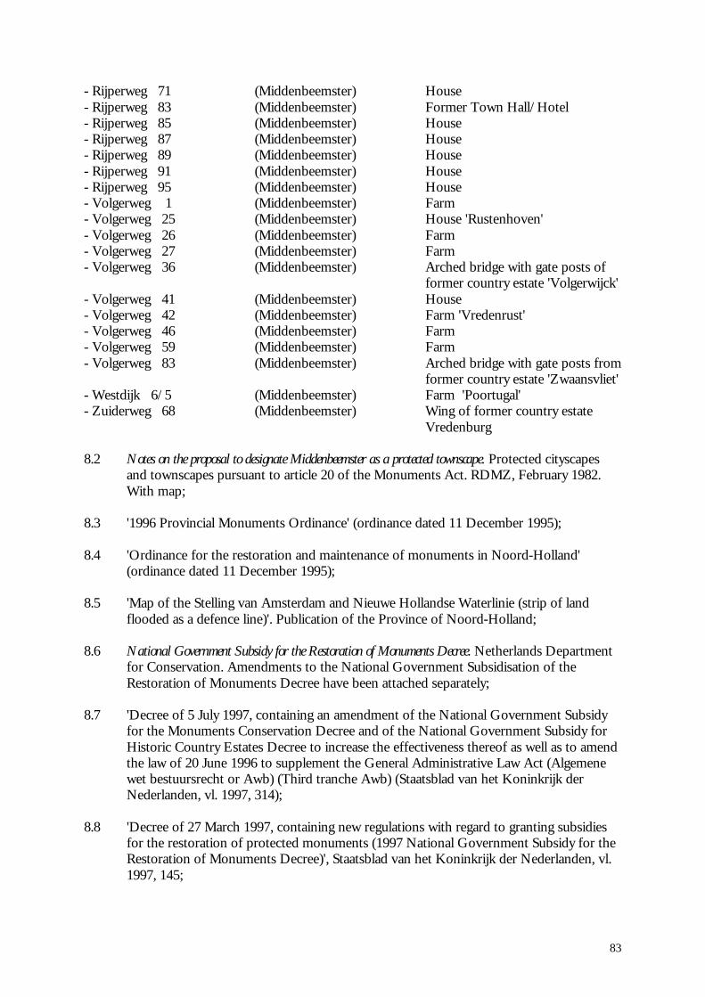
83
- Rijperweg 71 (Middenbeemster) House- Rijperweg 83 (Middenbeemster) Former Town Hall/Hotel- Rijperweg 85 (Middenbeemster) House- Rijperweg 87 (Middenbeemster) House- Rijperweg 89 (Middenbeemster) House- Rijperweg 91 (Middenbeemster) House- Rijperweg 95 (Middenbeemster) House- Volgerweg 1 (Middenbeemster) Farm- Volgerweg 25 (Middenbeemster) House 'Rustenhoven'- Volgerweg 26 (Middenbeemster) Farm- Volgerweg 27 (Middenbeemster) Farm- Volgerweg 36 (Middenbeemster) Arched bridge with gate posts of
former country estate 'Volgerwijck'- Volgerweg 41 (Middenbeemster) House- Volgerweg 42 (Middenbeemster) Farm 'Vredenrust'- Volgerweg 46 (Middenbeemster) Farm- Volgerweg 59 (Middenbeemster) Farm- Volgerweg 83 (Middenbeemster) Arched bridge with gate posts from
former country estate 'Zwaansvliet'- Westdijk 6/5 (Middenbeemster) Farm 'Poortugal'- Zuiderweg 68 (Middenbeemster) Wing of former country estate
Vredenburg
8.2 Notes on the proposal to designate Middenbeemster as a protected townscape. Protected cityscapesand townscapes pursuant to article 20 of the Monuments Act. RDMZ, February 1982.With map;
8.3 '1996 Provincial Monuments Ordinance' (ordinance dated 11 December 1995);
8.4 'Ordinance for the restoration and maintenance of monuments in Noord-Holland'(ordinance dated 11 December 1995);
8.5 'Map of the Stelling van Amsterdam and Nieuwe Hollandse Waterlinie (strip of landflooded as a defence line)'. Publication of the Province of Noord-Holland;
8.6 National Government Subsidy for the Restoration of Monuments Decree. Netherlands Departmentfor Conservation. Amendments to the National Government Subsidisation of theRestoration of Monuments Decree have been attached separately;
8.7 'Decree of 5 July 1997, containing an amendment of the National Government Subsidyfor the Monuments Conservation Decree and of the National Government Subsidy forHistoric Country Estates Decree to increase the effectiveness thereof as well as to amendthe law of 20 June 1996 to supplement the General Administrative Law Act (Algemenewet bestuursrecht or Awb) (Third tranche Awb) (Staatsblad van het Koninkrijk derNederlanden, vl. 1997, 314);
8.8 'Decree of 27 March 1997, containing new regulations with regard to granting subsidiesfor the restoration of protected monuments (1997 National Government Subsidy for theRestoration of Monuments Decree)', Staatsblad van het Koninkrijk der Nederlanden, vl.1997, 145;

84
8.9 Level chart 5400 Beemster. Waterschap De Waterlanden. 1997 Service Year (1993Appendix Level Decree);
8.10 Koggen. ANWB VVV Tourist route. ANWB bv, 1997.
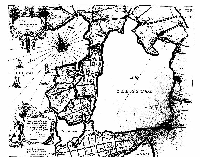


84
Beemster Polder (The Netherlands)
No 899
Identification
Nomination Droogmakerij de Beemster (The Beemster Polder)
Location Province of Noord-Holland
State Party The Netherlands
Date 26 June 1998
Justification by State Party
De Beemster, a clearly defined, systematically laid outreclaimed land, a complex designed and created as acultural landscape by man, is a site of outstandinguniversal value from the point of view of history, art,(landscape) architecture, science, and learning, as well asbeing a monument in its own right, representing a uniquemasterpiece of human creative genius. Criterion i
It is also an outstanding example of an architecturalensemble and physical environment that illustrates asignificant stage in the history of land colonization in TheNetherlands and elsewhere since the 17th century. Thehistoric physical environment of The Netherlands has beenbrought to life and developed through ever-improveddevelopments in civil water-management techniques. It is aman-made landscape that constitutes a site in a river deltawith large areas consisting of fenlands. Criterion ii
De Beemster was drained, cultivated, and colonized - adeliberate intervention in this undeveloped region - at thesame time as the city of Amsterdam first expanded duringthe 17th century. This expansion was supported by thenouveaux riches, the merchants and regents of Amsterdam,and was carried out by surveyors, city architects, andadministrators. They were involved in the expansion ofAmsterdam in 1613 as well as in De Beemster polder. Atthe time, town-planning and architectural principles wereapplied that even today show a close relationship to theclassical and Italian theories and treatises of Vitruvius,Palladio, and others concerning radial cities, about thecittà ideale, about checkerboard patterns, and about layingout straight, safe, paved, and planted roads. Criterion iv
There were two main reasons for creating De Beemster: tocontrol recurrent flooding and reclaim new agriculturalland, and also to find a safe way to invest funds. It hadbeen determined as early as 1611 that the region shouldalso realize the pastoral classical nature and agriculturemodel, because of its spatial design with lanes, green
compartments ('chambers'), pleasure gardens for thewealthy merchants of Amsterdam, and plantations.
De Beemster with its rational geometric layout wasdesigned as an architectural landscape. The theory of 17thcentury urban development and agricultural engineeringfor reclaiming land was based on the 'ideal of the straightline', and in addition fell back on old-fashioned principlessuch as (geometric) structure, planning and linearmonumentality, symmetry, harmony, and order - alandscape in which the square, the basic pattern fromanalogy of the theories of Scamozzi, induces balance anddiffusion. Criterion vi
Category of property
In terms of the categories of cultural property set out inArticle 1 of the 1972 World Heritage Convention, this is a.site. It is also a cultural landscape as defined in paragraph 39of the Operational Guidelines for the Implementation of theWorld Heritage Convention.
History and Description
History
Lagoons and deltas take up the greater part of the Dutchland. Over the centuries this land was made habitable bymeans of land reclamation and protection against thewater. Of the 3.4 million ha which now constitute TheNetherlands, a third is below sea level. If no dikes hadbeen constructed and if there were no drainage of excesswater, 65% of The Netherlands of today would be underwater.
The northern coastal area of the Kop van Noord-Hollandand along the Wadden Sea was once a virtuallyinterconnected series of mud-flats that extended to south-western Denmark. The earliest habitation was on knolls,which offered protection from the water before sea wallsand dikes had been constructed. The need to 'create' newland arose from the damage caused by the continualflooding, with the added bonus of obtaining excellentagricultural land.
Five factors influenced on the process of land reclamation:the availability of capital for investment, stable politicaland economic relationships, and the availability oftechnical means, entrepreneurial spirit, and good prices forfarmland.
The battle against the water began in the northern part ofNoord-Holland, in the area situated above the former openwaters of the IJ, by keeping out the sea-water. From the16th century onward efforts were geared toward draininglakes and ponds situated further inland. Land reclamationtook place by draining the big lakes, particularly in thenorthern part of Holland. This process was made possibleby the drastic improvement in pumping and drainingtechnology using windmills driving waterwheels. From theend of the Middle Ages the entire north of the IJ (HollandsNoorderkwartier) was enclosed within a ring of dikes;however, considerable areas of water survived within theindividual polders and the centre of the region was stilloccupied by the large Schermer, Purmer, and Beemsterlakes. More and more land could be reclaimed when the

85
technique of building dikes with discharging structures(sluices) was developed. These developments aresometimes called the delta-works of the 17th and 18thcentury.
Wind power was used to drain the polders as early as the15th century, through the use of wind-driven water-pumping mills. The 16th century development of therevolving cap on windmills made it possible to drain thelarger lakes. From the beginning of the 17th centuryonward it became possible to drain large bodies of water,such as the Beemster, by using networks of three or fourwindmills. The invention of this process is attributed toSimon Stevin (1548-1620).
The initiative to drain the water of the Beemster was takenby a number of wealthy regents and merchants fromAmsterdam and a number of high-ranking civil servants inThe Hague. In 1607 a patent was granted by the States ofHolland to sixteen people who founded theBeemstercompagnie to provide the requisite capital. Thepatent speaks of "work such, that it is possible to makeWater into Land." In total there were 123 investors, whoreceived a return of 17% on their investment uponcompletion of the polder in 1612.
As a preliminary to the work, a map of the Beemster andits environs was made by the surveyor Pieter Cornelisz.Cort of Alkmaar, to determine the possible consequencesof diking and to establish how to drain the Beemster itself.After Cort's death in 1608, he was succeeded by LucasJansz. Sinck, land surveyor in Amsterdam, who laid outthe first dike section for the Beemster polder. In 1608 thedike section between Purmerend and Neck was sub-contracted, as was the drainage canal to the Zuiderzee.
It was decided in 1611 that Sinck would draw in the roadsand canals. In that same year a start was made on layingout the canals and roads to prepare for the allotment ofland. Within the allotments the owners would be allowedto dig as many canals and ditches as they saw fit. Theblocks between the roads were to have a surface area of400 morgen, divided by canals into four blocks of 100morgen (1 morgen = c 0.85ha). It was finally decided todivide the land into five allotments. The allotments weremade in "packages"; the value of each package comparedto the others would be the same, as poor soil wascompensated by good.
Shovels and pickaxes were used in the basic engineeringworks; the foundations for sluices and windmills weresunk using manual pile-driving installations operated by30-40 people. Reclamation was effected by means ofwindmills. The reclamation of the Beemster ultimatelytook place with the construction of fifteen windmillnetworks.
The polder finally became a reality on 19 May 1612, andin August 1612 the plots of land were allotted. The bye-law of 1616 includes conditions on "plants and trees." Thiscreated an "ideal" landscape from 1620 onward with theplanting of the lanes with trees. First only the northern andwestern side of the roads were planted, so that the suncould dry the roads, which were still waterlogged.
After the conversion from drainage by wind to steampower in the late 1800s, the water was discharged into thebelt canal by three pumping stations. In the 20th centurythese were converted to diesel power. De Beemster is now
drained by the fully automated electric pumping stationWouter Sluis along the Westdijk (Middensloot) and by thediesel pumping station Jacobus Bouman along the Oostdijk(Oosthuizersloot).
Description
The Beemster polder is situated to the north of Amsterdamand to the west of Purmerend. De Beemster was formerly achain of peat bogs diked in by means of ring-dikes andprotected against the sea on the western side by the dunesof Kennemerland. The Zeevang to the east of De Beemsterand the Waterlant and Zaanstreek to the south wereencircled by ring-dikes. In between there were stretches ofwater, such as the Beemster and the Schermer and the wideinlet, the Ye.
At high tide the water of the Zuiderzee flowed freely intothe Beemster via the Korsloot. The Beemster in turnflowed into the Purmer via the Weere, and into theSchermer through the Zwet at Schermerhoorn and into theStarnmeer via the Spijkerboor. At some time in the early14th century the Beemster was closed off on the north-eastern side and no longer had an opening to the Zuiderzeeat that point.
The former Beemstermeer, which was once the largestopen water of the Noorderkwartier of The Netherlands,was created by the gradual overflow and by low-lying peatland crumbling away after the Zuiderzee had found a waythrough to this area. This process was completed by around1100. The current size of the Beemster Polder indicates thesize of this body of water at the time.
The land was allocated in oblong lots of 180m by 900m.The short sides of the lots are connected by a drainagecanal and an access road. Five such lots formed a unit, amodule of 900m square, and four of these units in turnformed a large square of 400 morgen. The direction of thesquares corresponded as much as possible with the originaldirection of the former shorelines of the lake so as to avoidcreating unusable lots along the shoreline.
- Buildings in De Beemster
The "bell-jar" farm (stolpboederij) with its typical squarebase fits in particularly well in the geometric pattern of thepolder. The farm in itself can be considered a geometricmodular unit with barns, hay and seed stores, stables, andother outbuildings.
There is also a number of country homes with their formalgardens, intended as pleasure farms (lusthoven) and out-of-town houses which served as summer residences for urbanproprietors, mainly from Amsterdam. Decoration andpractical use interchanged in the design of orchards,arbours, kitchen gardens, and footpaths. However, most ofthese were demolished in the 18th century, and all thatremains is a number of monumental entry gates to farmsbuilt at later dates.
- Agriculture in De Beemster
The drained land was originally used for cereal production,but as time went by it was gradually turned into pastureland for cattle because the high water table and soilconditions were not suitable for arable farming. Until the1880s, De Beemster was primarily used for cattle breeding.With the introduction of steam-driven pumping stations itwas possible to drain more deeply and to remove more
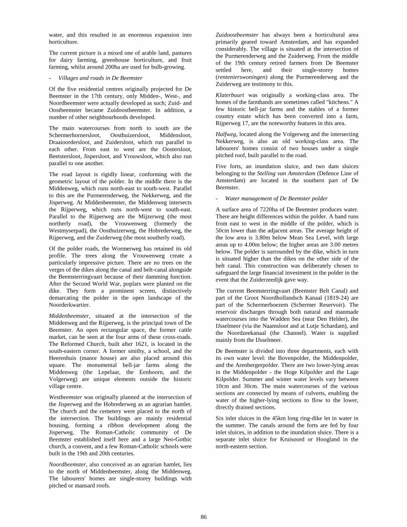
86
water, and this resulted in an enormous expansion intohorticulture.
The current picture is a mixed one of arable land, pasturesfor dairy farming, greenhouse horticulture, and fruitfarming, whilst around 200ha are used for bulb-growing.
- Villages and roads in De Beemster
Of the five residential centres originally projected for DeBeemster in the 17th century, only Midden-, West-, andNoordbeemster were actually developed as such; Zuid- andOostbeemster became Zuidoostbeemster. In addition, anumber of other neighbourhoods developed.
The main watercourses from north to south are theSchermerhornersloot, Oosthuizersloot, Middensloot,Draaioordersloot, and Zuidersloot, which run parallel toeach other. From east to west are the Oostersloot,Beetstersloot, Jispersloot, and Vrouwsloot, which also runparallel to one another.
The road layout is rigidly linear, conforming with thegeometric layout of the polder. In the middle there is theMiddenweg, which runs north-east to south-west. Parallelto this are the Purmerenderweg, the Nekkerweg, and theJisperweg. At Middenbeemster, the Middenweg intersectsthe Rijperweg, which runs north-west to south-east.Parallel to the Rijperweg are the Mijzerweg (the mostnortherly road), the Vrouwenweg (formerly theWestmyserpad), the Oosthuizerweg, the Hobrederweg, theRijperweg, and the Zuiderweg (the most southerly road).
Of the polder roads, the Wormerweg has retained its oldprofile. The trees along the Vrouwenweg create aparticularly impressive picture. There are no trees on theverges of the dikes along the canal and belt-canal alongsidethe Beemsterringvaart because of their damming function.After the Second World War, poplars were planted on thedike. They form a prominent screen, distinctivelydemarcating the polder in the open landscape of theNoorderkwartier.
Middenbeemster, situated at the intersection of theMiddenweg and the Rijperweg, is the principal town of DeBeemster. An open rectangular space, the former cattlemarket, can be seen at the four arms of these cross-roads.The Reformed Church, built after 1621, is located in thesouth-eastern corner. A former smithy, a school, and theHeerenhuis (manor house) are also placed around thissquare. The monumental bell-jar farms along theMiddenweg (the Lepelaar, the Eenhoorn, and theVolgerweg) are unique elements outside the historicvillage centre.
Westbeemster was originally planned at the intersection ofthe Jisperweg and the Hobrederweg as an agrarian hamlet.The church and the cemetery were placed to the north ofthe intersection. The buildings are mainly residentialhousing, forming a ribbon development along theJisperweg. The Roman-Catholic community of DeBeemster established itself here and a large Neo-Gothicchurch, a convent, and a few Roman-Catholic schools werebuilt in the 19th and 20th centuries.
Noordbeemster, also conceived as an agrarian hamlet, liesto the north of Middenbeemster, along the Middenweg.The labourers' homes are single-storey buildings withpitched or mansard roofs.
Zuidoostbeemster has always been a horticultural areaprimarily geared toward Amsterdam, and has expandedconsiderably. The village is situated at the intersection ofthe Purmerenderweg and the Zuiderweg. From the middleof the 19th century retired farmers from De Beemstersettled here, and their single-storey homes(rentenierswoningen) along the Purmerenderweg and theZuiderweg are testimony to this.
Klaterbuurt was originally a working-class area. Thehomes of the farmhands are sometimes called "kitchens." Afew historic bell-jar farms and the stables of a formercountry estate which has been converted into a farm,Rijperweg 17, are the noteworthy features in this area.
Halfweg, located along the Volgerweg and the intersectingNekkerweg, is also an old working-class area. Thelabourers' homes consist of two houses under a singlepitched roof, built parallel to the road.
Five forts, an inundation sluice, and two dam sluicesbelonging to the Stelling van Amsterdam (Defence Line ofAmsterdam) are located in the southern part of DeBeemster.
- Water management of De Beemster polder
A surface area of 7220ha of De Beemster produces water.There are height differences within the polder. A band runsfrom east to west in the middle of the polder, which is50cm lower than the adjacent areas. The average height ofthe low area is 3.80m below Mean Sea Level, with largeareas up to 4.00m below; the higher areas are 3.00 metresbelow. The polder is surrounded by the dike, which in turnis situated higher than the dikes on the other side of thebelt canal. This construction was deliberately chosen tosafeguard the large financial investment in the polder in theevent that the Zuiderzeedijk gave way.
The current Beemsterringvaart (Beemster Belt Canal) andpart of the Groot Noordhollandsch Kanaal (1819-24) arepart of the Schermerboezem (Schermer Reservoir). Thereservoir discharges through both natural and manmadewatercourses into the Wadden Sea (near Den Helder), theIJsselmeer (via the Naamsloot and at Lutje Schardam), andthe Noordzeekanaal (the Channel). Water is suppliedmainly from the IJsselmeer.
De Beemster is divided into three departments, each withits own water level: the Bovenpolder, the Middenpolder,and the Arenbergerpolder. There are two lower-lying areasin the Middenpolder - the Hoge Kilpolder and the LageKilpolder. Summer and winter water levels vary between10cm and 30cm. The main watercourses of the varioussections are connected by means of culverts, enabling thewater of the higher-lying sections to flow to the lower,directly drained sections.
Six inlet sluices in the 45km long ring-dike let in water inthe summer. The canals around the forts are fed by fourinlet sluices, in addition to the inundation sluice. There is aseparate inlet sluice for Kruisoord or Hoogland in thenorth-eastern section.

87
Management and Protection
Legal status
At State level, the 1988 Monuments Act defines as StateMonuments "everything constructed over at least fifty yearsago that is of public importance because of its beauty, itsimportance to science, or its cultural-historical value." TheState Monument Register extends to townscapes, for whichthere must be zoning plans drawn up by local authoritiesunder the provisions of the 1985 Rural Development Act.Currently 60 monuments in the Municipality of Beemster,which corresponds exactly with the polder, are protectedmonuments, and a further list of seventeen has beensubmitted for consideration.
There is provision at regional, provincial, and municipallevel for the preparation and implementation ofcomprehensive land-use and zoning plans, which areregularly updated. Cultural heritage protection forms anintegral part of these plans. The Beemster Polder forms partof the National Central Landscape of Noord-Holland, asdefined in the 1991 Waterland Regional Plan.
The 1996 Monument Decree of the Province of Noord-Holland covers monuments, buildings, and townscapes andis directly applied to the Beemster Polder. In 1991 theMunicipality of Beemster adopted its own MonumentDecree; this was updated in 1994.
Management
Management at different levels, in accordance with zoningand land-use plans, is shared by the Municipality ofBeemster, the Provincial Administration of Noord-Holland,and the Waterschap De Waterlanden.
The last-named is a water board of a type that is unique toThe Netherlands. It was created in 1981 following amerger of a number of water boards, and is in charge ofwater management in an area of c 35,000ha, including DeBeemster. One of its special duties is to manage theplanting of trees along the public roads of De Beemster.
State protected monuments are the concern of theNetherlands Department for Conservation (Rijksdienstvoor de Monumentenzorg), an agency of the Ministry ofEducation, Culture and Science. The Association for theConservation of Nature Monuments in The Netherlands(Vereniging tot Behoud van Natuurmonumenten inNederland) manages the forts of the Stelling vanAmsterdam.
All these bodies have programmes of regular andsystematic monitoring of conservation and protectionmeasures within their respective competences.
The boundaries of the nominated area are clear-cut andlogical, being based on the functional dikes and canalscreated in the early 17th century when the Beemsterproject was completed and never changed. There is alogical and adequate buffer zone, comprising the NorthHolland Canal and other polders (including the historictown of Rijp), in which protection is provided under theDutch legislation listed above.
Conservation and Authenticity
The Beemster Polder is a living organic landscape that hasevolved over nearly four centuries and continues to play animportant role in the economic life of The Netherlands. Withchanging social and economic conditions certain elements,such as the pleasure farms and windmills, have disappeared,whilst others have changed their functions. There has been ashift from primarily arable farming to a mixed economy, withemphasis on dairy farming and horticulture, which haschanged certain aspects of the landscape.
However, the basic structure of dikes, canals, roads, andhuman settlements laid down in the early 17th centuryremains intact and authentic, since any fundamentaldisturbance would put the physical integrity of the entireregion in jeopardy.
Evaluation
Action by ICOMOS
An ICMOS expert mission visited the Beemster Polder inJanuary 1999. ICOMOS also benefited from the expertise ofits International Scientific Committee on Historic Gardensand Sites.
Qualities
The Beemster Polder represents a very important event in thehistory of land reclamation. It combines the genius of theDutch water engineers, who were to carry out similarreclamation projects in many parts of the world, with anintellectual concept, that of the fully planned architectoniclandscape, that stems from the classical and Renaissanceideal of the "ideal city," imposing both spatial and socialorder upon the landscape and fusing natural and manmadeelements into an integrated and ordered whole. As such ithad a profound influence on subsequent reclamation andlandscaping projects throughout Europe and beyond.
Comparative analysis
The example of the Beemster Polder was followed rapidly byother projects in The Netherlands in the 17th century,occasioned by the pressures created by a rapidly expandingpopulation. It was to be adopted as a model for the ambitious20th century reclamation project for draining theZuiderzee/IJsselmeer. None of these, however, can beconsidered to compare with the Beemster Polder because ofthe latter's intellectual and technological creativity. advancedapproach.
Brief description
The Beemster Polder is the oldest area of reclaimed land inThe Netherlands, dating from the early 17th century. It haspreserved intact its regular landscape of fields, roads, canals,dikes, and settlements, laid out in accordance with theprinciples of classical and Renaissance planning.

88
Recommendation
That this property be inscribed on the World Heritage List onthe basis of criteria i, ii, and iv:
Criterion i The Beemster Polder is a masterpiece ofcreative planning, in which the ideals of antiquity andthe Renaissance were applied to the design of areclaimed landscape.
Criterion ii The innovative and intellectuallyimaginative landscape of the Beemster Polder had aprofound and lasting impact on reclamation projects inEurope and beyond.
Criterion iv The creation of the Beemster Polder marksa major step forward in the interrelationship betweenhumankind and water at a crucial period of social andeconomic expansion.
ICOMOS, September 1999

99
Polder de Beemster (Pays-Bas)
No 899
Identification
Bien proposé Droogmakerij de Beemster (Le polderde Beemster)
Lieu Province de Hollande-Septentrionale
Etat Partie Pays-Bas
Date 26 juin 1998
Justification émanant de l’Etat partie
Beemster, terre conquise sur les eaux, clairementdéfinie et planifiée systématiquement, paysage culturelcomplexe, conçu et créé volontairement par l’homme,est un site d’une valeur universelle exceptionnelle dupoint de vue de l’histoire, de l’art, de l’architecture(landscape), des sciences et de la connaissance ainsiqu’un monument à part entière. Il représente un chef-d’œuvre unique du génie créateur humain. Critère i
C’est aussi un exemple remarquable d’ensemblearchitectural et d’environnement physique qui illustreun stade important de l’histoire de la colonisation desterres aux Pays-Bas et dans d’autre partie du monde,depuis le XVIIe siècle. L’environnement physique ethistorique des Pays-Bas a été conçu et a évolué avec leperfectionnement des techniques de gestion des eauxet des terres humides. Beemster est un paysagefaçonné par l’homme. Il constitue un site dans le deltad’une rivière qui comporte de vastes zonesmarécageuses. Critère ii
Beemster a été drainé, mis en culture et colonisé –mise en valeur voulue par l’homme d’une zonejusqu’alors inexploitée – en même temps que la villed’Amsterdam prenait son premier essor au XVIIe
siècle. La réalisation du polder Beemster en 1613 futsoutenue par les élus et la riche bourgeoisiecommerçante de la ville d’Amsterdam. Elle estl’œuvre des ingénieurs hydrographes, architectes,géomètres et gestionnaires qui prirent part dans lemême temps à l’expansion d’Amsterdam. Lesprincipes d’urbanisme et d’architecture quidominaient à l’époque, et qui transparaissent encoreaujourd’hui, s’inspiraient largement des théories ettraités classiques et italiens, développés par Vitruve etrepris par Palladio et d’autres architectes, quipréconisaient des villes à plan radial ou à damier - lacittà ideale - ordonnées par des voies droites, sûres,pavées et plantées d’arbres. Critère iv
Deux objectifs principaux présidèrent à la création dupolder de Beemster : la lutte contre les inondationsrépétées et la conquête de nouvelles terres cultivables.C’était par ailleurs un moyen sûr et rentable de fairefructifier les richesses produites par la ville. Dès 1611,il fut décidé que la région refléterait une naturepastorale classique et deviendrait un modèle agricolepar sa conception spatiale, avec ses routes rectilignes,ses compartiments verts (chambres), ses cultures et sesjardins d’agréments pour les riches marchandsd’Amsterdam.
Le tracé rationnel et géométrique de Beemster en fait,dès l’origine, un paysage architectural. Les théoriesd’urbanisme et les techniques de conquête des terresagricoles, telles qu’elles étaient pratiquées au XVIIe
siècle, étaient fondées sur « l’idéal de la ligne droite »et reposaient sur des principes anciens tels que lastructure (géométrique), la monumentalité planifiée etlinéaire, la symétrie, l’harmonie et l’ordre – unpaysage dans lequel le carré, figure de base desthéories de Scamozzi, induit équilibre et diffusion.
Critère vi
Catégorie de bien
En termes de catégories de biens culturels, tellesqu’elles sont définies à l’article premier de laconvention du Patrimoine mondial de 1972, le polder deBeemster est un site. C’est aussi un paysage culturel telque défini au paragraphe 39 des Orientations devantguider la mise en œuvre de la Convention dupatrimoine mondial.
Histoire et description
Histoire
Lagunes et deltas occupent la plus grande partie desPays-Bas. Au cours des siècles, ces terres basses ontété rendues habitables grâce à la conquête deterritoires et la protection contre les eaux. Un tiers des3,4 millions d’hectares qui composent actuellementles Pays-Bas est situé en dessous du niveau de la mer.Sans la construction de digues et le drainage de l’eauexcédentaire, 65% de la superficie des Pays-Basseraient aujourd’hui immergés.
La région littorale nord de la péninsule de laHollande-Septentrionale et de la mer des Wadden étaitautrefois constituée d’une succession de terres basseset marécageuses qui s’étendaient jusqu’au sud-ouestdu Danemark. Les premières habitations furentconstruites sur des tertres qui offraient une protectioncontre les eaux, et cela avant que soient construits desmurs et des digues. La « création » de nouveauxterritoires résulte de la nécessité de lutter contre lesinondations incessantes et fournit de surcroîtd’excellentes terres agricoles.
Les facteurs ayant influencé le processus de laconquête de territoires sont au nombre de cinq : ladisponibilité de capitaux à investir, un climat politiqueet économique stable, l’existence de moyens

100
techniques, l’esprit d’entreprise et le bon prix desterres arables.
La lutte contre les eaux a commencé dans le nord de laHollande-Septentrionale, dans la zone située au-delàdes eaux autrefois libres de l’IJ, en l’isolant de la mer.A partir du XVIe siècle, tous les efforts tendent àéliminer l’eau des lacs et des marais situés à l’intérieurde cette limite. La conquête des terres a été réaliséepar le drainage des grands lacs, en particulier dans lenord de la Hollande. Ce processus a été rendu possiblepar l’amélioration radicale des techniques de pompageet de drainage qui utilisaient le moulin à vent et laroue hydraulique. A partir de la fin du Moyen Age,toute la partie nord de l’IJ (HollandsNoorderkwartier) était fermée par un ensemble dedigues. Toutefois, de vastes étendues d’eausubsistaient à l’intérieur de chacun des polders et lecentre de la région était encore occupé par les grandslacs de Schermer, Purmer et Beemster. Il devintpossible de conquérir davantage de terres avec la miseau point de digues comportant des vannes derégulation et des écluses. Ces aménagements sontparfois appelés les travaux du delta des XVIIe etXVIIIe siècles.
Dès le XVe siècle on utilisa la force du vent pourdrainer les polders à l’aide des moulins à vent quiactionnent les pompe à eau. Au XVIe siècle, lesaméliorations techniques apportées aux moulinspermirent le drainage de lacs plus grands. A partir dudébut du XVIIe siècle, il devint possible de drainer degrandes étendues d’eau comme le Beemster, enutilisant trois ou quatre moulins à vent en chaîne.L’invention de ce procédé est attribuée à SimonStevin (1548-1620).
L’initiative de drainer l’eau du Beemster revient àplusieurs administrateurs prospères et richesmarchands de la ville d’Amsterdam et à un certainnombre de hauts fonctionnaires de La Haye. En 1607un droit d’exploitation fut accordé par legouvernement des Provinces-Unies à seize personnesqui fondèrent la Beemstercompagnie chargée de réunirle capital nécessaire. Le droit d’exploitation faitmention de "travailler de manière à transformer desétendues d’eau en terres (arables)" Au total, 123investisseurs bénéficièrent d’un retour surinvestissement de 17% à l’achèvement du polder en1612.
Avant le début les travaux, une carte du Beemster etde ses environs fut dressée par l’ingénieur PieterCornelisz Cort de Alkmaar, afin de déterminer lespossibles conséquences de la construction de digues etde définir la manière de drainer le Beemster lui-même.Cort décéda en 1608 et son successeur, Lucas Jansz.Sinck, géomètre à Amsterdam, dessina la premièrepartie de la digue du polder de Beemster. En 1608, laconstruction de la digue entre Purmerend et Neck futconfiée à une entreprise, de même que le creusementdu canal de drainage jusqu’au Zuiderzee.
En 1611 Sinck fut chargé de tracer les routes et lescanaux. La même année, les travaux de constructionde ces derniers commencèrent et on délimita les
parcelles. Sur chacune d’elles, les propriétairesauraient le droit de creuser autant de canaux et defossés qu’ils jugeraient nécessaire. Les terrainscompris entre chaque route devaient avoir unesuperficie de 400 morgen, être divisés par des canauxen quatre unités de 100 morgen (1 morgen = 0.85ha).Il fut finalement décidé de diviser la terre en cinqparcelles qui, réunies, constitueraient des unités devaleur équivalente, car les sols pauvres seraientcompensés par d’autres plus riches.
Les travaux de gros œuvre furent effectués à la pelle età la pioche. Les pieux des fondations destinées àrecevoir les écluses et les moulins à vents étaientenfoncés à l’aide de dispositifs manuels manœuvréspar 30 à 40 personnes. L’assèchement des terres sefaisait au moyen des moulins à vent. Celui duBeemster nécessita la construction d’une série dequinze moulins à vent.Le polder devint une réalité le 19 mai 1612 et en août1612 les parcelles de terres étaient attribuées. Unarrêté municipal de 1616 précise les conditions deplantation des arbres et haies. Ainsi était créé à partirde 1620 un paysage « idéal » avec des routes bordéesd’arbres. Au début, seuls les côtés nord et ouestdevaient être plantés afin de permettre au soleil desécher les routes encore détrempées.
Vers la fin du XIXe siècle, les pompes à vapeurremplacent les moulins à vent et l’eau est refoulée versle canal périphérique par trois stations de pompage.Au XXe siècle, la vapeur fait place au diesel. LeBeemster est maintenant drainé par la station depompage électrique entièrement automatique deWouter Sluis sur le Westdijk (Middensloot) et par lastation de pompage au diesel Jacobus Bouman surl’Oostdijk (Oosthuizersloot).
Description
Le polder de Beemster est situé au nord d’Amsterdamet à l’ouest de Purmerend. Le Beemster était autrefoisconstitué d’un ensemble de tourbières entourées dedigues et protégées de la mer sur le flanc ouest par lesdunes du Kennemerland. Le Zeevang à l’est deBeemster et les Waterlant et Zaanstreek au sud étaientencerclés de digues. Entre ces polders demeuraient desétendues d’eau comme le Beemster et le Schermer etle bras de mer Ye.
A marée haute, l’eau du Zuiderzee remontaitlibrement dans le Beemster via le Korsloot. LeBeemster à son tour se déversait dans le Purmer via leWeere, et dans le Schermer par le Zwet au niveau deSchermerhoorn, et enfin dans le Starnmeer via leSpijkerboor. Pendant quelques temps au début duXIVe siècle, le Beemster fut fermé sur le côté nord-estet était coupé du Zuiderzee à cet endroit-là.
L’ancien Beemstermeer, qui fut autrefois la plusgrande étendue d’eau de mer du Noorderkwartier desPays-Bas, fut créé par les inondations répétées etl’effritement des tourbières basses après que leZuiderzee eut fait irruption dans les terres. Leprocessus d’envahissement de la terre par la mer prit

101
fin vers 1100. Les dimensions actuelles du polder deBeemster correspondent à celles de l’ancien lac.
La terre fut attribuée par parcelles rectangulaires de180m sur 900m. Les côtés les plus courts des parcellessont reliés par un canal de drainage et une routed’accès. Cinq de ces parcelles forment une unité, unmodule de 900m carrés, et quatre de ces unitésforment un grand carré de 400 morgen. L’orientationdes parcelles correspondait autant que possible à celledes rives de l’ancien lac de manière à éviter la créationde parcelles inutilisables le long de cette anciennerive.
- Les constructions dans le polder de Beemster
La ferme à toit en cloche (stolpboederij), avec sonplan carré caractéristique, convient particulièrementbien au dessin géométrique du polder. La ferme enelle-même est une unité modulaire géométriqueflanquée d’étables, de silos à grains, de granges à foin,d’écuries et d’autres dépendances.
Il existe aussi des maisons de campagne avec leurjardin à la française conçues comme des fermesd’agrément (lusthoven) et des maisons rurales quiservent de résidences d’été pour des habitants desvilles, essentiellement d’Amsterdam. Les fonctionsdécoratives et utilitaires des jardins guidaient de lamême façon la création de vergers, de charmilles, dejardins aromatiques et de chemins. La plupart desconstructions et des jardins disparurent cependant auXVIIIe siècle et il ne reste qu’un certain nombred’entrées et de grilles monumentales menant à desfermes construites ultérieurement.
- Agriculture dans le Beemster
Les terrains drainés furent au départ consacrés à laproduction de céréales, mais ces cultures furentabandonnées au profit de pâturages, car le niveauélevé de l’eau et l’état du sol ne permettaient pasl’exploitation d’une terre arable. Jusque vers 1880, leBeemster fut essentiellement consacré à l’élevagebovin. Grâce à l’introduction des stations de pompageà vapeur, il fut possible de drainer l’eau plusprofondément et de l’éliminer davantage, ce quipermit une grande extension de l’horticulture.
Actuellement, le Beemster est partagé entrel’exploitation de terres arables, les prairies pour laproduction laitière, l’horticulture sous serre, laproduction fruitière, 200ha étant consacrés à la culturede la tulipe.
- Villages et routes du Beemster
Sur les cinq centres résidentiels prévus dès l’origineau XVIIe siècle, seuls Midden-, West-, etNoordbeemster ont été effectivement construits. Zuid-et Oostbeemster sont devenus Zuidoostbeemster. Deplus, un certain nombre d’autres centres se sontdéveloppés.
Les principaux canaux, orientés nord sud, et creusésparallèlement les uns aux autres sont le
Schermerhornersloot, l’Oosthuizersloot, leMiddensloot, Draaioordersloot, et le Zuidersloot.D’est en ouest on trouve l’Oostersloot, leBeetstersloot, le Jispersloot et le Vrouwsloot, dont letracé est également parallèle.
Le réseau routier est parfaitement rectiligne, conformeau dessin géométrique du polder. Au milieu se trouvele Middenweg, orienté nord-est sud-ouest.Parallèlement à celui-ci sont tracés lePurmerenderweg, le Nekkerweg et le Jisperweg. AMiddenbeemster, le Middenweg croise le Rijperwegdont le tracé suit l’axe nord-ouest sud-est.Parallèlement au Rijperweg se trouve le Mijzerweg (laroute la plus au nord), le Vrouwenweg (autrefoisappelé le Westmyserpad), l’Oosthuizerweg, leHobrederweg, le Rijperweg, et le Zuiderweg (la routela plus au sud).
Parmi les routes du polder, le Wormerweg a conservéson aspect ancien. Les arbres qui le bordent offrentune vision particulièrement frappante. Aucun arbren’est planté à proximité des digues le long du canalcollecteur ni du canal périphérique longeant leBeemsterringvaart à cause de leur fonction de barrage.Après la Deuxième Guerre mondiale, la digue futplantée de peupliers. Ils forment un écran proéminentet dessinent nettement les limites du polder dans lepaysage ouvert du Noorderkwartier.
Middenbeemster, situé à l’intersection du Middenweget du Rijperweg, est la principale ville du Beemster.L’ancien marché aux bestiaux, correspondant à unespace ouvert de forme rectangulaire, se trouve àl’intersection de ces routes. L’église réformée,construite après 1621, s’élève dans l’angle sud-est.Une ancienne forge, une école et le manoir (Heerenhuis) sont également disposés autour de cetteplace. Les fermes monumentales à toit en clocheconstruites en bordure du Middenweg, dénomméesLepelaar, Eenhoorn, et Volgerweg, sont des élémentsoriginaux situés en dehors du centre historique duvillage.
Westbeemster fut dès l’origine conçu comme hameauagricole situé à l’intersection du Jisperweg et duHobrederweg. L’église et le cimetière furent implantésau nord du croisement des routes. Les bâtiments sontessentiellement des maisons d’habitation construitesde façon linéaire en bordure du Jisperweg. Lacommunauté catholique romaine de Beemster s’estinstallée dans ce village et une grande églisenéogothique, un couvent et quelques écolesreligieuses catholiques furent construits aux XIXe etXXe siècle.
Noordbeemster, également conçu comme un hameauagricole, est situé au nord de Middenbeemster, sur leMiddenweg. Les maisons des agriculteurs comportentun seul niveau et un toit pentu ou mansardé.
Zuidoostbeemster, qui a toujours été une régiond’horticulture destinée à approvisionner Amsterdam,s’est considérablement développé. Le village est situéà l’intersection du Purmerenderweg et du Zuiderweg.A partir du milieu du XIXe siècle, les fermiers du
102
Beemster s’installait ici pour prendre leur retraite, cedont témoignent leurs maisons à un seul niveau(rentenierswoningen) construites en bordure duPurmerenderweg et du Zuiderweg.
Klaterbuurt était à l’origine une région destinée à laclasse ouvrière. Les habitations des ouvriers agricoless’appellent parfois des "cuisines." Quelques fermesanciennes à toit en cloche et les étables d’un anciendomaine agricole transformé en ferme, Rijperweg 17,sont des caractéristiques remarquables de la région.
Halfweg, situé sur le Volgerweg et à l’intersection duNekkerweg, est également un ancien village ouvrier.Les maisons des ouvriers agricoles, construitesparallèlement à la route, sont constituées de deuxhabitations réunies sous un toit en pente.
Cinq forts, une écluse d’inondation et deux vannes derégulation appartenant à la ligne de défensed’Amsterdam (Stelling van Amsterdam) se trouventdans la partie sud du Beemster.
- Gestion de l’eau du polder Beemster
Le polder de Beemster produit de l’eau sur unesuperficie de 7220ha. Il existe des différences deniveaux à l’intérieur du polder. Une bande de terreorientée est ouest et passant par le milieu du polder està 50cm en dessous des zones adjacentes. L’altitudemoyenne est de 3,80m sous le niveau de la mer, degrandes étendues se trouvant à moins 4m ; les zonesles plus élevées sont à 3m en dessous du niveau de lamer. Le polder est entouré d’une digue qui elle-mêmeest surélevée par rapport aux digues situées de l’autrecôté du canal périphérique. Ce type de construction aété réalisé afin de protéger les importantsinvestissements réalisés dans le polder au cas où ladigue du Zuiderzee céderait.
L’actuel Beemsterringvaart (canal périphérique duBeemster) et une partie du Groot NoordhollandschKanaal (1819-24) appartiennent au Schermerboezem(réservoir du Schermer). Le réservoir se déverse à lafois via des cours d’eau naturel et des canauxartificiels dans la mer des Wadden (près de DenHelder), dans l’IJsselmeer (via le Naamsloot à LutjeSchardam), et le Noordzeekanaal (le Canal). L’eauprovient essentiellement de l’IJsselmeer.
Le Beemster est divisé en trois parties, chacune ayantson propre niveau d’eau : le Bovenpolder, leMiddenpolder et l’Arenbergerpolder. Il existe deuxzones plus basses dans le Middenpolder - le HogeKilpolder et le Lage Kilpolder. Le niveau des eaux enété et en hiver varie entre 10cm and 30cm. Lesprincipaux cours d’eau des différentes parties dupolder sont reliés par des caniveaux qui permettentl’écoulement de l’eau des zones les plus hautes dansles zones plus basses qui sont drainées.
Six écluses pratiquées dans les 45km de digue laissentpénétrer l’eau pendant l’été. Les canaux autour desforts sont alimentés par quatre de ces écluses, en plusdes vannes d’inondation. Il existe une écluse
d’admission d’eau pour Kruisoord ou Hoogland dansla partie nord-est.
Gestion et protection
Statut juridique
Au niveau de l’Etat, la loi de 1988 sur les monumentsdéfinit comme monument d’Etat "tout ce qui estconstruit depuis plus de cinquante ans et qui présente unintérêt général en raison de son esthétique, de sonimportance pour la science ou de sa valeur historico-culturelle." Le Registre des monuments d’Etat comporteles paysages urbains pour lesquels il doit exister desplans réalisés par les autorités locales dans le cadre de laloi de 1985 sur le développement rural. Actuellement,60 monuments de la municipalité de Beemster, dont leslimites sont calquées sur celles du polder, sont desmonuments protégés et une liste complémentaire de 17autres bâtiments a été soumise à examen.
Des dispositions sont prises au niveau régional,provincial et municipal en faveur de la préparation et dela mise en œuvre de plans de zonage et d’utilisation dessols qui sont régulièrement mis à jour. La protection dupatrimoine culturel fait partie intégrante de ces plans. Lepolder de Beemster est un élément constitutif dupaysage national de Hollande Septentrionale tel qu’il estdéfini dans le plan régional des terres humides de 1991.
Le décret de 1996 de la Province de la Hollande-Septentrionale concerne les monuments, les bâtiments etles paysages urbains et s’applique directement au polderde Beemster. En 1991, la municipalité de Beemster aadopté son propre décret portant sur les monuments ; ila été mis à jour en 1994.
Gestion
Conformément aux plans de zonage et d’utilisation dessols, la gestion est partagée à différents niveaux par laMunicipalité de Beemster, l’administration Provincialede Hollande-Septentrionale et le Waterschap DeWaterlanden.
Ce dernier organisme est une agence de l’eau de typeparticulier aux Pays-Bas. Il a été créé en 1981 à lasuite de la fusion de plusieurs services et s’occupe dela gestion de l’eau sur un territoire d’environ 35000haqui comporte le Beemster. Il est entre autreresponsable des plantations d’arbres le long des routesdu domaine public dans le Beemster.
Les monuments d’Etat protégés sont placés sous latutelle de la direction de la Conservation des Pays-Bas(Rijksdienst voor de Monumentenzorg) qui dépend duMinistère de l’Education, de la Culture et desSciences. L’Association pour la Conservation de lanature des Pays-Bas (Vereniging tot Behoud vanNatuurmonumenten in Nederland) gère les forts de laLigne de défense d’Amsterdam.
Tous ces organismes ont des programmes deconservation systématiques et prennent des mesures

103
de protection et de conservation dans leur domaine decompétence.
Les limites de la zone proposée pour inscription sontclairement délimitées et logiques, du fait qu’ellessuivent le tracé des digues et des canaux qui furentcréés au début du XVIIe siècle au moment de laréalisation du projet du Beemster et qui ne subitaucune modification ultérieure. Il existe une zonetampon logique et appropriée, comprenant le canal deHollande-Septentrionale et d’autres polders (et la villehistorique de Rijp), à laquelle s’applique uneprotection découlant de la loi néerlandaise précitée.
Conservation et authenticité
Le polder de Beemster est un paysage organique vivantqui évolue depuis plus de quatre siècles et continue dejouer un rôle important dans la vie économique desPays-Bas. Avec l’évolution des conditions économiqueset sociales, certains éléments tels que les fermesd’agrément et les moulins à vent ont disparu tandis qued’autres ont changé de fonction. L’économie de la zone,à l’origine essentiellement fondée sur l’agriculture, estactuellement diversifiée, l’accent étant mis sur laproduction laitière et l’horticulture, ce qui a modifiécertains aspects du paysage.
Toutefois, la structure de base des digues, des canaux,des routes et de la colonisation définie au début duXVIIe siècle demeure intacte et authentique, car toutemodification fondamentale mettrait l’intégrité physiquede la région en péril.
Evaluation
Action de l’ICOMOS
Une mission d’expertise de l’ICOMOS a visité le polderde Beemster en janvier 1999. L’ICOMOS a égalementbénéficié de l’expertise de son Comité scientifiqueinternational sur les jardins et sites historiques.
Caractéristiques
Le polder de Beemster représente un événement trèsimportant dans l’histoire de la conquête de terres. Il alliele génie des ingénieurs hydrographes néerlandais, quidevaient mener des projets similaires dans d’autresparties du monde, et un concept intellectuel, celui dupaysage architectonique entièrement dessiné, issu del’idéal classique et Renaissance, à savoir la « villeidéale », qui impose au paysage à la fois l’ordre social etspatial et qui opère la fusion des éléments naturels etceux créés par la main de l’homme en un tout intégré etordonné. Le polder de Beemster a exercé une profondeinfluence sur les entreprises d’assèchement ultérieures etsur les projets de façonnage du paysage en Europe etdans le monde.
Analyse Comparative
L’exemple du polder de Beemster fut rapidement suivipar d’autres projets réalisés aux Pays-Bas au XVIIe
siècle, sous la pression d’une démographie en expansionrapide. Il devait servir de modèle à l’ambitieux projet dudrainage du Zuiderzee, actuel Ijsselmeer, entrepris auXXe siècle. Aucun de ces projets ne peut cependant luiêtre comparé, car il représentait à l’époque uneinnovation et une audace technologique et intellectuelleincomparables.
Brève description
Datant du début du XVIIe siècle, le polder de Beemsterest la plus ancienne région conquise sur l’eau aux Pays-Bas. Il a conservé intact son paysage régulier dechamps, de routes, de canaux, de digues et de villagesdessinés selon les principes urbanistiques de l’antiquitéet de la Renaissance.
Recommandation
Que ce bien soit inscrit sur la Liste du Patrimoinemondial sur la base des critères i, ii, et iv :
Critère i Le polder de Beemster est un chef-d’œuvre de planification créatrice dans lequel lesidéaux de l’antiquité et de la Renaissance furentappliqués à la conquête d’une terre.
Critère ii Le paysage innovateur et imaginatif dupolder de Beemster a eu un impact profond etdurable sur les projets de reconquête des terres enEurope et au-delà de ses frontières.
Critère iv La création du polder de Beemstermarque une étape majeure dans la relation entrel’homme et l’eau à une période cruciale d’expansionéconomique et sociale.
ICOMOS, septembre 1999