
Sinkholes Modeling, and Soil Survey. Objectives Examine a few techniques and efforts to model karst...
28
Sinkholes Modeling, and Soil Survey
-
Upload
angie-seader -
Category
Documents
-
view
213 -
download
0
Transcript of Sinkholes Modeling, and Soil Survey. Objectives Examine a few techniques and efforts to model karst...

Sinkholes
Modeling, and Soil Survey
Objectives
• Examine a few techniques and efforts to model karst features for map unit and/or component delineation.
• Consider some case studies of mapping and updating karst areas:– Lawrence co, Indiana– Springfield plateau, Missouri

Karst: Dade county, MO
GIS techniques to enhance identification of karst

Same area: 10m DEM, hillshade relief, hypso lines

Sinkholes: 3x vertical exaggeration, 5m display resolution (10m DEM)

Flowaccumulation (multi-path): karst area
Didn’t work that well…
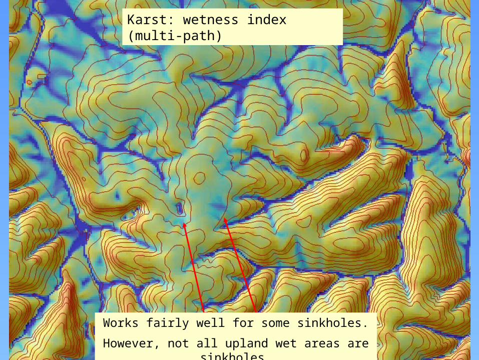
Karst: wetness index (multi-path)
Works fairly well for some sinkholes.
However, not all upland wet areas are sinkholes.

Can we model these sinkholes?
• Moderately high elevationAvg about 325m; range about 315 to 335m
• High Flow accumulationAbove about 200
• High Wetness IndexAbove about 9
• Not on the stream networkNot so easy to model

Fuzzy Membership Model for SinksHigher-elevation valleys confounded w sinks
What about using streams in the model?
USGS streams layer is incomplete (missing tributaries)
Modeled stream network runs into sinks

Fuzzy Membership Model w more restrictive lower elevation criteria
(lost the lowest elevation sinkhole)

Karst plain: Pierpont area, Boone county, MO

Simple Fuzzy Membership model for Pierpont sinkhole areas:
High elevation (full membership above 225m)
High wetness index (full membership above 5)
Does an OK job of identifying areas where the sinkholes occur

Mapping karst in SSURGO
• How can we identify karst features in…– Spatial data– Attribute data
• How might this affect interpretations?• Case studies: karst in soil survey– Lawrence county, IN– Springfield Plateau (MLRA 116B), MO
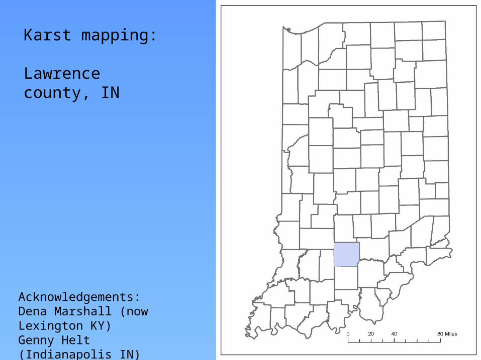
Karst mapping:
Lawrence county, IN
Acknowledgements:Dena Marshall (now Lexington KY)Genny Helt (Indianapolis IN)

Physiographic Features of southern Indiana (Schneider, 1966)

A closer look at features of the Crawford Upland & Mitchell Plain

Highland Rim & Pennyroyal
KY & IN Sandstone & Shale Hills & Valleys
KY & IN Sandstone & Shale Hills & ValleysLawrence county
- 30m DEM - MLRAs
How do the lines look?
Where’s the karst?

Mitchell Plain
Norman Upland
Crawford Upland
Physiographic Regions
Mitchell Plain:middle Mississippian- aged limestones

Karst map units in Lawrence county, IN
Note: no sinkhole spot symbols
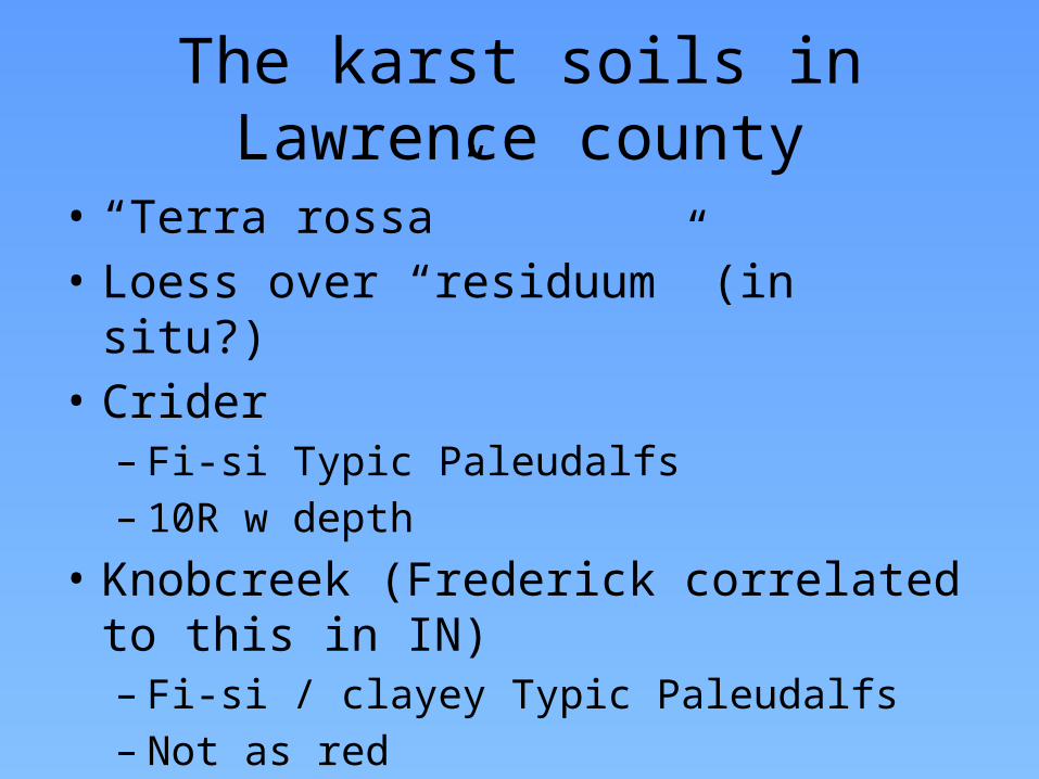
The karst soils in Lawrence county
• “Terra rossa”• Loess over “residuum” (in situ?)• Crider– Fi-si Typic Paleudalfs– 10R w depth
• Knobcreek (Frederick correlated to this in IN)– Fi-si / clayey Typic Paleudalfs– Not as red
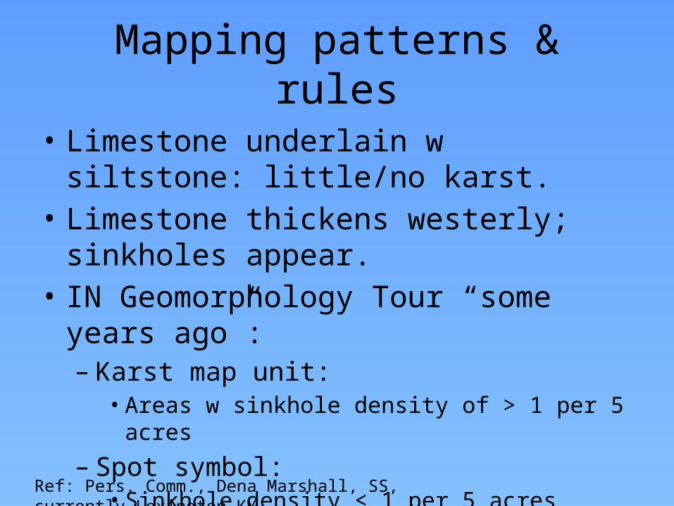
Mapping patterns & rules
• Limestone underlain w siltstone: little/no karst.
• Limestone thickens westerly; sinkholes appear.• IN Geomorphology Tour “some years ago”:– Karst map unit:• Areas w sinkhole density of > 1 per 5 acres
– Spot symbol:• Sinkhole density < 1 per 5 acres
Ref: Pers. Comm., Dena Marshall, SS, currently Lexington KY

Attributes (NASIS soil properties)
• Bedrock in a karst component within 80”– Higher Ksat than corresponding non-karst unit
• Entry for Ksat in R layer
– E.g., Navilleton components, Floyd co IN:• Karst component: R Ksat 1.42 – 141.14• Non-karst component: R ksat 0.43 – 42.34
• Bedrock below 80”– No known differences in soil properties between karst
and non-karst map units• If we could populate soil property data below 80”, there would be differences.

MLRA Soil Survey Project:Updating Karst Areas on the Springfield Plateau (MLRA 116B)
• Ignored in some,• Spot symbols in some,• Karst map units in some.• Inconsistent use of all of
the above, both within and among counties.
County-based soil surveys (over 40+ years) handled karst in various ways.
Springfield Plateau

Karst Project: Methodology
• Primarily a GIS office project• Utilize:
– Elevation data• DEMs, Hypsography lines
– Existing SSURGO– Orthophotos– Sinkholes layer (statewide; USGS)
• On-screen digitizing/editing of SSURGO• Establish new map units
– “Karst” in name, or– Soil series that occur only in sinkhole basins.

Results: 20 new map units in 7 counties• “Karst” map units; e.g.,
– Goss grsil, karst, 8-15%
• Sinkhole basin map units; e.g.,– Lowassie sil, 0-3%, freq.
ponded
Zoom in to this area (next slide)
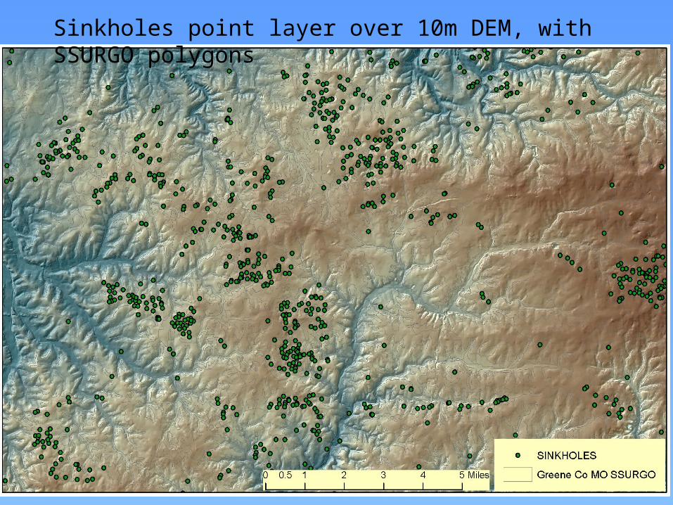
Sinkholes point layer over 10m DEM, with SSURGO polygons

Map units added in this area
Blue = sinkhole basin units; Red = “Karst” in MU Name

Karst discussion “answers”• Spatial identification of karst:
– Map unit phases (i.e., “karst” in muname).– Spot symbols.– Map units named by components that only occur in karst (i.e., no need for
“karst” in muname).• e.g., in Missouri: Lowassie, Grandgulf series only occur in sinkholes.
• Attribute interpretation– Muname contains “karst”– Component geomorphic description table: landform = “sinkhole”– Differences in soil properties?
• Interpretations– Possibility for groundwater contamination– Onsite wastewater disposal; lagoons; others?– Not keyed in standard National Interps (?)– Custom, state-created interps (e.g., MO onsite wastewater interp)
• Keys on “karst” in the muname, and “sinkhole” landform


![Remote Sensing and GIS Contribution to the Investigation ...€¦ · caves, collapsed sinkholes and carbonate depositional landforms [1–3]. This karst landscape type is well developed](https://static.fdocuments.in/doc/165x107/5f3f31fc5a728c6c4c5e5009/remote-sensing-and-gis-contribution-to-the-investigation-caves-collapsed-sinkholes.jpg)
