
SHOW ME THE DATA - · PDF fileSHOW ME THE DATA FEMA Region 6 ... (ArcGIS, Collector iOS App,...
22
SHOW ME THE DATA FEMA Region 6 Community Assistance Visits Findings Collector Roberto Ramirez, CFM / ASFPM – June 4, 2015
Transcript of SHOW ME THE DATA - · PDF fileSHOW ME THE DATA FEMA Region 6 ... (ArcGIS, Collector iOS App,...

SHOW ME THE DATAFEMA Region 6
Community Assistance Visits Findings Collector
Roberto Ramirez, CFM / ASFPM – June 4, 2015

Overview of CAV Findings Collection project
Why a GIS Based CAV tool
What makes this possible
Tools Used (ArcGIS, Collector iOS App, ArcGIS.com, GeoPlatform, SDE database)
How is the Region Using Collector
Other potential applications of the tool
App Limitations at this time
Additional Resources
Topics of Discussion

FEMA CAV Findings Collector Project
This pilot project started with a team of 3 Mitigation Division members: Mark English, Diana Herrera, and Roberto Ramirez
Identify all methods people had used at our region to collect findings during CAVs
Reviewed all the Checklists for CAVs to determine the data needs
Use FEMA guidance F-776, and the National Tool to develop our Database
Completed Pilot CAVs in Oklahoma (Midwest City & Piedmont)

National Flood Mitigation Data Collection Tool

Need For a Geospatial Database (National Flood Mitigation Data Collection Tool )
Data Entry – Decreases Margin of Error (lat/long)
GIS Based – Ability to do analysis
Collected Findings to be used with other internal/external datasets
Mobile Capability
One Device vs. Multiple Devices & Software (GPS, Laptop, Camera, Paper Maps, USB ports, Batteries, Street and Trips, MS Access)
Available any where there is Internet Connectivity (but you can work offline)
Why a GIS based CAV Tool

ESRI – ArcGIS Desktop Software
A GIS Analyst to Set up the Database (R6-Mark English)
ArcGIS online (GeoPlatform)
Collector Application (iOS)
Purchase of IPADs (Recommend GSM version)
NFHL
Internet Connectivity
Database Remote Access
What Makes this Possible

CAV Tool on GeoPlatform

ArcGIS online & Collector
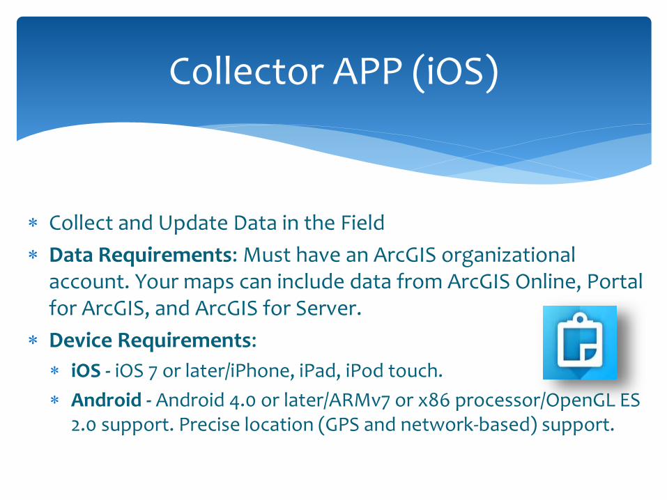
Collect and Update Data in the Field
Data Requirements: Must have an ArcGIS organizational account. Your maps can include data from ArcGIS Online, Portal for ArcGIS, and ArcGIS for Server.
Device Requirements:
iOS - iOS 7 or later/iPhone, iPad, iPod touch.
Android - Android 4.0 or later/ARMv7 or x86 processor/OpenGL ES 2.0 support. Precise location (GPS and network-based) support.
Collector APP (iOS)

Maps
My Location
Bookmarks
Layers
Address search
Measurements (Linear Miles, Square Miles)
Basemap Changes (imagery, streets, topographic, etc.)
Toolbar in Collector

Address City County Development Type Structure Type Foundation Type Machine Elevated (For equipment) CID Number FEMA Specialist Vented Purpose Structure Type Construction Type EC Diagram Permit Deficiency General Comments
CAV Tool DB (Attributes)
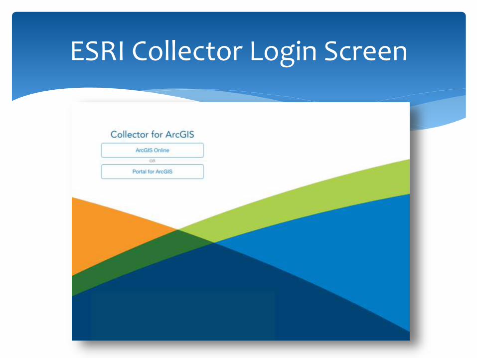
ESRI Collector Login Screen
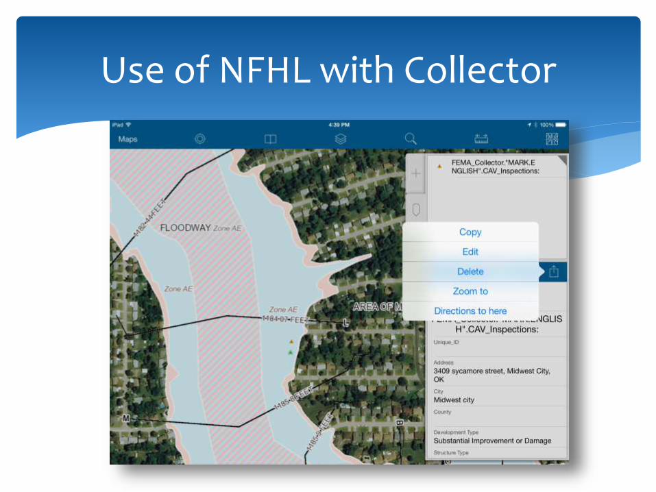
Use of NFHL with Collector

Changes to Layers (NFHL)

Data Collection & Accuracy

Collection Point & Images

Repetitive Loss/Severe Repetitive Loss Data Collection/Verification
PA Projects
Damage Assessments
Substantial Damage Inspections
Permitting
Recording Potential Mitigation Actions
Collection of Low Water Crossings
Additional Potential Applications in Floodplain Management
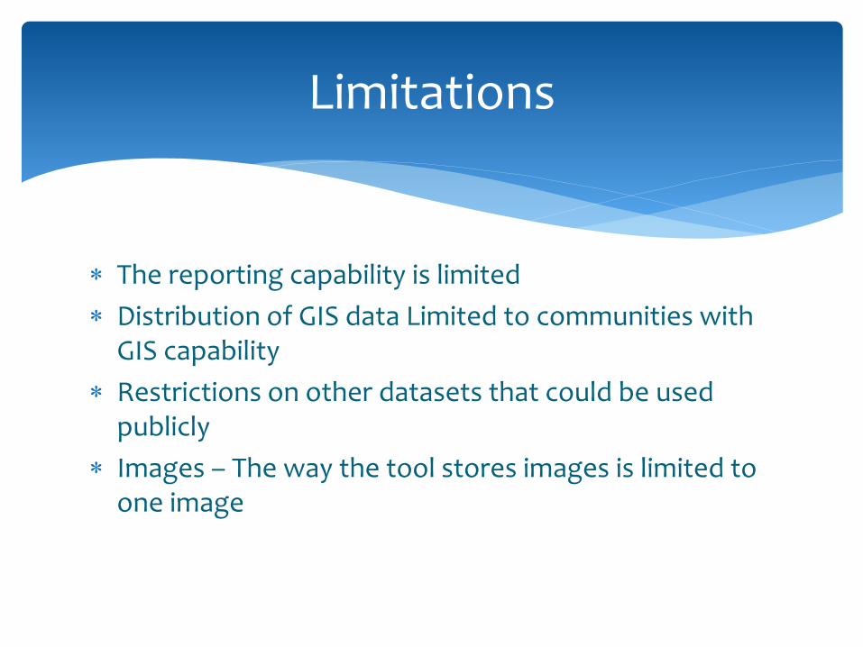
The reporting capability is limited
Distribution of GIS data Limited to communities with GIS capability
Restrictions on other datasets that could be used publicly
Images – The way the tool stores images is limited to one image
Limitations
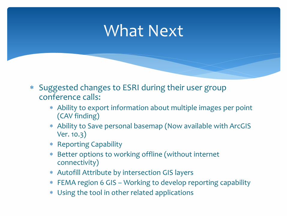
Suggested changes to ESRI during their user group conference calls:
Ability to export information about multiple images per point (CAV finding)
Ability to Save personal basemap (Now available with ArcGIS Ver. 10.3)
Reporting Capability
Better options to working offline (without internet connectivity)
Autofill Attribute by intersection GIS layers
FEMA region 6 GIS – Working to develop reporting capability
Using the tool in other related applications
What Next

FEMA 776 - Guidance for Conducting Community Assistance Contacts and Community Assistance Visits (http://www.fema.gov/media-library/assets/documents/23575?id=4917)
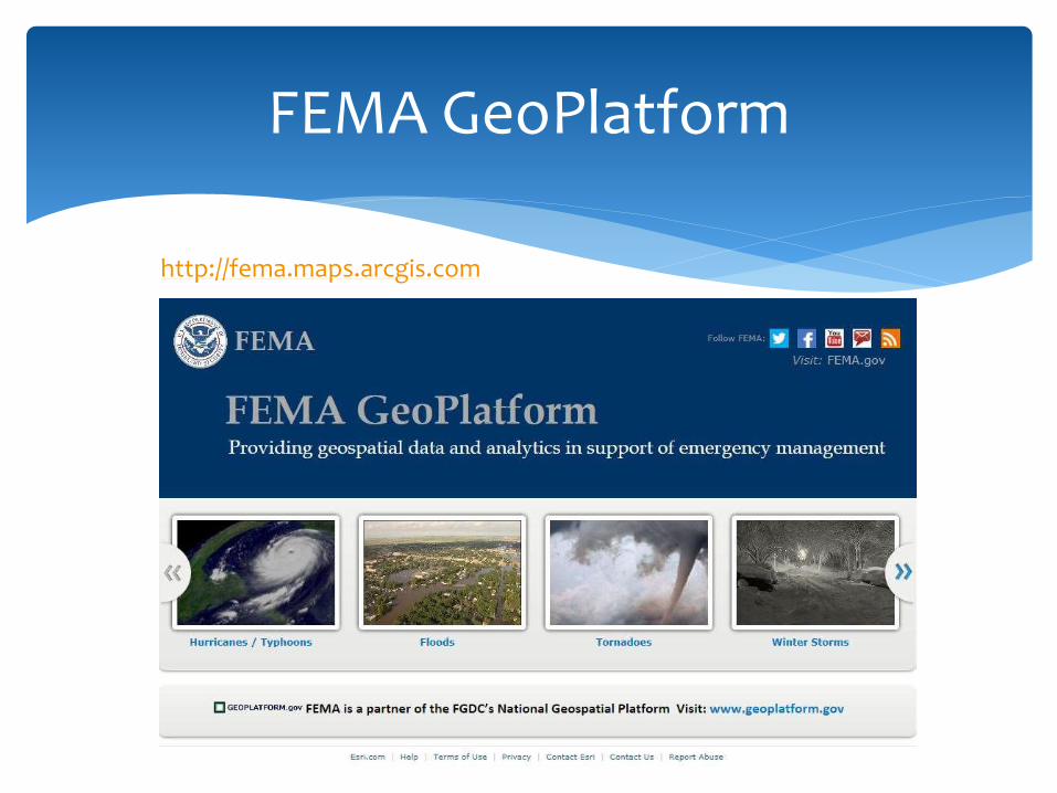
FEMA Geoplatform (http://fema.maps.arcgis.com/home/)
ESRI Collector (http://www.esri.com/software/arcgis/collector-for-arcgis)
Instructional Video: (https://www.youtube.com/watch?v=rULl6QCuOyA)
National Flood Mitigation Data Collection Tool (http://www.fema.gov/media-library-data/20130726-1446-20490-5839/fema497_ntusersguide_v3.pdf)
Additional Resources
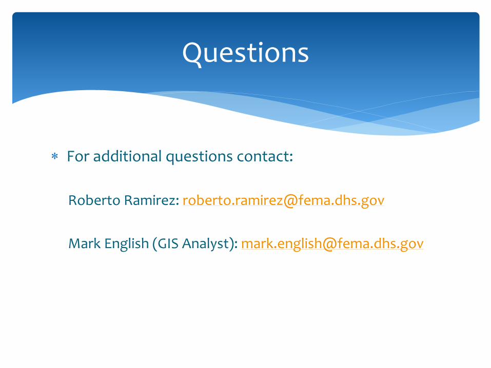
For additional questions contact:
Roberto Ramirez: [email protected]
Mark English (GIS Analyst): [email protected]
Questions