Shoreland Zoning - University of Wisconsin - Stevens … Zoning Protecting lakes through a...
65
Shoreland Zoning Protecting lakes through a partnership between citizens, lake associations, county zoning staff, county boards, DNR, UW-Extension and more Wisconsin Lakes Convention March 30, 2016 Co‐presented by: Kay Lutze Shoreland Zoning Policy Coordinator Lynn Markham Center for Land Use Education, UWEX
Transcript of Shoreland Zoning - University of Wisconsin - Stevens … Zoning Protecting lakes through a...
Shoreland ZoningProtecting lakes through a partnership between citizens, lake associations, county zoning staff, county boards, DNR, UW-Extension and more
Wisconsin Lakes ConventionMarch 30, 2016
Co‐presented by:
Kay Lutze Shoreland Zoning Policy
Coordinator
Lynn MarkhamCenter for Land Use Education,
UWEX
Introductions
Please tell us who you are and where you’re from. Were you at last year’s SL zoning session?
Why are lakes and rivers important to you?
Why do you want to learn more about shoreland zoning?
What do you want to see in the future with regard to SL zoning and dev’t around our lakes and rivers in WI?
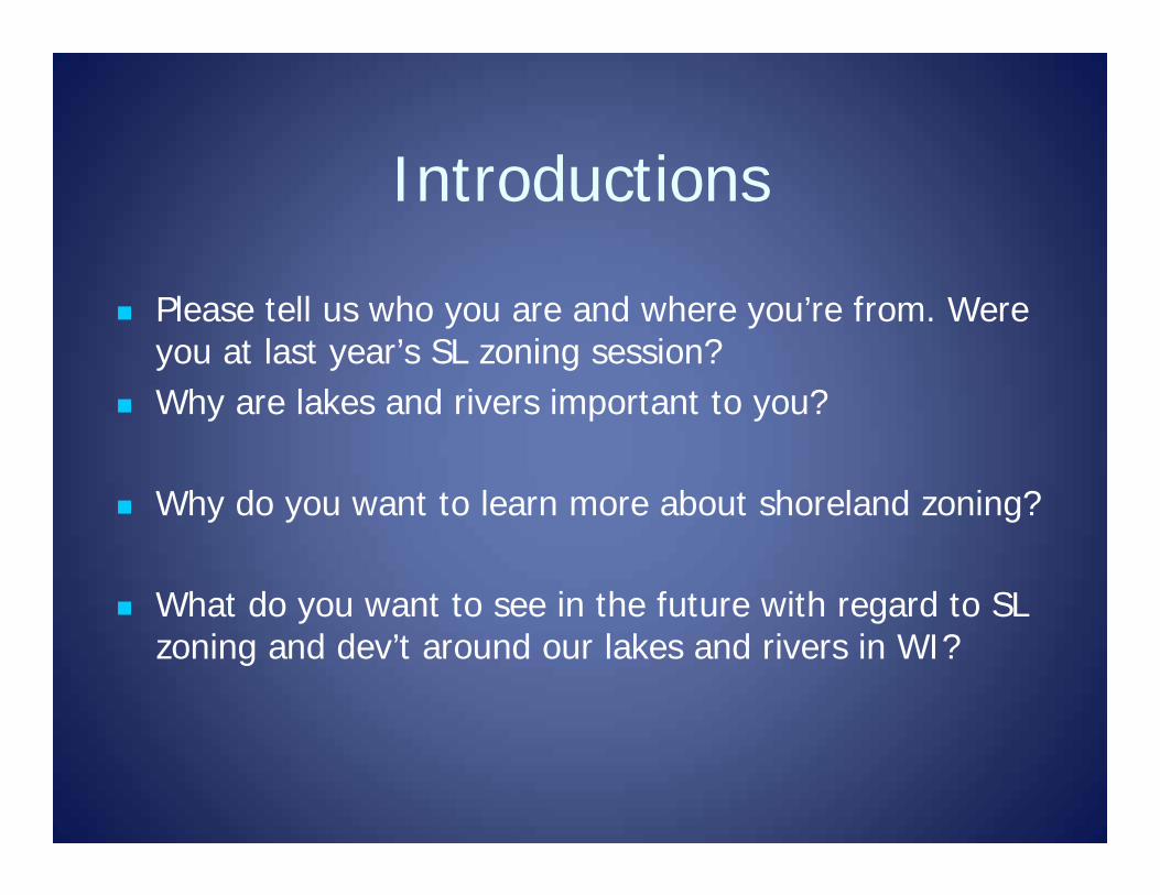
Outline1. Brief history of shoreland zoning & the public trust
doctrine 2. Shoreland standards: Science and changes from Act 55
– State budget passed in July 20153. Spring 2016 changes by WI Legislature 4. Timeline for county SL ordinance changes - October
2016 5. Thoughts and feelings about changes. Questions.
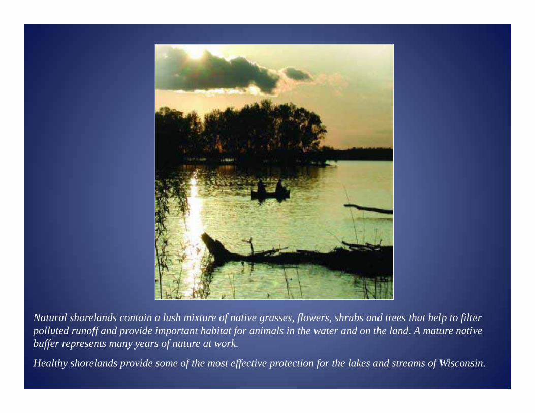
Natural shorelands contain a lush mixture of native grasses, flowers, shrubs and trees that help to filter polluted runoff and provide important habitat for animals in the water and on the land. A mature native buffer represents many years of nature at work.
Healthy shorelands provide some of the most effective protection for the lakes and streams of Wisconsin.
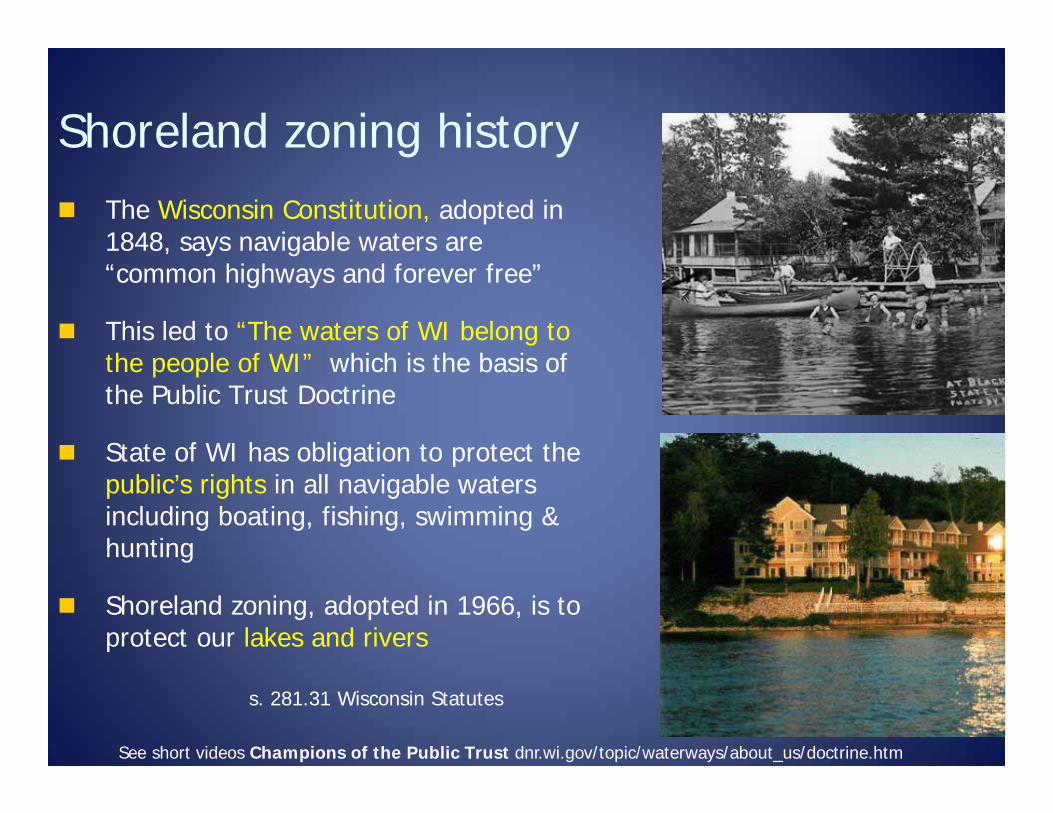
Shoreland zoning history The Wisconsin Constitution, adopted in
1848, says navigable waters are “common highways and forever free”
This led to “The waters of WI belong to the people of WI” which is the basis of the Public Trust Doctrine
State of WI has obligation to protect the public’s rights in all navigable waters including boating, fishing, swimming & hunting
Shoreland zoning, adopted in 1966, is to protect our lakes and rivers
s. 281.31 Wisconsin Statutes
See short videos Champions of the Public Trust dnr.wi.gov/topic/waterways/about_us/doctrine.htm
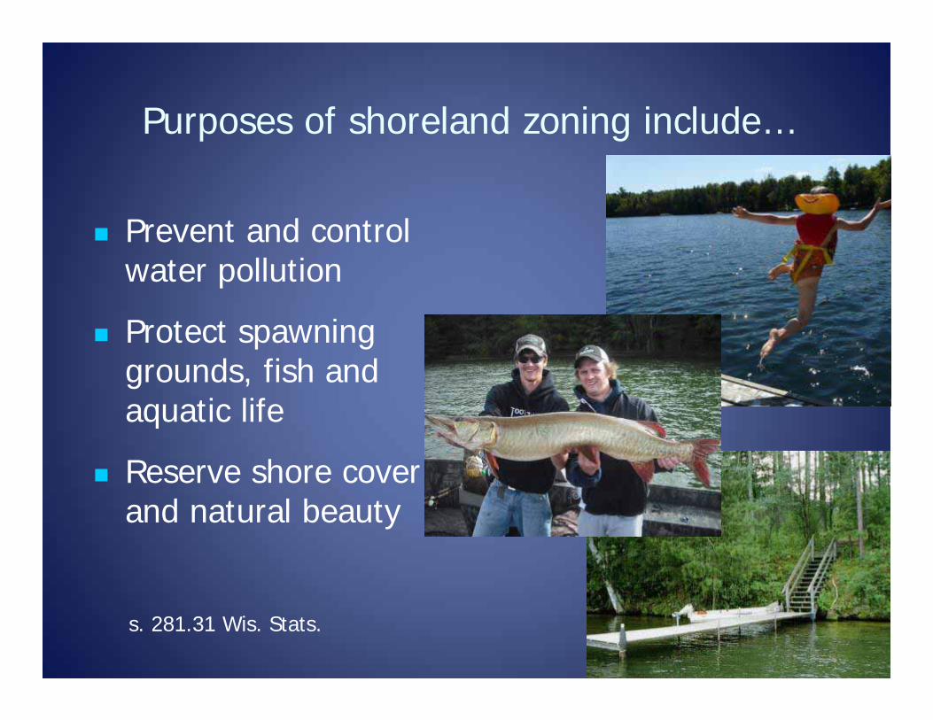
Purposes of shoreland zoning include…
Prevent and control water pollution
Protect spawning grounds, fish and aquatic life
Reserve shore cover and natural beauty
s. 281.31 Wis. Stats.
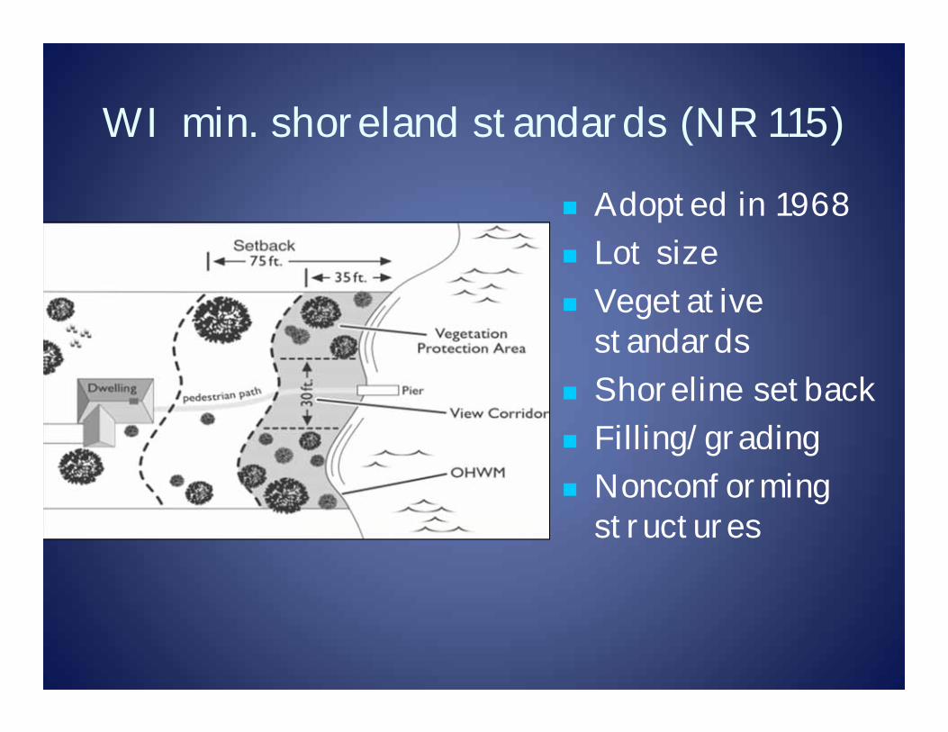
WI min. shoreland standards (NR 115)
Adopted in 1968 Lot size Vegetative
standards Shoreline setback Filling/grading Nonconforming
structures

Shoreland Zoning History
1968 – set minimum standards Counties could be more protective or
restrictive with the standards to effectively manage the resources in their geographical location and development pressures.
Many counties had the minimums until…
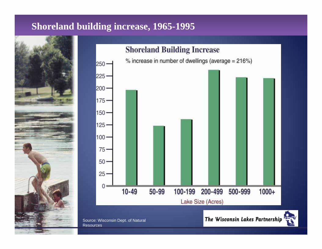
Shoreland building increase, 1965-1995
Source: Wisconsin Dept. of Natural Resources
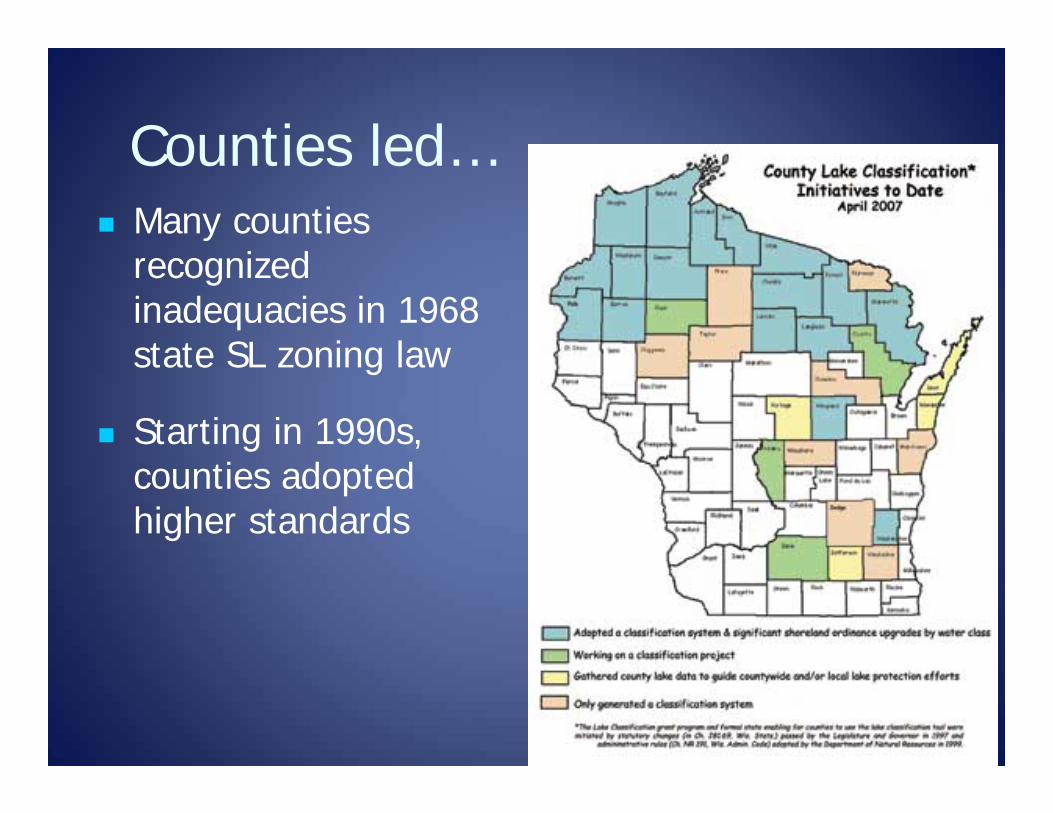
Counties led… Many counties
recognized inadequacies in 1968 state SL zoning law
Starting in 1990s, counties adopted higher standards
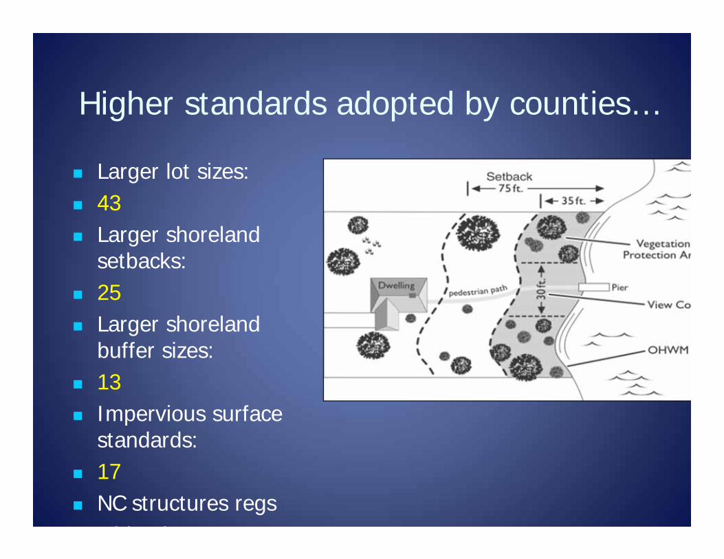
Higher standards adopted by counties…
Larger lot sizes: 43 Larger shoreland
setbacks: 25 Larger shoreland
buffer sizes: 13 Impervious surface
standards: 17 NC structures regs
Mi i i
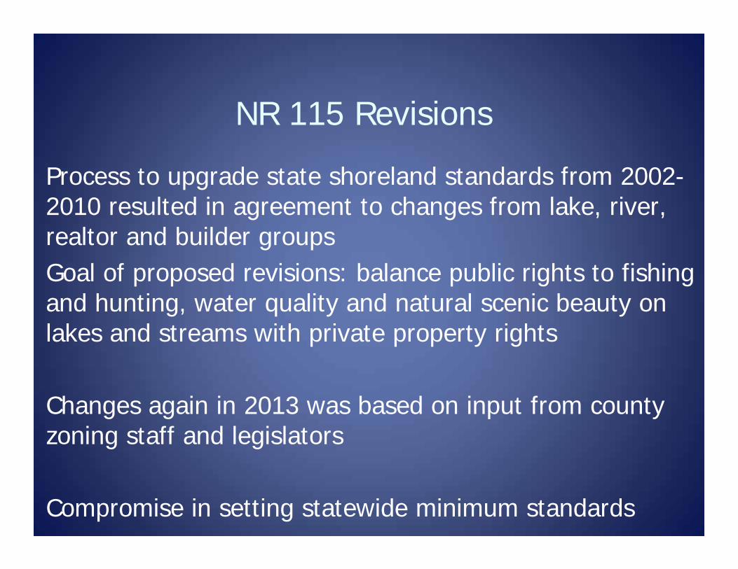
NR 115 Revisions
Process to upgrade state shoreland standards from 2002-2010 resulted in agreement to changes from lake, river, realtor and builder groupsGoal of proposed revisions: balance public rights to fishing and hunting, water quality and natural scenic beauty on lakes and streams with private property rights
Changes again in 2013 was based on input from county zoning staff and legislators
Compromise in setting statewide minimum standards
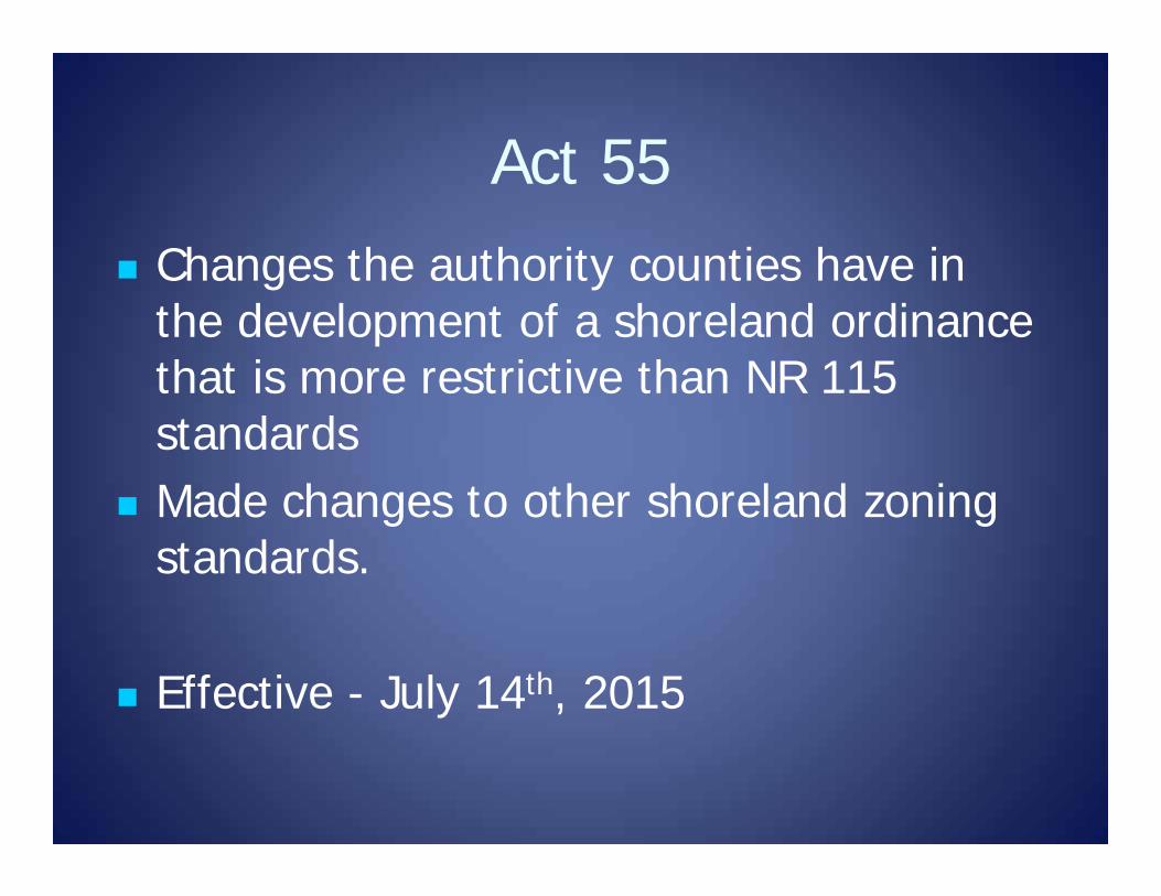
Act 55 Changes the authority counties have in
the development of a shoreland ordinance that is more restrictive than NR 115 standards
Made changes to other shoreland zoning standards.
Effective - July 14th, 2015
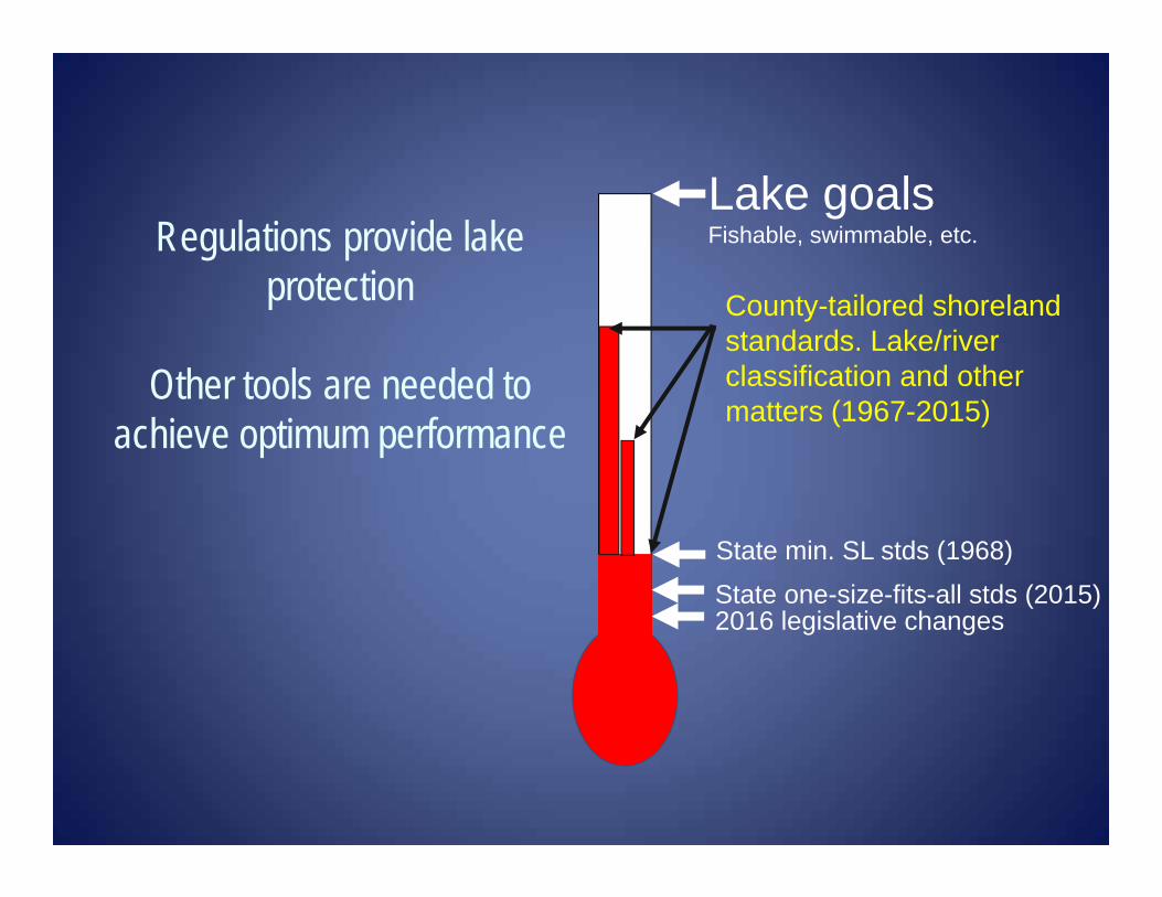
Regulations provide lake protection
Other tools are needed to achieve optimum performance
Lake goalsFishable, swimmable, etc.
State min. SL stds (1968)
County-tailored shoreland standards. Lake/river classification and other matters (1967-2015)
State one-size-fits-all stds (2015)2016 legislative changes
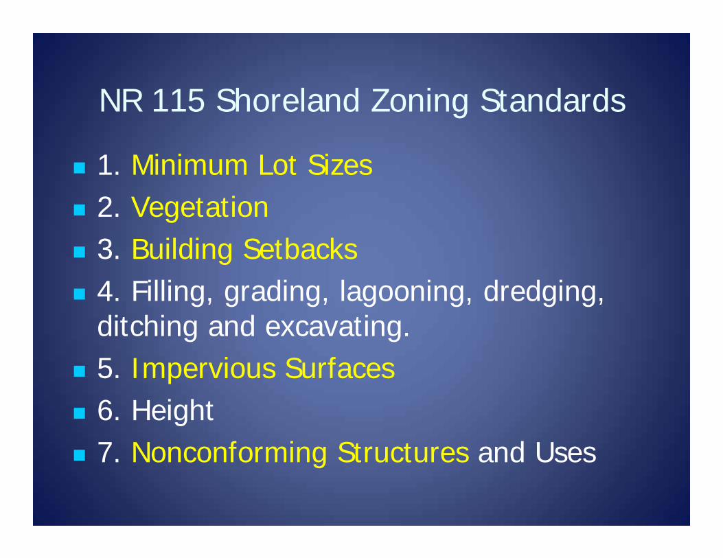
NR 115 Shoreland Zoning Standards
1. Minimum Lot Sizes 2. Vegetation 3. Building Setbacks 4. Filling, grading, lagooning, dredging,
ditching and excavating. 5. Impervious Surfaces 6. Height 7. Nonconforming Structures and Uses
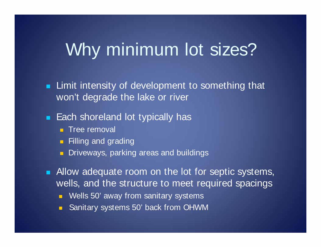
Why minimum lot sizes?
Limit intensity of development to something that won’t degrade the lake or river
Each shoreland lot typically has Tree removal Filling and grading Driveways, parking areas and buildings
Allow adequate room on the lot for septic systems, wells, and the structure to meet required spacings Wells 50’ away from sanitary systems Sanitary systems 50’ back from OHWM
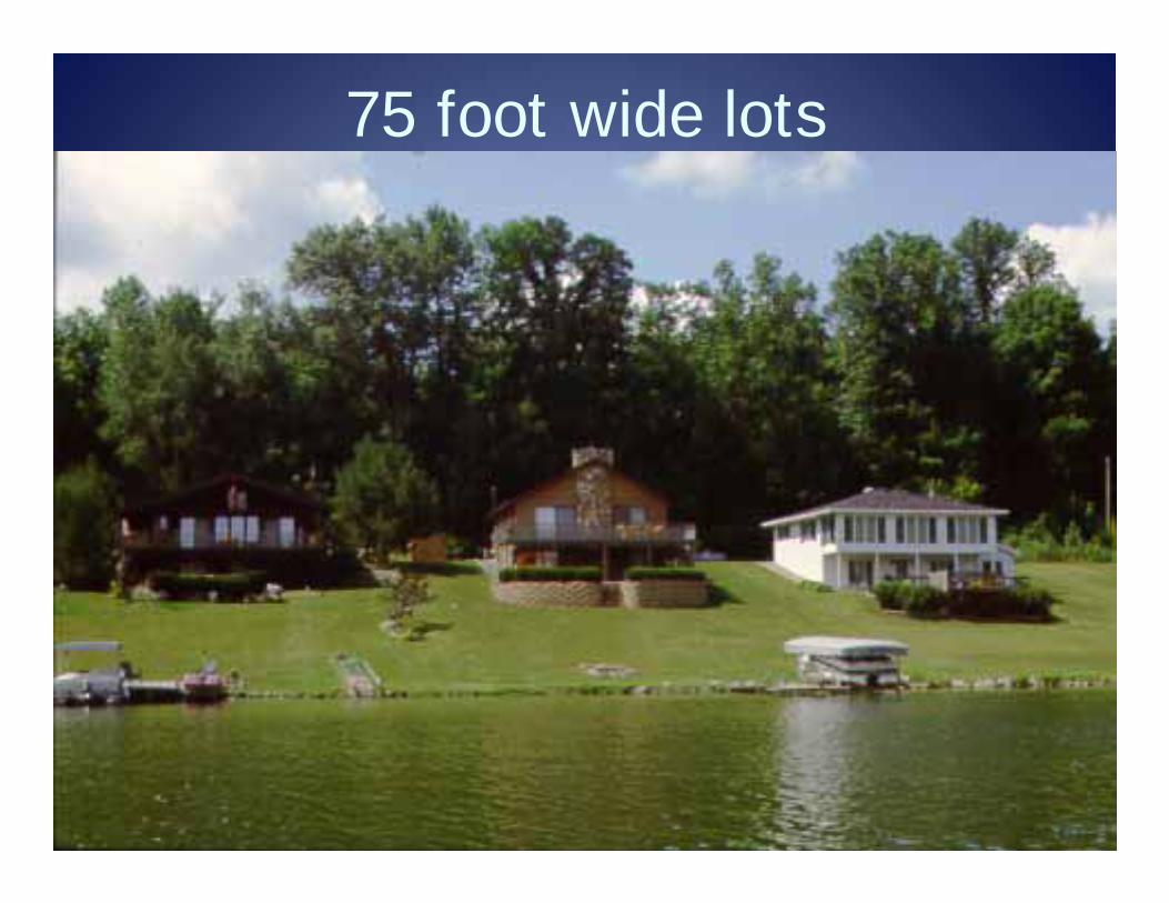
75 foot wide lots
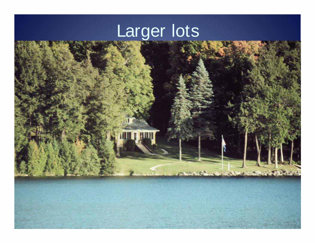
Larger lots
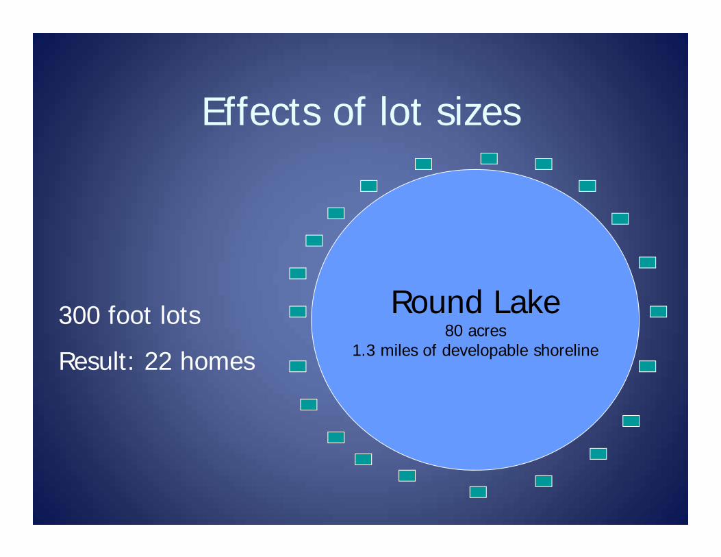
Effects of lot sizes
Round Lake80 acres
1.3 miles of developable shoreline
300 foot lots
Result: 22 homes
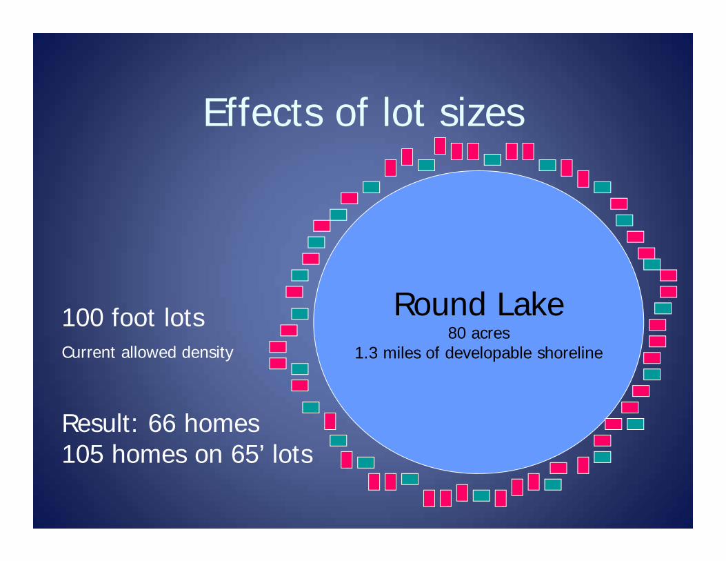
Effects of lot sizes
Round Lake80 acres
1.3 miles of developable shoreline
100 foot lotsCurrent allowed density
Result: 66 homes 105 homes on 65’ lots
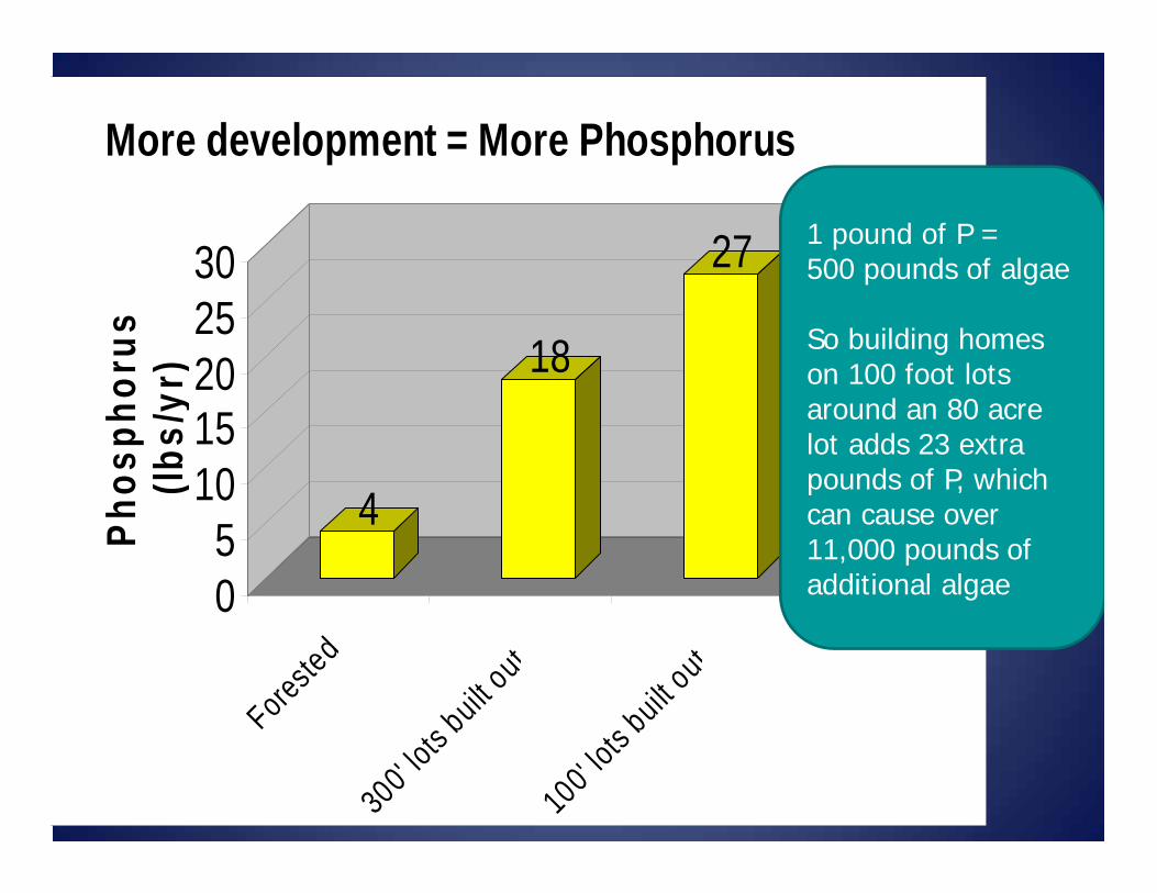
4
18
27
05
1015202530
Phos
phor
us
(lbs/
yr)
Forested
300' lots b
uilt out
100' lots b
uilt out
More development = More Phosphorus
1 pound of P = 500 pounds of algae
So building homes on 100 foot lots around an 80 acre lot adds 23 extra pounds of P, which can cause over 11,000 pounds of additional algae
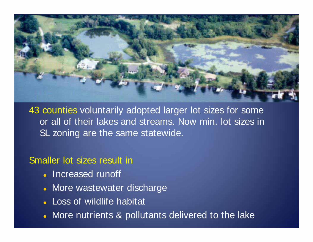
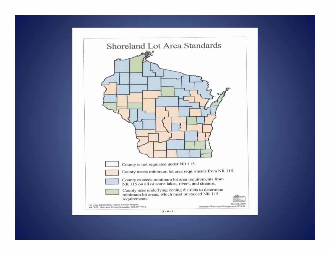
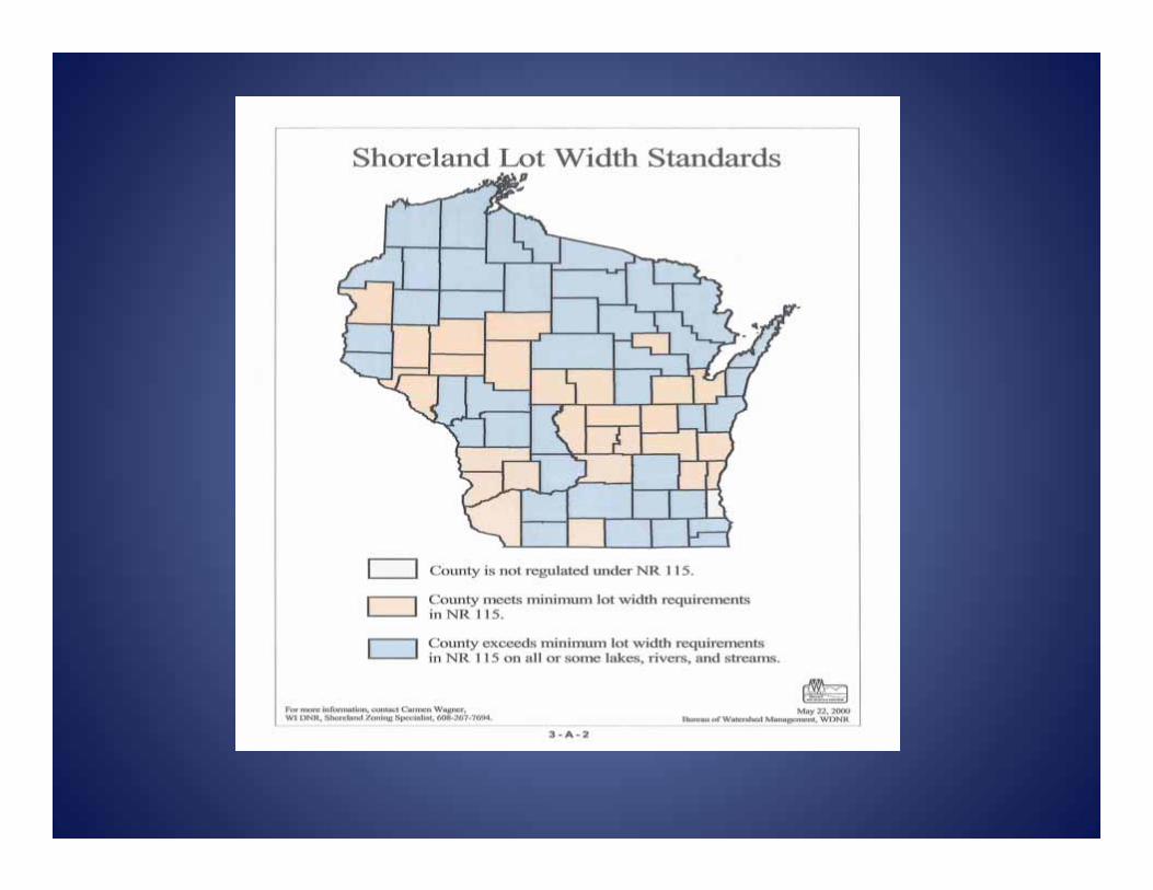
43 counties voluntarily adopted larger lot sizes for some or all of their lakes and streams. Now min. lot sizes in SL zoning are the same statewide.
Smaller lot sizes result in Increased runoff More wastewater discharge Loss of wildlife habitat More nutrients & pollutants delivered to the lake

Minimum Lot sizes Shoreland zoning ordinance may not
require lot sizes larger than the minimum lot size identified in NR 115.05(1)(a) 20,000 square feet and 100’ wide -
unsewered 10,000 square feet and 65’ wide – sewered Measurement of average lot width can
continue to be defined by the counties. Original model measured it at water’s edge and at
building line
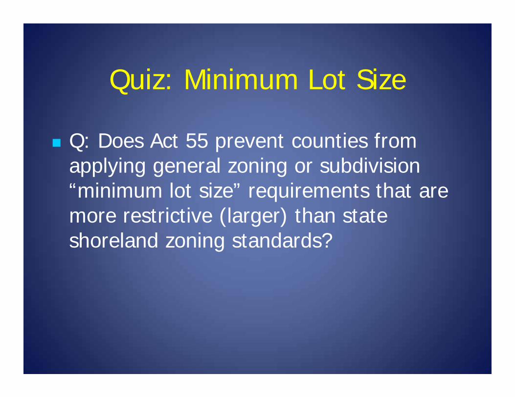
Quiz: Minimum Lot Size
Q: Does Act 55 prevent counties from applying general zoning or subdivision “minimum lot size” requirements that are more restrictive (larger) than state shoreland zoning standards?

A: No. A county may require a larger lot size under another statutory authority (general zoning, farmland preservation, subdivision, etc.) as long as the district and its more restrictive provisions does not only apply because the land in the district is within the shoreland.
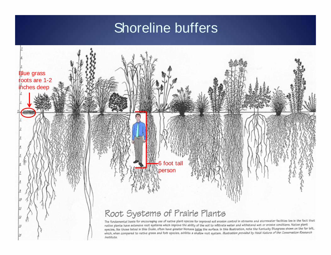
Shoreline buffers
35
Blue grass roots are 1-2 inches deep
Native plant roots are 5-15 feet deep, holding much more soil and P in place
Blue grass cannot hold as much soil in place as native plants because blue grass has much shorter roots. Blue grass can lead to loss of shoreline, erosion, and sediment covering fish spawning beds.
6 foot tall person
Blue grass roots are 1-2 inches deep
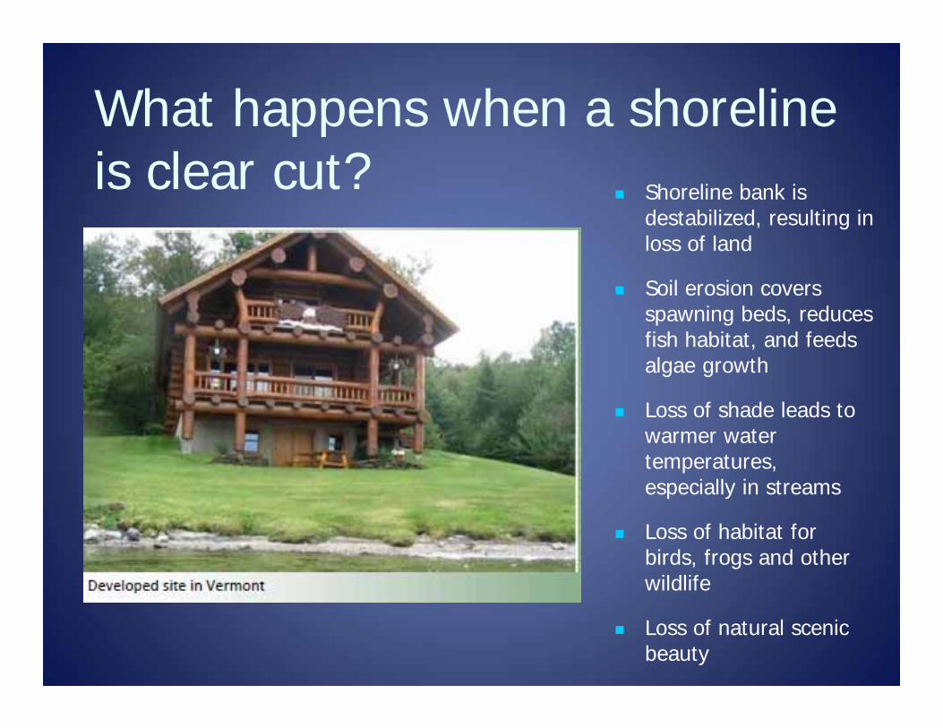
What happens when a shoreline is clear cut?
Shoreline bank is destabilized, resulting in loss of land
Soil erosion covers spawning beds, reduces fish habitat, and feeds algae growth
Loss of shade leads to warmer water temperatures, especially in streams
Loss of habitat for birds, frogs and other wildlife
Loss of natural scenic beauty
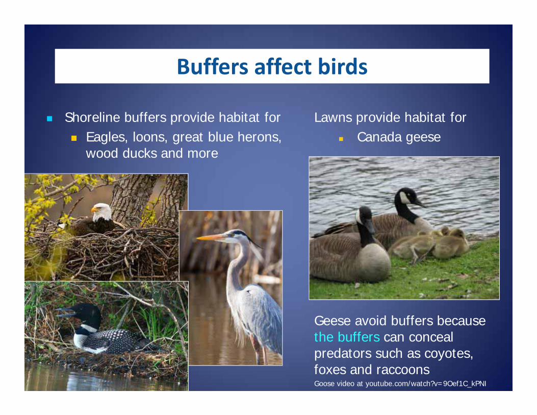
Shoreline buffers provide habitat for Eagles, loons, great blue herons,
wood ducks and more
Lawns provide habitat for Canada geese
Geese avoid buffers because the buffers can conceal predators such as coyotes, foxes and raccoonsGoose video at youtube.com/watch?v=9Oef1C_kPNI
Buffers affect birds
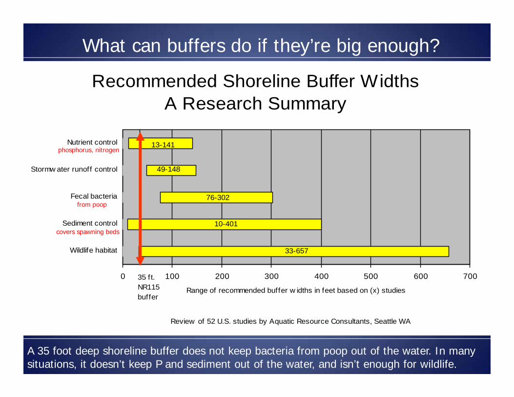
Recommended Shoreline Buffer WidthsA Research Summary
0 100 200 300 400 500 600 700
Wildlife habitat
Sediment control
Fecal bacteria
Stormw ater runoff control
Nutrient control
Range of recommended buffer w idths in feet based on (x) studies
Review of 52 U.S. studies by Aquatic Resource Consultants, Seattle WA
35 ft.NR115buffer
13-141
49-148
76-302
10-401
33-657
from poop
phosphorus, nitrogen
covers spawning beds
What can buffers do if they’re big enough?
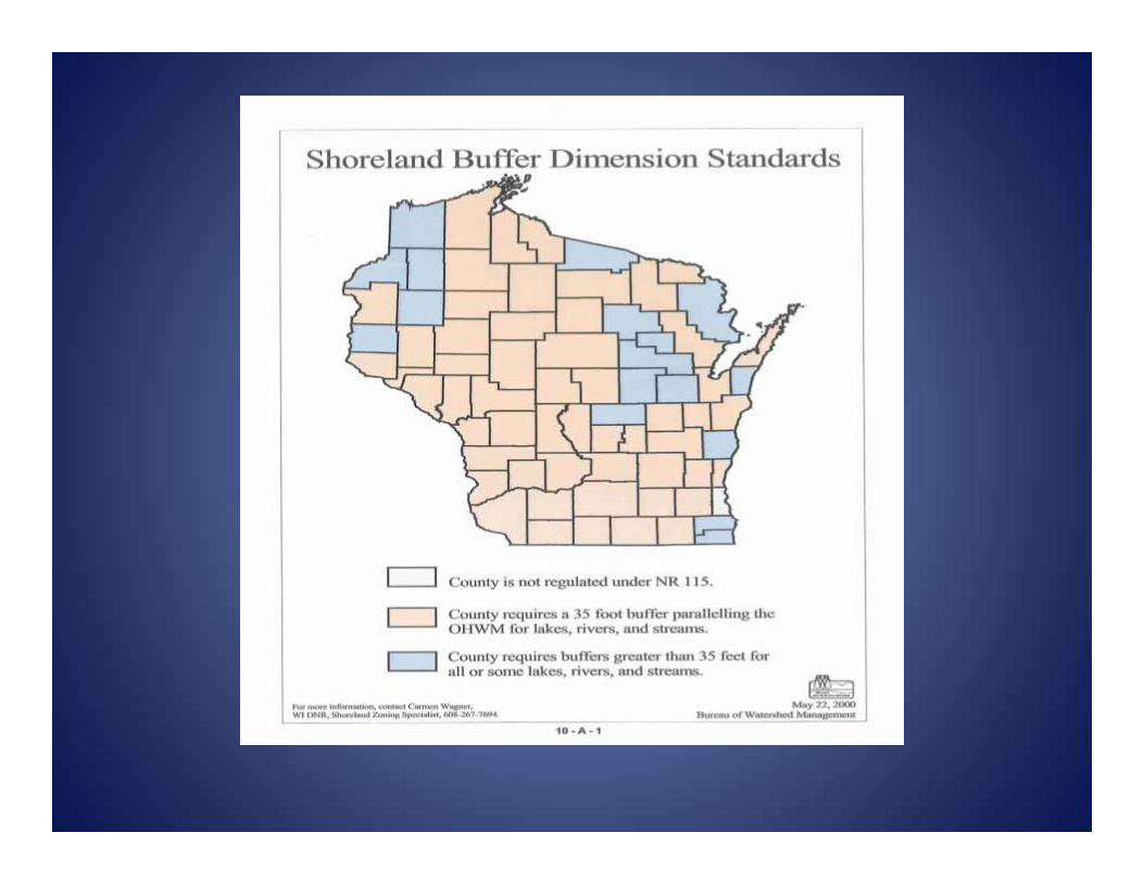
A 35 foot deep shoreline buffer does not keep bacteria from poop out of the water. In many situations, it doesn’t keep P and sediment out of the water, and isn’t enough for wildlife.
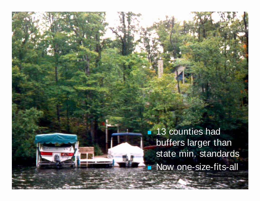
13 counties had buffers larger than state min. standards
Now one-size-fits-all
Changes to NR 115 standard -Vegetation
Vegetative Buffer – size allowed has been modified: A vegetative buffer that provides that a 35’ viewing corridor for every 100’ is allowed and the viewing corridor is allowed to run contiguously for the entire maximum width.
A county shoreland ordinance may not require a person to establish a vegetative buffer on previously developed land and from expanding an existing buffer. Establishment of veg. buffer can remain an OPTION
for mitigation purposes. Open sided structure (gazebo) exemption
requirement to establish the vegetative buffer remains in effect.
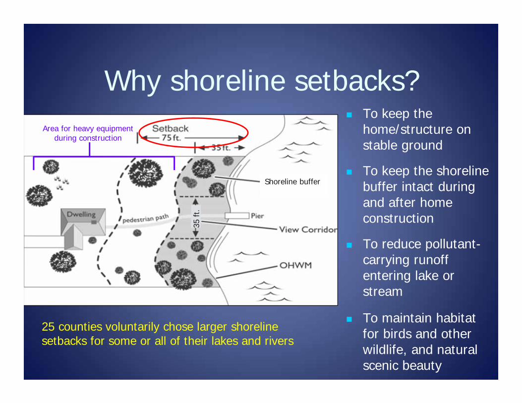
Why shoreline setbacks?
Shoreline buffer
35 ft
.
To keep the home/structure on stable ground
To keep the shoreline buffer intact during and after home construction
To reduce pollutant-carrying runoff entering lake or stream
To maintain habitat for birds and other wildlife, and natural scenic beauty
Area for heavy equipment during construction
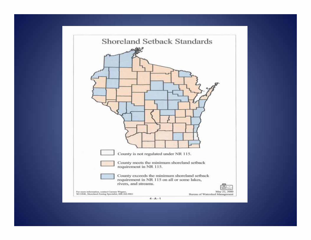
25 counties voluntarily chose larger shoreline setbacks for some or all of their lakes and rivers

Building Setbacks Required setback is 75’ Act 55 did not allow counties to keep
larger setbacks Counties must allow setback averaging
All structures are required to meet the setback from the OHWM unless they are identified and qualify as an exempt structure.
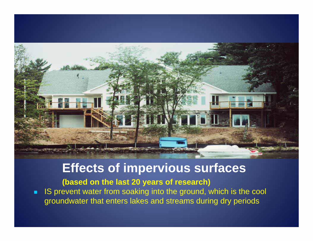
Effects of impervious surfaces (based on the last 20 years of research)
IS prevent water from soaking into the ground, which is the cool groundwater that enters lakes and streams during dry periods
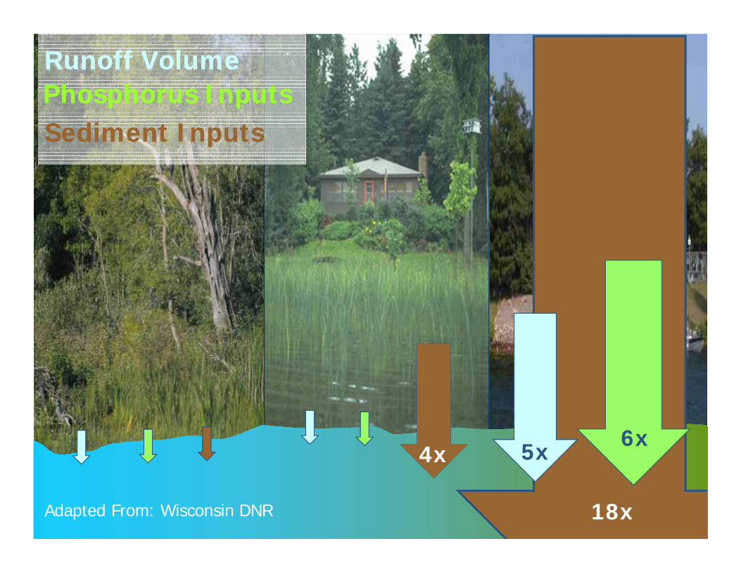
Adapted From: Wisconsin DNR
4x
18x
5x 6x
Phosphorus InputsPhosphorus InputsRunoff VolumeRunoff Volume
Sediment InputsSediment Inputs

2008 study of 164 WI lakes found the same trend
2008 study of 164 WI lakes found the same trend
Impervious surfaces are hard surfaces like roofs, driveways, parking areas and patios
See Impervious Surfaces: How They Impact Fish, Wildlife and Waterfront Property Values – handout and video at uwsp.edu/cnr-ap/clue/Pages/publications-resources/water.aspx
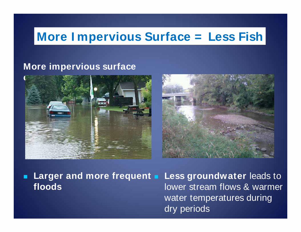
More impervious surface causes
Larger and more frequent floods
Less groundwater leads to lower stream flows & warmer water temperatures during dry periods
More Impervious Surface = Less Fish
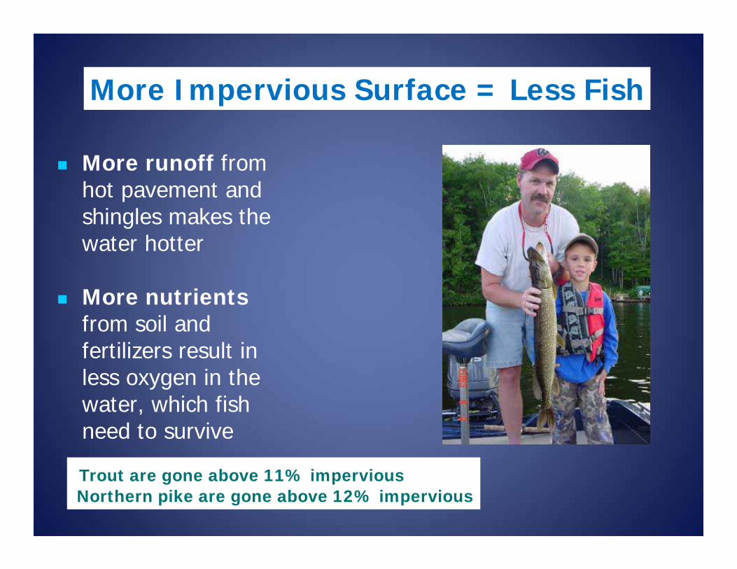
More runoff from hot pavement and shingles makes the water hotter
More nutrients from soil and fertilizers result in less oxygen in the water, which fish need to survive
More Impervious Surface = Less Fish
Trout are gone above 11% imperviousNorthern pike are gone above 12% impervious

More sedimentsand algae growth make it difficult for some predator species that hunt by sight to find their food
More sedimentscover spawning beds of fish such as walleye and smallmouth bass, depriving eggs of oxygen
More Impervious Surface = Less Fish
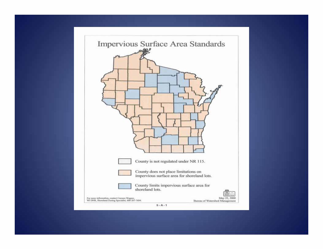
17 counties voluntarily adopted impervious surface standards
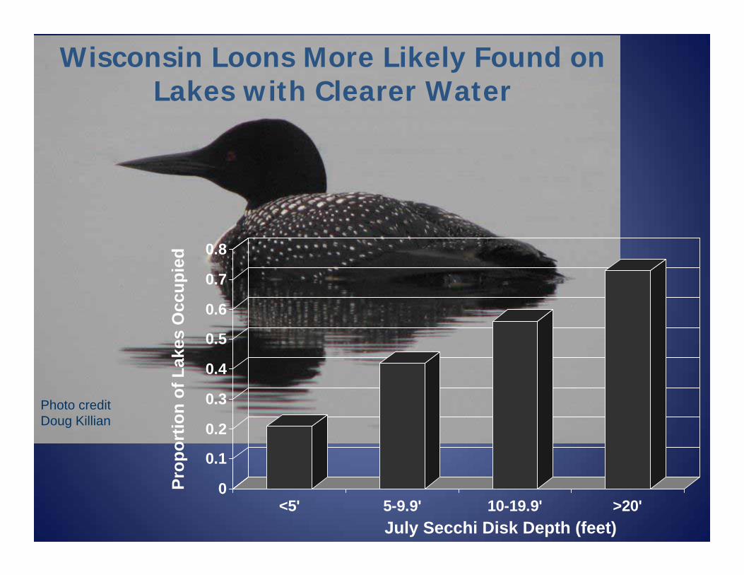
Wisconsin Loons More Likely Found on Lakes with Clearer Water
0
0.1
0.2
0.3
0.4
0.5
0.6
0.7
0.8
<5' 5-9.9' 10-19.9' >20'July Secchi Disk Depth (feet)
Prop
ortio
n of
Lak
esO
ccup
ied
Photo creditDoug Killian
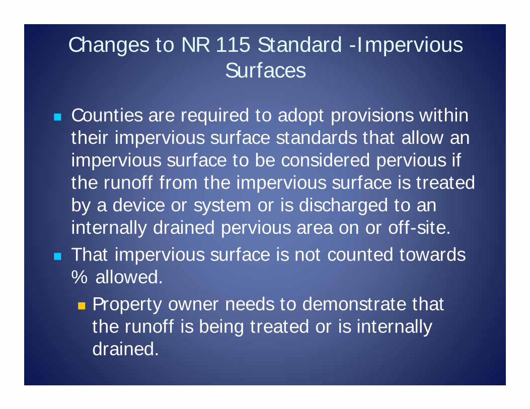
Changes to NR 115 Standard -Impervious Surfaces
Counties are required to adopt provisions within their impervious surface standards that allow an impervious surface to be considered pervious if the runoff from the impervious surface is treated by a device or system or is discharged to an internally drained pervious area on or off-site.
That impervious surface is not counted towards % allowed. Property owner needs to demonstrate that
the runoff is being treated or is internally drained.
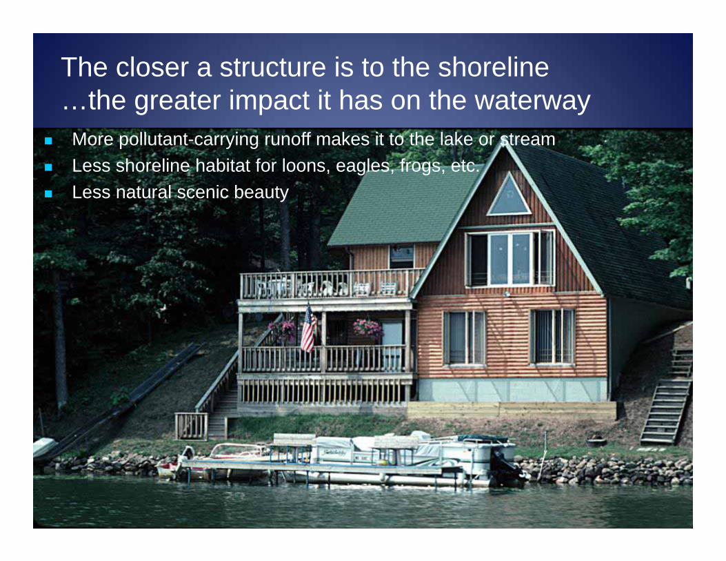
The closer a structure is to the shoreline…the greater impact it has on the waterway
More pollutant-carrying runoff makes it to the lake or stream Less shoreline habitat for loons, eagles, frogs, etc. Less natural scenic beauty
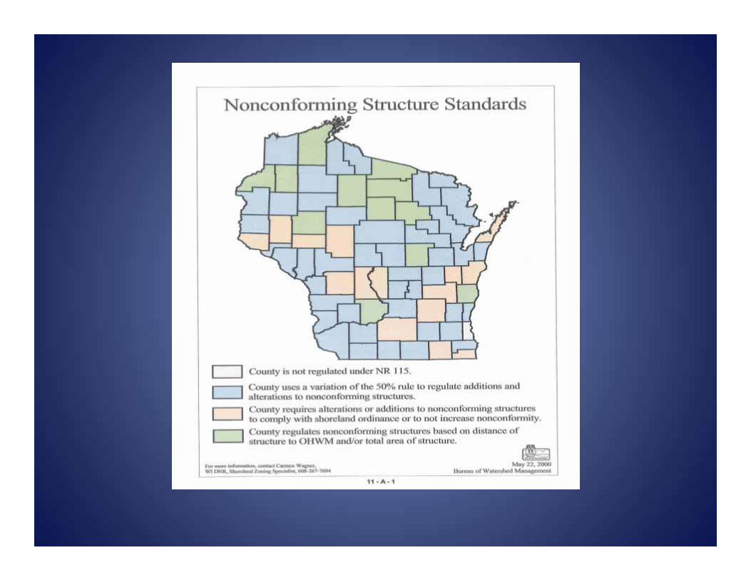
Changes to NR 115 standard -Nonconforming Structures
What is a nonconforming structure for shoreland zoning purposes? A structure that was lawfully placed when
constructed but does not comply with the required setback from the ordinary high water mark.
Structures that are exempt (boathouses) from the OHWM, were granted a variance, or have been illegally constructed are not considered nonconforming structures.
Nonconforming Structures -activities now allowed
Shoreland ordinance cannot regulate the maintenance, repair, replacement, restoration, rebuilding, or remodeling of a nonconforming structure if the activity does not expand the footprint. No approval, fee or mitigation required.
Shoreland ordinance cannot regulate the vertical expansion of a nonconforming structure if the expansion does not go beyond 35’ in height. No approval, fee or mitigation required.
Nonconforming Principal Structure: activities that still require a permit
Expansion beyond the setback Relocation of NC structure Lateral expansion of 200 square feet if:
Principal structure is 35’ from OHWM Mitigation required All other ordinance provisions are met
Act 55 also resulted in:
The Dept. may not issue an opinion on whether or not a variance should be granted or denied without the request of a county BOA.
The Dept. may not appeal a BOA decision.
Regulating Other Matters
Act 55 continues to allow counties to regulate “matters” that are not regulated by a shoreland zoning standard in NR 115. Other matters need to further the maintenance of safe and healthful conditions; prevent and control water pollution; protect spawning grounds, fish and aquatic life; control building sites, placement of structure and land uses and reserve shore cover and natural beauty.
Examples of other matters
Escarpment regulations and setbacks Wetland setbacks and other regulations
not covered in the wetland section Density requirements – ex. how many
structures permitted on a lot Land uses Land suitability

Quiz: Other Matters
Q: Can a county through its shoreland ordinance regulate the number of principal structures?
A: Yes, a county can regulate density as an “other matter” since it furthers the purpose of controlling building sites and the placement of structures.

Regulations provide lake protection
Other tools are needed to achieve optimum performance
Lake goalsFishable, swimmable, etc.
State min. SL stds (1968)
County-tailored shoreland standards. Lake/river classification and other matters (1967-2015)
State one-size-fits-all stds (2015)2016 legislative changes
Interaction with other enabling statutes
Act 55 affected 59.692 shoreland zoning Act 55 did not impact a county’s ability to enact
ordinances under other statutes such as 59.69 (general zoning), 87.30 (floodplain zoning), 236 (land division), etc…..
Floodplain, sanitary, building -UDC, general zoning are all layers that still apply.
County Working Sessions
Held 7 full day working sessions with the counties to review legislative changes and existing shoreland standards.
Counties have until October 1, 2016 to have a compliant, certified ordinance.
Recent Legislative Changes
Act 167 (AB 603)
AB 582
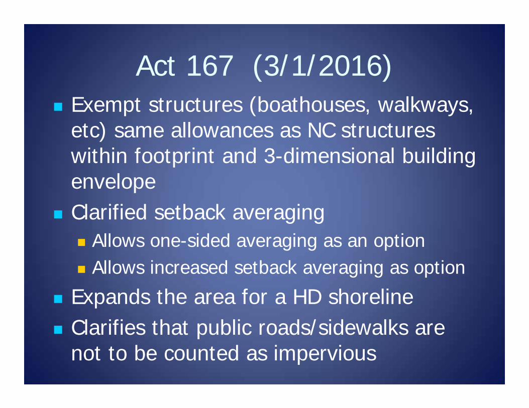
Act 167 (3/1/2016) Exempt structures (boathouses, walkways,
etc) same allowances as NC structures within footprint and 3-dimensional building envelope
Clarified setback averaging Allows one-sided averaging as an option Allows increased setback averaging as option
Expands the area for a HD shoreline Clarifies that public roads/sidewalks are
not to be counted as impervious
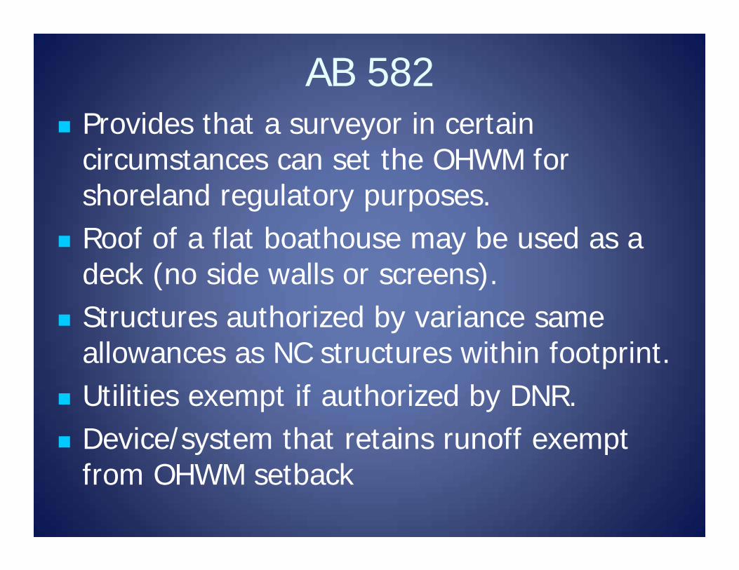
AB 582 Provides that a surveyor in certain
circumstances can set the OHWM for shoreland regulatory purposes.
Roof of a flat boathouse may be used as a deck (no side walls or screens).
Structures authorized by variance same allowances as NC structures within footprint.
Utilities exempt if authorized by DNR. Device/system that retains runoff exempt
from OHWM setback
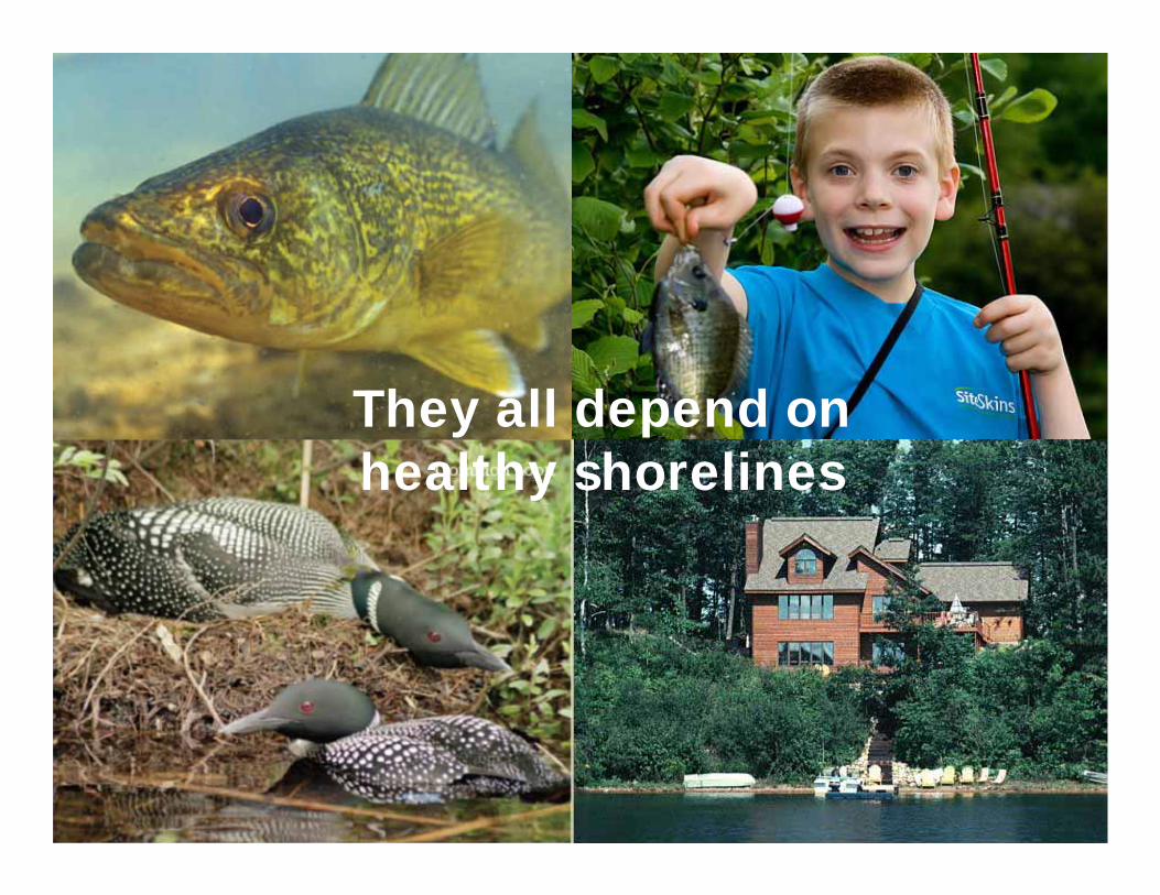
They all depend on healthy shorelines
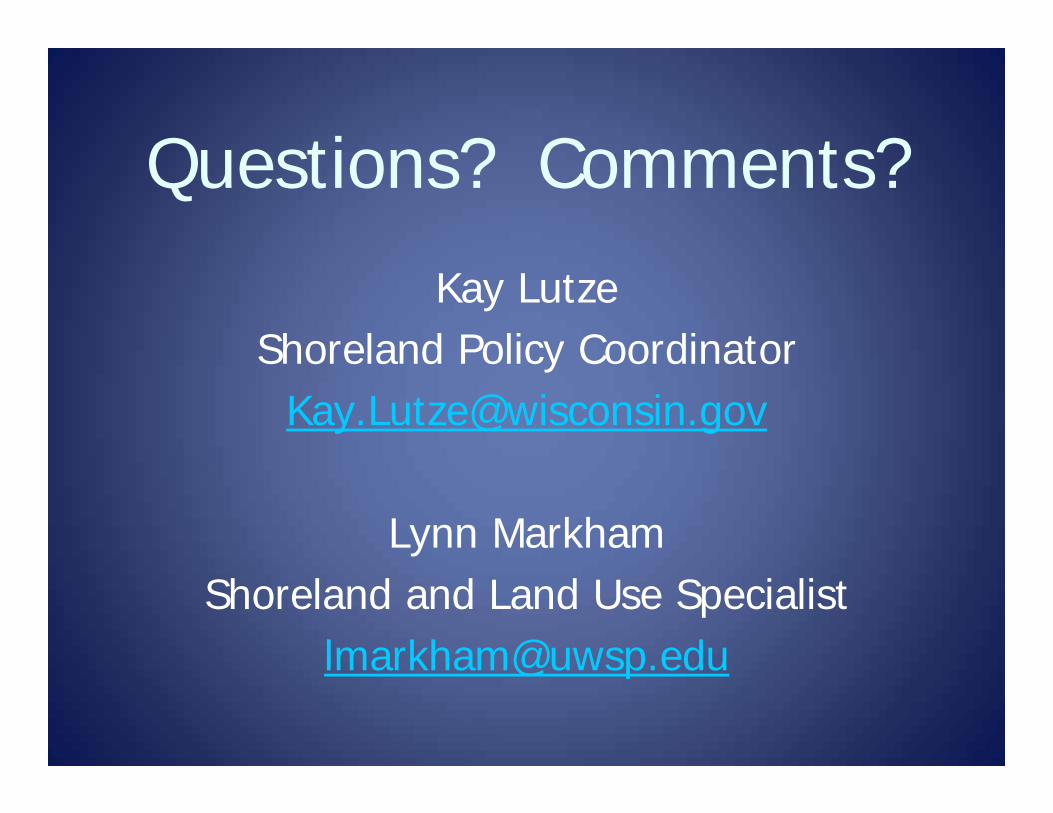
Questions? Comments?
Kay LutzeShoreland Policy Coordinator
Lynn MarkhamShoreland and Land Use Specialist