Sheri-defense (2)
25
-
Upload
shehryar-khan -
Category
Documents
-
view
403 -
download
0
Transcript of Sheri-defense (2)

Application of 2-D seismic interpretation in the reservoir
characterization of Meyal Oil Field of Upper Indus Basin, Pakistan.

INTRODUCTION
Study Area

Upper Indus Basin
Study Area

Stratigraphic column of Potwar Basin
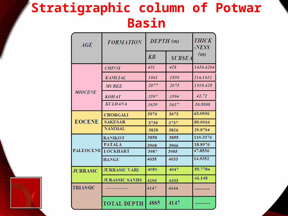
Stratigraphic column of Potwar Basin
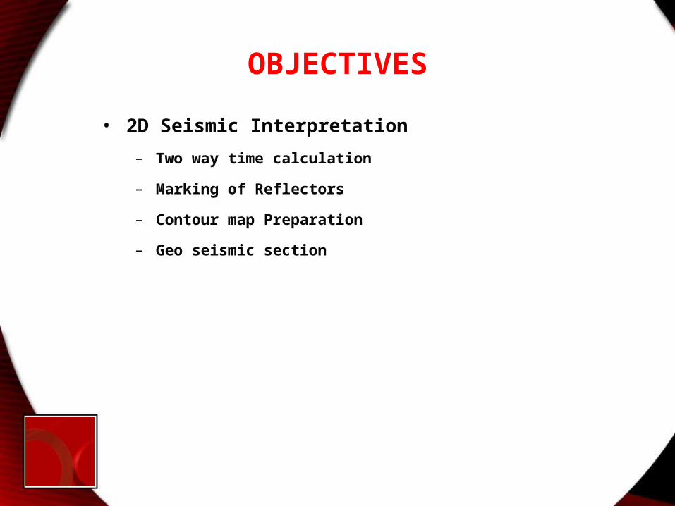
OBJECTIVES• 2D Seismic Interpretation
– Two way time calculation
– Marking of Reflectors
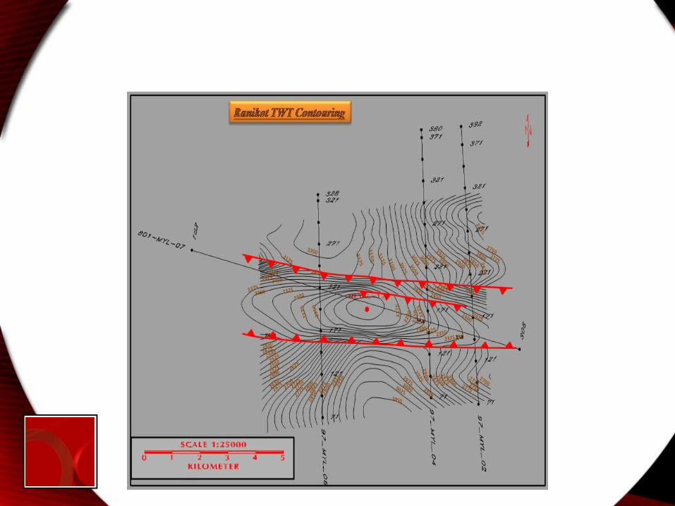
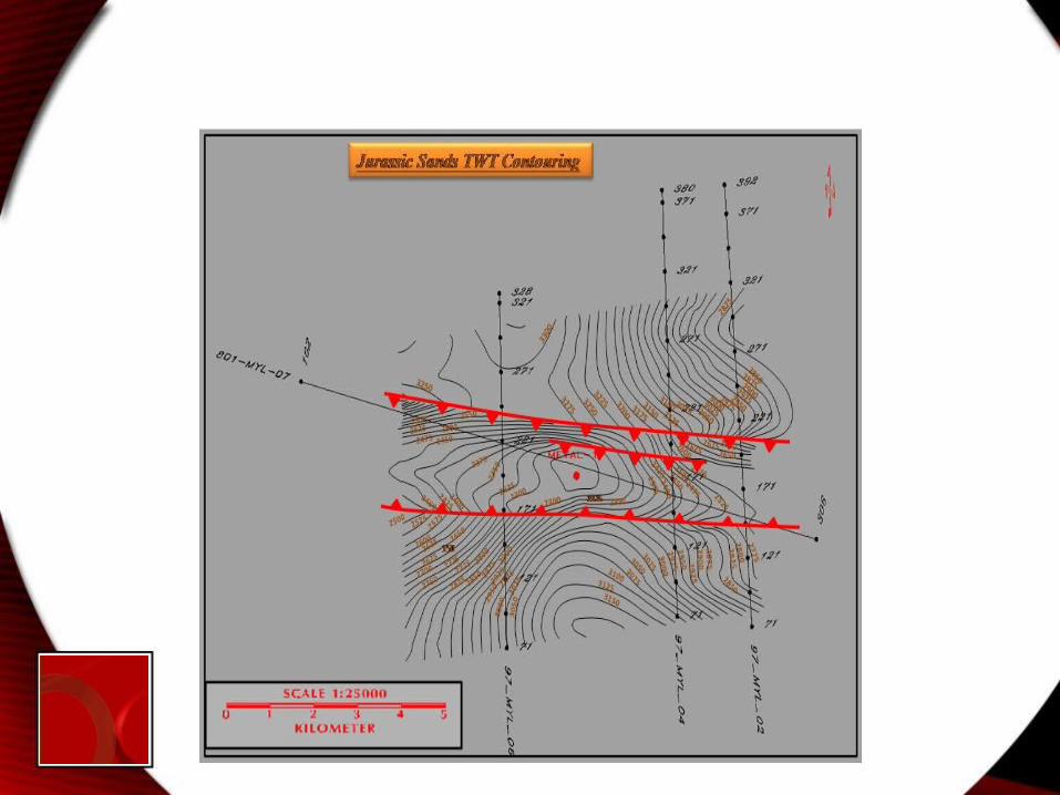
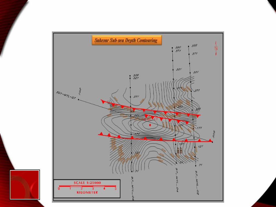
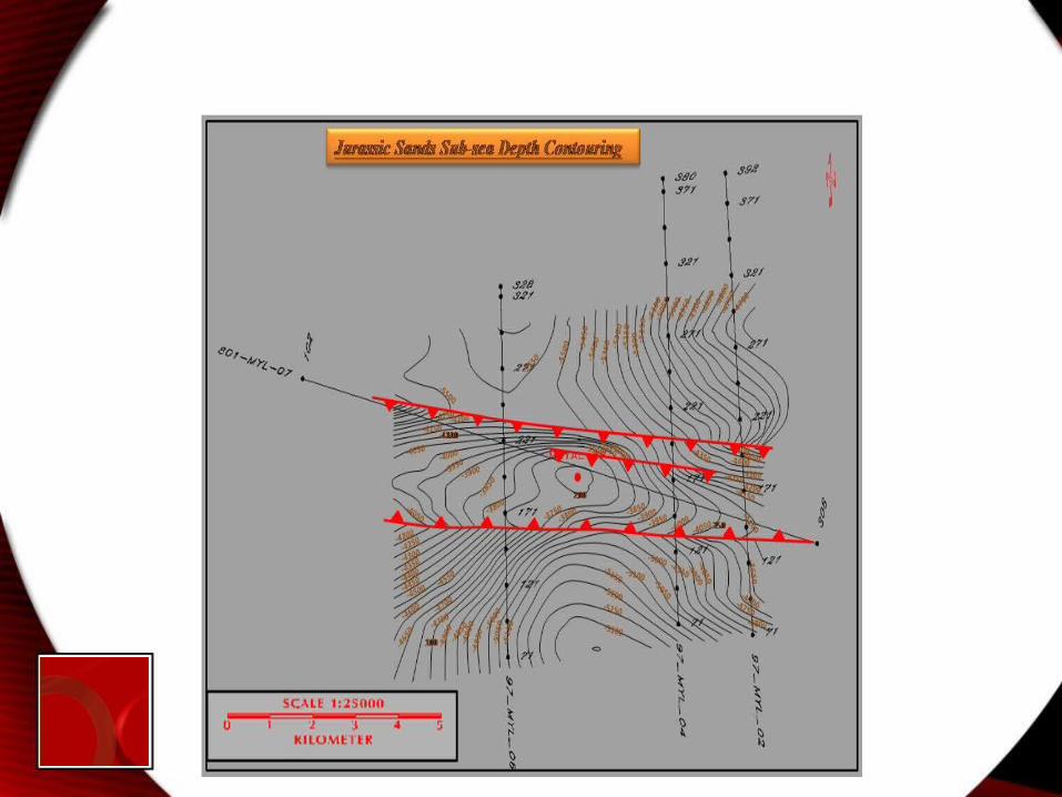
– Contour map Preparation
– Geo seismic section

Methodology• Data Collection
• Analysis of Collected Data
• Picking of Interested Zone
• 2D seismic interpretation (manually)
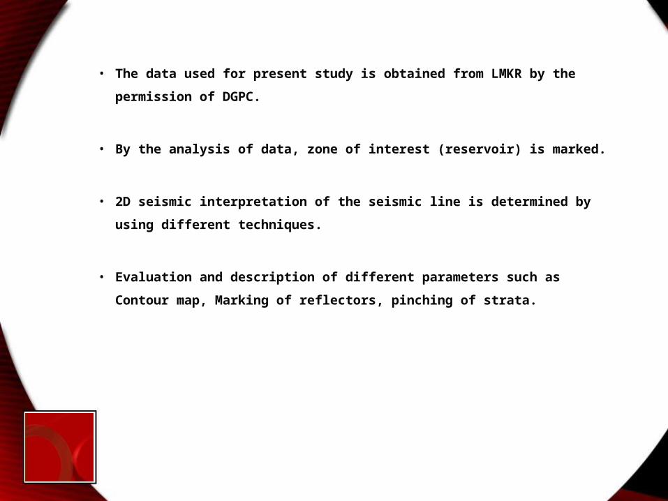
• The data used for present study is obtained from LMKR by the permission of DGPC.
• By the analysis of data, zone of interest (reservoir) is marked.
• 2D seismic interpretation of the seismic line is determined by using different techniques.
• Evaluation and description of different parameters such as Contour map, Marking of reflectors, pinching of strata.
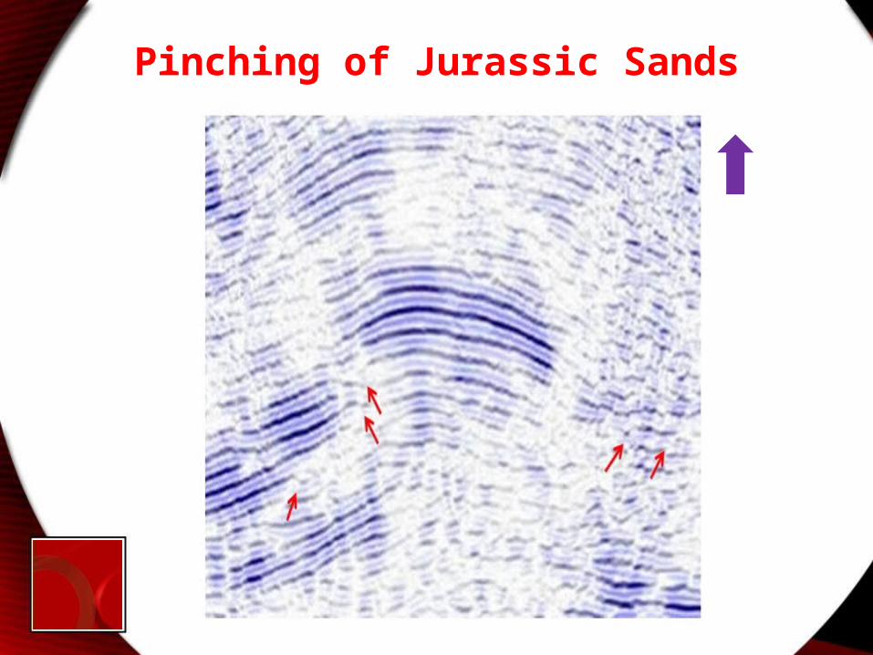
Pinching of Jurassic Sands
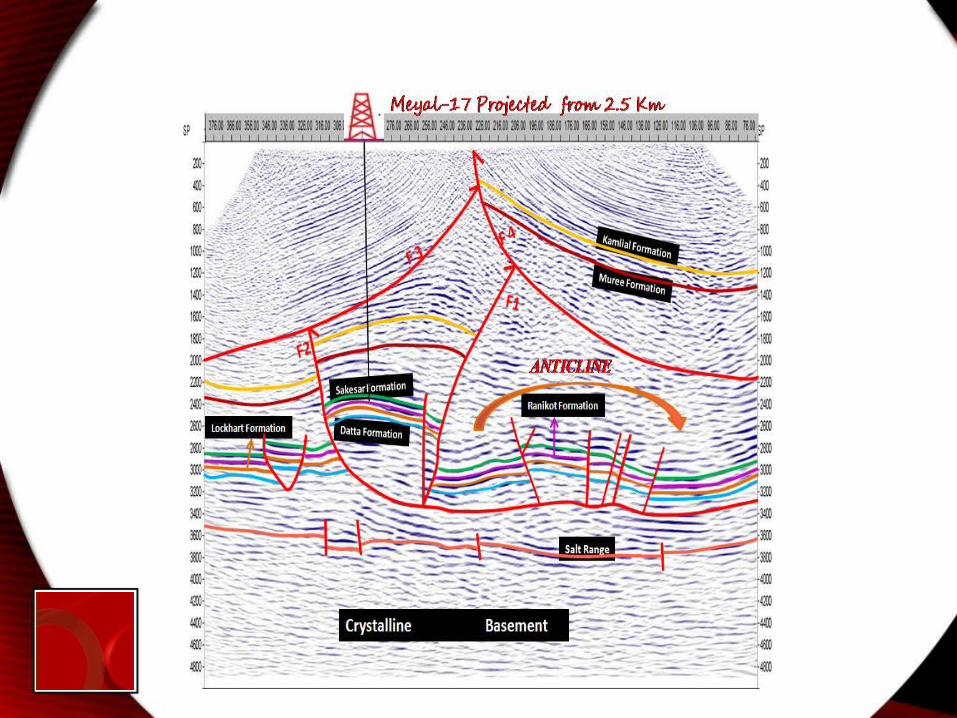


Geoseismic Sections along 97-MYL-04
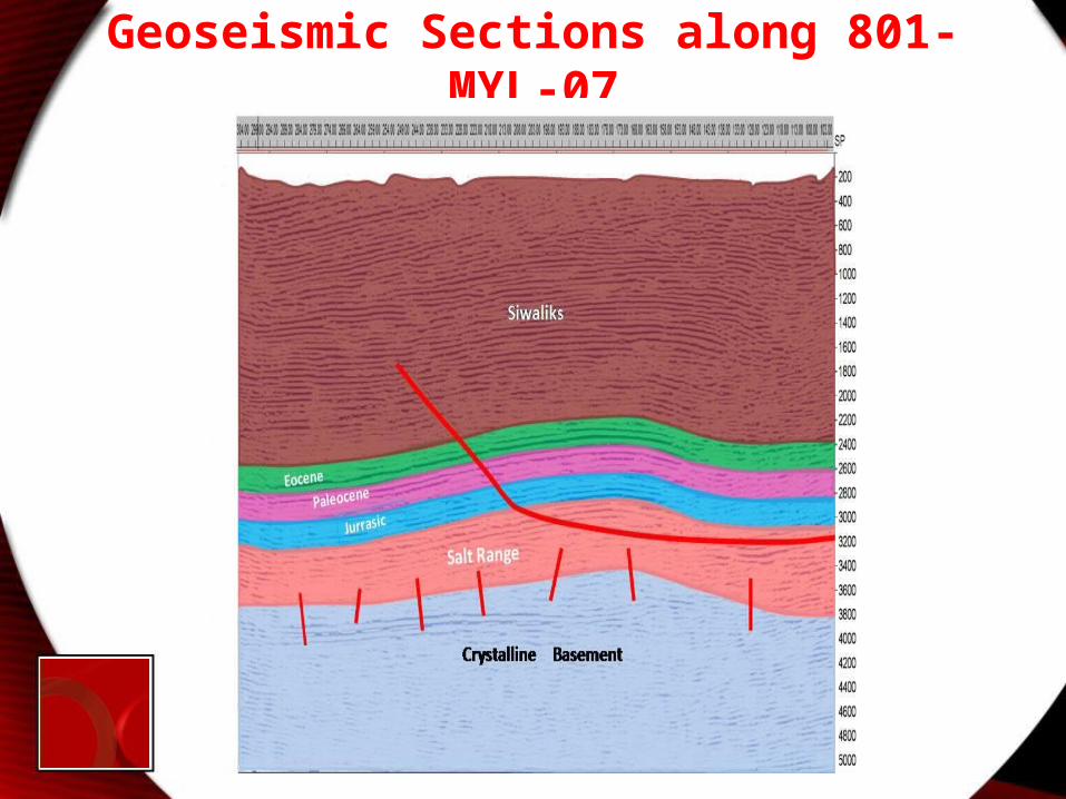
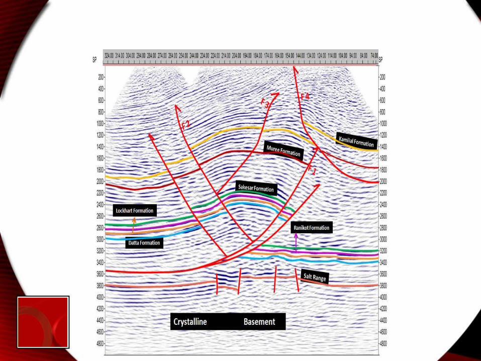
Geoseismic Sections along 801-MYL-07
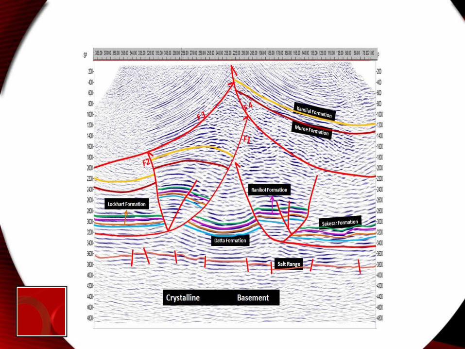
Conclusion• The exact depth of top Kamlial formation, Muree formation,
Sakesar formation, Ranikot formation, Lockhart formation, Datta formation , Salt Range and Basement shield have been demarcated in Meyal-17.
• The reflectors interpreted are the Top Eocene Sakesar formation, Paleocene Ranikot formation and Jurassic Datta formations.
• Major faults identified on the sections are thrust faults and reverse faults showing Pop-Up structures, which indicate the compressional tectonics.
• Paleocene Ranikot Formation act as a reservoir while the role of a cap rock is fulfilled by Eocene Sakesar Formation. This arrangement appear best for the accumulation of hydrocarbons. While the ''Time'' and ''Depth'' contour maps of Sakesar Formation, Ranikot Formation and Jurassic Formation were prepared which show anticlinal structure as value of contours decrease towards the centre. Therefore drilling at the point lying above the peak of the anticline is recommended to verify the findings of this study.
• Meyal is a proven old oil field, so any structure resembling Meyal on the available seismic sections should have the potential of oil. To the north-east of Meyal structure a lead is identified on the seismic line 97-MYL-04. A broad deeper anticline is clearly present there. On the seismic section 97-MYL-04 only eastern plunge of that anticline is present. It should be shallower towards the west. If the lead turn into prospect and is drillable, it could be a potential target for the exploration and production companies. Prospectivity at deeper level is however questionable; Lopatin’s method and the porosity of fractured at that depth method must be taken into account.
• Pinching of the Jurassic sands in Meyal seismic section encourages other than the structural traps. Pinching of beds may be the indication of whole sand package termination and hence forming a stratigraphic pinch out of Jurassic Sands. On observing 801-MYL-07 it is evident that Jurassic Sands are thinning towards the east. Where will they exactly terminate? This cannot be answered on the basis of available data. The trend on the seismic 801-MYL-07 if extrapolated shows somewhere 7km-15km to the east of 801-MYL-07.
Thank-youThank-you