Setting Up Your Geospatial Python Environment · Setting Up Your Geospatial Python Environment...
48
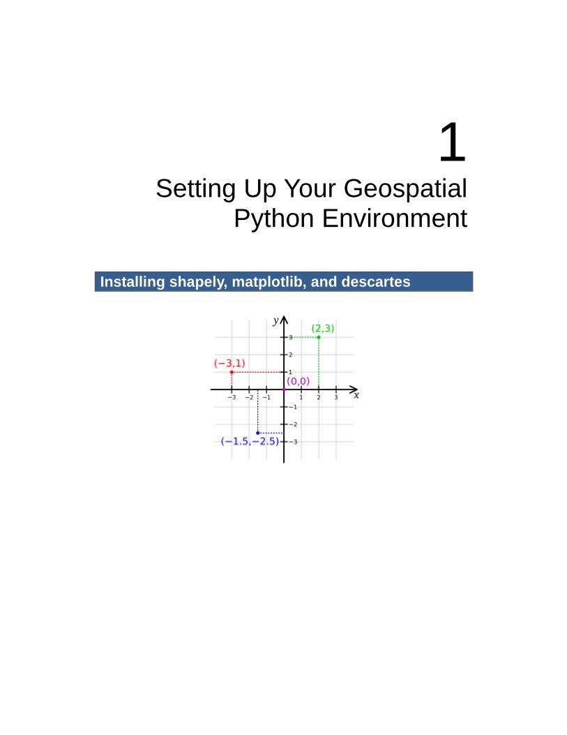
1 Setting Up Your Geospatial Python Environment Installing shapely, matplotlib, and descartes
Transcript of Setting Up Your Geospatial Python Environment · Setting Up Your Geospatial Python Environment...
1 Setting Up Your Geospatial
Python Environment
Installing shapely, matplotlib, and descartes
2
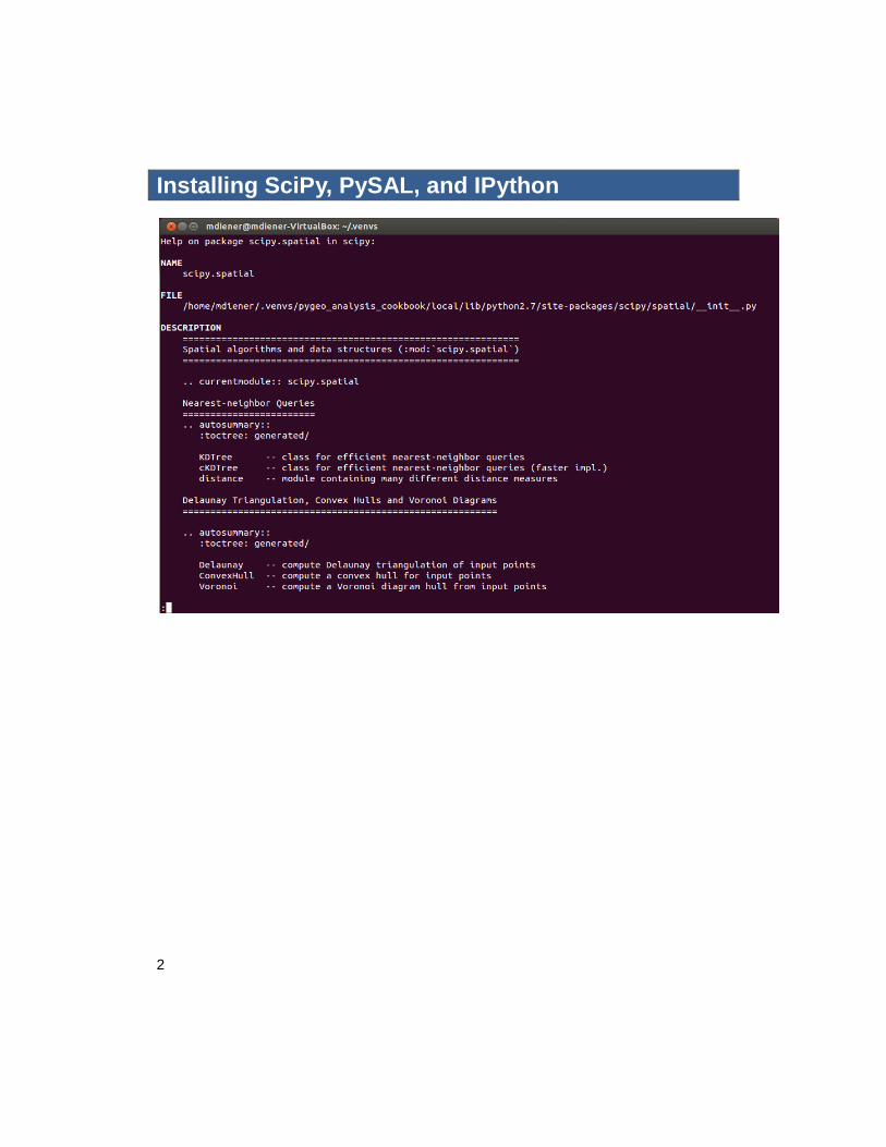
Installing SciPy, PySAL, and IPython
2 Working with Projections
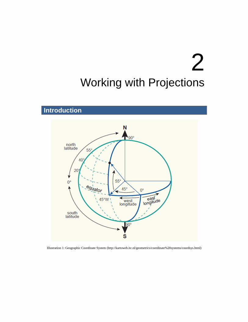
Introduction
Illustration 1: Geographic Coordinate System (http://kartoweb.itc.nl/geometrics/coordinate%20systems/coordsys.html)
4
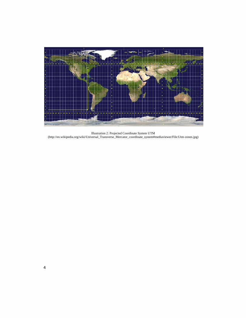
Illustration 2: Projected Coordinate System UTM (http://en.wikipedia.org/wiki/Universal_Transverse_Mercator_coordinate_system#mediaviewer/File:Utm-zones.jpg)
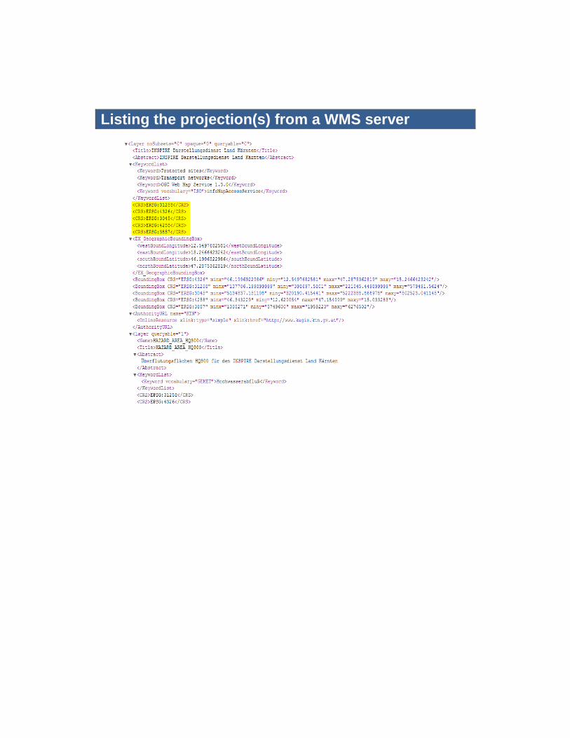
Listing the projection(s) from a WMS server
6
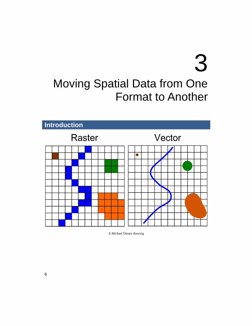
3 Moving Spatial Data from One
Format to Another
Introduction
A Michael Diener drawing
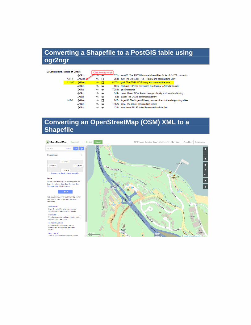
Converting a Shapefile to a PostGIS table using ogr2ogr
Converting an OpenStreetMap (OSM) XML to a Shapefile
8
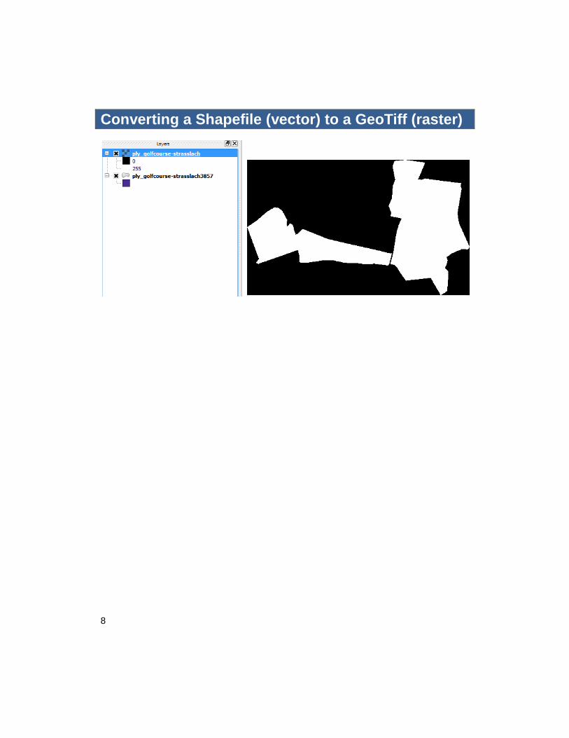
Converting a Shapefile (vector) to a GeoTiff (raster)
4 Working with PostGIS
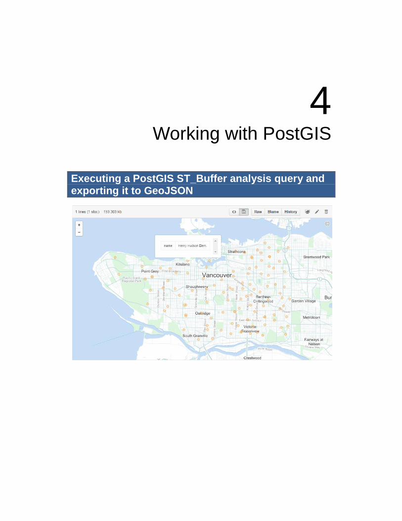
Executing a PostGIS ST_Buffer analysis query and exporting it to GeoJSON
10
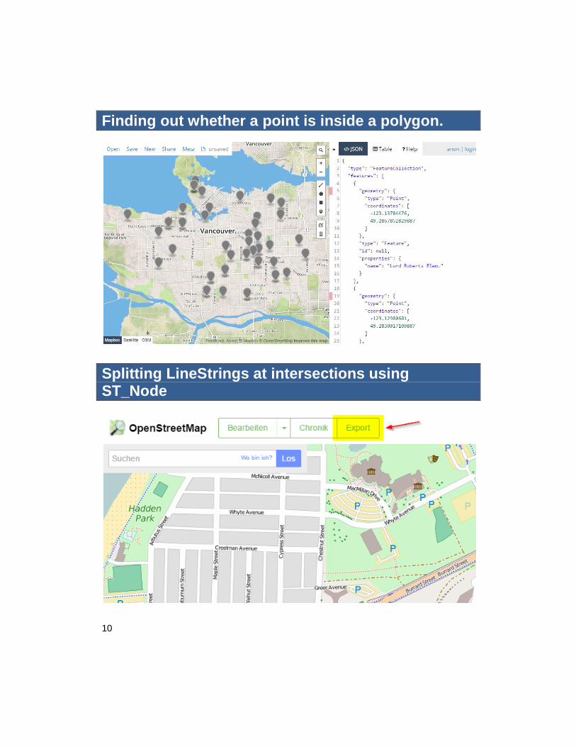
Finding out whether a point is inside a polygon.
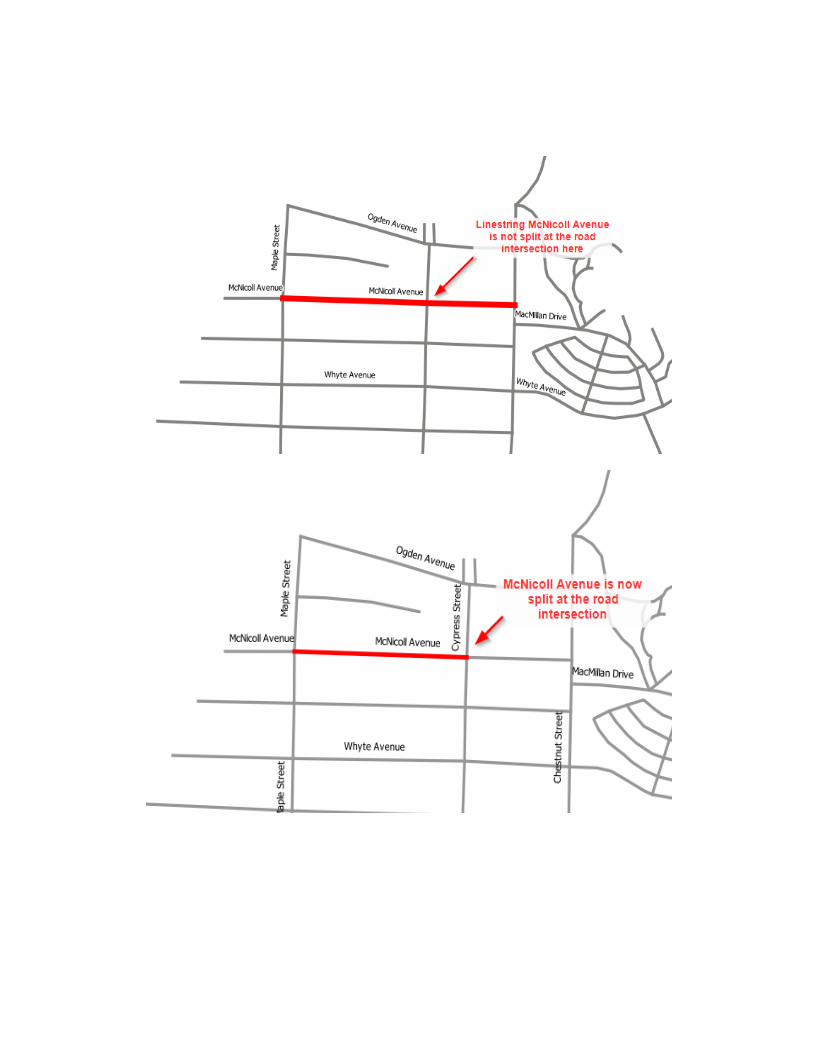
Splitting LineStrings at intersections using ST_Node
12
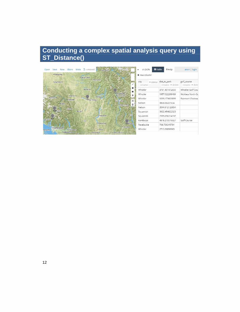
Conducting a complex spatial analysis query using ST_Distance()
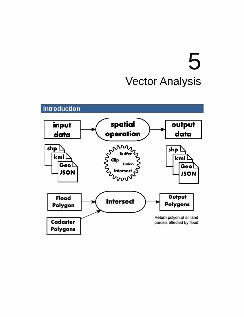
5 Vector Analysis
Introduction
14
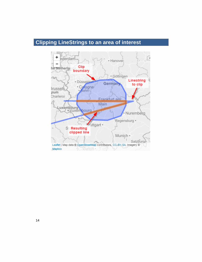
Clipping LineStrings to an area of interest
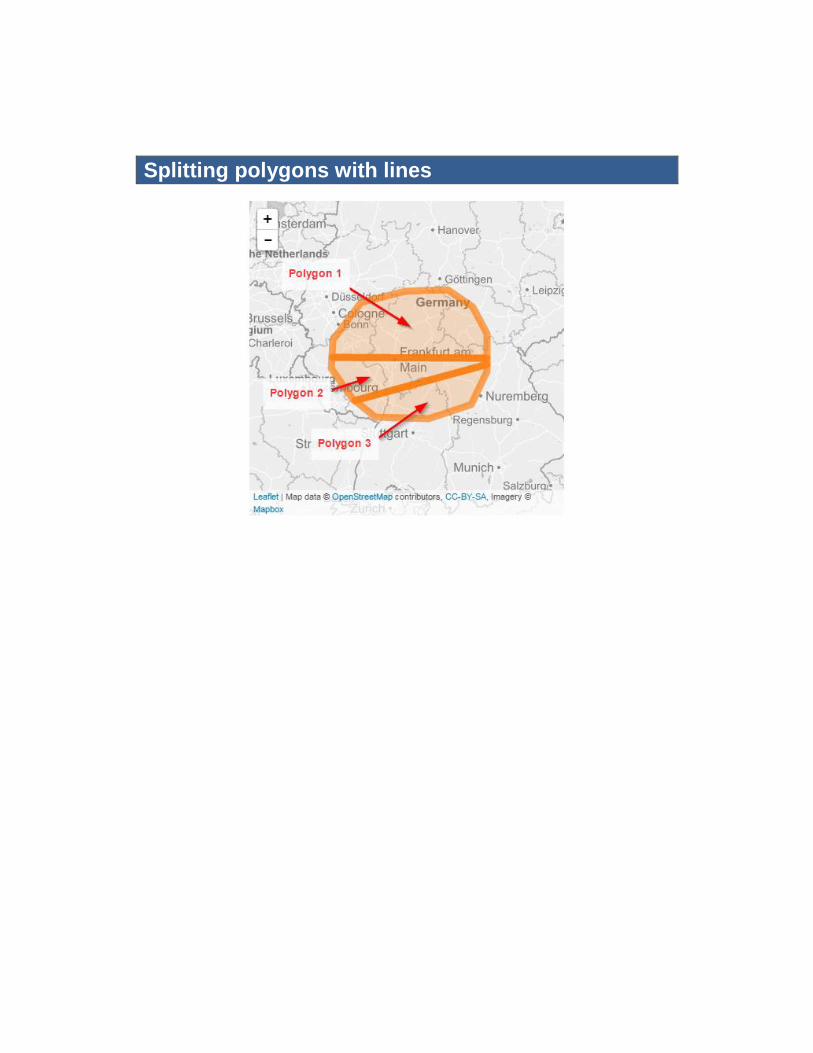
Splitting polygons with lines
16
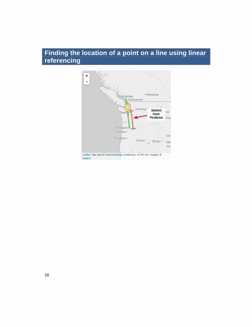
Finding the location of a point on a line using linear referencing
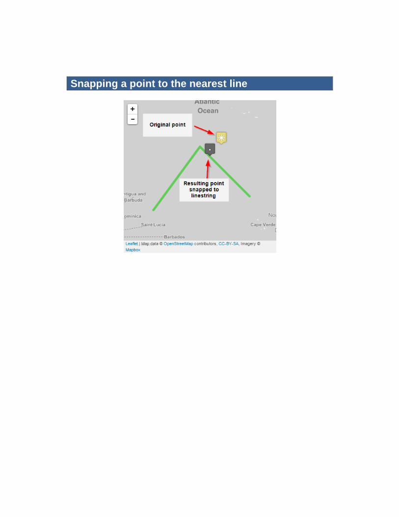
Snapping a point to the nearest line
18
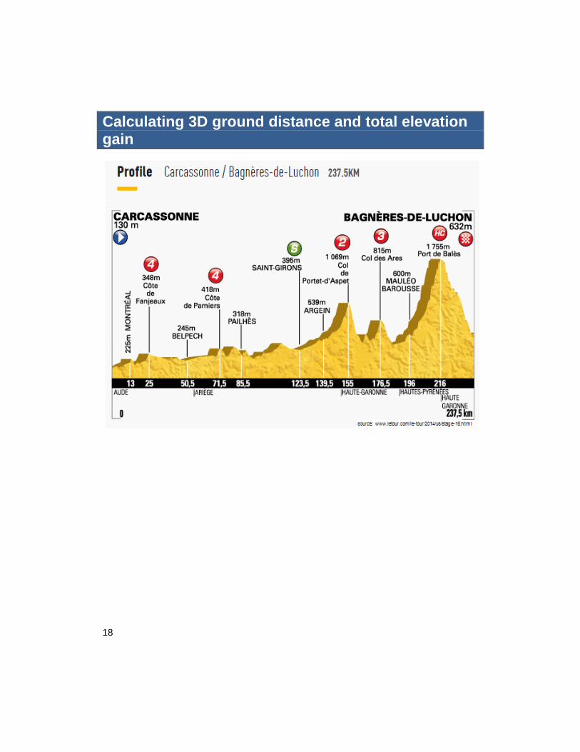
Calculating 3D ground distance and total elevation gain
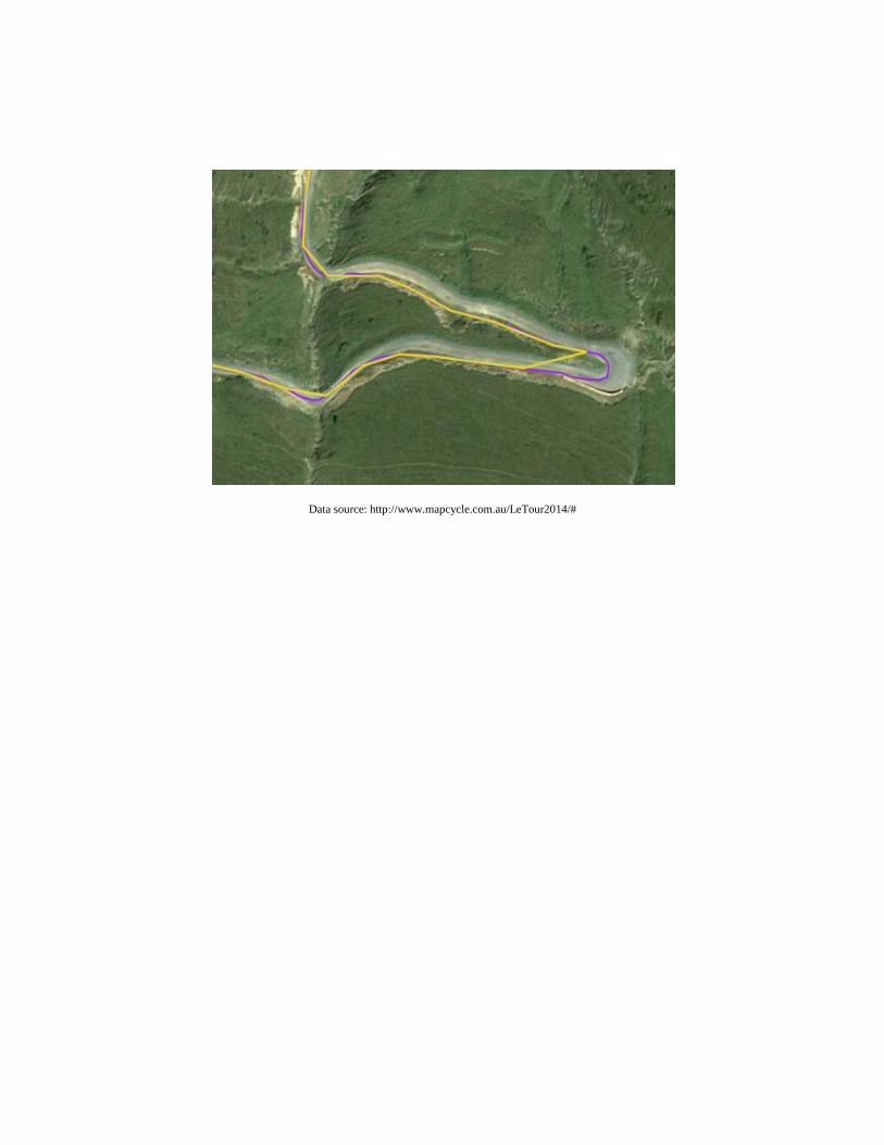
Data source: http://www.mapcycle.com.au/LeTour2014/#
20
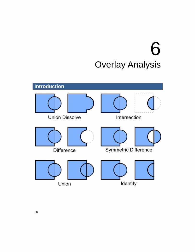
6 Overlay Analysis
Introduction
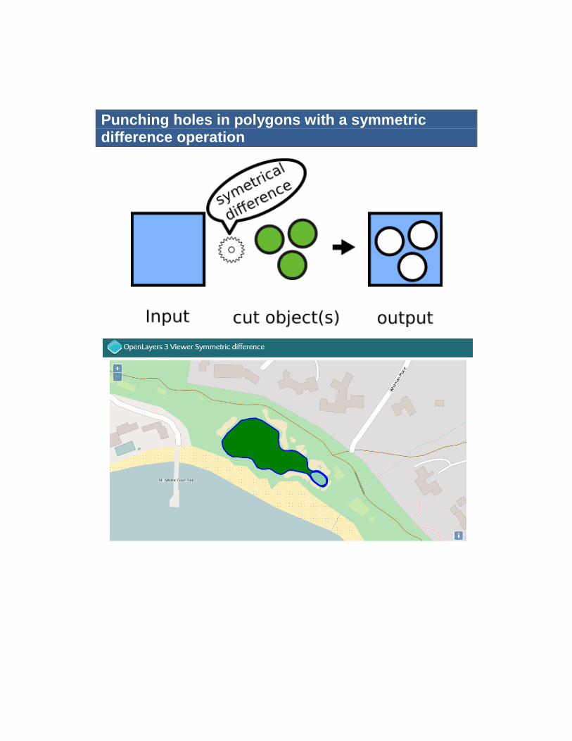
Punching holes in polygons with a symmetric difference operation
22
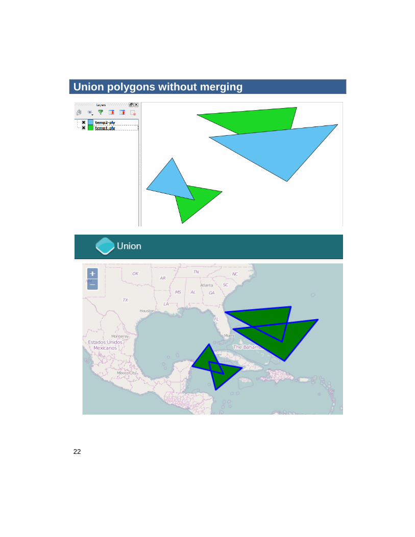
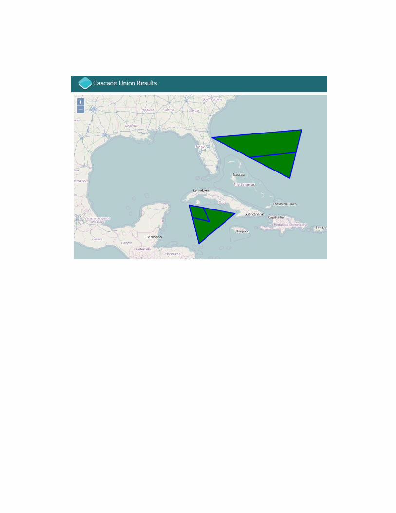
Union polygons without merging
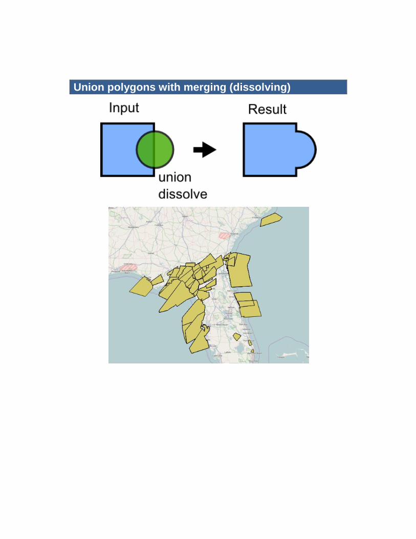
Union polygons with merging (dissolving)
24
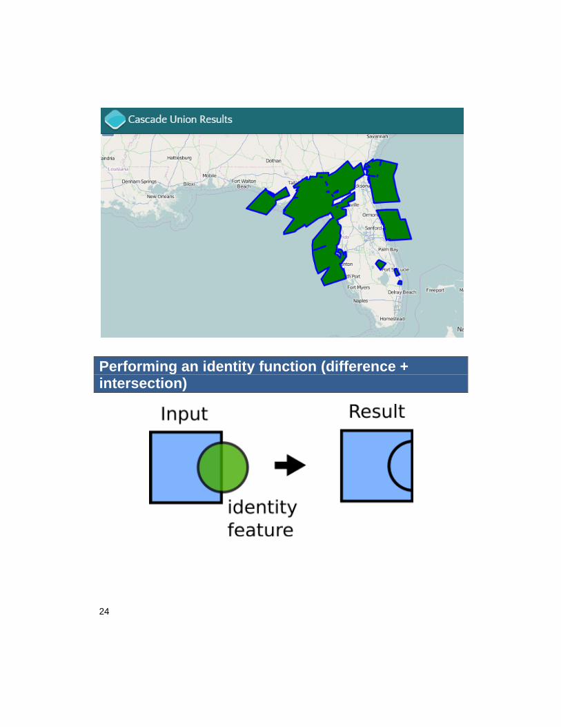
Performing an identity function (difference + intersection)
26
7 Raster Analysis
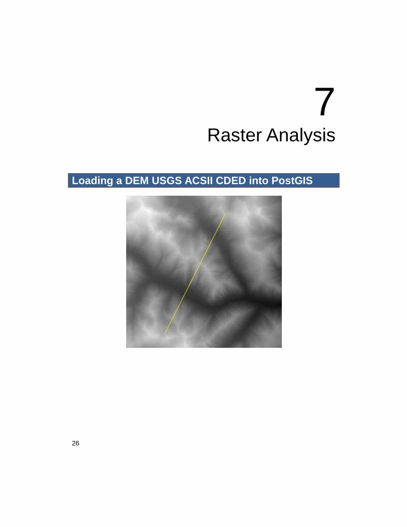
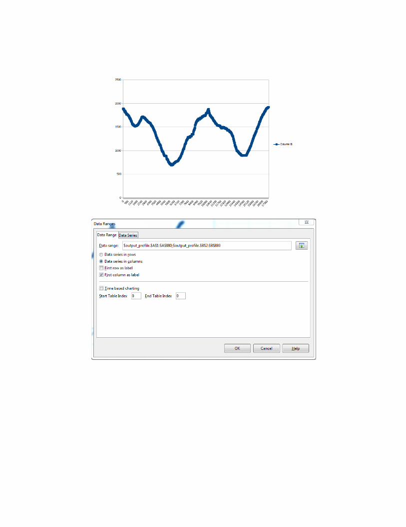
Loading a DEM USGS ACSII CDED into PostGIS
28
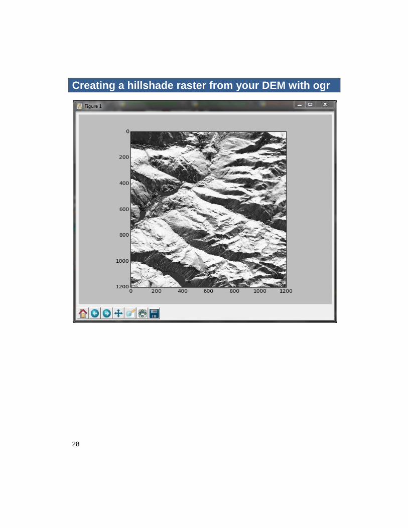
Creating a hillshade raster from your DEM with ogr
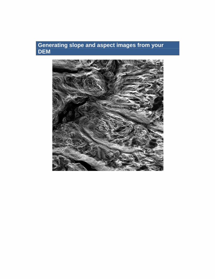
Generating slope and aspect images from your DEM
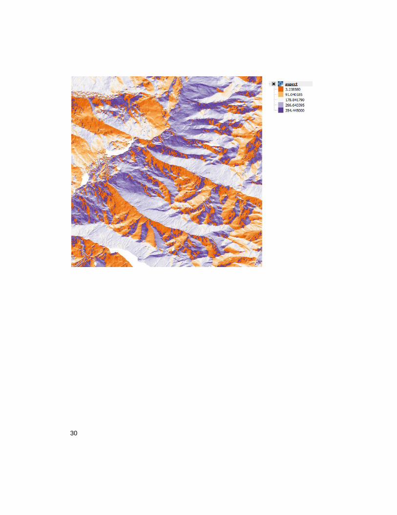
30
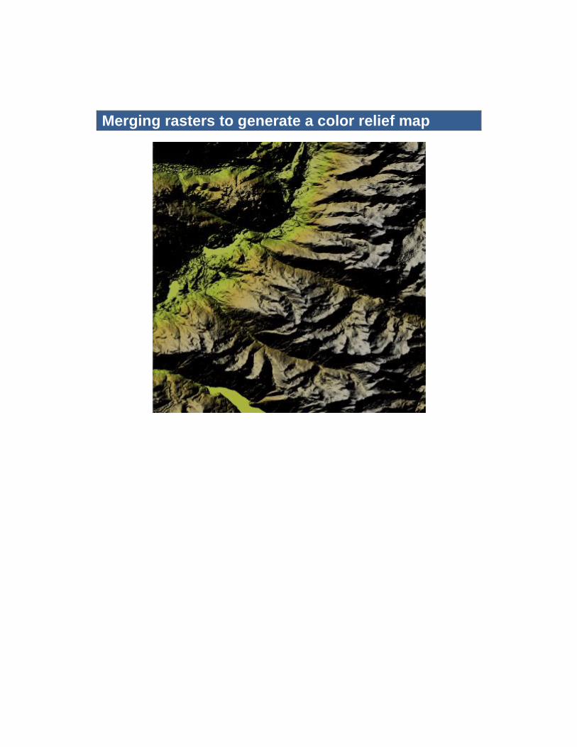
Merging rasters to generate a color relief map
32
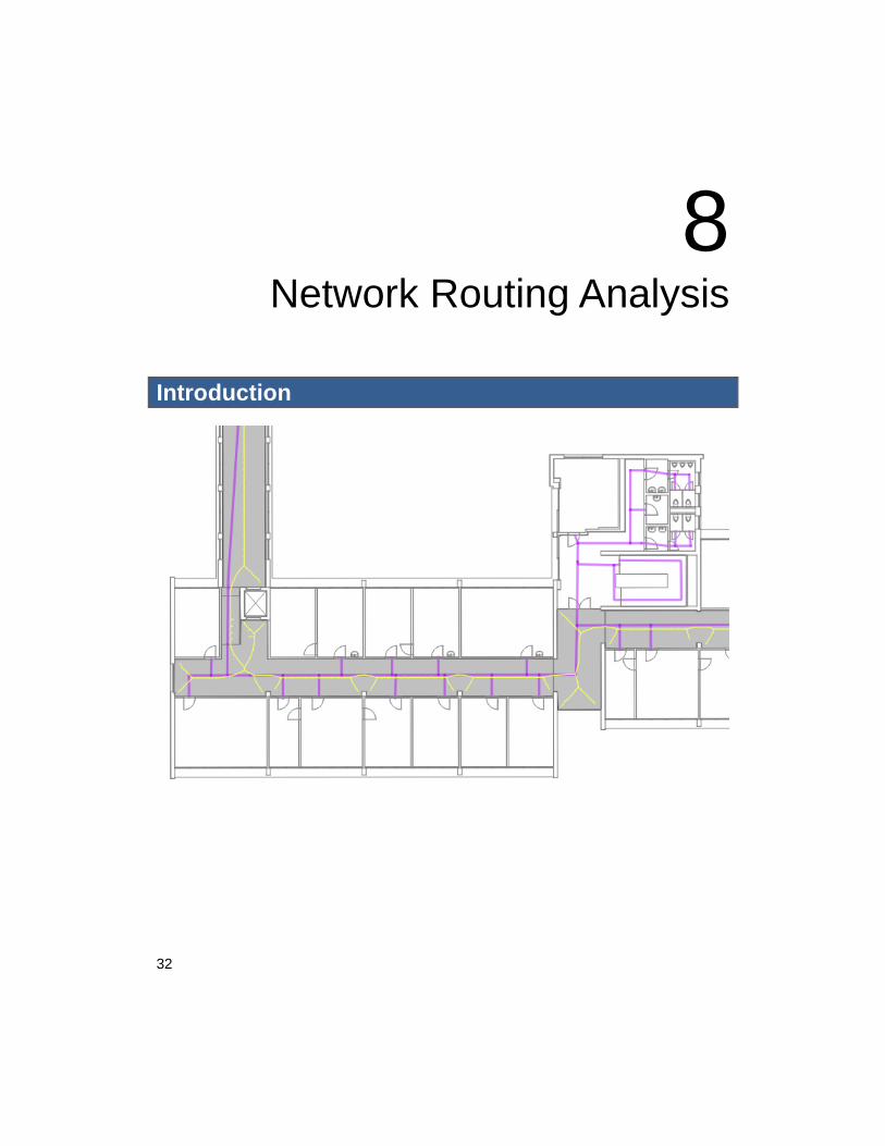
8 Network Routing Analysis
Introduction
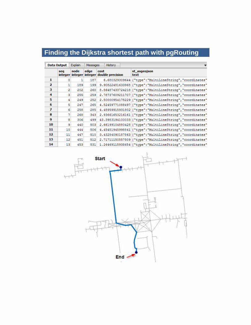
Finding the Dijkstra shortest path with pgRouting
34
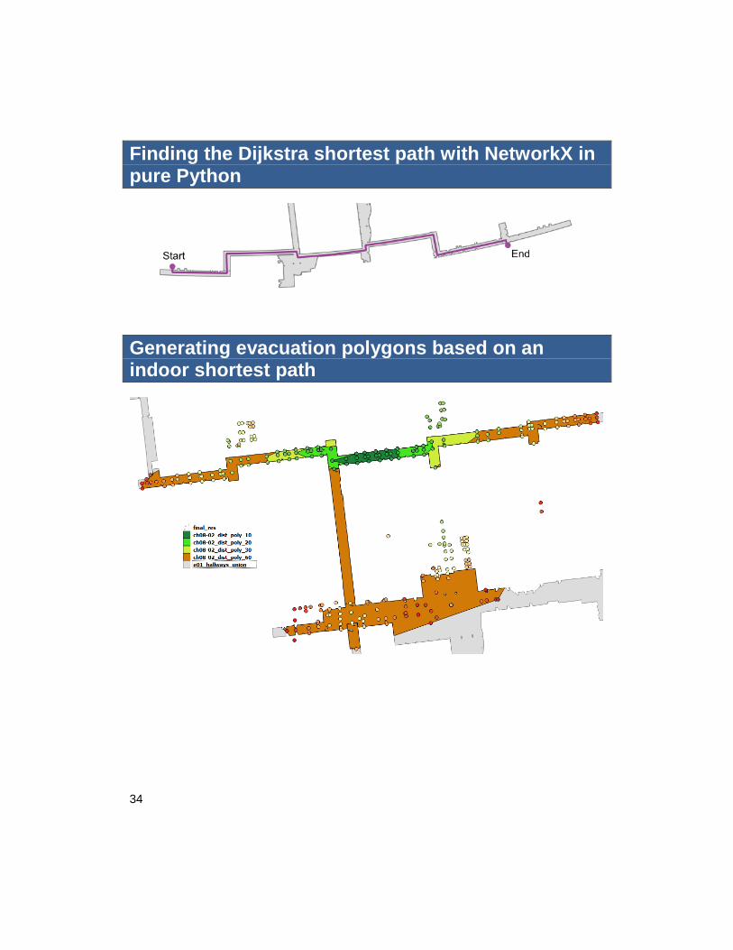
Finding the Dijkstra shortest path with NetworkX in pure Python
Generating evacuation polygons based on an indoor shortest path
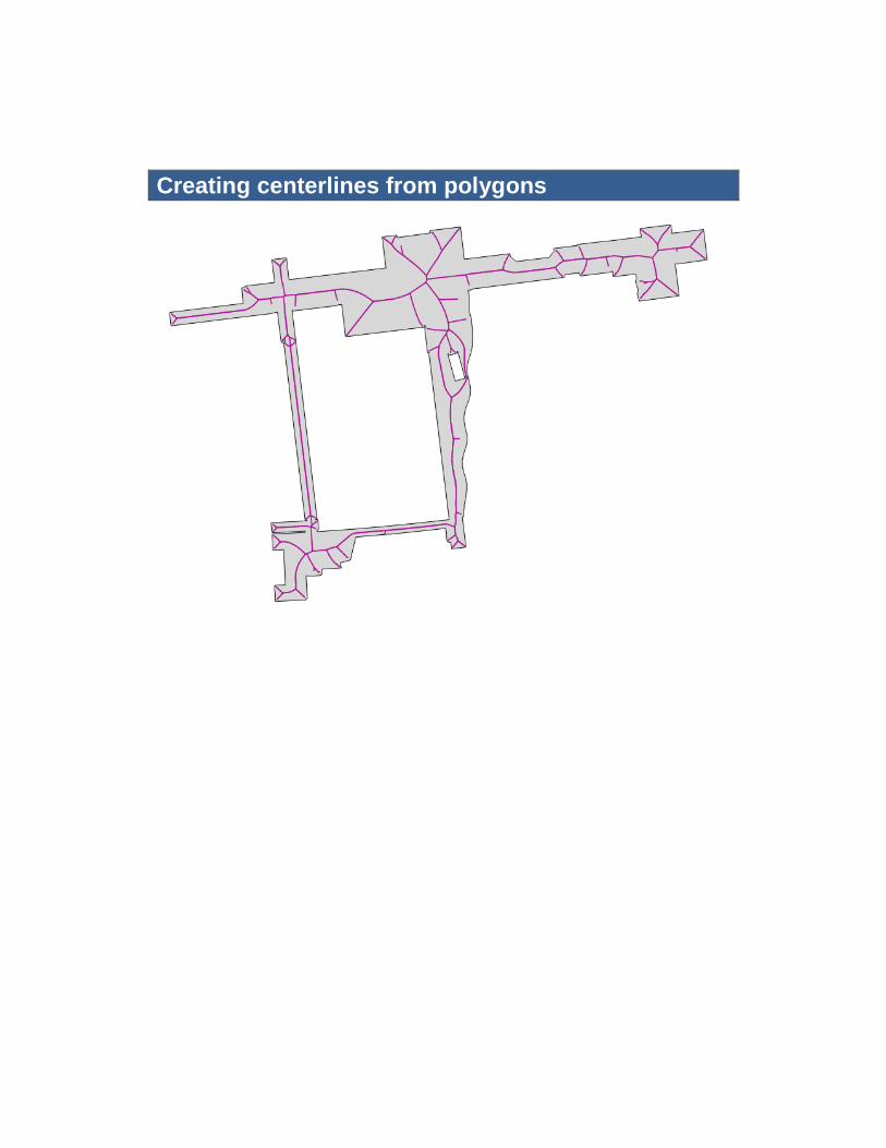
Creating centerlines from polygons
36
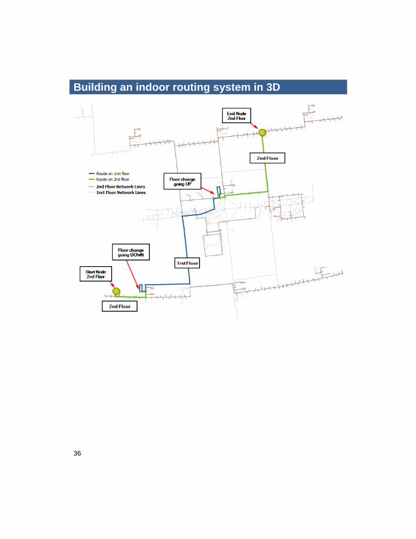
Building an indoor routing system in 3D
9 Topology Checking and Data
Validation
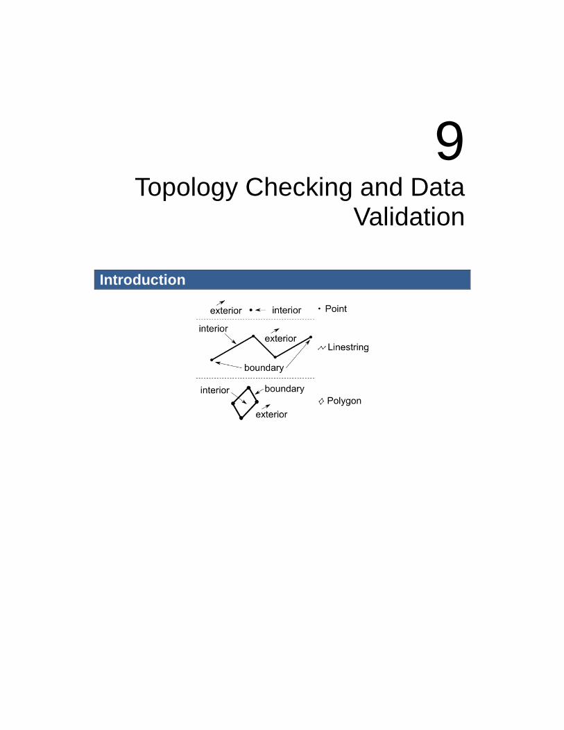
Introduction
38
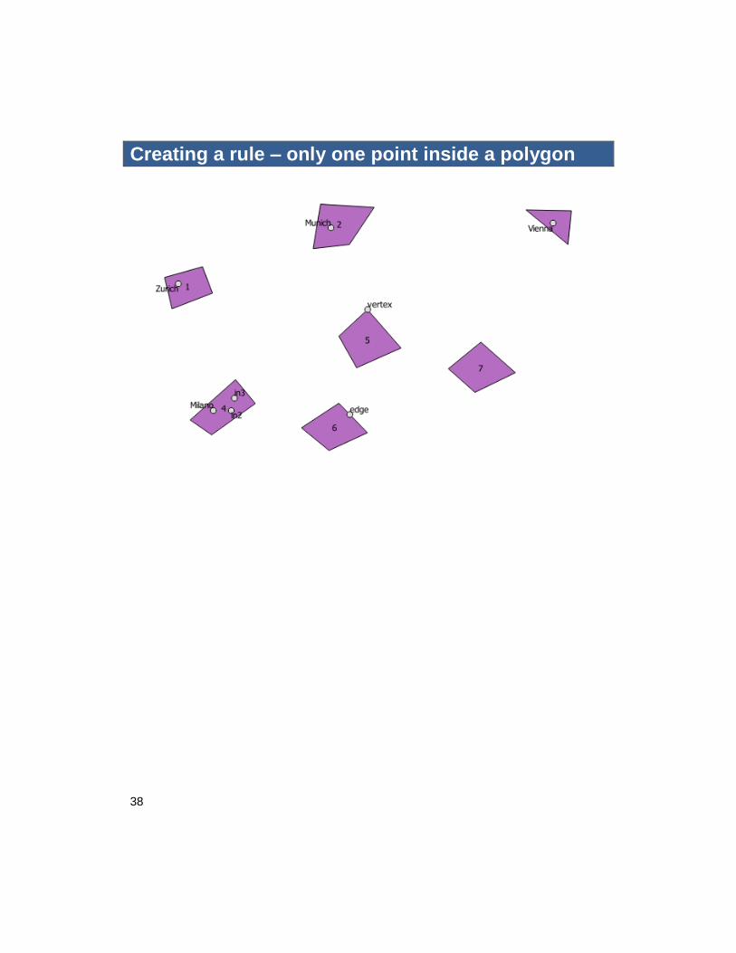
Creating a rule – only one point inside a polygon
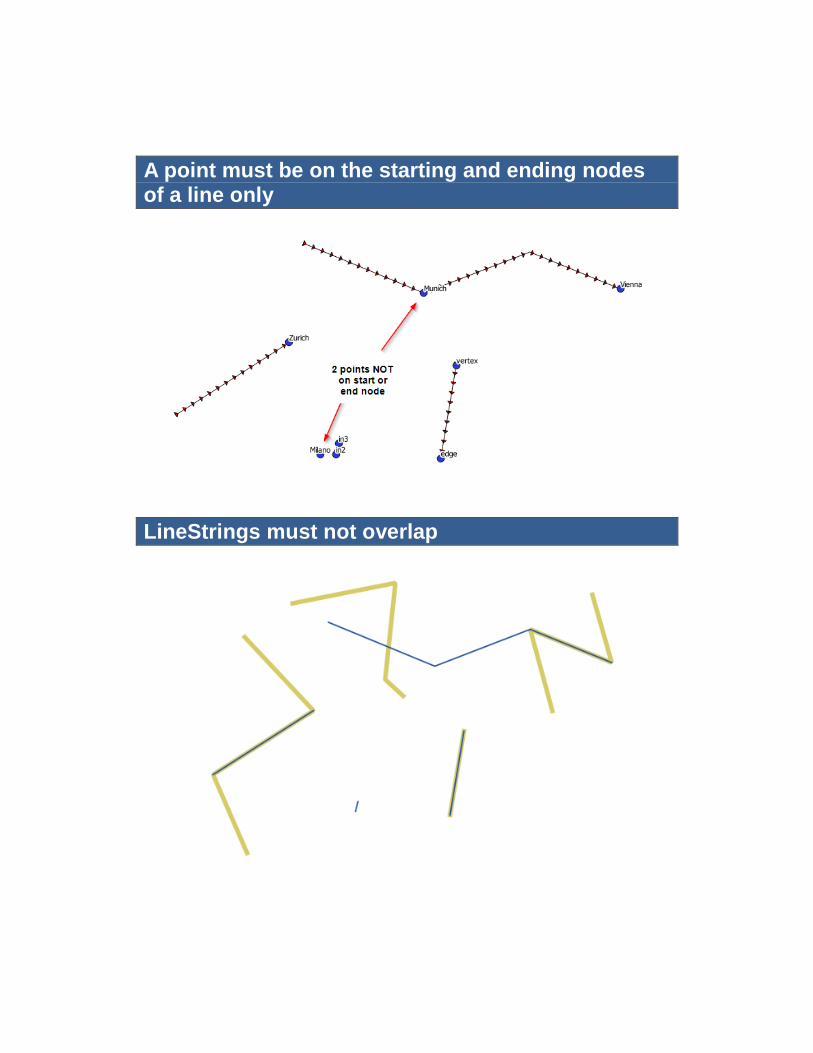
A point must be on the starting and ending nodes of a line only
LineStrings must not overlap
40
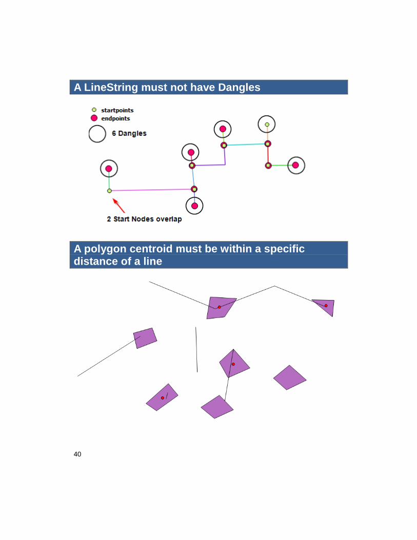
A LineString must not have Dangles
A polygon centroid must be within a specific distance of a line
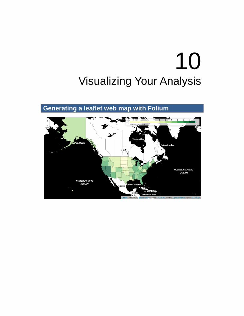
10 Visualizing Your Analysis
Generating a leaflet web map with Folium
42
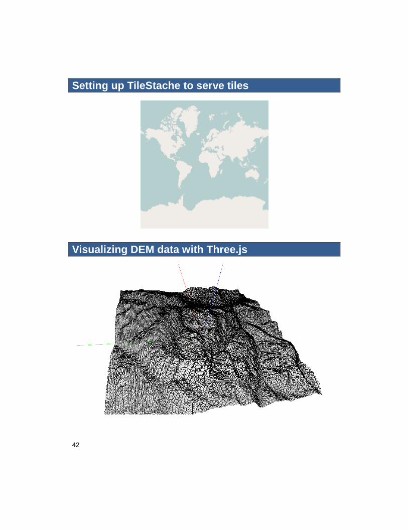
Setting up TileStache to serve tiles
Visualizing DEM data with Three.js
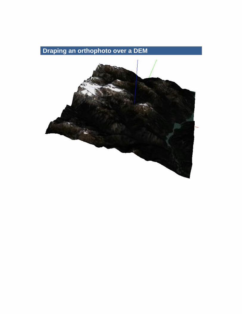
Draping an orthophoto over a DEM
44
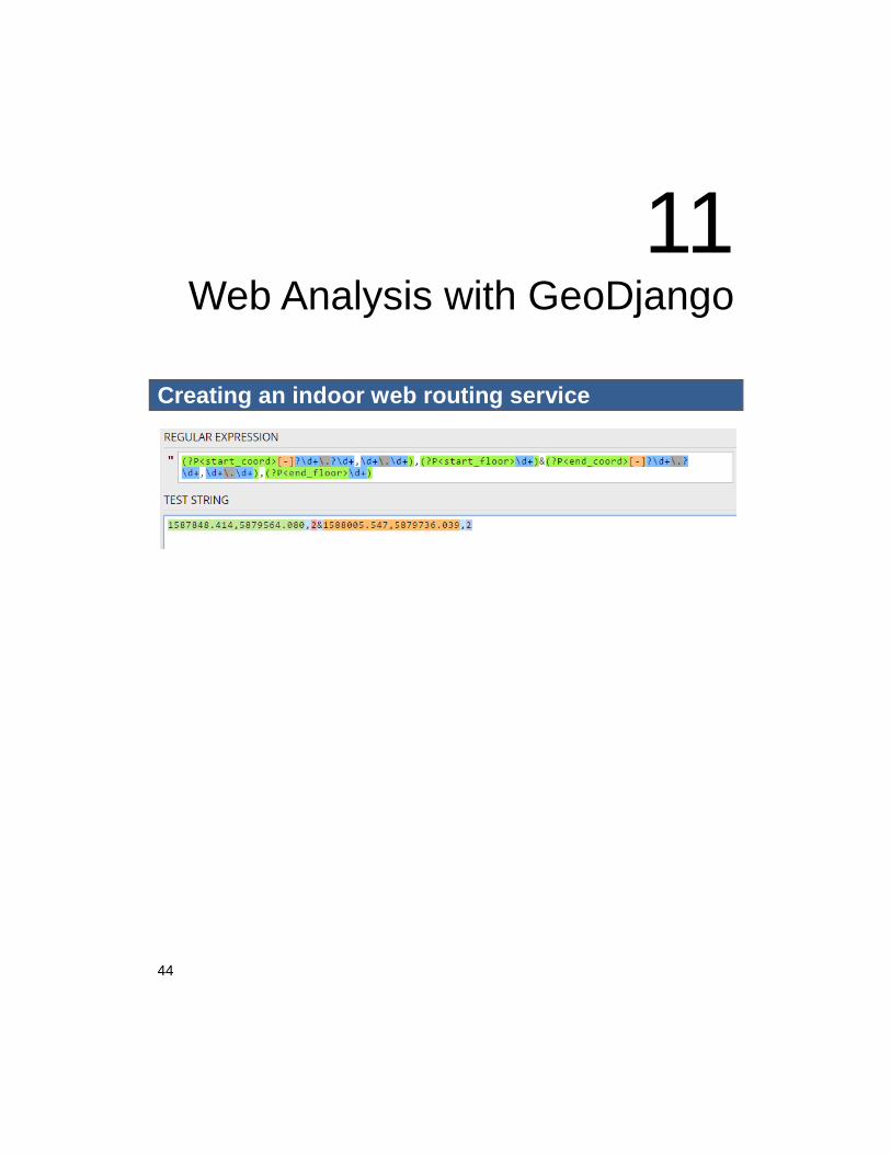
11 Web Analysis with GeoDjango
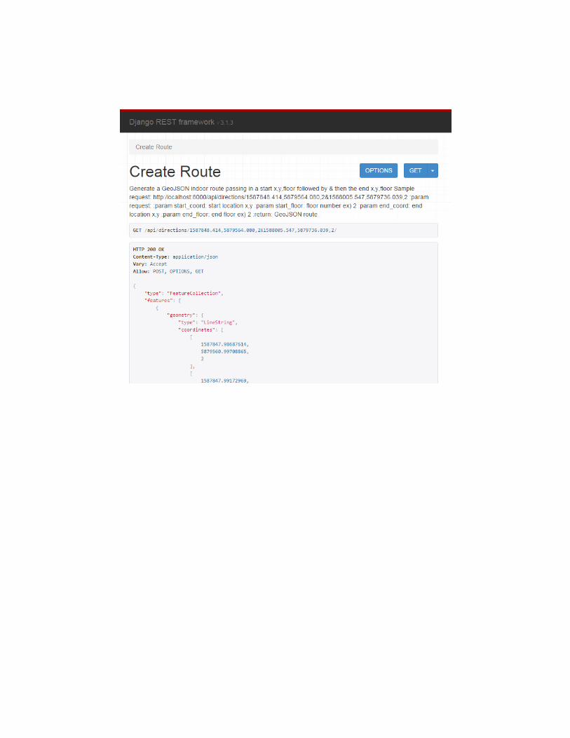
Creating an indoor web routing service
46
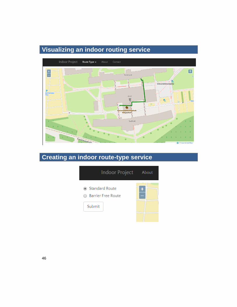
Visualizing an indoor routing service
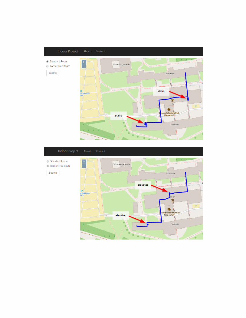
Creating an indoor route-type service
48
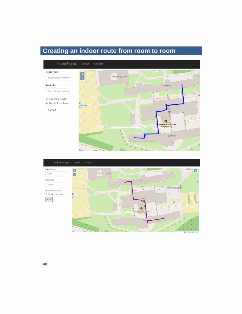
Creating an indoor route from room to room