Setting Performance Targets and Design Guidelines
33
Stormwater Planning Guidebook Setting Performance Targets and Design Guidelines Chapter Six 6.1 The Role of Performance Targets Constant Improvement through Adaptive Management 6.2 Defining the Target Condition Defining a Runoff Volume Target Defining a Runoff Rate Target Additional Performance Indicators Achieving the Target Condition at the Site Level Other Objectives for Managing Stream Health A Widely Applicable Target Condition 6.3 Moving from Science to Site Design The Need for Flexibility in Setting Performance Targets 6.4 Managing the Complete Rainfall Spectrum Understanding the Rainfall Spectrum The Importance of Rainfall Tiers Components of an Integrated Strategy for Managing the Complete Spectrum of Rainfall The Role of Continuous Simulation Modeling Understanding Why Rainfall Capture is the Key 6.5 Methodology for Setting Performance Targets and Site Design Guidelines Step #1: Assemble a Rainfall Database Step #2: Define Rainfall Distribution Step #3: Define Performance Targets for Managing the Complete Spectrum of Rainfall Events Step #4: Translate Performance Targets into Design Guidelines that can be Applied at the Site Level Step #5: Evaluate Source Control Options Through Continuous Water Balance Modeling Step #6: Optimize Stormwater System Design Through Adaptive Management
Transcript of Setting Performance Targets and Design Guidelines

Stormwater Planning Guidebook
Setting Performance Targets and Design Guidelines
Chapter Six
6.1 The Role of Performance Targets� Constant Improvement through Adaptive Management
6.2 Defining the Target Condition� Defining a Runoff Volume Target� Defining a Runoff Rate Target� Additional Performance Indicators� Achieving the Target Condition at the Site Level� Other Objectives for Managing Stream Health� A Widely Applicable Target Condition
6.3 Moving from Science to Site Design� The Need for Flexibility in Setting Performance Targets
6.4 Managing the Complete Rainfall Spectrum� Understanding the Rainfall Spectrum� The Importance of Rainfall Tiers� Components of an Integrated Strategy for Managing the Complete Spectrum of Rainfall� The Role of Continuous Simulation Modeling� Understanding Why Rainfall Capture is the Key
6.5 Methodology for Setting Performance Targets and Site Design Guidelines� Step #1: Assemble a Rainfall Database� Step #2: Define Rainfall Distribution� Step #3: Define Performance Targets for Managing the Complete Spectrum of Rainfall Events� Step #4: Translate Performance Targets into Design Guidelines that can be Applied at the Site Level� Step #5: Evaluate Source Control Options Through Continuous Water Balance Modeling� Step #6: Optimize Stormwater System Design Through Adaptive Management

STORMWATER PLANNING: A GUIDEBOOK FOR BRITISH COLUMBIAPART B – INTEGRATED STORMWATER MANAGEMENT SOLUTIONS
MAY 2002

STORMWATER PLANNING: A GUIDEBOOK FOR BRITISH COLUMBIAPART B – INTEGRATED STORMWATER MANAGEMENT SOLUTIONS
MAY 2002
6-1
6.1 The Role of Performance Targets
Performance targets provide the foundation for implementing common sense solutions thateliminate the source of stormwater related problems. This chapter presents a cost-effectiveframework for local governments to:
� establish performance targets that reflect science-based understanding to guide earlyaction in at-risk catchments (see Chapter 5)
� translate these performance targets into design criteria and guidelines that can beapplied at the site level to design stormwater systems that mitigate the impacts ofland development
Performance targets provide a starting point to guide the actions of local government in theright direction. Site design criteria provide local government staff and developers withpractical guidance for moving from planning to action.
For a performance target to be implemented and effective, it must be quantifiable. It mustalso have a feedback loop so that adjustments and course corrections can be made over time.To be understood and accepted, a performance target needs to synthesize complexity into asingle number that is simple to understand and achieve, yet is comprehensive in its scope. Arunoff volume-based performance target fulfils these criteria. This chapter presents amethodology for setting volume-based performance targets.
Volume-based thinking is an integral element of a paradigm-shift that views watersheds as afully integrated system where creek headwaters originate at rooftops and roads. Lookingahead to the GVRD case study results presented in Chapter 7, the implications are far-reaching because a volume-based approach to stormwater management touches on virtuallyevery aspect of land use planning and site design. Volume-based thinking leads directly intolandscape architecture, green roofs, urban reforestation, interflow and groundwater recharge,and water re-use.

STORMWATER PLANNING: A GUIDEBOOK FOR BRITISH COLUMBIAPART B – INTEGRATED STORMWATER MANAGEMENT SOLUTIONS
MAY 2002
6-2
Constant Improvement through Adaptive ManagementPerformance targets and design criteria provide a basis for:
� integrating appropriate stormwater management policies with land use andcommunity planning (see Chapter 4)
� selecting appropriate site design practices to reduce runoff and improve water qualityat the source (see Chapter 7)
The policies and site design practices implemented in at-risk catchments becomedemonstration projects. Monitoring the performance of these demonstration projectsprovides the foundation for adaptive management, as illustrated in Figure 6-1.
The goal of adaptive management is to learn from experience and constantly improve landdevelopment and stormwater management practices over time. This requires ongoingmonitoring of demonstration projects to assess progress towards performance targets and theshared watershed vision. The details of adaptive management are discussed further inSection 6.5.
Figure 6-1

STORMWATER PLANNING: A GUIDEBOOK FOR BRITISH COLUMBIAPART B – INTEGRATED STORMWATER MANAGEMENT SOLUTIONS
MAY 2002
6-3
6.2 Defining a Target ConditionA biophysically-based target condition can be established based on an understanding of thecharacteristics of a healthy watershed.
In order to be achievable, a biophysically-based target condition must be translated intoperformance targets that can be applied to stormwater management practice.
Since changes in Water Balance and hydrology are the primary source of stormwater relatedimpacts on watershed health (see Chapter 2), it is especially important to establishperformance targets for managing:
� Runoff Volume, and
� Runoff Rate
Defining a Runoff Volume TargetRecent research from Washington State shows that stormwater related impacts on streamhealth start to occur once the impervious percentage of a watershed exceeds about 10% (seeChapter 2). Therefore, to ensure the health of aquatic systems, developments should beplanned and built to function like watersheds with less than 10% total impervious area.
Stormwater-related impacts are a direct result of runoff from impervious surfaces that aredirectly connected to a storm drainage system or to downstream watercourses (often definedas effective impervious area (EIA)).
The Washington State research is based on data from watersheds with traditional ditch andpipe systems designed to remove runoff from impervious surfaces as quickly as possible, anddeliver it to receiving waters.
When the impervious area of watersheds with traditional ditch and pipe systems reaches the10% threshold, about 10% of the total rainfall volume becomes runoff that enters receivingwaters; this runoff volume is the root cause of aquatic habitat degradation. Note that there isvirtually no surface runoff from the naturally vegetated portion of a watershed, but nearly allrain that falls on directly connected impervious surfaces becomes runoff.
An appropriate performance target for managing runoff volume is to limit total runoff volumeto 10% (or less) of total rainfall volume. This means that 90% of rainfall volume must bereturned to natural hydrologic pathways, through infiltration, evapotranspiration or re-use onthe development site. Managing 90% of the rainfall volume throughout a watershed shouldachieve the biophysical target condition for the watershed. Managing 90% of rainfall volumetherefore becomes the volume-based performance target.
Defining a Runoff Rate TargetAs discussed in Chapter 2, the Mean Annual Flood (MAF) is defined as the channel-formingevent; as the MAF increases with development, stream channels erode to expand their cross-section, thereby degrading aquatic habitat. Therefore, an appropriate runoff rate target is toensure that streamflow rates that correspond to the natural MAF occur no more than once peryear, on average.
In order to achieve this target, stormwater systems should be designed to limit the frequencythat the natural MAF is exceeded.
The MAF correlates roughly with the runoff from a Mean Annual Rainfall (MAR), which isdefined as the rainfall event that occurs once per year, on average. The significance of theMAR is discussed further in Section 6.4.
Natural streamflow patterns can be approximated for the majority of rainfall conditions (allrainfall in an average year) by providing enough storage capacity to capture the runoff from aMAR, and releasing the stored runoff at a rate that mimics the rate of interflow in a naturallyvegetated watershed.

STORMWATER PLANNING: A GUIDEBOOK FOR BRITISH COLUMBIAPART B – INTEGRATED STORMWATER MANAGEMENT SOLUTIONS
MAY 2002
6-4
Additional Performance IndicatorsAs discussed in Chapter 2, there are additional science-based indicators that could be used asperformance targets for protecting watershed health, including:
� Maintain stream baseflow at a minimum of 10% of the Mean Annual Discharge(MAD).
� Maintain natural total suspended solids (TSS) loading rates.� Maintain key indicators of aquatic ecosystem health (e.g. maintain Benthic Index of
Biological Integrity (B-IBI) score above 30).� Preserve a 30-metre wide intact riparian corridor along all streamside areas.� Retain 65% forest cover across the watershed.
These indicators of watershed health can play an important role in comprehensiveperformance monitoring and adaptive management programs (as discussed in Section 6.5).
These indicators may also be used to help define a biophysically-based target condition for ahealthy watershed. The GVRD’s Integrated Stormwater Management Planning Terms ofReference Template (2002) provides an example of how some these indicators have beenapplied to define a target condition.
This Guidebook presents a methodology for setting performance to achieve the runoffvolume target (i.e. limiting runoff volume to 10% of total rainfall) and runoff rate target (i.e.maintaining natural MAF). The runoff volume and rate targets have been selected as theprimary basis for defining a biophysically-based target condition to guide stormwaterplanning and design because:
� They are based on scientifically defensible research that correlates watershedimperviousness and changes in hydrology with stream health.
� They provides an easily understood starting point for the design of stormwatersystems at the site level (as described in this chapter). These targets can be directlymanaged at the site level.
� Achieving the 10% volume target should also achieve management objectives forstream baseflows, water quality and aquatic ecosystem health. This is a reasonableassumption because:
� Infiltrating rainfall at the source is the most effective way to maintain streambaseflows.
� Infiltration and other stormwater source control strategies provide effectivetreatment for the first flush of pollutants that wash off from developed areas.
� Restoring the natural Water Balance eliminates the source of stream degradationand improves aquatic ecosystem health.
Monitoring the performance of demonstration projects will provide the opportunity to testhow well alternative performance targets relating to baseflows, water quality and aquaticecosystem health can be managed by achieving the runoff volume and rate targets (seeSection 6.5).
STORMWATER PLANNING: A GUIDEBOOK FOR BRITISH COLUMBIAPART B – INTEGRATED STORMWATER MANAGEMENT SOLUTIONS
MAY 2002
6-5
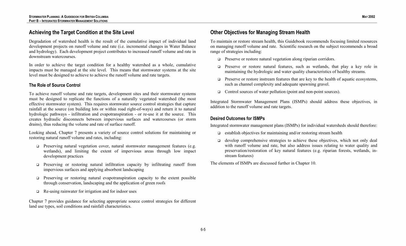
Achieving the Target Condition at the Site LevelDegradation of watershed health is the result of the cumulative impact of individual landdevelopment projects on runoff volume and rate (i.e. incremental changes in Water Balanceand hydrology). Each development project contributes to increased runoff volume and rate indownstream watercourses.
In order to achieve the target condition for a healthy watershed as a whole, cumulativeimpacts must be managed at the site level. This means that stormwater systems at the sitelevel must be designed to achieve to achieve the runoff volume and rate targets.
The Role of Source ControlTo achieve runoff volume and rate targets, development sites and their stormwater systemsmust be designed to replicate the functions of a naturally vegetated watershed (the mosteffective stormwater system). This requires stormwater source control strategies that capturerainfall at the source (on building lots or within road right-of-ways) and return it to naturalhydrologic pathways - infiltration and evapotranspiration - or re-use it at the source. Thiscreates hydraulic disconnects between impervious surfaces and watercourses (or stormdrains), thus reducing the volume and rate of surface runoff.
Looking ahead, Chapter 7 presents a variety of source control solutions for maintaining orrestoring natural runoff volume and rates, including:
� Preserving natural vegetation cover, natural stormwater management features (e.g.wetlands), and limiting the extent of impervious areas through low impactdevelopment practices
� Preserving or restoring natural infiltration capacity by infiltrating runoff fromimpervious surfaces and applying absorbent landscaping
� Preserving or restoring natural evapotranspiration capacity to the extent possiblethrough conservation, landscaping and the application of green roofs
� Re-using rainwater for irrigation and for indoor uses
Chapter 7 provides guidance for selecting appropriate source control strategies for differentland use types, soil conditions and rainfall characteristics.
Other Objectives for Managing Stream HealthTo maintain or restore stream health, this Guidebook recommends focusing limited resourceson managing runoff volume and rate. Scientific research on the subject recommends a broadrange of strategies including:
� Preserve or restore natural vegetation along riparian corridors.
� Preserve or restore natural features, such as wetlands, that play a key role inmaintaining the hydrologic and water quality characteristics of healthy streams.
� Preserve or restore instream features that are key to the health of aquatic ecosystems,such as channel complexity and adequate spawning gravel.
� Control sources of water pollution (point and non-point sources).
Integrated Stormwater Management Plans (ISMPs) should address these objectives, inaddition to the runoff volume and rate targets.
Desired Outcomes for ISMPsIntegrated stormwater management plans (ISMPs) for individual watersheds should therefore:
� establish objectives for maintaining and/or restoring stream health
� develop comprehensive strategies to achieve these objectives, which not only dealwith runoff volume and rate, but also address issues relating to water quality andpreservation/restoration of key natural features (e.g. riparian forests, wetlands, in-stream features)
The elements of ISMPs are discussed further in Chapter 10.

STORMWATER PLANNING: A GUIDEBOOK FOR BRITISH COLUMBIAPART B – INTEGRATED STORMWATER MANAGEMENT SOLUTIONS
MAY 2002
6-6
A Widely Applicable Target ConditionThe fact that performance targets are based on the characteristics of a healthy watershed iskey. This means that the performance targets for any given watershed apply to:
� new development or retrofit scenarios - Appropriate land development practices canprevent the degradation of a healthy watershed or restore an unhealthy watershed.The target condition remains the same.
� protection of environment or property - Maintaining or restoring the ecological healthof a watershed will also eliminate the source of flooding risk to property and publicsafety. Protecting aquatic resources and protecting property are complementaryobjectives. Even if property impacts are the driver for action, biophysically-basedperformance targets are still appropriate.
The Range of Case Study ExperienceThe methodology presented in this chapter for setting performance targets and design criteriaevolved through recent integrated stormwater management experiences in British Columbia.Preliminary performance targets and site design criteria were developed using thismethodology in three different catchments, all with different initial conditions, developmenttypes and drivers for action. The three case studies included the following developmentscenarios:
� Urban - High-density urban development at the top of a mountain, where protectionof downstream aquatic habitat was the primary driver for action.
� Suburban - Fully developed suburban watershed, where the need for immediateflood relief was the driver for action.
� Suburban/Rural - A municipality comprising rural and suburban land uses, wherefuture development areas (currently forested) drains to agricultural lowlands.Aquatic habitat protection was also a driver.
The methodology has been tested and accepted by the local governments in all three cases.The suburban/rural example (City of Chilliwack) is used as a case study for the remainder ofthis chapter to illustrate the methodology.

STORMWATER PLANNING: A GUIDEBOOK FOR BRITISH COLUMBIAPART B – INTEGRATED STORMWATER MANAGEMENT SOLUTIONS
MAY 2002
6-7
6.3 Moving from Science to Site DesignAs shown below, the biophysically-based target condition provides a basis for acomprehensive stormwater management strategy (see Figure 6-3). Performance targets andsite design criteria are needed to translate this strategy into action at the site level.
Biophysically-Based Target ConditionThe target condition is based on the characteristics of a healthy watershed, and incorporates targetsfor maintaining the natural Water Balance (restore 90% of rainfall volume to natural hydrologicpathways) and hydrology (maintain natural MAF). Other characteristics of a healthy watershed (e.g.water quality, baseflow, riparian integrity) may also help define a target condition.
Science-Based Performance Targets and Site Design Criteria
Translating the above strategy into an action plan requires performance targets and designcriteria to guide stormwater management and development practices at the site level.Performance targets and design criteria can be evaluated and optimized to reduce costsover time by monitoring the performance of demonstration projects.
Science Based Strategy for Managing the Complete Spectrum ofRainfall Events
Stormwater impacts occur when land use change alters the water balance, thus increasing thevolume and rate of surface runoff from every rainfall event. In order to maintain or movetowards the target condition, the complete spectrum of rainfall events must be managed in amanner that approximates a naturally vegetated watershed.
Leads to:
Figure 6-2
Implementingthis strategy
requires:
InfrequentLarge Storms(up to MAR)
FrequentSmall Storms
(less than half of MAR)
RareExtreme Storms
(greater than MAR)
Site-Specific Rainfall Distribution(relative to MAR, the site-specific mean annual rainfall)
Infil
trat
ion
Rainfall Capture
DeepGroundwater
Evaporation-Transpiration
Infiltrate or Reuse Small Storms at the Source to Reduce
Total Runoff Volume
Reuse
Runoff
Provide DetentionStorage to
Control the Rate of Runoff from Large Storms
StorageRelease
Rate TargetThe natural
Mean Annual Floodis maintained
Controlled Flow
Ensure that the Stormwater Systemcan Safely Convey
Extreme Storms
Flood RiskManagement
Volume Target90% of total rainfall volume is returned to
natural hydrologic pathways
Runoff Control

STORMWATER PLANNING: A GUIDEBOOK FOR BRITISH COLUMBIAPART B – INTEGRATED STORMWATER MANAGEMENT SOLUTIONS
MAY 2002
6-8
The Need for Flexibility in Setting Performance TargetsEstablishing performance targets provides a quantifiable way of measuring success inprotecting or restoring a watershed, and for identifying what needs to be done to achieve acertain level of protection for a given watershed.
The runoff volume and rate targets presented in presented in Section 6.2 provide a referencepoint that is based on the Water Balance and hydrology of a healthy watershed. To determinewhether these targets are realistic or achievable for a given watershed, an ISMP must answerthe following questions:
� What is the existing level of annual runoff volume? What percentage of total annualrainfall volume does it represent? What is the existing Mean Annual Flood (MAF)?
� What are acceptable levels of runoff volume and rate in terms of flood risk andenvironmental risk? What are the consequences of increased or decreased flowsrelated to land development? Are these consequences acceptable?
� What actions are needed to avoid flooding or environmental consequences?
� How can necessary actions be staged over time?
� Are the targets to maintain 10% runoff volume and maintain the natural MAFnecessary or achievable over time? If not, what levels are?
Performance targets that are based on the characteristics of a healthy watershed, includingtargets for runoff volume, runoff rate, and any other indicators that may be used to define atarget condition, should be used as a starting point. Performance targets should becustomized for individual watersheds and catchments, based on what is effective andaffordable in the context of watershed-specific conditions.
For example, the 10% runoff volume target may not be appropriate for a watershed withlimited fisheries value. In this case it may be more appropriate to establish targets forreducing the volume and rate of runoff based on judgements regarding acceptable levels offlooding.
Continuous Water Balance modeling can be applied to determine what is effective andaffordable. Further discussion of Water Balance modeling is found in Chapter 7.

STORMWATER PLANNING: A GUIDEBOOK FOR BRITISH COLUMBIAPART B – INTEGRATED STORMWATER MANAGEMENT SOLUTIONS
MAY 2002
6-9
6.4 Managing the Complete Rainfall SpectrumA guiding principle of integrated stormwater management is to design for the completespectrum of rainfall events (as shown in Figure 6-2). Designing for the complete spectrum ofrainfall events provides the foundation for protecting both property and stream health.
Understanding the Rainfall SpectrumA key parameter for describing the rainfall spectrum is the size of the Mean Annual Rainfall(MAR), the rainfall event that occurs once per year, on average. The distribution of rainfallevents relative to the MAR is fairly constant throughout British Columbia.
The following rainfall tiers are the building blocks of an integrated strategy for managing thecomplete spectrum of rainfall events:
� Tier A Events* – The small rainfall events that are less than half the size ofa MAR. About 90% of all rainfall events are Tier A events.
� Tier B Events* – The large rainfall events that are greater than half the sizeof a MAR, but smaller than a MAR. About 10% of all rainfall events are Tier Bevents.
� Tier C Events* – The extreme rainfall events exceeding a MAR. Anextreme event may or may not occur in any given year.
* For the purpose of setting performance targets, a rainfall event is defined as total daily rainfall(i.e. mm of rainfall accumulated over 24 hours). This assumption results in conservative sitedesign criteria, which can be optimized over time through continuous simulation modeling, and bymonitoring the performance of demonstration projects (as discussed in Section 6.5).
These three rainfall tiers correspond to three components of an integrated strategy formanaging the complete spectrum of rainfall events (see Figure 6-2); rainfall capture (sourcecontrol), runoff control (detention), and flood risk management (contain and convey). Thesethree components are discussed further in this section.
The Importance of Rainfall TiersDefining tiers is the key to the rainfall analysis. It enables a systematic approach to dataprocessing and identification of rainfall patterns, distributions and frequencies. Establishingthe MAR as a reference point provides a convenient way to divide the rainfall database intothree groupings.
Table 6-1 below shows how the rainfall tiers vary across the regions of BC where the mostdevelopment is occurring. In the Georgia Basin the MAR ranges from about 40 mm on theEast Coast of Vancouver Island, to about 60 mm in the Fraser Valley (also representative ofmuch of the Lower Mainland), to about 80 mm on the North Shore of Vancouver. For theOkanagan Region, the MAR is closer to 20 mm.
Table 6-1 – Rainfall Spectrum for Various Locations in BC
Location Tier A Events(less than 50% of
MAR)
Tier B Events(between 50% ofMAR and MAR)
Tier C Events(Greater than MAR)
Vancouver(North Shore)
< 40 mm 40 to 80 mm > 80 mm
Chilliwack < 30 mm 30 to 60 mm > 60 mm
Nanaimo < 20 mm 20 to 40 mm > 40 mm
Kelowna < 10 mm 10 to 20 mm > 20 mm
* approximate values based on statistical analyses using of 30+ years of rainfall data
One of these examples (Chilliwack) is used throughout this chapter to illustrate how to:� use rainfall data to define MAR and the rainfall tiers� apply the rainfall tiers to establish performance targets and site design guidelines

STORMWATER PLANNING: A GUIDEBOOK FOR BRITISH COLUMBIAPART B – INTEGRATED STORMWATER MANAGEMENT SOLUTIONS
MAY 2002
6-10
Managing Rainfall Volume at the SourceTier A events make up the bulk of total annual rainfall events and rainfall volume (seeFigures 6-3 and 6-4). Capturing these small events at the source is the key to reducing runoffvolume and managing the Water Balance (i.e. rainfall capture).
Figures 6-3 and 6-4 illustrate both coastal and interior conditions. Regardless of location, themajority of rainfall events are small (less than 50% of MAR). This is a key observation withrespect to the feasibility of approximating the natural Water Balance through infiltrationand/or rainfall re-use.
Consistency with Current Stormwater PracticeReferencing the rainfall tiers to the Mean Annual Rainfall (MAR) provides consistency withcriteria that became accepted practice in the 1990s.
In British Columbia, the Land Development Guidelines for the Protection of Aquatic Habitat(1992) focus on managing runoff from storms with a 2-year return period, which isapproximately equal to the MAR.
Also, 50% of the MAR corresponds to what is called a ‘6-month storm’ in Washington State.The concept of the ‘6-month storm’ was introduced in Washington to provide context formanaging the six to ten runoff events per year that have the most potential to causewatercourse erosion (i.e. Tier B events). At the time, this approach represented a majordeparture from traditional drainage practice.
Prior to the late 1990s, the focus of drainage planning was on the extreme events that rarelyoccurred (Tier C events).
The tiered approach marks a further shift in drainage practice, from managing 25% of therainfall volume (Tier B and C) to managing 100% of the rainfall (i.e. the completespectrum).
74% 71%
21% 23%
4 % 6%
0
2 0
4 0
6 0
8 0
1 0 0
Pe
rce
nt
of
To
tal
An
nR
ain
fall
L e s s th a n 5 0 % o fM A R
5 0 % o f M A R to M A R G re a te r th a n M A R
R a in fa ll E v e n t S iz e (m m )
T y p ic a l V o lu m e D is tr ib u tio n o f A n n u a l R a in fa ll
S o u th C o a s t (B u rn a b y M o u n ta in ) O k a n a g a n (K e lo w n a A irp o rt)
N ote : B urnab y M oun ta in M A R * = 70 m m K e low na M A R * = 20 m m (*2 4 -h o u r ra in fa ll )
Figure 6-4
160
97
8 5 1 1
0
50
100
150
200
No. R
ainf
all E
vent
s pe
r Yea
r
Less than 50% of MAR 50% of MAR to MAR Greater than MAR
Rainfall Event Size (mm)
Typical Frequency Distribution ofAnnual Rainfall
South Coast (Burnaby Mountain) Okanagan (Kelowna Airport)
Note: Burnaby Mountain MAR* = 70 mm Kelowna MAR* = 20 mm
(*24-hour rainfall)
Defined as Tier A Events.
Defined asTier B Events Defined as
Tier C Events
Figure 6-3

STORMWATER PLANNING: A GUIDEBOOK FOR BRITISH COLUMBIAPART B – INTEGRATED STORMWATER MANAGEMENT SOLUTIONS
MAY 2002
6-11
Components of an Integrated Strategy for Managing the CompleteSpectrum of Rainfall
Each of the three rainfall tiers corresponds to a component of an integrated strategy:
1. Rainfall Capture (Source Control) to Manage the Small Tier A Rainfall EventsThe key to runoff volume reduction and water quality improvement is capturing the smallstorm runoff (Tier A rainfall events) from rooftops and paved surfaces. This capturedrainfall should be infiltrated, evapotranspired, and/or re-used at the source. Rainfallcapture can be provided at the source with:
� On-lot stormwater source control facilities to capture runoff from rooftops,driveways, parking and other impervious areas for infiltration, evapo-transpirationand/or reuse.
� On-street source control facilities to capture and infiltrate runoff from pavedroadways. These facilities must also be designed to convey extreme storms, similarto conventional storm sewers.
Chapter 7 describes specific source control options available for development parcels androads, including specific examples.
2. Runoff Control (Detention) to Manage the Large Tier B Rainfall EventsThe runoff resulting from the large Tier B events causes the most significant peak flowsin downstream watercourses. Therefore, the key to runoff rate control is storing therunoff from impervious surfaces resulting from the large Tier B rainfall events andreleasing it at a controlled rate. This controlled release will eliminate the ‘spikes’ thatcharacterize the rapid response of runoff from impervious surfaces. Storage capacity forlarge Tier B storms can be provided:
� By increasing the storage capacity of on-parcel and on-street source control facilities(above the capacity required to achieve rainfall capture targets).
� In community detention facilities that serve sub-catchments of a watershed (canprovide runoff control but not rainfall capture).
3. Flood Risk Management (Contain and Convey) for the Extreme Tier C RainfallEvents
Development sites must have adequate escape routes for runoff from extreme storms(combination of overland flow and flow collection and conveyance systems). Streamchannels and stream crossing (e.g. culverts and bridges) must have sufficient capacity tocontain and convey flood flows resulting from very large storms (e.g. the 100-yearstorm), without resulting in threats to public safety or property damage. A framework forflood risk management is presented in Section 6.5.
The Role of Continuous Simulation ModelingPerformance targets (i.e. a starting point) can be established based on simple rainfall analysis(see Section 6.5). The level of effort required to apply continuous simulation modeling is notappropriate for setting performance targets, but is appropriate for optimizing design solutionsto achieve the performance targets.
As explained in Chapter 7, continuous simulation modeling is also appropriate for evaluatingstormwater source control options and optimizing the design of stormwater systemcomponents.

STORMWATER PLANNING: A GUIDEBOOK FOR BRITISH COLUMBIAPART B – INTEGRATED STORMWATER MANAGEMENT SOLUTIONS
MAY 2002
6-12
Understanding Why Rainfall Capture is the KeyRunoff control without rainfall capture is the conventional detention-based approach tostormwater management. It is only a partial solution. It is now recognized that this approachdoes not protect downstream fish habitat because it does not maintain natural levels oferosion or support baseflows in watercourses.
The water released from conventional detention storage typically goes directly to downstreamwatercourses. This slows down the water and reduces peak runoff rates, but does not reducethe total runoff volume. Therefore, the total runoff volume is spread out over a longer periodof time, which can result in erosive streamflows for longer periods of time.
Rainfall capture requires storage at the source, where runoff from impervious surfaces can beinfiltrated into the ground, evapotranspired, or re-used rather than released directly to surfacedrainage systems. Infiltration not only reduces runoff volume, but also supports streambaseflow by partially restoring the natural Water Balance.
Detention facilities that serve sub-catchments of a watershed do not provide the opportunityfor infiltration, evapotranspiration or re-use at the source. However, there may beopportunities to implement community source control facilities through neighbourhoodplanning (e.g. infiltration facilities that serve multiple dwelling units).
The objective of emphasizing rainfall capture is to place the stormwater management focusclearly on volume. Traditional drainage practice concentrated on peak flow rates andoverlooked the importance of volume management.
The Importance of Rainfall Capture for Water QualityRainfall capture is important for improving water quality as well as for reducing runoffvolume. The objective of rainfall capture is to infiltrate small storms and the first portion oflarge storms at the source. This means that the ‘first flush’ of pollutants that get washed offimpervious surfaces at the beginning of rainfall events will be filtered and receive sometreatment as they infiltrate into the ground.
Rainfall that is captured at the source for re-use may require a certain amount of treatment,depending on its intended use. Indoor uses, such as toilet flush water, would likely requiresome form of treatment to satisfy regulatory requirements for public health protection.

STORMWATER PLANNING: A GUIDEBOOK FOR BRITISH COLUMBIAPART B – INTEGRATED STORMWATER MANAGEMENT SOLUTIONS
MAY 2002
6-13
6.5 Methodology for Setting Performance Targets andSite Design Guidelines
Case Study Example: City of ChilliwackThe City of Chilliwack is used as a case study in this section to demonstrate how to setperformance targets and translate these targets into site design criteria. Chilliwack hasapplied a 6-step process for setting performance targets and developing site design criteria(see Figure 6-5). These steps are described in this section.
Chapter 4 showed how Chilliwack has integrated performance targets with stormwatermanagement policies. This is a first step towards integrating targets with the OfficialCommunity Plan.
Chapter 7 elaborates on how Chilliwack has translated performance targets into a series ofDesign Guidelines for Stormwater Systems that developers can apply at the site level.
Chilliwack started applying the Guidebook methodology in the spring of 2001. Over the yearthat followed, the Chilliwack case study provided an opportunity to test, validate and refinethe Guidebook methodology. This process was undertaken in an inter-departmental andinter-agency environment, and used actual land development projects in the City to apply themethodology. The interaction with the development community was essential to making themethodology practical.
Tier B Storms50% MAR to MAR*
= 30 to 60 mm
Tier A Storms less than 50% MAR*
= up to 30 mm
Tier C Storms> MAR*
= greater than 60 mm
Step #2 – Define Rainfall Distribution* In the Chilliwack region, the MAR for a 24-hour duration is 60 mm.
Rainfall Capture(runoff volume reduction)
Runoff Control(runoff rate control)
Capture the first 30 mm of rainfall perday at the source (i.e. lots and roads)for infiltration, evapotranspiration or
re-use
Detain the next 30 mm of rainfall perday (storms up to 60 mm) and releaseto storm sewers or streams at a rate
that mimics natural interflow*
Flood RiskManagement
Ensure that the stormwatersystem can safely convey
storms greater than 60 mm(up to 100-year flood)
Step #3 – Define Performance Targets for Managing the Complete Spectrum of Rainfall
Step #4 – Translate Performance Targets into Design Guidelinesthat can be Applied at the Site Level
Step #6 – Optimize Stormwater System Design Through Adaptive Management
* Rate of release should replicate the interflow (or baseflow) from a natural forested area equal to thearea served by the runoff control facility. For the Chilliwack region this rate is about 1 Lps per hectare.
Step #5 – Evaluate Source Control Options ThroughContinuous Water Balance Modeling
Step #1 - Assemble a Rainfall Database
Figure 6-5

STORMWATER PLANNING: A GUIDEBOOK FOR BRITISH COLUMBIAPART B – INTEGRATED STORMWATER MANAGEMENT SOLUTIONS
MAY 2002
6-14
Step #1 - Assemble a Rainfall DatabaseRainfall data is readily available in most jurisdictions. Environment Canada operates anextensive network of rainfall gauging stations across the province. Many regional districtsand municipalities are beginning to operate their own stations, and in some cases localgovernment-operated networks are in place.
Rainfall data should be obtained from a gauging stations as close as possible to the watershedwhere performance targets are being set.
Obtaining rainfall data from several stations in a region can provide a good idea of rainfallvariability and enable the establishment of regional performance targets (as shown in theChilliwack example).
For establishing performance targets, a rainfall data set should have a period of record that islong enough to enable statistical analysis (longer is better). The rainfall data must be put intoa spreadsheet format to enable the necessary analysis (described on the following page).
A key principle is to assemble the best rainfall data available (i.e. longest period of record,closest to watersheds of interest) and to use this data to establish performance targets.
Even in the absence of rainfall data, the example rainfall tiers shown in Table 6-1 (from therelevant region) can be used to develop performance targets that provide a reasonable startingpoint for action. The values in Table 6-1 can also provide a check on analyses performedusing data from rain gauges with short periods of record.
Daily versus Hourly Rainfall DataDaily rainfall data is adequate for the basic analysis needed to set preliminary performancetargets and site design criteria. However, hourly rainfall data provides a better description oflocal rainfall characteristics. Certain rainfall characteristics, such as rainfall intensity, can notbe established based on daily data. Hourly data also enables more detailed monitoring andmodeling (see Step #5 and #6).
Climate Change ConcernsClimate change projections show that total winter rainfall is likely to increase over time (thusincreasing total runoff volume), and that the frequency of short intense storms, orcloudbursts, is also likely to increase. Chapter 7 shows how the implementation ofstormwater source control strategies can mitigate the impacts of climate change.
Performance targets provide a starting point for evaluating source control options. It does notmatter that these targets are based on historic rainfall data.
Case Study Example: Assembling Rainfall Data
Long-term rainfall data is available from three Environment Canada rainfall gauging stationsin the greater Chilliwack area:
� Agassiz (on the north side of the Fraser River) – 109 years of record
� Sardis (near Vedder crossing) – 46 years of record
� Chilliwack (between Chilliwack City Center and Highway 1) – 90 years ofrecord
Rainfall data from these three stations were used to establish general performance targets forthe Chilliwack region. These targets can be customized for individual sub-catchments withinthe region by monitoring the performance of demonstration projects (see Step #6).
Since April 1999, the City has been operating two continuous rain gauges on a hillside areaabove the agricultural lowlands that is designated for future land development. These gaugesare important for monitoring the change in rainfall-runoff response as land developmentprogresses on the hillsides, and thus evaluating how well particular site design practices aremitigating the impacts of land development.

STORMWATER PLANNING: A GUIDEBOOK FOR BRITISH COLUMBIAPART B – INTEGRATED STORMWATER MANAGEMENT SOLUTIONS
MAY 2002
6-15
Step #2 – Define Rainfall DistributionThe rainfall event categories (Tier A, Tier B, and Tier C) form the basis for settingperformance targets and developing site design criteria to manage the complete spectrum ofrainfall events. In order to define the thresholds for these categories, the Mean AnnualRainfall (MAR) must be determined.
Methodology for Defining Mean Annual Rainfall (MAR)The MAR for any watershed can be defined through the following process:
1. Calculate the peak daily rainfall (24-hr rainfall depth) for each year of record fromthe rainfall gauge. This can be done with a simple spreadsheet function.
2. Rank the rainfall maxima from highest to lowest and calculate a return period (T) foreach using a standard plotting position formula (e.g. Weibull formula, T = [total # ofrainfall maxima + 1]/rank).
3. Create a logarithmic plot of rainfall maxima vs. return period.
4. From this plot determine the rainfall maxima with a 2-year return period (R2). This isapproximately equal to the MAR (the statistical definition of MAR is the rainfall witha 2.33 year return period).
Since the preceding methodology is a statistical analysis, a long period of record (30 years ormore) will ensure confidence in the results.
Defining Rainfall TiersOnce the site-specific MAR is determined, rainfall event categories can be defined:
� Tier A = less than 50% of MAR� Tier B = 50% MAR to MAR� Tier C = greater than MAR
Illustrating the Rainfall DistributionThe site-specific rainfall frequency distribution (see Figure 6-3) can be determined byapplying a spreadsheet query to the rainfall database (count the total # of Tier A, Tier B, andTier C events). This will validate that the majority of rainfall events are small.
The site-specific rainfall volume distribution (see Figure 6-4) can also be determined usingspreadsheet functions (add up the total depth of Tier A, Tier B, and Tier C events). This willvalidate that the small Tier A events account for the majority of total annual rainfall volume.

STORMWATER PLANNING: A GUIDEBOOK FOR BRITISH COLUMBIAPART B – INTEGRATED STORMWATER MANAGEMENT SOLUTIONS
MAY 2002
6-16
Case Study Example: Defining Rainfall DistributionThe MAR (24-hour duration) for Chilliwack was determined using data from the three long-term rainfall gauging stations. The points plotted on Figure 6-6 represent the peak annualrainfall event (24-hr rainfall depth) for each of the 90 years of record from the Chilliwackrainfall gauge. The same analysis was performed using the Sardis rainfall gauge and theAgassiz rainfall gauge.
Based on this analysis, the MAR at each of the three stations was determined to be:
� Chilliwack = 63 mm� Agassiz = 60 mm� Sardis = 55 mm
Therefore, the regional MAR for the Chilliwack area can be defined as 60 mm (over 24 hrs).This regional approximation provides the basis for specifying the following rainfall tiers:
� Tier A = less than 50% of MAR = less than 30 mm� Tier B = 50% MAR to MAR = 30 mm to 60 mm� Tier C = greater than MAR = greater than 60 mm
Chilliwack Rainfall AnalysisReturn Period Analysis - Daily Rainfall Maxima
0102030405060708090
100110120130140150160170180190
1 10 100
Return Period (yrs)
Peak
Ann
ual D
aily
Rai
nfal
l (m
m)
MAR ~ R2
MAR = 63 mm
Figure 6-6

STORMWATER PLANNING: A GUIDEBOOK FOR BRITISH COLUMBIAPART B – INTEGRATED STORMWATER MANAGEMENT SOLUTIONS
MAY 2002
6-17
Step #3 – Define Performance Targets for Managing theComplete Spectrum of Rainfall EventsThe rainfall tiers, established in Step #2, must be translated into performance targets forrainfall capture, runoff control and flood risk management.
Case Study Example: Translating Tiers into TargetsThe City of Chilliwack’s performance targets are presented below to illustrate how rainfalltiers translate into performance targets.
Rainfall Capture Performance Targets (for Tier A Events)
Capture the first 30 mm of rainfall per day (24 h) at the source (i.e. lots and roads) andrestore to natural hydrologic pathways (infiltration and evapotranspiration) and/or re-use.
This relates to the following specific rainfall capture targets:
� For impervious areas – Provide stormwater source control facilities* on developmentlots, roads or neighbourhood sites that are designed to capture 30 mm of rainfall per day,and either infiltrate, evapotranspire, or re-use the captured rainfall.
� For pervious areas – Preserve as much undisturbed natural area as possible. Forlandscaped areas, provide an absorbent surface soil layer that has the capacity to storeat least 60 mm of rainfall and infiltrate at the natural rate of local soils. This will ensurethat pervious areas produce virtually no surface runoff (much like a naturally vegetatedwatershed).
* the selection and design of source controls must be based on site-specific conditions (see Steps #4 and #5)
Runoff Control Performance Targets (for Tier B Events)
Detain the next 30 mm per day (all rainfall events up to 60 mm over 24 h) and release tostorm sewers or stream channels at a rate that approximates a natural forestedwatershed.
This relates to the following specific runoff control target:
� For impervious areas – Provide enough storage volume to detain the runoff resultingfrom rainfall events up to 60 mm per day, either in rainfall capture facilities and/orcommunity detention facilities. Release the stored rainfall at a rate that replicates theinterflow from a natural forested area* (equivalent to the area served by the runoff controlfacility).
� For pervious areas – Meeting the rainfall capture target also provides adequate runoffcontrol (i.e. enough storage for 60 mm of rainfall).* natural interflow can be defined based on streamflow monitoring in undeveloped catchments (see Step #4)
Flood Risk Management Performance Target (for Tier C Events)
Ensure the stormwater system is capable of safely conveying an extreme flood event thatresults from rainfall events greater than 60 mm (e.g. the 100-Year Flood, Q100).
The runoff from extreme storms must be conveyed, through a combination of overland flowpaths and flow collection and conveyance systems, without causing property damage, posing athreat to public safety, or causing unacceptable levels of flooding in agricultural areas.

STORMWATER PLANNING: A GUIDEBOOK FOR BRITISH COLUMBIAPART B – INTEGRATED STORMWATER MANAGEMENT SOLUTIONS
MAY 2002
6-18
Validating Performance TargetsAs discussed in Section 6.2, achieving the biophysically-based target condition (a healthywatershed) means that 90% of total rainfall volume must be captured at the source to reducetotal runoff volume to 10% or less of total rainfall volume.
Figure 6-7 relates the performance targets for rainfall capture, runoff control and flood riskmanagement to rainfall volume distribution (at the Sardis gauge).
The same analysis was performed using data from the other two long-term rainfall stations(Chilliwack and Agassiz). The volume distribution for all three stations is summarizedbelow.
Rainfall Station Rainfall CaptureVolume
Runoff ControlVolume
Flood ControlVolume
Chilliwack 89% 7% 4%Agassiz 91% 6% 3%Sardis 93% 5% 2%
Capturing the first 30 mm of rainfall per day (i.e. meeting Chilliwack’s rainfall capturetarget) would result in capture of about 90% of the total volume of runoff from imperviousareas. Also, implementing absorbent landscaping practices can virtually eliminate runofffrom pervious areas (i.e. achieve close to 100% capture), as discussed in Chapter 7.
The key point is that meeting rainfall capture targets should achieve the biophysically-basedtarget condition.
0
200
400
600
800
1000
1200
Tota
l Ann
ual R
ainf
all (
mm
)
less than 30 mm 30 mm to 60 mm greater than 60 mm
Rainfall Event Size
Distribution of Annual Rainfall Volum e (Sardis)
Rainfall Capture Volume (93%) Runoff Control Volume (5%) Flood Control Volume (2%)
Figure 6-7

STORMWATER PLANNING: A GUIDEBOOK FOR BRITISH COLUMBIAPART B – INTEGRATED STORMWATER MANAGEMENT SOLUTIONS
MAY 2002
6-19
Step #4 – Translate Performance Targets into DesignGuidelines that can be Applied at the Site LevelIn order to achieve performance targets for rainfall capture, runoff control and flood riskmanagement, the targets must be translated into achievable design guidelines that developersand local government staff can understand and apply at the site level.
Design Guidelines for Rainfall Capture (Managing Tier A Events)Reducing runoff volume is the key to achieving performance targets for rainfall capture. Thefollowing volume reduction strategies should be applied:
� Minimize the disturbance of natural soils and vegetation. At the land use planningand site design levels, it is important to identify and preserve the natural areas that aremost important to maintaining the natural Water Balance, such as wetlands, naturalinfiltration areas and riparian forests. Low impact site design practices that limit thecreation of impervious area, the compaction of natural soils and the clearing of naturalvegetation should also be applied.
� Apply absorbent landscaping. For landscaped areas, an absorbent surface soil layershould be provided. This absorbent soil layer should:
� be deep enough to store the mean annual rainfall (24-h duration). Since mostabsorbent soils store about 20% of their volume in soil water, five times theMAR is an appropriate soil depth (e.g. for Chilliwack this would be 60 mm x 5 =300 mm).
� meet the BC Landscape Standard for medium or better landscape, which willensure the type of hydrologic characteristics required for rainfall capture.
� Implement stormwater source control practices to capture runoff from impervioussurfaces. Source control options include:
� Infiltration Facilities – Infiltration is likely the only way achieve the targetcondition of restoring 90% of total rainfall volume to natural hydrologicpathways, and is the most appropriate source control for single family land uses,which is the dominant land use in most developed watersheds in the province.
The level of reduction in the volume and rate of runoff that is achievable usinginfiltration depends on soil conditions, and therefore, soils information is key tothe planning and design of infiltration facilities.
� Green Roofs – The volume and rate of rooftop runoff can be reduced by installingabsorbent landscaping on rooftops of buildings or parkades. Green roofs willstore and evapotranspire rainfall from small events, and will slow the rate ofrelease of medium-sized events. Green roofs are most effective for land useswith high levels of rooftop coverage, such as multiple family and commercialland uses (especially with underground or structured parkades).
� Rainwater Re-use – Capturing and re-using rooftop runoff for greywater uses (e.g.toilets, laundry) or for irrigation can reduce runoff volume. The opportunities forvolume reduction through re-use are most significant for high density residentialand commercial land uses with high water use.
Chapter 7 provides quantitative information on the effectiveness of these stormwater sourcecontrol options under various conditions (e.g. rainfall, land use, soil type), and also providesfurther guidance on low impact site design practices and absorbent landscaping.

STORMWATER PLANNING: A GUIDEBOOK FOR BRITISH COLUMBIAPART B – INTEGRATED STORMWATER MANAGEMENT SOLUTIONS
MAY 2002
6-20
Determining What is AchievableEstablishing a rainfall capture target, as shown in Step #3, provides a starting point that isbased on the characteristics of a healthy watershed. The next step is to determine what isachievable and affordable based on assessments of constraints and opportunities in individualcatchments.
Based on these assessments, catchment-specific performance targets and design guidelinesfor achieving these targets can be established. These catchment-specific targets andguidelines will then provide direction for all land development projects within eachcatchment.
The following information is key to assessing opportunities and constraints in any givencatchment:
� Soils Information - Soil conditions govern the feasibility and affordability of usinginfiltration facilities to meet rainfall capture targets. At the watershed planning level,coarse level soils mapping can provide local government staff with the informationneeded to determine where infiltration makes sense, and to evaluate the level ofrunoff volume reduction that could be achieved through infiltration in variouscatchments. This will enable the establishment of catchment-specific performancetargets.
It is also important to evaluate soil conditions at the site level, in order to determinehow much infiltration area is required to meet catchment-specific targets, and toidentify the most suitable infiltration areas within a development site (see the casestudy example on the following page).
� Land Use Information – Land use information will provide local government staffwith guidance regarding where source control options other than infiltration shouldbe considered. In multiple family and commercial land uses, or where opportunitiesfor infiltration are limited, there may be opportunities to achieve significant levels ofrunoff volume reduction by implementing green roofs or rainwater re-use.

STORMWATER PLANNING: A GUIDEBOOK FOR BRITISH COLUMBIAPART B – INTEGRATED STORMWATER MANAGEMENT SOLUTIONS
MAY 2002
6-21
Case Study Example: Design Guidelines for Infiltration FacilitiesSince the majority of new development in the City of Chilliwack are likely to be singlefamily residential, the City’s guidelines for rainfall capture focus on infiltration.
The key design parameter for infiltration facilities is footprint area. Increasing the area ofinfiltration facilities improves their effectiveness at reducing runoff volume, but alsoincreases their cost.
Determining What is Achievable Through InfiltrationSoil conditions govern the feasibility and affordability of using infiltration facilities to meetrainfall capture targets. Figure 6-8 shows that the amount of infiltration area required to meetChilliwack’s rainfall capture target becomes very large where the hydraulic conductivity ofsoils is low.The City’s rainfall capture target is not likely achievable through infiltration in areas wherethe hydraulic conductivity of local soils is less than about 5 mm/hr (typical of soils with highclay content). Also, infiltration is not likely feasible in areas where the regional water table isat or very near the ground surface. Where appropriate, alternative source control strategies(green roofs or rainwater re-use) should be considered in areas where the opportunities forinfiltration are limited.
Chilliwack’s approach allows for flexibility in setting catchment-specific performance targetsthat reflect what is achievable and affordable.
Catchment-Specific Performance TargetsChilliwack has adopted three levels of stormwater planning: watershed, sub-watershed andcatchment. Catchment-specific performance targets will be established through the masterplanning process (at the sub-watershed level) based on a planning-level assessment of soiland groundwater conditions in individual catchments. Having catchment-specific targets willthen provide direction for all land development projects within that catchment.
City of ChilliwackInfiltration Area Required to Achieve Rainfall Capture Target
(per 1000 m2 of Impervious Area Served)
050
100150
200250
300350
400450
500
0 10 20 30 40 50 60 70 80 90 100
Hydraulic Conductivity of Site Specific Soils (mm/hr)
Min
imum
Foo
tprin
t Are
a fo
r In
filtra
tion
Fac
ilitie
s (m
2 )
Soil Types Typical HydraulicConductivity Range
� Sands and gravels > 50 mm/h� Sandy loams 10 – 50 mm/h� Silty loams 5 – 40 mm/h� Clay loams 2 – 6 mm/h� Clays < 2 mm/h
Infiltration Facility Type:Bioretention area with 1 metre of absorbent soiland 300 mm of ponding on surface
Figure 6-8

STORMWATER PLANNING: A GUIDEBOOK FOR BRITISH COLUMBIAPART B – INTEGRATED STORMWATER MANAGEMENT SOLUTIONS
MAY 2002
6-22
Communicating Performance Targets to DevelopersChilliwack’s Design Guidelines for Stormwater Systems (see Chapter 7) include a step-by-step procedure for land developers to follow in order to design infiltration facilities that meetthe City’s rainfall capture performance targets. These Guidelines apply to all landdevelopment projects in catchments where the rainfall capture target is consideredachievable.
Figure 6-8 shows an example design curve for sizing a particular type of facility based on thehydraulic conductivity of site specific soils.
Soils InformationChilliwack has been building a database of the soils data submitted with developmentapplications throughout the City. Using this information, coarse level soils mapping has beenprepared to provide City staff and developers with guidance regarding where infiltrationmakes sense. This soils information will be used to develop catchment-specific performancetargets.
At the site level, developers are required to perform soil investigations and percolation testingto identify the best infiltration areas and to design infiltration facilities.
Infiltration facilities should be sized based on site-specific estimates of saturated hydraulicconductivity. To obtain these estimates, on-site specific percolation tests should beperformed at the location and depth of proposed infiltration facilities, and carried out undersaturated soil conditions.
Developers may consider using areas with the best soil conditions to locate neighbourhoodinfiltration facilities serving multiple dwelling units.
Estimating Hydraulic Conductivity of SoilsThe hydraulic conductivity of soils can initially be estimated through on-site percolationtesting. These estimates can be improved over time by monitoring infiltration facility waterlevels and overflows (see Step #6).
It is also possible to estimate hydraulic conductivity based on soil texture and composition.A good reference is Washington State University’s on-line Soil Texture Triangle(http://www.bsyse.wsu.edu/saxton/soilwater/), which estimates hydraulic conductivity basedon approximate sand and clay content. The typical conductivity ranges shown on Figure 6-8were obtained from this source.
The Importance of Protecting Infiltration AreasWhere infiltration facilities are to be located, it is critical to maintain soils in their natural,undisturbed state and to prevent sedimentation during construction. This requires:
� sediment and erosion control during construction to prevent clogging of rainfallcapture facilities and their underlying soils
� management of constructions sites to prevent disturbance and compaction ofinfiltration areas; infiltration areas should be identified by fencing or other means
Failure to adequately protect infiltration areas during construction will likely result in failureto achieve rainfall capture targets.

STORMWATER PLANNING: A GUIDEBOOK FOR BRITISH COLUMBIAPART B – INTEGRATED STORMWATER MANAGEMENT SOLUTIONS
MAY 2002
6-23
Design Guidelines for Runoff Control (Managing Tier B Events)In order to meet runoff control targets, the combination of source control facilities andcommunity detention facilities should have the capacity to detain the MAR. Increasing thelevel of runoff reduction achieved through source control (i.e. rainfall capture) decreases thestorage volume needed in community detention facilities.
For detention facilities, the operational objective is to replicate the hydrograph of anundeveloped drainage catchment as closely as possible. Therefore, the rate of release fromdetention facilities should approximate the natural streamflow rates that results from Tier Brainfall events (i.e. the target events for runoff control). Ideally, this release rate should beestimated based on streamflow monitoring from undeveloped catchments, as shown in thefollowing case study example.
Case Study Example: Design Criteria for Runoff Control FacilitiesChilliwack has established preliminary detention storage and release criteria to achieve theCity’s runoff control target (i.e. detain rainfall events up to 60 mm per day and release at thenatural interflow rate).
Storage VolumesFor development sites that achieve the City’s rainfall capture target (i.e. capture the first 30mm per day), an additional 300 m3 of detention storage (i.e. 30 mm x 10 m3 per mm) shouldbe provided in community detention facilities.
Developers can reduce the size of detention facilities by increasing the size of infiltrationfacilities. The City’s Design Guidelines for Stormwater Systems (see Chapter 7) provide astep-by-step procedure for designing integrated infiltration and detention systems and allowdevelopers to make trade-offs between storage at the source and community storage.
Similarly, in catchments where the City’s rainfall capture target cannot been achieved due tophysical constraints (high water table, poor soils), more detention storage is required.
Release rate is not subtracted from storage volume criteria, which builds in a safety factor toaccount for back-to-back rainfall events. Performance monitoring may demonstrate that thesafety factor is not needed in future development phases (see Step #6).
Release RatesIn 1999, the City of Chilliwack was proactive in setting up a network of streamflowmonitoring stations, including two in natural forested catchments. This has enabled the Cityto establish the following detention release rate that approximates the natural forestedcondition.
Continued operation of the streamflow monitoring stations in the forested catchments (priorto development occurring in these catchments) will enable validation and refinement of thisrelease rate. Post-development streamflow monitoring will enable the operation of detentionfacilities to be optimized (see Step #6).
Preliminary Release Rate for Detention Facilities in the City of Chilliwack= 1 L/s per hectare (total area tributary to the detention facility)

STORMWATER PLANNING: A GUIDEBOOK FOR BRITISH COLUMBIAPART B – INTEGRATED STORMWATER MANAGEMENT SOLUTIONS
MAY 2002
6-24
Design Guidelines for Flood Risk Management (Managing Tier C Events)
Conveyance of peak flows from extreme storms and minimizing flood risk was the focus oftraditional drainage engineering. While the focus has shifted to managing the completespectrum of rainfall events (i.e. incorporating rainfall capture and runoff control), the floodrisk management function is still an essential component of the overall strategy.
Providing Escape Routes for Extreme StormsFlood risk management at the site level requires a common sense approach to site drainage.The objective is to ensure that the runoff from extreme rainfall events, such as a 100-yearstorm event, can escape to downstream watercourses without posing a threat to property orpublic safety. To achieve this objective, three design conditions must be addressed:
� All rainfall capture and runoff control facilities must include overflow escape routesto allow extreme storms to be routed to downstream watercourses, either as overlandflow or via a storm drainage system (swales, ditches or pipes).
� Sites must be graded to ensure that any overland flow resulting from extreme stormsis dispersed away from areas where flooding problems could otherwise result (e.g.residential properties in low-lying areas).
� The downstream storm drainage system must meet assessment criteria for bothhydraulic and physical adequacy to handle the runoff from upstream developmentareas (refer to adjacent discussion).
Note that managing volume at the site through rainfall capture and runoff control will alsoreduce peak rates of stormwater runoff resulting from extreme storms.
Ensuring that Drainage Installations in Watercourses are Adequately DesignedDrainage system requirements for adequate containment and conveyance of stormwaterrunoff via watercourses are highly site-specific. However, the risk and acceptability of anydrainage facility should be assessed in the context of two basic criteria:
� Hydraulic Adequacy – A comparison of rated capacity versus design flow
� Physical Adequacy – A qualitative judgement regarding physical constraints (e.g.culvert blockage) that could adversely impact hydraulic adequacy
Based on long-term experience, the governing criterion is almost always physical adequacy,with hydraulic adequacy generally being a secondary concern. Assessment of physicaladequacy is a key input for any flood risk analysis.
Drainage problems often occur in small tributaries where stream crossings, such as culvertinstallations, are vulnerable to blockage (i.e. physically inadequate). Flooding may be acommon occurrence at tributary stream crossings even though conventional analysis indicatesthat the conveyance capacity (i.e. hydraulic adequacy) is adequate.
Guiding Design Principle for Stream Crossings: Maintain Waterway OpeningA guiding principle for the design of stream crossings is to preserve or improve the cross-sectional area and gradient of the natural waterway. Clear span bridges are typically betterthan culverts.
A smooth flow condition should be maintained through culvert installations to minimize thedegree of interference with creek processes. If this principle is followed, then the need forpeak flow estimates to design culverts is diminished because it is of incidental interest.Physical acceptability governs.

STORMWATER PLANNING: A GUIDEBOOK FOR BRITISH COLUMBIAPART B – INTEGRATED STORMWATER MANAGEMENT SOLUTIONS
MAY 2002
6-25
Physical Acceptability of Culvert Installations in WatercoursesThe high-risk locations for stormwater system failure are most often at culvert installationsthat are vulnerable to blockage (often on the smaller watercourses). Assessment of physicaladequacy for culvert installations involves a 3-step process:
� Conformance with Design Guidelines (Step #1): Assess the overall conformance withthe nine guidelines for effective culvert design presented below.
Nine Guidelines for Effective Culvert Design
1
2
3
4
5
6
7
8
9
Maintain line and grade of creek channel
Maintain the waterway opening by ‘bridging’ the creek channel
Construct inlet structure to provide direct entry and accelerated velocity
Ensure that culvert can pass trash, small debris and bedload material
Install debris interceptor upstream to provide protection from large debris
Provide scour protection to prevent undermining of the outlet structure
Incorporate provision for an overflow route in the event of a worst-casescenario
Provide equipment access for ease of maintenance (debris removal)
Consider environmental issues, such as fish passage
� Vulnerability to Blockage (Step #2): Assess culvert vulnerability and probability ofculvert failure due to blockage. The potential for blockage reflects the bedload anddebris characteristics of a creek.
� Consequences of Failure (Step #3): Assess the consequences of culvert failure due toblockage (e.g. road failure, damage to downstream properties)
The nine guidelines can be used to qualitatively assess the adequacy of existing facilities aseither poor, fair, good or excellent. The outcome of Step #1 is an overall rating.
The results of Step #2 and Step #3 then determine the acceptability of the overall rating andwhether or not to replace an existing facility.
The level of risk associated with the status quo then determines the need for and timing ofreplacement.
The Importance of Erosion Control for Flood ManagementThe culvert blockages that are often the cause of flooding problems on tributary streams canusually be traced back to two sources:
� erosion and deposition of bedload material
� transport of floatable debris such as branches and brush
Deposition of bedload material also results in the progressive reduction of drainage channelcapacity, which increases flooding risk and can create an ongoing channel maintenanceproblem.
As discussed in Chapter 2, these physical processes are the result of increases in volume andrate of surface runoff. Therefore, providing rainfall capture and runoff control to reduce thevolume and rate of runoff is an important part of flood risk management.

STORMWATER PLANNING: A GUIDEBOOK FOR BRITISH COLUMBIAPART B – INTEGRATED STORMWATER MANAGEMENT SOLUTIONS
MAY 2002
6-26
Flood Management Guidelines for Agricultural AreasA primary flood management objective for agricultural areas is to provide adequate drainageto ensure that the frequency and duration of flooding in agricultural areas does not inhibitproductivity. Meeting the following drainage criteria from the Agri-Food RegionalDevelopment Subsidiary Agreement (ARDSA) will ensure that flood management is adequatefor agriculture:
� Flooding should be limited to a maximum of five days for the 10-year, 5-day winterstorm (November to February).
� Flooding should be limited to a maximum of two days for the 10-year, 2-day growingseason storm (March to October).
� Between storm events, the baseflow in ditches should be maintained at 1.2 m belowthe average ground level to provide free outlet for drains.
Note that these criteria are based on winter storms with a 10-year return period, which aresignificantly larger than a MAR (corresponds roughly to a 2-year return period).
The stormwater management practices required to achieve flood management criteria foragricultural areas will be highly watershed-specific, and should be evaluated as part ofIntegrated Stormwater Management Plans (ISMPs).
It is important to consider agricultural drainage objectives in the context of other objectives.For example, there may be a need to achieve a balance between the third ARDSA criteriondefined above, and a fisheries objective of maintaining adequate low flows in channels toallow for fish passage, since agricultural drainage channels are often used as fish migrationcorridors.
Impacts from Upstream AreasA key stormwater planning consideration is the potential impact that development could haveon downstream agricultural areas (and vice versa). A common stormwater-related problem isthe increase in frequency of flooding of agricultural areas as a result of increased runoff fromupstream development areas. Implementing site design practices that meet rainfall captureand runoff control targets will mitigate this problem to a large extent.
Impacts on Downstream AreasAgricultural areas can also have an impact on downstream urban and suburban land uses.This is often related to water quality impacts associated with agricultural land uses. Specificpractices for managing water quality in agricultural areas (e.g. proper storage of manure) arebeyond the scope of this Guidebook.

STORMWATER PLANNING: A GUIDEBOOK FOR BRITISH COLUMBIAPART B – INTEGRATED STORMWATER MANAGEMENT SOLUTIONS
MAY 2002
6-27
Step #5 – Evaluate Source Control Options ThroughContinuous Simulation Water Balance ModelingThe Importance of Continuous Simulation for Site DesignThe most appropriate site design solutions for achieving rainfall capture targets on any givendevelopment site will depend on site-specific conditions such as soil type, land use type,rainfall and groundwater characteristics.
Continuous simulation modeling provides a tool to evaluate site design options under a fullrange of operating conditions (i.e. the complete rainfall spectrum).
While single event modeling provides an expedient way of establishing capacities and sizesfor the design of conveyance facilities, it does not account for seasonal variation inhydrologic parameters such as antecedent soil moisture and evapotranspiration capacity. Nordoes it account for the frequently occurring small rainfall events (the focus of rainfallcapture). Chapter 7 provides a more detailed discussion on continuous simulation modelingfor stormwater source controls.
Chapter 10 provides a more detailed discussion on the applications of single event andcontinuous simulation modeling in the context of integrated stormwater management plans(ISMPs).
Water Balance ModelingWater Balance modeling using spreadsheets is a cost-effective method to ensure that thedesign of rainfall capture and runoff control facilities:
� meets performance targets for reducing runoff volume and rate� is practical and achievable in the context of local conditions
Water Balance modeling for rainfall capture and runoff control facilities serves severalpurposes:
� Validates preliminary design criteria – Model outputs will provide confidence thatpreliminary design criteria meet (or exceed) performance targets for rainfall captureand runoff control.
� Provides a benchmark for future evaluation – Model outputs will guide theperiodic evaluation of stormwater system performance and facilitate the process ofoptimizing design criteria (see Step #6).
� Provides further design guidance for source control facilities - The performanceof source control options will depend on site-specific conditions such as soilconditions, land use and rainfall characteristics. Water Balance modeling helps withthe selection of appropriate design options.
Case Study Example: Applying Water Balance Modeling to Evaluate theEffectiveness of Stormwater Source Control OptionsThe Water Balance Model (WBM) is a continuous simulation model that has been developedto simulate the hydrologic performance of stormwater source control options (i.e. how wellthey reduce the volume and rate of runoff). This model has evolved through case studyapplications of the Water Balance design approach presented in this Guidebook, including:
� developing design criteria for infiltration facilities in the City of Chilliwack(discussed in Step #4)
� evaluating the potential effectiveness of a broader range of stormwater source controloptions in the Greater Vancouver Regional District (GVRD), including:� absorbent landscaping� infiltration facilities (on lots and along roads)� green roofs� rainwater re-use
Key findings from the GVRD source control evaluation are presented in Chapter 7.

STORMWATER PLANNING: A GUIDEBOOK FOR BRITISH COLUMBIAPART B – INTEGRATED STORMWATER MANAGEMENT SOLUTIONS
MAY 2002
6-28
Step #6 - Optimize Stormwater System Design ThroughAdaptive ManagementThe performance targets and site design criteria presented in Steps #1 through #5 provide astarting point for the design of stormwater systems.
Stormwater system design criteria should be reviewed periodically (e.g. every 3 years), andoptimized based on a detailed performance evaluation. The primary objective of thisevaluation is to reduce stormwater-related costs while still achieving the defined goals andobjectives for protecting downstream property, aquatic habitat and receiving water quality.
Performance Evaluation at the Site LevelMonitoring and evaluating the performance of demonstration projects at the site level is theprimary basis for optimizing the design of stormwater systems. Figure 6-9 shows theindicators that should be monitored to enable a thorough evaluation of stormwater systemperformance.
Monitoring water level and flow in rainfall capture and runoff control facilities provides thebasis for performance evaluation. A continuous record of water level and flow in rainfallcapture and runoff control facilities (including road drainage flows) over an extended timeperiod, combined with continuous rainfall data over the same time period, provides anaccurate picture of how water moves through a stormwater system.
This continuous record will provide answers to key questions related to stormwater systemperformance, such as those shown in the adjacent table.
Framework for Performance Evaluation
For Rainfall Capture Facilities:� What is the frequency and
volume of overflow?� Are targets for runoff volume
reduction being achieved?� How often does water
accumulate?� How fast does water level drop
(i.e. infiltrate) under saturatedsoil conditions?
� What would be the effect ofincreasing/ or decreasinginfiltration area?
� What would be the effect ofdecreasing storage volume?
For Runoff Control Facilities:� What is the frequency and
volume of overflow?� Are targets for runoff rate
control being achieved?� Do detention facilities
empty prior to largerainfall events?
� What would be the effectof decreasing storagevolume?
� Does the outflowhydrograph from detentionfacilities resemble thehydrographs observed atthe streamflow monitoringstations in adjacentundeveloped catchments?
For Road Infiltration/Drainage:� Where does road runoff
go?� How much runoff
discharges to detentionponds? storm sewers?directly to watercourses?
� How much infiltrates?� How fast does road runoff
and overflow from rainfallcapture facilities enter theroad drainage system?
� are the targets for runoffvolume reduction and ratecontrol being achieved?*
* These targets will depend on the road design objectives. Roads may be designed to provide rainfall capture or tobe ‘self-mitigating’ (i.e. provide rainfall capture and runoff control).
Case Study Example: Communicating Performance MonitoringRequirements to Developers
The City of Chilliwack’s Design Guidelines for Stormwater Systems (refer to Chapter 7)include requirements for performance monitoring, which correspond to Figure 6-9.

STORMWATER PLANNING: A GUIDEBOOK FOR BRITISH COLUMBIAPART B – INTEGRATED STORMWATER MANAGEMENT SOLUTIONS
MAY 2002
6-29
Performance Monitoring Requirements
Note:
Indicator OF1 OF2 Road Drainage Streamflow
PerformanceTargets
� Total overflowvolume shouldbe about 10%of total runoffvolume.
� The frequencyof overflowsshould beabout 6 to 8times per year,on average.
� Total overflowvolume shouldbe about 3% ofthe total runoffvolume.
� The frequencyof overflowsshould beabout once peryear, onaverage.
� total flow inthe roaddrainagesystem shouldmeet thevolume andfrequencytargets(3) forOF1 or OF2
� The pre-developmenthydrographshould bemaintained indownstreamwatercourses.
(1) Compound weir outlet structures will enable overflow from rainfall capture facilities and outflow fromrunoff control facilities to be correlated with water levels (WL1 and WL2, respectively). Overflow fromrunoff control facilities (OF2) can be determined by subtracting controlled release (a known parameter)from total outflow.(2) The amount of road runoff that infiltrates can be determined by subtracting FR from total road runoff(and accounting for OF1).(3) If the design objective for roads is to provide rainfall capture, then the targets for OF1 would apply. Ifthe design objective is to make roads ‘self-mitigating’ (i.e. provide rainfall capture and runoff control), thenthe targets for OF2 would apply. Note that storage does not need to be provided in runoff control facilitiesfor self-mitigating roads.
MonitorOverflow(1)
(OF1)
MonitorOutflow(1)
=Controlled Release
at 1 Lps per ha.+
Overflow (OF2)
Rainfall CaptureFacilities (Tier A)
Monitor WaterLevel (WL1)
Runoff ControlFacilities (Tier B)
Monitor WaterLevel (WL2)
Infiltration(Rate of infiltration fromrainfall capture facilitiescan be determined bymonitoring WL1)
MonitorStreamflow and
Turbidity
RainwaterRe-use
+Evapo-
transpiration
Interflow
Monitor RainfallRunoff fromrooftops andparking areas
Site Level Indicators
Catchment Level Indicators
#
#
Runoff fromroads
MonitorFlow(2)
(FR)
RoadInfiltration/Drainage(Tier A)
Note: These overflow targets relate to the typical volume and frequencydistribution of Tier A and Tier B rainfall events.
Figure 6-9

STORMWATER PLANNING: A GUIDEBOOK FOR BRITISH COLUMBIAPART B – INTEGRATED STORMWATER MANAGEMENT SOLUTIONS
MAY 2002
6-30
Deciding Which Facilities to MonitorTo properly evaluate the performance of a demonstration stormwater management system, acomprehensive monitoring program should define the Water Balance of the development siteserved by that system. This means that the monitoring information must answer thefollowing question:
� Where does the rain that falls on the site end up?
Not every rainfall and runoff control facility needs to be monitored, however, it is importantto monitor a representative sample from each component of the stormwater system. Forexample, a comprehensive monitoring program for a residential subdivision may include:
� On-lot rainfall capture monitoring (Tier A) – Monitor water level andoverflow from at least one on-lot rainfall capture facility.
� Road infiltration/drainage monitoring (Tier A) – Monitor the drainage from atleast one section of road, which may include more than one drainage path (e.g.french drains and catch basins).
� Community detention pond monitoring (Tier B) – Monitor water level andoutflow from a detention pond serving the entire subdivision.
The monitoring information from a stormwater system should enable the performance of eachstormwater system component and the performance of the overall system to be evaluatedseparately based on the appropriate performance targets and design objectives.
Testing Conservative AssumptionsTo deal with uncertainty, the preliminary stormwater system design criteria presented inSteps #1 through #5 are based on conservative assumptions:
� Detention storage volumes are conservative because they are based on long-duration rainfall events (24 hr) and do not account for release rate.
� Infiltration facility design criteria are based on conservative modelingassumptions.
Performance monitoring would be expected to confirm that initial assumptions areconservative and provide the certainty needed to reduce the size of facilities installed insubsequent developments. This should translate into cost savings over time.
Customizing Infiltration Criteria for Different ZonesThe rate of infiltration from on-lot or on-road infiltration facilities, and from unlineddetention ponds, depends on soil conditions.
Monitoring the water level in rainfall capture or runoff control facilities will demonstrate howmuch water actually infiltrates and how the infiltration rate varies throughout the year.
This site-specific information can be used to develop customized design criteria for zones thathave similar soil types.

STORMWATER PLANNING: A GUIDEBOOK FOR BRITISH COLUMBIAPART B – INTEGRATED STORMWATER MANAGEMENT SOLUTIONS
MAY 2002
6-31
Performance Evaluation at the Catchment LevelPerformance evaluation at the site level is the primary basis for optimizing the design ofstormwater systems. Performance evaluation at the catchment level is also important toensure that overall objectives for protecting aquatic habitat and receiving water quality arebeing achieved over time, and to improve stormwater management practices. Performanceevaluation at the catchment level may require monitoring of:
� Hydrologic Indicators (e.g. change in rainfall-runoff response). Monitoringrainfall and runoff patterns provides an understanding of the effectiveness ofsource control strategies at maintaining or restoring the catchment’s naturalWater Balance and hydrology.
� Water Quality Indicators (e.g. change in total suspended solids (TSS)).Monitoring changes in TSS provides an indicator of improvements or declines inwater quality. TSS acts as a ‘carrier’ for other pollutants such as heavy metals,and provides a direct measure of stream erosion and sedimentation rates.
� Ecological Indicators (e.g. abundance of benthic invertebrate community).Monitoring the characteristics of benthic invertebrate communities can provide adirect measure of changes in stream health over time.
Hydrologic Performance EvaluationA key performance objective is to maintain, as closely as possible, the characteristics of thenatural hydrograph (i.e. hydrograph of the catchment in its undeveloped state), including:
� total flow volume� peak flow rates� baseflow rates (i.e. interflow)� hydrograph shape
Note that when natural forest cover is removed a certain amount of natural evapo-transpiration capacity is lost. Therefore, an increase in total flow volume is almost alwaysexpected from developed catchments (unless rainwater re-use is implemented). Thisunderscores the importance of land development practices that preserve and/or restore asmuch natural forest cover as possible. The use of green roofs can also limit, though notreplace, the loss of natural evapotranspiration capacity.
Continued streamflow monitoring at the catchment level will answer the following keyperformance evaluation question:
� How well are stormwater management practices at the site level maintaining thecharacteristics of a natural hydrograph as development proceeds within acatchment?
Water Quality Performance EvaluationAnother performance objective is to maintain pre-development water quality. Turbidity andtotal suspended solids (TSS) are key water quality indicators that can be monitored at thecatchment level. Because turbidity can be correlated with TSS, turbidity monitoring could beeffectively integrated with streamflow monitoring.
A water quality baseline should be established by measuring turbidity and TSS prior todevelopment proceeding in a catchment. This will enable future water quality monitoring toanswer the following performance evaluation question:
� How well are stormwater management practices at the site level maintaining thepre-development water quality?
Benthic Monitoring as an Early Warning IndicatorThe Benthic Index of Biological Integrity (B-IBI) is a direct indicator of stream health. Forstreams that are seen as highly valuable (by citizens or environmental agencies), establishinga B-IBI baseline and implementing an ongoing monitoring program would provide an ‘earlywarning’ of stream degradation, and signal the need for action.
A Look AheadChapter 10 elaborates on environmental monitoring techniques that can be used to measuresuccess at the catchment scale. This includes a discussion of the suite of tools that comprise acomprehensive approach, and an overview of the appropriate scale on which to use them.The key message is that this suite of indicators accurately represents the environmental stateof both the surface drainage function and the ecological function of receiving waters and cantherefore be used to evaluate and optimize stormwater management strategies over time.